

History of cartography
Encyclopedia

Cartography
Cartography is the study and practice of making maps. Combining science, aesthetics, and technique, cartography builds on the premise that reality can be modeled in ways that communicate spatial information effectively.The fundamental problems of traditional cartography are to:*Set the map's...
(from Greek
Greek language
Greek is an independent branch of the Indo-European family of languages. Native to the southern Balkans, it has the longest documented history of any Indo-European language, spanning 34 centuries of written records. Its writing system has been the Greek alphabet for the majority of its history;...
χάρτης chartis, "map"; and γράφειν graphein, "write"), or mapmaking, has been an integral part of the human story for a long time, possibly up to 8,000 years. From cave paintings to ancient maps of Babylon
Babylon
Babylon was an Akkadian city-state of ancient Mesopotamia, the remains of which are found in present-day Al Hillah, Babil Province, Iraq, about 85 kilometers south of Baghdad...
, Greece
Greece
Greece , officially the Hellenic Republic , and historically Hellas or the Republic of Greece in English, is a country in southeastern Europe....
, and Asia
Asia
Asia is the world's largest and most populous continent, located primarily in the eastern and northern hemispheres. It covers 8.7% of the Earth's total surface area and with approximately 3.879 billion people, it hosts 60% of the world's current human population...
, through the Age of Exploration, and on into the 21st century, people have created and used maps as the essential tools to help them define, explain, and navigate their way through the world. Mapping represented a significant step forward in the intellectual development of human beings and it serves as a record of the advancement of knowledge of the human race, which could be passed from members of one generation to those that follow in the development of culture
Culture
Culture is a term that has many different inter-related meanings. For example, in 1952, Alfred Kroeber and Clyde Kluckhohn compiled a list of 164 definitions of "culture" in Culture: A Critical Review of Concepts and Definitions...
. Maps began as two dimensional drawings. Although that remains the nature of most maps, modern graphics have enabled projections beyond that.
Earliest known maps
The earliest known maps are of the heavens, not the earth. Dots dating to 16,500 BCE found on the walls of the LascauxLascaux
Lascaux is the setting of a complex of caves in southwestern France famous for its Paleolithic cave paintings. The original caves are located near the village of Montignac, in the department of Dordogne. They contain some of the best-known Upper Paleolithic art. These paintings are estimated to be...
caves map out part of the night sky, including the three bright stars Vega
Vega
Vega is the brightest star in the constellation Lyra, the fifth brightest star in the night sky and the second brightest star in the northern celestial hemisphere, after Arcturus...
, Deneb
Deneb
Deneb is the brightest star in the constellation Cygnus and one of the vertices of the Summer Triangle. It is the 19th brightest star in the night sky, with an apparent magnitude of 1.25. A blue-white supergiant, Deneb is also one of the most luminous nearby stars...
, and Altair (the Summer Triangle
Summer Triangle
The Summer Triangle is an astronomical asterism involving an imaginary triangle drawn on the northern hemisphere's celestial sphere, with its defining vertices at Altair, Deneb, and Vega, being the brightest stars in the three constellations of Aquila, Cygnus, and Lyra.The English term was...
asterism), as well as the Pleiades
Pleiades (star cluster)
In astronomy, the Pleiades, or Seven Sisters , is an open star cluster containing middle-aged hot B-type stars located in the constellation of Taurus. It is among the nearest star clusters to Earth and is the cluster most obvious to the naked eye in the night sky...
star cluster. The Cuevas de El Castillo
Cuevas de El Castillo
The Cueva de El Castillo, or the Cave of the Castle, is an archaeological site within the complex of the Caves of Monte Castillo, and is located in Puente Viesgo, in the province of Cantabria, Spain....
in Spain contain a dot map of the Corona Borealis
Corona Borealis
Corona Borealis is a small constellation in the northern sky. Its name is Latin for "northern crown", a name inspired by its shape; its main stars form a semicircular arc. It was one of the 48 constellations listed by the 2nd century astronomer Ptolemy and remains one of the 88 modern...
constellation dating from 12,000 BCE.
Cave painting and rock carvings used simple visual elements that may have aided in recognizing landscape features, such as hills or dwellings. A map-like representation of a mountain, river, valleys and routes around Pavlov in the Czech Republic
Czech Republic
The Czech Republic is a landlocked country in Central Europe. The country is bordered by Poland to the northeast, Slovakia to the east, Austria to the south, and Germany to the west and northwest....
has been dated to 25,000 BP
Before Present
Before Present years is a time scale used in archaeology, geology, and other scientific disciplines to specify when events in the past occurred. Because the "present" time changes, standard practice is to use AD 1950 as the origin of the age scale, reflecting the fact that radiocarbon...
, and a 14,000 BP polished chunk of sandstone
Sandstone
Sandstone is a sedimentary rock composed mainly of sand-sized minerals or rock grains.Most sandstone is composed of quartz and/or feldspar because these are the most common minerals in the Earth's crust. Like sand, sandstone may be any colour, but the most common colours are tan, brown, yellow,...
from a cave in Spanish Navarre
Navarre
Navarre , officially the Chartered Community of Navarre is an autonomous community in northern Spain, bordering the Basque Country, La Rioja, and Aragon in Spain and Aquitaine in France...
may represent similar features superimposed on animal etchings, although it may also represent a spiritual landscape, or simple incisings.
Another ancient picture that resembles a map was created in the late 7th millennium BCE in Çatalhöyük
Çatalhöyük
Çatalhöyük was a very large Neolithic and Chalcolithic settlement in southern Anatolia, which existed from approximately 7500 BCE to 5700 BCE...
, Anatolia
Anatolia
Anatolia is a geographic and historical term denoting the westernmost protrusion of Asia, comprising the majority of the Republic of Turkey...
, modern Turkey
Turkey
Turkey , known officially as the Republic of Turkey , is a Eurasian country located in Western Asia and in East Thrace in Southeastern Europe...
. This wall painting may represent a plan of this Neolithic village; however, recent scholarship has questioned the identification of this painting as a map.
Whoever visualized the Çatalhöyük "mental map" may have been encouraged by the fact that houses in Çatalhöyük were clustered together and were entered via flat roofs. Therefore, it was normal for the inhabitants to view their city from a bird's eye view. Later civilizations followed the same convention; today, almost all maps are drawn as if we are looking down from the sky instead of from a horizontal or oblique perspective. The logical advantage of such a perspective is that it provides a view of a greater area, conceptually. There are exceptions: one of the "quasi-maps" of the Minoan civilization
Minoan civilization
The Minoan civilization was a Bronze Age civilization that arose on the island of Crete and flourished from approximately the 27th century BC to the 15th century BC. It was rediscovered at the beginning of the 20th century through the work of the British archaeologist Arthur Evans...
on Crete
Crete
Crete is the largest and most populous of the Greek islands, the fifth largest island in the Mediterranean Sea, and one of the thirteen administrative regions of Greece. It forms a significant part of the economy and cultural heritage of Greece while retaining its own local cultural traits...
, the “House of the Admiral” wall painting, dating from , shows a seaside community in an oblique perspective.
Ancient Near East
Maps in Ancient BabyloniaBabylonia
Babylonia was an ancient cultural region in central-southern Mesopotamia , with Babylon as its capital. Babylonia emerged as a major power when Hammurabi Babylonia was an ancient cultural region in central-southern Mesopotamia (present-day Iraq), with Babylon as its capital. Babylonia emerged as...
were made by using accurate surveying
Surveying
See Also: Public Land Survey SystemSurveying or land surveying is the technique, profession, and science of accurately determining the terrestrial or three-dimensional position of points and the distances and angles between them...
techniques.
For example, a 7.6 × 6.8 cm clay tablet
Clay tablet
In the Ancient Near East, clay tablets were used as a writing medium, especially for writing in cuneiform, throughout the Bronze Age and well into the Iron Age....
found in 1930 at Ga-Sur, near contemporary Kirkuk
Kirkuk
Kirkuk is a city in Iraq and the capital of Kirkuk Governorate.It is located in the Iraqi governorate of Kirkuk, north of the capital, Baghdad...
, shows a map of a river valley between two hills. Cuneiform
Cuneiform
Cuneiform can refer to:*Cuneiform script, an ancient writing system originating in Mesopotamia in the 4th millennium BC*Cuneiform , three bones in the human foot*Cuneiform Records, a music record label...
inscriptions label the features on the map, including a plot of land described as 354 iku (12 hectares) that was owned by a person called Azala. Most scholars date the tablet to the 25th to 24th century BCE; Leo Bagrow
Leo Bagrow
Leo Bagrow , born Lev Semenovich Bagrow, was a historian of cartography and the founder of the journal Imago Mundi.-External Links:* at , Harvard University...
dissents with a date of 7000 BCE. Hills are shown by overlapping semicircles, rivers by lines, and cities by circles. The map also is marked to show the cardinal directions.
An engraved map from the Kassite period (fourteenth–twelfth centuries BCE) of Babylonian history shows walls and buildings in the holy city of Nippur
Nippur
Nippur was one of the most ancient of all the Sumerian cities. It was the special seat of the worship of the Sumerian god Enlil, the "Lord Wind," ruler of the cosmos subject to An alone...
.
In contrast, the Babylonian World Map, the earliest surviving map of the world , is a symbolic, not a literal representation. It deliberately omits peoples such as the Persians
Persian people
The Persian people are part of the Iranian peoples who speak the modern Persian language and closely akin Iranian dialects and languages. The origin of the ethnic Iranian/Persian peoples are traced to the Ancient Iranian peoples, who were part of the ancient Indo-Iranians and themselves part of...
and Egyptians
Egyptians
Egyptians are nation an ethnic group made up of Mediterranean North Africans, the indigenous people of Egypt.Egyptian identity is closely tied to geography. The population of Egypt is concentrated in the lower Nile Valley, the small strip of cultivable land stretching from the First Cataract to...
, who were well known to the Babylonians. The area shown is depicted as a circular shape surrounded by water, which fits the religious image of the world in which the Babylonians believed.
Examples of maps from ancient Egypt
Egypt
Egypt , officially the Arab Republic of Egypt, Arabic: , is a country mainly in North Africa, with the Sinai Peninsula forming a land bridge in Southwest Asia. Egypt is thus a transcontinental country, and a major power in Africa, the Mediterranean Basin, the Middle East and the Muslim world...
are quite rare, however, those that have survived show an emphasis on geometry and well-developed surveying techniques, perhaps stimulated by the need to re-establish the exact boundaries of properties after the annual Nile floods. The Turin Papyrus Map
Turin Papyrus Map
The Turin Papyrus Map is an ancient Egyptian map, generally considered the oldest surviving map of topographical interest from the ancient world. It is drawn on a papyrus reportedly discovered at Deir el-Medina in Thebes, collected by Bernardino Drovetti in Egypt sometime before 1824 AD and now...
, dated , shows the mountains east of the Nile where gold and silver were mined, along with the location of the miners' shelters, wells, and the road network that linked the region with the mainland. Its originality can be seen in the map's inscriptions, its precise orientation, and the use of colour.
Ancient Greece
Early Greek Literature
In reviewing the literature of early geography and early conceptions of the earth, all sources lead to HomerHomer
In the Western classical tradition Homer , is the author of the Iliad and the Odyssey, and is revered as the greatest ancient Greek epic poet. These epics lie at the beginning of the Western canon of literature, and have had an enormous influence on the history of literature.When he lived is...
, who is considered by many (Strabo
Strabo
Strabo, also written Strabon was a Greek historian, geographer and philosopher.-Life:Strabo was born to an affluent family from Amaseia in Pontus , a city which he said was situated the approximate equivalent of 75 km from the Black Sea...
, Kish, and Dilke) as the founding father of Geography. Regardless of the doubts about Homer's existence, one thing is certain: he never was a mapmaker.
The enclosed map, which represents the conjectural view of the Homeric world, was never created by him. It is an imaginary reconstruction of the world as Homer described it in his two poems the Iliad
Iliad
The Iliad is an epic poem in dactylic hexameters, traditionally attributed to Homer. Set during the Trojan War, the ten-year siege of the city of Troy by a coalition of Greek states, it tells of the battles and events during the weeks of a quarrel between King Agamemnon and the warrior Achilles...
and the Odyssey
Odyssey
The Odyssey is one of two major ancient Greek epic poems attributed to Homer. It is, in part, a sequel to the Iliad, the other work ascribed to Homer. The poem is fundamental to the modern Western canon, and is the second—the Iliad being the first—extant work of Western literature...
. It is worth mentioning that each of these writings involves strong geographic symbolism. They can be seen as descriptive pictures of life and warfare in the Bronze Age
Bronze Age
The Bronze Age is a period characterized by the use of copper and its alloy bronze as the chief hard materials in the manufacture of some implements and weapons. Chronologically, it stands between the Stone Age and Iron Age...
and the illustrated plans of real journeys. Thus, each one develops a philosophical view of the world, which makes it possible to show this information in the form of a map.
The depiction of the earth conceived by Homer
Homer
In the Western classical tradition Homer , is the author of the Iliad and the Odyssey, and is revered as the greatest ancient Greek epic poet. These epics lie at the beginning of the Western canon of literature, and have had an enormous influence on the history of literature.When he lived is...
, which was accepted by the early Greeks
Greeks
The Greeks, also known as the Hellenes , are a nation and ethnic group native to Greece, Cyprus and neighboring regions. They also form a significant diaspora, with Greek communities established around the world....
, represents a circular flat disk surrounded by a constantly moving stream of Ocean (Brown, 22), an idea which would be suggested by the appearance of the horizon as it is seen from a mountaintop or from a seacoast. Homer's knowledge of the Earth was very limited. He and his Greek contemporaries knew very little of the earth beyond Egypt
Egypt
Egypt , officially the Arab Republic of Egypt, Arabic: , is a country mainly in North Africa, with the Sinai Peninsula forming a land bridge in Southwest Asia. Egypt is thus a transcontinental country, and a major power in Africa, the Mediterranean Basin, the Middle East and the Muslim world...
as far south as the Libyan desert, the south-west coast of Asia Minor
Asia Minor
Asia Minor is a geographical location at the westernmost protrusion of Asia, also called Anatolia, and corresponds to the western two thirds of the Asian part of Turkey...
, and the northern boundary of the Greek homeland. Furthermore, the coast of the Black Sea was only known through myths and legends that circulated during his time. In his poems there is no mention of Europe
Europe
Europe is, by convention, one of the world's seven continents. Comprising the westernmost peninsula of Eurasia, Europe is generally 'divided' from Asia to its east by the watershed divides of the Ural and Caucasus Mountains, the Ural River, the Caspian and Black Seas, and the waterways connecting...
and Asia
Asia
Asia is the world's largest and most populous continent, located primarily in the eastern and northern hemispheres. It covers 8.7% of the Earth's total surface area and with approximately 3.879 billion people, it hosts 60% of the world's current human population...
as geographical concepts (Thompson, 21), and no mention of the Phoenicians either (Thompson, 40). This seems strange if we recall that the origin of the name Oceanus
Oceanus
Oceanus ; , Ōkeanós) was a pseudo-geographical feature in classical antiquity, believed by the ancient Greeks and Romans to be the world-ocean, an enormous river encircling the world....
, a term used by Homer in his poems, belonged to the Phoenicians (Thomson, 27). That is why the big part of Homer's world that is portrayed on this interpretive map represents lands that border on the Aegean Sea
Aegean Sea
The Aegean Sea[p] is an elongated embayment of the Mediterranean Sea located between the southern Balkan and Anatolian peninsulas, i.e., between the mainlands of Greece and Turkey. In the north, it is connected to the Marmara Sea and Black Sea by the Dardanelles and Bosporus...
. It is worth noting that even though Greeks believed that they were in the middle of the earth, they also thought that the edges of the world's disk were inhabited by savage, monstrous barbarians and strange animals and monsters; Homer's Odyssey mentions a great many of them.
Additional statements about ancient geography may be found in Hesiod
Hesiod
Hesiod was a Greek oral poet generally thought by scholars to have been active between 750 and 650 BC, around the same time as Homer. His is the first European poetry in which the poet regards himself as a topic, an individual with a distinctive role to play. Ancient authors credited him and...
's poems, probably written during the 8th century BCE (Kirsh, 1). Through the lyrics of Works and Days
Works and Days
Works and Days is a didactic poem of some 800 verses written by the ancient Greek poet Hesiod around 700 BC. At its center, the Works and Days is a farmer's almanac in which Hesiod instructs his brother Perses in the agricultural arts...
and Theogony
Theogony
The Theogony is a poem by Hesiod describing the origins and genealogies of the gods of the ancient Greeks, composed circa 700 BC...
he shows to his contemporaries some definite geographical knowledge. He introduces the names of such rivers as Nile
Nile
The Nile is a major north-flowing river in North Africa, generally regarded as the longest river in the world. It is long. It runs through the ten countries of Sudan, South Sudan, Burundi, Rwanda, Democratic Republic of the Congo, Tanzania, Kenya, Ethiopia, Uganda and Egypt.The Nile has two major...
, Ister (Danube
Danube
The Danube is a river in the Central Europe and the Europe's second longest river after the Volga. It is classified as an international waterway....
), the shores of the Bosporus
Bosporus
The Bosphorus or Bosporus , also known as the Istanbul Strait , is a strait that forms part of the boundary between Europe and Asia. It is one of the Turkish Straits, along with the Dardanelles...
, and the Euxine (Black Sea
Black Sea
The Black Sea is bounded by Europe, Anatolia and the Caucasus and is ultimately connected to the Atlantic Ocean via the Mediterranean and the Aegean seas and various straits. The Bosphorus strait connects it to the Sea of Marmara, and the strait of the Dardanelles connects that sea to the Aegean...
), the coast of Gaul
Gaul
Gaul was a region of Western Europe during the Iron Age and Roman era, encompassing present day France, Luxembourg and Belgium, most of Switzerland, the western part of Northern Italy, as well as the parts of the Netherlands and Germany on the left bank of the Rhine. The Gauls were the speakers of...
, the island of Sicily
Sicily
Sicily is a region of Italy, and is the largest island in the Mediterranean Sea. Along with the surrounding minor islands, it constitutes an autonomous region of Italy, the Regione Autonoma Siciliana Sicily has a rich and unique culture, especially with regard to the arts, music, literature,...
, and a few other regions and rivers (Keane, 6–7). His advanced geographical knowledge not only had predated Greek colonial expansions, but also was used in the earliest Greek world maps, produced by Greek mapmakers such as Anaximander
Anaximander
Anaximander was a pre-Socratic Greek philosopher who lived in Miletus, a city of Ionia; Milet in modern Turkey. He belonged to the Milesian school and learned the teachings of his master Thales...
and Hecataeus of Miletus.
Early Greek maps
In classical antiquity, maps were drawn by AnaximanderAnaximander
Anaximander was a pre-Socratic Greek philosopher who lived in Miletus, a city of Ionia; Milet in modern Turkey. He belonged to the Milesian school and learned the teachings of his master Thales...
, Hecataeus of Miletus, Herodotus
Herodotus
Herodotus was an ancient Greek historian who was born in Halicarnassus, Caria and lived in the 5th century BC . He has been called the "Father of History", and was the first historian known to collect his materials systematically, test their accuracy to a certain extent and arrange them in a...
, Eratosthenes
Eratosthenes
Eratosthenes of Cyrene was a Greek mathematician, poet, athlete, geographer, astronomer, and music theorist.He was the first person to use the word "geography" and invented the discipline of geography as we understand it...
, and Ptolemy
Ptolemy
Claudius Ptolemy , was a Roman citizen of Egypt who wrote in Greek. He was a mathematician, astronomer, geographer, astrologer, and poet of a single epigram in the Greek Anthology. He lived in Egypt under Roman rule, and is believed to have been born in the town of Ptolemais Hermiou in the...
using both observations by explorers and a mathematical approach.
Early steps in the development of intellectual thought in ancient Greece
Ancient Greece
Ancient Greece is a civilization belonging to a period of Greek history that lasted from the Archaic period of the 8th to 6th centuries BC to the end of antiquity. Immediately following this period was the beginning of the Early Middle Ages and the Byzantine era. Included in Ancient Greece is the...
belonged to Ionians
Ionians
The Ionians were one of the four major tribes into which the Classical Greeks considered the population of Hellenes to have been divided...
from their well-known city of Miletus
Miletus
Miletus was an ancient Greek city on the western coast of Anatolia , near the mouth of the Maeander River in ancient Caria...
in Asia Minor
Asia Minor
Asia Minor is a geographical location at the westernmost protrusion of Asia, also called Anatolia, and corresponds to the western two thirds of the Asian part of Turkey...
. Miletus was placed favourably to absorb aspects of Babylonian knowledge and to profit from the expanding commerce of the Mediterranean. The earliest ancient Greek who is said to have constructed a map of the world is Anaximander of Miletus , pupil of Thales
Thales
Thales of Miletus was a pre-Socratic Greek philosopher from Miletus in Asia Minor, and one of the Seven Sages of Greece. Many, most notably Aristotle, regard him as the first philosopher in the Greek tradition...
. He believed that the earth was a cylindrical form, like a stone pillar and suspended in space. The inhabited part of his world was circular, disk-shaped, and presumably located on the upper surface of the cylinder (Brown, 24).
Anaximander was the first ancient Greek to draw a map of the known world. It is for this reason that he is considered by many to be the first mapmaker (Dilke, 23). A scarcity of archaeological and written evidence prevents us from giving any assessment of his map. What we may presume is that he portrayed land and sea in a map form. Unfortunately, any definite geographical knowledge that he included in his map is lost as well. Although the map has not survived, Hecataeus of Miletus (550–475 BCE) produced another map fifty years later that he claimed was an improved version of the map of his illustrious predecessor.

The work follows the assumption of the author that the world was divided into two continents, Asia and Europe. He depicts the line between the Pillars of Hercules through the Bosporus, and the Don River as a boundary between the two. Hecatæus is the first known writer who thought that the Caspian flows into the circumference ocean—an idea that persisted long into the Hellenic period. He was particularly informative on the Black Sea, adding many geographic places that already were known to Greeks through the colonization process. To the north of the Danube, according to Hecatæus, were the Rhipæan (gusty) Mountains, beyond which lived the Hyperboreans—peoples of the far north.
Hecatæus depicted the origin of the Nile River at the southern circumference ocean. His view of the Nile seems to have been that it came from the southern circumference ocean. This assumption helped Hecatæus solve the mystery of the annual flooding of the Nile. He believed that the waves of the ocean were a primary cause of this occurrence (Tozer, 63). It is worth mentioning that a similar map based upon one designed by Hecataeus was intended to aid political decision-making. According to Herodotus
Herodotus
Herodotus was an ancient Greek historian who was born in Halicarnassus, Caria and lived in the 5th century BC . He has been called the "Father of History", and was the first historian known to collect his materials systematically, test their accuracy to a certain extent and arrange them in a...
, it was engraved upon a bronze tablet and was carried to Sparta by Aristagoras during the revolt of the Ionian cities against Persian rule from 499 to 494 BCE.
Anaximenes
Anaximenes may refer to:*Anaximenes of Lampsacus , Greek rhetorician and historian*Anaximenes of Miletus , Greek pre-Socratic philosopher*Anaximenes , a lunar crater...
of Miletus (6th century BCE), who studied under Anaximander, rejected the views of his teacher regarding the shape of the earth and instead, he visualized the earth as a rectangular form supported by compressed air.
Pythagoras
Pythagoras
Pythagoras of Samos was an Ionian Greek philosopher, mathematician, and founder of the religious movement called Pythagoreanism. Most of the information about Pythagoras was written down centuries after he lived, so very little reliable information is known about him...
of Samos speculated about the notion of a spherical earth with a central fire at its core. He is also credited with the introduction of a model that divides a spherical earth into five zones: one hot, two temperate, and two cold—northern and southern. It seems likely that he illustrated his division in the form of a map, however, no evidence of this has survived to the present.
Scylax, a sailor, made a record of his Mediterranean voyages in . This is the earliest known set of Greek periploi, or sailing instructions, which became the basis for many future mapmakers, especially in the medieval period.
The way in which the geographical knowledge of the Greeks advanced from the previous assumptions of the Earth's shape was through Herodotus and his conceptual view of the world. This map also did not survive and many have speculated that it was never produced. A possible reconstruction of his map is displayed below.

Histories
Histories or, in Latin, Historiae may refer to:* Histories , by Herodotus* The Histories, by Timaeus* The Histories , by Polybius* Histories , by Tacitus...
in the mid-400s BCE. Although his work was dedicated to the story of long struggle of the Greeks with the Persian Empire, Herodotus also included everything he knew about the geography, history, and peoples of the world. Thus, his work provides a detailed picture of the known world of the 5th century BCE.
Herodotus rejected the prevailing view of most 5th century maps that the earth is a circular plate surrounded by Ocean. In his work he describes the earth as an irregular shape with oceans surrounding only Asia and Africa. He introduces names such as the Atlantic Sea and the Erythrean Sea. He also divided the world into three continents: Europe, Asia, and Africa. He depicted the boundary of Europe as the line from the Pillars of Hercules through the Bosporus and the area between Caspian Sea and Indus River. He regarded the Nile as the boundary between Asia and Africa. He speculated that the extent of Europe was much greater than was assumed at the time and left Europe's shape to be determined by future research.
In the case of Africa, he believed that, except for the small stretch of land in the vicinity of Suez, the continent was in fact surrounded by water. However, he definitely disagreed with his predecessors and contemporaries about its presumed circular shape. He based his theory on the story of Pharaoh Necho II
Necho II
Necho II was a king of the Twenty-sixth dynasty of Egypt .Necho II is most likely the pharaoh mentioned in several books of the Bible . The Book of Kings states that Necho met King Josiah of the Kingdom of Judah at Megiddo and killed him...
, the ruler of Egypt between 609 and 594 BCE, who had sent Phoenicians to circumnavigate Africa. Apparently, it took them three years, but they certainly did prove his idea. He speculated that the Nile River started as far west as the Ister River in Europe and cut Africa through the middle. He was the first writer to assume that the Caspian Sea was separated from other seas and he recognised northern Scythia as one of the coldest inhabited lands in the world.
Similar to his predecessors, Herodotus also made mistakes. He accepted a clear distinction between the civilized Greeks in the centre of the earth and the barbarians on the world's edges. In his Histories
Histories
Histories or, in Latin, Historiae may refer to:* Histories , by Herodotus* The Histories, by Timaeus* The Histories , by Polybius* Histories , by Tacitus...
we can see very clearly that he believed that the world became stranger and stranger when one traveled away from Greece, until one reached the ends of the earth, where humans behaved as savages.
Spherical Earth and Meridians
Whereas a number of previous Greek philosophers presumed the earth to be spherical, AristotleAristotle
Aristotle was a Greek philosopher and polymath, a student of Plato and teacher of Alexander the Great. His writings cover many subjects, including physics, metaphysics, poetry, theater, music, logic, rhetoric, linguistics, politics, government, ethics, biology, and zoology...
(384–322 BCE) is the one to be credited with proving the Earth's sphericity. Those arguments may be summarized as follows:
- The lunar eclipseLunar eclipseA lunar eclipse occurs when the Moon passes behind the Earth so that the Earth blocks the Sun's rays from striking the Moon. This can occur only when the Sun, Earth, and Moon are aligned exactly, or very closely so, with the Earth in the middle. Hence, a lunar eclipse can only occur the night of a...
is always circular - Ships seem to sink as they move away from view and pass the horizon
- Some stars can be seen only from certain parts of the Earth.
A vital contribution to mapping the reality of the world came with a scientific estimate of the circumference of the earth. This event has been described as the first scientific attempt to give geographical studies a mathematical basis. The man credited for this achievement was Eratosthenes
Eratosthenes
Eratosthenes of Cyrene was a Greek mathematician, poet, athlete, geographer, astronomer, and music theorist.He was the first person to use the word "geography" and invented the discipline of geography as we understand it...
(275–195 BCE). As described by George Sarton
George Sarton
George Sarton was a Belgian chemist and historian who is considered the founder of the discipline of history of science. He left Belgium because of the First World War and settled in the United States where he spent the rest of his life researching and writing about the history of science...
, historian of science, “there was among them [Eratosthenes's contemporaries] a man of genius but as he was working in a new field they were too stupid to recognize him” (Noble, 27). His work, including On the Measurement of the Earth and Geographica
Géographica
Géographica is the French-language magazine of the Royal Canadian Geographical Society , published under the Society's French name, the Société géographique royale du Canada . Introduced in 1997, Géographica is not a stand-alone publication, but is published as an irregular supplement to La...
, has only survived in the writings of later philosophers such as Cleomedes
Cleomedes
Cleomedes was a Greek astronomer who is known chiefly for his book On the Circular Motions of the Celestial Bodies.-Placing his work chronologically:...
and Strabo
Strabo
Strabo, also written Strabon was a Greek historian, geographer and philosopher.-Life:Strabo was born to an affluent family from Amaseia in Pontus , a city which he said was situated the approximate equivalent of 75 km from the Black Sea...
. He was a devoted geographer who set out to reform and perfect the map of the world. Eratosthenes argued that accurate mapping, even if in two dimensions only, depends upon the establishment of accurate linear measurements. He was able to calculate the circumference of the Earth within 0.5 percent accuracy by calculating the heights of shadows on different parts of the Egypt at a given time. The first in Alexandria
Alexandria
Alexandria is the second-largest city of Egypt, with a population of 4.1 million, extending about along the coast of the Mediterranean Sea in the north central part of the country; it is also the largest city lying directly on the Mediterranean coast. It is Egypt's largest seaport, serving...
, the other further up the Nile
Nile
The Nile is a major north-flowing river in North Africa, generally regarded as the longest river in the world. It is long. It runs through the ten countries of Sudan, South Sudan, Burundi, Rwanda, Democratic Republic of the Congo, Tanzania, Kenya, Ethiopia, Uganda and Egypt.The Nile has two major...
, where reports of a well into which the sun shone only at midsummer, long existed. Proximity to the equator being the dynamics creating the effect. He had the distance between the two shadows calculated and then their height. From this he determined the difference in angle between the two points and calculated how large a circle would be made by adding in the rest of the degrees to 360. His great achievement in the field of cartography was the use of a new technique of charting with meridians
Meridian (geography)
A meridian is an imaginary line on the Earth's surface from the North Pole to the South Pole that connects all locations along it with a given longitude. The position of a point along the meridian is given by its latitude. Each meridian is perpendicular to all circles of latitude...
, his imaginary north–south lines, and parallels
Parallels
Parallels may refer to:* Circle of latitude , imaginary east-west circles connecting all locations that share a given latitude* "Parallels", the third track from the 1977 Yes album Going for the One...
, his imaginary west–east lines. These axis lines were placed over the map of the earth with their origin in the city of Rhodes and divided the world into sectors. Then, Eratosthenes used these earth partitions to reference places on the map. He also was the first person to divide Earth correctly into five climatic regions: a torrid zone across the middle, two frigid zones at extreme north and south, and two temperate bands in between. He was also the first person to use the word "geography
Geography
Geography is the science that studies the lands, features, inhabitants, and phenomena of Earth. A literal translation would be "to describe or write about the Earth". The first person to use the word "geography" was Eratosthenes...
".
Claudius Ptolemy
Ptolemy
Claudius Ptolemy , was a Roman citizen of Egypt who wrote in Greek. He was a mathematician, astronomer, geographer, astrologer, and poet of a single epigram in the Greek Anthology. He lived in Egypt under Roman rule, and is believed to have been born in the town of Ptolemais Hermiou in the...
(90–168 CE) thought that, with the aid of astronomy and mathematics, the earth could be mapped very accurately. Ptolemy revolutionized the depiction of the spherical earth on a map by using perspective projection, and suggested precise methods for fixing the position of geographic features on its surface using a coordinate system
Coordinate system
In geometry, a coordinate system is a system which uses one or more numbers, or coordinates, to uniquely determine the position of a point or other geometric element. The order of the coordinates is significant and they are sometimes identified by their position in an ordered tuple and sometimes by...
with parallel
Circle of latitude
A circle of latitude, on the Earth, is an imaginary east-west circle connecting all locations that share a given latitude...
s of latitude
Latitude
In geography, the latitude of a location on the Earth is the angular distance of that location south or north of the Equator. The latitude is an angle, and is usually measured in degrees . The equator has a latitude of 0°, the North pole has a latitude of 90° north , and the South pole has a...
and meridian
Meridian (geography)
A meridian is an imaginary line on the Earth's surface from the North Pole to the South Pole that connects all locations along it with a given longitude. The position of a point along the meridian is given by its latitude. Each meridian is perpendicular to all circles of latitude...
s of longitude
Longitude
Longitude is a geographic coordinate that specifies the east-west position of a point on the Earth's surface. It is an angular measurement, usually expressed in degrees, minutes and seconds, and denoted by the Greek letter lambda ....
.
Ptolemy's eight-volume atlas Geographia is a prototype of modern mapping and GIS. It included an index of place-names, with the latitude and longitude of each place to guide the search, scale, conventional signs with legends, and the practice of orienting maps so that north is at the top and east to the right of the map—an almost universal custom today.
Yet with all his important innovations, however, Ptolemy was not infallible. His most important error was a miscalculation of the circumference of the earth. He believed that Eurasia
Eurasia
Eurasia is a continent or supercontinent comprising the traditional continents of Europe and Asia ; covering about 52,990,000 km2 or about 10.6% of the Earth's surface located primarily in the eastern and northern hemispheres...
covered 180° of the globe, which convinced Christopher Columbus
Christopher Columbus
Christopher Columbus was an explorer, colonizer, and navigator, born in the Republic of Genoa, in northwestern Italy. Under the auspices of the Catholic Monarchs of Spain, he completed four voyages across the Atlantic Ocean that led to general European awareness of the American continents in the...
to sail across the Atlantic to look for a simpler and faster way to travel to India. Had Columbus known that the true figure was much greater, it is conceivable that he would never have set out on his momentous voyage.
Roman Empire
Pomponius Mela (c.43 AD)
Pomponius is unique among ancient geographers in that, after dividing the earth into five zones, of which two only were habitable, he asserts the existence of antichthonesAntichthones
Antichthones, in geography, are those peoples who inhabit the antipodes, countries on opposite sides of the Earth. The word is compounded of the Greek ὰντὶ, contra, and χθών, terra....
, inhabiting the southern temperate zone inaccessible to the folk of the northern temperate regions from the unbearable heat of the intervening torrid belt. On the divisions and boundaries of Europe
Europe
Europe is, by convention, one of the world's seven continents. Comprising the westernmost peninsula of Eurasia, Europe is generally 'divided' from Asia to its east by the watershed divides of the Ural and Caucasus Mountains, the Ural River, the Caspian and Black Seas, and the waterways connecting...
, Asia
Asia
Asia is the world's largest and most populous continent, located primarily in the eastern and northern hemispheres. It covers 8.7% of the Earth's total surface area and with approximately 3.879 billion people, it hosts 60% of the world's current human population...
and Africa
Africa
Africa is the world's second largest and second most populous continent, after Asia. At about 30.2 million km² including adjacent islands, it covers 6% of the Earth's total surface area and 20.4% of the total land area...
, he repeats Eratosthenes; like all classical geographers from Alexander the Great (except Ptolemy
Ptolemy
Claudius Ptolemy , was a Roman citizen of Egypt who wrote in Greek. He was a mathematician, astronomer, geographer, astrologer, and poet of a single epigram in the Greek Anthology. He lived in Egypt under Roman rule, and is believed to have been born in the town of Ptolemais Hermiou in the...
) he regards the Caspian Sea
Caspian Sea
The Caspian Sea is the largest enclosed body of water on Earth by area, variously classed as the world's largest lake or a full-fledged sea. The sea has a surface area of and a volume of...
as an inlet of the Northern Ocean, corresponding to the Persian and Arabian (Red Sea
Red Sea
The Red Sea is a seawater inlet of the Indian Ocean, lying between Africa and Asia. The connection to the ocean is in the south through the Bab el Mandeb strait and the Gulf of Aden. In the north, there is the Sinai Peninsula, the Gulf of Aqaba, and the Gulf of Suez...
) gulfs on the south.
5th century Roman road map
In 2007, the Tabula PeutingerianaTabula Peutingeriana
The Tabula Peutingeriana is an itinerarium showing the cursus publicus, the road network in the Roman Empire. The original map of which this is a unique copy was last revised in the fourth or early fifth century. It covers Europe, parts of Asia and North Africa...
, a 12th century replica of a 5th century map, was placed on the UNESCO Memory of the World Register and displayed to the public for the first time. Although well preserved and believed to be an accurate copy of an authentic original, the scroll media it is on is so delicate now it must be protected at all times from exposure to daylight.
Earliest extant maps from the Qin State
The earliest known maps to have survived in China date to the 4th century BCE. In 1986, seven ancient Chinese maps were found in an archeological excavation of a Qin StateQin (state)
The State of Qin was a Chinese feudal state that existed during the Spring and Autumn and Warring States Periods of Chinese history...
tomb in what is now Fangmatian, Dangchuan Xian, in the vicinity of Tianshui City, Gansu
Gansu
' is a province located in the northwest of the People's Republic of China.It lies between the Tibetan and Huangtu plateaus, and borders Mongolia, Inner Mongolia, and Ningxia to the north, Xinjiang and Qinghai to the west, Sichuan to the south, and Shaanxi to the east...
province. Before this find, the earliest extant maps that were known came from the Mawangdui excavation in 1973, which found three maps on silk
Silk
Silk is a natural protein fiber, some forms of which can be woven into textiles. The best-known type of silk is obtained from the cocoons of the larvae of the mulberry silkworm Bombyx mori reared in captivity...
dated to the 2nd century BCE in the early Han Dynasty
Han Dynasty
The Han Dynasty was the second imperial dynasty of China, preceded by the Qin Dynasty and succeeded by the Three Kingdoms . It was founded by the rebel leader Liu Bang, known posthumously as Emperor Gaozu of Han. It was briefly interrupted by the Xin Dynasty of the former regent Wang Mang...
. The 4th century BCE maps from the State of Qin were drawn with black ink on wooden blocks. These blocks fortunately survived in soaking conditions due to underground water that had seeped into the tomb; the quality of the wood had much to do with their survival. After two years of slow-drying techniques, the maps were fully restored.
The territory shown in the seven Qin maps overlap each other. The maps display tributary river systems of the Jialing River
Jialing River
The Jialing River is a tributary of the Yangtze River with its source in Gansu province. It gets its name from its crossing the Jialing Vale in Feng County of Shaanxi. It was once known as Langshui or Yushui .-Overview:...
in Sichuan
Sichuan
' , known formerly in the West by its postal map spellings of Szechwan or Szechuan is a province in Southwest China with its capital in Chengdu...
province, in a total measured area of 107 by 68 km. The maps featured rectangular symbols encasing character names for the locations of administrative counties. Rivers and roads are displayed with similar line symbols; this makes interpreting the map somewhat difficult, although the labels of rivers placed in order of stream flow are helpful to modern day cartographers. These maps also feature locations where different types of timber can be gathered, while two of the maps state the distances in mileage
Li (unit)
The li is a traditional Chinese unit of distance, which has varied considerably over time but now has a standardized length of 500 meters or half a kilometer...
to the timber sites. In light of this, these maps are perhaps the oldest economic maps
Economic geography
Economic geography is the study of the location, distribution and spatial organization of economic activities across the world. The subject matter investigated is strongly influenced by the researcher's methodological approach. Neoclassical location theorists, following in the tradition of Alfred...
in the world since they predate Strabo
Strabo
Strabo, also written Strabon was a Greek historian, geographer and philosopher.-Life:Strabo was born to an affluent family from Amaseia in Pontus , a city which he said was situated the approximate equivalent of 75 km from the Black Sea...
's economic maps.
Earliest geographical writing
In ChinaChina
Chinese civilization may refer to:* China for more general discussion of the country.* Chinese culture* Greater China, the transnational community of ethnic Chinese.* History of China* Sinosphere, the area historically affected by Chinese culture...
, the earliest known geographical Chinese writing dates back to the 5th century BCE, during the beginning of the Warring States (481–221 BCE). This was the 'Yu Gong' ('Tribute of Yu
Yu the Great
Yu the Great , was a legendary ruler of Ancient China famed for his introduction of flood control, inaugurating dynastic rule in China by founding the Xia Dynasty, and for his upright moral character....
') chapter of the book Shu Jing (Classic of History
Classic of History
The Classic of History is a compilation of documentary records related to events in ancient history of China. It is also commonly known as the Shàngshū , or simply Shū...
). The book describes the traditional nine provinces, their kinds of soil, their characteristic products and economic goods, their tributary goods, their trades and vocations, their state revenues and agricultural systems, and the various rivers and lakes listed and placed accordingly. The nine provinces in the time of this geographical work was very small in terrain size compared to what modern China occupies today. In fact, its description pertained to areas of the Yellow River
Yellow River
The Yellow River or Huang He, formerly known as the Hwang Ho, is the second-longest river in China and the sixth-longest in the world at the estimated length of . Originating in the Bayan Har Mountains in Qinghai Province in western China, it flows through nine provinces of China and empties into...
, the lower valleys of the Yangtze, with the plain between them and the Shandong Peninsula, and to the west the most northern parts of the Wei River
Wei River
The Wei River is a major river in west-central China's Gansu and Shaanxi provinces. It is the largest tributary of the Yellow River and very important in the early development of Chinese civilization....
and the Han River
Han River (Hanshui)
The Han River is a left tributary of the Yangtze River with a length of 1532 km. Historically it was referred to as Hànshuǐ and the name is still occasionally used today....
were known (along with the southern parts of modern day Shanxi
Shanxi
' is a province in Northern China. Its one-character abbreviation is "晋" , after the state of Jin that existed here during the Spring and Autumn Period....
province).
Earliest known reference to a map, or 'tu'
The oldest reference to a map in China comes from the 3rd century BCE. This was the event of 227 BCE where Crown Prince Dan of YanCrown Prince Dan of Yan
Crown Prince Dan of Yan was a crown prince of the state of Yan during the Warring States Period in China. Originally a hostage in the State of Qin, he was sent back to Yan in 232 BC. He sent Jing Ke to assassinate Qin Shi Huang, then Emperor of China, but he failed...
had his assassin Jing Ke
Jing Ke
Jing Ke was a guest residing in the estates of Dan, crown prince of Yan and renowned for his failed assassination attempt of Ying Zheng, King of Qin state, who later became China's first emperor...
visit the court of the ruler of the State of Qin
Qin (state)
The State of Qin was a Chinese feudal state that existed during the Spring and Autumn and Warring States Periods of Chinese history...
, who would become Qin Shi Huang
Qin Shi Huang
Qin Shi Huang , personal name Ying Zheng , was king of the Chinese State of Qin from 246 BC to 221 BC during the Warring States Period. He became the first emperor of a unified China in 221 BC...
(r. 221–210 BCE). Jing Ke was to present the ruler of Qin with a district map painted on a silk scroll, rolled up and held in a case where he hid his assassin's dagger. Handing to him the map of the designated territory was the first diplomatic act of submitting that district to Qin rule. Instead he attempted to kill Qin, an assassination plot that failed. From then on maps are frequently mentioned in Chinese sources.
Han Dynasty and period of division
Cardinal direction
The four cardinal directions or cardinal points are the directions of north, east, south, and west, commonly denoted by their initials: N, E, S, W. East and west are at right angles to north and south, with east being in the direction of rotation and west being directly opposite. Intermediate...
of north at the top of the map, the Han maps are orientated with the southern direction at the top. The Han maps are also more complex, since they cover a much larger area, employ a large number of well-designed map symbols, and include additional information on local military sites and the local population. The Han maps also note measured distances between certain places, but a formal graduated scale and rectangular grid system
Grid reference
Grid references define locations on maps using Cartesian coordinates. Grid lines on maps define the coordinate system, and are numbered to provide a unique reference to features....
for maps would not be used—or at least described in full—until the 3rd century (see Pei Xiu below). Among the three maps found at Mawangdui was a small map representing the tomb area where it was found, a larger topographical map showing the Han's borders along the subordinate Kingdom of Changsha and the Nanyue
Nanyue
Nanyue was an ancient kingdom that consisted of parts of the modern Chinese provinces of Guangdong, Guangxi, and Yunnan and northern Vietnam. Nanyue was established in 204 BC at the final collapse of the Qin Dynasty by Zhao Tuo, who was the military commander of Nanhai Commandery at the time, and...
kingdom (of northern Vietnam
Vietnam
Vietnam – sometimes spelled Viet Nam , officially the Socialist Republic of Vietnam – is the easternmost country on the Indochina Peninsula in Southeast Asia. It is bordered by China to the north, Laos to the northwest, Cambodia to the southwest, and the South China Sea –...
and parts of modern Guangdong
Guangdong
Guangdong is a province on the South China Sea coast of the People's Republic of China. The province was previously often written with the alternative English name Kwangtung Province...
and Guangxi
Guangxi
Guangxi, formerly romanized Kwangsi, is a province of southern China along its border with Vietnam. In 1958, it became the Guangxi Zhuang Autonomous Region of the People's Republic of China, a region with special privileges created specifically for the Zhuang people.Guangxi's location, in...
), and a map which marks the positions of Han military garrisons that were employed in an attack against Nanyue in 181 BCE.
An early text that mentioned maps was the Rites of Zhou
Rites of Zhou
The Rites of Zhou , also known as Zhouguan, is one of three ancient ritual texts listed among the classics of Confucianism. It was later renamed Zhouli by Liu Xin to differentiate it from a chapter in the Classic of History which was also known as Zhouguan.Though tradition ascribed the text of the...
. Although attributed to the era of the Zhou Dynasty
Zhou Dynasty
The Zhou Dynasty was a Chinese dynasty that followed the Shang Dynasty and preceded the Qin Dynasty. Although the Zhou Dynasty lasted longer than any other dynasty in Chinese history, the actual political and military control of China by the Ji family lasted only until 771 BC, a period known as...
, its first recorded appearance was in the libraries of Prince Liu De , and was compiled and commented on by Liu Xin
Liu Xin
Liu Xin , later changed name to Liu Xiu , courtesy name Zijun , was a Chinese astronomer, historian, and editor during the Xin Dynasty . He was the son of Confucian scholar Liu Xiang and an associate of other prominent thinkers such as the philosopher Huan Tan...
in the 1st century CE. It outlined the use of maps that were made for governmental provinces and districts, principalities, frontier boundaries, and even pinpointed locations of ores and minerals for mining
Mining
Mining is the extraction of valuable minerals or other geological materials from the earth, from an ore body, vein or seam. The term also includes the removal of soil. Materials recovered by mining include base metals, precious metals, iron, uranium, coal, diamonds, limestone, oil shale, rock...
facilities. Upon the investiture of three of his sons as feudal princes in 117 BCE, Emperor Wu of Han
Emperor Wu of Han
Emperor Wu of Han , , personal name Liu Che , was the seventh emperor of the Han Dynasty of China, ruling from 141 BC to 87 BC. Emperor Wu is best remembered for the vast territorial expansion that occurred under his reign, as well as the strong and centralized Confucian state he organized...
had maps of the entire empire submitted to him.
From the 1st century CE onwards, official Chinese historical texts contained a geographical section (Diliji), which was often an enormous compilation of changes in place-names and local administrative divisions controlled by the ruling dynasty, descriptions of mountain ranges, river systems, taxable products, etc. From the time of the 5th century BCE Shu Jing forward, Chinese geographical writing provided more concrete information and less legendary element. This example can be seen in the 4th chapter of the Huainanzi
Huainanzi
The Huáinánzǐ is a 2nd century BCE Chinese philosophical classic from the Han dynasty that blends Daoist, Confucianist, and Legalist concepts, including theories such as Yin-Yang and the Five Phases. It was written under the patronage of Liu An, Prince of Huainan, a legendarily prodigious author...
(Book of the Master of Huainan), compiled under the editorship of Prince Liu An
Liu An
Líu Ān was a Chinese prince and advisor to his nephew, Emperor Wu of Han of the Han Dynasty in China and the legendary inventor of t'ai chi...
in 139 BCE during the Han Dynasty
Han Dynasty
The Han Dynasty was the second imperial dynasty of China, preceded by the Qin Dynasty and succeeded by the Three Kingdoms . It was founded by the rebel leader Liu Bang, known posthumously as Emperor Gaozu of Han. It was briefly interrupted by the Xin Dynasty of the former regent Wang Mang...
(202 BCE–202 CE). The chapter gave general descriptions of topography
Topography
Topography is the study of Earth's surface shape and features or those ofplanets, moons, and asteroids...
in a systematic fashion, given visual aids by the use of maps (di tu) due to the efforts of Liu An and his associate Zuo Wu. In Chang Chu's Hua Yang Guo Chi (Historical Geography of Szechuan) of 347 CE, not only rivers, trade routes, and various tribes were described, but it also wrote of a 'Ba Jun Tu Jing' ('Map of Szechuan'), which had been made much earlier in 150 CE.
Local mapmaking such as the one of Szechuan mentioned above, became a widespread tradition of Chinese geographical works by the 6th century, as noted in the bibliography of the Sui Shu. It is during this time of the Southern and Northern Dynasties
Southern and Northern Dynasties
The Southern and Northern Dynasties was a period in the history of China that lasted from 420 to 589 AD. Though an age of civil war and political chaos, it was also a time of flourishing arts and culture, advancement in technology, and the spreading of Mahayana Buddhism and Daoism...
that the Liang Dynasty
Liang Dynasty
The Liang Dynasty , also known as the Southern Liang Dynasty , was the third of the Southern dynasties in China and was followed by the Chen Dynasty...
(502–557 CE) cartographers also began carving maps into stone steles (alongside the maps already drawn and painted on paper and silk).
Pei Xiu, the 'Ptolemy of China'
In the year 267, a Pei XiuPei Xiu
Pei Xiu , style name Jiyan , was a minister, geographer, and cartographer of the state of Cao Wei during the Three Kingdoms period of Chinese history, as well as the subsequent Jin Dynasty. Pei Xiu was very much trusted by Sima Zhao, and participated in the suppression of Zhuge Dan's coup...
(224–271) was appointed as the Minister of Works by Emperor Wu of Jin
Emperor Wu of Jìn
Emperor Wu of Jin, , personal name Sima Yan , style name Anshi , was the grandson of Sima Yi and son of Sima Zhao. He became the first emperor of the Jin Dynasty after forcing Cao Huan, last ruler of the state of Cao Wei, to abdicate to him. He reigned from 265 to 290, and after conquering the...
, the first emperor of the Jin Dynasty. Pei is best known for his work in cartography. Although map making and use of the grid existed in China before him, he was the first to mention a plotted geometrical grid and graduated scale
Grid reference
Grid references define locations on maps using Cartesian coordinates. Grid lines on maps define the coordinate system, and are numbered to provide a unique reference to features....
displayed on the surface of maps to gain greater accuracy in the estimated distance between different locations. Pei outlined six principles that should be observed when creating maps, two of which included the rectangular grid and the graduated scale for measuring distance. Historians compare him to the Greek Ptolemy for his contributions in cartography. However, Howard Nelson states that, although the accounts of earlier cartographic works by the inventor and official Zhang Heng
Zhang Heng
Zhang Heng was a Chinese astronomer, mathematician, inventor, geographer, cartographer, artist, poet, statesman, and literary scholar from Nanyang, Henan. He lived during the Eastern Han Dynasty of China. He was educated in the capital cities of Luoyang and Chang'an, and began his career as a...
(78–139) are somewhat vague and sketchy, there is ample written evidence that Pei Xiu derived the use of the rectangular grid reference from the maps of Zhang Heng. Robert Temple also asserts that Zhang created a mathematical reference grid for maps before Pei Xiu.
Later Chinese ideas about the quality of maps made during the Han Dynasty and before stem from the assessment given by Pei Xiu, which was not a positive one. Pei Xiu noted that the extant Han maps at his disposal were of little use since they featured too many inaccuracies and exaggerations in measured distance between locations. However, the Qin State maps and Mawangdui maps of the Han era were far superior in quality than those examined by Pei Xiu. It was not until the 20th century that Pei Xiu's 3rd century assessment of earlier maps' dismal quality would be overturned and disproven. The Qin and Han maps did have a degree of accuracy in scale and pinpointed location, but the major improvement in Pei Xiu's work and that of his contemporaries was expressing topographical elevation
Elevation
The elevation of a geographic location is its height above a fixed reference point, most commonly a reference geoid, a mathematical model of the Earth's sea level as an equipotential gravitational surface ....
on maps.
Sui and Tang dynasties
In the year 605, during the Sui DynastySui Dynasty
The Sui Dynasty was a powerful, but short-lived Imperial Chinese dynasty. Preceded by the Southern and Northern Dynasties, it ended nearly four centuries of division between rival regimes. It was followed by the Tang Dynasty....
(581–618), the Commercial Commissioner Pei Ju
Pei Ju
Pei Ju , courtesy name Hongda , formally Duke Jing of Anyi , was a high level official during the Chinese dynasties Sui Dynasty and Tang Dynasty, briefly serving as a chancellor during the reign of Emperor Gaozu of Tang...
(547–627) created a famous geometrically gridded map. In 610 CE Emperor Yang of Sui
Emperor Yang of Sui
Emperor Yang of Sui , personal name Yang Guang , alternative name Ying , nickname Amo , known as Emperor Ming during the brief reign of his grandson Yang Tong), was the second son of Emperor Wen of Sui, and the second emperor of China's Sui Dynasty.Emperor Yang's original name was Yang Ying, but...
ordered government officials from throughout the empire to document in gazetteer
Gazetteer
A gazetteer is a geographical dictionary or directory, an important reference for information about places and place names , used in conjunction with a map or a full atlas. It typically contains information concerning the geographical makeup of a country, region, or continent as well as the social...
s the customs, products, and geographical features of their local areas and provinces, providing descriptive writing and drawing them all onto separate maps, which would be sent to the imperial secretariat in the capital city.
The Tang Dynasty
Tang Dynasty
The Tang Dynasty was an imperial dynasty of China preceded by the Sui Dynasty and followed by the Five Dynasties and Ten Kingdoms Period. It was founded by the Li family, who seized power during the decline and collapse of the Sui Empire...
(618–907) also had its fair share of cartographers, including the works of Xu Jingzong
Xu Jingzong
Xu Jingzong , courtesy name Yanzu , formally Duke Gong of Gaoyang , was a chancellor of the Chinese dynasty Tang Dynasty...
in 658 CE, Wang Mingyuan in 661 CE, and Wang Zhongsi
Wang Zhongsi
Wang Zhongsi , né Wang Xun , was a general of the Chinese dynasty Tang Dynasty. Because of how his father Wang Haibin had died in army service, Emperor Xuanzong took him and raised him in the palace, and subsequently entrusted him with army commands. Eventually, though, he was accused of...
in 747 CE. Arguably the greatest geographer and cartographer of the Tang period was Jia Dan
Jia Dan
Jia Dan , courtesy name Dunshi , formally Duke Yuanjing of Wei , was a Chinese scholar-official, general, geographer, and cartographer from Cangzhou, Hebei during the Tang Dynasty of China.- Background :...
(730–805), whom Emperor Dezong of Tang
Emperor Dezong of Tang
Emperor Dezong of Tang , personally name Li Kuo , was an emperor of the Chinese Tang Dynasty and the oldest son of his father Emperor Daizong. His reign of 26 years was the third longest in the Tang dynasty...
entrusted in 785 to complete a map of China with her recently former inland colonies of Central Asia, the massive and detailed work completed in 801 CE, called the Hai Nei Hua Yi Tu (Map of both Chinese and Barbarian Peoples within the (Four) Seas). The map was 30 ft (9.1 m) and 33 ft (10.1 m) in dimension, mapped out on a grid scale of 1 inches (25.4 mm) equaling 100 li (unit)
Li (unit)
The li is a traditional Chinese unit of distance, which has varied considerably over time but now has a standardized length of 500 meters or half a kilometer...
(the Chinese equivalent of the mile/kilometer). Jia Dan is also known for having described the Persian Gulf
Persian Gulf
The Persian Gulf, in Southwest Asia, is an extension of the Indian Ocean located between Iran and the Arabian Peninsula.The Persian Gulf was the focus of the 1980–1988 Iran-Iraq War, in which each side attacked the other's oil tankers...
region with great detail, along with lighthouses that were erected at the mouth of the Persian Gulf by the medieval Iran
Iran
Iran , officially the Islamic Republic of Iran , is a country in Southern and Western Asia. The name "Iran" has been in use natively since the Sassanian era and came into use internationally in 1935, before which the country was known to the Western world as Persia...
ians in the Abbasid
Abbasid
The Abbasid Caliphate or, more simply, the Abbasids , was the third of the Islamic caliphates. It was ruled by the Abbasid dynasty of caliphs, who built their capital in Baghdad after overthrowing the Umayyad caliphate from all but the al-Andalus region....
period (refer to article on Tang Dynasty
Tang Dynasty
The Tang Dynasty was an imperial dynasty of China preceded by the Sui Dynasty and followed by the Five Dynasties and Ten Kingdoms Period. It was founded by the Li family, who seized power during the decline and collapse of the Sui Empire...
for more).
Song Dynasty
During the Song DynastySong Dynasty
The Song Dynasty was a ruling dynasty in China between 960 and 1279; it succeeded the Five Dynasties and Ten Kingdoms Period, and was followed by the Yuan Dynasty. It was the first government in world history to issue banknotes or paper money, and the first Chinese government to establish a...
(960–1279 CE) Emperor Taizu of Song
Emperor Taizu of Song
Emperor Tàizǔ , born Zhao Kuangyin , was the founder of the Song Dynasty of China, reigning from 960 to 976.-Ancestry and early life:...
ordered Lu Duosun in 971 CE to update and 're-write all the Tu Jing in the world', which would seem to be a daunting task for one individual, who was sent out throughout the provinces to collect texts and as much data as possible. With the aid of Song Zhun, the massive work was completed in 1010 CE, with some 1566 chapters. The later Song Shi historical text stated (Wade-Giles
Wade-Giles
Wade–Giles , sometimes abbreviated Wade, is a romanization system for the Mandarin Chinese language. It developed from a system produced by Thomas Wade during the mid-19th century , and was given completed form with Herbert Giles' Chinese–English dictionary of 1892.Wade–Giles was the most...
spelling):
The famous 11th century scientist and polymath
Polymath
A polymath is a person whose expertise spans a significant number of different subject areas. In less formal terms, a polymath may simply be someone who is very knowledgeable...
statesman Shen Kuo
Shen Kuo
Shen Kuo or Shen Gua , style name Cunzhong and pseudonym Mengqi Weng , was a polymathic Chinese scientist and statesman of the Song Dynasty...
(1031–1095) was also a geographer and cartographer. His largest atlas
Atlas
An atlas is a collection of maps; it is typically a map of Earth or a region of Earth, but there are atlases of the other planets in the Solar System. Atlases have traditionally been bound into book form, but today many atlases are in multimedia formats...
included twenty three maps of China and foreign regions that were drawn at a uniform scale of 1:900,000. Shen also created a three dimensional
Three-dimensional space
Three-dimensional space is a geometric 3-parameters model of the physical universe in which we live. These three dimensions are commonly called length, width, and depth , although any three directions can be chosen, provided that they do not lie in the same plane.In physics and mathematics, a...
raised-relief map
Raised-relief map
A raised-relief map or terrain model is a three-dimensional representation, usually of terrain. When representing terrain, the elevation dimension is usually exaggerated by a factor between five and ten; this facilitates the visual recognition of terrain features.-History:In his 1665 paper for the...
using sawdust, wood, beeswax, and wheat paste, while representing the topography and specific locations of a frontier region to the imperial court. Shen Kuo's contemporary, Su Song
Su Song
Su Song was a renowned Chinese polymath who specialized himself as a statesman, astronomer, cartographer, horologist, pharmacologist, mineralogist, zoologist, botanist, mechanical and architectural engineer, poet, antiquarian, and ambassador of the Song Dynasty .Su Song was the engineer of a...
(1020–1101), was a cartographer who created detailed maps in order to resolve a territorial border dispute between the Song Dynasty and the Liao Dynasty
Liao Dynasty
The Liao Dynasty , also known as the Khitan Empire was an empire in East Asia that ruled over the regions of Manchuria, Mongolia, and parts of northern China proper between 9071125...
.
Ming and Qing dynasties
The Da Ming hunyi tu map, dating from about 1390, is in multicolour. The horizontal scale is 1:820,000 and the vertical scale is 1:1,060,000.In 1579, Luo Hongxian published the Guang Yutu atlas, including more than 40 maps, a grid system, and a systematic way of representing major landmarks such as mountains, rivers, roads and borders. The Guang Yutu incorporates the discoveries of naval explorer Zheng He
Zheng He
Zheng He , also known as Ma Sanbao and Hajji Mahmud Shamsuddin was a Hui-Chinese mariner, explorer, diplomat and fleet admiral, who commanded voyages to Southeast Asia, South Asia, the Middle East, and East Africa, collectively referred to as the Voyages of Zheng He or Voyages of Cheng Ho from...
's 15th century voyages along the coasts of China, Southeast Asia, India and Africa.
From the 16th and 17th centuries, several examples survive of maps focused on cultural information. Gridlines are not used on either Yu Shi's Gujin xingsheng zhi tu (1555) or Zhang Huang's Tushu bian (1613); instead, illustrations and annotations show mythical places, exotic foreign peoples, administrative changes and the deeds of historic and legendary heroes. Also in the 17th century, an edition of a possible Tang Dynasty map shows clear topographical contour lines. Although topographic
Topography
Topography is the study of Earth's surface shape and features or those ofplanets, moons, and asteroids...
features were part of maps in China for centuries, a Fujian
Fujian
' , formerly romanised as Fukien or Huguing or Foukien, is a province on the southeast coast of mainland China. Fujian is bordered by Zhejiang to the north, Jiangxi to the west, and Guangdong to the south. Taiwan lies to the east, across the Taiwan Strait...
county official Ye Chunji
Ye Chunji
Ye Chunji was a Chinese county official during the Ming Dynasty of China.-Life and career:He was a native of Guangdong province and served as a county official of Huian County in Fujian province. Although topographic features were part of maps in China for centuries, Ye was the first to base...
(1532–1595) was the first to base county maps using on-site topographical surveying
Surveying
See Also: Public Land Survey SystemSurveying or land surveying is the technique, profession, and science of accurately determining the terrestrial or three-dimensional position of points and the distances and angles between them...
and observations.
The Korean made Kangnido based on two Chinese maps, which describes the Old World
Old World
The Old World consists of those parts of the world known to classical antiquity and the European Middle Ages. It is used in the context of, and contrast with, the "New World" ....
.
Mongol Empire
In the Mongol EmpireMongol Empire
The Mongol Empire , initially named as Greater Mongol State was a great empire during the 13th and 14th centuries...
, the Mongol scholars with the Persian and Chinese cartographers or their foreign colleagues created maps, geographical compendium as well as travel accounts. Rashid-al-Din Hamadani described his geographical compendium, "Suvar al-aqalim", constituted volume four of the Collected chronicles of the Ilkhanate
Ilkhanate
The Ilkhanate, also spelled Il-khanate , was a Mongol khanate established in Azerbaijan and Persia in the 13th century, considered a part of the Mongol Empire...
in Persia. His works says about the borders of the seven climes (old world), rivers, major cities, places, climate, and Mongol yams (relay stations)
Yam (route)
Yam is a supply point route messenger system employed and extensively used and expanded by Genghis Khan and used by subsequent Great Khans and Khans.Relay stations were used to give food, shelter and spare horses for Mongol armies messengers...
. The Great Khan Khubilai's ambassador and minister, Bolad
Bolad
Bolad, also known as Bolad chingsang , was a Mongol minister of the Yuan Dynasty, and later served in the Ilkhanate as an ambassador of the Yuan emperor and adviser to the Ilkhans...
, had helped Rashid's works in relation to the Mongols and Mongolia
Mongolia
Mongolia is a landlocked country in East and Central Asia. It is bordered by Russia to the north and China to the south, east and west. Although Mongolia does not share a border with Kazakhstan, its western-most point is only from Kazakhstan's eastern tip. Ulan Bator, the capital and largest...
. Thanks to Pax Mongolica
Pax Mongolica
The Pax Mongolica is a Latin phrase meaning "Mongol Peace" coined by Western scholars to describe the stabilizing effects of the conquests of the Mongol Empire on the social, cultural, and economic life of the inhabitants of the vast Eurasian territory that the Mongols conquered in the 13th and...
, the easterners and the westerners in Mongol dominions were able to gain access to one another's geographical materials.
The Mongols required the nations they conquered to send geographical maps to the Mongol headqaurter.
One of medieval Persian work written in northwest Iran can clarify the historical geography of Mongolia
Mongolia
Mongolia is a landlocked country in East and Central Asia. It is bordered by Russia to the north and China to the south, east and west. Although Mongolia does not share a border with Kazakhstan, its western-most point is only from Kazakhstan's eastern tip. Ulan Bator, the capital and largest...
where Genghis Khan
Genghis Khan
Genghis Khan , born Temujin and occasionally known by his temple name Taizu , was the founder and Great Khan of the Mongol Empire, which became the largest contiguous empire in history after his death....
was born and united the Mongol and Turkic
Turkic peoples
The Turkic peoples are peoples residing in northern, central and western Asia, southern Siberia and northwestern China and parts of eastern Europe. They speak languages belonging to the Turkic language family. They share, to varying degrees, certain cultural traits and historical backgrounds...
nomad
Nomad
Nomadic people , commonly known as itinerants in modern-day contexts, are communities of people who move from one place to another, rather than settling permanently in one location. There are an estimated 30-40 million nomads in the world. Many cultures have traditionally been nomadic, but...
s as recorded in native sources, especially the Secret History of the Mongols.
Map of relay stations, called "yam", and strategic points existed in the Yuan Dynasty
Yuan Dynasty
The Yuan Dynasty , or Great Yuan Empire was a ruling dynasty founded by the Mongol leader Kublai Khan, who ruled most of present-day China, all of modern Mongolia and its surrounding areas, lasting officially from 1271 to 1368. It is considered both as a division of the Mongol Empire and as an...
. The Mongol cartography was enriched by traditions of ancient China and Iran which were now under the Mongols.
Because the Yuan court often requested the western Mongol khanates to send their maps, the Yuan Dynasty was able to publish a map describing the whole Mongol world in c.1330. This is called "Hsi-pei pi ti-li tu". The map includes the Mongol dominions including 30 cities in Iran such as Ispahan and the Ilkhanid capital Soltaniyeh
Soltaniyeh
Soltaniyeh is a city in and capital of Soltaniyeh District of Abhar County, Zanjan Province, Iran. At the 2006 census, its population was 5,684, in 1,649 families. Soltaniyeh, located some to the north-west of Tehran, used to be the capital of Mongol Ilkhanid rulers of Persia in the 14th century....
, and Russia
Russia
Russia or , officially known as both Russia and the Russian Federation , is a country in northern Eurasia. It is a federal semi-presidential republic, comprising 83 federal subjects...
(as "Orash") as well as their neighbors, e.g. Egypt
Egypt
Egypt , officially the Arab Republic of Egypt, Arabic: , is a country mainly in North Africa, with the Sinai Peninsula forming a land bridge in Southwest Asia. Egypt is thus a transcontinental country, and a major power in Africa, the Mediterranean Basin, the Middle East and the Muslim world...
and Syria
Syria
Syria , officially the Syrian Arab Republic , is a country in Western Asia, bordering Lebanon and the Mediterranean Sea to the West, Turkey to the north, Iraq to the east, Jordan to the south, and Israel to the southwest....
.
India
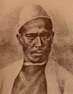
Pole star
The term "Pole Star" usually refers to Polaris, which is the current northern pole star, also known as the North Star.In general, however, a pole star is a visible star, especially a prominent one, that is approximately aligned with the Earth's axis of rotation; that is, a star whose apparent...
and other constellations of use. These charts may have been in use by the beginning of the Common Era
Common Era
Common Era ,abbreviated as CE, is an alternative designation for the calendar era originally introduced by Dionysius Exiguus in the 6th century, traditionally identified with Anno Domini .Dates before the year 1 CE are indicated by the usage of BCE, short for Before the Common Era Common Era...
for purposes of navigation.
Detailed maps of considerable length describing the locations of settlements, sea shores, rivers, and mountains were also made. The 8th century scholar Bhavabhuti
Bhavabhuti
Bhavabhuti was an 8th century scholar of India noted for his plays and poetry, written in Sanskrit. His plays are considered equivalent to the works of Kalidasa...
conceived paintings which indicated geographical regions.
European scholar Francesco I reproduced a number of ancient Indian maps in his magnum opus La Cartografia Antica dell India. Out these maps, two have been reproduced using a manuscript of Lokaprakasa, originally compiled by the polymath Ksemendra (Kashmir
Kashmir
Kashmir is the northwestern region of the Indian subcontinent. Until the mid-19th century, the term Kashmir geographically denoted only the valley between the Great Himalayas and the Pir Panjal mountain range...
, 11th century CE), as a source. The other manuscript, used as a source by Francesco I, is titled Samgrahani. The early volumes of the Encyclopedia Britannica also described cartographic charts made by the Dravidian people of India.
Maps from the Ain-e-Akbari, a Mughal
Mughal era
The Mughal era is a historic period of the Mughal Empire in South Asia . It ran from the early 15th century to a point in the early 18th century when the Mughal Emperors' power had dwindled...
document detailing India's history and traditions, contain references to locations indicated in earlier Indian cartographic traditions. Another map describing the kingdom of Nepal, four feet in length and about two and a half feet in breadth, was presented to Warren Hastings
Warren Hastings
Warren Hastings PC was the first Governor-General of India, from 1773 to 1785. He was famously accused of corruption in an impeachment in 1787, but was acquitted in 1795. He was made a Privy Councillor in 1814.-Early life:...
. In this map the mountains were elevated above the surface, and several geographical elements were indicated in different colors.
Arab cartography
In the Middle Ages, Muslim scholars continued and advanced on the mapmaking traditions of earlier cultures. Most used Ptolemy's methods; but they also took advantage of what explorers and merchants learned in their travels across the Muslim world, from Spain to India to Africa, and beyond in trade relationships with China, and Russia.An important influence in the development of cartography
Cartography
Cartography is the study and practice of making maps. Combining science, aesthetics, and technique, cartography builds on the premise that reality can be modeled in ways that communicate spatial information effectively.The fundamental problems of traditional cartography are to:*Set the map's...
was the patronage of the Abbasid
Abbasid
The Abbasid Caliphate or, more simply, the Abbasids , was the third of the Islamic caliphates. It was ruled by the Abbasid dynasty of caliphs, who built their capital in Baghdad after overthrowing the Umayyad caliphate from all but the al-Andalus region....
caliph
Caliph
The Caliph is the head of state in a Caliphate, and the title for the ruler of the Islamic Ummah, an Islamic community ruled by the Shari'ah. It is a transcribed version of the Arabic word which means "successor" or "representative"...
, al-Ma'mun
Al-Ma'mun
Abū Jaʿfar Abdullāh al-Māʾmūn ibn Harūn was an Abbasid caliph who reigned from 813 until his death in 833...
, who reigned from 813 to 833. He commissioned several geographers to remeasure the distance on earth that corresponds to one degree of celestial meridian. Thus his patronage resulted in the refinement of the definition of the mile used by Arabs (mīl in Arabic) in comparison to the stadion used by Greeks. These efforts also enabled Muslims to calculate the circumference of the earth. Al-Mamun also commanded the production of a large map of the world, which has not survived, though it is known that its map projection type was based on Marinus of Tyre
Marinus of Tyre
Marinus of Tyre, was a Greek geographer, cartographer and mathematician, who founded mathematical geography.-Biography and historical context:...
rather than Ptolemy
Ptolemy
Claudius Ptolemy , was a Roman citizen of Egypt who wrote in Greek. He was a mathematician, astronomer, geographer, astrologer, and poet of a single epigram in the Greek Anthology. He lived in Egypt under Roman rule, and is believed to have been born in the town of Ptolemais Hermiou in the...
.
Also in the 9th century, the Persian mathematician and geographer, Habash al-Hasib al-Marwazi, employed the use spherical trigonometry
Spherical trigonometry
Spherical trigonometry is a branch of spherical geometry which deals with polygons on the sphere and the relationships between the sides and the angles...
and map projection
Map projection
A map projection is any method of representing the surface of a sphere or other three-dimensional body on a plane. Map projections are necessary for creating maps. All map projections distort the surface in some fashion...
methods in order to convert polar coordinates
Polar coordinate system
In mathematics, the polar coordinate system is a two-dimensional coordinate system in which each point on a plane is determined by a distance from a fixed point and an angle from a fixed direction....
to a different coordinate system centred on a specific point on the sphere, in this the Qibla
Qibla
The Qiblah , also transliterated as Qibla, Kiblah or Kibla, is the direction that should be faced when a Muslim prays during salah...
, the direction to Mecca
Mecca
Mecca is a city in the Hijaz and the capital of Makkah province in Saudi Arabia. The city is located inland from Jeddah in a narrow valley at a height of above sea level...
. Abū Rayhān Bīrūnī (973–1048) later developed ideas which are seen as an anticipation of the polar coordinate system. Around 1025 CE, he describes a polar equi-azimuthal equidistant projection
Azimuthal equidistant projection
The azimuthal equidistant projection is a type of map projection.A useful application for this type of projection is a polar projection in which all distances measured from the center of the map along any longitudinal line are accurate; an example of a polar azimuthal equidistant projection can be...
of the celestial sphere
Celestial sphere
In astronomy and navigation, the celestial sphere is an imaginary sphere of arbitrarily large radius, concentric with the Earth and rotating upon the same axis. All objects in the sky can be thought of as projected upon the celestial sphere. Projected upward from Earth's equator and poles are the...
. However, this type of projection had been used in ancient Egyptian star-maps and was not to be fully developed until the 15 and 16th centuries.
In the early 10th century, Abū Zayd al-Balkhī
Ahmed ibn Sahl al-Balkhi
Abu Zayd Ahmed ibn Sahl Balkhi was a Persian Muslim polymath: a geographer, mathematician, physician, psychologist and scientist. Born in 850 CE in Shamistiyan, in the Persian province of Balkh, Khorasan , he was a disciple of al-Kindi...
, originally from Balkh
Balkh
Balkh , was an ancient city and centre of Zoroastrianism in what is now northern Afghanistan. Today it is a small town in the province of Balkh, about 20 kilometers northwest of the provincial capital, Mazar-e Sharif, and some south of the Amu Darya. It was one of the major cities of Khorasan...
, founded the "Balkhī school" of terrestrial mapping in Baghdad
Baghdad
Baghdad is the capital of Iraq, as well as the coterminous Baghdad Governorate. The population of Baghdad in 2011 is approximately 7,216,040...
. The geographers of this school also wrote extensively of the peoples, products, and customs of areas in the Muslim world, with little interest in the non-Muslim realms. The "Balkhī school", which included geographers such as Estakhri
Estakhri
Abu Ishaq Ibrahim ibn Muhammad al-Farisi al Istakhri was a medieval Persian geographer in the 10th century.-Career:...
, al-Muqaddasi
Al-Muqaddasi
Muhammad ibn Ahmad Shams al-Din Al-Muqaddasi , also transliterated as Al-Maqdisi and el-Mukaddasi, was a medieval Arab geographer, author of Ahsan at-Taqasim fi Ma`rifat il-Aqalim .-Biography:Al-Muqaddasi, "the Hierosolomite" was born in Jerusalem in 946 AD...
and Ibn Hawqal
Ibn Hawqal
Muḥammad Abū’l-Qāsim Ibn Ḥawqal was a 10th century Muslim writer, geographer, and chronicler. His famous work, written in 977, is called Ṣūrat al-’Arḍ ....
, produced world atlas
Atlas
An atlas is a collection of maps; it is typically a map of Earth or a region of Earth, but there are atlases of the other planets in the Solar System. Atlases have traditionally been bound into book form, but today many atlases are in multimedia formats...
es, each one featuring a world map
World map
A world map is a map of the surface of the Earth, which may be made using any of a number of different map projections. A map projection is any method of representing the surface of a sphere or other three-dimensional body on a plane....
and twenty regional maps.
Suhrāb, a late 10th century Muslim geographer, accompanied a book of geographical coordinates
Coordinate system
In geometry, a coordinate system is a system which uses one or more numbers, or coordinates, to uniquely determine the position of a point or other geometric element. The order of the coordinates is significant and they are sometimes identified by their position in an ordered tuple and sometimes by...
with instructions for making a rectangular world map, with equirectangular projection
Equirectangular projection
The equirectangular projection is a very simple map projection attributed to Marinus of Tyre, who Ptolemy claims invented the projection about AD 100...
or cylindrical cylindrical equidistant projection. The earliest surviving rectangular coordinate map is dated to the 13th century and is attributed to Hamdallah al-Mustaqfi al-Qazwini
Qazwini
Qazwini, Qazvini, al-Quazvini, meaning " from Qazvin", may refer to one of the following persons.* Najm al-Dīn al-Qazwīnī al-Kātibī , Persian philosopher and astronomer...
, who based it on the work of Suhrāb. The orthogonal
Orthogonality
Orthogonality occurs when two things can vary independently, they are uncorrelated, or they are perpendicular.-Mathematics:In mathematics, two vectors are orthogonal if they are perpendicular, i.e., they form a right angle...
parallel lines were separated by one degree intervals, and the map was limited to Southwest Asia
Southwest Asia
Western Asia, West Asia, Southwest Asia or Southwestern Asia are terms that describe the westernmost portion of Asia. The terms are partly coterminous with the Middle East, which describes a geographical position in relation to Western Europe rather than its location within Asia...
and Central Asia
Central Asia
Central Asia is a core region of the Asian continent from the Caspian Sea in the west, China in the east, Afghanistan in the south, and Russia in the north...
. The earliest surviving world maps based on a rectangular coordinate grid are attributed to al-Mustawfi in the 14th or 15th century (who used invervals of ten degrees for the lines), and to Hafiz-i-Abru (d. 1430).
Ibn Battuta
Ibn Battuta
Abu Abdullah Muhammad Ibn Battuta , or simply Ibn Battuta, also known as Shams ad–Din , was a Muslim Moroccan Berber explorer, known for his extensive travels published in the Rihla...
(1304–1368?) wrote "Rihlah" (Travels) based on three decades of journeys, covering more than 120,000 km through northern Africa, southern Europe, and much of Asia.
Regional cartography
Islamic regional cartography is usually categorized into three groups: that produced by the "Balkhī schoolAhmed ibn Sahl al-Balkhi
Abu Zayd Ahmed ibn Sahl Balkhi was a Persian Muslim polymath: a geographer, mathematician, physician, psychologist and scientist. Born in 850 CE in Shamistiyan, in the Persian province of Balkh, Khorasan , he was a disciple of al-Kindi...
", the type devised by Muhammad al-Idrisi
Muhammad al-Idrisi
Abu Abd Allah Muhammad al-Idrisi al-Qurtubi al-Hasani al-Sabti or simply Al Idrisi was a Moroccan Muslim geographer, cartographer, Egyptologist and traveller who lived in Sicily, at the court of King Roger II. Muhammed al-Idrisi was born in Ceuta then belonging to the Almoravid Empire and died in...
, and the type that are uniquely foundin the Book of curiosities.
The maps by the Balkhī schools were defined by political, not longitudinal boundaries and covered only the Muslim world. In these maps the distances between various "stops" (cities or rivers) were equalized. The only shapes used in designs were verticals, horizontals, 90-degree angles, and arcs of circles; unnecessary geographical details were eliminated. This approach is similar to that used in subway
Rapid transit
A rapid transit, underground, subway, elevated railway, metro or metropolitan railway system is an electric passenger railway in an urban area with a high capacity and frequency, and grade separation from other traffic. Rapid transit systems are typically located either in underground tunnels or on...
maps, most notable used in the "London Underground
London Underground
The London Underground is a rapid transit system serving a large part of Greater London and some parts of Buckinghamshire, Hertfordshire and Essex in England...
Tube Map
Tube map
The Tube map is a schematic transit map representing the lines and stations of London's rapid transit railway systems, namely the London Underground , the Docklands Light Railway and London Overground....
" in 1931 by Harry Beck.
Al-Idrīsī defined his maps differently. He considered the extent of the known world to be 160° in longitude, and divided the region into ten parts, each 16° wide. In terms of latitude, he portioned the known world into seven 'climes', determined by the length of the longest day. In his maps, many dominant geographical features can be found.
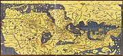
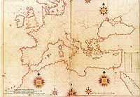
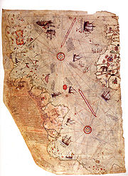
Book on the appearance of the Earth
Muhammad ibn Mūsā al-KhwārizmīMuhammad ibn Musa al-Khwarizmi
'There is some confusion in the literature on whether al-Khwārizmī's full name is ' or '. Ibn Khaldun notes in his encyclopedic work: "The first who wrote upon this branch was Abu ʿAbdallah al-Khowarizmi, after whom came Abu Kamil Shojaʿ ibn Aslam." . 'There is some confusion in the literature on...
's ("Book on the appearance of the Earth") was completed in 833
833
Year 833 was a common year starting on Wednesday of the Julian calendar.- Asia :* al-Mu'tasim succeeds his brother Al-Ma'mun as Abbasid caliph....
. It is a revised and completed version of Ptolemy
Ptolemy
Claudius Ptolemy , was a Roman citizen of Egypt who wrote in Greek. He was a mathematician, astronomer, geographer, astrologer, and poet of a single epigram in the Greek Anthology. He lived in Egypt under Roman rule, and is believed to have been born in the town of Ptolemais Hermiou in the...
's Geography
Geographia (Ptolemy)
The Geography is Ptolemy's main work besides the Almagest...
, consisting of a list of 2402 coordinates of cities and other geographical features following a general introduction.
Al-Khwārizmī, Al-Ma'mun
Al-Ma'mun
Abū Jaʿfar Abdullāh al-Māʾmūn ibn Harūn was an Abbasid caliph who reigned from 813 until his death in 833...
's most famous geographer, corrected Ptolemy's gross overestimate for the length of the Mediterranean Sea
Mediterranean Sea
The Mediterranean Sea is a sea connected to the Atlantic Ocean surrounded by the Mediterranean region and almost completely enclosed by land: on the north by Anatolia and Europe, on the south by North Africa, and on the east by the Levant...
(from the Canary Islands
Canary Islands
The Canary Islands , also known as the Canaries , is a Spanish archipelago located just off the northwest coast of mainland Africa, 100 km west of the border between Morocco and the Western Sahara. The Canaries are a Spanish autonomous community and an outermost region of the European Union...
to the eastern shores of the Mediterranean); Ptolemy overestimated it at 63 degrees of longitude
Longitude
Longitude is a geographic coordinate that specifies the east-west position of a point on the Earth's surface. It is an angular measurement, usually expressed in degrees, minutes and seconds, and denoted by the Greek letter lambda ....
, while al-Khwarizmi almost correctly estimated it at nearly 50 degrees of longitude. Al-Ma'mun's geographers "also depicted the Atlantic
Atlantic Ocean
The Atlantic Ocean is the second-largest of the world's oceanic divisions. With a total area of about , it covers approximately 20% of the Earth's surface and about 26% of its water surface area...
and Indian Ocean
Indian Ocean
The Indian Ocean is the third largest of the world's oceanic divisions, covering approximately 20% of the water on the Earth's surface. It is bounded on the north by the Indian Subcontinent and Arabian Peninsula ; on the west by eastern Africa; on the east by Indochina, the Sunda Islands, and...
s as open bodies of water
Ocean
An ocean is a major body of saline water, and a principal component of the hydrosphere. Approximately 71% of the Earth's surface is covered by ocean, a continuous body of water that is customarily divided into several principal oceans and smaller seas.More than half of this area is over 3,000...
, not land-locked sea
Sea
A sea generally refers to a large body of salt water, but the term is used in other contexts as well. Most commonly, it means a large expanse of saline water connected with an ocean, and is commonly used as a synonym for ocean...
s as Ptolemy had done. " Al-Khwarizmi thus set the Prime Meridian
Prime Meridian
The Prime Meridian is the meridian at which the longitude is defined to be 0°.The Prime Meridian and its opposite the 180th meridian , which the International Date Line generally follows, form a great circle that divides the Earth into the Eastern and Western Hemispheres.An international...
of the Old World
Old World
The Old World consists of those parts of the world known to classical antiquity and the European Middle Ages. It is used in the context of, and contrast with, the "New World" ....
at the eastern shore of the Mediterranean, 10–13 degrees to the east of Alexandria
Alexandria
Alexandria is the second-largest city of Egypt, with a population of 4.1 million, extending about along the coast of the Mediterranean Sea in the north central part of the country; it is also the largest city lying directly on the Mediterranean coast. It is Egypt's largest seaport, serving...
(the prime meridian previously set by Ptolemy) and 70 degrees to the west of Baghdad
Baghdad
Baghdad is the capital of Iraq, as well as the coterminous Baghdad Governorate. The population of Baghdad in 2011 is approximately 7,216,040...
. Most medieval Muslim geographers continued to use al-Khwarizmi's prime meridian. Other prime meridians used were set by Abū Muhammad al-Hasan al-Hamdānī and Habash al-Hasib al-Marwazi at Ujjain
Ujjain
Ujjain , is an ancient city of Malwa region in central India, on the eastern bank of the Kshipra River , today part of the state of Madhya Pradesh. It is the administrative centre of Ujjain District and Ujjain Division.In ancient times the city was called Ujjayini...
, a centre of Indian astronomy, and by another anonymous writer at Basra
Basra
Basra is the capital of Basra Governorate, in southern Iraq near Kuwait and Iran. It had an estimated population of two million as of 2009...
.
Tabula Rogeriana
The Arab geographer, Muhammad al-IdrisiMuhammad al-Idrisi
Abu Abd Allah Muhammad al-Idrisi al-Qurtubi al-Hasani al-Sabti or simply Al Idrisi was a Moroccan Muslim geographer, cartographer, Egyptologist and traveller who lived in Sicily, at the court of King Roger II. Muhammed al-Idrisi was born in Ceuta then belonging to the Almoravid Empire and died in...
, produced his medieval atlas, Tabula Rogeriana
Tabula Rogeriana
The Nuzhat al-mushtaq fi'khtiraq al-afaq lit. "the book of pleasant journeys into faraway lands", most often known as the Tabula Rogeriana , is a description of the world and world map created by the Arab geographer, Muhammad al-Idrisi, in 1154...
or The Recreation for Him Who Wishes to Travel Through the Countries, in 1154. He incorporated the knowledge of Africa
Africa
Africa is the world's second largest and second most populous continent, after Asia. At about 30.2 million km² including adjacent islands, it covers 6% of the Earth's total surface area and 20.4% of the total land area...
, the Indian Ocean
Indian Ocean
The Indian Ocean is the third largest of the world's oceanic divisions, covering approximately 20% of the water on the Earth's surface. It is bounded on the north by the Indian Subcontinent and Arabian Peninsula ; on the west by eastern Africa; on the east by Indochina, the Sunda Islands, and...
and the Far East
Far East
The Far East is an English term mostly describing East Asia and Southeast Asia, with South Asia sometimes also included for economic and cultural reasons.The term came into use in European geopolitical discourse in the 19th century,...
gathered by Arab merchants
Islamic economics in the world
Islamic economics in practice, or economic policies supported by self-identified Islamic groups, has varied throughout its long history. Traditional Islamic concepts having to do with economics included...
and explorers with the information inherited from the classical geographers to create the most accurate map of the world in pre-modern times. With funding from Roger II of Sicily
Roger II of Sicily
Roger II was King of Sicily, son of Roger I of Sicily and successor to his brother Simon. He began his rule as Count of Sicily in 1105, later became Duke of Apulia and Calabria , then King of Sicily...
(1097–1154), al-Idrisi drew on the knowledge collected at the University of Cordoba
Córdoba, Spain
-History:The first trace of human presence in the area are remains of a Neanderthal Man, dating to c. 32,000 BC. In the 8th century BC, during the ancient Tartessos period, a pre-urban settlement existed. The population gradually learned copper and silver metallurgy...
and paid draftsmen to make journeys and map their routes. The book describes the earth as a sphere with a circumference of 22900 miles (36,853.9 km) but maps it in 70 rectangular sections. Notable features include the correct dual sources of the Nile, the coast of Ghana and mentions of Norway. Climate zones were a chief organizational principle. A second and shortened copy from 1192 called Garden of Joys is known by scholars as the Little Idrisi.
On the work of al-Idrisi, S. P. Scott commented:
.
Piri Reis map
The Ottoman cartographer Piri ReisPiri Reis
Piri Reis was an Turkish Ottoman admiral, geographer and cartographer born between 1465 and 1470 and died in 1554 or 1555....
published navigational maps in his Kitab-ı Bahriye. The work includes an atlas of charts for small segments of the mediterranean, accompanied by sailing instructions covering the sea. In the second version of the work, he included a map of the Americas
Americas
The Americas, or America , are lands in the Western hemisphere, also known as the New World. In English, the plural form the Americas is often used to refer to the landmasses of North America and South America with their associated islands and regions, while the singular form America is primarily...
. The Piri Reis map
Piri Reis map
The Piri Reis map is a pre-modern world map compiled in 1513 from military intelligence by the Ottoman-Turkish admiral and cartographer Piri Reis. The half of the map that survives shows the western coasts of Europe and North Africa and the coast of Brazil with reasonable accuracy...
drawn by the Ottoman cartographer Piri Reis
Piri Reis
Piri Reis was an Turkish Ottoman admiral, geographer and cartographer born between 1465 and 1470 and died in 1554 or 1555....
in 1513, is one of the oldest surviving maps to show the Americas.
Pacific Islands
The Polynesian peoples who explored and settled the Pacific islands in the first two millenniums AD used maps to navigate across large distances. A surviving map from the Marshall IslandsMarshall Islands
The Republic of the Marshall Islands , , is a Micronesian nation of atolls and islands in the middle of the Pacific Ocean, just west of the International Date Line and just north of the Equator. As of July 2011 the population was 67,182...
uses sticks tied in a grid with palm strips representing wave and wind patterns, with shells attached to show the location of islands. Other maps were created as needed using temporary arrangements of stones or shells.
European cartography
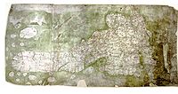
Medieval maps and the Mappa Mundi
Medieval maps in Europe were mainly symbolic in form along the lines of the much earlier Babylonian World Map. Known as Mappa MundiMappa mundi
Mappa mundi is a general term used to describe medieval European maps of the world. These maps range in size and complexity from simple schematic maps an inch or less across to elaborate wall maps, the largest of which was 11 ft. in diameter...
(cloth of the world) these maps were circular or symmetrical cosmological diagrams representing the Earth's single land mass as disk-shaped and surrounded by ocean.
Roger Bacon
Roger Bacon
Roger Bacon, O.F.M. , also known as Doctor Mirabilis , was an English philosopher and Franciscan friar who placed considerable emphasis on the study of nature through empirical methods...
's investigations of map projections and the appearance of portolano and then portolan chart
Portolan chart
Portolan charts are navigational maps based on realistic descriptions of harbours and coasts. They were first made in the 14th century in Italy, Portugal and Spain...
s for plying the European trade routes were rare innovations of the period. The Carta Pisana
Carta Pisana
The Carta Pisana is a map made at the end of the 13th century, about 1275-1300. It was found in Pisa, hence its name. It shows the whole Mediterranean, the Black Sea and a part of the atlantic coast, from the north of present-day Morocco to present-day Holland, but the accuracy of the map is...
portolan chart, made at the end of the 13th century (1275–1300), is the oldest surviving nautical chart
Nautical chart
A nautical chart is a graphic representation of a maritime area and adjacent coastal regions. Depending on the scale of the chart, it may show depths of water and heights of land , natural features of the seabed, details of the coastline, navigational hazards, locations of natural and man-made aids...
(that is, not simply a map but a document showing accurate navigational directions).
The Age of Exploration
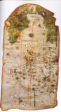
Renaissance
The Renaissance was a cultural movement that spanned roughly the 14th to the 17th century, beginning in Italy in the Late Middle Ages and later spreading to the rest of Europe. The term is also used more loosely to refer to the historical era, but since the changes of the Renaissance were not...
, with the renewed interest in classical works, maps became more like surveys once again, while the discovery of the Americas by Europeans and the subsequent effort to control and divide those lands revived interest in scientific mapping methods. Peter Whitfield, the author of several books on the history of maps, credits European mapmaking as a factor in the global spread of western power: "Men in Seville, Amsterdam or London had access to knowledge of America, Brazil, or India, while the native peoples knew only their own immediate environment" (Whitfield).
- 15th century: The monk Nicholas Germanus wrote a pioneering Cosmographia. He added the first new maps to Ptolemy's Geographica. Germanus invented the Donis map projection where parallels of latitude are made equidistant, but meridians converge toward the poles.
- : Portuguese cartographer Pedro ReinelPedro ReinelPedro Reinel was a Portuguese cartographer of the 16th century, author of one of the oldest signed Portuguese nautical chart . That is a portolan type of chart, covering western Europe and part of Africa, and already reflecting the explorations made by Diogo Cão in 1482-1485. With his son Jorge...
made the oldest known signed Portuguese nautical chart. - 1492: German merchant Martin BehaimMartin BehaimMartin Behaim , was a German mariner, artist, cosmographer, astronomer, philosopher, geographer and explorer in service to the King of Portugal.-Biography:The Behaim family had immigrated to Nuremberg because of religious persecution around...
(1459–1507) made the oldest surviving terrestrial globe, but it lacked the Americas. - 1492: Cartographer Jorge de Aguiar made the oldest known signed and dated Portuguese nautical chart.
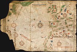
First maps of the Americas
The Spanish cartographer and explorer Juan de la CosaJuan de la Cosa
Juan de la Cosa was a Spanish cartographer, conquistador and explorer. He made the earliest extant European world map to incorporate the territories of the Americas that were discovered in the 15th century, sailed first 3 voyages with Christopher Columbus, and was the owner/captain of the Santa...
sailed with Christopher Columbus
Christopher Columbus
Christopher Columbus was an explorer, colonizer, and navigator, born in the Republic of Genoa, in northwestern Italy. Under the auspices of the Catholic Monarchs of Spain, he completed four voyages across the Atlantic Ocean that led to general European awareness of the American continents in the...
. He created the first known cartographic representations showing both the Americas as well as Africa and Eurasia.
- 1502: Unknown Portuguese cartographer made the Cantino planisphereCantino planisphereThe Cantino planisphere is the earliest surviving map showing Portuguese Discoveries in the east and west. It is named after Alberto Cantino, an agent for the Duke of Ferrara, who successfully smuggled it from Portugal to Italy in 1502...
, the first nautical chart to implicitly represent latitudes. - 1504: Portuguese cartographer Pedro ReinelPedro ReinelPedro Reinel was a Portuguese cartographer of the 16th century, author of one of the oldest signed Portuguese nautical chart . That is a portolan type of chart, covering western Europe and part of Africa, and already reflecting the explorations made by Diogo Cão in 1482-1485. With his son Jorge...
made the oldest known nautical chart with a scale of latitudes. - 1507: Martin WaldseemüllerMartin WaldseemüllerMartin Waldseemüller was a German cartographer...
's World Map was the first to use the term America for the Western continents (after explorer Amerigo VespucciAmerigo VespucciAmerigo Vespucci was an Italian explorer, financier, navigator and cartographer. The Americas are generally believed to have derived their name from the feminized Latin version of his first name.-Expeditions:...
). - 1519 : Portuguese cartographers Lopo HomemLopo HomemLopo Homem was a Portuguese cartographer and cosmographer.- Biography :In 1517 King Manuel I of Portugal handed Lopo Homem a charter entitling him the privilege of certifying and amending all compass needles in vessels. This charter was revalidated in 1524 by King John III of Portugal...
, Pedro ReinelPedro ReinelPedro Reinel was a Portuguese cartographer of the 16th century, author of one of the oldest signed Portuguese nautical chart . That is a portolan type of chart, covering western Europe and part of Africa, and already reflecting the explorations made by Diogo Cão in 1482-1485. With his son Jorge...
and Jorge ReinelJorge ReinelJorge Reinel born Lisbon renown Portuguese cartographer and instructor in cartography, son of the well-known cartographer Pedro Reinel. In 1519 in Seville he participated in the maps designed for the trip of his countryman Ferdinand Magellan, and his depiction of the Maluku Islands served as a...
made the group of maps known today as the Miller AtlasMiller AtlasThe Miller Atlas also known as Lopo Homem-Reineis Atlas is a Portuguese richly illustrated atlas dated from 1519, including a dozen charts...
or Lopo Homem - Reinéis Atlas.
Diogo Ribeiro map (1527)
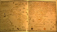
Padrón Real
The Padrón Real , known after 2 August 1527 as the Padrón General , was the official and secret Spanish master map used as a template for the maps present on all Spanish ships during the 16th century. It was kept in Seville, Spain by the Casa de Contratación. Ship pilots were required to use a copy...
The layout of the map (Mapamundi) is strongly influenced by the information obtained during the Magellan-Elcano
Juan Sebastián Elcano
Juan Sebastián Elcano was a Basque Spanish explorer who completed the first circumnavigation of the world. As Ferdinand Magellan's second in command, Elcano took over after Magellan's death in the Philippines.-Early life:Elcano was born to Domingo Sebastián Elcano I and Catalina del Puerto...
trip around the world. Diogo's map delineates very precisely the coasts of Central
Central America
Central America is the central geographic region of the Americas. It is the southernmost, isthmian portion of the North American continent, which connects with South America on the southeast. When considered part of the unified continental model, it is considered a subcontinent...
and South America
South America
South America is a continent situated in the Western Hemisphere, mostly in the Southern Hemisphere, with a relatively small portion in the Northern Hemisphere. The continent is also considered a subcontinent of the Americas. It is bordered on the west by the Pacific Ocean and on the north and east...
. The map shows, for the first time, the real extension of the Pacific Ocean
Pacific Ocean
The Pacific Ocean is the largest of the Earth's oceanic divisions. It extends from the Arctic in the north to the Southern Ocean in the south, bounded by Asia and Australia in the west, and the Americas in the east.At 165.2 million square kilometres in area, this largest division of the World...
. It also shows, for the first time, the North America
North America
North America is a continent wholly within the Northern Hemisphere and almost wholly within the Western Hemisphere. It is also considered a northern subcontinent of the Americas...
n coast as a continuous one (probably influenced by the Esteban Gómez
Esteban Gómez
Esteban Gómez, also known as Estevan Gómez, and born Estêvão Gomes, , was a Portuguese cartographer and explorer. He sailed at the service of Spain in the fleet of Ferdinand Magellan, but deserted the expedition before reaching the Strait of Magellan, and returned to Spain in May 1521...
's exploration in 1525). It also shows the demarcation of the Treaty of Tordesillas
Treaty of Tordesillas
The Treaty of Tordesillas , signed at Tordesillas , , divided the newly discovered lands outside Europe between Spain and Portugal along a meridian 370 leagueswest of the Cape Verde islands...
.
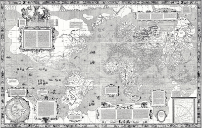
Gerardus Mercator (1569)
Gerardus MercatorGerardus Mercator
thumb|right|200px|Gerardus MercatorGerardus Mercator was a cartographer, born in Rupelmonde in the Hapsburg County of Flanders, part of the Holy Roman Empire. He is remembered for the Mercator projection world map, which is named after him...
(1512–1594) was a Flemish cartographer who in his quest to make the world “look right” on the maps invented a new projection, called the Mercator projection
Mercator projection
The Mercator projection is a cylindrical map projection presented by the Belgian geographer and cartographer Gerardus Mercator, in 1569. It became the standard map projection for nautical purposes because of its ability to represent lines of constant course, known as rhumb lines or loxodromes, as...
. The projection was mathematically based and the Mercator maps gave much more accurate maps for world-wide navigation than any until that date. As in all cylindrical projections, parallel
Circle of latitude
A circle of latitude, on the Earth, is an imaginary east-west circle connecting all locations that share a given latitude...
s and meridian
Meridian (geography)
A meridian is an imaginary line on the Earth's surface from the North Pole to the South Pole that connects all locations along it with a given longitude. The position of a point along the meridian is given by its latitude. Each meridian is perpendicular to all circles of latitude...
s are straight and perpendicular to each other. In accomplishing this, the unavoidable east-west stretching of the map, is accompanied by a corresponding north-south stretching, so that at every point location, the east-west scale is the same as the north-south scale, making the projection conformal
Conformal map
In mathematics, a conformal map is a function which preserves angles. In the most common case the function is between domains in the complex plane.More formally, a map,...
.
The development of the Mercator projection represented a major breakthrough in the nautical cartography of the 16th century. However, it was much ahead of its time, since the old navigational and surveying techniques were not compatible with its use in navigation.The Mercator projection would over time become the conventional view of the world that we are accustomed to today.

Ortelius and the first Atlas
- 1570: Antwerp cartographer Abraham OrteliusAbraham Orteliusthumb|250px|Abraham Ortelius by [[Peter Paul Rubens]]Abraham Ortelius thumb|250px|Abraham Ortelius by [[Peter Paul Rubens]]Abraham Ortelius (Abraham Ortels) thumb|250px|Abraham Ortelius by [[Peter Paul Rubens]]Abraham Ortelius (Abraham Ortels) (April 14, 1527 – June 28,exile in England to take...
published the Theatrum Orbis TerrarumTheatrum Orbis TerrarumTheatrum Orbis Terrarum is considered to be the first true modern atlas. Written by Abraham Ortelius and originally printed on May 20, 1570, in Antwerp, it consisted of a collection of uniform map sheets and sustaining text bound to form a book for which copper printing plates were specifically...
, the first modern atlas. - 1608: Captain John SmithJohn Smith of JamestownCaptain John Smith Admiral of New England was an English soldier, explorer, and author. He was knighted for his services to Sigismund Bathory, Prince of Transylvania and friend Mózes Székely...
published a map of Virginia's coastline. - 1670s: The astronomer Giovanni Domenico CassiniGiovanni Domenico CassiniThis article is about the Italian-born astronomer. For his French-born great-grandson, see Jean-Dominique Cassini.Giovanni Domenico Cassini was an Italian/French mathematician, astronomer, engineer, and astrologer...
began work on the first modern topographic mapTopographic mapA topographic map is a type of map characterized by large-scale detail and quantitative representation of relief, usually using contour lines in modern mapping, but historically using a variety of methods. Traditional definitions require a topographic map to show both natural and man-made features...
in France. It was completed in 1789 or 1793 by his grandson Cassini de Thury.
Enlightenment and scientific map-making
- 1715: Herman MollHerman MollHerman Moll , was a cartographer, engraver, and publisher. Moll moved to England in 1678 and opened a book and map store in London...
published the Beaver Map, one of the most famous early maps of North America, which he copied from a 1698 work by Nicolas de Fer - 1763–1767: Captain James CookJames CookCaptain James Cook, FRS, RN was a British explorer, navigator and cartographer who ultimately rose to the rank of captain in the Royal Navy...
mapped Newfoundland.
Modern cartography
The Vertical Perspective projection was first used by the German map publisher Matthias SeutterMatthias Seutter
Georg Matthäus Seutter was one of the most important and prolific German map publishers of the 18th century.Seutter started his career as an apprentice brewer. Apparently uninspired by the beer business, Seutter left his apprenticeship and moved to Nuremberg where he apprenticed as an engraver...
in 1740. He placed his observer at ~12,750 km distance. This is the type of projection used today by Google Earth.
The final form of the Equidistant Conic projection was constructed by the French astronomer Joseph-Nicolas Delisle
Joseph-Nicolas Delisle
Joseph-Nicolas Delisle was a French astronomer.-Life:He was one of the 11 sons of Claude Delisle . Like many of his brothers, among them Guillaume Delisle, he initially followed classical studies. Soon however, he moved to astronomy under the supervision of Joseph Lieutaud and Jacques Cassini...
in 1745.
The Swiss mathematician Johann Lambert invented several hemisperic map projections. In 1772 he created the Lambert Conformal Conic and Lambert Azimuthal Equal-Area projections.
The Albers Equal-Area Conic projection features no distortion along standard parallels. It was invented by Heinrich Albers in 1805.
In the United States
United States
The United States of America is a federal constitutional republic comprising fifty states and a federal district...
in the 17th and 18th centuries, explorers mapped trails and army engineers surveyed government lands. Two agencies were established to provide more detailed, large-scale mapping. They were the U.S. Geological Survey and the United States Coast and Geodetic Survey
NGS
NGS could stand for:* the National Garden Scheme, a British organisation which promotes the opening of private gardens for charity.* the National Geodetic Survey, a service operating under the control of the National Oceanic and Atmospheric Administration...
(now the National Geodetic Survey under the National Oceanic and Atmospheric Association).
The Greenwich prime meridian
Prime Meridian
The Prime Meridian is the meridian at which the longitude is defined to be 0°.The Prime Meridian and its opposite the 180th meridian , which the International Date Line generally follows, form a great circle that divides the Earth into the Eastern and Western Hemispheres.An international...
became the international standard reference for cartographers in 1884.
During the 1900s, maps became more abundant due to improvements in printing and photography that made production cheaper and easier. Airplanes made it possible to photograph large areas at a time.
Two-Point Equidistant projection was first drawn up by Hans Maurer
Hans Maurer
Hans Maurer was a West German bobsledder who competed during the early 1960s. He won a bronze medal in the two-man event at the 1962 FIBT World Championships in Garmisch-Partenkirchen.-References:*...
in 1919. In this projection the distance from any point on the map to either of the two regulating points is accurate.
The Loximuthal projection was constructed by Karl Siemon in 1935 and refined by Waldo Tobler in 1966.
Since the mid-1990s, the use of computers in mapmaking has helped to store, sort, and arrange data for mapping in order to create map projections.
Technological changes
In cartography, technology has continually changed in order to meet the demands of new generations of mapmakers and map users. The first maps were manually constructed with brushes and parchment and therefore varied in quality and were limited in distribution. The advent of the compassCompass
A compass is a navigational instrument that shows directions in a frame of reference that is stationary relative to the surface of the earth. The frame of reference defines the four cardinal directions – north, south, east, and west. Intermediate directions are also defined...
, printing press
Printing press
A printing press is a device for applying pressure to an inked surface resting upon a print medium , thereby transferring the ink...
, telescope
Telescope
A telescope is an instrument that aids in the observation of remote objects by collecting electromagnetic radiation . The first known practical telescopes were invented in the Netherlands at the beginning of the 1600s , using glass lenses...
, sextant
Sextant
A sextant is an instrument used to measure the angle between any two visible objects. Its primary use is to determine the angle between a celestial object and the horizon which is known as the altitude. Making this measurement is known as sighting the object, shooting the object, or taking a sight...
, quadrant
Quadrant (instrument)
A quadrant is an instrument that is used to measure angles up to 90°. It was originally proposed by Ptolemy as a better kind of astrolabe. Several different variations of the instrument were later produced by medieval Muslim astronomers.-Types of quadrants:...
and vernier
Vernier scale
A vernier scale is an additional scale which allows a distance or angle measurement to be read more precisely than directly reading a uniformly-divided straight or circular measurement scale...
allowed for the creation of far more accurate maps and the ability to make accurate reproductions.
Advances in photochemical technology, such as the lithographic
Lithography
Lithography is a method for printing using a stone or a metal plate with a completely smooth surface...
and photochemical processes
Photography
Photography is the art, science and practice of creating durable images by recording light or other electromagnetic radiation, either electronically by means of an image sensor or chemically by means of a light-sensitive material such as photographic film...
, have allowed for the creation of maps that have fine details, do not distort in shape and resist moisture and wear. This also eliminated the need for engraving which further shortened the time it takes to make and reproduce maps.
In the mid to late 20th century advances in electronic technology have led to a new revolution in cartography. Specifically computer hardware
Computer hardware
Personal computer hardware are component devices which are typically installed into or peripheral to a computer case to create a personal computer upon which system software is installed including a firmware interface such as a BIOS and an operating system which supports application software that...
devices such as computer screens, plotters, printers, scanners (remote and document) and analytic stereo plotters along with visualization, image processing, spatial analysis and database software, have democratized and greatly expanded the making of maps, particularly with their ability to produce maps that show slightly different features, without engraving a new printing plate. See also digital raster graphic
Digital raster graphic
A digital raster graphic is a digital image resulting from scanning a paper USGS topographic map for use on a computer. DRGs created by USGS are typically scanned at 250 dpi and saved as a TIFF. The raster image usually includes the original border information, referred to as the "map collar". ...
and History of web mapping.
See also
- Ancient world mapsAncient world mapsEarly world maps cover depictions of the world from the Iron Age to the Age of Discovery and the emergence of modern geography during the early modern period.-Babylonian Imago Mundi Early world maps cover depictions of the world from the Iron Age to the Age of Discovery and the emergence of modern...
- CartographyCartographyCartography is the study and practice of making maps. Combining science, aesthetics, and technique, cartography builds on the premise that reality can be modeled in ways that communicate spatial information effectively.The fundamental problems of traditional cartography are to:*Set the map's...
- City mapCity mapA city map is a large-scale thematic map of a city created to enable the fastest possible orientation in an urban space. The graphic representation of objects on a city map is therefore usually greatly simplified, and reduced to generally understood symbology.Depending upon its target group or...
s - Geographic information systemGeographic Information SystemA geographic information system, geographical information science, or geospatial information studies is a system designed to capture, store, manipulate, analyze, manage, and present all types of geographically referenced data...
- Here be dragonsHere be dragons"Here be dragons" is a phrase used to denote dangerous or unexplored territories, in imitation of the medieval practice of putting sea serpents and other mythological creatures in uncharted areas of maps.-History:...
- List of cartographers
- Map projections
- Mappa mundiMappa mundiMappa mundi is a general term used to describe medieval European maps of the world. These maps range in size and complexity from simple schematic maps an inch or less across to elaborate wall maps, the largest of which was 11 ft. in diameter...
- Pictorial mapsPictorial mapsPictorial maps are a category of maps that are also loosely called illustrated maps, panoramic maps, perspective maps, bird’s-eye view maps and Geopictorial maps amongst others. In contrast to the regular road map, Atlas or topographic cartography, pictorial maps depict a given territory with a...
- Table of historical mapsTable of Historical MapsThis is a table of historic maps.-Map Type Notes:All maps show at least some geographical features, such as ocean and lake shorelines, rivers, mountains, and forests, at some level of detail and accuracy....
- Terra incognitaTerra incognitaTerra incognita or terra ignota is a term used in cartography for regions that have not been mapped or documented. The expression is believed to be first seen in Ptolemy’s Geography circa 150 CE...
- Web mappingWeb mappingWeb mapping is the process of designing, implementing, generating and delivering maps on the World Wide Web and its product. While web mapping primarily deals with technological issues, web cartography additionally studies theoretic aspects: the use of web maps, the evaluation and optimization of...
- World mapWorld mapA world map is a map of the surface of the Earth, which may be made using any of a number of different map projections. A map projection is any method of representing the surface of a sphere or other three-dimensional body on a plane....
External links
- The History of Cartography Project at the University of Wisconsin, a comprehensive research project in the history of maps and mapping
- The history of cartography at the School of Mathematics and Statistics, University of St. Andrews, Scotland
- Mapping History - a learning resource from the British Library
- Modern Medieval Map Myths: The Flat World, Ancient Sea-Kings, and Dragons
- Concise Bibliography of the History of Cartography, Newberry Library
- Newberry Library Cartographic Catalog : map catalog and bibliography of the history of cartography
- American Geographical Society Library Digital Map Collection
See Maps for more links to historical maps; however, most of the largest sites are listed at the sites linked below.
- Eratosthenes Map of the Earth, and Measuring of its Circumference at Convergence
- A listing of over 5000 websites describing holdings of manuscripts, archives, rare books, historical photographs, and other primary sources for the research scholar