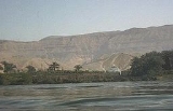
All Topics  
Nile

 
Nile

   Email Print
   Bookmark   Link


Nile


The Nile ( Ancient Egyptian
Egyptian language

Egyptian is a branch of the Afro-Asiatic languages language family along with the Chadic languages, Berber languages, Semitic languages, Cushitic languages and possibly Omotic languages languages....
 iteru or ?'pi, Coptic
Coptic language

Coptic or Coptic Egyptian is the final stage of the Egyptian language, a northern Afro-Asiatic languages language spoken in Egypt until at least the seventeenth century....
 piaro or phiaro) is a major north-flowing river
River

A river is a natural stream of water, usually freshwater, flowing toward an ocean, a lake, or another stream. In some cases a river flows into the ground or dries up completely before reaching another body of water....
 in Africa
Africa

Africa is the world's second-largest and second most-populous continent, after Asia. At about 30.2 million km? including adjacent islands, it covers 6% of the Earth's total surface area and 20.4% of the total land area....
, generally regarded as the longest river
List of rivers by length

This is a list of the longest rivers on Earth. It includes river systems over 1,000 kilometers....
 in the world.

The Nile has two major tributaries
Tributary

A tributary is a stream or river which flows into a Mainstem river. A tributary does not flow directly into a sea. Tributaries and the mainstem river serve to drain the surrounding drainage basin of its surface water and groundwater by leading the water out into an ocean or some other large body of water....
, the White Nile
White Nile

The White Nile is a river of Africa, one of the two main tributary of the Nile, the other being the Blue Nile. In the strict meaning, "White Nile" refers to the river formed at Lake No at the confluence of the Bahr al Jabal and Bahr el Ghazal rivers....
 and Blue Nile
Blue Nile

The Blue Nile is a river originating at Lake Tana in Ethiopia. Sometimes in Ethiopia the river?especially the upper reaches?is called the Abbai....
, the latter being the source of most of the Nile's water and fertile soil
Silt

Silt is soil or Rock derived granular material of a Particle size between sand and clay. Silt may occur as a soil or as suspended sediment in a surface water body....
, but the former being the longer of the two. The White Nile rises in the Great Lakes
African Great Lakes

The Great Lakes of Africa are a series of lakes in and around the geographic Great Rift Valley formed by the action of the tectonic East African Rift....
 region of central Africa, with the most distant source in southern Rwanda
Rwanda

The Republic of Rwanda is a small landlocked country in the Great Lakes region of east-central Africa, bordered by Uganda, Burundi, the Democratic Republic of the Congo and Tanzania....
 , and flows north from there through Tanzania
Tanzania

Tanzania , officially the United Republic of Tanzania , is a country in East Africa that is bordered by Kenya and Uganda on the north, Rwanda, Burundi and the Democratic Republic of the Congo on the west, and Zambia, Malawi and Mozambique on the south....
, Lake Victoria
Lake Victoria

Lake Victoria or Victoria Nyanza is one of the Great Lakes of Africa.Lake Victoria is 68,800 square kilometres in size, making it the continent's largest lake, the largest tropical lake in the world, and the second widest fresh water lake in the world in terms of surface area ....
, Uganda
Uganda

The Republic of Uganda is a landlocked country in East Africa. It is bordered on the east by Kenya, on the north by Sudan, on the west by the Democratic Republic of the Congo, on the southwest by Rwanda, and on the south by Tanzania....
 and southern Sudan
Sudan

Sudan is a country in northeastern Africa. It is the largest in the African continent and the Arab World, and List of countries and outlying territories by total area by area....
, while the Blue Nile starts at Lake Tana
Lake Tana

Lake Tana is the source of the Blue Nile and is the largest lake in Ethiopia. Located in the north-western Ethiopian highlands, according to the Statistical Abstract of Ethiopia for 1967/68, the lake is approximately 84 kilometers long and 66 kilometers wide, with a maximum depth of 15 meters, and an elevation of 1,840 meters....
 in Ethiopia
Ethiopia

Ethiopia , officially the Federal Democratic Republic of Ethiopia, is a landlocked country situated in the Horn of Africa. Ethiopia is bordered by Eritrea to the north, Sudan to the west, Kenya to the south, Somalia to the east and Djibouti to the northeast....
 , flowing into Sudan from the southeast.


Discussion
Ask a question about 'Nile'
Start a new discussion about 'Nile'
Answer questions from other users
Full Discussion Forum


Recent Posts


Encyclopedia


The Nile ( Ancient Egyptian
Egyptian language

Egyptian is a branch of the Afro-Asiatic languages language family along with the Chadic languages, Berber languages, Semitic languages, Cushitic languages and possibly Omotic languages languages....
 iteru or ?'pi, Coptic
Coptic language

Coptic or Coptic Egyptian is the final stage of the Egyptian language, a northern Afro-Asiatic languages language spoken in Egypt until at least the seventeenth century....
 piaro or phiaro) is a major north-flowing river
River

A river is a natural stream of water, usually freshwater, flowing toward an ocean, a lake, or another stream. In some cases a river flows into the ground or dries up completely before reaching another body of water....
 in Africa
Africa

Africa is the world's second-largest and second most-populous continent, after Asia. At about 30.2 million km? including adjacent islands, it covers 6% of the Earth's total surface area and 20.4% of the total land area....
, generally regarded as the longest river
List of rivers by length

This is a list of the longest rivers on Earth. It includes river systems over 1,000 kilometers....
 in the world.

The Nile has two major tributaries
Tributary

A tributary is a stream or river which flows into a Mainstem river. A tributary does not flow directly into a sea. Tributaries and the mainstem river serve to drain the surrounding drainage basin of its surface water and groundwater by leading the water out into an ocean or some other large body of water....
, the White Nile
White Nile

The White Nile is a river of Africa, one of the two main tributary of the Nile, the other being the Blue Nile. In the strict meaning, "White Nile" refers to the river formed at Lake No at the confluence of the Bahr al Jabal and Bahr el Ghazal rivers....
 and Blue Nile
Blue Nile

The Blue Nile is a river originating at Lake Tana in Ethiopia. Sometimes in Ethiopia the river?especially the upper reaches?is called the Abbai....
, the latter being the source of most of the Nile's water and fertile soil
Silt

Silt is soil or Rock derived granular material of a Particle size between sand and clay. Silt may occur as a soil or as suspended sediment in a surface water body....
, but the former being the longer of the two. The White Nile rises in the Great Lakes
African Great Lakes

The Great Lakes of Africa are a series of lakes in and around the geographic Great Rift Valley formed by the action of the tectonic East African Rift....
 region of central Africa, with the most distant source in southern Rwanda
Rwanda

The Republic of Rwanda is a small landlocked country in the Great Lakes region of east-central Africa, bordered by Uganda, Burundi, the Democratic Republic of the Congo and Tanzania....
 , and flows north from there through Tanzania
Tanzania

Tanzania , officially the United Republic of Tanzania , is a country in East Africa that is bordered by Kenya and Uganda on the north, Rwanda, Burundi and the Democratic Republic of the Congo on the west, and Zambia, Malawi and Mozambique on the south....
, Lake Victoria
Lake Victoria

Lake Victoria or Victoria Nyanza is one of the Great Lakes of Africa.Lake Victoria is 68,800 square kilometres in size, making it the continent's largest lake, the largest tropical lake in the world, and the second widest fresh water lake in the world in terms of surface area ....
, Uganda
Uganda

The Republic of Uganda is a landlocked country in East Africa. It is bordered on the east by Kenya, on the north by Sudan, on the west by the Democratic Republic of the Congo, on the southwest by Rwanda, and on the south by Tanzania....
 and southern Sudan
Sudan

Sudan is a country in northeastern Africa. It is the largest in the African continent and the Arab World, and List of countries and outlying territories by total area by area....
, while the Blue Nile starts at Lake Tana
Lake Tana

Lake Tana is the source of the Blue Nile and is the largest lake in Ethiopia. Located in the north-western Ethiopian highlands, according to the Statistical Abstract of Ethiopia for 1967/68, the lake is approximately 84 kilometers long and 66 kilometers wide, with a maximum depth of 15 meters, and an elevation of 1,840 meters....
 in Ethiopia
Ethiopia

Ethiopia , officially the Federal Democratic Republic of Ethiopia, is a landlocked country situated in the Horn of Africa. Ethiopia is bordered by Eritrea to the north, Sudan to the west, Kenya to the south, Somalia to the east and Djibouti to the northeast....
 , flowing into Sudan from the southeast. The two rivers meet near the Sudanese capital Khartoum
Khartoum

Khartoum is the Capital of Sudan and of Khartoum . It is located at the confluence point of the White Nile flowing north from Lake Victoria, and the Blue Nile flowing west from Ethiopia....
.

The northern section of the river flows almost entirely through desert
Désert

?D?sert? is ?milie Simon's debut single, released in October 2002. The song was a huge success both critically and commercially in her homeland....
, from Sudan into Egypt
Egypt

Egypt is a country mainly in North Africa, with the Sinai Peninsula forming a land bridge in Western Asia. Covering an area of about , Egypt borders the Mediterranean Sea to the north, the Gaza Strip and Israel to the northeast, the Red Sea to the east, Sudan to the south and Libya to the west....
, a country
Country

Country may refer to the territory of a state, or to a smaller, or former, political division of a geographical region. In another meaning of the word, the country is also a term used to refer to rural areas....
 whose civilization
History of Egypt

The history of Egypt is the longest continuous history, as a unified state, of any country in the world. The Nile valley forms a natural geographic and economic unit, bounded to the east and west by deserts, to the north by the sea and to the south by the Cataracts of the Nile....
 has depended on the river since ancient times. Most of the population of Egypt and all of its cities, with the exception of those near the coast, lie along those parts of the Nile valley north of Aswan
Aswan

Aswan , Egyptian language: Swenet , Coptic language: Swan; Greek language: Syene; ) is a city in the south of Egypt, the capital of the Aswan Governorate....
; and nearly all the cultural and historical sites of Ancient Egypt
Ancient Egypt

Ancient Egypt was an Ancient history civilization in eastern North Africa, concentrated along the lower reaches of the Nile in what is now the modern nation of Egypt....
 are found along the banks of the river. The Nile ends in a large delta
Nile Delta

The Nile Delta is the River delta formed in Northern Egypt where the Nile River spreads out and drains into the Mediterranean Sea. It is one of the world's largest river deltas?from Alexandria in the west to Port Said in the east, it covers some 240 km of Mediterranean coastline?and is a rich agricultural region....
 that empties into the Mediterranean Sea
Mediterranean Sea

The Mediterranean Sea is a sea or Ocean off the Atlantic Ocean surrounded by the Mediterranean region and almost completely enclosed by land: on the north by Europe, on the south by Africa, and on the east by Asia....
.

Etymology of the word Nile

Iteru
The word "Nile" comes from Greek Neilos (?e????), of unknown derivation. In the ancient Egyptian language
Egyptian language

Egyptian is a branch of the Afro-Asiatic languages language family along with the Chadic languages, Berber languages, Semitic languages, Cushitic languages and possibly Omotic languages languages....
, the Nile is called ?'pi or iteru, meaning "great river", represented by the hieroglyphs
Egyptian hieroglyphs

Egyptian hieroglyphs was a formal writing system used by the ancient Egyptians that contained a combination of logographic and alphabetic elements....
 shown on the right (literally itrw). In Coptic
Coptic language

Coptic or Coptic Egyptian is the final stage of the Egyptian language, a northern Afro-Asiatic languages language spoken in Egypt until at least the seventeenth century....
, the words piaro (Sahidic) or phiaro (Bohairic) meaning "the river" (lit. p(h).iar-o "the.canal-great") come from the same ancient name.

Tributaries and distributaries


The drainage basin
Drainage basin

A drainage basin is an extent of land where water from rain or snow melt drains downhill into a body of water, such as a river, lake, reservoir, estuary, wetland, sea or ocean....
 of the Nile covers , about 10% of the area of Africa.

There are two great tributaries of the Nile, joining at Khartoum
Khartoum

Khartoum is the Capital of Sudan and of Khartoum . It is located at the confluence point of the White Nile flowing north from Lake Victoria, and the Blue Nile flowing west from Ethiopia....
: the White Nile
White Nile

The White Nile is a river of Africa, one of the two main tributary of the Nile, the other being the Blue Nile. In the strict meaning, "White Nile" refers to the river formed at Lake No at the confluence of the Bahr al Jabal and Bahr el Ghazal rivers....
, starting in equatorial East Africa, and the Blue Nile
Blue Nile

The Blue Nile is a river originating at Lake Tana in Ethiopia. Sometimes in Ethiopia the river?especially the upper reaches?is called the Abbai....
, beginning in Ethiopia. Both branches are on the western flanks of the East African Rift, the southern part of the Great Rift Valley
Great Rift Valley

The Great Rift Valley is a name given in the late 19th century by British explorer John Walter Gregory to the continuous geographic trough, approximately in length, that runs from northern Syria in Southwest Asia to central Mozambique in East Africa....
. Below the Blue and White Nile confluence the only remaining major tributary is the Atbara River, which originates in Ethiopia north of Lake Tana, and is around long. It flows only while there is rain in Ethiopia and dries very fast. It joins the Nile approximately north of Khartoum.

The Nile is unusual in that its last tributary (the Atbara) joins it roughly halfway to the sea. From that point north, the Nile diminishes because of evaporation.

The course of the Nile in Sudan is distinctive. It flows over 6 groups of cataracts
Cataracts of the Nile

The cataracts of the Nile River are shallow stretches between Aswan and Khartoum where the water's surface is broken by numerous small boulders and stones lying on the river bed, as well as many small rocky islets....
, from the first at Aswan to the sixth at Sabaloka (just north of Khartoum) and then turns to flow southward for a good portion of its course, before again returning to flow north to the sea. This is called the "Great Bend of the Nile."
River Nile Route
North of Cairo
Cairo

Cairo , which means "the triumphant", is the Cairo and largest city of Egypt.It is the most populous metropolitan area in Egypt and is also one of the most populous in the world....
, the Nile splits into two branches (or distributaries) that feed the Mediterranean: the Rosetta
Rosetta

Rosetta is a port city on the Mediterranean Sea coast in Egypt. It is located 65 km east of Alexandria, at , in Al Buhayrah Governorate Governorates of Egypt....
 Branch to the west and the Damietta
Damietta

Damietta, Damiata, or Domyat is a harbor and the capital of the governorate of Domyat Governorate, Egypt. It is located at the intersection between the Mediterranean Sea and the Nile, about north of Cairo....
 to the east, forming the Nile Delta
Nile Delta

The Nile Delta is the River delta formed in Northern Egypt where the Nile River spreads out and drains into the Mediterranean Sea. It is one of the world's largest river deltas?from Alexandria in the west to Port Said in the east, it covers some 240 km of Mediterranean coastline?and is a rich agricultural region....
.

White Nile

Blue Nile Falls Ethiopia
The source
Source (river or stream)

The source of a river or stream is the place from which the water in the river or stream originates....
 of the Nile is sometimes considered to be Lake Victoria
Lake Victoria

Lake Victoria or Victoria Nyanza is one of the Great Lakes of Africa.Lake Victoria is 68,800 square kilometres in size, making it the continent's largest lake, the largest tropical lake in the world, and the second widest fresh water lake in the world in terms of surface area ....
, but the lake itself has feeder rivers of considerable size. The most distant stream—and thus the ultimate source of the Nile—emerges from Nyungwe Forest
Nyungwe Forest

Nyungwe Forest National Park is a national park in southwestern Rwanda, located south of Lake Kivu on the border with Burundi. The park was established in 2004 and covers an area of approximately 970 km? of rainforest, bamboo, grassland, swamps, and bogs....
 in Rwanda, via the Rukarara, Mwogo, Nyabarongo and Kagera
Kagera

Kagera may refer to:* Kagera Region in Tanzania* Kagera River, originating in Burundi and flowing into Lake Victoria** Akagera National Park in Rwanda...
 rivers, before flowing into Lake Victoria in Tanzania near the town of Bukoba
Bukoba

Bukoba is a town in northwest Tanzania on the western shore of Lake Victoria. It is the capital of the Kagera region. Population estimate: 100,000....
.

The Nile leaves Lake Victoria at Ripon Falls near Jinja, Uganda
Jinja, Uganda

Jinja is the second commercial centre in Uganda, Africa. It was established in 1907....
, as the Victoria Nile. It flows for approximately farther, through Lake Kyoga
Lake Kyoga

Lake Kyoga is a large shallow lake complex of Uganda, about 1,720 km? in area and at an elevation of 914 m. The Victoria Nile flows through the lake on its way from Lake Victoria to Lake Albert....
, until it reaches Lake Albert. After leaving Lake Albert, the river is known as the Albert Nile. It then flows into Sudan, where it becomes known as the Bahr al Jabal
Bahr al Jabal

Bahr al Jabal may refer to:* Bahr al Jabal, a section of the White Nile between Nimule and Lake No* Bahr al Jabal, a state of Sudan renamed Central Equatoria in 2005...
 ("River of the Mountain"). The Bahr al Ghazal, itself long, joins the Bahr al Jabal at a small lagoon called Lake No
Lake No

Lake No is a lake in Sudan. It is located just north of the vast swamp of the Sudd, at the confluence of the Bahr al Jabal and Bahr el Ghazal rivers....
, after which the Nile becomes known as the Bahr al Abyad, or the White Nile
White Nile

The White Nile is a river of Africa, one of the two main tributary of the Nile, the other being the Blue Nile. In the strict meaning, "White Nile" refers to the river formed at Lake No at the confluence of the Bahr al Jabal and Bahr el Ghazal rivers....
, from the whitish clay suspended in its waters. When the Nile flooded it left this rich material named silt. The Ancient Egyptians used this soil to farm. From Lake No, the river flows to Khartoum. An anabranch
Anabranch

An anabranch is a section of a river or stream that diverts from the main watercourse channel and rejoins the mainstem downstream.In the simplest case, an island or rock in the river creates a main course and an anabranch course; a more significant anabranch would diverge for a distance of several kilometres before rejoining....
 river called Bahr el Zeraf
Bahr el Zeraf

The Bahr el Zeraf is Anabranch of the White Nile in the Sudd region of Sudan, Africa. It is completely contained within the States of Sudan of Jonglei....
 flows out of the Nile's Bahr al Jabal section and rejoins the White Nile.

The term "White Nile" is used in both a general sense, referring to the entire river above Khartoum, and a limited sense, the section between Lake No and Khartoum.

Blue Nile

The Blue Nile
Blue Nile

The Blue Nile is a river originating at Lake Tana in Ethiopia. Sometimes in Ethiopia the river?especially the upper reaches?is called the Abbai....
 (Ge'ez
Ge'ez alphabet

Ge'ez , also called Ethiopic, is an abugida script that was originally developed to write Ge'ez language, a Semitic languages. In communities that use it, such as the Amharic language and Tigrinya language, the script is called , which means "script" or "alphabet"....
 ??? ??? ?iqur ?Abbay (Black Abay) to Ethiopia
Ethiopia

Ethiopia , officially the Federal Democratic Republic of Ethiopia, is a landlocked country situated in the Horn of Africa. Ethiopia is bordered by Eritrea to the north, Sudan to the west, Kenya to the south, Somalia to the east and Djibouti to the northeast....
ns; Bahr al Azraq to Sudanese) springs from Lake Tana
Lake Tana

Lake Tana is the source of the Blue Nile and is the largest lake in Ethiopia. Located in the north-western Ethiopian highlands, according to the Statistical Abstract of Ethiopia for 1967/68, the lake is approximately 84 kilometers long and 66 kilometers wide, with a maximum depth of 15 meters, and an elevation of 1,840 meters....
 in the Ethiopian Highlands. The Blue Nile flows about to Khartoum, where the Blue Nile and White Nile join to form the "Nile proper". 90% of the water and 96% of the transported sediment carried by the Nile originates in Ethiopia, with 59% of the water from the Blue Nile alone (the rest being from the Tekezé
Tekezé River

The Tekez? River is a major river of Ethiopia, and forms a section the westernmost border of Ethiopia and Eritrea for part of its course. The river is also known as the Setit in Eritrea, western Ethiopia, and eastern Sudan....
, Atbarah, Sobat, and small tributaries). The erosion and transportation of silt only occurs during the Ethiopian rainy season in the summer, however, when rainfall is especially high on the Ethiopian Plateau
Ethiopian Highlands

The Ethiopian Highlands are a rugged mass of mountains in Ethiopia, Eritrea , and northern Somalia in the Horn of Africa. The Ethiopian Highlands form the largest continuous area of its altitude in the whole continent, with little of its surface falling below 1500 m , while the summits reach heights of up to 4550 m ....
; the rest of the year, the great rivers draining Ethiopia into the Nile (Sobat, Blue Nile, Tekezé, and Atbarah) flow weakly.

Yellow Nile

The Yellow Nile is a former tributary that connected the Ouaddaď Highlands of eastern Chad
Chad

Chad , officially known as the Republic of Chad, is a landlocked country in central Africa. It is bordered by Libya to the north, Sudan to the east, the Central African Republic to the south, Cameroon and Nigeria to the southwest, and Niger to the west....
 to the Nile River Valley ca. 8000 to ca. 1000 BCE. Its remains are known as the Wadi Howar. The wadi passes through Gharb Darfur near the northern border with Chad and meets up with the Nile and near the southern point of the Great Bend.

Lost headwaters

Formerly Lake Tanganyika
Lake Tanganyika

Lake Tanganyika is a large lake in central Africa . It is estimated to be the List of lakes by volume in the world by volume, and the List of lakes by depth, after Lake Baikal in Siberia....
 drained northwards along the African Rift Valley into the Albert Nile, making the Nile about longer, until blocked in Miocene
Miocene

The Miocene is a Geologic time scale of the Neogene period and extends from about 23.03 to 5.33 million years before the present. As with other older geologic periods, the rock beds that define the start and end are well identified but the exact dates of the start and end of the period are uncertain....
 times by the bulk of the Virunga Volcanoes. See List of rivers by length
List of rivers by length

This is a list of the longest rivers on Earth. It includes river systems over 1,000 kilometers....
.

Politics

Nile Composite Nasa
The usage of the Nile River has been vastly associated with East and horn of African politics for many decades. Various countries, including Uganda, Sudan, Ethiopia and Kenya have complained about the Egyptian domination of the Nile water resources. The Nile Basin Initiative was one of the most important programs to promote equal usage and peaceful cooperation between the "Nile Basin States." Yet many fear, the Egyptian domination of the waters still causes massive economic obstacles in the area.

The Nile still supports much of the population living along its banks, with the Egyptians living in otherwise inhospitable regions of the Sahara. The river flooded every summer, depositing fertile silt on the plains. The flow of the river is disturbed at several points by cataracts
Cataracts of the Nile

The cataracts of the Nile River are shallow stretches between Aswan and Khartoum where the water's surface is broken by numerous small boulders and stones lying on the river bed, as well as many small rocky islets....
, which are sections of faster-flowing water with many small islands, shallow water, and rocks, forming an obstacle to navigation by boat
Boat

A boat is a watercraft of modest size designed to float or plane on water, and provide transport over it. Usually this water will be inland or in protected coastal areas....
s. The Sudd
Sudd

The Sudd also called the Bahr el Jebel in Southern Sudan Sudan, is a vast swamp formed by the White Nile. The Sudd area is one of the largest wetland areas in the world and the largest freshwater wetland in the Nile basin....
 wetlands in Sudan also forms a formidable obstacle for navigation and flow of water, to the extent that Sudan had once attempted to dig a canal (the Jonglei Canal) to bypass this stagnant mass of water.

The Nile was, and still is, used to transport goods to different places along its long path; especially since winter winds in this area blow up river, the ships could travel up with no work by using the sail, and down using the flow of the river. While most Egyptians still live in the Nile valley, the construction of the Aswan High Dam (finished in 1970) to provide hydroelectricity ended the summer floods and their renewal of the fertile soil.

Cities on the Nile include Khartoum, Aswan, Luxor
Luxor

Luxor is a city in Upper Egypt and the capital of Luxor Governorate. Its population numbers 376,022 , and its area is about . As the site of the ancient Egyptian city of Thebes, Egypt, Luxor has frequently been characterized as the "world's greatest open air museum", the ruins of the temple complexes at Karnak and Luxor Temple standing wi...
 (Thebes
Thebes, Egypt

Thebes was a city in Ancient Egypt located about 800 km south of the Mediterranean, on the east bank of the river Nile . It was the capital of Waset, the fourth Upper Egyptian Nome ....
), and the Giza
Giza

in the 2006 national census, while the governate had 6,272,571 at the same census. Its large population makes it the 2nd largest suburb in the world, tied with Incheon, Korea and Quezon City, Philippines, second only to Yokohama, Japan....
 Cairo
Cairo

Cairo , which means "the triumphant", is the Cairo and largest city of Egypt.It is the most populous metropolitan area in Egypt and is also one of the most populous in the world....
 conurbation. The first cataract, the closest to the mouth of the river, is at Aswan to the north of the Aswan Dams. The Nile north of Aswan is a regular tourist route, with cruise ships and traditional wooden sailing boats known as felucca
Felucca

A felucca is a traditional wooden sailing boat used in protected waters of the Red Sea and eastern Mediterranean including Malta, and particularly along the Nile in Egypt....
s. In addition, many "floating hotel" cruise boats ply the route between Luxor and Aswan, stopping in at Edfu
Edfu

Edfu is an Egyptian city, located on the west bank of the Nile River between Esna and Aswan, with a population of approximately sixty thousand people....
 and Kom Ombo
Kom Ombo

Kom Ombo or Ombos or Latin: Ambo and Ombi – is an agricultural town in Egypt famous for the Temple of Kom Ombo. It was originally an Ancient Egypt city called Nubt, meaning City of Gold ....
 along the way. It used to be possible to sail on these boats all the way from Cairo
Cairo

Cairo , which means "the triumphant", is the Cairo and largest city of Egypt.It is the most populous metropolitan area in Egypt and is also one of the most populous in the world....
 to Aswan, but security concerns have shut down the northernmost portion for many years.

More recently, drought during the 1980s led to widespread starvation in Ethiopia and Sudan but Egypt was protected from drought by water impounded in Lake Nasser
Lake Nasser

Lake Nasser is a vast reservoir in southern Egypt and northern Sudan. Strictly, "Lake Nasser" refers only to the much larger portion of the lake that is in Egyptian territory , with the Sudanese preferring to call their smaller body of water Lake Nubia ....
. Beginning in the 1980s techniques of analysis using hydrology transport models have been used in the Nile to analyze water quality.

Hydrology

The flow rate of the Albert Nile at Mongalla is almost constant throughout the year and averages . After Mongalla, the Nile is known as the Bahr El Jebel which enters the enormous swamps of the Sudd region of Sudan. More than half of the Nile’s water is lost in this swamp to evaporation
Evaporation

Evaporation is the slow vaporization of a liquid and the reverse of condensation. A type of phase transition, it is the process by which molecules in a liquid State of matter spontaneously become gaseous ....
 and transpiration
Transpiration

Transpiration is the evaporation of water from the aerial parts of plants, especially leaf but also Plant stems, flowers and roots. Leaf surfaces are dotted with openings called stoma that are bordered by guard cells....
. The average flow rate in the Bahr El Jebel at the tails of the swamps is about . From here it soon meets with the Sobat River and forms the White Nile.

The Bahr al Ghazal and the Sobat River are the two most important tributaries of the White Nile in terms of drainage area and discharge. The Bahr al Ghazal's drainage basin
Drainage basin

A drainage basin is an extent of land where water from rain or snow melt drains downhill into a body of water, such as a river, lake, reservoir, estuary, wetland, sea or ocean....
 is the largest of any of the Nile's sub-basins, measuring in size, but it contributes a relatively small amount of water, about annually, due to tremendous volumes of water being lost in the Sudd wetlands. The Sobat River, which joins the Nile a short distance below Lake No, drains about half as much land, , but contributes annually to the Nile. When in flood the Sobat carries a large amount of sediment, adding greatly to the White Nile's color.

The average flow of the White Nile at Malakal, just below the Sobat River, is , the peak flow is approximately in early March and minimum flow is about in late August. The fluctuation there is due the substantial variation in the flow of the Sobat which has a minimum flow of about in August and a peak flow of over in early March.

From here the White Nile flows to Khartoum where it merges with the Blue Nile to form the Nile River. Further downstream the Atbara River, the last significant Nile tributary, merges with the Nile. During the dry season (January to June) the White Nile contributes between 70% and 90% of the total discharge from the Nile. During this period of time the natural discharge of the Blue Nile can be as low as , although upstream dams regulate the flow of the river. During the dry period, there will typically be no flow from the Atbara River.

The Blue Nile contributes approximately 80-90% of the Nile River discharge. The flow of the Blue Nile varies considerably over its yearly cycle and is the main contribution to the large natural variation of the Nile flow. During the wet season the peak flow of the Blue Nile will often exceed in latter August (variation by a factor of 50).

Before the placement of dams on the river the yearly discharge varied by a factor of 15 at Aswan. Peak flows of over would occur during the later portions of August and early September and minimum flows of about would occur during later April and early May. The Nile basin is complex, and because of this, the discharge at any given point along the mainstem
Mainstem (hydrology)

A mainstem is defined as the principal river within a given drainage basin, in the case where a number of tributaries discharge into a larger watercourse....
 depends on many factors including weather, diversions, evaporation/evapotranspiration
Evapotranspiration

Evapotranspiration is a term used to describe the sum of evaporation and plant transpiration from the earth's land surface to atmosphere. Evaporation accounts for the movement of water to the air from sources such as the soil, canopy interception, and waterbody....
, and groundwater
Groundwater

Groundwater is water located beneath the ground surface in soil porosity spaces and in the fractures of lithologic formations. A unit of rock or an unconsolidated deposit is called an aquifer when it can yield a usable quantity of water....
 flow.

History

Kageraruvubu
The Nile (iteru in Ancient Egyptian
Egyptian language

Egyptian is a branch of the Afro-Asiatic languages language family along with the Chadic languages, Berber languages, Semitic languages, Cushitic languages and possibly Omotic languages languages....
) was the lifeline of the ancient Egypt
Ancient Egypt

Ancient Egypt was an Ancient history civilization in eastern North Africa, concentrated along the lower reaches of the Nile in what is now the modern nation of Egypt....
ian civilization, with most of the population and all of the cities of Egypt resting along those parts of the Nile valley lying north of Aswan. The Nile has been the lifeline for Egyptian culture since the Stone Age
Stone Age

The Stone Age is a broad prehistory time period during which humans widely used Rock for toolmaking.Stone tools were made from a variety of different kinds of stone....
. Climate change, or perhaps overgrazing
Desertification

Desertification is the degradation of land in arid and dry Humid subtropical climate areas, resulting primarily from natural activities and influenced by Climate variations....
, desiccated
Desiccation

Desiccation is the state of extreme dryness, or the process of extreme drying. A desiccant is a hygroscopic substance that induces or sustains such a state in its local vicinity in a moderately-well sealed container....
 the pastoral
Pastoralism

File:Nomadic Camping .jpgPastoralism or pastoral farming is the branch of agriculture concerned with the raising of livestock. It is animal husbandry: the care, tending and use of animals such as camels, goats, cattle, yaks, llamas, sheep, and so forth....
 lands of Egypt to form the Sahara
Sahara

The Sahara is the world's largest hot desert. At over 9,000,000 square kilometers , it covers most of Northern Africa, making it almost as large as the United States or the continent of Europe....
 desert, possibly as long ago as 8000 BC, and the inhabitants then presumably migrated to the river, where they developed a settled agricultural
Agriculture

Agriculture refers to the production of food and goods through farming and forestry. Agriculture was the key development that led to the rise of civilization, with the animal husbandry of domestication animals and plants creating food surpluses that enabled the development of more Population density and Social stratification societies....
 economy
Economics

File:Ballard Farmers' Market - vegetables.jpgEconomics is the Social sciences that studies the Production theory basics, Distribution , and Consumption of Good and Service ....
 and a more centralized society
Society

A society is a group of humans characterized by patterns of relationships between individuals that share a distinctive culture and/or institutions....
.

The Eonile

The present Nile is at least the fifth river that has flowed north from the Ethiopian Highlands. Satellite imagery
Satellite imagery

Satellite imagery consists of photographs of Earth or other planets made by means of artificial satellites....
 was used to identify dry watercourses in the desert to the west of the Nile. An Eonile canyon, now filled by surface drift, represents an ancestral Nile called the Eonile that flowed during the later Miocene
Miocene

The Miocene is a Geologic time scale of the Neogene period and extends from about 23.03 to 5.33 million years before the present. As with other older geologic periods, the rock beds that define the start and end are well identified but the exact dates of the start and end of the period are uncertain....
 (23–5.3 million years before the present). The Eonile transported clastic sediments to the Mediterranean, where several gas fields have been discovered within these sediments.

During the late-Miocene Messinian Salinity Crisis
Messinian salinity crisis

The Messinian Salinity Crisis, also referred to as the Messinian Event, is a period when the Mediterranean Sea evaporated partly or completely dry during the Messinian period of the Miocene epoch, 5.96 million years ago....
, when the Mediterranean Sea
Mediterranean Sea

The Mediterranean Sea is a sea or Ocean off the Atlantic Ocean surrounded by the Mediterranean region and almost completely enclosed by land: on the north by Europe, on the south by Africa, and on the east by Asia....
 was a closed basin and evaporated empty or nearly so, the Nile cut its course down to the new base level until it was several hundred feet below world ocean level at Aswan and below Cairo. This huge canyon is now full of later sediment.

Lake Tanganyika drained northwards into the Nile until the Virunga Volcanoes
Virunga Mountains

The Virunga Mountains are a chain of volcanoes in East Africa, along the northern border of Rwanda, the Democratic Republic of the Congo and Uganda....
 blocked its course in Rwanda. That would have made the Nile much longer, with its longest headwaters in northern Zambia
Zambia

The Republic of Zambia is a landlocked country in Southern Africa. The neighbouring countries are the Democratic Republic of the Congo to the north, Tanzania to the north-east, Malawi to the east, Mozambique, Zimbabwe, Botswana, and Namibia to the south, and Angola to the west....
.

The integrated Nile

There are two theories in relation to the age of the integrated Nile. The first one is that the integrated drainage of the Nile is of young age, that the Nile basin was formerly broken into series of separate basins, only the most northerly (the Proto Nile basin) feeding a river following the present course of the Nile in Egypt and in the far north of the Sudan. Said (1981) stresses the idea that Egypt itself supplied most of the waters of the Nile during the early part of its history. The other theory is that the drainage from Ethiopia via rivers equivalent to the Blue Nile and the Atbara/Takazze
Tekezé River

The Tekez? River is a major river of Ethiopia, and forms a section the westernmost border of Ethiopia and Eritrea for part of its course. The river is also known as the Setit in Eritrea, western Ethiopia, and eastern Sudan....
 flowed to the Mediterranean via the Egyptian Nile since well back into Tertiary
Tertiary

The Tertiary is a a term for a Geologic time scale#Terminology 65 million to 1.8 million years ago. The Tertiary covered the time span between the superseded Secondary period and an out-of-date definition of the Neogene#Controversy....
 times.

Salama (1987) suggested that during the Tertiary there were a series of separate closed continental basins, each basin occupying one of the major Sudanese Rift System: Mellut Rift, White Nile Rift, Blue Nile Rift, Atbara Rift and Sag El Naam Rift. The Mellut Rift Basin is nearly 12 km deep at its central part. This rift is possibly still active, with reported tectonic activity in its northern and southern boundaries. The Sudd swamps which forms the central part of the Basin is possibly still subsiding. The White Nile Rift System, although shallower than Bahr El Arab
Bahr al-Arab

Bahr al-Arab is a river which flows approximately through the southwest of Sudan. It is part of the Nile river system, being a tributary of Bahr el Ghazal , which is a tributary of the White Nile....
, is about 9 km deep. Geophysical exploration of the Blue Nile Rift System estimated the depth of the sediments to be 5–9 km. These basins were not interconnected except after their subsidence ceased and the rate of sediment deposition was enough to fill up the basins to such a level that would allow connection to take place. The filling up of the depressions led to the connection of the Egyptian Nile with the Sudanese Nile, which captures the Ethiopian and Equatorial head waters during the latest stages of tectonic activities of Eastern, Central and Sudanese Rift Systems. The connection of the different Niles occurred during the cyclic wet periods. The River Atbara overflowed its closed basin during the wet periods which occurred about 100,000 to 120,000 years B.P. The Blue Nile was connected to the main Nile during the 70,000–80,000 years B.P. wet period. The White Nile system in Bahr El Arab and White Nile Rifts remained a closed lake until the connection of the Victoria Nile some 12,500 years B.P.

Role in the founding of Egyptian civilization


Sustenance played a crucial role in the founding of Egyptian civilization. The Nile is an unending source of sustenance. The Nile made the land surrounding it extremely fertile when it flooded or was inundated annually. The Egyptians
Egyptians

Egyptians is the name of the nationality and Mediterranean North African ethnic group native to Egypt.Egyptian identity is closely tied to the Geography of Egypt, dominated by the lower Nile Valley, the small strip of cultivable land stretching from the Cataracts of the Nile to the Mediterranean Sea and enclosed by desert both to the Easte...
 were able to cultivate wheat and crops around the Nile, providing food for the general population. Also, the Nile’s water attracted game such as water buffalo; and after the Persians introduced them in the 7th century BC, camel
Camel

Camels are even-toed ungulates within the genus Camelus. The dromedary, one-humped or Arabian camel has a single hump and is well known for its healthy low fat milk, and the Bactrian camel has two humps....
s. These animals could be killed for meat, or could be captured, tamed and used for ploughing — or in the camels' case, travelling. Water was vital to both people and livestock. The Nile was also a convenient and efficient way of transportation for people and goods. The structure of Egypt’s society made it one of the most stable in history. In fact, it might easily have surpassed many modern societies. This stability was an immediate result of the Nile’s fertility. The Nile also provided flax
Flax

Flax is a member of the genus Linum in the family Linaceae. It is native to the region extending from the eastern Mediterranean region to India and was probably first domesticated in the Fertile Crescent....
 for trade. Wheat was also traded, a crucial crop in the Middle East where famine was very common. This trading system secured the diplomatic relationship Egypt had with other countries, and often contributed to Egypt's economic stability. Also, the Nile provided the resources such as food or money, to quickly and efficiently raise an army for offensive or defensive roles.

The Nile played a major role in politics and social life. The pharaoh
Pharaoh

Pharaoh is a title used in many modern discussions of the ancient Egyptian rulers of all periods. In antiquity this title began to be used for the ruler who was the religious and political leader of united ancient Egypt, only during the New Kingdom, specifically, during the middle of the Eighteenth dynasty of Egypt....
 would supposedly flood the Nile, and in return for the life-giving water and crops, the peasants would cultivate the fertile soil and send a portion of the resources they had reaped to the Pharaoh. He or she would in turn use it for the well-being of Egyptian society.

The Nile was a source of spiritual dimension. The Nile was so significant to the lifestyle of the Egyptians, that they created a god dedicated to the welfare of the Nile’s annual inundation. The god’s name was Hapy
Hapy

Hapy was a deification of the annual flooding of the Nile River, in Egyptian mythology, which deposited rich silt on its banks, allowing the Egyptians to grow crops....
, and both he and the pharaoh were thought to control the flooding of the Nile River. Also, the Nile was considered as a causeway from life to death and afterlife. The east was thought of as a place of birth and growth, and the west was considered the place of death, as the god Ra
Ra

Ra is an ancient Egyptian Solar deity . By the Fifth dynasty of Egypt he became a major deity in ancient Egyptian religion, identified primarily with the noon, with other deities representing other positions of the sun....
, the sun
Sun

The Sun , a G V star, is the star at the center of the Solar System. The Earth and other matter orbit the Sun, which by itself accounts for about 98.6% of the Solar System's mass....
, underwent birth, death, and resurrection each time he crossed the sky. Thus, all tombs were located west of the Nile, because the Egyptians believed that in order to enter the afterlife, they must be buried on the side that symbolized death.

The Greek historian, Herodotus
Herodotus

Herodotus of Halicarnassus was a Greeks historian who lived in the 5th century BC and is regarded as the "Father of History" in Western culture....
, wrote that ‘Egypt was the gift of the Nile’, and in a sense that is correct. Without the waters of the Nile River for irrigation, Egyptian civilization would probably have been short-lived. The Nile provided the elements that make a vigorous civilization, and contributed much to its lasting three thousand years.

That far-reaching trade has been carried on along the Nile since ancient times can be seen from the Ishango bone
Ishango bone

The Ishango bone is a bone tool, dated to the Upper Paleolithic era, about 18000 to 20000 BC. It is a dark brown length of bone, the fibula of a baboon, with a sharp piece of quartz affixed to one end, perhaps for engraving or writing....
, possibly the earliest known indication of Ancient Egyptian multiplication
Ancient Egyptian multiplication

Ancient Egyptian multiplication is a systematic method for multiplying two numbers that does not require the multiplication table, only the ability to multiply and division by 2, and to addition....
, which was discovered along the headwaters of the Nile River (near Lake Edward
Lake Edward

Lake Edward or Edward Nyanza is the smallest of the Great Lakes ofAfrica. It is located in the western Great Rift Valley, on the border between the Democratic Republic of the Congo and Uganda, with its northern shore a few kilometers south of the Equator....
, in northeastern Congo
Democratic Republic of the Congo

The Democratic Republic of the Congo , is a country in central Africa with a small length of Atlantic coastline. It is the third largest list of African countries in order of geographical area....
) and was carbon-dated to 20,000 BC.

The search for the source of the Nile

Iss006 E 43181
Despite the attempts of the Greeks
Ancient Greece

The term Ancient Greece refers to the period of History of Greece lasting from the Greek Dark Ages ca. 1100 BC and the Dorian invasion, to 146 BC and the Roman Republic conquest of Greece after the Battle of Corinth ....
 and Romans
Rome

Rome is the capital city of Italy and Lazio, and is Italy's largest and most populous city, with 2,724,347 residents in an urban area of some ....
 (who were unable to penetrate the Sudd
Sudd

The Sudd also called the Bahr el Jebel in Southern Sudan Sudan, is a vast swamp formed by the White Nile. The Sudd area is one of the largest wetland areas in the world and the largest freshwater wetland in the Nile basin....
), the upper reaches of the Nile remained largely unknown. Various expeditions had failed to determine the river's source
Source (river or stream)

The source of a river or stream is the place from which the water in the river or stream originates....
, thus yielding classical Hellenistic and Roman representations of the river as a male god with his face and head obscured in drapery. Agatharcides records that in the time of Ptolemy II Philadelphus
Ptolemy II Philadelphus

Ptolemy II Philadelphus , was the king of Ptolemaic Egypt from 283 BC to 246 BC. He was the son of the founder of the Ptolemaic kingdom Ptolemy I Soter and Berenice I of Egypt, and was educated by Philitas of Cos....
, a military expedition had penetrated far enough along the course of the Blue Nile to determine that the summer floods were caused by heavy seasonal rainstorms in the Ethiopian highlands
Ethiopian Highlands

The Ethiopian Highlands are a rugged mass of mountains in Ethiopia, Eritrea , and northern Somalia in the Horn of Africa. The Ethiopian Highlands form the largest continuous area of its altitude in the whole continent, with little of its surface falling below 1500 m , while the summits reach heights of up to 4550 m ....
, but no European in antiquity is known to have reached Lake Tana.

Europeans learned little new information about the origins of the Nile until the 15th and 16th centuries, when travelers to Ethiopia visited not only Lake Tana, but the source of the Blue Nile in the mountains south of the lake. Although James Bruce
James Bruce

James Bruce was a Scotland traveller and travel writer who spent more than a dozen years in North Africa and Ethiopia, where he traced the origins of the Blue Nile....
 claimed to have been the first European to have visited the headwaters (Travels to Discover the Source of the Nile
Travels to Discover the Source of the Nile

Travels to Discover the Source of the Nile, In the Years 1768, 1769, 1770, 1771, 1772 and 1773 is an multi-volume account of the Scottish traveller James Bruce of his journeys in the Horn of Africa, which includes an eye-witness account of Ethiopian history and culture, as well as a description of that country and the neighboring kingdom...
, 1790), modern writers with better knowledge give the credit to the Jesuit Pedro Páez
Pedro Páez

Pedro P?ez or P?ro Pais was a Jesuit missionary in History of Ethiopia. He was the first European who saw and described the source of the Blue Nile....
. Páez’ account of the source of the Nile (History of Ethiopia c. 1622) was not published in full until the early 20th century. The work is a long and vivid account of Ethiopia. The account is however featured in several contemporary works, including Balthazar Telles (Historia geral da Ethiopia a Alta, 1660), Athanasius Kircher
Athanasius Kircher

Athanasius Kircher was a 17th century Germany Society of Jesus scholar who published around 40 works, most notably in the fields of Orientalism, geology, and medicine....
 (Mundus Subterraneus, 1664) and by Johann Michael Vansleb
Johann Michael Vansleb

Johann Michael Vansleb was a German theologian, linguist and Egypt traveller. He converted to Catholicism and was a member of the Dominican Order from 1666....
 (The Present State of Egypt, 1678). Europeans had been resident in the country since the late 15th century, and it is entirely possible one of them had visited the headwaters even earlier but was unable to send a report of his discoveries out of Ethiopia. Jerónimo Lobo
Jerónimo Lobo

Jer?nimo Lobo was a Portugal Society of Jesus missionary.He was born in Lisbon the third of at least five sons and six daughters to Francisco Lobo da Gama, the Colonial heads of Cape Verde of Cape Verde, and Dona Maria Brand?o de Vasconcelos....
 also describes the source of the Blue Nile, visiting shortly after Pedro Páez. His account is likewise utilized by Balthazar Telles.

The White Nile was even less understood, and the ancients mistakenly believed that the Niger River
Niger River

The Niger River is the principal river of western Africa, extending about 4180 km . Its drainage basin is in area. Its source is in the Guinea Highlands in southeastern Guinea....
 represented the upper reaches of the White Nile; for example, Pliny the Elder
Pliny the Elder

Gaius Plinius Secundus , better known as Pliny the Elder, was an ancient author, naturalist or natural philosopher and naval and military commander of some importance who wrote Natural History ....
 wrote that the Nile had its origins "in a mountain of lower Mauretania
Mauretania

In Antiquity, Mauretania was originally an independent Berber people monarchy on the Mediterranean coast of north Africa , corresponding to western Algeria, northern Morocco and Spain Plazas de soberan?a....
", flowed above ground for "many days" distance, then went underground, reappeared as a large lake in the territories of the Masaesyli
Masaesyli

The Masaesyli were a North African tribe of western Numidia and the main antagonists of the Massylii in eastern Numidia. During the Second Punic War they initially supported the Roman Republic, led by Syphax against the Massyllii, led by Massinissa....
, then sank again below the desert to flow underground "for a distance of 20 days' journey till it reaches the nearest Ethiopians." A merchant named Diogenes reported the Nile’s water attracted game such as water buffalo; and after the Persians introduced them in the 7th century BC, camels.

Lake Victoria was first sighted by Europeans in 1858 when the British
United Kingdom

The United Kingdom of Great Britain and Northern Ireland, commonly known as the United Kingdom , the UK or Britain,is a sovereign state located off the northwestern coast of continental Europe....
 explorer
List of explorers

This list of explorers is sorted by surname. See also the links #See also.A B C D E F G ...
 John Hanning Speke
John Hanning Speke

John Hanning Speke was an officer in the British Indian army, who made three voyages of exploration to Africa and who is most associated with the search for the Nile#The_search_for_the_source_of_the_Nile....
 reached its southern shore whilst on his journey with Richard Francis Burton
Richard Francis Burton

Captain Sir Richard Francis Burton Order of St Michael and St George Royal Geographic Society was an English explorer, translator, writer, soldier, orientalist, ethnologist, linguistics, poet, hypnotism, fencing and diplomat....
 to explore central Africa and locate the great Lakes. Believing he had found the source of the Nile on seeing this "vast expanse of open water" for the first time, Speke named the lake after the then Queen of the United Kingdom
Victoria of the United Kingdom

Victoria was from 20 June 1837 the Queen regnant of the United Kingdom of Great Britain and Ireland and from 1 May 1876 the first Empress of India of the British Raj until her death....
. Burton, who had been recovering from illness at the time and resting further south on the shores of Lake Tanganyika, was outraged that Speke claimed to have proved his discovery to have been the true source of the Nile when Burton regarded this as still unsettled. A very public quarrel ensued, which not only sparked a great deal of intense debate within the scientific community of the day, but much interest by other explorers keen to either confirm or refute Speke's discovery. The well known British explorer and missionary David Livingstone
David Livingstone

Doctor David Livingstone was a Scotland Congregational church pioneer medical missionary with the London Missionary Society and List of explorers in Central Africa Africa....
 failed in his attempt to verify Speke's discovery, instead pushing too far west and entering the Congo River
Congo River

The Congo River is the largest river in Western Central Africa. Its overall length of 4,700 km makes it the second longest in Africa ....
 system instead. It was ultimately the Welsh
Wales

native_name = Cymru|conventional_long_name = Wales|common_name = Wales|image_flag = Flag of Wales 2.svg|national_motto = ...
-American
United States

The United States of America is a Federal government constitutional republic comprising U.S. state and a federal district. The country is situated mostly in central North America, where its Contiguous United States and Washington, D.C., the Capital districts and territories, lie between the Pacific Ocean and Atlantic Oceans, Borders of the U...
 explorer Henry Morton Stanley
Henry Morton Stanley

Sir Henry Morton Stanley , Order of the Bath, born John Rowlands , was a Wales journalist and List of explorers famous for his exploration of Africa and his search for David Livingstone....
 who confirmed the truth of Speke's discovery, circumnavigating Lake Victoria and reporting the great outflow at Ripon Falls on the Lake's northern shore.

European involvement in Egypt goes back to the time of Napoleon. Laird shipyard of Liverpool sent an iron steamer to the Nile in the 1830s. With the completion of the Suez Canal
Suez Canal

The Suez Canal is a canal in Egypt. Opened in November 1869, it allows water transportation between Europe and Asia without navigating around Africa or carrying goods overland between the Mediterranean and the Red Sea....
, and the British takeover of Egypt in the1870s, more British river steamers were sure to follow. The Nile is the natural navigation channel in the area. Access to Khartoum and Sudan was via steamer. The Siege of Khartoum was ameliorated with steamers. Purpose built sternwheelers were shipped from England and steamed up the river to re-take the city. After this regular steam navigation came. With British Forces in Egypt in the First World War and the inter war years, river steamers provided both security and sight seeing to the pyramids and Luxor. Agatha Christie stories indicate the penetration of Nile steamer into the public consciousness. Steam navigation remained integral to the two countries as late as 1962--Sudan steamer traffic was the lifeline as few railways or roads were built. Most paddle steamers have been retired to shorefront service, but modern diesel tourist boats remain on the river.

Modern achievements

The White Nile Expedition, led by South African national Hendri Coetzee, became the first to navigate the Nile's entire length. The expedition took off from the source of the Nile in Uganda on January 17, 2004 and arrived safely at the Mediterranean in Rosetta, 4 months and 2 weeks later. National Geographic
National Geographic Society

The National Geographic Society , headquartered in Washington, D.C. in the United States, is one of the largest non-profit scientific and educational institutions in the world....
 released a feature film about the expedition towards in late 2005 entitled The Longest River.

On April 28, 2004, geologist Pasquale Scaturro and his partner, kayaker and documentary filmmaker Gordon Brown became the first people to navigate the Blue Nile, from Lake Tana in Ethiopia to the beaches of Alexandria on the Mediterranean. Though their expedition included a number of others, Brown and Scaturro were the only ones to remain on the expedition for the entire journey. They chronicled their adventure with an IMAX
IMAX

IMAX is a film film format and projection standard created by Canada's IMAX Corporation. The traditional version of IMAX has the capacity to record and display images of far greater size and than conventional film display systems....
 camera and two handheld video cams, sharing their story in the IMAX film "Mystery of the Nile
Mystery of the Nile

Mystery of the Nile is a 2005 IMAX film documenting the first successful expedition to navigate the entire length of the Blue Nile and Nile from its source in Ethiopia to the Mediterranean Sea....
", and in a book of the same title. The team was forced to use outboard motors for most of their journey, and it was not until January 29, 2005 when Canadian
Canada

Canada is a country occupying most of northern North America, extending from the Atlantic Ocean in the east to the Pacific Ocean in the west and northward into the Arctic Ocean....
 Les Jickling and New Zealand
New Zealand

New Zealand is an island country in the south-western Pacific Ocean comprising two main landmasses , and numerous Islands of New Zealand, most notably Stewart Island/Rakiura and the Chatham Islands....
er Mark Tanner reached the Mediterranean Sea, that the river had been paddled for the first time under human power.

A team led by South Africans Peter Meredith and Hendri Coetzee on 30 April 2005, became the first to navigate the most remote headstream, the remote source of the Nile, the Akagera river
Kagera River

The Kagera River, also Akagera River, is a remote source of the Nile. The river originates in Burundi, forms the Rwanda-Tanzania, Tanzania-Uganda border and flows into Lake Victoria....
, which starts as the Rukarara in Nyungwe forest in Rwanda.

On March 31, 2006, three explorers from Britain and New Zealand lead by Neil McGrigor claimed to have been the first to travel the river from its mouth to a new "true source" deep in Rwanda's Nyungwe rainforest..

Crossings

This is a list of crossings from Khartoum
Khartoum

Khartoum is the Capital of Sudan and of Khartoum . It is located at the confluence point of the White Nile flowing north from Lake Victoria, and the Blue Nile flowing west from Ethiopia....
 to the Mediterranean:
  • Aswan Bridge, Aswan
    Aswan

    Aswan , Egyptian language: Swenet , Coptic language: Swan; Greek language: Syene; ) is a city in the south of Egypt, the capital of the Aswan Governorate....
  • Luxor Bridge, Luxor
    Luxor

    Luxor is a city in Upper Egypt and the capital of Luxor Governorate. Its population numbers 376,022 , and its area is about . As the site of the ancient Egyptian city of Thebes, Egypt, Luxor has frequently been characterized as the "world's greatest open air museum", the ruins of the temple complexes at Karnak and Luxor Temple standing wi...
  • 1st Ring Road Bridge (Moneeb Crossing), Cairo
    Cairo

    Cairo , which means "the triumphant", is the Cairo and largest city of Egypt.It is the most populous metropolitan area in Egypt and is also one of the most populous in the world....
  • Abbas Bridge, Cairo
    Cairo

    Cairo , which means "the triumphant", is the Cairo and largest city of Egypt.It is the most populous metropolitan area in Egypt and is also one of the most populous in the world....
  • University Bridge, Cairo
    Cairo

    Cairo , which means "the triumphant", is the Cairo and largest city of Egypt.It is the most populous metropolitan area in Egypt and is also one of the most populous in the world....
  • Qasr El Nile Bridge, Cairo
    Cairo

    Cairo , which means "the triumphant", is the Cairo and largest city of Egypt.It is the most populous metropolitan area in Egypt and is also one of the most populous in the world....
  • 6th of October Bridge, Cairo
    Cairo

    Cairo , which means "the triumphant", is the Cairo and largest city of Egypt.It is the most populous metropolitan area in Egypt and is also one of the most populous in the world....
  • Abu El Ela Bridge, Cairo
    Cairo

    Cairo , which means "the triumphant", is the Cairo and largest city of Egypt.It is the most populous metropolitan area in Egypt and is also one of the most populous in the world....
     (Removed)
  • 2nd Ring Road Bridge, Cairo
    Cairo

    Cairo , which means "the triumphant", is the Cairo and largest city of Egypt.It is the most populous metropolitan area in Egypt and is also one of the most populous in the world....

Gallery


Media


Image:Nile-River1.ogg|River and mountain scenery on the Nile Image:Nile-River-Cruise.ogg|People living on the banks of the Nile

See also

  • Aswan Dam
    Aswan Dam

    Aswan is a city on the first Cataracts of the Nile of the Nile in Egypt.Two dams straddle the river at this point: the newer Aswan High Dam , and the older Aswan Dam or Aswan Low Dam....
  • Hydropolitics in the Nile Basin
    Hydropolitics in the Nile Basin

    The Nile River is subject to political interactions. It is the world's longest river flowing 6,700 kilometers through ten countries in northeastern Africa ? Rwanda, Burundi, Democratic Republic of the Congo ,...
  • Nile Basin Initiative
    Nile Basin Initiative

    The Nile Basin Initiative is a partnership among the Nile riparian states that ?seeks to develop the river in a cooperative manner, share substantial socioeconomic benefits, and promote regional peace and security?....
     (NBI)
  • Nile Delta
    Nile Delta

    The Nile Delta is the River delta formed in Northern Egypt where the Nile River spreads out and drains into the Mediterranean Sea. It is one of the world's largest river deltas?from Alexandria in the west to Port Said in the east, it covers some 240 km of Mediterranean coastline?and is a rich agricultural region....
  • Orders of magnitude (length)
    Orders of magnitude (length)

    To help compare different orders of magnitude, the following list describes various lengths between 1.6 m and 1.3 m.|}Detailed List...
  • River cruise
    River cruise

    A River cruise is a voyage along inland waterways, often stopping at multiple ports along the way. Since cities and towns often grew up around rivers, river cruise ships frequently dock in the center of cities and towns....


Annotated bibliography

An annotated bibliography of the key written documents for the western exploration of the Nile.

1600’s:

Historia da Ethiopia

Pero Pais or Pedro Paez
Pedro Páez

Pedro P?ez or P?ro Pais was a Jesuit missionary in History of Ethiopia. He was the first European who saw and described the source of the Blue Nile....


Portugal, 1620

A Jesuit missionary who was sent from Goa
Goa

Goa is India's smallest states and territories of India in terms of area and the List of states and territories of India by population. Located on the west coast of India in the region known as the Konkan, it is bounded by the state of Maharashtra to the north, and by Karnataka to the east and south, while the Arabian Sea forms its western...
 to Ethiopia
Ethiopia

Ethiopia , officially the Federal Democratic Republic of Ethiopia, is a landlocked country situated in the Horn of Africa. Ethiopia is bordered by Eritrea to the north, Sudan to the west, Kenya to the south, Somalia to the east and Djibouti to the northeast....
 in 1589 and remained in the area until his death in 1622. Credited with being the first European to view the source of the Blue Nile which he describes in this volume.


Voyage historique d'Abissinie

Girolamo Lobo or Jerónimo Lobo
Jerónimo Lobo

Jer?nimo Lobo was a Portugal Society of Jesus missionary.He was born in Lisbon the third of at least five sons and six daughters to Francisco Lobo da Gama, the Colonial heads of Cape Verde of Cape Verde, and Dona Maria Brand?o de Vasconcelos....


Piero Matini, Firenze; 1693

One of the most important and earliest sources on Ethiopia and the Nile. Jerónimo Lobo (1595-1687), a Jesuit priest, stayed in Ethiopia, mostly in Tigre
Tigre

Tigre may mean:...
, for 9 years and travelled to Lake Tana
Lake Tana

Lake Tana is the source of the Blue Nile and is the largest lake in Ethiopia. Located in the north-western Ethiopian highlands, according to the Statistical Abstract of Ethiopia for 1967/68, the lake is approximately 84 kilometers long and 66 kilometers wide, with a maximum depth of 15 meters, and an elevation of 1,840 meters....
 and the Blue Nile, reaching the province of Damot
Damot

Damot was a medieval kingdom in what is now Ethiopia. Originally located south of the Abay River, under the pressure of Oromo people attacks, the rulers were forced to resettle north of the Abay in southern Gojjam....
. When the Jesuits were expelled from the country, he too had to leave and did so via Massaua and Suakin
Suakin

Suakin is a port in north eastern Sudan, on the Red Sea. It was formerly the region's chief port on the Red Sea, but is now a secondary port to Port Sudan, which lies about 30 miles to the north....
. ‘He was the best expert on Ethiopian matters. After Pais, Lobo is the second European to describe the sources of the Blue Nile and he did so exacter than Bruce’ (transl. from Henze)


1700’s:

Travels to Discover the Source of the Nile in the Years – 1768, 1770, 1771, 1772, and 1773

James Bruce
James Bruce

James Bruce was a Scotland traveller and travel writer who spent more than a dozen years in North Africa and Ethiopia, where he traced the origins of the Blue Nile....
 of Kinnaird

J. Ruthven for G.GJ. and J. Robinson et al., Edinburgh, 1790 (5 Volumes)

With time on his hands and at the urging of a friend, Bruce composed this account of his travels on the African continent, including comments on the history and religion of Egypt, an account of Indian trade, a history of Abyssinia
Ethiopia

Ethiopia , officially the Federal Democratic Republic of Ethiopia, is a landlocked country situated in the Horn of Africa. Ethiopia is bordered by Eritrea to the north, Sudan to the west, Kenya to the south, Somalia to the east and Djibouti to the northeast....
, and other material. Although Bruce would not be confused with "a great scholar or a judicious critic., few books of equal compass are equally entertaining; and few such monuments exist of the energy and enterprise of a single traveller" (DNB). "The result of his travels was a very great enrichment of the knowledge of geography and ethnography" (Cox II, p. 389.) Bruce was one of the earliest westerners to search for the source of the Nile. In November of 1770 he reached the source of the Blue Nile, and though he acknowledged that the White Nile was the larger stream, he claimed that the Blue Nile was the Nile of the ancients and that he was thus the discoverer of its source. The account of his travels was written twelve years after his journey and without reference to his journals, which gave critics grounds for disbelief, but the substantial accuracy of the book has since been amply demonstrated


1800 - 1850:

Egypt And Mohammed Ali, Or Travels In The Valley of The Nile

James Augustus St. John

Longman, London, 1834

St. John traveled extensively in Egypt and Nubia
Nubia

Nubia is a region in Southern Egypt along the Nile and in what is now northern Sudan. Most of Nubia is situated in Sudan with about a quarter of its territory in Egypt....
 in 1832-33, mainly on foot. He gives a very interesting picture of Egyptian life and politics under Mohammed Ali, a large part of volume II deals with the Egyptian campaign in Syria
Syria

Syria , officially the Syrian Arab Republic , is an Arab-majority country in Southwest Asia, bordering Lebanon and the Mediterranean Sea to the west, Israel to the southwest, Jordan to the south, Iraq to the east, and Turkey to the north....
.


Travels in Ethiopia Above the Second Cateract of the Nile; Exhibiting the State of That Country and Its Various Inhabitants Under the Dominion of Mohammed Ali; and Illustrating the Antiquities, arts, and History of the Ancient Kingdom of Meroe

G.A.Hoskins

Longman, Rees, Orme, Brown, Green, & Longman, London; 1835

Modern Egypt and Thebes: Being a Description of Egypt; Including Information Required for Travellers in That Country

Sir Gardner Wilkinson

John Murray, London, 1843

The first known English travelers guide to the Lower Nile Basin

1850 - 1900:

Lake Regions of Central Equatorial Africa, with Notices of The Lunar Mountains and the Sources of the White Nile; being The Results of an Expedition Undertaken under the Patronage of Her Majesty's Government and the Royal Geographical Society of London, In the Years 1857-1859

Sir Richard Burton

W. Clowes , London; 1860

Sir Richard Burton's presentation of his expedition with John Speke. Ultimately, Burton's view of the sources of the Nile failed and Speke's prevailed

Travels, researches, and missionary labours, during eighteen years' residence in eastern Africa. Together with journeys to Jagga, Usambara, Ukambani, Shoa, Abessinia, and Khartum; and a coasting voyage from Mombaz to Cape Delgado. With an appendix respecting the snow-capped mountains of eastern Africa; the sources of the Nile; the languages and literature of Abessinia And eastern Africa, etc.etc.

Rev Dr. J. Krapf

Trubner and Co, London; 1860

Tickner & Fields, Boston; 1860

Krapf went to East Africa in the service of the English Church Missionary Society, arriving at Mombasa
Mombasa

Mombasa is the second largest city in Kenya, lying on the Indian Ocean. It has a major Seaport and an international airport. The city is the centre of the coastal tourism industry....
, Kenya
Kenya

The Republic of Kenya is a country in East Africa. It is bordered by Ethiopia to the north, Somalia to the northeast, Tanzania to the south, Uganda to the west, and Sudan to the northwest, with the Indian Ocean running along the southeast border....
 in 1844 and staying in East Africa until 1853. While stationed there he was the first to report the existence of Lake Baringo
Lake Baringo

Lake Baringo is, after Lake Turkana, the most northern of the Great Rift Valley lakes of Kenya, with a surface area of about 1 E8 m2 and an elevation of about 970 m....
 and a sighting of the snow-clad Kilimanjaro. Krapf, during his travels, collected information from the Arab traders operating inland from the coast. From the traders Krapf and his companions learned of great lakes and snow-capped mountains, which Krapf claimed to have seen for himself, much to the ridicule of English explorers who could not believe the idea of snow on the equator. However, Krapf was correct and had seen Mounts Kilimanjaro and Kenya, the first European to do so.


Egypt, Soudan and Central Africa: With Explorations From Khartoum on the White Nile to the Regions of the Equator, Being Sketches from Sixteen Years' Travel

John Petherick
John Petherick

John Petherick , Wales traveller in East Central Africa, was born in Glamorganshire, and adopted the profession of mining engineer.In 1845 he entered the service of Mehemet Ali, and was employed in examining Upper Egypt, Nubia, the Red Sea coast and Kordofan in an unsuccessful search for coal....


William Blackwood, Edinburgh; 1861

Petherick was a well known Welsh traveler in East Central Africa where he had adopted the profession of mining engineer. This work describes sixteen years of his travel throughout Africa. In 1845 he entered the service of Mehemet Ali, and was employed in examining Upper Egypt, Nubia, the Red Sea
Red Sea

The Red Sea is a salt water inlet of the Indian Ocean between Africa and Asia. The connection to the ocean is in the south through the Bab el Mandeb sound and the Gulf of Aden....
 coast and Kordofan in an unsuccessful search for coal. In 1848 he left the Egyptian service and established himself at El Obeid as a trader and was, at the same time made British Consul for the Sudan. In 1853 he removed to Khartoum
Khartoum

Khartoum is the Capital of Sudan and of Khartoum . It is located at the confluence point of the White Nile flowing north from Lake Victoria, and the Blue Nile flowing west from Ethiopia....
 and became an ivory trader. He traveled extensively in the Bahr-el-Ghazal region, then almost unknown, exploring the Jur, Yalo
Yalo

Yalo was a Palestinian people Arab village located 13 kilometres southeast of Ramla. Identified by Edward Robinson as the ancient Canaanite city of Aijalon, after the 1948 Arab-Israeli war, Jordan formally annexed Yalo along with the rest of the West Bank....
 and other affluents of the Ghazal
Ghazal

In poetry, the ghazal is a poetic form consisting of rhyming couplets and a refrain. Each line must share the same meter. The Arabic word "ghazal" is pronounced roughly like the English word "guzzle", but with the first, g-like consonant further back in the throat....
 and in 1858 he penetrated the Niam-Niam country. Petherick's additions to the knowledge of natural history were considerable, being responsible for the discovery of a number of new species. In 1859 he returned to England where he became acquainted with John Speke, then arranging for an expedition to discover the source of the Nile. While in England, Petherick married and published this account of his travels. He got the idea to join Speke in his travels, and in this volume is an actual subscription and list of subscribers to raise money to send Petherick to join Speke. His subsequent adventures as a consul in Africa were published in a later work


Journal of the Discovery of the Source of the Nile

John Hanning Speke
John Hanning Speke

John Hanning Speke was an officer in the British Indian army, who made three voyages of exploration to Africa and who is most associated with the search for the Nile#The_search_for_the_source_of_the_Nile....


Blackwood, Edinburgh; 1863

Harper & Brothers, New York; 1864

Speke had previously made an expedition with Sir Richard Burton under the auspices of the Indian government, on which Speke was convinced that he had discovered the source of the Nile. Burton, however, disagreed and ridiculed Speke's account. Speke set off on another expedition, recounted here, in the company of Captain Grant. During the course of this expedition he not only produced further evidence for his discoveries but also met up with Sir Samuel Baker
Samuel Baker

Sir Samuel White Baker, Order of the Bath, Royal Society, Royal Geographic Society was a United Kingdom List of explorers, officer, naturalist, big game hunter, engineer, writer and abolitionism....
 and provided him with essential information which helped Baker in his discovery of the Albert Nyanza. The importance of Speke's discoveries can hardly be overestimated. In discovering the source reservoir of the Nile he succeeded in solving the problem of all ages; he and Grant were the first Europeans to cross Equatorial Eastern Africa and gained for the world a knowledge of about 500 miles of a portion of Eastern Africa previously totally unknown


External links

  • See Nile River. Peace Palace Libray
  • (accessed October 21, 2006)