
Atlas
Encyclopedia
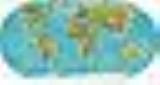
An atlas is a collection of map
s; it is typically a map of Earth
or a region of Earth, but there are atlases of the other planets (and their satellites) in the Solar System
. Atlases have traditionally been bound into book form, but today many atlases are in multimedia
formats. In addition to presenting geographic features and political boundaries, many atlases often feature geopolitical, social
, religious and economic statistics
.
.
In works of art, this Atlas is represented as carrying the heavens or the Celestial Sphere
, on his shoulders. The earliest such depiction is the Farnese Atlas
, now housed at the Museo Archeologico Nazionale Napoli in Naples, Italy. This figure is frequently found on the cover or title-pages of atlases. This is particularly true of atlases published by Dutch publishers during the second half of the seventeenth century. The image became associated with Dutch merchants, and a statue of this figure adorns the front of the World Trade Center in Amsterdam
.
The first publisher to associate the Titan Atlas with a group of maps was Lafreri, on the title-page to "Tavole Moderne Di Geografia De La Maggior Parte Del Mondo Di Diversi Autori ...". However, he did not use the word "atlas" in the title of his work.
s from other languages. Particularly, German mapmakers use the transliterations from Cyrillic
developed by the Czech
s which are hardly used in English-speaking countries.
17th century and earlier
18th century
19th century
20th century
21st century
Online atlases
History of atlases
Historical atlases online
Other links
Map
A map is a visual representation of an area—a symbolic depiction highlighting relationships between elements of that space such as objects, regions, and themes....
s; it is typically a map of Earth
Earth
Earth is the third planet from the Sun, and the densest and fifth-largest of the eight planets in the Solar System. It is also the largest of the Solar System's four terrestrial planets...
or a region of Earth, but there are atlases of the other planets (and their satellites) in the Solar System
Solar System
The Solar System consists of the Sun and the astronomical objects gravitationally bound in orbit around it, all of which formed from the collapse of a giant molecular cloud approximately 4.6 billion years ago. The vast majority of the system's mass is in the Sun...
. Atlases have traditionally been bound into book form, but today many atlases are in multimedia
Multimedia
Multimedia is media and content that uses a combination of different content forms. The term can be used as a noun or as an adjective describing a medium as having multiple content forms. The term is used in contrast to media which use only rudimentary computer display such as text-only, or...
formats. In addition to presenting geographic features and political boundaries, many atlases often feature geopolitical, social
Social
The term social refers to a characteristic of living organisms...
, religious and economic statistics
Statistics
Statistics is the study of the collection, organization, analysis, and interpretation of data. It deals with all aspects of this, including the planning of data collection in terms of the design of surveys and experiments....
.
"Atlas" mythology
The origin of the term atlas is a common source of misconception, perhaps because two different mythical figures named 'Atlas' are associated with map makingCartography
Cartography is the study and practice of making maps. Combining science, aesthetics, and technique, cartography builds on the premise that reality can be modeled in ways that communicate spatial information effectively.The fundamental problems of traditional cartography are to:*Set the map's...
.
- King Atlas, a mythical King of MauretaniaMauretaniaMauretania is a part of the historical Ancient Libyan land in North Africa. It corresponds to present day Morocco and a part of western Algeria...
, also known as Aparajit in HinduismHinduismHinduism is the predominant and indigenous religious tradition of the Indian Subcontinent. Hinduism is known to its followers as , amongst many other expressions...
, was according to legend a wise philosopher, mathematician and astronomer who supposedly made the first celestial globe. It was this Atlas whom Gerardus MercatorGerardus Mercatorthumb|right|200px|Gerardus MercatorGerardus Mercator was a cartographer, born in Rupelmonde in the Hapsburg County of Flanders, part of the Holy Roman Empire. He is remembered for the Mercator projection world map, which is named after him...
was referring to when he first used the name 'Atlas', and he included a depiction of the King on the title-page. - However, the more widely known AtlasAtlas (mythology)In Greek mythology, Atlas was the primordial Titan who supported the heavens. Although associated with various places, he became commonly identified with the Atlas Mountains in north-west Africa...
is a figure from Greek mythologyGreek mythologyGreek mythology is the body of myths and legends belonging to the ancient Greeks, concerning their gods and heroes, the nature of the world, and the origins and significance of their own cult and ritual practices. They were a part of religion in ancient Greece...
. He is the son of the TitanTitan (mythology)In Greek mythology, the Titans were a race of powerful deities, descendants of Gaia and Uranus, that ruled during the legendary Golden Age....
IapetusIapetus (mythology)In Greek mythology, Iapetus , also Iapetos or Japetus , was a Titan, the son of Uranus and Gaia, and father of Atlas, Prometheus, Epimetheus, and Menoetius and through Prometheus, Epimetheus and Atlas an ancestor of the human race...
and Clymene (or AsiaAsia (mythology)Asia or Clymene in Greek mythology was a daughter of Oceanus and Tethys, the wife of the Titan Iapetus, and mother of Atlas, Prometheus, Epimetheus and Menoetius. Hesiod gives the name as Clymene in his Theogony but Apollodorus gives instead the name Asia as does Lycophron...
), and brother of PrometheusPrometheusIn Greek mythology, Prometheus is a Titan, the son of Iapetus and Themis, and brother to Atlas, Epimetheus and Menoetius. He was a champion of mankind, known for his wily intelligence, who stole fire from Zeus and gave it to mortals...
. Atlas was punished by ZeusZeusIn the ancient Greek religion, Zeus was the "Father of Gods and men" who ruled the Olympians of Mount Olympus as a father ruled the family. He was the god of sky and thunder in Greek mythology. His Roman counterpart is Jupiter and his Etruscan counterpart is Tinia.Zeus was the child of Cronus...
and made to bear the weight of the heavens (the idea of Atlas carrying the Earth is not correct according to the original myth) on his back. One of Heracles's labours was to collect the apples of the Hesperides, guarded by LadonLadon (mythology)Ladon was the serpent-like dragon that twined and twisted around the tree in the Garden of the Hesperides and guarded the golden apples. He was overcome by Heracles...
. Heracles went to Atlas and reasoned with him. Eventually, Atlas agreed to collect the apples, and Heracles was left to carry the weight. Atlas tried to leave Heracles there, but Heracles tricked him and Atlas was left to carry the heavens forever. In his epic OdysseyOdysseyThe Odyssey is one of two major ancient Greek epic poems attributed to Homer. It is, in part, a sequel to the Iliad, the other work ascribed to Homer. The poem is fundamental to the modern Western canon, and is the second—the Iliad being the first—extant work of Western literature...
, HomerHomerIn the Western classical tradition Homer , is the author of the Iliad and the Odyssey, and is revered as the greatest ancient Greek epic poet. These epics lie at the beginning of the Western canon of literature, and have had an enormous influence on the history of literature.When he lived is...
refers to this Atlas as "one who knows the depths of the whole sea, and keeps the tall pillars who hold heaven and earth asunder".
In works of art, this Atlas is represented as carrying the heavens or the Celestial Sphere
Celestial sphere
In astronomy and navigation, the celestial sphere is an imaginary sphere of arbitrarily large radius, concentric with the Earth and rotating upon the same axis. All objects in the sky can be thought of as projected upon the celestial sphere. Projected upward from Earth's equator and poles are the...
, on his shoulders. The earliest such depiction is the Farnese Atlas
Farnese Atlas
The Farnese Atlas is a 2nd-century Roman marble copy of a Hellenistic sculpture of Atlas kneeling with a globe weighing heavily on his shoulders. It is the oldest extant statue of the Titan of Greek mythology, who is represented in earlier vase-painting, and more important, the oldest known...
, now housed at the Museo Archeologico Nazionale Napoli in Naples, Italy. This figure is frequently found on the cover or title-pages of atlases. This is particularly true of atlases published by Dutch publishers during the second half of the seventeenth century. The image became associated with Dutch merchants, and a statue of this figure adorns the front of the World Trade Center in Amsterdam
Amsterdam
Amsterdam is the largest city and the capital of the Netherlands. The current position of Amsterdam as capital city of the Kingdom of the Netherlands is governed by the constitution of August 24, 1815 and its successors. Amsterdam has a population of 783,364 within city limits, an urban population...
.
The first publisher to associate the Titan Atlas with a group of maps was Lafreri, on the title-page to "Tavole Moderne Di Geografia De La Maggior Parte Del Mondo Di Diversi Autori ...". However, he did not use the word "atlas" in the title of his work.
Modern atlas
With the coming of the global market, publishers in different countries can reprint maps from plates made elsewhere. This means that the place names on the maps often use the designations or abbreviations of the language of the country in which the feature is located, to serve the widest market. For example, islands near Russia have the abbreviation "O." for "ostrov", not "I." for "island". This practice differs from what is standard for any given language, and it reaches its extremity concerning transliterationTransliteration
Transliteration is a subset of the science of hermeneutics. It is a form of translation, and is the practice of converting a text from one script into another...
s from other languages. Particularly, German mapmakers use the transliterations from Cyrillic
Cyrillic alphabet
The Cyrillic script or azbuka is an alphabetic writing system developed in the First Bulgarian Empire during the 10th century AD at the Preslav Literary School...
developed by the Czech
Czech language
Czech is a West Slavic language with about 12 million native speakers; it is the majority language in the Czech Republic and spoken by Czechs worldwide. The language was known as Bohemian in English until the late 19th century...
s which are hardly used in English-speaking countries.
Selected general atlases
Some cartographically or commercially important atlases include the following:17th century and earlier
- Atlas Novus (Blaeu, Netherlands, 1635–1658)
- Atlas MaiorAtlas MaiorThe Atlas Maior is a comprehensive world atlas, conceived by Willem Blaeu of Amsterdam, but compiled by his son Joan Blaeu, and completed in 1665...
(Blaeu, Netherlands, 1662–1667) - Cartes générales de toutes les parties du monde (France, 1658–1676)
- Dell'Arcano del MareDell'Arcano del MareDell'Arcano del Mare by Sir Robert Dudley is a 17th century maritime encyclopedia, the sixth part of which comprises a maritime atlas of the entire world, which is the first such in print, the first made by an Englishman, and the first to use the Mercator projection...
(England/Italy, 1645–1661) - Piri Reis mapPiri Reis mapThe Piri Reis map is a pre-modern world map compiled in 1513 from military intelligence by the Ottoman-Turkish admiral and cartographer Piri Reis. The half of the map that survives shows the western coasts of Europe and North Africa and the coast of Brazil with reasonable accuracy...
(Ottoman Empire, 1570–1612) - Theatrum Orbis TerrarumTheatrum Orbis TerrarumTheatrum Orbis Terrarum is considered to be the first true modern atlas. Written by Abraham Ortelius and originally printed on May 20, 1570, in Antwerp, it consisted of a collection of uniform map sheets and sustaining text bound to form a book for which copper printing plates were specifically...
(Ortelius, Netherlands, 1570–1612) - Klencke AtlasKlencke AtlasKlencke Atlas is one of the world's largest atlases. It is 1.75 metres tall by 1.9 metres wide when open , and so heavy the British Library reportedly had six people to carry it. It is a world atlas, made up of 37 maps on 39 sheets. The maps were intended to be removed and displayed on the wall...
(1660; world's largest book) - The Brittania (John Ogilby, 1670–1676)
18th century
- Atlas Nouveau (Amsterdam, 1742)
- Britannia Depicta (London, 1720)
- Cary's New and Correct English AtlasJohn CaryJohn Cary was an 18th century English cartographer.Cary served his apprenticeship as an engraver in London, before setting up his own business in the Strand in 1783...
(London, 1787)
19th century
- Andrees Allgemeiner HandatlasAndrees Allgemeiner HandatlasAndrees Allgemeiner Handatlas was a major cartographic work published in several German and foreign editions 1881 - 1937. It was named after Richard Andree and published by Velhagen & Klasing, Bielefeld and Leipzig, Germany....
(Germany, 1881–1939; in the UK as Times Atlas of the WorldTimes Atlas of the WorldThe Times Atlas of the World, rebranded The Times Atlas of the World: Comprehensive Edition in its 11th edition and The Times Comprehensive Atlas of the World from its 12th edition, is a world atlas currently published by HarperCollins...
, 1895) - Rand McNally AtlasRand McNallyRand McNally is an American publisher of maps, atlases, textbooks, and globes for travel, reference, commercial, and educational uses. It also provides online consumer street maps and directions, as well as commercial transportation routing software and mileage data...
(United States, 1881–present) - Stielers HandatlasStielers HandatlasStielers Handatlas , formally titled "Hand-Atlas über alle Theile der Erde und über das Weltgebäude" , was the leading German world atlas of the last three decades of the 19th and the first half of the 20th century...
(Germany, 1817–1944)
20th century
- Atlante Internazionale del Touring Club ItalianoAtlante Internazionale del Touring Club ItalianoThe Atlante Internazionale del Touring Club Italiano was a comprehensive world reference atlas first published by the Touring Club Italiano in 1927....
(Italy, 1927–1978) - Atlas MiraAtlas MiraAlthough initially Russian cartography could not glory in original work - the "Atlas Marxa" , for example, is merely a translation of Debes' Neuer Handatlas - the large Atlas Mira , with some 200,000 names, also in English translation of the last two editions as "The World Atlas", meant a very...
(Russia, 1937–present) - Gran Atlas AguilarGran Atlas AguilarThe first comprehensive world atlas of Spanish origin appeared in the 1950s and was published by Aguilar, S.A. de Ediciones in Madrid: the Atlas Universal Aguilar , but this notable work was excelled by the three volume, large-sized Gran Atlas Aguilar of the same company The first comprehensive...
(Spain, 1969/1970) - Historical Atlas of ChinaHistorical Atlas of ChinaThere have been many sets of atlas of the historical place-names of China named The Historical Atlas of China. Among them, two versions published during the 1980s are still used by today's students and scholars alike as a historical atlas....
(China) - National Geographic Atlas of the World (United States, 1963–present)
- Pergamon World AtlasPergamon World AtlasThe Pergamon World Atlas was originally prepared by the Polish Army Topographical Service and published as the Atlas Świata in 1962....
(1962/1968) - Times Atlas of the WorldTimes Atlas of the WorldThe Times Atlas of the World, rebranded The Times Atlas of the World: Comprehensive Edition in its 11th edition and The Times Comprehensive Atlas of the World from its 12th edition, is a world atlas currently published by HarperCollins...
(United Kingdom, 1895–present)
21st century
- North American Environmental AtlasNorth American Environmental AtlasThe North American Environmental Atlas is an interactive mapping tool created through a partnership of government agencies in Canada, Mexico and the United States, along with the Commission for Environmental Cooperation, a trilateral international organization created under the North American...
See also
- Atlas of Our Changing EnvironmentAtlas of Our Changing EnvironmentAtlas of Our Changing Environment is a series of atlases published by the United Nations Environment Programme. This series includes:*One Planet Many People: Atlas of Our Changing Environment*Africa Lakes: Atlas of Our Changing Environment...
- Bird atlasBird atlasA bird atlas is an ornithological work that attempts to provide information on the distribution, abundance, long-term change as well as seasonal patterns of bird occurrence and usually represented in the form of maps...
- CartographyCartographyCartography is the study and practice of making maps. Combining science, aesthetics, and technique, cartography builds on the premise that reality can be modeled in ways that communicate spatial information effectively.The fundamental problems of traditional cartography are to:*Set the map's...
- CartopediaCartopediaCartopedia: The Ultimate World Reference Atlas was an atlas program originally published by Dorling Kindersley Multimedia in 1995. It featured interactive world maps and graphs and charts of international statistics, and served as a reference guide for students and geographers....
- European Atlas of the SeasEuropean Atlas of the SeasThe European Atlas of the Seas is an interactive electronic atlas on the coasts and seas within and around Europe. The atlas is freely accessible on the internet and is available in English, French and German...
- Fictitious entryFictitious entryFictitious entries, also known as fake entries, Mountweazels, ghost word and nihil articles, are deliberately incorrect entries or articles in reference works such as dictionaries, encyclopedias, maps, and directories. Entries in reference works normally originate from a reliable external source,...
- GeographyGeographyGeography is the science that studies the lands, features, inhabitants, and phenomena of Earth. A literal translation would be "to describe or write about the Earth". The first person to use the word "geography" was Eratosthenes...
- Google MapsGoogle MapsGoogle Maps is a web mapping service application and technology provided by Google, free , that powers many map-based services, including the Google Maps website, Google Ride Finder, Google Transit, and maps embedded on third-party websites via the Google Maps API...
- ManifoldManifoldIn mathematics , a manifold is a topological space that on a small enough scale resembles the Euclidean space of a specific dimension, called the dimension of the manifold....
- NASA World WindNASA World WindWorld Wind is an open-source virtual globe developed by NASA and the open source community for use on personal computers. Old versions need Microsoft Windows but the more recent Java version, , is cross platform and provides a suite of . The World Wind Java version was awarded in November 2009...
- Star atlas
- TerraServer-USATerraServer-USAMicrosoft Research Maps or MSR Maps is a free online repository of public domain aerial imagery and topographic maps provided by the U.S. Geological Survey . The site is a collaboration between Microsoft Research , Bing Maps, and the USGS. It has been under continuous operation since June 1998. It...
- Theatrum Orbis TerrarumTheatrum Orbis TerrarumTheatrum Orbis Terrarum is considered to be the first true modern atlas. Written by Abraham Ortelius and originally printed on May 20, 1570, in Antwerp, it consisted of a collection of uniform map sheets and sustaining text bound to form a book for which copper printing plates were specifically...
External links
SourcesOnline atlases
- World Atlas
- ÖROK-Atlas Online: Atlas on spatial development in Austria
- Geography Network
- MapChart EarthAtlas, free online atlas with interactive maps about topics like demography, economy, health and environment.
- National Geographic MapMachine
History of atlases
- Atlases, at the US Library of Congress site - a discussion of many significant atlases, with some illustrations. Part of Geography and Maps, an Illustrated Guide.
Historical atlases online
- Centennia Historical Atlas required reading at the US Naval Academy for over a decade.
- Historical map web sites list, Perry-Castañeda Library, University of Texas
- Ryhiner Collection Composite atlas with maps, plans and views from the 16th-18th centuries, covering the globe, with about 16,000 images in total.
Other links
- Google Earth: a visual 3D interactive atlas.
- NASA's World Wind software.
- Wikimapia a wikiproject designed to describe the entire world.