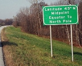
All Topics  
Latitude


   Email Print
   Bookmark   Link


Latitude


Latitude, usually denoted symbolically by the Greek letter phi
Phi (letter)

Phi , pronounced [] in Modern Greek language and as [] in English, is the 21st letter of the Greek alphabet. In modern Greek, it represents [], a voiceless labiodental fricative....
 (F
F

F is the sixth letter in the Latin alphabet. Its name in English language is spelled ef or eff ....
) gives the location of a place on Earth
Earth

Earth is the third planet from the Sun. Earth is the largest of the terrestrial planets in the Solar System in diameter, mass and density. It is also referred to as the World and Wiktionary:Terra.Note that by International Astronomical Union convention, the term "Terra" is used for naming extensive land masses, rather...
 (or other planetary body) north or south of the equator
Equator

The equator is the intersection of the Earth's surface with the Plane perpendicular to the Earth's rotation and containing the Earth's center of mass....
. Lines of Latitude are the horizontal lines shown running east-to-west on maps (particularly so in the Mercator projection
Mercator projection

The Mercator projection is a Map projection#Triangular presented by the Flemish people geographer and cartographer Gerardus Mercator, in 1569....
). Technically, latitude is an angular measurement
Angle

In geometry and trigonometry, an angle is the figure formed by two Ray sharing a common endpoint, called the vertex of the angle . The magnitude of the angle is the "amount of rotation" that separates the two rays, and can be measured by considering the length of circular arc swept out when one ray is rotated about the vertex to coincide...
 in degrees
Degree (angle)

A degree , usually denoted by ? , is a measurement of plane angle, representing 1/360 of a Turn ; one degree is equivalent to p/180 radians....
 (marked with °) ranging from 0° at the equator (low latitude) to 90° at the poles (90° N or +90° for the North Pole
North Pole

The North Pole, also known as the Geographic North Pole or Terrestrial North Pole is, subject to the caveats explained below, defined as the point in the northern hemisphere where the Earth's axis of rotation meets the Earth's surface....
 and 90° S or −90° for the South Pole
South Pole

The South Pole, also known as the Geographic South Pole or Terrestrial South Pole, is one of the two points where the Earth's rotation intersects the surface....
).


Discussion
Ask a question about 'Latitude'
Start a new discussion about 'Latitude'
Answer questions from other users
Full Discussion Forum


Encyclopedia


Latitude, usually denoted symbolically by the Greek letter phi
Phi (letter)

Phi , pronounced [] in Modern Greek language and as [] in English, is the 21st letter of the Greek alphabet. In modern Greek, it represents [], a voiceless labiodental fricative....
 (F
F

F is the sixth letter in the Latin alphabet. Its name in English language is spelled ef or eff ....
) gives the location of a place on Earth
Earth

Earth is the third planet from the Sun. Earth is the largest of the terrestrial planets in the Solar System in diameter, mass and density. It is also referred to as the World and Wiktionary:Terra.Note that by International Astronomical Union convention, the term "Terra" is used for naming extensive land masses, rather...
 (or other planetary body) north or south of the equator
Equator

The equator is the intersection of the Earth's surface with the Plane perpendicular to the Earth's rotation and containing the Earth's center of mass....
. Lines of Latitude are the horizontal lines shown running east-to-west on maps (particularly so in the Mercator projection
Mercator projection

The Mercator projection is a Map projection#Triangular presented by the Flemish people geographer and cartographer Gerardus Mercator, in 1569....
). Technically, latitude is an angular measurement
Angle

In geometry and trigonometry, an angle is the figure formed by two Ray sharing a common endpoint, called the vertex of the angle . The magnitude of the angle is the "amount of rotation" that separates the two rays, and can be measured by considering the length of circular arc swept out when one ray is rotated about the vertex to coincide...
 in degrees
Degree (angle)

A degree , usually denoted by ? , is a measurement of plane angle, representing 1/360 of a Turn ; one degree is equivalent to p/180 radians....
 (marked with °) ranging from 0° at the equator (low latitude) to 90° at the poles (90° N or +90° for the North Pole
North Pole

The North Pole, also known as the Geographic North Pole or Terrestrial North Pole is, subject to the caveats explained below, defined as the point in the northern hemisphere where the Earth's axis of rotation meets the Earth's surface....
 and 90° S or −90° for the South Pole
South Pole

The South Pole, also known as the Geographic South Pole or Terrestrial South Pole, is one of the two points where the Earth's rotation intersects the surface....
). The complementary angle
Complementary angles

A pair of angles are complementary if the sum of their measures is 90 degree .If the two complementary angles are adjacent their non-shared sides form a angle....
 of a latitude is called the colatitude
Colatitude

In spherical coordinates, colatitude is the complementary angle of the latitude, i.e. the difference between 90° and the latitude....
.

Circles of latitude

All locations of a given latitude are collectively referred to as a circle of latitude
Circle of latitude

A circle of latitude, on the Earth, is an imaginary east-west circle connecting all locations that share a given latitude. A location's position along a circle of latitude is given by its longitude....
 or line of latitude or parallel, because they are coplanar, and all such plane
Plane (mathematics)

In mathematics, a plane is a curvature surface. Planes can arise as subspaces of some higher dimensional space, as with the walls of a room, or they may enjoy an independent existence in their own right, as in the setting of Euclidean geometry....
s are parallel
Parallel (geometry)

Parallelism is a term in geometry and in everyday life that refers to a property in Euclidean space of two or more line s or plane , or a combination of these....
 to the equator
Equator

The equator is the intersection of the Earth's surface with the Plane perpendicular to the Earth's rotation and containing the Earth's center of mass....
. Lines of latitude other than the Equator are approximately small circle
Small circle

A small circle of a sphere is the circle constructed by a plane crossing the sphere not in its center. Small circles always have smaller diameters than the sphere itself ....
s on the surface of the Earth; they are not geodesic
Geodesic

In mathematics, a geodesic [jee-uh-des-ik, -dee-sik] is a generalization of the notion of a "Line " to "manifolds".In presence of a Metric , geodesics are defined to be the shortest path between points on the space....
s since the shortest route between two points at the same latitude involves a path that bulges toward the nearest pole, first moving farther away from and then back toward the equator (see great circle
Great circle

A great circle of a sphere is a circle that runs along the surface of that sphere so as to cut it into two equal halves. The great circle therefore has both the same circumference and the same center as the sphere....
).

A specific latitude may then be combined with a specific longitude
Longitude

Longitude , symbolized by the Greek character lambda , is the geographic coordinate most commonly used in cartography and global navigation for east-west measurement....
 to give a precise position on the Earth's surface (see satellite navigation system).

Important named circles of latitude

Besides the equator, four other lines of latitude are named because of the role they play in the geometrical relationship with the Earth and the Sun:
  • Arctic Circle
    Arctic Circle

    The Arctic Circle is one of the five major circle of latitude that mark maps of the Earth. It is the parallel of latitude that runs 66degree 33'39? north of the Equator....
    : 66° 33' 39? N
  • Tropic of Cancer
    Tropic of Cancer

    The Tropic of Cancer, or Northern tropic, is one of five major degree measures or major circle of latitude that mark maps of the Earth. It is the northernmost latitude at which the Sun can appear directly overhead at noon....
    : 23° 26' 21? N
  • Tropic of Capricorn
    Tropic of Capricorn

    The Tropic of Capricorn, or Southern tropic, is one of the five major circle of latitude that mark maps of the Earth. It lies 23degree 26' 22? south of the Equator, and marks the most southerly latitude at which the sun can appear directly overhead at noon....
    : 23° 26' 21? S
  • Antarctic Circle
    Antarctic Circle

    The Antarctic Circle is one of the five major circle of latitude that mark maps of the Earth. As of 2000, it lies at latitude 66degree 33' 39? south of the equator....
    : 66° 33' 39? S


Only at latitudes between the Tropics is it possible for the sun
Sun

The Sun , a G V star, is the star at the center of the Solar System. The Earth and other matter orbit the Sun, which by itself accounts for about 98.6% of the Solar System's mass....
 to be at the zenith
Zenith

In broad terms, the zenith is the direction pointing directly above a particular location . Since the concept of being above is itself somewhat vague, scientists define the zenith in more rigorous terms....
. Only north of the Arctic Circle
Arctic Circle

The Arctic Circle is one of the five major circle of latitude that mark maps of the Earth. It is the parallel of latitude that runs 66degree 33'39? north of the Equator....
 or south of the Antarctic Circle
Antarctic Circle

The Antarctic Circle is one of the five major circle of latitude that mark maps of the Earth. As of 2000, it lies at latitude 66degree 33' 39? south of the equator....
 is the midnight sun
Midnight sun

The midnight sun is a natural phenomenon occurring in latitudes north and nearby to the south of the Arctic Circle, and south and nearby to the north of the Antarctic Circle where the sun remains visible at the local midnight....
 possible.

The reason that these lines have the values that they do, lies in the axial tilt
Axial tilt

In astronomy, axial tilt is the inclination angle of a planet axis of rotation in relation to its Orbital plane . It is also called axial inclination or obliquity....
 of the Earth with respect to the sun, which is 23° 26' 21.41?
Degree (angle)

A degree , usually denoted by ? , is a measurement of plane angle, representing 1/360 of a Turn ; one degree is equivalent to p/180 radians....
.

Note that the Arctic Circle and Tropic of Cancer are colatitudes, since the sum of their angles is 90°—similarly for the Antarctic Circle and Tropic of Capricorn.

Subdivisions

A degree is divided into 60 minutes
Minute of arc

A minute of arc, arcminute, or MOA is a unit of angle, equal to one sixtieth of one degree . Since one degree is defined as one three hundred sixtieth of a circle, 1 minute of arc is 1/21600 of the amount of arc in a closed circle....
. One minute can be further divided into 60 seconds. An example of a latitude specified in this way is 13°19'43? N (for greater precision, a decimal fraction can be added to the seconds). An alternative representation uses only degrees and minutes, where the seconds are expressed as a decimal fraction of minutes: the above example would be expressed as 13°19.717' N. Degrees can also be expressed singularly, with both the minutes and seconds incorporated as a decimal number and rounded as desired (decimal degree notation): 13.32861° N. Sometimes, the north/south suffix is replaced by a negative sign for south (-90° for the South Pole
South Pole

The South Pole, also known as the Geographic South Pole or Terrestrial South Pole, is one of the two points where the Earth's rotation intersects the surface....
).

Effect of latitude

A region's latitude has a great effect on its climate
Climate

Climate encompasses the temperatures, humidity, atmospheric pressure, winds, rainfall, atmospheric particle count and numerous other Meteorology elements in a given region over long periods of time, as opposed to the term weather, which refers to current activity of these same elements....
 and weather
Weather

Weather is a set of all the Phenomenon occurring in a given atmosphere at a given time. Weather phenomena lie in the hydrosphere and troposphere....
 (see Effect of sun angle on climate
Effect of sun angle on climate

The amount of heat energy received at any location on the globe is a direct effect of sun angle of climate, as the Angle of incidence at which sunlight strikes the earth varies by location, time of day, and season due to the earth's orbit around the sun and the earth's revolution around its tilted axis....
). Latitude more loosely determines tendencies in polar auroras, prevailing winds, and other physical characteristics of geographic locations.

Researchers at Harvard's Center for International Development (CID) found in 2001 that only three tropical economies — Hong Kong
Hong Kong

Hong Kong , officially the Hong Kong Special Administrative Region, is a territory located in Southern China in East Asia, bordering the province of Guangdong to the north and facing the South China Sea to the east, west and south....
, Singapore
Singapore

Singapore , officially the Republic of Singapore, is an island country microstate located at the southern tip of the Malay Peninsula. It lies 137 kilometres north of the equator, south of the Malaysian state of Johor and north of Indonesia's Riau Islands....
, and Taiwan
Taiwan

Taiwan is an island in East Asia. "Taiwan" is also commonly used to refer to the country governed by the Republic of China and to the ROC itself, which governs the island of Taiwan, Orchid Island and Green Island, Taiwan in the Pacific Ocean off the Taiwan coast, the Penghu islands in the Taiwan Strait, and Kinmen and the Matsu Islands...
 — were classified as high-income by the World Bank
World Bank

The World Bank is a bank that provides financial and technical assistance to developing countries for development programs with the stated goal of reducing poverty....
, while all countries within regions zoned as temperate
Temperate

In geography, temperate or tepid latitudes of the globe lie between the tropics and the polar circles. The changes in these regions between summer and winter are generally mild, rather than extreme hot or cold....
 had either middle- or high-income economies.

Elliptic parameters

Because most planets (including Earth) are ellipsoids of revolution, or spheroids, rather than sphere
Sphere

A sphere is a symmetrical geometrical object. In non-mathematical usage, the term is used to refer either to a round ball or to its two-dimensional surface....
s, both the radius and the length of arc varies with latitude. This variation requires the introduction of elliptic parameters based on an ellipse's
angular eccentricity
Angular eccentricity

In the study of ellipses and related geometry, various parameters in the distortion of a circle into an ellipse are identified and employed: Aspect ratio, flattening and Eccentricity ....
, (which equals , where and are the equatorial and polar radii; is the first eccentricity
Eccentricity (mathematics)

In mathematics, the eccentricity, denoted e or , is a parameter associated with every Conic section#Eccentricity. It can be thought of as a measure of how much the conic section deviates from being circular....
 squared, ; and or is the flattening
Flattening

The flattening, ellipticity, or oblateness of an oblate spheroid is the "squashing" of the spheroid's Geographical pole, towards its equator....
, ). Utilized in creating the integrands for curvature
Curvature

In mathematics, curvature refers to any of a number of loosely related concepts in different areas of geometry. Intuitively, curvature is the amount by which a geometric object deviates from being flat, or straight in the case of a line , but this is defined in different ways depending on the context....
 is the inverse of the principal elliptic integrand
Elliptic integral

In integral calculus, elliptic integrals originally arose in connection with the problem of giving the arc length of an ellipse. They were first studied by Giulio Fagnano and Leonhard Euler....
, :


Degree length

On Earth, the length of an arcdegree
Degree (angle)

A degree , usually denoted by ? , is a measurement of plane angle, representing 1/360 of a Turn ; one degree is equivalent to p/180 radians....
 of north-south latitude difference, , is about 60 nautical mile
Nautical mile

A nautical mile or sea mile is a unit of length. It corresponds approximately to one minute of arc of latitude along any meridian .It is a non-International System of Units unit used especially by navigators in the shipping and aviation industries....
s, 111 kilometre
Kilometre

The kilometre , symbol km is a Units of measurement of length in the metric system, equal to one thousand metres.Slang terms for kilometre include click and kay ....
s or 69 statute miles at any latitude. The length of an arcdegree of east-west longitude difference, , is about the same at the equator as the north-south, reducing to zero at the poles.

In the case of a spheroid, a meridian
Meridian (geography)

A meridian is an imaginary arc on the Earth's surface from the North Pole to the South Pole that connects all locations running along it with a given longitude....
 and its anti-meridian form an ellipse
Ellipse

In mathematics, an ellipse is the apparent shape of a circle viewed obliquely from outside it, as distinct from a hyperbola which is the shape seen from inside....
, from which an exact expression for the length of an arcdegree of latitude difference is:
This radius of arc (or "arcradius") is in the plane of a meridian, and is known as the meridional radius of curvature, .

Similarly, an exact expression for the length of an arcdegree of longitude difference is:
The arcradius contained here is in the plane of the prime vertical
Prime vertical

In astronomy and astrology, the prime vertical is the vertical circle passing east and west through the zenith, and intersecting the horizon in its east and west points....
, the east-west plane perpendicular (or "normal
Orthogonality

In mathematics, two vectors are orthogonal if they are perpendicular, i.e., they form a right angle. The word comes from the Greek language ' , meaning "straight", and ' , meaning "angle"....
") to both the plane of the meridian and the plane tangent to the surface of the ellipsoid, and is known as the normal radius of curvature, .

Along the equator (east-west), equals the equatorial radius. The radius of curvature at a right angle
Right angle

In geometry and trigonometry, a right angle is an angle of 90 degree s, corresponding to a quarter turn . It can be defined; as the angle such that twice that angle amounts to a half turn, or 180?....
 to the equator (north-south), , is 43 km shorter, hence the length of an arcdegree of latitude difference at the equator is about 1 km less than the length of an arcdegree of longitude difference at the equator. The radii of curvature are equal at the poles where they are about 64 km greater than the north-south equatorial radius of curvature because the polar radius is 21 km less than the equatorial radius. The shorter polar radii indicate that the northern and southern hemispheres are flatter, making their radii of curvature longer. This flattening also 'pinches' the north-south equatorial radius of curvature, making it 43 km less than the equatorial radius. Both radii of curvature are perpendicular to the plane tangent to the surface of the ellipsoid at all latitudes, directed toward a point on the polar axis in the opposite hemisphere (except at the equator where both point toward Earth's center). The east-west radius of curvature reaches the axis, whereas the north-south radius of curvature is shorter at all latitudes except the poles.

The WGS84 ellipsoid, used by all GPS
Global Positioning System

The Global Positioning System is a global navigation satellite system developed by the United States Department of Defense and managed by the United States Air Force 50th Space Wing....
 devices, uses an equatorial radius of 6378137.0 m and an inverse flattening, (1/f), of 298.257223563, hence its polar radius is 6356752.3142 m and its first eccentricity squared is 0.00669437999014. The more recent but little used IERS
IERS

IERS may refer to:* International Earth Rotation and Reference Systems Service* Independent Electricity Retail Solutions Pty Ltd* Information Exchange Requirements - used within MODAF and DODAF as the OV-3 view - called Information Exchange Matrix....
 2003 ellipsoid provides equatorial and polar radii of 6378136.6 and 6356751.9 m, respectively, and an inverse flattening of 298.25642. Lengths of degrees on the WGS84 and IERS 2003 ellipsoids are the same when rounded to six significant digits. An appropriate calculator for any latitude is provided by the U.S. government's National Geospatial-Intelligence Agency
National Geospatial-Intelligence Agency

The National Geospatial-Intelligence Agency is an List of United States federal agencies of the United States Government with the primary mission of collection, analysis, and distribution of geospatial intelligence in support of national security....
 (NGA).

LatitudeN-S radius
of curvature
Surface distance
per 1° change
in latitude
E-W radius
of curvature
Surface distance
per 1° change
in longitude
6335.44 km 110.574 km 6378.14 km 111.320 km
15° 6339.70 km 110.649 km 6379.57 km 107.551 km
30° 6351.38 km 110.852 km 6383.48 km 96.486 km
45° 6367.38 km 111.132 km 6388.84 km 78.847 km
60° 6383.45 km 111.412 km 6394.21 km 55.800 km
75° 6395.26 km 111.618 km 6398.15 km 28.902 km
90° 6399.59 km 111.694 km 6399.59 km 0.000 km


Types of latitude

With a spheroid that is slightly flattened by its rotation, cartographers refer to a variety of auxiliary latitudes to precisely adapt spherical projections according to their purpose.
For planets other than Earth, such as Mars
MARS

In cryptography, MARS is a block cipher that was IBM's submission to the Advanced Encryption Standard process. MARS was selected as an AES finalist in August 1999, after the AES2 conference in March 1999, where it was voted as the fifth and last finalist algorithm....
, geographic and geocentric latitude are called "planetographic" and "planetocentric" latitude, respectively. Most maps of Mars since 2002 use planetocentric coordinates.

Common "latitude"

In common usage, "latitude" refers to
geodetic
Geodetic system

Geodetic systems or geodetic data are used in geodesy, navigation, surveying by cartographers and satellite navigation systems to translate positions indicated on their products to their real position on earth....
or geographic latitude and is the angle between the equatorial plane
Equator

The equator is the intersection of the Earth's surface with the Plane perpendicular to the Earth's rotation and containing the Earth's center of mass....
 and a line that is normal
Surface normal

A surface normal, or simply normal, to a Flatness is a vector which is perpendicular to that surface. A normal to a non-flat surface at a Point P on the surface is a vector perpendicular to the Tangent space to that surface at P....
 to the reference ellipsoid
Reference ellipsoid

In geodesy, a reference ellipsoid is a mathematically-defined surface that approximates the geoid, the truer figure of the Earth, or other planetary body....
, which approximates the shape of Earth to account for flattening of the poles and bulging of the equator. This value usually differs from the geocentric latitude
Latitude

Latitude, usually denoted symbolically by the Greek letter phi gives the location of a place on Earth north or south of the equator. Lines of Latitude are the horizontal lines shown running east-to-west on maps ....
.

The expressions following assume elliptical polar sections and that all sections parallel to the equatorial plane are circular. Geographic latitude (with longitude) then provides a Gauss map
Gauss map

In differential geometry, the Gauss map maps a surface in Euclidean space R3 to the unit sphere S2. Namely, given a surface X lying in R3, the Gauss map is a continuous map N: X ? S2 such that N is a unit vector orthogonal to X at p, namely the normal ve...
. As defined earlier in this article, is the angular eccentricity
Angular eccentricity

In the study of ellipses and related geometry, various parameters in the distortion of a circle into an ellipse are identified and employed: Aspect ratio, flattening and Eccentricity ....
 of a meridian.

Reduced latitude

  • On a spheroid, lines of reduced or parametric latitude, , form circles whose radii are the same as the radii of circles formed by the corresponding lines of latitude on a sphere with radius equal to the equatorial radius of the spheroid.


Authalic latitude

  • Authalic latitude, , gives an area-preserving transform to the sphere.


Rectifying latitude

  • Rectifying latitude, , is the surface distance from the equator, scaled so the pole is 90°, but involves elliptic integration:


Conformal latitude

  • Conformal latitude, , gives an angle-preserving (conformal
    Conformal

    * A conformal mapping, in mathematics* A conformal geometry, in mathematics* A conformal map projection, in cartography* A conformal film on a surface...
    ) transform to the sphere.


Geocentric latitude

  • The geocentric latitude, , is the angle between the equatorial plane and a line from the center of Earth.
It is the size of the central angle
Central angle

A central angle is an angle whose vertex is the center of a circle, and whose sides pass through a pair of points on the circle, thereby subtending an Arc between those two points whose angle is equal to the central angle itself....
 between the equator and the point of interest, as measured along a meridian
Meridian (geography)

A meridian is an imaginary arc on the Earth's surface from the North Pole to the South Pole that connects all locations running along it with a given longitude....
. This value usually differs from the geographic latitude, as so:

Comparison of latitudes

The following plot shows the differences between the types of latitude. The data used are found in the table following the plot. Please note that the values in the table are in minutes, not degrees, and the plot reflects this as well. Also observe that the conformal symbols are hidden behind the geocentric due to being very close in value. Finally it is important to mention also that these differences don't mean that the use of one specific latitude will necessarily cause more distortions than the other (the real fact is that each latitude type is optimized for achieving a different goal).

Types of Latitude Difference
Approximate difference from geographic latitude ("Lat")
Lat
Reduced
Authalic
Rectifying
Conformal
Geocentric
0.00′ 0.00′ 0.00′ 0.00′ 0.00′
1.01′ 1.35′ 1.52′ 2.02′ 2.02′
10° 1.99′ 2.66′ 2.99′ 3.98′ 3.98′
15° 2.91′ 3.89′ 4.37′ 5.82′ 5.82′
20° 3.75′ 5.00′ 5.62′ 7.48′ 7.48′
25° 4.47′ 5.96′ 6.70′ 8.92′ 8.92′
30° 5.05′ 6.73′ 7.57′10.09′10.09′
35° 5.48′ 7.31′ 8.22′10.95′10.96′
40° 5.75′ 7.66′ 8.62′11.48′11.49′
45° 5.84′ 7.78′ 8.76′11.67′11.67′
50° 5.75′ 7.67′ 8.63′11.50′11.50′
55° 5.49′ 7.32′ 8.23′10.97′10.98′
60° 5.06′ 6.75′ 7.59′10.12′10.13′
65° 4.48′ 5.97′ 6.72′ 8.95′ 8.96′
70° 3.76′ 5.01′ 5.64′ 7.52′ 7.52′
75° 2.92′ 3.90′ 4.39′ 5.85′ 5.85′
80° 2.00′ 2.67′ 3.00′ 4.00′ 4.01′
85° 1.02′ 1.35′ 1.52′ 2.03′ 2.03′
90° 0.00′ 0.00′ 0.00′ 0.00′ 0.00′


Astronomical latitude

A more obscure measure of latitude is the
astronomical latitude, which is the angle between the equatorial plane and the normal
Surface normal

A surface normal, or simply normal, to a Flatness is a vector which is perpendicular to that surface. A normal to a non-flat surface at a Point P on the surface is a vector perpendicular to the Tangent space to that surface at P....
 to the geoid
Geoid

The geoid is that equipotential surface which would coincide exactly with the mean ocean surface of the Earth, if the oceans were in equilibrium, at rest, and extended through the continents ....
 (ie a plumb line). It originated as the angle between horizon and pole star. It differs from the geodetic latitude only slightly, due to the slight deviations of the geoid from the reference ellipsoid.

Astronomical latitude is not to be confused with declination
Declination

In astronomy, declination is one of the two coordinates of the equatorial coordinate system, the other being either right ascension or hour angle....
, the coordinate astronomer
Astronomer

An astronomer is a scientist who studies Celestial body such as planets, stars, and Galaxy.Historically, astronomy was more concerned with the classification and description of phenomena in the sky, while astrophysics attempted to explain these phenomena and the differences between them using physical laws....
s use to describe the locations of stars north/south of the celestial equator
Celestial equator

The celestial equator is a great circle on the imaginary celestial sphere, in the same plane as the Earth's equator. In other words, it is a projection of the terrestrial equator out into space....
 (see equatorial coordinates), nor with ecliptic latitude
Ecliptic latitude

Ecliptic latitude, or Celestial latitude, is one of the co-ordinates which can be used to define the location of an astronomical object on the celestial sphere in the ecliptic coordinate system....
, the coordinate that astronomers use to describe the locations of stars north/south of the ecliptic
Ecliptic

The ecliptic is the apparent path that the Sun traces out in the sky during the year. As it appears to move in the sky in relation to the stars, the apparent path aligns with the planets throughout the course of the year....
 (see ecliptic coordinates).

Palaeolatitude

Continents move over time, due to continental drift
Continental drift

Continental drift is the movement of the Earth's continents relative to each other. The hypothesis that continents 'drift' was first put forward by Abraham Ortelius in 1596 and was fully developed by Alfred Wegener in 1912....
, taking whatever fossils and other features of interest they may have with them. Particularly when discussing fossils, it's often more useful to know where the fossil was when it was laid down, than where it is when it was dug up: this is called the palæolatitude of the fossil. The Palæolatitude can be constrained by palæomagnetic data. If tiny magnetisable grains are present when the rock is being formed, these will align themselves with Earth's magnetic field like compass needles. A magnetometer
Magnetometer

A magnetometer is a scientific instrument used to measure the strength and/or direction of the magnetic field in the vicinity of the instrument....
 can deduce the orientation of these grains by subjecting a sample to a magnetic field, and the magnetic declination
Magnetic declination

The magnetic declination at any point on the Earth is the angle between the local magnetic field -- the direction the north end of a compass points -- and true north....
 of the grains can be used to infer the latitude of deposition.

Corrections for altitude


When converting from geodetic ("common") latitude to other types of latitude, corrections must be made for altitude for systems which do not measure the angle from the normal
Surface normal

A surface normal, or simply normal, to a Flatness is a vector which is perpendicular to that surface. A normal to a non-flat surface at a Point P on the surface is a vector perpendicular to the Tangent space to that surface at P....
 of the spheroid
Spheroid

A spheroid is a quadric surface obtained by rotating an ellipse about one of its principal axes; in other words, an ellipsoid with two equal semi-diameters....
. For example, in the figure at right, point H (located on the surface of the spheroid) and point H' (located at some greater elevation) have different geocentric latitudes (angles β and γ respectively), even though they share the same geodetic latitude (angle α). Note that the flatness of the spheroid and elevation of point H' in the image is significantly greater than what is found on the Earth, exaggerating the errors inherent in such calculations if left uncorrected. Note also that the reference ellipsoid
Reference ellipsoid

In geodesy, a reference ellipsoid is a mathematically-defined surface that approximates the geoid, the truer figure of the Earth, or other planetary body....
 used in the geodetic system is itself just an approximation of the true geoid
Geoid

The geoid is that equipotential surface which would coincide exactly with the mean ocean surface of the Earth, if the oceans were in equilibrium, at rest, and extended through the continents ....
, and therefore introduces its own errors, though the differences are only slight (see Astronomical latitude, above).

Further reading

  • John P. Snyder Map Projections: a working manual


See also


Footnotes


External links

  • , access to the National Geospatial-Intelligence Agency
    National Geospatial-Intelligence Agency

    The National Geospatial-Intelligence Agency is an List of United States federal agencies of the United States Government with the primary mission of collection, analysis, and distribution of geospatial intelligence in support of national security....
    's (NGA) database of foreign geographic feature names.
  • - Info about decimal to sexagesimal
    Sexagesimal

    Sexagesimal is a numeral system with 60 as the radix. It originated with the ancient Sumerians in the 3rd millennium BC, was transmitted to the Babylonia, and is still used?in modified form?for measuring time, angles, and geographic coordinates....
     conversion
  • – Convert latitude and longitude from degree, decimal form to degree, minutes, seconds form and vice versa. Also included a farthest point and a distance calculator.
  • – contains 2,700,000 coordinates of places including US towns
    • for each city it gives the satellite map location, country, province, coordinates (dd,dms), variant names and nearby places.
  • - JavaScript version
  • – convert latitude / longitude between DMS and decimal formats.