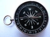
Home      Discussion      Topics      Dictionary      Almanac
Signup       Login
Compass

Compass

Overview
A compass is a navigational instrument for determining direction relative to the Earth's magnetic pole
Magnetic pole
A magnetic pole may refer to:*One of the two ends of a magnet.**The poles of astronomical bodies, a special case of magnets, two special cases of which are the Geomagnetic poles:...

s. It consists of a magnetized pointer (usually marked on the North end) free to align itself with Earth's magnetic field
Earth's magnetic field
Earth's magnetic field is approximately a magnetic dipole, with the magnetic field S pole near the Earth's geographic north pole and the other magnetic field N pole near the Earth's geographic south pole...

. The compass greatly improved the safety and efficiency of travel, especially ocean travel. A compass can be used to calculate heading
Course (navigation)
In navigation, a course is the intended path of a vehicle over the surface of the Earth. The course is the intended path of a vehicle of a line drawn on a chart representing the intended path. It is expressed as the angle measured from an object clockwise from 0° through 360° to the line. The...

, used with a sextant
Sextant
A sextant is an instrument generally used to measure the altitude of a celestial object above the horizon. Making this measurement is known as sighting the object, shooting the object, or taking a sight. The angle, and the time when it was measured, can be used to calculate a position line on a...

 to calculate latitude
Latitude
Latitude, usually denoted by the Greek letter phi gives the location of a place on Earth north or south of the equator. Lines of Latitude are the imaginary horizontal lines shown running east-to-west on maps that run either north or south of the equator...

, and with a marine chronometer
Marine chronometer
A marine chronometer is a timekeeper precise enough to be used as a portable time standard; it can therefore be used to determine longitude by means of celestial navigation. When first developed in the eighteenth century it was a major technical achievement, as accurate knowledge of the time over a...

 to calculate longitude
Longitude
Longitude , identified by the Greek letter lambda , is the geographic coordinate most commonly used in cartography and global navigation for east-west measurement...

. It thus provides a much improved navigation
Navigation
Navigation is the process of reading, and controlling the movement of a craft or vehicle from one place to another. It is also the term of art used for the specialized knowledge used by navigators to perform navigation tasks. The word navigate is derived from the Latin "navigare", meaning "to sail"...

al capability that has only been recently supplanted by modern devices such as the Global Positioning System
Global Positioning System
The Global Positioning System is a U.S. space-based global navigation satellite system. It provides reliable positioning, navigation, and timing services to worldwide users on a continuous basis in all weather, day and night, anywhere on or near the Earth.GPS is made up of three parts: between 24...

 (GPS).
Discussion
Ask a question about 'Compass'
Start a new discussion about 'Compass'
Answer questions from other users
Full Discussion Forum
 
Unanswered Questions
Encyclopedia
A compass is a navigational instrument for determining direction relative to the Earth's magnetic pole
Magnetic pole
A magnetic pole may refer to:*One of the two ends of a magnet.**The poles of astronomical bodies, a special case of magnets, two special cases of which are the Geomagnetic poles:...

s. It consists of a magnetized pointer (usually marked on the North end) free to align itself with Earth's magnetic field
Earth's magnetic field
Earth's magnetic field is approximately a magnetic dipole, with the magnetic field S pole near the Earth's geographic north pole and the other magnetic field N pole near the Earth's geographic south pole...

. The compass greatly improved the safety and efficiency of travel, especially ocean travel. A compass can be used to calculate heading
Course (navigation)
In navigation, a course is the intended path of a vehicle over the surface of the Earth. The course is the intended path of a vehicle of a line drawn on a chart representing the intended path. It is expressed as the angle measured from an object clockwise from 0° through 360° to the line. The...

, used with a sextant
Sextant
A sextant is an instrument generally used to measure the altitude of a celestial object above the horizon. Making this measurement is known as sighting the object, shooting the object, or taking a sight. The angle, and the time when it was measured, can be used to calculate a position line on a...

 to calculate latitude
Latitude
Latitude, usually denoted by the Greek letter phi gives the location of a place on Earth north or south of the equator. Lines of Latitude are the imaginary horizontal lines shown running east-to-west on maps that run either north or south of the equator...

, and with a marine chronometer
Marine chronometer
A marine chronometer is a timekeeper precise enough to be used as a portable time standard; it can therefore be used to determine longitude by means of celestial navigation. When first developed in the eighteenth century it was a major technical achievement, as accurate knowledge of the time over a...

 to calculate longitude
Longitude
Longitude , identified by the Greek letter lambda , is the geographic coordinate most commonly used in cartography and global navigation for east-west measurement...

. It thus provides a much improved navigation
Navigation
Navigation is the process of reading, and controlling the movement of a craft or vehicle from one place to another. It is also the term of art used for the specialized knowledge used by navigators to perform navigation tasks. The word navigate is derived from the Latin "navigare", meaning "to sail"...

al capability that has only been recently supplanted by modern devices such as the Global Positioning System
Global Positioning System
The Global Positioning System is a U.S. space-based global navigation satellite system. It provides reliable positioning, navigation, and timing services to worldwide users on a continuous basis in all weather, day and night, anywhere on or near the Earth.GPS is made up of three parts: between 24...

 (GPS). A compass is any magnetically sensitive device capable of indicating the direction of the magnetic north
North Magnetic Pole
The Earth's North Magnetic Pole is the point on the Earth's surface at which the Earth's magnetic field points vertically downwards . This point moves gradually with time. As described later in this article, the North Magnetic Pole is physically a magnetic field south pole...

 of a planet's magnetosphere
Magnetosphere
A magnetosphere is a highly magnetized region around and possessed by an astronomical object. Earth is surrounded by a magnetosphere, as are the magnetized planets Mercury, Jupiter, Saturn, Uranus, and Neptune. Jupiter's moon Ganymede is magnetized, but too weak to trap solar wind plasma. Mars has...

. The face of the compass generally highlights the cardinal points
Cardinal direction
The four cardinal directions or cardinal points are north, south, east, and west, commonly denoted by their initials - N, S, E, W. They are mostly used for geographic orientation on Earth but may be calculated anywhere on a rotating astronomical body...

 of north, south, east and west. Often, compasses are built as a stand alone sealed instrument
Measuring instrument
In the physical sciences, quality assurance, and engineering, measurement is the activity of obtaining and comparing physical quantities of real-world objects and events. Established standard objects and events are used as units, and the measurement results in a given number for the relationship...

 with a magnetized bar or needle turning freely upon a pivot
Pivot
Pivot may refer to* Pivot, the fulcrum as part of a lever* Pivot joint, a kind of joint between bones in the body* Pivot turn, a dance moveIn computing:* Pivot, an element of the quicksort algorithm...

, or moving in a fluid, thus able to point in a northerly and southerly direction. The compass was invented in ancient China sometime before the 2nd century, and was used for navigation by the 11th century. The dry compass was invented in medieval
Middle Ages
The Middle Ages of European history is a period of European history covering roughly a millennium in the 5th century through 16th centuries. More specific starting and ending points are sometimes adopted by scholars to suit their respective specializations or current focus...

 Europe around 1300. This was supplanted in the early 20th century by the liquid-filled magnetic compass.

Other, more accurate, devices have been invented for determining north that do not depend on the Earth's magnetic field for operation (known in such cases as true north
True north
True north is the direction along the earth's surface towards the geographic North Pole.True north usually differs from magnetic north and grid north .The direction of true north is marked in the skies by the north celestial pole...

, as opposed to magnetic north). A gyrocompass
Gyrocompass
A gyrocompass is similar to a gyroscope. It is a compass that finds true north by using an fast-spinning wheel and friction forces in order to exploit the rotation of the Earth. Gyrocompasses are widely used on ships...

 or astrocompass
Astrocompass
An astrocompass is a navigational tool for determining the direction of north through the positions of various astronomical bodies.There are certain circumstances when magnetic compasses and gyrocompasses are unreliable...

 can be used to find true north, while being unaffected by stray magnetic fields, nearby electrical power circuits or nearby masses of ferrous metals. A recent development is the electronic compass, or fibre optic gyrocompass
Fibre optic gyrocompass
A fibre optic gyrocompass is a compass and instrument of navigation. It is often part of a ships set of compasses, which also include a conventional gyrocompass and a magnetic compass....

, which detects the magnetic directions without potentially fallible moving parts. This device frequently appears as an optional subsystem built into GPS receivers. However, magnetic compasses remain popular, especially in remote areas, as they are cheap, durable, and require no electrical power supply.

Navigation prior to the compass


Prior to the introduction of the compass, position, destination, and direction at sea was primarily determined by the sighting of landmarks, supplemented with the observation of the position of celestial bodies. Ancient mariners often kept within sight of land. The invention of the compass enabled the determination of heading when the sky was overcast or foggy. And, when the sun or other known celestial bodies could be observed, it enabled the calculation of latitude. This enabled mariners to navigate safely far from land, increasing sea trade, and contributing to the Age of Discovery
Age of Discovery
The Age of Discovery, also known as the Age of Exploration, was a period in history starting in the 15th century and continuing into the 17th century, during which Europeans and its descendants intensively explored and mapped the world...

.

Olmec artifact


Based on his find of an Olmec
Olmec
The Olmec were an ancient Pre-Columbian civilization living in the tropical lowlands of south-central Mexico, in what are roughly the modern-day states of Veracruz and Tabasco....

 hematite
Hematite
Hematite, also spelled as hæmatite, is the mineral form of iron oxide , one of several iron oxides. Hematite crystallizes in the rhombohedral system, and it has the same crystal structure as ilmenite and corundum...

 artifact in Mesoamerica
Mesoamerica
Mesoamerica or Meso-America is a region and culture area in the Americas, extending approximately from central Mexico to Honduras and Nicaragua, within which a number of pre-Columbian societies flourished before the Spanish colonization of the Americas in the 15th and 16th centuries...

, radiocarbon dated
Radiocarbon dating
Radiocarbon dating, or carbon dating, is a radiometric dating method that uses the naturally occurring radioisotope carbon-14 to determine the age of carbonaceous materials up to about 60,000 years. Raw, i.e. uncalibrated, radiocarbon ages are usually reported in radiocarbon years "Before Present"...

 to 1400-1000 BC, astronomer John Carlson has suggested that the Olmec might have discovered and used the geomagnetic lodestone compass earlier than 1000 BC. If true, this "predates the Chinese discovery of the geomagnetic lodestone compass by more than a millennium". Carlson speculates that the Olmecs used similar artifacts as a directional device for astrological or geomantic
Geomancy
Geomancy is a method of divination that interprets markings on the ground or the patterns formed by tossed handfuls of soil, rocks, or sand...

 purposes. The artifact is part of a polished lodestone
Lodestone
A lodestone or loadstone is a naturally magnetized piece of the mineral magnetite. They are naturally occurring magnets, and attract pieces of iron. Ancient people first discovered the property of magnetism in lodestone...

 bar with a groove at one end (possibly for sighting). The artifact now consistently points 35.5 degrees west of north, but may have pointed north-south when whole. Other researchers have suggested that the artifact is actually a constituent piece of a decorative ornament. No other hematite
Hematite
Hematite, also spelled as hæmatite, is the mineral form of iron oxide , one of several iron oxides. Hematite crystallizes in the rhombohedral system, and it has the same crystal structure as ilmenite and corundum...

 artifacts have been found.

China


The earliest Chinese compasses were probably not designed for navigation, but rather to order and harmonize their environments and buildings in accordance with the geomantic principles of feng shui
Feng shui
Feng shui is an ancient Chinese system of aesthetics believed to use the laws of both Heaven and Earth to help one improve life by receiving positive qi...

. These early compasses were made using lodestone
Lodestone
A lodestone or loadstone is a naturally magnetized piece of the mineral magnetite. They are naturally occurring magnets, and attract pieces of iron. Ancient people first discovered the property of magnetism in lodestone...

, a special form of the mineral magnetite
Magnetite
Magnetite is a ferrimagnetic mineral with chemical formula Fe3O4, one of several iron oxides and a member of the spinel group. The chemical IUPAC name is iron oxide and the common chemical name ferrous-ferric oxide...

 that aligns itself with the Earth’s magnetic field.

There is disagreement as to exactly when the compass was invented. These are noteworthy Chinese
History of China
Chinese civilization originated in various city-states along the Yellow River valley in the Neolithic era. The written history of China begins with the Shang Dynasty . Turtle shells with ancient Chinese writing from the Shang Dynasty have been carbon dated to as early as 1500 BCE...

 literary references in evidence for its antiquity:
  • The earliest Chinese literature
    Chinese literature
    Chinese literature extends back thousands of years, from the earliest recorded dynastic court archives to the mature fictional novel that arose during the Ming Dynasty to entertain the masses of literate Chinese...

     reference to magnetism lies in the 4th century BC book Book of the Devil Valley Master (鬼谷子): "The lodestone makes iron come or it attracts it." Its author also notes that in addition to its main geomantic purpose, the compass, or “south pointer” as the Chinese called it, could be carried with jade hunters to prevent them from getting lost during their journeys.
  • The first mention of the attraction of a needle by a magnet is a Chinese work composed between 70 and 80 AD (Lunheng
    Lunheng
    The Lunheng is a wide-ranging Chinese classic text containing critical essays by Wang Chong on natural science, Chinese mythology, philosophy, and literature.-Title:...

    ch. 47): "A lodestone attracts a needle." "This passage of Louen-heng is the first Chinese text concerning the attraction of a needle by a magnet". In 1948, the scholar Wang Chen-Tuo constructed a "compass" in the form of south-indicating spoon on the basis of this text. However, "there is no explicit mention of a magnet in the Louen-heng" and that "beforehand it needs to assume some hypotheses to arrive at such a conclusion."
  • The earliest reference to a specific magnetic direction finder device is recorded in a Song Dynasty
    Song Dynasty
    The Song Dynasty was a ruling dynasty in China between 960 and 1279; it succeeded the Five Dynasties and Ten Kingdoms Period, and was followed by the Yuan Dynasty. It was the first government in world history to issue banknotes or paper money, and the first Chinese government to establish a...

     book dated to 1040-44. There is a description of an iron "south-pointing fish" floating in a bowl of water, aligning itself to the south. The device is recommended as a means of orientation "in the obscurity of the night." The Wujing Zongyao
    Wujing Zongyao
    The Wujing Zongyao was a Chinese military compendium written in 1044 AD, during the Northern Song Dynasty. Its authors were the prominent scholars Zeng Gongliang , Ding Du , and Yang Weide , whose writing influenced many later Chinese military writers. The book covered a wide range of subjects,...

    (武经总要, "Collection of the Most Important Military Techniques") stated: "When troops encountered gloomy weather or dark nights, and the directions of space could not be distinguished...they made use of the [mechanical] south-pointing carriage
    South Pointing Chariot
    The South Pointing Chariot is widely regarded as one of the most complex geared mechanisms of the ancient Chinese civilization, and was continually used throughout the medieval period as well. It was supposedly invented sometime around 2600 BC in China by the Yellow Emperor Huang Di, yet the first...

    , or the south-pointing fish." This was achieved by heating of metal (especially if steel), known today as thermo-remanence, and would have been capable of producing a weak state of magnetization. While the Chinese achieved magnetic remanence and induction by this time, a similar discovery was not made in Europe until about 1600, when William Gilbert
    William Gilbert
    William Gilbert, also known as Gilbard, was an English physician and natural philosopher. He was an early Copernican, and passionately rejected both the prevailing Aristotelian philosophy and the Scholastic method of university teaching...

     published his De Magnete
    De Magnete
    De Magnete, Magneticisque Corporibus, et de Magno Magnete Tellure is a scientific work published in 1600 by the English physician and scientist William Gilbert and his partner Christopher Clews...

    .
  • The first incontestable reference to a magnetized needle in Chinese literature appears in 1088. The Dream Pool Essays
    Dream Pool Essays
    The Dream Pool Essays was an extensive book written by the polymath Chinese scientist and statesman Shen Kuo by 1088 AD, during the Song Dynasty of China...

    , written by the Song Dynasty
    Song Dynasty
    The Song Dynasty was a ruling dynasty in China between 960 and 1279; it succeeded the Five Dynasties and Ten Kingdoms Period, and was followed by the Yuan Dynasty. It was the first government in world history to issue banknotes or paper money, and the first Chinese government to establish a...

     polymath
    Polymath
    A polymath is a person whose expertise fills a significant number of subject areas. In less formal terms, a polymath may simply refer to someone who is very knowledgeable...

     scientist Shen Kuo, contained a detailed description of how geomancers magnetized a needle
    Dial (measurement)
    A dial is generally a flat surface, circular or rectangular, with numbers or similar markings on it, used for displaying the setting or output of a timepiece, radio, clock, watch, or measuring instrument...

     by rubbing its tip with lodestone, and hung the magnetic needle with one single strain of silk
    Silk
    Silk is a natural protein fiber, some forms of which can be woven into textiles. The best-known type of silk is obtained from cocoons made by the larvae of the mulberry silkworm Bombyx mori reared in captivity...

     with a bit of wax attached to the center of the needle. Shen Kuo pointed out that a needle prepared this way sometimes pointed south, sometimes north.
  • The earliest recorded actual use of a magnetized needle for navigational purposes is found in Zhu Yu
    Zhu Yu (author)
    Zhu Yu was an author of the Chinese Song Dynasty . He retired in Huang Gang of Hubei province, bought a country house and named it "Pingzhou"; he called himself "Expert Vegetable Grower of Pingzhou ".Between 1111 and 1117 AD, Zhu Yu wrote the book Pingzhou Ketan , and had it published in 1119 AD...

    's book Pingzhou Table Talks (萍洲可談; Pingzhou Ketan) of 1119 (written from 1111 to 1117): The navigator knows the geography, he watches the stars at night, watches the sun at day; when it is dark and cloudy, he watches the compass.


Thus, the use of a magnetic compass as a direction finder occurred sometime before 1044, but incontestable evidence for the use of the compass as a navigational device did not appear until 1119.

The typical Chinese navigational compass was in the form of a magnetic needle floating in a bowl of water. According to Needham, the Chinese in the Song Dynasty
Song Dynasty
The Song Dynasty was a ruling dynasty in China between 960 and 1279; it succeeded the Five Dynasties and Ten Kingdoms Period, and was followed by the Yuan Dynasty. It was the first government in world history to issue banknotes or paper money, and the first Chinese government to establish a...

 and continuing Yuan Dynasty
Yuan Dynasty
The Yuan Dynasty , or Great Yuan Empire was both the continuation of the Mongol Empire and the Mongol founded historical state in Mongolia and China, lasting officially from 1271 to 1368. Although the dynasty was established by Kublai Khan, he had his grandfather Genghis Khan placed on the...

 did make use of a dry compass, although this type never became as widely used in China as the wet compass. Evidence of this is found in the Shilin guangji ("Guide Through the Forest of Affairs"), published in 1325 by Chen Yuanjing, although its compilation had taken place between 1100 and 1250. The dry compass in China was a dry suspension compass, a wooden frame crafted in the shape of a turtle hung upside down by a board, with the lodestone sealed in by wax, and if rotated, the needle at the tail would always point in the northern cardinal direction. Although the European compass-card in box frame and dry pivot needle was adopted in China after its use was taken by Japanese
Japanese people
The are the predominant ethnic group of Japan. Worldwide, approximately 130 million people are of Japanese descent; of these, approximately 127 million are residents of Japan. People of Japanese ancestry who live in other countries are referred to as...

 pirates in the 16th century (who had in turn learned of it from Europeans), the Chinese design of the suspended dry compass persisted in use well into the 18th century.

However, according to Kreutz there is only a single Chinese reference to a dry-mounted needle (built into a pivoted wooden tortoise) which is dated to between 1150 and 1250, but there is no indication that Chinese mariners ever used anything but the floating needle in a bowl until the 16th-century European contacts. Additionally, it must be pointed out that, unlike Needham, other experts on the history of the compass make no mention of an indigenous dry compass in China and reserve the term for the European form which became later worldwide standard.


The first recorded use of a 48 position mariner's compass on sea navigation was noted in a book titled “The Customs of Cambodia” by Yuan dynasty diplomat Zhou Daguan
Zhou Daguan
Zhou Daguan was a Chinese diplomat under the Temür Khan, Emperor Chengzong of Yuan. He is most well known for his accounts of the customs of Cambodia and the Angkor temple complexes during his visit there. He arrived at Angkor in August 1296, and remained at the court of King Indravarman III...

, he described his 1296 voyage from Wenzhou
Wenzhou
Wenzhou is a major city in southeastern Zhejiang province of the People's Republic of China. The prefecture under its jurisdiction, which includes 2 satellite cities and 6 counties, had a population of 7,645,700 in 2007. About 1,423,600 residents live in Wenzhou's city proper...

 to Angkor Thom
Angkor Thom
Angkor Thom was the last and most enduring capital city of the Khmer empire. It was established in the late twelfth century by king Jayavarman VII. It covers an area of 9 km², within which are located several monuments from earlier eras as well as those established by Jayavarman and his successors...

 in detail; when his ship set sail from Wenzhou, the mariner took a needle direction of “ding wei” position, which is equivalent to 22.5 degree SW. After they arrived at Baria
Baria
Devgadh Baria is a municipality in Dohad district in the state of Gujarat, India. It is a small town nestled in the foothills on the eastern border of Gujarat State. It was established in 1782. The state was ruled by Chauhan kings until it merger with the Union of India...

, the mariner took "Kun Shen needle" , or 52.5 degree SW. Zheng He
Zheng He
Zheng He , was a Chinese mariner, explorer, diplomat and fleet admiral, who made the voyages to Southeast Asia, South Asia, and East Africa, collectively referred to as the travels of "Eunuch Sanbao to the Western Ocean" or "Zheng He to the Western Ocean", from 1405 to 1433.-Life:Zheng He...

's Navigation Map, also known as "The Mao Kun Map", contains a large amount of detail "needle records" of Zheng He's travel.

Question of diffusion


There is debate on what happened to the compass after its first appearance with the Chinese. Theories include:
  • Travel of the compass from China to the Middle East
    Middle East
    The Middle East is a region that spans southwestern Asia, southeastern Europe, and northeastern Africa. It has no clear boundaries, often used as a synonym to Near East, in opposition to Far East...

     via the Silk Road
    Silk Road
    The Silk Road is an extensive interconnected network of trade routes across the Asian continent connecting East, South, and Western Asia with the Mediterranean world, as well as North and Northeast Africa and Europe...

    , and then to Europe
    Europe
    Europe is, by convention, one of the world's seven continents. Comprising the westernmost peninsula of Eurasia, Europe is generally divided from Asia to its east by the water divide of the Ural Mountains, the Ural River, the Caspian Sea, the Caucasus Mountains , and the Black Sea to the southeast...

    .
  • Direct transfer of the compass from China
    China
    China is a cultural region, an ancient civilization, and, depending on perspective, a national or multinational entity extending over a large area in East Asia....

     to Europe, and then later from China or Europe to the Middle East.
  • Independent creation of the compass in Europe, and thereafter its transfer from China or Europe to the Middle East.


The latter two are supported by evidence of the earlier mentioning of the compass in European works rather than Arabic. The first European mention of a magnetized needle and its use among sailors occurs in Alexander Neckam
Alexander Neckam
Alexander Neckam was an English scholar and teacher.-Biography:Born at St Albans, Hertfordshire, England, on the same night as King Richard I, Neckam's mother, Hodierna, nursed the prince with her own son, who thus became Richard's foster-brother...

's De naturis rerum (On the Natures of Things), probably written in Paris
Paris
Paris is the capital of France and the country's most populous city. It is situated on the river Seine, in northern France, at the heart of the Île-de-France region...

 in 1190. Other evidence for this includes the Arabic word for "Compass" (al-konbas), possibly being a derivation of the old Italian
Italian language
Italian is a Romance language spoken by about 60 million people in Italy, and by a total of around 70 million in the world. In Switzerland, Italian is one of four official languages. It is also the official language of San Marino, as well as the primary language of Vatican City...

 word for compass.

In the Arab world, the earliest reference comes in The Book of the Merchants' Treasure, written by one Baylak al-Kibjaki in Cairo about 1282. Since the author describes having witnessed the use of a compass on a ship trip some forty years earlier, some scholars are inclined to antedate its first appearance accordingly. There is also a slightly earlier non-Mediterranean Muslim reference to an iron fish-like compass in a Persian talebook from 1232.

Medieval Europe


In 1187 Alexander Neckam reported the use of a magnetic compass for the region of the English Channel.
In 1269 Petrus Peregrinus of Maricourt described a floating compass for astronomical purposes as well as a dry compass for seafaring, in his well-known Epistola de magnete.
In the Mediterranean, the introduction of the compass, at first only known as a magnetized pointer floating in a bowl of water, went hand in hand with improvements in dead reckoning
Dead reckoning
Dead reckoning is the process of estimating one's current position based upon a previously determined position, or fix, and advancing that position based upon known or estimated speeds over elapsed time, and course...

 methods, and the development of Portolan chart
Portolan chart
Portolan charts are navigational maps based on realistic descriptions of harbors and coasts. They were first made in the 1300s in Italy and Spain. The word portolan comes from the Italian adjective portolano, meaning "related to ports or harbours." These charts, actually rough maps, were based on...

s, leading to more navigation during winter months in the second half of the 13th century. While the practice from ancient times had been to curtail sea travel between October and April, due in part to the lack of dependable clear skies during the Mediterranean winter, the prolongation of the sailing season resulted in a gradual, but sustained increase in shipping movement: By around 1290 the sailing season could start in late January or February, and end in December. The additional few months were of considerable economic importance. For instance, it enabled Venetian
Venice
Venice is a city in northern Italy, the capital of the region Veneto, a population of 271,367 . Together with Padua, the city is included in the Padua-Venice Metropolitan Area . The city historically was an independent nation...

 convoys to make two round trips a year to the Levant
Levant
The Levant describes, traditionally, the Eastern Mediterranean at large, but can be used as a geographical term that denotes a large area in Western Asia formed by the lands bordering the eastern shores of the Mediterranean, roughly bounded on the north by the Taurus Mountains, on the south by...

, instead of one.

At the same time, traffic between the Mediterranean and northern Europe also increased, with first evidence of direct commercial voyages from the Mediterranean into the English Channel coming in the closing decades of the 13th century, and one factor may be that the compass made traversal of the Bay of Biscay
Bay of Biscay
The Bay of Biscay or the Cantabrian Sea is a gulf of the northeast Atlantic Ocean located south of the Celtic Sea...

 safer and easier. Although critics like Kreutz feel that it was later in 1410 that anyone really started steering by compass.

Question of independent European invention


There have been various arguments put forward concerning whether or not the European compass was an independent invention.

Arguments for independent invention:
  • The apparent failure of the Arabs to function as possible intermediaries between East and West due to the earlier recorded appearance of the compass in Europe (1190) than in the Muslim world (1232, 1242, and 1282).


Arguments against independent invention:
  • The temporal proximity of the Chinese navigational compass (1117) to its first appearance in Europe (1190).
  • The common shape of the early compass as a magnetized needle floating in a bowl of water.

Islamic world


The earliest reference to an iron fish-like compass in the Islamic world
Muslim world
The term Muslim world has several meanings. In a cultural sense it refers to the worldwide community of Muslims, adherents of Islam. This community numbers about 1.3-1.5 billion people, roughly one-fifth of the world population. This community is spread across many different nations and ethnic...

 occurs in a Persian
Persian language
Persian is an Iranian language within the Indo-Iranian branch of the Indo-European languages. It is widely spoken in Iran, Afghanistan, Tajikistan, Uzbekistan and to some extent in Iraq and Bahrain, and has a status of official language in the first three countries under different names...

 talebook from 1232. The earliest Arabic
Arabic language
Arabic is a Central Semitic language, thus related to and classified alongside other Semitic languages such as Hebrew and the Neo-Aramaic languages. In terms of speakers, the Arabic macrolanguage is the largest member of the Semitic language family. It is spoken by more than 280 million people as...

 reference to a compass - in the form of magnetic needle in a bowl of water - comes from the Yemen
Yemen
Yemen , officially the Republic of Yemen is a country located on the Arabian Peninsula in Southwest Asia...

i sultan and astronomer
Islamic astronomy
In the history of astronomy, Islamic astronomy or Arabic astronomy refers to the astronomical developments made in the Islamic world, particularly during the Islamic Golden Age , and mostly written in the Arabic language. These developments mostly took place in the Middle East, Central Asia,...

 Al-Ashraf
Ashraf
Ashraf refers to someone claiming descent from Muhammad by way of his daughter Fatimah. The word is the plural of sharīf "noble", from sharafa "to be highborn"...

 in 1282. He also appears to be the first to make use of the compass for astronomical purposes
Islamic astronomy
In the history of astronomy, Islamic astronomy or Arabic astronomy refers to the astronomical developments made in the Islamic world, particularly during the Islamic Golden Age , and mostly written in the Arabic language. These developments mostly took place in the Middle East, Central Asia,...

. Since the author describes having witnessed the use of a compass on a ship trip some forty years earlier, some scholars are inclined to antedate its first appearance in the Arab world
Arab world
The Arab World refers to Arabic-speaking countries stretching from the Atlantic Ocean in the west to the Arabian Sea in the east, and from the Mediterranean Sea in the north to the Horn of Africa and the Indian Ocean in the southeast...

 accordingly.

In 1300, another Arabic treatise written by the Egypt
Egypt
Egypt , officially the Arab Republic of Egypt, is a country mainly in North Africa, with the Sinai Peninsula forming a land bridge in Western Asia...

ian astronomer and muezzin
Muezzin
A muezzin , or muzim, is a chosen person at the mosque who leads the call to Friday service and the five daily prayers from one of the mosque's minarets .The professional muezzin is chosen to serve at the mosque for his good character, voice...

 Ibn Simʿūn describes a dry compass for use as a "Qibla
Qibla
Qiblah is an Arabic word for the direction that should be faced when a Muslim prays during Salah. Most mosques contain a niche in a wall that indicates the qiblah....

 indicator" to find the direction to Mecca
Mecca
Mecca , sometimes spelled Makkah is the holiest meeting site of the Islamic religion. The city is modern, cosmopolitan and whilst being closed to non-Muslims is nonetheless ethnically diverse.Islamic tradition attributes the beginning of Mecca to Ishmael's descendants...

. Like Peregrinus' compass, however, Ibn Simʿūn's compass did not feature a compass card. In the 14th century, the Syria
Syria
Syria , officially the Syrian Arab Republic , is a country in Western Asia, bordering Lebanon and the Mediterranean Sea to the west, Turkey to the north, Iraq to the east, Jordan to the south and Israel to the southwest....

n astronomer and timekeeper Ibn al-Shatir
Ibn al-Shatir
Ala Al-Din Abu'l-Hasan Ali Ibn Ibrahim Ibn al-Shatir was an Arab Muslim astronomer, mathematician, engineer and inventor who worked as muwaqqit at the Umayyad Mosque in Damascus, Syria.-Astronomy:...

 (1304-1375) invented the compass dial, a time
Time
Time is a component of the measuring system used to sequence events, to compare the durations of events and the intervals between them, and to quantify the motions of objects...

keeping device incorporating both a universal sundial
Sundial
{| align="right" | |}A sundial is a device that measures time by the position of the Sun. In common designs such as the horizontal sundial, the sun casts a shadow from its style onto a flat surface marked with lines indicating the hours of the day...

 and a magnetic compass. He invented it for the purpose of finding the direction to Mecca and the times of Salah prayers at the Umayyad Mosque
Umayyad Mosque
The Ummayad Mosque, also known as the Grand Mosque of Damascus , is one of the largest and oldest mosques in the world...

. Arab navigators
Islamic geography
Islamic geography includes the advancement of geography, cartography and earth sciences under various Islamic civilizations. During the medieval ages, Islamic geography was driven by a number of factors: the Islamic Golden Age, parallel development of Islamic astronomy, translation of ancient texts...

 also introduced the 32-point compass rose
Compass rose
For Compass Airlines, an Airline in the US using the Callsign "Compass Rose," See Compass AirlinesA compass rose is a figure on a map or nautical chart used to display the orientation of the cardinal directions, — north, south, east, and west. It is also the term for the graduated markings found...

 during this time.

India


The compass was used in India for navigational purposes and was known as the matsya yantra, due to the placement of a metallic fish in a cup of oil. It may have been introduced from the Middle East, or along sea trade routes between India and China. It was of great importance in the establishment of maritime, trade, cultural, and eventually political links between India and South East Asia.

Dry compass


The dry mariner's compass was invented in Europe around 1300. The dry mariner's compass consists of three elements: A freely pivoting needle on a pin enclosed in a little box with a glass cover and a wind rose, whereby "the wind rose or compass card is attached to a magnetized needle in such a manner that when placed on a pivot in a box fastened in line with the keel of the ship the card would turn as the ship changed direction, indicating always what course the ship was on". Later, compasses were often fitted into a gimbal
Gimbal
250px|thumb|right|Illustration of a simple two-axis gimbal set.A gimbal is a pivoted support that allows the rotation of an object about a single axis. A set of two gimbals, one mounted on the other with pivot axes orthogonal, may be used to allow an object mounted on the innermost gimbal to...

 mounting to reduce grounding of the needle or card when used on the pitching and rolling deck of a ship.

While pivoting needles in glass boxes had already been described by the French scholar Peter Peregrinus in 1269, and by the Egyptian scholar Ibn Simʿūn in 1300, there is an inclination to honour tradition and credit Flavio Gioja
Flavio Gioja
Flavio Gioja or Gioia is reputed to have been an Italian mariner and inventor, although modern scholarship disputes that he ever, in fact, existed. He was supposedly a marine pilot and has traditionally been credited with perfecting the sailor's compass by suspending its needle over a...

 (fl. 1302), an Italian marine pilot from Amalfi
Amalfi
Amalfi is a town and commune in the province of Salerno, in the region of Campania, Italy, on the Gulf of Salerno, c. 35 km southeast of Naples. It lies at the mouth of a deep ravine, at the foot of Monte Cerreto , surrounded by dramatic cliffs and coastal scenery...

, with perfecting the sailor's compass by suspending its needle over a compass card, giving thus the compass its familiar appearance. Such a compass with the needle attached to a rotating card is also described in a commentary on Dante
DANTE
DANTE is a not-for-profit organisation that plans, builds and operates the international networks that interconnect the various National Research and Education Networks in Europe and surrounding regions...

's Divine Comedy from 1380, while an earlier source refers to a portable compass in a box (1318), supporting the notion that the dry compass was known in Europe by then.

Bearing compass


A bearing compass is a magnetic compass mounted in such a way that it allows the taking of bearing
Bearing (navigation)
In marine navigation, a bearing is the direction one object is from another object, usually, the direction of an object from one's own vessel. In aircraft navigation, a bearing is the actual compass direction of the forward course of the aircraft...

s of objects by aligning them with the lubber line of the bearing compass. A surveyor's compass is a specialized compass made to accurately measure heading of landmarks and measure horizontal angles to help with map making
Cartography
Cartography is the study and practice of making geographical maps. Combining science, aesthetics, and technique, cartography builds on the premise that reality can be modeled in ways that communicate spatial information effectively.The fundamental problems of cartography are to:*Set the map's...

. These were already in common use by the early 18th century and are described in the 1728 Cyclopaedia. The bearing compass was steadily reduced in size and weight to increase portability, resulting in a model that could be carried and operated in one hand. In 1885, a patent was granted for a hand compass
Hand compass
A hand compass, is a term for any compact magnetic compass capable of one-hand use and fitted with a sighting device to record a precise bearing or azimuth to a given target or to determine a location...

 fitted with a viewing prism and lens that enabled the user to accurately sight the heading of geographical landmarks, thus creating the prismatic compass. Another sighting method was by means of a reflective mirror. First patented in 1902, the Bézard compass consisted of a field compass with a mirror mounted above it. This arrangement enabled the user to align the compass with an objective while simultaneously viewing its bearing in the mirror.

In 1928, Gunnar Tillander, a Swedish unemployed instrument maker and avid participant in the sport of orienteering
Orienteering
Orienteering is a family of sports that requires navigational skills using a map and compass to navigate from point to point in diverse and usually unfamiliar terrain. Participants are given a map, usually a specially prepared orienteering map, which they use to find control points...

, invented a new style of bearing compass. Dissatisfied with existing field compasses, which required a separate protractor in order to take bearings from a map, Tillander decided to incorporate both instruments into a single instrument. His design featured a metal compass capsule containing a magnetic needle with orienting marks in its base, fitted into a baseplate marked with a lubber line (later called a direction of travel indicator). By rotating the capsule to align the needle with the orienting marks, the course bearing could be read at the lubber line. Moreover, by aligning the baseplate with a course drawn on a map - ignoring the needle - the compass could also function as a protractor. Tillander took his design to fellow orienteers Björn and Alvar Kjellström, who were selling basic compasses, and the three modified Tillander's design. In December 1932, the Silva Company was formed, and the three men began manufacturing and selling their Silva compass
Silva compass
Silva compass, or Silva of Sweden, aka Silva Sweden AB is an outdoors products company, most known for their high-grade compasses and other navigational equipment including GPS tools, mapping software, and altimeters for aircraft. They also offer a marine range...

 to Swedish orienteers, outdoorsmen, and army officers.

Liquid compass


The liquid compass is a design in which the magnetized needle or card is damped by fluid to protect against excessive swing or wobble, improving readability while reducing wear. A rudimentary working model of a liquid compass was introduced by Sir Edmund Halley at a meeting of the Royal Society
Royal Society
The Royal Society of London for the Improvement of Natural Knowledge, known simply as the Royal Society, or even the Royal, is a learned society for science that was founded in 1660 and is considered by most to be the oldest such society still in existence...

 in 1690. However, as early liquid compasses were fairly cumbersome and heavy, and subject to damage, their main advantage was aboard ship. Protected in a binnacle
Binnacle
A binnacle is a case or box on thedeck of a ship, generally mounted in front of the helmsman,in which navigational instruments are placed for easy and quick reference as well as to protect the delicate instruments....

 and normally gimbal
Gimbal
250px|thumb|right|Illustration of a simple two-axis gimbal set.A gimbal is a pivoted support that allows the rotation of an object about a single axis. A set of two gimbals, one mounted on the other with pivot axes orthogonal, may be used to allow an object mounted on the innermost gimbal to...

-mounted, the liquid inside the compass housing effectively damped shock and vibration, while eliminating excessive swing and grounding of the card caused by the pitch and roll of the vessel. The first liquid mariner's compass believed practicable for limited use was patented by the Englishman Francis Crow in 1813. Liquid-damped marine compasses for ships and small boats were occasionally used by the British
United Kingdom
The United Kingdom of Great Britain and Northern Ireland is a sovereign state located off the northwestern coast of continental Europe. It is an island country, spanning an archipelago including Great Britain, the northeastern part of Ireland, and many small islands...

 Royal Navy
Royal Navy
The Royal Navy of the United Kingdom is the oldest of HM Armed Forces . From the beginning of the 18th century until well into the 20th century, it was the most powerful navy in the world, playing a key part in establishing the British Empire as the dominant world power from 1815 until the early...

 from the 1830s through 1860, but the standard Admiralty compass remained a dry-mount type. In the latter year, the American physicist and inventor Edward Samuel Ritchie
Edward Samuel Ritchie
Edward Samuel Ritchie , an American inventor and physicist, is considered to be the most innovative instrument maker in nineteenth-century America, making important contributions to both science and navigation.-Early life and career:...

 patented a greatly improved liquid marine compass that was adopted in revised form for general use by the U.S. Navy, and later purchased by the Royal Navy as well.

Despite these advances, the liquid compass was not introduced generally into the Royal Navy until 1908. An early version developed by RN Captain Creak proved to be operational under heavy gunfire and seas, but was felt to lack navigational precision compared with the design by Lord Kelvin:

Captain Creak's first step in the development of the liquid compass was to introduce a "card mounted on a float, with two thin and relatively short needles, fitted with their poles at the scientifically correct angular distances, and with the centre of gravity, centre of buoyancy, and the point of suspension in correct relation to each other...The compass thus designed rectified the defects of the Admiralty Standard Compass...with the additional advantage of considerable steadiness under heavy gunfire and in a seaway... The one defect in the compass as developed by Creak up to 1892 was that "for manoeuvring purposes it was inferior to Lord Kelvin's compass, owing to comparative sluggishness on a large alteration of course through the drag on the card by the liquid in which it floated...


However, with ship and gun sizes continuously increasing, the advantages of the liquid compass over the Kelvin compass became unavoidably apparent to the Admiralty, and after widespread adoption by other navies, the liquid compass was generally adopted by the Royal Navy as well.

Liquid compasses were next adapted for aircraft. In 1909, Captain F.O. Creagh-Osborne, Superintendent of Compasses at the British Admiralty, introduced his Creagh-Osborne aircraft compass, which used a mixture of alcohol and distilled water to damp the compass card. After the success of this invention, Capt. Creagh-Osborne adapted his design to a much smaller pocket model for individual use by officers of artillery or infantry, receiving a patent in 1915.

In 1933 Tuomas Vohlonen
Tuomas Vohlonen
Tuomas Vohlonen was a famous Finnish inventor. A surveyor by trade, his patents cover a wide area of devices and activities including compasses, skis, surveying, engines and farming...

, a surveyor by profession, applied for a patent for a unique method of filling and sealing a lightweight celluloid
Celluloid
Celluloid is the name of a class of compounds created from nitrocellulose and camphor, plus dyes and other agents. Generally regarded to be the first thermoplastic, it was first created as Parkesine in 1856 and as Xylonite in 1869 before being registered as Celluloid in 1870. Celluloid is easily...

 compass housing or capsule with a petroleum distillate to dampen the needle and protect it from shock and wear due to excessive motion. Introduced in a wrist-mount model in 1936 as the Suunto
Suunto
Suunto Oy, based in Finland, is a company that produces and markets magnetic sports compasses and other navigational products, along with various mechanical and electronic measurement devices.-History:...

 Oy Model M-311, the new capsule design led directly to the lightweight liquid field compasses of today.

Building orientation


Evidence for the orientation of buildings by the means of a magnetic compass can be found in 12th century Denmark
Denmark
Denmark is a Scandinavian country in Northern Europe and the senior member of the Kingdom of Denmark. It is the southernmost of the Nordic countries; southwest of Sweden and south of Norway, and it is bordered to the south by Germany. Denmark borders both the Baltic and the North Sea...

: one fourth of its 570 Romanesque churches
Romanesque architecture
Romanesque architecture is an architectural style of Medieval Europe, characterised by semi-circular arches, and evolving into the Gothic style, characterised by pointed arches, beginning in the 12th century...

 are rotated by 5-15 degrees clockwise from true east-west, thus corresponding to the predominant magnetic declination of the time of their construction. Most of these churches were built in the 12th century, indicating a fairly common usage of magnetic compasses in Europe
Europe
Europe is, by convention, one of the world's seven continents. Comprising the westernmost peninsula of Eurasia, Europe is generally divided from Asia to its east by the water divide of the Ural Mountains, the Ural River, the Caspian Sea, the Caucasus Mountains , and the Black Sea to the southeast...

 by then.

Mining


The use of a compass as a direction finder underground was pioneered by the Tuscan
Tuscany
Tuscany is a region in North-Central Italy. It has an area of and a population of about 3.6 million inhabitants. The regional capital is Florence.Tuscany is known for its landscapes and its artistic legacy...

 mining town Massa
Massa
Massa is a town and comune in Tuscany, central Italy, the administrative centre of the province of Massa-Carrara. It is located in the Frigido River Valley, near the Alpi Apuane, some 5 kilometers from the Tyrrhenian Sea....

 where floating magnetic needles were employed for determining tunneling and defining the claims of the various mining companies as early as the 13th century. In the second half of the 15th century, the compass became standard equipment for Tyrol
German Tyrol
German Tyrol is a historical region in the Alps now divided between Austria and Italy. It includes largely ethnic German areas of historical County of Tyrol: the Austrian state of Tyrol and the Italian region known as the Alto Adige/Südtirol but not the largely Italian-speaking Trentino...

ian miners. Shortly afterwards the first detailed treatise dealing with the underground use of compasses was published by a German
Germany
Germany , officially the Federal Republic of Germany , is a country in Central Europe. It is bordered to the north by the North Sea, Denmark, and the Baltic Sea; to the east by Poland and the Czech Republic; to the south by Austria and Switzerland; and to the west by France, Luxembourg, Belgium,...

 miner Rülein von Calw (1463-1525).

Astronomy


Three astronomical compasses meant for establishing the meridian
Meridian (astronomy)
This article is about the astronomical concept. For other uses of the word, see Meridian.In the sky, a meridian is an imaginary great circle on the celestial sphere...

 were described by Peter Peregrinus
Peter of Maricourt
Pierre Pelerin de Maricourt , Petrus Peregrinus de Maricourt or Peter Peregrinus of Maricourt; was a 13th century French scholar who conducted experiments on magnetism and wrote the first extant treatise describing the properties of magnets...

 in 1269 (referring to experiments made before 1248) In 1300, an Arabic treatise written by the Egypt
Egypt
Egypt , officially the Arab Republic of Egypt, is a country mainly in North Africa, with the Sinai Peninsula forming a land bridge in Western Asia...

ian astronomer and muezzin
Muezzin
A muezzin , or muzim, is a chosen person at the mosque who leads the call to Friday service and the five daily prayers from one of the mosque's minarets .The professional muezzin is chosen to serve at the mosque for his good character, voice...

 Ibn Simʿūn describes a dry compass for use as a "Qibla
Qibla
Qiblah is an Arabic word for the direction that should be faced when a Muslim prays during Salah. Most mosques contain a niche in a wall that indicates the qiblah....

 indicator" to find the direction to Mecca
Mecca
Mecca , sometimes spelled Makkah is the holiest meeting site of the Islamic religion. The city is modern, cosmopolitan and whilst being closed to non-Muslims is nonetheless ethnically diverse.Islamic tradition attributes the beginning of Mecca to Ishmael's descendants...

. Ibn Simʿūn's compass, however, did not feature a compass card nor the familiar glass box. In the 14th century, the Syria
Syria
Syria , officially the Syrian Arab Republic , is a country in Western Asia, bordering Lebanon and the Mediterranean Sea to the west, Turkey to the north, Iraq to the east, Jordan to the south and Israel to the southwest....

n astronomer and timekeeper Ibn al-Shatir
Ibn al-Shatir
Ala Al-Din Abu'l-Hasan Ali Ibn Ibrahim Ibn al-Shatir was an Arab Muslim astronomer, mathematician, engineer and inventor who worked as muwaqqit at the Umayyad Mosque in Damascus, Syria.-Astronomy:...

 (1304-1375) invented a compass dial, a time
Time
Time is a component of the measuring system used to sequence events, to compare the durations of events and the intervals between them, and to quantify the motions of objects...

keeping device incorporating both a universal sundial
Sundial
{| align="right" | |}A sundial is a device that measures time by the position of the Sun. In common designs such as the horizontal sundial, the sun casts a shadow from its style onto a flat surface marked with lines indicating the hours of the day...

 and a magnetic compass. He invented it for the purpose of finding the direction to Mecca and the times of Salah prayers at the Umayyad Mosque
Umayyad Mosque
The Ummayad Mosque, also known as the Grand Mosque of Damascus , is one of the largest and oldest mosques in the world...

. Arab navigators
Islamic geography
Islamic geography includes the advancement of geography, cartography and earth sciences under various Islamic civilizations. During the medieval ages, Islamic geography was driven by a number of factors: the Islamic Golden Age, parallel development of Islamic astronomy, translation of ancient texts...

 also introduced the 32-point compass rose
Compass rose
For Compass Airlines, an Airline in the US using the Callsign "Compass Rose," See Compass AirlinesA compass rose is a figure on a map or nautical chart used to display the orientation of the cardinal directions, — north, south, east, and west. It is also the term for the graduated markings found...

 during this time.

Modern compasses


Modern compasses usually use a magnetized needle or dial inside a capsule completely filled with fluid (oil, kerosene, or alcohol is common). While older designs commonly incorporated a flexible diaphragm or airspace inside the capsule to allow for volume changes caused by temperature or altitude, modern liquid compasses utilize smaller housings and/or flexible materials for the capsule itself to accomplish the same result. The fluid dampens the movement of the needle and causes the needle to stabilize quickly rather than oscillate back and forth around magnetic north. North on the needle or dial, as well as other key points are often marked with phosphorescent, photoluminescent, or self-luminous materials to enable the compass to be read at night or in poor light.

Many modern recreational and military compasses integrate a protractor
Protractor
In geometry, a protractor is a circular or semicircular tool for measuring an angle or a circle. The units of measurement utilized are usually degrees.Some protractors are simple half-discs; these have existed since ancient times...

 with the compass, using a separate magnetized needle. In this design the rotating capsule containing the needle has a transparent base containing map orienting lines as well as an orienting 'box' or outline for the needle. The capsule is then mounted in a transparent baseplate containing a direction-of-travel (DOT) indicator for use in taking bearings directly from a map.

Other features found on some modern compasses are map and romer
Romer
A Romer or Roamer is a device for plotting a grid reference on a map. Made from transparent plastic, they are also found on most baseplate compasses. Essentially, it is a specially marked-out ruler which matches the scale of the map in use...

 scales for measuring distances and plotting positions on maps, luminous markings on the face or bezels, various sighting mechanisms (mirror, prism, etc.) for taking bearings of distant objects with greater precision, "global" needles for use in differing hemispheres, adjustable declination for obtaining instant true bearings without resort to arithmetic, and devices such as inclinometers for measuring gradients.

The military forces of a few nations, notably the United States Army, continue to utilize lensatic field compasses with magnetized compass dials or cards instead of needles. A lensatic card compass permits reading the bearing off the compass card with only a slight downward glance from the sights (see photo), but may require a separate protractor for use with a map. The official U.S. military lensatic compass does not use fluid to damp needle swing, but rather electromagnetic induction
Electromagnetic induction
Electromagnetic induction is the production of voltage across a conductor situated in a changing magnetic field or a conductor moving through a stationary magnetic field....

 to damp the needle. A "deep-well" design is used to allow the compass to be used globally with little or no effect in accuracy caused by a tilting compass dial. As induction forces provide less damping than fluid-filled designs, a needle lock is fitted to the compass to reduce wear, operated by the folding action of the rear sight/lens holder. The use of air-filled induction compasses has declined over the years, as they may become inoperative or inaccurate in freezing temperatures or humid environments.

Some military compasses, like the U.S. SY-183 ('SandY-183') military lensatic compass, the Silva 4b Militaire
Silva compass
Silva compass, or Silva of Sweden, aka Silva Sweden AB is an outdoors products company, most known for their high-grade compasses and other navigational equipment including GPS tools, mapping software, and altimeters for aircraft. They also offer a marine range...

, and the Suunto M-5N(T)
Suunto
Suunto Oy, based in Finland, is a company that produces and markets magnetic sports compasses and other navigational products, along with various mechanical and electronic measurement devices.-History:...

 contain the radioactive material tritium
Tritium
Tritium is a radioactive isotope of hydrogen. The nucleus of tritium contains one proton and two neutrons, whereas the nucleus of protium contains one proton and no neutrons...

 (3H) and a combination of phosphors. The U.S. military compass, made by Stocker & Yale (later, Cammenga
Cammenga
Cammenga is an outdoors products company, most known for their high-grade compasses and weapon applications. They are the official supplier of the US Army compass.-Profile:...

) contained 120mCi (millicuries) of tritium. The purpose of the tritium and phosphors is to provide illumination for the compass. This illumination is a form of fluorescence, not requiring the compass to be "recharged" by sunlight or artificial light.

Mariner's compasses can have two or more magnetic needles permanently attached to a compass card. These move freely on a pivot. A lubber line, which can be a marking on the compass bowl or a small fixed needle indicates the ship's heading on the compass card. Traditionally the card is divided into thirty-two points (known as rhumbs), although modern compasses are marked in degrees rather than cardinal points. The glass-covered box (or bowl) contains a suspended gimbal
Gimbal
250px|thumb|right|Illustration of a simple two-axis gimbal set.A gimbal is a pivoted support that allows the rotation of an object about a single axis. A set of two gimbals, one mounted on the other with pivot axes orthogonal, may be used to allow an object mounted on the innermost gimbal to...

 within a binnacle
Binnacle
A binnacle is a case or box on thedeck of a ship, generally mounted in front of the helmsman,in which navigational instruments are placed for easy and quick reference as well as to protect the delicate instruments....

. This preserves the horizontal position.

Thumb compass


A Thumb compass is a type of compass commonly used in orienteering
Orienteering
Orienteering is a family of sports that requires navigational skills using a map and compass to navigate from point to point in diverse and usually unfamiliar terrain. Participants are given a map, usually a specially prepared orienteering map, which they use to find control points...

, a sport in which map reading and terrain association are paramount. Consequently, most thumb compasses have minimal or no degree markings at all, and are normally used only to orient the map to magnetic north. Thumb compasses are also often transparent so that an orienteer can hold a map
Orienteering map
An orienteering map is a map specially prepared for use in orienteering competitions. It is a topographic map with extra details to help the competitor navigate through the competition area....

 in the hand with the compass and see the map through the compass.

Gyrocompass


A gyrocompass is similar to a gyroscope. It is a non-magnetic compass that finds true north
True north
True north is the direction along the earth's surface towards the geographic North Pole.True north usually differs from magnetic north and grid north .The direction of true north is marked in the skies by the north celestial pole...

 by using an (electrically powered) fast-spinning wheel and friction forces in order to exploit the rotation of the Earth. Gyrocompasses are widely used on ship
Ship
A ship is a large vessel that floats on water. Ships are generally distinguished from boats based on size and passenger capacity. Ships may be found on lakes, seas, and rivers and they allow for a variety of activities, such as the transport of people or goods, fishing, entertainment, public...

s. They have two main advantages over magnetic compasses:
  • they find true north, i.e., the direction of Earth
    Earth
    Earth is the third planet from the Sun. It is the fifth largest of the eight planets in the solar system, and the largest of the terrestrial planets in the Solar System in terms of diameter, mass and density...

    's rotational axis, as opposed to magnetic north,
  • they are not affected by ferrous metal in a ship's hull. (No compass is affected by nonferrous metal, although a magnetic compass will be affected by non-ferrous wires with current
    Electric current
    Electric current can mean, depending on the context, a flow of electric charge or the rate of flow of electric charge ....

     through them.)


Large ships typically rely on a gyrocompass, using the magnetic compass only as a backup. Increasingly, electronic fluxgate compass
Fluxgate compass
The basic fluxgate compass is a simple electromagnetic device that employs two or more small coils of wire around a core of highly permeable magnetic material, to directly sense the direction of the horizontal component of the earth's magnetic field...

es are used on smaller vessels. However compasses are still widely in use as they can be small, use simple reliable technology, are comparatively cheap, often easier to use than GPS, require no energy supply, and unlike GPS, are not affected by objects, e.g. trees, that can block the reception of electronic signals.

Solid state compasses


Small compasses found in clocks, mobile phones, and other electronic devices are solid-state compasses, usually built out of two or three magnetic field sensors that provide data for a microprocessor. The correct heading relative to the compass is calculated using trigonometry
Trigonometry
Trigonometry is a branch of mathematics that deals with triangles, particularly those plane triangles in which one angle has 90 degrees...

.

Often, the device is a discrete component which outputs either a digital or analog signal proportional to its orientation. This signal is interpreted by a controller
Microcontroller
A microcontroller is a small computer on a single integrated circuit consisting of a relatively simple CPU combined with support functions such as a crystal oscillator, timers, watchdog timer, serial and analog I/O etc. Program memory in the form of NOR flash or OTP ROM is also often included on...

 or microprocessor
Microprocessor
A microprocessor incorporates most or all of the functions of a central processing unit on a single integrated circuit . The first microprocessors emerged in the early 1970s and were used for electronic calculators, using binary-coded decimal arithmetic on 4-bit words...

 and used either internally, or sent to a display unit. An example implementation, including parts list and circuit schematics, shows one design of such electronics. The sensor uses highly calibrated internal electronics to measure the response of the device to the Earth's magnetic field.

GPS receivers using two or more antennae can now achieve 0.5° in heading accuracy (e.g.) and have startup times in seconds rather than hours for gyrocompass systems. Manufactured primarily for maritime applications, they can also detect pitch and roll of ships.

Specialty compasses


Apart from navigational compases, other specialty compasses have also been designed to accommodate specific uses. These include:
  • Qibla compass
    Qibla compass
    A qibla compass or qiblih compass is a modified compass designed to indicate the direction of prayer...

    , which is used by Muslims to show the direction to Mecca for prayers.
  • Optical or prismatic
    Prism (optics)
    In optics, a prism is a transparent optical element with flat, polished surfaces that refract light. The exact angles between the surfaces depend on the application. The traditional geometrical shape is that of a triangular prism with a triangular base and rectangular sides, and in colloquial use...

     hand bearing compass, most often used by surveyors, but also by cave explorers, foresters, and geologists. This compasses ordinarily uses a liquid-damped capsule and magnetized floating compass dial with an integral optical (direct or lensatic) or prismatic sight, often fitted with built-in photoluminescent or battery-powered illumination. Using the optical or prism sight, such compasses can be read with extreme accuracy when taking bearings to an object, often to fractions of a degree. Most of these compasses are designed for heavy-duty use, with high-quality needles and jeweled bearings, and many are fitted for tripod mounting for additional accuracy.
  • Trough compasses, mounted in a rectangular box whose length was often several times its width, date back several centuries. The were used for land surveying, particularly with plane tables.

Magnetic needle


A magnetic rod is required when constructing a compass. This can be created by aligning an iron or steel rod with Earth's magnetic field and then tempering or striking it. However, this method produces only a weak magnet so other methods are preferred. For example, a magnetised rod can be created by repeatedly rubbing an iron rod with a magnetic lodestone
Lodestone
A lodestone or loadstone is a naturally magnetized piece of the mineral magnetite. They are naturally occurring magnets, and attract pieces of iron. Ancient people first discovered the property of magnetism in lodestone...

. This magnetised rod (or magnetic needle) is then placed on a low friction surface to allow it to freely pivot to align itself with the magnetic field. It is then labeled so the user can distinguish the north-pointing from the south-pointing end; in modern convention the north end is typically marked in some way, often by being painted red.

Needle-and-bowl device


If a needle is rubbed on a lodestone
Lodestone
A lodestone or loadstone is a naturally magnetized piece of the mineral magnetite. They are naturally occurring magnets, and attract pieces of iron. Ancient people first discovered the property of magnetism in lodestone...

 or other magnet, the needle becomes magnetized. When it is inserted in a cork or piece of wood, and placed in a bowl of water it becomes a compass. Such devices were universally used as compass until the invention of the box-like compass with a 'dry' pivoting needle sometime around 1300.

Points of the compass


Originally, many compasses were marked only as to the direction of magnetic north, or to the four cardinal points (north, south, east, west). Later, these were divided, in China into 24, and in Europe into 32 equally spaced points around the compass card. For a table of the thirty-two points, see compass points.

In the modern era, the 360-degree system took hold. This system is still in use today for civilian navigators. The degree system spaces 360 equidistant points located clockwise around the compass dial. In the 19th century some European nations adopted the "grad
Grad (angle)
The grad is a unit of plane angle, equivalent to of a full circle, dividing a right angle in 100. It is also known as gon, grade, or gradian . One grad equals of a degree or of a radian...

" (also called grade or gon) system instead, where a right angle is 100 grads to give a circle of 400 grads. Dividing grads into tenths to give a circle of 4000 decigrades has also been used in armies.

Most military forces have adopted the French "millieme" system. This is an approximation of a milli-radian (6283 per circle), in which the compass dial is spaced into 6400 units (Sweden uses 6300 ) or "mils" for additional precision when measuring angles, laying artillery, etc. The value to the military is that one mil subtends approximately one metre at a distance of one kilometer. Imperial Russia used a system derived by dividing the circumference of a circle into chords of the same length as the radius. Each of these was divided into 100 spaces, giving a circle of 600. The Soviet Union
Soviet Union
The Union of Soviet Socialist Republics was a constitutionally socialist state that existed in Eurasia from 1922 to 1991. The name is a translation of the , tr. Soyuz Sovetskikh Sotsialisticheskikh Respublik, abbreviated СССР, SSSR. The common short name is Soviet Union, from , Sovetskiy Soyuz...

 divided these into tenths to give a circle of 6000 units, usually translated as "mils". This systems was adopted by the former Warsaw Pact
Warsaw Pact
The Warsaw Pact is the informal name for the mutual defense Treaty of Friendship, Cooperation and Mutual Assistance subscribed by eight Communist states in Eastern Europe, that was established at the USSR’s initiative and realised on 14 May 1955, in Warsaw, Poland...

 countries (Soviet Union
Soviet Union
The Union of Soviet Socialist Republics was a constitutionally socialist state that existed in Eurasia from 1922 to 1991. The name is a translation of the , tr. Soyuz Sovetskikh Sotsialisticheskikh Respublik, abbreviated СССР, SSSR. The common short name is Soviet Union, from , Sovetskiy Soyuz...

, GDR etc.), often counterclockwise (see picture of wrist compass). This is still in use in Russia.

Compass balancing


Because the Earth's magnetic field's inclination and intensity vary at different latitudes, compasses are often balanced during manufacture. Most manufacturers balance their compass needles for one of five zones, ranging from zone 1, covering most of the Northern Hemisphere
Northern Hemisphere
The Northern Hemisphere is the half of a planet that is north of the equator—the word hemisphere literally means 'half sphere'. It is also that half of the celestial sphere north of the celestial equator...

, to zone 5 covering Australia
Australia
Australia , officially the Commonwealth of Australia, is a country in the Southern Hemisphere comprising the continental mainland , the island of Tasmania, and numerous smaller islands in the Indian and Pacific Oceans...

 and the southern oceans. This balancing prevents excessive dipping of one end of the needle which can cause the compass card to stick and give false readings.

Compass correction


Like any magnetic device, compasses are affected by nearby ferrous materials as well as by strong local electromagnetic forces. Compasses used for wilderness land navigation should not be used in proximity to ferrous metal objects or electromagnetic fields (car electrical systems, automobile engines, steel piton
Piton
In climbing, a piton is a metal spike that is driven into a crack or seam in the rock with a hammer, and which acts as an anchor to protect the climber against the consequences of a fall, or to assist progress in aid climbing...

s, etc) as that can affect their accuracy. Compasses are particularly difficult to use accurately in or near trucks, cars or other mechanized vehicles even when corrected for deviation by the use of built-in magnets or other devices. Large amounts of ferrous metal combined with the on-and-off electrical fields caused by the vehicle's ignition and charging systems generally result in significant compass errors.

At sea, a ship's compass must also be corrected for errors, called deviation
Magnetic deviation
Magnetic deviation is the error induced in a compass by local magnetic fields, which must be allowed for, along with magnetic declination, if accurate bearings are to be calculated.Relevant local magnetic fields include:...

, caused by iron and steel in its structure and equipment. The ship is swung, that is rotated about a fixed point while its heading is noted by alignment with fixed points on the shore. A compass deviation card is prepared so that the navigator can convert between compass and magnetic headings. The compass can be corrected in three ways. First the lubber line
Lubber line
A lubber line is a fixed-line displayed on a compass binnacle or radar plan position indicator display pointing towards the front of the ship or aircraft and corresponding to the craft's centreline....

 can be adjusted so that it is aligned with the direction in which the ship travels, then the effects of permanent magnets can be corrected for by small magnets fitted within the case of the compass. The effect of ferromagnetic
Ferromagnetism
Ferromagnetism is the basic mechanism by which certain materials form permanent magnets and/or exhibit strong interactions with magnets; it is responsible for most phenomena of magnetism encountered in everyday life...

 materials in the compass's environment can be corrected by two iron balls mounted on either side of the compass binnacle. The coefficient representing the error in the lubber line, while the ferromagnetic effects and the non-ferromagnetic component.

A similar process is used to calibrate the compass in light general aviation aircraft, with the compass deviation card often mounted permanently just above or below the magnetic compass on the instrument panel. Fluxgate compasses can be calibrated automatically, and can also be programmed with the correct local compass variation so as to indicate the true heading.

Using a compass


A magnetic compass points to magnetic North pole, which is approximately 1,000 miles from the true geographic North Pole. A magnetic compass's user can determine true North by finding the magnetic North and then correcting for variation and deviation. Variation
Magnetic declination
The magnetic declination at any point on the Earth is the angle between the local magnetic field—the direction the north end of a compass points—and true north. The declination is positive when the magnetic north is east of true north...

 is defined as the angle between the direction of true (geographic) north and the direction of the meridian
Meridian
-Earth science:* Meridian , imaginary circle perpendicular to the celestial equator and horizon* Meridian , an imaginary arc on the Earth's surface from the North Pole to the South Pole-United States geography:* Meridian, California...

 between the magnetic poles. Variation values for most of the oceans had been calculated and published by 1914. Deviation
Magnetic deviation
Magnetic deviation is the error induced in a compass by local magnetic fields, which must be allowed for, along with magnetic declination, if accurate bearings are to be calculated.Relevant local magnetic fields include:...

 refers to the response of the compass to local magnetic fields caused by the presence of iron and electric currents; one can partly compensate for these by careful location of the compass and the placement of compensating magnets under the compass itself. Mariners have long known that these measures do not completely cancel deviation; hence, they performed an additional step by measuring the compass bearing of a landmark with a known magnetic bearing. They then pointed their ship to the next compass point and measured again, graphing their results. In this way, correction tables could be created, which would be consulted when compasses were used when traveling in those locations.

Mariners are concerned about very accurate measurements; however, casual users need not be concerned with differences between magnetic and true North. Except in areas of extreme magnetic declination variance (20 degrees or more), this is enough to protect from walking in a substantially different direction than expected over short distances, provided the terrain is fairly flat and visibility is not impaired. By carefully recording distances (time or paces) and magnetic bearings traveled, one can plot a course and return to one's starting point using the compass alone.

Compass navigation in conjunction with a map (terrain association) requires a different method. To take a map bearing or true bearing (a bearing taken in reference to true, not magnetic north) to a destination with a protractor compass, the edge of the compass is placed on the map so that it connects the current location with the desired destination (some sources recommend physically drawing a line). The orienting lines in the base of the compass dial are then rotated to align with actual or true north by aligning them with a marked line of longitude (or the vertical margin of the map), ignoring the compass needle entirely. The resulting true bearing or map bearing may then be read at the degree indicator or direction-of-travel (DOT) line, which may be followed as an azimuth
Azimuth
An Azimuth is the angle from a reference vector in a reference plane to a second vector in the same plane, pointing toward, , something of interest. For example, with the sea as your reference plane, the azimuth of the Sun might be the angle between due North and the point on the horizon the Sun...

(course) to the destination. If a magnetic north bearing or compass bearing is desired, the compass must be adjusted by the amount of magnetic declination before using the bearing so that both map and compass are in agreement. In the given example, the large mountain in the second photo was selected as the target destination on the map.

The modern hand-held protractor compass always has an additional direction-of-travel (DOT) arrow or indicator inscribed on the baseplate. To check one's progress along a course or azimuth, or to ensure that the object in view is indeed the destination, a new compass reading may be taken to the target if visible (here, the large mountain). After pointing the DOT arrow on the baseplate at the target, the compass is oriented so that the needle is superimposed over the orienting arrow in the capsule. The resulting bearing indicated is the magnetic bearing to the target. Again, if one is using "true" or map bearings, and the compass does not have preset, pre-adjusted declination, one must additionally add or subtract magnetic declination
Magnetic declination
The magnetic declination at any point on the Earth is the angle between the local magnetic field—the direction the north end of a compass points—and true north. The declination is positive when the magnetic north is east of true north...

 to convert the magnetic bearing into a true bearing. The exact value of the magnetic declination is place-dependent and varies over time, though declination is frequently given on the map itself or obtainable on-line from various sites. If the hiker has been following the correct path, the compass' corrected (true) indicated bearing should closely correspond to the true bearing previously obtained from the map.

See also

  • Absolute bearing
    Absolute bearing
    In nautical navigation the absolute bearing is the clockwise angle between north and an object observed from the vessel. If the north used as reference is the true geographical north then the relative bearing is a true bearing whereas if the reference used is magnetic north then the relative...

  • Beam compass
  • Boxing the compass
    Boxing the compass
    Boxing the compass is the action of naming all thirty-two principal points of the compass in clockwise order. Such names, formed by the initials of the cardinal directions and their intermediate ordinal directions, are accepted internationally, even though they have their origin in the English...

  • Brunton compass
    Brunton compass
    A Brunton compass, properly known as the Brunton Pocket Transit, is a type of precision compass made by Brunton, Inc. of Riverton, Wyoming. Unlike most modern compasses, the Brunton Pocket Transit utilizes magnetic induction damping rather than fluid to dampen needle oscillation. Although Brunton...

  • Coordinates
  • Earth Inductor Compass
    Earth Inductor Compass
    The Earth inductor compass is a device for determining aircraft direction using the magnetic field of the Earth. The operation of the compass is based on the principle of electromagnetic induction with the Earth's magnetic field acting as the induction field for an electric generator...

  • Fluxgate compass
    Fluxgate compass
    The basic fluxgate compass is a simple electromagnetic device that employs two or more small coils of wire around a core of highly permeable magnetic material, to directly sense the direction of the horizontal component of the earth's magnetic field...

  • Hand compass
    Hand compass
    A hand compass, is a term for any compact magnetic compass capable of one-hand use and fitted with a sighting device to record a precise bearing or azimuth to a given target or to determine a location...

  • Inertial navigation system
    Inertial navigation system
    An Inertial Navigation System is a navigation aid that uses a computer, motion sensors and rotation sensors to continuously calculate via dead reckoning the position, orientation, and velocity of a moving object without the need for external references...

  • Magnetic dip
    Magnetic dip
    Magnetic dip or magnetic inclination is the angle made by a compass needle with the horizontal at any point on the Earth's surface. Positive values of inclination indicate that the field is pointing downward, into the Earth, at the point of measurement...

  • Marching line
    Marching line
    Marching lines are a pair of lines drawn on the glass of a compass, and arranged at 45 degrees to each other. These are an essential component in hiking through the wilderness...

  • Pelorus (instrument)
    Pelorus (instrument)
    In appearance and use, a pelorus resembles a compass or compass repeater, with sighting vanes or a sighting telescope attached, but it has no directive properties. That is, it remains at any relative direction to which it is set. It is generally used by setting 000° at the lubber's line. Relative...

  • Radio compass
  • Radio direction finder
    Radio direction finder
    A radio direction finder is a device for finding the direction to a radio source. Due to radio's ability to travel very long distances and "over the horizon", it makes a particularly good navigation system for ships, small boats, and aircraft that might be some distance from their destination...

  • Relative bearing
    Relative bearing
    In nautical navigation the relative bearing of an object is the clockwise angle in degrees from the heading of the vessel to a straight line drawn from the observation station on the vessel to the object....

  • Wrist compass

External links