
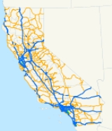
List of state highways in California
Encyclopedia
This is a list of state highway
s in the U.S. state
of California
that have existed since the 1964 renumbering. It includes routes that were defined by the California State Legislature
but never built, as well as routes that have been entirely relinquished to local governments. It does not include the few routes that were relinquished before 1964 or the larger number of sign routes that were renumbered in or before 1964.
Notes
{|class="wikitable sortable"
|-
!Number
!South or west terminus
!North or east terminus
!Length (mi
)
!(km)
!Formed
!Deleted
!Became
a state
highway
!Notes
|-
|
|San Juan Capistrano
(I-5
)
|Leggett
(US 101)
|1964
|
|1910-1951
|-
|
|Santa Monica
(I-10
/SR 1
)
|Wrightwood
(SR 138
)
|1964
|
|1919-1933
|
|-
|
|Peanut
(SR 36
)
|Montague
|1964
|
|1907-1959
|
|-
|
|Hercules
(I-80
)
|Markleeville
(SR 89
)
|1964
|
|1910-1933
|
|-
|
|Mexico
|Oregon
(I-5
)
|1964
|
|1910-1957
|
|-
|
|Bishop
(US 395
)
|Nevada
(US 6
)
|1964
|
|1931
|
|-
|
|Mexico
|El Centro
(I-8)
|1990
|
|1990
|
|- style="background:#e7e7e7;"
|
deleted
|Long Beach
(SR 1
)
formerly San Pedro (I-110) via SR 47
, I-710
(partly unconstructed)
|Pasadena
(I-210
/SR 134)
|1964
|1984 (I-710
)
|1933-1959
|
|-
|
|San Diego
|Arizona
(I-8)
|1964
|
|1910-1959
|-
|
|Santa Cruz
(SR 1
)
|Los Gatos
(SR 17)
|1964
|
|1913-1933
|
|-
|
|Santa Monica
(SR 1
)
|Arizona
(I-10
/US 95)
|1964
|
|1916-1933
|
|-
|
unconstructed
|Mexico
|San Diego
(SR 125
/SR 905
)
|1994
|
|1994
|- style="background:#e7e7e7;"
|
deleted
|San Pedro
|Pasadena
|1964
|1981 (I-110/SR 110)
|1933-1935
|
|-
|
|Sebastopol
(SR 116
)
unconstructed: Valley Ford
(SR 1
)
|San Andreas
(SR 49
)
|1964
|
|1910-1959
|
|-
|
|Oakland
(I-580
)
unconstructed: San Leandro
(SR 61
)
|Berkeley
(I-80
/I-580
)
unconstructed: Berkeley
(SR 61
)
|1964
|
|1935-1959
|
|-
|
|Santa Clarita
(I-5
)
unconstructed: Santa Monica
(SR 1
)
|Inyokern
(US 395
)
|1964
|
|1910-1959
|
|-
|
|San Diego
(I-5
)
|Nevada
(I-15
)
|1964
|
|1916-1959
|SR 15 becomes I-15 at I-8
|-
|
|Rumsey
(SR 20)
|Drytown
(SR 49
)
|1964
|
|1919-1933
|
|-
|
|Santa Cruz
(SR 1
)
|San Jose
(I-280
/I-880
)
formerly San Rafael
(US 101) via I-880
, I-580
formerly unconstructed: Point Reyes Station
(SR 1
) via SR 251
|1964
|
|1910
|
|-
|
|San Bernardino
(SR 210)
unconstructed: San Bernardino
(I-10
)
|Pearblossom
(SR 138
)
|1964
|
|1917-1959
|
|-
|
|Long Beach
(SR 1
)
|Pico Rivera
(SR 164)
|1964
|
|1933
|Also signed along SR 164
|-
|
|Fort Bragg
(SR 1
)
|Emigrant Gap
(I-80
)
|1964
|
|1910-1953
|
|- style="background:#e7e7e7;"
|
deleted
|Benicia
(I-680
/I-780
)
|Cordelia (I-80
)
|1964
|1976 (I-680
)
|1910-1953
|
|-
|
|Long Beach
(SR 1
)
|Orange
(SR 55
)
formerly Irvine Regional Park
|1964
|
|1933
|
|-
|
|Malibu (SR 1
)
|Fillmore
(SR 126
)
|1964
|
|1933
|
|-
|
|Oakland
(I-580
/I-980
)
formerly Oakland
(I-880
) via I-980
|Walnut Creek
(I-680
)
unconstructed: Pittsburg
(SR 4)
|1964
|
|1931-1959
|
|-
|
|Priest Valley (SR 198
)
|Gilroy
(US 101)
|1964
|
|1933
|
|-
|
|Stockton
(SR 99
)
formerly Stockton
(SR 4)
|Pioneer
(SR 88
)
|1964
|
|1933-1970
|
|-
|
|Topanga Beach (SR 1
)
|Chatsworth (SR 118
)
|1964
|
|1933
|
|-
|
|Tahoe City
(SR 89
)
|Nevada
(SR 28
)
|1964
|
|1915
|
|-
|
|Vallejo
(I-80
)
|Upper Lake
(SR 20)
|1964
|
|1910-1984
|
|- style="background:#e7e7e7;"
|
deleted
|Glendora
(I-210
/SR 57
)
|Redlands
(I-10
)
formerly Running Springs
(SR 18) via SR 330
|1964
|1998 (SR 210)
|1910-1933
|
|- style="background:#e7e7e7;"
|
deleted
|Corona
(I-15
/SR 91
)
|Ontario
(I-10
)
unconstructed: Devore
(I-15
/I-215
)
|1964
|1974 (I-15
)
|1933-1959
|
|-
|
|Orland
(I-5
)
|Chester
(SR 36
/SR 89
)
|1964
|
|1919-1933
|
|-
|
|Ventura
(US 101)
|Tracy
(I-5
)
formerly Tracy
(I-205
)
|1964
|
|1933-1955
|
|-
|
|Oxnard
(SR 1
)
formerly Port Hueneme
|Somis
(SR 118
)
|1964
|
|1933
|
|-
|
|Redwood Estates
(SR 17)
|San Francisco
(SR 1
)
|1964
|
|1919
|
|-
|
|Fortuna
(US 101)
|Susanville
(US 395
)
formerly unconstructed: Termo
(US 395
)
|1964
|
|1907-1933
|
|-
|
|Novato
(US 101)
unconstructed: Nicasio
(SR 251)
|Vallejo
(I-80
)
|1964
|
|1910-1959
|
|-
|
|Redlands
(I-10
)
|Big Bear City
(SR 18)
|1964
|
|1917-1933
|
|-
|
|Huntington Beach
(SR 1
)
|Angeles National Forest
(SR 2)
|1964
|
|1919-1933
|
|-
|
|Barstow
(I-15
)
|Arizona
(I-40
)
|1964
|
|1919-1925
|
|-
|
|Morro Bay
(SR 1
)
|Yosemite National Park
|1964
|
|1933
|
|- style="background:#e7e7e7;"
|
deleted
|Inglewood
(SR 1
)
|Anaheim
(SR 91
)
|1964
|1968 (I-105
/SR 90
)
|1933
|
|-
|
|Taft
(SR 119
)
|Selma
(SR 99
)
|1964
|
|1933-1961
|
|-
|
|Redding
(SR 273
/SR 299
)
|Susanville
(SR 36
)
|1964
|
|1933-1959
|
|-
|
|Knights Landing
(SR 113
)
|Hamilton City
(SR 32
)
|1964
|
|1933-1959
|
|-
|
|Cambria
(SR 1
)
|Famoso
(SR 99
)
|1964
|
|1916-1933
|
|-
|
|San Pedro (I-110)
|Compton
(SR 91
)
unconstructed: Los Angeles
(I-10
)
|1964
|
|1949-1959
|
|-
|
unconstructed
|Lancaster
(SR 14
/SR 138
)
formerly Gorman
(SR 138
) via SR 138
|Barstow
(SR 122)
|1964
|
|1959
|
|-
|
|Oakhurst
(SR 41
)
|Vinton
(SR 70
)
|1964
|
|1910-1965
|
|-
|
|West Sacramento
(I-80
)
|Nevada
(US 50
)
|1964
|
|1895-1915
|
|-
|
|Sacramento
(US 50
/SR 99
)
|Sacramento
(I-80
/SR 244
)
|1981 (I-80
)
|
|1910-1933
|Signed as Business 80
|- style="background:#e7e7e7;"
|
deleted
|Santa Ana
(I-5
)
|Santa Ana
(I-5
)
|1964
|1965
|1910
|
|-
|
|San Diego
(I-5
)
|Santee
(SR 125
)
unconstructed: Santee
(SR 67
)
|1964
|
|1959
|
|-
|
|Lower Lake
(SR 29
)
|Clearlake
(SR 20)
|1964
|
|1919
|
|-
|
|National City
(I-5
)
|El Cajon
(I-8)
|1964
|
|1959
|
|-
|
|Newport Beach
(SR 1
)
|Anaheim
(SR 91
)
|1964
|
|1931
|
|-
|
|San Diego
(I-5
)
|San Diego
(I-15
)
unconstructed: Ramona
(SR 67
)
|1964
|
|1959
|
|-
|
|Santa Ana
(I-5
/SR 22
)
Unconstructed: Huntington Beach
(SR 1
)
|Glendora
(I-210
/SR 210)
|1964
|
|1931-1959
|
|-
|
|Santa Margarita
(US 101)
|Barstow
(I-15
)
|1964
|
|1919-1933
|
|-
|
|El Nido (SR 152
)
|Snelling
|1964
|
|1933
|
|-
|
|Los Angeles
(I-5
/I-10
/US 101)
|Beaumont
(I-10
)
|1964
|
|1910-1933
|
|-
|
|San Leandro
(SR 112)
unconstructed: Newark
(SR 84
)
|Alameda
(SR 260)
unconstructed: Albany
(I-580
)
|1964
|
|1947-1965
|Also signed along SR 260
|-
|
|White Water
(I-10
)
|Arizona
(SR 95S)
|1964
|
|1933-1970
|
|-
|
|Tulare
(SR 137
)
|Squaw Valley (SR 180
)
formerly Auckland (SR 245
)
|1964
|
|1933-1965
|
|-
|
unconstructed
|Malibu (SR 1
)
|San Fernando
(I-5
/SR 170)
|1964
|
|1959
|
|-
|
|Bakersfield
(SR 99
)
|Olivehurst
(SR 70
)
unconstructed: Yuba City
(SR 99
)
|1964
|
|1910-1959
|
|-
|
|La Verne
(SR 210)
|San Bernardino
(I-215
)
|1964
|
|1910
|
|-
|
|El Cajon
(I-8)
|Ramona
(SR 78
)
|1964
|
|1933
|
|-
|
|Pacific Grove
|Salinas
(US 101)
|1964
|
|1933-1959
|
|- style="background:#e7e7e7;"
|
deleted
|Exeter
(SR 198
)
|Dunlap
(SR 180
)
|1964
|1972 (SR 245
)
|1933
|
|-
|
|Sacramento
(SR 99
)
|Beckwourth Pass (US 395
)
|1964
|
|1910-1949
|
|-
|
|Corona
(SR 91
)
formerly Anza
(SR 74
) via SR 371
, SR 79
, I-15
|San Dimas
(I-10
/SR 57
)
|1964
|
|1931
|
|-
|
|La Habra
(SR 39
)
formerly Anaheim
(I-5
)
|East Los Angeles
|1964
|
|1910
|
|-
|
|Mission Viejo
(I-5
)
formerly Corona del Mar (SR 1
)
|Costa Mesa
(I-405
)
formerly Santa Ana
(I-5
)
|1964
|
|1933-1983
|
|-
|
|San Juan Capistrano
(I-5
)
|Palm Desert
(SR 111
)
unconstructed: Thousand Palms
(I-10
)
|1964
|
|1931-1965
|
|-
|
|San Diego
(I-5
)
formerly unconstructed: San Diego
(SR 125
) via SR 905
|San Diego
(I-5
)
|1964
|
|1933-1967
|
|-
|
|Oceanside
(I-5
)
|Lake Henshaw (SR 79
)
|1964
|
|1933
|
|-
|
|Oakland
(I-880
)
|Oakland
unconstructed: Lafayette
(SR 24
)
formerly unconstructed: Concord
(SR 242
)
|1964
|
|1953-1959
|Not signed
|-
|
|Oceanside
(I-5
)
|Blythe
(I-10
)
|1964
|
|1931-1959
|
|-
|
|Descanso
(I-8)
|Beaumont
(I-10
)
|1964
|
|1933-1959
|
|-
|
|San Francisco
(US 101)
formerly unconstructed: San Francisco
(SR 1
)
|Nevada
(I-80
)
|1964
|
|1909-1959
|
|-
|
unconstructed
|Riverside
(I-215
)
|Devore
(I-15
)
|1964
|
|1959
|
|-
|
|San Jose
(US 101)
|San Francisco
(I-280
)
formerly San Francisco
(I-280
/SR 230) via I-280
|1964
|
|1910
|
|-
|
|Chino Hills
(SR 71
)
|Upland
unconstructed: Upland
(SR 210)
|1964
|
|1933
|
|-
|
|San Gregorio
(SR 1
)
|West Sacramento
(I-80
)
|1964
|
|1933-1984
|
|-
|
|San Jose
(US 101)
|Mountain View
(US 101)
|1964
|
|1933-1959
|
|-
|
|Calexico
(SR 111
)
|Indio
(SR 111
)
|1964
|
|1916-1931
|
|-
|
|Oasis
(SR 86
)
|Indio
(I-10
)
|1964
as SR 86
|
|1916
|
|-
|
|San Jose
(SR 85
)
|San Jose
(US 101)
unconstructed: San Jose
(SR 237
)
formerly unconstructed: San Francisco
(I-280
) via SR 230, I-280
|1964
|
|1959-1961
|
|-
|
|Stockton
(SR 99
)
|Nevada
(SR 88
)
|1964
|
|1910-1959
|
|-
|
|Coleville
(US 395
)
|Mount Shasta
(I-5
)
|1964
|
|1911-1933
|
|-
|
|Los Angeles
(SR 1
)
|Anaheim
(SR 91
)
|1964
|
|1933-1959
|
|-
|
|Redondo Beach
(SR 1
)
|Riverside
(I-215
/SR 60
)
|1964
|
|1931-1933
|
|-
|
|Half Moon Bay
(SR 1
)
|Hayward
(SR 185
/SR 238
)
unconstructed: Castro Valley
(I-580
)
|1964
|
|1933-1959
|
|-
|
unconstructed
|Moraga
(SR 77)
formerly unconstructed: Alamo
(I-680
)
|Richmond
(I-580
)
|1964
|
|1959
|
|-
|
|San Diego
(I-5
)
|Boulevard
(I-8)
|1964
|
|1933
|
|-
|
|Arizona
(I-10
/US 95)
|Nevada
(US 95
)
|1964
|
|1933
|
|-
|
|Willow Creek
(SR 299
)
|Hornbrook
(I-5
)
|1964
|
|1910-1933
|
|-
|
|Weed
(I-5
)
|Oregon
(US 97)
|1964
|
|1910-1931
|
|-
|
|Ocotillo
(I-8)
|Holtville
(I-8)
|1964
|
|1933-1953
|
|-
|
|Wheeler Ridge
(I-5
)
|Red Bluff
(SR 36
)
|1964
|
|1910-1959
|
|-
|
unconstructed
|Santa Cruz
(SR 1
)
|Santa Cruz
(SR 1
/SR 17)
|1964
|
|1959
|
|-
|
|Los Angeles
(I-5
/SR 60
)
|Oregon
(US 101
)
|1964
|
|1910-1947
|
|-
|
unconstructed
|Elkhorn
(I-5
)
|Auburn
(I-80
)
|1964
|
|1959
|
|-
|
|Los Angeles
(SR 47
)
|Long Beach
(SR 1
)
|1984 (SR 47
)
|
|1959
|
|- style="background:#e7e7e7;"
|
deleted
|San Diego
(I-5
)
|San Diego
(I-15
/SR 163)
|1964
|1969 (I-15
/SR 15)
|1959
|
|-
|
|Galt
(SR 99
)
|Sutter Creek
(SR 49
)
unconstructed: Pine Grove (SR 88
)
formerly West Point
(SR 26
) via SR 26
|1964
|
|1910-1970
|
|-
|
|Inglewood
(SR 1
)
unconstructed: El Segundo
|Norwalk
(I-605
)
|1968 (SR 42)
|
|1933-1981
|
|- style="background:#e7e7e7;"
|
deleted
|Los Angeles
(I-5
/SR 60
)
|Los Angeles
(I-10
/US 101)
|1964
|1968 (US 101)
|1910
|
|- style="background:#e7e7e7;"
|
deleted
|Redlands
(SR 38
)
|Highland
(SR 210/SR 330
)
|1964
|1972 (SR 30)
|1933
|
|-
|
|Torrance
(SR 1
)
|Lawndale
(I-405
)
formerly Culver City
(I-405
)
|1964
|
|1933
|
|-
|
|Modesto
(SR 99
/SR 132
)
unconstructed: Crows Landing
(I-5
)
|Bridgeport
(US 395
)
|1964
|
|1901-1959
|
|-
|
|East Palo Alto
unconstructed: East Palo Alto
(US 101)
|Menlo Park
(SR 84
)
|1984
|
|1984-1988
|Not signed
|- style="background:#e7e7e7;"
|
deleted
|San Diego
|San Diego
(I-5
)
|1964
|1972 (I-8)
|1959
|
|-
|
|San Pedro
|Pasadena
|1981 (SR 11)
|
|1933-1935
|I-110 becomes SR 110 at I-10
|- style="background:#e7e7e7;"
|
deleted
|Los Angeles
(US 101)
|Los Angeles
(I-10
)
|1964
|1968 (I-10
)
|1933
|
|-
|
|Mexico
|White Water
(I-10
)
|1964
|
|1931-1933
|
|-
|
|San Leandro
(SR 61
)
|San Leandro
(SR 185
)
|1964
|
|1947
|Not signed
|-
|
|Rio Vista
(SR 12)
|Yuba City
(SR 99
)
|1964
|
|1910-1933
|
|-
|
|East Palo Alto
(US 101)
formerly unconstructed: Menlo Park
(I-280
)
|Menlo Park
(SR 84
)
|1984 (SR 84
)
|
|1949
|Not signed
|- style="background:#e7e7e7;"
|
deleted
|Woodside
(I-280
)
|Redwood City
(US 101)
|1964
|1984 (SR 84
)
|1933-1935
|
|-
|
|Holtville
(I-8)
formerly Bonds Corner
(SR 98)
|Calipatria
(SR 111
)
|1964
|
|1916-1933
|
|-
|
|Jenner
(SR 1
)
|Sonoma
(SR 121
)
|1964
|
|1933
|
|- style="background:#e7e7e7;"
|
deleted
|San Bruno
|Daly City
(I-280
/SR 1
)
|1964
|1965
|1956
|
|- style="background:#e7e7e7;"
|
deleted
|San Diego
(I-5
)
unconstructed: Mexico
|San Diego
unconstructed: San Diego
(SR 125
)
|1972
|1986 (SR 905
)
|1959-1972
|
|-
|
|Ventura
(SR 126
)
|San Fernando
(I-210
)
unconstructed: La Cañada Flintridge
(SR 249)
|1964
|
|1910-1959
|
|-
|
|Taft
(SR 33
)
|Bakersfield
(SR 99
)
|1964
|
|1933
|
|-
|
|Tracy
(I-5
)
|Benton
(US 6
)
|1964
|
|1899-1933
|
|-
|
|Sears Point (SR 37
)
|Lake Berryessa (SR 128
)
|1964
|
|1910-1933
|
|-
|
unconstructed
|Palmdale
(SR 14
/SR 249)
|Barstow
(SR 58
)
|1964
|
|1959
|
|-
|
|Oakland
(I-580
)
|Richmond
(I-80
)
|1964
|
|1910
|
|-
|
|Ione
(SR 88
)
|Drytown
(SR 16)
|1964
|
|1933
|
|-
|
|San Diego
(SR 905
)
formerly unconstructed: Mexico
via SR 905
|Santee
(SR 52
)
unconstructed: Poway
(SR 56
)
|1964
|
|1933-1959
|
|-
|
|Ventura
(US 101)
|Santa Clarita
(SR 14
)
|1964
|
|1910-1931
|
|-
|
|Baker
(I-15
)
|Nevada
(SR 373
)
|1964
|
|1933
|
|-
|
|Albion
(SR 1
)
|Winters
(I-505
)
unconstructed: Davis
(SR 113
)
|1964
|
|1910-1959
|
|-
|
|Watsonville
(SR 1
)
|San Juan Bautista
(US 101)
|1964
|
|1921-1933
|
|-
|
|San Jose
(US 101)
|Mount Hamilton
unconstructed: Patterson
(SR 33
)
|1964
|
|1933-1959
|
|-
|
|Mill Valley
(US 101)
|Tiburon
|1964
|
|1919
|
|-
|
|Tracy
(I-580
)
|Coulterville
(SR 49
)
|1964
|
|1933-1957
|
|-
|
|Laguna Beach
(SR 1
)
|Irvine
(SR 241
)
|1964
|
|1933-1991
|
|-
|
|Los Angeles
(US 101/SR 170)
|Pasadena
(I-210
/SR 710)
|1964
|
|1933-1957
|
|-
|
|Los Alamos
(US 101)
|Santa Maria
(US 101)
|1964
|
|1933
|
|-
|
|Lone Pine
(US 395
)
|Death Valley (SR 190
)
|1964
|
|1933
|
|-
|
|Corcoran
(SR 43
)
|Lindsay
(SR 65
)
|1964
|
|1933
|
|-
|
|Gorman
(I-5
)
|Crestline
(SR 18)
|1964
|
|1919-1933
|
|-
|
|Susanville
(SR 36
)
|Oregon
(OR 39)
|1964
|
|1939-1959
|
|-
|
|Gustine
(I-5
)
|Yosemite National Park
|1964
|
|1910-1959
|
|- style="background:#e7e7e7;"
|
deleted
|Vallejo
(SR 29
)
unconstructed: Vallejo
(SR 37
)
|Vallejo
(I-80
)
|1964
|1988
|1935-1975
|
|-
|
|Brea
(SR 90
)
|Chino Hills
(SR 71
)
unconstructed: Upland
(SR 210)
|1964
|
|1933-1959
|
|-
|
unconstructed
|Elk Grove
(SR 99
)
|Carmichael
(SR 244
)
formerly unconstructed: Antelope
(SR 102)
|1964
|
|1959
|
|-
|
|Santa Barbara
(US 101)
|Santa Barbara
(SR 192)
|1964
|
|1933
|
|-
|
|Coalinga
(I-5
/SR 33
)
|Friant
(SR 41
)
|1964
|
|1933-1970
|
|-
|
|Soledad
(US 101)
|Paicines
(SR 25
)
|1964
|
|1933
|
|-
|
|Canyondam
(SR 89
)
|Westwood
(SR 36
)
|1964
|
|1961
|
|-
|
unconstructed
|Sacramento
(I-5
)
|Sloughhouse
(SR 65
)
|1964
|
|1959-1985
|
|-
|
|Oroville
(SR 70
)
|Chico
(SR 99
)
|1964
|
|1933
|
|-
|
|Carpinteria
(US 101)
|Santa Paula
(SR 126
)
|1964
|
|1933
|
|-
|
|Shasta Dam
|Shasta Lake
(I-5
)
|1964
|
|1939
|
|-
|
|Watsonville
(SR 1
)
|Chowchilla
(SR 99
)
unconstructed: Chowchilla
(SR 65
)
|1964
|
|1916-1959
|
|-
|
|Marshall's Monument
|Coloma
(SR 49
)
|1964
|
|1933
|Not signed (except for one reassurance sign)
|-
|
|Los Olivos
(US 101)
|Santa Barbara
(US 101)
|1964
|
|1931
|
|-
|
|Delano
(SR 99
)
formerly Bakersfield
(SR 204
)
|Lake Isabella
(SR 178
)
|1964
|
|1933-1965
|
|-
|
|Castroville
(SR 1
)
|Hollister
(SR 152
)
|1964
|
|1910-1933
|
|- style="background:#e7e7e7;"
|
deleted
unconstructed
|San Diego
(I-805
)
|Sweetwater Reservoir
(SR 125
)
|1964
|1994
|1959
|
|-
|
|June Lake Junction
(US 395
)
|Grant Lake Junction (US 395
)
|1964
|
|1933
|
|- style="background:#e7e7e7;"
|
deleted
|Pasadena
(SR 134)
formerly Los Angeles
(I-5
)
|La Cañada Flintridge
(I-210
)
|1964
|1992
|1933
|
|-
|
|Antioch
(SR 4)
|Sacramento
(SR 51)
|1964
|
|1910-1933
|
|-
|
|Dorris
(US 97
)
|Tulelake
(SR 139
)
|1964
|
|1959
|
|-
|
|Longvale
(US 101)
|Brush Creek
|1964
|
|1910-1970
|
|-
|
|San Diego
|San Diego
(I-15
)
|1969 (US 395
)
|
|1931
|
|- style="background:#e7e7e7;"
|
deleted
|Los Angeles
(I-5
/SR 110)
|Los Angeles
(I-5
)
|1964
|1965
|1910
|
|-
|
|Pico Rivera
(SR 19)
formerly unconstructed: Pico Rivera
(I-605
)
|Pasadena
(I-210
)
|1964
|
|1933
|Signed as SR 19
|-
|
|Los Banos
(I-5
)
|Turlock
(SR 99
)
|1970
|
|1970
|
|- style="background:#e7e7e7;"
|
deleted
|Los Angeles
(SR 60
)
|Los Angeles
(I-5
)
|1964
|1965
|1947
|
|-
|
|Guadalupe
(SR 1
)
|Mettler
(SR 99
)
|1964
|
|1919-1933
|
|-
|
|Lundy
(US 395
)
|Nevada
(SR 359
)
|1964
|
|1953
|
|-
|
|Fresno
(SR 180
)
|Oasis
(SR 266
)
formerly Nevada
(SR 266) via SR 266
|1964
|
|1919-1933
|
|-
|
|Klamath
(US 101)
|Weitchpec
(SR 96
)
|1964
|
|1919
|
|-
|
|Los Angeles
(SR 2)
unconstructed: LAX Airport
|San Fernando
(I-5
)
|1964
|
|1933-1965
|
|- style="background:#e7e7e7;"
|
deleted
unconstructed
|San Diego
(I-5
)
|San Diego
(I-805
)
|1964
|1994
|1959
|
|-
|
|Mineral
(SR 36
)
|Morgan Springs (SR 36
)
|1964
|
|1910
|
|-
|
|Hesperia
(SR 138
)
|Lake Arrowhead
(SR 18)
|1964
|
|1933
|
|-
|
|Colfax
(I-80
)
|Grass Valley
(SR 20/SR 49
)
|1964
|
|1933
|
|-
|
|Hopland
(US 101)
|Middletown
(SR 29
)
|1964
|
|1910-1933
|
|- style="background:#e7e7e7;"
|
deleted
|Santa Maria
(US 101)
|Sisquoc
|1964
|1984
|1933
|
|-
|
|Desert Center
(I-10
)
|Rice
(SR 62
)
|1972
|
|1972
|
|- style="background:#e7e7e7;"
|
deleted
|San Jacinto
(SR 79
)
|Moreno Valley
(SR 60
)
|1964
|1965
|1933
|
|-
|
|Bakersfield
(SR 58
/SR 99
)
|Nevada
(SR 372
)
|1964
|
|1919-1947
|
|-
|
unconstructed
|Vacaville
(I-80
)
|Berryessa Reservoir (SR 128
)
|1964
|
|1959
|
|-
|
|Mendota
(SR 33
)
unconstructed: Paicines
(SR 25
)
formerly Gilroy
(US 101) via SR 25
|Kings Canyon National Park
|1964
|
|1909-1959
|
|-
|
unconstructed
|Forestville
(SR 116
)
|Fulton
(US 101)
|1964
|
|1959
|
|-
|
|Bridgeport
(US 395
)
|Nevada
(SR 338
)
|1964
|
|1933
|
|-
|
|Salinas
(US 101)
|Castroville
(SR 1
)
|1964
|
|1933
|
|-
|
|Arvin
(SR 223
)
|Bakersfield
(SR 178
)
|1964
|
|1933
|
|-
|
|Hayward
(SR 92
/SR 238
)
|Oakland
(SR 77)
|1964
|
|1933
|
|-
|
|Mexico
|Winterhaven
(I-8)
|1972
|
|1972
|
|- style="background:#e7e7e7;"
|
deleted
unconstructed
|Pacifica
(SR 1
)
|San Bruno
(SR 87
)
|1964
|1969 (I-380
)
|1947-1965
|
|-
|
|Los Angeles
(SR 1
)
formerly Santa Monica
(SR 1
)
|Culver City
(I-10
)
|1964
|
|1961
|Not signed
|-
|
|Mexico
|Potrero
(SR 94
)
|1972
|
|1972
|
|- style="background:#e7e7e7;"
|
deleted
|Fallen Leaf
|South Lake Tahoe
(SR 89
)
|1964
|1965
|1933
|
|-
|
|Crestline
(SR 18)
|Lake Arrowhead
(SR 173)
|1964
|
|1933
|
|-
|
|Tipton
(SR 99
)
|Death Valley Junction
(SR 127
)
|1964
|
|1933-1959
|
|-
|
|Oroville
(SR 70
)
|Paradise
|1964
|
|1961
|
|-
|
|Santa Barbara
(SR 154)
|Carpinteria
(SR 150
)
|1964
|
|1933
|
|-
|
|Lincoln
(SR 65
)
|Placerville
(SR 49
)
|1964
|
|1933
|
|- style="background:#e7e7e7;"
|
deleted
|Downieville
(SR 49
)
|Saddleback Mountain
|1964
|1965
|1907
|
|- style="background:#e7e7e7;"
|
deleted
|Murrieta
(I-15
)
|Devore
(I-15
)
|1974 (I-15
)
|1982 (I-215
)
|1916-1951
|Signed as I-15E
|-
|
|Oasis
(SR 86
)
|Mecca
(SR 111
)
formerly Shaver's Summit (I-10
)
|1964
|
|1935
|
|- style="background:#e7e7e7;"
|
deleted
unconstructed
|Angeles National Forest
(SR 2)
|Palmdale
(SR 249)
|1964
|1965
|1959
|
|-
|
|Hiouchi
(US 199)
|Smith River
(US 101)
|1964
|
|1933
|
|-
|
|San Lucas
(US 101)
|Sequoia National Park
|1964
|
|1910-1919
|
|-
|
|Crescent City
(US 101)
|Oregon
(US 199
)
|1964
|
|1919
|
|-
|
|McKinleyville
(US 101)
|Blue Lake
(SR 299
)
|1964
|
|1933
|
|-
|
|Kingsburg
(SR 99
)
|Elderwood (SR 245
)
|1964
|
|1933
|
|-
|
|California Correctional Institution
|Tehachapi
(SR 58
)
|1964
|
|1933
|
|-
|
|Minaret Summit
|Mammoth Lakes
(US 395
)
|1964
|
|1933-1967
|
|-
|
|Bakersfield
(SR 58
)
formerly Bakersfield
(SR 99
)
|Oildale
(SR 99
)
|1964
|
|1910-1978
|
|-
|
|Tracy
(I-580
)
|Manteca
(I-5
)
|1964
|
|1910
|- style="background:#e7e7e7;"
|
deleted
|San Bernardino
(SR 210/SR 259
)
|Devore
(I-215
)
|1964
|1991
|1933
|
|-
|
|Bear Valley
(SR 4)
|Mount Reba
|1979
|
|1979
|
|- style="background:#e7e7e7;"
|
deleted
|Los Banos
(SR 33
/SR 152
)
|Santa Nella
(SR 33
)
|1964
|1972 (SR 33
)
|1933
|
|- style="background:#e7e7e7;"
|
deleted
|Rockport
(SR 1
)
|Leggett
(US 101)
|1964
|1984 (SR 1
)
|1951
|
|- style="background:#e7e7e7;"
|
deleted
|Point Loma
|San Diego
(I-5
/I-8)
|1964
|2003
|1933
|
|-
|
|San Fernando
(I-5
)
|Redlands
(I-10
)
formerly Pomona
(I-10
/SR 57
/SR 71
) via SR 57
|1964
|
|1910-1933
|I-210 becomes SR 210 at SR 57
|-
|
|Ferndale
unconstructed: Rockport
(SR 1
)
|Fernbridge
(US 101)
|1984 (SR 1
)
|
|1933-1951
|
|- style="background:#e7e7e7;"
|
deleted
|Delano
(SR 99
)
|Woody
(SR 65
)
|1964
|1965 (SR 155
)
|1933
|
|- style="background:#e7e7e7;"
|
deleted
|Los Angeles
|El Monte
(I-10
)
|1964
|1965
|1935
|
|-
|
|San Pedro
|Torrance
unconstructed: Torrance
(I-405
)
|1964
|
|1961
|
|- style="background:#e7e7e7;"
|
deleted
|Lakewood
(SR 19)
|Anaheim
(I-5
)
|1964
|1981
|1933
|
|-
|
|Murrieta
(I-15
)
|Devore
(I-15
)
|1982 (SR 194)
|
|1916-1951
|
|- style="background:#e7e7e7;"
|
deleted
|Pomona
(SR 60
)
|Claremont
(SR 66)
|1964
|1965
|1910
|
|-
|
|Visalia
(SR 198
)
|Woodlake
(SR 198
)
|1964
|
|1933
|
|-
|
|UC Santa Barbara
unconstructed: Ellwood (US 101)
|Goleta
(US 101)
|1964
|
|1955-1968
|
|-
|
|Seaside
(SR 1
)
|Del Rey Oaks
(SR 68
)
|1964
|
|1959
|
|-
|
|Salida
(SR 99
)
|Modesto
(SR 108
)
|1964
|
|1910
|
|-
|
|Rio Vista
(SR 84
)
|Walnut Grove
(SR 160
)
|1964
|
|1933
|
|-
|
|Vallejo
(SR 12/SR 29
)
|Napa
(SR 121
)
|1984 (SR 121
)
|
|1910
|
|- style="background:#e7e7e7;"
|
deleted
unconstructed
|Napa
(SR 29
)
|Napa
(SR 121
)
|1964
|1984
|1959
|
|-
|
|Ukiah
(US 101)
|Talmage
|1964
|
|1925
|Not signed
|-
|
|Taft
(I-5
)
|Arvin
(SR 58
)
|1964
|
|1933-1959
|
|- style="background:#e7e7e7;"
|
deleted
|Carpinteria State Beach
|Carpinteria
(US 101)
|1964
|1996
|1933
|
|-
|
|Santa Barbara
(US 101)
|Santa Barbara
(US 101)
formerly Montecito
(US 101)
|1964
|
|1933-1998
|
|- style="background:#e7e7e7;"
|
deleted
|Orosi
(SR 63
)
|Orange Cove
|1964
|1965 (SR 63
)
|1933
|
|-
|
|Arroyo Grande
(US 101)
unconstructed: Oceano
(SR 1
)
|San Luis Obispo
(US 101/SR 1
)
|1964
|
|1933-1967
|
|- style="background:#e7e7e7;"
|
deleted
unconstructed
|Brawley
(SR 86
)
|Brawley
(SR 78
/SR 86
)
|1964
|1998
|1933
|
|-
|
|Santa Margarita
(SR 58
)
|Creston
(SR 41
)
|1964
|
|1933
|
|-
|
unconstructed
|South San Francisco
(US 101)
|San Francisco
(I-280
)
|1964
|
|1959
|
|- style="background:#e7e7e7;"
|
deleted
|Coachella
(SR 86
)
|Mecca
(SR 195)
|1964
|1972
|1935
|
|- style="background:#e7e7e7;"
|
deleted
unconstructed
|Irvine
(I-5
)
formerly unconstructed: Tustin
(I-5
) via SR 261
|Anaheim
(SR 91
)
|1988
|1996 (SR 133
, SR 241
)
|1988-1991
|
|-
|
|Oxnard
(SR 1
)
|Saticoy
(SR 118
)
|1964
|
|1933
|
|-
|
|Chowchilla
(SR 152
)
|Chowchilla
(SR 99
)
|1964
|
|1933
|
|-
|
unconstructed
|French Camp
(I-5
)
|Stockton
(SR 99
)
|1964
|
|1959
|
|-
|
unconstructed
|Stockton
(I-5
)
|Stockton
(SR 99
)
|1964
|
|1959
|
|-
|
|Boulder Creek
(SR 9
)
|Waterman Gap (SR 9
)
|1964
|
|1913-1917
|
|-
|
|Mountain View
(SR 82
)
|Milpitas
(I-680
)
|1964
|
|1933
|
|-
|
|Fremont
(I-680
)
|San Leandro
(I-880
)
unconstructed: San Leandro
(SR 61
)
|1964
|
|1910-1959
|SR 238 becomes I-238 at I-580
|-
|
unconstructed
|Tracy
(I-205
/I-580
)
|Brentwood
(SR 4)
|1964
|
|1959
|
|- style="background:#e7e7e7;"
|
deleted
|Seal Beach
(SR 22
)
unconstructed: Seal Beach
(SR 1
)
|Seal Beach
(I-405
/I-605
)
|1964
|1968 (I-605
)
|1957
|
|-
|
|Rancho Santa Margarita
unconstructed: San Clemente
(I-5
)
|Anaheim
(SR 91
)
|1988
|
|1988
|
|- style="background:#e7e7e7;"
|
deleted
unconstructed
|Los Angeles
(I-110)
|Los Angeles
(SR 110)
|1964
|1965
|1947
|
|- style="background:#e7e7e7;"
|
deleted
unconstructed
|San Francisco
(SR 1
)
|San Francisco
(US 101)
|1968 (I-80
)
|1972
|1947
|
|-
|
|Concord
(I-680
)
|Concord
(SR 4)
|1964
|
|1933
|
|-
|
|Mountain Center
(SR 74
)
|Banning
(I-10
)
|1970
|
|1970
|
|- style="background:#e7e7e7;"
|
deleted
unconstructed
|Baldwin Park
(I-10
)
|Irwindale
(I-210
)
|1964
|1968 (I-605
)
|1959
|
|-
|
|Sacramento
(I-80
/SR 51)
|Sacramento
(SR 143)
formerly unconstructed: Fair Oaks
(US 50
)
|1964
|
|1959
|Not signed
|-
|
|Exeter
(SR 198
)
|Dunlap
(SR 180
)
|1972 (SR 69)
|
|1933
|
|- style="background:#e7e7e7;"
|
deleted
|East Los Angeles
(SR 60
)
|East Los Angeles
(I-5
)
|1964
|1965
|1941
|
|-
|
|Lompoc
formerly Surf
|Santa Ynez
(SR 154)
|1964
|
|1933
|
|-
|
|Yucca Valley
(SR 62
)
|Barstow
(I-15
)
|1964
|
|1959-1970
|
|- style="background:#e7e7e7;"
|
deleted
|Pasadena
(SR 134)
|Monrovia
(I-210
)
|1964
|1992
|1933
|
|-
|
unconstructed
|La Cañada Flintridge
(SR 2)
|Palmdale
(SR 14
/SR 122)
|1964
|
|1959
|
|- style="background:#e7e7e7;"
|
deleted
|Orange
(I-5
)
|Anaheim
(SR 91
)
|1964
|1981
|1933
|
|-
|
unconstructed
|Point Reyes Station
(SR 1
)
|Point San Quentin (I-580
)
|1964
|
|1959
|
|- style="background:#e7e7e7;"
|
deleted
|National City
unconstructed: National City
(I-5
)
|National City
(I-805
)
|1964
|1994
|1959
|
|-
|
|Boonville
(SR 128
)
|Ukiah
(US 101)
|1964
|
|1963
|
|-
|
|Phillipsville
(US 101)
|Stafford
(US 101)
|1964
|
|1910
|Mostly not signed
|-
|
|Eureka
(US 101)
|Arcata
(US 101)
|1964
|
|1963-1970
|
|- style="background:#e7e7e7;"
|
deleted
unconstructed
|Roseville
(I-80
)
|Roseville
(SR 65
)
|1965
|1994
|1965
|
|-
|
unconstructed
|Oxnard
(SR 34
)
|Ventura
(US 101)
|1965
|
|1965
|
|-
|
unconstructed
|Torrance
(I-405
)
|Hollywood (US 101)
|1965
|
|1965
|
|-
|
|San Bernardino
(I-215
)
|San Bernardino
(SR 210)
|1965 (SR 18)
|
|1931
|
|-
|
|Alameda
(SR 61
)
|Oakland
(I-880
)
|1965 (SR 61
)
|
|1947
|Signed as SR 61
|-
|
|Tustin
|Orange
(SR 241
)
|1991 (SR 231)
|
|1988-1996
|
|- style="background:#e7e7e7;"
|
deleted
|Longvale
(US 101)
|Willows
(I-5
)
|1965
|1972 (SR 162)
|1965
|
|-
|
|Fremont
(I-880
)
|Fremont
(I-680
)
|1965 (I-680
)
|
|1959
|Not signed
|-
|
|Yreka
(SR 3)
formerly Hornbrook
(I-5
) via SR 96
|Yreka
(SR 96
)
|1965 (I-5
)
|
|1910
|
|-
|
|Weed
(US 97
)
|Weed
(I-5
)
|1965 (I-5
)
|
|1910
|
|-
|
|Nevada
(SR 266
)
|Nevada
(SR 264
)
|1965
|
|1931-1965
|
|-
|
|Truckee
(I-80
/SR 89
)
|Kings Beach
(SR 28
)
|1965
|
|1965
|
|- style="background:#e7e7e7;"
|
deleted
unconstructed
|Los Angeles
(SR 27
)
|Los Angeles
(I-405
)
|1965
|1970
|1965
|
|-
|
|Avenal
(SR 33
)
|Kerman
(SR 145
)
|1972
|
|1972
|
|-
|
|Bridgeport
(US 395
)
|Bodie
|1970
|
|1970
|
|-
|
|Cummings
(US 101)
|Cooks Valley
(US 101)
|1970 (US 101)
|
|1910
|
|-
|
|Anderson
(I-5
)
|Redding
(I-5
)
|1967 (I-5
)
|
|1910
|
|- style="background:#e7e7e7;"
|
deleted
|San Diego
(I-5
)
|San Diego
(I-15
)
|1965
|1999
|1965
|
|-
|
|West Sacramento
(US 50
)
|Sacramento
|1967 (I-80
)
|
|1910
|Not signed
|-
|
unconstructed
|Three Rivers
(SR 198
)
|Oak Grove
formerly unconstructed: Mineral King
|1965
|
|1965
|
|-
|
|San Jose
(I-680
/US 101)
|San Francisco
unconstructed: San Francisco
(I-80
)
formerly San Francisco
(US 101) via SR 1
|1964
|
|1910-1959
|
|-
|
|Clear Lake
unconstructed: Lakeport
(SR 29
)
|Glenview
(SR 29
)
|1970
|
|1970
|
|-
|
|NAS North Island
|Coronado
(SR 75
)
|1967
|
|1967
|
|-
|
|Scotia
(US 101)
|Rio Dell
|1970 (US 101)
|
|1910
|Not signed
|-
|
|Chilcoot
(SR 70
)
|Frenchman Lake
|1970
|
|1970
|
|- style="background:#e7e7e7;"
|
deleted
unconstructed
|Portola
(SR 70
)
|Grizzly Reservoir
|1970
|1998
|1970
|
|-
|
|Arcata
(US 101)
|Nevada
(SR 8A
)
|1964
|
|1910-1921
|
|-
|
|San Bernardino
(SR 210)
|Running Springs
(SR 18)
|1972 (SR 30)
|
|1937
|
|-
|
|Aguanga
(SR 79
)
|Anza
(SR 74
)
|1974 (SR 71
)
|
|1959
|
|-
|
|San Bruno
(I-280
)
unconstructed: Pacifica
(SR 1
)
|South San Francisco
(US 101)
formerly unconstructed: San Bruno
(SR 87
)
|1969 (SR 186)
|
|1947-1959
|
|-
|
|Hesperia
(I-15
)
formerly San Diego
via SR 163, I-15
, I-215
, I-15
|Oregon
(US 395
)
|1964
|
|1901-1933
|
|-
|
|Irvine
(I-5
)
|San Fernando
(I-5
)
|1964
|
|1933-1951
|
|- style="background:#e7e7e7;"
|
deleted
|San Francisco
(I-280
)
formerly San Francisco
(I-80
) via I-280
|San Francisco
(SR 1
)
|1964
|1991 (US 101)
|1945-1947
|
|-
|
|Vacaville
(I-80
)
|Dunnigan
(I-5
)
|1964
|
|1933
|
|-
|
|San Rafael
(US 101)
|Tracy
(I-5
)
|1964
|
|1910-1965
|
|-
|
|Seal Beach
(I-405
/SR 22
)
unconstructed: Seal Beach
(SR 1
)
|Irwindale
(I-210
)
|1964
|
|1933-1959
|
|-
|
|San Jose
(I-280
/US 101)
|Cordelia (I-80
)
formerly Vallejo
(I-80
) via I-780
|1964
|
|1910-1953
|
|-
|
|Long Beach
unconstructed: Long Beach
(SR 47
)
|Pasadena
(I-210
/SR 134)
|1984 (SR 7)
|
|1933-1959
|
|-
|
|Vallejo
(I-80
)
|Benicia
(I-680
)
|1976 (I-680
)
|
|1935
|
|-
|
|San Diego
(I-5
)
|Del Mar
(I-5
)
|1964
|
|1959
|
|-
|
|San Jose
(I-280
/SR 17)
|Oakland
(I-80
/I-580
)
|1984 (SR 17)
|
|1910-1933
|
|- style="background:#e7e7e7;"
|
deleted
|West Sacramento
(I-80
/US 50
)
|Sacramento
(I-80
/SR 51/SR 244
)
|1964
|1981 (I-80
)
|1959
|
|-
|
|San Diego
(I-5
)
unconstructed: Mexico
|Mexico
|1986 (SR 117)
|
|1959-1972
|
|-
|
|Oakland
(I-880
)
|Oakland
(I-580
/SR 24
)
|1981 (SR 24
)
|
|1947
|
|}
State highway
State highway, state road or state route can refer to one of three related concepts, two of them related to a state or provincial government in a country that is divided into states or provinces :#A...
s in the U.S. state
U.S. state
A U.S. state is any one of the 50 federated states of the United States of America that share sovereignty with the federal government. Because of this shared sovereignty, an American is a citizen both of the federal entity and of his or her state of domicile. Four states use the official title of...
of California
California
California is a state located on the West Coast of the United States. It is by far the most populous U.S. state, and the third-largest by land area...
that have existed since the 1964 renumbering. It includes routes that were defined by the California State Legislature
California State Legislature
The California State Legislature is the state legislature of the U.S. state of California. It is a bicameral body consisting of the lower house, the California State Assembly, with 80 members, and the upper house, the California State Senate, with 40 members...
but never built, as well as routes that have been entirely relinquished to local governments. It does not include the few routes that were relinquished before 1964 or the larger number of sign routes that were renumbered in or before 1964.
Notes
- If a route was renumbered, the old or new number is given in the "formed" or "deleted" column.
- The years are when legislative action was taken, not when real-world changes were made. Most notably, SR 275California State Route 275State Route 275 is a short unsigned state highway in the Sacramento area of the U.S. state of California. The highway, also known as Tower Bridge Gateway , is a short spur from Interstate 80 Business in West Sacramento over the Tower Bridge into downtown Sacramento...
was deleted from the Streets and Highways Code in 1996, but remains partially maintained, and SR 42 was signed as such for over 30 years after it was renumbered 105Interstate 105 (California)Interstate 105 is an Interstate Highway in southern Los Angeles County, California that runs east–west from near the Los Angeles International Airport to Norwalk...
. - Since the 1990s, a number of piecemeal relinquishments have been made. These are generally reflected in the length but not the termini.
- Former termini are not shown if they are along the current route, meaning that the route was simply extended.
- One Interstate Highway - Interstate 305 - is defined only federally; the state calls it part of US 50U.S. Route 50 in CaliforniaIn the U.S. state of California, U.S. Route 50 runs east from I-80 in West Sacramento to the Nevada state line in South Lake Tahoe. Portions within Sacramento are known as the Capital City Freeway and El Dorado Freeway...
. It is signed as part of Business 80, the only state-maintained Interstate business route in California.
| 170 180 190 200 210 220 230 240 250 260 270 280 299 505 References |
|-
!Number
!South or west terminus
!North or east terminus
!Length (mi
Mile
A mile is a unit of length, most commonly 5,280 feet . The mile of 5,280 feet is sometimes called the statute mile or land mile to distinguish it from the nautical mile...
)
!(km)
!Formed
!Deleted
!Became
a state
highway
!Notes
|-
|
|San Juan Capistrano
San Juan Capistrano, California
San Juan Capistrano is a city in southern Orange County, California, located approximately southeast of Downtown Santa Ana. The current OMB metropolitan designation for San Juan Capistrano and the Orange County Area is “Santa Ana-Anaheim-Irvine, CA.” The population was 34,593 at the 2010 census,...
(I-5
Interstate 5 in California
Interstate 5 is a major north–south route of the Interstate Highway System in the U.S. state of California. It begins at the Mexico – United States border at the San Ysidro crossing, goes north across the length of California and crosses into Oregon south of the Medford-Ashland metropolitan...
)
|Leggett
Leggett, California
Leggett is a census-designated place in Mendocino County, California. It is located on the South Fork of the Eel River northwest of Laytonville, at an elevation of 984 feet . It is home to some of the largest trees in the world...
(US 101)
|1964
|
|1910-1951
|-
|
|Santa Monica
Santa Monica, California
Santa Monica is a beachfront city in western Los Angeles County, California, US. Situated on Santa Monica Bay, it is surrounded on three sides by the city of Los Angeles — Pacific Palisades on the northwest, Brentwood on the north, West Los Angeles on the northeast, Mar Vista on the east, and...
(I-10
Interstate 10 in California
Interstate 10 , the major east–west Interstate Highway in the Southern United States, runs in the U.S. state of California east from Santa Monica, on the Pacific Ocean, through Los Angeles and San Bernardino to the border with Arizona...
/SR 1
California State Route 1
State Route 1 , more often called Highway 1, is a state highway that runs along much of the Pacific coast of the U.S. state of California. It is famous for running along some of the most beautiful coastlines in the world, leading to its designation as an All-American Road.Highway 1 does not run...
)
|Wrightwood
Wrightwood, California
Wrightwood is a census-designated place in San Bernardino County, California. It sits at an elevation of . The population was 4,525 at the 2010 census.-History:...
(SR 138
California State Route 138
State Route 138 is an east–west state highway generally following the northern foothills of the San Gabriel Mountains of southern California, USA from its junction with Interstate 5 south of Gorman eastward to Mount Anderson Junction, its eastern junction with State Route 18 south of...
)
|1964
|
|1919-1933
|
|-
|
|Peanut
Peanut, California
Peanut is a tiny unincorporated community in Trinity County, California. It is located on Highway 3, south of Hayfork and north of Highway 36 at an elevation of 2499 feet....
(SR 36
California State Route 36
State Route 36 is an east–west state highway in the U.S. state of California that is routed from U.S. Route 101 in Humboldt County to U.S. Route 395 just east of Susanville in Lassen County. The portion of SR 36 travelling past Lassen Volcanic National Park and Lake Almanor is part of the...
)
|Montague
Montague, California
Montague is a city in Siskiyou County, California, United States. The population was 1,443 at the 2010 census, down from 1,456 at the 2000 census.-Geography:Montague is located at ....
|1964
|
|1907-1959
|
|-
|
|Hercules
Hercules, California
Hercules is a city in western Contra Costa County, California. Situated along the coast of San Pablo Bay, it is located in the eastern region of the San Francisco Bay Area, about northeast of San Francisco. The city has a 2010 population of 24,060 according to the U.S...
(I-80
Interstate 80 in California
In the U.S. state of California, Interstate 80 , a major east–west route of the Interstate Highway System, has its western terminus in San Francisco, California, United States. From there it heads east across the Bay Bridge to Oakland, where it turns north and crosses the Carquinez Bridge...
)
|Markleeville
Markleeville, California
Markleeville is a census-designated place and the county seat of Alpine County, California. The population was 210 at the 2010 census, up from 197 at the 2000 census.The CDP of Markleeville also includes Woodfords....
(SR 89
California State Route 89
State Route 89 is a California State Highway that travels in the north–south direction, and is the major thoroughfare for many mountain communities. It starts from U.S. Route 395 near Topaz Lake, winding its way up to the Monitor Pass, down to the Carson River, and up again over the Luther...
)
|1964
|
|1910-1933
|
|-
|
|Mexico
Mexico
The United Mexican States , commonly known as Mexico , is a federal constitutional republic in North America. It is bordered on the north by the United States; on the south and west by the Pacific Ocean; on the southeast by Guatemala, Belize, and the Caribbean Sea; and on the east by the Gulf of...
|Oregon
Oregon
Oregon is a state in the Pacific Northwest region of the United States. It is located on the Pacific coast, with Washington to the north, California to the south, Nevada on the southeast and Idaho to the east. The Columbia and Snake rivers delineate much of Oregon's northern and eastern...
(I-5
Interstate 5 in Oregon
In the U.S. state of Oregon, Interstate 5 traverses the state from north to south, passing through the major cities of Portland, Salem, Eugene, and Medford.-Route description:...
)
|1964
|
|1910-1957
|
|-
|
|Bishop
Bishop, California
Bishop is a city in Inyo County, California, United States. Though Bishop is the only city and the largest populated place in Inyo County, the county seat is Independence. Bishop is located near the northern end of the Owens Valley, at an elevation of 4147 feet . The population was 3,879 at the...
(US 395
U.S. Route 395 in California
In the U.S. state of California, U.S. Route 395 is a route which traverses from Interstate 15 near the southern city limits of Hesperia, north to the Oregon state line in Modoc County near Goose Lake...
)
|Nevada
Nevada
Nevada is a state in the western, mountain west, and southwestern regions of the United States. With an area of and a population of about 2.7 million, it is the 7th-largest and 35th-most populous state. Over two-thirds of Nevada's people live in the Las Vegas metropolitan area, which contains its...
(US 6
U.S. Route 6 in Nevada
In the U.S. state of Nevada, U.S. Route 6 cuts across the middle portion of the state, serving the cities of Tonopah and Ely, en route to Utah and points further east....
)
|1964
|
|1931
|
|-
|
|Mexico
Mexico
The United Mexican States , commonly known as Mexico , is a federal constitutional republic in North America. It is bordered on the north by the United States; on the south and west by the Pacific Ocean; on the southeast by Guatemala, Belize, and the Caribbean Sea; and on the east by the Gulf of...
|El Centro
El Centro, California
El Centro is a city in and county seat of Imperial County, the largest city in the Imperial Valley and the east anchor of the Southern California Border Region, and the core urban area and principal city of the El Centro metropolitan area which encompasses all of Imperial County. El Centro is also...
(I-8)
|1990
|
|1990
|
|- style="background:#e7e7e7;"
|
deleted
|Long Beach
Long Beach, California
Long Beach is a city situated in Los Angeles County in Southern California, on the Pacific coast of the United States. The city is the 36th-largest city in the nation and the seventh-largest in California. As of 2010, its population was 462,257...
(SR 1
California State Route 1
State Route 1 , more often called Highway 1, is a state highway that runs along much of the Pacific coast of the U.S. state of California. It is famous for running along some of the most beautiful coastlines in the world, leading to its designation as an All-American Road.Highway 1 does not run...
)
formerly San Pedro (I-110) via SR 47
California State Route 47
State Route 47 is a state highway in the U.S. state of California, connecting Terminal Island to the mainland in the Los Angeles area. From its south end at I-110 in San Pedro, it heads east across the Vincent Thomas Bridge to the island and the end of state maintenance...
, I-710
Interstate 710
Interstate 710 is a major north–south interstate freeway running for 23 miles through Los Angeles County, California...
(partly unconstructed)
|Pasadena
Pasadena, California
Pasadena is a city in Los Angeles County, California, United States. Although famous for hosting the annual Rose Bowl football game and Tournament of Roses Parade, Pasadena is the home to many scientific and cultural institutions, including the California Institute of Technology , the Jet...
(I-210
Interstate 210 and State Route 210 (California)
Interstate 210 and State Route 210 together form a contiguous highway, called the Foothill Freeway, in the Greater Los Angeles area of the U.S. state of California. The western portion of the route is an auxiliary Interstate Highway, while the eastern portion is a state highway...
/SR 134)
|1964
|1984 (I-710
Interstate 710
Interstate 710 is a major north–south interstate freeway running for 23 miles through Los Angeles County, California...
)
|1933-1959
|
|-
|
|San Diego
San Diego, California
San Diego is the eighth-largest city in the United States and second-largest city in California. The city is located on the coast of the Pacific Ocean in Southern California, immediately adjacent to the Mexican border. The birthplace of California, San Diego is known for its mild year-round...
|Arizona
Arizona
Arizona ; is a state located in the southwestern region of the United States. It is also part of the western United States and the mountain west. The capital and largest city is Phoenix...
(I-8)
|1964
|
|1910-1959
|-
|
|Santa Cruz
Santa Cruz, California
Santa Cruz is the county seat and largest city of Santa Cruz County, California in the US. As of the 2010 U.S. Census, Santa Cruz had a total population of 59,946...
(SR 1
California State Route 1
State Route 1 , more often called Highway 1, is a state highway that runs along much of the Pacific coast of the U.S. state of California. It is famous for running along some of the most beautiful coastlines in the world, leading to its designation as an All-American Road.Highway 1 does not run...
)
|Los Gatos
Los Gatos, California
The Town of Los Gatos is an incorporated town in Santa Clara County, California, United States. The population was 29,413 at the 2010 census. It is located in the San Francisco Bay Area at the southwest corner of San Jose in the foothills of the Santa Cruz Mountains...
(SR 17)
|1964
|
|1913-1933
|
|-
|
|Santa Monica
Santa Monica, California
Santa Monica is a beachfront city in western Los Angeles County, California, US. Situated on Santa Monica Bay, it is surrounded on three sides by the city of Los Angeles — Pacific Palisades on the northwest, Brentwood on the north, West Los Angeles on the northeast, Mar Vista on the east, and...
(SR 1
California State Route 1
State Route 1 , more often called Highway 1, is a state highway that runs along much of the Pacific coast of the U.S. state of California. It is famous for running along some of the most beautiful coastlines in the world, leading to its designation as an All-American Road.Highway 1 does not run...
)
|Arizona
Arizona
Arizona ; is a state located in the southwestern region of the United States. It is also part of the western United States and the mountain west. The capital and largest city is Phoenix...
(I-10
Interstate 10 in Arizona
In the U.S. state of Arizona, Interstate 10, the major east–west Interstate Highway in the southern United States, runs east from California, enters Arizona and continues through Phoenix and Tucson and exits at the border with New Mexico.-Route description:...
/US 95)
|1964
|
|1916-1933
|
|-
|
unconstructed
|Mexico
Mexico
The United Mexican States , commonly known as Mexico , is a federal constitutional republic in North America. It is bordered on the north by the United States; on the south and west by the Pacific Ocean; on the southeast by Guatemala, Belize, and the Caribbean Sea; and on the east by the Gulf of...
|San Diego
San Diego, California
San Diego is the eighth-largest city in the United States and second-largest city in California. The city is located on the coast of the Pacific Ocean in Southern California, immediately adjacent to the Mexican border. The birthplace of California, San Diego is known for its mild year-round...
(SR 125
California State Route 125
State Route 125 is a state highway in the U.S. state of California that currently runs from State Route 905 in Otay Mesa near the U.S.–Mexico border to State Route 52 in Santee....
/SR 905
California State Route 905
State Route 905 is a state highway in San Diego, California that connects Interstate 5 and Interstate 805 in San Ysidro to the United States – Mexico border at Otay Mesa. The portions of the route from I-5 to I-805 and from Britannia Boulevard to the International border are freeway...
)
|1994
|
|1994
|- style="background:#e7e7e7;"
|
deleted
|San Pedro
|Pasadena
Pasadena, California
Pasadena is a city in Los Angeles County, California, United States. Although famous for hosting the annual Rose Bowl football game and Tournament of Roses Parade, Pasadena is the home to many scientific and cultural institutions, including the California Institute of Technology , the Jet...
|1964
|1981 (I-110/SR 110)
|1933-1935
|
|-
|
|Sebastopol
Sebastopol, California
Sebastopol is a city in Sonoma County, California, United States, approximately north of San Francisco. The population was 7,379 at the 2010 census, but its businesses also serve surrounding rural portions of Sonoma County, totaling about 50,000 people...
(SR 116
California State Route 116
State Route 116 is a state highway in the U.S. state of California in Sonoma County. The route runs from State Route 1 on the Pacific coast near Jenner to State Route 121 south of Sonoma.-Route description:...
)
unconstructed: Valley Ford
Valley Ford, California
Valley Ford is an unincorporated community and census-designated place in western Sonoma County, California, United States. It is located on State Route 1 in an area of rolling hills about 75 minutes north of San Francisco by automobile...
(SR 1
California State Route 1
State Route 1 , more often called Highway 1, is a state highway that runs along much of the Pacific coast of the U.S. state of California. It is famous for running along some of the most beautiful coastlines in the world, leading to its designation as an All-American Road.Highway 1 does not run...
)
|San Andreas
San Andreas, California
San Andreas is an unincorporated census-designated place and the county seat of Calaveras County, California. The population was 2,783 at the 2010 census, up from 2,615 at the 2000 census. Like most towns in the region, it was originally founded during the California Gold Rush...
(SR 49
California State Route 49
State Route 49 is a north–south state highway in the U.S. state of California that passes through many historic mining communities of the 1849 California gold rush. Highway 49 is numbered after the "49ers", the waves of immigrants who swept into the area looking for gold, and a portion of it...
)
|1964
|
|1910-1959
|
|-
|
|Oakland
Oakland, California
Oakland is a major West Coast port city on San Francisco Bay in the U.S. state of California. It is the eighth-largest city in the state with a 2010 population of 390,724...
(I-580
Interstate 580 (California)
Interstate 580 is an 80-mile east–west Interstate Highway in Northern California. The heavily traveled spur route of Interstate 80 runs from San Rafael in the San Francisco Bay Area to Interstate 5 near Tracy in the Central Valley...
)
unconstructed: San Leandro
San Leandro, California
San Leandro is a city in Alameda County, California, United States. It is considered a suburb of Oakland and San Francisco. The population was 84,950 as of 2010 census. The climate of the city is mild throughout the year.-Geography and water resources:...
(SR 61
California State Route 61
State Route 61 is a California, United States, highway which runs through Alameda and along the Oakland International Airport. The western terminus is with State Route 260 at Webster Street in Alameda, and it runs along east Central Avenue and Encinal Avenue until reaching Broadway...
)
|Berkeley
Berkeley, California
Berkeley is a city on the east shore of the San Francisco Bay in Northern California, United States. Its neighbors to the south are the cities of Oakland and Emeryville. To the north is the city of Albany and the unincorporated community of Kensington...
(I-80
Interstate 80 in California
In the U.S. state of California, Interstate 80 , a major east–west route of the Interstate Highway System, has its western terminus in San Francisco, California, United States. From there it heads east across the Bay Bridge to Oakland, where it turns north and crosses the Carquinez Bridge...
/I-580
Interstate 580 (California)
Interstate 580 is an 80-mile east–west Interstate Highway in Northern California. The heavily traveled spur route of Interstate 80 runs from San Rafael in the San Francisco Bay Area to Interstate 5 near Tracy in the Central Valley...
)
unconstructed: Berkeley
Berkeley, California
Berkeley is a city on the east shore of the San Francisco Bay in Northern California, United States. Its neighbors to the south are the cities of Oakland and Emeryville. To the north is the city of Albany and the unincorporated community of Kensington...
(SR 61
California State Route 61
State Route 61 is a California, United States, highway which runs through Alameda and along the Oakland International Airport. The western terminus is with State Route 260 at Webster Street in Alameda, and it runs along east Central Avenue and Encinal Avenue until reaching Broadway...
)
|1964
|
|1935-1959
|
|-
|
|Santa Clarita
Santa Clarita, California
Santa Clarita is the fourth largest city in Los Angeles County, California, United States and the twenty-fourth largest city in the state of California. The 2010 US Census reported the city's population grew 16.7% from the year 2000 to 176,320 residents. It is located about northwest of downtown...
(I-5
Interstate 5 in California
Interstate 5 is a major north–south route of the Interstate Highway System in the U.S. state of California. It begins at the Mexico – United States border at the San Ysidro crossing, goes north across the length of California and crosses into Oregon south of the Medford-Ashland metropolitan...
)
unconstructed: Santa Monica
Santa Monica, California
Santa Monica is a beachfront city in western Los Angeles County, California, US. Situated on Santa Monica Bay, it is surrounded on three sides by the city of Los Angeles — Pacific Palisades on the northwest, Brentwood on the north, West Los Angeles on the northeast, Mar Vista on the east, and...
(SR 1
California State Route 1
State Route 1 , more often called Highway 1, is a state highway that runs along much of the Pacific coast of the U.S. state of California. It is famous for running along some of the most beautiful coastlines in the world, leading to its designation as an All-American Road.Highway 1 does not run...
)
|Inyokern
Inyokern, California
Inyokern is a census-designated place in Kern County, California, United States. Inyokern is located west of Ridgecrest, at an elevation of 2434 feet . Located in the Indian Wells Valley. The population was 1,099 at the 2010 census, up from 984 at the 2000 census...
(US 395
U.S. Route 395 in California
In the U.S. state of California, U.S. Route 395 is a route which traverses from Interstate 15 near the southern city limits of Hesperia, north to the Oregon state line in Modoc County near Goose Lake...
)
|1964
|
|1910-1959
|
|-
|
|San Diego
San Diego, California
San Diego is the eighth-largest city in the United States and second-largest city in California. The city is located on the coast of the Pacific Ocean in Southern California, immediately adjacent to the Mexican border. The birthplace of California, San Diego is known for its mild year-round...
(I-5
Interstate 5 in California
Interstate 5 is a major north–south route of the Interstate Highway System in the U.S. state of California. It begins at the Mexico – United States border at the San Ysidro crossing, goes north across the length of California and crosses into Oregon south of the Medford-Ashland metropolitan...
)
|Nevada
Nevada
Nevada is a state in the western, mountain west, and southwestern regions of the United States. With an area of and a population of about 2.7 million, it is the 7th-largest and 35th-most populous state. Over two-thirds of Nevada's people live in the Las Vegas metropolitan area, which contains its...
(I-15
Interstate 15 in Nevada
In the U.S. State of Nevada, Interstate 15 begins in Primm, continues through Las Vegas and it crosses the border with Arizona in Mesquite. The freeway runs entirely in Clark County. Many motorists use Interstate 15 to visit Las Vegas, as it is the only primary Interstate Highway in the city. The...
)
|1964
|
|1916-1959
|SR 15 becomes I-15 at I-8
|-
|
|Rumsey
Rumsey, California
Rumsey is an unincorporated community in Yolo County, California. It is located northwest of Esparto, in the Capay Valley, in the northwestern part of the county. Rumsey's ZIP Code is 95679 and its area code 530. It lies at an elevation of 420 feet ....
(SR 20)
|Drytown
Drytown, California
Drytown is a census-designated place in Amador County, California. It is located south of Plymouth on Dry Creek, at an elevation of 646 feet . The current population is 167. The town is registered as California Historical Landmark #31. The community is in ZIP code 95699 and area code 209...
(SR 49
California State Route 49
State Route 49 is a north–south state highway in the U.S. state of California that passes through many historic mining communities of the 1849 California gold rush. Highway 49 is numbered after the "49ers", the waves of immigrants who swept into the area looking for gold, and a portion of it...
)
|1964
|
|1919-1933
|
|-
|
|Santa Cruz
Santa Cruz, California
Santa Cruz is the county seat and largest city of Santa Cruz County, California in the US. As of the 2010 U.S. Census, Santa Cruz had a total population of 59,946...
(SR 1
California State Route 1
State Route 1 , more often called Highway 1, is a state highway that runs along much of the Pacific coast of the U.S. state of California. It is famous for running along some of the most beautiful coastlines in the world, leading to its designation as an All-American Road.Highway 1 does not run...
)
|San Jose
San Jose, California
San Jose is the third-largest city in California, the tenth-largest in the U.S., and the county seat of Santa Clara County which is located at the southern end of San Francisco Bay...
(I-280
Interstate 280 (California)
Interstate 280 is a 57-mile long north–south Interstate Highway in the San Francisco Bay Area of Northern California. It connects San Jose and San Francisco, running along just to the west of the cities of San Francisco Peninsula for most of its route.I-280 from its northern end at King...
/I-880
Interstate 880
Interstate 880 is an Interstate Highway in the San Francisco Bay Area connecting San Jose and Oakland, running parallel to the southeastern shore of San Francisco Bay...
)
formerly San Rafael
San Rafael, California
San Rafael is a city and the county seat of Marin County, California, United States. The city is located in the North Bay region of the San Francisco Bay Area...
(US 101) via I-880
Interstate 880
Interstate 880 is an Interstate Highway in the San Francisco Bay Area connecting San Jose and Oakland, running parallel to the southeastern shore of San Francisco Bay...
, I-580
Interstate 580 (California)
Interstate 580 is an 80-mile east–west Interstate Highway in Northern California. The heavily traveled spur route of Interstate 80 runs from San Rafael in the San Francisco Bay Area to Interstate 5 near Tracy in the Central Valley...
formerly unconstructed: Point Reyes Station
Point Reyes Station, California
Point Reyes Station is small unincorporated town located in western Marin County, California. Point Reyes Station is located south-southeast of Tomales, at an elevation of . Point Reyes Station is located along State Route 1 and is a gateway to the Point Reyes National Seashore, an extremely...
(SR 1
California State Route 1
State Route 1 , more often called Highway 1, is a state highway that runs along much of the Pacific coast of the U.S. state of California. It is famous for running along some of the most beautiful coastlines in the world, leading to its designation as an All-American Road.Highway 1 does not run...
) via SR 251
|1964
|
|1910
|
|-
|
|San Bernardino
San Bernardino, California
San Bernardino is a city located in the Riverside-San Bernardino metropolitan area , and serves as the county seat of San Bernardino County, California, United States...
(SR 210)
unconstructed: San Bernardino
San Bernardino, California
San Bernardino is a city located in the Riverside-San Bernardino metropolitan area , and serves as the county seat of San Bernardino County, California, United States...
(I-10
Interstate 10 in California
Interstate 10 , the major east–west Interstate Highway in the Southern United States, runs in the U.S. state of California east from Santa Monica, on the Pacific Ocean, through Los Angeles and San Bernardino to the border with Arizona...
)
|Pearblossom
Pearblossom, California
Pearblossom is an unincorporated town located in Los Angeles County, California. The town has a population of 2,435. The ZIP Code is 93553 and the community is inside area code 661.-Geography:...
(SR 138
California State Route 138
State Route 138 is an east–west state highway generally following the northern foothills of the San Gabriel Mountains of southern California, USA from its junction with Interstate 5 south of Gorman eastward to Mount Anderson Junction, its eastern junction with State Route 18 south of...
)
|1964
|
|1917-1959
|
|-
|
|Long Beach
Long Beach, California
Long Beach is a city situated in Los Angeles County in Southern California, on the Pacific coast of the United States. The city is the 36th-largest city in the nation and the seventh-largest in California. As of 2010, its population was 462,257...
(SR 1
California State Route 1
State Route 1 , more often called Highway 1, is a state highway that runs along much of the Pacific coast of the U.S. state of California. It is famous for running along some of the most beautiful coastlines in the world, leading to its designation as an All-American Road.Highway 1 does not run...
)
|Pico Rivera
Pico Rivera, California
Pico Rivera is a city located in southeastern Los Angeles County, California, United States. The city is situated approximately 11 miles southeast of downtown Los Angeles, on the eastern edge of the Los Angeles basin, and on the southern edge of the area known as the San Gabriel Valley...
(SR 164)
|1964
|
|1933
|Also signed along SR 164
|-
|
|Fort Bragg
Fort Bragg, California
Fort Bragg is a city located in coastal Mendocino County, California along State Route 1, the major north-south highway along the Pacific Coast. Fort Bragg is located west of Willits, at an elevation of 85 feet...
(SR 1
California State Route 1
State Route 1 , more often called Highway 1, is a state highway that runs along much of the Pacific coast of the U.S. state of California. It is famous for running along some of the most beautiful coastlines in the world, leading to its designation as an All-American Road.Highway 1 does not run...
)
|Emigrant Gap
Emigrant Gap, California
Emigrant Gap is an unincorporated community in Placer County, California. Emigrant Gap is located southwest of Emigrant Gap. It lies at an elevation of 5190 feet ....
(I-80
Interstate 80 in California
In the U.S. state of California, Interstate 80 , a major east–west route of the Interstate Highway System, has its western terminus in San Francisco, California, United States. From there it heads east across the Bay Bridge to Oakland, where it turns north and crosses the Carquinez Bridge...
)
|1964
|
|1910-1953
|
|- style="background:#e7e7e7;"
|
deleted
|Benicia
Benicia, California
Benicia is a waterside city in Solano County, California, United States. It was the first city in California to be founded by Anglo-Americans, and served as the state capital for nearly thirteen months from 1853 to 1854. The population was 26,997 at the 2010 census. The city is located in the San...
(I-680
Interstate 680 (California)
Interstate 680 is a north–south Interstate Highway in Northern California. It curves around the eastern cities of the San Francisco Bay Area from San Jose to Interstate 80 at Cordelia, bypassing cities along the eastern shore of San Francisco Bay such as Oakland and Richmond while serving...
/I-780
Interstate 780
Interstate 780 is an Interstate Highway in the San Francisco Bay Area of the U.S. state of California. It serves to connect Interstate 80 in Vallejo with Interstate 680 just north of the Benicia-Martinez Bridge in Benicia. Originally, this segment was part of I-680 before that Interstate was...
)
|Cordelia (I-80
Interstate 80 in California
In the U.S. state of California, Interstate 80 , a major east–west route of the Interstate Highway System, has its western terminus in San Francisco, California, United States. From there it heads east across the Bay Bridge to Oakland, where it turns north and crosses the Carquinez Bridge...
)
|1964
|1976 (I-680
Interstate 680 (California)
Interstate 680 is a north–south Interstate Highway in Northern California. It curves around the eastern cities of the San Francisco Bay Area from San Jose to Interstate 80 at Cordelia, bypassing cities along the eastern shore of San Francisco Bay such as Oakland and Richmond while serving...
)
|1910-1953
|
|-
|
|Long Beach
Long Beach, California
Long Beach is a city situated in Los Angeles County in Southern California, on the Pacific coast of the United States. The city is the 36th-largest city in the nation and the seventh-largest in California. As of 2010, its population was 462,257...
(SR 1
California State Route 1
State Route 1 , more often called Highway 1, is a state highway that runs along much of the Pacific coast of the U.S. state of California. It is famous for running along some of the most beautiful coastlines in the world, leading to its designation as an All-American Road.Highway 1 does not run...
)
|Orange
Orange, California
Southern California is well-known for year-round pleasant weather: - On average, the warmest month is August. - The highest recorded temperature was in 1985. - On average, the coolest month is December. - The lowest recorded temperature was in 1950...
(SR 55
California State Route 55
State Route 55 is an 18-mile long north–south highway in the U.S. state of California. The portion of the route built to freeway standards is known as the Costa Mesa Freeway...
)
formerly Irvine Regional Park
|1964
|
|1933
|
|-
|
|Malibu (SR 1
California State Route 1
State Route 1 , more often called Highway 1, is a state highway that runs along much of the Pacific coast of the U.S. state of California. It is famous for running along some of the most beautiful coastlines in the world, leading to its designation as an All-American Road.Highway 1 does not run...
)
|Fillmore
Fillmore, California
Fillmore is a city in Ventura County, California, United States. The population was 15,002 at the 2010 census, up from 13,643 at the 2000 census.- History :...
(SR 126
California State Route 126
State Route 126 is a highway in Ventura and Los Angeles counties, California. The route runs from U.S. Route 101 in Ventura to Interstate 5 in Santa Clarita...
)
|1964
|
|1933
|
|-
|
|Oakland
Oakland, California
Oakland is a major West Coast port city on San Francisco Bay in the U.S. state of California. It is the eighth-largest city in the state with a 2010 population of 390,724...
(I-580
Interstate 580 (California)
Interstate 580 is an 80-mile east–west Interstate Highway in Northern California. The heavily traveled spur route of Interstate 80 runs from San Rafael in the San Francisco Bay Area to Interstate 5 near Tracy in the Central Valley...
/I-980
Interstate 980
Interstate 980 is a short Interstate Highway spur entirely within Oakland, California, connecting Interstate 580 and State Route 24 to Interstate 880 near Downtown Oakland. I-980 passes the Oakland Convention Center and near the famous Jack London Square. I-980 is commonly considered the dividing...
)
formerly Oakland
Oakland, California
Oakland is a major West Coast port city on San Francisco Bay in the U.S. state of California. It is the eighth-largest city in the state with a 2010 population of 390,724...
(I-880
Interstate 880
Interstate 880 is an Interstate Highway in the San Francisco Bay Area connecting San Jose and Oakland, running parallel to the southeastern shore of San Francisco Bay...
) via I-980
Interstate 980
Interstate 980 is a short Interstate Highway spur entirely within Oakland, California, connecting Interstate 580 and State Route 24 to Interstate 880 near Downtown Oakland. I-980 passes the Oakland Convention Center and near the famous Jack London Square. I-980 is commonly considered the dividing...
|Walnut Creek
Walnut Creek, California
Walnut Creek is an incorporated city located east of the city of Oakland. It lies in the East Bay region of the San Francisco Bay Area. While not as large as neighboring Concord, Walnut Creek serves as the business and entertainment hub for the neighboring cities within central Contra Costa...
(I-680
Interstate 680 (California)
Interstate 680 is a north–south Interstate Highway in Northern California. It curves around the eastern cities of the San Francisco Bay Area from San Jose to Interstate 80 at Cordelia, bypassing cities along the eastern shore of San Francisco Bay such as Oakland and Richmond while serving...
)
unconstructed: Pittsburg
Pittsburg, California
Pittsburg is a city located in eastern Contra Costa County, California, the outer portion of the East Bay region of the San Francisco Bay Area. The population was 63,264 at the 2010 census....
(SR 4)
|1964
|
|1931-1959
|
|-
|
|Priest Valley (SR 198
California State Route 198
State Route 198 is an east–west state highway that connects the California Central Coast to the mid-Central Valley at Visalia, although the most-traveled portion is in the Central Valley itself....
)
|Gilroy
Gilroy, California
Gilroy is the southernmost city in Santa Clara County, California, United States. The population was 48,821 at the 2010 census. Gilroy is well-known for its garlic crop and for the annual Gilroy Garlic Festival, featuring various garlicky foods, including garlic ice cream. Gilroy also produces...
(US 101)
|1964
|
|1933
|
|-
|
|Stockton
Stockton, California
Stockton, California, the seat of San Joaquin County, is the fourth-largest city in the Central Valley of the U.S. state of California. With a population of 291,707 at the 2010 census, Stockton ranks as this state's 13th largest city...
(SR 99
California State Route 99
California State Route 99 , commonly known as Highway 99 or, simply, as 99 , is a north–south state highway in the U.S. state of California, stretching almost the entire length of the Central Valley...
)
formerly Stockton
Stockton, California
Stockton, California, the seat of San Joaquin County, is the fourth-largest city in the Central Valley of the U.S. state of California. With a population of 291,707 at the 2010 census, Stockton ranks as this state's 13th largest city...
(SR 4)
|Pioneer
Pioneer, California
Pioneer is a census-designated place in Amador County, California. It is located east-northeast of Pine Grove, at an elevation of 2986 feet , along State Route 88. The community is in ZIP code 95666 and area code 209...
(SR 88
California State Route 88
State Route 88 , also known as the Carson Pass Highway, is a California State Highway that travels in an east–west direction, from Stockton, crossing the Sierra Nevada at Carson Pass, and ending at the border with Nevada, whereupon it becomes Nevada State Route 88, eventually terminating at U.S...
)
|1964
|
|1933-1970
|
|-
|
|Topanga Beach (SR 1
California State Route 1
State Route 1 , more often called Highway 1, is a state highway that runs along much of the Pacific coast of the U.S. state of California. It is famous for running along some of the most beautiful coastlines in the world, leading to its designation as an All-American Road.Highway 1 does not run...
)
|Chatsworth (SR 118
California State Route 118
State Route 118 is a state highway in the U.S. state of California that begins running west to east through Ventura and Los Angeles counties in southern California. It travels from Saticoy in Ventura County east to Lake View Terrace in Los Angeles...
)
|1964
|
|1933
|
|-
|
|Tahoe City
Tahoe City, California
Tahoe City is an unincorporated community in Placer County, California. Tahoe City is located on Lake Tahoe, southeast of Donner Pass. It lies at an elevation of 6250 feet ....
(SR 89
California State Route 89
State Route 89 is a California State Highway that travels in the north–south direction, and is the major thoroughfare for many mountain communities. It starts from U.S. Route 395 near Topaz Lake, winding its way up to the Monitor Pass, down to the Carson River, and up again over the Luther...
)
|Nevada
Nevada
Nevada is a state in the western, mountain west, and southwestern regions of the United States. With an area of and a population of about 2.7 million, it is the 7th-largest and 35th-most populous state. Over two-thirds of Nevada's people live in the Las Vegas metropolitan area, which contains its...
(SR 28
Nevada State Route 28
State Route 28 is a road that runs along the northeastern shore of Lake Tahoe. The road has been designated as the north piece of the Lake Tahoe–Eastshore Drive Scenic Byway as part of the National Scenic Byway program...
)
|1964
|
|1915
|
|-
|
|Vallejo
Vallejo, California
Vallejo is the largest city in Solano County, California, United States. The population was 115,942 at the 2010 census. It is located in the San Francisco Bay Area on the northeastern shore of San Pablo Bay...
(I-80
Interstate 80 in California
In the U.S. state of California, Interstate 80 , a major east–west route of the Interstate Highway System, has its western terminus in San Francisco, California, United States. From there it heads east across the Bay Bridge to Oakland, where it turns north and crosses the Carquinez Bridge...
)
|Upper Lake
Upper Lake, California
Upper Lake is a census-designated place in Lake County, California, United States. Upper Lake is located north of Lakeport, at an elevation of 1345 feet . The population was 1,052 at the 2010 census, up from 989 at the 2000 census...
(SR 20)
|1964
|
|1910-1984
|
|- style="background:#e7e7e7;"
|
deleted
|Glendora
Glendora, California
Glendora is a municipality in Los Angeles County, California, United States, east of downtown Los Angeles. As of the 2010 census, the population of Glendora was 50,073....
(I-210
Interstate 210 and State Route 210 (California)
Interstate 210 and State Route 210 together form a contiguous highway, called the Foothill Freeway, in the Greater Los Angeles area of the U.S. state of California. The western portion of the route is an auxiliary Interstate Highway, while the eastern portion is a state highway...
/SR 57
California State Route 57
State Route 57 , also known as the Orange Freeway, is a north–south state highway in the Greater Los Angeles Area of the U.S. state of California. It connects the interchange of Interstate 5 and State Route 22 near downtown Orange, locally known as the Orange Crush, with the Glendora Curve...
)
|Redlands
Redlands, California
Redlands is a city in San Bernardino County, California, United States. As of the 2010 census, the city had a population of 68,747, up from 63,591 at the 2000 census. The city is located east of downtown San Bernardino.- History :...
(I-10
Interstate 10 in California
Interstate 10 , the major east–west Interstate Highway in the Southern United States, runs in the U.S. state of California east from Santa Monica, on the Pacific Ocean, through Los Angeles and San Bernardino to the border with Arizona...
)
formerly Running Springs
Running Springs, California
Running Springs is a census-designated place in San Bernardino County, California, United States. The population was 4,862 at the 2010 census, down from 5,125 at the 2000 census.-Geography:Running Springs is located at ....
(SR 18) via SR 330
California State Route 330
State Route 330 is a state highway in the U.S. state of California. It is also known as City Creek Road in the San Bernardino Mountains.-Route description:...
|1964
|1998 (SR 210)
|1910-1933
|
|- style="background:#e7e7e7;"
|
deleted
|Corona
Corona, California
Corona is a city in Riverside County, California, United States. As of the 2010 census, the city had a population of 152,374, up from 124,966 at the 2000 census...
(I-15
Interstate 15 in California
In the U.S. state of California, Interstate 15 is a major north–south route through the San Bernardino, Riverside, and San Diego Counties, and it has a length of in the state. It is a major thoroughfare for traffic between Southern California and Las Vegas, Nevada, as well as points beyond...
/SR 91
California State Route 91
State Route 91 is a major east–west freeway located entirely within Southern California and serving several regions of the Greater Los Angeles metropolitan area...
)
|Ontario
Ontario, California
Ontario is a city located in San Bernardino County, California, United States, 35 miles east of downtown Los Angeles. Located in the western part of the Inland Empire region, it lies just east of the Los Angeles county line and is part of the Greater Los Angeles Area...
(I-10
Interstate 10 in California
Interstate 10 , the major east–west Interstate Highway in the Southern United States, runs in the U.S. state of California east from Santa Monica, on the Pacific Ocean, through Los Angeles and San Bernardino to the border with Arizona...
)
unconstructed: Devore
Devore, California
Devore is a neighborhood in the city of San Bernardino, California. It is located near the northern junction of Interstate 15 and Interstate 215. The area is just outside the boundaries of the San Bernardino National Forest; nearby cities/town centers include Universitytown, Fontana, and Rialto...
(I-15
Interstate 15 in California
In the U.S. state of California, Interstate 15 is a major north–south route through the San Bernardino, Riverside, and San Diego Counties, and it has a length of in the state. It is a major thoroughfare for traffic between Southern California and Las Vegas, Nevada, as well as points beyond...
/I-215
Interstate 215 (California)
Interstate 215 is a long north–south Interstate highway in the Inland Empire region of Southern California. It is an auxiliary route of Interstate 15 , running from Murrieta to northern San Bernardino...
)
|1964
|1974 (I-15
Interstate 15 in California
In the U.S. state of California, Interstate 15 is a major north–south route through the San Bernardino, Riverside, and San Diego Counties, and it has a length of in the state. It is a major thoroughfare for traffic between Southern California and Las Vegas, Nevada, as well as points beyond...
)
|1933-1959
|
|-
|
|Orland
Orland, California
Orland is a city in Glenn County, California. The population was 7,291 at the 2010 census, up from 6,281 at the 2000 census, making Orland the most populous city in Glenn County. Orland is located north of Willows, at an elevation of 259 feet . Interstate 5, passes west of the downtown area while...
(I-5
Interstate 5 in California
Interstate 5 is a major north–south route of the Interstate Highway System in the U.S. state of California. It begins at the Mexico – United States border at the San Ysidro crossing, goes north across the length of California and crosses into Oregon south of the Medford-Ashland metropolitan...
)
|Chester
Chester, California
Chester is a census-designated place in Plumas County, California, United States. Chester is located on Lake Almanor, north-northwest of Quincy. The town is located along State Route 36. The US Postal Service ZIP code for the community is 96020...
(SR 36
California State Route 36
State Route 36 is an east–west state highway in the U.S. state of California that is routed from U.S. Route 101 in Humboldt County to U.S. Route 395 just east of Susanville in Lassen County. The portion of SR 36 travelling past Lassen Volcanic National Park and Lake Almanor is part of the...
/SR 89
California State Route 89
State Route 89 is a California State Highway that travels in the north–south direction, and is the major thoroughfare for many mountain communities. It starts from U.S. Route 395 near Topaz Lake, winding its way up to the Monitor Pass, down to the Carson River, and up again over the Luther...
)
|1964
|
|1919-1933
|
|-
|
|Ventura
Ventura, California
Ventura is the county seat of Ventura County, California, United States, incorporated in 1866. The population was 106,433 at the 2010 census, up from 100,916 at the 2000 census. Ventura is accessible via U.S...
(US 101)
|Tracy
Tracy, California
Tracy is the second most populated city in San Joaquin County, California, United States and an exurb of the San Francisco Bay Area. The population was 82,922 at the 2010 census.-History:...
(I-5
Interstate 5 in California
Interstate 5 is a major north–south route of the Interstate Highway System in the U.S. state of California. It begins at the Mexico – United States border at the San Ysidro crossing, goes north across the length of California and crosses into Oregon south of the Medford-Ashland metropolitan...
)
formerly Tracy
Tracy, California
Tracy is the second most populated city in San Joaquin County, California, United States and an exurb of the San Francisco Bay Area. The population was 82,922 at the 2010 census.-History:...
(I-205
Interstate 205 (California)
Interstate 205 is a short Interstate Highway that connects Interstate 5 with Interstate 580 in the San Joaquin Valley of California. Along with those highways, I-205 forms the north side of a triangle around the city of Tracy...
)
|1964
|
|1933-1955
|
|-
|
|Oxnard
Oxnard, California
Oxnard is the 113th largest city in the United States, 19th largest city in California and largest city in Ventura County, California, by way of population. It is located at the western edge of the fertile Oxnard Plain, and is an important agricultural center, with its distinction as the...
(SR 1
California State Route 1
State Route 1 , more often called Highway 1, is a state highway that runs along much of the Pacific coast of the U.S. state of California. It is famous for running along some of the most beautiful coastlines in the world, leading to its designation as an All-American Road.Highway 1 does not run...
)
formerly Port Hueneme
Port Hueneme, California
Port Hueneme is a small beach city in Ventura County, California surrounded by the city of Oxnard and the Pacific Ocean. The name derives from the Spanish spelling of the Chumash wene me, meaning "Resting Place". The area was discovered by Juan Rodríguez Cabrillo in the mid 16th century...
|Somis
Somis, California
Somis is an unincorporated area of Ventura County, California, just north of the Camarillo city limits. Its generally recognized boundaries are the areas around the intersection of Somis Road and Los Angeles Avenue , the latter being the dividing line between uptown and downtown. Its official...
(SR 118
California State Route 118
State Route 118 is a state highway in the U.S. state of California that begins running west to east through Ventura and Los Angeles counties in southern California. It travels from Saticoy in Ventura County east to Lake View Terrace in Los Angeles...
)
|1964
|
|1933
|
|-
|
|Redwood Estates
Redwood Estates, California
Redwood Estates is a rural community along State Route 17 in the coastal Santa Cruz Mountains of California, USA. The Census Bureau includes it in a census-designated place named Lexington Hills. It lies inside the confines of Santa Clara County...
(SR 17)
|San Francisco
San Francisco, California
San Francisco , officially the City and County of San Francisco, is the financial, cultural, and transportation center of the San Francisco Bay Area, a region of 7.15 million people which includes San Jose and Oakland...
(SR 1
California State Route 1
State Route 1 , more often called Highway 1, is a state highway that runs along much of the Pacific coast of the U.S. state of California. It is famous for running along some of the most beautiful coastlines in the world, leading to its designation as an All-American Road.Highway 1 does not run...
)
|1964
|
|1919
|
|-
|
|Fortuna
Fortuna, California
Fortuna is a city in western-central Humboldt County, California, United States. The population was 11,926 at the 2010 census, up from 10,497 at the 2000 census. The city lies on the northeast shore of the Eel River , and is on U.S...
(US 101)
|Susanville
Susanville, California
Susanville is the county seat of Lassen County, California, United States. Susanville is located on the Susan River in the south-central part of the county, at an elevation of 4186 feet . The population was 17,974 at the 2010 census, up from 13,541 at the 2000 census...
(US 395
U.S. Route 395 in California
In the U.S. state of California, U.S. Route 395 is a route which traverses from Interstate 15 near the southern city limits of Hesperia, north to the Oregon state line in Modoc County near Goose Lake...
)
formerly unconstructed: Termo
Termo, California
Termo is an unincorporated community in Lassen County, California. It is located on the Southern Pacific Railroad north-northeast of Susanville, at an elevation of 5305 feet . This town straddles U.S. Highway 395 north of Ravendale.In 1909, Termo was the terminus of the Nevada–California–Oregon...
(US 395
U.S. Route 395 in California
In the U.S. state of California, U.S. Route 395 is a route which traverses from Interstate 15 near the southern city limits of Hesperia, north to the Oregon state line in Modoc County near Goose Lake...
)
|1964
|
|1907-1933
|
|-
|
|Novato
Novato, California
Novato is a city located in the North Bay region of the San Francisco Bay Area, in northern Marin County. Novato is located about north-northwest of San Rafael, at an elevation of 30 feet above sea level . The 2010 U.S. Census estimated the city population to be about 51,904. Novato is about ...
(US 101)
unconstructed: Nicasio
Nicasio, California
Nicasio is a census-designated place in Marin County, California. It is located west-southwest of Novato, at an elevation of 194 feet . The population was 96 at the 2010 census....
(SR 251)
|Vallejo
Vallejo, California
Vallejo is the largest city in Solano County, California, United States. The population was 115,942 at the 2010 census. It is located in the San Francisco Bay Area on the northeastern shore of San Pablo Bay...
(I-80
Interstate 80 in California
In the U.S. state of California, Interstate 80 , a major east–west route of the Interstate Highway System, has its western terminus in San Francisco, California, United States. From there it heads east across the Bay Bridge to Oakland, where it turns north and crosses the Carquinez Bridge...
)
|1964
|
|1910-1959
|
|-
|
|Redlands
Redlands, California
Redlands is a city in San Bernardino County, California, United States. As of the 2010 census, the city had a population of 68,747, up from 63,591 at the 2000 census. The city is located east of downtown San Bernardino.- History :...
(I-10
Interstate 10 in California
Interstate 10 , the major east–west Interstate Highway in the Southern United States, runs in the U.S. state of California east from Santa Monica, on the Pacific Ocean, through Los Angeles and San Bernardino to the border with Arizona...
)
|Big Bear City
Big Bear City, California
Big Bear City is an unincorporated, census-designated place in San Bernardino County, California immediately east of Big Bear Lake. The population was 12,304 at the 2010 census, up from 5,779 at the 2000 census...
(SR 18)
|1964
|
|1917-1933
|
|-
|
|Huntington Beach
Huntington Beach, California
Huntington Beach is a seaside city in Orange County in Southern California. According to the 2010 census, the city population was 189,992; making it the largest beach city in Orange County in terms of population...
(SR 1
California State Route 1
State Route 1 , more often called Highway 1, is a state highway that runs along much of the Pacific coast of the U.S. state of California. It is famous for running along some of the most beautiful coastlines in the world, leading to its designation as an All-American Road.Highway 1 does not run...
)
|Angeles National Forest
Angeles National Forest
The Angeles National Forest of the U.S. National Forest Service is located in the San Gabriel Mountains of Los Angeles County, southern California. It was established on July 1, 1908, incorporating the first San Bernardino National Forest and parts of the former Santa Barbara and San Gabriel...
(SR 2)
|1964
|
|1919-1933
|
|-
|
|Barstow
Barstow, California
Barstow is a city in San Bernardino County, California, United States. The population was 22,639 at the 2010 census, up from 21,119 at the 2000 census. Barstow is located north of San Bernardino....
(I-15
Interstate 15 in California
In the U.S. state of California, Interstate 15 is a major north–south route through the San Bernardino, Riverside, and San Diego Counties, and it has a length of in the state. It is a major thoroughfare for traffic between Southern California and Las Vegas, Nevada, as well as points beyond...
)
|Arizona
Arizona
Arizona ; is a state located in the southwestern region of the United States. It is also part of the western United States and the mountain west. The capital and largest city is Phoenix...
(I-40
Interstate 40 in Arizona
Interstate 40 is an east–west Interstate Highway that has a section in the U.S. state of Arizona connecting sections in California to New Mexico. It enters Arizona from the west at a crossing of the Colorado River southwest of Kingman...
)
|1964
|
|1919-1925
|
|-
|
|Morro Bay
Morro Bay, California
Morro Bay is a waterfront city in San Luis Obispo County, California, United States. As of the 2010 census, the city population was 10,234, down from 10,350 at the 2000 census.- History :...
(SR 1
California State Route 1
State Route 1 , more often called Highway 1, is a state highway that runs along much of the Pacific coast of the U.S. state of California. It is famous for running along some of the most beautiful coastlines in the world, leading to its designation as an All-American Road.Highway 1 does not run...
)
|Yosemite National Park
Yosemite National Park
Yosemite National Park is a United States National Park spanning eastern portions of Tuolumne, Mariposa and Madera counties in east central California, United States. The park covers an area of and reaches across the western slopes of the Sierra Nevada mountain chain...
|1964
|
|1933
|
|- style="background:#e7e7e7;"
|
deleted
|Inglewood
Inglewood, California
Inglewood is a city in southwestern Los Angeles County, California, southwest of downtown Los Angeles. It was incorporated on February 14, 1908. Its population stood at 109,673 as of the 2010 Census...
(SR 1
California State Route 1
State Route 1 , more often called Highway 1, is a state highway that runs along much of the Pacific coast of the U.S. state of California. It is famous for running along some of the most beautiful coastlines in the world, leading to its designation as an All-American Road.Highway 1 does not run...
)
|Anaheim
Anaheim, California
Anaheim is a city in Orange County, California. As of the 2010 United States Census, the city population was about 365,463, making it the most populated city in Orange County, the 10th most-populated city in California, and ranked 54th in the United States...
(SR 91
California State Route 91
State Route 91 is a major east–west freeway located entirely within Southern California and serving several regions of the Greater Los Angeles metropolitan area...
)
|1964
|1968 (I-105
Interstate 105 (California)
Interstate 105 is an Interstate Highway in southern Los Angeles County, California that runs east–west from near the Los Angeles International Airport to Norwalk...
/SR 90
California State Route 90
State Route 90 is a state highway in Southern California, United States. It consists of two unconnected pieces in Greater Los Angeles....
)
|1933
|
|-
|
|Taft
Taft, California
Taft is a city in the foothills at the extreme southwestern edge of the San Joaquin Valley, in Kern County, California. Taft is located west-southwest of Bakersfield, at an elevation of 955 feet . The population was 9,327 at the 2010 census...
(SR 119
California State Route 119
State Route 119 is a state highway in the U.S. state of California that runs in an east–west direction from State Route 33 in Taft to State Route 99 just south of Bakersfield. SR 119 is part of the former U.S. Route 399, which ran along SR 33 and State Route 166 before ending at SR 99...
)
|Selma
Selma, California
Selma is a city in Fresno County, California. The population was 23,219 at the 2010 census, up from 19,240 at the 2000 census. Selma is located southeast of Fresno, at an elevation of 308 feet .-Geography:...
(SR 99
California State Route 99
California State Route 99 , commonly known as Highway 99 or, simply, as 99 , is a north–south state highway in the U.S. state of California, stretching almost the entire length of the Central Valley...
)
|1964
|
|1933-1961
|
|-
|
|Redding
Redding, California
Redding is a city in far-Northern California. It is the county seat of Shasta County, California, USA. With a population of 89,861, according to the 2010 Census...
(SR 273
California State Route 273
State Route 273 is a state highway in Shasta County, California, USA. The route takes a more direct approach to the cities of Anderson and Redding, passing through their downtown districts. Interstate 5 is a bypass of this route, as it connects both ends. This route was part of former U.S. Route...
/SR 299
California State Route 299
State Route 299 is a state highway in the U.S. state of California that runs across the northern part of the state. It runs from Arcata on the Pacific Ocean to the border with Nevada. Between Arcata and Redding, Route 299 junctions with State Route 96 and is briefly co-signed with State Route 3. In...
)
|Susanville
Susanville, California
Susanville is the county seat of Lassen County, California, United States. Susanville is located on the Susan River in the south-central part of the county, at an elevation of 4186 feet . The population was 17,974 at the 2010 census, up from 13,541 at the 2000 census...
(SR 36
California State Route 36
State Route 36 is an east–west state highway in the U.S. state of California that is routed from U.S. Route 101 in Humboldt County to U.S. Route 395 just east of Susanville in Lassen County. The portion of SR 36 travelling past Lassen Volcanic National Park and Lake Almanor is part of the...
)
|1964
|
|1933-1959
|
|-
|
|Knights Landing
Knights Landing, California
Knights Landing is a census-designated place in Yolo County, California, USA founded by William Knight. It is located on the Sacramento River in the northeastern portion of the county. Knights Landing's ZIP Code is 95645 and its area code 530. It lies at an elevation of 36 feet...
(SR 113
California State Route 113
State Route 113 is a north–south state highway in the U.S. state of California that runs from around west of Rio Vista at State Route 12 to State Route 99 south of Yuba City. It is an important connecting route between Interstate 80 and Interstate 5. Past the southern terminus are...
)
|Hamilton City
Hamilton City, California
Hamilton City is a census-designated place in Glenn County, California, United States. The population was 1,759 at the 2010 census, down from 1,903 at the 2000 census. Hamilton City is located east of Orland, and 10 miles west of Chico at an elevation of 151 feet . The default numbers used for...
(SR 32
California State Route 32
State Route 32 is an east–west state highway in the U.S. State of California which is routed from Interstate 5 in Orland, through Chico, through the northern Sierra Nevada, ending at SR 36 and SR 89 in eastern Tehama County.-Route description:...
)
|1964
|
|1933-1959
|
|-
|
|Cambria
Cambria, California
Cambria is a seaside village located midway between San Francisco and Los Angeles on the California State Route 1 . The name Cambria was settled upon in 1869 .It is a census-designated place in San Luis Obispo County, California, United States...
(SR 1
California State Route 1
State Route 1 , more often called Highway 1, is a state highway that runs along much of the Pacific coast of the U.S. state of California. It is famous for running along some of the most beautiful coastlines in the world, leading to its designation as an All-American Road.Highway 1 does not run...
)
|Famoso
Famoso, California
Famoso is an unincorporated community in Kern County, California. It is located on Poso Creek south-southeast of McFarland, at an elevation of 427 feet ....
(SR 99
California State Route 99
California State Route 99 , commonly known as Highway 99 or, simply, as 99 , is a north–south state highway in the U.S. state of California, stretching almost the entire length of the Central Valley...
)
|1964
|
|1916-1933
|
|-
|
|San Pedro (I-110)
|Compton
Compton, California
Compton is a city in southern Los Angeles County, California, United States, southeast of downtown Los Angeles. The city of Compton is one of the oldest cities in the county and on May 11, 1888, was the eighth city to incorporate. The city is considered part of the South side by residents of Los...
(SR 91
California State Route 91
State Route 91 is a major east–west freeway located entirely within Southern California and serving several regions of the Greater Los Angeles metropolitan area...
)
unconstructed: Los Angeles
Los Angeles, California
Los Angeles , with a population at the 2010 United States Census of 3,792,621, is the most populous city in California, USA and the second most populous in the United States, after New York City. It has an area of , and is located in Southern California...
(I-10
Interstate 10 in California
Interstate 10 , the major east–west Interstate Highway in the Southern United States, runs in the U.S. state of California east from Santa Monica, on the Pacific Ocean, through Los Angeles and San Bernardino to the border with Arizona...
)
|1964
|
|1949-1959
|
|-
|
unconstructed
|Lancaster
Lancaster, California
Lancaster is a charter city in northern Los Angeles County, in the high desert, near the Kern County line. Lancaster currently ranks as the 30th largest city in California, and the 148th largest city in the United States. Lancaster is the principal city within the Antelope Valley...
(SR 14
California State Route 14
State Route 14 is a north–south state highway in the U.S. state of California, largely in the Mojave Desert. The southern portion of the highway is signed as the Antelope Valley Freeway. The route connects Interstate 5, or Golden State Freeway, near Santa Clarita and with U.S. Route 395 near...
/SR 138
California State Route 138
State Route 138 is an east–west state highway generally following the northern foothills of the San Gabriel Mountains of southern California, USA from its junction with Interstate 5 south of Gorman eastward to Mount Anderson Junction, its eastern junction with State Route 18 south of...
)
formerly Gorman
Gorman, California
Gorman, California, is an unincorporated community in northwestern Los Angeles County. As of 2005 it had just 15 homes and a few registered voters, but tens of thousands of motorists traveled through it daily on the Interstate 5 freeway....
(SR 138
California State Route 138
State Route 138 is an east–west state highway generally following the northern foothills of the San Gabriel Mountains of southern California, USA from its junction with Interstate 5 south of Gorman eastward to Mount Anderson Junction, its eastern junction with State Route 18 south of...
) via SR 138
|Barstow
Barstow, California
Barstow is a city in San Bernardino County, California, United States. The population was 22,639 at the 2010 census, up from 21,119 at the 2000 census. Barstow is located north of San Bernardino....
(SR 122)
|1964
|
|1959
|
|-
|
|Oakhurst
Oakhurst, California
Oakhurst is a census-designated place in Madera County, California, south of the entrance to Yosemite National Park, in the foothills of the Sierra Nevada mountain range. Oakhurst is located on the Fresno River south-southwest of Yosemite Forks, at an elevation of 2274 feet...
(SR 41
California State Route 41
State Route 41 is a state highway in the U.S. state of California, connecting the Cabrillo Highway in Morro Bay with Fresno and Yosemite National Park via the San Joaquin Valley. Except between US 101 in Atascadero and SR 46 near Shandon, SR 41 is part of the California Freeway and Expressway...
)
|Vinton
Vinton, California
Vinton is an unincorporated community in Plumas County, California. It lies at an elevation of . Vinton is located west of Chilcoot.For census purposes, Vinton is included in the census-designated place of Vinton-Vinton....
(SR 70
California State Route 70
State Route 70 is a state highway in the U.S. state of California. Connecting Sacramento with U.S. Route 395 near Beckwourth Pass via the Feather River Canyon, it was formerly known as U.S. Route 40 Alternate, crossing the Sierra Nevada at a lower elevation than Donner Pass on U.S. Route 40...
)
|1964
|
|1910-1965
|
|-
|
|West Sacramento
West Sacramento, California
West Sacramento is a city in Yolo County, California. It is contiguous with Sacramento, but is separated by the Sacramento River which is also the county line, so West Sacramento is in a different county than Sacramento...
(I-80
Interstate 80 in California
In the U.S. state of California, Interstate 80 , a major east–west route of the Interstate Highway System, has its western terminus in San Francisco, California, United States. From there it heads east across the Bay Bridge to Oakland, where it turns north and crosses the Carquinez Bridge...
)
|Nevada
Nevada
Nevada is a state in the western, mountain west, and southwestern regions of the United States. With an area of and a population of about 2.7 million, it is the 7th-largest and 35th-most populous state. Over two-thirds of Nevada's people live in the Las Vegas metropolitan area, which contains its...
(US 50
U.S. Route 50 in Nevada
U.S. Route 50 is a transcontinental highway in the United States, stretching from Sacramento, California in the west to Ocean City, Maryland on the east coast. The Nevada portion crosses the center of state and was named The Loneliest Road in America by Life magazine in July 1986...
)
|1964
|
|1895-1915
|
|-
|
|Sacramento
Sacramento, California
Sacramento is the capital city of the U.S. state of California and the county seat of Sacramento County. It is located at the confluence of the Sacramento River and the American River in the northern portion of California's expansive Central Valley. With a population of 466,488 at the 2010 census,...
(US 50
U.S. Route 50 in California
In the U.S. state of California, U.S. Route 50 runs east from I-80 in West Sacramento to the Nevada state line in South Lake Tahoe. Portions within Sacramento are known as the Capital City Freeway and El Dorado Freeway...
/SR 99
California State Route 99
California State Route 99 , commonly known as Highway 99 or, simply, as 99 , is a north–south state highway in the U.S. state of California, stretching almost the entire length of the Central Valley...
)
|Sacramento
Sacramento, California
Sacramento is the capital city of the U.S. state of California and the county seat of Sacramento County. It is located at the confluence of the Sacramento River and the American River in the northern portion of California's expansive Central Valley. With a population of 466,488 at the 2010 census,...
(I-80
Interstate 80 in California
In the U.S. state of California, Interstate 80 , a major east–west route of the Interstate Highway System, has its western terminus in San Francisco, California, United States. From there it heads east across the Bay Bridge to Oakland, where it turns north and crosses the Carquinez Bridge...
/SR 244
California State Route 244
State Route 244 is a short unsigned freeway connection northeast of Sacramento, California, United States. It connects the junction of Interstate 80 and Interstate 80 Business with Auburn Boulevard State Route 244 (SR 244) is a short unsigned freeway connection northeast of Sacramento,...
)
|1981 (I-80
Interstate 80 in California
In the U.S. state of California, Interstate 80 , a major east–west route of the Interstate Highway System, has its western terminus in San Francisco, California, United States. From there it heads east across the Bay Bridge to Oakland, where it turns north and crosses the Carquinez Bridge...
)
|
|1910-1933
|Signed as Business 80
|- style="background:#e7e7e7;"
|
deleted
|Santa Ana
Santa Ana, California
Santa Ana is the county seat and second most populous city in Orange County, California, and with a population of 324,528 at the 2010 census, Santa Ana is the 57th-most populous city in the United States....
(I-5
Interstate 5 in California
Interstate 5 is a major north–south route of the Interstate Highway System in the U.S. state of California. It begins at the Mexico – United States border at the San Ysidro crossing, goes north across the length of California and crosses into Oregon south of the Medford-Ashland metropolitan...
)
|1964
|1965
|1910
|
|-
|
|San Diego
San Diego, California
San Diego is the eighth-largest city in the United States and second-largest city in California. The city is located on the coast of the Pacific Ocean in Southern California, immediately adjacent to the Mexican border. The birthplace of California, San Diego is known for its mild year-round...
(I-5
Interstate 5 in California
Interstate 5 is a major north–south route of the Interstate Highway System in the U.S. state of California. It begins at the Mexico – United States border at the San Ysidro crossing, goes north across the length of California and crosses into Oregon south of the Medford-Ashland metropolitan...
)
|Santee
Santee, California
Santee is a suburban city in San Diego County, California with a population of 53,413 at the 2010 census. Although it is a part of the East County region, Santee is located just from the Pacific Ocean. The city is connected to the coastline by State Route 52, a six-lane freeway that runs from...
(SR 125
California State Route 125
State Route 125 is a state highway in the U.S. state of California that currently runs from State Route 905 in Otay Mesa near the U.S.–Mexico border to State Route 52 in Santee....
)
unconstructed: Santee
Santee, California
Santee is a suburban city in San Diego County, California with a population of 53,413 at the 2010 census. Although it is a part of the East County region, Santee is located just from the Pacific Ocean. The city is connected to the coastline by State Route 52, a six-lane freeway that runs from...
(SR 67
California State Route 67
State Route 67 runs from Interstate 8 in El Cajon to Lakeside as the San Vicente Freeway. It then becomes a smaller roadway through Poway and becomes Main Street in Ramona before ending into State Route 78....
)
|1964
|
|1959
|
|-
|
|Lower Lake
Lower Lake, California
Lower Lake is a census-designated place in Lake County, California, USA. Lower Lake is located east-southeast of Kelseyville, at an elevation of 1371 feet...
(SR 29
California State Route 29
State Route 29 is a state highway in the U.S. state of California that travels in a north–south direction from State Route 20 in Upper Lake to Interstate 80 in Vallejo.-Route description:...
)
|Clearlake
Clearlake, California
Clearlake is a city located in Lake County, California. Clearlake is located north-northwest of Lower Lake, at an elevation of 1417 feet...
(SR 20)
|1964
|
|1919
|
|-
|
|National City
National City, California
National City is a city in San Diego County, California. The population was 58,582 at the 2010 census, up from 54,260 at the 2000 census. National City is the second oldest city in San Diego County and has a historic past.-History:...
(I-5
Interstate 5 in California
Interstate 5 is a major north–south route of the Interstate Highway System in the U.S. state of California. It begins at the Mexico – United States border at the San Ysidro crossing, goes north across the length of California and crosses into Oregon south of the Medford-Ashland metropolitan...
)
|El Cajon
El Cajon, California
-History:El Cajon is located on the Rancho El Cajon Mexican land grant made in 1845 to María Antonia Estudillo, wife of Miguel Pedrorena. In 1876 Amaziah Lord Knox , a New Englander who had recently moved to California, established a hotel there to serve the growing number of people traveling...
(I-8)
|1964
|
|1959
|
|-
|
|Newport Beach
Newport Beach, California
Newport Beach, incorporated in 1906, is a city in Orange County, California, south of downtown Santa Ana. The population was 85,186 at the 2010 census.The city's median family income and property values consistently place high in national rankings...
(SR 1
California State Route 1
State Route 1 , more often called Highway 1, is a state highway that runs along much of the Pacific coast of the U.S. state of California. It is famous for running along some of the most beautiful coastlines in the world, leading to its designation as an All-American Road.Highway 1 does not run...
)
|Anaheim
Anaheim, California
Anaheim is a city in Orange County, California. As of the 2010 United States Census, the city population was about 365,463, making it the most populated city in Orange County, the 10th most-populated city in California, and ranked 54th in the United States...
(SR 91
California State Route 91
State Route 91 is a major east–west freeway located entirely within Southern California and serving several regions of the Greater Los Angeles metropolitan area...
)
|1964
|
|1931
|
|-
|
|San Diego
San Diego, California
San Diego is the eighth-largest city in the United States and second-largest city in California. The city is located on the coast of the Pacific Ocean in Southern California, immediately adjacent to the Mexican border. The birthplace of California, San Diego is known for its mild year-round...
(I-5
Interstate 5 in California
Interstate 5 is a major north–south route of the Interstate Highway System in the U.S. state of California. It begins at the Mexico – United States border at the San Ysidro crossing, goes north across the length of California and crosses into Oregon south of the Medford-Ashland metropolitan...
)
|San Diego
San Diego, California
San Diego is the eighth-largest city in the United States and second-largest city in California. The city is located on the coast of the Pacific Ocean in Southern California, immediately adjacent to the Mexican border. The birthplace of California, San Diego is known for its mild year-round...
(I-15
Interstate 15 in California
In the U.S. state of California, Interstate 15 is a major north–south route through the San Bernardino, Riverside, and San Diego Counties, and it has a length of in the state. It is a major thoroughfare for traffic between Southern California and Las Vegas, Nevada, as well as points beyond...
)
unconstructed: Ramona
Ramona, California
Ramona is a census-designated place in San Diego County, California. The population was 20,292 at the 2010 census.The term Ramona also refers to an unincorporated community that includes both the Ramona CDP and the adjacent CDP of San Diego Country Estates CDP...
(SR 67
California State Route 67
State Route 67 runs from Interstate 8 in El Cajon to Lakeside as the San Vicente Freeway. It then becomes a smaller roadway through Poway and becomes Main Street in Ramona before ending into State Route 78....
)
|1964
|
|1959
|
|-
|
|Santa Ana
Santa Ana, California
Santa Ana is the county seat and second most populous city in Orange County, California, and with a population of 324,528 at the 2010 census, Santa Ana is the 57th-most populous city in the United States....
(I-5
Interstate 5 in California
Interstate 5 is a major north–south route of the Interstate Highway System in the U.S. state of California. It begins at the Mexico – United States border at the San Ysidro crossing, goes north across the length of California and crosses into Oregon south of the Medford-Ashland metropolitan...
/SR 22
California State Route 22
State Route 22 in the U.S. state of California is an east–west highway in southern Los Angeles County and northern Orange County. It runs between Long Beach and Orange by way of Garden Grove. The westernmost part of it is a surface street, Long Beach's 7th Street. From Long Beach to its...
)
Unconstructed: Huntington Beach
Huntington Beach, California
Huntington Beach is a seaside city in Orange County in Southern California. According to the 2010 census, the city population was 189,992; making it the largest beach city in Orange County in terms of population...
(SR 1
California State Route 1
State Route 1 , more often called Highway 1, is a state highway that runs along much of the Pacific coast of the U.S. state of California. It is famous for running along some of the most beautiful coastlines in the world, leading to its designation as an All-American Road.Highway 1 does not run...
)
|Glendora
Glendora, California
Glendora is a municipality in Los Angeles County, California, United States, east of downtown Los Angeles. As of the 2010 census, the population of Glendora was 50,073....
(I-210
Interstate 210 and State Route 210 (California)
Interstate 210 and State Route 210 together form a contiguous highway, called the Foothill Freeway, in the Greater Los Angeles area of the U.S. state of California. The western portion of the route is an auxiliary Interstate Highway, while the eastern portion is a state highway...
/SR 210)
|1964
|
|1931-1959
|
|-
|
|Santa Margarita
Santa Margarita, California
Santa Margarita is a census-designated place located in San Luis Obispo County, California. It was founded in 1897 near Cuesta Peak and San Luis Obispo along State Route 58. The town's name comes from the Mexican Alta California land grant. It is home to the Santa Margarita de Cortona Asistencia...
(US 101)
|Barstow
Barstow, California
Barstow is a city in San Bernardino County, California, United States. The population was 22,639 at the 2010 census, up from 21,119 at the 2000 census. Barstow is located north of San Bernardino....
(I-15
Interstate 15 in California
In the U.S. state of California, Interstate 15 is a major north–south route through the San Bernardino, Riverside, and San Diego Counties, and it has a length of in the state. It is a major thoroughfare for traffic between Southern California and Las Vegas, Nevada, as well as points beyond...
)
|1964
|
|1919-1933
|
|-
|
|El Nido (SR 152
California State Route 152
State Route 152 is a state highway that runs near the latitudinal middle of the U.S. state of California from Watsonville to Route 99 southeast of Merced...
)
|Snelling
Snelling, California
Snelling is a census-designated place in Merced County, California. It is located on the north bank of the Merced River north of Merced, at an elevation of 256 feet . The population was 231 at the 2010 census....
|1964
|
|1933
|
|-
|
|Los Angeles
Los Angeles, California
Los Angeles , with a population at the 2010 United States Census of 3,792,621, is the most populous city in California, USA and the second most populous in the United States, after New York City. It has an area of , and is located in Southern California...
(I-5
Interstate 5 in California
Interstate 5 is a major north–south route of the Interstate Highway System in the U.S. state of California. It begins at the Mexico – United States border at the San Ysidro crossing, goes north across the length of California and crosses into Oregon south of the Medford-Ashland metropolitan...
/I-10
Interstate 10 in California
Interstate 10 , the major east–west Interstate Highway in the Southern United States, runs in the U.S. state of California east from Santa Monica, on the Pacific Ocean, through Los Angeles and San Bernardino to the border with Arizona...
/US 101)
|Beaumont
Beaumont, California
Beaumont is a city in Riverside County, California, United States in the Greater Los Angeles area.Now a growing, community planned city, the population was 36,877 at the 2010 census, and expected to be up to 125,000 projected by 2040, making Beaumont as California's next, newest fastest-growing...
(I-10
Interstate 10 in California
Interstate 10 , the major east–west Interstate Highway in the Southern United States, runs in the U.S. state of California east from Santa Monica, on the Pacific Ocean, through Los Angeles and San Bernardino to the border with Arizona...
)
|1964
|
|1910-1933
|
|-
|
|San Leandro
San Leandro, California
San Leandro is a city in Alameda County, California, United States. It is considered a suburb of Oakland and San Francisco. The population was 84,950 as of 2010 census. The climate of the city is mild throughout the year.-Geography and water resources:...
(SR 112)
unconstructed: Newark
Newark, California
Newark is a city in Alameda County, California, United States. It was incorporated as a city in September 1955. Newark is an enclave, completely surrounded by the city of Fremont. Its population was 42,573 at the 2010 census.-Geography:...
(SR 84
California State Route 84
State Route 84 is a split-section California State Highway consisting of two sections. The first section is an east–west arterial road running from San Gregorio to Menlo Park, across the Dumbarton Bridge through Fremont and Newark and ending at I-580 in Livermore. The route overlaps the...
)
|Alameda
Alameda, California
Alameda is a city in Alameda County, California, United States. It is located on Alameda Island and Bay Farm Island, and is adjacent to Oakland in the San Francisco Bay. The Bay Farm Island portion of the city is adjacent to the Oakland International Airport. At the 2010 census, the city had a...
(SR 260)
unconstructed: Albany
Albany, California
Albany is a city in Alameda County, California, United States. The population was 18,539 at the 2010 census.-History:In 1908, a group of local women protested the dumping of Berkeley garbage in their community...
(I-580
Interstate 580 (California)
Interstate 580 is an 80-mile east–west Interstate Highway in Northern California. The heavily traveled spur route of Interstate 80 runs from San Rafael in the San Francisco Bay Area to Interstate 5 near Tracy in the Central Valley...
)
|1964
|
|1947-1965
|Also signed along SR 260
|-
|
|White Water
White Water, California
Whitewater is a census-designated place in Riverside County, California. It is directly off Interstate 10 halfway between North Palm Springs and Cabazon on the way from Palm Springs to Los Angeles. It is known as the site of the San Gorgonio Pass Wind Farm. The ZIP Code is 92282, and the...
(I-10
Interstate 10 in California
Interstate 10 , the major east–west Interstate Highway in the Southern United States, runs in the U.S. state of California east from Santa Monica, on the Pacific Ocean, through Los Angeles and San Bernardino to the border with Arizona...
)
|Arizona
Arizona
Arizona ; is a state located in the southwestern region of the United States. It is also part of the western United States and the mountain west. The capital and largest city is Phoenix...
(SR 95S)
|1964
|
|1933-1970
|
|-
|
|Tulare
Tulare, California
Tulare is a city in Tulare County, California, United States. The population was 59,278 at the 2010 census.Just eight miles south of Visalia, it is part of the Census Bureau's designation of the Visalia Metropolitan Area. The city is named for the currently dry Tulare Lake, once the largest...
(SR 137
California State Route 137
State Route 137 is a state highway in California, USA, running from Corcoran to State Route 65 in the San Joaquin Valley.-Route description:SR 137 is part of the California Freeway and Expressway System....
)
|Squaw Valley (SR 180
California State Route 180
State Route 180 is a state highway in California, United States, which runs through the heart of the San Joaquin Valley from Mendota through Fresno to Kings Canyon National Park, with an unbuilt segment defined west to Paicines....
)
formerly Auckland (SR 245
California State Route 245
State Route 245 is a north–south highway that runs from near Exeter to near Kings Canyon National Park, connecting State Route 198 in Tulare County to State Route 180 in Fresno County. It runs through the city of Woodlake and the small unincorporated towns of Elderwood, Badger, and...
)
|1964
|
|1933-1965
|
|-
|
unconstructed
|Malibu (SR 1
California State Route 1
State Route 1 , more often called Highway 1, is a state highway that runs along much of the Pacific coast of the U.S. state of California. It is famous for running along some of the most beautiful coastlines in the world, leading to its designation as an All-American Road.Highway 1 does not run...
)
|San Fernando
San Fernando, California
San Fernando is a city located in the San Fernando Valley, in northwestern region of Los Angeles, California, United States. The population was 23,645 at the 2010 census, up from 23,564 at the 2000 census.-History:...
(I-5
Interstate 5 in California
Interstate 5 is a major north–south route of the Interstate Highway System in the U.S. state of California. It begins at the Mexico – United States border at the San Ysidro crossing, goes north across the length of California and crosses into Oregon south of the Medford-Ashland metropolitan...
/SR 170)
|1964
|
|1959
|
|-
|
|Bakersfield
Bakersfield, California
Bakersfield is a city near the southern end of the San Joaquin Valley in Kern County, California. It is roughly equidistant between Fresno and Los Angeles, to the north and south respectively....
(SR 99
California State Route 99
California State Route 99 , commonly known as Highway 99 or, simply, as 99 , is a north–south state highway in the U.S. state of California, stretching almost the entire length of the Central Valley...
)
|Olivehurst
Olivehurst, California
Olivehurst is a census-designated place in Yuba County, California, United States. The population was 13,656 at the 2010 census, up from 11,061 at the 2000 census...
(SR 70
California State Route 70
State Route 70 is a state highway in the U.S. state of California. Connecting Sacramento with U.S. Route 395 near Beckwourth Pass via the Feather River Canyon, it was formerly known as U.S. Route 40 Alternate, crossing the Sierra Nevada at a lower elevation than Donner Pass on U.S. Route 40...
)
unconstructed: Yuba City
Yuba City, California
Yuba City is a Northern California city, founded in 1849. It is the county seat of Sutter County, California, United States. The population was 64,925 at the 2010 census....
(SR 99
California State Route 99
California State Route 99 , commonly known as Highway 99 or, simply, as 99 , is a north–south state highway in the U.S. state of California, stretching almost the entire length of the Central Valley...
)
|1964
|
|1910-1959
|
|-
|
|La Verne
La Verne, California
La Verne is a city in Los Angeles County, California, United States. The population was 31,063 at the 2010 census, down from 31,638 at the 2000 census.-History:...
(SR 210)
|San Bernardino
San Bernardino, California
San Bernardino is a city located in the Riverside-San Bernardino metropolitan area , and serves as the county seat of San Bernardino County, California, United States...
(I-215
Interstate 215 (California)
Interstate 215 is a long north–south Interstate highway in the Inland Empire region of Southern California. It is an auxiliary route of Interstate 15 , running from Murrieta to northern San Bernardino...
)
|1964
|
|1910
|
|-
|
|El Cajon
El Cajon, California
-History:El Cajon is located on the Rancho El Cajon Mexican land grant made in 1845 to María Antonia Estudillo, wife of Miguel Pedrorena. In 1876 Amaziah Lord Knox , a New Englander who had recently moved to California, established a hotel there to serve the growing number of people traveling...
(I-8)
|Ramona
Ramona, California
Ramona is a census-designated place in San Diego County, California. The population was 20,292 at the 2010 census.The term Ramona also refers to an unincorporated community that includes both the Ramona CDP and the adjacent CDP of San Diego Country Estates CDP...
(SR 78
California State Route 78
State Route 78 is a state highway in the U.S. state of California in the United States that runs from Oceanside east to Blythe, traversing nearly the entire width of the state. Its western terminus is at Interstate 5 in San Diego County and its eastern terminus is at I-10 in Riverside County...
)
|1964
|
|1933
|
|-
|
|Pacific Grove
Pacific Grove, California
Pacific Grove is a coastal city in Monterey County, California, USA, with a population of 15,041 as of the 2010 census, down from 15,522 as of the 2000 census...
|Salinas
Salinas, California
Salinas is the county seat and the largest municipality of Monterey County, California. Salinas is located east-southeast of the mouth of the Salinas River, at an elevation of about 52 feet above sea level. The population was 150,441 at the 2010 census...
(US 101)
|1964
|
|1933-1959
|
|- style="background:#e7e7e7;"
|
deleted
|Exeter
Exeter, California
Exeter is a city in Tulare County, California, United States. It is situated near the foothills of the Sierra Nevada Mountain Range. The population was 10,334 at the 2010 census....
(SR 198
California State Route 198
State Route 198 is an east–west state highway that connects the California Central Coast to the mid-Central Valley at Visalia, although the most-traveled portion is in the Central Valley itself....
)
|Dunlap
Dunlap, California
Dunlap is an unincorporated community in Fresno County, California. It lies at an elevation of 1919 feet . It has a population of 131. It is located approximately east of Fresno. St. Nicholas Ranch , a retreat center run by the Greek Orthodox Church, is a major attraction...
(SR 180
California State Route 180
State Route 180 is a state highway in California, United States, which runs through the heart of the San Joaquin Valley from Mendota through Fresno to Kings Canyon National Park, with an unbuilt segment defined west to Paicines....
)
|1964
|1972 (SR 245
California State Route 245
State Route 245 is a north–south highway that runs from near Exeter to near Kings Canyon National Park, connecting State Route 198 in Tulare County to State Route 180 in Fresno County. It runs through the city of Woodlake and the small unincorporated towns of Elderwood, Badger, and...
)
|1933
|
|-
|
|Sacramento
Sacramento, California
Sacramento is the capital city of the U.S. state of California and the county seat of Sacramento County. It is located at the confluence of the Sacramento River and the American River in the northern portion of California's expansive Central Valley. With a population of 466,488 at the 2010 census,...
(SR 99
California State Route 99
California State Route 99 , commonly known as Highway 99 or, simply, as 99 , is a north–south state highway in the U.S. state of California, stretching almost the entire length of the Central Valley...
)
|Beckwourth Pass (US 395
U.S. Route 395 in California
In the U.S. state of California, U.S. Route 395 is a route which traverses from Interstate 15 near the southern city limits of Hesperia, north to the Oregon state line in Modoc County near Goose Lake...
)
|1964
|
|1910-1949
|
|-
|
|Corona
Corona, California
Corona is a city in Riverside County, California, United States. As of the 2010 census, the city had a population of 152,374, up from 124,966 at the 2000 census...
(SR 91
California State Route 91
State Route 91 is a major east–west freeway located entirely within Southern California and serving several regions of the Greater Los Angeles metropolitan area...
)
formerly Anza
Anza, California
Anza is a census-designated place located in southern Riverside County, California, in the Anza Valley, a semi-arid region at a mean elevation of above sea level. It is located south of Idyllwild, and approximately southwest of Palm Springs, southeast of Los Angeles, California and...
(SR 74
California State Route 74
State Route 74 , a part of the Pines to Palms Scenic Byway, is a mostly scenic highway in the U.S. state of California. It runs from Palm Desert in Riverside County westward to San Juan Capistrano in Orange County.-Route description:...
) via SR 371
California State Route 371
State Route 371 is a state highway in the U.S. state of California, serving as a short connector from SR 79 near Aguanga to SR 74 near Anza. It is a heavily used shortcut from southwestern Riverside County to the Coachella Valley via SR 74. This was part of SR 71 until 1973, when SR 79 and SR 71...
, SR 79
California State Route 79
State Route 79 is a state highway in the U.S. state of California. The route goes from Interstate 10 in Riverside County to Interstate 8 in San Diego County.-Route description:...
, I-15
Interstate 15 in California
In the U.S. state of California, Interstate 15 is a major north–south route through the San Bernardino, Riverside, and San Diego Counties, and it has a length of in the state. It is a major thoroughfare for traffic between Southern California and Las Vegas, Nevada, as well as points beyond...
|San Dimas
San Dimas, California
San Dimas is a city located in the San Gabriel Valley, in Los Angeles County, California. As of the 2010 census, the city had a total population of 33,371. The city historically took its name from San Dismas Canyon in the San Gabriel Mountains above the northern section of present day San Dimas...
(I-10
Interstate 10 in California
Interstate 10 , the major east–west Interstate Highway in the Southern United States, runs in the U.S. state of California east from Santa Monica, on the Pacific Ocean, through Los Angeles and San Bernardino to the border with Arizona...
/SR 57
California State Route 57
State Route 57 , also known as the Orange Freeway, is a north–south state highway in the Greater Los Angeles Area of the U.S. state of California. It connects the interchange of Interstate 5 and State Route 22 near downtown Orange, locally known as the Orange Crush, with the Glendora Curve...
)
|1964
|
|1931
|
|-
|
|La Habra
La Habra, California
La Habra is a city in the northwestern corner of Orange County, California. In the 2010 census, the city had a population of 60,239. Its related city, La Habra Heights is located to the north of La Habra, and is in Los Angeles County.-Origin of name:...
(SR 39
California State Route 39
State Route 39 is a state highway in the U.S. state of California that travels through Orange and Los Angeles counties. Its southern terminus is at Pacific Coast Highway , in Huntington Beach, and its northern terminus is at Islip Saddle on Angeles Crest Highway in the Angeles National...
)
formerly Anaheim
Anaheim, California
Anaheim is a city in Orange County, California. As of the 2010 United States Census, the city population was about 365,463, making it the most populated city in Orange County, the 10th most-populated city in California, and ranked 54th in the United States...
(I-5
Interstate 5 in California
Interstate 5 is a major north–south route of the Interstate Highway System in the U.S. state of California. It begins at the Mexico – United States border at the San Ysidro crossing, goes north across the length of California and crosses into Oregon south of the Medford-Ashland metropolitan...
)
|East Los Angeles
East Los Angeles, California
East Los Angeles is an unincorporated area and census-designated place in Los Angeles County, California, United States...
|1964
|
|1910
|
|-
|
|Mission Viejo
Mission Viejo, California
Mission Viejo is a city located in southern Orange County, California, U.S. in the Saddleback Valley. Mission Viejo is considered one of the largest master-planned communities ever built under a single project in the United States, and is rivaled only by Highlands Ranch, Colorado, in its size...
(I-5
Interstate 5 in California
Interstate 5 is a major north–south route of the Interstate Highway System in the U.S. state of California. It begins at the Mexico – United States border at the San Ysidro crossing, goes north across the length of California and crosses into Oregon south of the Medford-Ashland metropolitan...
)
formerly Corona del Mar (SR 1
California State Route 1
State Route 1 , more often called Highway 1, is a state highway that runs along much of the Pacific coast of the U.S. state of California. It is famous for running along some of the most beautiful coastlines in the world, leading to its designation as an All-American Road.Highway 1 does not run...
)
|Costa Mesa
Costa Mesa, California
Costa Mesa is a city in Orange County, California. The population was 109,960 at the 2010 census. Since its incorporation in 1953, the city has grown from a semi-rural farming community of 16,840 to a primarily suburban and "edge" city with an economy based on retail, commerce, and light...
(I-405
Interstate 405 (California)
Interstate 405 is a major north–south Interstate Highway in Southern California. It is a bypass of Interstate 5, running along the western areas of the Greater Los Angeles Area from Irvine in the south to near San Fernando in the north...
)
formerly Santa Ana
Santa Ana, California
Santa Ana is the county seat and second most populous city in Orange County, California, and with a population of 324,528 at the 2010 census, Santa Ana is the 57th-most populous city in the United States....
(I-5
Interstate 5 in California
Interstate 5 is a major north–south route of the Interstate Highway System in the U.S. state of California. It begins at the Mexico – United States border at the San Ysidro crossing, goes north across the length of California and crosses into Oregon south of the Medford-Ashland metropolitan...
)
|1964
|
|1933-1983
|
|-
|
|San Juan Capistrano
San Juan Capistrano, California
San Juan Capistrano is a city in southern Orange County, California, located approximately southeast of Downtown Santa Ana. The current OMB metropolitan designation for San Juan Capistrano and the Orange County Area is “Santa Ana-Anaheim-Irvine, CA.” The population was 34,593 at the 2010 census,...
(I-5
Interstate 5 in California
Interstate 5 is a major north–south route of the Interstate Highway System in the U.S. state of California. It begins at the Mexico – United States border at the San Ysidro crossing, goes north across the length of California and crosses into Oregon south of the Medford-Ashland metropolitan...
)
|Palm Desert
Palm Desert, California
Palm Desert is a city in Riverside County, California, United States, in the Coachella Valley, approximately east of Palm Springs. The population was 48,445 at the 2010 census, up from 41,155 at the 2000 census...
(SR 111
California State Route 111
State Route 111 is a state highway in the U.S. state of California. It is the main north/south state highway and retail corridor through the Coachella Valley, a part of the Colorado Desert in the southeastern corner of the state and famous as a resort destination...
)
unconstructed: Thousand Palms
Thousand Palms, California
Thousand Palms is a census-designated place in Riverside County, California, United States. The population was 7,715 at the 2010 census, up from 5,120 at the 2000 census.-Geography:Thousand Palms is located at ....
(I-10
Interstate 10 in California
Interstate 10 , the major east–west Interstate Highway in the Southern United States, runs in the U.S. state of California east from Santa Monica, on the Pacific Ocean, through Los Angeles and San Bernardino to the border with Arizona...
)
|1964
|
|1931-1965
|
|-
|
|San Diego
San Diego, California
San Diego is the eighth-largest city in the United States and second-largest city in California. The city is located on the coast of the Pacific Ocean in Southern California, immediately adjacent to the Mexican border. The birthplace of California, San Diego is known for its mild year-round...
(I-5
Interstate 5 in California
Interstate 5 is a major north–south route of the Interstate Highway System in the U.S. state of California. It begins at the Mexico – United States border at the San Ysidro crossing, goes north across the length of California and crosses into Oregon south of the Medford-Ashland metropolitan...
)
formerly unconstructed: San Diego
San Diego, California
San Diego is the eighth-largest city in the United States and second-largest city in California. The city is located on the coast of the Pacific Ocean in Southern California, immediately adjacent to the Mexican border. The birthplace of California, San Diego is known for its mild year-round...
(SR 125
California State Route 125
State Route 125 is a state highway in the U.S. state of California that currently runs from State Route 905 in Otay Mesa near the U.S.–Mexico border to State Route 52 in Santee....
) via SR 905
California State Route 905
State Route 905 is a state highway in San Diego, California that connects Interstate 5 and Interstate 805 in San Ysidro to the United States – Mexico border at Otay Mesa. The portions of the route from I-5 to I-805 and from Britannia Boulevard to the International border are freeway...
|San Diego
San Diego, California
San Diego is the eighth-largest city in the United States and second-largest city in California. The city is located on the coast of the Pacific Ocean in Southern California, immediately adjacent to the Mexican border. The birthplace of California, San Diego is known for its mild year-round...
(I-5
Interstate 5 in California
Interstate 5 is a major north–south route of the Interstate Highway System in the U.S. state of California. It begins at the Mexico – United States border at the San Ysidro crossing, goes north across the length of California and crosses into Oregon south of the Medford-Ashland metropolitan...
)
|1964
|
|1933-1967
|
|-
|
|Oceanside
Oceanside, California
-2010:The 2010 United States Census reported that Oceanside had a population of 167,086. The population density was 3,961.8 people per square mile...
(I-5
Interstate 5 in California
Interstate 5 is a major north–south route of the Interstate Highway System in the U.S. state of California. It begins at the Mexico – United States border at the San Ysidro crossing, goes north across the length of California and crosses into Oregon south of the Medford-Ashland metropolitan...
)
|Lake Henshaw (SR 79
California State Route 79
State Route 79 is a state highway in the U.S. state of California. The route goes from Interstate 10 in Riverside County to Interstate 8 in San Diego County.-Route description:...
)
|1964
|
|1933
|
|-
|
|Oakland
Oakland, California
Oakland is a major West Coast port city on San Francisco Bay in the U.S. state of California. It is the eighth-largest city in the state with a 2010 population of 390,724...
(I-880
Interstate 880
Interstate 880 is an Interstate Highway in the San Francisco Bay Area connecting San Jose and Oakland, running parallel to the southeastern shore of San Francisco Bay...
)
|Oakland
Oakland, California
Oakland is a major West Coast port city on San Francisco Bay in the U.S. state of California. It is the eighth-largest city in the state with a 2010 population of 390,724...
unconstructed: Lafayette
Lafayette, California
Lafayette is a city in Contra Costa County, California, United States. As of the 2010 census, the city's population was 23,893. It was named after the Marquis de Lafayette, a French military hero of the American Revolutionary War...
(SR 24
California State Route 24
State Route 24 in the U.S. state of California is a heavily-traveled east–west freeway in the eastern side of the San Francisco Bay Area of northern California that runs from the Interstate 580/Interstate 980 interchange in Oakland to the Interstate 680 junction in Walnut Creek...
)
formerly unconstructed: Concord
Concord, California
Concord is the largest city in Contra Costa County, California, USA. At the 2010 census, the city had a population of 122,067. Originally founded in 1869 as the community of Todos Santos by Salvio Pacheco, the name was changed to Concord within months...
(SR 242
California State Route 242
State Route 242 is a short three-mile connector route that links Interstate 680 north of Pleasant Hill to State Route 4 in Concord. In 2000, State Route 242 was widended to six through-traffic lanes for the entire route. Ramp metering is present at all onramps, but is not used at this time. It...
)
|1964
|
|1953-1959
|Not signed
|-
|
|Oceanside
Oceanside, California
-2010:The 2010 United States Census reported that Oceanside had a population of 167,086. The population density was 3,961.8 people per square mile...
(I-5
Interstate 5 in California
Interstate 5 is a major north–south route of the Interstate Highway System in the U.S. state of California. It begins at the Mexico – United States border at the San Ysidro crossing, goes north across the length of California and crosses into Oregon south of the Medford-Ashland metropolitan...
)
|Blythe
Blythe, California
Blythe is a city in Riverside County, California, United States, in the "Palo Verde Valley" of the Lower Colorado River Valley region, an agricultural area and part of the Colorado Desert along the Colorado River. Blythe was named after Thomas Blythe, a gold prospector who established primary...
(I-10
Interstate 10 in California
Interstate 10 , the major east–west Interstate Highway in the Southern United States, runs in the U.S. state of California east from Santa Monica, on the Pacific Ocean, through Los Angeles and San Bernardino to the border with Arizona...
)
|1964
|
|1931-1959
|
|-
|
|Descanso
Descanso, California
Descanso is a small census-designated place in the Mountain Empire area of southeastern San Diego County, California and part of California's 52nd congressional district. Descanso is located east of Alpine and west of Pine Valley. The population was 1,423 at the 2010 census.The community's name...
(I-8)
|Beaumont
Beaumont, California
Beaumont is a city in Riverside County, California, United States in the Greater Los Angeles area.Now a growing, community planned city, the population was 36,877 at the 2010 census, and expected to be up to 125,000 projected by 2040, making Beaumont as California's next, newest fastest-growing...
(I-10
Interstate 10 in California
Interstate 10 , the major east–west Interstate Highway in the Southern United States, runs in the U.S. state of California east from Santa Monica, on the Pacific Ocean, through Los Angeles and San Bernardino to the border with Arizona...
)
|1964
|
|1933-1959
|
|-
|
|San Francisco
San Francisco, California
San Francisco , officially the City and County of San Francisco, is the financial, cultural, and transportation center of the San Francisco Bay Area, a region of 7.15 million people which includes San Jose and Oakland...
(US 101)
formerly unconstructed: San Francisco
San Francisco, California
San Francisco , officially the City and County of San Francisco, is the financial, cultural, and transportation center of the San Francisco Bay Area, a region of 7.15 million people which includes San Jose and Oakland...
(SR 1
California State Route 1
State Route 1 , more often called Highway 1, is a state highway that runs along much of the Pacific coast of the U.S. state of California. It is famous for running along some of the most beautiful coastlines in the world, leading to its designation as an All-American Road.Highway 1 does not run...
)
|Nevada
Nevada
Nevada is a state in the western, mountain west, and southwestern regions of the United States. With an area of and a population of about 2.7 million, it is the 7th-largest and 35th-most populous state. Over two-thirds of Nevada's people live in the Las Vegas metropolitan area, which contains its...
(I-80
Interstate 80 in Nevada
In the U.S. state of Nevada, Interstate 80 traverses the northern portion of the state. The freeway serves the Reno-Sparks metropolitan area, and also goes through the towns of Fernley, Lovelock, Winnemucca, Battle Mountain, Elko, Wells and West Wendover on its way through the state.I-80 follows...
)
|1964
|
|1909-1959
|
|-
|
unconstructed
|Riverside
Riverside, California
Riverside is a city in Riverside County, California, United States, and the county seat of the eponymous county. Named for its location beside the Santa Ana River, it is the largest city in the Riverside-San Bernardino-Ontario metropolitan area of Southern California, 4th largest inland California...
(I-215
Interstate 215 (California)
Interstate 215 is a long north–south Interstate highway in the Inland Empire region of Southern California. It is an auxiliary route of Interstate 15 , running from Murrieta to northern San Bernardino...
)
|Devore
Devore, California
Devore is a neighborhood in the city of San Bernardino, California. It is located near the northern junction of Interstate 15 and Interstate 215. The area is just outside the boundaries of the San Bernardino National Forest; nearby cities/town centers include Universitytown, Fontana, and Rialto...
(I-15
Interstate 15 in California
In the U.S. state of California, Interstate 15 is a major north–south route through the San Bernardino, Riverside, and San Diego Counties, and it has a length of in the state. It is a major thoroughfare for traffic between Southern California and Las Vegas, Nevada, as well as points beyond...
)
|1964
|
|1959
|
|-
|
|San Jose
San Jose, California
San Jose is the third-largest city in California, the tenth-largest in the U.S., and the county seat of Santa Clara County which is located at the southern end of San Francisco Bay...
(US 101)
|San Francisco
San Francisco, California
San Francisco , officially the City and County of San Francisco, is the financial, cultural, and transportation center of the San Francisco Bay Area, a region of 7.15 million people which includes San Jose and Oakland...
(I-280
Interstate 280 (California)
Interstate 280 is a 57-mile long north–south Interstate Highway in the San Francisco Bay Area of Northern California. It connects San Jose and San Francisco, running along just to the west of the cities of San Francisco Peninsula for most of its route.I-280 from its northern end at King...
)
formerly San Francisco
San Francisco, California
San Francisco , officially the City and County of San Francisco, is the financial, cultural, and transportation center of the San Francisco Bay Area, a region of 7.15 million people which includes San Jose and Oakland...
(I-280
Interstate 280 (California)
Interstate 280 is a 57-mile long north–south Interstate Highway in the San Francisco Bay Area of Northern California. It connects San Jose and San Francisco, running along just to the west of the cities of San Francisco Peninsula for most of its route.I-280 from its northern end at King...
/SR 230) via I-280
|1964
|
|1910
|
|-
|
|Chino Hills
Chino Hills, California
Chino Hills is a Los Angeles suburb located in the southwestern corner of San Bernardino County, California, United States. The city borders Los Angeles County on its northwest side, Orange County to its south, and Riverside County to its southeast...
(SR 71
California State Route 71
State Route 71 is the Chino Valley Freeway, formerly the Corona Expressway and before then the Temescal Freeway, a freeway/highway of about 15 miles in length located entirely within Southern California, United States...
)
|Upland
Upland, California
Upland is a city in San Bernardino County, California, located at an elevation of 1,242 feet . As of the 2010 census, the city had a population of 73,732, up from 68,393 at the 2000 census. It was incorporated on May 15, 1906, after previously being named North Ontario.-History and culture:Upland...
unconstructed: Upland
Upland, California
Upland is a city in San Bernardino County, California, located at an elevation of 1,242 feet . As of the 2010 census, the city had a population of 73,732, up from 68,393 at the 2000 census. It was incorporated on May 15, 1906, after previously being named North Ontario.-History and culture:Upland...
(SR 210)
|1964
|
|1933
|
|-
|
|San Gregorio
San Gregorio, California
-History:Named after Pope Gregory I , San Gregorio was a booming town in the 1850s, when wealthy San Franciscans would travel to the San Gregorio House by stagecoach to enjoy fishing, hunting, sea bathing, and boat races. The building still stands, but is no longer a functioning hotel. However, the...
(SR 1
California State Route 1
State Route 1 , more often called Highway 1, is a state highway that runs along much of the Pacific coast of the U.S. state of California. It is famous for running along some of the most beautiful coastlines in the world, leading to its designation as an All-American Road.Highway 1 does not run...
)
|West Sacramento
West Sacramento, California
West Sacramento is a city in Yolo County, California. It is contiguous with Sacramento, but is separated by the Sacramento River which is also the county line, so West Sacramento is in a different county than Sacramento...
(I-80
Interstate 80 in California
In the U.S. state of California, Interstate 80 , a major east–west route of the Interstate Highway System, has its western terminus in San Francisco, California, United States. From there it heads east across the Bay Bridge to Oakland, where it turns north and crosses the Carquinez Bridge...
)
|1964
|
|1933-1984
|
|-
|
|San Jose
San Jose, California
San Jose is the third-largest city in California, the tenth-largest in the U.S., and the county seat of Santa Clara County which is located at the southern end of San Francisco Bay...
(US 101)
|Mountain View
Mountain View, California
-Downtown:Mountain View has a pedestrian-friendly downtown centered on Castro Street. The downtown area consists of the seven blocks of Castro Street from the Downtown Mountain View Station transit center in the north to the intersection with El Camino Real in the south...
(US 101)
|1964
|
|1933-1959
|
|-
|
|Calexico
Calexico, California
Calexico is a city in Imperial County, California. The population was 38,572 at the 2010 census, up from 27,109 at the 2000 census. Calexico is about east of San Diego and west of Yuma, Arizona...
(SR 111
California State Route 111
State Route 111 is a state highway in the U.S. state of California. It is the main north/south state highway and retail corridor through the Coachella Valley, a part of the Colorado Desert in the southeastern corner of the state and famous as a resort destination...
)
|Indio
Indio, California
Indio is a city in Riverside County, California, United States, located in the Coachella Valley of Southern California's Colorado Desert region. It lies east of Palm Springs, east of Riverside, and east of Los Angeles. It is about north of Mexicali, Baja California on the U.S.-Mexican border...
(SR 111
California State Route 111
State Route 111 is a state highway in the U.S. state of California. It is the main north/south state highway and retail corridor through the Coachella Valley, a part of the Colorado Desert in the southeastern corner of the state and famous as a resort destination...
)
|1964
|
|1916-1931
|
|-
|
|Oasis
Oasis, Riverside County, California
Oasis is a census-designated place in Riverside County, California. Oasis sits at an elevation of below sea level. The 2010 United States census reported Oasis's population was 6,890.-Geography:...
(SR 86
California State Route 86
State Route 86 is a north–south state highway in the southeastern desert region of Southern California, United States. It runs from State Route 111, near the Mexican border crossing at Calexico, north through the Imperial Valley via El Centro and Brawley, and around the west side of the...
)
|Indio
Indio, California
Indio is a city in Riverside County, California, United States, located in the Coachella Valley of Southern California's Colorado Desert region. It lies east of Palm Springs, east of Riverside, and east of Los Angeles. It is about north of Mexicali, Baja California on the U.S.-Mexican border...
(I-10
Interstate 10 in California
Interstate 10 , the major east–west Interstate Highway in the Southern United States, runs in the U.S. state of California east from Santa Monica, on the Pacific Ocean, through Los Angeles and San Bernardino to the border with Arizona...
)
|1964
as SR 86
California State Route 86
State Route 86 is a north–south state highway in the southeastern desert region of Southern California, United States. It runs from State Route 111, near the Mexican border crossing at Calexico, north through the Imperial Valley via El Centro and Brawley, and around the west side of the...
|
|1916
|
|-
|
|San Jose
San Jose, California
San Jose is the third-largest city in California, the tenth-largest in the U.S., and the county seat of Santa Clara County which is located at the southern end of San Francisco Bay...
(SR 85
California State Route 85
State Route 85 is a freeway which connects Mountain View and southern San Jose. The entire freeway is named the West Valley Freeway. The majority of the route is also named the Norman Y. Mineta Highway, with the exception of the portion of Highway 85 passing through Saratoga which is named the CHP...
)
|San Jose
San Jose, California
San Jose is the third-largest city in California, the tenth-largest in the U.S., and the county seat of Santa Clara County which is located at the southern end of San Francisco Bay...
(US 101)
unconstructed: San Jose
San Jose, California
San Jose is the third-largest city in California, the tenth-largest in the U.S., and the county seat of Santa Clara County which is located at the southern end of San Francisco Bay...
(SR 237
California State Route 237
State Route 237 runs from El Camino Real in Mountain View to Interstate 680 in Milpitas. It runs south of the San Francisco Bay, connecting the East Bay to the Peninsula.This route is part of the California Freeway and Expressway System....
)
formerly unconstructed: San Francisco
San Francisco, California
San Francisco , officially the City and County of San Francisco, is the financial, cultural, and transportation center of the San Francisco Bay Area, a region of 7.15 million people which includes San Jose and Oakland...
(I-280
Interstate 280 (California)
Interstate 280 is a 57-mile long north–south Interstate Highway in the San Francisco Bay Area of Northern California. It connects San Jose and San Francisco, running along just to the west of the cities of San Francisco Peninsula for most of its route.I-280 from its northern end at King...
) via SR 230, I-280
|1964
|
|1959-1961
|
|-
|
|Stockton
Stockton, California
Stockton, California, the seat of San Joaquin County, is the fourth-largest city in the Central Valley of the U.S. state of California. With a population of 291,707 at the 2010 census, Stockton ranks as this state's 13th largest city...
(SR 99
California State Route 99
California State Route 99 , commonly known as Highway 99 or, simply, as 99 , is a north–south state highway in the U.S. state of California, stretching almost the entire length of the Central Valley...
)
|Nevada
Nevada
Nevada is a state in the western, mountain west, and southwestern regions of the United States. With an area of and a population of about 2.7 million, it is the 7th-largest and 35th-most populous state. Over two-thirds of Nevada's people live in the Las Vegas metropolitan area, which contains its...
(SR 88
Nevada State Route 88
State Route 88 is a state highway in Douglas County, Nevada. It runs from California State Route 88 at the California state line along Woodfords Road to U.S. Route 395 in Minden. Prior to 1957, the highway existed as State Route 37...
)
|1964
|
|1910-1959
|
|-
|
|Coleville
Coleville, California
Coleville is a census-designated place in Mono County, California. It is located in the Antelope Valley on the West Walker River northwest of Bridgeport, at an elevation of 5141 feet . The population was 495 at the 2010 census....
(US 395
U.S. Route 395 in California
In the U.S. state of California, U.S. Route 395 is a route which traverses from Interstate 15 near the southern city limits of Hesperia, north to the Oregon state line in Modoc County near Goose Lake...
)
|Mount Shasta
Mount Shasta, California
Mount Shasta is a city in Siskiyou County, California, located at around 3,600 ft on the flanks of Mount Shasta, a prominent northern California landmark. The city is less than southwest of the summit of its namesake volcano...
(I-5
Interstate 5 in California
Interstate 5 is a major north–south route of the Interstate Highway System in the U.S. state of California. It begins at the Mexico – United States border at the San Ysidro crossing, goes north across the length of California and crosses into Oregon south of the Medford-Ashland metropolitan...
)
|1964
|
|1911-1933
|
|-
|
|Los Angeles
Los Angeles, California
Los Angeles , with a population at the 2010 United States Census of 3,792,621, is the most populous city in California, USA and the second most populous in the United States, after New York City. It has an area of , and is located in Southern California...
(SR 1
California State Route 1
State Route 1 , more often called Highway 1, is a state highway that runs along much of the Pacific coast of the U.S. state of California. It is famous for running along some of the most beautiful coastlines in the world, leading to its designation as an All-American Road.Highway 1 does not run...
)
|Anaheim
Anaheim, California
Anaheim is a city in Orange County, California. As of the 2010 United States Census, the city population was about 365,463, making it the most populated city in Orange County, the 10th most-populated city in California, and ranked 54th in the United States...
(SR 91
California State Route 91
State Route 91 is a major east–west freeway located entirely within Southern California and serving several regions of the Greater Los Angeles metropolitan area...
)
|1964
|
|1933-1959
|
|-
|
|Redondo Beach
Redondo Beach, California
Redondo Beach is one of the three Beach Cities located in Los Angeles County, California, United States. The population was 66,748 at the 2010 census, up from 63,261 at the 2000 census. The city is located in the South Bay region of the greater Los Angeles area.Redondo Beach was originally part of...
(SR 1
California State Route 1
State Route 1 , more often called Highway 1, is a state highway that runs along much of the Pacific coast of the U.S. state of California. It is famous for running along some of the most beautiful coastlines in the world, leading to its designation as an All-American Road.Highway 1 does not run...
)
|Riverside
Riverside, California
Riverside is a city in Riverside County, California, United States, and the county seat of the eponymous county. Named for its location beside the Santa Ana River, it is the largest city in the Riverside-San Bernardino-Ontario metropolitan area of Southern California, 4th largest inland California...
(I-215
Interstate 215 (California)
Interstate 215 is a long north–south Interstate highway in the Inland Empire region of Southern California. It is an auxiliary route of Interstate 15 , running from Murrieta to northern San Bernardino...
/SR 60
California State Route 60
State Route 60 is a state highway in the U.S. state of California. It runs from Interstate 10 near the Los Angeles River in Los Angeles east to I-10 in Riverside County, with overlaps at State Route 57 and Interstate 215.-Route description:...
)
|1964
|
|1931-1933
|
|-
|
|Half Moon Bay
Half Moon Bay, California
Half Moon Bay is a coastal city in San Mateo County, California, USA. Its population was 11,324 as of the 2010 census. Immediately at the north of Half Moon Bay is the Pillar Point Harbor and the unincorporated community of Princeton-by-the-Sea....
(SR 1
California State Route 1
State Route 1 , more often called Highway 1, is a state highway that runs along much of the Pacific coast of the U.S. state of California. It is famous for running along some of the most beautiful coastlines in the world, leading to its designation as an All-American Road.Highway 1 does not run...
)
|Hayward
Hayward, California
Hayward is a city located in the East Bay in Alameda County, California. With a population of 144,186, Hayward is the sixth largest city in the San Francisco Bay Area and the third largest in Alameda County. Hayward was ranked as the 37th most populous municipality in California. It is included in...
(SR 185
California State Route 185
State Route 185 is a state highway in the San Francisco Bay Area of the U.S. state of California. It runs along sections of Mission Boulevard in Hayward, East 14th Street in San Leandro and International Boulevard in Oakland.-Route description:...
/SR 238
California State Route 238
State Route 238 is a north–south highway in the U.S. state of California. The route is a divided multilane surface highway in the southeastern part of the San Francisco Bay Area. SR 238 connects Interstate 580 in Castro Valley and Interstate 680 in Fremont.-Route description:SR 238 goes...
)
unconstructed: Castro Valley
Castro Valley, California
Castro Valley is a census-designated place in Alameda County, California, United States. As of the 2000 census, it is the fifth most populous unincorporated area in California, and the twenty-third in the United States...
(I-580
Interstate 580 (California)
Interstate 580 is an 80-mile east–west Interstate Highway in Northern California. The heavily traveled spur route of Interstate 80 runs from San Rafael in the San Francisco Bay Area to Interstate 5 near Tracy in the Central Valley...
)
|1964
|
|1933-1959
|
|-
|
unconstructed
|Moraga
Moraga, California
Moraga is a suburban incorporated town located in Contra Costa County, California, United States, in the San Francisco Bay Area. It is named in honor of Joaquin Moraga, whose grandfather was José Joaquin Moraga, second in command to Juan Bautista de Anza...
(SR 77)
formerly unconstructed: Alamo
Alamo, California
Alamo is an unincorporated community and census-designated place in Contra Costa County, California, in the United States. It is located in the East Bay region of the San Francisco Bay Area...
(I-680
Interstate 680 (California)
Interstate 680 is a north–south Interstate Highway in Northern California. It curves around the eastern cities of the San Francisco Bay Area from San Jose to Interstate 80 at Cordelia, bypassing cities along the eastern shore of San Francisco Bay such as Oakland and Richmond while serving...
)
|Richmond
Richmond, California
Richmond is a city in western Contra Costa County, California, United States. The city was incorporated on August 7, 1905. It is located in the East Bay, part of the San Francisco Bay Area. It is a residential inner suburb of San Francisco, as well as the site of heavy industry, which has been...
(I-580
Interstate 580 (California)
Interstate 580 is an 80-mile east–west Interstate Highway in Northern California. The heavily traveled spur route of Interstate 80 runs from San Rafael in the San Francisco Bay Area to Interstate 5 near Tracy in the Central Valley...
)
|1964
|
|1959
|
|-
|
|San Diego
San Diego, California
San Diego is the eighth-largest city in the United States and second-largest city in California. The city is located on the coast of the Pacific Ocean in Southern California, immediately adjacent to the Mexican border. The birthplace of California, San Diego is known for its mild year-round...
(I-5
Interstate 5 in California
Interstate 5 is a major north–south route of the Interstate Highway System in the U.S. state of California. It begins at the Mexico – United States border at the San Ysidro crossing, goes north across the length of California and crosses into Oregon south of the Medford-Ashland metropolitan...
)
|Boulevard
Boulevard, California
Boulevard is a census-designated place in the Mountain Empire area of southeastern San Diego County. At the 2010 census, it had a population of 315...
(I-8)
|1964
|
|1933
|
|-
|
|Arizona
Arizona
Arizona ; is a state located in the southwestern region of the United States. It is also part of the western United States and the mountain west. The capital and largest city is Phoenix...
(I-10
Interstate 10 in Arizona
In the U.S. state of Arizona, Interstate 10, the major east–west Interstate Highway in the southern United States, runs east from California, enters Arizona and continues through Phoenix and Tucson and exits at the border with New Mexico.-Route description:...
/US 95)
|Nevada
Nevada
Nevada is a state in the western, mountain west, and southwestern regions of the United States. With an area of and a population of about 2.7 million, it is the 7th-largest and 35th-most populous state. Over two-thirds of Nevada's people live in the Las Vegas metropolitan area, which contains its...
(US 95
U.S. Route 95 in Nevada
In the U.S. state of Nevada, U.S. Route 95 is a major U.S. highway traversing the state from north to south directly through Las Vegas and providing connections to both Carson City and Reno...
)
|1964
|
|1933
|
|-
|
|Willow Creek
Willow Creek, California
Willow Creek is a census-designated place in Humboldt County, California, United States. The population was 1,710 at the 2010 census, down from 1,743 at the 2000 census....
(SR 299
California State Route 299
State Route 299 is a state highway in the U.S. state of California that runs across the northern part of the state. It runs from Arcata on the Pacific Ocean to the border with Nevada. Between Arcata and Redding, Route 299 junctions with State Route 96 and is briefly co-signed with State Route 3. In...
)
|Hornbrook
Hornbrook, California
Hornbrook is a census-designated place in Siskiyou County, California, United States. The population was 248 at the 2010 census, down from 286 at the 2000 census.-Geography:Hornbrook is located at ....
(I-5
Interstate 5 in California
Interstate 5 is a major north–south route of the Interstate Highway System in the U.S. state of California. It begins at the Mexico – United States border at the San Ysidro crossing, goes north across the length of California and crosses into Oregon south of the Medford-Ashland metropolitan...
)
|1964
|
|1910-1933
|
|-
|
|Weed
Weed, California
Weed is a city located in Siskiyou County, California. As of the 2010 Census, the town had a total population of 2,967, down from 2,979 at the 2000 census. There are several unincorporated communities adjacent to, or just outside Weed proper. These include Edgewood, Carrick, Lake Shastina, Rancho...
(I-5
Interstate 5 in California
Interstate 5 is a major north–south route of the Interstate Highway System in the U.S. state of California. It begins at the Mexico – United States border at the San Ysidro crossing, goes north across the length of California and crosses into Oregon south of the Medford-Ashland metropolitan...
)
|Oregon
Oregon
Oregon is a state in the Pacific Northwest region of the United States. It is located on the Pacific coast, with Washington to the north, California to the south, Nevada on the southeast and Idaho to the east. The Columbia and Snake rivers delineate much of Oregon's northern and eastern...
(US 97)
|1964
|
|1910-1931
|
|-
|
|Ocotillo
Ocotillo, California
Ocotillo is a census-designated place in Imperial County, California. Ocotillo is located west of El Centro, The population was 266 at the 2010 census, down from 296 at the 2000 census...
(I-8)
|Holtville
Holtville, California
Holtville is a city in Imperial County, California. Holtville is located east of El Centro, The population was 5,939 at the 2010 census, up from 5,612 at the 2000 census. It is part of the 'El Centro, California, Metropolitan Statistical Area'...
(I-8)
|1964
|
|1933-1953
|
|-
|
|Wheeler Ridge
Wheeler Ridge, California
Wheeler Ridge is an unincorporated community in Kern County, California. It is located south-southeast of Mettler, at an elevation of 955 feet .A post office operated at Wheeler Ridge from 1923 to 1972....
(I-5
Interstate 5 in California
Interstate 5 is a major north–south route of the Interstate Highway System in the U.S. state of California. It begins at the Mexico – United States border at the San Ysidro crossing, goes north across the length of California and crosses into Oregon south of the Medford-Ashland metropolitan...
)
|Red Bluff
Red Bluff, California
Red Bluff is a city in and the county seat of Tehama County, California, United States. The population was 14,076 at the 2010 census, up from 13,147 at the 2000 census....
(SR 36
California State Route 36
State Route 36 is an east–west state highway in the U.S. state of California that is routed from U.S. Route 101 in Humboldt County to U.S. Route 395 just east of Susanville in Lassen County. The portion of SR 36 travelling past Lassen Volcanic National Park and Lake Almanor is part of the...
)
|1964
|
|1910-1959
|
|-
|
unconstructed
|Santa Cruz
Santa Cruz, California
Santa Cruz is the county seat and largest city of Santa Cruz County, California in the US. As of the 2010 U.S. Census, Santa Cruz had a total population of 59,946...
(SR 1
California State Route 1
State Route 1 , more often called Highway 1, is a state highway that runs along much of the Pacific coast of the U.S. state of California. It is famous for running along some of the most beautiful coastlines in the world, leading to its designation as an All-American Road.Highway 1 does not run...
)
|Santa Cruz
Santa Cruz, California
Santa Cruz is the county seat and largest city of Santa Cruz County, California in the US. As of the 2010 U.S. Census, Santa Cruz had a total population of 59,946...
(SR 1
California State Route 1
State Route 1 , more often called Highway 1, is a state highway that runs along much of the Pacific coast of the U.S. state of California. It is famous for running along some of the most beautiful coastlines in the world, leading to its designation as an All-American Road.Highway 1 does not run...
/SR 17)
|1964
|
|1959
|
|-
|
|Los Angeles
Los Angeles, California
Los Angeles , with a population at the 2010 United States Census of 3,792,621, is the most populous city in California, USA and the second most populous in the United States, after New York City. It has an area of , and is located in Southern California...
(I-5
Interstate 5 in California
Interstate 5 is a major north–south route of the Interstate Highway System in the U.S. state of California. It begins at the Mexico – United States border at the San Ysidro crossing, goes north across the length of California and crosses into Oregon south of the Medford-Ashland metropolitan...
/SR 60
California State Route 60
State Route 60 is a state highway in the U.S. state of California. It runs from Interstate 10 near the Los Angeles River in Los Angeles east to I-10 in Riverside County, with overlaps at State Route 57 and Interstate 215.-Route description:...
)
|Oregon
Oregon
Oregon is a state in the Pacific Northwest region of the United States. It is located on the Pacific coast, with Washington to the north, California to the south, Nevada on the southeast and Idaho to the east. The Columbia and Snake rivers delineate much of Oregon's northern and eastern...
(US 101
U.S. Route 101 in Oregon
In the U.S. state of Oregon, U.S. Route 101, a major north–south U.S. Highway, runs through the state along the coastline near the Pacific Ocean. In Oregon, it runs from the Oregon–California border, south of Brookings, to the Oregon–Washington border on the Columbia River, between Astoria,...
)
|1964
|
|1910-1947
|
|-
|
unconstructed
|Elkhorn
Elkhorn, California
Elkhorn is a census-designated place in Monterey County, California, United States. Elkhorn was a stop on the Southern Pacific Railroad northwest of Prunedale, at an elevation of 10 feet . The population of Elkhorn was 1,565 at the 2010 census, down from 1,591 at the 2000 census. Elkhorn was...
(I-5
Interstate 5 in California
Interstate 5 is a major north–south route of the Interstate Highway System in the U.S. state of California. It begins at the Mexico – United States border at the San Ysidro crossing, goes north across the length of California and crosses into Oregon south of the Medford-Ashland metropolitan...
)
|Auburn
Auburn, California
Auburn is the county seat of Placer County, California. Its population at the 2010 census was 13,330. Auburn is known for its California Gold Rush history.Auburn is part of the Greater Sacramento area.- History :...
(I-80
Interstate 80 in California
In the U.S. state of California, Interstate 80 , a major east–west route of the Interstate Highway System, has its western terminus in San Francisco, California, United States. From there it heads east across the Bay Bridge to Oakland, where it turns north and crosses the Carquinez Bridge...
)
|1964
|
|1959
|
|-
|
|Los Angeles
Los Angeles, California
Los Angeles , with a population at the 2010 United States Census of 3,792,621, is the most populous city in California, USA and the second most populous in the United States, after New York City. It has an area of , and is located in Southern California...
(SR 47
California State Route 47
State Route 47 is a state highway in the U.S. state of California, connecting Terminal Island to the mainland in the Los Angeles area. From its south end at I-110 in San Pedro, it heads east across the Vincent Thomas Bridge to the island and the end of state maintenance...
)
|Long Beach
Long Beach, California
Long Beach is a city situated in Los Angeles County in Southern California, on the Pacific coast of the United States. The city is the 36th-largest city in the nation and the seventh-largest in California. As of 2010, its population was 462,257...
(SR 1
California State Route 1
State Route 1 , more often called Highway 1, is a state highway that runs along much of the Pacific coast of the U.S. state of California. It is famous for running along some of the most beautiful coastlines in the world, leading to its designation as an All-American Road.Highway 1 does not run...
)
|1984 (SR 47
California State Route 47
State Route 47 is a state highway in the U.S. state of California, connecting Terminal Island to the mainland in the Los Angeles area. From its south end at I-110 in San Pedro, it heads east across the Vincent Thomas Bridge to the island and the end of state maintenance...
)
|
|1959
|
|- style="background:#e7e7e7;"
|
deleted
|San Diego
San Diego, California
San Diego is the eighth-largest city in the United States and second-largest city in California. The city is located on the coast of the Pacific Ocean in Southern California, immediately adjacent to the Mexican border. The birthplace of California, San Diego is known for its mild year-round...
(I-5
Interstate 5 in California
Interstate 5 is a major north–south route of the Interstate Highway System in the U.S. state of California. It begins at the Mexico – United States border at the San Ysidro crossing, goes north across the length of California and crosses into Oregon south of the Medford-Ashland metropolitan...
)
|San Diego
San Diego, California
San Diego is the eighth-largest city in the United States and second-largest city in California. The city is located on the coast of the Pacific Ocean in Southern California, immediately adjacent to the Mexican border. The birthplace of California, San Diego is known for its mild year-round...
(I-15
Interstate 15 in California
In the U.S. state of California, Interstate 15 is a major north–south route through the San Bernardino, Riverside, and San Diego Counties, and it has a length of in the state. It is a major thoroughfare for traffic between Southern California and Las Vegas, Nevada, as well as points beyond...
/SR 163)
|1964
|1969 (I-15
Interstate 15 in California
In the U.S. state of California, Interstate 15 is a major north–south route through the San Bernardino, Riverside, and San Diego Counties, and it has a length of in the state. It is a major thoroughfare for traffic between Southern California and Las Vegas, Nevada, as well as points beyond...
/SR 15)
|1959
|
|-
|
|Galt
Galt, California
Galt is a city in Sacramento County, California, USA. It is part of the Sacramento–Arden-Arcade–Roseville Metropolitan Statistical Area...
(SR 99
California State Route 99
California State Route 99 , commonly known as Highway 99 or, simply, as 99 , is a north–south state highway in the U.S. state of California, stretching almost the entire length of the Central Valley...
)
|Sutter Creek
Sutter Creek, California
Sutter Creek is a city in Amador County, California, United States. The population was 2,501 at the 2010 census, up from 2,303 at the 2000 census...
(SR 49
California State Route 49
State Route 49 is a north–south state highway in the U.S. state of California that passes through many historic mining communities of the 1849 California gold rush. Highway 49 is numbered after the "49ers", the waves of immigrants who swept into the area looking for gold, and a portion of it...
)
unconstructed: Pine Grove (SR 88
California State Route 88
State Route 88 , also known as the Carson Pass Highway, is a California State Highway that travels in an east–west direction, from Stockton, crossing the Sierra Nevada at Carson Pass, and ending at the border with Nevada, whereupon it becomes Nevada State Route 88, eventually terminating at U.S...
)
formerly West Point
West Point, California
West Point is a census-designated place in Calaveras County, California, in the United States. As of the 2010 United States Census, West Point's population was 674, down from 746 as of the 2000 census. The town is registered as California Historical Landmark #268...
(SR 26
California State Route 26
State Route 26 is a state highway in the U.S. state of California, running from Stockton to State Route 88 near Pioneer.-Route description:This route is part of the California Freeway and Expressway System....
) via SR 26
|1964
|
|1910-1970
|
|-
|
|Inglewood
Inglewood, California
Inglewood is a city in southwestern Los Angeles County, California, southwest of downtown Los Angeles. It was incorporated on February 14, 1908. Its population stood at 109,673 as of the 2010 Census...
(SR 1
California State Route 1
State Route 1 , more often called Highway 1, is a state highway that runs along much of the Pacific coast of the U.S. state of California. It is famous for running along some of the most beautiful coastlines in the world, leading to its designation as an All-American Road.Highway 1 does not run...
)
unconstructed: El Segundo
El Segundo, California
El Segundo is a city in Los Angeles County, California, United States. Located on the Santa Monica Bay, it was incorporated on January 18, 1917, and is one of the Beach Cities of Los Angeles County and part of the South Bay Cities Council of Governments...
|Norwalk
Norwalk, California
Norwalk is a suburban city in Los Angeles County, California, United States. The population was 105,549 at the 2010 census, up from 103,298 at the 2000 census, making it the 58th most populous city in California and the 255th nationally....
(I-605
Interstate 605
Interstate 605 is a major north–south Interstate Highway in the Greater Los Angeles Area of Southern California...
)
|1968 (SR 42)
|
|1933-1981
|
|- style="background:#e7e7e7;"
|
deleted
|Los Angeles
Los Angeles, California
Los Angeles , with a population at the 2010 United States Census of 3,792,621, is the most populous city in California, USA and the second most populous in the United States, after New York City. It has an area of , and is located in Southern California...
(I-5
Interstate 5 in California
Interstate 5 is a major north–south route of the Interstate Highway System in the U.S. state of California. It begins at the Mexico – United States border at the San Ysidro crossing, goes north across the length of California and crosses into Oregon south of the Medford-Ashland metropolitan...
/SR 60
California State Route 60
State Route 60 is a state highway in the U.S. state of California. It runs from Interstate 10 near the Los Angeles River in Los Angeles east to I-10 in Riverside County, with overlaps at State Route 57 and Interstate 215.-Route description:...
)
|Los Angeles
Los Angeles, California
Los Angeles , with a population at the 2010 United States Census of 3,792,621, is the most populous city in California, USA and the second most populous in the United States, after New York City. It has an area of , and is located in Southern California...
(I-10
Interstate 10 in California
Interstate 10 , the major east–west Interstate Highway in the Southern United States, runs in the U.S. state of California east from Santa Monica, on the Pacific Ocean, through Los Angeles and San Bernardino to the border with Arizona...
/US 101)
|1964
|1968 (US 101)
|1910
|
|- style="background:#e7e7e7;"
|
deleted
|Redlands
Redlands, California
Redlands is a city in San Bernardino County, California, United States. As of the 2010 census, the city had a population of 68,747, up from 63,591 at the 2000 census. The city is located east of downtown San Bernardino.- History :...
(SR 38
California State Route 38
State Route 38 is a mostly rural and scenic road in the U.S. state of California. Despite the orientation of its alignment, SR 38 is assigned in a west–east direction.-Route description:...
)
|Highland
Highland, California
Highland is a city in San Bernardino County, California, United States. The population in 2010 was 53,104, up from 44,605 at the 2000 census...
(SR 210/SR 330
California State Route 330
State Route 330 is a state highway in the U.S. state of California. It is also known as City Creek Road in the San Bernardino Mountains.-Route description:...
)
|1964
|1972 (SR 30)
|1933
|
|-
|
|Torrance
Torrance, California
Torrance is a city incorporated in 1921 and located in the South Bay region of Los Angeles County, California, United States. Torrance has of shore-front beaches on the Pacific Ocean, quieter and less well-known by tourists than others on the Santa Monica Bay, such as those of neighboring...
(SR 1
California State Route 1
State Route 1 , more often called Highway 1, is a state highway that runs along much of the Pacific coast of the U.S. state of California. It is famous for running along some of the most beautiful coastlines in the world, leading to its designation as an All-American Road.Highway 1 does not run...
)
|Lawndale
Lawndale, California
Lawndale is a city in Los Angeles County, California, United States. The population was 32,769 at the 2010 census, up from 31,711 according to the 2000 census...
(I-405
Interstate 405 (California)
Interstate 405 is a major north–south Interstate Highway in Southern California. It is a bypass of Interstate 5, running along the western areas of the Greater Los Angeles Area from Irvine in the south to near San Fernando in the north...
)
formerly Culver City
Culver City, California
Culver City is a city in western Los Angeles County, California. As of the 2010 census, the city had a population of 38,883, up from 38,816 at the 2000 census. It is mostly surrounded by the city of Los Angeles, but also shares a border with unincorporated areas of Los Angeles County. Culver...
(I-405
Interstate 405 (California)
Interstate 405 is a major north–south Interstate Highway in Southern California. It is a bypass of Interstate 5, running along the western areas of the Greater Los Angeles Area from Irvine in the south to near San Fernando in the north...
)
|1964
|
|1933
|
|-
|
|Modesto
Modesto, California
Modesto is a city in, and is the county seat of, Stanislaus County, California. With a population of approximately 201,165 at the 2010 census, Modesto ranks as the 18th largest city in the state of California....
(SR 99
California State Route 99
California State Route 99 , commonly known as Highway 99 or, simply, as 99 , is a north–south state highway in the U.S. state of California, stretching almost the entire length of the Central Valley...
/SR 132
California State Route 132
State Route 132 is a route in the Central Valley that leads to the Sierra Nevada foothills and the California Gold Country. It also connects the city of Modesto with the San Francisco Bay Area via I-580, although this route is discouraged due to it being a two-lane road between Modesto and...
)
unconstructed: Crows Landing
Crows Landing, California
Crows Landing is a census-designated place in Stanislaus County, California. Crows Landing is about southeast of Patterson. It also gives its name to a brand of wine produced in the area. Crows Landing sits at an elevation of...
(I-5
Interstate 5 in California
Interstate 5 is a major north–south route of the Interstate Highway System in the U.S. state of California. It begins at the Mexico – United States border at the San Ysidro crossing, goes north across the length of California and crosses into Oregon south of the Medford-Ashland metropolitan...
)
|Bridgeport
Bridgeport, California
Bridgeport is a census-designated place that is the county seat of Mono County, California. It lies at an elevation of 6463 feet in the middle of the Bridgeport Valley. Bridgeport is located at the intersection of highways US 395 and State Route 182. The population was 575 at the 2010...
(US 395
U.S. Route 395 in California
In the U.S. state of California, U.S. Route 395 is a route which traverses from Interstate 15 near the southern city limits of Hesperia, north to the Oregon state line in Modoc County near Goose Lake...
)
|1964
|
|1901-1959
|
|-
|
|East Palo Alto
East Palo Alto, California
East Palo Alto is a city in San Mateo County, California, United States.-Overview:As of the 2010 census, the population of East Palo Alto was 28,155. It is situated on the San Francisco Peninsula, roughly halfway between the cities of San Francisco and San Jose...
unconstructed: East Palo Alto
East Palo Alto, California
East Palo Alto is a city in San Mateo County, California, United States.-Overview:As of the 2010 census, the population of East Palo Alto was 28,155. It is situated on the San Francisco Peninsula, roughly halfway between the cities of San Francisco and San Jose...
(US 101)
|Menlo Park
Menlo Park, California
Menlo Park, California is a city at the eastern edge of San Mateo County, in the San Francisco Bay Area of California, in the United States. It is bordered by San Francisco Bay on the north and east; East Palo Alto, Palo Alto, and Stanford to the south; Atherton, North Fair Oaks, and Redwood City...
(SR 84
California State Route 84
State Route 84 is a split-section California State Highway consisting of two sections. The first section is an east–west arterial road running from San Gregorio to Menlo Park, across the Dumbarton Bridge through Fremont and Newark and ending at I-580 in Livermore. The route overlaps the...
)
|1984
|
|1984-1988
|Not signed
|- style="background:#e7e7e7;"
|
deleted
|San Diego
San Diego, California
San Diego is the eighth-largest city in the United States and second-largest city in California. The city is located on the coast of the Pacific Ocean in Southern California, immediately adjacent to the Mexican border. The birthplace of California, San Diego is known for its mild year-round...
(I-5
Interstate 5 in California
Interstate 5 is a major north–south route of the Interstate Highway System in the U.S. state of California. It begins at the Mexico – United States border at the San Ysidro crossing, goes north across the length of California and crosses into Oregon south of the Medford-Ashland metropolitan...
)
|1964
|1972 (I-8)
|1959
|
|-
|
|San Pedro
|Pasadena
Pasadena, California
Pasadena is a city in Los Angeles County, California, United States. Although famous for hosting the annual Rose Bowl football game and Tournament of Roses Parade, Pasadena is the home to many scientific and cultural institutions, including the California Institute of Technology , the Jet...
|1981 (SR 11)
|
|1933-1935
|I-110 becomes SR 110 at I-10
Interstate 10 in California
Interstate 10 , the major east–west Interstate Highway in the Southern United States, runs in the U.S. state of California east from Santa Monica, on the Pacific Ocean, through Los Angeles and San Bernardino to the border with Arizona...
|- style="background:#e7e7e7;"
|
deleted
|Los Angeles
Los Angeles, California
Los Angeles , with a population at the 2010 United States Census of 3,792,621, is the most populous city in California, USA and the second most populous in the United States, after New York City. It has an area of , and is located in Southern California...
(US 101)
|Los Angeles
Los Angeles, California
Los Angeles , with a population at the 2010 United States Census of 3,792,621, is the most populous city in California, USA and the second most populous in the United States, after New York City. It has an area of , and is located in Southern California...
(I-10
Interstate 10 in California
Interstate 10 , the major east–west Interstate Highway in the Southern United States, runs in the U.S. state of California east from Santa Monica, on the Pacific Ocean, through Los Angeles and San Bernardino to the border with Arizona...
)
|1964
|1968 (I-10
Interstate 10 in California
Interstate 10 , the major east–west Interstate Highway in the Southern United States, runs in the U.S. state of California east from Santa Monica, on the Pacific Ocean, through Los Angeles and San Bernardino to the border with Arizona...
)
|1933
|
|-
|
|Mexico
Mexico
The United Mexican States , commonly known as Mexico , is a federal constitutional republic in North America. It is bordered on the north by the United States; on the south and west by the Pacific Ocean; on the southeast by Guatemala, Belize, and the Caribbean Sea; and on the east by the Gulf of...
|White Water
White Water, California
Whitewater is a census-designated place in Riverside County, California. It is directly off Interstate 10 halfway between North Palm Springs and Cabazon on the way from Palm Springs to Los Angeles. It is known as the site of the San Gorgonio Pass Wind Farm. The ZIP Code is 92282, and the...
(I-10
Interstate 10 in California
Interstate 10 , the major east–west Interstate Highway in the Southern United States, runs in the U.S. state of California east from Santa Monica, on the Pacific Ocean, through Los Angeles and San Bernardino to the border with Arizona...
)
|1964
|
|1931-1933
|
|-
|
|San Leandro
San Leandro, California
San Leandro is a city in Alameda County, California, United States. It is considered a suburb of Oakland and San Francisco. The population was 84,950 as of 2010 census. The climate of the city is mild throughout the year.-Geography and water resources:...
(SR 61
California State Route 61
State Route 61 is a California, United States, highway which runs through Alameda and along the Oakland International Airport. The western terminus is with State Route 260 at Webster Street in Alameda, and it runs along east Central Avenue and Encinal Avenue until reaching Broadway...
)
|San Leandro
San Leandro, California
San Leandro is a city in Alameda County, California, United States. It is considered a suburb of Oakland and San Francisco. The population was 84,950 as of 2010 census. The climate of the city is mild throughout the year.-Geography and water resources:...
(SR 185
California State Route 185
State Route 185 is a state highway in the San Francisco Bay Area of the U.S. state of California. It runs along sections of Mission Boulevard in Hayward, East 14th Street in San Leandro and International Boulevard in Oakland.-Route description:...
)
|1964
|
|1947
|Not signed
|-
|
|Rio Vista
Rio Vista, California
Rio Vista is a city located in the eastern end of Solano County, California in the San Francisco Bay Area, on the Sacramento River, in the Sacramento River Delta region. The population was 7,360 at the 2010 census....
(SR 12)
|Yuba City
Yuba City, California
Yuba City is a Northern California city, founded in 1849. It is the county seat of Sutter County, California, United States. The population was 64,925 at the 2010 census....
(SR 99
California State Route 99
California State Route 99 , commonly known as Highway 99 or, simply, as 99 , is a north–south state highway in the U.S. state of California, stretching almost the entire length of the Central Valley...
)
|1964
|
|1910-1933
|
|-
|
|East Palo Alto
East Palo Alto, California
East Palo Alto is a city in San Mateo County, California, United States.-Overview:As of the 2010 census, the population of East Palo Alto was 28,155. It is situated on the San Francisco Peninsula, roughly halfway between the cities of San Francisco and San Jose...
(US 101)
formerly unconstructed: Menlo Park
Menlo Park, California
Menlo Park, California is a city at the eastern edge of San Mateo County, in the San Francisco Bay Area of California, in the United States. It is bordered by San Francisco Bay on the north and east; East Palo Alto, Palo Alto, and Stanford to the south; Atherton, North Fair Oaks, and Redwood City...
(I-280
Interstate 280 (California)
Interstate 280 is a 57-mile long north–south Interstate Highway in the San Francisco Bay Area of Northern California. It connects San Jose and San Francisco, running along just to the west of the cities of San Francisco Peninsula for most of its route.I-280 from its northern end at King...
)
|Menlo Park
Menlo Park, California
Menlo Park, California is a city at the eastern edge of San Mateo County, in the San Francisco Bay Area of California, in the United States. It is bordered by San Francisco Bay on the north and east; East Palo Alto, Palo Alto, and Stanford to the south; Atherton, North Fair Oaks, and Redwood City...
(SR 84
California State Route 84
State Route 84 is a split-section California State Highway consisting of two sections. The first section is an east–west arterial road running from San Gregorio to Menlo Park, across the Dumbarton Bridge through Fremont and Newark and ending at I-580 in Livermore. The route overlaps the...
)
|1984 (SR 84
California State Route 84
State Route 84 is a split-section California State Highway consisting of two sections. The first section is an east–west arterial road running from San Gregorio to Menlo Park, across the Dumbarton Bridge through Fremont and Newark and ending at I-580 in Livermore. The route overlaps the...
)
|
|1949
|Not signed
|- style="background:#e7e7e7;"
|
deleted
|Woodside
Woodside, California
Woodside is a small incorporated town in San Mateo County, California, United States, on the San Francisco Peninsula. It uses a council-manager system of government. The U.S. Census estimated the population of the town to be 5,287 in 2010....
(I-280
Interstate 280 (California)
Interstate 280 is a 57-mile long north–south Interstate Highway in the San Francisco Bay Area of Northern California. It connects San Jose and San Francisco, running along just to the west of the cities of San Francisco Peninsula for most of its route.I-280 from its northern end at King...
)
|Redwood City
Redwood City, California
Redwood City is a California charter city located on the San Francisco Peninsula in Northern California, approximately 27 miles south of San Francisco, and 24 miles north of San Jose. Redwood City's history spans from its earliest inhabitation by the Ohlone people, to its tradition as a port for...
(US 101)
|1964
|1984 (SR 84
California State Route 84
State Route 84 is a split-section California State Highway consisting of two sections. The first section is an east–west arterial road running from San Gregorio to Menlo Park, across the Dumbarton Bridge through Fremont and Newark and ending at I-580 in Livermore. The route overlaps the...
)
|1933-1935
|
|-
|
|Holtville
Holtville, California
Holtville is a city in Imperial County, California. Holtville is located east of El Centro, The population was 5,939 at the 2010 census, up from 5,612 at the 2000 census. It is part of the 'El Centro, California, Metropolitan Statistical Area'...
(I-8)
formerly Bonds Corner
Bonds Corner, California
Bonds Corner is an unincorporated community in Imperial County, California a short distance east of El Centro and north of the international border with Baja California. A United States port of entry for trucks entering and exiting the country is located along nearby California State Route 7...
(SR 98)
|Calipatria
Calipatria, California
Calipatria is a city in Imperial County, California. Calipatria is located north of El Centro, It is part of the El Centro Metropolitan Area. The population was 7,705 at the 2010 census, up from 7,289 at the 2000 census, including 4000 inmates at Calipatria State Prison...
(SR 111
California State Route 111
State Route 111 is a state highway in the U.S. state of California. It is the main north/south state highway and retail corridor through the Coachella Valley, a part of the Colorado Desert in the southeastern corner of the state and famous as a resort destination...
)
|1964
|
|1916-1933
|
|-
|
|Jenner
Jenner, California
Jenner is a small coastal town and census-designated place with a population of about 136 in Sonoma County, California, U.S. It is located on the Pacific coast near the mouth of the Russian River. State Route 1 runs through the town and State Route 116 runs nearby, along the Russian River...
(SR 1
California State Route 1
State Route 1 , more often called Highway 1, is a state highway that runs along much of the Pacific coast of the U.S. state of California. It is famous for running along some of the most beautiful coastlines in the world, leading to its designation as an All-American Road.Highway 1 does not run...
)
|Sonoma
Sonoma, California
Sonoma is a historically significant city in Sonoma Valley, Sonoma County, California, USA, surrounding its historic town plaza, a remnant of the town's Mexican colonial past. It was the capital of the short-lived California Republic...
(SR 121
California State Route 121
State Route 121 is a California state highway in the Wine Country that runs northerly from its junction with State Route 37 at Sears Point, past the Tolay Lake basin and across Tolay Creek near Infineon Raceway, veers east at a junction with State Route 116 and Bonneau Road at Schellville, runs...
)
|1964
|
|1933
|
|- style="background:#e7e7e7;"
|
deleted
|San Bruno
San Bruno, California
San Bruno is a city in San Mateo County, California, United States. The population was 41,114 at the 2010 census.The city is adjacent to San Francisco International Airport and Golden Gate National Cemetery.-Geography:San Bruno is located at...
|Daly City
Daly City, California
Daly City is the largest city in San Mateo County, California, United States, with a 2010 population of 101,123. Located immediately south of San Francisco, it is named in honor of businessman and landowner John Daly.-History:...
(I-280
Interstate 280 (California)
Interstate 280 is a 57-mile long north–south Interstate Highway in the San Francisco Bay Area of Northern California. It connects San Jose and San Francisco, running along just to the west of the cities of San Francisco Peninsula for most of its route.I-280 from its northern end at King...
/SR 1
California State Route 1
State Route 1 , more often called Highway 1, is a state highway that runs along much of the Pacific coast of the U.S. state of California. It is famous for running along some of the most beautiful coastlines in the world, leading to its designation as an All-American Road.Highway 1 does not run...
)
|1964
|1965
|1956
|
|- style="background:#e7e7e7;"
|
deleted
|San Diego
San Diego, California
San Diego is the eighth-largest city in the United States and second-largest city in California. The city is located on the coast of the Pacific Ocean in Southern California, immediately adjacent to the Mexican border. The birthplace of California, San Diego is known for its mild year-round...
(I-5
Interstate 5 in California
Interstate 5 is a major north–south route of the Interstate Highway System in the U.S. state of California. It begins at the Mexico – United States border at the San Ysidro crossing, goes north across the length of California and crosses into Oregon south of the Medford-Ashland metropolitan...
)
unconstructed: Mexico
Mexico
The United Mexican States , commonly known as Mexico , is a federal constitutional republic in North America. It is bordered on the north by the United States; on the south and west by the Pacific Ocean; on the southeast by Guatemala, Belize, and the Caribbean Sea; and on the east by the Gulf of...
|San Diego
San Diego, California
San Diego is the eighth-largest city in the United States and second-largest city in California. The city is located on the coast of the Pacific Ocean in Southern California, immediately adjacent to the Mexican border. The birthplace of California, San Diego is known for its mild year-round...
unconstructed: San Diego
San Diego, California
San Diego is the eighth-largest city in the United States and second-largest city in California. The city is located on the coast of the Pacific Ocean in Southern California, immediately adjacent to the Mexican border. The birthplace of California, San Diego is known for its mild year-round...
(SR 125
California State Route 125
State Route 125 is a state highway in the U.S. state of California that currently runs from State Route 905 in Otay Mesa near the U.S.–Mexico border to State Route 52 in Santee....
)
|1972
|1986 (SR 905
California State Route 905
State Route 905 is a state highway in San Diego, California that connects Interstate 5 and Interstate 805 in San Ysidro to the United States – Mexico border at Otay Mesa. The portions of the route from I-5 to I-805 and from Britannia Boulevard to the International border are freeway...
)
|1959-1972
|
|-
|
|Ventura
Ventura, California
Ventura is the county seat of Ventura County, California, United States, incorporated in 1866. The population was 106,433 at the 2010 census, up from 100,916 at the 2000 census. Ventura is accessible via U.S...
(SR 126
California State Route 126
State Route 126 is a highway in Ventura and Los Angeles counties, California. The route runs from U.S. Route 101 in Ventura to Interstate 5 in Santa Clarita...
)
|San Fernando
San Fernando, California
San Fernando is a city located in the San Fernando Valley, in northwestern region of Los Angeles, California, United States. The population was 23,645 at the 2010 census, up from 23,564 at the 2000 census.-History:...
(I-210
Interstate 210 and State Route 210 (California)
Interstate 210 and State Route 210 together form a contiguous highway, called the Foothill Freeway, in the Greater Los Angeles area of the U.S. state of California. The western portion of the route is an auxiliary Interstate Highway, while the eastern portion is a state highway...
)
unconstructed: La Cañada Flintridge
La Cañada Flintridge, California
La Cañada Flintridge is a small and affluent city in Los Angeles County, California, United States whose population at the 2010 census was 20,246, down from 20,318 at the 2000 census. According to Forbes, as of 2010, La Cañada Flintridge ranks as the 143rd most expensive U.S...
(SR 249)
|1964
|
|1910-1959
|
|-
|
|Taft
Taft, California
Taft is a city in the foothills at the extreme southwestern edge of the San Joaquin Valley, in Kern County, California. Taft is located west-southwest of Bakersfield, at an elevation of 955 feet . The population was 9,327 at the 2010 census...
(SR 33
California State Route 33
State Route 33 is a north–south state highway in the U.S. state of California. SR 33 replaced part of U.S. Route 399 in 1964 during the "great renumbering" of routes. In the unincorporated sections of Kern County it is known as the West Side Highway...
)
|Bakersfield
Bakersfield, California
Bakersfield is a city near the southern end of the San Joaquin Valley in Kern County, California. It is roughly equidistant between Fresno and Los Angeles, to the north and south respectively....
(SR 99
California State Route 99
California State Route 99 , commonly known as Highway 99 or, simply, as 99 , is a north–south state highway in the U.S. state of California, stretching almost the entire length of the Central Valley...
)
|1964
|
|1933
|
|-
|
|Tracy
Tracy, California
Tracy is the second most populated city in San Joaquin County, California, United States and an exurb of the San Francisco Bay Area. The population was 82,922 at the 2010 census.-History:...
(I-5
Interstate 5 in California
Interstate 5 is a major north–south route of the Interstate Highway System in the U.S. state of California. It begins at the Mexico – United States border at the San Ysidro crossing, goes north across the length of California and crosses into Oregon south of the Medford-Ashland metropolitan...
)
|Benton
Benton, California
Benton is a census-designated place in Mono County, California, United States. It is located 3 miles east-northeast of the community of Benton Hot Springs and north of the community of Bishop, at an elevation of 5387 feet...
(US 6
U.S. Route 6 in California
U.S. Route 6, or US 6, is a transcontinental highway from the U.S. state of California to Massachusetts. In California, the highway lies in the eastern portion of the state from Bishop in the Owens Valley north to the Nevada state line in Esmeralda County...
)
|1964
|
|1899-1933
|
|-
|
|Sears Point (SR 37
California State Route 37
State Route 37 is a state highway in the northern part of the U.S. state of California that runs 21 miles along the northern shore of San Pablo Bay. It is built from U.S. Route 101 in Novato and runs through the southern tips of Sonoma and Napa Counties to Interstate 80 in Vallejo...
)
|Lake Berryessa (SR 128
California State Route 128
State Route 128 is a state highway in the U.S. state of California, connecting the Mendocino coast to the Central Valley through the state's Wine Country.-Route description:...
)
|1964
|
|1910-1933
|
|-
|
unconstructed
|Palmdale
Palmdale, California
Palmdale is a city located in the center of northern Los Angeles County, California, United States.Palmdale was the first community within the Antelope Valley to incorporate as a city on August 24, 1962; 47 years later, voters approved creating a charter city in November, 2009. Palmdale is...
(SR 14
California State Route 14
State Route 14 is a north–south state highway in the U.S. state of California, largely in the Mojave Desert. The southern portion of the highway is signed as the Antelope Valley Freeway. The route connects Interstate 5, or Golden State Freeway, near Santa Clarita and with U.S. Route 395 near...
/SR 249)
|Barstow
Barstow, California
Barstow is a city in San Bernardino County, California, United States. The population was 22,639 at the 2010 census, up from 21,119 at the 2000 census. Barstow is located north of San Bernardino....
(SR 58
California State Route 58
State Route 58 is an east-west highway across the California Coast Ranges, the southern San Joaquin Valley, the Tehachapi Mountains, which border the southern Sierra Nevada, and the Mojave Desert. It runs between its western terminus near Santa Margarita and its eastern terminus at Barstow...
)
|1964
|
|1959
|
|-
|
|Oakland
Oakland, California
Oakland is a major West Coast port city on San Francisco Bay in the U.S. state of California. It is the eighth-largest city in the state with a 2010 population of 390,724...
(I-580
Interstate 580 (California)
Interstate 580 is an 80-mile east–west Interstate Highway in Northern California. The heavily traveled spur route of Interstate 80 runs from San Rafael in the San Francisco Bay Area to Interstate 5 near Tracy in the Central Valley...
)
|Richmond
Richmond, California
Richmond is a city in western Contra Costa County, California, United States. The city was incorporated on August 7, 1905. It is located in the East Bay, part of the San Francisco Bay Area. It is a residential inner suburb of San Francisco, as well as the site of heavy industry, which has been...
(I-80
Interstate 80 in California
In the U.S. state of California, Interstate 80 , a major east–west route of the Interstate Highway System, has its western terminus in San Francisco, California, United States. From there it heads east across the Bay Bridge to Oakland, where it turns north and crosses the Carquinez Bridge...
)
|1964
|
|1910
|
|-
|
|Ione
Ione, California
Ione is a city in Amador County, California, United States. The population was 7,918 at the 2010 census, up from 7,129 at the 2000 census. Once known as "Bed-Bug" and "Freeze Out," Ione was an important supply center on the main road to the Mother Lode and Southern Mines during the California Gold...
(SR 88
California State Route 88
State Route 88 , also known as the Carson Pass Highway, is a California State Highway that travels in an east–west direction, from Stockton, crossing the Sierra Nevada at Carson Pass, and ending at the border with Nevada, whereupon it becomes Nevada State Route 88, eventually terminating at U.S...
)
|Drytown
Drytown, California
Drytown is a census-designated place in Amador County, California. It is located south of Plymouth on Dry Creek, at an elevation of 646 feet . The current population is 167. The town is registered as California Historical Landmark #31. The community is in ZIP code 95699 and area code 209...
(SR 16)
|1964
|
|1933
|
|-
|
|San Diego
San Diego, California
San Diego is the eighth-largest city in the United States and second-largest city in California. The city is located on the coast of the Pacific Ocean in Southern California, immediately adjacent to the Mexican border. The birthplace of California, San Diego is known for its mild year-round...
(SR 905
California State Route 905
State Route 905 is a state highway in San Diego, California that connects Interstate 5 and Interstate 805 in San Ysidro to the United States – Mexico border at Otay Mesa. The portions of the route from I-5 to I-805 and from Britannia Boulevard to the International border are freeway...
)
formerly unconstructed: Mexico
Mexico
The United Mexican States , commonly known as Mexico , is a federal constitutional republic in North America. It is bordered on the north by the United States; on the south and west by the Pacific Ocean; on the southeast by Guatemala, Belize, and the Caribbean Sea; and on the east by the Gulf of...
via SR 905
California State Route 905
State Route 905 is a state highway in San Diego, California that connects Interstate 5 and Interstate 805 in San Ysidro to the United States – Mexico border at Otay Mesa. The portions of the route from I-5 to I-805 and from Britannia Boulevard to the International border are freeway...
|Santee
Santee, California
Santee is a suburban city in San Diego County, California with a population of 53,413 at the 2010 census. Although it is a part of the East County region, Santee is located just from the Pacific Ocean. The city is connected to the coastline by State Route 52, a six-lane freeway that runs from...
(SR 52
California State Route 52
State Route 52 is a state highway in the U.S. state of California in San Diego County, that extends from La Jolla Parkway at Interstate 5 in La Jolla to Route 67 in Santee. Route 52 is a freeway for its entire length...
)
unconstructed: Poway
Poway, California
Poway is a city in San Diego County, California. Originally an unincorporated community in San Diego County, Poway officially became a city in December 1980. Even though Poway lies geographically in the middle of San Diego County, most consider its relative location as north county inland...
(SR 56
California State Route 56
State Route 56 runs from Interstate 5 in the Carmel Valley neighborhood of San Diego to Interstate 15. Route 56 was originally planned in 1964 to connect to the north end of State Route 125 and continue east to State Route 67, but the city of Poway worked to make sure that would not be possible...
)
|1964
|
|1933-1959
|
|-
|
|Ventura
Ventura, California
Ventura is the county seat of Ventura County, California, United States, incorporated in 1866. The population was 106,433 at the 2010 census, up from 100,916 at the 2000 census. Ventura is accessible via U.S...
(US 101)
|Santa Clarita
Santa Clarita, California
Santa Clarita is the fourth largest city in Los Angeles County, California, United States and the twenty-fourth largest city in the state of California. The 2010 US Census reported the city's population grew 16.7% from the year 2000 to 176,320 residents. It is located about northwest of downtown...
(SR 14
California State Route 14
State Route 14 is a north–south state highway in the U.S. state of California, largely in the Mojave Desert. The southern portion of the highway is signed as the Antelope Valley Freeway. The route connects Interstate 5, or Golden State Freeway, near Santa Clarita and with U.S. Route 395 near...
)
|1964
|
|1910-1931
|
|-
|
|Baker
Baker, California
Baker is a census-designated place located in San Bernardino County, California, USA. As of the 2010 census, the town had a total population of 735.Baker was founded as a station on the Tonopah and Tidewater Railroad in 1908,...
(I-15
Interstate 15 in California
In the U.S. state of California, Interstate 15 is a major north–south route through the San Bernardino, Riverside, and San Diego Counties, and it has a length of in the state. It is a major thoroughfare for traffic between Southern California and Las Vegas, Nevada, as well as points beyond...
)
|Nevada
Nevada
Nevada is a state in the western, mountain west, and southwestern regions of the United States. With an area of and a population of about 2.7 million, it is the 7th-largest and 35th-most populous state. Over two-thirds of Nevada's people live in the Las Vegas metropolitan area, which contains its...
(SR 373
Nevada State Route 373
State Route 373 is a state highway in Nye County, Nevada, USA. It is a highway connecting California State Route 127 to U.S. Route 95, providing southern Nye County access to the eastern areas of Death Valley National Park.-Route description:...
)
|1964
|
|1933
|
|-
|
|Albion
Albion, California
Albion is a census-designated place in Mendocino County, California. It is located south of Fort Bragg, at an elevation of 174 feet . Albion had a population of 168 at the 2010 census.-Geography:...
(SR 1
California State Route 1
State Route 1 , more often called Highway 1, is a state highway that runs along much of the Pacific coast of the U.S. state of California. It is famous for running along some of the most beautiful coastlines in the world, leading to its designation as an All-American Road.Highway 1 does not run...
)
|Winters
Winters, California
Winters is a city in Yolo County, California. The population was 6,624 as of the 2010 census. It is part of the Sacramento–Arden-Arcade–Roseville Metropolitan Statistical Area. The city is near Lake Berryessa. It is noted as the one-time residence of cartoonist R...
(I-505
Interstate 505
Interstate 505 is an Interstate Highway in California between Interstate 80 in Vacaville and Interstate 5 near Dunnigan. I-505 is primarily a rural interstate, but travels through Vacaville and the city of Winters. The interstate is the primary route connecting the San Francisco Bay Area and the...
)
unconstructed: Davis
Davis, California
Davis is a city in Yolo County, California, United States. It is part of the Sacramento–Arden-Arcade–Roseville Metropolitan Statistical Area...
(SR 113
California State Route 113
State Route 113 is a north–south state highway in the U.S. state of California that runs from around west of Rio Vista at State Route 12 to State Route 99 south of Yuba City. It is an important connecting route between Interstate 80 and Interstate 5. Past the southern terminus are...
)
|1964
|
|1910-1959
|
|-
|
|Watsonville
Watsonville, California
Watsonville is a city in Santa Cruz County, California, United States. The population was 51,199 according to the 2010 census.Located on the central coast of California, the economy centers predominantly around the farming industry. It is known for growing strawberries, apples, lettuce and a host...
(SR 1
California State Route 1
State Route 1 , more often called Highway 1, is a state highway that runs along much of the Pacific coast of the U.S. state of California. It is famous for running along some of the most beautiful coastlines in the world, leading to its designation as an All-American Road.Highway 1 does not run...
)
|San Juan Bautista
San Juan Bautista, California
San Juan Bautista is a city in San Benito County, California, United States. The population was 1,862 at the 2010 census, up from 1,549 at the 2000 census. The city of San Juan Bautista was named after Mission San Juan Bautista...
(US 101)
|1964
|
|1921-1933
|
|-
|
|San Jose
San Jose, California
San Jose is the third-largest city in California, the tenth-largest in the U.S., and the county seat of Santa Clara County which is located at the southern end of San Francisco Bay...
(US 101)
|Mount Hamilton
unconstructed: Patterson
Patterson, California
Patterson is a city in Stanislaus County, California, United States, located off Interstate 5. It is 45 miles southeast of Livermore and part of the Modesto Metropolitan Statistical Area. Patterson is known as the "Apricot Capital of the World"; the town holds an annual Apricot Fiesta to...
(SR 33
California State Route 33
State Route 33 is a north–south state highway in the U.S. state of California. SR 33 replaced part of U.S. Route 399 in 1964 during the "great renumbering" of routes. In the unincorporated sections of Kern County it is known as the West Side Highway...
)
|1964
|
|1933-1959
|
|-
|
|Mill Valley
Mill Valley, California
Mill Valley is a city in Marin County, California, United States located about north of San Francisco via the Golden Gate Bridge. The population was 13,903 at the 2010 census.Mill Valley is located on the western and northern shores of Richardson Bay...
(US 101)
|Tiburon
Tiburon, California
Tiburon is an incorporated town in Marin County, California. It occupies most of the Tiburon Peninsula, which reaches south into the San Francisco Bay. The smaller city of Belvedere occupies the south-east part of the peninsula and is contiguous with Tiburon...
|1964
|
|1919
|
|-
|
|Tracy
Tracy, California
Tracy is the second most populated city in San Joaquin County, California, United States and an exurb of the San Francisco Bay Area. The population was 82,922 at the 2010 census.-History:...
(I-580
Interstate 580 (California)
Interstate 580 is an 80-mile east–west Interstate Highway in Northern California. The heavily traveled spur route of Interstate 80 runs from San Rafael in the San Francisco Bay Area to Interstate 5 near Tracy in the Central Valley...
)
|Coulterville
Coulterville, California
Coulterville is a census-designated place in Mariposa County, California. It is located on Maxwell Creek northwest of Mariposa, at an elevation of 1699 feet . Coulterville had a population of 201 at the 2010 census. It is a mining town located in the foothills of the Sierra Nevada. The ZIP Code...
(SR 49
California State Route 49
State Route 49 is a north–south state highway in the U.S. state of California that passes through many historic mining communities of the 1849 California gold rush. Highway 49 is numbered after the "49ers", the waves of immigrants who swept into the area looking for gold, and a portion of it...
)
|1964
|
|1933-1957
|
|-
|
|Laguna Beach
Laguna Beach, California
Laguna Beach is a seaside resort city and artist community located in southern Orange County, California, United States, approximately southwest of the county seat of Santa Ana...
(SR 1
California State Route 1
State Route 1 , more often called Highway 1, is a state highway that runs along much of the Pacific coast of the U.S. state of California. It is famous for running along some of the most beautiful coastlines in the world, leading to its designation as an All-American Road.Highway 1 does not run...
)
|Irvine
Irvine, California
Irvine is a suburban incorporated city in Orange County, California, United States. It is a planned city, mainly developed by the Irvine Company since the 1960s. Formally incorporated on December 28, 1971, the city has a population of 212,375 as of the 2010 census. However, the California...
(SR 241
California State Route 241
State Route 241 is a state highway in the U.S. state of California. For its entire run, Route 241 is a toll road. Its northern half is part of the Eastern Toll Road while its southern half is part of the Foothill Toll Road....
)
|1964
|
|1933-1991
|
|-
|
|Los Angeles
Los Angeles, California
Los Angeles , with a population at the 2010 United States Census of 3,792,621, is the most populous city in California, USA and the second most populous in the United States, after New York City. It has an area of , and is located in Southern California...
(US 101/SR 170)
|Pasadena
Pasadena, California
Pasadena is a city in Los Angeles County, California, United States. Although famous for hosting the annual Rose Bowl football game and Tournament of Roses Parade, Pasadena is the home to many scientific and cultural institutions, including the California Institute of Technology , the Jet...
(I-210
Interstate 210 and State Route 210 (California)
Interstate 210 and State Route 210 together form a contiguous highway, called the Foothill Freeway, in the Greater Los Angeles area of the U.S. state of California. The western portion of the route is an auxiliary Interstate Highway, while the eastern portion is a state highway...
/SR 710)
|1964
|
|1933-1957
|
|-
|
|Los Alamos
Los Alamos, California
Los Alamos is a census-designated place in Santa Barbara County, California, United States. Although located in the Los Alamos Valley, the town of Los Alamos is usually considered to be a part of the Santa Ynez Valley community...
(US 101)
|Santa Maria
Santa Maria, California
Santa Maria is a city in Santa Barbara County, on the Central Coast of California. The 2010 census population was 100,062, putting it ahead of Santa Barbara for the first time and making it the largest city in the county...
(US 101)
|1964
|
|1933
|
|-
|
|Lone Pine
Lone Pine, California
Lone Pine is a census-designated place in Inyo County, California, United States. Lone Pine is located south-southeast of Independence, at an elevation of 3727 feet . The population was 2,035 at the 2010 census, up from 1,655 at the 2000 census. The town is located in the Owens Valley, near the...
(US 395
U.S. Route 395 in California
In the U.S. state of California, U.S. Route 395 is a route which traverses from Interstate 15 near the southern city limits of Hesperia, north to the Oregon state line in Modoc County near Goose Lake...
)
|Death Valley (SR 190
California State Route 190
State Route 190 is a state highway in the U.S. state of California that is split into two parts by the Sierra Nevada. The western portion of begins at Tipton at a junction with State Route 99 and heads east towards Porterville before ending at Quaking Aspen in the Sequoia National Forest...
)
|1964
|
|1933
|
|-
|
|Corcoran
Corcoran, California
Corcoran is a city in Kings County, California, United States. Corcoran is located south-southeast of Hanford, at an elevation of 207 feet . It is part of the Hanford–Corcoran, Metropolitan Statistical Area...
(SR 43
California State Route 43
State Route 43 is a north–south state highway in the U.S. State of California, routed along the southern San Joaquin Valley connecting the towns of Shafter, Wasco, Hanford, and Selma, running roughly parallel to SR 99...
)
|Lindsay
Lindsay, California
Lindsay is a city in Tulare County, California, United States. The population was 11,768 at the 2010 census. Lindsay is located southeast of Visalia and is considered part of the Visalia Metropolitan Area by the United States Census Bureau.-History:...
(SR 65
California State Route 65
State Route 65 , commonly known as Highway 65, is a north–south state highway in the U.S. state of California composed of two segments connecting Bakersfield to Exeter and Roseville to Olivehurst...
)
|1964
|
|1933
|
|-
|
|Gorman
Gorman, California
Gorman, California, is an unincorporated community in northwestern Los Angeles County. As of 2005 it had just 15 homes and a few registered voters, but tens of thousands of motorists traveled through it daily on the Interstate 5 freeway....
(I-5
Interstate 5 in California
Interstate 5 is a major north–south route of the Interstate Highway System in the U.S. state of California. It begins at the Mexico – United States border at the San Ysidro crossing, goes north across the length of California and crosses into Oregon south of the Medford-Ashland metropolitan...
)
|Crestline
Crestline, California
Crestline is a census-designated place in the San Bernardino Mountains of San Bernardino County, California, USA. The population was 10,770 at the 2010 census, up from 10,218 at the 2000 census.-Geography:Crestline is located at ....
(SR 18)
|1964
|
|1919-1933
|
|-
|
|Susanville
Susanville, California
Susanville is the county seat of Lassen County, California, United States. Susanville is located on the Susan River in the south-central part of the county, at an elevation of 4186 feet . The population was 17,974 at the 2010 census, up from 13,541 at the 2000 census...
(SR 36
California State Route 36
State Route 36 is an east–west state highway in the U.S. state of California that is routed from U.S. Route 101 in Humboldt County to U.S. Route 395 just east of Susanville in Lassen County. The portion of SR 36 travelling past Lassen Volcanic National Park and Lake Almanor is part of the...
)
|Oregon
Oregon
Oregon is a state in the Pacific Northwest region of the United States. It is located on the Pacific coast, with Washington to the north, California to the south, Nevada on the southeast and Idaho to the east. The Columbia and Snake rivers delineate much of Oregon's northern and eastern...
(OR 39)
|1964
|
|1939-1959
|
|-
|
|Gustine
Gustine, California
Gustine is a city in Merced County, California, United States. Gustine is located west of Merced, at an elevation of 98 feet . As of the United States 2010 Census, the city population was 5,520, up from 4,698 at the 2000 census.-Geography:...
(I-5
Interstate 5 in California
Interstate 5 is a major north–south route of the Interstate Highway System in the U.S. state of California. It begins at the Mexico – United States border at the San Ysidro crossing, goes north across the length of California and crosses into Oregon south of the Medford-Ashland metropolitan...
)
|Yosemite National Park
Yosemite National Park
Yosemite National Park is a United States National Park spanning eastern portions of Tuolumne, Mariposa and Madera counties in east central California, United States. The park covers an area of and reaches across the western slopes of the Sierra Nevada mountain chain...
|1964
|
|1910-1959
|
|- style="background:#e7e7e7;"
|
deleted
|Vallejo
Vallejo, California
Vallejo is the largest city in Solano County, California, United States. The population was 115,942 at the 2010 census. It is located in the San Francisco Bay Area on the northeastern shore of San Pablo Bay...
(SR 29
California State Route 29
State Route 29 is a state highway in the U.S. state of California that travels in a north–south direction from State Route 20 in Upper Lake to Interstate 80 in Vallejo.-Route description:...
)
unconstructed: Vallejo
Vallejo, California
Vallejo is the largest city in Solano County, California, United States. The population was 115,942 at the 2010 census. It is located in the San Francisco Bay Area on the northeastern shore of San Pablo Bay...
(SR 37
California State Route 37
State Route 37 is a state highway in the northern part of the U.S. state of California that runs 21 miles along the northern shore of San Pablo Bay. It is built from U.S. Route 101 in Novato and runs through the southern tips of Sonoma and Napa Counties to Interstate 80 in Vallejo...
)
|Vallejo
Vallejo, California
Vallejo is the largest city in Solano County, California, United States. The population was 115,942 at the 2010 census. It is located in the San Francisco Bay Area on the northeastern shore of San Pablo Bay...
(I-80
Interstate 80 in California
In the U.S. state of California, Interstate 80 , a major east–west route of the Interstate Highway System, has its western terminus in San Francisco, California, United States. From there it heads east across the Bay Bridge to Oakland, where it turns north and crosses the Carquinez Bridge...
)
|1964
|1988
|1935-1975
|
|-
|
|Brea
Brea, California
Brea is a city in Orange County, California. The population, as of the 2010 Census was 39,282.The city began as a center of crude oil production, was later propelled by citrus production, and is now an important retail center because of the large Brea Mall and the recently redeveloped Brea Downtown...
(SR 90
California State Route 90
State Route 90 is a state highway in Southern California, United States. It consists of two unconnected pieces in Greater Los Angeles....
)
|Chino Hills
Chino Hills, California
Chino Hills is a Los Angeles suburb located in the southwestern corner of San Bernardino County, California, United States. The city borders Los Angeles County on its northwest side, Orange County to its south, and Riverside County to its southeast...
(SR 71
California State Route 71
State Route 71 is the Chino Valley Freeway, formerly the Corona Expressway and before then the Temescal Freeway, a freeway/highway of about 15 miles in length located entirely within Southern California, United States...
)
unconstructed: Upland
Upland, California
Upland is a city in San Bernardino County, California, located at an elevation of 1,242 feet . As of the 2010 census, the city had a population of 73,732, up from 68,393 at the 2000 census. It was incorporated on May 15, 1906, after previously being named North Ontario.-History and culture:Upland...
(SR 210)
|1964
|
|1933-1959
|
|-
|
unconstructed
|Elk Grove
Elk Grove, California
Elk Grove is a city in Sacramento County, California, located just south of the state capital of Sacramento. It is part of the Sacramento–Arden-Arcade–Roseville Metropolitan Statistical Area. As of the 2010 census, the population of the city is 153,015...
(SR 99
California State Route 99
California State Route 99 , commonly known as Highway 99 or, simply, as 99 , is a north–south state highway in the U.S. state of California, stretching almost the entire length of the Central Valley...
)
|Carmichael
Carmichael, California
Carmichael is a census-designated place in Sacramento County, California, United States. It is part of the Sacramento–Arden-Arcade–Roseville Metropolitan Statistical Area. The population was 61,762 at the 2010 census, up from 49,742 at the 2000 census.-Geography and geology:Carmichael...
(SR 244
California State Route 244
State Route 244 is a short unsigned freeway connection northeast of Sacramento, California, United States. It connects the junction of Interstate 80 and Interstate 80 Business with Auburn Boulevard State Route 244 (SR 244) is a short unsigned freeway connection northeast of Sacramento,...
)
formerly unconstructed: Antelope
Antelope, California
Antelope is a census-designated place in Sacramento County, California, United States located approximately 15 miles northeast of downtown Sacramento and 5 miles southwest of Roseville. The population was 45,770 at the 2010 census....
(SR 102)
|1964
|
|1959
|
|-
|
|Santa Barbara
Santa Barbara, California
Santa Barbara is the county seat of Santa Barbara County, California, United States. Situated on an east-west trending section of coastline, the longest such section on the West Coast of the United States, the city lies between the steeply-rising Santa Ynez Mountains and the Pacific Ocean...
(US 101)
|Santa Barbara
Santa Barbara, California
Santa Barbara is the county seat of Santa Barbara County, California, United States. Situated on an east-west trending section of coastline, the longest such section on the West Coast of the United States, the city lies between the steeply-rising Santa Ynez Mountains and the Pacific Ocean...
(SR 192)
|1964
|
|1933
|
|-
|
|Coalinga
Coalinga, California
Coalinga is a city in Fresno County, California. The population was 13,380 at the 2010 census, up from 11,668 at the 2000 census. It is the site of both Pleasant Valley State Prison and Coalinga State Hospital. Coalinga is located southwest of Fresno, at an elevation of 673 feet .-Early...
(I-5
Interstate 5 in California
Interstate 5 is a major north–south route of the Interstate Highway System in the U.S. state of California. It begins at the Mexico – United States border at the San Ysidro crossing, goes north across the length of California and crosses into Oregon south of the Medford-Ashland metropolitan...
/SR 33
California State Route 33
State Route 33 is a north–south state highway in the U.S. state of California. SR 33 replaced part of U.S. Route 399 in 1964 during the "great renumbering" of routes. In the unincorporated sections of Kern County it is known as the West Side Highway...
)
|Friant
Friant, California
Friant is a census-designated place in Fresno County, California, United States. The population was 549 at the 2010 census, down from 778 at the 2000 census. Friant is located north of Clovis, at an elevation of 344 feet .-Geography:Friant is located at...
(SR 41
California State Route 41
State Route 41 is a state highway in the U.S. state of California, connecting the Cabrillo Highway in Morro Bay with Fresno and Yosemite National Park via the San Joaquin Valley. Except between US 101 in Atascadero and SR 46 near Shandon, SR 41 is part of the California Freeway and Expressway...
)
|1964
|
|1933-1970
|
|-
|
|Soledad
Soledad, California
Soledad, meaning "solitude" and "loneliness" in Spanish, is a city in Monterey County, California, United States. Soledad is located southeast of Salinas, at an elevation of 190 feet...
(US 101)
|Paicines
Paicines, California
The unincorporated community of Paicines is located at above mean sea level in San Benito County, California along State Route 25. Guide signs along SR25 say the community is south of Hollister. The community is at the intersection of Panoche Road and SR25...
(SR 25
California State Route 25
State Route 25 is a state highway in the U.S. state of California between Gilroy and State Route 198. This route is part of the California Freeway and Expressway System and is eligible for the State Scenic Highway System.-Route description:...
)
|1964
|
|1933
|
|-
|
|Canyondam
Canyondam, California
Canyondam is a census-designated place in Plumas County, California, United States. Canyondam is located near the dam that forms Lake Almanor, east-southeast of Almanor...
(SR 89
California State Route 89
State Route 89 is a California State Highway that travels in the north–south direction, and is the major thoroughfare for many mountain communities. It starts from U.S. Route 395 near Topaz Lake, winding its way up to the Monitor Pass, down to the Carson River, and up again over the Luther...
)
|Westwood
Westwood, California
Westwood is a census-designated place in Lassen County, California, United States. Westwood is located west-southwest of Susanville, at an elevation of 5128 feet...
(SR 36
California State Route 36
State Route 36 is an east–west state highway in the U.S. state of California that is routed from U.S. Route 101 in Humboldt County to U.S. Route 395 just east of Susanville in Lassen County. The portion of SR 36 travelling past Lassen Volcanic National Park and Lake Almanor is part of the...
)
|1964
|
|1961
|
|-
|
unconstructed
|Sacramento
Sacramento, California
Sacramento is the capital city of the U.S. state of California and the county seat of Sacramento County. It is located at the confluence of the Sacramento River and the American River in the northern portion of California's expansive Central Valley. With a population of 466,488 at the 2010 census,...
(I-5
Interstate 5 in California
Interstate 5 is a major north–south route of the Interstate Highway System in the U.S. state of California. It begins at the Mexico – United States border at the San Ysidro crossing, goes north across the length of California and crosses into Oregon south of the Medford-Ashland metropolitan...
)
|Sloughhouse
Sloughhouse, California
Sloughhouse is an unincorporated community in Sacramento County, California, United States. Sloughhouse is located on California State Route 16 east-southeast of downtown Sacramento. Sloughhouse has a post office with ZIP code 95683, which was established in 1916. Jared Sheldon, who built a...
(SR 65
California State Route 65
State Route 65 , commonly known as Highway 65, is a north–south state highway in the U.S. state of California composed of two segments connecting Bakersfield to Exeter and Roseville to Olivehurst...
)
|1964
|
|1959-1985
|
|-
|
|Oroville
Oroville, California
Oroville is the county seat of Butte County, California. The population was 15,506 at the 2010 census, up from 13,004 at the 2000 census...
(SR 70
California State Route 70
State Route 70 is a state highway in the U.S. state of California. Connecting Sacramento with U.S. Route 395 near Beckwourth Pass via the Feather River Canyon, it was formerly known as U.S. Route 40 Alternate, crossing the Sierra Nevada at a lower elevation than Donner Pass on U.S. Route 40...
)
|Chico
Chico, California
Chico is the most populous city in Butte County, California, United States. The population was 86,187 at the 2010 census, up from 59,954 at the time of the 2000 census...
(SR 99
California State Route 99
California State Route 99 , commonly known as Highway 99 or, simply, as 99 , is a north–south state highway in the U.S. state of California, stretching almost the entire length of the Central Valley...
)
|1964
|
|1933
|
|-
|
|Carpinteria
Carpinteria, California
Carpinteria is a small oceanside city located in southeastern Santa Barbara County, California, east of Santa Barbara and northwest of Ventura. The population was 13,040 at the 2010 census, down from 14,194 at the 2000 census....
(US 101)
|Santa Paula
Santa Paula, California
Santa Paula is a city within Ventura County, California, United States. The population was 29,321 at the 2010 census, up from 28,598 at the 2000 census...
(SR 126
California State Route 126
State Route 126 is a highway in Ventura and Los Angeles counties, California. The route runs from U.S. Route 101 in Ventura to Interstate 5 in Santa Clarita...
)
|1964
|
|1933
|
|-
|
|Shasta Dam
|Shasta Lake
Shasta Lake, California
Shasta Lake or Shasta Lake City is a city in Shasta County, California, United States. It is the closest settlement to Lake Shasta and the Shasta Dam, which are popular tourist destinations...
(I-5
Interstate 5 in California
Interstate 5 is a major north–south route of the Interstate Highway System in the U.S. state of California. It begins at the Mexico – United States border at the San Ysidro crossing, goes north across the length of California and crosses into Oregon south of the Medford-Ashland metropolitan...
)
|1964
|
|1939
|
|-
|
|Watsonville
Watsonville, California
Watsonville is a city in Santa Cruz County, California, United States. The population was 51,199 according to the 2010 census.Located on the central coast of California, the economy centers predominantly around the farming industry. It is known for growing strawberries, apples, lettuce and a host...
(SR 1
California State Route 1
State Route 1 , more often called Highway 1, is a state highway that runs along much of the Pacific coast of the U.S. state of California. It is famous for running along some of the most beautiful coastlines in the world, leading to its designation as an All-American Road.Highway 1 does not run...
)
|Chowchilla
Chowchilla, California
Chowchilla is a city in Madera County, California, United States. Chowchilla is located northwest of Madera, at an elevation of 240 feet . It is a principal city of the Madera–Chowchilla Metropolitan Statistical Area. The population was 18,720 at the 2010 census, up from 11,127 at the 2000...
(SR 99
California State Route 99
California State Route 99 , commonly known as Highway 99 or, simply, as 99 , is a north–south state highway in the U.S. state of California, stretching almost the entire length of the Central Valley...
)
unconstructed: Chowchilla
Chowchilla, California
Chowchilla is a city in Madera County, California, United States. Chowchilla is located northwest of Madera, at an elevation of 240 feet . It is a principal city of the Madera–Chowchilla Metropolitan Statistical Area. The population was 18,720 at the 2010 census, up from 11,127 at the 2000...
(SR 65
California State Route 65
State Route 65 , commonly known as Highway 65, is a north–south state highway in the U.S. state of California composed of two segments connecting Bakersfield to Exeter and Roseville to Olivehurst...
)
|1964
|
|1916-1959
|
|-
|
|Marshall's Monument
|Coloma
Coloma, California
Coloma is a census-designated place in El Dorado County, California, USA. It is approximately northeast of Sacramento, California. Coloma is most noted for being the site where James W. Marshall first discovered gold in California, at Sutter's Mill on January 24, 1848, leading to the California...
(SR 49
California State Route 49
State Route 49 is a north–south state highway in the U.S. state of California that passes through many historic mining communities of the 1849 California gold rush. Highway 49 is numbered after the "49ers", the waves of immigrants who swept into the area looking for gold, and a portion of it...
)
|1964
|
|1933
|Not signed (except for one reassurance sign)
|-
|
|Los Olivos
Los Olivos, California
Los Olivos is a census-designated place in Santa Barbara County, California. The ZIP Code is 93441, and the community is inside area code 805...
(US 101)
|Santa Barbara
Santa Barbara, California
Santa Barbara is the county seat of Santa Barbara County, California, United States. Situated on an east-west trending section of coastline, the longest such section on the West Coast of the United States, the city lies between the steeply-rising Santa Ynez Mountains and the Pacific Ocean...
(US 101)
|1964
|
|1931
|
|-
|
|Delano
Delano, California
Delano's climate is characteristic of the San Joaquin Valley. The weather is hot and dry during the summer and cool and damp in winter. Frequent ground fog known regionally as "tule fog" can obscure vision. Record temperatures range between 115°F and 14°F...
(SR 99
California State Route 99
California State Route 99 , commonly known as Highway 99 or, simply, as 99 , is a north–south state highway in the U.S. state of California, stretching almost the entire length of the Central Valley...
)
formerly Bakersfield
Bakersfield, California
Bakersfield is a city near the southern end of the San Joaquin Valley in Kern County, California. It is roughly equidistant between Fresno and Los Angeles, to the north and south respectively....
(SR 204
California State Route 204
State Route 204 is a short state highway in the Bakersfield, California, United States area. It connects SR 99 and SR 58 with downtown. It also connects Bakersfield's three major freeways together . Only the north 1.4 miles has been built to freeway standards; the rest is a six-lane arterial...
)
|Lake Isabella
Lake Isabella, California
Lake Isabella is a census-designated place in the southern Sierra Nevadas, in Kern County, California, United States, located near Lake Isabella. Lake Isabella is located east-northeast of Bakersfield, at an elevation of 2513 feet...
(SR 178
California State Route 178
State Route 178 is a route that exists in two constructed segments. The gap in between segments is connected by various local roads and State Route 190 through Death Valley National Park....
)
|1964
|
|1933-1965
|
|-
|
|Castroville
Castroville, California
Castroville is a census-designated place in Monterey County, California, United States. Castroville is located northwest of Salinas, at an elevation of 23 feet . The population was 6,481 at the 2010 census, down from 6,724 at the 2000 census. Castroville calls itself "Artichoke Center of the...
(SR 1
California State Route 1
State Route 1 , more often called Highway 1, is a state highway that runs along much of the Pacific coast of the U.S. state of California. It is famous for running along some of the most beautiful coastlines in the world, leading to its designation as an All-American Road.Highway 1 does not run...
)
|Hollister
Hollister, California
Hollister is a city in and the county seat of San Benito County, California, United States. The population was 34,928 at the 2010 census. Hollister is primarily an agricultural town.-History:...
(SR 152
California State Route 152
State Route 152 is a state highway that runs near the latitudinal middle of the U.S. state of California from Watsonville to Route 99 southeast of Merced...
)
|1964
|
|1910-1933
|
|- style="background:#e7e7e7;"
|
deleted
unconstructed
|San Diego
San Diego, California
San Diego is the eighth-largest city in the United States and second-largest city in California. The city is located on the coast of the Pacific Ocean in Southern California, immediately adjacent to the Mexican border. The birthplace of California, San Diego is known for its mild year-round...
(I-805
Interstate 805
Interstate 805 is a major north–south Interstate Highway in Southern California. It is a bypass of Interstate 5, running along the eastern areas of the Greater San Diego area from San Ysidro near the Mexico–U.S...
)
|Sweetwater Reservoir
Sweetwater Reservoir
Sweetwater Reservoir is a artificial lake in San Diego County, California formed by the Sweetwater Dam on the Sweetwater River. It lies near the city of Spring Valley....
(SR 125
California State Route 125
State Route 125 is a state highway in the U.S. state of California that currently runs from State Route 905 in Otay Mesa near the U.S.–Mexico border to State Route 52 in Santee....
)
|1964
|1994
|1959
|
|-
|
|June Lake Junction
June Lake Junction, California
June Lake Junction is a location within the community of June Lake in Mono County, California. It is located south-southeast of Lee Vining, at an elevation of 7710 feet . This small settlement consists primarily of a Gas Station and Store, located on a parcel of public land under lease from the...
(US 395
U.S. Route 395 in California
In the U.S. state of California, U.S. Route 395 is a route which traverses from Interstate 15 near the southern city limits of Hesperia, north to the Oregon state line in Modoc County near Goose Lake...
)
|Grant Lake Junction (US 395
U.S. Route 395 in California
In the U.S. state of California, U.S. Route 395 is a route which traverses from Interstate 15 near the southern city limits of Hesperia, north to the Oregon state line in Modoc County near Goose Lake...
)
|1964
|
|1933
|
|- style="background:#e7e7e7;"
|
deleted
|Pasadena
Pasadena, California
Pasadena is a city in Los Angeles County, California, United States. Although famous for hosting the annual Rose Bowl football game and Tournament of Roses Parade, Pasadena is the home to many scientific and cultural institutions, including the California Institute of Technology , the Jet...
(SR 134)
formerly Los Angeles
Los Angeles, California
Los Angeles , with a population at the 2010 United States Census of 3,792,621, is the most populous city in California, USA and the second most populous in the United States, after New York City. It has an area of , and is located in Southern California...
(I-5
Interstate 5 in California
Interstate 5 is a major north–south route of the Interstate Highway System in the U.S. state of California. It begins at the Mexico – United States border at the San Ysidro crossing, goes north across the length of California and crosses into Oregon south of the Medford-Ashland metropolitan...
)
|La Cañada Flintridge
La Cañada Flintridge, California
La Cañada Flintridge is a small and affluent city in Los Angeles County, California, United States whose population at the 2010 census was 20,246, down from 20,318 at the 2000 census. According to Forbes, as of 2010, La Cañada Flintridge ranks as the 143rd most expensive U.S...
(I-210
Interstate 210 and State Route 210 (California)
Interstate 210 and State Route 210 together form a contiguous highway, called the Foothill Freeway, in the Greater Los Angeles area of the U.S. state of California. The western portion of the route is an auxiliary Interstate Highway, while the eastern portion is a state highway...
)
|1964
|1992
|1933
|
|-
|
|Antioch
Antioch, California
Antioch is a city in Contra Costa County, California. Located in the East Bay region of the San Francisco Bay Area along the San Joaquin-Sacramento River Delta, it is a suburb of San Francisco and Oakland. The city's population was 102,372 at the U.S...
(SR 4)
|Sacramento
Sacramento, California
Sacramento is the capital city of the U.S. state of California and the county seat of Sacramento County. It is located at the confluence of the Sacramento River and the American River in the northern portion of California's expansive Central Valley. With a population of 466,488 at the 2010 census,...
(SR 51)
|1964
|
|1910-1933
|
|-
|
|Dorris
Dorris, California
Dorris is a city in Siskiyou County, California, United States. The population was 939 at the 2010 census, up from 886 at the 2000 census.-Geography:...
(US 97
U.S. Route 97 in California
In the U.S. state of California, U.S. Route 97 runs north from I-5 in Weed to the Oregon state line. This is the majority of a shortcut between I-5 and Klamath Falls, Oregon, added to both states' state highway systems in 1931.-Route description:...
)
|Tulelake
Tulelake, California
Tulelake is a city in Siskiyou County, California, United States. It is named after the nearby Tule Lake. The population was 1,010 at the 2010 census, down from 1,020 at the 2000 census.-Geography:Tulelake is located at ....
(SR 139
California State Route 139
State Route 139 is a state highway in the U.S. state of California. Running from Susanville north to Oregon Route 39, it forms part of the shortest route between Reno, Nevada and Klamath Falls, Oregon. The entire route is part of the California Freeway and Expressway System, but is a two-lane road...
)
|1964
|
|1959
|
|-
|
|Longvale
Longvale, California
Longvale is an unincorporated community in Mendocino County, California. It is located south-southeast of Laytonville, at an elevation of 1191 feet .A post office operated at Longvale from 1911 to 1958....
(US 101)
|Brush Creek
Brush Creek, California
Brush Creek is an unincorporated community near Oroville in Butte County, California, United States....
|1964
|
|1910-1970
|
|-
|
|San Diego
San Diego, California
San Diego is the eighth-largest city in the United States and second-largest city in California. The city is located on the coast of the Pacific Ocean in Southern California, immediately adjacent to the Mexican border. The birthplace of California, San Diego is known for its mild year-round...
(I-15
Interstate 15 in California
In the U.S. state of California, Interstate 15 is a major north–south route through the San Bernardino, Riverside, and San Diego Counties, and it has a length of in the state. It is a major thoroughfare for traffic between Southern California and Las Vegas, Nevada, as well as points beyond...
)
|1969 (US 395
U.S. Route 395 in California
In the U.S. state of California, U.S. Route 395 is a route which traverses from Interstate 15 near the southern city limits of Hesperia, north to the Oregon state line in Modoc County near Goose Lake...
)
|
|1931
|
|- style="background:#e7e7e7;"
|
deleted
|Los Angeles
Los Angeles, California
Los Angeles , with a population at the 2010 United States Census of 3,792,621, is the most populous city in California, USA and the second most populous in the United States, after New York City. It has an area of , and is located in Southern California...
(I-5
Interstate 5 in California
Interstate 5 is a major north–south route of the Interstate Highway System in the U.S. state of California. It begins at the Mexico – United States border at the San Ysidro crossing, goes north across the length of California and crosses into Oregon south of the Medford-Ashland metropolitan...
/SR 110)
|Los Angeles
Los Angeles, California
Los Angeles , with a population at the 2010 United States Census of 3,792,621, is the most populous city in California, USA and the second most populous in the United States, after New York City. It has an area of , and is located in Southern California...
(I-5
Interstate 5 in California
Interstate 5 is a major north–south route of the Interstate Highway System in the U.S. state of California. It begins at the Mexico – United States border at the San Ysidro crossing, goes north across the length of California and crosses into Oregon south of the Medford-Ashland metropolitan...
)
|1964
|1965
|1910
|
|-
|
|Pico Rivera
Pico Rivera, California
Pico Rivera is a city located in southeastern Los Angeles County, California, United States. The city is situated approximately 11 miles southeast of downtown Los Angeles, on the eastern edge of the Los Angeles basin, and on the southern edge of the area known as the San Gabriel Valley...
(SR 19)
formerly unconstructed: Pico Rivera
Pico Rivera, California
Pico Rivera is a city located in southeastern Los Angeles County, California, United States. The city is situated approximately 11 miles southeast of downtown Los Angeles, on the eastern edge of the Los Angeles basin, and on the southern edge of the area known as the San Gabriel Valley...
(I-605
Interstate 605
Interstate 605 is a major north–south Interstate Highway in the Greater Los Angeles Area of Southern California...
)
|Pasadena
Pasadena, California
Pasadena is a city in Los Angeles County, California, United States. Although famous for hosting the annual Rose Bowl football game and Tournament of Roses Parade, Pasadena is the home to many scientific and cultural institutions, including the California Institute of Technology , the Jet...
(I-210
Interstate 210 and State Route 210 (California)
Interstate 210 and State Route 210 together form a contiguous highway, called the Foothill Freeway, in the Greater Los Angeles area of the U.S. state of California. The western portion of the route is an auxiliary Interstate Highway, while the eastern portion is a state highway...
)
|1964
|
|1933
|Signed as SR 19
|-
|
|Los Banos
Los Banos, California
Los Banos is a city in Merced County, California, near the junction of State Route 152 and Interstate 5. Los Banos is located southwest of Merced, at an elevation of 118 feet . The population was 35,972 at the 2010 census, up from 25,869 at the 2000 census...
(I-5
Interstate 5 in California
Interstate 5 is a major north–south route of the Interstate Highway System in the U.S. state of California. It begins at the Mexico – United States border at the San Ysidro crossing, goes north across the length of California and crosses into Oregon south of the Medford-Ashland metropolitan...
)
|Turlock
Turlock, California
Turlock is a city in Stanislaus County, California, United States, part of the Modesto Metropolitan Statistical Area. As of the 2010 Census, Turlock had a population of 80,549, up from 55,810 at the 2000 census, making it the second-largest city in Stanislaus County.-Geography:Turlock lies in the...
(SR 99
California State Route 99
California State Route 99 , commonly known as Highway 99 or, simply, as 99 , is a north–south state highway in the U.S. state of California, stretching almost the entire length of the Central Valley...
)
|1970
|
|1970
|
|- style="background:#e7e7e7;"
|
deleted
|Los Angeles
Los Angeles, California
Los Angeles , with a population at the 2010 United States Census of 3,792,621, is the most populous city in California, USA and the second most populous in the United States, after New York City. It has an area of , and is located in Southern California...
(SR 60
California State Route 60
State Route 60 is a state highway in the U.S. state of California. It runs from Interstate 10 near the Los Angeles River in Los Angeles east to I-10 in Riverside County, with overlaps at State Route 57 and Interstate 215.-Route description:...
)
|Los Angeles
Los Angeles, California
Los Angeles , with a population at the 2010 United States Census of 3,792,621, is the most populous city in California, USA and the second most populous in the United States, after New York City. It has an area of , and is located in Southern California...
(I-5
Interstate 5 in California
Interstate 5 is a major north–south route of the Interstate Highway System in the U.S. state of California. It begins at the Mexico – United States border at the San Ysidro crossing, goes north across the length of California and crosses into Oregon south of the Medford-Ashland metropolitan...
)
|1964
|1965
|1947
|
|-
|
|Guadalupe
Guadalupe, California
Guadalupe is a small city located in Santa Barbara County, California. According to the U.S. Census of 2010, the city has a population of 7,080. It was incorporated as a city on May 19, 1946...
(SR 1
California State Route 1
State Route 1 , more often called Highway 1, is a state highway that runs along much of the Pacific coast of the U.S. state of California. It is famous for running along some of the most beautiful coastlines in the world, leading to its designation as an All-American Road.Highway 1 does not run...
)
|Mettler
Mettler, California
Mettler, or Mettler Station, is a heavily Hispanic, low-income unincorporated area and census-designated place in Kern County, California. The population was 136 at the 2010 census, down from 157 at the 2000 census...
(SR 99
California State Route 99
California State Route 99 , commonly known as Highway 99 or, simply, as 99 , is a north–south state highway in the U.S. state of California, stretching almost the entire length of the Central Valley...
)
|1964
|
|1919-1933
|
|-
|
|Lundy
Lundy, California
Lundy is a defunct community in Mono County, California, United States, located on Mill Creek in Lundy Canon near the west end of Lundy Lake. It is situated at an elevation of 7858 feet . It was named after W.J. Lundy who operated a sawmill near Lundy Lake. The sawmill was a major timber producer...
(US 395
U.S. Route 395 in California
In the U.S. state of California, U.S. Route 395 is a route which traverses from Interstate 15 near the southern city limits of Hesperia, north to the Oregon state line in Modoc County near Goose Lake...
)
|Nevada
Nevada
Nevada is a state in the western, mountain west, and southwestern regions of the United States. With an area of and a population of about 2.7 million, it is the 7th-largest and 35th-most populous state. Over two-thirds of Nevada's people live in the Las Vegas metropolitan area, which contains its...
(SR 359
Nevada State Route 359
State Route 359 is a state highway in Mineral County, Nevada, USA. It starts from where California State Route 167 ends at the California stateline and continues the road on north to U.S. Route 95 in Hawthorne.-Major intersections:...
)
|1964
|
|1953
|
|-
|
|Fresno
Fresno, California
Fresno is a city in central California, United States, the county seat of Fresno County. As of the 2010 census, the city's population was 510,365, making it the fifth largest city in California, the largest inland city in California, and the 34th largest in the nation...
(SR 180
California State Route 180
State Route 180 is a state highway in California, United States, which runs through the heart of the San Joaquin Valley from Mendota through Fresno to Kings Canyon National Park, with an unbuilt segment defined west to Paicines....
)
|Oasis
Oasis, Mono County, California
Oasis is an unincorporated community in Mono County, California. It is located in Fish Lake Valley east-southeast of Mount Bancroft. Oasis is at the junction of California State Route 266 and California State Route 168. The 2000 Census reports that Oasis had a population of 22.A post office...
(SR 266
California State Route 266
State Route 266 is a state highway in the U.S. state of California. The route is a connector between Nevada State Route 264 and Nevada State Route 266, and it can serve as transportation of agricultural goods between California and Nevada via the route's only junction State Route 168...
)
formerly Nevada
Nevada
Nevada is a state in the western, mountain west, and southwestern regions of the United States. With an area of and a population of about 2.7 million, it is the 7th-largest and 35th-most populous state. Over two-thirds of Nevada's people live in the Las Vegas metropolitan area, which contains its...
(SR 266) via SR 266
California State Route 266
State Route 266 is a state highway in the U.S. state of California. The route is a connector between Nevada State Route 264 and Nevada State Route 266, and it can serve as transportation of agricultural goods between California and Nevada via the route's only junction State Route 168...
|1964
|
|1919-1933
|
|-
|
|Klamath
Klamath, California
Klamath is an unincorporated, rural, census-designated place in Del Norte County, California, situated on US Route 101 inland from the mouth of the Klamath River. The population was 779 at the 2010 census, up from 651 at the 2000 census...
(US 101)
|Weitchpec
Weitchpec, California
Weitchpec is an unincorporated community in Humboldt County, California, United States. It is located northeast of Eureka, at an elevation of 361 feet...
(SR 96
California State Route 96
State Route 96 follows the Trinity and Klamath Rivers in Northern California. For most of the route it goes through the Karuk Tribal Reservation, the Yurok Tribal Reservation, and the Hoopa Tribal Reservation...
)
|1964
|
|1919
|
|-
|
|Los Angeles
Los Angeles, California
Los Angeles , with a population at the 2010 United States Census of 3,792,621, is the most populous city in California, USA and the second most populous in the United States, after New York City. It has an area of , and is located in Southern California...
(SR 2)
unconstructed: LAX Airport
|San Fernando
San Fernando, California
San Fernando is a city located in the San Fernando Valley, in northwestern region of Los Angeles, California, United States. The population was 23,645 at the 2010 census, up from 23,564 at the 2000 census.-History:...
(I-5
Interstate 5 in California
Interstate 5 is a major north–south route of the Interstate Highway System in the U.S. state of California. It begins at the Mexico – United States border at the San Ysidro crossing, goes north across the length of California and crosses into Oregon south of the Medford-Ashland metropolitan...
)
|1964
|
|1933-1965
|
|- style="background:#e7e7e7;"
|
deleted
unconstructed
|San Diego
San Diego, California
San Diego is the eighth-largest city in the United States and second-largest city in California. The city is located on the coast of the Pacific Ocean in Southern California, immediately adjacent to the Mexican border. The birthplace of California, San Diego is known for its mild year-round...
(I-5
Interstate 5 in California
Interstate 5 is a major north–south route of the Interstate Highway System in the U.S. state of California. It begins at the Mexico – United States border at the San Ysidro crossing, goes north across the length of California and crosses into Oregon south of the Medford-Ashland metropolitan...
)
|San Diego
San Diego, California
San Diego is the eighth-largest city in the United States and second-largest city in California. The city is located on the coast of the Pacific Ocean in Southern California, immediately adjacent to the Mexican border. The birthplace of California, San Diego is known for its mild year-round...
(I-805
Interstate 805
Interstate 805 is a major north–south Interstate Highway in Southern California. It is a bypass of Interstate 5, running along the eastern areas of the Greater San Diego area from San Ysidro near the Mexico–U.S...
)
|1964
|1994
|1959
|
|-
|
|Mineral
Mineral, California
Mineral is a census-designated place in Tehama County, California, United States. The population was 123 at the 2010 census, down from 143 at the 2000 census.-Geography:Mineral is located at ....
(SR 36
California State Route 36
State Route 36 is an east–west state highway in the U.S. state of California that is routed from U.S. Route 101 in Humboldt County to U.S. Route 395 just east of Susanville in Lassen County. The portion of SR 36 travelling past Lassen Volcanic National Park and Lake Almanor is part of the...
)
|Morgan Springs (SR 36
California State Route 36
State Route 36 is an east–west state highway in the U.S. state of California that is routed from U.S. Route 101 in Humboldt County to U.S. Route 395 just east of Susanville in Lassen County. The portion of SR 36 travelling past Lassen Volcanic National Park and Lake Almanor is part of the...
)
|1964
|
|1910
|
|-
|
|Hesperia
Hesperia, California
Hesperia is a city in San Bernardino County, California, United States. It is located in the Mojave Desert north of San Bernardino. The locals refer to the surrounding area as the High Desert...
(SR 138
California State Route 138
State Route 138 is an east–west state highway generally following the northern foothills of the San Gabriel Mountains of southern California, USA from its junction with Interstate 5 south of Gorman eastward to Mount Anderson Junction, its eastern junction with State Route 18 south of...
)
|Lake Arrowhead
Lake Arrowhead, California
Lake Arrowhead is an unincorporated community and a census-designated place in the San Bernardino Mountains of San Bernardino County, California, within the San Bernardino National Forest, adjacent to Lake Arrowhead Reservoir...
(SR 18)
|1964
|
|1933
|
|-
|
|Colfax
Colfax, California
Colfax is a city in Placer County, California, at the crossroads of Interstate 80 and State Route 174. It is part of the Sacramento–Arden-Arcade–Roseville Metropolitan Statistical Area. The population was 1,963 at the 2010 census...
(I-80
Interstate 80 in California
In the U.S. state of California, Interstate 80 , a major east–west route of the Interstate Highway System, has its western terminus in San Francisco, California, United States. From there it heads east across the Bay Bridge to Oakland, where it turns north and crosses the Carquinez Bridge...
)
|Grass Valley
Grass Valley, California
-2010:The 2010 United States Census reported that Grass Valley had a population of 12,860. The population density was 2,711.3 people per square mile . The racial makeup of Grass Valley was 11,493 White, 46 African American, 208 Native American, 188 Asian, 9 Pacific Islander, 419 from other...
(SR 20/SR 49
California State Route 49
State Route 49 is a north–south state highway in the U.S. state of California that passes through many historic mining communities of the 1849 California gold rush. Highway 49 is numbered after the "49ers", the waves of immigrants who swept into the area looking for gold, and a portion of it...
)
|1964
|
|1933
|
|-
|
|Hopland
Hopland, California
Hopland is a census-designated place in Mendocino County, California. It is located on the west bank of the Russian River south-southeast of Ukiah, at an elevation of 502 feet . The population was 756 at the 2010 census....
(US 101)
|Middletown
Middletown, California
Middletown is a census-designated place in Lake County, California, United States. Middletown is located south of Lower Lake, at an elevation of 1099 feet . The population was 1,323 at the 2010 census, up from 1,020 at the 2000 census...
(SR 29
California State Route 29
State Route 29 is a state highway in the U.S. state of California that travels in a north–south direction from State Route 20 in Upper Lake to Interstate 80 in Vallejo.-Route description:...
)
|1964
|
|1910-1933
|
|- style="background:#e7e7e7;"
|
deleted
|Santa Maria
Santa Maria, California
Santa Maria is a city in Santa Barbara County, on the Central Coast of California. The 2010 census population was 100,062, putting it ahead of Santa Barbara for the first time and making it the largest city in the county...
(US 101)
|Sisquoc
Sisquoc, California
Sisquoc is a census-designated place in Santa Barbara County, California located east of U.S. Route 101 about southeast of Santa Maria and south of Garey. The ZIP Code is 93454, and the community is inside area code 805. Sisquoc has a fire station, a church, a Preschool-8 school and a store. It...
|1964
|1984
|1933
|
|-
|
|Desert Center
Desert Center, California
-"Desert Steve" Ragsdale:The town was founded in 1921 by Stephen A. Ragsdale, also known as “Desert Steve”, and his wife, Lydia. Ragsdale was an itinerant preacher and cotton farmer, originally from Arkansas. In 1915, he left his farm in the Palo Verde Valley along the Colorado River to attend to...
(I-10
Interstate 10 in California
Interstate 10 , the major east–west Interstate Highway in the Southern United States, runs in the U.S. state of California east from Santa Monica, on the Pacific Ocean, through Los Angeles and San Bernardino to the border with Arizona...
)
|Rice
Rice, California
Rice, California is a vacant town site in the southern tip of the Mojave Desert in unincorporated San Bernardino County, California, United States.-History:...
(SR 62
California State Route 62
State Route 62 is a state highway in the U.S. state of California.-Route description:This route is part of the California Freeway and Expressway System and is eligible for the State Scenic Highway System...
)
|1972
|
|1972
|
|- style="background:#e7e7e7;"
|
deleted
|San Jacinto
San Jacinto, California
San Jacinto is a city in Riverside County, California, U.S.A. It was named after Saint Hyacinth and is located at the north end of the San Jacinto Valley, with Hemet to its south. The mountains associated with the valley are the San Jacinto Mountains. The population was 44,199 at the 2010...
(SR 79
California State Route 79
State Route 79 is a state highway in the U.S. state of California. The route goes from Interstate 10 in Riverside County to Interstate 8 in San Diego County.-Route description:...
)
|Moreno Valley
Moreno Valley, California
Moreno Valley is a city located in Riverside County, California.A relatively young city, its rapid growth in the 1980s and the first decade of the 21st century made it second-largest city in Riverside County by population, and one of the Inland Empire's population centers. As of the 2010 census,...
(SR 60
California State Route 60
State Route 60 is a state highway in the U.S. state of California. It runs from Interstate 10 near the Los Angeles River in Los Angeles east to I-10 in Riverside County, with overlaps at State Route 57 and Interstate 215.-Route description:...
)
|1964
|1965
|1933
|
|-
|
|Bakersfield
Bakersfield, California
Bakersfield is a city near the southern end of the San Joaquin Valley in Kern County, California. It is roughly equidistant between Fresno and Los Angeles, to the north and south respectively....
(SR 58
California State Route 58
State Route 58 is an east-west highway across the California Coast Ranges, the southern San Joaquin Valley, the Tehachapi Mountains, which border the southern Sierra Nevada, and the Mojave Desert. It runs between its western terminus near Santa Margarita and its eastern terminus at Barstow...
/SR 99
California State Route 99
California State Route 99 , commonly known as Highway 99 or, simply, as 99 , is a north–south state highway in the U.S. state of California, stretching almost the entire length of the Central Valley...
)
|Nevada
Nevada
Nevada is a state in the western, mountain west, and southwestern regions of the United States. With an area of and a population of about 2.7 million, it is the 7th-largest and 35th-most populous state. Over two-thirds of Nevada's people live in the Las Vegas metropolitan area, which contains its...
(SR 372
Nevada State Route 372
State Route 372 is a short state highway in Nye County, Nevada, USA. The route connects the town of Pahrump to the southeast side of Death Valley National Park via California State Route 178...
)
|1964
|
|1919-1947
|
|-
|
unconstructed
|Vacaville
Vacaville, California
Vacaville, California is a city located in the northeastern portion of the San Francisco Bay Area in Solano County. The city is nearly half way between Sacramento and San Francisco on I-80. It sits approximately from Sacramento, and from San Francisco...
(I-80
Interstate 80 in California
In the U.S. state of California, Interstate 80 , a major east–west route of the Interstate Highway System, has its western terminus in San Francisco, California, United States. From there it heads east across the Bay Bridge to Oakland, where it turns north and crosses the Carquinez Bridge...
)
|Berryessa Reservoir (SR 128
California State Route 128
State Route 128 is a state highway in the U.S. state of California, connecting the Mendocino coast to the Central Valley through the state's Wine Country.-Route description:...
)
|1964
|
|1959
|
|-
|
|Mendota
Mendota, California
Mendota is a city in Fresno County, California, United States. The population was 11,014 at the 2010 census. The State Routes 180 and 33 run through the agricultural city. Mendota is located south-southeast of Firebaugh, at an elevation of 174 feet ....
(SR 33
California State Route 33
State Route 33 is a north–south state highway in the U.S. state of California. SR 33 replaced part of U.S. Route 399 in 1964 during the "great renumbering" of routes. In the unincorporated sections of Kern County it is known as the West Side Highway...
)
unconstructed: Paicines
Paicines, California
The unincorporated community of Paicines is located at above mean sea level in San Benito County, California along State Route 25. Guide signs along SR25 say the community is south of Hollister. The community is at the intersection of Panoche Road and SR25...
(SR 25
California State Route 25
State Route 25 is a state highway in the U.S. state of California between Gilroy and State Route 198. This route is part of the California Freeway and Expressway System and is eligible for the State Scenic Highway System.-Route description:...
)
formerly Gilroy
Gilroy, California
Gilroy is the southernmost city in Santa Clara County, California, United States. The population was 48,821 at the 2010 census. Gilroy is well-known for its garlic crop and for the annual Gilroy Garlic Festival, featuring various garlicky foods, including garlic ice cream. Gilroy also produces...
(US 101) via SR 25
California State Route 25
State Route 25 is a state highway in the U.S. state of California between Gilroy and State Route 198. This route is part of the California Freeway and Expressway System and is eligible for the State Scenic Highway System.-Route description:...
|Kings Canyon National Park
Kings Canyon National Park
Kings Canyon National Park is a National Park in the southern Sierra Nevada, east of Fresno, California. The park was established in 1940 and covers...
|1964
|
|1909-1959
|
|-
|
unconstructed
|Forestville
Forestville, California
Forestville is a census-designated place in Sonoma County, California, United States. The town came into existence during the late 1860s and was originally named Forrestville, after one its founders, but the spelling long ago became standardized with one "r". The population was 3,293 at the 2010...
(SR 116
California State Route 116
State Route 116 is a state highway in the U.S. state of California in Sonoma County. The route runs from State Route 1 on the Pacific coast near Jenner to State Route 121 south of Sonoma.-Route description:...
)
|Fulton
Fulton, California
Fulton is a census-designated place in Sonoma County, California, United States. Fulton is just to the north of the city limits of Santa Rosa, and north-northeast of Sebastopol. Fulton has a post office with ZIP code 95439, which was established in 1871. The community is named after Thomas and...
(US 101)
|1964
|
|1959
|
|-
|
|Bridgeport
Bridgeport, California
Bridgeport is a census-designated place that is the county seat of Mono County, California. It lies at an elevation of 6463 feet in the middle of the Bridgeport Valley. Bridgeport is located at the intersection of highways US 395 and State Route 182. The population was 575 at the 2010...
(US 395
U.S. Route 395 in California
In the U.S. state of California, U.S. Route 395 is a route which traverses from Interstate 15 near the southern city limits of Hesperia, north to the Oregon state line in Modoc County near Goose Lake...
)
|Nevada
Nevada
Nevada is a state in the western, mountain west, and southwestern regions of the United States. With an area of and a population of about 2.7 million, it is the 7th-largest and 35th-most populous state. Over two-thirds of Nevada's people live in the Las Vegas metropolitan area, which contains its...
(SR 338
Nevada State Route 338
State Route 338 is a state highway in Lyon County, Nevada, USA. It connects the towns of Smith and Wellington to the California state line north of Bridgeport, California...
)
|1964
|
|1933
|
|-
|
|Salinas
Salinas, California
Salinas is the county seat and the largest municipality of Monterey County, California. Salinas is located east-southeast of the mouth of the Salinas River, at an elevation of about 52 feet above sea level. The population was 150,441 at the 2010 census...
(US 101)
|Castroville
Castroville, California
Castroville is a census-designated place in Monterey County, California, United States. Castroville is located northwest of Salinas, at an elevation of 23 feet . The population was 6,481 at the 2010 census, down from 6,724 at the 2000 census. Castroville calls itself "Artichoke Center of the...
(SR 1
California State Route 1
State Route 1 , more often called Highway 1, is a state highway that runs along much of the Pacific coast of the U.S. state of California. It is famous for running along some of the most beautiful coastlines in the world, leading to its designation as an All-American Road.Highway 1 does not run...
)
|1964
|
|1933
|
|-
|
|Arvin
Arvin, California
Arvin is a city in Kern County, in the United States. Arvin is located southeast of Bakersfield, at an elevation of 449 feet . As of the 2010 census, the population was 19,304, up from 12,956 at the 2000 census....
(SR 223
California State Route 223
State Route 223 is a state route in Kern County, California, and is locally known as Bear Mountain Boulevard. It is a truck route, connecting the agricultural land south of Bakersfield and east of SR 99/I-5, and the city of Arvin, to three major transportation corridors without having to drive...
)
|Bakersfield
Bakersfield, California
Bakersfield is a city near the southern end of the San Joaquin Valley in Kern County, California. It is roughly equidistant between Fresno and Los Angeles, to the north and south respectively....
(SR 178
California State Route 178
State Route 178 is a route that exists in two constructed segments. The gap in between segments is connected by various local roads and State Route 190 through Death Valley National Park....
)
|1964
|
|1933
|
|-
|
|Hayward
Hayward, California
Hayward is a city located in the East Bay in Alameda County, California. With a population of 144,186, Hayward is the sixth largest city in the San Francisco Bay Area and the third largest in Alameda County. Hayward was ranked as the 37th most populous municipality in California. It is included in...
(SR 92
California State Route 92
State Route 92 is an east-west highway in the San Francisco Bay area between Half Moon Bay near the coast in the west and downtown Hayward at its junction with State Route 238 and State Route 185. It is most notable for being the route that traverses the San Mateo Bridge. It has interchanges with...
/SR 238
California State Route 238
State Route 238 is a north–south highway in the U.S. state of California. The route is a divided multilane surface highway in the southeastern part of the San Francisco Bay Area. SR 238 connects Interstate 580 in Castro Valley and Interstate 680 in Fremont.-Route description:SR 238 goes...
)
|Oakland
Oakland, California
Oakland is a major West Coast port city on San Francisco Bay in the U.S. state of California. It is the eighth-largest city in the state with a 2010 population of 390,724...
(SR 77)
|1964
|
|1933
|
|-
|
|Mexico
Mexico
The United Mexican States , commonly known as Mexico , is a federal constitutional republic in North America. It is bordered on the north by the United States; on the south and west by the Pacific Ocean; on the southeast by Guatemala, Belize, and the Caribbean Sea; and on the east by the Gulf of...
|Winterhaven
Winterhaven, California
Winterhaven is a census-designated place in Imperial County, California. Winterhaven is located east of Pilot Knob, The population was 394 at the 2010 census, down from 529 at the 2000 census. It is part of the 'El Centro, California Metropolitan Statistical Area'...
(I-8)
|1972
|
|1972
|
|- style="background:#e7e7e7;"
|
deleted
unconstructed
|Pacifica
Pacifica, California
Pacifica is a city in San Mateo County, California, on the coast of the Pacific Ocean between San Francisco and Half Moon Bay.-Overview:The City of Pacifica is spread along a six mile stretch of the north central California coastal beach and hills, nestled in several small valleys spanning between...
(SR 1
California State Route 1
State Route 1 , more often called Highway 1, is a state highway that runs along much of the Pacific coast of the U.S. state of California. It is famous for running along some of the most beautiful coastlines in the world, leading to its designation as an All-American Road.Highway 1 does not run...
)
|San Bruno
San Bruno, California
San Bruno is a city in San Mateo County, California, United States. The population was 41,114 at the 2010 census.The city is adjacent to San Francisco International Airport and Golden Gate National Cemetery.-Geography:San Bruno is located at...
(SR 87
California State Route 87
State Route 87 , locally called Highway 87 or the Guadalupe Freeway, is a north–south state highway entirely within San Jose, California, United States. Its name was changed from Guadalupe Parkway in 2004 after its entire constructed length was upgraded to a freeway...
)
|1964
|1969 (I-380
Interstate 380 (California)
Interstate 380 is a short 3.3-mile east–west spur Interstate Highway in the San Francisco Bay Area of Northern California, connecting Interstate 280 in San Bruno to U.S. Route 101 near the San Francisco International Airport . The highway primarily consists of only three intersections:...
)
|1947-1965
|
|-
|
|Los Angeles
Los Angeles, California
Los Angeles , with a population at the 2010 United States Census of 3,792,621, is the most populous city in California, USA and the second most populous in the United States, after New York City. It has an area of , and is located in Southern California...
(SR 1
California State Route 1
State Route 1 , more often called Highway 1, is a state highway that runs along much of the Pacific coast of the U.S. state of California. It is famous for running along some of the most beautiful coastlines in the world, leading to its designation as an All-American Road.Highway 1 does not run...
)
formerly Santa Monica
Santa Monica, California
Santa Monica is a beachfront city in western Los Angeles County, California, US. Situated on Santa Monica Bay, it is surrounded on three sides by the city of Los Angeles — Pacific Palisades on the northwest, Brentwood on the north, West Los Angeles on the northeast, Mar Vista on the east, and...
(SR 1
California State Route 1
State Route 1 , more often called Highway 1, is a state highway that runs along much of the Pacific coast of the U.S. state of California. It is famous for running along some of the most beautiful coastlines in the world, leading to its designation as an All-American Road.Highway 1 does not run...
)
|Culver City
Culver City, California
Culver City is a city in western Los Angeles County, California. As of the 2010 census, the city had a population of 38,883, up from 38,816 at the 2000 census. It is mostly surrounded by the city of Los Angeles, but also shares a border with unincorporated areas of Los Angeles County. Culver...
(I-10
Interstate 10 in California
Interstate 10 , the major east–west Interstate Highway in the Southern United States, runs in the U.S. state of California east from Santa Monica, on the Pacific Ocean, through Los Angeles and San Bernardino to the border with Arizona...
)
|1964
|
|1961
|Not signed
|-
|
|Mexico
Mexico
The United Mexican States , commonly known as Mexico , is a federal constitutional republic in North America. It is bordered on the north by the United States; on the south and west by the Pacific Ocean; on the southeast by Guatemala, Belize, and the Caribbean Sea; and on the east by the Gulf of...
|Potrero
Potrero, California
Potrero is a census-designated place in the Mountain Empire area of southeastern San Diego County, California.-Location:State Route 94 connects Potrero by road west to San Diego and east to Campo. Potrero is Spanish for 'pasture land'...
(SR 94
California State Route 94
State Route 94 in the U.S. state of California is the Martin Luther King Jr. Freeway from Interstate 5 in Downtown San Diego to the end of the freeway portion past Route 125 in Spring Valley; the non-freeway segment of SR 94 is Campo Road....
)
|1972
|
|1972
|
|- style="background:#e7e7e7;"
|
deleted
|Fallen Leaf
Fallen Leaf, California
Fallen Leaf is an unincorporated community in El Dorado County, California. It is located at the south end of Fallen Leaf Lake, at an elevation of 6527 feet ....
|South Lake Tahoe
South Lake Tahoe, California
South Lake Tahoe is the most populous city in El Dorado County, California, in the Sierra Nevada Mountains. The population was 21,403 at the 2010 census, down from 23,609 at the 2000 census...
(SR 89
California State Route 89
State Route 89 is a California State Highway that travels in the north–south direction, and is the major thoroughfare for many mountain communities. It starts from U.S. Route 395 near Topaz Lake, winding its way up to the Monitor Pass, down to the Carson River, and up again over the Luther...
)
|1964
|1965
|1933
|
|-
|
|Crestline
Crestline, California
Crestline is a census-designated place in the San Bernardino Mountains of San Bernardino County, California, USA. The population was 10,770 at the 2010 census, up from 10,218 at the 2000 census.-Geography:Crestline is located at ....
(SR 18)
|Lake Arrowhead
Lake Arrowhead, California
Lake Arrowhead is an unincorporated community and a census-designated place in the San Bernardino Mountains of San Bernardino County, California, within the San Bernardino National Forest, adjacent to Lake Arrowhead Reservoir...
(SR 173)
|1964
|
|1933
|
|-
|
|Tipton
Tipton, California
Tipton is a census-designated place in Tulare County, California, United States. The population was 2,543 at the 2010 census, up from 1,790 at the 2000 census.-Geography:Tipton is located at ....
(SR 99
California State Route 99
California State Route 99 , commonly known as Highway 99 or, simply, as 99 , is a north–south state highway in the U.S. state of California, stretching almost the entire length of the Central Valley...
)
|Death Valley Junction
Death Valley Junction, California
Death Valley Junction is a tiny Mojave Desert community in unincorporated Inyo County, California, at the intersection of SR 190 and SR 127, just east of Death Valley National Park. The zip code is 92328, the elevation is , and the population fewer than 20. The city limits sign reports a...
(SR 127
California State Route 127
State Route 127 is a California state highway that connects Interstate 15 to Nevada State Route 373, passing through Death Valley National Park....
)
|1964
|
|1933-1959
|
|-
|
|Oroville
Oroville, California
Oroville is the county seat of Butte County, California. The population was 15,506 at the 2010 census, up from 13,004 at the 2000 census...
(SR 70
California State Route 70
State Route 70 is a state highway in the U.S. state of California. Connecting Sacramento with U.S. Route 395 near Beckwourth Pass via the Feather River Canyon, it was formerly known as U.S. Route 40 Alternate, crossing the Sierra Nevada at a lower elevation than Donner Pass on U.S. Route 40...
)
|Paradise
Paradise, California
Paradise is an incorporated town in Butte County, in the northwest foothills of California's Central Valley, in the Sierra. The town is considered part of the Chico Metropolitan Area. The population was 26,218 at the 2010 census, down from 26,408 at the 2000 census...
|1964
|
|1961
|
|-
|
|Santa Barbara
Santa Barbara, California
Santa Barbara is the county seat of Santa Barbara County, California, United States. Situated on an east-west trending section of coastline, the longest such section on the West Coast of the United States, the city lies between the steeply-rising Santa Ynez Mountains and the Pacific Ocean...
(SR 154)
|Carpinteria
Carpinteria, California
Carpinteria is a small oceanside city located in southeastern Santa Barbara County, California, east of Santa Barbara and northwest of Ventura. The population was 13,040 at the 2010 census, down from 14,194 at the 2000 census....
(SR 150
California State Route 150
State Route 150 is a state highway in the U.S. state of California. It runs from Santa Paula to U.S. Route 101 near the Ventura/Santa Barbara County line. It is a two-lane road...
)
|1964
|
|1933
|
|-
|
|Lincoln
Lincoln, California
Lincoln is a city in Placer County, California, United States located in the metropolitan area of Sacramento. The population was 42,819 at the 2010 census, with a growth rate of 282.1 percent since 2000 , making it the fastest growing city in the U.S...
(SR 65
California State Route 65
State Route 65 , commonly known as Highway 65, is a north–south state highway in the U.S. state of California composed of two segments connecting Bakersfield to Exeter and Roseville to Olivehurst...
)
|Placerville
Placerville, California
Placerville is the county seat of El Dorado County, California. The population was 10,389 at the 2010 census, up from 9,610 at the 2000 census. It is part of the Sacramento–Arden-Arcade–Roseville Metropolitan Statistical Area.-Geography:...
(SR 49
California State Route 49
State Route 49 is a north–south state highway in the U.S. state of California that passes through many historic mining communities of the 1849 California gold rush. Highway 49 is numbered after the "49ers", the waves of immigrants who swept into the area looking for gold, and a portion of it...
)
|1964
|
|1933
|
|- style="background:#e7e7e7;"
|
deleted
|Downieville
Downieville, California
Downieville is a census-designated place in and the county seat of Sierra County, California, United States. Downieville sits at an elevation of...
(SR 49
California State Route 49
State Route 49 is a north–south state highway in the U.S. state of California that passes through many historic mining communities of the 1849 California gold rush. Highway 49 is numbered after the "49ers", the waves of immigrants who swept into the area looking for gold, and a portion of it...
)
|Saddleback Mountain
Saddleback Mountain
Saddleback Mountain is the name of a number of mountains worldwide.-In the United States:California* Saddleback Maine* Saddleback Junior, 574662...
|1964
|1965
|1907
|
|- style="background:#e7e7e7;"
|
deleted
|Murrieta
Murrieta, California
Murrieta has a Mediterranean climate or Dry-Summer Subtropical . Murrieta has plenty of sunshine throughout the year, with an average of 263 sunshine days and 35 days with measurable precipitation annually....
(I-15
Interstate 15 in California
In the U.S. state of California, Interstate 15 is a major north–south route through the San Bernardino, Riverside, and San Diego Counties, and it has a length of in the state. It is a major thoroughfare for traffic between Southern California and Las Vegas, Nevada, as well as points beyond...
)
|Devore
Devore, California
Devore is a neighborhood in the city of San Bernardino, California. It is located near the northern junction of Interstate 15 and Interstate 215. The area is just outside the boundaries of the San Bernardino National Forest; nearby cities/town centers include Universitytown, Fontana, and Rialto...
(I-15
Interstate 15 in California
In the U.S. state of California, Interstate 15 is a major north–south route through the San Bernardino, Riverside, and San Diego Counties, and it has a length of in the state. It is a major thoroughfare for traffic between Southern California and Las Vegas, Nevada, as well as points beyond...
)
|1974 (I-15
Interstate 15 in California
In the U.S. state of California, Interstate 15 is a major north–south route through the San Bernardino, Riverside, and San Diego Counties, and it has a length of in the state. It is a major thoroughfare for traffic between Southern California and Las Vegas, Nevada, as well as points beyond...
)
|1982 (I-215
Interstate 215 (California)
Interstate 215 is a long north–south Interstate highway in the Inland Empire region of Southern California. It is an auxiliary route of Interstate 15 , running from Murrieta to northern San Bernardino...
)
|1916-1951
|Signed as I-15E
|-
|
|Oasis
Oasis, Riverside County, California
Oasis is a census-designated place in Riverside County, California. Oasis sits at an elevation of below sea level. The 2010 United States census reported Oasis's population was 6,890.-Geography:...
(SR 86
California State Route 86
State Route 86 is a north–south state highway in the southeastern desert region of Southern California, United States. It runs from State Route 111, near the Mexican border crossing at Calexico, north through the Imperial Valley via El Centro and Brawley, and around the west side of the...
)
|Mecca
Mecca, California
Mecca is a census-designated place in Riverside County, California, United States. The population was 8,577 at the 2010 census, up from 5,402 at the 2000 census....
(SR 111
California State Route 111
State Route 111 is a state highway in the U.S. state of California. It is the main north/south state highway and retail corridor through the Coachella Valley, a part of the Colorado Desert in the southeastern corner of the state and famous as a resort destination...
)
formerly Shaver's Summit (I-10
Interstate 10 in California
Interstate 10 , the major east–west Interstate Highway in the Southern United States, runs in the U.S. state of California east from Santa Monica, on the Pacific Ocean, through Los Angeles and San Bernardino to the border with Arizona...
)
|1964
|
|1935
|
|- style="background:#e7e7e7;"
|
deleted
unconstructed
|Angeles National Forest
Angeles National Forest
The Angeles National Forest of the U.S. National Forest Service is located in the San Gabriel Mountains of Los Angeles County, southern California. It was established on July 1, 1908, incorporating the first San Bernardino National Forest and parts of the former Santa Barbara and San Gabriel...
(SR 2)
|Palmdale
Palmdale, California
Palmdale is a city located in the center of northern Los Angeles County, California, United States.Palmdale was the first community within the Antelope Valley to incorporate as a city on August 24, 1962; 47 years later, voters approved creating a charter city in November, 2009. Palmdale is...
(SR 249)
|1964
|1965
|1959
|
|-
|
|Hiouchi
Hiouchi, California
Hiouchi is a census-designated place in Del Norte County, California. It is located on the Smith River east-northeast of Crescent City, at an elevation of 171 feet . Hiouchi's population is 301.-Demographics:...
(US 199)
|Smith River
Smith River, California
Smith River is a census-designated place in Del Norte County, California, United States. It is located north-northeast of Crescent City, east of the mouth of the Smith River, at an elevation of 52 feet . As of 2010, the population was 866. The ZIP Code is 95567...
(US 101)
|1964
|
|1933
|
|-
|
|San Lucas
San Lucas, California
San Lucas is a census-designated place in Monterey County, California, United States. San Lucas is located on the Salinas River southeast of King City, at an elevation of 410 feet...
(US 101)
|Sequoia National Park
Sequoia National Park
Sequoia National Park is a national park in the southern Sierra Nevada east of Visalia, California, in the United States. It was established on September 25, 1890. The park spans . Encompassing a vertical relief of nearly , the park contains among its natural resources the highest point in the...
|1964
|
|1910-1919
|
|-
|
|Crescent City
Crescent City, California
Crescent City is the county seat and only incorporated city in Del Norte County, California. Named for the crescent-shaped stretch of sandy beach south of the city, Crescent City had a total population of 7,643 in the 2010 census, up from 4,006 in the 2000 census...
(US 101)
|Oregon
Oregon
Oregon is a state in the Pacific Northwest region of the United States. It is located on the Pacific coast, with Washington to the north, California to the south, Nevada on the southeast and Idaho to the east. The Columbia and Snake rivers delineate much of Oregon's northern and eastern...
(US 199
U.S. Route 199
U.S. Route 199 is a U.S. highway in the U.S. states of California and Oregon. The highway was established in 1926 as a spur of U.S. Route 99, which has since been replaced by Interstate 5. US 199 stretches from U.S. Route 101 near Crescent City, California northeast to Interstate 5 in Grants...
)
|1964
|
|1919
|
|-
|
|McKinleyville
McKinleyville, California
McKinleyville is a census-designated place in Humboldt County, California, United States. McKinleyville is located north of Arcata, at an elevation of . The population was 15,177 at the 2010 census, up from 13,599 at the 2000 census. This unincorporated community is the third largest community,...
(US 101)
|Blue Lake
Blue Lake, California
Blue Lake is a city in Humboldt County, California, United States. Blue Lake is located on the Mad River northeast of Eureka, at an elevation of 131 feet...
(SR 299
California State Route 299
State Route 299 is a state highway in the U.S. state of California that runs across the northern part of the state. It runs from Arcata on the Pacific Ocean to the border with Nevada. Between Arcata and Redding, Route 299 junctions with State Route 96 and is briefly co-signed with State Route 3. In...
)
|1964
|
|1933
|
|-
|
|Kingsburg
Kingsburg, California
Kingsburg is a city in Fresno County, California. Kingsburg is located southeast of Selma at an elevation of 302 feet , on the banks of the Kings River. The city is half an hour away from Fresno, and two hours away from the California Central Coast and Sierra Nevada Mountain Range...
(SR 99
California State Route 99
California State Route 99 , commonly known as Highway 99 or, simply, as 99 , is a north–south state highway in the U.S. state of California, stretching almost the entire length of the Central Valley...
)
|Elderwood (SR 245
California State Route 245
State Route 245 is a north–south highway that runs from near Exeter to near Kings Canyon National Park, connecting State Route 198 in Tulare County to State Route 180 in Fresno County. It runs through the city of Woodlake and the small unincorporated towns of Elderwood, Badger, and...
)
|1964
|
|1933
|
|-
|
|California Correctional Institution
California Correctional Institution
California Correctional Institution is a state prison located in Cummings Valley, west of the city of Tehachapi in southern California. It is a supermax...
|Tehachapi
Tehachapi, California
Tehachapi is a city incorporated in 1909 located in the Tehachapi Mountains between Bakersfield and Mojave in Kern County, California. Tehachapi is located east-southeast of Bakersfield, at an elevation of...
(SR 58
California State Route 58
State Route 58 is an east-west highway across the California Coast Ranges, the southern San Joaquin Valley, the Tehachapi Mountains, which border the southern Sierra Nevada, and the Mojave Desert. It runs between its western terminus near Santa Margarita and its eastern terminus at Barstow...
)
|1964
|
|1933
|
|-
|
|Minaret Summit
|Mammoth Lakes
Mammoth Lakes, California
-History:The European history of Mammoth Lakes started in 1877, when four prospectors staked a claim on Mineral Hill, south of the current town, along Old Mammoth Road. In 1878, the Mammoth Mining Company was organized to mine Mineral Hill, which caused a gold rush. By the end of 1878, 1500 people...
(US 395
U.S. Route 395 in California
In the U.S. state of California, U.S. Route 395 is a route which traverses from Interstate 15 near the southern city limits of Hesperia, north to the Oregon state line in Modoc County near Goose Lake...
)
|1964
|
|1933-1967
|
|-
|
|Bakersfield
Bakersfield, California
Bakersfield is a city near the southern end of the San Joaquin Valley in Kern County, California. It is roughly equidistant between Fresno and Los Angeles, to the north and south respectively....
(SR 58
California State Route 58
State Route 58 is an east-west highway across the California Coast Ranges, the southern San Joaquin Valley, the Tehachapi Mountains, which border the southern Sierra Nevada, and the Mojave Desert. It runs between its western terminus near Santa Margarita and its eastern terminus at Barstow...
)
formerly Bakersfield
Bakersfield, California
Bakersfield is a city near the southern end of the San Joaquin Valley in Kern County, California. It is roughly equidistant between Fresno and Los Angeles, to the north and south respectively....
(SR 99
California State Route 99
California State Route 99 , commonly known as Highway 99 or, simply, as 99 , is a north–south state highway in the U.S. state of California, stretching almost the entire length of the Central Valley...
)
|Oildale
Oildale, California
Oildale is a census-designated place in Kern County, California, United States. Oildale is located north-northwest of downtown Bakersfield, at an elevation of 469 feet . The population was 32,684 at the 2010 census, up from 27,885 at the 2000 census...
(SR 99
California State Route 99
California State Route 99 , commonly known as Highway 99 or, simply, as 99 , is a north–south state highway in the U.S. state of California, stretching almost the entire length of the Central Valley...
)
|1964
|
|1910-1978
|
|-
|
|Tracy
Tracy, California
Tracy is the second most populated city in San Joaquin County, California, United States and an exurb of the San Francisco Bay Area. The population was 82,922 at the 2010 census.-History:...
(I-580
Interstate 580 (California)
Interstate 580 is an 80-mile east–west Interstate Highway in Northern California. The heavily traveled spur route of Interstate 80 runs from San Rafael in the San Francisco Bay Area to Interstate 5 near Tracy in the Central Valley...
)
|Manteca
Manteca, California
Manteca is a city in , USA. As of the 2010 census, the city's population was 67,096.- History :Manteca is a city in the Central Valley of California, 76 miles east of San Francisco. It was founded in 1861 by Joshua Cowell. Cowell claimed around and built houses on what is now the corner of Main...
(I-5
Interstate 5 in California
Interstate 5 is a major north–south route of the Interstate Highway System in the U.S. state of California. It begins at the Mexico – United States border at the San Ysidro crossing, goes north across the length of California and crosses into Oregon south of the Medford-Ashland metropolitan...
)
|1964
|
|1910
|- style="background:#e7e7e7;"
|
deleted
|San Bernardino
San Bernardino, California
San Bernardino is a city located in the Riverside-San Bernardino metropolitan area , and serves as the county seat of San Bernardino County, California, United States...
(SR 210/SR 259
California State Route 259
State Route 259 is a very short freeway connector that connects Interstate 215 with State Route 210 in the U.S. state of California. The short freeway has one complete exit and one partial exit , and was previously unsigned for many years...
)
|Devore
Devore, California
Devore is a neighborhood in the city of San Bernardino, California. It is located near the northern junction of Interstate 15 and Interstate 215. The area is just outside the boundaries of the San Bernardino National Forest; nearby cities/town centers include Universitytown, Fontana, and Rialto...
(I-215
Interstate 215 (California)
Interstate 215 is a long north–south Interstate highway in the Inland Empire region of Southern California. It is an auxiliary route of Interstate 15 , running from Murrieta to northern San Bernardino...
)
|1964
|1991
|1933
|
|-
|
|Bear Valley
Bear Valley, California
Bear Valley is a census-designated place in Alpine County, California. The population was 121 at the 2010 census, down from 133 at the 2000 census. The town is accessible by State Route 4. Bear Valley is within the Stanislaus National Forest...
(SR 4)
|Mount Reba
|1979
|
|1979
|
|- style="background:#e7e7e7;"
|
deleted
|Los Banos
Los Banos, California
Los Banos is a city in Merced County, California, near the junction of State Route 152 and Interstate 5. Los Banos is located southwest of Merced, at an elevation of 118 feet . The population was 35,972 at the 2010 census, up from 25,869 at the 2000 census...
(SR 33
California State Route 33
State Route 33 is a north–south state highway in the U.S. state of California. SR 33 replaced part of U.S. Route 399 in 1964 during the "great renumbering" of routes. In the unincorporated sections of Kern County it is known as the West Side Highway...
/SR 152
California State Route 152
State Route 152 is a state highway that runs near the latitudinal middle of the U.S. state of California from Watsonville to Route 99 southeast of Merced...
)
|Santa Nella
Santa Nella, California
Santa Nella is a census-designated place in Merced County, California, USA. It is located east-northeast of Pacheco Pass, at an elevation of 154 feet . At the 2010 census, Santa Nella had a population of 1,380 people and has one elementary school.The town is located by Interstate 5, at the...
(SR 33
California State Route 33
State Route 33 is a north–south state highway in the U.S. state of California. SR 33 replaced part of U.S. Route 399 in 1964 during the "great renumbering" of routes. In the unincorporated sections of Kern County it is known as the West Side Highway...
)
|1964
|1972 (SR 33
California State Route 33
State Route 33 is a north–south state highway in the U.S. state of California. SR 33 replaced part of U.S. Route 399 in 1964 during the "great renumbering" of routes. In the unincorporated sections of Kern County it is known as the West Side Highway...
)
|1933
|
|- style="background:#e7e7e7;"
|
deleted
|Rockport
Rockport, California
Rockport is an unincorporated community in Mendocino County, California. It is located north-northwest of Westport, at an elevation of 30 feet ....
(SR 1
California State Route 1
State Route 1 , more often called Highway 1, is a state highway that runs along much of the Pacific coast of the U.S. state of California. It is famous for running along some of the most beautiful coastlines in the world, leading to its designation as an All-American Road.Highway 1 does not run...
)
|Leggett
Leggett, California
Leggett is a census-designated place in Mendocino County, California. It is located on the South Fork of the Eel River northwest of Laytonville, at an elevation of 984 feet . It is home to some of the largest trees in the world...
(US 101)
|1964
|1984 (SR 1
California State Route 1
State Route 1 , more often called Highway 1, is a state highway that runs along much of the Pacific coast of the U.S. state of California. It is famous for running along some of the most beautiful coastlines in the world, leading to its designation as an All-American Road.Highway 1 does not run...
)
|1951
|
|- style="background:#e7e7e7;"
|
deleted
|Point Loma
|San Diego
San Diego, California
San Diego is the eighth-largest city in the United States and second-largest city in California. The city is located on the coast of the Pacific Ocean in Southern California, immediately adjacent to the Mexican border. The birthplace of California, San Diego is known for its mild year-round...
(I-5
Interstate 5 in California
Interstate 5 is a major north–south route of the Interstate Highway System in the U.S. state of California. It begins at the Mexico – United States border at the San Ysidro crossing, goes north across the length of California and crosses into Oregon south of the Medford-Ashland metropolitan...
/I-8)
|1964
|2003
|1933
|
|-
|
|San Fernando
San Fernando, California
San Fernando is a city located in the San Fernando Valley, in northwestern region of Los Angeles, California, United States. The population was 23,645 at the 2010 census, up from 23,564 at the 2000 census.-History:...
(I-5
Interstate 5 in California
Interstate 5 is a major north–south route of the Interstate Highway System in the U.S. state of California. It begins at the Mexico – United States border at the San Ysidro crossing, goes north across the length of California and crosses into Oregon south of the Medford-Ashland metropolitan...
)
|Redlands
Redlands, California
Redlands is a city in San Bernardino County, California, United States. As of the 2010 census, the city had a population of 68,747, up from 63,591 at the 2000 census. The city is located east of downtown San Bernardino.- History :...
(I-10
Interstate 10 in California
Interstate 10 , the major east–west Interstate Highway in the Southern United States, runs in the U.S. state of California east from Santa Monica, on the Pacific Ocean, through Los Angeles and San Bernardino to the border with Arizona...
)
formerly Pomona
Pomona, California
-2010:The 2010 United States Census reported that Pomona had a population of 149,058, a slight decline from the 2000 census population. The population density was 6,491.2 people per square mile...
(I-10
Interstate 10 in California
Interstate 10 , the major east–west Interstate Highway in the Southern United States, runs in the U.S. state of California east from Santa Monica, on the Pacific Ocean, through Los Angeles and San Bernardino to the border with Arizona...
/SR 57
California State Route 57
State Route 57 , also known as the Orange Freeway, is a north–south state highway in the Greater Los Angeles Area of the U.S. state of California. It connects the interchange of Interstate 5 and State Route 22 near downtown Orange, locally known as the Orange Crush, with the Glendora Curve...
/SR 71
California State Route 71
State Route 71 is the Chino Valley Freeway, formerly the Corona Expressway and before then the Temescal Freeway, a freeway/highway of about 15 miles in length located entirely within Southern California, United States...
) via SR 57
|1964
|
|1910-1933
|I-210 becomes SR 210 at SR 57
California State Route 57
State Route 57 , also known as the Orange Freeway, is a north–south state highway in the Greater Los Angeles Area of the U.S. state of California. It connects the interchange of Interstate 5 and State Route 22 near downtown Orange, locally known as the Orange Crush, with the Glendora Curve...
|-
|
|Ferndale
Ferndale, California
Ferndale is a city in Humboldt County, California, United States. Known for its well-preserved Victorian buildings, the city's population was 1,371 at the 2010 census, down from 1,382 at the 2000 census...
unconstructed: Rockport
Rockport, California
Rockport is an unincorporated community in Mendocino County, California. It is located north-northwest of Westport, at an elevation of 30 feet ....
(SR 1
California State Route 1
State Route 1 , more often called Highway 1, is a state highway that runs along much of the Pacific coast of the U.S. state of California. It is famous for running along some of the most beautiful coastlines in the world, leading to its designation as an All-American Road.Highway 1 does not run...
)
|Fernbridge
Fernbridge, California
Fernbridge is an unincorporated community at an elevation of in Humboldt County, California, named for an historic bridge, west-northwest of Fortuna.-Town of Fernbridge:...
(US 101)
|1984 (SR 1
California State Route 1
State Route 1 , more often called Highway 1, is a state highway that runs along much of the Pacific coast of the U.S. state of California. It is famous for running along some of the most beautiful coastlines in the world, leading to its designation as an All-American Road.Highway 1 does not run...
)
|
|1933-1951
|
|- style="background:#e7e7e7;"
|
deleted
|Delano
Delano, California
Delano's climate is characteristic of the San Joaquin Valley. The weather is hot and dry during the summer and cool and damp in winter. Frequent ground fog known regionally as "tule fog" can obscure vision. Record temperatures range between 115°F and 14°F...
(SR 99
California State Route 99
California State Route 99 , commonly known as Highway 99 or, simply, as 99 , is a north–south state highway in the U.S. state of California, stretching almost the entire length of the Central Valley...
)
|Woody
Woody, California
Woody is an unincorporated community in Kern County, California. It is located north-northeast of Bakersfield, at an elevation of 1654 feet ....
(SR 65
California State Route 65
State Route 65 , commonly known as Highway 65, is a north–south state highway in the U.S. state of California composed of two segments connecting Bakersfield to Exeter and Roseville to Olivehurst...
)
|1964
|1965 (SR 155
California State Route 155
State Route 155 is a state highway in the U.S. state of California connecting State Route 99 and State Route 178, going through the southern part of the Sierra Nevada mountain range. This highway runs from east to west. Its west terminus is in Delano and its east terminus is in the small town of...
)
|1933
|
|- style="background:#e7e7e7;"
|
deleted
|Los Angeles
Los Angeles, California
Los Angeles , with a population at the 2010 United States Census of 3,792,621, is the most populous city in California, USA and the second most populous in the United States, after New York City. It has an area of , and is located in Southern California...
|El Monte
El Monte, California
El Monte is a residential, industrial, and commercial city in Los Angeles County, California, United States. The city's slogan is "Welcome to Friendly El Monte," and historically is known as "The End of the Santa Fe Trail." As of the 2010 census, the city had a total population of 113,475,...
(I-10
Interstate 10 in California
Interstate 10 , the major east–west Interstate Highway in the Southern United States, runs in the U.S. state of California east from Santa Monica, on the Pacific Ocean, through Los Angeles and San Bernardino to the border with Arizona...
)
|1964
|1965
|1935
|
|-
|
|San Pedro
|Torrance
Torrance, California
Torrance is a city incorporated in 1921 and located in the South Bay region of Los Angeles County, California, United States. Torrance has of shore-front beaches on the Pacific Ocean, quieter and less well-known by tourists than others on the Santa Monica Bay, such as those of neighboring...
unconstructed: Torrance
Torrance, California
Torrance is a city incorporated in 1921 and located in the South Bay region of Los Angeles County, California, United States. Torrance has of shore-front beaches on the Pacific Ocean, quieter and less well-known by tourists than others on the Santa Monica Bay, such as those of neighboring...
(I-405
Interstate 405 (California)
Interstate 405 is a major north–south Interstate Highway in Southern California. It is a bypass of Interstate 5, running along the western areas of the Greater Los Angeles Area from Irvine in the south to near San Fernando in the north...
)
|1964
|
|1961
|
|- style="background:#e7e7e7;"
|
deleted
|Lakewood
Lakewood, California
Lakewood is a city in Los Angeles County, California, United States. The population was 80,048 at the 2010 census. It is bordered by Long Beach on the west and south, Bellflower on the north, Cerritos on the northeast, Cypress on the east, and Hawaiian Gardens on the southeast. Major thoroughfares...
(SR 19)
|Anaheim
Anaheim, California
Anaheim is a city in Orange County, California. As of the 2010 United States Census, the city population was about 365,463, making it the most populated city in Orange County, the 10th most-populated city in California, and ranked 54th in the United States...
(I-5
Interstate 5 in California
Interstate 5 is a major north–south route of the Interstate Highway System in the U.S. state of California. It begins at the Mexico – United States border at the San Ysidro crossing, goes north across the length of California and crosses into Oregon south of the Medford-Ashland metropolitan...
)
|1964
|1981
|1933
|
|-
|
|Murrieta
Murrieta, California
Murrieta has a Mediterranean climate or Dry-Summer Subtropical . Murrieta has plenty of sunshine throughout the year, with an average of 263 sunshine days and 35 days with measurable precipitation annually....
(I-15
Interstate 15 in California
In the U.S. state of California, Interstate 15 is a major north–south route through the San Bernardino, Riverside, and San Diego Counties, and it has a length of in the state. It is a major thoroughfare for traffic between Southern California and Las Vegas, Nevada, as well as points beyond...
)
|Devore
Devore, California
Devore is a neighborhood in the city of San Bernardino, California. It is located near the northern junction of Interstate 15 and Interstate 215. The area is just outside the boundaries of the San Bernardino National Forest; nearby cities/town centers include Universitytown, Fontana, and Rialto...
(I-15
Interstate 15 in California
In the U.S. state of California, Interstate 15 is a major north–south route through the San Bernardino, Riverside, and San Diego Counties, and it has a length of in the state. It is a major thoroughfare for traffic between Southern California and Las Vegas, Nevada, as well as points beyond...
)
|1982 (SR 194)
|
|1916-1951
|
|- style="background:#e7e7e7;"
|
deleted
|Pomona
Pomona, California
-2010:The 2010 United States Census reported that Pomona had a population of 149,058, a slight decline from the 2000 census population. The population density was 6,491.2 people per square mile...
(SR 60
California State Route 60
State Route 60 is a state highway in the U.S. state of California. It runs from Interstate 10 near the Los Angeles River in Los Angeles east to I-10 in Riverside County, with overlaps at State Route 57 and Interstate 215.-Route description:...
)
|Claremont
Claremont, California
Claremont is a small affluent college town in eastern Los Angeles County, California, United States, about east of downtown Los Angeles at the base of the San Gabriel Mountains. The population as of the 2010 census is 34,926. Claremont is known for its seven higher-education institutions, its...
(SR 66)
|1964
|1965
|1910
|
|-
|
|Visalia
Visalia, California
Visalia is a Central California city situated in the heart of California’s agricultural San Joaquin Valley, approximately southeast of San Francisco and north of Los Angeles...
(SR 198
California State Route 198
State Route 198 is an east–west state highway that connects the California Central Coast to the mid-Central Valley at Visalia, although the most-traveled portion is in the Central Valley itself....
)
|Woodlake
Woodlake, California
Woodlake is a city in Tulare County, California, United States. The population was 7,279 at the 2010 census, up from 6,651 at the 2000 census.-Geography:Woodlake is located at ....
(SR 198
California State Route 198
State Route 198 is an east–west state highway that connects the California Central Coast to the mid-Central Valley at Visalia, although the most-traveled portion is in the Central Valley itself....
)
|1964
|
|1933
|
|-
|
|UC Santa Barbara
unconstructed: Ellwood (US 101)
|Goleta
Goleta, California
Goleta is a city in southern Santa Barbara County, California, USA. It was incorporated as a city in 2002, after a long period as the largest unincorporated, populated area in the county. As of the 2000 census, the Census-designated place had a total population of 55,204, however, a significant...
(US 101)
|1964
|
|1955-1968
|
|-
|
|Seaside
Seaside, California
Seaside is a city in Monterey County, California, United States, with a population of 33,025 as of the 2010 census. Seaside is located east-northeast of Monterey, at an elevation of 33 feet...
(SR 1
California State Route 1
State Route 1 , more often called Highway 1, is a state highway that runs along much of the Pacific coast of the U.S. state of California. It is famous for running along some of the most beautiful coastlines in the world, leading to its designation as an All-American Road.Highway 1 does not run...
)
|Del Rey Oaks
Del Rey Oaks, California
Del Rey Oaks is a city in Monterey County, California, United States. Del Rey Oaks is located just southeast of Seaside, at an elevation of 82 feet . The population was 1,650 at the 2000 census...
(SR 68
California State Route 68
State Route 68 is a state highway that runs from Pacific Grove to Salinas in Monterey County. It is about long.-Route description:This route is part of the California Freeway and Expressway System and is eligible for the State Scenic Highway System. However, only the part from SR 1 to the Salinas...
)
|1964
|
|1959
|
|-
|
|Salida
Salida, California
Salida is a census-designated place in Stanislaus County, California in the United States. As of the 2010 census, the CDP population was 13,722. It is part of the Modesto Metropolitan Statistical Area. Cultivation of almonds has historically been a significant activity in the vicinity, including a...
(SR 99
California State Route 99
California State Route 99 , commonly known as Highway 99 or, simply, as 99 , is a north–south state highway in the U.S. state of California, stretching almost the entire length of the Central Valley...
)
|Modesto
Modesto, California
Modesto is a city in, and is the county seat of, Stanislaus County, California. With a population of approximately 201,165 at the 2010 census, Modesto ranks as the 18th largest city in the state of California....
(SR 108
California State Route 108
State Route 108, also known as Highway 108, is a numbered state highway in California. SR 108 runs generally northeast across central California from downtown Modesto near the SR 99/SR 132 interchange, crossing the Sierra Nevada at Sonora Pass, to U.S. Route 395 near the Nevada state line...
)
|1964
|
|1910
|
|-
|
|Rio Vista
Rio Vista, California
Rio Vista is a city located in the eastern end of Solano County, California in the San Francisco Bay Area, on the Sacramento River, in the Sacramento River Delta region. The population was 7,360 at the 2010 census....
(SR 84
California State Route 84
State Route 84 is a split-section California State Highway consisting of two sections. The first section is an east–west arterial road running from San Gregorio to Menlo Park, across the Dumbarton Bridge through Fremont and Newark and ending at I-580 in Livermore. The route overlaps the...
)
|Walnut Grove
Walnut Grove, California
Walnut Grove is a census-designated place in Sacramento County, California, United States. It is part of the Sacramento–Arden-Arcade–Roseville Metropolitan Statistical Area...
(SR 160
California State Route 160
State Route 160 is a state highway in the U.S. state of California consisting of two sections. The longer, southern, section is a scenic highway through the alluvial plain of the Sacramento River, linking SR 4 in Antioch with Sacramento via the Antioch Bridge...
)
|1964
|
|1933
|
|-
|
|Vallejo
Vallejo, California
Vallejo is the largest city in Solano County, California, United States. The population was 115,942 at the 2010 census. It is located in the San Francisco Bay Area on the northeastern shore of San Pablo Bay...
(SR 12/SR 29
California State Route 29
State Route 29 is a state highway in the U.S. state of California that travels in a north–south direction from State Route 20 in Upper Lake to Interstate 80 in Vallejo.-Route description:...
)
|Napa
Napa, California
-History:The name Napa was probably derived from the name given to a southern Nappan village whose people shared the area with elk, deer, grizzlies and cougars for many centuries, according to Napa historian Kami Santiago. At the time of the first recorded exploration into Napa Valley in 1823, the...
(SR 121
California State Route 121
State Route 121 is a California state highway in the Wine Country that runs northerly from its junction with State Route 37 at Sears Point, past the Tolay Lake basin and across Tolay Creek near Infineon Raceway, veers east at a junction with State Route 116 and Bonneau Road at Schellville, runs...
)
|1984 (SR 121
California State Route 121
State Route 121 is a California state highway in the Wine Country that runs northerly from its junction with State Route 37 at Sears Point, past the Tolay Lake basin and across Tolay Creek near Infineon Raceway, veers east at a junction with State Route 116 and Bonneau Road at Schellville, runs...
)
|
|1910
|
|- style="background:#e7e7e7;"
|
deleted
unconstructed
|Napa
Napa, California
-History:The name Napa was probably derived from the name given to a southern Nappan village whose people shared the area with elk, deer, grizzlies and cougars for many centuries, according to Napa historian Kami Santiago. At the time of the first recorded exploration into Napa Valley in 1823, the...
(SR 29
California State Route 29
State Route 29 is a state highway in the U.S. state of California that travels in a north–south direction from State Route 20 in Upper Lake to Interstate 80 in Vallejo.-Route description:...
)
|Napa
Napa, California
-History:The name Napa was probably derived from the name given to a southern Nappan village whose people shared the area with elk, deer, grizzlies and cougars for many centuries, according to Napa historian Kami Santiago. At the time of the first recorded exploration into Napa Valley in 1823, the...
(SR 121
California State Route 121
State Route 121 is a California state highway in the Wine Country that runs northerly from its junction with State Route 37 at Sears Point, past the Tolay Lake basin and across Tolay Creek near Infineon Raceway, veers east at a junction with State Route 116 and Bonneau Road at Schellville, runs...
)
|1964
|1984
|1959
|
|-
|
|Ukiah
Ukiah, California
The average high temperature is 73.5 °F . Average low temperature is 46.1 °F . Temperatures reach 90 °F on an average of 65.6 days annually and 100 °F on an average of 14.4 days annually. Due to frequent low humidity, summer temperatures normally drop into the fifties at night. Freezing...
(US 101)
|Talmage
Talmage, California
Talmage is a census-designated place in Mendocino County, California, United States. Talmage is located east-southeast of Ukiah, at an elevation of 627 feet . The population was 1,130 at the 2010 census, down from 1,141 at the 2000 census...
|1964
|
|1925
|Not signed
|-
|
|Taft
Taft, California
Taft is a city in the foothills at the extreme southwestern edge of the San Joaquin Valley, in Kern County, California. Taft is located west-southwest of Bakersfield, at an elevation of 955 feet . The population was 9,327 at the 2010 census...
(I-5
Interstate 5 in California
Interstate 5 is a major north–south route of the Interstate Highway System in the U.S. state of California. It begins at the Mexico – United States border at the San Ysidro crossing, goes north across the length of California and crosses into Oregon south of the Medford-Ashland metropolitan...
)
|Arvin
Arvin, California
Arvin is a city in Kern County, in the United States. Arvin is located southeast of Bakersfield, at an elevation of 449 feet . As of the 2010 census, the population was 19,304, up from 12,956 at the 2000 census....
(SR 58
California State Route 58
State Route 58 is an east-west highway across the California Coast Ranges, the southern San Joaquin Valley, the Tehachapi Mountains, which border the southern Sierra Nevada, and the Mojave Desert. It runs between its western terminus near Santa Margarita and its eastern terminus at Barstow...
)
|1964
|
|1933-1959
|
|- style="background:#e7e7e7;"
|
deleted
|Carpinteria State Beach
Carpinteria State Beach
Carpinteria State Beach is a protected beach in the state park system of California, USA. It is located south of Santa Barbara in the city of Carpinteria. The park has of beachfront. Recreational activities include swimming, surf fishing, camping, and tidepool exploration. The park was...
|Carpinteria
Carpinteria, California
Carpinteria is a small oceanside city located in southeastern Santa Barbara County, California, east of Santa Barbara and northwest of Ventura. The population was 13,040 at the 2010 census, down from 14,194 at the 2000 census....
(US 101)
|1964
|1996
|1933
|
|-
|
|Santa Barbara
Santa Barbara, California
Santa Barbara is the county seat of Santa Barbara County, California, United States. Situated on an east-west trending section of coastline, the longest such section on the West Coast of the United States, the city lies between the steeply-rising Santa Ynez Mountains and the Pacific Ocean...
(US 101)
formerly Montecito
Montecito, California
Montecito is an unincorporated community in Santa Barbara County, California. As a census-designated place, it had a population of 8,965 in 2010. This does not include areas such as Coast Village Road, that, while usually considered part of Montecito, are actually within the city limits of Santa...
(US 101)
|1964
|
|1933-1998
|
|- style="background:#e7e7e7;"
|
deleted
|Orosi
Orosi, California
Orosi is a census-designated place in Tulare County, California, United States. The population was 8,770 at the 2010 census, up from 7,318 at the 2000 census.-Geography:Orosi is located at ....
(SR 63
California State Route 63
State Route 63 is a north–south state highway in the U.S. state of California in the Central Valley. It begins from near Tulare at Route 137, runs north through the city of Visalia and the towns of Cutler and Orosi, before ending north of Orange Cove, where it reaches its northern terminus...
)
|Orange Cove
Orange Cove, California
Orange Cove is a small city in Fresno County, California, United States. The population was 9,078 at the 2010 census, up from 7,722 at the 2000 census. Almost all of Orange Cove's residents are Hispanic, many of whom are farmers...
|1964
|1965 (SR 63
California State Route 63
State Route 63 is a north–south state highway in the U.S. state of California in the Central Valley. It begins from near Tulare at Route 137, runs north through the city of Visalia and the towns of Cutler and Orosi, before ending north of Orange Cove, where it reaches its northern terminus...
)
|1933
|
|-
|
|Arroyo Grande
Arroyo Grande, California
Arroyo Grande is a city in San Luis Obispo County, California, United States. The population was 17,252 at the 2010 census.-Geography:Arroyo Grande is a small coastal town with historic, suburban, and rural elements located at...
(US 101)
unconstructed: Oceano
Oceano, California
Oceano is a census-designated place in San Luis Obispo County, California, United States. The population was 7,286 at the 2010 census, up from 7,260 at the 2000 census.-Geography:Oceano is located at ....
(SR 1
California State Route 1
State Route 1 , more often called Highway 1, is a state highway that runs along much of the Pacific coast of the U.S. state of California. It is famous for running along some of the most beautiful coastlines in the world, leading to its designation as an All-American Road.Highway 1 does not run...
)
|San Luis Obispo
San Luis Obispo, California
San Luis Obispo is a city in California, located roughly midway between San Francisco and Los Angeles on the Central Coast. Founded in 1772 by Spanish Fr. Junipero Serra, San Luis Obispo is one of California’s oldest communities...
(US 101/SR 1
California State Route 1
State Route 1 , more often called Highway 1, is a state highway that runs along much of the Pacific coast of the U.S. state of California. It is famous for running along some of the most beautiful coastlines in the world, leading to its designation as an All-American Road.Highway 1 does not run...
)
|1964
|
|1933-1967
|
|- style="background:#e7e7e7;"
|
deleted
unconstructed
|Brawley
Brawley, California
Brawley is a city in Imperial County, California, United States. Brawley is located north of El Centro. The population was 24,953 at the 2010 census, up from 22,052 at the 2000 census. The town has a significant cattle and feed industry, and hosts the annual Cattle Call Rodeo. Year-round...
(SR 86
California State Route 86
State Route 86 is a north–south state highway in the southeastern desert region of Southern California, United States. It runs from State Route 111, near the Mexican border crossing at Calexico, north through the Imperial Valley via El Centro and Brawley, and around the west side of the...
)
|Brawley
Brawley, California
Brawley is a city in Imperial County, California, United States. Brawley is located north of El Centro. The population was 24,953 at the 2010 census, up from 22,052 at the 2000 census. The town has a significant cattle and feed industry, and hosts the annual Cattle Call Rodeo. Year-round...
(SR 78
California State Route 78
State Route 78 is a state highway in the U.S. state of California in the United States that runs from Oceanside east to Blythe, traversing nearly the entire width of the state. Its western terminus is at Interstate 5 in San Diego County and its eastern terminus is at I-10 in Riverside County...
/SR 86
California State Route 86
State Route 86 is a north–south state highway in the southeastern desert region of Southern California, United States. It runs from State Route 111, near the Mexican border crossing at Calexico, north through the Imperial Valley via El Centro and Brawley, and around the west side of the...
)
|1964
|1998
|1933
|
|-
|
|Santa Margarita
Santa Margarita, California
Santa Margarita is a census-designated place located in San Luis Obispo County, California. It was founded in 1897 near Cuesta Peak and San Luis Obispo along State Route 58. The town's name comes from the Mexican Alta California land grant. It is home to the Santa Margarita de Cortona Asistencia...
(SR 58
California State Route 58
State Route 58 is an east-west highway across the California Coast Ranges, the southern San Joaquin Valley, the Tehachapi Mountains, which border the southern Sierra Nevada, and the Mojave Desert. It runs between its western terminus near Santa Margarita and its eastern terminus at Barstow...
)
|Creston
Creston, California
Creston is a census-designated place in San Luis Obispo County, California, United States. It is located about 15 miles southeast of the City of Paso Robles.-History:Creston Creston is a census-designated place in San Luis Obispo County, California, United States. It is located about 15 miles...
(SR 41
California State Route 41
State Route 41 is a state highway in the U.S. state of California, connecting the Cabrillo Highway in Morro Bay with Fresno and Yosemite National Park via the San Joaquin Valley. Except between US 101 in Atascadero and SR 46 near Shandon, SR 41 is part of the California Freeway and Expressway...
)
|1964
|
|1933
|
|-
|
unconstructed
|South San Francisco
South San Francisco, California
South San Francisco is a city in San Mateo County, California, United States, located on the San Francisco Peninsula in the San Francisco Bay Area...
(US 101)
|San Francisco
San Francisco, California
San Francisco , officially the City and County of San Francisco, is the financial, cultural, and transportation center of the San Francisco Bay Area, a region of 7.15 million people which includes San Jose and Oakland...
(I-280
Interstate 280 (California)
Interstate 280 is a 57-mile long north–south Interstate Highway in the San Francisco Bay Area of Northern California. It connects San Jose and San Francisco, running along just to the west of the cities of San Francisco Peninsula for most of its route.I-280 from its northern end at King...
)
|1964
|
|1959
|
|- style="background:#e7e7e7;"
|
deleted
|Coachella
Coachella, California
Coachella is a city in Riverside County, California; it is the easternmost city in the region collectively known as the Coachella Valley...
(SR 86
California State Route 86
State Route 86 is a north–south state highway in the southeastern desert region of Southern California, United States. It runs from State Route 111, near the Mexican border crossing at Calexico, north through the Imperial Valley via El Centro and Brawley, and around the west side of the...
)
|Mecca
Mecca, California
Mecca is a census-designated place in Riverside County, California, United States. The population was 8,577 at the 2010 census, up from 5,402 at the 2000 census....
(SR 195)
|1964
|1972
|1935
|
|- style="background:#e7e7e7;"
|
deleted
unconstructed
|Irvine
Irvine, California
Irvine is a suburban incorporated city in Orange County, California, United States. It is a planned city, mainly developed by the Irvine Company since the 1960s. Formally incorporated on December 28, 1971, the city has a population of 212,375 as of the 2010 census. However, the California...
(I-5
Interstate 5 in California
Interstate 5 is a major north–south route of the Interstate Highway System in the U.S. state of California. It begins at the Mexico – United States border at the San Ysidro crossing, goes north across the length of California and crosses into Oregon south of the Medford-Ashland metropolitan...
)
formerly unconstructed: Tustin
Tustin, California
-Top employers:According to the City's 2010 Comprehensive Annual Financial Report, the top employers in the city are:-2010:The 2010 United States Census reported that Tustin had a population of 75,540. The population density was 6,816.7 people per square mile...
(I-5
Interstate 5 in California
Interstate 5 is a major north–south route of the Interstate Highway System in the U.S. state of California. It begins at the Mexico – United States border at the San Ysidro crossing, goes north across the length of California and crosses into Oregon south of the Medford-Ashland metropolitan...
) via SR 261
California State Route 261
State Route 261 is a tollway in the U.S. state of California that is part of the Eastern Transportation Corridor system. It connects State Route 241 with Interstate 5...
|Anaheim
Anaheim, California
Anaheim is a city in Orange County, California. As of the 2010 United States Census, the city population was about 365,463, making it the most populated city in Orange County, the 10th most-populated city in California, and ranked 54th in the United States...
(SR 91
California State Route 91
State Route 91 is a major east–west freeway located entirely within Southern California and serving several regions of the Greater Los Angeles metropolitan area...
)
|1988
|1996 (SR 133
California State Route 133
State Route 133 is a state highway in the U.S. state of California. It connects SR 1 in Laguna Beach through the San Joaquin Hills with several freeways in Irvine, ending at the SR 241 toll road in the latter city...
, SR 241
California State Route 241
State Route 241 is a state highway in the U.S. state of California. For its entire run, Route 241 is a toll road. Its northern half is part of the Eastern Toll Road while its southern half is part of the Foothill Toll Road....
)
|1988-1991
|
|-
|
|Oxnard
Oxnard, California
Oxnard is the 113th largest city in the United States, 19th largest city in California and largest city in Ventura County, California, by way of population. It is located at the western edge of the fertile Oxnard Plain, and is an important agricultural center, with its distinction as the...
(SR 1
California State Route 1
State Route 1 , more often called Highway 1, is a state highway that runs along much of the Pacific coast of the U.S. state of California. It is famous for running along some of the most beautiful coastlines in the world, leading to its designation as an All-American Road.Highway 1 does not run...
)
|Saticoy
Saticoy, California
Saticoy is an unincorporated town and census-designated place in Ventura County, California. It lies in the Santa Clara River Valley, south of the intersection of Wells Road and the Santa Paula Freeway, on the east side of Ventura, and north of the Santa Clara River at the head of the delta...
(SR 118
California State Route 118
State Route 118 is a state highway in the U.S. state of California that begins running west to east through Ventura and Los Angeles counties in southern California. It travels from Saticoy in Ventura County east to Lake View Terrace in Los Angeles...
)
|1964
|
|1933
|
|-
|
|Chowchilla
Chowchilla, California
Chowchilla is a city in Madera County, California, United States. Chowchilla is located northwest of Madera, at an elevation of 240 feet . It is a principal city of the Madera–Chowchilla Metropolitan Statistical Area. The population was 18,720 at the 2010 census, up from 11,127 at the 2000...
(SR 152
California State Route 152
State Route 152 is a state highway that runs near the latitudinal middle of the U.S. state of California from Watsonville to Route 99 southeast of Merced...
)
|Chowchilla
Chowchilla, California
Chowchilla is a city in Madera County, California, United States. Chowchilla is located northwest of Madera, at an elevation of 240 feet . It is a principal city of the Madera–Chowchilla Metropolitan Statistical Area. The population was 18,720 at the 2010 census, up from 11,127 at the 2000...
(SR 99
California State Route 99
California State Route 99 , commonly known as Highway 99 or, simply, as 99 , is a north–south state highway in the U.S. state of California, stretching almost the entire length of the Central Valley...
)
|1964
|
|1933
|
|-
|
unconstructed
|French Camp
French Camp, California
French Camp is a census-designated place in San Joaquin County, California, United States. The population was 3,376 at the 2010 census, down from 4,109 at the 2000 census. San Joaquin General Hospital is located in French Camp....
(I-5
Interstate 5 in California
Interstate 5 is a major north–south route of the Interstate Highway System in the U.S. state of California. It begins at the Mexico – United States border at the San Ysidro crossing, goes north across the length of California and crosses into Oregon south of the Medford-Ashland metropolitan...
)
|Stockton
Stockton, California
Stockton, California, the seat of San Joaquin County, is the fourth-largest city in the Central Valley of the U.S. state of California. With a population of 291,707 at the 2010 census, Stockton ranks as this state's 13th largest city...
(SR 99
California State Route 99
California State Route 99 , commonly known as Highway 99 or, simply, as 99 , is a north–south state highway in the U.S. state of California, stretching almost the entire length of the Central Valley...
)
|1964
|
|1959
|
|-
|
unconstructed
|Stockton
Stockton, California
Stockton, California, the seat of San Joaquin County, is the fourth-largest city in the Central Valley of the U.S. state of California. With a population of 291,707 at the 2010 census, Stockton ranks as this state's 13th largest city...
(I-5
Interstate 5 in California
Interstate 5 is a major north–south route of the Interstate Highway System in the U.S. state of California. It begins at the Mexico – United States border at the San Ysidro crossing, goes north across the length of California and crosses into Oregon south of the Medford-Ashland metropolitan...
)
|Stockton
Stockton, California
Stockton, California, the seat of San Joaquin County, is the fourth-largest city in the Central Valley of the U.S. state of California. With a population of 291,707 at the 2010 census, Stockton ranks as this state's 13th largest city...
(SR 99
California State Route 99
California State Route 99 , commonly known as Highway 99 or, simply, as 99 , is a north–south state highway in the U.S. state of California, stretching almost the entire length of the Central Valley...
)
|1964
|
|1959
|
|-
|
|Boulder Creek
Boulder Creek, California
Boulder Creek is a census-designated place in Santa Cruz County, California, United States. The population was 4,923 at the 2010 census.-Geography:Boulder Creek is located at ....
(SR 9
California State Route 9
State Route 9 is mainly a rural and mountainous route in the U.S. state of California that travels 35 miles from SR 1 near Santa Cruz to SR 17 in Los Gatos, passing through the San Lorenzo Valley and the Saratoga Gap...
)
|Waterman Gap (SR 9
California State Route 9
State Route 9 is mainly a rural and mountainous route in the U.S. state of California that travels 35 miles from SR 1 near Santa Cruz to SR 17 in Los Gatos, passing through the San Lorenzo Valley and the Saratoga Gap...
)
|1964
|
|1913-1917
|
|-
|
|Mountain View
Mountain View, California
-Downtown:Mountain View has a pedestrian-friendly downtown centered on Castro Street. The downtown area consists of the seven blocks of Castro Street from the Downtown Mountain View Station transit center in the north to the intersection with El Camino Real in the south...
(SR 82
California State Route 82
State Route 82 is a state highway in the U.S. state of California that runs from U.S. Route 101 at Blossom Hill Road in San Jose to Interstate 280 in San Francisco following the San Francisco Peninsula...
)
|Milpitas
Milpitas, California
Milpitas is a city in Santa Clara County, California. It is a suburb of the major city of San Jose, California. It is located with San Jose to its south and Fremont to its north, at the eastern end of State Route 237 and generally between Interstates 680 and 880 which run roughly north/south...
(I-680
Interstate 680 (California)
Interstate 680 is a north–south Interstate Highway in Northern California. It curves around the eastern cities of the San Francisco Bay Area from San Jose to Interstate 80 at Cordelia, bypassing cities along the eastern shore of San Francisco Bay such as Oakland and Richmond while serving...
)
|1964
|
|1933
|
|-
|
|Fremont
Fremont, California
Fremont is a city in Alameda County, California. It was incorporated on January 23, 1956, from the merger of five smaller communities: Centerville, Niles, Irvington, Mission San Jose, and Warm Springs...
(I-680
Interstate 680 (California)
Interstate 680 is a north–south Interstate Highway in Northern California. It curves around the eastern cities of the San Francisco Bay Area from San Jose to Interstate 80 at Cordelia, bypassing cities along the eastern shore of San Francisco Bay such as Oakland and Richmond while serving...
)
|San Leandro
San Leandro, California
San Leandro is a city in Alameda County, California, United States. It is considered a suburb of Oakland and San Francisco. The population was 84,950 as of 2010 census. The climate of the city is mild throughout the year.-Geography and water resources:...
(I-880
Interstate 880
Interstate 880 is an Interstate Highway in the San Francisco Bay Area connecting San Jose and Oakland, running parallel to the southeastern shore of San Francisco Bay...
)
unconstructed: San Leandro
San Leandro, California
San Leandro is a city in Alameda County, California, United States. It is considered a suburb of Oakland and San Francisco. The population was 84,950 as of 2010 census. The climate of the city is mild throughout the year.-Geography and water resources:...
(SR 61
California State Route 61
State Route 61 is a California, United States, highway which runs through Alameda and along the Oakland International Airport. The western terminus is with State Route 260 at Webster Street in Alameda, and it runs along east Central Avenue and Encinal Avenue until reaching Broadway...
)
|1964
|
|1910-1959
|SR 238 becomes I-238 at I-580
Interstate 580 (California)
Interstate 580 is an 80-mile east–west Interstate Highway in Northern California. The heavily traveled spur route of Interstate 80 runs from San Rafael in the San Francisco Bay Area to Interstate 5 near Tracy in the Central Valley...
|-
|
unconstructed
|Tracy
Tracy, California
Tracy is the second most populated city in San Joaquin County, California, United States and an exurb of the San Francisco Bay Area. The population was 82,922 at the 2010 census.-History:...
(I-205
Interstate 205 (California)
Interstate 205 is a short Interstate Highway that connects Interstate 5 with Interstate 580 in the San Joaquin Valley of California. Along with those highways, I-205 forms the north side of a triangle around the city of Tracy...
/I-580
Interstate 580 (California)
Interstate 580 is an 80-mile east–west Interstate Highway in Northern California. The heavily traveled spur route of Interstate 80 runs from San Rafael in the San Francisco Bay Area to Interstate 5 near Tracy in the Central Valley...
)
|Brentwood
Brentwood, California
Brentwood is a city in Contra Costa County, California, United States. It is located in the East Bay region of the San Francisco Bay Area. The population is 51,481 as of 2010....
(SR 4)
|1964
|
|1959
|
|- style="background:#e7e7e7;"
|
deleted
|Seal Beach
Seal Beach, California
-Neighborhoods:Seal Beach encompasses the Leisure World retirement gated community with roughly 9,000 residents. This was the first major planned retirement community of its type in the U.S...
(SR 22
California State Route 22
State Route 22 in the U.S. state of California is an east–west highway in southern Los Angeles County and northern Orange County. It runs between Long Beach and Orange by way of Garden Grove. The westernmost part of it is a surface street, Long Beach's 7th Street. From Long Beach to its...
)
unconstructed: Seal Beach
Seal Beach, California
-Neighborhoods:Seal Beach encompasses the Leisure World retirement gated community with roughly 9,000 residents. This was the first major planned retirement community of its type in the U.S...
(SR 1
California State Route 1
State Route 1 , more often called Highway 1, is a state highway that runs along much of the Pacific coast of the U.S. state of California. It is famous for running along some of the most beautiful coastlines in the world, leading to its designation as an All-American Road.Highway 1 does not run...
)
|Seal Beach
Seal Beach, California
-Neighborhoods:Seal Beach encompasses the Leisure World retirement gated community with roughly 9,000 residents. This was the first major planned retirement community of its type in the U.S...
(I-405
Interstate 405 (California)
Interstate 405 is a major north–south Interstate Highway in Southern California. It is a bypass of Interstate 5, running along the western areas of the Greater Los Angeles Area from Irvine in the south to near San Fernando in the north...
/I-605
Interstate 605
Interstate 605 is a major north–south Interstate Highway in the Greater Los Angeles Area of Southern California...
)
|1964
|1968 (I-605
Interstate 605
Interstate 605 is a major north–south Interstate Highway in the Greater Los Angeles Area of Southern California...
)
|1957
|
|-
|
|Rancho Santa Margarita
Rancho Santa Margarita, California
Rancho Santa Margarita is a city in Orange County, California. One of Orange County's youngest cities, Rancho Santa Margarita is a master planned community set upon rolling hills. Most neighborhoods in Rancho Santa Margarita are within various homeowners associations...
unconstructed: San Clemente
San Clemente, California
San Clemente is a city in Orange County, California. The population was 63,522 at the 2010 census. Located on the California Coast, midway between Los Angeles and San Diego at the southern tip of the county, it is known for its ocean, hill, and mountain views, a pleasant climate and its Spanish...
(I-5
Interstate 5 in California
Interstate 5 is a major north–south route of the Interstate Highway System in the U.S. state of California. It begins at the Mexico – United States border at the San Ysidro crossing, goes north across the length of California and crosses into Oregon south of the Medford-Ashland metropolitan...
)
|Anaheim
Anaheim, California
Anaheim is a city in Orange County, California. As of the 2010 United States Census, the city population was about 365,463, making it the most populated city in Orange County, the 10th most-populated city in California, and ranked 54th in the United States...
(SR 91
California State Route 91
State Route 91 is a major east–west freeway located entirely within Southern California and serving several regions of the Greater Los Angeles metropolitan area...
)
|1988
|
|1988
|
|- style="background:#e7e7e7;"
|
deleted
unconstructed
|Los Angeles
Los Angeles, California
Los Angeles , with a population at the 2010 United States Census of 3,792,621, is the most populous city in California, USA and the second most populous in the United States, after New York City. It has an area of , and is located in Southern California...
(I-110)
|Los Angeles
Los Angeles, California
Los Angeles , with a population at the 2010 United States Census of 3,792,621, is the most populous city in California, USA and the second most populous in the United States, after New York City. It has an area of , and is located in Southern California...
(SR 110)
|1964
|1965
|1947
|
|- style="background:#e7e7e7;"
|
deleted
unconstructed
|San Francisco
San Francisco, California
San Francisco , officially the City and County of San Francisco, is the financial, cultural, and transportation center of the San Francisco Bay Area, a region of 7.15 million people which includes San Jose and Oakland...
(SR 1
California State Route 1
State Route 1 , more often called Highway 1, is a state highway that runs along much of the Pacific coast of the U.S. state of California. It is famous for running along some of the most beautiful coastlines in the world, leading to its designation as an All-American Road.Highway 1 does not run...
)
|San Francisco
San Francisco, California
San Francisco , officially the City and County of San Francisco, is the financial, cultural, and transportation center of the San Francisco Bay Area, a region of 7.15 million people which includes San Jose and Oakland...
(US 101)
|1968 (I-80
Interstate 80 in California
In the U.S. state of California, Interstate 80 , a major east–west route of the Interstate Highway System, has its western terminus in San Francisco, California, United States. From there it heads east across the Bay Bridge to Oakland, where it turns north and crosses the Carquinez Bridge...
)
|1972
|1947
|
|-
|
|Concord
Concord, California
Concord is the largest city in Contra Costa County, California, USA. At the 2010 census, the city had a population of 122,067. Originally founded in 1869 as the community of Todos Santos by Salvio Pacheco, the name was changed to Concord within months...
(I-680
Interstate 680 (California)
Interstate 680 is a north–south Interstate Highway in Northern California. It curves around the eastern cities of the San Francisco Bay Area from San Jose to Interstate 80 at Cordelia, bypassing cities along the eastern shore of San Francisco Bay such as Oakland and Richmond while serving...
)
|Concord
Concord, California
Concord is the largest city in Contra Costa County, California, USA. At the 2010 census, the city had a population of 122,067. Originally founded in 1869 as the community of Todos Santos by Salvio Pacheco, the name was changed to Concord within months...
(SR 4)
|1964
|
|1933
|
|-
|
|Mountain Center
Mountain Center, California
Mountain Center is a census-designated place in west central Riverside County, California. It lies along State Route 74 in the southern division of San Bernardino National Forest, just north of Lake Hemet. Mountain Center lies midway between Hemet and Palm Desert, and it is southeast of the city...
(SR 74
California State Route 74
State Route 74 , a part of the Pines to Palms Scenic Byway, is a mostly scenic highway in the U.S. state of California. It runs from Palm Desert in Riverside County westward to San Juan Capistrano in Orange County.-Route description:...
)
|Banning
Banning, California
-2010:The 2010 United States Census reported that Banning had a population of 29,603. The population density was 1,281.6 people per square mile . The racial makeup of Banning was 19,164 White, 2,165 African American, 641 Native American, 1,549 Asian, 39 Pacific Islander, 4,604 from other...
(I-10
Interstate 10 in California
Interstate 10 , the major east–west Interstate Highway in the Southern United States, runs in the U.S. state of California east from Santa Monica, on the Pacific Ocean, through Los Angeles and San Bernardino to the border with Arizona...
)
|1970
|
|1970
|
|- style="background:#e7e7e7;"
|
deleted
unconstructed
|Baldwin Park
Baldwin Park, California
Baldwin Park is a city located in the central San Gabriel Valley region of Los Angeles County, California, United States. As of the 2010 census, the population was 75,390, down from 75,837 at the 2000 census.- History :...
(I-10
Interstate 10 in California
Interstate 10 , the major east–west Interstate Highway in the Southern United States, runs in the U.S. state of California east from Santa Monica, on the Pacific Ocean, through Los Angeles and San Bernardino to the border with Arizona...
)
|Irwindale
Irwindale, California
Irwindale is a city in the San Gabriel Valley, in Los Angeles County, California, United States. The population was 1,422 at the 2010 census, down from 1,446 at the 2000 census....
(I-210
Interstate 210 and State Route 210 (California)
Interstate 210 and State Route 210 together form a contiguous highway, called the Foothill Freeway, in the Greater Los Angeles area of the U.S. state of California. The western portion of the route is an auxiliary Interstate Highway, while the eastern portion is a state highway...
)
|1964
|1968 (I-605
Interstate 605
Interstate 605 is a major north–south Interstate Highway in the Greater Los Angeles Area of Southern California...
)
|1959
|
|-
|
|Sacramento
Sacramento, California
Sacramento is the capital city of the U.S. state of California and the county seat of Sacramento County. It is located at the confluence of the Sacramento River and the American River in the northern portion of California's expansive Central Valley. With a population of 466,488 at the 2010 census,...
(I-80
Interstate 80 in California
In the U.S. state of California, Interstate 80 , a major east–west route of the Interstate Highway System, has its western terminus in San Francisco, California, United States. From there it heads east across the Bay Bridge to Oakland, where it turns north and crosses the Carquinez Bridge...
/SR 51)
|Sacramento
Sacramento, California
Sacramento is the capital city of the U.S. state of California and the county seat of Sacramento County. It is located at the confluence of the Sacramento River and the American River in the northern portion of California's expansive Central Valley. With a population of 466,488 at the 2010 census,...
(SR 143)
formerly unconstructed: Fair Oaks
Fair Oaks, California
Fair Oaks is a census-designated place in Sacramento County, California, United States. It is part of the Sacramento–Arden-Arcade–Roseville Metropolitan Statistical Area. The population was 30,912 at the 2010 census, up from 28,008 at the 2000 census. Fair Oaks's zip code is 95628...
(US 50
U.S. Route 50 in California
In the U.S. state of California, U.S. Route 50 runs east from I-80 in West Sacramento to the Nevada state line in South Lake Tahoe. Portions within Sacramento are known as the Capital City Freeway and El Dorado Freeway...
)
|1964
|
|1959
|Not signed
|-
|
|Exeter
Exeter, California
Exeter is a city in Tulare County, California, United States. It is situated near the foothills of the Sierra Nevada Mountain Range. The population was 10,334 at the 2010 census....
(SR 198
California State Route 198
State Route 198 is an east–west state highway that connects the California Central Coast to the mid-Central Valley at Visalia, although the most-traveled portion is in the Central Valley itself....
)
|Dunlap
Dunlap, California
Dunlap is an unincorporated community in Fresno County, California. It lies at an elevation of 1919 feet . It has a population of 131. It is located approximately east of Fresno. St. Nicholas Ranch , a retreat center run by the Greek Orthodox Church, is a major attraction...
(SR 180
California State Route 180
State Route 180 is a state highway in California, United States, which runs through the heart of the San Joaquin Valley from Mendota through Fresno to Kings Canyon National Park, with an unbuilt segment defined west to Paicines....
)
|1972 (SR 69)
|
|1933
|
|- style="background:#e7e7e7;"
|
deleted
|East Los Angeles
East Los Angeles, California
East Los Angeles is an unincorporated area and census-designated place in Los Angeles County, California, United States...
(SR 60
California State Route 60
State Route 60 is a state highway in the U.S. state of California. It runs from Interstate 10 near the Los Angeles River in Los Angeles east to I-10 in Riverside County, with overlaps at State Route 57 and Interstate 215.-Route description:...
)
|East Los Angeles
East Los Angeles, California
East Los Angeles is an unincorporated area and census-designated place in Los Angeles County, California, United States...
(I-5
Interstate 5 in California
Interstate 5 is a major north–south route of the Interstate Highway System in the U.S. state of California. It begins at the Mexico – United States border at the San Ysidro crossing, goes north across the length of California and crosses into Oregon south of the Medford-Ashland metropolitan...
)
|1964
|1965
|1941
|
|-
|
|Lompoc
Lompoc, California
Lompoc is a city in Santa Barbara County, California, United States. The city was incorporated in 1888. The population was 42,434 at the 2010 census, up from 41,103 at the 2000 census....
formerly Surf
|Santa Ynez
Santa Ynez, California
Santa Ynez is a census-designated place in Santa Barbara County, California, United States. The town of Santa Ynez is one of the communities that make up the Santa Ynez Valley, and features the Santa Ynez Airport for general aviation with a paved 2804 x 75 foot runway. The population was 4,418...
(SR 154)
|1964
|
|1933
|
|-
|
|Yucca Valley
Yucca Valley, California
Yucca Valley is an incorporated town located in San Bernardino County, California, United States. The population was 20,700 at the 2010 census, up from 16,865 at the 2000 census...
(SR 62
California State Route 62
State Route 62 is a state highway in the U.S. state of California.-Route description:This route is part of the California Freeway and Expressway System and is eligible for the State Scenic Highway System...
)
|Barstow
Barstow, California
Barstow is a city in San Bernardino County, California, United States. The population was 22,639 at the 2010 census, up from 21,119 at the 2000 census. Barstow is located north of San Bernardino....
(I-15
Interstate 15 in California
In the U.S. state of California, Interstate 15 is a major north–south route through the San Bernardino, Riverside, and San Diego Counties, and it has a length of in the state. It is a major thoroughfare for traffic between Southern California and Las Vegas, Nevada, as well as points beyond...
)
|1964
|
|1959-1970
|
|- style="background:#e7e7e7;"
|
deleted
|Pasadena
Pasadena, California
Pasadena is a city in Los Angeles County, California, United States. Although famous for hosting the annual Rose Bowl football game and Tournament of Roses Parade, Pasadena is the home to many scientific and cultural institutions, including the California Institute of Technology , the Jet...
(SR 134)
|Monrovia
Monrovia, California
Monrovia is a city located in the foothills of the San Gabriel Mountains in the San Gabriel Valley of Los Angeles County, California, United States. The population was 36,590 at the 2010 census, down from 36,929 at the 2000 census...
(I-210
Interstate 210 and State Route 210 (California)
Interstate 210 and State Route 210 together form a contiguous highway, called the Foothill Freeway, in the Greater Los Angeles area of the U.S. state of California. The western portion of the route is an auxiliary Interstate Highway, while the eastern portion is a state highway...
)
|1964
|1992
|1933
|
|-
|
unconstructed
|La Cañada Flintridge
La Cañada Flintridge, California
La Cañada Flintridge is a small and affluent city in Los Angeles County, California, United States whose population at the 2010 census was 20,246, down from 20,318 at the 2000 census. According to Forbes, as of 2010, La Cañada Flintridge ranks as the 143rd most expensive U.S...
(SR 2)
|Palmdale
Palmdale, California
Palmdale is a city located in the center of northern Los Angeles County, California, United States.Palmdale was the first community within the Antelope Valley to incorporate as a city on August 24, 1962; 47 years later, voters approved creating a charter city in November, 2009. Palmdale is...
(SR 14
California State Route 14
State Route 14 is a north–south state highway in the U.S. state of California, largely in the Mojave Desert. The southern portion of the highway is signed as the Antelope Valley Freeway. The route connects Interstate 5, or Golden State Freeway, near Santa Clarita and with U.S. Route 395 near...
/SR 122)
|1964
|
|1959
|
|- style="background:#e7e7e7;"
|
deleted
|Orange
Orange, California
Southern California is well-known for year-round pleasant weather: - On average, the warmest month is August. - The highest recorded temperature was in 1985. - On average, the coolest month is December. - The lowest recorded temperature was in 1950...
(I-5
Interstate 5 in California
Interstate 5 is a major north–south route of the Interstate Highway System in the U.S. state of California. It begins at the Mexico – United States border at the San Ysidro crossing, goes north across the length of California and crosses into Oregon south of the Medford-Ashland metropolitan...
)
|Anaheim
Anaheim, California
Anaheim is a city in Orange County, California. As of the 2010 United States Census, the city population was about 365,463, making it the most populated city in Orange County, the 10th most-populated city in California, and ranked 54th in the United States...
(SR 91
California State Route 91
State Route 91 is a major east–west freeway located entirely within Southern California and serving several regions of the Greater Los Angeles metropolitan area...
)
|1964
|1981
|1933
|
|-
|
unconstructed
|Point Reyes Station
Point Reyes Station, California
Point Reyes Station is small unincorporated town located in western Marin County, California. Point Reyes Station is located south-southeast of Tomales, at an elevation of . Point Reyes Station is located along State Route 1 and is a gateway to the Point Reyes National Seashore, an extremely...
(SR 1
California State Route 1
State Route 1 , more often called Highway 1, is a state highway that runs along much of the Pacific coast of the U.S. state of California. It is famous for running along some of the most beautiful coastlines in the world, leading to its designation as an All-American Road.Highway 1 does not run...
)
|Point San Quentin (I-580
Interstate 580 (California)
Interstate 580 is an 80-mile east–west Interstate Highway in Northern California. The heavily traveled spur route of Interstate 80 runs from San Rafael in the San Francisco Bay Area to Interstate 5 near Tracy in the Central Valley...
)
|1964
|
|1959
|
|- style="background:#e7e7e7;"
|
deleted
|National City
National City, California
National City is a city in San Diego County, California. The population was 58,582 at the 2010 census, up from 54,260 at the 2000 census. National City is the second oldest city in San Diego County and has a historic past.-History:...
unconstructed: National City
National City, California
National City is a city in San Diego County, California. The population was 58,582 at the 2010 census, up from 54,260 at the 2000 census. National City is the second oldest city in San Diego County and has a historic past.-History:...
(I-5
Interstate 5 in California
Interstate 5 is a major north–south route of the Interstate Highway System in the U.S. state of California. It begins at the Mexico – United States border at the San Ysidro crossing, goes north across the length of California and crosses into Oregon south of the Medford-Ashland metropolitan...
)
|National City
National City, California
National City is a city in San Diego County, California. The population was 58,582 at the 2010 census, up from 54,260 at the 2000 census. National City is the second oldest city in San Diego County and has a historic past.-History:...
(I-805
Interstate 805
Interstate 805 is a major north–south Interstate Highway in Southern California. It is a bypass of Interstate 5, running along the eastern areas of the Greater San Diego area from San Ysidro near the Mexico–U.S...
)
|1964
|1994
|1959
|
|-
|
|Boonville
Boonville, California
Boonville is a census-designated place in Mendocino County, California. It is located southwest of Ukiah, at an elevation of 381 feet . The population was 1,035 at the 2010 census.-History:...
(SR 128
California State Route 128
State Route 128 is a state highway in the U.S. state of California, connecting the Mendocino coast to the Central Valley through the state's Wine Country.-Route description:...
)
|Ukiah
Ukiah, California
The average high temperature is 73.5 °F . Average low temperature is 46.1 °F . Temperatures reach 90 °F on an average of 65.6 days annually and 100 °F on an average of 14.4 days annually. Due to frequent low humidity, summer temperatures normally drop into the fifties at night. Freezing...
(US 101)
|1964
|
|1963
|
|-
|
|Phillipsville
Phillipsville, California
Phillipsville is a census-designated place in Humboldt County, California. It is located on the South Fork of the Eel River north of Garberville, at an elevation of 289 feet . It is the southernmost town on the Avenue of the Giants. Near the town is the Chimney Tree...
(US 101)
|Stafford
Stafford, Humboldt County, California
Stafford is an unincorporated community in Humboldt County, California. It is located on the south bank of the Eel River southeast of Scotia, at an elevation of 138 feet ....
(US 101)
|1964
|
|1910
|Mostly not signed
|-
|
|Eureka
Eureka, California
Eureka is the principal city and the county seat of Humboldt County, California, United States. Its population was 27,191 at the 2010 census, up from 26,128 at the 2000 census....
(US 101)
|Arcata
Arcata, California
-Demographics:-2010 Census data:The 2010 United States Census reported that Arcata had a population of 17,231. The population density was 1,567.4 people per square mile...
(US 101)
|1964
|
|1963-1970
|
|- style="background:#e7e7e7;"
|
deleted
unconstructed
|Roseville
Roseville, California
-2010:The 2010 United States Census reported that Roseville had a population of 118,788. The population density was 3,279.4 people per square mile...
(I-80
Interstate 80 in California
In the U.S. state of California, Interstate 80 , a major east–west route of the Interstate Highway System, has its western terminus in San Francisco, California, United States. From there it heads east across the Bay Bridge to Oakland, where it turns north and crosses the Carquinez Bridge...
)
|Roseville
Roseville, California
-2010:The 2010 United States Census reported that Roseville had a population of 118,788. The population density was 3,279.4 people per square mile...
(SR 65
California State Route 65
State Route 65 , commonly known as Highway 65, is a north–south state highway in the U.S. state of California composed of two segments connecting Bakersfield to Exeter and Roseville to Olivehurst...
)
|1965
|1994
|1965
|
|-
|
unconstructed
|Oxnard
Oxnard, California
Oxnard is the 113th largest city in the United States, 19th largest city in California and largest city in Ventura County, California, by way of population. It is located at the western edge of the fertile Oxnard Plain, and is an important agricultural center, with its distinction as the...
(SR 34
California State Route 34
State Route 34 is a short state highway in the U.S. state of California.-Route description:SR 34 is part of the California Freeway and Expressway System....
)
|Ventura
Ventura, California
Ventura is the county seat of Ventura County, California, United States, incorporated in 1866. The population was 106,433 at the 2010 census, up from 100,916 at the 2000 census. Ventura is accessible via U.S...
(US 101)
|1965
|
|1965
|
|-
|
unconstructed
|Torrance
Torrance, California
Torrance is a city incorporated in 1921 and located in the South Bay region of Los Angeles County, California, United States. Torrance has of shore-front beaches on the Pacific Ocean, quieter and less well-known by tourists than others on the Santa Monica Bay, such as those of neighboring...
(I-405
Interstate 405 (California)
Interstate 405 is a major north–south Interstate Highway in Southern California. It is a bypass of Interstate 5, running along the western areas of the Greater Los Angeles Area from Irvine in the south to near San Fernando in the north...
)
|Hollywood (US 101)
|1965
|
|1965
|
|-
|
|San Bernardino
San Bernardino, California
San Bernardino is a city located in the Riverside-San Bernardino metropolitan area , and serves as the county seat of San Bernardino County, California, United States...
(I-215
Interstate 215 (California)
Interstate 215 is a long north–south Interstate highway in the Inland Empire region of Southern California. It is an auxiliary route of Interstate 15 , running from Murrieta to northern San Bernardino...
)
|San Bernardino
San Bernardino, California
San Bernardino is a city located in the Riverside-San Bernardino metropolitan area , and serves as the county seat of San Bernardino County, California, United States...
(SR 210)
|1965 (SR 18)
|
|1931
|
|-
|
|Alameda
Alameda, California
Alameda is a city in Alameda County, California, United States. It is located on Alameda Island and Bay Farm Island, and is adjacent to Oakland in the San Francisco Bay. The Bay Farm Island portion of the city is adjacent to the Oakland International Airport. At the 2010 census, the city had a...
(SR 61
California State Route 61
State Route 61 is a California, United States, highway which runs through Alameda and along the Oakland International Airport. The western terminus is with State Route 260 at Webster Street in Alameda, and it runs along east Central Avenue and Encinal Avenue until reaching Broadway...
)
|Oakland
Oakland, California
Oakland is a major West Coast port city on San Francisco Bay in the U.S. state of California. It is the eighth-largest city in the state with a 2010 population of 390,724...
(I-880
Interstate 880
Interstate 880 is an Interstate Highway in the San Francisco Bay Area connecting San Jose and Oakland, running parallel to the southeastern shore of San Francisco Bay...
)
|1965 (SR 61
California State Route 61
State Route 61 is a California, United States, highway which runs through Alameda and along the Oakland International Airport. The western terminus is with State Route 260 at Webster Street in Alameda, and it runs along east Central Avenue and Encinal Avenue until reaching Broadway...
)
|
|1947
|Signed as SR 61
California State Route 61
State Route 61 is a California, United States, highway which runs through Alameda and along the Oakland International Airport. The western terminus is with State Route 260 at Webster Street in Alameda, and it runs along east Central Avenue and Encinal Avenue until reaching Broadway...
|-
|
|Tustin
Tustin, California
-Top employers:According to the City's 2010 Comprehensive Annual Financial Report, the top employers in the city are:-2010:The 2010 United States Census reported that Tustin had a population of 75,540. The population density was 6,816.7 people per square mile...
|Orange
Orange, California
Southern California is well-known for year-round pleasant weather: - On average, the warmest month is August. - The highest recorded temperature was in 1985. - On average, the coolest month is December. - The lowest recorded temperature was in 1950...
(SR 241
California State Route 241
State Route 241 is a state highway in the U.S. state of California. For its entire run, Route 241 is a toll road. Its northern half is part of the Eastern Toll Road while its southern half is part of the Foothill Toll Road....
)
|1991 (SR 231)
|
|1988-1996
|
|- style="background:#e7e7e7;"
|
deleted
|Longvale
Longvale, California
Longvale is an unincorporated community in Mendocino County, California. It is located south-southeast of Laytonville, at an elevation of 1191 feet .A post office operated at Longvale from 1911 to 1958....
(US 101)
|Willows
Willows, California
Willows is the county seat of Glenn County, California. As the county seat, the city is a home to regional government offices, including the California Highway Patrol, California Department of Motor Vehicles and the United States Bureau of Reclamation...
(I-5
Interstate 5 in California
Interstate 5 is a major north–south route of the Interstate Highway System in the U.S. state of California. It begins at the Mexico – United States border at the San Ysidro crossing, goes north across the length of California and crosses into Oregon south of the Medford-Ashland metropolitan...
)
|1965
|1972 (SR 162)
|1965
|
|-
|
|Fremont
Fremont, California
Fremont is a city in Alameda County, California. It was incorporated on January 23, 1956, from the merger of five smaller communities: Centerville, Niles, Irvington, Mission San Jose, and Warm Springs...
(I-880
Interstate 880
Interstate 880 is an Interstate Highway in the San Francisco Bay Area connecting San Jose and Oakland, running parallel to the southeastern shore of San Francisco Bay...
)
|Fremont
Fremont, California
Fremont is a city in Alameda County, California. It was incorporated on January 23, 1956, from the merger of five smaller communities: Centerville, Niles, Irvington, Mission San Jose, and Warm Springs...
(I-680
Interstate 680 (California)
Interstate 680 is a north–south Interstate Highway in Northern California. It curves around the eastern cities of the San Francisco Bay Area from San Jose to Interstate 80 at Cordelia, bypassing cities along the eastern shore of San Francisco Bay such as Oakland and Richmond while serving...
)
|1965 (I-680
Interstate 680 (California)
Interstate 680 is a north–south Interstate Highway in Northern California. It curves around the eastern cities of the San Francisco Bay Area from San Jose to Interstate 80 at Cordelia, bypassing cities along the eastern shore of San Francisco Bay such as Oakland and Richmond while serving...
)
|
|1959
|Not signed
|-
|
|Yreka
Yreka, California
Yreka is the county seat of Siskiyou County, California, United States. The population was 7,765 at the 2010 census, up from 7,290 at the 2000 census.- History:...
(SR 3)
formerly Hornbrook
Hornbrook, California
Hornbrook is a census-designated place in Siskiyou County, California, United States. The population was 248 at the 2010 census, down from 286 at the 2000 census.-Geography:Hornbrook is located at ....
(I-5
Interstate 5 in California
Interstate 5 is a major north–south route of the Interstate Highway System in the U.S. state of California. It begins at the Mexico – United States border at the San Ysidro crossing, goes north across the length of California and crosses into Oregon south of the Medford-Ashland metropolitan...
) via SR 96
California State Route 96
State Route 96 follows the Trinity and Klamath Rivers in Northern California. For most of the route it goes through the Karuk Tribal Reservation, the Yurok Tribal Reservation, and the Hoopa Tribal Reservation...
|Yreka
Yreka, California
Yreka is the county seat of Siskiyou County, California, United States. The population was 7,765 at the 2010 census, up from 7,290 at the 2000 census.- History:...
(SR 96
California State Route 96
State Route 96 follows the Trinity and Klamath Rivers in Northern California. For most of the route it goes through the Karuk Tribal Reservation, the Yurok Tribal Reservation, and the Hoopa Tribal Reservation...
)
|1965 (I-5
Interstate 5 in California
Interstate 5 is a major north–south route of the Interstate Highway System in the U.S. state of California. It begins at the Mexico – United States border at the San Ysidro crossing, goes north across the length of California and crosses into Oregon south of the Medford-Ashland metropolitan...
)
|
|1910
|
|-
|
|Weed
Weed, California
Weed is a city located in Siskiyou County, California. As of the 2010 Census, the town had a total population of 2,967, down from 2,979 at the 2000 census. There are several unincorporated communities adjacent to, or just outside Weed proper. These include Edgewood, Carrick, Lake Shastina, Rancho...
(US 97
U.S. Route 97 in California
In the U.S. state of California, U.S. Route 97 runs north from I-5 in Weed to the Oregon state line. This is the majority of a shortcut between I-5 and Klamath Falls, Oregon, added to both states' state highway systems in 1931.-Route description:...
)
|Weed
Weed, California
Weed is a city located in Siskiyou County, California. As of the 2010 Census, the town had a total population of 2,967, down from 2,979 at the 2000 census. There are several unincorporated communities adjacent to, or just outside Weed proper. These include Edgewood, Carrick, Lake Shastina, Rancho...
(I-5
Interstate 5 in California
Interstate 5 is a major north–south route of the Interstate Highway System in the U.S. state of California. It begins at the Mexico – United States border at the San Ysidro crossing, goes north across the length of California and crosses into Oregon south of the Medford-Ashland metropolitan...
)
|1965 (I-5
Interstate 5 in California
Interstate 5 is a major north–south route of the Interstate Highway System in the U.S. state of California. It begins at the Mexico – United States border at the San Ysidro crossing, goes north across the length of California and crosses into Oregon south of the Medford-Ashland metropolitan...
)
|
|1910
|
|-
|
|Nevada
Nevada
Nevada is a state in the western, mountain west, and southwestern regions of the United States. With an area of and a population of about 2.7 million, it is the 7th-largest and 35th-most populous state. Over two-thirds of Nevada's people live in the Las Vegas metropolitan area, which contains its...
(SR 266
Nevada State Route 266
State Route 266 is a state highway in Esmeralda County, Nevada, USA. It connects the routing of California State Route 266 east to U.S. Route 95 via the town of Lida...
)
|Nevada
Nevada
Nevada is a state in the western, mountain west, and southwestern regions of the United States. With an area of and a population of about 2.7 million, it is the 7th-largest and 35th-most populous state. Over two-thirds of Nevada's people live in the Las Vegas metropolitan area, which contains its...
(SR 264
Nevada State Route 264
State Route 264 is a state highway in Esmeralda County, Nevada, USA. It connects California State Route 266 to U.S. Route 6 via the town of Dyer, Nevada. The majority of the route is known as Fish Lake Valley Road, with the northern portion referred to as the Dicalite Cutoff...
)
|1965
|
|1931-1965
|
|-
|
|Truckee
Truckee, California
Truckee is an incorporated town in Nevada County, California, United States. The population was 16,180 at the 2010 census, up from 13,864 at the 2000 census.-Name:...
(I-80
Interstate 80 in California
In the U.S. state of California, Interstate 80 , a major east–west route of the Interstate Highway System, has its western terminus in San Francisco, California, United States. From there it heads east across the Bay Bridge to Oakland, where it turns north and crosses the Carquinez Bridge...
/SR 89
California State Route 89
State Route 89 is a California State Highway that travels in the north–south direction, and is the major thoroughfare for many mountain communities. It starts from U.S. Route 395 near Topaz Lake, winding its way up to the Monitor Pass, down to the Carson River, and up again over the Luther...
)
|Kings Beach
Kings Beach, California
Kings Beach is a census-designated place in Placer County, California, United States on the north shore of Lake Tahoe. It is part of the Sacramento–Arden-Arcade–Roseville Metropolitan Statistical Area. The population was 3,796 at the 2010 census, down from 4,037 at the 2000 census.The...
(SR 28
California State Route 28
State Route 28 is a state highway in the U.S. state of California that travels along the northern shore of Lake Tahoe, starting at Route 89 in Tahoe City and ending at the Nevada state border, whereupon it becomes Nevada State Route 28...
)
|1965
|
|1965
|
|- style="background:#e7e7e7;"
|
deleted
unconstructed
|Los Angeles
Los Angeles, California
Los Angeles , with a population at the 2010 United States Census of 3,792,621, is the most populous city in California, USA and the second most populous in the United States, after New York City. It has an area of , and is located in Southern California...
(SR 27
California State Route 27
State Route 27 is a state highway in the U.S. state of California that runs from Pacific Coast Highway at Topanga State Beach near Pacific Palisades, through Topanga Canyon including the community of Fernwood Pacific also known as Topanga, and continuing through Woodland Hills, Canoga Park, West...
)
|Los Angeles
Los Angeles, California
Los Angeles , with a population at the 2010 United States Census of 3,792,621, is the most populous city in California, USA and the second most populous in the United States, after New York City. It has an area of , and is located in Southern California...
(I-405
Interstate 405 (California)
Interstate 405 is a major north–south Interstate Highway in Southern California. It is a bypass of Interstate 5, running along the western areas of the Greater Los Angeles Area from Irvine in the south to near San Fernando in the north...
)
|1965
|1970
|1965
|
|-
|
|Avenal
Avenal, California
Avenal is a city in Kings County, California, United States. Avenal is located southwest of Hanford, at an elevation of 807 feet . It is part of the Hanford–Corcoran Metropolitan Statistical Area , which encompasses all of Kings County. In area, it is the largest city in Kings County...
(SR 33
California State Route 33
State Route 33 is a north–south state highway in the U.S. state of California. SR 33 replaced part of U.S. Route 399 in 1964 during the "great renumbering" of routes. In the unincorporated sections of Kern County it is known as the West Side Highway...
)
|Kerman
Kerman, California
Kerman is a city at the intersection of State Route 180 and State Route 145 in Fresno County, California, USA. The population was 13,544 at the 2010 census. Kerman is located west of Fresno, at an elevation of 220 feet ....
(SR 145
California State Route 145
State Route 145 is a state highway in California, USA, which runs through the heart of the San Joaquin Valley from Interstate 5 north to Route 41 north of Fresno.-Route description:SR 145 is part of the California Freeway and Expressway System....
)
|1972
|
|1972
|
|-
|
|Bridgeport
Bridgeport, California
Bridgeport is a census-designated place that is the county seat of Mono County, California. It lies at an elevation of 6463 feet in the middle of the Bridgeport Valley. Bridgeport is located at the intersection of highways US 395 and State Route 182. The population was 575 at the 2010...
(US 395
U.S. Route 395 in California
In the U.S. state of California, U.S. Route 395 is a route which traverses from Interstate 15 near the southern city limits of Hesperia, north to the Oregon state line in Modoc County near Goose Lake...
)
|Bodie
Bodie, California
Bodie is a ghost town in the Bodie Hills east of the Sierra Nevada mountain range in Mono County, California, United States, about 75 miles southeast of Lake Tahoe. It is located east-southeast of Bridgeport, at an elevation of 8379 feet . As Bodie Historic District, the U.S. Department of the...
|1970
|
|1970
|
|-
|
|Cummings
Cummings, Mendocino County, California
Cummings is an unincorporated community in Mendocino County, California. It is located on Rattlesnake Creek east-southeast of Leggett, at an elevation of 1329 feet ....
(US 101)
|Cooks Valley
Cooks Valley, California
Cooks Valley is an locality in Humboldt County, California. It lies at an elevation of ....
(US 101)
|1970 (US 101)
|
|1910
|
|-
|
|Anderson
Anderson, California
Anderson is a city in Shasta County, California, USA, approximately 10 miles south of Redding. The population was 9,932 at the 2010 census, up from 9,022 at the 2000 census....
(I-5
Interstate 5 in California
Interstate 5 is a major north–south route of the Interstate Highway System in the U.S. state of California. It begins at the Mexico – United States border at the San Ysidro crossing, goes north across the length of California and crosses into Oregon south of the Medford-Ashland metropolitan...
)
|Redding
Redding, California
Redding is a city in far-Northern California. It is the county seat of Shasta County, California, USA. With a population of 89,861, according to the 2010 Census...
(I-5
Interstate 5 in California
Interstate 5 is a major north–south route of the Interstate Highway System in the U.S. state of California. It begins at the Mexico – United States border at the San Ysidro crossing, goes north across the length of California and crosses into Oregon south of the Medford-Ashland metropolitan...
)
|1967 (I-5
Interstate 5 in California
Interstate 5 is a major north–south route of the Interstate Highway System in the U.S. state of California. It begins at the Mexico – United States border at the San Ysidro crossing, goes north across the length of California and crosses into Oregon south of the Medford-Ashland metropolitan...
)
|
|1910
|
|- style="background:#e7e7e7;"
|
deleted
|San Diego
San Diego, California
San Diego is the eighth-largest city in the United States and second-largest city in California. The city is located on the coast of the Pacific Ocean in Southern California, immediately adjacent to the Mexican border. The birthplace of California, San Diego is known for its mild year-round...
(I-5
Interstate 5 in California
Interstate 5 is a major north–south route of the Interstate Highway System in the U.S. state of California. It begins at the Mexico – United States border at the San Ysidro crossing, goes north across the length of California and crosses into Oregon south of the Medford-Ashland metropolitan...
)
|San Diego
San Diego, California
San Diego is the eighth-largest city in the United States and second-largest city in California. The city is located on the coast of the Pacific Ocean in Southern California, immediately adjacent to the Mexican border. The birthplace of California, San Diego is known for its mild year-round...
(I-15
Interstate 15 in California
In the U.S. state of California, Interstate 15 is a major north–south route through the San Bernardino, Riverside, and San Diego Counties, and it has a length of in the state. It is a major thoroughfare for traffic between Southern California and Las Vegas, Nevada, as well as points beyond...
)
|1965
|1999
|1965
|
|-
|
|West Sacramento
West Sacramento, California
West Sacramento is a city in Yolo County, California. It is contiguous with Sacramento, but is separated by the Sacramento River which is also the county line, so West Sacramento is in a different county than Sacramento...
(US 50
U.S. Route 50 in California
In the U.S. state of California, U.S. Route 50 runs east from I-80 in West Sacramento to the Nevada state line in South Lake Tahoe. Portions within Sacramento are known as the Capital City Freeway and El Dorado Freeway...
)
|Sacramento
Sacramento, California
Sacramento is the capital city of the U.S. state of California and the county seat of Sacramento County. It is located at the confluence of the Sacramento River and the American River in the northern portion of California's expansive Central Valley. With a population of 466,488 at the 2010 census,...
|1967 (I-80
Interstate 80 in California
In the U.S. state of California, Interstate 80 , a major east–west route of the Interstate Highway System, has its western terminus in San Francisco, California, United States. From there it heads east across the Bay Bridge to Oakland, where it turns north and crosses the Carquinez Bridge...
)
|
|1910
|Not signed
|-
|
unconstructed
|Three Rivers
Three Rivers, California
Three Rivers is a census-designated place in Tulare County, California, United States. The population was 2,182 at the 2010 census, down from 2,248 at the 2000 census....
(SR 198
California State Route 198
State Route 198 is an east–west state highway that connects the California Central Coast to the mid-Central Valley at Visalia, although the most-traveled portion is in the Central Valley itself....
)
|Oak Grove
Oak Grove, California
Oak Grove is a former settlement in Yuba County, California. It was located on Dry Creek west-southwest of Oregon House, at an elevation of 1158 feet . The site is covered by the Virginia Ranch Reservoir....
formerly unconstructed: Mineral King
|1965
|
|1965
|
|-
|
|San Jose
San Jose, California
San Jose is the third-largest city in California, the tenth-largest in the U.S., and the county seat of Santa Clara County which is located at the southern end of San Francisco Bay...
(I-680
Interstate 680 (California)
Interstate 680 is a north–south Interstate Highway in Northern California. It curves around the eastern cities of the San Francisco Bay Area from San Jose to Interstate 80 at Cordelia, bypassing cities along the eastern shore of San Francisco Bay such as Oakland and Richmond while serving...
/US 101)
|San Francisco
San Francisco, California
San Francisco , officially the City and County of San Francisco, is the financial, cultural, and transportation center of the San Francisco Bay Area, a region of 7.15 million people which includes San Jose and Oakland...
unconstructed: San Francisco
San Francisco, California
San Francisco , officially the City and County of San Francisco, is the financial, cultural, and transportation center of the San Francisco Bay Area, a region of 7.15 million people which includes San Jose and Oakland...
(I-80
Interstate 80 in California
In the U.S. state of California, Interstate 80 , a major east–west route of the Interstate Highway System, has its western terminus in San Francisco, California, United States. From there it heads east across the Bay Bridge to Oakland, where it turns north and crosses the Carquinez Bridge...
)
formerly San Francisco
San Francisco, California
San Francisco , officially the City and County of San Francisco, is the financial, cultural, and transportation center of the San Francisco Bay Area, a region of 7.15 million people which includes San Jose and Oakland...
(US 101) via SR 1
California State Route 1
State Route 1 , more often called Highway 1, is a state highway that runs along much of the Pacific coast of the U.S. state of California. It is famous for running along some of the most beautiful coastlines in the world, leading to its designation as an All-American Road.Highway 1 does not run...
|1964
|
|1910-1959
|
|-
|
|Clear Lake
unconstructed: Lakeport
Lakeport, California
Lakeport is an incorporated city and county seat of Lake County, California. Lakeport is located on the west shore of Clear Lake, at an elevation of 1355 feet...
(SR 29
California State Route 29
State Route 29 is a state highway in the U.S. state of California that travels in a north–south direction from State Route 20 in Upper Lake to Interstate 80 in Vallejo.-Route description:...
)
|Glenview
Glenview, Lake County, California
Glenview is an unincorporated community in Lake County, California. It is located southeast of Kelseyville, at an elevation of 2464 feet ....
(SR 29
California State Route 29
State Route 29 is a state highway in the U.S. state of California that travels in a north–south direction from State Route 20 in Upper Lake to Interstate 80 in Vallejo.-Route description:...
)
|1970
|
|1970
|
|-
|
|NAS North Island
|Coronado
Coronado, California
Coronado, also known as Coronado Island, is an affluent resort city located in San Diego County, California, 5.2 miles from downtown San Diego. Its population was 24,697 at the 2010 census, up from 24,100 at the 2000 census. U.S. News and World Report lists Coronado as one of the most expensive...
(SR 75
California State Route 75
State Route 75 is a short, expressway in the U.S. state of California. It is a loop route of Interstate 5 in the Barrio Logan Community in San Diego and the route ends at Interstate 5 in South San Diego near San Ysidro...
)
|1967
|
|1967
|
|-
|
|Scotia
Scotia, California
Scotia is a census-designated place in Humboldt County, California. It is located south-southeast of Fortuna, at an elevation of 194 feet . The ZIP Code is 95565. The population was 850 at the 2010 census....
(US 101)
|Rio Dell
Rio Dell, California
Rio Dell is a city in Humboldt County, California, United States. Rio Dell is located on the west bank of the Eel River north of Scotia, at an elevation of 161 feet...
|1970 (US 101)
|
|1910
|Not signed
|-
|
|Chilcoot
Chilcoot, California
Chilcoot is an unincorporated community in Plumas County, California. It lies at an elevation of . Chilcoot is located east of Portola.For census purposes, Chilcoot is included in the census-designated place of Chilcoot-Vinton....
(SR 70
California State Route 70
State Route 70 is a state highway in the U.S. state of California. Connecting Sacramento with U.S. Route 395 near Beckwourth Pass via the Feather River Canyon, it was formerly known as U.S. Route 40 Alternate, crossing the Sierra Nevada at a lower elevation than Donner Pass on U.S. Route 40...
)
|Frenchman Lake
Frenchman Lake
Frenchman Lake is located in Southeastern Plumas County, California and was created by the damming of Little Last Chance Creek.-Geography:...
|1970
|
|1970
|
|- style="background:#e7e7e7;"
|
deleted
unconstructed
|Portola
Portola, California
Portola is the only incorporated city in Plumas County, California, United States. The population was 2,104 at the 2010 census, down from 2,227 at the 2000 census...
(SR 70
California State Route 70
State Route 70 is a state highway in the U.S. state of California. Connecting Sacramento with U.S. Route 395 near Beckwourth Pass via the Feather River Canyon, it was formerly known as U.S. Route 40 Alternate, crossing the Sierra Nevada at a lower elevation than Donner Pass on U.S. Route 40...
)
|Grizzly Reservoir
|1970
|1998
|1970
|
|-
|
|Arcata
Arcata, California
-Demographics:-2010 Census data:The 2010 United States Census reported that Arcata had a population of 17,231. The population density was 1,567.4 people per square mile...
(US 101)
|Nevada
Nevada
Nevada is a state in the western, mountain west, and southwestern regions of the United States. With an area of and a population of about 2.7 million, it is the 7th-largest and 35th-most populous state. Over two-thirds of Nevada's people live in the Las Vegas metropolitan area, which contains its...
(SR 8A
Nevada State Route 8A
Former State Route 8A was a two-part state highway in the U.S. state of Nevada, running from California State Route 299 in a general easterly and southeasterly direction via Vya and Denio to US 95 north of Winnemucca, and south from US 40 at Battle Mountain via Austin to US 6 near Tonopah...
)
|1964
|
|1910-1921
|
|-
|
|San Bernardino
San Bernardino, California
San Bernardino is a city located in the Riverside-San Bernardino metropolitan area , and serves as the county seat of San Bernardino County, California, United States...
(SR 210)
|Running Springs
Running Springs, California
Running Springs is a census-designated place in San Bernardino County, California, United States. The population was 4,862 at the 2010 census, down from 5,125 at the 2000 census.-Geography:Running Springs is located at ....
(SR 18)
|1972 (SR 30)
|
|1937
|
|-
|
|Aguanga
Aguanga, California
Aguanga is a census-designated place located within the Inland Empire, Riverside County, California. It is located south-southeast of Hemet. Aguanga lies at an elevation of 1955 feet...
(SR 79
California State Route 79
State Route 79 is a state highway in the U.S. state of California. The route goes from Interstate 10 in Riverside County to Interstate 8 in San Diego County.-Route description:...
)
|Anza
Anza, California
Anza is a census-designated place located in southern Riverside County, California, in the Anza Valley, a semi-arid region at a mean elevation of above sea level. It is located south of Idyllwild, and approximately southwest of Palm Springs, southeast of Los Angeles, California and...
(SR 74
California State Route 74
State Route 74 , a part of the Pines to Palms Scenic Byway, is a mostly scenic highway in the U.S. state of California. It runs from Palm Desert in Riverside County westward to San Juan Capistrano in Orange County.-Route description:...
)
|1974 (SR 71
California State Route 71
State Route 71 is the Chino Valley Freeway, formerly the Corona Expressway and before then the Temescal Freeway, a freeway/highway of about 15 miles in length located entirely within Southern California, United States...
)
|
|1959
|
|-
|
|San Bruno
San Bruno, California
San Bruno is a city in San Mateo County, California, United States. The population was 41,114 at the 2010 census.The city is adjacent to San Francisco International Airport and Golden Gate National Cemetery.-Geography:San Bruno is located at...
(I-280
Interstate 280 (California)
Interstate 280 is a 57-mile long north–south Interstate Highway in the San Francisco Bay Area of Northern California. It connects San Jose and San Francisco, running along just to the west of the cities of San Francisco Peninsula for most of its route.I-280 from its northern end at King...
)
unconstructed: Pacifica
Pacifica, California
Pacifica is a city in San Mateo County, California, on the coast of the Pacific Ocean between San Francisco and Half Moon Bay.-Overview:The City of Pacifica is spread along a six mile stretch of the north central California coastal beach and hills, nestled in several small valleys spanning between...
(SR 1
California State Route 1
State Route 1 , more often called Highway 1, is a state highway that runs along much of the Pacific coast of the U.S. state of California. It is famous for running along some of the most beautiful coastlines in the world, leading to its designation as an All-American Road.Highway 1 does not run...
)
|South San Francisco
South San Francisco, California
South San Francisco is a city in San Mateo County, California, United States, located on the San Francisco Peninsula in the San Francisco Bay Area...
(US 101)
formerly unconstructed: San Bruno
San Bruno, California
San Bruno is a city in San Mateo County, California, United States. The population was 41,114 at the 2010 census.The city is adjacent to San Francisco International Airport and Golden Gate National Cemetery.-Geography:San Bruno is located at...
(SR 87
California State Route 87
State Route 87 , locally called Highway 87 or the Guadalupe Freeway, is a north–south state highway entirely within San Jose, California, United States. Its name was changed from Guadalupe Parkway in 2004 after its entire constructed length was upgraded to a freeway...
)
|1969 (SR 186)
|
|1947-1959
|
|-
|
|Hesperia
Hesperia, California
Hesperia is a city in San Bernardino County, California, United States. It is located in the Mojave Desert north of San Bernardino. The locals refer to the surrounding area as the High Desert...
(I-15
Interstate 15 in California
In the U.S. state of California, Interstate 15 is a major north–south route through the San Bernardino, Riverside, and San Diego Counties, and it has a length of in the state. It is a major thoroughfare for traffic between Southern California and Las Vegas, Nevada, as well as points beyond...
)
formerly San Diego
San Diego, California
San Diego is the eighth-largest city in the United States and second-largest city in California. The city is located on the coast of the Pacific Ocean in Southern California, immediately adjacent to the Mexican border. The birthplace of California, San Diego is known for its mild year-round...
via SR 163, I-15
Interstate 15 in California
In the U.S. state of California, Interstate 15 is a major north–south route through the San Bernardino, Riverside, and San Diego Counties, and it has a length of in the state. It is a major thoroughfare for traffic between Southern California and Las Vegas, Nevada, as well as points beyond...
, I-215
Interstate 215 (California)
Interstate 215 is a long north–south Interstate highway in the Inland Empire region of Southern California. It is an auxiliary route of Interstate 15 , running from Murrieta to northern San Bernardino...
, I-15
|Oregon
Oregon
Oregon is a state in the Pacific Northwest region of the United States. It is located on the Pacific coast, with Washington to the north, California to the south, Nevada on the southeast and Idaho to the east. The Columbia and Snake rivers delineate much of Oregon's northern and eastern...
(US 395
U.S. Route 395 in Oregon
In the U.S. state of Oregon, U.S. Route 395 traverses the desert and rural areas on the eastern side of the state. The largest cities that US 395 passes through are Pendleton, the county seat of Umatilla County, and Hermiston, also in Umatilla County....
)
|1964
|
|1901-1933
|
|-
|
|Irvine
Irvine, California
Irvine is a suburban incorporated city in Orange County, California, United States. It is a planned city, mainly developed by the Irvine Company since the 1960s. Formally incorporated on December 28, 1971, the city has a population of 212,375 as of the 2010 census. However, the California...
(I-5
Interstate 5 in California
Interstate 5 is a major north–south route of the Interstate Highway System in the U.S. state of California. It begins at the Mexico – United States border at the San Ysidro crossing, goes north across the length of California and crosses into Oregon south of the Medford-Ashland metropolitan...
)
|San Fernando
San Fernando, California
San Fernando is a city located in the San Fernando Valley, in northwestern region of Los Angeles, California, United States. The population was 23,645 at the 2010 census, up from 23,564 at the 2000 census.-History:...
(I-5
Interstate 5 in California
Interstate 5 is a major north–south route of the Interstate Highway System in the U.S. state of California. It begins at the Mexico – United States border at the San Ysidro crossing, goes north across the length of California and crosses into Oregon south of the Medford-Ashland metropolitan...
)
|1964
|
|1933-1951
|
|- style="background:#e7e7e7;"
|
deleted
|San Francisco
San Francisco, California
San Francisco , officially the City and County of San Francisco, is the financial, cultural, and transportation center of the San Francisco Bay Area, a region of 7.15 million people which includes San Jose and Oakland...
(I-280
Interstate 280 (California)
Interstate 280 is a 57-mile long north–south Interstate Highway in the San Francisco Bay Area of Northern California. It connects San Jose and San Francisco, running along just to the west of the cities of San Francisco Peninsula for most of its route.I-280 from its northern end at King...
)
formerly San Francisco
San Francisco, California
San Francisco , officially the City and County of San Francisco, is the financial, cultural, and transportation center of the San Francisco Bay Area, a region of 7.15 million people which includes San Jose and Oakland...
(I-80
Interstate 80 in California
In the U.S. state of California, Interstate 80 , a major east–west route of the Interstate Highway System, has its western terminus in San Francisco, California, United States. From there it heads east across the Bay Bridge to Oakland, where it turns north and crosses the Carquinez Bridge...
) via I-280
Interstate 280 (California)
Interstate 280 is a 57-mile long north–south Interstate Highway in the San Francisco Bay Area of Northern California. It connects San Jose and San Francisco, running along just to the west of the cities of San Francisco Peninsula for most of its route.I-280 from its northern end at King...
|San Francisco
San Francisco, California
San Francisco , officially the City and County of San Francisco, is the financial, cultural, and transportation center of the San Francisco Bay Area, a region of 7.15 million people which includes San Jose and Oakland...
(SR 1
California State Route 1
State Route 1 , more often called Highway 1, is a state highway that runs along much of the Pacific coast of the U.S. state of California. It is famous for running along some of the most beautiful coastlines in the world, leading to its designation as an All-American Road.Highway 1 does not run...
)
|1964
|1991 (US 101)
|1945-1947
|
|-
|
|Vacaville
Vacaville, California
Vacaville, California is a city located in the northeastern portion of the San Francisco Bay Area in Solano County. The city is nearly half way between Sacramento and San Francisco on I-80. It sits approximately from Sacramento, and from San Francisco...
(I-80
Interstate 80 in California
In the U.S. state of California, Interstate 80 , a major east–west route of the Interstate Highway System, has its western terminus in San Francisco, California, United States. From there it heads east across the Bay Bridge to Oakland, where it turns north and crosses the Carquinez Bridge...
)
|Dunnigan
Dunnigan, California
Dunnigan is a census-designated place in Yolo County, California on Interstate 5. The population was 1,416 at the 2010 census. Dunnigan's ZIP code is 95937 and its area code 530. It lies at an elevation of 69 feet .-History:...
(I-5
Interstate 5 in California
Interstate 5 is a major north–south route of the Interstate Highway System in the U.S. state of California. It begins at the Mexico – United States border at the San Ysidro crossing, goes north across the length of California and crosses into Oregon south of the Medford-Ashland metropolitan...
)
|1964
|
|1933
|
|-
|
|San Rafael
San Rafael, California
San Rafael is a city and the county seat of Marin County, California, United States. The city is located in the North Bay region of the San Francisco Bay Area...
(US 101)
|Tracy
Tracy, California
Tracy is the second most populated city in San Joaquin County, California, United States and an exurb of the San Francisco Bay Area. The population was 82,922 at the 2010 census.-History:...
(I-5
Interstate 5 in California
Interstate 5 is a major north–south route of the Interstate Highway System in the U.S. state of California. It begins at the Mexico – United States border at the San Ysidro crossing, goes north across the length of California and crosses into Oregon south of the Medford-Ashland metropolitan...
)
|1964
|
|1910-1965
|
|-
|
|Seal Beach
Seal Beach, California
-Neighborhoods:Seal Beach encompasses the Leisure World retirement gated community with roughly 9,000 residents. This was the first major planned retirement community of its type in the U.S...
(I-405
Interstate 405 (California)
Interstate 405 is a major north–south Interstate Highway in Southern California. It is a bypass of Interstate 5, running along the western areas of the Greater Los Angeles Area from Irvine in the south to near San Fernando in the north...
/SR 22
California State Route 22
State Route 22 in the U.S. state of California is an east–west highway in southern Los Angeles County and northern Orange County. It runs between Long Beach and Orange by way of Garden Grove. The westernmost part of it is a surface street, Long Beach's 7th Street. From Long Beach to its...
)
unconstructed: Seal Beach
Seal Beach, California
-Neighborhoods:Seal Beach encompasses the Leisure World retirement gated community with roughly 9,000 residents. This was the first major planned retirement community of its type in the U.S...
(SR 1
California State Route 1
State Route 1 , more often called Highway 1, is a state highway that runs along much of the Pacific coast of the U.S. state of California. It is famous for running along some of the most beautiful coastlines in the world, leading to its designation as an All-American Road.Highway 1 does not run...
)
|Irwindale
Irwindale, California
Irwindale is a city in the San Gabriel Valley, in Los Angeles County, California, United States. The population was 1,422 at the 2010 census, down from 1,446 at the 2000 census....
(I-210
Interstate 210 and State Route 210 (California)
Interstate 210 and State Route 210 together form a contiguous highway, called the Foothill Freeway, in the Greater Los Angeles area of the U.S. state of California. The western portion of the route is an auxiliary Interstate Highway, while the eastern portion is a state highway...
)
|1964
|
|1933-1959
|
|-
|
|San Jose
San Jose, California
San Jose is the third-largest city in California, the tenth-largest in the U.S., and the county seat of Santa Clara County which is located at the southern end of San Francisco Bay...
(I-280
Interstate 280 (California)
Interstate 280 is a 57-mile long north–south Interstate Highway in the San Francisco Bay Area of Northern California. It connects San Jose and San Francisco, running along just to the west of the cities of San Francisco Peninsula for most of its route.I-280 from its northern end at King...
/US 101)
|Cordelia (I-80
Interstate 80 in California
In the U.S. state of California, Interstate 80 , a major east–west route of the Interstate Highway System, has its western terminus in San Francisco, California, United States. From there it heads east across the Bay Bridge to Oakland, where it turns north and crosses the Carquinez Bridge...
)
formerly Vallejo
Vallejo, California
Vallejo is the largest city in Solano County, California, United States. The population was 115,942 at the 2010 census. It is located in the San Francisco Bay Area on the northeastern shore of San Pablo Bay...
(I-80
Interstate 80 in California
In the U.S. state of California, Interstate 80 , a major east–west route of the Interstate Highway System, has its western terminus in San Francisco, California, United States. From there it heads east across the Bay Bridge to Oakland, where it turns north and crosses the Carquinez Bridge...
) via I-780
Interstate 780
Interstate 780 is an Interstate Highway in the San Francisco Bay Area of the U.S. state of California. It serves to connect Interstate 80 in Vallejo with Interstate 680 just north of the Benicia-Martinez Bridge in Benicia. Originally, this segment was part of I-680 before that Interstate was...
|1964
|
|1910-1953
|
|-
|
|Long Beach
Long Beach, California
Long Beach is a city situated in Los Angeles County in Southern California, on the Pacific coast of the United States. The city is the 36th-largest city in the nation and the seventh-largest in California. As of 2010, its population was 462,257...
unconstructed: Long Beach
Long Beach, California
Long Beach is a city situated in Los Angeles County in Southern California, on the Pacific coast of the United States. The city is the 36th-largest city in the nation and the seventh-largest in California. As of 2010, its population was 462,257...
(SR 47
California State Route 47
State Route 47 is a state highway in the U.S. state of California, connecting Terminal Island to the mainland in the Los Angeles area. From its south end at I-110 in San Pedro, it heads east across the Vincent Thomas Bridge to the island and the end of state maintenance...
)
|Pasadena
Pasadena, California
Pasadena is a city in Los Angeles County, California, United States. Although famous for hosting the annual Rose Bowl football game and Tournament of Roses Parade, Pasadena is the home to many scientific and cultural institutions, including the California Institute of Technology , the Jet...
(I-210
Interstate 210 and State Route 210 (California)
Interstate 210 and State Route 210 together form a contiguous highway, called the Foothill Freeway, in the Greater Los Angeles area of the U.S. state of California. The western portion of the route is an auxiliary Interstate Highway, while the eastern portion is a state highway...
/SR 134)
|1984 (SR 7)
|
|1933-1959
|
|-
|
|Vallejo
Vallejo, California
Vallejo is the largest city in Solano County, California, United States. The population was 115,942 at the 2010 census. It is located in the San Francisco Bay Area on the northeastern shore of San Pablo Bay...
(I-80
Interstate 80 in California
In the U.S. state of California, Interstate 80 , a major east–west route of the Interstate Highway System, has its western terminus in San Francisco, California, United States. From there it heads east across the Bay Bridge to Oakland, where it turns north and crosses the Carquinez Bridge...
)
|Benicia
Benicia, California
Benicia is a waterside city in Solano County, California, United States. It was the first city in California to be founded by Anglo-Americans, and served as the state capital for nearly thirteen months from 1853 to 1854. The population was 26,997 at the 2010 census. The city is located in the San...
(I-680
Interstate 680 (California)
Interstate 680 is a north–south Interstate Highway in Northern California. It curves around the eastern cities of the San Francisco Bay Area from San Jose to Interstate 80 at Cordelia, bypassing cities along the eastern shore of San Francisco Bay such as Oakland and Richmond while serving...
)
|1976 (I-680
Interstate 680 (California)
Interstate 680 is a north–south Interstate Highway in Northern California. It curves around the eastern cities of the San Francisco Bay Area from San Jose to Interstate 80 at Cordelia, bypassing cities along the eastern shore of San Francisco Bay such as Oakland and Richmond while serving...
)
|
|1935
|
|-
|
|San Diego
San Diego, California
San Diego is the eighth-largest city in the United States and second-largest city in California. The city is located on the coast of the Pacific Ocean in Southern California, immediately adjacent to the Mexican border. The birthplace of California, San Diego is known for its mild year-round...
(I-5
Interstate 5 in California
Interstate 5 is a major north–south route of the Interstate Highway System in the U.S. state of California. It begins at the Mexico – United States border at the San Ysidro crossing, goes north across the length of California and crosses into Oregon south of the Medford-Ashland metropolitan...
)
|Del Mar
Del Mar, California
Del Mar is an upscale beach town in San Diego County, California. The population was 4,161 at the 2010 census, down from 4,389 at the 2000 census. The San Diego County Fair is hosted on the Del Mar Fairgrounds every summer. Del Mar is Spanish for "of the sea" or "by the sea", because it is located...
(I-5
Interstate 5 in California
Interstate 5 is a major north–south route of the Interstate Highway System in the U.S. state of California. It begins at the Mexico – United States border at the San Ysidro crossing, goes north across the length of California and crosses into Oregon south of the Medford-Ashland metropolitan...
)
|1964
|
|1959
|
|-
|
|San Jose
San Jose, California
San Jose is the third-largest city in California, the tenth-largest in the U.S., and the county seat of Santa Clara County which is located at the southern end of San Francisco Bay...
(I-280
Interstate 280 (California)
Interstate 280 is a 57-mile long north–south Interstate Highway in the San Francisco Bay Area of Northern California. It connects San Jose and San Francisco, running along just to the west of the cities of San Francisco Peninsula for most of its route.I-280 from its northern end at King...
/SR 17)
|Oakland
Oakland, California
Oakland is a major West Coast port city on San Francisco Bay in the U.S. state of California. It is the eighth-largest city in the state with a 2010 population of 390,724...
(I-80
Interstate 80 in California
In the U.S. state of California, Interstate 80 , a major east–west route of the Interstate Highway System, has its western terminus in San Francisco, California, United States. From there it heads east across the Bay Bridge to Oakland, where it turns north and crosses the Carquinez Bridge...
/I-580
Interstate 580 (California)
Interstate 580 is an 80-mile east–west Interstate Highway in Northern California. The heavily traveled spur route of Interstate 80 runs from San Rafael in the San Francisco Bay Area to Interstate 5 near Tracy in the Central Valley...
)
|1984 (SR 17)
|
|1910-1933
|
|- style="background:#e7e7e7;"
|
deleted
|West Sacramento
West Sacramento, California
West Sacramento is a city in Yolo County, California. It is contiguous with Sacramento, but is separated by the Sacramento River which is also the county line, so West Sacramento is in a different county than Sacramento...
(I-80
Interstate 80 in California
In the U.S. state of California, Interstate 80 , a major east–west route of the Interstate Highway System, has its western terminus in San Francisco, California, United States. From there it heads east across the Bay Bridge to Oakland, where it turns north and crosses the Carquinez Bridge...
/US 50
U.S. Route 50 in California
In the U.S. state of California, U.S. Route 50 runs east from I-80 in West Sacramento to the Nevada state line in South Lake Tahoe. Portions within Sacramento are known as the Capital City Freeway and El Dorado Freeway...
)
|Sacramento
Sacramento, California
Sacramento is the capital city of the U.S. state of California and the county seat of Sacramento County. It is located at the confluence of the Sacramento River and the American River in the northern portion of California's expansive Central Valley. With a population of 466,488 at the 2010 census,...
(I-80
Interstate 80 in California
In the U.S. state of California, Interstate 80 , a major east–west route of the Interstate Highway System, has its western terminus in San Francisco, California, United States. From there it heads east across the Bay Bridge to Oakland, where it turns north and crosses the Carquinez Bridge...
/SR 51/SR 244
California State Route 244
State Route 244 is a short unsigned freeway connection northeast of Sacramento, California, United States. It connects the junction of Interstate 80 and Interstate 80 Business with Auburn Boulevard State Route 244 (SR 244) is a short unsigned freeway connection northeast of Sacramento,...
)
|1964
|1981 (I-80
Interstate 80 in California
In the U.S. state of California, Interstate 80 , a major east–west route of the Interstate Highway System, has its western terminus in San Francisco, California, United States. From there it heads east across the Bay Bridge to Oakland, where it turns north and crosses the Carquinez Bridge...
)
|1959
|
|-
|
|San Diego
San Diego, California
San Diego is the eighth-largest city in the United States and second-largest city in California. The city is located on the coast of the Pacific Ocean in Southern California, immediately adjacent to the Mexican border. The birthplace of California, San Diego is known for its mild year-round...
(I-5
Interstate 5 in California
Interstate 5 is a major north–south route of the Interstate Highway System in the U.S. state of California. It begins at the Mexico – United States border at the San Ysidro crossing, goes north across the length of California and crosses into Oregon south of the Medford-Ashland metropolitan...
)
unconstructed: Mexico
Mexico
The United Mexican States , commonly known as Mexico , is a federal constitutional republic in North America. It is bordered on the north by the United States; on the south and west by the Pacific Ocean; on the southeast by Guatemala, Belize, and the Caribbean Sea; and on the east by the Gulf of...
|Mexico
Mexico
The United Mexican States , commonly known as Mexico , is a federal constitutional republic in North America. It is bordered on the north by the United States; on the south and west by the Pacific Ocean; on the southeast by Guatemala, Belize, and the Caribbean Sea; and on the east by the Gulf of...
|1986 (SR 117)
|
|1959-1972
|
|-
|
|Oakland
Oakland, California
Oakland is a major West Coast port city on San Francisco Bay in the U.S. state of California. It is the eighth-largest city in the state with a 2010 population of 390,724...
(I-880
Interstate 880
Interstate 880 is an Interstate Highway in the San Francisco Bay Area connecting San Jose and Oakland, running parallel to the southeastern shore of San Francisco Bay...
)
|Oakland
Oakland, California
Oakland is a major West Coast port city on San Francisco Bay in the U.S. state of California. It is the eighth-largest city in the state with a 2010 population of 390,724...
(I-580
Interstate 580 (California)
Interstate 580 is an 80-mile east–west Interstate Highway in Northern California. The heavily traveled spur route of Interstate 80 runs from San Rafael in the San Francisco Bay Area to Interstate 5 near Tracy in the Central Valley...
/SR 24
California State Route 24
State Route 24 in the U.S. state of California is a heavily-traveled east–west freeway in the eastern side of the San Francisco Bay Area of northern California that runs from the Interstate 580/Interstate 980 interchange in Oakland to the Interstate 680 junction in Walnut Creek...
)
|1981 (SR 24
California State Route 24
State Route 24 in the U.S. state of California is a heavily-traveled east–west freeway in the eastern side of the San Francisco Bay Area of northern California that runs from the Interstate 580/Interstate 980 interchange in Oakland to the Interstate 680 junction in Walnut Creek...
)
|
|1947
|
|}