

Tiburon, California
Encyclopedia
Tiburon is an incorporated town in Marin County, California
. It occupies most of the Tiburon Peninsula
, which reaches south into the San Francisco Bay
. The smaller city of Belvedere
(formerly a separate island) occupies the south-east part of the peninsula and is contiguous with Tiburon. Tiburon is bordered by Corte Madera
to the north and Mill Valley
to the west, but is otherwise surrounded by the Bay. The population was 8,962 at the 2010 census.
The city's name derives from the Spanish
word tiburón, which means "shark
". The name was first given to the peninsula on which the city is situated, and probably inspired by the prevalence of locally native leopard shark
s in the surrounding waters. Tiburon was formerly the southern terminus of the Northwestern Pacific Railroad
. This railroad carried freight, mostly lumber, to the town for transfer to barge
s for shipping to cities around San Francisco Bay. It is now a commuter
and tourist town, linked by fast ferry services to San Francisco and with a concentration of restaurants and clothes shops. It is the nearest mainland point to Angel Island and a regular ferry service connects to the island.
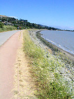
The former railroad right of way now forms part of the San Francisco Bay Trail
, used by hikers and cyclists. Within the Tiburon town limits, the rail trail
passes through the Richardson Bay Park
and next to the Audubon Society's Richardson Bay
Sanctuary. These provide excellent opportunities for observing wildlife
.
people, who have left rock carvings on Ring Mountain
.
The first post office in Tiburon opened in 1884. Tiburon incorporated in 1964.
Tiburon has a Town Historian, Branwell Fanning. Much of the modern history material below is drawn from his "Brief History of Tiburon", published in the Town of Tiburon's General Plan.
. Whether Lt. Juan Manuel de Ayala
saw a number of sharks near where he anchored the San Carlos in August 1775, off what is now Angel Island, or whether the tree-covered Tiburon Peninsula
looked like a shark we may never know. He named the land Punta del Tiburon, or Shark Point. The Coast Miwok
Indians had lived here for thousands of years, but there is no clear concept of what they called the peninsula
.
John Reed
, from Dublin, received a provisional grant for much of Southern Marin, including the Tiburon Peninsula, from the Mexican
authorities in 1831, and was formally granted the Rancho Corte Madera del Presidio
in 1834. Reed married Hilaria Sanchez, daughter of the commandante of the San Francisco Presidio in 1836. The Reed name is preserved on streets, subdivisions, and the local school district. Various forms of Hilaria's name, and that of her granddaughter Hilarita Reed, are found on streets, a housing development, and the Catholic Church.
Hilarita married Dr. Benjamin Lyford, who became the first land developer with his Lyford's Hygeia, now Old Tiburon. The Benjamin and Hilarita Lyford House
, formerly located on their dairy farm on Strawberry Point, is now a feature of the Audubon Society's Western Headquarters and Sanctuary on Greenwood Beach Road.
 Life changed little in the 40 years between the death of John Reed in 1842 and the arrival of Peter Donahue in 1882. Donahue brought with him the San Francisco and North Pacific Railroad
(later the Northwestern Pacific Railroad
). He made a deal with the Reed family for a right-of-way, blasted out the rock at Point Tiburon, and built a railroad terminal to connect with ferries of San Francisco Bay
. The passenger ferries took commuters and automobiles to San Francisco and Sausalito, while barge
s carried loaded freight cars to San Francisco and Richmond.
The last railroad operated passenger ferry
left Tiburon in 1941, but the passenger and freight trains ran until 1967. Passenger ferry service was resumed in the 1960s when Harbor Carriers utilized sightseeing boats in the early morning and evening hours. In the 1970s the railroad tore up the tracks, plugged the tunnels, removed the trestle over Trestle Glen, and demolished the railroad ferry pier. The railroad right-of-way was purchased by the City of Tiburon and is now the waterfront Multi-Use Path. After years of hearings and studies, the former railroad yards became the Point Tiburon housing and commercial project.
During its heyday the railroad-ferry service brought many other industries to Tiburon. Codfish canneries sprouted along the bay shore to can fish brought down from Alaska. Ship dismantlers broke up many obsolete ocean-going vessels. In 1904, the Navy established a huge coaling station on the east shore of the peninsula on the site of one of the old fish canneries. Brick kilns were built and several powder plants opened, and oyster beds developed in the shallow waters of the bay. The rail yards were fully equipped to not only repair and service trains but to build passenger and freight cars and locomotives.
Several of the largest San Francisco Bay
ferries were built in the Tiburon yards. The Navy coaling station has played a prominent part in the history of both Tiburon and Bay Area at large. Theodore Roosevelt
's Great White Fleet
was refueled there on its famous round-the-world cruise. Coaling service ended in 1931 and the California Maritime Academy
moved in to train officers for the merchant fleet. Because the large cranes left over from the coaling operations were still operational, the company spinning the cables for the Golden Gate Bridge
set up shop.
loomed, the coaling station site was transformed into the United States Navy Net Depot Tiburon. This wartime facility was used for the manufacture and service of huge nets
to stop enemy torpedoes and submarines from entering San Francisco Bay. Later, the U.S. Bureau of Mines and the U.S. Bureau of Fisheries established research facilities on the site and the Coast Guard
's icebreakers made this their summer home. It is now the Romberg Tiburon Center for Environmental Studies operated by San Francisco State University
.
With all the seamen, sailors, railroad workers, cannery employees, and local dairymen in Tiburon, the taverns and other attractions of Main Street were very popular on Saturday night. Prohibition did not interrupt Main Street activities as the railroad workers were able to signal the Tiburon depot as soon as any revenuers boarded a train or ferry headed for town. By the time they got to Tiburon, prayer meetings were being held in the taverns. The volunteer fire department organized highly spirited baseball games, and the Corinthian Yacht Club was in full swing, so Main Street was not the only activity center.
World War II
brought more people to Tiburon as the Navy built housing for NetDepot workers on the site of the present Hilarita Housing, for sailors from submarines at an annex to the Net Depot (now Paradise Beach County Park). Real estate development did not get under way in any meaningful form until after the end of the war. The descendants of the Reed family still controlled most of the land that was used for cattle ranching. Small areas of filled land were sold off to create the Bel Aire and Belveron Gardens subdivisions. The Little Reed Ranch was sold and Hawthorne Terrace, Del Mar, and Reed Heights subdivisions were well under way by the time the County finally began preparing a Master Plan for the Tiburon Peninsula.
After several years of public hearings and discussions with the primary landowners a Master Plan was finally completed in 1956. It had something for everyone: freeways on both sides of the peninsula, a four lane "ridge route" down the center of the peninsula (with a high-level bridge over Trestle Glen Boulevard), a shopping center on the crest of Ring Mountain, and a bridge to San Francisco (via Angel Island and Alcatraz) off the end. A land-use density of two homes to the acre, plus areas zoned for apartments and duplexes, would have permitted 50,000 to 60,000 people to live in Tiburon.
One of the first challenges to be decided was just what properties were to be included in the incorporated area. The mapping committee started with the Tiburon Fire Protection District map as a base. The properties of large land owners who had been able to frustrate previous attempts were eliminated from the map. Certain areas, such as the Reedlands and part of Belveron Gardens, which were outside the Tiburon Fire District, but which wanted to be in the new city, were added. Angel Island, also outside the fire district boundary, was more controversial. Most did not see any value to having it within the city limits, as it was a state park. The counter argument was that it was "there", and we wanted a say in whatever future development might be planned. The County Boundary Commission (later Marin Local Agency Formation Commission, or LAFCO), at the time made up of the members of the Board of Supervisors, wanted it out of the new city because of potential sales tax revenues.
They finally yielded to arguments put forth by the incorporation committee, and let it remain within the new city limits. In March 1964 an election was held to create the Town of Tiburon, and on June 23, 1964, the incorporation was final and a Town Council seated, and mayor elected.
A city manager was hired and a contract for police services was made with the county sheriff. A Planning Commission was established and commissioners appointed. Offices at 80 Main Street were rented. To help plan for the future the Tiburon Advisory Committee was appointed, consisting of citizens who had been active in community affairs. Their report, issued in 1965, outlined goals in land use, recreation, traffic, and "image".
In 1966, at the first election after incorporation, three of the incumbents were replaced. Over the next several years, the new City Council strengthened the Planning Commission and divided it further into Boards of Design Review and Adjustments. They completed a new Master Plan and General Plan for the peninsula and new zoning ordinances to implement the plans. They also created a parks and recreation commission. Special ordinances to protect trees and to protect views were created. Property values were rising faster than funds could be accumulated, so bonds were issued and several hundred acres of open space were acquired. Several hundred additional acres were purchased by the Nature Conservancy to permanently protect the ridgelines, and the City purchased additional land from the Navy. The railroad right-of-way, almost 2.5 miles (4 km) of frontage on Richardson Bay, was acquired for a bicycle path.
One of the most difficult decisions involved traffic planning. After numerous public hearings it was finally decided that Tiburon Boulevard
would remain a two-lane road east of Trestle Glen Blvd. Stop lights and turnouts were scheduled east of that point and eventually built. The four-lane bypass section from Highway 101
to Blackie's Pasture (the old Tiburon Boulevard became Greenwood Beach Road) was completed in 1966. The California Department of Transportation
(Caltrans) had anticipated extending the four lanes downtown, so the fill created during this project was placed in the Bay east of Blackie's Pasture, and after the City did some land swapping with Caltrans, became McKegney Green and the park South of the Knoll Park. Blackie's Pasture property was also acquired and became part of the series of waterfront parks and paths known as the Richardson Bay Lineal Park.
LAFCO determined that Tiburon's sphere of influence would extend to Highway 101. Annexation of the rest of the peninsula was attempted but never successful due to opposition in Strawberry. Eventually, those areas that wished to be within the city limits were annexed, and the city grew westward to include the Reedland Woods, Bel Aire, Tiburon Crest and Cypress Hollow subdivisions.
next door. A new police station followed in 2000.
Following a large and successful Millennium Party the Town has pursued a policy to revitalize Main Street and the rest of downtown Tiburon. Main Street was reconstructed to make it and the shops and restaurants handicapped accessible without ruining its quaint charm. The Allan Thompson Walkway along the water side of Main Street was completely rebuilt. In the summer of 2004 a series of "Friday Nights on Main Street" community parties was inaugurated. Main Street was closed to automobile traffic on Friday nights during the summer and the restaurants created special menus for the occasion. Tables in the street in front of each restaurant added to the festivities. As of 2009, the festival continues.
In November 2006, a commissioned fountain with a nautically-themed sculpture titled "Coming About" was at the entrance to Main Street was formally dedicated. About half of the $500,000 cost of the sculpture was donated by the Zelinsky family, longtime owners of many commercial properties in Tiburon. The sculpture was designed by Jeffery Reed and Jennifer Madden.
At the lowest level, any new construction or exterior renovation, commercial or residential, must be approved by the Design Review Board, which often applies stringent criteria to avoid "eyesores" and preserve neighbors' views.
More significantly, there remain several large tracts of undeveloped land, virtually all of which have owners who desire to build multiple residences on these properties. Many of these properties, while located on the Tiburon Peninsula, are outside of town boundaries. However, under a LAFCO policy, any urbanization of these lands would result in their being annexed by the Town, since it is the Town that would provide needed services. Hence it is the town planning commission and ultimately the Town Council that determines the extent that these lands can be developed. Major tracts of land currently in various stages of planning or permitting include the Martha Property, Easton Point and Tiburon Glen. The permitting processes in all cases are lengthy and contentious, pitting developers against active and organized residents seeking to preserve the open space and quasi-rural character of the area and avoid the kind of traffic seen by other Bay Area communities. Particularly active in opposing development is the Tiburon Last Chance Committee. No development has yet begun on any of these open tracts.
The Martha Property and Easton Point, the largest of the undeveloped lands, are particularly contested issues, with court battles dating back to 1975. Historically the Ring Mountain
property was an area of contest, especially due to the high biodiversity
and presence of rare
and endangered species
.
In 2002 residents in a referendum narrowly defeated a proposed rule that would have prohibited much of the development on open tracts of land by, among other things, banning development near ridgelines. Among the arguments against this proposal were that it would subject the town to costly lawsuits by developers claiming their economic rights had been unjustly impaired.
A 2006 controversy concerned the expansion plans of the Kol Shofar Synagogue
. These were opposed by a number of neighbors, principally over the size of a new multi-purpose room and the traffic and noise impact of a proposed 27 additional events with up to 250 persons. The Tiburon Planning Commission in the summer of 2006 rejected the expansion plans, claiming that Kol Shofar refused to engage in compromise discussions. This brought the issue to the Tiburon Town Council. In October 2006, the dispute took on broader significance when Kol Shofar proponents raised issues of religious freedom. Specifically, they claimed that the federal Religious Land Use and Institutionalized Persons Act
(RLUIPA), which prohibits "substantial burdens" on the exercise of religion by government regulations, would be violated if the Town prohibited their expansion plans. The synagogue retained The Becket Fund for Religious Liberty
which threatened litigation depending on the outcome. The Tiburon City Council attempted to resolve the issue late in the 2006 by permitting a somewhat reduced expansion with restrictions on event sizes and hours and provisions to mitigate the parking, noise and traffic impacts. However a group of neighbors sued both the town and the synagogue in March, 2007, alleging environmental and land-use violations. In 2008, a Marin Superior Court judge ruled in favor of the expansion, and the Coalition filed an appeal with the 1st District Court of Appeal. The appeal was ultimately dropped later that same year, and Kol Shofar was able to proceed, agreeing not to seek repayment of court costs. Kol Shofar's new space opened on August 29, 2010.
According to the United States Census Bureau
, the town has a total area of 13.2 square miles (34.2 km²). 4.4 square miles (11.4 km²) of it is land and 8.7 square miles (22.5 km²) of it (66.27%) is water, much in the form of Richardson Bay.
The serpentine soil
s of Ring Mountain
and the Tiburon Hills are host to a unique plant community, including several endemic
or near-endemic species, notably, the Tiburon mariposa lily, the Tiburon indian paintbrush
, and the Tiburon jewelflower, as well as a number of other rare
and endangered species
Ring Mountain is also a significant location of Native American
prehistoric sites, notably rock carvings.
(Köppen climate classification
Csb).
was 679.9 people per square mile (262.5/km²). The racial makeup of Tiburon was 7,899 (88.1%) White, 83 (0.9%) African American, 16 (0.2%) Native American, 505 (5.6%) Asian, 8 (0.1%) Pacific Islander, 80 (0.9%) from other races
, and 371 (4.1%) from two or more races. Hispanic or Latino of any race were 410 persons (4.6%).
The Census reported that 8,924 people (99.6% of the population) lived in households, 6 (0.1%) lived in non-institutionalized group quarters, and 32 (0.4%) were institutionalized.
There were 3,729 households, out of which 1,160 (31.1%) had children under the age of 18 living in them, 2,116 (56.7%) were opposite-sex married couples
living together, 280 (7.5%) had a female householder with no husband present, 86 (2.3%) had a male householder with no wife present. There were 157 (4.2%) unmarried opposite-sex partnerships
, and 20 (0.5%) same-sex married couples or partnerships. 1,029 households (27.6%) were made up of individuals and 528 (14.2%) had someone living alone who was 65 years of age or older. The average household size was 2.39. There were 2,482 families
(66.6% of all households); the average family size was 2.94.
The population was spread out with 2,150 people (24.0%) under the age of 18, 295 people (3.3%) aged 18 to 24, 1,582 people (17.7%) aged 25 to 44, 3,037 people (33.9%) aged 45 to 64, and 1,898 people (21.2%) who were 65 years of age or older. The median age was 48.0 years. For every 100 females there were 87.9 males. For every 100 females age 18 and over, there were 84.2 males.
There were 4,025 housing units at an average density of 305.3 per square mile (117.9/km²), of which 2,530 (67.8%) were owner-occupied, and 1,199 (32.2%) were occupied by renters. The homeowner vacancy rate was 1.5%; the rental vacancy rate was 5.0%. 6,406 people (71.5% of the population) lived in owner-occupied housing units and 2,518 people (28.1%) lived in rental housing units.
, there were 8,666 people, 3,712 households, and 2,409 families residing in the town. The population density
was 1,914.9 people per square mile (738.6/km²). There were 3,893 housing units at an average density of 860.2 per square mile (331.8/km²). The racial makeup of the town was 84.9% non-Hispanic White, 0.9% non-Hispanic African American, 0.1% Native American, 5.6% Asian, 0.1% Pacific Islander, 0.2% from other races
, and 3.7% from two or more races. Hispanic or Latino of any race were 4.6% of the population.
There were 3,712 households out of which 27.7% had children under the age of 18 living with them, 55.3% were married couples
living together, 7.2% had a female householder with no husband present, and 35.1% were non-families. 27.6% of all households were made up of individuals and 9.5% had someone living alone who was 65 years of age or older. The average household size was 2.31 and the average family size was 2.82.
In the town the population was spread out with 21.9% under the age of 18, 2.8% from 18 to 24, 24.4% from 25 to 44, 34.3% from 45 to 64, and 16.5% who were 65 years of age or older. The median age was 45 years. For every 100 females there were 88.3 males. For every 100 females age 18 and over, there were 84.1 males.
The median income
for a household in the town was $106,611, and the median income for a family was $149,041. Males had a median income of $100,000+ versus $60,773 for females. The per capita income
for the town was $85,966. About 1.6% of families and 3.3% of the population were below the poverty line, including 3.0% of those under age 18 and 1.5% of those age 65 or over.
Belvedere/Tiburon was ranked by Forbes magazine as among the 20 most expensive real-estate markets in the US. It ranked 18th.
In 2004 Tiburon became the first city in the world to eliminate trans-fats from all its restaurants.
One of the oldest Tiburon restaurants is Sam's Anchor Cafe, founded in 1920. Sam's is especially popular on sunny days for the outdoor dining on its harbor-front deck. It is one of the only restaurants in the San Francisco Bay with a public dock for pleasure boats (under 40 feet). Other restaurants to include upscale dining with expansive Bay views are The Caprice, Guaymas, The Dynasty and Servino Ristorante.
Tiburon has two hotels: Water's Edge, a boutique hotel
on Main Street, and the recently refurbished The Lodge at Tiburon.
One weekly newspaper is published in the town, The Ark, which extensively covers local news and events.
On Friday evenings in the spring and summer, the town's Main Street is closed to vehicles and transformed into a large alfresco
dining area for "Friday Nights on Main". Local restaurants and bars provide outdoor dining and drinks, with music and lively crowds helping create a festive atmosphere. There is also a small shopping center named The Cove in the Bel Aire neighborhood.
, and a part of Corte Madera
are in the Reed Union School District
. The District has three schools, all located in Tiburon: Reed Elementary
(grades K-2); Bel Aire Elementary
(grades 3-5); and Del Mar Middle School
(grades 6-8). All three have been recognized as "California Distinguished Schools" by the state Department of Education. St. Hilary School, a Catholic primary school for children grades K-8, is also located in Tiburon.
All three of Tiburon's public schools have gone or are undergoing substantial renovation and expansion. Reed completed reconstruction in 2004, and both Bel Aire and Del Mar completed reconstruction in 2006.
Tiburon is in the Reed Union School District
and the Marin Community College District
. Tiburon graduates attended Tamalpais High School
in Mill Valley
from 1908, when Tam opened, until 1958, when Redwood High School opened in Larkspur
, with Reed Union School District in its attendance area.
Marin County, California
Marin County is a county located in the North San Francisco Bay Area of the U.S. state of California, across the Golden Gate Bridge from San Francisco. As of 2010, the population was 252,409. The county seat is San Rafael and the largest employer is the county government. Marin County is well...
. It occupies most of the Tiburon Peninsula
Tiburon Peninsula (U.S.)
The Tiburon Peninsula is a landform of the San Francisco Bay Area's Marin County and incorporates the communities of Tiburon and Belvedere, California Much of the land area of the Tiburon Peninsula was part of a Spanish land grant originally given to the early Californian John Reed...
, which reaches south into the San Francisco Bay
San Francisco Bay
San Francisco Bay is a shallow, productive estuary through which water draining from approximately forty percent of California, flowing in the Sacramento and San Joaquin rivers from the Sierra Nevada mountains, enters the Pacific Ocean...
. The smaller city of Belvedere
Belvedere, California
Belvedere is an affluent city in Marin County, California, United States. Belvedere is located northeast of Sausalito, at an elevation of 36 feet...
(formerly a separate island) occupies the south-east part of the peninsula and is contiguous with Tiburon. Tiburon is bordered by Corte Madera
Corte Madera, California
Corte Madera is an incorporated town in Marin County, California, United States. Corte Madera is located south of San Rafael, at an elevation of 39 feet . The population was 9,253 at the 2010 census...
to the north and Mill Valley
Mill Valley, California
Mill Valley is a city in Marin County, California, United States located about north of San Francisco via the Golden Gate Bridge. The population was 13,903 at the 2010 census.Mill Valley is located on the western and northern shores of Richardson Bay...
to the west, but is otherwise surrounded by the Bay. The population was 8,962 at the 2010 census.
The city's name derives from the Spanish
Spanish language
Spanish , also known as Castilian , is a Romance language in the Ibero-Romance group that evolved from several languages and dialects in central-northern Iberia around the 9th century and gradually spread with the expansion of the Kingdom of Castile into central and southern Iberia during the...
word tiburón, which means "shark
Shark
Sharks are a type of fish with a full cartilaginous skeleton and a highly streamlined body. The earliest known sharks date from more than 420 million years ago....
". The name was first given to the peninsula on which the city is situated, and probably inspired by the prevalence of locally native leopard shark
Leopard shark
The leopard shark is a species of houndshark, family Triakidae, found along the Pacific coast of North America from the U.S. state of Oregon to Mazatlán in Mexico...
s in the surrounding waters. Tiburon was formerly the southern terminus of the Northwestern Pacific Railroad
Northwestern Pacific Railroad
The Northwestern Pacific Railroad is a regional railroad serving California's North Coast. The railroad currently runs on 62 miles of the 462 mile main line, stretching from Schellville, California to Eureka, California...
. This railroad carried freight, mostly lumber, to the town for transfer to barge
Barge
A barge is a flat-bottomed boat, built mainly for river and canal transport of heavy goods. Some barges are not self-propelled and need to be towed by tugboats or pushed by towboats...
s for shipping to cities around San Francisco Bay. It is now a commuter
Commuter town
A commuter town is an urban community that is primarily residential, from which most of the workforce commutes out to earn their livelihood. Many commuter towns act as suburbs of a nearby metropolis that workers travel to daily, and many suburbs are commuter towns...
and tourist town, linked by fast ferry services to San Francisco and with a concentration of restaurants and clothes shops. It is the nearest mainland point to Angel Island and a regular ferry service connects to the island.
The former railroad right of way now forms part of the San Francisco Bay Trail
San Francisco Bay Trail
The San Francisco Bay Trail is a bicycle and pedestrian trail that will eventually allow continuous travel around the shoreline of San Francisco Bay. As of 2011, approximately 310 miles of trail have been completed...
, used by hikers and cyclists. Within the Tiburon town limits, the rail trail
Rail trail
A rail trail is the conversion of a disused railway easement into a multi-use path, typically for walking, cycling and sometimes horse riding. The characteristics of former tracks—flat, long, frequently running through historical areas—are appealing for various development. The term sometimes also...
passes through the Richardson Bay Park
Richardson Bay
Richardson Bay is a shallow, ecologically rich arm of San Francisco Bay, managed under a Joint Powers Agency of four Northern California cities. The Richardson Bay Sanctuary was acquired in the early 1960s by the National Audubon Society. The bay was named for William A...
and next to the Audubon Society's Richardson Bay
Richardson Bay
Richardson Bay is a shallow, ecologically rich arm of San Francisco Bay, managed under a Joint Powers Agency of four Northern California cities. The Richardson Bay Sanctuary was acquired in the early 1960s by the National Audubon Society. The bay was named for William A...
Sanctuary. These provide excellent opportunities for observing wildlife
Wildlife
Wildlife includes all non-domesticated plants, animals and other organisms. Domesticating wild plant and animal species for human benefit has occurred many times all over the planet, and has a major impact on the environment, both positive and negative....
.
History
Earliest human habitation of the local area was by Native AmericanNative Americans in the United States
Native Americans in the United States are the indigenous peoples in North America within the boundaries of the present-day continental United States, parts of Alaska, and the island state of Hawaii. They are composed of numerous, distinct tribes, states, and ethnic groups, many of which survive as...
people, who have left rock carvings on Ring Mountain
Ring Mountain (California)
Ring Mountain is an elevated landform on the Tiburon Peninsula in Marin County, California. This mountain was named for George E. Ring, who served as a Marin County Supervisor from 1895 to 1903.A number of rare and endangered flora inhabit Ring Mountain...
.
The first post office in Tiburon opened in 1884. Tiburon incorporated in 1964.
Tiburon has a Town Historian, Branwell Fanning. Much of the modern history material below is drawn from his "Brief History of Tiburon", published in the Town of Tiburon's General Plan.
1775–1882
Tiburón means "shark" in SpanishSpanish language
Spanish , also known as Castilian , is a Romance language in the Ibero-Romance group that evolved from several languages and dialects in central-northern Iberia around the 9th century and gradually spread with the expansion of the Kingdom of Castile into central and southern Iberia during the...
. Whether Lt. Juan Manuel de Ayala
Juan de Ayala
Juan Manuel de Ayala y Aranza was a Spanish naval officer who played a significant role in the European exploration of California, since he and the crew of his ship the San Carlos are the first Europeans known to have entered the San Francisco Bay.Ayala was born in Osuna, Andalucía...
saw a number of sharks near where he anchored the San Carlos in August 1775, off what is now Angel Island, or whether the tree-covered Tiburon Peninsula
Tiburon Peninsula (U.S.)
The Tiburon Peninsula is a landform of the San Francisco Bay Area's Marin County and incorporates the communities of Tiburon and Belvedere, California Much of the land area of the Tiburon Peninsula was part of a Spanish land grant originally given to the early Californian John Reed...
looked like a shark we may never know. He named the land Punta del Tiburon, or Shark Point. The Coast Miwok
Coast Miwok
The Coast Miwok were the second largest group of Miwok Native American people. The Coast Miwok inhabited the general area of modern Marin County and southern Sonoma County in Northern California, from the Golden Gate north to Duncans Point and eastward to Sonoma Creek...
Indians had lived here for thousands of years, but there is no clear concept of what they called the peninsula
Peninsula
A peninsula is a piece of land that is bordered by water on three sides but connected to mainland. In many Germanic and Celtic languages and also in Baltic, Slavic and Hungarian, peninsulas are called "half-islands"....
.
John Reed
John Reed (Early Californian)
John Thomas Reed was an early California European settler who was the grantee of Rancho Corte Madera del Presidio in what is present day Marin County, California.-Life:Reed went to Acapulco, Mexico in 1820...
, from Dublin, received a provisional grant for much of Southern Marin, including the Tiburon Peninsula, from the Mexican
Mexico
The United Mexican States , commonly known as Mexico , is a federal constitutional republic in North America. It is bordered on the north by the United States; on the south and west by the Pacific Ocean; on the southeast by Guatemala, Belize, and the Caribbean Sea; and on the east by the Gulf of...
authorities in 1831, and was formally granted the Rancho Corte Madera del Presidio
Rancho Corte Madera del Presidio
Rancho Corte Madera del Presidio was a Mexican land grant in present day Marin County, California given in 1834 by Governor José Figueroa to John Reed. Corte Madera del Presidio means the "lumber mill of the Presidio". The grant encompassed what is now southern Corte Madera, Mill Valley,...
in 1834. Reed married Hilaria Sanchez, daughter of the commandante of the San Francisco Presidio in 1836. The Reed name is preserved on streets, subdivisions, and the local school district. Various forms of Hilaria's name, and that of her granddaughter Hilarita Reed, are found on streets, a housing development, and the Catholic Church.
Hilarita married Dr. Benjamin Lyford, who became the first land developer with his Lyford's Hygeia, now Old Tiburon. The Benjamin and Hilarita Lyford House
Benjamin and Hilarita Lyford House
The Benjamin and Hilarita Lyford House is a Victorian house located in Tiburon, California. Built in 1876, the house is listed on the National Register of Historic Places.-Prehistory:...
, formerly located on their dairy farm on Strawberry Point, is now a feature of the Audubon Society's Western Headquarters and Sanctuary on Greenwood Beach Road.
Tiburon's industrial era
San Francisco and North Pacific Railroad
San Francisco and North Pacific Railroad provided the first extensive standard gauge rail service to Sonoma County and became the southern end of the regional Northwestern Pacific Railroad...
(later the Northwestern Pacific Railroad
Northwestern Pacific Railroad
The Northwestern Pacific Railroad is a regional railroad serving California's North Coast. The railroad currently runs on 62 miles of the 462 mile main line, stretching from Schellville, California to Eureka, California...
). He made a deal with the Reed family for a right-of-way, blasted out the rock at Point Tiburon, and built a railroad terminal to connect with ferries of San Francisco Bay
Ferries of San Francisco Bay
San Francisco Bay in California has been served by ferries of all types for over 150 years. Although the construction of the Golden Gate Bridge and the San Francisco – Oakland Bay Bridge led to the decline in the importance of most ferries, some are still in use today for both commuters and...
. The passenger ferries took commuters and automobiles to San Francisco and Sausalito, while barge
Barge
A barge is a flat-bottomed boat, built mainly for river and canal transport of heavy goods. Some barges are not self-propelled and need to be towed by tugboats or pushed by towboats...
s carried loaded freight cars to San Francisco and Richmond.
The last railroad operated passenger ferry
Ferry
A ferry is a form of transportation, usually a boat, but sometimes a ship, used to carry primarily passengers, and sometimes vehicles and cargo as well, across a body of water. Most ferries operate on regular, frequent, return services...
left Tiburon in 1941, but the passenger and freight trains ran until 1967. Passenger ferry service was resumed in the 1960s when Harbor Carriers utilized sightseeing boats in the early morning and evening hours. In the 1970s the railroad tore up the tracks, plugged the tunnels, removed the trestle over Trestle Glen, and demolished the railroad ferry pier. The railroad right-of-way was purchased by the City of Tiburon and is now the waterfront Multi-Use Path. After years of hearings and studies, the former railroad yards became the Point Tiburon housing and commercial project.
During its heyday the railroad-ferry service brought many other industries to Tiburon. Codfish canneries sprouted along the bay shore to can fish brought down from Alaska. Ship dismantlers broke up many obsolete ocean-going vessels. In 1904, the Navy established a huge coaling station on the east shore of the peninsula on the site of one of the old fish canneries. Brick kilns were built and several powder plants opened, and oyster beds developed in the shallow waters of the bay. The rail yards were fully equipped to not only repair and service trains but to build passenger and freight cars and locomotives.
Several of the largest San Francisco Bay
San Francisco Bay
San Francisco Bay is a shallow, productive estuary through which water draining from approximately forty percent of California, flowing in the Sacramento and San Joaquin rivers from the Sierra Nevada mountains, enters the Pacific Ocean...
ferries were built in the Tiburon yards. The Navy coaling station has played a prominent part in the history of both Tiburon and Bay Area at large. Theodore Roosevelt
Theodore Roosevelt
Theodore "Teddy" Roosevelt was the 26th President of the United States . He is noted for his exuberant personality, range of interests and achievements, and his leadership of the Progressive Movement, as well as his "cowboy" persona and robust masculinity...
's Great White Fleet
Great White Fleet
The Great White Fleet was the popular nickname for the United States Navy battle fleet that completed a circumnavigation of the globe from 16 December 1907 to 22 February 1909 by order of U.S. President Theodore Roosevelt. It consisted of 16 battleships divided into two squadrons, along with...
was refueled there on its famous round-the-world cruise. Coaling service ended in 1931 and the California Maritime Academy
California Maritime Academy
The California Maritime Academy is one of 23 campuses in the California State University system and is one of only seven degree-granting maritime academies in the United States...
moved in to train officers for the merchant fleet. Because the large cranes left over from the coaling operations were still operational, the company spinning the cables for the Golden Gate Bridge
Golden Gate Bridge
The Golden Gate Bridge is a suspension bridge spanning the Golden Gate, the opening of the San Francisco Bay into the Pacific Ocean. As part of both U.S. Route 101 and California State Route 1, the structure links the city of San Francisco, on the northern tip of the San Francisco Peninsula, to...
set up shop.
World War II
As World War IIWorld War II
World War II, or the Second World War , was a global conflict lasting from 1939 to 1945, involving most of the world's nations—including all of the great powers—eventually forming two opposing military alliances: the Allies and the Axis...
loomed, the coaling station site was transformed into the United States Navy Net Depot Tiburon. This wartime facility was used for the manufacture and service of huge nets
Anti-submarine net
An anti-submarine net is a device placed across the mouth of a harbour or a strait for protection against submarines.-Examples of anti-submarine nets:*Lake Macquarie anti-submarine boom*Indicator net*Naval operations in the Dardanelles Campaign...
to stop enemy torpedoes and submarines from entering San Francisco Bay. Later, the U.S. Bureau of Mines and the U.S. Bureau of Fisheries established research facilities on the site and the Coast Guard
United States Coast Guard
The United States Coast Guard is a branch of the United States Armed Forces and one of the seven U.S. uniformed services. The Coast Guard is a maritime, military, multi-mission service unique among the military branches for having a maritime law enforcement mission and a federal regulatory agency...
's icebreakers made this their summer home. It is now the Romberg Tiburon Center for Environmental Studies operated by San Francisco State University
San Francisco State University
San Francisco State University is a public university located in San Francisco, California. As part of the 23-campus California State University system, the university offers over 100 areas of study from nine academic colleges...
.
With all the seamen, sailors, railroad workers, cannery employees, and local dairymen in Tiburon, the taverns and other attractions of Main Street were very popular on Saturday night. Prohibition did not interrupt Main Street activities as the railroad workers were able to signal the Tiburon depot as soon as any revenuers boarded a train or ferry headed for town. By the time they got to Tiburon, prayer meetings were being held in the taverns. The volunteer fire department organized highly spirited baseball games, and the Corinthian Yacht Club was in full swing, so Main Street was not the only activity center.
World War II
World War II
World War II, or the Second World War , was a global conflict lasting from 1939 to 1945, involving most of the world's nations—including all of the great powers—eventually forming two opposing military alliances: the Allies and the Axis...
brought more people to Tiburon as the Navy built housing for NetDepot workers on the site of the present Hilarita Housing, for sailors from submarines at an annex to the Net Depot (now Paradise Beach County Park). Real estate development did not get under way in any meaningful form until after the end of the war. The descendants of the Reed family still controlled most of the land that was used for cattle ranching. Small areas of filled land were sold off to create the Bel Aire and Belveron Gardens subdivisions. The Little Reed Ranch was sold and Hawthorne Terrace, Del Mar, and Reed Heights subdivisions were well under way by the time the County finally began preparing a Master Plan for the Tiburon Peninsula.
After several years of public hearings and discussions with the primary landowners a Master Plan was finally completed in 1956. It had something for everyone: freeways on both sides of the peninsula, a four lane "ridge route" down the center of the peninsula (with a high-level bridge over Trestle Glen Boulevard), a shopping center on the crest of Ring Mountain, and a bridge to San Francisco (via Angel Island and Alcatraz) off the end. A land-use density of two homes to the acre, plus areas zoned for apartments and duplexes, would have permitted 50,000 to 60,000 people to live in Tiburon.
City incorporation and growth
There had been numerous attempts to incorporate a City of Tiburon over the years, but they had all failed to come to a vote due to the opposition of the large land owners. The only semblance of local land use input came from the Tiburon Peninsula Coordinating Council (TPCC). This was made up of representatives of each of the home owners associations; the school, fire and sanitary districts; and the City of Belvedere. In 1963, after a number of adverse rulings by County planners regarding development on the Tiburon Peninsula, the leaders of the TPCC decided that another attempt to incorporate was justified. A separate incorporation committee was established and work began. The main issues were: revision of the 1956 Master Plan, improved police services, opposition to the bridge to San Francisco, preservation of open space, and a desire for responsive local government.One of the first challenges to be decided was just what properties were to be included in the incorporated area. The mapping committee started with the Tiburon Fire Protection District map as a base. The properties of large land owners who had been able to frustrate previous attempts were eliminated from the map. Certain areas, such as the Reedlands and part of Belveron Gardens, which were outside the Tiburon Fire District, but which wanted to be in the new city, were added. Angel Island, also outside the fire district boundary, was more controversial. Most did not see any value to having it within the city limits, as it was a state park. The counter argument was that it was "there", and we wanted a say in whatever future development might be planned. The County Boundary Commission (later Marin Local Agency Formation Commission, or LAFCO), at the time made up of the members of the Board of Supervisors, wanted it out of the new city because of potential sales tax revenues.
They finally yielded to arguments put forth by the incorporation committee, and let it remain within the new city limits. In March 1964 an election was held to create the Town of Tiburon, and on June 23, 1964, the incorporation was final and a Town Council seated, and mayor elected.
A city manager was hired and a contract for police services was made with the county sheriff. A Planning Commission was established and commissioners appointed. Offices at 80 Main Street were rented. To help plan for the future the Tiburon Advisory Committee was appointed, consisting of citizens who had been active in community affairs. Their report, issued in 1965, outlined goals in land use, recreation, traffic, and "image".
In 1966, at the first election after incorporation, three of the incumbents were replaced. Over the next several years, the new City Council strengthened the Planning Commission and divided it further into Boards of Design Review and Adjustments. They completed a new Master Plan and General Plan for the peninsula and new zoning ordinances to implement the plans. They also created a parks and recreation commission. Special ordinances to protect trees and to protect views were created. Property values were rising faster than funds could be accumulated, so bonds were issued and several hundred acres of open space were acquired. Several hundred additional acres were purchased by the Nature Conservancy to permanently protect the ridgelines, and the City purchased additional land from the Navy. The railroad right-of-way, almost 2.5 miles (4 km) of frontage on Richardson Bay, was acquired for a bicycle path.
One of the most difficult decisions involved traffic planning. After numerous public hearings it was finally decided that Tiburon Boulevard
California State Route 131
State Route 131 is a state highway in the U.S. state of California in Marin County. It is a short route that connects U.S. Route 101 with the town of Tiburon. It is named Tiburon Boulevard along its entire length.-Route description:...
would remain a two-lane road east of Trestle Glen Blvd. Stop lights and turnouts were scheduled east of that point and eventually built. The four-lane bypass section from Highway 101
U.S. Route 101
U.S. Route 101, or U.S. Highway 101, is an important north–south U.S. highway that runs through the states of California, Oregon, and Washington, on the West Coast of the United States...
to Blackie's Pasture (the old Tiburon Boulevard became Greenwood Beach Road) was completed in 1966. The California Department of Transportation
California Department of Transportation
The California Department of Transportation is a government department in the U.S. state of California. Its mission is to improve mobility across the state. It manages the state highway system and is actively involved with public transportation systems throughout the state...
(Caltrans) had anticipated extending the four lanes downtown, so the fill created during this project was placed in the Bay east of Blackie's Pasture, and after the City did some land swapping with Caltrans, became McKegney Green and the park South of the Knoll Park. Blackie's Pasture property was also acquired and became part of the series of waterfront parks and paths known as the Richardson Bay Lineal Park.
LAFCO determined that Tiburon's sphere of influence would extend to Highway 101. Annexation of the rest of the peninsula was attempted but never successful due to opposition in Strawberry. Eventually, those areas that wished to be within the city limits were annexed, and the city grew westward to include the Reedland Woods, Bel Aire, Tiburon Crest and Cypress Hollow subdivisions.
After 1997
The completion of the Point Tiburon development in the former railroad yards in 1985 signaled a change in the population mix and needs of the area. In 1997 a new Town Hall was opened with a new Belvedere-Tiburon LibraryBelvedere-Tiburon Library
The Belvedere-Tiburon Library is an independent public library serving the communities of Belvedere and Tiburon, California. The library opened in 1997 at its present location of 1501 Tiburon Boulevard in Tiburon. The library collection consists of over 70,000 books, periodicals, CDs, DVDs, Videos,...
next door. A new police station followed in 2000.
Following a large and successful Millennium Party the Town has pursued a policy to revitalize Main Street and the rest of downtown Tiburon. Main Street was reconstructed to make it and the shops and restaurants handicapped accessible without ruining its quaint charm. The Allan Thompson Walkway along the water side of Main Street was completely rebuilt. In the summer of 2004 a series of "Friday Nights on Main Street" community parties was inaugurated. Main Street was closed to automobile traffic on Friday nights during the summer and the restaurants created special menus for the occasion. Tables in the street in front of each restaurant added to the festivities. As of 2009, the festival continues.
In November 2006, a commissioned fountain with a nautically-themed sculpture titled "Coming About" was at the entrance to Main Street was formally dedicated. About half of the $500,000 cost of the sculpture was donated by the Zelinsky family, longtime owners of many commercial properties in Tiburon. The sculpture was designed by Jeffery Reed and Jennifer Madden.
Development
Controversies surrounding development are a significant public policy issues facing the Town; this condition has endured for at least three decades.At the lowest level, any new construction or exterior renovation, commercial or residential, must be approved by the Design Review Board, which often applies stringent criteria to avoid "eyesores" and preserve neighbors' views.
More significantly, there remain several large tracts of undeveloped land, virtually all of which have owners who desire to build multiple residences on these properties. Many of these properties, while located on the Tiburon Peninsula, are outside of town boundaries. However, under a LAFCO policy, any urbanization of these lands would result in their being annexed by the Town, since it is the Town that would provide needed services. Hence it is the town planning commission and ultimately the Town Council that determines the extent that these lands can be developed. Major tracts of land currently in various stages of planning or permitting include the Martha Property, Easton Point and Tiburon Glen. The permitting processes in all cases are lengthy and contentious, pitting developers against active and organized residents seeking to preserve the open space and quasi-rural character of the area and avoid the kind of traffic seen by other Bay Area communities. Particularly active in opposing development is the Tiburon Last Chance Committee. No development has yet begun on any of these open tracts.
The Martha Property and Easton Point, the largest of the undeveloped lands, are particularly contested issues, with court battles dating back to 1975. Historically the Ring Mountain
Ring Mountain (California)
Ring Mountain is an elevated landform on the Tiburon Peninsula in Marin County, California. This mountain was named for George E. Ring, who served as a Marin County Supervisor from 1895 to 1903.A number of rare and endangered flora inhabit Ring Mountain...
property was an area of contest, especially due to the high biodiversity
Biodiversity
Biodiversity is the degree of variation of life forms within a given ecosystem, biome, or an entire planet. Biodiversity is a measure of the health of ecosystems. Biodiversity is in part a function of climate. In terrestrial habitats, tropical regions are typically rich whereas polar regions...
and presence of rare
Rare species
A rare species is a group of organisms that are very uncommon or scarce. This designation may be applied to either a plant or animal taxon, and may be distinct from the term "endangered" or "threatened species" but not "extinct"....
and endangered species
Endangered species
An endangered species is a population of organisms which is at risk of becoming extinct because it is either few in numbers, or threatened by changing environmental or predation parameters...
.
In 2002 residents in a referendum narrowly defeated a proposed rule that would have prohibited much of the development on open tracts of land by, among other things, banning development near ridgelines. Among the arguments against this proposal were that it would subject the town to costly lawsuits by developers claiming their economic rights had been unjustly impaired.
A 2006 controversy concerned the expansion plans of the Kol Shofar Synagogue
Congregation Kol Shofar
Congregation Kol Shofar is a Conservative synagogue founded in 1962 and located in Tiburon, California. The congregation is led by Rabbi Chai Levy who was ordained in 2002 by the Jewish Theological Seminary of America in New York City.-History:...
. These were opposed by a number of neighbors, principally over the size of a new multi-purpose room and the traffic and noise impact of a proposed 27 additional events with up to 250 persons. The Tiburon Planning Commission in the summer of 2006 rejected the expansion plans, claiming that Kol Shofar refused to engage in compromise discussions. This brought the issue to the Tiburon Town Council. In October 2006, the dispute took on broader significance when Kol Shofar proponents raised issues of religious freedom. Specifically, they claimed that the federal Religious Land Use and Institutionalized Persons Act
Religious Land Use and Institutionalized Persons Act
The Religious Land Use and Institutionalized Persons Act , , codified as et seq., is a United States federal law that prohibits the imposition of burdens on the ability of prisoners to worship as they please, as well as giving churches and other religious institutions a way to avoid burdensome...
(RLUIPA), which prohibits "substantial burdens" on the exercise of religion by government regulations, would be violated if the Town prohibited their expansion plans. The synagogue retained The Becket Fund for Religious Liberty
The Becket Fund for Religious Liberty
The Becket Fund for Religious Liberty is a non-profit organization based in Washington, DC that describes itself as "a non-profit, public interest law firm defending the freedom of religion of people of all faiths." The Becket Fund operates in three arenas: in the courts of law , in the court of...
which threatened litigation depending on the outcome. The Tiburon City Council attempted to resolve the issue late in the 2006 by permitting a somewhat reduced expansion with restrictions on event sizes and hours and provisions to mitigate the parking, noise and traffic impacts. However a group of neighbors sued both the town and the synagogue in March, 2007, alleging environmental and land-use violations. In 2008, a Marin Superior Court judge ruled in favor of the expansion, and the Coalition filed an appeal with the 1st District Court of Appeal. The appeal was ultimately dropped later that same year, and Kol Shofar was able to proceed, agreeing not to seek repayment of court costs. Kol Shofar's new space opened on August 29, 2010.
Geography and environment
Tiburon is located at 37°52′25"N 122°27′24"W.According to the United States Census Bureau
United States Census Bureau
The United States Census Bureau is the government agency that is responsible for the United States Census. It also gathers other national demographic and economic data...
, the town has a total area of 13.2 square miles (34.2 km²). 4.4 square miles (11.4 km²) of it is land and 8.7 square miles (22.5 km²) of it (66.27%) is water, much in the form of Richardson Bay.
The serpentine soil
Serpentine soil
A serpentine soil is derived from ultramafic rocks, in particular serpentinite, a rock formed by the hydration and metamorphic transformation of ultramafic rock from the Earth's mantle....
s of Ring Mountain
Ring Mountain (California)
Ring Mountain is an elevated landform on the Tiburon Peninsula in Marin County, California. This mountain was named for George E. Ring, who served as a Marin County Supervisor from 1895 to 1903.A number of rare and endangered flora inhabit Ring Mountain...
and the Tiburon Hills are host to a unique plant community, including several endemic
Endemic (ecology)
Endemism is the ecological state of being unique to a defined geographic location, such as an island, nation or other defined zone, or habitat type; organisms that are indigenous to a place are not endemic to it if they are also found elsewhere. For example, all species of lemur are endemic to the...
or near-endemic species, notably, the Tiburon mariposa lily, the Tiburon indian paintbrush
Tiburon Indian paintbrush
Tiburon Indian paintbrush, whose scientific name is Castilleja neglecta or Casteileja affinis spp. neglecta, is an endangered perennial herb that is endemic to seven different colonies in the San Francisco Bay Area including the Tiburon Peninsula of Marin County, California; American Canyon in Napa...
, and the Tiburon jewelflower, as well as a number of other rare
Rare species
A rare species is a group of organisms that are very uncommon or scarce. This designation may be applied to either a plant or animal taxon, and may be distinct from the term "endangered" or "threatened species" but not "extinct"....
and endangered species
Endangered species
An endangered species is a population of organisms which is at risk of becoming extinct because it is either few in numbers, or threatened by changing environmental or predation parameters...
Ring Mountain is also a significant location of Native American
Indigenous peoples of the Americas
The indigenous peoples of the Americas are the pre-Columbian inhabitants of North and South America, their descendants and other ethnic groups who are identified with those peoples. Indigenous peoples are known in Canada as Aboriginal peoples, and in the United States as Native Americans...
prehistoric sites, notably rock carvings.
Climate
Tiburon experiences a Mediterranean climateMediterranean climate
A Mediterranean climate is the climate typical of most of the lands in the Mediterranean Basin, and is a particular variety of subtropical climate...
(Köppen climate classification
Köppen climate classification
The Köppen climate classification is one of the most widely used climate classification systems. It was first published by Crimea German climatologist Wladimir Köppen in 1884, with several later modifications by Köppen himself, notably in 1918 and 1936...
Csb).
2010
The 2010 United States Census reported that Tiburon had a population of 8,962. The population densityPopulation density
Population density is a measurement of population per unit area or unit volume. It is frequently applied to living organisms, and particularly to humans...
was 679.9 people per square mile (262.5/km²). The racial makeup of Tiburon was 7,899 (88.1%) White, 83 (0.9%) African American, 16 (0.2%) Native American, 505 (5.6%) Asian, 8 (0.1%) Pacific Islander, 80 (0.9%) from other races
Race (United States Census)
Race and ethnicity in the United States Census, as defined by the Federal Office of Management and Budget and the United States Census Bureau, are self-identification data items in which residents choose the race or races with which they most closely identify, and indicate whether or not they are...
, and 371 (4.1%) from two or more races. Hispanic or Latino of any race were 410 persons (4.6%).
The Census reported that 8,924 people (99.6% of the population) lived in households, 6 (0.1%) lived in non-institutionalized group quarters, and 32 (0.4%) were institutionalized.
There were 3,729 households, out of which 1,160 (31.1%) had children under the age of 18 living in them, 2,116 (56.7%) were opposite-sex married couples
Marriage
Marriage is a social union or legal contract between people that creates kinship. It is an institution in which interpersonal relationships, usually intimate and sexual, are acknowledged in a variety of ways, depending on the culture or subculture in which it is found...
living together, 280 (7.5%) had a female householder with no husband present, 86 (2.3%) had a male householder with no wife present. There were 157 (4.2%) unmarried opposite-sex partnerships
POSSLQ
POSSLQ is an abbreviation for "Persons of Opposite Sex Sharing Living Quarters," a term coined in the late 1970s by the United States Census Bureau as part of an effort to more accurately gauge the prevalence of cohabitation in American households....
, and 20 (0.5%) same-sex married couples or partnerships. 1,029 households (27.6%) were made up of individuals and 528 (14.2%) had someone living alone who was 65 years of age or older. The average household size was 2.39. There were 2,482 families
Family (U.S. Census)
A family or family household is defined by the United States Census Bureau for statistical purposes as "a householder and one or more other people related to the householder by birth, marriage, or adoption. They do not include same-sex married couples even if the marriage was performed in a state...
(66.6% of all households); the average family size was 2.94.
The population was spread out with 2,150 people (24.0%) under the age of 18, 295 people (3.3%) aged 18 to 24, 1,582 people (17.7%) aged 25 to 44, 3,037 people (33.9%) aged 45 to 64, and 1,898 people (21.2%) who were 65 years of age or older. The median age was 48.0 years. For every 100 females there were 87.9 males. For every 100 females age 18 and over, there were 84.2 males.
There were 4,025 housing units at an average density of 305.3 per square mile (117.9/km²), of which 2,530 (67.8%) were owner-occupied, and 1,199 (32.2%) were occupied by renters. The homeowner vacancy rate was 1.5%; the rental vacancy rate was 5.0%. 6,406 people (71.5% of the population) lived in owner-occupied housing units and 2,518 people (28.1%) lived in rental housing units.
2000
As of the year 2000 censusCensus
A census is the procedure of systematically acquiring and recording information about the members of a given population. It is a regularly occurring and official count of a particular population. The term is used mostly in connection with national population and housing censuses; other common...
, there were 8,666 people, 3,712 households, and 2,409 families residing in the town. The population density
Population density
Population density is a measurement of population per unit area or unit volume. It is frequently applied to living organisms, and particularly to humans...
was 1,914.9 people per square mile (738.6/km²). There were 3,893 housing units at an average density of 860.2 per square mile (331.8/km²). The racial makeup of the town was 84.9% non-Hispanic White, 0.9% non-Hispanic African American, 0.1% Native American, 5.6% Asian, 0.1% Pacific Islander, 0.2% from other races
Race (United States Census)
Race and ethnicity in the United States Census, as defined by the Federal Office of Management and Budget and the United States Census Bureau, are self-identification data items in which residents choose the race or races with which they most closely identify, and indicate whether or not they are...
, and 3.7% from two or more races. Hispanic or Latino of any race were 4.6% of the population.
There were 3,712 households out of which 27.7% had children under the age of 18 living with them, 55.3% were married couples
Marriage
Marriage is a social union or legal contract between people that creates kinship. It is an institution in which interpersonal relationships, usually intimate and sexual, are acknowledged in a variety of ways, depending on the culture or subculture in which it is found...
living together, 7.2% had a female householder with no husband present, and 35.1% were non-families. 27.6% of all households were made up of individuals and 9.5% had someone living alone who was 65 years of age or older. The average household size was 2.31 and the average family size was 2.82.
In the town the population was spread out with 21.9% under the age of 18, 2.8% from 18 to 24, 24.4% from 25 to 44, 34.3% from 45 to 64, and 16.5% who were 65 years of age or older. The median age was 45 years. For every 100 females there were 88.3 males. For every 100 females age 18 and over, there were 84.1 males.
The median income
Income
Income is the consumption and savings opportunity gained by an entity within a specified time frame, which is generally expressed in monetary terms. However, for households and individuals, "income is the sum of all the wages, salaries, profits, interests payments, rents and other forms of earnings...
for a household in the town was $106,611, and the median income for a family was $149,041. Males had a median income of $100,000+ versus $60,773 for females. The per capita income
Per capita income
Per capita income or income per person is a measure of mean income within an economic aggregate, such as a country or city. It is calculated by taking a measure of all sources of income in the aggregate and dividing it by the total population...
for the town was $85,966. About 1.6% of families and 3.3% of the population were below the poverty line, including 3.0% of those under age 18 and 1.5% of those age 65 or over.
Belvedere/Tiburon was ranked by Forbes magazine as among the 20 most expensive real-estate markets in the US. It ranked 18th.
Economy
Tiburon features numerous small boutiques and restaurants, catering both to local residents and to tourists. Most of the town's restaurants are located on or near Main Street, near the ferry landing.In 2004 Tiburon became the first city in the world to eliminate trans-fats from all its restaurants.
One of the oldest Tiburon restaurants is Sam's Anchor Cafe, founded in 1920. Sam's is especially popular on sunny days for the outdoor dining on its harbor-front deck. It is one of the only restaurants in the San Francisco Bay with a public dock for pleasure boats (under 40 feet). Other restaurants to include upscale dining with expansive Bay views are The Caprice, Guaymas, The Dynasty and Servino Ristorante.
Tiburon has two hotels: Water's Edge, a boutique hotel
Boutique hotel
Boutique hotel is a term popularized in North America and the United Kingdom to describe intimate, usually luxurious or unique hotel environments. Boutique hotels differentiate themselves from larger chain/branded hotels and motels by providing personalized accommodation and services / facilities...
on Main Street, and the recently refurbished The Lodge at Tiburon.
One weekly newspaper is published in the town, The Ark, which extensively covers local news and events.
On Friday evenings in the spring and summer, the town's Main Street is closed to vehicles and transformed into a large alfresco
Alfresco
Alfresco in English usually refers to eating outside , but also may refer to:* Alfresco , an open-source content-management system...
dining area for "Friday Nights on Main". Local restaurants and bars provide outdoor dining and drinks, with music and lively crowds helping create a festive atmosphere. There is also a small shopping center named The Cove in the Bel Aire neighborhood.
Schools
Tiburon, BelvedereBelvedere, California
Belvedere is an affluent city in Marin County, California, United States. Belvedere is located northeast of Sausalito, at an elevation of 36 feet...
, and a part of Corte Madera
Corte Madera, California
Corte Madera is an incorporated town in Marin County, California, United States. Corte Madera is located south of San Rafael, at an elevation of 39 feet . The population was 9,253 at the 2010 census...
are in the Reed Union School District
Reed Union School District
Reed Union School District is a California school district located in Marin County. There are three different schools in the district:*Reed Elementary School *Bel Aire Elementary School *Del Mar Middle School -External links:* * *...
. The District has three schools, all located in Tiburon: Reed Elementary
Reed Union School District
Reed Union School District is a California school district located in Marin County. There are three different schools in the district:*Reed Elementary School *Bel Aire Elementary School *Del Mar Middle School -External links:* * *...
(grades K-2); Bel Aire Elementary
Reed Union School District
Reed Union School District is a California school district located in Marin County. There are three different schools in the district:*Reed Elementary School *Bel Aire Elementary School *Del Mar Middle School -External links:* * *...
(grades 3-5); and Del Mar Middle School
Reed Union School District
Reed Union School District is a California school district located in Marin County. There are three different schools in the district:*Reed Elementary School *Bel Aire Elementary School *Del Mar Middle School -External links:* * *...
(grades 6-8). All three have been recognized as "California Distinguished Schools" by the state Department of Education. St. Hilary School, a Catholic primary school for children grades K-8, is also located in Tiburon.
All three of Tiburon's public schools have gone or are undergoing substantial renovation and expansion. Reed completed reconstruction in 2004, and both Bel Aire and Del Mar completed reconstruction in 2006.
Tiburon is in the Reed Union School District
Reed Union School District
Reed Union School District is a California school district located in Marin County. There are three different schools in the district:*Reed Elementary School *Bel Aire Elementary School *Del Mar Middle School -External links:* * *...
and the Marin Community College District
College of Marin
The College of Marin is a community college in Marin County, California, U.S., with two campuses, one in Kentfield, and the second in Novato. It is the only institution operated by the Marin Community College District. Its chief executive officer is currently Superintendent/President David Wain...
. Tiburon graduates attended Tamalpais High School
Tamalpais High School
Tamalpais High School is a public secondary school located in Mill Valley, California. It is named after nearby Mount Tamalpais, which rises more than above Mill Valley....
in Mill Valley
Mill Valley, California
Mill Valley is a city in Marin County, California, United States located about north of San Francisco via the Golden Gate Bridge. The population was 13,903 at the 2010 census.Mill Valley is located on the western and northern shores of Richardson Bay...
from 1908, when Tam opened, until 1958, when Redwood High School opened in Larkspur
Larkspur, California
Larkspur is a city in Marin County, California, United States. Larkspur is located south of San Rafael, at an elevation of . As of the 2010 Census, the city's population was 11,926. Larkspur is located north of San Francisco near Mount Tamalpais. Larkspur's Police Department is shared with that...
, with Reed Union School District in its attendance area.
Natural hazards
In 2006, Tiburon launched the Get Ready 94920 program, which seeks to be the first city in the United States to train 100% of its citizens in disaster preparedness.See also
- Blackie the HorseBlackie (horse)Blackie was a swaybacked horse who, for twenty-eight years, was a well-known fixture in Tiburon, California. He not only stood in the same spot in a pasture at the corner of Tiburon Boulevard and Trestle Glen Road, rarely moving, day after day, but he faced in the same direction, becoming the...
- List of people from Marin County, California
- Old Saint Hilary ChurchOld Saint Hilary ChurchOld Saint Hilary Church is a historic landmark and former place of worship on the Tiburon Peninsula, Marin County, California, USA. The church is situated on the flank of the Tiburon Hills, which is characterized by serpentine soils and hence has a distinct plant community. The area surrounding the...
- Streptanthus nigerStreptanthus nigerStreptanthus niger is an endangered species within the family Brassicaceae. Like other genus members, this herb has wavy petal margins with perimeter calluses that discourage larval herbivory. This plant is endemic to the Tiburon Peninsula of Northern California, and occurs at elevations below 150...
, an endangered species within the family BrassicaceaeBrassicaceaeBrassicaceae, a medium sized and economically important family of flowering plants , are informally known as the mustards, mustard flowers, the crucifers or the cabbage family....
External links
- Tiburon demographic information
- Belvedere-Tiburon Library
- Tiburon Heritage & Arts Commission
- Belvedere-Tiburon Landmarks Society
- Reed Union School District
- Tiburon Belvedere Chamber of Commerce
- TibTV: Daily News and Views from Tiburon, California
- Tiburon-Belvedere.com
- Playwright David Largman Murray