

Oakhurst, California
Encyclopedia
Census-designated place
A census-designated place is a concentration of population identified by the United States Census Bureau for statistical purposes. CDPs are delineated for each decennial census as the statistical counterparts of incorporated places such as cities, towns and villages...
(CDP) in Madera County
Madera County, California
Madera County is a county of the U.S. state of California, located in the Central Valley and the Sierra Nevada north of Fresno County. It comprises the Madera-Chowchilla, CA Metropolitan Statistical Area. As of the 2010 census the population was 150,865...
, California
California
California is a state located on the West Coast of the United States. It is by far the most populous U.S. state, and the third-largest by land area...
, 14 miles (22.5 km) south of the entrance to Yosemite National Park
Yosemite National Park
Yosemite National Park is a United States National Park spanning eastern portions of Tuolumne, Mariposa and Madera counties in east central California, United States. The park covers an area of and reaches across the western slopes of the Sierra Nevada mountain chain...
, in the foothills of the Sierra Nevada mountain range. Oakhurst is located on the Fresno River
Fresno River
The Fresno River is a river in Central California and a major tributary of the San Joaquin River. It runs approximately from the Sierra Nevada Range to the San Joaquin River.-Course:...
3 miles (4.8 km) south-southwest of Yosemite Forks
Yosemite Forks, California
Yosemite Forks is an unincorporated community in Madera County, California. It is located northeast of Raymond, at an elevation of 2907 feet . The road forks at the place: one continues to Yosemite Valley, the other to Bass Lake....
, at an elevation of 2274 feet (693 m). It is part of the Madera
Madera, California
Madera is a city in and the county seat of Madera County, California, United States. It is a principal city of the Madera–Chowchilla Metropolitan Statistical Area, which encompasses all of Madera County, and Metropolitan Fresno. It is located in California's San Joaquin Valley. As of the 2010...
–Chowchilla
Chowchilla, California
Chowchilla is a city in Madera County, California, United States. Chowchilla is located northwest of Madera, at an elevation of 240 feet . It is a principal city of the Madera–Chowchilla Metropolitan Statistical Area. The population was 18,720 at the 2010 census, up from 11,127 at the 2000...
Metropolitan Statistical Area. At the 2010 census, the population was 2,829, down from 2,868 people at the 2000 census. (Read more below in Demographics.)
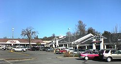
Geography
A small community located in central California near Yosemite National Park. Oakhurst is located at the junction of Highways 41California State Route 41
State Route 41 is a state highway in the U.S. state of California, connecting the Cabrillo Highway in Morro Bay with Fresno and Yosemite National Park via the San Joaquin Valley. Except between US 101 in Atascadero and SR 46 near Shandon, SR 41 is part of the California Freeway and Expressway...
& 49
California State Route 49
State Route 49 is a north–south state highway in the U.S. state of California that passes through many historic mining communities of the 1849 California gold rush. Highway 49 is numbered after the "49ers", the waves of immigrants who swept into the area looking for gold, and a portion of it...
, at the southern end of California's gold country.
Oakhurst is located at 37°19′41"N 119°38′58"W.
According to the United States Census Bureau
United States Census Bureau
The United States Census Bureau is the government agency that is responsible for the United States Census. It also gathers other national demographic and economic data...
, the CDP has a total area of 6 square miles (15.5 km²), of which, 6 square miles (15.5 km²) of it is land and 0.12% is water.
History
The Fresno Flats post office opened in 1873, moved and changed its name to Oakhurst in 1912. MLB pitcher Ted Lilly attended high school at Yosemite High School, one of two of the towns high schools.2010
The 2010 United States Census reported that Oakhurst had a population of 2,829. The population densityPopulation density
Population density is a measurement of population per unit area or unit volume. It is frequently applied to living organisms, and particularly to humans...
was 471.0 people per square mile (181.9/km²). The racial makeup of Oakhurst was 2,532 (89.5%) White, 22 (0.8%) African American, 61 (2.2%) Native American, 44 (1.6%) Asian, 3 (0.1%) Pacific Islander, 66 (2.3%) from other races
Race (United States Census)
Race and ethnicity in the United States Census, as defined by the Federal Office of Management and Budget and the United States Census Bureau, are self-identification data items in which residents choose the race or races with which they most closely identify, and indicate whether or not they are...
, and 101 (3.6%) from two or more races. Hispanic or Latino of any race were 473 persons (16.7%).
The Census reported that 2,772 people (98.0% of the population) lived in households, 0 (0%) lived in non-institutionalized group quarters, and 57 (2.0%) were institutionalized.
There were 1,226 households, out of which 301 (24.6%) had children under the age of 18 living in them, 515 (42.0%) were opposite-sex married couples
Marriage
Marriage is a social union or legal contract between people that creates kinship. It is an institution in which interpersonal relationships, usually intimate and sexual, are acknowledged in a variety of ways, depending on the culture or subculture in which it is found...
living together, 153 (12.5%) had a female householder with no husband present, 76 (6.2%) had a male householder with no wife present. There were 61 (5.0%) unmarried opposite-sex partnerships
POSSLQ
POSSLQ is an abbreviation for "Persons of Opposite Sex Sharing Living Quarters," a term coined in the late 1970s by the United States Census Bureau as part of an effort to more accurately gauge the prevalence of cohabitation in American households....
, and 14 (1.1%) same-sex married couples or partnerships. 386 households (31.5%) were made up of individuals and 216 (17.6%) had someone living alone who was 65 years of age or older. The average household size was 2.26. There were 744 families
Family (U.S. Census)
A family or family household is defined by the United States Census Bureau for statistical purposes as "a householder and one or more other people related to the householder by birth, marriage, or adoption. They do not include same-sex married couples even if the marriage was performed in a state...
(60.7% of all households); the average family size was 2.80.
The population was spread out with 526 people (18.6%) under the age of 18, 228 people (8.1%) aged 18 to 24, 567 people (20.0%) aged 25 to 44, 758 people (26.8%) aged 45 to 64, and 750 people (26.5%) who were 65 years of age or older. The median age was 48.4 years. For every 100 females there were 90.5 males. For every 100 females age 18 and over, there were 86.2 males.
There were 1,379 housing units at an average density of 229.6 per square mile (88.6/km²), of which 691 (56.4%) were owner-occupied, and 535 (43.6%) were occupied by renters. The homeowner vacancy rate was 3.5%; the rental vacancy rate was 5.5%. 1,485 people (52.5% of the population) lived in owner-occupied housing units and 1,287 people (45.5%) lived in rental housing units.
2000
As of the censusCensus
A census is the procedure of systematically acquiring and recording information about the members of a given population. It is a regularly occurring and official count of a particular population. The term is used mostly in connection with national population and housing censuses; other common...
of 2000, there were 2868 people, 1,250 households, and 773 families residing in the CDP. The population density
Population density
Population density is a measurement of population per unit area or unit volume. It is frequently applied to living organisms, and particularly to humans...
was 484.8 people per square mile (187.1/km²). There were 1,380 housing units at an average density of 233.3 per square mile (90.0/km²). The racial makeup of the CDP was 87.62% White, 0.45% African American, 2.93% Native American, 1.05% Asian, 0.10% Pacific Islander, 6.03% from other races
Race (United States Census)
Race and ethnicity in the United States Census, as defined by the Federal Office of Management and Budget and the United States Census Bureau, are self-identification data items in which residents choose the race or races with which they most closely identify, and indicate whether or not they are...
, and 1.81% from two or more races. Hispanic or Latino of any race were 9.94% of the population.
There were 1,250 households out of which 23.7% had children under 18 living with them, 44.6% were married couples
Marriage
Marriage is a social union or legal contract between people that creates kinship. It is an institution in which interpersonal relationships, usually intimate and sexual, are acknowledged in a variety of ways, depending on the culture or subculture in which it is found...
living together, 12.4% had a female householder with no husband present, and 38.1% were non-families. 31.3% of all households were made up of individuals and 19.7% had someone living alone who was 65 years of age or older. The average household size was 2.21 and the average family size was 2.72.
In the CDP the population was spread out with 19.7% under the age of 18, 7.9% from 18 to 24, 21.5% from 25 to 44, 24.2% from 45 to 64, and 26.7% who were 65 years of age or older. The median age was 46 years. For every 100 females there were 86.0 males. For every 100 females age 18 and over, there were 81.1 males.
The median income for a household in the CDP was $27,679, and the median income for a family was $35,495. Males had a median income of $36,979 versus $21,111 for females. The per capita income
Per capita income
Per capita income or income per person is a measure of mean income within an economic aggregate, such as a country or city. It is calculated by taking a measure of all sources of income in the aggregate and dividing it by the total population...
for the CDP was $16,851. About 12.8% of families and 17.3% of the population were below the poverty line, including 27.2% of those under age 18 and 10.9% of those age 65 or over. Tourism constitutes the major industry.
On February 5, 2008 residents voted on Measure C. The outcome decided that Oakhurst would not incorporate as a city. The residents voted to remain unincorporated.
Politics
In the state legislatureCalifornia State Legislature
The California State Legislature is the state legislature of the U.S. state of California. It is a bicameral body consisting of the lower house, the California State Assembly, with 80 members, and the upper house, the California State Senate, with 40 members...
Oakhurst is located in the 14th Senate
California State Senate
The California State Senate is the upper house of the California State Legislature. There are 40 state senators. The state legislature meets in the California State Capitol in Sacramento. The Lieutenant Governor is the ex officio President of the Senate and may break a tied vote...
District, represented by Republican
Republican Party (United States)
The Republican Party is one of the two major contemporary political parties in the United States, along with the Democratic Party. Founded by anti-slavery expansion activists in 1854, it is often called the GOP . The party's platform generally reflects American conservatism in the U.S...
Tom Berryhill
Tom Berryhill
Tom Berryhill is a Republican politician in the United States who currently represents the 14th district in the California State Senate...
, and in the 25th Assembly
California State Assembly
The California State Assembly is the lower house of the California State Legislature. There are 80 members in the Assembly, representing an approximately equal number of constituents, with each district having a population of at least 420,000...
District, represented by Republican Kristin Olsen
Kristin Olsen
Kristin Olsen is an American politician currently serving in the California State Assembly. She is a Republican representing the 25th district, encompassing Calaveras, Mariposa, Mono, and Tuolumne counties, and parts of Madera and Stanislaus counties...
. Federally, Oakhurst is located in California's 19th congressional district
California's 19th congressional district
California's 19th congressional district is a congressional district located in the U.S. state of California that covers parts of Fresno, Madera, Mariposa, Tuolumne, and Stanislaus counties....
, which has a Cook PVI
Cook Partisan Voting Index
The Cook Partisan Voting Index , sometimes referred to as simply the Partisan Voting Index , is a measurement of how strongly an American congressional district or state leans toward one political party compared to the nation as a whole...
of R +10 and is represented by Republican Jeff Denham
Jeff Denham
Jeffrey John "Jeff" Denham is the U.S. Representative for . He is a member of the Republican Party.He previously served two terms in the California State Senate, representing the 12th District, which includes Madera, Merced, Monterey, San Benito and Stanislaus counties. Denham was the second...
.
In February 2008 Measure C, to incorporate Oakhurst as a city was defeated at the ballot box.
Industry
Oakhurst earned the nickname of "birthplace of computer gaming" being home to the pioneering computer game developer Sierra On-line from 1981 to 1999.Many industry firsts were achieved in Oakhurst including the development of the first 3D adventure game (King's Quest
King's Quest
King's Quest is an adventure game series created by the American software company Sierra Entertainment. It is widely considered a classic series from the golden era of adventure games. Following the success of its first installment, the series was primarily responsible for building the reputation...
, 1984) and one of the first online gaming networks (The Sierra Network, 1989).
Sierra Entertainment
Sierra Entertainment
Sierra Entertainment Inc. was an American video-game developer and publisher founded in 1979 as On-Line Systems by Ken and Roberta Williams...
, headquartered in Los Angeles, CA continued to publish games for the personal computer and popular gaming consoles until 2008 when their parent company Vivendi Universal merged with games publisher Activision
Activision
Activision is an American publisher, majority owned by French conglomerate Vivendi SA. Its current CEO is Robert Kotick. It was founded on October 1, 1979 and was the world's first independent developer and distributor of video games for gaming consoles...
. The Sierra name was then closed down for possible future sale.
Public utilities
Cable televisionCable television
Cable television is a system of providing television programs to consumers via radio frequency signals transmitted to televisions through coaxial cables or digital light pulses through fixed optical fibers located on the subscriber's property, much like the over-the-air method used in traditional...
services for the town of Oakhurst are contracted to Northland Cable TV.
Sierra Telephone Company, which serves northern Madera County and much of adjoining Mariposa County
Mariposa County, California
Mariposa County is a county in the U.S. state of California, located in the western foothills of the Sierra Nevada mountains. It lies north of Fresno, east of Merced, and southeast of Stockton. As of the 2010 census, the population was 18,251 up from 17,130 at the 2000 census...
, is based in Oakhurst.