
Berkeley, California
Encyclopedia
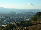
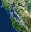
Berkeley is a city on the east shore of the San Francisco Bay
in Northern California
, United States
. Its neighbors to the south are the cities of Oakland
and Emeryville
. To the north is the city of Albany
and the unincorporated
community of Kensington
. The eastern city limits coincide with the county line (bordering Contra Costa County
), which generally follows the ridge line of the Berkeley Hills
. Berkeley is located in northern Alameda County
. The population was 112,580 at the 2010 census.
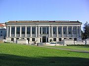
Berkeley is the site of the University of California, Berkeley
, the oldest of the University of California
system, and the Lawrence Berkeley National Laboratory
. It is also home to the Graduate Theological Union
. The city is noted as one of the most politically liberal in the nation, with one study placing it as the third most liberal city in the United States.
people when the first Europeans arrived. Remnants of their existence in the area include pits in rock formations, which they used to grind acorns, and a shellmound, now mostly leveled and covered up, along the shoreline of San Francisco Bay
at the mouth of Strawberry Creek
. Other artifacts were discovered in the 1950s in the downtown area during remodeling of a commercial building, near the upper course of the creek.
The first people of European descent (most of whom were born in America, and many of whom were of mixed ancestry) arrived with the De Anza Expedition in 1776. Today, this is noted by signage on Interstate 80, which runs along the San Francisco Bay shoreline of Berkeley. The De Anza Expedition led to establishment of the Spanish Presidio of San Francisco
at the entrance to San Francisco Bay (the Golden Gate
), which is due west of Berkeley. Luís Peralta
was among the soldiers at the Presidio. For his services to the King of Spain, he was granted a vast stretch of land on the east shore of San Francisco Bay (the contra costa, "opposite shore") for a ranch, including that portion that now comprises the City of Berkeley.
Luís Peralta named his holding, "Rancho San Antonio." The primary activity of the ranch was raising cattle for meat and hides, but hunting and farming were also pursued. Eventually, Peralta gave portions of the ranch to each of his four sons. What is now Berkeley lies mostly in the portion that went to Peralta's son, Domingo, with a little in the portion that went to another son, Vicente. No artifact survives of the ranches of Domingo or Vicente, although their names have been preserved in the naming of Berkeley streets (Vicente, Domingo, and Peralta). However, legal title to all land in the City of Berkeley remains based on the original Peralta land grant.
The Peraltas' Rancho San Antonio continued after Alta California
passed from Spanish to Mexican sovereignty after the Mexican War of Independence
. However, the advent of U.S. sovereignty after the Mexican–American War
, and especially, the Gold Rush
, saw the Peralta's lands quickly encroached on by squatters and diminished by dubious legal proceedings. The lands of the brothers Domingo and Vicente were quickly reduced to reservations close to their respective ranch homes. The rest of the land was surveyed and parceled out to various American claimants (See Kellersberger's Map
).
Politically, the area that became Berkeley was initially part of a vast Contra Costa County. On March 25, 1853, Alameda County was created by division of Contra Costa County, as well as from a small portion of Santa Clara County.
The area of Berkeley was at this period mostly a mix of open land, farms and ranches, with a small though busy wharf by the bay. It was not yet "Berkeley," but merely the northern part of the "Oakland Township" subdivision of Alameda County.
looked for a new site. It settled on a location north of Oakland along the foot of the Contra Costa Range
(later called the Berkeley Hills) astride Strawberry Creek
, at an elevation about 500 feet (152.4 m) above the bay, commanding a fantastic view of the Bay Area and the Pacific Ocean through the Golden Gate
.
According to the Centennial Record of the University of California, "In 1866…at Founders' Rock
, a group of College of California men watched two ships standing out to sea through the Golden Gate
. One of them, Frederick Billings, thought of the lines of the Anglo-Irish Anglican Bishop George Berkeley
, 'westward the course of empire takes its way,' and suggested that the town and college site be named for the eighteenth-century Anglo-Irish philosopher."
The College of California's College Homestead Association planned to raise funds for the new campus by selling off parcels of land adjacent to it. To this end, they laid out a plat and street grid that became the basis of Berkeley's modern street plan. Their plans fell far short of their desires, and collaboration was then begun with the State of California, which culminated in 1868 with the creation of the public University of California
.
As construction began on the new site, more residences were constructed in the vicinity of the new campus. At the same time, a settlement of residences, saloons, and various industries grew around the wharf area called "Ocean View." A horsecar
ran from Temescal
in Oakland to the university campus along what is now Telegraph Avenue
.
By the 1870s, the Transcontinental Railroad
reached its terminus in Oakland. In 1876, a branch line of the Central Pacific Railroad
, the Berkeley Branch Railroad
, was laid from a junction with the mainline called Shellmound (now a part of Emeryville) into what is now downtown Berkeley
. That same year, the mainline of the transcontinental railroad into Oakland was re-routed, putting the right-of-way along the bay shore through Ocean View.
There was a strong prohibition movement in Berkeley at this time. In 1876 the "mile limit law" was passed, which prevented sale or public consumption of alcohol within one mile (1.6 km) of the new University of California. Then, in 1899 Berkeley residents voted to make their city an alcohol-free zone. Scientists, scholars and religious leaders spoke vehemently of the dangers of alcohol.
The first post office opened in 1872.
In 1878, the people of Ocean View and the area around the University campus, together with local farmers, incorporated themselves as the Town of Berkeley. The first elected trustees of the town were the slate of Denis Kearney's Workingman's Party
, who were particularly favored in the working class area of the former Ocean View, now called "West Berkeley." The area near the university became known as "East Berkeley."
The modern age came quickly to Berkeley, no doubt due to the influence of the university. Electric light
s were in use by 1888. The telephone
had already come to town. Electric streetcars soon replaced the horsecar
. A silent film of one of these early streetcars in Berkeley can be seen at the Library of Congress
website: "A Trip To Berkeley, California"
. The town and other parts of the East Bay somehow managed to escape serious damage from the massive temblor, and thousands of refugees flowed across the Bay.
In 1908, a statewide referendum that proposed moving the California state capital to Berkeley was defeated by a margin of about 33,000 votes. A legacy of this ballot measure that survives was the naming of streets in the vicinity of the proposed capitol grounds for the counties of California.
In 1909, the citizens of Berkeley adopted a new charter, and the Town of Berkeley became the City of Berkeley. Rapid growth continued up to the Crash of 1929. The Great Depression
hit Berkeley hard, but not as hard as many other places in the U.S., thanks in part to the University.
On September 17, 1923, a major fire
swept down the hills toward the University campus and the downtown section. Some 640 structures burned before a late afternoon sea breeze stopped its progress, allowing firefighters to put it out.
The next big growth occurred with the advent of World War II
, when large numbers of people moved to the Bay Area to work in the many war industries, such as the immense Kaiser Shipyards
in nearby Richmond
. One who moved out, but played a big role in the outcome of the War was U.C. Professor and Berkeley resident J. Robert Oppenheimer. During the war, an Army base, Camp Ashby
, was temporarily sited in Berkeley.
induced the University to demand a loyalty oath from its professors, many of whom refused to sign the oath on the principle of freedom of thought. In 1960, a U.S. House committee (HUAC) came to San Francisco to investigate the influence of communists in the Bay Area. Their presence was met by protesters, including many from the University. Meanwhile, a number of U.C. students became active in support of the Civil Rights Movement
. Finally, the University in 1964 provoked a massive student protest by banning distribution of political literature on campus. This protest became the Free Speech Movement
. As the Vietnam War
rapidly escalated in the ensuing years, so did student activism at the University, particularly that organized by the Vietnam Day Committee
.
Berkeley is strongly identified with the rapid social changes, civic unrest, and political upheaval that characterized the late 1960s. In that period, Berkeley—especially Telegraph Avenue—became a focal point for the hippie
movement, which spilled over the Bay from San Francisco. Many hippies were apolitical drop-outs, rather than students, but in the heady atmosphere of Berkeley in 1967–1969 there was considerable overlap of the hippie movement and the radical left. An iconic event in the Berkeley Sixties scene was a conflict over a parcel of University property south of the contiguous campus site that came to be called "People's Park."
 The battle over disposition of People's Park resulted in a month-long occupation of Berkeley by the National Guard
on orders of then-Governor Ronald Reagan
. In the end, the park remained undeveloped, and remains so today. A spin-off, "People's Park Annex," was established at the same time by activist citizens of Berkeley on a strip of land above the Bay Area Rapid Transit
subway construction along Hearst Avenue northwest of the U.C. campus. The land had also been intended for development, but was turned over to the City by BART and is now Ohlone Park
.
From the 1980s to the present, Berkeley has seen rising housing costs, especially since the mid-1990s. In 2005–2007, sales of homes began to slow, but average home prices, as of 2010, remain among the highest in the nation.
The era of large public protest in Berkeley waned considerably with the end of the Vietnam War in 1974.
In 2006, the Berkeley Oak Grove Protest began protesting construction of a new sports center annex to Memorial Stadium at the expense of a grove of oak trees on the UC campus. The protest ended in September 2008 after a lengthy court process.
In 2007–08, Berkeley received media attention due to demonstrations against a Marine Corps recruiting office in downtown Berkeley and a series of controversial motions by Berkeley's City Council regarding opposition to Marine recruiting. (See Berkeley Marine Corps Recruiting Center controversy
.)
In the Fall of 2011, the nationwide Occupy Wall Street
movement made its appearance on the campus of the University of California.
While the 1960s were the heyday of liberal activism in Berkeley, it remains one of the most overwhelmingly Democratic cities in the United States.
 According to the United States Census Bureau
, the city has a total area of 17.7 square miles (45.8 km²). 10.5 square miles (27.2 km²) of it is land and 7.2 square miles (18.6 km²) of it (40.83%) is water, most of it part of San Francisco Bay
.
Berkeley borders the cities of Albany, Oakland, and Emeryville and Contra Costa County including unincorporated Kensington as well as San Francisco Bay.
Berkeley lies within telephone area code 510 (until September 2, 1991, Berkeley was part of the 415 telephone code that is now exclusive to San Francisco and Marin Counties), and the postal ZIP code
s are 94701 through 94710, 94712, and 94720 for the University of California
campus.
. From there, the land rises dramatically. The highest peak along the ridge line above Berkeley is Grizzly Peak
, elevation 1754 feet (534.6 m). A number of small creeks run from the hills to the Bay through Berkeley: Cerrito
, Codornices
, Schoolhouse
and Strawberry
Creeks are the principal streams. Most of these are largely culverted once they reach the plain west of the hills.
The Berkeley Hills are part of the Pacific Coast Ranges
, and run in a northwest–southeast alignment. In Berkeley, the hills consist mainly of a soft, crumbly rock with outcroppings of harder material of old (and extinct) volcanic origin. These rhyolite
formations can be seen in several city parks and in the yards of a number of private residences. Indian Rock Park
in the northeastern part of Berkeley near the Arlington/Marin Circle features a large example.
Berkeley is traversed by the Hayward Fault, a major branch of the San Andreas Fault
to the west. No large earthquake has occurred on the Hayward Fault near Berkeley in historic times (except possibly in 1836), but seismologists warn about the geologic record of large temblors several times in the deeper past, and their current assessment is that a quake of 6.5 or greater is imminent, sometime within the next 30 years.
The 1868 Hayward earthquake
did occur on the southern segment of the Hayward Fault in the vicinity of today's city of Hayward
(hence, how the fault got its name). This quake destroyed the county seat of Alameda County then located in San Leandro
and it subsequently moved to Oakland. It was strongly felt in San Francisco, causing major damage, and experienced by Samuel Clemens (Mark Twain
). It was regarded as the "Great San Francisco Quake" prior to 1906. The quake produced a furrow in the ground along the fault line in Berkeley, across the grounds of the new State Asylum for the Deaf, Dumb and Blind then under construction, which was noted by one early University of California professor. Though no significant damage was reported to most of the few Berkeley buildings of the time, the 1868 quake did destroy the vulnerable adobe home of Domingo Peralta in north Berkeley.
Today, evidence of the Hayward Fault's "creeping" is visible at various locations in Berkeley. Cracked roadways, sharp jogs in streams, and springs mark the fault's path. However, since it cuts across the base of the hills, the creep is often concealed by or confused with slide activity. Some of the slide activity itself, however, results from movement on the Hayward Fault.
A notorious segment of the Hayward Fault runs lengthwise down the middle of Memorial Stadium
at the mouth of Strawberry Canyon on the University of California campus. Photos and measurements show the movement of the fault through the stadium.
(Köppen climate classification Csb), with dry summers and wet winters. The summers are cooler than a typical Mediterranean climate thanks to upwelling
ocean currents along the California coast. These help produce cool and fog
gy nights and mornings. Berkeley's location directly opposite the Golden Gate
ensures that typical eastward fog flow blankets the city more often than its neighbors.
Winter is punctuated with rainstorms of varying ferocity and duration, but also produces stretches of bright sunny days and clear cold nights. It does not normally snow, though occasionally the hilltops get a dusting. Spring and fall are transitional and intermediate, with some rainfall and variable temperature. Summer typically brings night and morning low clouds or fog
, followed by sunny, warm days. The warmest and driest months are typically June through September, with the highest temperatures occurring in September. Mid-summer (July–August) is often a bit cooler due to the sea breezes and fog common then.
Average January temperatures are a maximum of 56.4 °F (13.6 °C) and a minimum of 43.6 °F (6.4 °C). Average September (the warmest month) temperatures are a maximum of 71.7 °F (22.1 °C) and a minimum of 55.9 °F (13.3 °C). In a year, there are an average of 2.9 days with highs of 90 °F (32.2 °C) or higher, and an average of 0.8 days with lows of 32 °F (0 °C) or lower. The highest recorded temperature was 107 °F (41.7 °C) on June 15, 2000, and the lowest recorded temperature was 24 °F (-4.4 °C) on December 22, 1990.
January is normally the wettest month, averaging 5.13 inches (130.3 mm) of precipitation. Average annual precipitation is 25.4 inches (645.2 mm), falling on an average of 63.7 days each year. The most rainfall in one month was 14.49 inches (368 mm) in February 1998. The most rainfall in 24 hours was 6.98 inches (177.3 mm) on January 4, 1982. Light snow has fallen on rare occasions. Snow has generally fallen every several years on the higher peaks of the Berkeley Hills
.
In the late spring and early fall, strong offshore winds of sinking air typically develop, bringing heat and dryness to the area. In the spring, this is not usually a problem as vegetation is still moist from winter rains, but extreme dryness prevails by the fall, creating a danger of wildfires. In September 1923 a major fire swept through the neighborhoods north of the University campus, stopping just short of downtown. (See 1923 Berkeley fire
). On October 20, 1991, gusty, hot winds fanned a conflagration along the Berkeley–Oakland border, killing 25 people and injuring 150, as well as destroying 2,449 single-family dwellings and 437 apartment and condominium units. (See 1991 Oakland firestorm
)
was 6,361.8 people per square mile (2,456.3/km²). The racial makeup of Berkeley was 66,996 (59.5%) White, 11,241 (10.0%) Black or African American, 479 (0.4%) Native American, 21,690 (19.3%) Asian (8.4% Chinese
, 2.4% Indian
, 2.1% Korean
, 1.6% Japanese
, 1.5% Filipino
, 1.0% Vietnamese
, 0.3% Pakistani
, 0.3% Thai
, 0.2% Nepalese
), 186 (0.2%) Pacific Islander, 4,994 (4.4%) from other races
, and 6,994 (6.2%) from two or more races. Hispanic or Latino of any race were 12,209 persons (10.8%). Among the Hispanic population, 6.8% are Mexican
, 0.5% Puerto Rican
, 0.4% Salvadoran
, 0.3% Peruvian
, 0.3% Guatemalan
.
The Census reported that 99,731 people (88.6% of the population) lived in households, 12,430 (11.0%) lived in non-institutionalized group quarters, and 419 (0.4%) were institutionalized.
There were 46,029 households, out of which 8,467 (18.4%) had children under the age of 18 living in them, 13,569 (29.5%) were opposite-sex married couples
living together, 3,855 (8.4%) had a female householder with no husband present, 1,368 (3.0%) had a male householder with no wife present. There were 2,931 (6.4%) unmarried opposite-sex partnerships
, and 961 (2.1%) same-sex married couples or partnerships. 16,904 households (36.7%) were made up of individuals and 4,578 (9.9%) had someone living alone who was 65 years of age or older. The average household size was 2.17. There were 18,792 families
(40.8% of all households); the average family size was 2.81.
The population was spread out with 13,872 people (12.3%) under the age of 18, 30,295 people (26.9%) aged 18 to 24, 30,231 people (26.9%) aged 25 to 44, 25,006 people (22.2%) aged 45 to 64, and 13,176 people (11.7%) who were 65 years of age or older. The median age was 31.0 years. For every 100 females there were 95.6 males. For every 100 females age 18 and over, there were 94.2 males.
There were 49,454 housing units at an average density of 2,794.6 per square mile (1,079.0/km²), of which 18,846 (40.9%) were owner-occupied, and 27,183 (59.1%) were occupied by renters. The homeowner vacancy rate was 1.0%; the rental vacancy rate was 4.5%. 45,096 people (40.1% of the population) lived in owner-occupied housing units and 54,635 people (48.5%) lived in rental housing units.
of 2000, there were 102,743 people, 44,955 households, and 18,656 families residing in the city. The population density
was 9,823.3 people per square mile (3,792.5/km²), one of the highest in California. There were 46,875 housing units at an average density of 4,481.8 per square mile (1,730.3/km²). 10.2% were of German, 8.9% English
and 8.2% Irish
ancestry according to 2008 American Survey. 73.1% spoke English
, 8.3% Spanish
, 4.5% Chinese
or Mandarin, 1.6% French
, 1.2% Korean
, 1.1% Japanese
and 1.0% German
as their first language.
There were 44,955 households, out of which 17.8% had children under the age of 18 living with them, 28.9% were married couples living together, 9.5% had a female householder with no husband present, and 58.5% were non-families and/or unmarried couples. 38.1% of all households were made up of individuals and 7.9% had someone living alone who was 65 years of age or older. The average household size was 2.16 and the average family size was 2.84.
In the city the population was spread out with 14.1% under the age of 18, 21.6% from 18 to 24, 31.8% from 25 to 44, 22.3% from 45 to 64, and 10.2% who were 65 years of age or older. The median age was 32 years. For every 100 females there were 96.5 males. For every 100 females age 18 and over, there were 95.1 males.
According to a 2007 estimate, the median income for a household in the city was $57,189, and the median income for a family was $93,297. Males had a median income of $50,789 versus $40,623 for females. The per capita income
for the city was $30,477. About 8.3% of families and 20.0% of the population were below the poverty line, including 13.4% of those under age 18 and 7.9% of those age 65 or over.
(Capitol Corridor
), AC Transit
, BART
(Downtown Berkeley Station, North Berkeley, and Ashby
) and bus shuttles operated by major employers including UC Berkeley
and Lawrence Berkeley National Laboratory
. The Eastshore Freeway (Interstate 80 and Interstate 580
) runs along the bay shoreline. Each day there is an influx of thousands of cars into the city by commuting UC faculty, staff and students, making parking for more than a few hours an expensive proposition.
Berkeley has one of the highest rates of bicycle
and pedestrian commuting in the nation. Berkeley is the safest city of its size in California for pedestrians and cyclists, considering the number of injuries per pedestrian and cyclist, rather than per capita.
Berkeley has modified its original grid roadway structure through use of diverters and barriers, moving most traffic out of neighborhoods and onto arterial streets (visitors often find this confusing, because the diverters are not shown on all maps). Berkeley maintains a separate grid of arterial streets for bicycles, called Bicycle Boulevards, with bike lanes and lower amounts of car traffic than the major streets they often parallel.
Berkeley hosts car sharing networks run by City CarShare, U Car Share
, and Zipcar
. Rather than owning (and parking) their own cars, members share a group of cars parked nearby. Web- and telephone-based reservation systems keep track of hours and charges. Several "pods" (points of departure where cars are kept) exist throughout the city, in several downtown locations, at the Ashby and North Berkeley BART stations, and at various other locations in Berkeley (and other cities in the region). Using alternative transportation is encouraged.
Berkeley has had recurring problems with parking meter
vandalism. In 1999, over 2,400 Berkeley meters were jammed, smashed, or sawed apart. Starting in 2005 and continuing into 2006, Berkeley began to phase out mechanical meters in favor of more centralized electronic meters.
's Berkeley Branch Railroad
, a standard gauge
steam railroad
, which terminated in downtown Berkeley, and connected in Emeryville (at a locale then known as "Shellmound") with trains to the Oakland ferry pier
as well as with the Central Pacific main line starting in 1876. The Berkeley Branch line was extended from Shattuck and University to Vine Street ("Berryman's Station") in 1878. Starting in 1882, Berkeley trains ran directly to the Oakland Pier. In the 1880s, Southern Pacific
assumed operations of the Berkeley Branch. In 1911, Southern Pacific electrified this line and the several others it constructed in Berkeley, creating its East Bay Electric Lines
division. The huge and heavy cars specially built for these lines came to be called the "Red Trains" or the "Big Red Cars." The Shattuck line was extended and connected with two other Berkeley lines (the Ninth Street Line and the California Street line) at Solano and Colusa (the "Colusa Wye"). It was at this time that the Northbrae Tunnel
and the Rose Street Undercrossing were constructed, both of which still exist (the Rose Street Undercrossing is not accessible to the public, being situated between what is now two backyards). The fourth Berkeley line was the Ellsworth St. line to the university campus. The last Red Trains ran in July, 1941.
The first electric rail service in Berkeley was provided by several small streetcar companies starting in 1891. Most of these were eventually bought up by the Key System
of Francis "Borax" Smith who added lines and improved equipment. The Key System's streetcars were operated by its East Bay Street Railways division. Principal lines in Berkeley ran on Euclid, The Arlington, College, Telegraph, Shattuck, San Pablo, University, and Grove (today's Martin Luther King Jr. Way). The last streetcars ran in 1948, replaced by buses.
The first electric commuter interurban-type trains to San Francisco from Berkeley were put in operation by the Key System in 1903, several years before the Southern Pacific electrified its steam commuter lines. Like the SP, Key trains ran to a pier serviced by the Key's own fleet of ferryboats
, which also docked at the Ferry Building in San Francisco. After the Bay Bridge was built, the Key trains ran to the Transbay Terminal in San Francisco, sharing tracks on the lower deck of the Bay Bridge with the SP's red trains and the Sacramento Northern Railroad. It was at this time that the Key trains acquired their letter designations, which were later preserved by Key's public successor, AC Transit. Today's F bus is the successor of the F train. Likewise, the E, G and the H. Before the Bridge, these lines were simply the Shattuck Avenue Line, the Claremont Line, the Westbrae Line, and the Sacramento Street Line, respectively.
After the Southern Pacific abandoned transbay service in 1941, the Key System acquired the rights to use its tracks and catenary
on Shattuck north of Dwight Way and through the Northbrae Tunnel to The Alameda for the F-train. The SP tracks along Monterey Avenue as far as Colusa had been acquired by the Key System in 1933 for the H-train, but were abandoned in 1941. The Key System trains stopped running in April 1958. In 1963, the Northbrae Tunnel was opened to auto traffic.
 Berkeley has a number of distinct neighborhoods.
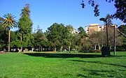
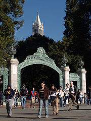
Surrounding the University of California campus
are the most densely populated parts of the city. West of the campus is Downtown Berkeley
, the city's traditional commercial core; home of the civic center
, the city's only public high school
, the busiest BART station in Berkeley, as well as a major transfer point for AC Transit
buses. South of the campus is the Southside
neighborhood, mainly a student ghetto
, where much of the university's student housing
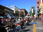
is located. The busiest stretch of Telegraph Avenue
is in this neighborhood. North of the campus is the quieter Northside
neighborhood, the location of the Graduate Theological Union
.
Further from the university campus, the influence of the University quickly becomes less visible. Most of Berkeley's neighborhoods are primarily made up of detached houses, often with separate in-law units in the rear, although larger apartment buildings are also common in many neighborhoods. Commercial activities are concentrated along the major avenues and at important intersections.
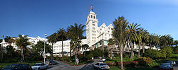
In the southeastern corner of the city is the Claremont District
, home to the Claremont Hotel
; and the Elmwood District
, with a small shopping area on College Avenue. West of Elmwood is South Berkeley
, known for its weekend flea market
at the Ashby Station
.
West of (and including) San Pablo Avenue, a major commercial corridor, is West Berkeley
, the historic commercial center of the city, and the former unincorporated town of Ocean View. West Berkeley contains the remnants of Berkeley's industrial area, much of which has been replaced by retail and office uses, as well as residential live/work loft space, with the decline of manufacturing in the United States. The areas of South and West Berkeley are in the midst of redevelopment. Some residents have opposed redevelopment in this area. Along the shoreline of San Francisco Bay at the foot of University Avenue is the Berkeley Marina
. Nearby is Berkeley's Aquatic Park
, featuring an artificial linear lagoon of San Francisco Bay.
North of Downtown is the North Berkeley neighborhood, which has been nicknamed the "Gourmet Ghetto" because of the concentration of well-known restaurants and other food-related businesses. Further north are Northbrae, a master-planned subdivision from the early 20th century, and Thousand Oaks
. Above these last three neighborhoods, in the northeastern part of Berkeley, are the Berkeley Hills
. The neighborhoods of the Berkeley Hills such as Cragmont and La Loma Park
are notable for their dramatic views, winding streets, and numerous public stairways and paths.
much of which is in Richmond. The city is also heavily involved in creek restoration and wetlands restoration. The Berkeley Marina
and East Shore State Park flank its shoreline at San Francisco Bay
and organizations like the Urban Creeks Council
and Friends of the Five Creeks the former of which is headquartered in Berkeley support the riparian areas in the town and coastlines as well. César Chávez Park
, near the Berkeley Marina, was built at the former site of the city dump.
, including:
.jpg) Historic Districts listed in the National Register of Historic Places:
Historic Districts listed in the National Register of Historic Places:
See List of Berkeley Landmarks, Structures of Merit, and Historic Districts
, the largest cultural center for this community in the United States.
. In the 1960s, Berkeley was one of the earliest US cities to voluntarily desegregate, utilizing a system of buses, still in use. The city has only one public high school, Berkeley High School (BHS)
was established in 1880 and has over 3,000 students .The Berkeley High campus was designated a historic district by the National Register of Historic Places
on January 7, 2008. Saint Mary's College High School, a Catholic school, has its street address in Berkeley, although most of the grounds and buildings are actually in neighboring Albany. Berkeley has 11 elementary schools and three middle schools. There is also the Bay Area Technology School
, the only school in the whole Bay Area to offer a technology- and science-based curriculum, with major connections to leading universities. In addition, Berkeley City College
is a community college
in the Peralta Community College District
.
Gao
, Mali
Dmitrov
, Russia
Blackfeet Nation, Montana
, United States
Jena
, Germany
Ulan-Ude
, Buryatia, Russia
Yurok Tribe
, California
, United States
Uma-Bawang, Malaysia Sakai, Osaka
, Japan
San Antonio Los Ranchos
, El Salvador
Oukasie, South Africa
Yondó
, Colombia
Palma Soriano
, Cuba
León, Nicaragua
San Francisco Bay
San Francisco Bay is a shallow, productive estuary through which water draining from approximately forty percent of California, flowing in the Sacramento and San Joaquin rivers from the Sierra Nevada mountains, enters the Pacific Ocean...
in Northern California
Northern California
Northern California is the northern portion of the U.S. state of California. The San Francisco Bay Area , and Sacramento as well as its metropolitan area are the main population centers...
, United States
United States
The United States of America is a federal constitutional republic comprising fifty states and a federal district...
. Its neighbors to the south are the cities of Oakland
Oakland, California
Oakland is a major West Coast port city on San Francisco Bay in the U.S. state of California. It is the eighth-largest city in the state with a 2010 population of 390,724...
and Emeryville
Emeryville, California
Emeryville is a small city located in Alameda County, California, in the United States. It is located in a corridor between the cities of Berkeley and Oakland, extending to the shore of San Francisco Bay. Its proximity to San Francisco, the Bay Bridge, the University of California, Berkeley, and...
. To the north is the city of Albany
Albany, California
Albany is a city in Alameda County, California, United States. The population was 18,539 at the 2010 census.-History:In 1908, a group of local women protested the dumping of Berkeley garbage in their community...
and the unincorporated
Unincorporated area
In law, an unincorporated area is a region of land that is not a part of any municipality.To "incorporate" in this context means to form a municipal corporation, a city, town, or village with its own government. An unincorporated community is usually not subject to or taxed by a municipal government...
community of Kensington
Kensington, California
Kensington is an unincorporated community and census-designated place located in the East Bay, part of the San Francisco Bay Area, in Contra Costa County, California, United States. The population was 5,077 at the 2010 census.- Law and government :Kensington is an unincorporated area of Contra...
. The eastern city limits coincide with the county line (bordering Contra Costa County
Contra Costa County, California
Contra Costa County is a primarily suburban county in the San Francisco Bay Area of the U.S. state of California. As of the 2010 census, it had a population of 1,049,025...
), which generally follows the ridge line of the Berkeley Hills
Berkeley Hills
The Berkeley Hills are a range of the Pacific Coast Ranges that overlook the northeast side of the valley that surrounds San Francisco Bay. They were previously called the "Contra Costa Range/Hills" , but with the establishment of Berkeley and the University of California, the current usage was...
. Berkeley is located in northern Alameda County
Alameda County, California
Alameda County is a county in the U.S. state of California. It occupies most of the East Bay region of the San Francisco Bay Area. As of the 2010 census it had a population of 1,510,271, making it the 7th most populous county in the state...
. The population was 112,580 at the 2010 census.
Berkeley is the site of the University of California, Berkeley
University of California, Berkeley
The University of California, Berkeley , is a teaching and research university established in 1868 and located in Berkeley, California, USA...
, the oldest of the University of California
University of California
The University of California is a public university system in the U.S. state of California. Under the California Master Plan for Higher Education, the University of California is a part of the state's three-tier public higher education system, which also includes the California State University...
system, and the Lawrence Berkeley National Laboratory
Lawrence Berkeley National Laboratory
The Lawrence Berkeley National Laboratory , is a U.S. Department of Energy national laboratory conducting unclassified scientific research. It is located on the grounds of the University of California, Berkeley, in the Berkeley Hills above the central campus...
. It is also home to the Graduate Theological Union
Graduate Theological Union
The Graduate Theological Union ' is a consortium of nine independent theological schools, and eleven centers and affiliates. Eight of the theological schools are located in Berkeley, California. The GTU was founded in 1962. It maintains the Graduate Theological Union Library, one of the most...
. The city is noted as one of the most politically liberal in the nation, with one study placing it as the third most liberal city in the United States.
Early history
The site of today's City of Berkeley was the territory of the Chochen/Huichin band of the OhloneOhlone
The Ohlone people, also known as the Costanoan, are a Native American people of the central California coast. When Spanish explorers and missionaries arrived in the late 18th century, the Ohlone inhabited the area along the coast from San Francisco Bay through Monterey Bay to the lower Salinas Valley...
people when the first Europeans arrived. Remnants of their existence in the area include pits in rock formations, which they used to grind acorns, and a shellmound, now mostly leveled and covered up, along the shoreline of San Francisco Bay
San Francisco Bay
San Francisco Bay is a shallow, productive estuary through which water draining from approximately forty percent of California, flowing in the Sacramento and San Joaquin rivers from the Sierra Nevada mountains, enters the Pacific Ocean...
at the mouth of Strawberry Creek
Strawberry Creek
Strawberry Creek is the principal watercourse running through the city of Berkeley, California. Two forks rise in the Berkeley Hills of the California Coast Ranges, and form a confluence at the campus of the University of California, Berkeley...
. Other artifacts were discovered in the 1950s in the downtown area during remodeling of a commercial building, near the upper course of the creek.
The first people of European descent (most of whom were born in America, and many of whom were of mixed ancestry) arrived with the De Anza Expedition in 1776. Today, this is noted by signage on Interstate 80, which runs along the San Francisco Bay shoreline of Berkeley. The De Anza Expedition led to establishment of the Spanish Presidio of San Francisco
Presidio of San Francisco
The Presidio of San Francisco is a park on the northern tip of the San Francisco Peninsula in San Francisco, California, within the Golden Gate National Recreation Area...
at the entrance to San Francisco Bay (the Golden Gate
Golden Gate
The Golden Gate is the North American strait connecting San Francisco Bay to the Pacific Ocean. Since 1937 it has been spanned by the Golden Gate Bridge...
), which is due west of Berkeley. Luís Peralta
Luís María Peralta
Luis María Peralta was a soldier in the Spanish Army, who received one of the largest of the Spanish land grants, Rancho San Antonio, a plot that encompassed most of the East Bay region of California.-Biography:...
was among the soldiers at the Presidio. For his services to the King of Spain, he was granted a vast stretch of land on the east shore of San Francisco Bay (the contra costa, "opposite shore") for a ranch, including that portion that now comprises the City of Berkeley.
Luís Peralta named his holding, "Rancho San Antonio." The primary activity of the ranch was raising cattle for meat and hides, but hunting and farming were also pursued. Eventually, Peralta gave portions of the ranch to each of his four sons. What is now Berkeley lies mostly in the portion that went to Peralta's son, Domingo, with a little in the portion that went to another son, Vicente. No artifact survives of the ranches of Domingo or Vicente, although their names have been preserved in the naming of Berkeley streets (Vicente, Domingo, and Peralta). However, legal title to all land in the City of Berkeley remains based on the original Peralta land grant.
The Peraltas' Rancho San Antonio continued after Alta California
Alta California
Alta California was a province and territory in the Viceroyalty of New Spain and later a territory and department in independent Mexico. The territory was created in 1769 out of the northern part of the former province of Las Californias, and consisted of the modern American states of California,...
passed from Spanish to Mexican sovereignty after the Mexican War of Independence
Mexican War of Independence
The Mexican War of Independence was an armed conflict between the people of Mexico and the Spanish colonial authorities which started on 16 September 1810. The movement, which became known as the Mexican War of Independence, was led by Mexican-born Spaniards, Mestizos and Amerindians who sought...
. However, the advent of U.S. sovereignty after the Mexican–American War
Mexican–American War
The Mexican–American War, also known as the First American Intervention, the Mexican War, or the U.S.–Mexican War, was an armed conflict between the United States and Mexico from 1846 to 1848 in the wake of the 1845 U.S...
, and especially, the Gold Rush
California Gold Rush
The California Gold Rush began on January 24, 1848, when gold was found by James W. Marshall at Sutter's Mill in Coloma, California. The first to hear confirmed information of the gold rush were the people in Oregon, the Sandwich Islands , and Latin America, who were the first to start flocking to...
, saw the Peralta's lands quickly encroached on by squatters and diminished by dubious legal proceedings. The lands of the brothers Domingo and Vicente were quickly reduced to reservations close to their respective ranch homes. The rest of the land was surveyed and parceled out to various American claimants (See Kellersberger's Map
Kellersberger's Map
Kellersberger's Map is a plat map created in 1856 of Rancho San Antonio on the northeastern shore lands, the Contra Costa of San Francisco Bay, in present day Alameda County, California....
).
Politically, the area that became Berkeley was initially part of a vast Contra Costa County. On March 25, 1853, Alameda County was created by division of Contra Costa County, as well as from a small portion of Santa Clara County.
The area of Berkeley was at this period mostly a mix of open land, farms and ranches, with a small though busy wharf by the bay. It was not yet "Berkeley," but merely the northern part of the "Oakland Township" subdivision of Alameda County.
Late 19th century
In 1866, Oakland's private College of CaliforniaCollege of California
The College of California was the predecessor of the University of California system of public universities. The private college was founded in 1855 by noted educator Dr. Samuel H. Willey...
looked for a new site. It settled on a location north of Oakland along the foot of the Contra Costa Range
Berkeley Hills
The Berkeley Hills are a range of the Pacific Coast Ranges that overlook the northeast side of the valley that surrounds San Francisco Bay. They were previously called the "Contra Costa Range/Hills" , but with the establishment of Berkeley and the University of California, the current usage was...
(later called the Berkeley Hills) astride Strawberry Creek
Strawberry Creek
Strawberry Creek is the principal watercourse running through the city of Berkeley, California. Two forks rise in the Berkeley Hills of the California Coast Ranges, and form a confluence at the campus of the University of California, Berkeley...
, at an elevation about 500 feet (152.4 m) above the bay, commanding a fantastic view of the Bay Area and the Pacific Ocean through the Golden Gate
Golden Gate
The Golden Gate is the North American strait connecting San Francisco Bay to the Pacific Ocean. Since 1937 it has been spanned by the Golden Gate Bridge...
.
According to the Centennial Record of the University of California, "In 1866…at Founders' Rock
Founders' Rock
On the corner of Hearst Avenue and Gayley Road, in Berkeley, California, lies the Founders' Rock, the spot, according to college lore, where the 12 trustees of the College of California, the nascent University of California, Berkeley, stood on April 16, 1860, to dedicate the property they had just...
, a group of College of California men watched two ships standing out to sea through the Golden Gate
Golden Gate
The Golden Gate is the North American strait connecting San Francisco Bay to the Pacific Ocean. Since 1937 it has been spanned by the Golden Gate Bridge...
. One of them, Frederick Billings, thought of the lines of the Anglo-Irish Anglican Bishop George Berkeley
George Berkeley
George Berkeley , also known as Bishop Berkeley , was an Irish philosopher whose primary achievement was the advancement of a theory he called "immaterialism"...
, 'westward the course of empire takes its way,' and suggested that the town and college site be named for the eighteenth-century Anglo-Irish philosopher."
The College of California's College Homestead Association planned to raise funds for the new campus by selling off parcels of land adjacent to it. To this end, they laid out a plat and street grid that became the basis of Berkeley's modern street plan. Their plans fell far short of their desires, and collaboration was then begun with the State of California, which culminated in 1868 with the creation of the public University of California
University of California
The University of California is a public university system in the U.S. state of California. Under the California Master Plan for Higher Education, the University of California is a part of the state's three-tier public higher education system, which also includes the California State University...
.
As construction began on the new site, more residences were constructed in the vicinity of the new campus. At the same time, a settlement of residences, saloons, and various industries grew around the wharf area called "Ocean View." A horsecar
Horsecar
A horsecar or horse-drawn tram is an animal-powered streetcar or tram.These early forms of public transport developed out of industrial haulage routes that had long been in existence, and from the omnibus routes that first ran on public streets in the 1820s, using the newly improved iron or steel...
ran from Temescal
Temescal, Oakland, California
Temescal is one of the oldest neighborhoods in Oakland, California. It is located in North Oakland, centered on Telegraph Avenue, and bordered by Broadway and State Route 24 to the east and west. MacArthur Boulevard is to the south...
in Oakland to the university campus along what is now Telegraph Avenue
Telegraph Avenue
Telegraph Avenue is a street that begins, at its southernmost point, in the midst of the historic downtown district of Oakland, California, USA, and ends, at its northernmost point, at the southern edge of the University of California campus in Berkeley, California...
.
By the 1870s, the Transcontinental Railroad
Transcontinental railroad
A transcontinental railroad is a contiguous network of railroad trackage that crosses a continental land mass with terminals at different oceans or continental borders. Such networks can be via the tracks of either a single railroad, or over those owned or controlled by multiple railway companies...
reached its terminus in Oakland. In 1876, a branch line of the Central Pacific Railroad
Central Pacific Railroad
The Central Pacific Railroad is the former name of the railroad network built between California and Utah, USA that formed part of the "First Transcontinental Railroad" in North America. It is now part of the Union Pacific Railroad. Many 19th century national proposals to build a transcontinental...
, the Berkeley Branch Railroad
Berkeley Branch Railroad
The Berkeley Branch Railroad was a long branch line of the Central Pacific Railroad from a junction in what later became Emeryville called "Shellmound" to what soon became downtown Berkeley, adjacent to the new University of California campus. The line opened on August 16, 1876. The initial...
, was laid from a junction with the mainline called Shellmound (now a part of Emeryville) into what is now downtown Berkeley
Downtown Berkeley, California
Downtown Berkeley is the central business district of the city of Berkeley, California, United States, around the intersection of Shattuck Avenue and Center Street, and extending north to Hearst Avenue, south to Dwight Way, west to Martin Luther King Jr. Way, and east to Oxford Street...
. That same year, the mainline of the transcontinental railroad into Oakland was re-routed, putting the right-of-way along the bay shore through Ocean View.
There was a strong prohibition movement in Berkeley at this time. In 1876 the "mile limit law" was passed, which prevented sale or public consumption of alcohol within one mile (1.6 km) of the new University of California. Then, in 1899 Berkeley residents voted to make their city an alcohol-free zone. Scientists, scholars and religious leaders spoke vehemently of the dangers of alcohol.
The first post office opened in 1872.
In 1878, the people of Ocean View and the area around the University campus, together with local farmers, incorporated themselves as the Town of Berkeley. The first elected trustees of the town were the slate of Denis Kearney's Workingman's Party
Workingman's Party
The Workingman's Party was a California labor organization led by Denis Kearney in the 1870s. The party took particular aim against Chinese immigrant labor and the Central Pacific Railroad which employed them. Its famous slogan was "The Chinese must go!" They held large Sunday afternoon rallies...
, who were particularly favored in the working class area of the former Ocean View, now called "West Berkeley." The area near the university became known as "East Berkeley."
The modern age came quickly to Berkeley, no doubt due to the influence of the university. Electric light
Electric light
Electric lights are a convenient and economic form of artificial lighting which provide increased comfort, safety and efficiency. Most electric lighting is powered by centrally-generated electric power, but lighting may also be powered by mobile or standby electric generators or battery systems...
s were in use by 1888. The telephone
Telephone
The telephone , colloquially referred to as a phone, is a telecommunications device that transmits and receives sounds, usually the human voice. Telephones are a point-to-point communication system whose most basic function is to allow two people separated by large distances to talk to each other...
had already come to town. Electric streetcars soon replaced the horsecar
Horsecar
A horsecar or horse-drawn tram is an animal-powered streetcar or tram.These early forms of public transport developed out of industrial haulage routes that had long been in existence, and from the omnibus routes that first ran on public streets in the 1820s, using the newly improved iron or steel...
. A silent film of one of these early streetcars in Berkeley can be seen at the Library of Congress
Library of Congress
The Library of Congress is the research library of the United States Congress, de facto national library of the United States, and the oldest federal cultural institution in the United States. Located in three buildings in Washington, D.C., it is the largest library in the world by shelf space and...
website: "A Trip To Berkeley, California"
Early 20th century
Berkeley's slow growth ended abruptly with the Great San Francisco Earthquake of 19061906 San Francisco earthquake
The San Francisco earthquake of 1906 was a major earthquake that struck San Francisco, California, and the coast of Northern California at 5:12 a.m. on Wednesday, April 18, 1906. The most widely accepted estimate for the magnitude of the earthquake is a moment magnitude of 7.9; however, other...
. The town and other parts of the East Bay somehow managed to escape serious damage from the massive temblor, and thousands of refugees flowed across the Bay.
In 1908, a statewide referendum that proposed moving the California state capital to Berkeley was defeated by a margin of about 33,000 votes. A legacy of this ballot measure that survives was the naming of streets in the vicinity of the proposed capitol grounds for the counties of California.
In 1909, the citizens of Berkeley adopted a new charter, and the Town of Berkeley became the City of Berkeley. Rapid growth continued up to the Crash of 1929. The Great Depression
Great Depression
The Great Depression was a severe worldwide economic depression in the decade preceding World War II. The timing of the Great Depression varied across nations, but in most countries it started in about 1929 and lasted until the late 1930s or early 1940s...
hit Berkeley hard, but not as hard as many other places in the U.S., thanks in part to the University.
On September 17, 1923, a major fire
1923 Berkeley Fire
The 1923 Berkeley Fire was a conflagration which consumed some 640 structures, including 584 homes in the densely-built neighborhoods north of the campus of the University of California in Berkeley, California on September 17, 1923....
swept down the hills toward the University campus and the downtown section. Some 640 structures burned before a late afternoon sea breeze stopped its progress, allowing firefighters to put it out.
The next big growth occurred with the advent of World War II
World War II
World War II, or the Second World War , was a global conflict lasting from 1939 to 1945, involving most of the world's nations—including all of the great powers—eventually forming two opposing military alliances: the Allies and the Axis...
, when large numbers of people moved to the Bay Area to work in the many war industries, such as the immense Kaiser Shipyards
Kaiser Shipyards
The Kaiser Shipyards were seven major shipbuilding yards located mostly on the U.S. west coast during World War II. They were owned by the Kaiser Shipbuilding Company, a creation of American industrialist Henry J...
in nearby Richmond
Richmond, California
Richmond is a city in western Contra Costa County, California, United States. The city was incorporated on August 7, 1905. It is located in the East Bay, part of the San Francisco Bay Area. It is a residential inner suburb of San Francisco, as well as the site of heavy industry, which has been...
. One who moved out, but played a big role in the outcome of the War was U.C. Professor and Berkeley resident J. Robert Oppenheimer. During the war, an Army base, Camp Ashby
Camp Ashby
Camp Ashby was a temporary U.S. Army installation sited in Berkeley, California during World War II. The base was named for Ashby Avenue, a nearby thoroughfare , which in turn was named for one of Berkeley's earliest settlers, William Ashby .Camp Ashby was used to quarter and train the 779th...
, was temporarily sited in Berkeley.
1950s and 1960s
The postwar years saw moderate growth of the City, as events on the U.C. campus began to build up to the recognizable activism of the sixties. In the 1950s, McCarthyismMcCarthyism
McCarthyism is the practice of making accusations of disloyalty, subversion, or treason without proper regard for evidence. The term has its origins in the period in the United States known as the Second Red Scare, lasting roughly from the late 1940s to the late 1950s and characterized by...
induced the University to demand a loyalty oath from its professors, many of whom refused to sign the oath on the principle of freedom of thought. In 1960, a U.S. House committee (HUAC) came to San Francisco to investigate the influence of communists in the Bay Area. Their presence was met by protesters, including many from the University. Meanwhile, a number of U.C. students became active in support of the Civil Rights Movement
Civil rights movement
The civil rights movement was a worldwide political movement for equality before the law occurring between approximately 1950 and 1980. In many situations it took the form of campaigns of civil resistance aimed at achieving change by nonviolent forms of resistance. In some situations it was...
. Finally, the University in 1964 provoked a massive student protest by banning distribution of political literature on campus. This protest became the Free Speech Movement
Free Speech Movement
The Free Speech Movement was a student protest which took place during the 1964–1965 academic year on the campus of the University of California, Berkeley under the informal leadership of students Mario Savio, Brian Turner, Bettina Aptheker, Steve Weissman, Art Goldberg, Jackie Goldberg, and...
. As the Vietnam War
Vietnam War
The Vietnam War was a Cold War-era military conflict that occurred in Vietnam, Laos, and Cambodia from 1 November 1955 to the fall of Saigon on 30 April 1975. This war followed the First Indochina War and was fought between North Vietnam, supported by its communist allies, and the government of...
rapidly escalated in the ensuing years, so did student activism at the University, particularly that organized by the Vietnam Day Committee
Vietnam Day Committee
The Vietnam Day Committee was a coalition of left-wing political groups, student groups, labour organizations, and pacifist religions in the United States of America that opposed the Vietnam War...
.
Berkeley is strongly identified with the rapid social changes, civic unrest, and political upheaval that characterized the late 1960s. In that period, Berkeley—especially Telegraph Avenue—became a focal point for the hippie
Hippie
The hippie subculture was originally a youth movement that arose in the United States during the mid-1960s and spread to other countries around the world. The etymology of the term 'hippie' is from hipster, and was initially used to describe beatniks who had moved into San Francisco's...
movement, which spilled over the Bay from San Francisco. Many hippies were apolitical drop-outs, rather than students, but in the heady atmosphere of Berkeley in 1967–1969 there was considerable overlap of the hippie movement and the radical left. An iconic event in the Berkeley Sixties scene was a conflict over a parcel of University property south of the contiguous campus site that came to be called "People's Park."
United States National Guard
The National Guard of the United States is a reserve military force composed of state National Guard militia members or units under federally recognized active or inactive armed force service for the United States. Militia members are citizen soldiers, meaning they work part time for the National...
on orders of then-Governor Ronald Reagan
Ronald Reagan
Ronald Wilson Reagan was the 40th President of the United States , the 33rd Governor of California and, prior to that, a radio, film and television actor....
. In the end, the park remained undeveloped, and remains so today. A spin-off, "People's Park Annex," was established at the same time by activist citizens of Berkeley on a strip of land above the Bay Area Rapid Transit
Bay Area Rapid Transit
Bay Area Rapid Transit is a rapid transit system serving the San Francisco Bay Area. The heavy-rail public transit and subway system connects San Francisco with cities in the East Bay and suburbs in northern San Mateo County. BART operates five lines on of track with 44 stations in four counties...
subway construction along Hearst Avenue northwest of the U.C. campus. The land had also been intended for development, but was turned over to the City by BART and is now Ohlone Park
Ohlone Park
Ohlone Park is a public park in the city of Berkeley, California, United States, situated on a strip of land along the north side of Hearst Avenue between Martin Luther King Jr. Way and Sacramento Street...
.
1970s to present
The 1970s saw a decline in the population of Berkeley, partly due to an exodus to the suburbs. Some moved because of the rising cost of living throughout the Bay Area, and others because of the decline and disappearance of many industries in West Berkeley.From the 1980s to the present, Berkeley has seen rising housing costs, especially since the mid-1990s. In 2005–2007, sales of homes began to slow, but average home prices, as of 2010, remain among the highest in the nation.
The era of large public protest in Berkeley waned considerably with the end of the Vietnam War in 1974.
In 2006, the Berkeley Oak Grove Protest began protesting construction of a new sports center annex to Memorial Stadium at the expense of a grove of oak trees on the UC campus. The protest ended in September 2008 after a lengthy court process.
In 2007–08, Berkeley received media attention due to demonstrations against a Marine Corps recruiting office in downtown Berkeley and a series of controversial motions by Berkeley's City Council regarding opposition to Marine recruiting. (See Berkeley Marine Corps Recruiting Center controversy
Berkeley Marine Corps Recruiting Center controversy
The Berkeley Marine Corps Recruiting Center protests began in September 2007 when a small group of protesters from Code Pink began periodically protesting in front of a United States Marine Corps Officer Selection Office located in Downtown Berkeley, California at 64 Shattuck Avenue by standing in...
.)
In the Fall of 2011, the nationwide Occupy Wall Street
Occupy Wall Street
Occupy Wall Street is an ongoing series of demonstrations initiated by the Canadian activist group Adbusters which began September 17, 2011 in Zuccotti Park, located in New York City's Wall Street financial district...
movement made its appearance on the campus of the University of California.
While the 1960s were the heyday of liberal activism in Berkeley, it remains one of the most overwhelmingly Democratic cities in the United States.
Geography
Berkeley is located at 37°52′18"N 122°16′29"W (37.871775, −122.274603).United States Census Bureau
The United States Census Bureau is the government agency that is responsible for the United States Census. It also gathers other national demographic and economic data...
, the city has a total area of 17.7 square miles (45.8 km²). 10.5 square miles (27.2 km²) of it is land and 7.2 square miles (18.6 km²) of it (40.83%) is water, most of it part of San Francisco Bay
San Francisco Bay
San Francisco Bay is a shallow, productive estuary through which water draining from approximately forty percent of California, flowing in the Sacramento and San Joaquin rivers from the Sierra Nevada mountains, enters the Pacific Ocean...
.
Berkeley borders the cities of Albany, Oakland, and Emeryville and Contra Costa County including unincorporated Kensington as well as San Francisco Bay.
Berkeley lies within telephone area code 510 (until September 2, 1991, Berkeley was part of the 415 telephone code that is now exclusive to San Francisco and Marin Counties), and the postal ZIP code
ZIP Code
ZIP codes are a system of postal codes used by the United States Postal Service since 1963. The term ZIP, an acronym for Zone Improvement Plan, is properly written in capital letters and was chosen to suggest that the mail travels more efficiently, and therefore more quickly, when senders use the...
s are 94701 through 94710, 94712, and 94720 for the University of California
University of California
The University of California is a public university system in the U.S. state of California. Under the California Master Plan for Higher Education, the University of California is a part of the state's three-tier public higher education system, which also includes the California State University...
campus.
Geology
Most of Berkeley lies on a rolling sedimentary plain that rises gently from sea level to the base of the Berkeley HillsBerkeley Hills
The Berkeley Hills are a range of the Pacific Coast Ranges that overlook the northeast side of the valley that surrounds San Francisco Bay. They were previously called the "Contra Costa Range/Hills" , but with the establishment of Berkeley and the University of California, the current usage was...
. From there, the land rises dramatically. The highest peak along the ridge line above Berkeley is Grizzly Peak
Grizzly Peak (Berkeley Hills)
Grizzly Peak is a summit in the Berkeley Hills above Berkeley, California. The peak is located on the border between Alameda and Contra Costa counties, within the boundaries of Tilden Regional Park, and directly behind the University of California, Berkeley campus.The peak was named for the...
, elevation 1754 feet (534.6 m). A number of small creeks run from the hills to the Bay through Berkeley: Cerrito
Cerrito Creek
Cerrito Creek is one of the principal watercourses running out of the Berkeley Hills into San Francisco Bay in northern California. It is significant for its use as a boundary demarcation historically, as well as presently. In the early 19th century, it separated the vast Rancho San Antonio to...
, Codornices
Codornices Creek
Codornices Creek , long, is one of the principal creeks which runs out of the Berkeley Hills in the East Bay area of the San Francisco Bay Area in California. In its upper stretch, it passes entirely within the city limits of Berkeley, and marks the city limit with the adjacent city of Albany in...
, Schoolhouse
Schoolhouse Creek
Schoolhouse Creek is the name of a creek which flows through the city of Berkeley, California in the San Francisco Bay Area.-History:The creek acquired its name from a school which was sited adjacent to it, the Ocean View School...
and Strawberry
Strawberry Creek
Strawberry Creek is the principal watercourse running through the city of Berkeley, California. Two forks rise in the Berkeley Hills of the California Coast Ranges, and form a confluence at the campus of the University of California, Berkeley...
Creeks are the principal streams. Most of these are largely culverted once they reach the plain west of the hills.
The Berkeley Hills are part of the Pacific Coast Ranges
Pacific Coast Ranges
The Pacific Coast Ranges and the Pacific Mountain System are the series of mountain ranges that stretch along the West Coast of North America from Alaska south to Northern and Central Mexico...
, and run in a northwest–southeast alignment. In Berkeley, the hills consist mainly of a soft, crumbly rock with outcroppings of harder material of old (and extinct) volcanic origin. These rhyolite
Rhyolite
This page is about a volcanic rock. For the ghost town see Rhyolite, Nevada, and for the satellite system, see Rhyolite/Aquacade.Rhyolite is an igneous, volcanic rock, of felsic composition . It may have any texture from glassy to aphanitic to porphyritic...
formations can be seen in several city parks and in the yards of a number of private residences. Indian Rock Park
Indian Rock Park
Indian Rock Park is a public park in the city of Berkeley, California, on the slope of the Berkeley Hills. It is located in the northeast part of the city, about one block north of the Arlington/Marin Circle, and straddles Indian Rock Avenue. The central feature of the park is a large rock...
in the northeastern part of Berkeley near the Arlington/Marin Circle features a large example.
Berkeley is traversed by the Hayward Fault, a major branch of the San Andreas Fault
San Andreas Fault
The San Andreas Fault is a continental strike-slip fault that runs a length of roughly through California in the United States. The fault's motion is right-lateral strike-slip...
to the west. No large earthquake has occurred on the Hayward Fault near Berkeley in historic times (except possibly in 1836), but seismologists warn about the geologic record of large temblors several times in the deeper past, and their current assessment is that a quake of 6.5 or greater is imminent, sometime within the next 30 years.
The 1868 Hayward earthquake
1868 Hayward earthquake
The 1868 Hayward earthquake was the last large earthquake to occur on the Hayward Fault Zone in the San Francisco Bay Area, California, United States. It caused significant damage throughout the region, and was known as the "Great San Francisco Earthquake" prior to the 1906 San Francisco earthquake...
did occur on the southern segment of the Hayward Fault in the vicinity of today's city of Hayward
Hayward, California
Hayward is a city located in the East Bay in Alameda County, California. With a population of 144,186, Hayward is the sixth largest city in the San Francisco Bay Area and the third largest in Alameda County. Hayward was ranked as the 37th most populous municipality in California. It is included in...
(hence, how the fault got its name). This quake destroyed the county seat of Alameda County then located in San Leandro
San Leandro, California
San Leandro is a city in Alameda County, California, United States. It is considered a suburb of Oakland and San Francisco. The population was 84,950 as of 2010 census. The climate of the city is mild throughout the year.-Geography and water resources:...
and it subsequently moved to Oakland. It was strongly felt in San Francisco, causing major damage, and experienced by Samuel Clemens (Mark Twain
Mark Twain
Samuel Langhorne Clemens , better known by his pen name Mark Twain, was an American author and humorist...
). It was regarded as the "Great San Francisco Quake" prior to 1906. The quake produced a furrow in the ground along the fault line in Berkeley, across the grounds of the new State Asylum for the Deaf, Dumb and Blind then under construction, which was noted by one early University of California professor. Though no significant damage was reported to most of the few Berkeley buildings of the time, the 1868 quake did destroy the vulnerable adobe home of Domingo Peralta in north Berkeley.
Today, evidence of the Hayward Fault's "creeping" is visible at various locations in Berkeley. Cracked roadways, sharp jogs in streams, and springs mark the fault's path. However, since it cuts across the base of the hills, the creep is often concealed by or confused with slide activity. Some of the slide activity itself, however, results from movement on the Hayward Fault.
A notorious segment of the Hayward Fault runs lengthwise down the middle of Memorial Stadium
California Memorial Stadium
California Memorial Stadium is an outdoor football stadium on the campus of the University of California in Berkeley. Commonly known as Memorial Stadium, it is the home field for the University of California Golden Bears of the Pacific-12 Conference...
at the mouth of Strawberry Canyon on the University of California campus. Photos and measurements show the movement of the fault through the stadium.
Climate
Berkeley has a cool summer Mediterranean climateMediterranean climate
A Mediterranean climate is the climate typical of most of the lands in the Mediterranean Basin, and is a particular variety of subtropical climate...
(Köppen climate classification Csb), with dry summers and wet winters. The summers are cooler than a typical Mediterranean climate thanks to upwelling
Upwelling
Upwelling is an oceanographic phenomenon that involves wind-driven motion of dense, cooler, and usually nutrient-rich water towards the ocean surface, replacing the warmer, usually nutrient-depleted surface water. The increased availability in upwelling regions results in high levels of primary...
ocean currents along the California coast. These help produce cool and fog
Fog
Fog is a collection of water droplets or ice crystals suspended in the air at or near the Earth's surface. While fog is a type of stratus cloud, the term "fog" is typically distinguished from the more generic term "cloud" in that fog is low-lying, and the moisture in the fog is often generated...
gy nights and mornings. Berkeley's location directly opposite the Golden Gate
Golden Gate
The Golden Gate is the North American strait connecting San Francisco Bay to the Pacific Ocean. Since 1937 it has been spanned by the Golden Gate Bridge...
ensures that typical eastward fog flow blankets the city more often than its neighbors.
Winter is punctuated with rainstorms of varying ferocity and duration, but also produces stretches of bright sunny days and clear cold nights. It does not normally snow, though occasionally the hilltops get a dusting. Spring and fall are transitional and intermediate, with some rainfall and variable temperature. Summer typically brings night and morning low clouds or fog
Fog
Fog is a collection of water droplets or ice crystals suspended in the air at or near the Earth's surface. While fog is a type of stratus cloud, the term "fog" is typically distinguished from the more generic term "cloud" in that fog is low-lying, and the moisture in the fog is often generated...
, followed by sunny, warm days. The warmest and driest months are typically June through September, with the highest temperatures occurring in September. Mid-summer (July–August) is often a bit cooler due to the sea breezes and fog common then.
Average January temperatures are a maximum of 56.4 °F (13.6 °C) and a minimum of 43.6 °F (6.4 °C). Average September (the warmest month) temperatures are a maximum of 71.7 °F (22.1 °C) and a minimum of 55.9 °F (13.3 °C). In a year, there are an average of 2.9 days with highs of 90 °F (32.2 °C) or higher, and an average of 0.8 days with lows of 32 °F (0 °C) or lower. The highest recorded temperature was 107 °F (41.7 °C) on June 15, 2000, and the lowest recorded temperature was 24 °F (-4.4 °C) on December 22, 1990.
January is normally the wettest month, averaging 5.13 inches (130.3 mm) of precipitation. Average annual precipitation is 25.4 inches (645.2 mm), falling on an average of 63.7 days each year. The most rainfall in one month was 14.49 inches (368 mm) in February 1998. The most rainfall in 24 hours was 6.98 inches (177.3 mm) on January 4, 1982. Light snow has fallen on rare occasions. Snow has generally fallen every several years on the higher peaks of the Berkeley Hills
Berkeley Hills
The Berkeley Hills are a range of the Pacific Coast Ranges that overlook the northeast side of the valley that surrounds San Francisco Bay. They were previously called the "Contra Costa Range/Hills" , but with the establishment of Berkeley and the University of California, the current usage was...
.
In the late spring and early fall, strong offshore winds of sinking air typically develop, bringing heat and dryness to the area. In the spring, this is not usually a problem as vegetation is still moist from winter rains, but extreme dryness prevails by the fall, creating a danger of wildfires. In September 1923 a major fire swept through the neighborhoods north of the University campus, stopping just short of downtown. (See 1923 Berkeley fire
1923 Berkeley Fire
The 1923 Berkeley Fire was a conflagration which consumed some 640 structures, including 584 homes in the densely-built neighborhoods north of the campus of the University of California in Berkeley, California on September 17, 1923....
). On October 20, 1991, gusty, hot winds fanned a conflagration along the Berkeley–Oakland border, killing 25 people and injuring 150, as well as destroying 2,449 single-family dwellings and 437 apartment and condominium units. (See 1991 Oakland firestorm
1991 Oakland firestorm
The Oakland Firestorm of 1991 was a large urban fire that occurred on the hillsides of northern Oakland, California, and southeastern Berkeley on Sunday October 20, 1991, two years after the Loma Prieta earthquake...
)
Demographics
2010
The 2010 United States Census reported that Berkeley had a population of 112,580. The population densityPopulation density
Population density is a measurement of population per unit area or unit volume. It is frequently applied to living organisms, and particularly to humans...
was 6,361.8 people per square mile (2,456.3/km²). The racial makeup of Berkeley was 66,996 (59.5%) White, 11,241 (10.0%) Black or African American, 479 (0.4%) Native American, 21,690 (19.3%) Asian (8.4% Chinese
Chinese American
Chinese Americans represent Americans of Chinese descent. Chinese Americans constitute one group of overseas Chinese and also a subgroup of East Asian Americans, which is further a subgroup of Asian Americans...
, 2.4% Indian
Indian American
Indian Americans are Americans whose ancestral roots lie in India. The U.S. Census Bureau popularized the term Asian Indian to avoid confusion with Indigenous peoples of the Americas who are commonly referred to as American Indians.-The term: Indian:...
, 2.1% Korean
Korean American
Korean Americans are Americans of Korean descent, mostly from South Korea, with a small minority from North Korea...
, 1.6% Japanese
Japanese American
are American people of Japanese heritage. Japanese Americans have historically been among the three largest Asian American communities, but in recent decades have become the sixth largest group at roughly 1,204,205, including those of mixed-race or mixed-ethnicity...
, 1.5% Filipino
Filipino American
Filipino Americans are Americans of Filipino ancestry. Filipino Americans, often shortened to "Fil-Ams", or "Pinoy",Filipinos in what is now the United States were first documented in the 16th century, with small settlements beginning in the 18th century...
, 1.0% Vietnamese
Vietnamese American
A Vietnamese American is an American of Vietnamese descent. They make up about half of all overseas Vietnamese and are the fourth-largest Asian American group....
, 0.3% Pakistani
Pakistani American
A Pakistani American is any citizen or resident of the United States who has Pakistani heritage.- History in the United States :Muslim immigrants from areas that are now part of Pakistan have been migrating to America and first entered the United States as early as the eighteenth century, working...
, 0.3% Thai
Thai American
A Thai American is an American of whose parents or grandparents came from Thailand. Many of them may in fact be of Thai Chinese or at least part Chinese ancestry, but they are still considered to be Thais.-History in U.S.:...
, 0.2% Nepalese
Nepalese American
Nepalese Americans or Nepali Americans are the Citizens or Permanent Residents staying in United States whose ethnic origins lie fully or partially in the Asian nation of Nepal. But this list also include other Nepali language speaking people migrated from India, Bhutan or Myanmar...
), 186 (0.2%) Pacific Islander, 4,994 (4.4%) from other races
Race (United States Census)
Race and ethnicity in the United States Census, as defined by the Federal Office of Management and Budget and the United States Census Bureau, are self-identification data items in which residents choose the race or races with which they most closely identify, and indicate whether or not they are...
, and 6,994 (6.2%) from two or more races. Hispanic or Latino of any race were 12,209 persons (10.8%). Among the Hispanic population, 6.8% are Mexican
Mexican American
Mexican Americans are Americans of Mexican descent. As of July 2009, Mexican Americans make up 10.3% of the United States' population with over 31,689,000 Americans listed as of Mexican ancestry. Mexican Americans comprise 66% of all Hispanics and Latinos in the United States...
, 0.5% Puerto Rican
Puerto Rican people
A Puerto Rican is a person who was born in Puerto Rico.Puerto Ricans born and raised in the continental United States are also sometimes referred to as Puerto Ricans, although they were not born in Puerto Rico...
, 0.4% Salvadoran
Salvadoran American
Salvadorian Americans are citizens or residents of the United States of Salvadoran descent. As of 2010 there are 1.6 million Salvadoran Americans in the United States, the fourth-largest Hispanic community by nation of ancestry.They are also known as the nicknamed Salvi people in the USA,...
, 0.3% Peruvian
Peruvian American
A Peruvian American , mestizo, Amerindian, and Afro-Peruvian descent, as well as others, including Italian, French, and German or a mix of any of these. A significant number are of pure or mixed Chinese or/and Japanese heritage....
, 0.3% Guatemalan
Guatemalan American
A Guatemalan American is an American of Guatemalan descent.The Guatemalan American population in the USA in 2009 was estimated by the US Census Bureau at 1,081,858...
.
The Census reported that 99,731 people (88.6% of the population) lived in households, 12,430 (11.0%) lived in non-institutionalized group quarters, and 419 (0.4%) were institutionalized.
There were 46,029 households, out of which 8,467 (18.4%) had children under the age of 18 living in them, 13,569 (29.5%) were opposite-sex married couples
Marriage
Marriage is a social union or legal contract between people that creates kinship. It is an institution in which interpersonal relationships, usually intimate and sexual, are acknowledged in a variety of ways, depending on the culture or subculture in which it is found...
living together, 3,855 (8.4%) had a female householder with no husband present, 1,368 (3.0%) had a male householder with no wife present. There were 2,931 (6.4%) unmarried opposite-sex partnerships
POSSLQ
POSSLQ is an abbreviation for "Persons of Opposite Sex Sharing Living Quarters," a term coined in the late 1970s by the United States Census Bureau as part of an effort to more accurately gauge the prevalence of cohabitation in American households....
, and 961 (2.1%) same-sex married couples or partnerships. 16,904 households (36.7%) were made up of individuals and 4,578 (9.9%) had someone living alone who was 65 years of age or older. The average household size was 2.17. There were 18,792 families
Family (U.S. Census)
A family or family household is defined by the United States Census Bureau for statistical purposes as "a householder and one or more other people related to the householder by birth, marriage, or adoption. They do not include same-sex married couples even if the marriage was performed in a state...
(40.8% of all households); the average family size was 2.81.
The population was spread out with 13,872 people (12.3%) under the age of 18, 30,295 people (26.9%) aged 18 to 24, 30,231 people (26.9%) aged 25 to 44, 25,006 people (22.2%) aged 45 to 64, and 13,176 people (11.7%) who were 65 years of age or older. The median age was 31.0 years. For every 100 females there were 95.6 males. For every 100 females age 18 and over, there were 94.2 males.
There were 49,454 housing units at an average density of 2,794.6 per square mile (1,079.0/km²), of which 18,846 (40.9%) were owner-occupied, and 27,183 (59.1%) were occupied by renters. The homeowner vacancy rate was 1.0%; the rental vacancy rate was 4.5%. 45,096 people (40.1% of the population) lived in owner-occupied housing units and 54,635 people (48.5%) lived in rental housing units.
2000
As of the censusCensus
A census is the procedure of systematically acquiring and recording information about the members of a given population. It is a regularly occurring and official count of a particular population. The term is used mostly in connection with national population and housing censuses; other common...
of 2000, there were 102,743 people, 44,955 households, and 18,656 families residing in the city. The population density
Population density
Population density is a measurement of population per unit area or unit volume. It is frequently applied to living organisms, and particularly to humans...
was 9,823.3 people per square mile (3,792.5/km²), one of the highest in California. There were 46,875 housing units at an average density of 4,481.8 per square mile (1,730.3/km²). 10.2% were of German, 8.9% English
English people
The English are a nation and ethnic group native to England, who speak English. The English identity is of early mediaeval origin, when they were known in Old English as the Anglecynn. England is now a country of the United Kingdom, and the majority of English people in England are British Citizens...
and 8.2% Irish
Irish people
The Irish people are an ethnic group who originate in Ireland, an island in northwestern Europe. Ireland has been populated for around 9,000 years , with the Irish people's earliest ancestors recorded having legends of being descended from groups such as the Nemedians, Fomorians, Fir Bolg, Tuatha...
ancestry according to 2008 American Survey. 73.1% spoke English
English language
English is a West Germanic language that arose in the Anglo-Saxon kingdoms of England and spread into what was to become south-east Scotland under the influence of the Anglian medieval kingdom of Northumbria...
, 8.3% Spanish
Spanish language
Spanish , also known as Castilian , is a Romance language in the Ibero-Romance group that evolved from several languages and dialects in central-northern Iberia around the 9th century and gradually spread with the expansion of the Kingdom of Castile into central and southern Iberia during the...
, 4.5% Chinese
Standard Chinese
Standard Chinese, or Modern Standard Chinese, also known as Mandarin or Putonghua, is the official language of the People's Republic of China and Republic of China , and is one of the four official languages of Singapore....
or Mandarin, 1.6% French
French language
French is a Romance language spoken as a first language in France, the Romandy region in Switzerland, Wallonia and Brussels in Belgium, Monaco, the regions of Quebec and Acadia in Canada, and by various communities elsewhere. Second-language speakers of French are distributed throughout many parts...
, 1.2% Korean
Korean language
Korean is the official language of the country Korea, in both South and North. It is also one of the two official languages in the Yanbian Korean Autonomous Prefecture in People's Republic of China. There are about 78 million Korean speakers worldwide. In the 15th century, a national writing...
, 1.1% Japanese
Japanese language
is a language spoken by over 130 million people in Japan and in Japanese emigrant communities. It is a member of the Japonic language family, which has a number of proposed relationships with other languages, none of which has gained wide acceptance among historical linguists .Japanese is an...
and 1.0% German
German language
German is a West Germanic language, related to and classified alongside English and Dutch. With an estimated 90 – 98 million native speakers, German is one of the world's major languages and is the most widely-spoken first language in the European Union....
as their first language.
There were 44,955 households, out of which 17.8% had children under the age of 18 living with them, 28.9% were married couples living together, 9.5% had a female householder with no husband present, and 58.5% were non-families and/or unmarried couples. 38.1% of all households were made up of individuals and 7.9% had someone living alone who was 65 years of age or older. The average household size was 2.16 and the average family size was 2.84.
In the city the population was spread out with 14.1% under the age of 18, 21.6% from 18 to 24, 31.8% from 25 to 44, 22.3% from 45 to 64, and 10.2% who were 65 years of age or older. The median age was 32 years. For every 100 females there were 96.5 males. For every 100 females age 18 and over, there were 95.1 males.
According to a 2007 estimate, the median income for a household in the city was $57,189, and the median income for a family was $93,297. Males had a median income of $50,789 versus $40,623 for females. The per capita income
Per capita income
Per capita income or income per person is a measure of mean income within an economic aggregate, such as a country or city. It is calculated by taking a measure of all sources of income in the aggregate and dividing it by the total population...
for the city was $30,477. About 8.3% of families and 20.0% of the population were below the poverty line, including 13.4% of those under age 18 and 7.9% of those age 65 or over.
Transportation
Berkeley is served by AmtrakAmtrak
The National Railroad Passenger Corporation, doing business as Amtrak , is a government-owned corporation that was organized on May 1, 1971, to provide intercity passenger train service in the United States. "Amtrak" is a portmanteau of the words "America" and "track". It is headquartered at Union...
(Capitol Corridor
Capitol Corridor
The Capitol Corridor is a 168-mile passenger train route operated by Amtrak in California. Because it is fully supported by the state, the Capitol Corridor operates under Amtrak California. It runs from the San Francisco Bay Area to Sacramento, roughly parallel to Interstate 80...
), AC Transit
AC Transit
AC Transit is an Oakland-based regional public transit agency serving the western half of Alameda County and parts of western Contra Costa County in the western, Bay-side area of the East Bay of the San Francisco Bay Area...
, BART
Bay Area Rapid Transit
Bay Area Rapid Transit is a rapid transit system serving the San Francisco Bay Area. The heavy-rail public transit and subway system connects San Francisco with cities in the East Bay and suburbs in northern San Mateo County. BART operates five lines on of track with 44 stations in four counties...
(Downtown Berkeley Station, North Berkeley, and Ashby
Ashby (BART station)
Ashby Station is a BART station, located beneath and parallel to Adeline Street, extending from Woolsey Street to Ashby Avenue in the southern part of Berkeley, California. It consists of an underground island platform...
) and bus shuttles operated by major employers including UC Berkeley
University of California, Berkeley
The University of California, Berkeley , is a teaching and research university established in 1868 and located in Berkeley, California, USA...
and Lawrence Berkeley National Laboratory
Lawrence Berkeley National Laboratory
The Lawrence Berkeley National Laboratory , is a U.S. Department of Energy national laboratory conducting unclassified scientific research. It is located on the grounds of the University of California, Berkeley, in the Berkeley Hills above the central campus...
. The Eastshore Freeway (Interstate 80 and Interstate 580
Interstate 580 (California)
Interstate 580 is an 80-mile east–west Interstate Highway in Northern California. The heavily traveled spur route of Interstate 80 runs from San Rafael in the San Francisco Bay Area to Interstate 5 near Tracy in the Central Valley...
) runs along the bay shoreline. Each day there is an influx of thousands of cars into the city by commuting UC faculty, staff and students, making parking for more than a few hours an expensive proposition.
Berkeley has one of the highest rates of bicycle
Bicycle
A bicycle, also known as a bike, pushbike or cycle, is a human-powered, pedal-driven, single-track vehicle, having two wheels attached to a frame, one behind the other. A person who rides a bicycle is called a cyclist, or bicyclist....
and pedestrian commuting in the nation. Berkeley is the safest city of its size in California for pedestrians and cyclists, considering the number of injuries per pedestrian and cyclist, rather than per capita.
Berkeley has modified its original grid roadway structure through use of diverters and barriers, moving most traffic out of neighborhoods and onto arterial streets (visitors often find this confusing, because the diverters are not shown on all maps). Berkeley maintains a separate grid of arterial streets for bicycles, called Bicycle Boulevards, with bike lanes and lower amounts of car traffic than the major streets they often parallel.
Berkeley hosts car sharing networks run by City CarShare, U Car Share
U Car Share
UhaulCarShare is a for-profit carsharing service offered by U-Haul in selected cities across the United States, billable hourly or by the day.-Schools Served:* University of Utah* Lynn University* Kenyon College* Northwood University...
, and Zipcar
Zipcar
Zipcar is an American membership-based car sharing company providing automobile reservations to its members, billable by the hour or day. Zipcar was founded in 2000 by Cambridge, Massachusetts residents Antje Danielson and Robin Chase, and is now led by Scott Griffith, Chairman and Chief Executive...
. Rather than owning (and parking) their own cars, members share a group of cars parked nearby. Web- and telephone-based reservation systems keep track of hours and charges. Several "pods" (points of departure where cars are kept) exist throughout the city, in several downtown locations, at the Ashby and North Berkeley BART stations, and at various other locations in Berkeley (and other cities in the region). Using alternative transportation is encouraged.
Berkeley has had recurring problems with parking meter
Parking meter
A parking meter is a device used to collect money in exchange for the right to park a vehicle in a particular place for a limited amount of time. Parking meters can be used by municipalities as a tool for enforcing their integrated on-street parking policy, usually related to their traffic and...
vandalism. In 1999, over 2,400 Berkeley meters were jammed, smashed, or sawed apart. Starting in 2005 and continuing into 2006, Berkeley began to phase out mechanical meters in favor of more centralized electronic meters.
Transportation past
The first commuter service to San Francisco was provided by the Central PacificCentral Pacific Railroad
The Central Pacific Railroad is the former name of the railroad network built between California and Utah, USA that formed part of the "First Transcontinental Railroad" in North America. It is now part of the Union Pacific Railroad. Many 19th century national proposals to build a transcontinental...
's Berkeley Branch Railroad
Berkeley Branch Railroad
The Berkeley Branch Railroad was a long branch line of the Central Pacific Railroad from a junction in what later became Emeryville called "Shellmound" to what soon became downtown Berkeley, adjacent to the new University of California campus. The line opened on August 16, 1876. The initial...
, a standard gauge
Standard gauge
The standard gauge is a widely-used track gauge . Approximately 60% of the world's existing railway lines are built to this gauge...
steam railroad
Steam railroad
Steam railroad is a term used in the United States to distinguish conventional heavy railroads from street railways, interurban streetcar lines, and other light railways usually dedicated primarily to passenger transport....
, which terminated in downtown Berkeley, and connected in Emeryville (at a locale then known as "Shellmound") with trains to the Oakland ferry pier
Oakland Long Wharf
The Oakland Long Wharf, later known as the Oakland Pier or the SP Mole was a massive railroad wharf and ferry pier in Oakland, California. It was located at the foot of Seventh Street....
as well as with the Central Pacific main line starting in 1876. The Berkeley Branch line was extended from Shattuck and University to Vine Street ("Berryman's Station") in 1878. Starting in 1882, Berkeley trains ran directly to the Oakland Pier. In the 1880s, Southern Pacific
Southern Pacific Railroad
The Southern Pacific Transportation Company , earlier Southern Pacific Railroad and Southern Pacific Company, and usually simply called the Southern Pacific or Espee, was an American railroad....
assumed operations of the Berkeley Branch. In 1911, Southern Pacific electrified this line and the several others it constructed in Berkeley, creating its East Bay Electric Lines
East Bay Electric Lines
The East Bay Electric Lines were a unit of the Southern Pacific Railroad which operated a system of electric interurban-type trains in the East Bay region of the San Francisco Bay Area...
division. The huge and heavy cars specially built for these lines came to be called the "Red Trains" or the "Big Red Cars." The Shattuck line was extended and connected with two other Berkeley lines (the Ninth Street Line and the California Street line) at Solano and Colusa (the "Colusa Wye"). It was at this time that the Northbrae Tunnel
Northbrae Tunnel
The Northbrae Tunnel, also referred to as the Solano Avenue Tunnel, was built as a commuter electric railroad tunnel in the northern part of Berkeley, California and was later converted to street use.In 1910...
and the Rose Street Undercrossing were constructed, both of which still exist (the Rose Street Undercrossing is not accessible to the public, being situated between what is now two backyards). The fourth Berkeley line was the Ellsworth St. line to the university campus. The last Red Trains ran in July, 1941.
The first electric rail service in Berkeley was provided by several small streetcar companies starting in 1891. Most of these were eventually bought up by the Key System
Key System
The Key System was a privately owned company which provided mass transit in the cities of Oakland, Berkeley, Alameda, Emeryville, Piedmont, San Leandro, Richmond, Albany and El Cerrito in the eastern San Francisco Bay Area from 1903 until 1960, when the system was sold to a newly formed public...
of Francis "Borax" Smith who added lines and improved equipment. The Key System's streetcars were operated by its East Bay Street Railways division. Principal lines in Berkeley ran on Euclid, The Arlington, College, Telegraph, Shattuck, San Pablo, University, and Grove (today's Martin Luther King Jr. Way). The last streetcars ran in 1948, replaced by buses.
The first electric commuter interurban-type trains to San Francisco from Berkeley were put in operation by the Key System in 1903, several years before the Southern Pacific electrified its steam commuter lines. Like the SP, Key trains ran to a pier serviced by the Key's own fleet of ferryboats
Ferries of San Francisco Bay
San Francisco Bay in California has been served by ferries of all types for over 150 years. Although the construction of the Golden Gate Bridge and the San Francisco – Oakland Bay Bridge led to the decline in the importance of most ferries, some are still in use today for both commuters and...
, which also docked at the Ferry Building in San Francisco. After the Bay Bridge was built, the Key trains ran to the Transbay Terminal in San Francisco, sharing tracks on the lower deck of the Bay Bridge with the SP's red trains and the Sacramento Northern Railroad. It was at this time that the Key trains acquired their letter designations, which were later preserved by Key's public successor, AC Transit. Today's F bus is the successor of the F train. Likewise, the E, G and the H. Before the Bridge, these lines were simply the Shattuck Avenue Line, the Claremont Line, the Westbrae Line, and the Sacramento Street Line, respectively.
After the Southern Pacific abandoned transbay service in 1941, the Key System acquired the rights to use its tracks and catenary
Overhead lines
Overhead lines or overhead wires are used to transmit electrical energy to trams, trolleybuses or trains at a distance from the energy supply point...
on Shattuck north of Dwight Way and through the Northbrae Tunnel to The Alameda for the F-train. The SP tracks along Monterey Avenue as far as Colusa had been acquired by the Key System in 1933 for the H-train, but were abandoned in 1941. The Key System trains stopped running in April 1958. In 1963, the Northbrae Tunnel was opened to auto traffic.
Top Employers
According to the City's 2009 Comprehensive Annual Financial Report, the top employers in the city are:| # | Employer | # of Employees |
|---|---|---|
| 1 | University of California, Berkeley University of California, Berkeley The University of California, Berkeley , is a teaching and research university established in 1868 and located in Berkeley, California, USA... |
14,444 |
| 2 | Lawrence Berkeley National Laboratory Lawrence Berkeley National Laboratory The Lawrence Berkeley National Laboratory , is a U.S. Department of Energy national laboratory conducting unclassified scientific research. It is located on the grounds of the University of California, Berkeley, in the Berkeley Hills above the central campus... |
3,735 |
| 3 | Alta Bates Summit Medical Center Alta Bates Summit Medical Center Alta Bates Summit Medical Center is a hospital located in the East Bay of the San Francisco Bay Area. Its three campuses are located in Berkeley and Oakland... |
3,100 |
| 4 | City of Berkeley | 1,658 |
| 5 | Bayer Bayer Bayer AG is a chemical and pharmaceutical company founded in Barmen , Germany in 1863. It is headquartered in Leverkusen, North Rhine-Westphalia, Germany and well known for its original brand of aspirin.-History:... |
1,500 |
| 6 | Berkeley Unified School District Berkeley Unified School District Berkeley Unified School District is the public school district for the city of Berkeley, California. Its administrative offices are located in Berkeley's old city hall on Martin Luther King Jr. Way between Center Street and Allston Way... |
1,200 |
| 7 | Kaiser Permanente Kaiser Permanente Kaiser Permanente is an integrated managed care consortium, based in Oakland, California, United States, founded in 1945 by industrialist Henry J. Kaiser and physician Sidney Garfield... |
700 |
| 8 | Pacific Steel | 600 |
| 9 | Andronico's Andronico's Andronico's is a supermarket chain based primarily in the San Francisco Bay Area. Its first store was founded in 1929 on Berkeley's Solano Avenue by Greek immigrant Frank Andronico. Since then, thirteen additional stores have opened and five have since closed... |
325 |
| 10 | Berkeley City College Berkeley City College Berkeley City College , formerly Vista Community College, one of the California Community Colleges, is part of the Peralta Community College District. It is centrally located in downtown Berkeley, two blocks west of the UC Berkeley campus... |
300 |
Businesses
Berkeley is the location of a number of nationally prominent businesses, many of which have been pioneers in their areas of operation.Current
- The supermarket chain Grocery OutletGrocery OutletGrocery Outlet, first known as Canned Foods Grocery Outlet until 1987, is a privately owned supermarket chain. Founded in 1946 in San Francisco, California, it currently operates within the Western states of California, Oregon, Washington, Idaho, Nevada, and Arizona...
is based in Berkeley. - Peet's Coffee opened its first store in Berkeley, at Vine and Walnut Street, which is still operating. Peet's was in part responsible for the creation of StarbucksStarbucksStarbucks Corporation is an international coffee and coffeehouse chain based in Seattle, Washington. Starbucks is the largest coffeehouse company in the world, with 17,009 stores in 55 countries, including over 11,000 in the United States, over 1,000 in Canada, over 700 in the United Kingdom, and...
, thus is given credit for helping to bring about the "gourmet coffee revolution" of the late twentieth century. - Chez PanisseChez PanisseChez Panisse is a Berkeley, California restaurant known for using local, organic foods and credited as the inspiration for the style of cooking known as California cuisine. Well-known restauranteur, author, and food activist Alice Waters co-founded Chez Panisse in 1971 with film producer Paul...
– founded in 1971 and the birthplace of California cuisineCalifornia CuisineCalifornia cuisine is a style of cuisine marked by an interest in fusion cuisine and in the use of freshly prepared local ingredients.The food is typically prepared with strong attention to presentation...
. - The Freight and SalvageThe Freight and SalvageThe Freight and Salvage is a nonprofit musical performance venue in Berkeley, California, that primarily hosts folk music and world music acts. It was founded in 1968 and derived its name from the used furniture store that previously occupied the same space on San Pablo Avenue...
– founded in 1968, this is a nonprofit musical performance venue that primarily hosts folk musicFolk musicFolk music is an English term encompassing both traditional folk music and contemporary folk music. The term originated in the 19th century. Traditional folk music has been defined in several ways: as music transmitted by mouth, as music of the lower classes, and as music with unknown composers....
and world musicWorld musicWorld music is a term with widely varying definitions, often encompassing music which is primarily identified as another genre. This is evidenced by world music definitions such as "all of the music in the world" or "somebody else's local music"...
acts - Acme Bread CompanyAcme Bread CompanyThe Acme Bread Company is a Berkeley, California-based bakery that is one of the pioneers of the San Francisco Bay Area's "Bread Revolution", which in turn created the modern "artisan bread" movement in America, and remains a "benchmark" for commercial handmade bread.- Origin of Acme :Founder...
, one of the earliest artisanal bakers in the Bay Area. - The Cheese BoardCheese Board CollectiveThe Cheese Board Collective in Berkeley, California, comprises two worker owned and operated businesses: a cheese shop/bakery commonly referred to as "The Cheese Board," and a pizzeria known as "Cheese Board Pizza." The Cheese Board is located at 1504 Shattuck Ave and Cheese Board Pizza is located...
– founded in 1967/71, this business comprises two collectively ownedWorker cooperativeA worker cooperative is a cooperative owned and democratically managed by its worker-owners. This control may be exercised in a number of ways. A cooperative enterprise may mean a firm where every worker-owner participates in decision making in a democratic fashion, or it may refer to one in which...
and operated businesses. - The Claremont ResortClaremont ResortThe Claremont Hotel Club & Spa is a historic hotel at the foot of Claremont Canyon in the Berkeley Hills, providing the resort with scenic views of San Francisco Bay. The hotel building is entirely in Oakland, bordering Berkeley....
– founded in 1906, this historic site was originally the Claremont Hotel. Although the main hotel building lies entirely within the city limits of adjacent Oakland, a portion of the grounds lie within Berkeley, and the resort uses this for its street address. - 924 Gilman924 Gilman Street924 Gilman Street is an all-ages, not for profit, collectively organized music club usually referred to by its fans simply as "The Gilman." It is located in the West Berkeley area of Berkeley, California about a mile and a half west of the North Berkeley BART station and a quarter-mile west of San...
– founded in 1986, this is an all-ages, non-profit, collectively organized music club where Berkeley natives Operation IvyOperation Ivy (band)Operation Ivy was an American ska punk band that formed in Berkeley, California, and was often credited with spurring the 1990s punk revival in California. It is well-known as one of the first bands to "mix" hardcore punk with elements of ska, known as ska-core...
, Pansy DivisionPansy DivisionPansy Division is an American punk rock band that formed in San Francisco, California in 1991. Featuring primarily gay musicians and focusing mostly on gay-related themes, Pansy Division is one of the more melodic-oriented bands to emerge from the "queercore" movement that began in the 1980s.-Early...
, Green DayGreen DayGreen Day is an American punk rock band formed in 1987. The band consists of lead vocalist and guitarist Billie Joe Armstrong, bassist and backing vocalist Mike Dirnt, and drummer Tre Cool...
, RancidRancid (band)Rancid is an American punk rock band formed in Berkeley, California in 1991. Founded by Tim Armstrong and Matt Freeman, both of whom previously played in the ska punk band Operation Ivy, Rancid is credited—along with Green Day and The Offspring—for reviving mainstream interest in punk rock in the...
, CrimpshrineCrimpshrineCrimpshrine was an American punk rock band from Berkeley, California. The group was formed in 1982 by Aaron Cometbus, founder of the seminal punk rock zine Cometbus, and a friend, Jeff Ott. Within D.I.Y...
, Tiger ArmyTiger ArmyTiger Army is an American psychobilly band that was formed in 1995 in Berkeley, California. Its constant member and lead song writer is Nick 13. The band have released a total of four studio albums.-History:...
and AFIAFI (band)AFI is an American alternative rock band from Ukiah, California that formed in 1991. They have consisted of the same lineup since 1998: lead vocalist Davey Havok, drummer and backup vocalist Adam Carson, with bassist Hunter Burgan and guitarist Jade Puget, who both play keyboard and contribute...
started out. - The Other Change of HobbitThe Other Change of HobbitThe Other Change of Hobbit is a bookstore that began in Berkeley, California in 1977, opening the same weekend as Star Wars. Specializing in science fiction and fantasy books, it has been the site of many popular events over the years. The founding partners were Dave Nee, Tom Whitmore and Debbie...
– A science fiction and fantasy bookstore first opened in 1977. - Caffe MediterraneumCaffe MediterraneumCaffe Mediterraneum, often referred to as Caffe Med or simply the Med, is a famous café located on Telegraph Avenue in Berkeley, California, near the University of California, Berkeley...
– Allen GinsbergAllen GinsbergIrwin Allen Ginsberg was an American poet and one of the leading figures of the Beat Generation in the 1950s. He vigorously opposed militarism, materialism and sexual repression...
wrote part of HowlHowl"Howl" is a poem written by Allen Ginsberg in 1955 and published as part of his 1956 collection of poetry titled Howl and Other Poems. The poem is considered to be one of the great works of the Beat Generation, along with Jack Kerouac's On the Road and William S. Burroughs's Naked Lunch...
at "Caffe Med." - Cleis PressCleis PressCleis Press is an independent publisher of books in the areas of sexuality, erotica, feminism, gay and lesbian studies, gender studies, fiction, and human rights. The press was founded in 1980 in Minneapolis, Minnesota, later moved to San Francisco, and is now based out of Berkeley, CA...
, a feminist and woman centered publishing company, moved from Minneapolis to San Francisco and is now located in Berkeley. - Fantasy StudiosFantasy StudiosFantasy Studios is a recording studio in Berkeley, California at the Zaentz Media Center, known for its recording of award-winning albums such as Journey's Escape and Green Day's Dookie. Built as a private recording studio for artists on the Fantasy Records label in 1971, it was opened to the...
, recording studio founded by Saul ZaentzSaul ZaentzSaul Zaentz is an American film producer and former record company executive. He has won the Academy Award for Best Picture three times and in 1996 was awarded the Irving G. Thalberg Memorial Award.... - Heyday BooksHeyday BooksHeyday Books is an independent nonprofit publisher based in Berkeley, California.Heyday was founded by Malcolm Margolin in 1974 when he wrote, typeset, designed, and distributed The East Bay Out, a guide to the natural history of the hills and bayshore around Berkeley and Oakland...
, independent nonprofit publisher with a focus on California history, often partnering with organizations such as the Oakland Museum and Santa Clara UniversitySanta Clara UniversitySanta Clara University is a private, not-for-profit, Jesuit-affiliated university located in Santa Clara, California, United States. Chartered by the state of California and accredited by the Western Association of Schools and Colleges, it operates in collaboration with the Society of Jesus , whose... - Image ComicsImage ComicsImage Comics is a United States comic book publisher. It was founded in 1992 by high-profile illustrators as a venue where creators could publish their material without giving up the copyrights to the characters they created, as creator-owned properties. It was immediately successful, and remains...
, independent comic book publisher
Historic
- Cody's BooksCody's BooksCody's Books was an independent bookstore based in Berkeley, California. It "was a pioneer in bookselling, bringing the paperback revolution to Berkeley, fighting censorship, and providing a safe harbor from tear gas directed at anti-Vietnam War protesters throughout the 1960s and...
– founded in 1956 and closed in 2008, Cody's was "a pioneer in bookselling, bringing the paperback revolution to Berkeley, fighting censorship, and providing a safe harbor from teargas for student activists during the Free Speech Movement and throughout the 1960s and 70s." - Whole Earth AccessWhole Earth AccessThe Whole Earth Access was a countercultural retail store in Berkeley, California. Two more shops were later opened San Rafael and San Francisco . By 1993 it also had stores in Concord, San Mateo and Sacramento...
– founded in 1969 and closed in 1998, this was initially established as a countercultural retail storeRetailingRetail consists of the sale of physical goods or merchandise from a fixed location, such as a department store, boutique or kiosk, or by mail, in small or individual lots for direct consumption by the purchaser. Retailing may include subordinated services, such as delivery. Purchasers may be...
inspired by Stewart BrandStewart BrandStewart Brand is an American writer, best known as editor of the Whole Earth Catalog. He founded a number of organizations including The WELL, the Global Business Network, and the Long Now Foundation...
's Whole Earth CatalogWhole Earth CatalogThe Whole Earth Catalog was an American counterculture catalog published by Stewart Brand between 1968 and 1972, and occasionally thereafter, until 1998...
. - Clif BarClif BarClif Bar & Company is an American company that produces organic foods and drinks marketed towards active people. Their flagship product, CLIF BAR, was created in 1992 by owner Gary Erickson. The company's headquarters are in Emeryville, California....
headquarters, formerly in Berkeley, moved to neighboring EmeryvilleEmeryville, CaliforniaEmeryville is a small city located in Alameda County, California, in the United States. It is located in a corridor between the cities of Berkeley and Oakland, extending to the shore of San Francisco Bay. Its proximity to San Francisco, the Bay Bridge, the University of California, Berkeley, and...
. - BookpeopleBookpeople (distributor)Bookpeople was an employee-owned and operated book wholesaler and distributor based in the San Francisco Bay Area. It operated from 1969-2003. Bookpeople was one of the major forces behind the renaissance of independent publishing that occurred during this period. The business provided a wide range...
, an alternative book wholesaler, responsible for much of the growth in alternative/small pressSmall pressSmall press is a term often used to describe publishers with annual sales below a certain level. Commonly, in the United States, this is set at $50 million, after returns and discounts...
book publishing from 1970-1990. Moved to Oakland in the 1990s, closed in 2004. - Cutter LaboratoriesCutter LaboratoriesCutter Laboratories was a pharmaceutical company located in Berkeley, California. They were bought by the Bayer pharmaceutical company in the 1970s.-The Cutter incident:...
, pharmaceutical company bought out by BayerBayerBayer AG is a chemical and pharmaceutical company founded in Barmen , Germany in 1863. It is headquartered in Leverkusen, North Rhine-Westphalia, Germany and well known for its original brand of aspirin.-History:...
in the 1970s - The Nature CompanyThe Nature CompanyThe Nature Company was a Berkeley, California based chain of retail stores that sold scientific toys, telescopes, artwork and music CDs.The Nature Company was founded in 1972 by Priscilla and Tom Wrubel. Starting from its flagship store on Berkeley's 4th Street, it expanded throughout the United...
, former nationwide natural history and scientific general merchandise retailer - Scharffen Berger Chocolate MakerScharffen Berger Chocolate MakerScharffen Berger Chocolate is a line of chocolate produced by Artisan Confections Company, a subsidiary of The Hershey Company. Acquired by Hershey in 2005, it was formerly produced by Scharffen Berger Chocolate Maker, an independent Berkeley, California-based chocolate maker, founded in 1996 by...
, now a subsidiary of The Hershey CompanyThe Hershey CompanyThe Hershey Company, known until April 2005 as the Hershey Foods Corporation and commonly called Hershey's, is the largest chocolate manufacturer in North America. Its headquarters are in Hershey, Pennsylvania, which is also home to Hershey's Chocolate World. It was founded by Milton S...
, closing the Berkeley factory in 2009
Major streets
- Shattuck Avenue passes through several neighborhoods, including the downtown business districtDowntown Berkeley, CaliforniaDowntown Berkeley is the central business district of the city of Berkeley, California, United States, around the intersection of Shattuck Avenue and Center Street, and extending north to Hearst Avenue, south to Dwight Way, west to Martin Luther King Jr. Way, and east to Oxford Street...
in Berkeley. It is named for Francis K. ShattuckFrancis K. ShattuckFrancis Kittredge Shattuck was the most prominent civic leader in the early history of Berkeley, California, and played an important role in the creation and government of Alameda County as well. He also served as the fifth mayor of the city of Oakland in 1859, and represented the 4th District in...
, one of Berkeley's earliest influential citizens. - University Avenue runs from Berkeley's bayshore and marina to the University of California campus.
- Ashby Avenue (Highway 13), which also runs from Berkeley's bayshore to the hills, connects with the Warren Freeway and Highway 24California State Route 24State Route 24 in the U.S. state of California is a heavily-traveled east–west freeway in the eastern side of the San Francisco Bay Area of northern California that runs from the Interstate 580/Interstate 980 interchange in Oakland to the Interstate 680 junction in Walnut Creek...
leading to the Caldecott TunnelCaldecott TunnelThe Caldecott Tunnel is a three bore highway tunnel between Oakland, California and Contra Costa County, California. The east-west tunnel is signed as a part of State Route 24, which is also known as the William Byron Rumford...
, named for a former Berkeley mayor. - San Pablo Avenue (Highway 123California State Route 123State Route 123 is a state highway in the U.S. state of California in the San Francisco Bay Area. Named San Pablo Avenue for virtually its entire length, SR 123 is a major north–south state highway along the flats of the urban East Bay in the U.S. state of California...
) runs north–south through West Berkeley, connecting OaklandOakland, CaliforniaOakland is a major West Coast port city on San Francisco Bay in the U.S. state of California. It is the eighth-largest city in the state with a 2010 population of 390,724...
and EmeryvilleEmeryville, CaliforniaEmeryville is a small city located in Alameda County, California, in the United States. It is located in a corridor between the cities of Berkeley and Oakland, extending to the shore of San Francisco Bay. Its proximity to San Francisco, the Bay Bridge, the University of California, Berkeley, and...
to the south and AlbanyAlbany, CaliforniaAlbany is a city in Alameda County, California, United States. The population was 18,539 at the 2010 census.-History:In 1908, a group of local women protested the dumping of Berkeley garbage in their community...
to the north. - Telegraph AvenueTelegraph AvenueTelegraph Avenue is a street that begins, at its southernmost point, in the midst of the historic downtown district of Oakland, California, USA, and ends, at its northernmost point, at the southern edge of the University of California campus in Berkeley, California...
, which runs north-south from the University Campus to Oakland, historically the site of much of the hippieHippieThe hippie subculture was originally a youth movement that arose in the United States during the mid-1960s and spread to other countries around the world. The etymology of the term 'hippie' is from hipster, and was initially used to describe beatniks who had moved into San Francisco's...
culture of Berkeley. - Martin Luther King Jr. Way, which until 1984 was called Grove St, runs north-south a few blocks west of Shattuck Avenue, connecting Oakland and the freeways to the south with the neighborhoods and other communities to the north.
- Solano AvenueSolano AvenueSolano Avenue in Berkeley and Albany, California is a two mile long east-west street. Solano Avenue is one of the larger shopping districts in the Berkeley area...
, a major street for shopping and restaurants, runs east-west near the north end of Berkeley, continuing into Albany.
Freeways
- The Eastshore Freeway (I-80 & I-580Interstate 580 (California)Interstate 580 is an 80-mile east–west Interstate Highway in Northern California. The heavily traveled spur route of Interstate 80 runs from San Rafael in the San Francisco Bay Area to Interstate 5 near Tracy in the Central Valley...
) runs along Berkeley's bayshore with exits at Ashby Avenue, University Avenue and Gilman Street.
Bicycle and pedestrian paths
- Ohlone GreenwayOhlone GreenwayThe Ohlone Greenway is a pedestrian and bicycle path in the East Bay region of the San Francisco Bay Area.The path is named for the Ohlone Indians who originally lived in the area....
- San Francisco Bay TrailSan Francisco Bay TrailThe San Francisco Bay Trail is a bicycle and pedestrian trail that will eventually allow continuous travel around the shoreline of San Francisco Bay. As of 2011, approximately 310 miles of trail have been completed...
- Berkeley I-80 bridgeBerkeley I-80 bridgeThe Berkeley I-80 bridge is a -wide bridge spanning the Eastshore Freeway in Berkeley, California to allow bicycles, pedestrians, and wheelchair users access to the Berkeley Marina, Eastshore State Park, and the city. In the records of the city, the bridge is referred to as the "City of Berkeley...
– opened in 2002, an arch-suspension bridge spanning Interstate 80, for bicycles and pedestrians only, giving access from the city at the foot of Addison Street to the San Francisco Bay TrailSan Francisco Bay TrailThe San Francisco Bay Trail is a bicycle and pedestrian trail that will eventually allow continuous travel around the shoreline of San Francisco Bay. As of 2011, approximately 310 miles of trail have been completed...
, the Eastshore State ParkEastshore State ParkEastshore State Park is a state park and wildlife refuge along the San Francisco Bay shoreline of the East Bay between the cities of Richmond, Albany, Berkeley, Emeryville, and Oakland. It encompasses remnant natural wetlands, restored wetlands as well as landfill west of the Eastshore Freeway. It...
and the Berkeley MarinaBerkeley MarinaThe Berkeley Marina is the westernmost portion of the city of Berkeley, California, located west of the Eastshore Freeway at the foot of University Avenue on San Francisco Bay...
. - Berkeley's Network of Historic Pathways – Berkeley has a network of historic pathways that link the winding neighborhoods found in the hills and offer panoramic lookouts over the East Bay. A complete guide to the pathways may be found at Berkeley Path Wanderers Association
- Maps of Berkeley's network of bicycle routes can be accessed from the City of Berkeley web site: Bicycling and Walking Maps and Guides
Neighborhoods
Surrounding the University of California campus
University of California, Berkeley Campus Architecture
The University of California, Berkeley campus and its surrounding community are home to a number of notable buildings by early 20th-century campus architect John Galen Howard, his peer Bernard Maybeck , and Maybeck's student Julia Morgan...
are the most densely populated parts of the city. West of the campus is Downtown Berkeley
Downtown Berkeley, California
Downtown Berkeley is the central business district of the city of Berkeley, California, United States, around the intersection of Shattuck Avenue and Center Street, and extending north to Hearst Avenue, south to Dwight Way, west to Martin Luther King Jr. Way, and east to Oxford Street...
, the city's traditional commercial core; home of the civic center
Civic center
A civic center or civic centre is a prominent land area within a community that is constructed to be its focal point or center. It usually contains one or more dominant public buildings, which may also include a government building...
, the city's only public high school
Berkeley High School (California)
Berkeley High School is the only public high school in Berkeley, California. It is located one long block west of Shattuck Avenue and three short blocks south of University Avenue in Downtown Berkeley, and is recognized as a Berkeley landmark...
, the busiest BART station in Berkeley, as well as a major transfer point for AC Transit
AC Transit
AC Transit is an Oakland-based regional public transit agency serving the western half of Alameda County and parts of western Contra Costa County in the western, Bay-side area of the East Bay of the San Francisco Bay Area...
buses. South of the campus is the Southside
Southside, Berkeley, California
Southside, also known by the older names South of Campus or South Campus, is a neighborhood in Berkeley, California. Southside is located directly south of and adjacent to the University of California, Berkeley campus...
neighborhood, mainly a student ghetto
Student ghetto
A student quarter or a student ghetto is a residential area, usually in proximity to a college or university, that houses mostly students. Due to the youth and relative low income of the students, most of the housing is rented, with some cooperatives. Landlords have little incentive to properly...
, where much of the university's student housing
UC Berkeley student housing
Housing at the University of California, Berkeley consists of student housing facilities run by the office of Residential and Student Service Programs...
is located. The busiest stretch of Telegraph Avenue
Telegraph Avenue
Telegraph Avenue is a street that begins, at its southernmost point, in the midst of the historic downtown district of Oakland, California, USA, and ends, at its northernmost point, at the southern edge of the University of California campus in Berkeley, California...
is in this neighborhood. North of the campus is the quieter Northside
Northside, Berkeley, California
Northside is a principally residential neighborhood in Berkeley, California, located north of the University of California, Berkeley campus, east of Oxford Street, and south of Cedar Street. There is a small shopping area located at Euclid and Hearst Avenues, at the northern entrance to the...
neighborhood, the location of the Graduate Theological Union
Graduate Theological Union
The Graduate Theological Union ' is a consortium of nine independent theological schools, and eleven centers and affiliates. Eight of the theological schools are located in Berkeley, California. The GTU was founded in 1962. It maintains the Graduate Theological Union Library, one of the most...
.
Further from the university campus, the influence of the University quickly becomes less visible. Most of Berkeley's neighborhoods are primarily made up of detached houses, often with separate in-law units in the rear, although larger apartment buildings are also common in many neighborhoods. Commercial activities are concentrated along the major avenues and at important intersections.
In the southeastern corner of the city is the Claremont District
Claremont, Oakland/Berkeley, California
The Claremont district is a neighborhood straddling the city limits of Oakland and Berkeley in the East Bay section of the San Francisco Bay Area in California, United States. It lies at an elevation of 266 feet . The main thoroughfares are Claremont and Ashby Avenues.The name was given in the...
, home to the Claremont Hotel
Claremont Resort
The Claremont Hotel Club & Spa is a historic hotel at the foot of Claremont Canyon in the Berkeley Hills, providing the resort with scenic views of San Francisco Bay. The hotel building is entirely in Oakland, bordering Berkeley....
; and the Elmwood District
Elmwood, Berkeley, California
The Elmwood District is a neighborhood of the City of Berkeley, California. It is primarily residential, with a small commercial area. The district does not have set lines of demarcation, but is focused around College and Ashby Avenues...
, with a small shopping area on College Avenue. West of Elmwood is South Berkeley
South Berkeley, Berkeley, California
South Berkeley is a neighborhood in the city of Berkeley, California. It extends roughly from Dwight Way to the city’s border with Oakland, between Telegraph Avenue in the east and either Sacramento Street or San Pablo Avenue in the west...
, known for its weekend flea market
Flea market
A flea market or swap meet is a type of bazaar where inexpensive or secondhand goods are sold or bartered. It may be indoors, such as in a warehouse or school gymnasium; or it may be outdoors, such as in a field or under a tent...
at the Ashby Station
Ashby (BART station)
Ashby Station is a BART station, located beneath and parallel to Adeline Street, extending from Woolsey Street to Ashby Avenue in the southern part of Berkeley, California. It consists of an underground island platform...
.
West of (and including) San Pablo Avenue, a major commercial corridor, is West Berkeley
West Berkeley, Berkeley, California
West Berkeley is generally the area of Berkeley, California which lies west of San Pablo Avenue, abutting San Francisco Bay. It includes the area which was once the unincorporated town of Ocean View, as well as the filled-in areas along the shoreline west of I-80 including, mainly, the Berkeley...
, the historic commercial center of the city, and the former unincorporated town of Ocean View. West Berkeley contains the remnants of Berkeley's industrial area, much of which has been replaced by retail and office uses, as well as residential live/work loft space, with the decline of manufacturing in the United States. The areas of South and West Berkeley are in the midst of redevelopment. Some residents have opposed redevelopment in this area. Along the shoreline of San Francisco Bay at the foot of University Avenue is the Berkeley Marina
Berkeley Marina
The Berkeley Marina is the westernmost portion of the city of Berkeley, California, located west of the Eastshore Freeway at the foot of University Avenue on San Francisco Bay...
. Nearby is Berkeley's Aquatic Park
Aquatic Park (Berkeley)
Aquatic Park is a public park in Berkeley, California, United States, located just east of the Eastshore Freeway between Ashby and University Avenues. The park was created in the 1930s by the Works Progress Administration, simultaneous with its work on the nearby Berkeley Yacht Harbor...
, featuring an artificial linear lagoon of San Francisco Bay.
North of Downtown is the North Berkeley neighborhood, which has been nicknamed the "Gourmet Ghetto" because of the concentration of well-known restaurants and other food-related businesses. Further north are Northbrae, a master-planned subdivision from the early 20th century, and Thousand Oaks
Thousand Oaks, Berkeley, California
Thousand Oaks is a neighborhood of Berkeley in Alameda County, California. Located at the base of the Berkeley Hills, it lies at an elevation of 239 feet .The principal shopping area is Solano Avenue, along the southern edge of the neighborhood...
. Above these last three neighborhoods, in the northeastern part of Berkeley, are the Berkeley Hills
Berkeley Hills
The Berkeley Hills are a range of the Pacific Coast Ranges that overlook the northeast side of the valley that surrounds San Francisco Bay. They were previously called the "Contra Costa Range/Hills" , but with the establishment of Berkeley and the University of California, the current usage was...
. The neighborhoods of the Berkeley Hills such as Cragmont and La Loma Park
La Loma Park
La Loma Park is the historic name, no longer in common use, of a tract of land located in the Berkeley Hills section of the city of Berkeley, California in the San Francisco Bay Area. The Spanish word loma means "rise/low hill". It was the property of Captain Richard Parks Thomas, a veteran of the ...
are notable for their dramatic views, winding streets, and numerous public stairways and paths.
Points of interest
- University of California, BerkeleyUniversity of California, BerkeleyThe University of California, Berkeley , is a teaching and research university established in 1868 and located in Berkeley, California, USA...
- Berkeley Art Museum and Pacific Film ArchiveBerkeley Art Museum and Pacific Film ArchiveThe Berkeley Art Museum and Pacific Film Archive is associated with the University of California at Berkeley. The director is Lawrence Rinder who was appointed in 2008.-Collection:...
- Berkeley MarinaBerkeley MarinaThe Berkeley Marina is the westernmost portion of the city of Berkeley, California, located west of the Eastshore Freeway at the foot of University Avenue on San Francisco Bay...
- Berkeley History CenterBerkeley Historical SocietyThe Berkeley Historical Society is a non profit association in Berkeley, California dedicated to the preservation and archiving of the history of the city. It was founded in 1976. Its primary activity is the operation of the Berkeley History Center, located in the Veterans Memorial Building at...
(1931 Center St.) - Berkeley Public LibraryBerkeley Public LibraryThe Berkeley Public Library is the public library system for Berkeley, California. It consists of the Central Branch, the North Branch, Claremont Branch, South Branch, and West Branch.-History:...
(Shattuck Avenue at Kittridge Street) - Berkeley Repertory TheatreBerkeley Repertory TheatreBerkeley Repertory Theatre is a regional theater company located in Berkeley, California. It was founded in 1968, as the East Bay’s first resident professional theatre. Michael Leibert was the founding artistic director, who was then succeeded by Sharon Ott in 1984. The company runs seven...
- Berkeley Rose GardenBerkeley Rose GardenThe Berkeley Rose Garden is a city-owned park in Berkeley, California. The Rose Garden is situated in a residential area of the Berkeley Hills between the Cragmont and La Loma Park neighborhoods, occupying most of the block between Eunice Street and Bayview Place along the west side of Euclid...
- Cloyne Court HotelCloyne Court HotelThe Cloyne Court Hotel, often referred to simply as Cloyne, is a student housing cooperative located at 2600 Ridge Road in Berkeley, California on the north side of the University of California, Berkeley campus, on Ridge Road at Leroy Avenue. It is part of the Berkeley Student Cooperative system...
, a member of the Berkeley Student Cooperative - Hearst Greek TheatreHearst Greek TheatreThe William Randolph Hearst Greek Theatre, known locally as simply the Greek Theatre, is an 8,500-seat amphitheater owned and operated by the University of California, Berkeley in Berkeley, California, USA....
(home of the annual Berkeley Jazz FestivalThe Berkeley Jazz FestivalThe Berkeley Jazz Festival is held once a year at the outdoors Hearst Greek Theatre on the University of California, Berkeley campus. The theatre overlooks the San Francisco Bay at Hearst & Gayley Road. The festival, begun in 1967 by Darlene Chan, is now being produced by "Bay Area Productions",...
) - Judah L. Magnes MuseumJudah L. Magnes MuseumThe Judah L. Magnes Museum is a museum of Jewish history, art, and culture in Berkeley, California. It was founded in 1962 by Seymour and Rebecca Fromer and named for Jewish activist Rabbi Judah L. Magnes, a native of Oakland...
- Lawrence Berkeley National LaboratoryLawrence Berkeley National LaboratoryThe Lawrence Berkeley National Laboratory , is a U.S. Department of Energy national laboratory conducting unclassified scientific research. It is located on the grounds of the University of California, Berkeley, in the Berkeley Hills above the central campus...
- Lawrence Hall of ScienceLawrence Hall of ScienceThe Lawrence Hall of Science is a public science center featuring hands-on exhibits and activities. Located in the hills above the University of California, Berkeley campus, LHS is also a resource center for preschool through high school science and mathematics education.Established in 1968 in...
- Regional Parks Botanic GardenRegional Parks Botanic GardenThe Regional Parks Botanic Garden is a 10 acre botanical garden located in Tilden Regional Park in the Berkeley Hills, east of Berkeley, California, in the United States. It showcases California native plants, and is open to the public in daylight hours every day of the year except New Year's Day,...
- Tilden Regional ParkTilden Regional ParkTilden Regional Park, also known as "Tilden" , is a regional park in the East Bay, part of the San Francisco Bay Area in California. It is situated between the Berkeley Hills and San Pablo Ridge....
- University of California Botanical GardenUniversity of California Botanical GardenThe University of California Botanical Garden is a 34 acre botanical garden located on the University of California, Berkeley campus. The Garden is in the campus's Strawberry Canyon which overlooks the San Francisco Bay...
- The Campanile (Sather TowerSather TowerSather Tower is a campanile on the University of California, Berkeley campus. It is more commonly known as The Campanile due to its resemblance to the Campanile di San Marco in Venice, and serves as UC Berkeley's most recognizable symbol. It was completed in 1914 and first opened to the public in...
) in the University of California, BerkeleyUniversity of California, BerkeleyThe University of California, Berkeley , is a teaching and research university established in 1868 and located in Berkeley, California, USA...
campus. - Telegraph AvenueTelegraph AvenueTelegraph Avenue is a street that begins, at its southernmost point, in the midst of the historic downtown district of Oakland, California, USA, and ends, at its northernmost point, at the southern edge of the University of California campus in Berkeley, California...
and People's ParkPeople's Park (Berkeley)People's Park in Berkeley, California, USA, is a park off Telegraph Avenue, bounded by Haste and Bowditch streets and Dwight Way, near the University of California, Berkeley. The park was created during the radical political activism of the late 1960s....
, both known as centers of the counterculture of the 1960sCounterculture of the 1960sThe counterculture of the 1960s refers to a cultural movement that mainly developed in the United States and spread throughout much of the western world between 1960 and 1973. The movement gained momentum during the U.S. government's extensive military intervention in Vietnam...
. - the Berkeley Free ClinicBerkeley Free ClinicThe Berkeley Free Clinic is a nonprofit community clinic located in Berkeley, California, USA. It is operated as a worker-run collective by over a hundred volunteers. It has provided free medical and dental care since 1969. They also offer peer counseling services...
, a free clinicFree clinicA free clinic is a medical facility offering community healthcare on a free or very low-cost basis in countries with marginal or no universal health care. Care is generally provided in these clinics to persons who have lower or limited income and no health insurance, including persons who are not...
operating since 1969. - The Edible SchoolyardEdible schoolyardThe Edible Schoolyard is a garden at the Martin Luther King Jr. Middle School in Berkeley, California. The Edible Schoolyard was established by chef and activist Alice Waters through the Chez Panisse Foundation...
is a one acre garden at Martin Luther King Middle School (Berkeley)Martin Luther King Middle School (Berkeley)Martin Luther King Middle School is a public school in Berkeley, California serving grades 6-8. Its address is .-History:...
Parks and recreation
The city has many parks puts a focus on greenery and the environment. The city has planted trees for years and led the effort nationwide to re-tree urban areas. The city's hills are covered by Tilden Regional ParkTilden Regional Park
Tilden Regional Park, also known as "Tilden" , is a regional park in the East Bay, part of the San Francisco Bay Area in California. It is situated between the Berkeley Hills and San Pablo Ridge....
much of which is in Richmond. The city is also heavily involved in creek restoration and wetlands restoration. The Berkeley Marina
Berkeley Marina
The Berkeley Marina is the westernmost portion of the city of Berkeley, California, located west of the Eastshore Freeway at the foot of University Avenue on San Francisco Bay...
and East Shore State Park flank its shoreline at San Francisco Bay
San Francisco Bay
San Francisco Bay is a shallow, productive estuary through which water draining from approximately forty percent of California, flowing in the Sacramento and San Joaquin rivers from the Sierra Nevada mountains, enters the Pacific Ocean...
and organizations like the Urban Creeks Council
Urban Creeks Council
The Urban Creeks Council is a Berkeley, California non-profit organization that promotes stewardship of San Francisco Bay creeks and habitat restoration around them...
and Friends of the Five Creeks the former of which is headquartered in Berkeley support the riparian areas in the town and coastlines as well. César Chávez Park
César Chávez Park
César Chávez Park is a city park of Berkeley, California named after César Chávez. It can be found on the peninsula on the north side of the Berkeley Marina in the San Francisco Bay and is adjacent to Eastshore State Park....
, near the Berkeley Marina, was built at the former site of the city dump.
Landmarks and Historic Districts
165 buildings in Berkeley are designated as local landmarks or local structures of merit. Of these, 49 are listed in the National Register of Historic PlacesNational Register of Historic Places
The National Register of Historic Places is the United States government's official list of districts, sites, buildings, structures, and objects deemed worthy of preservation...
, including:
- Berkeley High SchoolBerkeley High School (California)Berkeley High School is the only public high school in Berkeley, California. It is located one long block west of Shattuck Avenue and three short blocks south of University Avenue in Downtown Berkeley, and is recognized as a Berkeley landmark...
(the city's only public high school) and the Berkeley Community TheatreBerkeley Community TheatreThe Berkeley Community Theatre is a theatre, located in Berkeley, California on the campus of Berkeley High School. The Art Deco-style theater has 3,491 seats, including a balcony section...
, which is on its campus. - Berkeley Women’s City Club, now Berkeley City ClubBerkeley City ClubThe Berkeley City Club, formerly known as the Berkeley Women's City Club, was organized by women in Berkeley, California in 1927, to contribute to social, civic, and cultural progress...
– Julia MorganJulia MorganJulia Morgan was an American architect. The architect of over 700 buildings in California, she is best known for her work on Hearst Castle in San Simeon, California...
(1929–30) - First Church of Christ, ScientistFirst Church of Christ, Scientist (Berkeley, California)First Church of Christ, Scientist, in Berkeley, California is a building designed by Bernard Ralph Maybeck. It was declared a National Historic Landmark in 1977. The church is widely considered Maybeck's masterpiece.-External links:* - Official website...
– Bernard MaybeckBernard MaybeckBernard Ralph Maybeck was a architect in the Arts and Crafts Movement of the early 20th century. He was a professor at University of California, Berkeley...
(1910) - Studio BuildingStudio Building (Berkeley, California)The Studio Building is a historic building, listed on the National Register of Historic Places, and located at 2045 Shattuck Avenue, Berkeley, California. It dates back to 1905, and at the time of its building was the tallest building in downtown Berkeley. It was built by Frederick H. Dakin, for...
– architect not recorded, built for Frederick H. Dakin (1905) - William R. Thorsen HouseThorsen HouseThe William R. Thorsen House, often referred to as the Thorsen House, was built in 1909 in Berkeley, California by William Randolph and Caroline Canfield Thorsen. Designed by Henry and Charles Greene, of the renowned Pasadena firm of Greene & Greene, in the American Craftsman style of the Arts and...
, now Sigma PhiSigma PhiThe Sigma Phi Society was founded on 4 March 1827, on the campus of Union College as a part of the Union Triad in Schenectady, New York.It is the second oldest Greek fraternal organization in the United States, and the oldest in continuous existence...
Society Chapter House – Charles Sumner Greene & Henry Mather Greene (1908–10)
- George C. Edwards Stadium – Located at intersection of Bancroft Way and Fulton Street on University of California, Berkeley campus (80 acres (32.4 ha), 3 buildings, 4 structures, 3 objects; added 1993).
- Site of the Clark Kerr Campus, UC Berkeley – until 1980, this location housed the State Asylum for the Deaf, Dumb and Blind, also known as The California Schools for the Deaf and Blind – Bounded by Dwight Way, the City line, Derby Street, and Warring Street (500 acres (2 km²), 20 buildings; added 1982). The school was closed in 1980 and the Clark Kerr Campus was opened in 1986.
See List of Berkeley Landmarks, Structures of Merit, and Historic Districts
Arts and culture
Berkeley is home to the Chilean-American community's La Peña Cultural CenterLa Peña Cultural Center
La Peña Cultural Center is the main Chilean-American culture center in the United States. It opened in 1975 and has been operated by the same two expats since in the Ashby neighborhood in Berkeley, California...
, the largest cultural center for this community in the United States.
Annual events
- Jewish Music Festival website – March
- Cal Day University of California, BerkeleyUniversity of California, BerkeleyThe University of California, Berkeley , is a teaching and research university established in 1868 and located in Berkeley, California, USA...
Open House website – April - Berkeley Arts Festival website – April and May
- Himalayan Fair website – May
- Berkeley Juggling and Unicycling Festival website – July or August
- Berkeley Kite Festival website – late July weekend
- How Berkeley Can You Be!? Parade and Festival website – September
- Solano StrollSolano AvenueSolano Avenue in Berkeley and Albany, California is a two mile long east-west street. Solano Avenue is one of the larger shopping districts in the Berkeley area...
– September
Schools
The first public school in Berkeley was the Ocean View School, now the site of the Berkeley Adult School located at Virginia Street and San Pablo Avenue. The public schools today are administered by the Berkeley Unified School DistrictBerkeley Unified School District
Berkeley Unified School District is the public school district for the city of Berkeley, California. Its administrative offices are located in Berkeley's old city hall on Martin Luther King Jr. Way between Center Street and Allston Way...
. In the 1960s, Berkeley was one of the earliest US cities to voluntarily desegregate, utilizing a system of buses, still in use. The city has only one public high school, Berkeley High School (BHS)
Berkeley High School (California)
Berkeley High School is the only public high school in Berkeley, California. It is located one long block west of Shattuck Avenue and three short blocks south of University Avenue in Downtown Berkeley, and is recognized as a Berkeley landmark...
was established in 1880 and has over 3,000 students .The Berkeley High campus was designated a historic district by the National Register of Historic Places
National Register of Historic Places
The National Register of Historic Places is the United States government's official list of districts, sites, buildings, structures, and objects deemed worthy of preservation...
on January 7, 2008. Saint Mary's College High School, a Catholic school, has its street address in Berkeley, although most of the grounds and buildings are actually in neighboring Albany. Berkeley has 11 elementary schools and three middle schools. There is also the Bay Area Technology School
Bay Area Technology School
The Bay Area Technology School is a public charter school located in Oakland, California. BayTech is a college prep middle and high school which serves 6th through 12th grade students from the East Bay Region. BayTech was established in 2004 by Willow Education Foundation....
, the only school in the whole Bay Area to offer a technology- and science-based curriculum, with major connections to leading universities. In addition, Berkeley City College
Berkeley City College
Berkeley City College , formerly Vista Community College, one of the California Community Colleges, is part of the Peralta Community College District. It is centrally located in downtown Berkeley, two blocks west of the UC Berkeley campus...
is a community college
Junior college
The term junior college refers to different educational institutions in different countries.-India:In India, most states provide schooling through 12th grade...
in the Peralta Community College District
Peralta Community College District
The Peralta Community College District is the community college district serving northern Alameda County, California. The district operates four community colleges: Berkeley City College, Laney College and Merritt College in Oakland, and College of Alameda. From 1968 to 1988, non-contiguous Plumas...
.
Notable people
Mayors
City of Berkeley Mayor's Office- Presidents, Town Board of Trustees (1878–1909)
- Abel Whitton (Workingman's PartyWorkingman's PartyThe Workingman's Party was a California labor organization led by Denis Kearney in the 1870s. The party took particular aim against Chinese immigrant labor and the Central Pacific Railroad which employed them. Its famous slogan was "The Chinese must go!" They held large Sunday afternoon rallies...
) 1878–1881 - A. McKinstry 1881–1883
- W.C. Wright (Republican) 1883–1885
- J.B. Henley 1885–1887
- Henry L. Whitney 1887–1889
- Samuel HeywoodSamuel Heywood (Berkeley)Samuel Heywood was a prominent early resident of Berkeley, California. He served as the President of the Town Board of Trustees during 1889-1890....
/ Joseph L. Scotchler (Republican) 1889–1891 - Reuben RickardReuben RickardReuben Rickard was a mining engineer who served as President of the Town Board of Trustees in Berkeley, California from 1891 to 1893, and again for about one month during 1895....
(Republican) 1891–1893 - Byron E. Underwood / Martin J. Acton / Charles S. Preble 1893–1895
- Reuben Rickard (Republican) 1895
- John W. Richards 1895–1899
- William H. MarstonWilliam H. MarstonCaptain William Harrington Marston was an early resident of Berkeley, California. He served as President of the Town Board of Trustees from 1899 to 1903....
1899–1903 - Thomas RickardThomas RickardThomas Rickard was an early resident of Berkeley, California, and served as the last President of the Town Board of Trustees from 1903 to 1909, before the new city charter went into effect, creating the office of Mayor....
(Republican) 1903–1909
- Abel Whitton (Workingman's Party
- Mayors
- (Mr.) Beverly L. HodgheadBeverly L. HodgheadBeverly Lacy Hodghead was the first mayor of the City of Berkeley, California, serving from 1909 to 1911. Although Berkeley had been incorporated since 1878 as a Town, the office of mayor did not exist until the adoption of a new charter which transformed Berkeley into a City.Mr...
(Democrat) 1909–1911 - Jackson Stitt WilsonJackson Stitt WilsonJackson Stitt Wilson , commonly known as J. Stitt Wilson, was a leading Christian Socialist American politician during the first decades of the 20th Century. He is best remembered as the mayor of the city of Berkeley, California from 1911 to 1913.-Background and Ideas:J. Stitt Wilson was born in...
(SocialistSocialist Party of AmericaThe Socialist Party of America was a multi-tendency democratic-socialist political party in the United States, formed in 1901 by a merger between the three-year-old Social Democratic Party of America and disaffected elements of the Socialist Labor Party which had split from the main organization...
) 1911–1913 - Charles D. HeywoodCharles D. HeywoodCharles Dingley Heywood was a member of a family prominent in the early history of Berkeley, California. He served as mayor of the City of Berkeley from 1913 to 1915. In 1925, he was appointed as the local Postmaster, serving until 1933. He ran unsuccessfully for Congress on the Republican...
(Republican) 1913–1915 - Samuel C. IrvingSamuel C. IrvingSamuel C. Irving served as mayor of the City of Berkeley, California from 1915 to 1919.Irving was born in Cleveland, Ohio in 1858. He came to Berkeley to attend the University of California from which he graduated in 1879. Samuel Irving married his wife Laura Sell in 1886. They had two sons,...
(Democrat) 1915–1919 - Louis BartlettLouis BartlettLouis A. Bartlett was an attorney and Mayor of Berkeley, California from 1919 to 1923.Bartlett was noted for his work to promote public utilities, especially water and power....
(Republican) 1919–1923 - Frank D. StringhamFrank D. StringhamFrank D. Stringham was Mayor of Berkeley, California from 1923 to 1927. Mayor Stringham was notable for leading the effort to adopt the city manager form of government. Prior to his becoming Mayor, Stringham served as Berkeley's City Attorney. In 1928, Stringham was appointed to serve as a...
(Republican) 1923–1927 - Michael B. DriverMichael B. DriverMichael Branner Driver was Mayor of Berkeley, California from 1927 to 1930, and Sheriff of Alameda County from 1930 to 1939. He resigned as Mayor of Berkeley when he was appointed Sheriff, replacing Sheriff Burton Becker, a member of the local Ku Klux Klan , who was convicted for corruption and...
(Republican) 1927–1930 - Thomas E. CaldecottThomas E. CaldecottThomas Edwin Caldecott was a politician in Alameda County, California in the San Francisco Bay Area in the first half of the 20th century. The Caldecott Tunnel which is a key highway link through the Berkeley Hills is named after him....
(Republican) 1930–1932 - Edward N. AmentEdward N. AmentEdward Newton Ament was Mayor of Berkeley, California, United States from 1932 to 1939.Ament was born in Arcata, California July 30, 1860. He 1889, he married Florence Moody...
(Republican) 1932–1939 - Frank S. GainesFrank S. GainesFrank S. Gaines was the Mayor of Berkeley, California from 1939 to 1943.Gaines was noted for his involvement in the Berkeley-based Pacific Coast Committee on American Principles and Fair Play, a group which addressed the plight of Japanese Americans during World War II...
(Republican) 1939–1943 - Fitch RobertsonFitch RobertsonFitch Robertson was Mayor of Berkeley, California, United States, from 1943 to 1947.He was born February 12, 1896 in Pueblo, Colorado.Robertson was a graduate of the Colorado School of Mines. He served during World War I in a U.S. Army engineering battalion. He came to Berkeley in 1929. He...
(Republican) 1943–1946 - Carrie L. HoytCarrie L. HoytCarrie L. Hoyt was the Mayor of Berkeley, California from January 20 to circa May, 1947. She is notable for having been Berkeley's first female mayor....
(Republican) 1947 (January–April) - Laurance L. CrossLaurance L. CrossLaurance L. Cross was a Presbyterian minister and Mayor of Berkeley, California from 1947 to 1955.Cross was born in Gastonburg, Alabama. His father and two brothers were also pastors. One of his nephews is Frank M...
(Democrat) 1947–1955 - Claude B. HutchisonClaude B. HutchisonClaude Burton Hutchison was a botanist, agricultural economist, educator, and Mayor of the City of Berkeley, California from 1955 to 1963....
(Republican) 1955–1963 - Wallace Johnson (Republican) 1963–1971
- Warren Widener (Democrat) 1971–1979
- Gus Newport, (Berkeley Citizens Action) 1979–1986
- Loni HancockLoni HancockLoni Hancock is currently serving in her first term as the representative of California State Senate District 9. The 9th Senate District currently includes Alameda, Albany, Berkeley, Castro Valley, Dublin, El Sobrante, Emeryville, Livermore, Oakland, Piedmont, Richmond, and San Pablo...
, (Berkeley Citizens Action) 1986–1994 - Jeffrey Shattuck Leiter, 1994 (March–December)
- Shirley DeanShirley DeanShirley Ann Dean , considered moderate in Berkeley politics, is an American politician who served as the Mayor of Berkeley, California from 1994 to 2002...
, (Berkeley Democrat Club) 1994–2002 - Tom BatesTom BatesThomas H. Bates is an American politician and is currently serving as the Mayor of Berkeley, California. He previously served 20 years as a member of the California State Assembly before being termed out in 1996. Bates is married to Loni Hancock, a former mayor of Berkeley and State Assembly...
, 2002–
- (Mr.) Beverly L. Hodghead
Sister cities
Berkeley has 13 sister cities:Gao
Gao
Gao is a town in eastern Mali on the River Niger lying ESE of Timbuktu. Situated on the left bank of the river at the junction with the Tilemsi valley, it is the capital of the Gao Region and had a population of 86,663 in 2009....
, Mali
Mali
Mali , officially the Republic of Mali , is a landlocked country in Western Africa. Mali borders Algeria on the north, Niger on the east, Burkina Faso and the Côte d'Ivoire on the south, Guinea on the south-west, and Senegal and Mauritania on the west. Its size is just over 1,240,000 km² with...
Dmitrov
Dmitrov
Dmitrov is a town and the administrative center of Dmitrovsky District of Moscow Oblast, Russia, located to the north of Moscow on the Yakhroma River and the Moscow Canal. Population: -History:...
, Russia
Russia
Russia or , officially known as both Russia and the Russian Federation , is a country in northern Eurasia. It is a federal semi-presidential republic, comprising 83 federal subjects...
Blackfeet Nation, Montana
Montana
Montana is a state in the Western United States. The western third of Montana contains numerous mountain ranges. Smaller, "island ranges" are found in the central third of the state, for a total of 77 named ranges of the Rocky Mountains. This geographical fact is reflected in the state's name,...
, United States
United States
The United States of America is a federal constitutional republic comprising fifty states and a federal district...
Jena
Jena
Jena is a university city in central Germany on the river Saale. It has a population of approx. 103,000 and is the second largest city in the federal state of Thuringia, after Erfurt.-History:Jena was first mentioned in an 1182 document...
, Germany
Germany
Germany , officially the Federal Republic of Germany , is a federal parliamentary republic in Europe. The country consists of 16 states while the capital and largest city is Berlin. Germany covers an area of 357,021 km2 and has a largely temperate seasonal climate...
Ulan-Ude
Ulan-Ude
Ulan-Ude is the capital city of the Republic of Buryatia, Russia, located about southeast of Lake Baikal on the Uda River at its confluence with the Selenga...
, Buryatia, Russia
Russia
Russia or , officially known as both Russia and the Russian Federation , is a country in northern Eurasia. It is a federal semi-presidential republic, comprising 83 federal subjects...
Yurok Tribe
Yurok tribe
The Yurok, whose name means "downriver people" in the neighboring Karuk language, are Native Americans who live in northwestern California near the Klamath River and Pacific coast...
, California
California
California is a state located on the West Coast of the United States. It is by far the most populous U.S. state, and the third-largest by land area...
, United States
United States
The United States of America is a federal constitutional republic comprising fifty states and a federal district...
Uma-Bawang, Malaysia Sakai, Osaka
Sakai, Osaka
is a city in Osaka Prefecture, Japan. It has been one of the largest and most important seaports of Japan since the Medieval era.Following the February 2005 annexation of the town of Mihara, from Minamikawachi District, the city has grown further and is now the fourteenth most populous city in...
, Japan
Japan
Japan is an island nation in East Asia. Located in the Pacific Ocean, it lies to the east of the Sea of Japan, China, North Korea, South Korea and Russia, stretching from the Sea of Okhotsk in the north to the East China Sea and Taiwan in the south...
San Antonio Los Ranchos
San Antonio Los Ranchos
San Antonio Los Ranchos is a municipality in the Chalatenango department of El Salvador....
, El Salvador
El Salvador
El Salvador or simply Salvador is the smallest and the most densely populated country in Central America. The country's capital city and largest city is San Salvador; Santa Ana and San Miguel are also important cultural and commercial centers in the country and in all of Central America...
Oukasie, South Africa
South Africa
The Republic of South Africa is a country in southern Africa. Located at the southern tip of Africa, it is divided into nine provinces, with of coastline on the Atlantic and Indian oceans...
Yondó
Yondó
Yondó is a town and municipality in Antioquia Department, Colombia. The first settlers arrived around 10000 BC, archaeological site. The town was founded in 1941 for lodge the, at that time, discovered Casabe oilfield's workers. The town became into a municipality in 1979...
, Colombia
Colombia
Colombia, officially the Republic of Colombia , is a unitary constitutional republic comprising thirty-two departments. The country is located in northwestern South America, bordered to the east by Venezuela and Brazil; to the south by Ecuador and Peru; to the north by the Caribbean Sea; to the...
Palma Soriano
Palma Soriano
Palma Soriano is a municipality in the Santiago de Cuba Province of Cuba.The municipality is divided into the localite of Alto Cedro, Caney del Sitio, Guaninao, José Martí, Juan Barón, La Concepción, Las Cuchillas, Los Dorados, Norte, Palmarito de Cauto, San Leandro, San Ramón, Santa Filomena and...
, Cuba
Cuba
The Republic of Cuba is an island nation in the Caribbean. The nation of Cuba consists of the main island of Cuba, the Isla de la Juventud, and several archipelagos. Havana is the largest city in Cuba and the country's capital. Santiago de Cuba is the second largest city...
León, Nicaragua
León, Nicaragua
León is a department in northwestern Nicaragua . It is also the second largest city in Nicaragua, after Managua. It was founded by the Spaniards as Santiago de los Caballeros de León and rivals Granada, Nicaragua, in the number of historic Spanish colonial homes and churches...
Further reading
- Exactly Opposite the Golden Gate, edited by Phil McCardle. Berkeley Historical Society, 1983
- Berkeley: The Life and Spirit of a Remarkable Town, Ellen Weis, photographs by Kiran Singh. Berkeley: Frog, Ltd. 2004 ISBN 1-58394-093-6
External links
- Official Government Website
- Berkeley Historical Society
- Finding Aid to City of Berkeley Records, The Bancroft Library
- Berkeley Wiki