

Redwood Estates, California
Encyclopedia
Santa Cruz Mountains
The Santa Cruz Mountains, part of the Pacific Coast Ranges, are a mountain range in central California, United States. They form a ridge along the San Francisco Peninsula, south of San Francisco, separating the Pacific Ocean from San Francisco Bay and the Santa Clara Valley, and continuing south,...
Santa Cruz Mountains
Santa Cruz Mountains
The Santa Cruz Mountains, part of the Pacific Coast Ranges, are a mountain range in central California, United States. They form a ridge along the San Francisco Peninsula, south of San Francisco, separating the Pacific Ocean from San Francisco Bay and the Santa Clara Valley, and continuing south,...
of California
California
California is a state located on the West Coast of the United States. It is by far the most populous U.S. state, and the third-largest by land area...
, USA. The Census Bureau includes it in a census-designated place
Census-designated place
A census-designated place is a concentration of population identified by the United States Census Bureau for statistical purposes. CDPs are delineated for each decennial census as the statistical counterparts of incorporated places such as cities, towns and villages...
named Lexington Hills. It lies inside the confines of Santa Clara County
Santa Clara County, California
Santa Clara County is a county located at the southern end of the San Francisco Bay Area in the U.S. state of California. As of 2010 it had a population of 1,781,642. The county seat is San Jose. The highly urbanized Santa Clara Valley within Santa Clara County is also known as Silicon Valley...
. The area is about eight miles from downtown Los Gatos
Los Gatos, California
The Town of Los Gatos is an incorporated town in Santa Clara County, California, United States. The population was 29,413 at the 2010 census. It is located in the San Francisco Bay Area at the southwest corner of San Jose in the foothills of the Santa Cruz Mountains...
and nine miles from the Santa Cruz County
Santa Cruz County, California
Santa Cruz County is a county located on the Pacific coast of the U.S. state of California, on the California Central Coast. The county forms the northern coast of the Monterey Bay. . As of the 2010 U.S. Census, its population was 262,382. The county seat is Santa Cruz...
community of Scotts Valley
Scotts Valley, California
Scotts Valley is a small city in Santa Cruz County, California, United States, about thirty miles south of downtown San Jose and six miles north of Monterey Bay, in the upland slope of the Santa Cruz Mountains. As of the 2010 census, the city population was 11,580...
.
Nearby Summit Road is roughly the dividing line between the counties: Santa Cruz County areas being generally west of Summit Rd. The Butano Fault (also known as the Butano Rift Zone), roughly follows Summit Road through the area. The ZIP code
ZIP Code
ZIP codes are a system of postal codes used by the United States Postal Service since 1963. The term ZIP, an acronym for Zone Improvement Plan, is properly written in capital letters and was chosen to suggest that the mail travels more efficiently, and therefore more quickly, when senders use the...
for post office box
Post Office box
A post-office box or Post Office box is a uniquely addressable lockable box located on the premises of a post office station....
es in Redwood Estates is 95044, although the city and ZIP code for street delivery is Los Gatos, 95033. Street addresses are usually five digits. The U.S. Geological Survey, National Geographic Names Database, lists the NAD27 coordinates of the community as 37°09′23"N 121°59′08"W. The community is inside area code 408
Area code 408
North American area code 408 is a telephone area code in California that covers most of Santa Clara County and includes Gilroy, Morgan Hill, Saratoga, Los Gatos, Monte Sereno, Milpitas, Sunnyvale, Santa Clara, Cupertino, and San Jose. It was created in a 1959 split from area code 415 in a flash-cut...
while communities further west (but outside Redwood Estates) are in the coastal area code 831
Area code 831
North American area code 831 is a California area code which covers Salinas, Hollister, Monterey, Santa Cruz and the northern Central Coast. It was created in a split from area code 408 on July 11, 1998.-Monterey County:*Aromas*Boronda*Carmel Highlands...
.
The architecture of homes in the community varies widely. The roads are paved, but narrow and winding when compared to modern urban streets. While area housing prices have been buoyed by rising real estate prices in Silicon Valley, the area is quiet and informal. There are few lawns: most homes have redwood duff in the front yard. Poison oak
Western Poison-oak
Toxicodendron diversilobum, western poison oak or Pacific poison-oak is in the Anacardiaceae family and is a plant best known for its ability to cause allergic rashes after contact...
is evident in the area. There are very few storm drains, curbs, or sidewalks. Roads are framed by vegetation and wind along the contours of the area's hills. As the name implies, the area is populated by the towering redwood trees ubiquitous to the occasionally fog-shrouded areas of the California coast. Redwood roots seem to serve as informal speed bumps on many of the narrow community roads.
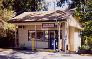
Business occupancies in the community include: Nonnos Italian Cafe, 21433 Broadway; Redwood Estates Store, 20121 Broadway; Redwood Mutual Water Company on Madrone Dr.; Santa Clara County Fire Department Redwood Station at 21452 Madrone Dr.; and the Redwood Estates Post Office. A traffic focal point is the SR17 interchange with Madrone Drive. Summit Road has an interchange with SR17 and approximates the southern extent of the community.
The area has a history with ties to railroading
History of rail transport
The history of rail transport dates back nearly 500 years and includes systems with man or horse power and rails of wood or stone. Modern rail transport systems first appeared in England in the 1820s...
. Until the 1940s, a Southern Pacific Railroad
Southern Pacific Railroad
The Southern Pacific Transportation Company , earlier Southern Pacific Railroad and Southern Pacific Company, and usually simply called the Southern Pacific or Espee, was an American railroad....
line to Santa Cruz
Santa Cruz, California
Santa Cruz is the county seat and largest city of Santa Cruz County, California in the US. As of the 2010 U.S. Census, Santa Cruz had a total population of 59,946...
passed through Holy City
Holy City, California
Holy City is an unincorporated community in Santa Clara County, California. With only one permanent resident, it is arguably a ghost town. The town is located in the Santa Cruz Mountains, off State Route 17 on Old Santa Cruz Highway, at . It is part of the Lexington Hills census-designated place...
east of Redwood Estates. A factor in the removal of the rail line was its high maintenance cost. The portals of three tunnels along this line were closed during World War II in case an invading military force might use them as cover.
Winter in Redwood Estates
The area gets significant rain during winters. SR17 is occasionally closed or affected by runoff, fallen trees, or mud slides in the winter. As a consequence, weather-influenced collisions occur more frequently in winter. Snowfall is rare, but occurs during some winters. Utility power can be out for several days at a time during a bad winter storm. Some residents own engine-generator sets for use during such power outages.A resident living west of Redwood Estates said the fog and rainfall of the Santa Cruz Mountains
Santa Cruz Mountains
The Santa Cruz Mountains, part of the Pacific Coast Ranges, are a mountain range in central California, United States. They form a ridge along the San Francisco Peninsula, south of San Francisco, separating the Pacific Ocean from San Francisco Bay and the Santa Clara Valley, and continuing south,...
caused roofing material on his home to last about half of the rated life. The resident attributed this to the fact that the material never dried out in the humid redwood forest environment.
Nearby
Other nearby mountain communities include Chemeketa ParkChemeketa Park, California
Chemeketa Park is an unincorporated community of approximately 150 homes located in Lexington Hills, in the Santa Cruz Mountains in Santa Clara County, California. The postal designation for Chemeketa Park is "Los Gatos 95033", although it lies approximately five miles South of the official...
, Aldercroft Heights, and Zayante. Previous communities include the ghost towns Holy City
Holy City, California
Holy City is an unincorporated community in Santa Clara County, California. With only one permanent resident, it is arguably a ghost town. The town is located in the Santa Cruz Mountains, off State Route 17 on Old Santa Cruz Highway, at . It is part of the Lexington Hills census-designated place...
and Wrights (also known as Wrights Station).
Moody Gulch oil field, an abandoned field, is north of Redwood Estates. There are roughly twenty plugged wells, some with buried well heads, in the area. Moody Gulch extends in an arc east to Chemeketa Park
Chemeketa Park, California
Chemeketa Park is an unincorporated community of approximately 150 homes located in Lexington Hills, in the Santa Cruz Mountains in Santa Clara County, California. The postal designation for Chemeketa Park is "Los Gatos 95033", although it lies approximately five miles South of the official...
north of the street named Apache Trail. One well is shown on the 7.5-minute quadrangle at 37°09′39"N 121°59′26"W (NAD83). The oil field is named for Moody Gulch, a creek tributary to Los Gatos Creek
Los Gatos Creek (Santa Clara County, California)
The Los Gatos Creek runs 24 miles in California through Santa Clara Valley Water District's Guadalupe Watershed from the Santa Cruz Mountains northward through the Santa Clara Valley until its confluence with the Guadalupe River in downtown San Jose...
.
External links
- [ftp://ftp.consrv.ca.gov/pub/oil/maps/dist3/w3-10/Mapw3-10.pdf PDF Oil field map of Redwood Estates area.]