
.gif)
Interstate 580 (California)
Encyclopedia
Interstate 580 is an 80-mile (129 km) east–west Interstate Highway
in Northern California
. The heavily traveled spur route
of Interstate 80 runs from San Rafael
in the San Francisco Bay Area
to Interstate 5 near Tracy
in the Central Valley. It provides access from San Francisco to the southern San Joaquin Valley
and Southern California
.
A portion of I-580 is called the MacArthur Freeway, after General Douglas MacArthur
. Other portions are named the John T. Knox Freeway (after a former California State Assemblyman and Speaker Pro Tempore who currently practices law at Nossaman
LLP), the Eastshore Freeway (after its location on San Francisco Bay
), the Arthur H. Breed Jr. Freeway (after a former California State Assemblyman and Senator), the William Elton "Brownie" Brown Freeway (after a Tracy
resident instrumental in determining the route of Interstate 5 through the San Joaquin Valley
), the Sgt. Daniel Sakai Memorial Highway (after the Castro Valley resident and Oakland SWAT
officer killed in the 2009 shootings of Oakland police officers), and the John P. Miller Memorial Highway (after the Livermore
resident and California Highway Patrol
officer killed while chasing down a DUI driver).
This route is part of the California Freeway and Expressway System
and is eligible for the State Scenic Highway System
.


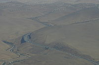
_between_pleasanton_and_castro_valley.jpg)
 The western terminus of I-580 is north of San Francisco
in San Rafael
, at a junction with U.S. Route 101. The eastern terminus is with I-5 southeast of Tracy
. Leaving San Rafael, I-580 runs next to the San Quentin State Prison
before crossing San Francisco Bay
over the Richmond-San Rafael Bridge
. The road then passes through Richmond
.
In Albany
, I-580 joins I-80 and then turns east at the interchange known as the MacArthur Maze
. From here, it is known as the MacArthur Freeway which runs through Oakland
and San Leandro
to Castro Valley
. About halfway to Castro Valley from the Maze, is an interchange with the Warren Freeway (State Route 13). Between this interchange and Castro Valley, I-580 runs near or along the trace of the Hayward Fault, a major branch of the San Andreas Fault
.
In Castro Valley, I-580 turns eastward toward Dublin Canyon before descending into Dublin
and Pleasanton
. After passing through Livermore
, the freeway enters the Altamont Pass
. The road emerges in the Central Valley west of Tracy
, where, after Interstate 205
splits near the Altamont Speedway, it turns southeastward and terminates by merging with Interstate 5 south of Tracy.
I-580 provides Interstate Highway access between San Francisco and Los Angeles
since Interstate 5 runs east of the Bay Area. However, the primary control city
listed on freeway signs along eastbound 580 between I-80 and I-205 is instead Stockton
, a vestige of when this segment use to be part of U.S. Route 50
.
s are prohibited through Oakland between Grand Avenue and the San Leandro border. Specifically, eastbound trucks cannot travel beyond the Grand Avenue/Lakeshore Avenue exit, and those going westbound must take the MacArthur Boulevard/Foothill Boulevard exit. They are instead instructed to take Interstate 238 and Interstate 880 as an alternative route through Oakland,
The truck prohibition has been in effect since the freeway was built in 1963 as part of U.S. 50. Both the Federal Highway Administration
(FHWA) and the California Department of Transportation
(Caltrans) imposed the restriction, partly because the City of Oakland already had a truck ban through the area prior to the freeway's construction. Since then, the restriction was grandfathered in
when the freeway was both renumbered and added to the Interstate Highway System.
As a result, it is one of the few segments along the Interstate Highway System that is not part of the National Truck Network
. For decades, the trucking industry lobbied
to have the ban removed, but was unsuccessful due to local opposition. In 2000, the California State Legislature
passed Assembly Bill 500, adding the I-580 truck restriction into the California Vehicle Code. However, the California Highway Patrol
has frequently allowed trucks through temporarily when major accidents occur on I-880 or I-238.
, during the course of the late 1960s and early 1970s. The segment which begins at the split with I-205 was constructed during the same period of time over a new right-of-way to a junction with I-5, running through some low hills on the east side of the San Joaquin Valley
near the city of Patterson
.
In the 1990s, the freeway segment from Castro Valley through Pleasanton was enlarged and otherwise re-engineered in conjunction with the construction of the Dublin/Pleasanton Line
of the Bay Area Rapid Transit
. The BART tracks were placed in a new median between the westbound and eastbound lanes of I-580 as was the new Dublin/Pleasantion Station. The interchange with I-238 and the Hayward
exit ramps was also re-engineered at this time.
and the large interchange along the eastern approach to the San Francisco – Oakland Bay Bridge in Oakland
now called the "MacArthur Maze
". The freeway was named in honor of World War II General Douglas MacArthur
. Some years prior to the construction of this freeway, the various city streets of Oakland (principally 38th Street, Hopkins Street, and part of Foothill Blvd.) had been named for the General as "MacArthur Boulevard" which, for the most part, still parallels the MacArthur Freeway.
From the Maze to the interchange locally known as the Hoffman Split in Albany
, just north of the Gilman Street interchange, I-580 follows the Eastshore Freeway, a wrong-way concurrency with I-80 for its entirety: northward on the Eastshore is signed I-80 East and I-580 West; headed southward, one finds signs indicating I-80 West and I-580 East.
At the Hoffman Split, I-580 leaves the Eastshore Freeway in a northwesterly direction through the cities of El Cerrito
and Richmond
. It then crosses San Francisco Bay
over the Richmond-San Rafael Bridge
. The freeway in this section, officially named the John T. Knox Freeway, was constructed from 1987 to 1991. It replaced a number of city streets which comprised the earlier highway leading to the San Rafael Bridge, principally, Hoffman and Cutting Boulevards.
After crossing the bridge, I-580 runs west to San Rafael
, ending at an interchange with U.S. Route 101. This freeway segment supplanted an earlier boulevard constructed as part of State Route 17.
, now part of Interstate 580. At the time the bridge had been identified as part of State Route 17 but was marked for inclusion in the Interstate Highway System.
Briefly the bridge used the number 180, despite the Fresno
-area State Route 180
's use of the number. The California Streets and Highways Code has a policy against using one route number for multiple noncontiguous highways. Unless the existing Route 180 is renumbered, which is unlikely due to its familiarity as the road to Kings Canyon National Park
, there will not be an Interstate 180 in California.
s in each direction, a westbound auxiliary lane between Fallon Road and Tassajara Road, the construction of a new interchange at Isabel Avenue in Livermore, the reconstruction of several interchanges, the construction of additional truck climbing lanes for the eastward ascent to the Altamont Pass
, and plans to preserve the right-of-way to accommodate a future transit corridor in the median of the freeway.
There is a plan to add a high-occupancy toll (HOT) lane along I-580 between Pleasanton
and Livermore
. Under the plan, the 12 miles (19.3 km) eastbound stretch between Hacienda Drive and North Greenville Road would be modified to include HOT lanes. Solo drivers would then be required to use a FasTrak
transponder. There are currently no plans to add westbound HOT lanes on I-580, however.
{| class=wikitable
!County
!Location
!Postmile
!Exit
!Destinations
!Notes
|-
|rowspan=5|Marin
MRN 4.78-0.00
|rowspan=5|San Rafael
|4.78
|
|
|Westbound exit and eastbound entrance
|-
|4.50
|1B
|.svg.png) Francisco Boulevard to US 101 south
Francisco Boulevard to US 101 south
|Signed as exit 1 eastbound
|-bgcolor=#ffdddd
|3.09
|2A
|Sir Francis Drake Boulevard
|Westbound exit and eastbound entrance
|-
|2.48
|2B
|Francisco Boulevard – San Quentin
|Signed as exit 2 eastbound
|-
|colspan=5 rowspan=2 align=center|Richmond – San Rafael Bridge over San Francisco Bay
|-
|rowspan=9|Contra Costa
CC 7.79-0.00
|rowspan=9|Richmond
|-bgcolor=#ffdddd
|6.01
|7A
|Western Drive – Point Molate
|No eastbound exit
|-
|R5.43
|7B
|.svg.png) Richmond Parkway
Richmond Parkway
to I-80 east – Port Richmond
, Sacramento
|Signed as exit 7 eastbound
|-
|R4.64
|8
|Canal Boulevard, Garrard Boulevard
|
|-
|R3.60
|9
|Cutting Boulevard, Harbour Way
|Signed as exits 9A (Cutting Boulevard, Harbour Way south) and 9B (Harbour Way north) westbound
|-
|R2.89
|10A
|Marina Bay Parkway, South 23rd Street
|
|-
|R2.09
|10B
|Regatta Boulevard
|
|-
|1.21
|11
|Bayview Avenue
|
|-
|0.24
|12
|Central Avenue
|
|-
|rowspan=55|Alameda
ALA 48.04-0.00
|rowspan=2|Albany
|
|13
|Buchanan Street – Albany
|Signed as exit 13A westbound
|-bgcolor=#ddffdd
|47.35
R7.30Indicates that the postmile represents the distance along I-80
rather than I-580.
|
|
|West end of I-80 overlap; westbound exit and eastbound entrance
|-
|rowspan=3|Berkeley
|6.62
|12
|Gilman Street
|
|-
|5.82
|11
|University Avenue – Berkeley
|
|-
|4.58
|10
|
|Shellmound Street accessible only from westbound I-580 / eastbound I-80
|-
|Emeryville
|3.79
|9
|Powell Street – Emeryville
|
|-
|rowspan=20|Oakland
|bgcolor=#ddffdd|2.80
46.46
|bgcolor=#ddffdd|19A
|bgcolor=#ddffdd|
|bgcolor=#ddffdd|East end of I-80 overlap; no exit number eastbound
|-bgcolor=#ffdddd
|46.46
|
|
|Eastbound exit and westbound entrance
|-bgcolor=#ffdddd
|46.01
|19A
|MacArthur Boulevard
|Eastbound left exit and westbound entrance
|-bgcolor=#ffdddd
|46.01
|19B
|
|Westbound exit and eastbound entrance
|-
|45.15
|19C
|
|Signed as exit 19B eastbound
|-
|45.15
|19D
|
|Signed as exit 19C eastbound
|-bgcolor=#ffdddd
|44.51
|20
|Webster Street, Broadway-Auto Row
|Eastbound exit only
|-
|44.28
|21A
|Harrison Street, Oakland Avenue, MacArthur Boulevard
|
|-
|43.75
|21B
|Grand Avenue
|
|-
|43.48
|22A
|Lake Shore Avenue
|Eastbound exit is via exit 21B
|-
|42.67-R42.18
|22B
|Park Boulevard, 14th Avenue
|Signed as exit 22 eastbound
|-
|R41.43
|23
|Fruitvale Avenue, Coolidge Avenue
|Signed as exit 24 westbound
|-bgcolor=#ffdddd
|R40.65
|24
|35th Avenue
|Eastbound exit and westbound entrance
|-
|R40.08
|25A
|High Street
|Westbound exit is via exit 25
|-
|R39.91
|25B
|MacArthur Boulevard
|Signed as exit 25 westbound
|-
|R39.24
|26A
|
|Eastbound exit is via exit 26
|-
|R38.92
|26B
|Seminary Avenue
|Signed as exit 26 eastbound
|-bgcolor=#ffdddd
|R38.31
|27A
|Edwards Avenue
|Eastbound exit and westbound entrance
|-
|R37.80
|27B
|Keller Avenue, Mountain Boulevard
|Signed as exit 27 westbound
|-
|R36.34
|29A
|Golf Links Road, 98th Avenue
|Signed as exit 29 westbound
|-
|rowspan=3|Oakland
,
San Leandro
|bgcolor=#ffdddd|R35.71
|bgcolor=#ffdddd|29B
|bgcolor=#ffdddd|106th Avenue, Foothill Boulevard
|bgcolor=#ffdddd|Eastbound exit and westbound entrance
|-bgcolor=#ffdddd
|R35.11
|30
|MacArthur Boulevard
, Foothill Boulevard
|Westbound exit and eastbound entrance
|-
|R34.48
|31A
|Dutton Avenue, Estudillo Avenue – Downtown San Leandro
|Signed as exit 31 westbound
|-
|rowspan=4|San Leandro
|bgcolor=#ffdddd|R33.94
|bgcolor=#ffdddd|31B
|bgcolor=#ffdddd|Grand Avenue – Downtown San Leandro
|bgcolor=#ffdddd|Eastbound exit and westbound entrance
|-bgcolor=#ffdddd
|R33.43
|32A
|Benedict Drive
|Westbound exit only
|-
|R32.84-R32.72
|32B
|150th Avenue, Fairmont Drive
|Signed as exit 32 eastbound
|-
|R31.71
|33
|164th Avenue, Miramar Avenue, Carolyn Street
|
|-
|rowspan=6|Castro Valley
|R30.81
|34
|
|Left exit westbound
|-bgcolor=#ffdddd
|R30.81
|34
|
|Eastbound exit and westbound entrance
|-
|30.35
|35
|Strobridge Avenue
|
|-bgcolor=#ffdddd
|R29.37
|36A
|Redwood Road – Castro Valley
|Eastbound exit and westbound entrance
|-
|R28.75
|36B
|Grove Way – Castro Valley
|
|-
|R26.23
|39
|Eden Canyon Road, Palomares Road
|
|-
|rowspan=5|Pleasanton
,
Dublin
|R21.43
|44A
|San Ramon Road, Foothill Road – Dublin
|
|-
|20.73
|44B
|
|
|-
|19.86
|45
|Hopyard Road, Dougherty Road
|
|-
|18.82
|46
|Hacienda Drive, Dublin Boulevard
|
|-
|17.95
|47
|Santa Rita Road, Tassajara Road
|
|-
|Dublin
|16.70
|48
|El Charro Road, Fallon Road
|
|-
|rowspan=7|Livermore
|14.98
|50
|
|
|-bgcolor=#ffdead
|
|
|
|Under construction
|-bgcolor=#d3d3d3
|13.22
|52A
|Portola Avenue
|Closed; former eastbound exit and westbound entrance
|-
|12.53
|52B
|North Livermore Avenue – Downtown Livermore
|Signed as exit 52 westbound
|-
|10.69
|54
|First Street, Springtown Boulevard
|Former SR 84
|-
|9.68
|55
|Vasco Road – Brentwood
|
|-
|R8.27
|57
|North Greenville Road, Altamont Pass Road, Laughlin Road
|
|-
|
|R5.98
|59
|North Flynn Road
|
|-
|
|R1.48
|63
|Grant Line Road – Byron
|
|-
|
|bgcolor=#ffdddd|0.42
|bgcolor=#ffdddd|65
|bgcolor=#ffdddd|
|bgcolor=#ffdddd|Eastbound left exit and westbound entrance
|-
|rowspan=5|San Joaquin
SJ 15.31-0.00
|
|13.54
|67
|Mountain House Parkway, Patterson Pass Road
|
|-
|Tracy
|8.15
|72
|Corral Hollow Road
|
|-
|
|4.34
|76
|
|Westbound exit is via exit 76
|-
|
|bgcolor=#ffdddd|4.02
|bgcolor=#ffdddd|76
|bgcolor=#ffdddd|Chrisman Road – Tracy
|bgcolor=#ffdddd|Westbound exit and eastbound entrance
|-
|
|bgcolor=#ffdddd|0.00
|bgcolor=#ffdddd|
|bgcolor=#ffdddd|
|bgcolor=#ffdddd|Eastbound exit and westbound entrance
Interstate Highway System
The Dwight D. Eisenhower National System of Interstate and Defense Highways, , is a network of limited-access roads including freeways, highways, and expressways forming part of the National Highway System of the United States of America...
in Northern California
Northern California
Northern California is the northern portion of the U.S. state of California. The San Francisco Bay Area , and Sacramento as well as its metropolitan area are the main population centers...
. The heavily traveled spur route
Spur route
A spur route is a short road forming a branch from a longer, more important route . A bypass or beltway is never considered a true spur route as it typically reconnects with the major road...
of Interstate 80 runs from San Rafael
San Rafael, California
San Rafael is a city and the county seat of Marin County, California, United States. The city is located in the North Bay region of the San Francisco Bay Area...
in the San Francisco Bay Area
San Francisco Bay Area
The San Francisco Bay Area, commonly known as the Bay Area, is a populated region that surrounds the San Francisco and San Pablo estuaries in Northern California. The region encompasses metropolitan areas of San Francisco, Oakland, and San Jose, along with smaller urban and rural areas...
to Interstate 5 near Tracy
Tracy, California
Tracy is the second most populated city in San Joaquin County, California, United States and an exurb of the San Francisco Bay Area. The population was 82,922 at the 2010 census.-History:...
in the Central Valley. It provides access from San Francisco to the southern San Joaquin Valley
San Joaquin Valley
The San Joaquin Valley is the area of the Central Valley of California that lies south of the Sacramento – San Joaquin River Delta in Stockton...
and Southern California
Southern California
Southern California is a megaregion, or megapolitan area, in the southern area of the U.S. state of California. Large urban areas include Greater Los Angeles and Greater San Diego. The urban area stretches along the coast from Ventura through the Southland and Inland Empire to San Diego...
.
A portion of I-580 is called the MacArthur Freeway, after General Douglas MacArthur
Douglas MacArthur
General of the Army Douglas MacArthur was an American general and field marshal of the Philippine Army. He was a Chief of Staff of the United States Army during the 1930s and played a prominent role in the Pacific theater during World War II. He received the Medal of Honor for his service in the...
. Other portions are named the John T. Knox Freeway (after a former California State Assemblyman and Speaker Pro Tempore who currently practices law at Nossaman
Nossaman
Nossaman LLP is a national law firm with over 150 attorneys and lobbyists located in seven offices throughout the United States. The Firm’s expertise is focused in distinct areas of law and policy, as well as in specific industries, ranging from transportation, healthcare and financial services to...
LLP), the Eastshore Freeway (after its location on San Francisco Bay
San Francisco Bay
San Francisco Bay is a shallow, productive estuary through which water draining from approximately forty percent of California, flowing in the Sacramento and San Joaquin rivers from the Sierra Nevada mountains, enters the Pacific Ocean...
), the Arthur H. Breed Jr. Freeway (after a former California State Assemblyman and Senator), the William Elton "Brownie" Brown Freeway (after a Tracy
Tracy, California
Tracy is the second most populated city in San Joaquin County, California, United States and an exurb of the San Francisco Bay Area. The population was 82,922 at the 2010 census.-History:...
resident instrumental in determining the route of Interstate 5 through the San Joaquin Valley
San Joaquin Valley
The San Joaquin Valley is the area of the Central Valley of California that lies south of the Sacramento – San Joaquin River Delta in Stockton...
), the Sgt. Daniel Sakai Memorial Highway (after the Castro Valley resident and Oakland SWAT
SWAT
A SWAT team is an elite tactical unit in various national law enforcement departments. They are trained to perform high-risk operations that fall outside of the abilities of regular officers...
officer killed in the 2009 shootings of Oakland police officers), and the John P. Miller Memorial Highway (after the Livermore
Livermore
Livermore may refer to:In places in the US:*Livermore, California**Lawrence Livermore National Laboratory, a U.S. Department of Energy lab in Livermore, California**Livermore Valley AVA, California wine region in Alameda County*Livermore, Colorado...
resident and California Highway Patrol
California Highway Patrol
The California Highway Patrol is a law enforcement agency of the U.S. state of California. The CHP has patrol jurisdiction over all California highways and also acts as the state police....
officer killed while chasing down a DUI driver).
This route is part of the California Freeway and Expressway System
California Freeway and Expressway System
The California Freeway and Expressway System is a system of existing or planned freeways and expressways in the U.S. state of California. It is defined by the Streets and Highways Code.-List of roads in the system:*State Route 1 *State Route 2...
and is eligible for the State Scenic Highway System
State Scenic Highway System (California)
The State Scenic Highway System is a list of highways, mainly state highways, that have been designated by the California Department of Transportation as scenic highways. The California State Legislature, primarily through Section 263 of the Streets and Highways Code, makes highways eligible for...
.
Route description
San Francisco, California
San Francisco , officially the City and County of San Francisco, is the financial, cultural, and transportation center of the San Francisco Bay Area, a region of 7.15 million people which includes San Jose and Oakland...
in San Rafael
San Rafael, California
San Rafael is a city and the county seat of Marin County, California, United States. The city is located in the North Bay region of the San Francisco Bay Area...
, at a junction with U.S. Route 101. The eastern terminus is with I-5 southeast of Tracy
Tracy, California
Tracy is the second most populated city in San Joaquin County, California, United States and an exurb of the San Francisco Bay Area. The population was 82,922 at the 2010 census.-History:...
. Leaving San Rafael, I-580 runs next to the San Quentin State Prison
San Quentin State Prison
San Quentin State Prison is a California Department of Corrections and Rehabilitation state prison for men in unincorporated San Quentin, Marin County, California, United States. Opened in July 1852, it is the oldest prison in the state. California's only death row for male inmates, the largest...
before crossing San Francisco Bay
San Francisco Bay
San Francisco Bay is a shallow, productive estuary through which water draining from approximately forty percent of California, flowing in the Sacramento and San Joaquin rivers from the Sierra Nevada mountains, enters the Pacific Ocean...
over the Richmond-San Rafael Bridge
Richmond-San Rafael Bridge
The Richmond – San Rafael Bridge is the northernmost of the east–west crossings of the San Francisco Bay in California, USA, connecting Richmond on the east to San Rafael on the west end...
. The road then passes through Richmond
Richmond, California
Richmond is a city in western Contra Costa County, California, United States. The city was incorporated on August 7, 1905. It is located in the East Bay, part of the San Francisco Bay Area. It is a residential inner suburb of San Francisco, as well as the site of heavy industry, which has been...
.
In Albany
Albany, California
Albany is a city in Alameda County, California, United States. The population was 18,539 at the 2010 census.-History:In 1908, a group of local women protested the dumping of Berkeley garbage in their community...
, I-580 joins I-80 and then turns east at the interchange known as the MacArthur Maze
MacArthur Maze
The MacArthur Maze refers to the large freeway interchange located near the eastern end of the San Francisco – Oakland Bay Bridge in Oakland, California and is the largest freeway interchange in the world...
. From here, it is known as the MacArthur Freeway which runs through Oakland
Oakland, California
Oakland is a major West Coast port city on San Francisco Bay in the U.S. state of California. It is the eighth-largest city in the state with a 2010 population of 390,724...
and San Leandro
San Leandro, California
San Leandro is a city in Alameda County, California, United States. It is considered a suburb of Oakland and San Francisco. The population was 84,950 as of 2010 census. The climate of the city is mild throughout the year.-Geography and water resources:...
to Castro Valley
Castro Valley, California
Castro Valley is a census-designated place in Alameda County, California, United States. As of the 2000 census, it is the fifth most populous unincorporated area in California, and the twenty-third in the United States...
. About halfway to Castro Valley from the Maze, is an interchange with the Warren Freeway (State Route 13). Between this interchange and Castro Valley, I-580 runs near or along the trace of the Hayward Fault, a major branch of the San Andreas Fault
San Andreas Fault
The San Andreas Fault is a continental strike-slip fault that runs a length of roughly through California in the United States. The fault's motion is right-lateral strike-slip...
.
In Castro Valley, I-580 turns eastward toward Dublin Canyon before descending into Dublin
Dublin, California
Dublin is a suburban city of the East Bay region of Alameda County, California, United States. Located along the north side of Interstate 580 at the intersection with Interstate 680, roughly east of Hayward, west of Livermore and north of San Jose, it was named after the city of Dublin in...
and Pleasanton
Pleasanton, California
Pleasanton is a city in Alameda County, California, incorporated in 1894. It is a suburb in the San Francisco Bay Area located about east of Oakland, and west of Livermore. The population was 70,285 at the 2010 census. In 2005 and 2007, Pleasanton was ranked the wealthiest middle-sized city in...
. After passing through Livermore
Livermore, California
Livermore is a city in Alameda County. The population as of 2010 was 80,968. Livermore is located on the eastern edge of California's San Francisco Bay Area....
, the freeway enters the Altamont Pass
Altamont Pass
Altamont Pass, formerly Livermore Pass, is a mountain pass in the Diablo Range between Livermore in the Livermore Valley and Tracy in the San Joaquin Valley in Northern California...
. The road emerges in the Central Valley west of Tracy
Tracy, California
Tracy is the second most populated city in San Joaquin County, California, United States and an exurb of the San Francisco Bay Area. The population was 82,922 at the 2010 census.-History:...
, where, after Interstate 205
Interstate 205 (California)
Interstate 205 is a short Interstate Highway that connects Interstate 5 with Interstate 580 in the San Joaquin Valley of California. Along with those highways, I-205 forms the north side of a triangle around the city of Tracy...
splits near the Altamont Speedway, it turns southeastward and terminates by merging with Interstate 5 south of Tracy.
I-580 provides Interstate Highway access between San Francisco and Los Angeles
Los Ángeles
Los Ángeles is the capital of the province of Biobío, in the commune of the same name, in Region VIII , in the center-south of Chile. It is located between the Laja and Biobío rivers. The population is 123,445 inhabitants...
since Interstate 5 runs east of the Bay Area. However, the primary control city
Control city
A control city is a city or locality posted on a traffic sign indicating forward destinations on a certain route. These destinations aid motorists using the highway system to reach destinations along the various routes...
listed on freeway signs along eastbound 580 between I-80 and I-205 is instead Stockton
Stockton, California
Stockton, California, the seat of San Joaquin County, is the fourth-largest city in the Central Valley of the U.S. state of California. With a population of 291,707 at the 2010 census, Stockton ranks as this state's 13th largest city...
, a vestige of when this segment use to be part of U.S. Route 50
U.S. Route 50 in California
In the U.S. state of California, U.S. Route 50 runs east from I-80 in West Sacramento to the Nevada state line in South Lake Tahoe. Portions within Sacramento are known as the Capital City Freeway and El Dorado Freeway...
.
Truck ban through Oakland
Trucks over 4.5 tonTon
The ton is a unit of measure. It has a long history and has acquired a number of meanings and uses over the years. It is used principally as a unit of weight, and as a unit of volume. It can also be used as a measure of energy, for truck classification, or as a colloquial term.It is derived from...
s are prohibited through Oakland between Grand Avenue and the San Leandro border. Specifically, eastbound trucks cannot travel beyond the Grand Avenue/Lakeshore Avenue exit, and those going westbound must take the MacArthur Boulevard/Foothill Boulevard exit. They are instead instructed to take Interstate 238 and Interstate 880 as an alternative route through Oakland,
The truck prohibition has been in effect since the freeway was built in 1963 as part of U.S. 50. Both the Federal Highway Administration
Federal Highway Administration
The Federal Highway Administration is a division of the United States Department of Transportation that specializes in highway transportation. The agency's major activities are grouped into two "programs," the Federal-aid Highway Program and the Federal Lands Highway Program...
(FHWA) and the California Department of Transportation
California Department of Transportation
The California Department of Transportation is a government department in the U.S. state of California. Its mission is to improve mobility across the state. It manages the state highway system and is actively involved with public transportation systems throughout the state...
(Caltrans) imposed the restriction, partly because the City of Oakland already had a truck ban through the area prior to the freeway's construction. Since then, the restriction was grandfathered in
Grandfather clause
Grandfather clause is a legal term used to describe a situation in which an old rule continues to apply to some existing situations, while a new rule will apply to all future situations. It is often used as a verb: to grandfather means to grant such an exemption...
when the freeway was both renumbered and added to the Interstate Highway System.
As a result, it is one of the few segments along the Interstate Highway System that is not part of the National Truck Network
National Network
The National Network is a network of approved state highways and interstates for commercial truck drivers in the United States. The Surface Transportation Assistance Act of 1982 authorized the establishment of a national network of highways designated for use by large trucks. On these highways,...
. For decades, the trucking industry lobbied
Lobbying
Lobbying is the act of attempting to influence decisions made by officials in the government, most often legislators or members of regulatory agencies. Lobbying is done by various people or groups, from private-sector individuals or corporations, fellow legislators or government officials, or...
to have the ban removed, but was unsuccessful due to local opposition. In 2000, the California State Legislature
California State Legislature
The California State Legislature is the state legislature of the U.S. state of California. It is a bicameral body consisting of the lower house, the California State Assembly, with 80 members, and the upper house, the California State Senate, with 40 members...
passed Assembly Bill 500, adding the I-580 truck restriction into the California Vehicle Code. However, the California Highway Patrol
California Highway Patrol
The California Highway Patrol is a law enforcement agency of the U.S. state of California. The CHP has patrol jurisdiction over all California highways and also acts as the state police....
has frequently allowed trucks through temporarily when major accidents occur on I-880 or I-238.
I-5 to Castro Valley
For the most part, the I-580 freeway in this segment was constructed over or alongside the right-of-way of U.S. Route 50, previously part of the old Lincoln HighwayLincoln Highway
The Lincoln Highway was the first road across the United States of America.Conceived and promoted by entrepreneur Carl G. Fisher, the Lincoln Highway spanned coast-to-coast from Times Square in New York City to Lincoln Park in San Francisco, originally through 13 states: New York, New Jersey,...
, during the course of the late 1960s and early 1970s. The segment which begins at the split with I-205 was constructed during the same period of time over a new right-of-way to a junction with I-5, running through some low hills on the east side of the San Joaquin Valley
San Joaquin Valley
The San Joaquin Valley is the area of the Central Valley of California that lies south of the Sacramento – San Joaquin River Delta in Stockton...
near the city of Patterson
Patterson, California
Patterson is a city in Stanislaus County, California, United States, located off Interstate 5. It is 45 miles southeast of Livermore and part of the Modesto Metropolitan Statistical Area. Patterson is known as the "Apricot Capital of the World"; the town holds an annual Apricot Fiesta to...
.
In the 1990s, the freeway segment from Castro Valley through Pleasanton was enlarged and otherwise re-engineered in conjunction with the construction of the Dublin/Pleasanton Line
Dublin/Pleasanton - SFO/Millbrae Line
The Dublin/Pleasanton – Daly City line of the Bay Area Rapid Transit system in the San Francisco Bay Area consists of 18 metro stations from Dublin and Pleasanton to Daly City...
of the Bay Area Rapid Transit
Bay Area Rapid Transit
Bay Area Rapid Transit is a rapid transit system serving the San Francisco Bay Area. The heavy-rail public transit and subway system connects San Francisco with cities in the East Bay and suburbs in northern San Mateo County. BART operates five lines on of track with 44 stations in four counties...
. The BART tracks were placed in a new median between the westbound and eastbound lanes of I-580 as was the new Dublin/Pleasantion Station. The interchange with I-238 and the Hayward
Hayward, California
Hayward is a city located in the East Bay in Alameda County, California. With a population of 144,186, Hayward is the sixth largest city in the San Francisco Bay Area and the third largest in Alameda County. Hayward was ranked as the 37th most populous municipality in California. It is included in...
exit ramps was also re-engineered at this time.
The MacArthur Freeway: Castro Valley to Oakland
The I-580 freeway in this segment was constructed in the 1960s adjacent to the city streets which were part of U.S. Route 50 between Castro ValleyCastro Valley, California
Castro Valley is a census-designated place in Alameda County, California, United States. As of the 2000 census, it is the fifth most populous unincorporated area in California, and the twenty-third in the United States...
and the large interchange along the eastern approach to the San Francisco – Oakland Bay Bridge in Oakland
Oakland, California
Oakland is a major West Coast port city on San Francisco Bay in the U.S. state of California. It is the eighth-largest city in the state with a 2010 population of 390,724...
now called the "MacArthur Maze
MacArthur Maze
The MacArthur Maze refers to the large freeway interchange located near the eastern end of the San Francisco – Oakland Bay Bridge in Oakland, California and is the largest freeway interchange in the world...
". The freeway was named in honor of World War II General Douglas MacArthur
Douglas MacArthur
General of the Army Douglas MacArthur was an American general and field marshal of the Philippine Army. He was a Chief of Staff of the United States Army during the 1930s and played a prominent role in the Pacific theater during World War II. He received the Medal of Honor for his service in the...
. Some years prior to the construction of this freeway, the various city streets of Oakland (principally 38th Street, Hopkins Street, and part of Foothill Blvd.) had been named for the General as "MacArthur Boulevard" which, for the most part, still parallels the MacArthur Freeway.
Oakland to San Rafael
The segment of I-580 running from the MacArthur Maze to San Rafael is the most recent to be signed as I-580, beginning in 1984. Before 1984, this segment was part of State Route 17.From the Maze to the interchange locally known as the Hoffman Split in Albany
Albany, California
Albany is a city in Alameda County, California, United States. The population was 18,539 at the 2010 census.-History:In 1908, a group of local women protested the dumping of Berkeley garbage in their community...
, just north of the Gilman Street interchange, I-580 follows the Eastshore Freeway, a wrong-way concurrency with I-80 for its entirety: northward on the Eastshore is signed I-80 East and I-580 West; headed southward, one finds signs indicating I-80 West and I-580 East.
At the Hoffman Split, I-580 leaves the Eastshore Freeway in a northwesterly direction through the cities of El Cerrito
El Cerrito, Contra Costa County, California
-Transportation:The city's primary transportation infrastructure consists of the El Cerrito Plaza and El Cerrito del Norte BART stations along with several local bus lines, operated by AC Transit, providing access to the surrounding area and the nearby cities of Albany, Berkeley and Richmond...
and Richmond
Richmond, California
Richmond is a city in western Contra Costa County, California, United States. The city was incorporated on August 7, 1905. It is located in the East Bay, part of the San Francisco Bay Area. It is a residential inner suburb of San Francisco, as well as the site of heavy industry, which has been...
. It then crosses San Francisco Bay
San Francisco Bay
San Francisco Bay is a shallow, productive estuary through which water draining from approximately forty percent of California, flowing in the Sacramento and San Joaquin rivers from the Sierra Nevada mountains, enters the Pacific Ocean...
over the Richmond-San Rafael Bridge
Richmond-San Rafael Bridge
The Richmond – San Rafael Bridge is the northernmost of the east–west crossings of the San Francisco Bay in California, USA, connecting Richmond on the east to San Rafael on the west end...
. The freeway in this section, officially named the John T. Knox Freeway, was constructed from 1987 to 1991. It replaced a number of city streets which comprised the earlier highway leading to the San Rafael Bridge, principally, Hoffman and Cutting Boulevards.
After crossing the bridge, I-580 runs west to San Rafael
San Rafael, California
San Rafael is a city and the county seat of Marin County, California, United States. The city is located in the North Bay region of the San Francisco Bay Area...
, ending at an interchange with U.S. Route 101. This freeway segment supplanted an earlier boulevard constructed as part of State Route 17.
Interstate 180
Interstate 180 was a temporary designation used in 1978 for the Richmond-San Rafael BridgeRichmond-San Rafael Bridge
The Richmond – San Rafael Bridge is the northernmost of the east–west crossings of the San Francisco Bay in California, USA, connecting Richmond on the east to San Rafael on the west end...
, now part of Interstate 580. At the time the bridge had been identified as part of State Route 17 but was marked for inclusion in the Interstate Highway System.
Briefly the bridge used the number 180, despite the Fresno
Fresno, California
Fresno is a city in central California, United States, the county seat of Fresno County. As of the 2010 census, the city's population was 510,365, making it the fifth largest city in California, the largest inland city in California, and the 34th largest in the nation...
-area State Route 180
California State Route 180
State Route 180 is a state highway in California, United States, which runs through the heart of the San Joaquin Valley from Mendota through Fresno to Kings Canyon National Park, with an unbuilt segment defined west to Paicines....
's use of the number. The California Streets and Highways Code has a policy against using one route number for multiple noncontiguous highways. Unless the existing Route 180 is renumbered, which is unlikely due to its familiarity as the road to Kings Canyon National Park
Kings Canyon National Park
Kings Canyon National Park is a National Park in the southern Sierra Nevada, east of Fresno, California. The park was established in 1940 and covers...
, there will not be an Interstate 180 in California.
Future
The segment of I-580 from I-680 to I-205 is undergoing significant improvements. Among the projects along this segment is the construction of high-occupancy vehicle laneHigh-occupancy vehicle lane
In transportation engineering and transportation planning, a high-occupancy vehicle lane is a lane reserved for vehicles with a driver and one or more passengers...
s in each direction, a westbound auxiliary lane between Fallon Road and Tassajara Road, the construction of a new interchange at Isabel Avenue in Livermore, the reconstruction of several interchanges, the construction of additional truck climbing lanes for the eastward ascent to the Altamont Pass
Altamont Pass
Altamont Pass, formerly Livermore Pass, is a mountain pass in the Diablo Range between Livermore in the Livermore Valley and Tracy in the San Joaquin Valley in Northern California...
, and plans to preserve the right-of-way to accommodate a future transit corridor in the median of the freeway.
There is a plan to add a high-occupancy toll (HOT) lane along I-580 between Pleasanton
Pleasanton, California
Pleasanton is a city in Alameda County, California, incorporated in 1894. It is a suburb in the San Francisco Bay Area located about east of Oakland, and west of Livermore. The population was 70,285 at the 2010 census. In 2005 and 2007, Pleasanton was ranked the wealthiest middle-sized city in...
and Livermore
Livermore, California
Livermore is a city in Alameda County. The population as of 2010 was 80,968. Livermore is located on the eastern edge of California's San Francisco Bay Area....
. Under the plan, the 12 miles (19.3 km) eastbound stretch between Hacienda Drive and North Greenville Road would be modified to include HOT lanes. Solo drivers would then be required to use a FasTrak
FasTrak
FasTrak is the electronic toll collection system used in the state of California in the United States. The system is used statewide on all of the toll roads, toll bridges, and high occupancy/toll and express toll lanes along the California Freeway and Expressway System.As with other ETC systems,...
transponder. There are currently no plans to add westbound HOT lanes on I-580, however.
Exit list
- Note: Except where prefixed with a letter, postmiles were measured in 1964, based on the alignment as it existed at that time, and do not necessarily reflect current mileage. The numbers reset at county lines; the start and end postmiles in each county are given in the county column. Although Interstate 580 is a west–east highway, postmiles are assigned south to north.
{| class=wikitable
!County
!Location
!Postmile
!Exit
Exit number
An exit number is a number assigned to a road junction, usually an exit from a freeway. It is usually marked on the same sign as the destinations of the exit, as well as a sign in the gore....
!Destinations
!Notes
|-
|rowspan=5|Marin
Marin County, California
Marin County is a county located in the North San Francisco Bay Area of the U.S. state of California, across the Golden Gate Bridge from San Francisco. As of 2010, the population was 252,409. The county seat is San Rafael and the largest employer is the county government. Marin County is well...
MRN 4.78-0.00
|rowspan=5|San Rafael
San Rafael, California
San Rafael is a city and the county seat of Marin County, California, United States. The city is located in the North Bay region of the San Francisco Bay Area...
|4.78
|
|
|Westbound exit and eastbound entrance
|-
|4.50
|1B
|
|Signed as exit 1 eastbound
|-bgcolor=#ffdddd
|3.09
|2A
|Sir Francis Drake Boulevard
Sir Francis Drake Boulevard
Sir Francis Drake Boulevard is an east–west arterial road in Marin County, California, running from just west of the Richmond-San Rafael Bridge to the trailhead for Point Reyes Lighthouse at the end of the Point Reyes Peninsula.It is named for the English explorer Sir Francis Drake, whose...
|Westbound exit and eastbound entrance
|-
|2.48
|2B
|Francisco Boulevard – San Quentin
San Quentin, California
San Quentin is a small unincorporated community in Marin County, California. It is located west of Point San Quentin, at an elevation of 30 feet ....
|Signed as exit 2 eastbound
|-
|colspan=5 rowspan=2 align=center|Richmond – San Rafael Bridge over San Francisco Bay
San Francisco Bay
San Francisco Bay is a shallow, productive estuary through which water draining from approximately forty percent of California, flowing in the Sacramento and San Joaquin rivers from the Sierra Nevada mountains, enters the Pacific Ocean...
|-
|rowspan=9|Contra Costa
Contra Costa County, California
Contra Costa County is a primarily suburban county in the San Francisco Bay Area of the U.S. state of California. As of the 2010 census, it had a population of 1,049,025...
CC 7.79-0.00
|rowspan=9|Richmond
Richmond, California
Richmond is a city in western Contra Costa County, California, United States. The city was incorporated on August 7, 1905. It is located in the East Bay, part of the San Francisco Bay Area. It is a residential inner suburb of San Francisco, as well as the site of heavy industry, which has been...
|-bgcolor=#ffdddd
|6.01
|7A
|Western Drive – Point Molate
Point Molate
Point Molate may refer to:*Point Molate Beach Park*Point Molate Naval Fuel Depot*Winehaven, California*Point Molate Hills*Point Molate Marsh*Point Molate Peninsula*Point San Pablo Yacht Harbor...
|No eastbound exit
|-
|R5.43
|7B
|
Richmond Parkway (California)
The Richmond Parkway is an arterial road connecting Interstate 580 and Interstate 80 through Richmond, California. The road allows drivers traveling between Marin County and Solano County to bypass central Richmond.-History:...
to I-80 east – Port Richmond
Port Richmond, California
For other ports with similar names see: Port Richmond The Port of Richmond is a major shipping terminal in California's San Francisco Bay.-History:...
, Sacramento
Sacramento, California
Sacramento is the capital city of the U.S. state of California and the county seat of Sacramento County. It is located at the confluence of the Sacramento River and the American River in the northern portion of California's expansive Central Valley. With a population of 466,488 at the 2010 census,...
|Signed as exit 7 eastbound
|-
|R4.64
|8
|Canal Boulevard, Garrard Boulevard
|
|-
|R3.60
|9
|Cutting Boulevard, Harbour Way
|Signed as exits 9A (Cutting Boulevard, Harbour Way south) and 9B (Harbour Way north) westbound
|-
|R2.89
|10A
|Marina Bay Parkway, South 23rd Street
|
|-
|R2.09
|10B
|Regatta Boulevard
|
|-
|1.21
|11
|Bayview Avenue
|
|-
|0.24
|12
|Central Avenue
|
|-
|rowspan=55|Alameda
Alameda County, California
Alameda County is a county in the U.S. state of California. It occupies most of the East Bay region of the San Francisco Bay Area. As of the 2010 census it had a population of 1,510,271, making it the 7th most populous county in the state...
ALA 48.04-0.00
|rowspan=2|Albany
Albany, California
Albany is a city in Alameda County, California, United States. The population was 18,539 at the 2010 census.-History:In 1908, a group of local women protested the dumping of Berkeley garbage in their community...
|
|13
|Buchanan Street – Albany
Albany, California
Albany is a city in Alameda County, California, United States. The population was 18,539 at the 2010 census.-History:In 1908, a group of local women protested the dumping of Berkeley garbage in their community...
|Signed as exit 13A westbound
|-bgcolor=#ddffdd
|47.35
R7.30Indicates that the postmile represents the distance along I-80
Interstate 80 in California
In the U.S. state of California, Interstate 80 , a major east–west route of the Interstate Highway System, has its western terminus in San Francisco, California, United States. From there it heads east across the Bay Bridge to Oakland, where it turns north and crosses the Carquinez Bridge...
rather than I-580.
|
|
|West end of I-80 overlap; westbound exit and eastbound entrance
|-
|rowspan=3|Berkeley
Berkeley, California
Berkeley is a city on the east shore of the San Francisco Bay in Northern California, United States. Its neighbors to the south are the cities of Oakland and Emeryville. To the north is the city of Albany and the unincorporated community of Kensington...
|6.62
|12
|Gilman Street
|
|-
|5.82
|11
|University Avenue – Berkeley
Berkeley, California
Berkeley is a city on the east shore of the San Francisco Bay in Northern California, United States. Its neighbors to the south are the cities of Oakland and Emeryville. To the north is the city of Albany and the unincorporated community of Kensington...
|
|-
|4.58
|10
|
|Shellmound Street accessible only from westbound I-580 / eastbound I-80
|-
|Emeryville
Emeryville, California
Emeryville is a small city located in Alameda County, California, in the United States. It is located in a corridor between the cities of Berkeley and Oakland, extending to the shore of San Francisco Bay. Its proximity to San Francisco, the Bay Bridge, the University of California, Berkeley, and...
|3.79
|9
|Powell Street – Emeryville
Emeryville, California
Emeryville is a small city located in Alameda County, California, in the United States. It is located in a corridor between the cities of Berkeley and Oakland, extending to the shore of San Francisco Bay. Its proximity to San Francisco, the Bay Bridge, the University of California, Berkeley, and...
|
|-
|rowspan=20|Oakland
Oakland, California
Oakland is a major West Coast port city on San Francisco Bay in the U.S. state of California. It is the eighth-largest city in the state with a 2010 population of 390,724...
|bgcolor=#ddffdd|2.80
46.46
|bgcolor=#ddffdd|19A
|bgcolor=#ddffdd|
|bgcolor=#ddffdd|East end of I-80 overlap; no exit number eastbound
|-bgcolor=#ffdddd
|46.46
|
|
|Eastbound exit and westbound entrance
|-bgcolor=#ffdddd
|46.01
|19A
|MacArthur Boulevard
MacArthur Boulevard
MacArthur Boulevard may refer to:*MacArthur Boulevard , a road that parallels the C&O Canal in Washington, D.C. and Montgomery County, Maryland...
|Eastbound left exit and westbound entrance
|-bgcolor=#ffdddd
|46.01
|19B
|
|Westbound exit and eastbound entrance
|-
|45.15
|19C
|
|Signed as exit 19B eastbound
|-
|45.15
|19D
|
|Signed as exit 19C eastbound
|-bgcolor=#ffdddd
|44.51
|20
|Webster Street, Broadway-Auto Row
|Eastbound exit only
|-
|44.28
|21A
|Harrison Street, Oakland Avenue, MacArthur Boulevard
MacArthur Boulevard
MacArthur Boulevard may refer to:*MacArthur Boulevard , a road that parallels the C&O Canal in Washington, D.C. and Montgomery County, Maryland...
|
|-
|43.75
|21B
|Grand Avenue
|
|-
|43.48
|22A
|Lake Shore Avenue
|Eastbound exit is via exit 21B
|-
|42.67-R42.18
|22B
|Park Boulevard, 14th Avenue
|Signed as exit 22 eastbound
|-
|R41.43
|23
|Fruitvale Avenue, Coolidge Avenue
|Signed as exit 24 westbound
|-bgcolor=#ffdddd
|R40.65
|24
|35th Avenue
|Eastbound exit and westbound entrance
|-
|R40.08
|25A
|High Street
|Westbound exit is via exit 25
|-
|R39.91
|25B
|MacArthur Boulevard
MacArthur Boulevard
MacArthur Boulevard may refer to:*MacArthur Boulevard , a road that parallels the C&O Canal in Washington, D.C. and Montgomery County, Maryland...
|Signed as exit 25 westbound
|-
|R39.24
|26A
|
|Eastbound exit is via exit 26
|-
|R38.92
|26B
|Seminary Avenue
|Signed as exit 26 eastbound
|-bgcolor=#ffdddd
|R38.31
|27A
|Edwards Avenue
|Eastbound exit and westbound entrance
|-
|R37.80
|27B
|Keller Avenue, Mountain Boulevard
|Signed as exit 27 westbound
|-
|R36.34
|29A
|Golf Links Road, 98th Avenue
|Signed as exit 29 westbound
|-
|rowspan=3|Oakland
Oakland, California
Oakland is a major West Coast port city on San Francisco Bay in the U.S. state of California. It is the eighth-largest city in the state with a 2010 population of 390,724...
,
San Leandro
San Leandro, California
San Leandro is a city in Alameda County, California, United States. It is considered a suburb of Oakland and San Francisco. The population was 84,950 as of 2010 census. The climate of the city is mild throughout the year.-Geography and water resources:...
|bgcolor=#ffdddd|R35.71
|bgcolor=#ffdddd|29B
|bgcolor=#ffdddd|106th Avenue, Foothill Boulevard
|bgcolor=#ffdddd|Eastbound exit and westbound entrance
|-bgcolor=#ffdddd
|R35.11
|30
|MacArthur Boulevard
MacArthur Boulevard
MacArthur Boulevard may refer to:*MacArthur Boulevard , a road that parallels the C&O Canal in Washington, D.C. and Montgomery County, Maryland...
, Foothill Boulevard
|Westbound exit and eastbound entrance
|-
|R34.48
|31A
|Dutton Avenue, Estudillo Avenue – Downtown San Leandro
|Signed as exit 31 westbound
|-
|rowspan=4|San Leandro
San Leandro, California
San Leandro is a city in Alameda County, California, United States. It is considered a suburb of Oakland and San Francisco. The population was 84,950 as of 2010 census. The climate of the city is mild throughout the year.-Geography and water resources:...
|bgcolor=#ffdddd|R33.94
|bgcolor=#ffdddd|31B
|bgcolor=#ffdddd|Grand Avenue – Downtown San Leandro
|bgcolor=#ffdddd|Eastbound exit and westbound entrance
|-bgcolor=#ffdddd
|R33.43
|32A
|Benedict Drive
|Westbound exit only
|-
|R32.84-R32.72
|32B
|150th Avenue, Fairmont Drive
|Signed as exit 32 eastbound
|-
|R31.71
|33
|164th Avenue, Miramar Avenue, Carolyn Street
|
|-
|rowspan=6|Castro Valley
Castro Valley, California
Castro Valley is a census-designated place in Alameda County, California, United States. As of the 2000 census, it is the fifth most populous unincorporated area in California, and the twenty-third in the United States...
|R30.81
|34
|
|Left exit westbound
|-bgcolor=#ffdddd
|R30.81
|34
|
|Eastbound exit and westbound entrance
|-
|30.35
|35
|Strobridge Avenue
|
|-bgcolor=#ffdddd
|R29.37
|36A
|Redwood Road – Castro Valley
Castro Valley, California
Castro Valley is a census-designated place in Alameda County, California, United States. As of the 2000 census, it is the fifth most populous unincorporated area in California, and the twenty-third in the United States...
|Eastbound exit and westbound entrance
|-
|R28.75
|36B
|Grove Way – Castro Valley
Castro Valley, California
Castro Valley is a census-designated place in Alameda County, California, United States. As of the 2000 census, it is the fifth most populous unincorporated area in California, and the twenty-third in the United States...
|
|-
|R26.23
|39
|Eden Canyon Road, Palomares Road
|
|-
|rowspan=5|Pleasanton
Pleasanton, California
Pleasanton is a city in Alameda County, California, incorporated in 1894. It is a suburb in the San Francisco Bay Area located about east of Oakland, and west of Livermore. The population was 70,285 at the 2010 census. In 2005 and 2007, Pleasanton was ranked the wealthiest middle-sized city in...
,
Dublin
Dublin, California
Dublin is a suburban city of the East Bay region of Alameda County, California, United States. Located along the north side of Interstate 580 at the intersection with Interstate 680, roughly east of Hayward, west of Livermore and north of San Jose, it was named after the city of Dublin in...
|R21.43
|44A
|San Ramon Road, Foothill Road – Dublin
Dublin, California
Dublin is a suburban city of the East Bay region of Alameda County, California, United States. Located along the north side of Interstate 580 at the intersection with Interstate 680, roughly east of Hayward, west of Livermore and north of San Jose, it was named after the city of Dublin in...
|
|-
|20.73
|44B
|
|
|-
|19.86
|45
|Hopyard Road, Dougherty Road
|
|-
|18.82
|46
|Hacienda Drive, Dublin Boulevard
|
|-
|17.95
|47
|Santa Rita Road, Tassajara Road
|
|-
|Dublin
Dublin, California
Dublin is a suburban city of the East Bay region of Alameda County, California, United States. Located along the north side of Interstate 580 at the intersection with Interstate 680, roughly east of Hayward, west of Livermore and north of San Jose, it was named after the city of Dublin in...
|16.70
|48
|El Charro Road, Fallon Road
|
|-
|rowspan=7|Livermore
Livermore, California
Livermore is a city in Alameda County. The population as of 2010 was 80,968. Livermore is located on the eastern edge of California's San Francisco Bay Area....
|14.98
|50
|
|
|-bgcolor=#ffdead
|
|
|
|Under construction
|-bgcolor=#d3d3d3
|13.22
|52A
|Portola Avenue
|Closed; former eastbound exit and westbound entrance
|-
|12.53
|52B
|North Livermore Avenue – Downtown Livermore
|Signed as exit 52 westbound
|-
|10.69
|54
|First Street, Springtown Boulevard
|Former SR 84
California State Route 84
State Route 84 is a split-section California State Highway consisting of two sections. The first section is an east–west arterial road running from San Gregorio to Menlo Park, across the Dumbarton Bridge through Fremont and Newark and ending at I-580 in Livermore. The route overlaps the...
|-
|9.68
|55
|Vasco Road – Brentwood
Brentwood, California
Brentwood is a city in Contra Costa County, California, United States. It is located in the East Bay region of the San Francisco Bay Area. The population is 51,481 as of 2010....
|
|-
|R8.27
|57
|North Greenville Road, Altamont Pass Road, Laughlin Road
|
|-
|
|R5.98
|59
|North Flynn Road
|
|-
|
|R1.48
|63
|Grant Line Road – Byron
Byron, California
Byron is a census-designated place in Contra Costa County, California, United States. The population was 1,277 at the 2010 census.-Geography:...
|
|-
|
|bgcolor=#ffdddd|0.42
|bgcolor=#ffdddd|65
|bgcolor=#ffdddd|
|bgcolor=#ffdddd|Eastbound left exit and westbound entrance
|-
|rowspan=5|San Joaquin
San Joaquin County, California
San Joaquin County is a county located in Central Valley of the U.S. state of California, just east of the San Francisco Bay Area. As of the 2010 census, the population was 685,306. The county seat is Stockton.-History:...
SJ 15.31-0.00
|
|13.54
|67
|Mountain House Parkway, Patterson Pass Road
|
|-
|Tracy
Tracy, California
Tracy is the second most populated city in San Joaquin County, California, United States and an exurb of the San Francisco Bay Area. The population was 82,922 at the 2010 census.-History:...
|8.15
|72
|Corral Hollow Road
|
|-
|
|4.34
|76
|
|Westbound exit is via exit 76
|-
|
|bgcolor=#ffdddd|4.02
|bgcolor=#ffdddd|76
|bgcolor=#ffdddd|Chrisman Road – Tracy
Tracy, California
Tracy is the second most populated city in San Joaquin County, California, United States and an exurb of the San Francisco Bay Area. The population was 82,922 at the 2010 census.-History:...
|bgcolor=#ffdddd|Westbound exit and eastbound entrance
|-
|
|bgcolor=#ffdddd|0.00
|bgcolor=#ffdddd|
|bgcolor=#ffdddd|
|bgcolor=#ffdddd|Eastbound exit and westbound entrance