
Nevada State Route 338
Encyclopedia
State Route 338 is a state highway
in Lyon County
, Nevada
, USA. It connects the towns of Smith
and Wellington
to the California
state line
north of Bridgeport, California
. Much of the route has served as a road through this section of Nevada since at least 1919, and was known as State Route 22 from the 1920s until the late 1970s.
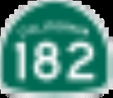
. The road begins as a continuation of California State Route 182 12 miles (19.3 km) north of Bridgeport. That route, which follows the East Walker River
as it flows from the Bridgeport Reservoir, crosses the Nevada state line east of the Sweetwater Mountains
. SR 338 follows the river northeast for about 3 miles (4.8 km) before diverting northwest, away from the water's course. The route eventually passes the former town of Sweetwater as it climbs up toward the 6812 feet (2,076.3 m) Sweetwater Summit.
As SR 338 heads down from the summit, it passes between the Wellington Hills to the west and the Pine Grove Hills to the east. The route crosses several small creeks as it heads north entering the Smith Valley. Farmlands come into view as the highway approaches its junction with Wellington Road (SR 829), which heads towards Wellington and points west. State Route 338 continues due north from here, heading through more farm tracts before ending at a "Y" junction with State Route 208
just south of Smith.
 An unimproved road connecting the Smith Valley to Sweetwater and Bridgeport existed as early as 1917. By 1929, the road had been made part of the state's highway system as State Route 22. The route, which largely followed present-day Sweetwater Road, connected directly to State Route 3
(now SR 208) on the north end at Wellington, via the Wellington Cutoff, instead of the present northern terminus near Smith. Earthwork improvements were made on SR 22 by 1936, but the northern end of the route would not be paved until 1948 with the remainder receiving pavement two years later. The north–south road segment connecting SR 22 to Smith appears to have been constructed by 1952.
After receiving upgrades in the early 1950s, no additional changes were made to State Route 22 until Nevada began renumbering its state highways in the late 1970s. During the renumbering process, the majority of SR 22 was renumbered as State Route 338—this also included the separate north–south link south of Smith. The portion of SR 22 that followed the Wellington Cutoff became State Route 829
in the same process. The Nevada Department of Transportation
approved the new highway numbers on July 1, 1976, with the route change first shown on the 1978–79 state highway map. The highways have remained unchanged since.
State highway
State highway, state road or state route can refer to one of three related concepts, two of them related to a state or provincial government in a country that is divided into states or provinces :#A...
in Lyon County
Lyon County, Nevada
Lyon County is a county located in the U.S. state of Nevada. As of the 2010 census, the population was 51,980. Its county seat is Yerington.-History:...
, Nevada
Nevada
Nevada is a state in the western, mountain west, and southwestern regions of the United States. With an area of and a population of about 2.7 million, it is the 7th-largest and 35th-most populous state. Over two-thirds of Nevada's people live in the Las Vegas metropolitan area, which contains its...
, USA. It connects the towns of Smith
Smith, Nevada
Smith is a small town in Lyon County, Nevada. It was named after a family that settled there in 1859....
and Wellington
Wellington, Nevada
Wellington is an unincorporated town in southwestern Lyon County, Nevada, United States. It lies along State Route 208 and southwest of the city of Yerington, the county seat of Lyon County. Its elevation is 4,836 feet , and it is located at about...
to the California
California
California is a state located on the West Coast of the United States. It is by far the most populous U.S. state, and the third-largest by land area...
state line
Border
Borders define geographic boundaries of political entities or legal jurisdictions, such as governments, sovereign states, federated states and other subnational entities. Some borders—such as a state's internal administrative borders, or inter-state borders within the Schengen Area—are open and...
north of Bridgeport, California
Bridgeport, California
Bridgeport is a census-designated place that is the county seat of Mono County, California. It lies at an elevation of 6463 feet in the middle of the Bridgeport Valley. Bridgeport is located at the intersection of highways US 395 and State Route 182. The population was 575 at the 2010...
. Much of the route has served as a road through this section of Nevada since at least 1919, and was known as State Route 22 from the 1920s until the late 1970s.
Route description
The majority of the route lies within the Humboldt-Toiyabe National ForestHumboldt-Toiyabe National Forest
The Humboldt-Toiyabe National Forest is the principal U.S. National Forest located in the U.S. state of Nevada. With an area of , it is the largest National Forest of the United States outside of Alaska...
. The road begins as a continuation of California State Route 182 12 miles (19.3 km) north of Bridgeport. That route, which follows the East Walker River
East Walker River
The East Walker River is a tributary of the Walker River, approximately long, in eastern California and western Nevada in the United States. It drains part of the eastern side of the Sierra Nevada in the watershed of Walker Lake in the Great Basin....
as it flows from the Bridgeport Reservoir, crosses the Nevada state line east of the Sweetwater Mountains
Sweetwater Mountains
The Sweetwater Mountains is a small mountain range in Northern Mono County, California and Western Lyon County, Nevada, separating the West Walker River from the East Walker River. Most of the range is only accessible by four wheel drive vehicle, on foot, or pack animal. Most of the range is...
. SR 338 follows the river northeast for about 3 miles (4.8 km) before diverting northwest, away from the water's course. The route eventually passes the former town of Sweetwater as it climbs up toward the 6812 feet (2,076.3 m) Sweetwater Summit.
As SR 338 heads down from the summit, it passes between the Wellington Hills to the west and the Pine Grove Hills to the east. The route crosses several small creeks as it heads north entering the Smith Valley. Farmlands come into view as the highway approaches its junction with Wellington Road (SR 829), which heads towards Wellington and points west. State Route 338 continues due north from here, heading through more farm tracts before ending at a "Y" junction with State Route 208
Nevada State Route 208
State Route 208 is a state highway within the counties of Douglas and Lyon in Nevada, USA. It connects U.S. Route 395 north of Topaz Lake to Alternate U.S. Route 95 in Yerington. The road serves as the primary transportation corridor of Smith Valley and is Main street in Yerington...
just south of Smith.
History
Nevada State Route 3
State Route 3 was the original designation for SR 208, SR 266 and SR 429. It was also the original designation for sections of SR 430, US 50, US 95, Alternate US 95, and US 395....
(now SR 208) on the north end at Wellington, via the Wellington Cutoff, instead of the present northern terminus near Smith. Earthwork improvements were made on SR 22 by 1936, but the northern end of the route would not be paved until 1948 with the remainder receiving pavement two years later. The north–south road segment connecting SR 22 to Smith appears to have been constructed by 1952.
After receiving upgrades in the early 1950s, no additional changes were made to State Route 22 until Nevada began renumbering its state highways in the late 1970s. During the renumbering process, the majority of SR 22 was renumbered as State Route 338—this also included the separate north–south link south of Smith. The portion of SR 22 that followed the Wellington Cutoff became State Route 829
Nevada State Route 829
State Route 829 is a state highway in Lyon County, Nevada. Also known as Wellington Road, the route serves as a shortcut connecting State Route 338 to State Route 208 near Wellington.-History:...
in the same process. The Nevada Department of Transportation
Nevada Department of Transportation
The Nevada Department of Transportation is a government agency in the U.S. state of Nevada. NDOT is responsible for maintaining and improving Nevada's highway system, which includes U.S. highways and Interstate highways within the state's boundaries. The department is notable for its...
approved the new highway numbers on July 1, 1976, with the route change first shown on the 1978–79 state highway map. The highways have remained unchanged since.