
California State Route 190
Encyclopedia
State Route 190 is a state highway
in the U.S. state
of California
that is split into two parts by the Sierra Nevada
. The western portion of begins at Tipton
at a junction with State Route 99
and heads east towards Porterville
before ending at Quaking Aspen in the Sequoia National Forest
. The eastern portion begins at US 395 at Olancha
, heads east through Death Valley National Park
, and ends at State Route 127
at Death Valley Junction
. The 43.0-mile (69.2 km) portion over the Sierra Nevada remains unconstructed, and the California Department of Transportation
(Caltrans) has no plans to build it through the wilderness
areas.
The route east of State Route 136
near Keeler
is on the California Freeway and Expressway System
, but is a two-lane road. Except west of State Route 65
in Porterville
, SR 190 is eligible for the State Scenic Highway System
; the part within Death Valley National Park, known as the Death Valley Scenic Byway, has been added to the system and is a National Scenic Byway
.
just south of downtown Tipton
in Tulare County
and heads straight east along the flat San Joaquin Valley
on Avenue 144. There is a short expressway
segment in Porterville
, including a cloverleaf interchange
at State Route 65
and a partial interchange at Main Street, after which the highway begins to curve alongside the Tule River
, passing the south side of Lake Success
, as the terrain becomes more rugged. Following the river, it meets the south end of County Route J37, an access road to Balch Park in the Mountain Home State Forest, at the forks of the river near the community of Springville
. SR 190 continues east near the Middle Fork and South Fork Middle Fork Tule River to near Camp Nelson
, where it begins rising into the foothills, going around many hairpin curves in order to rise to Quaking Aspen, the source of the South Fork Middle Fork and the end of the western segment of SR 190. The county-maintained Western Divide Highway continues south to a point west of Johnsondale
, where traffic can turn east to reach US 395 via Sherman Pass and County Route J41.
From Quaking Aspen across the Sierra Nevada to Olancha
, Caltrans has adopted a proposed alignment, but is unlikely to build it, in part due to two protected wilderness areas
—the Golden Trout Wilderness
and South Sierra Wilderness
—along the route. The unconstructed routing heads northeast from Quaking Aspen, cresting a small summit before following Freeman Creek easterly past the Freeman Creek Grove, crossing the Kern River
near its forks, and then using the path of Rattlesnake Creek and Beach Creek to the Beach Meadows area. Crossing several ridges to the northeast, SR 190 would make its way to the South Fork Kern River
near Monache Mountain, then heading southeast along that waterway to the vicinity of Haiwee Pass. That pass, elevation about 8200 feet (2500 m) above sea level, would take the highway over the Sierra crest
into Inyo County
, dropping for 12.0 miles (19.3 km) in a north-northeasterly direction to US 395 at Olancha (elevation 3650 feet/1100 m).
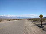
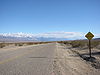 The eastern section of SR 190 begins at Olancha
in the Owens Valley
, at the intersection with US 395. The route heads northeast along the southeast side of Owens Lake
to the junction with SR 136
southeast of Keeler
, where it turns southeast and east around the south side of the Inyo Mountains
. After passing the turnoff to Darwin
, SR 190 enters Death Valley National Park
and becomes curvier as it heads down into the Panamint Valley
. The highway crosses the valley and then turns northeast over Towne Pass and into the northern part of Death Valley
at Stovepipe Wells
. Within the valley, at the intersection with North Highway, which leads to Scotty's Castle
and Beatty, Nevada
, SR 190 turns southeast through Death Valley, which it remains inside until the turnoff to Badwater Basin, the lowest point in North America, near the settlement of Furnace Creek. It leaves the valley to the southeast alongside Furnace Creek Wash, where the highway is usually closed at least once a year by flash flood
s. SR 190 turns east away from the wash at the turnoff to Dante's View
, and soon leaves the park, after which it follows a mostly straight alignment to its end at State Route 127
at Death Valley Junction
.
in Death Valley National Park was followed in late 1849 and early 1850 by the Death Valley '49ers
, a group of '49ers
that had left the Old Spanish Trail
at Enterprise, Utah
to look for a shortcut to Walker Pass
. The pioneers crossed the state line from Nevada
near Ash Meadows, following the general route of present SR 190 from Death Valley Junction into Death Valley, which they left to the west into Panamint Valley and then turned south towards present State Route 178
. After ore
was discovered in Death Valley, the route became a primitive road, though most travel into the valley, such as the twenty mule team
borax
route, was from the south.
The second boom in Death Valley was tourism
, started in the 1920s by Herman Eichbaum. After several failures in getting a toll road
approved from Lida, Nevada
or over Towne Pass, he scaled back plans to include only the part of the latter route between southeast of Darwin
and his resort at Stovepipe Wells. The new Eichbaum Toll Road was certified complete on May 4, 1926, and toll rates were set: $2 per motor vehicle and 50¢ per person. In 1933, the state legislature added many roads to the state highway system, including a new (unsigned) Route 127, connecting Tipton
with Baker
via Lone Pine
and Death Valley Junction. The Death Valley National Monument was created on February 11, 1933, and in December 1934 the Division of Highways paid $25,000 for the 30.35-mile (48.84 km) road, giving the 17 miles (27 km) east of the park boundary at the pass to the National Park Service
. The state Division of Highways and National Park Service soon paved the route from Lone Pine (on US 395) through Towne Pass and Death Valley to Baker (on US 91). The work was completed in October 1937, including the 17.5-mile (18 km) Darwin cutoff that bypassed Darwin and the old toll road west of Panamint Springs. The National Park Service, using Civilian Conservation Corps
labor, maintained the road through the park until August 1942, when an 11-mile (18 km) stretch east of the valley was washed out by a storm. At that time, maintenance was given back to the state, which rebuilt the destroyed segment.
When the state sign route system was created in 1934, Sign Route 190 was assigned to the portion of Route 127 west of Death Valley Junction, while the remainder to Baker became part of Sign Route 127
. However, the highway was not continuous, with the roadway from Tipton (which had been built by Tulare County) ending at Quaking Aspen (east of Camp Nelson
) and that from Death Valley ending southwest of Lone Pine. In 1923, Tulare County
businessmen had begun to push for a new trans-Sierra highway connecting Porterville
with Lone Pine
, but were set back by a lack of state aid, as the road was not a state highway. The first piece, which would turn out to be the only one built, opened in early July 1931 to Quaking Aspen (and became a state highway in 1933). Grading of the 15-mile (24 km) Western Divide Highway, a county road that was supposed to continue south to State Route 155
at Greenhorn Summit, was completed from Quaking Aspen south to near Johnsondale
in July 1962. A new road from Johnsondale across Sherman Pass, maintained by the U.S. Forest Service and Tulare and Inyo
Counties (the latter as County Route J41), was completed in 1976, allowing traffic on the western segment of SR 190 to reach US 395, though via a longer route than the proposed SR 190.
In March 1959, Tulare County approved a change in location of the proposed highway to Olancha Pass (Haiwee Pass, just to the south, was soon considered for a possible alternate location), and the legislature moved the main line of Route 127 south to that location, crossing US 395 at Olancha
, later that year. The old route from southeast of Keeler
to Lone Pine remained as a branch, and was still signed as SR 190. Also in 1959, the original routing from Lone Pine through Death Valley to Baker was added to the proposed California Freeway and Expressway System
, though no parts have been upgraded as such. The east–west piece between Tipton and Death Valley Junction legislatively received the State Route 190 designation in the 1964 renumbering, and the north–south part became State Route 127, which it had been signed as; the branch to Lone Pine became a new State Route 136. By the mid-1970s, the environmental movement
had essentially killed the planned connection, and the designation of the Golden Trout Wilderness in 1978 and South Sierra Wilderness in 1984 were the final blow, though Caltrans still has an officially adopted alignment designated over Haiwee Pass.
{| class=wikitable
!County
!Location
!Postmile
!Destinations
!Notes
|-
|rowspan=15|Tulare
TUL 0.00-56.57
|rowspan=2|Tipton
|0.00
|Poplar Avenue
|Continuation beyond SR 99
|-
|0.00
|
|Interchange
|-
|
|4.5
|
|
|-
|Poplar
|9.47
|
|
|-
|rowspan=7|Porterville
|colspan=3 align=center|West end of freeway
|-
|R15.24
|
|
|-
|colspan=3 align=center|Short gap in freeway
|-bgcolor=#ffdddd
|16.45
|Main Street (CR J29) – Porterville
|Eastbound exit and westbound entrance
|-
|colspan=3 align=center|East end of freeway
|-
|16.97
|Plano Street
|Interchange westbound; at-grade intersection
eastbound
|-
|18.45
|Blue Heron Parkway – Porterville Developmental Center
|Interchange eastbound; at-grade intersection westbound
|-
|
|21.10
|
|
|-
|
|27.30
|
|
|-
|
|R32.70
| – Balch Park
|
|-
|Quaking Aspen
|56.57
|Western Divide Highway
|
|-
|colspan=5 align=center|Gap in SR 190
|-
|rowspan=7|Inyo
INY 9.85-140.69
|Olancha
|9.85
|
|Former US 6
|-
|
|24.55
|
|
|-
|
|42.70
|colspan=2 align=center|Death Valley National Park
west boundary
|-
|
|57.91
| Panamint Valley Road to SR 178
|
|-
|
|93.21
|North Highway – Beatty
via Daylight Pass, Scotty's Castle
|
|-
|
|128.33
|colspan=2 align=center|Death Valley National Park
east boundary
|-
|Death Valley Junction
|140.69
| – Lathrop Wells, Shoshone
|
State highway
State highway, state road or state route can refer to one of three related concepts, two of them related to a state or provincial government in a country that is divided into states or provinces :#A...
in the U.S. state
U.S. state
A U.S. state is any one of the 50 federated states of the United States of America that share sovereignty with the federal government. Because of this shared sovereignty, an American is a citizen both of the federal entity and of his or her state of domicile. Four states use the official title of...
of California
California
California is a state located on the West Coast of the United States. It is by far the most populous U.S. state, and the third-largest by land area...
that is split into two parts by the Sierra Nevada
Sierra Nevada (US)
The Sierra Nevada is a mountain range in the U.S. states of California and Nevada, between the California Central Valley and the Basin and Range Province. The Sierra runs north-to-south, and is approximately across east-to-west...
. The western portion of begins at Tipton
Tipton, California
Tipton is a census-designated place in Tulare County, California, United States. The population was 2,543 at the 2010 census, up from 1,790 at the 2000 census.-Geography:Tipton is located at ....
at a junction with State Route 99
California State Route 99
California State Route 99 , commonly known as Highway 99 or, simply, as 99 , is a north–south state highway in the U.S. state of California, stretching almost the entire length of the Central Valley...
and heads east towards Porterville
Porterville, California
Porterville is a city in the San Joaquin Valley, in Tulare County, California, United States. Porterville's population was 54,165 at the 2010 census. The city's population grew dramatically as the city annexed many properties and unincorporated areas in and around Porterville. Not included in the...
before ending at Quaking Aspen in the Sequoia National Forest
Sequoia National Forest
Sequoia National Forest is located in the southern Sierra Nevada mountains of California. The U.S. National Forest is named for the majestic Giant Sequoia trees which populate 38 distinct groves within the boundaries of the forest....
. The eastern portion begins at US 395 at Olancha
Olancha, California
Olancha is a census-designated place in Inyo County of the U.S. state of California. Olancha is located on U.S. Route 395 in California, south-southeast of Independence, at an elevation of 3658 feet...
, heads east through Death Valley National Park
Death Valley National Park
Death Valley National Park is a national park in the U.S. states of California and Nevada located east of the Sierra Nevada in the arid Great Basin of the United States. The park protects the northwest corner of the Mojave Desert and contains a diverse desert environment of salt-flats, sand dunes,...
, and ends at State Route 127
California State Route 127
State Route 127 is a California state highway that connects Interstate 15 to Nevada State Route 373, passing through Death Valley National Park....
at Death Valley Junction
Death Valley Junction, California
Death Valley Junction is a tiny Mojave Desert community in unincorporated Inyo County, California, at the intersection of SR 190 and SR 127, just east of Death Valley National Park. The zip code is 92328, the elevation is , and the population fewer than 20. The city limits sign reports a...
. The 43.0-mile (69.2 km) portion over the Sierra Nevada remains unconstructed, and the California Department of Transportation
California Department of Transportation
The California Department of Transportation is a government department in the U.S. state of California. Its mission is to improve mobility across the state. It manages the state highway system and is actively involved with public transportation systems throughout the state...
(Caltrans) has no plans to build it through the wilderness
Wilderness
Wilderness or wildland is a natural environment on Earth that has not been significantly modified by human activity. It may also be defined as: "The most intact, undisturbed wild natural areas left on our planet—those last truly wild places that humans do not control and have not developed with...
areas.
The route east of State Route 136
California State Route 136
State Route 136 is a short state highway in California, USA, running from Lone Pine to State Route 190 along the northern edge of Owens Lake.-Route description:This route is part of the California Freeway and Expressway System....
near Keeler
Keeler, California
Keeler is a census-designated place in Inyo County, California, United States. Keeler is located on the east shore of Owens Lake south-southeast of New York Butte, at an elevation of 3602 feet...
is on the California Freeway and Expressway System
California Freeway and Expressway System
The California Freeway and Expressway System is a system of existing or planned freeways and expressways in the U.S. state of California. It is defined by the Streets and Highways Code.-List of roads in the system:*State Route 1 *State Route 2...
, but is a two-lane road. Except west of State Route 65
California State Route 65
State Route 65 , commonly known as Highway 65, is a north–south state highway in the U.S. state of California composed of two segments connecting Bakersfield to Exeter and Roseville to Olivehurst...
in Porterville
Porterville, California
Porterville is a city in the San Joaquin Valley, in Tulare County, California, United States. Porterville's population was 54,165 at the 2010 census. The city's population grew dramatically as the city annexed many properties and unincorporated areas in and around Porterville. Not included in the...
, SR 190 is eligible for the State Scenic Highway System
State Scenic Highway System (California)
The State Scenic Highway System is a list of highways, mainly state highways, that have been designated by the California Department of Transportation as scenic highways. The California State Legislature, primarily through Section 263 of the Streets and Highways Code, makes highways eligible for...
; the part within Death Valley National Park, known as the Death Valley Scenic Byway, has been added to the system and is a National Scenic Byway
National Scenic Byway
A National Scenic Byway is a road recognized by the United States Department of Transportation for its archeological, cultural, historic, natural, recreational, and/or scenic qualities. The program was established by Congress in 1991 to preserve and protect the nation's scenic but often...
.
Route description
State Route 190 begins at State Route 99California State Route 99
California State Route 99 , commonly known as Highway 99 or, simply, as 99 , is a north–south state highway in the U.S. state of California, stretching almost the entire length of the Central Valley...
just south of downtown Tipton
Tipton, California
Tipton is a census-designated place in Tulare County, California, United States. The population was 2,543 at the 2010 census, up from 1,790 at the 2000 census.-Geography:Tipton is located at ....
in Tulare County
Tulare County, California
Tulare County is a county located in the Central Valley of the U.S. state of California, south of Fresno. Sequoia National Park is located in the county, as are part of Kings Canyon National Park, in its northeast corner , and part of Mount Whitney, on its eastern border...
and heads straight east along the flat San Joaquin Valley
San Joaquin Valley
The San Joaquin Valley is the area of the Central Valley of California that lies south of the Sacramento – San Joaquin River Delta in Stockton...
on Avenue 144. There is a short expressway
Limited-access road
A limited-access road known by various terms worldwide, including limited-access highway, dual-carriageway and expressway, is a highway or arterial road for high-speed traffic which has many or most characteristics of a controlled-access highway , including limited or no access to adjacent...
segment in Porterville
Porterville, California
Porterville is a city in the San Joaquin Valley, in Tulare County, California, United States. Porterville's population was 54,165 at the 2010 census. The city's population grew dramatically as the city annexed many properties and unincorporated areas in and around Porterville. Not included in the...
, including a cloverleaf interchange
Cloverleaf interchange
A cloverleaf interchange is a two-level interchange in which left turns, reverse direction in left-driving regions, are handled by ramp roads...
at State Route 65
California State Route 65
State Route 65 , commonly known as Highway 65, is a north–south state highway in the U.S. state of California composed of two segments connecting Bakersfield to Exeter and Roseville to Olivehurst...
and a partial interchange at Main Street, after which the highway begins to curve alongside the Tule River
Tule River
The Tule River, also called Rio de San Pedro or Rio San Pedro, is a river in Tulare County in the U.S. state of California. The river originates in the Sierra Nevada east of Porterville and consists of three forks, North, Middle and South. The North Fork and Middle Fork meet above Springville. The...
, passing the south side of Lake Success
Lake Success (California)
Lake Success is a lake near Porterville, California on the Tule River at . It is formed by Success Dam and has a capacity of . The tall earth dam is owned and operated by the U.S. Army Corps of Engineers. Its construction was completed in 1961...
, as the terrain becomes more rugged. Following the river, it meets the south end of County Route J37, an access road to Balch Park in the Mountain Home State Forest, at the forks of the river near the community of Springville
Springville, California
Springville is a census-designated place in Tulare County, California, United States. The population was 934 at the 2010 census, down from 1,109 at the 2000 census.-Geography:Springville is located at ....
. SR 190 continues east near the Middle Fork and South Fork Middle Fork Tule River to near Camp Nelson
Camp Nelson, California
Camp Nelson is a census-designated place in Tulare County, California, United States. Camp Nelson is east of Springville. Camp Nelson has a post office with ZIP code 93208...
, where it begins rising into the foothills, going around many hairpin curves in order to rise to Quaking Aspen, the source of the South Fork Middle Fork and the end of the western segment of SR 190. The county-maintained Western Divide Highway continues south to a point west of Johnsondale
Johnsondale, California
Johnsondale is an unincorporated community in Tulare County, California, United States. Johnsondale is northeast of California Hot Springs. A post office opened in Johnsondale in 1939. The community is named after Walter Johnson of the Mount Whitney Lumber Company....
, where traffic can turn east to reach US 395 via Sherman Pass and County Route J41.
From Quaking Aspen across the Sierra Nevada to Olancha
Olancha, California
Olancha is a census-designated place in Inyo County of the U.S. state of California. Olancha is located on U.S. Route 395 in California, south-southeast of Independence, at an elevation of 3658 feet...
, Caltrans has adopted a proposed alignment, but is unlikely to build it, in part due to two protected wilderness areas
National Wilderness Preservation System
The National Wilderness Preservation System of the United States protects federally managed land areas designated for preservation in their natural condition. It was established by the Wilderness Act upon the signature of President Lyndon B. Johnson on September 3, 1964...
—the Golden Trout Wilderness
Golden Trout Wilderness
The Golden Trout Wilderness is a federally designated wilderness area in the Sierra Nevada, in Tulare County, California. It is located east of Visalia, California within Inyo National Forest and Sequoia National Forest....
and South Sierra Wilderness
South Sierra Wilderness
The South Sierra Wilderness is a federally designated wilderness protected area located northeast of Bakersfield, California.Created with the passage of the California Wilderness Act of 1984 by the U.S. Congress, it is in size, is within both the Sequoia and Inyo national forests and is managed...
—along the route. The unconstructed routing heads northeast from Quaking Aspen, cresting a small summit before following Freeman Creek easterly past the Freeman Creek Grove, crossing the Kern River
Kern River
The Kern River is a river in the U.S. state of California, approximately long. It drains an area of the southern Sierra Nevada mountains northeast of Bakersfield. Fed by snowmelt near Mount Whitney, the river passes through scenic canyons in the mountains and is a popular destination for...
near its forks, and then using the path of Rattlesnake Creek and Beach Creek to the Beach Meadows area. Crossing several ridges to the northeast, SR 190 would make its way to the South Fork Kern River
South Fork Kern River
The South Fork Kern River is a tributary of the Kern River in the Sierra Nevada of the U.S. state of California. It is one of the southernmost rivers on the western slope of the mountains, and drains an area of that comprises mostly rugged mountain ridges and dry evergreen forest...
near Monache Mountain, then heading southeast along that waterway to the vicinity of Haiwee Pass. That pass, elevation about 8200 feet (2500 m) above sea level, would take the highway over the Sierra crest
Sierra Crest
The Sierra Crest is a ~ generally north-to-south ridgeline that demarcates the broad west and narrow east slopes of the Sierra Nevada and that extends as far east as the Sierra's topographic front...
into Inyo County
Inyo County, California
-National protected areas:* Death Valley National Park * Inyo National Forest * Manzanar National Historic Site-Major highways:* U.S. Route 6* U.S. Route 395* State Route 127* State Route 136* State Route 168* State Route 178...
, dropping for 12.0 miles (19.3 km) in a north-northeasterly direction to US 395 at Olancha (elevation 3650 feet/1100 m).
Olancha, California
Olancha is a census-designated place in Inyo County of the U.S. state of California. Olancha is located on U.S. Route 395 in California, south-southeast of Independence, at an elevation of 3658 feet...
in the Owens Valley
Owens Valley
Owens Valley is the arid valley of the Owens River in eastern California in the United States, to the east of the Sierra Nevada and west of the White Mountains and Inyo Mountains on the west edge of the Great Basin section...
, at the intersection with US 395. The route heads northeast along the southeast side of Owens Lake
Owens Lake
Owens Lake is a mostly dry lake in the Owens Valley on the eastern side of the Sierra Nevada in Inyo County, California. It is located about south of Lone Pine, California...
to the junction with SR 136
California State Route 136
State Route 136 is a short state highway in California, USA, running from Lone Pine to State Route 190 along the northern edge of Owens Lake.-Route description:This route is part of the California Freeway and Expressway System....
southeast of Keeler
Keeler, California
Keeler is a census-designated place in Inyo County, California, United States. Keeler is located on the east shore of Owens Lake south-southeast of New York Butte, at an elevation of 3602 feet...
, where it turns southeast and east around the south side of the Inyo Mountains
Inyo Mountains
The Inyo Mountains are a short mountain range east of the Sierra Nevada mountains in eastern California in the United States. The range separates the Owens Valley to the west with Saline Valley to the east, extending for approximately 70 mi SSE from the southern end of the White Mountains,...
. After passing the turnoff to Darwin
Darwin, California
Darwin is a census-designated place in Inyo County, California, United States. Darwin is located southeast of Keeler, at an elevation of 4790 feet . The population was 43 at the 2010 census, down from 54 at the 2000 census. It is named after Dr...
, SR 190 enters Death Valley National Park
Death Valley National Park
Death Valley National Park is a national park in the U.S. states of California and Nevada located east of the Sierra Nevada in the arid Great Basin of the United States. The park protects the northwest corner of the Mojave Desert and contains a diverse desert environment of salt-flats, sand dunes,...
and becomes curvier as it heads down into the Panamint Valley
Panamint Valley
The Panamint Valley is a long basin located east of the Argus Range and Slate Range, and west of the Panamint Range in the northeastern reach of the Mojave Desert, in eastern California, United States.-Geography:...
. The highway crosses the valley and then turns northeast over Towne Pass and into the northern part of Death Valley
Death Valley
Death Valley is a desert valley located in Eastern California. Situated within the Mojave Desert, it features the lowest, driest, and hottest locations in North America. Badwater, a basin located in Death Valley, is the specific location of the lowest elevation in North America at 282 feet below...
at Stovepipe Wells
Stovepipe Wells, California
Stovepipe Wells is a small way-station in the northern part of Death Valley, in unincorporated Inyo County, California.-Geography and names:Stovepipe Wells is located at and is US Geological Survey feature ID 235564. It is entirely inside Death Valley National Park and along State Route 190 at...
. Within the valley, at the intersection with North Highway, which leads to Scotty's Castle
Scotty's Castle
Scotty's Castle is a two-story Mission Revival and Spanish Colonial Revival style villa located in the Grapevine Mountains of northern Death Valley in Death Valley National Park, California, U.S.. It is also known as Death Valley Ranch...
and Beatty, Nevada
Beatty, Nevada
Beatty is a census-designated place along the Amargosa River in Nye County in the U.S. state of Nevada. U.S. Route 95 runs through the CDP, which lies between Tonopah, about to the north, and Las Vegas, about to the southeast. State Route 374 connects Beatty to Death Valley National Park, about ...
, SR 190 turns southeast through Death Valley, which it remains inside until the turnoff to Badwater Basin, the lowest point in North America, near the settlement of Furnace Creek. It leaves the valley to the southeast alongside Furnace Creek Wash, where the highway is usually closed at least once a year by flash flood
Flash flood
A flash flood is a rapid flooding of geomorphic low-lying areas—washes, rivers, dry lakes and basins. It may be caused by heavy rain associated with a storm, hurricane, or tropical storm or meltwater from ice or snow flowing over ice sheets or snowfields...
s. SR 190 turns east away from the wash at the turnoff to Dante's View
Dante's View
Dante's View is a viewpoint terrace at 5,475 feet height, on the north side of Coffin Peak, along the crest of the Black Mountains, overlooking Death Valley...
, and soon leaves the park, after which it follows a mostly straight alignment to its end at State Route 127
California State Route 127
State Route 127 is a California state highway that connects Interstate 15 to Nevada State Route 373, passing through Death Valley National Park....
at Death Valley Junction
Death Valley Junction, California
Death Valley Junction is a tiny Mojave Desert community in unincorporated Inyo County, California, at the intersection of SR 190 and SR 127, just east of Death Valley National Park. The zip code is 92328, the elevation is , and the population fewer than 20. The city limits sign reports a...
.
History
The path of SR 190 east of the Panamint RangePanamint Range
The Panamint Range is a short rugged fault-block mountain range on the northern edge of the Mojave Desert, in Death Valley National Park, Inyo County, California, United States.-Geography:...
in Death Valley National Park was followed in late 1849 and early 1850 by the Death Valley '49ers
Death Valley '49ers
The Death Valley '49ers were a group of pioneers from the Eastern United States that endured a long difficult journey during the late 1840s California Gold Rush to prospect in the Sutter's Fort area of the Central Valley and Sierra Nevada in California...
, a group of '49ers
California Gold Rush
The California Gold Rush began on January 24, 1848, when gold was found by James W. Marshall at Sutter's Mill in Coloma, California. The first to hear confirmed information of the gold rush were the people in Oregon, the Sandwich Islands , and Latin America, who were the first to start flocking to...
that had left the Old Spanish Trail
Old Spanish Trail (trade route)
The Old Spanish Trail is a historical trade route which connected the northern New Mexico settlements near or in Santa Fe, New Mexico with that of Los Angeles, California and southern California. Approximately long, it ran through areas of high mountains, arid deserts, and deep canyons. It is...
at Enterprise, Utah
Enterprise, Utah
Enterprise is a city in Washington County, Utah, United States. The population was 1,711 at the 2010 census. Enterprise is home to two schools, Enterprise Elementary School and Enterprise High School .-Geography:...
to look for a shortcut to Walker Pass
Walker Pass
Walker Pass is a mountain pass by Lake Isabella in the southern Sierra Nevada mountains. It is located in northeastern Kern County, approximately 53 mi ENE of Bakersfield and 10 mi WNW of Ridgecrest...
. The pioneers crossed the state line from Nevada
Nevada
Nevada is a state in the western, mountain west, and southwestern regions of the United States. With an area of and a population of about 2.7 million, it is the 7th-largest and 35th-most populous state. Over two-thirds of Nevada's people live in the Las Vegas metropolitan area, which contains its...
near Ash Meadows, following the general route of present SR 190 from Death Valley Junction into Death Valley, which they left to the west into Panamint Valley and then turned south towards present State Route 178
California State Route 178
State Route 178 is a route that exists in two constructed segments. The gap in between segments is connected by various local roads and State Route 190 through Death Valley National Park....
. After ore
Ore
An ore is a type of rock that contains minerals with important elements including metals. The ores are extracted through mining; these are then refined to extract the valuable element....
was discovered in Death Valley, the route became a primitive road, though most travel into the valley, such as the twenty mule team
Twenty mule team
Twenty-mule teams were teams of eighteen mules and two horses attached to large wagons that ferried borax out of Death Valley from 1883 to 1889. They traveled from mines across the Mojave Desert to the nearest railroad spur, 165 miles away in Mojave, California...
borax
Borax
Borax, also known as sodium borate, sodium tetraborate, or disodium tetraborate, is an important boron compound, a mineral, and a salt of boric acid. It is usually a white powder consisting of soft colorless crystals that dissolve easily in water.Borax has a wide variety of uses...
route, was from the south.
The second boom in Death Valley was tourism
Tourism
Tourism is travel for recreational, leisure or business purposes. The World Tourism Organization defines tourists as people "traveling to and staying in places outside their usual environment for not more than one consecutive year for leisure, business and other purposes".Tourism has become a...
, started in the 1920s by Herman Eichbaum. After several failures in getting a toll road
Toll road
A toll road is a privately or publicly built road for which a driver pays a toll for use. Structures for which tolls are charged include toll bridges and toll tunnels. Non-toll roads are financed using other sources of revenue, most typically fuel tax or general tax funds...
approved from Lida, Nevada
Lida, Nevada
Lida, Nevada is a small town in Esmeralda County, Nevada, near the border with California. It is located on State Route 266, north of Magruder Mountain....
or over Towne Pass, he scaled back plans to include only the part of the latter route between southeast of Darwin
Darwin, California
Darwin is a census-designated place in Inyo County, California, United States. Darwin is located southeast of Keeler, at an elevation of 4790 feet . The population was 43 at the 2010 census, down from 54 at the 2000 census. It is named after Dr...
and his resort at Stovepipe Wells. The new Eichbaum Toll Road was certified complete on May 4, 1926, and toll rates were set: $2 per motor vehicle and 50¢ per person. In 1933, the state legislature added many roads to the state highway system, including a new (unsigned) Route 127, connecting Tipton
Tipton, California
Tipton is a census-designated place in Tulare County, California, United States. The population was 2,543 at the 2010 census, up from 1,790 at the 2000 census.-Geography:Tipton is located at ....
with Baker
Baker, California
Baker is a census-designated place located in San Bernardino County, California, USA. As of the 2010 census, the town had a total population of 735.Baker was founded as a station on the Tonopah and Tidewater Railroad in 1908,...
via Lone Pine
Lone Pine, California
Lone Pine is a census-designated place in Inyo County, California, United States. Lone Pine is located south-southeast of Independence, at an elevation of 3727 feet . The population was 2,035 at the 2010 census, up from 1,655 at the 2000 census. The town is located in the Owens Valley, near the...
and Death Valley Junction. The Death Valley National Monument was created on February 11, 1933, and in December 1934 the Division of Highways paid $25,000 for the 30.35-mile (48.84 km) road, giving the 17 miles (27 km) east of the park boundary at the pass to the National Park Service
National Park Service
The National Park Service is the U.S. federal agency that manages all national parks, many national monuments, and other conservation and historical properties with various title designations...
. The state Division of Highways and National Park Service soon paved the route from Lone Pine (on US 395) through Towne Pass and Death Valley to Baker (on US 91). The work was completed in October 1937, including the 17.5-mile (18 km) Darwin cutoff that bypassed Darwin and the old toll road west of Panamint Springs. The National Park Service, using Civilian Conservation Corps
Civilian Conservation Corps
The Civilian Conservation Corps was a public work relief program that operated from 1933 to 1942 in the United States for unemployed, unmarried men from relief families, ages 18–25. A part of the New Deal of President Franklin D...
labor, maintained the road through the park until August 1942, when an 11-mile (18 km) stretch east of the valley was washed out by a storm. At that time, maintenance was given back to the state, which rebuilt the destroyed segment.
When the state sign route system was created in 1934, Sign Route 190 was assigned to the portion of Route 127 west of Death Valley Junction, while the remainder to Baker became part of Sign Route 127
California State Route 127
State Route 127 is a California state highway that connects Interstate 15 to Nevada State Route 373, passing through Death Valley National Park....
. However, the highway was not continuous, with the roadway from Tipton (which had been built by Tulare County) ending at Quaking Aspen (east of Camp Nelson
Camp Nelson, California
Camp Nelson is a census-designated place in Tulare County, California, United States. Camp Nelson is east of Springville. Camp Nelson has a post office with ZIP code 93208...
) and that from Death Valley ending southwest of Lone Pine. In 1923, Tulare County
Tulare County, California
Tulare County is a county located in the Central Valley of the U.S. state of California, south of Fresno. Sequoia National Park is located in the county, as are part of Kings Canyon National Park, in its northeast corner , and part of Mount Whitney, on its eastern border...
businessmen had begun to push for a new trans-Sierra highway connecting Porterville
Porterville, California
Porterville is a city in the San Joaquin Valley, in Tulare County, California, United States. Porterville's population was 54,165 at the 2010 census. The city's population grew dramatically as the city annexed many properties and unincorporated areas in and around Porterville. Not included in the...
with Lone Pine
Lone Pine, California
Lone Pine is a census-designated place in Inyo County, California, United States. Lone Pine is located south-southeast of Independence, at an elevation of 3727 feet . The population was 2,035 at the 2010 census, up from 1,655 at the 2000 census. The town is located in the Owens Valley, near the...
, but were set back by a lack of state aid, as the road was not a state highway. The first piece, which would turn out to be the only one built, opened in early July 1931 to Quaking Aspen (and became a state highway in 1933). Grading of the 15-mile (24 km) Western Divide Highway, a county road that was supposed to continue south to State Route 155
California State Route 155
State Route 155 is a state highway in the U.S. state of California connecting State Route 99 and State Route 178, going through the southern part of the Sierra Nevada mountain range. This highway runs from east to west. Its west terminus is in Delano and its east terminus is in the small town of...
at Greenhorn Summit, was completed from Quaking Aspen south to near Johnsondale
Johnsondale, California
Johnsondale is an unincorporated community in Tulare County, California, United States. Johnsondale is northeast of California Hot Springs. A post office opened in Johnsondale in 1939. The community is named after Walter Johnson of the Mount Whitney Lumber Company....
in July 1962. A new road from Johnsondale across Sherman Pass, maintained by the U.S. Forest Service and Tulare and Inyo
Inyo County, California
-National protected areas:* Death Valley National Park * Inyo National Forest * Manzanar National Historic Site-Major highways:* U.S. Route 6* U.S. Route 395* State Route 127* State Route 136* State Route 168* State Route 178...
Counties (the latter as County Route J41), was completed in 1976, allowing traffic on the western segment of SR 190 to reach US 395, though via a longer route than the proposed SR 190.
In March 1959, Tulare County approved a change in location of the proposed highway to Olancha Pass (Haiwee Pass, just to the south, was soon considered for a possible alternate location), and the legislature moved the main line of Route 127 south to that location, crossing US 395 at Olancha
Olancha, California
Olancha is a census-designated place in Inyo County of the U.S. state of California. Olancha is located on U.S. Route 395 in California, south-southeast of Independence, at an elevation of 3658 feet...
, later that year. The old route from southeast of Keeler
Keeler, California
Keeler is a census-designated place in Inyo County, California, United States. Keeler is located on the east shore of Owens Lake south-southeast of New York Butte, at an elevation of 3602 feet...
to Lone Pine remained as a branch, and was still signed as SR 190. Also in 1959, the original routing from Lone Pine through Death Valley to Baker was added to the proposed California Freeway and Expressway System
California Freeway and Expressway System
The California Freeway and Expressway System is a system of existing or planned freeways and expressways in the U.S. state of California. It is defined by the Streets and Highways Code.-List of roads in the system:*State Route 1 *State Route 2...
, though no parts have been upgraded as such. The east–west piece between Tipton and Death Valley Junction legislatively received the State Route 190 designation in the 1964 renumbering, and the north–south part became State Route 127, which it had been signed as; the branch to Lone Pine became a new State Route 136. By the mid-1970s, the environmental movement
Environmental movement
The environmental movement, a term that includes the conservation and green politics, is a diverse scientific, social, and political movement for addressing environmental issues....
had essentially killed the planned connection, and the designation of the Golden Trout Wilderness in 1978 and South Sierra Wilderness in 1984 were the final blow, though Caltrans still has an officially adopted alignment designated over Haiwee Pass.
Major intersections
- Note: Except where prefixed with a letter, postmiles were measured in 1964, based on the alignment as it existed at that time, and do not necessarily reflect current mileage. The numbers reset at county lines; the start and end postmiles in each county are given in the county column.
{| class=wikitable
!County
!Location
!Postmile
!Destinations
!Notes
|-
|rowspan=15|Tulare
Tulare County, California
Tulare County is a county located in the Central Valley of the U.S. state of California, south of Fresno. Sequoia National Park is located in the county, as are part of Kings Canyon National Park, in its northeast corner , and part of Mount Whitney, on its eastern border...
TUL 0.00-56.57
|rowspan=2|Tipton
Tipton, California
Tipton is a census-designated place in Tulare County, California, United States. The population was 2,543 at the 2010 census, up from 1,790 at the 2000 census.-Geography:Tipton is located at ....
|0.00
|Poplar Avenue
|Continuation beyond SR 99
|-
|0.00
|
|Interchange
|-
|
|4.5
|
|
|-
|Poplar
|9.47
|
|
|-
|rowspan=7|Porterville
Porterville, California
Porterville is a city in the San Joaquin Valley, in Tulare County, California, United States. Porterville's population was 54,165 at the 2010 census. The city's population grew dramatically as the city annexed many properties and unincorporated areas in and around Porterville. Not included in the...
|colspan=3 align=center|West end of freeway
|-
|R15.24
|
|
|-
|colspan=3 align=center|Short gap in freeway
|-bgcolor=#ffdddd
|16.45
|Main Street (CR J29) – Porterville
Porterville, California
Porterville is a city in the San Joaquin Valley, in Tulare County, California, United States. Porterville's population was 54,165 at the 2010 census. The city's population grew dramatically as the city annexed many properties and unincorporated areas in and around Porterville. Not included in the...
|Eastbound exit and westbound entrance
|-
|colspan=3 align=center|East end of freeway
|-
|16.97
|Plano Street
|Interchange westbound; at-grade intersection
At-grade intersection
An at-grade intersection is a junction at which two or more transport axes cross at the same level .-Traffic management:With areas of high or fast traffic, an at-grade intersection normally requires a traffic control device such as a stop sign, traffic light or railway signal to manage conflicting...
eastbound
|-
|18.45
|Blue Heron Parkway – Porterville Developmental Center
|Interchange eastbound; at-grade intersection westbound
|-
|
|21.10
|
|
|-
|
|27.30
|
|
|-
|
|R32.70
| – Balch Park
|
|-
|Quaking Aspen
|56.57
|Western Divide Highway
|
|-
|colspan=5 align=center|Gap in SR 190
|-
|rowspan=7|Inyo
Inyo County, California
-National protected areas:* Death Valley National Park * Inyo National Forest * Manzanar National Historic Site-Major highways:* U.S. Route 6* U.S. Route 395* State Route 127* State Route 136* State Route 168* State Route 178...
INY 9.85-140.69
|Olancha
Olancha, California
Olancha is a census-designated place in Inyo County of the U.S. state of California. Olancha is located on U.S. Route 395 in California, south-southeast of Independence, at an elevation of 3658 feet...
|9.85
|
|Former US 6
U.S. Route 6 in California
U.S. Route 6, or US 6, is a transcontinental highway from the U.S. state of California to Massachusetts. In California, the highway lies in the eastern portion of the state from Bishop in the Owens Valley north to the Nevada state line in Esmeralda County...
|-
|
|24.55
|
|
|-
|
|42.70
|colspan=2 align=center|Death Valley National Park
Death Valley National Park
Death Valley National Park is a national park in the U.S. states of California and Nevada located east of the Sierra Nevada in the arid Great Basin of the United States. The park protects the northwest corner of the Mojave Desert and contains a diverse desert environment of salt-flats, sand dunes,...
west boundary
|-
|
|57.91
|
California State Route 178
State Route 178 is a route that exists in two constructed segments. The gap in between segments is connected by various local roads and State Route 190 through Death Valley National Park....
|
|-
|
|93.21
|North Highway – Beatty
Beatty, Nevada
Beatty is a census-designated place along the Amargosa River in Nye County in the U.S. state of Nevada. U.S. Route 95 runs through the CDP, which lies between Tonopah, about to the north, and Las Vegas, about to the southeast. State Route 374 connects Beatty to Death Valley National Park, about ...
via Daylight Pass, Scotty's Castle
Scotty's Castle
Scotty's Castle is a two-story Mission Revival and Spanish Colonial Revival style villa located in the Grapevine Mountains of northern Death Valley in Death Valley National Park, California, U.S.. It is also known as Death Valley Ranch...
|
|-
|
|128.33
|colspan=2 align=center|Death Valley National Park
Death Valley National Park
Death Valley National Park is a national park in the U.S. states of California and Nevada located east of the Sierra Nevada in the arid Great Basin of the United States. The park protects the northwest corner of the Mojave Desert and contains a diverse desert environment of salt-flats, sand dunes,...
east boundary
|-
|Death Valley Junction
Death Valley Junction, California
Death Valley Junction is a tiny Mojave Desert community in unincorporated Inyo County, California, at the intersection of SR 190 and SR 127, just east of Death Valley National Park. The zip code is 92328, the elevation is , and the population fewer than 20. The city limits sign reports a...
|140.69
| – Lathrop Wells, Shoshone
Shoshone, California
Shoshone is a census-designated place in Inyo County, California, United States. Shoshone is located on the Tonopah and Tidewater Railroad east of Epaulet Peak, at an elevation of 1585 feet . The population was 31 at the 2010 census, down from 52 at the 2000 census.The town was founded in 1910...
|