
California State Route 91
Encyclopedia
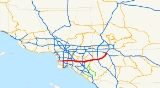
State Route 91 is a major east–west freeway located entirely within Southern California
and serving several regions of the Greater Los Angeles
metropolitan area. Specifically, it runs from Vermont Avenue
in Gardena
, just west of the junction with the Harbor Freeway (Interstate 110
), east to Riverside
at the junction with the Pomona (State Route 60
west of SR 91), and Moreno Valley (SR 60 and I-215
east of SR 91) freeways. The route is part of the California Freeway and Expressway System
, and, since the portion west of Vermont Avenue was relinquished to local governments, it is entirely a freeway. SR 91 is part of the State Scenic Highway System
from SR 55 to the east city limit of Anaheim, in the western part of the Santa Ana Canyon
, and is eligible for the system through the canyon to I-15.
Although SR 91 is an east–west road, it inherited its odd (as opposed to even) route number from the now mostly decommissioned U.S. 91
which passed through the Inland Empire
in a northeasterly direction on its way to Las Vegas
, Salt Lake City
, and points beyond. Those segments of U.S. 91 are now parallel to, or have been replaced altogether by, Interstate 15 (I-15).
The area from post mile 10.4 to 11.1 is known as the Juanita Millender-McDonald
Highway.
, SR 91 is named the Gardena Freeway. Between the Long Beach Freeway and its intersection with the Santa Ana Freeway
at the Fullerton
-Anaheim
border, it is named the Artesia Freeway. From the Santa Ana Freeway to its eastern terminus at the intersection of the Pomona, Moreno Valley, and Escondido Freeways, it is named the Riverside Freeway.
. It is the westernmost freeway portion of State Route 91. It begins just west of the Harbor Freeway at the intersection with Vermont Avenue
in the eastern edge of the city of Gardena
, proceeding eastward approximately six miles (10 km) until it intersects the Long Beach Freeway. Nearby the exit to Acacia Avenue, Artesia Boulevard meets with the Blue Line at its station
. Thereafter, SR 91 is known as the Artesia Freeway.
Until 1991, the Gardena Freeway was known as the Redondo Beach Freeway. The name change reflected the successful efforts of the cities of Torrance
and Redondo Beach
to block the extension of the freeway westward to its intended terminus at the cancelled Pacific Coast Freeway in Redondo Beach. In 1997, the California government dedicated the portion of the 91 between Alameda Rd and Central Ave to former assemblyman Willard H. Murray Jr.
and northwestern Orange County
. It is signed as State Route 91 for its entire length. It runs east–west from its western terminus at the Long Beach Freeway in northern Long Beach
to its eastern terminus at the Santa Ana Freeway
at the Fullerton
-Anaheim
border. (SR 91 continues west of the Long Beach Freeway as the Gardena Freeway, and east of the Santa Ana Freeway as the Riverside Freeway.) The "Artesia Freeway" name originally was assigned to the entire length of SR 91 west of the Santa Ana Freeway in the early 1970s since it was, in sense, the freeway realignment of SR 91 from the paralleling Artesia Boulevard.
During the 1984 Summer Olympics
, a 25 km (15.5 mi) stretch of the highway was home to the cycling men's road team time trial event
.
As the only freeway to link Los Angeles
, Orange
, and Riverside
counties, the 91 is one of the most heavily congested routes in Southern California.
 Between the Santa Ana Freeway
, Interstate 5 (I-5), in Buena Park
and the 91 Freeway's eastern terminus at a junction with Interstate 215
and State Route 60
in Riverside
, the 91 Freeway's assigned name is the Riverside Freeway. Past the I-215/CA-60/CA-91 junction, the Riverside Freeway continues as I-215.
The Riverside Freeway was first opened in 1963 signed as U.S. Route 91 and U.S. Route 395 and the last section was built in 1975.
combination contained entirely within the median
of the Riverside Freeway
(State Route 91
) in Orange County, California
. They run from the Costa Mesa Freeway (State Route 55
) interchange in Anaheim
to the Riverside County
line.
, called the "3+ Carpool Lane", that can only be used by motorcycles and vehicles with three or more passengers. Access to the 91 Express Lanes are provided only at its east and west ends.
All tolls are collected using an open road tolling
system, with each vehicle required to carry a FasTrak
transponder
; there are no toll booths to receive cash. The 91 Express Lanes use a variable pricing
system based on the time of day. The road is not truly "congestion priced
" because toll rates come from a preset schedule instead of being based on actual congestion. Since July 1, 2011 the toll on the busiest hour on the tollway, 3:00 pm to 4:00 pm eastbound on Fridays, is $9.75, or approximately $0.97 per mile, the highest toll for any toll road in the country. The highest toll in the morning rush hour, 7:00 am to 8:00 am westbound Monday to Thursday, is $4.60.
Motorcycles and vehicles with three or more passengers who use the "3+" carpool lanes are not charged a toll, except when traveling eastbound from 4:00 pm to 6:00 pm on weekdays. During that period, they are charged 50% of the full posted toll. Even though there may be no toll charge, a FasTrak transponder is still required on all vehicles using the "3+" carpool lanes.
A Toll Policy is published which states the criteria where tolls will be raised. The policy is designed to "a) reduce the likelihood of congestion by diverting traffic to other hours with available capacity; b) maintain free flow travel speed in the 91 Express Lanes; c) maintain travel time savings; d) accommodate projected growth in travel demand and; e) ensure that the toll road generates sufficient revenue to effectively operate the toll lanes and maintain a strong debt service position." Changes to the toll schedule require ten days notification to the public and the OCTA board. Once tolls are changed during the "super peak" period, they may not be changed again for six months. All tolls increase annually due to inflation. Despite this, the toll lanes are generally free flowing during most peak hour conditions.
, new residential development began in earnest in western Riverside County
(consistent with similar accelerated growth throughout the Inland Empire
) during the 1980s, and continues to this day. This new development is occurring in or around existing cities such as Riverside, Corona, Norco, and Moreno Valley. As there are very few direct routes between Orange and Riverside Counties because of the Santa Ana Mountains
that separate the two counties, the Riverside Freeway is subject to a very heavy traffic volume, composed primarily of commuters traveling between where they work in Orange County and where they live in Riverside County (often referred to by traffic reporters as "The Corona Crawl") Typical peak period delays were 30–40 minutes in each direction in the ten miles (16 km) of the tollway before construction.
Solutions to the traffic problem were limited. The chosen solution was to create a toll road in the median of the freeway. The toll road route operates between the Orange/Riverside county line and the Costa Mesa Freeway (SR 55
) interchange in eastern Anaheim
- a distance of about 10 miles (16.1 km). The project was developed in partnership with the California Department of Transportation
(Caltrans) by California Private Transportation Company (CPTC). CPTC formally transferred ownership of the facility to the State of California prior to opening the project to traffic on December 27, 1995. Caltrans then leased the toll road back to CPTC for a 35-year operating period. The new lanes have been officially designated a part of the state highway system. The California Highway Patrol
(CHP) is responsible for providing police services at CPTC's expense. Maintenance and operational costs for the facility are also the responsibility of CPTC. In April, 2002, the Orange County Transportation Authority
(OCTA) reached an agreement in concept to purchase the private toll road project for $207.5 million. OCTA took possession of the Toll Road on January 3, 2003, marking the first time the 91 Express Lanes was managed by public officials. Within a few months, OCTA turned the lanes into the HOT / tollway hybrid that it is today. One of the primary investors in CPTC, Cofiroute USA, continues to manage and operate the lanes under a management contract with OCTA.
Opening in 1995, the 91 Express Lanes is the first privately funded tollway built in the United States since the 1940s, and the first fully automated tollway in the world.
The express lanes have been controversial because of a "non-compete" agreement that the state made with CPTC. The clause, which was negotiated by Caltrans and never was brought to the legislature, prevent any improvements along 30 miles (48.3 km) of the Riverside Freeway
to ensure profit for the express lanes. This includes restricting the state from widening the free lanes or building mass transit near the freeway. CPTC filed a lawsuit against Caltrans over freeway widening related to the interchange with the Eastern Transportation Corridor
interchange, which was dismissed once the purchase with OCTA was finalized. Following the settlement, an additional lane was added for a 5 mile segment eastbound from SR-241 to SR-71, which has decreased usage of the toll road and revenues.
But as a result of the controversy, more toll road advocates favor creating local agencies similar to Transportation Corridor Agencies
to build and maintain future tollways. New toll roads would be financed with tax-exempt bonds on a stand-alone basis—taxpayers would not be responsible for repaying any debt if toll revenues fall short. And there would be a less restrictive "non-compete" clause: They would only be compensated for any revenue loss caused by improvements near the toll roads.
Meanwhile, OCTA announced a proposal in 2005 to study an 11 miles (17.7 km) tunnel through the Santa Ana Mountains and along fault lines to help relieve traffic on the 91. The proposal is opposed by environmental groups, cities in Orange County near the terminus of the proposed road, and by the Irvine Company
, which believes that the tunnel is not necessary and distracts from short term solutions such as freeway widening.
.svg.png) The Arrowhead Trail, an auto trail
The Arrowhead Trail, an auto trail
connecting Salt Lake City with Los Angeles, initially took a longer route via present US 95 and former US 66 between Las Vegas and Needles
, as the more direct Old Spanish Trail
was in very poor condition. The "Silver Lake
cutoff", which would save about 90 miles (145 km), was proposed by 1920, and completed in 1925 as an oiled road by San Bernardino County. The Bureau of Public Roads and the state of Nevada
both urged its inclusion in the state highway system, the former as part of the federal aid highway connecting Salt Lake City and Los Angeles, and the state legislature did that in 1925, with it becoming an extension of Route 31. (Across the state line, State Route 6 continued through Las Vegas to Arizona
.) The initial plan for the U.S. Highway system simply stated that Route No. 91 would run from Las Vegas "to an intersection with Route No. 60" (which became US 66 in 1926), but in 1926 the cutoff was chosen, ending at US 66 at Daggett, just east of Barstow. (The roadway south from Las Vegas later became part of US 95.) The route was added to the federal-aid secondary system in 1926, which helped pay for a mid-1930s widening and paving, including some realignments (parts of the old road are now known as Arrowhead Trail). The new routing generally followed the present I-15, except through Baker (where it used Baker Boulevard) and into Barstow (where it followed former SR 58 to First Avenue, ending at Main Street, which carried US 66).
.svg.png) US 91 was extended southwest to Long Beach in the late 1940s. Beginning at Barstow, the extension overlapped US 66 over Cajon Pass
US 91 was extended southwest to Long Beach in the late 1940s. Beginning at Barstow, the extension overlapped US 66 over Cajon Pass
to San Bernardino. From San Bernardino west through Riverside and Santa Ana Canyon
to Olive, the state took over a mostly-paved county highway
in 1931 as part of an extension of Route 43 to Newport Beach via Santa Ana. Two branches leading west from Route 43 near Olive along mostly-constructed county roads were added in 1933: Route 175 along Orangethorpe Avenue and Artesia Boulevard from near the mouth of the canyon west to Route 60 (now SR 1) in Hermosa Beach (unconstructed through Compton until the mid-1950s), and Route 178 along Lincoln Avenue and Carson Street from Olive west to Route 168 (now SR 19) in Lakewood. When state routes were marked in 1934, Route 175 became Sign Route 14, and Sign Route 18 included all of Route 178 and most of Route 43 into the San Bernardino Mountains
. When US 91 was extended to Long Beach, it overlapped SR 18 from San Bernardino to Lakewood, where it turned south along SR 19 to the Los Alamitos Traffic Circle. There it turned west along US 101 Alternate to near downtown Long Beach, where it ended at SR 15 (Atlantic Avenue), at a terminus shared with US 6. (This routing along SR 19 and US 101 Alt. also became an extension of SR 18.)
In 1935, the state improved the alignment between Fairmont Boulevard and Gypsum Canyon Road, including a bypass of the old road, which curved along the south slope of the canyon, east of Weir Canyon Road. In the late 1930s, the Prado Dam
project resulted in the bypassing of a longer section, replacing Prado Road, an abandoned road curving to the east end of the dam, Pomona Rincon Road, Auto Center Drive, Pomona Road, and Yorba Street with the present Green River Road, Palisades Drive, part of SR 91, and 6th Street.
Also, before 1997, the 91 continued all the way to State Route 1 in Hermosa Beach
, which Metro Local
line 130 runs through. At that time, the route became discontinuous in Gardena
, the portion between Vermont Avenue
and Western Avenue
being turned over to the city. In 2003, the western portion, from SR 1 to Western Ave. was relinquished to the local jurisdictions. The first segment of the freeway was made in 1965 signed as US 91, and the last segment was made in 1975.
south of Corona
near Cajalco Road to California State Route 241
near Irvine
. One concept for this project specifies a set of three tunnels—two for cars and one for both trucks and high-speed light rail
—that would stretch for 12 miles (19.3 km), burrowing beneath the Santa Ana mountain range
, and carrying up to 70,000 cars a day between California’s Riverside
and Orange
counties. The proposed tunnel project would follow a similar route to the 91 Freeway and is designed to reduce the growing traffic congestion on the 91 that prompted the construction of the 91 Express Lanes. If completed, the Irvine-Corona Expressway is projected to be the longest traffic tunnel in North America.
Numerous other projects are currently underway or in the planning phases for distant completion, some as far out as the year 2030. They can be found listed here and explained in the official implementation plan.
{| class=wikitable
!County
!Location
!Postmile
!Exit
!Destinations
!Notes
|-
|rowspan=37|Los Angeles
LA 0.00-R20.74
|rowspan=2|Hermosa Beach
,
Redondo Beach
|0.00
|
|Gould Avenue
|Continuation beyond SR 1
|-
|0.00
|
|
|
|-
|Lawndale
|rowspan=2 bgcolor=#ffdddd|
|rowspan=2 bgcolor=#ffdddd|
|rowspan=2 bgcolor=#ffdddd|.svg.png) Redondo Beach Boulevard to I-405
Redondo Beach Boulevard to I-405
north / Hawthorne Boulevard north
|rowspan=2 bgcolor=#ffdddd|Eastbound exit and westbound entrance
|-
|rowspan=2|Redondo Beach
|-
|rowspan=2 bgcolor=#ffdddd|2.47
|rowspan=2 bgcolor=#ffdddd|
|rowspan=2 bgcolor=#ffdddd|
|rowspan=2 bgcolor=#ffdddd|No left turn eastbound
|-
|rowspan=3|Torrance
|-bgcolor=#ffdddd
|3.07
|
|
|Interchange; eastbound exit and westbound entrance; former SR 7 south
|-bgcolor=#ffdddd
|3.07
|
|
|Interchange; westbound exit and eastbound entrance; former SR 7 north
|-
|Gardena
|rowspan=2|6.01
|rowspan=2|
|rowspan=2|Vermont Avenue
|rowspan=2|West end of state maintenance
|-
|rowspan=3|Los Angeles
|-
|colspan=4 align=center|West end of freeway
|-
|R6.34
|6
|
|No exit number eastbound
|-
|rowspan=3|Carson
|bgcolor=#ffdddd|R6.90
|bgcolor=#ffdddd|7A
|bgcolor=#ffdddd|Main Street
|bgcolor=#ffdddd|No westbound entrance
|-
|R7.43
|7B
|Avalon Boulevard
|
|-
|rowspan=2|R8.44
|rowspan=2|8
|rowspan=2|Central Avenue
|rowspan=2|
|-
|rowspan=5|Compton
|-
|R9.16
|9
|Wilmington Avenue
|
|-bgcolor=#ffdddd
|R9.80
|10A
|Acacia Avenue
|Eastbound exit and westbound entrance
|-
|10.27
|10B
| – Compton
|Signed as exit 10 westbound
|-
|10.41
|10C
|Santa Fe Avenue
|Signed as exit 10 westbound
|-
|rowspan=6|Long Beach
|R11.10
|11
|Long Beach Boulevard
|
|-
|R11.68
|12A
|
|Signed as exits 12A (south) and 12B (north) eastbound
|-
|R12.09
|12B
|Atlantic Avenue
|Signed as exit 12C eastbound; former SR 15
|-
|R13.09
|13
|Cherry Avenue
|
|-
|R13.59
|14A
|Paramount Boulevard
|
|-
|rowspan=2|R14.10
|rowspan=2|14B
|rowspan=2|Downey Avenue
|rowspan=2|
|-
|rowspan=4|Bellflower
|-
|R14.62
|15A
|
|Signed as exit 15 eastbound
|-bgcolor=#ffdddd
|R15.11
|15B
|Clark Avenue
|Westbound exit and eastbound entrance
|-
|R15.61
|16
|Bellflower Boulevard – Bellflower
|Former Legislative Route 169
|-
|rowspan=2|Cerritos
|R16.94
|17
|
|Signed as exit 17B westbound
|-bgcolor=#ffdddd
|R17.09
|17A
|Studebaker Road
|Westbound exit and eastbound entrance
|-
|Artesia
|R18.09
|18
|Pioneer Boulevard – Artesia
|Former SR 35
|-
|rowspan=4|Cerritos
|R18.65
|19A
|Norwalk Boulevard
|
|-bgcolor=#ffdddd
|R19.17-
R19.43
|19B
|Artesia Boulevard, Bloomfield Avenue
|No eastbound entrance
|-bgcolor=#ffdddd
|R19.81
|19C
|Shoemaker Avenue
|Eastbound exit and entrance
|-bgcolor=#ffdddd
|R20.45
|20
|Carmenita Road
|No eastbound entrance
|-
|rowspan=25|Orange
ORA R0.00-R18.91
|La Palma
|rowspan=2|R0.49-
R0.85
|rowspan=2|21
|rowspan=2|Orangethorpe Avenue, Valley View Street
|rowspan=2|Signed as exit 22 westbound
|-
|rowspan=3|Buena Park
|-
|R1.84
|23A
|Knott Avenue
|
|-
|R2.62
|23B
|
|
|-
|rowspan=6|Anaheim
,
Fullerton
|bgcolor=#ffdddd|R3.64
|bgcolor=#ffdddd|24
|bgcolor=#ffdddd|
|bgcolor=#ffdddd|Eastbound exit and westbound entrance
|-bgcolor=#ffdddd
|R3.64
|24
|
|Westbound exit and eastbound entrance
|-
|R3.85
|23C
|Magnolia Avenue, Orangethorpe Avenue
|Eastbound exit is part of exit 24
|-
|1.23
|26
|Brookhurst Street
|
|-
|2.23
|27
|Euclid Street
|
|-
|3.26-
3.51
|28
|Harbor Boulevard
, Lemon Street, Anaheim Boulevard
|Anaheim Boulevard was former SR 72
|-
|rowspan=10|Anaheim
|4.26
|29
|East Street, Raymond Avenue
|
|-
|5.26
|30A
|State College Boulevard
|Signed as exit 30 westbound; no westbound exit from SR 91 HOV lane interchange west; former SR 250
|-
|6.12
|30B
|
|Signed as exit 31 westbound
|-
|7.36
|31
|Kraemer Boulevard, Glassell Street
|Signed as exit 32 westbound
|-
|8.40
|33
|Tustin Avenue
|
|-
|R9.19
|34
|
|Left exit westbound
|-
|
|
|91 Express Lanes
|Eastbound left exit and westbound entrance
|-
|R10.09
|35
|Lakeview Avenue
|
|-
|R11.54
|36
|
|
|-
|rowspan=2|R14.43
|rowspan=2|39
|rowspan=2|Weir Canyon Road, Yorba Linda Boulevard
|rowspan=2|
|-
|rowspan=3|Anaheim
, Yorba Linda
|-
|R15.93
|40
|
|Signed as exit 41B westbound
|-
|R16.40
|41
|Gypsum Canyon Road
|Signed as exit 41A westbound
|-
|
|bgcolor=#d3d3d3|R17.95
|bgcolor=#d3d3d3|42
|bgcolor=#d3d3d3|Coal Canyon Road
|bgcolor=#d3d3d3|Closed since 2003 for environmental reasons
|-
|rowspan=2|
|rowspan=2|
|rowspan=2|
|rowspan=2|91 Express Lanes
|rowspan=2|Westbound left exit and eastbound entrance
|-
|rowspan=25|Riverside
RIV R0.00-21.66
|-
|rowspan=9|Corona
|R1.03
|44
|Green River Road
|
|-
|R2.09
|45
|
|
|-
|R3.71
|47
|Serfas Club Drive, Auto Center Drive
|
|-
|4.16
|48
|6th Street, Maple Street
|Former US 91 / SR 71
south
|-
|5.38
|49A
|Lincoln Avenue
|Signed as exit 49 westbound
|-bgcolor=#ffdddd
|6.02
|49B
||Grand Boulevard
|Eastbound exit and westbound entrance
|-
|6.34
|50
|Main Street
|Former SR 31
|-
|7.45
|51
|
|
|-
|9.18
|53
|McKinley Street
|Signed as exits 53A (south) and 53B (north) westbound
|-
|rowspan=15|Riverside
|bgcolor=#ffdddd|10.81
|bgcolor=#ffdddd|54
|bgcolor=#ffdddd|Pierce Street
|bgcolor=#ffdddd|Eastbound exit and westbound entrance
|-
|11.10
|55A
|Magnolia Avenue
|Former US 91
|-
|11.99
|55B
|La Sierra Avenue
|
|-
|13.04
|56
|Tyler Street
|
|-
|14.08
|58
|Van Buren Boulevard – Arlington
|
|-
|15.63
|59
|Adams Street, Auto Center Drive
|
|-
|16.65
|60
|Madison Street
|
|-
|17.82
|61
|Arlington Avenue
|
|-
|18.41
|62
|Central Avenue – Magnolia Center
|
|-
|20.00
|63
|14th Street
|
|-
|20.45-
20.53
|64
|University Avenue, Mission Inn Avenue – Downtown Riverside
|Former US 60 / US 395
|-bgcolor=#ffdddd
|21.47
|65A
|Spruce Street, Poplar Street
|Eastbound exit and westbound entrance
|-
|21.66
|65B
|
|Eastbound exit and westbound entrance; I-215 south was former I-15E south / US 395
south
|-
|21.66
|65C
| – Los Angeles
|Eastbound exit and westbound entrance
|-
|21.66
|
|
|Eastbound exit and westbound entrance; former I-15E north / US 91 north / US 395
north
Southern California
Southern California is a megaregion, or megapolitan area, in the southern area of the U.S. state of California. Large urban areas include Greater Los Angeles and Greater San Diego. The urban area stretches along the coast from Ventura through the Southland and Inland Empire to San Diego...
and serving several regions of the Greater Los Angeles
Greater Los Angeles Area
The Greater Los Angeles Area, or the Southland, is a term used for the Combined Statistical Area sprawled over five counties in the southern part of California, namely Los Angeles County, Orange County, San Bernardino County, Riverside County and Ventura County...
metropolitan area. Specifically, it runs from Vermont Avenue
Vermont Avenue
Vermont Avenue is one of the longest running north/south streets in Los Angeles, California with a length of about . Located just west of the Harbor Freeway for the major portion south of Downtown Los Angeles, it starts in Griffith Park at the Greek Theatre in the Los Feliz neighborhood as a...
in Gardena
Gardena, California
Gardena is a city in Los Angeles County, California, United States. The population was 58,829 at the 2010 census, up from 57,746 at the 2000 census.-Geography:Gardena is located at ....
, just west of the junction with the Harbor Freeway (Interstate 110
Interstate 110 (California)
Route 110, consisting of two segments of State Route 110 joined by Interstate 110 , is a state highway in the Los Angeles area of the U.S. state of California, mostly built to freeway standards...
), east to Riverside
Riverside, California
Riverside is a city in Riverside County, California, United States, and the county seat of the eponymous county. Named for its location beside the Santa Ana River, it is the largest city in the Riverside-San Bernardino-Ontario metropolitan area of Southern California, 4th largest inland California...
at the junction with the Pomona (State Route 60
California State Route 60
State Route 60 is a state highway in the U.S. state of California. It runs from Interstate 10 near the Los Angeles River in Los Angeles east to I-10 in Riverside County, with overlaps at State Route 57 and Interstate 215.-Route description:...
west of SR 91), and Moreno Valley (SR 60 and I-215
Interstate 215 (California)
Interstate 215 is a long north–south Interstate highway in the Inland Empire region of Southern California. It is an auxiliary route of Interstate 15 , running from Murrieta to northern San Bernardino...
east of SR 91) freeways. The route is part of the California Freeway and Expressway System
California Freeway and Expressway System
The California Freeway and Expressway System is a system of existing or planned freeways and expressways in the U.S. state of California. It is defined by the Streets and Highways Code.-List of roads in the system:*State Route 1 *State Route 2...
, and, since the portion west of Vermont Avenue was relinquished to local governments, it is entirely a freeway. SR 91 is part of the State Scenic Highway System
State Scenic Highway System (California)
The State Scenic Highway System is a list of highways, mainly state highways, that have been designated by the California Department of Transportation as scenic highways. The California State Legislature, primarily through Section 263 of the Streets and Highways Code, makes highways eligible for...
from SR 55 to the east city limit of Anaheim, in the western part of the Santa Ana Canyon
Santa Ana Canyon
Santa Ana Canyon is where the Santa Ana River passes between the Santa Ana Mountains and the Chino Hills, near the intersection of Orange, Riverside, and San Bernardino Counties. It receives particularly strong Santa Ana winds in comparison to surrounding areas, hence the name.-History:Originally,...
, and is eligible for the system through the canyon to I-15.
Although SR 91 is an east–west road, it inherited its odd (as opposed to even) route number from the now mostly decommissioned U.S. 91
U.S. Route 91
U.S. Route 91 is a north–south United States highway. The highway currently serves as a connection between the Cache Valley area of Utah and Idaho to the Salt Lake and Idaho Falls population centers. Prior the mid-1970s, U.S. 91 was an international commerce route from Long Beach, California...
which passed through the Inland Empire
Inland Empire (California)
The Inland Empire is a region in Southern California. The region sits directly east of the Los Angeles metropolitan area. The Inland Empire most commonly is used in reference to the U.S. Census Bureau's federally-defined Riverside-San Bernardino-Ontario metropolitan area, which covers more than...
in a northeasterly direction on its way to Las Vegas
Las Vegas, Nevada
Las Vegas is the most populous city in the U.S. state of Nevada and is also the county seat of Clark County, Nevada. Las Vegas is an internationally renowned major resort city for gambling, shopping, and fine dining. The city bills itself as The Entertainment Capital of the World, and is famous...
, Salt Lake City
Salt Lake City, Utah
Salt Lake City is the capital and the most populous city of the U.S. state of Utah. The name of the city is often shortened to Salt Lake or SLC. With a population of 186,440 as of the 2010 Census, the city lies in the Salt Lake City metropolitan area, which has a total population of 1,124,197...
, and points beyond. Those segments of U.S. 91 are now parallel to, or have been replaced altogether by, Interstate 15 (I-15).
The area from post mile 10.4 to 11.1 is known as the Juanita Millender-McDonald
Juanita Millender-McDonald
Juanita Millender-McDonald was an American politician who served as a member of the United States House of Representatives from 1996 until her death in 2007, representing California's 37th congressional district, which includes most of South Central Los Angeles and the city of Long Beach, California...
Highway.
Route description
From the Harbor Freeway to its intersection with the Long Beach Freeway in northern Long BeachLong Beach, California
Long Beach is a city situated in Los Angeles County in Southern California, on the Pacific coast of the United States. The city is the 36th-largest city in the nation and the seventh-largest in California. As of 2010, its population was 462,257...
, SR 91 is named the Gardena Freeway. Between the Long Beach Freeway and its intersection with the Santa Ana Freeway
Santa Ana Freeway
The Santa Ana Freeway is one of the principal freeways in Southern California, connecting Los Angeles and its southeastern suburbs including the freeway's namesake, the city of Santa Ana. The freeway begins at the Four Level Interchange in downtown Los Angeles, signed as U.S. Route 101...
at the Fullerton
Fullerton, California
Fullerton is a city located in northern Orange County, California. As of the 2010 census, the city had a total population of 135,161.It was founded in 1887 by George and Edward Amerige and named for George H. Fullerton, who secured the land on behalf of the Atchison, Topeka and Santa Fe Railway...
-Anaheim
Anaheim, California
Anaheim is a city in Orange County, California. As of the 2010 United States Census, the city population was about 365,463, making it the most populated city in Orange County, the 10th most-populated city in California, and ranked 54th in the United States...
border, it is named the Artesia Freeway. From the Santa Ana Freeway to its eastern terminus at the intersection of the Pomona, Moreno Valley, and Escondido Freeways, it is named the Riverside Freeway.
Gardena Freeway
The Gardena Freeway is a short freeway in southern Los Angeles CountyLos Angeles County, California
Los Angeles County is a county in the U.S. state of California. As of 2010 U.S. Census, the county had a population of 9,818,605, making it the most populous county in the United States. Los Angeles County alone is more populous than 42 individual U.S. states...
. It is the westernmost freeway portion of State Route 91. It begins just west of the Harbor Freeway at the intersection with Vermont Avenue
Vermont Avenue
Vermont Avenue is one of the longest running north/south streets in Los Angeles, California with a length of about . Located just west of the Harbor Freeway for the major portion south of Downtown Los Angeles, it starts in Griffith Park at the Greek Theatre in the Los Feliz neighborhood as a...
in the eastern edge of the city of Gardena
Gardena, California
Gardena is a city in Los Angeles County, California, United States. The population was 58,829 at the 2010 census, up from 57,746 at the 2000 census.-Geography:Gardena is located at ....
, proceeding eastward approximately six miles (10 km) until it intersects the Long Beach Freeway. Nearby the exit to Acacia Avenue, Artesia Boulevard meets with the Blue Line at its station
Artesia (LACMTA Station)
Artesia is a station on the Los Angeles County Metro Blue Line. It has an island platform, and is on the Blue Line right-of-way near Artesia Boulevard in the city of Compton, California. Artesia is a park and ride station with 380 parking spaces. The station is near the southern border of Compton,...
. Thereafter, SR 91 is known as the Artesia Freeway.
Until 1991, the Gardena Freeway was known as the Redondo Beach Freeway. The name change reflected the successful efforts of the cities of Torrance
Torrance, California
Torrance is a city incorporated in 1921 and located in the South Bay region of Los Angeles County, California, United States. Torrance has of shore-front beaches on the Pacific Ocean, quieter and less well-known by tourists than others on the Santa Monica Bay, such as those of neighboring...
and Redondo Beach
Redondo Beach, California
Redondo Beach is one of the three Beach Cities located in Los Angeles County, California, United States. The population was 66,748 at the 2010 census, up from 63,261 at the 2000 census. The city is located in the South Bay region of the greater Los Angeles area.Redondo Beach was originally part of...
to block the extension of the freeway westward to its intended terminus at the cancelled Pacific Coast Freeway in Redondo Beach. In 1997, the California government dedicated the portion of the 91 between Alameda Rd and Central Ave to former assemblyman Willard H. Murray Jr.
Artesia Freeway
The Artesia Freeway is a freeway in southeastern Los Angeles CountyLos Angeles County, California
Los Angeles County is a county in the U.S. state of California. As of 2010 U.S. Census, the county had a population of 9,818,605, making it the most populous county in the United States. Los Angeles County alone is more populous than 42 individual U.S. states...
and northwestern Orange County
Orange County, California
Orange County is a county in the U.S. state of California. Its county seat is Santa Ana. As of the 2010 census, its population was 3,010,232, up from 2,846,293 at the 2000 census, making it the third most populous county in California, behind Los Angeles County and San Diego County...
. It is signed as State Route 91 for its entire length. It runs east–west from its western terminus at the Long Beach Freeway in northern Long Beach
Long Beach, California
Long Beach is a city situated in Los Angeles County in Southern California, on the Pacific coast of the United States. The city is the 36th-largest city in the nation and the seventh-largest in California. As of 2010, its population was 462,257...
to its eastern terminus at the Santa Ana Freeway
Santa Ana Freeway
The Santa Ana Freeway is one of the principal freeways in Southern California, connecting Los Angeles and its southeastern suburbs including the freeway's namesake, the city of Santa Ana. The freeway begins at the Four Level Interchange in downtown Los Angeles, signed as U.S. Route 101...
at the Fullerton
Fullerton, California
Fullerton is a city located in northern Orange County, California. As of the 2010 census, the city had a total population of 135,161.It was founded in 1887 by George and Edward Amerige and named for George H. Fullerton, who secured the land on behalf of the Atchison, Topeka and Santa Fe Railway...
-Anaheim
Anaheim, California
Anaheim is a city in Orange County, California. As of the 2010 United States Census, the city population was about 365,463, making it the most populated city in Orange County, the 10th most-populated city in California, and ranked 54th in the United States...
border. (SR 91 continues west of the Long Beach Freeway as the Gardena Freeway, and east of the Santa Ana Freeway as the Riverside Freeway.) The "Artesia Freeway" name originally was assigned to the entire length of SR 91 west of the Santa Ana Freeway in the early 1970s since it was, in sense, the freeway realignment of SR 91 from the paralleling Artesia Boulevard.
During the 1984 Summer Olympics
1984 Summer Olympics
The 1984 Summer Olympics, officially known as the Games of the XXIII Olympiad, was an international multi-sport event held in Los Angeles, California, United States in 1984...
, a 25 km (15.5 mi) stretch of the highway was home to the cycling men's road team time trial event
Cycling at the 1984 Summer Olympics
The cycling competition at the 1984 Summer Olympics in Los Angeles consisted of three road cycling events and five track cycling events. For the first time, women's cycling events were included in the Olympic program, with a single event, the individual road race...
.
As the only freeway to link Los Angeles
Los Angeles County, California
Los Angeles County is a county in the U.S. state of California. As of 2010 U.S. Census, the county had a population of 9,818,605, making it the most populous county in the United States. Los Angeles County alone is more populous than 42 individual U.S. states...
, Orange
Orange County, California
Orange County is a county in the U.S. state of California. Its county seat is Santa Ana. As of the 2010 census, its population was 3,010,232, up from 2,846,293 at the 2000 census, making it the third most populous county in California, behind Los Angeles County and San Diego County...
, and Riverside
Riverside County, California
Riverside County is a county in the U.S. state of California. One of 58 California counties, it covers in the southern part of the state, and stretches from Orange County to the Colorado River, which forms the state border with Arizona. The county derives its name from the city of Riverside,...
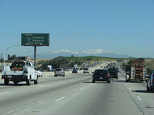
counties, the 91 is one of the most heavily congested routes in Southern California.
Riverside Freeway
Santa Ana Freeway
The Santa Ana Freeway is one of the principal freeways in Southern California, connecting Los Angeles and its southeastern suburbs including the freeway's namesake, the city of Santa Ana. The freeway begins at the Four Level Interchange in downtown Los Angeles, signed as U.S. Route 101...
, Interstate 5 (I-5), in Buena Park
Buena Park, California
Buena Park is a city in northwestern Orange County, California. As of Census 2010 the population was 80,530. The city is adjacent to the city of Anaheim and is 12 miles northwest of downtown Santa Ana. The Current OMB metropolitan designation for Buena Park and the Orange County Area is "Santa...
and the 91 Freeway's eastern terminus at a junction with Interstate 215
Interstate 215 (California)
Interstate 215 is a long north–south Interstate highway in the Inland Empire region of Southern California. It is an auxiliary route of Interstate 15 , running from Murrieta to northern San Bernardino...
and State Route 60
California State Route 60
State Route 60 is a state highway in the U.S. state of California. It runs from Interstate 10 near the Los Angeles River in Los Angeles east to I-10 in Riverside County, with overlaps at State Route 57 and Interstate 215.-Route description:...
in Riverside
Riverside, California
Riverside is a city in Riverside County, California, United States, and the county seat of the eponymous county. Named for its location beside the Santa Ana River, it is the largest city in the Riverside-San Bernardino-Ontario metropolitan area of Southern California, 4th largest inland California...
, the 91 Freeway's assigned name is the Riverside Freeway. Past the I-215/CA-60/CA-91 junction, the Riverside Freeway continues as I-215.
The Riverside Freeway was first opened in 1963 signed as U.S. Route 91 and U.S. Route 395 and the last section was built in 1975.
91 Express Lanes
The 91 Express Lanes is a ten-mile (16 km) high-occupancy toll road / full tollwayToll road
A toll road is a privately or publicly built road for which a driver pays a toll for use. Structures for which tolls are charged include toll bridges and toll tunnels. Non-toll roads are financed using other sources of revenue, most typically fuel tax or general tax funds...
combination contained entirely within the median
Central reservation
On divided roads, such as divided highways or freeways/motorways, the central reservation , median, parkway , median strip or central nature strip is the area which separates opposing lanes of traffic...
of the Riverside Freeway
Riverside Freeway
The Riverside Freeway is a named freeway in Orange, Riverside, and San Bernardino Counties in the U.S. state of California. It refers to the following two segments:...
(State Route 91
California State Route 91
State Route 91 is a major east–west freeway located entirely within Southern California and serving several regions of the Greater Los Angeles metropolitan area...
) in Orange County, California
Orange County, California
Orange County is a county in the U.S. state of California. Its county seat is Santa Ana. As of the 2010 census, its population was 3,010,232, up from 2,846,293 at the 2000 census, making it the third most populous county in California, behind Los Angeles County and San Diego County...
. They run from the Costa Mesa Freeway (State Route 55
California State Route 55
State Route 55 is an 18-mile long north–south highway in the U.S. state of California. The portion of the route built to freeway standards is known as the Costa Mesa Freeway...
) interchange in Anaheim
Anaheim, California
Anaheim is a city in Orange County, California. As of the 2010 United States Census, the city population was about 365,463, making it the most populated city in Orange County, the 10th most-populated city in California, and ranked 54th in the United States...
to the Riverside County
Riverside County, California
Riverside County is a county in the U.S. state of California. One of 58 California counties, it covers in the southern part of the state, and stretches from Orange County to the Colorado River, which forms the state border with Arizona. The county derives its name from the city of Riverside,...
line.
Description
The 91 Express Lanes consist of two primary lanes in each direction, separated from the regular, main lanes of the Riverside Freeway with reflective yellow, 3' high, plastic lane markers (as opposed to concrete barriers or a similar "solid" barrier). Each direction also has an additional high-occupancy vehicle laneHigh-occupancy vehicle lane
In transportation engineering and transportation planning, a high-occupancy vehicle lane is a lane reserved for vehicles with a driver and one or more passengers...
, called the "3+ Carpool Lane", that can only be used by motorcycles and vehicles with three or more passengers. Access to the 91 Express Lanes are provided only at its east and west ends.
All tolls are collected using an open road tolling
Open road tolling
Open road tolling or free-flow tolling is the collection of tolls on toll roads without the use of toll booths. An electronic toll collection system is usually used instead. The major advantage to ORT is that users are able to drive through the toll plaza at highway speeds without having to slow...
system, with each vehicle required to carry a FasTrak
FasTrak
FasTrak is the electronic toll collection system used in the state of California in the United States. The system is used statewide on all of the toll roads, toll bridges, and high occupancy/toll and express toll lanes along the California Freeway and Expressway System.As with other ETC systems,...
transponder
Transponder
In telecommunication, the term transponder has the following meanings:...
; there are no toll booths to receive cash. The 91 Express Lanes use a variable pricing
Variable pricing
Most firms use a fixed price policy. That is, they examine the situation, determine an appropriate price, and leave the price fixed at that amount until the situation changes, at which point they go through the process again...
system based on the time of day. The road is not truly "congestion priced
Congestion pricing
Congestion pricing or congestion charges is a system of surcharging users of a transport network in periods of peak demand to reduce traffic congestion. Examples include some toll-like road pricing fees, and higher peak charges for utilities, public transport and slots in canals and airports...
" because toll rates come from a preset schedule instead of being based on actual congestion. Since July 1, 2011 the toll on the busiest hour on the tollway, 3:00 pm to 4:00 pm eastbound on Fridays, is $9.75, or approximately $0.97 per mile, the highest toll for any toll road in the country. The highest toll in the morning rush hour, 7:00 am to 8:00 am westbound Monday to Thursday, is $4.60.
Motorcycles and vehicles with three or more passengers who use the "3+" carpool lanes are not charged a toll, except when traveling eastbound from 4:00 pm to 6:00 pm on weekdays. During that period, they are charged 50% of the full posted toll. Even though there may be no toll charge, a FasTrak transponder is still required on all vehicles using the "3+" carpool lanes.
A Toll Policy is published which states the criteria where tolls will be raised. The policy is designed to "a) reduce the likelihood of congestion by diverting traffic to other hours with available capacity; b) maintain free flow travel speed in the 91 Express Lanes; c) maintain travel time savings; d) accommodate projected growth in travel demand and; e) ensure that the toll road generates sufficient revenue to effectively operate the toll lanes and maintain a strong debt service position." Changes to the toll schedule require ten days notification to the public and the OCTA board. Once tolls are changed during the "super peak" period, they may not be changed again for six months. All tolls increase annually due to inflation. Despite this, the toll lanes are generally free flowing during most peak hour conditions.
History
Due to rapid population growth and the decline in the availability of affordable housing closer to job centers in Orange CountyOrange County, California
Orange County is a county in the U.S. state of California. Its county seat is Santa Ana. As of the 2010 census, its population was 3,010,232, up from 2,846,293 at the 2000 census, making it the third most populous county in California, behind Los Angeles County and San Diego County...
, new residential development began in earnest in western Riverside County
Riverside County, California
Riverside County is a county in the U.S. state of California. One of 58 California counties, it covers in the southern part of the state, and stretches from Orange County to the Colorado River, which forms the state border with Arizona. The county derives its name from the city of Riverside,...
(consistent with similar accelerated growth throughout the Inland Empire
Inland Empire (California)
The Inland Empire is a region in Southern California. The region sits directly east of the Los Angeles metropolitan area. The Inland Empire most commonly is used in reference to the U.S. Census Bureau's federally-defined Riverside-San Bernardino-Ontario metropolitan area, which covers more than...
) during the 1980s, and continues to this day. This new development is occurring in or around existing cities such as Riverside, Corona, Norco, and Moreno Valley. As there are very few direct routes between Orange and Riverside Counties because of the Santa Ana Mountains
Santa Ana Mountains
The Santa Ana Mountains are a short peninsular mountain range along the coast of Southern California in the United States. They extend for approximately 36 mi southeast of the Los Angeles Basin largely along the border between Orange and Riverside counties.- Geography :The range starts in the...
that separate the two counties, the Riverside Freeway is subject to a very heavy traffic volume, composed primarily of commuters traveling between where they work in Orange County and where they live in Riverside County (often referred to by traffic reporters as "The Corona Crawl") Typical peak period delays were 30–40 minutes in each direction in the ten miles (16 km) of the tollway before construction.
Solutions to the traffic problem were limited. The chosen solution was to create a toll road in the median of the freeway. The toll road route operates between the Orange/Riverside county line and the Costa Mesa Freeway (SR 55
California State Route 55
State Route 55 is an 18-mile long north–south highway in the U.S. state of California. The portion of the route built to freeway standards is known as the Costa Mesa Freeway...
) interchange in eastern Anaheim
Anaheim, California
Anaheim is a city in Orange County, California. As of the 2010 United States Census, the city population was about 365,463, making it the most populated city in Orange County, the 10th most-populated city in California, and ranked 54th in the United States...
- a distance of about 10 miles (16.1 km). The project was developed in partnership with the California Department of Transportation
California Department of Transportation
The California Department of Transportation is a government department in the U.S. state of California. Its mission is to improve mobility across the state. It manages the state highway system and is actively involved with public transportation systems throughout the state...
(Caltrans) by California Private Transportation Company (CPTC). CPTC formally transferred ownership of the facility to the State of California prior to opening the project to traffic on December 27, 1995. Caltrans then leased the toll road back to CPTC for a 35-year operating period. The new lanes have been officially designated a part of the state highway system. The California Highway Patrol
California Highway Patrol
The California Highway Patrol is a law enforcement agency of the U.S. state of California. The CHP has patrol jurisdiction over all California highways and also acts as the state police....
(CHP) is responsible for providing police services at CPTC's expense. Maintenance and operational costs for the facility are also the responsibility of CPTC. In April, 2002, the Orange County Transportation Authority
Orange County Transportation Authority
The Orange County Transportation Authority is the public sector transportation planning body and mass transit service provider for Orange County, California. Its ancestor agencies include not only the prior Orange County Transit District but also such diverse entities as the Pacific Electric...
(OCTA) reached an agreement in concept to purchase the private toll road project for $207.5 million. OCTA took possession of the Toll Road on January 3, 2003, marking the first time the 91 Express Lanes was managed by public officials. Within a few months, OCTA turned the lanes into the HOT / tollway hybrid that it is today. One of the primary investors in CPTC, Cofiroute USA, continues to manage and operate the lanes under a management contract with OCTA.
Opening in 1995, the 91 Express Lanes is the first privately funded tollway built in the United States since the 1940s, and the first fully automated tollway in the world.
The express lanes have been controversial because of a "non-compete" agreement that the state made with CPTC. The clause, which was negotiated by Caltrans and never was brought to the legislature, prevent any improvements along 30 miles (48.3 km) of the Riverside Freeway
Riverside Freeway
The Riverside Freeway is a named freeway in Orange, Riverside, and San Bernardino Counties in the U.S. state of California. It refers to the following two segments:...
to ensure profit for the express lanes. This includes restricting the state from widening the free lanes or building mass transit near the freeway. CPTC filed a lawsuit against Caltrans over freeway widening related to the interchange with the Eastern Transportation Corridor
California State Route 241
State Route 241 is a state highway in the U.S. state of California. For its entire run, Route 241 is a toll road. Its northern half is part of the Eastern Toll Road while its southern half is part of the Foothill Toll Road....
interchange, which was dismissed once the purchase with OCTA was finalized. Following the settlement, an additional lane was added for a 5 mile segment eastbound from SR-241 to SR-71, which has decreased usage of the toll road and revenues.
But as a result of the controversy, more toll road advocates favor creating local agencies similar to Transportation Corridor Agencies
Transportation Corridor Agencies
Transportation Corridor Agencies are two joint powers authorities formed by the California legislature in 1986 to plan, finance, construct, and operate Orange County's toll roads...
to build and maintain future tollways. New toll roads would be financed with tax-exempt bonds on a stand-alone basis—taxpayers would not be responsible for repaying any debt if toll revenues fall short. And there would be a less restrictive "non-compete" clause: They would only be compensated for any revenue loss caused by improvements near the toll roads.
Meanwhile, OCTA announced a proposal in 2005 to study an 11 miles (17.7 km) tunnel through the Santa Ana Mountains and along fault lines to help relieve traffic on the 91. The proposal is opposed by environmental groups, cities in Orange County near the terminus of the proposed road, and by the Irvine Company
Irvine Company
The Irvine Company is a privately held real estate development company based in Newport Beach, Orange County, Southern California. The corporate center of the company lies in Newport Center. A large portion of its operations are centered in and around the City of Irvine, a planned city of 250,000...
, which believes that the tunnel is not necessary and distracts from short term solutions such as freeway widening.
Original US 91 - Barstow to Nevada
Auto trail
The system of auto trails was an informal network of marked routes that existed in the United States and Canada in the early part of the 20th century. Marked with colored bands on telephone poles, the trails were intended to help travellers in the early days of the automobile.Auto trails were...
connecting Salt Lake City with Los Angeles, initially took a longer route via present US 95 and former US 66 between Las Vegas and Needles
Needles, California
Needles is a city located in the Mojave Desert on the western banks of the Colorado River in San Bernardino County, California. It is located in the Mohave Valley, which straddles the California–Arizona border. The city is accessible via Interstate 40 and U.S. Route 95...
, as the more direct Old Spanish Trail
Old Spanish Trail (trade route)
The Old Spanish Trail is a historical trade route which connected the northern New Mexico settlements near or in Santa Fe, New Mexico with that of Los Angeles, California and southern California. Approximately long, it ran through areas of high mountains, arid deserts, and deep canyons. It is...
was in very poor condition. The "Silver Lake
Silver Lake, California
Silver Lake is a town that existed near the Tonopah and Tidewater Railroad, between Ludlow, California and Death Valley Junction, California, in the Mojave Desert of San Bernardino County, California....
cutoff", which would save about 90 miles (145 km), was proposed by 1920, and completed in 1925 as an oiled road by San Bernardino County. The Bureau of Public Roads and the state of Nevada
Nevada
Nevada is a state in the western, mountain west, and southwestern regions of the United States. With an area of and a population of about 2.7 million, it is the 7th-largest and 35th-most populous state. Over two-thirds of Nevada's people live in the Las Vegas metropolitan area, which contains its...
both urged its inclusion in the state highway system, the former as part of the federal aid highway connecting Salt Lake City and Los Angeles, and the state legislature did that in 1925, with it becoming an extension of Route 31. (Across the state line, State Route 6 continued through Las Vegas to Arizona
Arizona
Arizona ; is a state located in the southwestern region of the United States. It is also part of the western United States and the mountain west. The capital and largest city is Phoenix...
.) The initial plan for the U.S. Highway system simply stated that Route No. 91 would run from Las Vegas "to an intersection with Route No. 60" (which became US 66 in 1926), but in 1926 the cutoff was chosen, ending at US 66 at Daggett, just east of Barstow. (The roadway south from Las Vegas later became part of US 95.) The route was added to the federal-aid secondary system in 1926, which helped pay for a mid-1930s widening and paving, including some realignments (parts of the old road are now known as Arrowhead Trail). The new routing generally followed the present I-15, except through Baker (where it used Baker Boulevard) and into Barstow (where it followed former SR 58 to First Avenue, ending at Main Street, which carried US 66).
SR 18 - former extension of US 91 through Santa Ana Canyon to Long Beach
Cajon Pass
Cajon Pass is a moderate-elevation mountain pass between the San Bernardino Mountains and the San Gabriel Mountains in Southern California in the United States. It was created by the movements of the San Andreas Fault...
to San Bernardino. From San Bernardino west through Riverside and Santa Ana Canyon
Santa Ana Canyon
Santa Ana Canyon is where the Santa Ana River passes between the Santa Ana Mountains and the Chino Hills, near the intersection of Orange, Riverside, and San Bernardino Counties. It receives particularly strong Santa Ana winds in comparison to surrounding areas, hence the name.-History:Originally,...
to Olive, the state took over a mostly-paved county highway
County highway
A county highway is a road in the United States and in the Canadian province of Ontario that is designated and/or maintained by the county highway department...
in 1931 as part of an extension of Route 43 to Newport Beach via Santa Ana. Two branches leading west from Route 43 near Olive along mostly-constructed county roads were added in 1933: Route 175 along Orangethorpe Avenue and Artesia Boulevard from near the mouth of the canyon west to Route 60 (now SR 1) in Hermosa Beach (unconstructed through Compton until the mid-1950s), and Route 178 along Lincoln Avenue and Carson Street from Olive west to Route 168 (now SR 19) in Lakewood. When state routes were marked in 1934, Route 175 became Sign Route 14, and Sign Route 18 included all of Route 178 and most of Route 43 into the San Bernardino Mountains
San Bernardino Mountains
The San Bernardino Mountains are a short transverse mountain range north and east of San Bernardino in Southern California in the United States. The mountains run for approximately 60 miles east-west on the southern edge of the Mojave Desert in southwestern San Bernardino County, north of the...
. When US 91 was extended to Long Beach, it overlapped SR 18 from San Bernardino to Lakewood, where it turned south along SR 19 to the Los Alamitos Traffic Circle. There it turned west along US 101 Alternate to near downtown Long Beach, where it ended at SR 15 (Atlantic Avenue), at a terminus shared with US 6. (This routing along SR 19 and US 101 Alt. also became an extension of SR 18.)
In 1935, the state improved the alignment between Fairmont Boulevard and Gypsum Canyon Road, including a bypass of the old road, which curved along the south slope of the canyon, east of Weir Canyon Road. In the late 1930s, the Prado Dam
Prado Dam
Prado Dam is an earth-fill dam across the Santa Ana River at the Chino Hills near Corona, California in Riverside County with the resulting impounded water creating Prado Flood Control Basin reservoir. The U.S. Army Corps of Engineers built the dam in Lower Santa Ana River Canyon...
project resulted in the bypassing of a longer section, replacing Prado Road, an abandoned road curving to the east end of the dam, Pomona Rincon Road, Auto Center Drive, Pomona Road, and Yorba Street with the present Green River Road, Palisades Drive, part of SR 91, and 6th Street.
SR 14 - present SR 91 to Hermosa Beach
Prior to 1991, the Gardena Freeway was known as the Redondo Beach Freeway, referring to Caltrans's original intention for the freeway portion of the route to continue all the way to the never-built Pacific Coast Freeway.Also, before 1997, the 91 continued all the way to State Route 1 in Hermosa Beach
Hermosa Beach, California
Hermosa Beach is a beachfront city in Los Angeles County, California, United States. Its population was 19,506 at the 2010 census, up from 18,566 at the 2000 census....
, which Metro Local
Metro Local
Metro Local is a bus system in Los Angeles County operated by the Los Angeles County Metropolitan Transportation Authority . This retronym designation was placed to differentiate it from the Metro Rapid service...
line 130 runs through. At that time, the route became discontinuous in Gardena
Gardena, California
Gardena is a city in Los Angeles County, California, United States. The population was 58,829 at the 2010 census, up from 57,746 at the 2000 census.-Geography:Gardena is located at ....
, the portion between Vermont Avenue
Vermont Avenue
Vermont Avenue is one of the longest running north/south streets in Los Angeles, California with a length of about . Located just west of the Harbor Freeway for the major portion south of Downtown Los Angeles, it starts in Griffith Park at the Greek Theatre in the Los Feliz neighborhood as a...
and Western Avenue
Western Avenue (Los Angeles)
Western Avenue is a major four lane street slightly west of Downtown Los Angeles and the center portion of Los Angeles County. Besides Sepulveda Boulevard, it is one of the longest north/south streets in Los Angeles...
being turned over to the city. In 2003, the western portion, from SR 1 to Western Ave. was relinquished to the local jurisdictions. The first segment of the freeway was made in 1965 signed as US 91, and the last segment was made in 1975.
Future
Testing evaluations are slated to begin in the winter of 2007 for a tunnel proposal, currently called the Irvine-Corona Expressway proposal, designed to carry traffic from Interstate 15Interstate 15
Interstate 15 is the fourth-longest north–south Interstate Highway in the United States, traveling through the states of California, Nevada, Arizona, Utah, Idaho, and Montana from San Diego to the Canadian border...
south of Corona
Corona, California
Corona is a city in Riverside County, California, United States. As of the 2010 census, the city had a population of 152,374, up from 124,966 at the 2000 census...
near Cajalco Road to California State Route 241
California State Route 241
State Route 241 is a state highway in the U.S. state of California. For its entire run, Route 241 is a toll road. Its northern half is part of the Eastern Toll Road while its southern half is part of the Foothill Toll Road....
near Irvine
Irvine, California
Irvine is a suburban incorporated city in Orange County, California, United States. It is a planned city, mainly developed by the Irvine Company since the 1960s. Formally incorporated on December 28, 1971, the city has a population of 212,375 as of the 2010 census. However, the California...
. One concept for this project specifies a set of three tunnels—two for cars and one for both trucks and high-speed light rail
Light rail
Light rail or light rail transit is a form of urban rail public transportation that generally has a lower capacity and lower speed than heavy rail and metro systems, but higher capacity and higher speed than traditional street-running tram systems...
—that would stretch for 12 miles (19.3 km), burrowing beneath the Santa Ana mountain range
Santa Ana Mountains
The Santa Ana Mountains are a short peninsular mountain range along the coast of Southern California in the United States. They extend for approximately 36 mi southeast of the Los Angeles Basin largely along the border between Orange and Riverside counties.- Geography :The range starts in the...
, and carrying up to 70,000 cars a day between California’s Riverside
Riverside County, California
Riverside County is a county in the U.S. state of California. One of 58 California counties, it covers in the southern part of the state, and stretches from Orange County to the Colorado River, which forms the state border with Arizona. The county derives its name from the city of Riverside,...
and Orange
Orange County, California
Orange County is a county in the U.S. state of California. Its county seat is Santa Ana. As of the 2010 census, its population was 3,010,232, up from 2,846,293 at the 2000 census, making it the third most populous county in California, behind Los Angeles County and San Diego County...
counties. The proposed tunnel project would follow a similar route to the 91 Freeway and is designed to reduce the growing traffic congestion on the 91 that prompted the construction of the 91 Express Lanes. If completed, the Irvine-Corona Expressway is projected to be the longest traffic tunnel in North America.
Numerous other projects are currently underway or in the planning phases for distant completion, some as far out as the year 2030. They can be found listed here and explained in the official implementation plan.
Exit list
- Note: Except where prefixed with a letter, postmiles were measured in 1964, based on the alignment as it existed at that time, and do not necessarily reflect current mileage. The numbers reset at county lines; the start and end postmiles in each county are given in the county column.
{| class=wikitable
!County
!Location
!Postmile
!Exit
Exit number
An exit number is a number assigned to a road junction, usually an exit from a freeway. It is usually marked on the same sign as the destinations of the exit, as well as a sign in the gore....
!Destinations
!Notes
|-
|rowspan=37|Los Angeles
Los Angeles County, California
Los Angeles County is a county in the U.S. state of California. As of 2010 U.S. Census, the county had a population of 9,818,605, making it the most populous county in the United States. Los Angeles County alone is more populous than 42 individual U.S. states...
LA 0.00-R20.74
|rowspan=2|Hermosa Beach
Hermosa Beach, California
Hermosa Beach is a beachfront city in Los Angeles County, California, United States. Its population was 19,506 at the 2010 census, up from 18,566 at the 2000 census....
,
Redondo Beach
Redondo Beach, California
Redondo Beach is one of the three Beach Cities located in Los Angeles County, California, United States. The population was 66,748 at the 2010 census, up from 63,261 at the 2000 census. The city is located in the South Bay region of the greater Los Angeles area.Redondo Beach was originally part of...
|0.00
|
|Gould Avenue
|Continuation beyond SR 1
|-
|0.00
|
|
|
|-
|Lawndale
Lawndale, California
Lawndale is a city in Los Angeles County, California, United States. The population was 32,769 at the 2010 census, up from 31,711 according to the 2000 census...
|rowspan=2 bgcolor=#ffdddd|
|rowspan=2 bgcolor=#ffdddd|
|rowspan=2 bgcolor=#ffdddd|
Interstate 405 (California)
Interstate 405 is a major north–south Interstate Highway in Southern California. It is a bypass of Interstate 5, running along the western areas of the Greater Los Angeles Area from Irvine in the south to near San Fernando in the north...
north / Hawthorne Boulevard north
|rowspan=2 bgcolor=#ffdddd|Eastbound exit and westbound entrance
|-
|rowspan=2|Redondo Beach
Redondo Beach, California
Redondo Beach is one of the three Beach Cities located in Los Angeles County, California, United States. The population was 66,748 at the 2010 census, up from 63,261 at the 2000 census. The city is located in the South Bay region of the greater Los Angeles area.Redondo Beach was originally part of...
|-
|rowspan=2 bgcolor=#ffdddd|2.47
|rowspan=2 bgcolor=#ffdddd|
|rowspan=2 bgcolor=#ffdddd|
|rowspan=2 bgcolor=#ffdddd|No left turn eastbound
|-
|rowspan=3|Torrance
Torrance, California
Torrance is a city incorporated in 1921 and located in the South Bay region of Los Angeles County, California, United States. Torrance has of shore-front beaches on the Pacific Ocean, quieter and less well-known by tourists than others on the Santa Monica Bay, such as those of neighboring...
|-bgcolor=#ffdddd
|3.07
|
|
|Interchange; eastbound exit and westbound entrance; former SR 7 south
|-bgcolor=#ffdddd
|3.07
|
|
|Interchange; westbound exit and eastbound entrance; former SR 7 north
|-
|Gardena
Gardena, California
Gardena is a city in Los Angeles County, California, United States. The population was 58,829 at the 2010 census, up from 57,746 at the 2000 census.-Geography:Gardena is located at ....
|rowspan=2|6.01
|rowspan=2|
|rowspan=2|Vermont Avenue
Vermont Avenue
Vermont Avenue is one of the longest running north/south streets in Los Angeles, California with a length of about . Located just west of the Harbor Freeway for the major portion south of Downtown Los Angeles, it starts in Griffith Park at the Greek Theatre in the Los Feliz neighborhood as a...
|rowspan=2|West end of state maintenance
|-
|rowspan=3|Los Angeles
Los Angeles, California
Los Angeles , with a population at the 2010 United States Census of 3,792,621, is the most populous city in California, USA and the second most populous in the United States, after New York City. It has an area of , and is located in Southern California...
|-
|colspan=4 align=center|West end of freeway
|-
|R6.34
|6
|
|No exit number eastbound
|-
|rowspan=3|Carson
Carson, California
Carson is a city in Los Angeles County, California. As of the 2010 census, Carson had a total population of 91,714. Located south of downtown Los Angeles and approximately 14 miles away from the Los Angeles International Airport, it is known as a suburb of the city....
|bgcolor=#ffdddd|R6.90
|bgcolor=#ffdddd|7A
|bgcolor=#ffdddd|Main Street
Main Street (Los Angeles)
Main Street is a major north-south thoroughfare in Los Angeles, California, and is the east-west postal divider for that city. It begins as a continuation of Valley Boulevard west of Mission Road in Lincoln Heights and ends at the Port of Los Angeles. At 9th Street, it merges with Spring Street in...
|bgcolor=#ffdddd|No westbound entrance
|-
|R7.43
|7B
|Avalon Boulevard
Avalon Boulevard
Avalon Boulevard is a north-south street in Los Angeles County.-Geography:Avalon Boulevard is formed after San Pedro Street intersects with Jefferson Boulevard east of Exposition Park. It passes through Southern Los Angeles County through cities and communities like Carson, Compton, Willowbrook,...
|
|-
|rowspan=2|R8.44
|rowspan=2|8
|rowspan=2|Central Avenue
Central Avenue (Los Angeles)
Central Avenue is a major north-south thoroughfare in the central portion of the Los Angeles, California metropolitan area. Located just to the west of the Alameda Corridor, it runs from the eastern end of the Los Angeles Civic Center south, ending at Del Amo Boulevard in Carson...
|rowspan=2|
|-
|rowspan=5|Compton
Compton, California
Compton is a city in southern Los Angeles County, California, United States, southeast of downtown Los Angeles. The city of Compton is one of the oldest cities in the county and on May 11, 1888, was the eighth city to incorporate. The city is considered part of the South side by residents of Los...
|-
|R9.16
|9
|Wilmington Avenue
|
|-bgcolor=#ffdddd
|R9.80
|10A
|Acacia Avenue
|Eastbound exit and westbound entrance
|-
|10.27
|10B
| – Compton
Compton, California
Compton is a city in southern Los Angeles County, California, United States, southeast of downtown Los Angeles. The city of Compton is one of the oldest cities in the county and on May 11, 1888, was the eighth city to incorporate. The city is considered part of the South side by residents of Los...
|Signed as exit 10 westbound
|-
|10.41
|10C
|Santa Fe Avenue
|Signed as exit 10 westbound
|-
|rowspan=6|Long Beach
Long Beach, California
Long Beach is a city situated in Los Angeles County in Southern California, on the Pacific coast of the United States. The city is the 36th-largest city in the nation and the seventh-largest in California. As of 2010, its population was 462,257...
|R11.10
|11
|Long Beach Boulevard
Long Beach Boulevard
Long Beach Boulevard is a north south thoroughfare in Los Angeles County.-Geography:Long Beach Boulevard starts off as a continuation of Pacific Boulevard south of Cudahy Avenue in South Gate. Long Beach Boulevard passes through South Gate, Lynwood, Compton and Long Beach...
|
|-
|R11.68
|12A
|
|Signed as exits 12A (south) and 12B (north) eastbound
|-
|R12.09
|12B
|Atlantic Avenue
|Signed as exit 12C eastbound; former SR 15
|-
|R13.09
|13
|Cherry Avenue
Garfield Avenue (Los Angeles County)
Garfield Avenue is a major north-south street in Los Angeles County, California, US.The avenue lies between Atlantic Boulevard and Rosemead/Lakewood Boulevard. It begins as Garfield Avenue as a minor street north of Grevelia Street in South Pasadena...
|
|-
|R13.59
|14A
|Paramount Boulevard
|
|-
|rowspan=2|R14.10
|rowspan=2|14B
|rowspan=2|Downey Avenue
|rowspan=2|
|-
|rowspan=4|Bellflower
Bellflower, California
Bellflower is a city in Los Angeles County, California, and is a suburb of Los Angeles. It was incorporated on September 3, 1957. As of the 2010 census, the city had a total population of 76,616, up from 72,878 at the 2000 census....
|-
|R14.62
|15A
|
|Signed as exit 15 eastbound
|-bgcolor=#ffdddd
|R15.11
|15B
|Clark Avenue
|Westbound exit and eastbound entrance
|-
|R15.61
|16
|Bellflower Boulevard – Bellflower
Bellflower, California
Bellflower is a city in Los Angeles County, California, and is a suburb of Los Angeles. It was incorporated on September 3, 1957. As of the 2010 census, the city had a total population of 76,616, up from 72,878 at the 2000 census....
|Former Legislative Route 169
|-
|rowspan=2|Cerritos
Cerritos, California
Cerritos is a city in Los Angeles County, California, United States, and is one of several cities that constitute the Gateway Cities of southeast Los Angeles County. It was incorporated on April 24, 1956...
|R16.94
|17
|
|Signed as exit 17B westbound
|-bgcolor=#ffdddd
|R17.09
|17A
|Studebaker Road
|Westbound exit and eastbound entrance
|-
|Artesia
Artesia, California
Artesia is a city in southeast Los Angeles County, California. Artesia was incorporated on May 29, 1959 and is one of Los Angeles County's Gateway Cities. The city has a 2010 census population of 16,522...
|R18.09
|18
|Pioneer Boulevard – Artesia
Artesia, California
Artesia is a city in southeast Los Angeles County, California. Artesia was incorporated on May 29, 1959 and is one of Los Angeles County's Gateway Cities. The city has a 2010 census population of 16,522...
|Former SR 35
|-
|rowspan=4|Cerritos
Cerritos, California
Cerritos is a city in Los Angeles County, California, United States, and is one of several cities that constitute the Gateway Cities of southeast Los Angeles County. It was incorporated on April 24, 1956...
|R18.65
|19A
|Norwalk Boulevard
|
|-bgcolor=#ffdddd
|R19.17-
R19.43
|19B
|Artesia Boulevard, Bloomfield Avenue
|No eastbound entrance
|-bgcolor=#ffdddd
|R19.81
|19C
|Shoemaker Avenue
|Eastbound exit and entrance
|-bgcolor=#ffdddd
|R20.45
|20
|Carmenita Road
|No eastbound entrance
|-
|rowspan=25|Orange
Orange County, California
Orange County is a county in the U.S. state of California. Its county seat is Santa Ana. As of the 2010 census, its population was 3,010,232, up from 2,846,293 at the 2000 census, making it the third most populous county in California, behind Los Angeles County and San Diego County...
ORA R0.00-R18.91
|La Palma
La Palma, California
La Palma is a city located in northern Orange County, California. Incorporated on October 26, 1955, the population was 15,408 at the 2000 census...
|rowspan=2|R0.49-
R0.85
|rowspan=2|21
|rowspan=2|Orangethorpe Avenue, Valley View Street
|rowspan=2|Signed as exit 22 westbound
|-
|rowspan=3|Buena Park
Buena Park, California
Buena Park is a city in northwestern Orange County, California. As of Census 2010 the population was 80,530. The city is adjacent to the city of Anaheim and is 12 miles northwest of downtown Santa Ana. The Current OMB metropolitan designation for Buena Park and the Orange County Area is "Santa...
|-
|R1.84
|23A
|Knott Avenue
|
|-
|R2.62
|23B
|
|
|-
|rowspan=6|Anaheim
Anaheim, California
Anaheim is a city in Orange County, California. As of the 2010 United States Census, the city population was about 365,463, making it the most populated city in Orange County, the 10th most-populated city in California, and ranked 54th in the United States...
,
Fullerton
Fullerton, California
Fullerton is a city located in northern Orange County, California. As of the 2010 census, the city had a total population of 135,161.It was founded in 1887 by George and Edward Amerige and named for George H. Fullerton, who secured the land on behalf of the Atchison, Topeka and Santa Fe Railway...
|bgcolor=#ffdddd|R3.64
|bgcolor=#ffdddd|24
|bgcolor=#ffdddd|
|bgcolor=#ffdddd|Eastbound exit and westbound entrance
|-bgcolor=#ffdddd
|R3.64
|24
|
|Westbound exit and eastbound entrance
|-
|R3.85
|23C
|Magnolia Avenue, Orangethorpe Avenue
|Eastbound exit is part of exit 24
|-
|1.23
|26
|Brookhurst Street
|
|-
|2.23
|27
|Euclid Street
|
|-
|3.26-
3.51
|28
|Harbor Boulevard
Harbor Boulevard
Harbor Boulevard is a major thoroughfare in central Orange County.-Route description:It runs from Costa Mesa through Santa Ana, Garden Grove, Anaheim and La Habra before it turns into Fullerton Road in the unincorporated community of Rowland Heights just over the Los Angeles County line...
, Lemon Street, Anaheim Boulevard
|Anaheim Boulevard was former SR 72
California State Route 72
State Route 72 is a state highway in the U.S. state of California. The route runs from Puente Street in Brea to Atlantic Boulevard in East Los Angeles. It forms part of El Camino Real.-Route description:...
|-
|rowspan=10|Anaheim
Anaheim, California
Anaheim is a city in Orange County, California. As of the 2010 United States Census, the city population was about 365,463, making it the most populated city in Orange County, the 10th most-populated city in California, and ranked 54th in the United States...
|4.26
|29
|East Street, Raymond Avenue
|
|-
|5.26
|30A
|State College Boulevard
|Signed as exit 30 westbound; no westbound exit from SR 91 HOV lane interchange west; former SR 250
|-
|6.12
|30B
|
|Signed as exit 31 westbound
|-
|7.36
|31
|Kraemer Boulevard, Glassell Street
|Signed as exit 32 westbound
|-
|8.40
|33
|Tustin Avenue
|
|-
|R9.19
|34
|
|Left exit westbound
|-
|
|
|91 Express Lanes
|Eastbound left exit and westbound entrance
|-
|R10.09
|35
|Lakeview Avenue
|
|-
|R11.54
|36
|
|
|-
|rowspan=2|R14.43
|rowspan=2|39
|rowspan=2|Weir Canyon Road, Yorba Linda Boulevard
|rowspan=2|
|-
|rowspan=3|Anaheim
Anaheim, California
Anaheim is a city in Orange County, California. As of the 2010 United States Census, the city population was about 365,463, making it the most populated city in Orange County, the 10th most-populated city in California, and ranked 54th in the United States...
, Yorba Linda
Yorba Linda, California
Yorba Linda is a suburban city in northeastern Orange County, California, approximately northeast of Downtown Santa Ana, and southeast of Downtown Los Angeles....
|-
|R15.93
|40
|
|Signed as exit 41B westbound
|-
|R16.40
|41
|Gypsum Canyon Road
|Signed as exit 41A westbound
|-
|
|bgcolor=#d3d3d3|R17.95
|bgcolor=#d3d3d3|42
|bgcolor=#d3d3d3|Coal Canyon Road
|bgcolor=#d3d3d3|Closed since 2003 for environmental reasons
|-
|rowspan=2|
|rowspan=2|
|rowspan=2|
|rowspan=2|91 Express Lanes
|rowspan=2|Westbound left exit and eastbound entrance
|-
|rowspan=25|Riverside
Riverside County, California
Riverside County is a county in the U.S. state of California. One of 58 California counties, it covers in the southern part of the state, and stretches from Orange County to the Colorado River, which forms the state border with Arizona. The county derives its name from the city of Riverside,...
RIV R0.00-21.66
|-
|rowspan=9|Corona
Corona, California
Corona is a city in Riverside County, California, United States. As of the 2010 census, the city had a population of 152,374, up from 124,966 at the 2000 census...
|R1.03
|44
|Green River Road
|
|-
|R2.09
|45
|
|
|-
|R3.71
|47
|Serfas Club Drive, Auto Center Drive
|
|-
|4.16
|48
|6th Street, Maple Street
|Former US 91 / SR 71
California State Route 71
State Route 71 is the Chino Valley Freeway, formerly the Corona Expressway and before then the Temescal Freeway, a freeway/highway of about 15 miles in length located entirely within Southern California, United States...
south
|-
|5.38
|49A
|Lincoln Avenue
|Signed as exit 49 westbound
|-bgcolor=#ffdddd
|6.02
|49B
||Grand Boulevard
Grand Boulevard (Corona)
Grand Boulevard is a beltway in Corona, California. It is an ordinary surface street that circles the city's downtown area and is approximately half a mile from the city center. It is unusual for being perfectly circular. The street was designed by Hiram Clay Kellogg . Grand Blvd...
|Eastbound exit and westbound entrance
|-
|6.34
|50
|Main Street
|Former SR 31
|-
|7.45
|51
|
|
|-
|9.18
|53
|McKinley Street
|Signed as exits 53A (south) and 53B (north) westbound
|-
|rowspan=15|Riverside
Riverside, California
Riverside is a city in Riverside County, California, United States, and the county seat of the eponymous county. Named for its location beside the Santa Ana River, it is the largest city in the Riverside-San Bernardino-Ontario metropolitan area of Southern California, 4th largest inland California...
|bgcolor=#ffdddd|10.81
|bgcolor=#ffdddd|54
|bgcolor=#ffdddd|Pierce Street
|bgcolor=#ffdddd|Eastbound exit and westbound entrance
|-
|11.10
|55A
|Magnolia Avenue
|Former US 91
|-
|11.99
|55B
|La Sierra Avenue
|
|-
|13.04
|56
|Tyler Street
|
|-
|14.08
|58
|Van Buren Boulevard – Arlington
Arlington, California
Arlington is a former unincorporated community now annexed to Riverside, in Riverside County, California. It lies at an elevation of 791 feet .Arlington is located southwest of downtown Riverside....
|
|-
|15.63
|59
|Adams Street, Auto Center Drive
|
|-
|16.65
|60
|Madison Street
|
|-
|17.82
|61
|Arlington Avenue
|
|-
|18.41
|62
|Central Avenue – Magnolia Center
|
|-
|20.00
|63
|14th Street
|
|-
|20.45-
20.53
|64
|University Avenue, Mission Inn Avenue – Downtown Riverside
|Former US 60 / US 395
U.S. Route 395 in California
In the U.S. state of California, U.S. Route 395 is a route which traverses from Interstate 15 near the southern city limits of Hesperia, north to the Oregon state line in Modoc County near Goose Lake...
|-bgcolor=#ffdddd
|21.47
|65A
|Spruce Street, Poplar Street
|Eastbound exit and westbound entrance
|-
|21.66
|65B
|
|Eastbound exit and westbound entrance; I-215 south was former I-15E south / US 395
U.S. Route 395 in California
In the U.S. state of California, U.S. Route 395 is a route which traverses from Interstate 15 near the southern city limits of Hesperia, north to the Oregon state line in Modoc County near Goose Lake...
south
|-
|21.66
|65C
| – Los Angeles
Los Ángeles
Los Ángeles is the capital of the province of Biobío, in the commune of the same name, in Region VIII , in the center-south of Chile. It is located between the Laja and Biobío rivers. The population is 123,445 inhabitants...
|Eastbound exit and westbound entrance
|-
|21.66
|
|
|Eastbound exit and westbound entrance; former I-15E north / US 91 north / US 395
U.S. Route 395 in California
In the U.S. state of California, U.S. Route 395 is a route which traverses from Interstate 15 near the southern city limits of Hesperia, north to the Oregon state line in Modoc County near Goose Lake...
north