
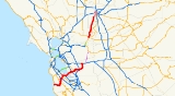
California State Route 84
Encyclopedia
State Route 84 is a split-section California State Highway consisting of two sections. The first section is an east–west arterial road
running from San Gregorio
to Menlo Park
, across the Dumbarton Bridge
through Fremont
and Newark
and ending at I-580
in Livermore
. The route overlaps
the freeway segment of U.S. 101 between Woodside Road in Redwood City and Marsh Road in Menlo Park. The segment between Marsh Road and the Dumbarton Bridge has been upgraded to an expressway
and is known as the Bayfront Expressway. The segment from the western end of the Dumbarton Bridge to the interchange with I-880 has been upgraded to a freeway.
The other section is a north-west arterial road that begins at Route 12 in Rio Vista
, passes through Ryer Island
(where it connects to Route 220
), and ends at the Interstate 80 interchange in West Sacramento
. However, plans are underway to turn maintenance of SR 84 through West Sacramento to that city.
A ferry provides the crossing over Cache Slough from Rio Vista to Ryer Island. The ferry, a diesel-powered boat operated by Caltrans, is in operation twenty-four hours per day and charges no toll.
Route 84 is legally defined to continue from I-580 to Route 4 in Antioch
, but there are currently no plans in place to bridge the gap at this time. A plan to build a $600 million toll road
called the Mid-State Tollway along the proposed route was suspended in 2001 due to local opposition.
and is eligible for the State Scenic Highway System
. However, it is not a scenic highway as defined by Caltrans.
 The route begins at SR 1
in San Gregorio
. It then heads northward through San Mateo County
as it enters Woodside
, where it intersects SR 35
, also known as Skyline Boulevard, and interchanges with Interstate 280 (California)
. It then exits the city, and enters Redwood City
, where it intersects SR 82
, which carries El Camino Real
through the south bay area. A few miles later, it interchanges with U.S. Route 101
, where it overlaps for several miles. Upon exiting, it enters the city of Menlo Park
as an expressway
, where it intersects SR 114
and SR 109
at intersections controlled by traffic light
s. The SR 114 (Willow Road) intersection was the site of the car crash in which author David Halberstam
was killed on April 23, 2007.
Route 84 then becomes a freeway at the north end of San Mateo County as it crosses as the Dumbarton Bridge
over the San Francisco Bay
. Midway through the bridge, it enters Alameda County
.
 In Alameda County
, it runs northward through the city of Newark
, where it begins a concurrency with Interstate 880. Both interchanges with Interstate 880 are partial cloverleaf interchanges, meaning that through traffic on Route 84 encounters traffic lights while joining and leaving I-880. Upon separation, the route loses its freeway status as it enters the city of Fremont
, where it has a short concurrency with SR 238
. There are plans to construct a new parkway between the I-880 interchange and Mission Boulevard (CA 238).
It then leaves Fremont and begins an overlap with I-680
. After separating, it runs for several miles, over a pass, then it enters the city of Livermore
; it runs along Isabel Ave until it meets I-580
, as the end of its south section.
Upon reappearing, the route begins at SR 12 in Rio Vista
. In then follows the Ryer Island Ferry, which carries the route across the Cache Slough. When it leaves the ferry, it intersects SR 220
. It continues northward and meets the end of state maintenance at the West Sacramento city limit, about six miles east of an intersection with CR E19. It then enters the city of West Sacramento
in Yolo County
. It then interchanges with I-80 Business
, also signed as U.S. Route 50
. As it continues northward, it ends at Interstate 80
.
{| class=wikitable
|-
!County
!Location
!Postmile
!Exit
!Destinations
!Notes
|-
|rowspan=14|San Mateo
SM 0.00-R30.15
|San Gregorio
|0.00
|
|
|
|-
|rowspan=2|Woodside
|14.95
|
|
|
|-
|21.54
|
|
|Interchange
|-
|rowspan=5|Redwood City
|22.68
|
|Alameda de las Pulgas
|
|-
|24.70
|
|
|Interchange
|-
|25.06
|
|Middlefield Road – Downtown Redwood City
|
|- style="background:#dfd;"
|25.72
5.39Indicates that the postmile represents the distance along US 101 rather than SR 84.
|
|
|Interchange; south end of US 101 overlap
|-
| colspan="4" style="text-align:center;"|South end of freeway on US 101
|-
|rowspan=6|Menlo Park
| colspan="4" style="text-align:center;"|North end of freeway on US 101
|- style="background:#dfd;"
|3.59
R25.81
|
|
|Interchange; north end of US 101 overlap
|-
|R27.66
|
|
|
|-
|R28.19
|
|
|
|-
| colspan="4" style="text-align:center;"|South end of freeway
|-
| rowspan="2" colspan="4" style="text-align:center;"|Dumbarton Bridge
over San Francisco Bay
|-
|rowspan=20|Alameda
ALA R0.00-R28.63
|rowspan=4|Newark
|-
|R3.75
|36
|Thornton Avenue, Paseo Padre Parkway
|
|-
|R4.88
|37
|Newark Boulevard, Ardenwood Boulevard
|
|- style="background:#dfd;"
|R6.01
10.30Indicates that the postmile represents the distance along I-880 rather than SR 84.
|
|
|Interchange; south end of I-880 overlap
|-
|rowspan=7|Fremont
| colspan="4" style="text-align:center;"|North end of freeway on I-880
|- style="background:#dfd;"
|8.84
6.92
|
|
|Interchange; north end of I-880 overlap
|-
|8.02
|
|Thornton Avenue, Fremont Boulevard
|
|-
|8.33
|
|Fremont Boulevard, Peralta Boulevard
|
|-
|9.92
|
|Mowry Avenue – Civic Center
|
|- style="background:#dfd;"
|10.82
3.31Indicates that the postmile represents the distance along SR 238
rather than SR 84.
|
|
|South end of SR 238 overlap
|- style="background:#dfd;"
|3.64
10.83
|
|
|North end of SR 238 overlap
|-
|Sunol
| style="background:#fdd;"|16.93
| style="background:#fdd;"|
| style="background:#fdd;"|Sunol
(Main Street)
| style="background:#fdd;"|Interchange; northbound exit and southbound entrance
|-
|
| style="background:#dfd;"|17.99
R11.04Indicates that the postmile represents the distance along I-680
rather than SR 84.
| style="background:#dfd;"|
| style="background:#dfd;"|
| style="background:#dfd;"|Interchange; south end of I-680 overlap
|-
| colspan="5" style="text-align:center;"|South end of freeway on I-680
|-
| colspan="5" style="text-align:center;"|North end of freeway on I-680
|-
|
| style="background:#dfd;"|R11.85
R17.99
| style="background:#dfd;"|
| style="background:#dfd;"|
| style="background:#dfd;"|Interchange; north end of I-680 overlap; no northbound entrance
|-
|Pleasanton
|23.56
|
|Vallecitos Road – Downtown Livermore
|Former SR 84 north
|-
|rowspan=3|Livermore
|R26.22
|
|Stanley Boulevard
|Interchange
|-
|M27.75
|
|Airway Boulevard, Kitty Hawk Road
|
|-
|R28.63
|
|
|Interchange
|-
| colspan="6" style="text-align:center;"|Gap in SR 84
|-
|rowspan=4|Solano
SOL 0.13-13.67
|Rio Vista
|0.13
|
|
|Interchange
|-
|
|2.49
| colspan="3" style="text-align:center;"|Ryer Island Ferry across Cache Slough
|-
|
|7.25
|
|
|
|-
|
|12.08
|
|Ryer Road East – Ryde
|
|-
|rowspan=14|Yolo
YOL 0.00-24.05
|
|4.57
|
|Courtland Road – Courtland
, Rio Vista
|
|-
|
|9.53
|
|
|
|-
|
|rowspan=2|15.69
| colspan="3" rowspan="2" style="text-align:center;"|North end of state maintenance at West Sacramento
city limit
|-
|rowspan=11|West Sacramento
|-
|19.65
|
|Linden Road
|
|-
|19.85
|
|Lake Washington Boulevard
|
|-
|R21.78
|
|
|Interchange; former I-80
|-
|21.84
|
|To Capitol Mall
(SR 275
, Tower Bridge Gateway)
|Interchange; former US 40 / US 99W
|-
|22.06
|
|West Capitol Avenue
|Former US 40 / US 99W
|-
|22.68
|
|Sacramento Avenue, Kegle Drive
|Sacramento Avenue was former SR 16 east
|-
|23.47
|
|Sunset Avenue – Woodland
|Former SR 16 west
|-
|23.67
|
|Harbor Boulevard
|
|-
|24.05
|
| – Reno
, San Francisco
|Interchange; former I-880
|-
|24.05
|
|Reed Avenue
|Continuation beyond I-80
Arterial road
An arterial road, or arterial thoroughfare, is a high-capacity urban road. The primary function of an arterial road is to deliver traffic from collector roads to freeways, and between urban centres at the highest level of service possible. As such, many arteries are limited-access roads, or feature...
running from San Gregorio
San Gregorio, California
-History:Named after Pope Gregory I , San Gregorio was a booming town in the 1850s, when wealthy San Franciscans would travel to the San Gregorio House by stagecoach to enjoy fishing, hunting, sea bathing, and boat races. The building still stands, but is no longer a functioning hotel. However, the...
to Menlo Park
Menlo Park, California
Menlo Park, California is a city at the eastern edge of San Mateo County, in the San Francisco Bay Area of California, in the United States. It is bordered by San Francisco Bay on the north and east; East Palo Alto, Palo Alto, and Stanford to the south; Atherton, North Fair Oaks, and Redwood City...
, across the Dumbarton Bridge
Dumbarton Bridge (California)
The Dumbarton Bridge is the southernmost of the highway bridges that span the San Francisco Bay in California. Carrying over 81,000 vehicles daily, it is also the shortest bridge across San Francisco Bay at 1.63 miles...
through Fremont
Fremont, California
Fremont is a city in Alameda County, California. It was incorporated on January 23, 1956, from the merger of five smaller communities: Centerville, Niles, Irvington, Mission San Jose, and Warm Springs...
and Newark
Newark, California
Newark is a city in Alameda County, California, United States. It was incorporated as a city in September 1955. Newark is an enclave, completely surrounded by the city of Fremont. Its population was 42,573 at the 2010 census.-Geography:...
and ending at I-580
Interstate 580 (California)
Interstate 580 is an 80-mile east–west Interstate Highway in Northern California. The heavily traveled spur route of Interstate 80 runs from San Rafael in the San Francisco Bay Area to Interstate 5 near Tracy in the Central Valley...
in Livermore
Livermore, California
Livermore is a city in Alameda County. The population as of 2010 was 80,968. Livermore is located on the eastern edge of California's San Francisco Bay Area....
. The route overlaps
Concurrency (road)
A concurrency, overlap, or coincidence in a road network is an instance of one physical road bearing two or more different highway, motorway, or other route numbers...
the freeway segment of U.S. 101 between Woodside Road in Redwood City and Marsh Road in Menlo Park. The segment between Marsh Road and the Dumbarton Bridge has been upgraded to an expressway
Limited-access road
A limited-access road known by various terms worldwide, including limited-access highway, dual-carriageway and expressway, is a highway or arterial road for high-speed traffic which has many or most characteristics of a controlled-access highway , including limited or no access to adjacent...
and is known as the Bayfront Expressway. The segment from the western end of the Dumbarton Bridge to the interchange with I-880 has been upgraded to a freeway.
The other section is a north-west arterial road that begins at Route 12 in Rio Vista
Rio Vista, California
Rio Vista is a city located in the eastern end of Solano County, California in the San Francisco Bay Area, on the Sacramento River, in the Sacramento River Delta region. The population was 7,360 at the 2010 census....
, passes through Ryer Island
Ryer Island
Ryer Island an island in the Sacramento-San Joaquin River Delta in Solano County, California surrounded by Miner Slough and Steamboat Slough at their confluence with the Sacramento River, 6.5 miles north-northeast of Rio Vista. The island is named in honor of a California pioneer, Dr. Washington...
(where it connects to Route 220
California State Route 220
State Route 220 is a state highway in the U.S. state of California, defined to run between State Route 84 and State Route 160 on Ryer Island. At the eastern end of Ryer Island, the road crosses Steamboat Slough on the J-Mack Ferry, a cable ferry....
), and ends at the Interstate 80 interchange in West Sacramento
West Sacramento, California
West Sacramento is a city in Yolo County, California. It is contiguous with Sacramento, but is separated by the Sacramento River which is also the county line, so West Sacramento is in a different county than Sacramento...
. However, plans are underway to turn maintenance of SR 84 through West Sacramento to that city.
A ferry provides the crossing over Cache Slough from Rio Vista to Ryer Island. The ferry, a diesel-powered boat operated by Caltrans, is in operation twenty-four hours per day and charges no toll.
Route 84 is legally defined to continue from I-580 to Route 4 in Antioch
Antioch, California
Antioch is a city in Contra Costa County, California. Located in the East Bay region of the San Francisco Bay Area along the San Joaquin-Sacramento River Delta, it is a suburb of San Francisco and Oakland. The city's population was 102,372 at the U.S...
, but there are currently no plans in place to bridge the gap at this time. A plan to build a $600 million toll road
Toll road
A toll road is a privately or publicly built road for which a driver pays a toll for use. Structures for which tolls are charged include toll bridges and toll tunnels. Non-toll roads are financed using other sources of revenue, most typically fuel tax or general tax funds...
called the Mid-State Tollway along the proposed route was suspended in 2001 due to local opposition.
Route description
This route is part of the California Freeway and Expressway SystemCalifornia Freeway and Expressway System
The California Freeway and Expressway System is a system of existing or planned freeways and expressways in the U.S. state of California. It is defined by the Streets and Highways Code.-List of roads in the system:*State Route 1 *State Route 2...
and is eligible for the State Scenic Highway System
State Scenic Highway System (California)
The State Scenic Highway System is a list of highways, mainly state highways, that have been designated by the California Department of Transportation as scenic highways. The California State Legislature, primarily through Section 263 of the Streets and Highways Code, makes highways eligible for...
. However, it is not a scenic highway as defined by Caltrans.
California State Route 1
State Route 1 , more often called Highway 1, is a state highway that runs along much of the Pacific coast of the U.S. state of California. It is famous for running along some of the most beautiful coastlines in the world, leading to its designation as an All-American Road.Highway 1 does not run...
in San Gregorio
San Gregorio, California
-History:Named after Pope Gregory I , San Gregorio was a booming town in the 1850s, when wealthy San Franciscans would travel to the San Gregorio House by stagecoach to enjoy fishing, hunting, sea bathing, and boat races. The building still stands, but is no longer a functioning hotel. However, the...
. It then heads northward through San Mateo County
San Mateo County, California
San Mateo County is a county located in the San Francisco Bay Area of the U.S. state of California. It covers most of the San Francisco Peninsula just south of San Francisco, and north of Santa Clara County. San Francisco International Airport is located at the northern end of the county, and...
as it enters Woodside
Woodside, California
Woodside is a small incorporated town in San Mateo County, California, United States, on the San Francisco Peninsula. It uses a council-manager system of government. The U.S. Census estimated the population of the town to be 5,287 in 2010....
, where it intersects SR 35
California State Route 35
State Route 35 in the U.S. state of California, generally known as Skyline Boulevard, is a two-lane road running along the western ridge of Silicon Valley in California. It runs from Highway 17 to San Francisco at State Route 1. It provides scenic views of both the Santa Cruz Mountains, the...
, also known as Skyline Boulevard, and interchanges with Interstate 280 (California)
Interstate 280 (California)
Interstate 280 is a 57-mile long north–south Interstate Highway in the San Francisco Bay Area of Northern California. It connects San Jose and San Francisco, running along just to the west of the cities of San Francisco Peninsula for most of its route.I-280 from its northern end at King...
. It then exits the city, and enters Redwood City
Redwood City, California
Redwood City is a California charter city located on the San Francisco Peninsula in Northern California, approximately 27 miles south of San Francisco, and 24 miles north of San Jose. Redwood City's history spans from its earliest inhabitation by the Ohlone people, to its tradition as a port for...
, where it intersects SR 82
California State Route 82
State Route 82 is a state highway in the U.S. state of California that runs from U.S. Route 101 at Blossom Hill Road in San Jose to Interstate 280 in San Francisco following the San Francisco Peninsula...
, which carries El Camino Real
El Camino Real (California)
El Camino Real and sometimes associated with Calle Real usually refers to the 600-mile California Mission Trail, connecting the former Alta California's 21 missions , 4 presidios, and several pueblos, stretching from Mission San Diego de Alcalá in San Diego...
through the south bay area. A few miles later, it interchanges with U.S. Route 101
U.S. Route 101
U.S. Route 101, or U.S. Highway 101, is an important north–south U.S. highway that runs through the states of California, Oregon, and Washington, on the West Coast of the United States...
, where it overlaps for several miles. Upon exiting, it enters the city of Menlo Park
Menlo Park, California
Menlo Park, California is a city at the eastern edge of San Mateo County, in the San Francisco Bay Area of California, in the United States. It is bordered by San Francisco Bay on the north and east; East Palo Alto, Palo Alto, and Stanford to the south; Atherton, North Fair Oaks, and Redwood City...
as an expressway
Limited-access road
A limited-access road known by various terms worldwide, including limited-access highway, dual-carriageway and expressway, is a highway or arterial road for high-speed traffic which has many or most characteristics of a controlled-access highway , including limited or no access to adjacent...
, where it intersects SR 114
California State Route 114
State Route 114 is a short state highway in the U.S. state of California that runs between U.S. Route 101 and State Route 84 in East Palo Alto and Menlo Park...
and SR 109
California State Route 109
State Route 109 is a short, unsigned state highway in the U.S. state of California. It is the portion of University Avenue that runs between U.S. Route 101 and State Route 84 in East Palo Alto and Menlo Park. The route is unsigned; however, it is noted on programs like Yahoo Maps.-Route...
at intersections controlled by traffic light
Traffic light
Traffic lights, which may also be known as stoplights, traffic lamps, traffic signals, signal lights, robots or semaphore, are signalling devices positioned at road intersections, pedestrian crossings and other locations to control competing flows of traffic...
s. The SR 114 (Willow Road) intersection was the site of the car crash in which author David Halberstam
David Halberstam
David Halberstam was an American Pulitzer Prize-winning journalist, author and historian, known for his early work on the Vietnam War, his work on politics, history, the Civil Rights Movement, business, media, American culture, and his later sports journalism.-Early life and education:Halberstam...
was killed on April 23, 2007.
Route 84 then becomes a freeway at the north end of San Mateo County as it crosses as the Dumbarton Bridge
Dumbarton Bridge (California)
The Dumbarton Bridge is the southernmost of the highway bridges that span the San Francisco Bay in California. Carrying over 81,000 vehicles daily, it is also the shortest bridge across San Francisco Bay at 1.63 miles...
over the San Francisco Bay
San Francisco Bay
San Francisco Bay is a shallow, productive estuary through which water draining from approximately forty percent of California, flowing in the Sacramento and San Joaquin rivers from the Sierra Nevada mountains, enters the Pacific Ocean...
. Midway through the bridge, it enters Alameda County
Alameda County, California
Alameda County is a county in the U.S. state of California. It occupies most of the East Bay region of the San Francisco Bay Area. As of the 2010 census it had a population of 1,510,271, making it the 7th most populous county in the state...
.
Alameda County, California
Alameda County is a county in the U.S. state of California. It occupies most of the East Bay region of the San Francisco Bay Area. As of the 2010 census it had a population of 1,510,271, making it the 7th most populous county in the state...
, it runs northward through the city of Newark
Newark, California
Newark is a city in Alameda County, California, United States. It was incorporated as a city in September 1955. Newark is an enclave, completely surrounded by the city of Fremont. Its population was 42,573 at the 2010 census.-Geography:...
, where it begins a concurrency with Interstate 880. Both interchanges with Interstate 880 are partial cloverleaf interchanges, meaning that through traffic on Route 84 encounters traffic lights while joining and leaving I-880. Upon separation, the route loses its freeway status as it enters the city of Fremont
Fremont, California
Fremont is a city in Alameda County, California. It was incorporated on January 23, 1956, from the merger of five smaller communities: Centerville, Niles, Irvington, Mission San Jose, and Warm Springs...
, where it has a short concurrency with SR 238
California State Route 238
State Route 238 is a north–south highway in the U.S. state of California. The route is a divided multilane surface highway in the southeastern part of the San Francisco Bay Area. SR 238 connects Interstate 580 in Castro Valley and Interstate 680 in Fremont.-Route description:SR 238 goes...
. There are plans to construct a new parkway between the I-880 interchange and Mission Boulevard (CA 238).
It then leaves Fremont and begins an overlap with I-680
Interstate 680 (California)
Interstate 680 is a north–south Interstate Highway in Northern California. It curves around the eastern cities of the San Francisco Bay Area from San Jose to Interstate 80 at Cordelia, bypassing cities along the eastern shore of San Francisco Bay such as Oakland and Richmond while serving...
. After separating, it runs for several miles, over a pass, then it enters the city of Livermore
Livermore, California
Livermore is a city in Alameda County. The population as of 2010 was 80,968. Livermore is located on the eastern edge of California's San Francisco Bay Area....
; it runs along Isabel Ave until it meets I-580
Interstate 580 (California)
Interstate 580 is an 80-mile east–west Interstate Highway in Northern California. The heavily traveled spur route of Interstate 80 runs from San Rafael in the San Francisco Bay Area to Interstate 5 near Tracy in the Central Valley...
, as the end of its south section.
Upon reappearing, the route begins at SR 12 in Rio Vista
Rio Vista, California
Rio Vista is a city located in the eastern end of Solano County, California in the San Francisco Bay Area, on the Sacramento River, in the Sacramento River Delta region. The population was 7,360 at the 2010 census....
. In then follows the Ryer Island Ferry, which carries the route across the Cache Slough. When it leaves the ferry, it intersects SR 220
California State Route 220
State Route 220 is a state highway in the U.S. state of California, defined to run between State Route 84 and State Route 160 on Ryer Island. At the eastern end of Ryer Island, the road crosses Steamboat Slough on the J-Mack Ferry, a cable ferry....
. It continues northward and meets the end of state maintenance at the West Sacramento city limit, about six miles east of an intersection with CR E19. It then enters the city of West Sacramento
West Sacramento, California
West Sacramento is a city in Yolo County, California. It is contiguous with Sacramento, but is separated by the Sacramento River which is also the county line, so West Sacramento is in a different county than Sacramento...
in Yolo County
Yolo County, California
Yolo County is a county located in the northern part of the U.S. state of California, bordered by the other counties of Sacramento, Solano, Napa, Lake, Colusa, and Sutter. The city of Woodland is its county seat, though Davis is its largest city....
. It then interchanges with I-80 Business
Interstate 80 Business (Sacramento, California)
Interstate 80 Business, called the Capital City Freeway in its entirety, is a Business Loop of Interstate 80 through Sacramento. As it is state-maintained, unlike most business routes in California, it is assigned route numbers - part of U.S. Route 50 on its western half , and unsigned State Route...
, also signed as U.S. Route 50
U.S. Route 50
U.S. Route 50 is a major east–west route of the U.S. Highway system, stretching just over from Ocean City, Maryland on the Atlantic Ocean to West Sacramento, California. Until 1972, when it was replaced by Interstate Highways west of the Sacramento area, it extended to San Francisco, near...
. As it continues northward, it ends at Interstate 80
Interstate 80 in California
In the U.S. state of California, Interstate 80 , a major east–west route of the Interstate Highway System, has its western terminus in San Francisco, California, United States. From there it heads east across the Bay Bridge to Oakland, where it turns north and crosses the Carquinez Bridge...
.
Major intersections
- Note: Except where prefixed with a letter, postmiles were measured in 1964, based on the alignment as it existed at that time, and do not necessarily reflect current mileage. The numbers reset at county lines; the start and end postmiles in each county are given in the county column.
{| class=wikitable
|-
!County
!Location
!Postmile
!Exit
Exit number
An exit number is a number assigned to a road junction, usually an exit from a freeway. It is usually marked on the same sign as the destinations of the exit, as well as a sign in the gore....
!Destinations
!Notes
|-
|rowspan=14|San Mateo
San Mateo County, California
San Mateo County is a county located in the San Francisco Bay Area of the U.S. state of California. It covers most of the San Francisco Peninsula just south of San Francisco, and north of Santa Clara County. San Francisco International Airport is located at the northern end of the county, and...
SM 0.00-R30.15
|San Gregorio
San Gregorio, California
-History:Named after Pope Gregory I , San Gregorio was a booming town in the 1850s, when wealthy San Franciscans would travel to the San Gregorio House by stagecoach to enjoy fishing, hunting, sea bathing, and boat races. The building still stands, but is no longer a functioning hotel. However, the...
|0.00
|
|
|
|-
|rowspan=2|Woodside
Woodside, California
Woodside is a small incorporated town in San Mateo County, California, United States, on the San Francisco Peninsula. It uses a council-manager system of government. The U.S. Census estimated the population of the town to be 5,287 in 2010....
|14.95
|
|
|
|-
|21.54
|
|
|Interchange
|-
|rowspan=5|Redwood City
Redwood City, California
Redwood City is a California charter city located on the San Francisco Peninsula in Northern California, approximately 27 miles south of San Francisco, and 24 miles north of San Jose. Redwood City's history spans from its earliest inhabitation by the Ohlone people, to its tradition as a port for...
|22.68
|
|Alameda de las Pulgas
|
|-
|24.70
|
|
|Interchange
|-
|25.06
|
|Middlefield Road – Downtown Redwood City
Redwood City, California
Redwood City is a California charter city located on the San Francisco Peninsula in Northern California, approximately 27 miles south of San Francisco, and 24 miles north of San Jose. Redwood City's history spans from its earliest inhabitation by the Ohlone people, to its tradition as a port for...
|
|- style="background:#dfd;"
|25.72
5.39Indicates that the postmile represents the distance along US 101 rather than SR 84.
|
|
|Interchange; south end of US 101 overlap
|-
| colspan="4" style="text-align:center;"|South end of freeway on US 101
|-
|rowspan=6|Menlo Park
Menlo Park, California
Menlo Park, California is a city at the eastern edge of San Mateo County, in the San Francisco Bay Area of California, in the United States. It is bordered by San Francisco Bay on the north and east; East Palo Alto, Palo Alto, and Stanford to the south; Atherton, North Fair Oaks, and Redwood City...
| colspan="4" style="text-align:center;"|North end of freeway on US 101
|- style="background:#dfd;"
|3.59
R25.81
|
|
|Interchange; north end of US 101 overlap
|-
|R27.66
|
|
|
|-
|R28.19
|
|
|
|-
| colspan="4" style="text-align:center;"|South end of freeway
|-
| rowspan="2" colspan="4" style="text-align:center;"|Dumbarton Bridge
Dumbarton Bridge (California)
The Dumbarton Bridge is the southernmost of the highway bridges that span the San Francisco Bay in California. Carrying over 81,000 vehicles daily, it is also the shortest bridge across San Francisco Bay at 1.63 miles...
over San Francisco Bay
San Francisco Bay
San Francisco Bay is a shallow, productive estuary through which water draining from approximately forty percent of California, flowing in the Sacramento and San Joaquin rivers from the Sierra Nevada mountains, enters the Pacific Ocean...
|-
|rowspan=20|Alameda
Alameda County, California
Alameda County is a county in the U.S. state of California. It occupies most of the East Bay region of the San Francisco Bay Area. As of the 2010 census it had a population of 1,510,271, making it the 7th most populous county in the state...
ALA R0.00-R28.63
|rowspan=4|Newark
Newark, California
Newark is a city in Alameda County, California, United States. It was incorporated as a city in September 1955. Newark is an enclave, completely surrounded by the city of Fremont. Its population was 42,573 at the 2010 census.-Geography:...
|-
|R3.75
|36
|Thornton Avenue, Paseo Padre Parkway
|
|-
|R4.88
|37
|Newark Boulevard, Ardenwood Boulevard
|
|- style="background:#dfd;"
|R6.01
10.30Indicates that the postmile represents the distance along I-880 rather than SR 84.
|
|
|Interchange; south end of I-880 overlap
|-
|rowspan=7|Fremont
Fremont, California
Fremont is a city in Alameda County, California. It was incorporated on January 23, 1956, from the merger of five smaller communities: Centerville, Niles, Irvington, Mission San Jose, and Warm Springs...
| colspan="4" style="text-align:center;"|North end of freeway on I-880
|- style="background:#dfd;"
|8.84
6.92
|
|
|Interchange; north end of I-880 overlap
|-
|8.02
|
|Thornton Avenue, Fremont Boulevard
|
|-
|8.33
|
|Fremont Boulevard, Peralta Boulevard
|
|-
|9.92
|
|Mowry Avenue – Civic Center
Fremont, California
Fremont is a city in Alameda County, California. It was incorporated on January 23, 1956, from the merger of five smaller communities: Centerville, Niles, Irvington, Mission San Jose, and Warm Springs...
|
|- style="background:#dfd;"
|10.82
3.31Indicates that the postmile represents the distance along SR 238
California State Route 238
State Route 238 is a north–south highway in the U.S. state of California. The route is a divided multilane surface highway in the southeastern part of the San Francisco Bay Area. SR 238 connects Interstate 580 in Castro Valley and Interstate 680 in Fremont.-Route description:SR 238 goes...
rather than SR 84.
|
|
|South end of SR 238 overlap
|- style="background:#dfd;"
|3.64
10.83
|
|
|North end of SR 238 overlap
|-
|Sunol
Sunol, California
Sunol is an unincorporated census-designated place in Alameda County, California, United States. The population was 913 at the 2010 census....
| style="background:#fdd;"|16.93
| style="background:#fdd;"|
| style="background:#fdd;"|Sunol
Sunol, California
Sunol is an unincorporated census-designated place in Alameda County, California, United States. The population was 913 at the 2010 census....
(Main Street)
| style="background:#fdd;"|Interchange; northbound exit and southbound entrance
|-
|
| style="background:#dfd;"|17.99
R11.04Indicates that the postmile represents the distance along I-680
Interstate 680 (California)
Interstate 680 is a north–south Interstate Highway in Northern California. It curves around the eastern cities of the San Francisco Bay Area from San Jose to Interstate 80 at Cordelia, bypassing cities along the eastern shore of San Francisco Bay such as Oakland and Richmond while serving...
rather than SR 84.
| style="background:#dfd;"|
| style="background:#dfd;"|
| style="background:#dfd;"|Interchange; south end of I-680 overlap
|-
| colspan="5" style="text-align:center;"|South end of freeway on I-680
|-
| colspan="5" style="text-align:center;"|North end of freeway on I-680
|-
|
| style="background:#dfd;"|R11.85
R17.99
| style="background:#dfd;"|
| style="background:#dfd;"|
| style="background:#dfd;"|Interchange; north end of I-680 overlap; no northbound entrance
|-
|Pleasanton
Pleasanton, California
Pleasanton is a city in Alameda County, California, incorporated in 1894. It is a suburb in the San Francisco Bay Area located about east of Oakland, and west of Livermore. The population was 70,285 at the 2010 census. In 2005 and 2007, Pleasanton was ranked the wealthiest middle-sized city in...
|23.56
|
|Vallecitos Road – Downtown Livermore
|Former SR 84 north
|-
|rowspan=3|Livermore
Livermore, California
Livermore is a city in Alameda County. The population as of 2010 was 80,968. Livermore is located on the eastern edge of California's San Francisco Bay Area....
|R26.22
|
|Stanley Boulevard
|Interchange
|-
|M27.75
|
|Airway Boulevard, Kitty Hawk Road
|
|-
|R28.63
|
|
|Interchange
|-
| colspan="6" style="text-align:center;"|Gap in SR 84
|-
|rowspan=4|Solano
Solano County, California
Solano County is a county located in Bay-Delta region of the U.S. state of California, about halfway between San Francisco and Sacramento and is one of the nine San Francisco Bay Area counties. The county's population was reported by the U.S. Census to be 413,344 in 2010...
SOL 0.13-13.67
|Rio Vista
Rio Vista, California
Rio Vista is a city located in the eastern end of Solano County, California in the San Francisco Bay Area, on the Sacramento River, in the Sacramento River Delta region. The population was 7,360 at the 2010 census....
|0.13
|
|
|Interchange
|-
|
|2.49
| colspan="3" style="text-align:center;"|Ryer Island Ferry across Cache Slough
|-
|
|7.25
|
|
|
|-
|
|12.08
|
|Ryer Road East – Ryde
Ryde, California
Ryde is an unincorporated community in Sacramento County, California, United States. Ryde is located on the Sacramento River at the junction of California State Route 160 and California State Route 220, north-northeast of Isleton. Ryde has a post office with ZIP code 95680, which was established...
|
|-
|rowspan=14|Yolo
Yolo County, California
Yolo County is a county located in the northern part of the U.S. state of California, bordered by the other counties of Sacramento, Solano, Napa, Lake, Colusa, and Sutter. The city of Woodland is its county seat, though Davis is its largest city....
YOL 0.00-24.05
|
|4.57
|
|Courtland Road – Courtland
Courtland, California
Courtland is a census-designated place in Sacramento County, California, United States. Courtland is located along the Sacramento River south-southwest of Sacramento. Courtland has a post office with ZIP code 95615, which was established in 1872. Courtland was named after Courtland Sims, son of...
, Rio Vista
Rio Vista, California
Rio Vista is a city located in the eastern end of Solano County, California in the San Francisco Bay Area, on the Sacramento River, in the Sacramento River Delta region. The population was 7,360 at the 2010 census....
|
|-
|
|9.53
|
|
|
|-
|
|rowspan=2|15.69
| colspan="3" rowspan="2" style="text-align:center;"|North end of state maintenance at West Sacramento
West Sacramento, California
West Sacramento is a city in Yolo County, California. It is contiguous with Sacramento, but is separated by the Sacramento River which is also the county line, so West Sacramento is in a different county than Sacramento...
city limit
|-
|rowspan=11|West Sacramento
West Sacramento, California
West Sacramento is a city in Yolo County, California. It is contiguous with Sacramento, but is separated by the Sacramento River which is also the county line, so West Sacramento is in a different county than Sacramento...
|-
|19.65
|
|Linden Road
|
|-
|19.85
|
|Lake Washington Boulevard
|
|-
|R21.78
|
|
|Interchange; former I-80
|-
|21.84
|
|To Capitol Mall
Capitol Mall
Capitol Mall is a major street in the city of Sacramento that leads to the iconic Tower Bridge which connects Downtown Sacramento with the Yolo County city of West Sacramento. The Capitol Mall was previously also known as State Route 275, but was relinquished to the city in January 2006. A plethora...
(SR 275
California State Route 275
State Route 275 is a short unsigned state highway in the Sacramento area of the U.S. state of California. The highway, also known as Tower Bridge Gateway , is a short spur from Interstate 80 Business in West Sacramento over the Tower Bridge into downtown Sacramento...
, Tower Bridge Gateway)
|Interchange; former US 40 / US 99W
|-
|22.06
|
|West Capitol Avenue
|Former US 40 / US 99W
|-
|22.68
|
|Sacramento Avenue, Kegle Drive
|Sacramento Avenue was former SR 16 east
|-
|23.47
|
|Sunset Avenue – Woodland
Woodland, California
Woodland is the county seat of Yolo County, California, located approximately northwest of Sacramento, and is a part of the Sacramento - Arden-Arcade - Roseville Metropolitan Statistical Area. The population was 55,468 at the 2010 census.Woodland's origins trace back to 1850 when California...
|Former SR 16 west
|-
|23.67
|
|Harbor Boulevard
|
|-
|24.05
|
| – Reno
Reno, Nevada
Reno is the county seat of Washoe County, Nevada, United States. The city has a population of about 220,500 and is the most populous Nevada city outside of the Las Vegas metropolitan area...
, San Francisco
San Francisco, California
San Francisco , officially the City and County of San Francisco, is the financial, cultural, and transportation center of the San Francisco Bay Area, a region of 7.15 million people which includes San Jose and Oakland...
|Interchange; former I-880
|-
|24.05
|
|Reed Avenue
|Continuation beyond I-80