
California State Route 58
Encyclopedia
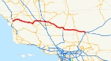
State Route 58 is an east-west highway
across the California Coast Ranges, the southern San Joaquin Valley
, the Tehachapi Mountains
, which border the southern Sierra Nevada, and the Mojave Desert
. It runs between its western terminus near Santa Margarita
(junction U.S. Route 101) and its eastern terminus at Barstow
(junction Interstate 15). It has junctions with Interstate 5 near Buttonwillow
, State Route 99
in Bakersfield
, State Route 202
in Tehachapi
, State Route 14
in Mojave
, and U.S. Route 395 at Kramer Junction
. Route 58 gives good access to Edwards Air Force Base
.
and is eligible for the State Scenic Highway System
. However, it is not a scenic highway as designated by Caltrans.
Route 58 has several names throughout its length, including the Blue Star Memorial Highway
(for its entire length); the Kern County Korean War Veterans Memorial Highway, for the section from Route 184 to the Kern County/San Bernardino County Line; and the Rosa Parks Highway, for the section between Route 99 and Route 184. The Korean War Veterans name honors the approximately 8,120 veterans from Kern County, while the section named for Rosa Parks honors the civil rights activist. The portion of the 58 from Barstow to Bakersfield is sometimes referred to as the Barstow–Bakersfield Highway.
Route 58 is a freeway from its south junction with Route 99 in Bakersfield
to several miles east of Mojave (a freeway bypass of Mojave was completed in 2004), except for two grade-level intersections two miles (3 km) apart in the Caliente
area. There is another grade level intersection east of Mojave and west of the main Edwards AFB north gate exit where California City Blvd. intersects it. Other freeway segments are bypasses of Boron
and Barstow. Except for the Boron freeway bypass, SR 58 is primarily a four lane expressway (two lanes per direction) just east of Boron up to the Barstow bypass segment with the exception of the portion of Route 58 between Boron and approximately 5 miles (8 km) east of Kramer Junction, which is currently two-lane highway and is not yet expressway.
Route 58 takes the southernmost route through the Sierra Nevada and allows motorists to travel between Northern California
and points to the east, such as Las Vegas
and Interstate 40
without having to face the extreme traffic congestion of greater Los Angeles
. Route 58 and Interstate 80 are the only freeways to cross the Sierra Nevada. The route also offers an alternative to the often treacherous Donner Pass
to truckers traveling from the San Francisco Bay Area
to points eastward; prior to the construction of Interstate 80, the road (as U.S. Route 466
) was heavily used for this purpose.
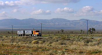
Route 58 west of Buttonwillow is a winding mountain road through a thinly-populated area. Alternatives such as State Route 46
to the north or State Route 166
to the south are recommended, such as on signage approaching the western terminus of Route 58 from US 101, for those not wishing to traverse so mountainous a route; much of this section of Route 58 is prohibited to truck traffic. However, this section of SR 58 does pass through the Carrizo Plain
, which is known for its scenic beauty and geological features, including the San Andreas Fault
.

 Route 58 did not exist as a California sign route until 1964 although previous to 1964 it was part of California legislative route 58. The other part of legislative route 58 is California's segment of Interstate 40; previous to 1964 it was a segment of US 66.
Prior to 1964 the segment of SR 58 between Bakersfield and Barstow was signed U.S. Route 466. Also at that time, the segment of Route 58 between State Route 33
at Mc Kittrick
and Route 99 in Bakersfield was signed as State Route 178
. Although it was proposed for signing as Route 178 in 1934, the segment of legislative route 58 between US 101 near Santa Margarita
and State Route 33 at Mc Kittrick was not signed prior to 1964.
Note that US 466 was co-signed with US 99, now State Route 99, between Bakersfield and Famoso Junction
. Between Famoso and US 101 at Paso Robles, US 466 largely became SR 46.
The eastern terminus was originally at I-15 north of Barstow. Route 58 was rerouted to I-15 in Barstow south of the I-40 interchange. The former eastern terminus is now known as "Old Highway 58."
in Kramer Junction is further complicated by the nearby Union Pacific Railroad
Tehachapi
line (a busy single track over which BNSF also operates) which Route 58 also crosses at grade two and a half miles to the west.
The San Luis Obispo Planning Commission is considering a permit application for the California Valley Solar Ranch
and has released a Draft Environmental Impact Report with a public comment period closure date Nov 1, 2010. Among the points raised in the DEIR is the aesthetic impact on the viewshed which would be particularly troublesome if large industrial scale arrays of solar panels are placed north of Route 58 in the section of road just east of Soda Lake Road.
of California State Route 58 in Mojave
. It provides access to downtown Mojave as Mojave-Barstow Highway. It also follows the former routing of U.S. Route 6 and U.S. Route 466.
of California State Route 58 in Tehachapi
. It provides access to downtown Tehachapi as Tehachapi Boulevard. It also follows the former routing of U.S. Route 466 and is overlapped with State Route 202
.
of California State Route 58 in Boron
. It provides access to downtown Boron as Twenty Mule Team Road. It also follows the former routing of U.S. Route 466. It is signed from westbound Route 58 approaching the San Bernardino
-Kern
county line and the beginning of the Boron bypass.
{| class=wikitable collapsable
!County
!Location
!Postmile
!Exit
!Destinations
!Notes
|-
|rowspan=7|San Luis Obispo
SLO 0.00-57.15
|rowspan=2|Santa Margarita
|0.00
|
|
|Interchange
|-
|
|
|El Camino Real
|
|-
|
|3.14
|
|Pozo Road – Santa Margarita Lake
|
|-
|
|6.89
|
|
|
|-
|
|
|
|La Panza Road – Paso Robles
|
|-
|
|
|
| Bitterwater Road to SR 46
– Cholame
|
|-
|
|45.20
|
|Soda Lake Road – California Valley
, Soda Lake
|Serves Carrizo Plain National Monument
|-
|rowspan=52|Kern
KER 0.00-R143.86
|rowspan=2|McKittrick
|bgcolor=#ddffdd|15.41
33.45Indicates that the postmile represents the distance along SR 33
rather than SR 58.
|bgcolor=#ddffdd|
|bgcolor=#ddffdd|
|bgcolor=#ddffdd|West end of SR 33 overlap
|-bgcolor=#ddffdd
|34.29
15.42
|
|
|East end of SR 33 overlap
|-
|Buttonwillow
|27.28
|
|.svg.png) Buttonwillow Drive to I-5 north
Buttonwillow Drive to I-5 north
|
|-
|
|
|
|Mirasol Avenue – Taft
|
|-
|
|28.75
|
|Wasco Way – Tupman
|
|-
|
|31.64
|
|
|Interchange
|-
|
|bgcolor=#ddffdd|39.96
8.11Indicates that the postmile represents the distance along SR 43
rather than SR 58.
|bgcolor=#ddffdd|
|bgcolor=#ddffdd|
|bgcolor=#ddffdd|West end of SR 43 overlap
|-
|
|bgcolor=#ddffdd|9.16
39.97
|bgcolor=#ddffdd|
|bgcolor=#ddffdd|
|bgcolor=#ddffdd|East end of SR 43 overlap
|-
|rowspan=13|Bakersfield
|46.10
|
|Allen Road – Shafter
|
|-
|48.11
|
|Calloway Drive
|
|-
|
|
|Coffee Road
|
|-bgcolor=#ddffdd
|51.81
25.65Indicates that the postmile represents the distance along SR 99
rather than SR 58.
|
|
|Interchange; west end of SR 99 overlap
|-
|colspan=5 align=center|West end of freeway on SR 99
|-
|24.60
|25
|California Avenue – Civic Center
|
|-bgcolor=#ffdddd
|23.62
|
|Stockdale Highway, Brundage Lane
|Eastbound exit and westbound entrance
|-bgcolor=#ddffdd
|23.51
R52.36
|110A
|
|East end of SR 99 overlap; no exit number eastbound
|-bgcolor=#ffdddd
|T52.14
|
|Real Road
|Westbound left exit and eastbound entrance
|-
|R53.39-
R53.52
|111
|Chester Avenue, H Street
|
|-
|R54.42
|112
|
|Former US 99
|-
|R55.40
|113
|Cottonwood Road
|
|-
|R56.41
|114
|Mt. Vernon Avenue
|
|-
|
|R57.41
|115
|Oswell Street
|
|-
|
|R58.44
|116
|Fairfax Road
|
|-
|
|R59.44
|117
|
|
|-
|
|R61.51
|119
|Edison Road – Edison
|
|-
|
|R63.58
|121
|Comanche Drive – Arvin
, Edison
|
|-
|
|R65.68
|123
|Tower Line Road
|
|-
|
|69.75
|127
|General Beale Road
|
|-
|colspan=5 align=center|East end of freeway
|-
|
|75.63
|
|
|
|-
|
|77.25
|
|Bealville Road – Caliente
|
|-
|colspan=5 align=center|West end of freeway
|-
|
|80.24
|137
|Hart Flat
|
|-
|
|82.06
|139
|Keene
|
|-
|
|R85.15
|142
|Broome Road
|
|-
|
|R90.72
|148
|
|
|-
|Tehachapi
|R91.67
|149
|Mill Street
|
|-
|
|R94.16
|151
|Tehachapi Boulevard (SR 58 Bus. west) – Monolith
, Tehachapi
|
|-
|
|R99.49
|156
|Sand Canyon Road – Monolith
|
|-
|
|R101.56
|159
|Cameron Road
|
|-
|
|R108.90
|165
|
|Former US 466 east / SR 58 east
|-
|
|R111.13
|167
|
|Former US 6
|-
|
|R116.22
|172
|
|Former US 466 west / SR 58 west
|-
|colspan=5 align=center|East end of freeway
|-
|
|R127.63
|
|California City Boulevard – California City
|
|-
|colspan=5 align=center|West end of freeway
|-
|
|R129.67
|186
|Edwards AFB
|
|-
|
|R132.04
|188
|Clay Mine Road
|
|-
|
|R136.40
|193
|Twenty Mule Team Road
|Former US 466 east
|-
|
|R137.77
|194
|Gephart Road, Rocket Site Road
|
|-
|
|R139.80
|196
|Borax Road (SR 58 Bus. east), Rocket Site Road
|
|-
|Boron
|R142.87
|199
|Boron Avenue – Boron
|
|-
|rowspan=7|San Bernardino
SBD R0.00-R34.81
|colspan=5 align=center|East end of freeway
|-
|
|
|
|Twenty Mule Team Road (SR 58 Bus. west)
|Former US 466 west
|-
|Kramer Junction
|5.40
|
|
|
|-
|
|R30.39
|
|Lenwood Road
|Former US 466 east / SR 58 east
|-
|colspan=5 align=center|West end of freeway
|-
|rowspan=2|Barstow
|R33.65
|
|West Main Street (to I-15 Bus.) – Barstow
|Former US 66
/ US 91
|-
|R34.81
|
| – Las Vegas
, San Bernardino
|Eastbound exit and westbound entrance
Highway
A highway is any public road. In American English, the term is common and almost always designates major roads. In British English, the term designates any road open to the public. Any interconnected set of highways can be variously referred to as a "highway system", a "highway network", or a...
across the California Coast Ranges, the southern San Joaquin Valley
San Joaquin Valley
The San Joaquin Valley is the area of the Central Valley of California that lies south of the Sacramento – San Joaquin River Delta in Stockton...
, the Tehachapi Mountains
Tehachapi Mountains
The Tehachapi Mountains , regionally also called The Tehachapis, are a mountain range in the Transverse Ranges system of California in the Western United States...
, which border the southern Sierra Nevada, and the Mojave Desert
Mojave Desert
The Mojave Desert occupies a significant portion of southeastern California and smaller parts of central California, southern Nevada, southwestern Utah and northwestern Arizona, in the United States...
. It runs between its western terminus near Santa Margarita
Santa Margarita, California
Santa Margarita is a census-designated place located in San Luis Obispo County, California. It was founded in 1897 near Cuesta Peak and San Luis Obispo along State Route 58. The town's name comes from the Mexican Alta California land grant. It is home to the Santa Margarita de Cortona Asistencia...
(junction U.S. Route 101) and its eastern terminus at Barstow
Barstow, California
Barstow is a city in San Bernardino County, California, United States. The population was 22,639 at the 2010 census, up from 21,119 at the 2000 census. Barstow is located north of San Bernardino....
(junction Interstate 15). It has junctions with Interstate 5 near Buttonwillow
Buttonwillow, California
Buttonwillow is a census-designated place in the San Joaquin Valley, in Kern County, California, United States. Buttonwilliow is located west of Bakersfield, at an elevation of 269 feet . The population was 1,508 at the 2010 census, up from 1,266 at the 2000 census...
, State Route 99
California State Route 99
California State Route 99 , commonly known as Highway 99 or, simply, as 99 , is a north–south state highway in the U.S. state of California, stretching almost the entire length of the Central Valley...
in Bakersfield
Bakersfield, California
Bakersfield is a city near the southern end of the San Joaquin Valley in Kern County, California. It is roughly equidistant between Fresno and Los Angeles, to the north and south respectively....
, State Route 202
California State Route 202
State Route 202 is a state highway in California, USA. It connects the California Correctional Institution to Route 58 in Tehachapi.A portion of SR 202 is overlapped with SR 58 Bus. That portion follows the alignment of decommissioned U.S...
in Tehachapi
Tehachapi, California
Tehachapi is a city incorporated in 1909 located in the Tehachapi Mountains between Bakersfield and Mojave in Kern County, California. Tehachapi is located east-southeast of Bakersfield, at an elevation of...
, State Route 14
California State Route 14
State Route 14 is a north–south state highway in the U.S. state of California, largely in the Mojave Desert. The southern portion of the highway is signed as the Antelope Valley Freeway. The route connects Interstate 5, or Golden State Freeway, near Santa Clarita and with U.S. Route 395 near...
in Mojave
Mojave, California
Mojave is a census-designated place in Kern County, California, United States. Mojave is located east of Bakersfield, at an elevation of 2762 feet...
, and U.S. Route 395 at Kramer Junction
Kramer Junction, California
Kramer Junction is a small community in the Mojave Desert at the intersection of U.S. Route 395 and State Route 58.Solar Energy Generating Systems sites SEGS III-VII are located less than a mile to the northwest....
. Route 58 gives good access to Edwards Air Force Base
Edwards Air Force Base
Edwards Air Force Base is a United States Air Force base located on the border of Kern County, Los Angeles County, and San Bernardino County, California, in the Antelope Valley. It is southwest of the central business district of North Edwards, California and due east of Rosamond.It is named in...
.
Route description
This route is part of the California Freeway and Expressway SystemCalifornia Freeway and Expressway System
The California Freeway and Expressway System is a system of existing or planned freeways and expressways in the U.S. state of California. It is defined by the Streets and Highways Code.-List of roads in the system:*State Route 1 *State Route 2...
and is eligible for the State Scenic Highway System
State Scenic Highway System (California)
The State Scenic Highway System is a list of highways, mainly state highways, that have been designated by the California Department of Transportation as scenic highways. The California State Legislature, primarily through Section 263 of the Streets and Highways Code, makes highways eligible for...
. However, it is not a scenic highway as designated by Caltrans.
Route 58 has several names throughout its length, including the Blue Star Memorial Highway
Blue Star Memorial Highway
Blue Star Memorial Highways are highways in the United States that are marked to pay tribute to the U.S. armed forces. The National Council of State Garden Clubs, now known as National Garden Clubs, Inc., started the program in 1945 after World War II. The blue star was used on service flags to...
(for its entire length); the Kern County Korean War Veterans Memorial Highway, for the section from Route 184 to the Kern County/San Bernardino County Line; and the Rosa Parks Highway, for the section between Route 99 and Route 184. The Korean War Veterans name honors the approximately 8,120 veterans from Kern County, while the section named for Rosa Parks honors the civil rights activist. The portion of the 58 from Barstow to Bakersfield is sometimes referred to as the Barstow–Bakersfield Highway.
Route 58 is a freeway from its south junction with Route 99 in Bakersfield
Bakersfield, California
Bakersfield is a city near the southern end of the San Joaquin Valley in Kern County, California. It is roughly equidistant between Fresno and Los Angeles, to the north and south respectively....
to several miles east of Mojave (a freeway bypass of Mojave was completed in 2004), except for two grade-level intersections two miles (3 km) apart in the Caliente
Caliente, California
Caliente is an unincorporated community in Kern County, California. It is located east-southeast of Bakersfield, at an elevation of 1312 feet ....
area. There is another grade level intersection east of Mojave and west of the main Edwards AFB north gate exit where California City Blvd. intersects it. Other freeway segments are bypasses of Boron
Boron, California
Boron is a census-designated place in Kern County, California, United States. Boron is located east-southeast of Castle Butte, at an elevation of 2467 feet . The population was 2,253 at the 2010 census, up from 2,025 at the 2000 census...
and Barstow. Except for the Boron freeway bypass, SR 58 is primarily a four lane expressway (two lanes per direction) just east of Boron up to the Barstow bypass segment with the exception of the portion of Route 58 between Boron and approximately 5 miles (8 km) east of Kramer Junction, which is currently two-lane highway and is not yet expressway.
Route 58 takes the southernmost route through the Sierra Nevada and allows motorists to travel between Northern California
Northern California
Northern California is the northern portion of the U.S. state of California. The San Francisco Bay Area , and Sacramento as well as its metropolitan area are the main population centers...
and points to the east, such as Las Vegas
Las Vegas, Nevada
Las Vegas is the most populous city in the U.S. state of Nevada and is also the county seat of Clark County, Nevada. Las Vegas is an internationally renowned major resort city for gambling, shopping, and fine dining. The city bills itself as The Entertainment Capital of the World, and is famous...
and Interstate 40
Interstate 40
Interstate 40 is the third-longest major east–west Interstate Highway in the United States, after I-90 and I-80. Its western end is at Interstate 15 in Barstow, California; its eastern end is at a concurrency of U.S. Route 117 and North Carolina Highway 132 in Wilmington, North Carolina...
without having to face the extreme traffic congestion of greater Los Angeles
Los Angeles, California
Los Angeles , with a population at the 2010 United States Census of 3,792,621, is the most populous city in California, USA and the second most populous in the United States, after New York City. It has an area of , and is located in Southern California...
. Route 58 and Interstate 80 are the only freeways to cross the Sierra Nevada. The route also offers an alternative to the often treacherous Donner Pass
Donner Pass
Donner Pass is a mountain pass in the northern Sierra Nevada, located above Donner Lake about nine miles west of Truckee, California. It has a steep approach from the east and a gradual approach from the west....
to truckers traveling from the San Francisco Bay Area
San Francisco Bay Area
The San Francisco Bay Area, commonly known as the Bay Area, is a populated region that surrounds the San Francisco and San Pablo estuaries in Northern California. The region encompasses metropolitan areas of San Francisco, Oakland, and San Jose, along with smaller urban and rural areas...
to points eastward; prior to the construction of Interstate 80, the road (as U.S. Route 466
U.S. Route 466
U.S. Route 466 was an east–west United States highway. Though it reached a length of around 500 miles , the route was co-signed with other US routes for much of its length. When California deleted most of its U.S...
) was heavily used for this purpose.
Route 58 west of Buttonwillow is a winding mountain road through a thinly-populated area. Alternatives such as State Route 46
California State Route 46
State Route 46 is an east–west state highway in the U.S. state of California. It is a major crossing of the Coast Ranges, connecting SR 1 on the Central Coast near Cambria and US 101 in Paso Robles with SR 99 at Famoso in the San Joaquin Valley. East of Paso Robles, where it carried U.S...
to the north or State Route 166
California State Route 166
State Route 166 is a state highway in the U.S. state of California. It connects the Central Coast to the southern San Joaquin Valley....
to the south are recommended, such as on signage approaching the western terminus of Route 58 from US 101, for those not wishing to traverse so mountainous a route; much of this section of Route 58 is prohibited to truck traffic. However, this section of SR 58 does pass through the Carrizo Plain
Carrizo Plain
The Carrizo Plain is a large enclosed plain, approximately 50 miles long and up to 15 miles across, in southeastern San Luis Obispo County, California, about 100 miles northwest of Los Angeles, California...
, which is known for its scenic beauty and geological features, including the San Andreas Fault
San Andreas Fault
The San Andreas Fault is a continental strike-slip fault that runs a length of roughly through California in the United States. The fault's motion is right-lateral strike-slip...
.
History
Prior to 1964 the segment of SR 58 between Bakersfield and Barstow was signed U.S. Route 466. Also at that time, the segment of Route 58 between State Route 33
California State Route 33
State Route 33 is a north–south state highway in the U.S. state of California. SR 33 replaced part of U.S. Route 399 in 1964 during the "great renumbering" of routes. In the unincorporated sections of Kern County it is known as the West Side Highway...
at Mc Kittrick
McKittrick, California
McKittrick is a census-designated place in Kern County, California, United States. McKittrick is located northwest of Taft, at an elevation of 1056 feet . The population was 115 at the 2010 census, down from 160 at the 2000 census.-Geography:...
and Route 99 in Bakersfield was signed as State Route 178
California State Route 178
State Route 178 is a route that exists in two constructed segments. The gap in between segments is connected by various local roads and State Route 190 through Death Valley National Park....
. Although it was proposed for signing as Route 178 in 1934, the segment of legislative route 58 between US 101 near Santa Margarita
Santa Margarita, California
Santa Margarita is a census-designated place located in San Luis Obispo County, California. It was founded in 1897 near Cuesta Peak and San Luis Obispo along State Route 58. The town's name comes from the Mexican Alta California land grant. It is home to the Santa Margarita de Cortona Asistencia...
and State Route 33 at Mc Kittrick was not signed prior to 1964.
Note that US 466 was co-signed with US 99, now State Route 99, between Bakersfield and Famoso Junction
Famoso, California
Famoso is an unincorporated community in Kern County, California. It is located on Poso Creek south-southeast of McFarland, at an elevation of 427 feet ....
. Between Famoso and US 101 at Paso Robles, US 466 largely became SR 46.
The eastern terminus was originally at I-15 north of Barstow. Route 58 was rerouted to I-15 in Barstow south of the I-40 interchange. The former eastern terminus is now known as "Old Highway 58."
Future
California has long sought federal funds for an extension of Interstate 40 west of Barstow; any such extension would use the general path of Route 58, if not existing highway, as far west at least as Bakersfield, whose rapid growth has made it a significant generator of traffic in its own right. The desired highway is being built piecemeal as Caltrans has funds available, at least between Mojave and Barstow. A Bakersfield Beltway is also proposed. Two at-grade intersections within 1½ miles of each other around mile 76, roughly halfway between Bakersfield and Mojave, would have to be either closed or upgraded to interchanges for the whole of Route 58 to be up to Interstate standards, and the at-grade junction of Route 58 and US 395U.S. Route 395 in California
In the U.S. state of California, U.S. Route 395 is a route which traverses from Interstate 15 near the southern city limits of Hesperia, north to the Oregon state line in Modoc County near Goose Lake...
in Kramer Junction is further complicated by the nearby Union Pacific Railroad
Union Pacific Railroad
The Union Pacific Railroad , headquartered in Omaha, Nebraska, is the largest railroad network in the United States. James R. Young is president, CEO and Chairman....
Tehachapi
Tehachapi Loop
The Tehachapi Loop is a long 'spiral', or helix, on The Union Pacific Railroad through Tehachapi Pass, in south central California. The railroad line connects Bakersfield in the San Joaquin Valley to Mojave in the Antelope Valley. The loop takes its name from the circuitous route it takes, in...
line (a busy single track over which BNSF also operates) which Route 58 also crosses at grade two and a half miles to the west.
The San Luis Obispo Planning Commission is considering a permit application for the California Valley Solar Ranch
California Valley Solar Ranch
The California Valley Solar Ranch is a 250 megawatt solar photovoltaic power plant, which is being built by SunPower in the Carrizo Plain, northeast of California Valley. Construction on the project began in September 2011, with approximately 350 jobs expected to be created in San Luis...
and has released a Draft Environmental Impact Report with a public comment period closure date Nov 1, 2010. Among the points raised in the DEIR is the aesthetic impact on the viewshed which would be particularly troublesome if large industrial scale arrays of solar panels are placed north of Route 58 in the section of road just east of Soda Lake Road.
Mojave
State Route 58 Business is a Business routeBusiness route
A business route in the United States and Canada is a short special route connected to a parent numbered highway at its beginning, then routed through the central business district of a nearby city or town, and finally reconnecting with the same parent numbered highway again at its...
of California State Route 58 in Mojave
Mojave, California
Mojave is a census-designated place in Kern County, California, United States. Mojave is located east of Bakersfield, at an elevation of 2762 feet...
. It provides access to downtown Mojave as Mojave-Barstow Highway. It also follows the former routing of U.S. Route 6 and U.S. Route 466.
Tehachapi
State Route 58 Business is a Business routeBusiness route
A business route in the United States and Canada is a short special route connected to a parent numbered highway at its beginning, then routed through the central business district of a nearby city or town, and finally reconnecting with the same parent numbered highway again at its...
of California State Route 58 in Tehachapi
Tehachapi, California
Tehachapi is a city incorporated in 1909 located in the Tehachapi Mountains between Bakersfield and Mojave in Kern County, California. Tehachapi is located east-southeast of Bakersfield, at an elevation of...
. It provides access to downtown Tehachapi as Tehachapi Boulevard. It also follows the former routing of U.S. Route 466 and is overlapped with State Route 202
California State Route 202
State Route 202 is a state highway in California, USA. It connects the California Correctional Institution to Route 58 in Tehachapi.A portion of SR 202 is overlapped with SR 58 Bus. That portion follows the alignment of decommissioned U.S...
.
Boron
State Route 58 Business is a Business routeBusiness route
A business route in the United States and Canada is a short special route connected to a parent numbered highway at its beginning, then routed through the central business district of a nearby city or town, and finally reconnecting with the same parent numbered highway again at its...
of California State Route 58 in Boron
Boron, California
Boron is a census-designated place in Kern County, California, United States. Boron is located east-southeast of Castle Butte, at an elevation of 2467 feet . The population was 2,253 at the 2010 census, up from 2,025 at the 2000 census...
. It provides access to downtown Boron as Twenty Mule Team Road. It also follows the former routing of U.S. Route 466. It is signed from westbound Route 58 approaching the San Bernardino
San Bernardino County, California
San Bernardino County is a county in the U.S. state of California. As of the 2010 census, the population was 2,035,210, up from 1,709,434 as of the 2000 census...
-Kern
Kern County, California
Spreading across the southern end of the California Central Valley, Kern County is the fifth-largest county by population in California. Its economy is heavily linked to agriculture and to petroleum extraction, and there is a strong aviation and space presence. Politically, it has generally...
county line and the beginning of the Boron bypass.
Major intersections
- Note: Except where prefixed with a letter, postmiles were measured in 1964, based on the alignment as it existed at that time, and do not necessarily reflect current mileage. The numbers reset at county lines; the start and end postmiles in each county are given in the county column.
{| class=wikitable collapsable
!County
!Location
!Postmile
!Exit
Exit number
An exit number is a number assigned to a road junction, usually an exit from a freeway. It is usually marked on the same sign as the destinations of the exit, as well as a sign in the gore....
!Destinations
!Notes
|-
|rowspan=7|San Luis Obispo
San Luis Obispo County, California
San Luis Obispo County is a county located along the Pacific Ocean in the Central Coast of the U.S. state of California, between Los Angeles and the San Francisco Bay Area. As of the 2010 census its population was 269,637, up from 246,681 at the 2000 census...
SLO 0.00-57.15
|rowspan=2|Santa Margarita
Santa Margarita, California
Santa Margarita is a census-designated place located in San Luis Obispo County, California. It was founded in 1897 near Cuesta Peak and San Luis Obispo along State Route 58. The town's name comes from the Mexican Alta California land grant. It is home to the Santa Margarita de Cortona Asistencia...
|0.00
|
|
|Interchange
|-
|
|
|El Camino Real
El Camino Real (California)
El Camino Real and sometimes associated with Calle Real usually refers to the 600-mile California Mission Trail, connecting the former Alta California's 21 missions , 4 presidios, and several pueblos, stretching from Mission San Diego de Alcalá in San Diego...
|
|-
|
|3.14
|
|Pozo Road – Santa Margarita Lake
Santa Margarita Lake
Santa Margarita Lake, also called Salinas Reservoir, is a lake several miles southeast of the town of Santa Margarita in San Luis Obispo County, California. The lake was created by the building of Salinas Dam on the southern end of the Salinas River, very close to the river's origin in the Coast...
|
|-
|
|6.89
|
|
|
|-
|
|
|
|La Panza Road – Paso Robles
Paso Robles, California
Paso Robles is a city in San Luis Obispo County, California, United States. Paso Robles is the fastest growing city in San Luis Obispo County: Its population at the 2000 census was 24,297; in 2010 it recorded some 29,793 residentsLocated on the Salinas River north of San Luis Obispo, California,...
|
|-
|
|
|
|
California State Route 46
State Route 46 is an east–west state highway in the U.S. state of California. It is a major crossing of the Coast Ranges, connecting SR 1 on the Central Coast near Cambria and US 101 in Paso Robles with SR 99 at Famoso in the San Joaquin Valley. East of Paso Robles, where it carried U.S...
– Cholame
Cholame, California
Cholame, California is an unincorporated community in San Luis Obispo County, California, USA. It sits within a mile of the San Andreas Rift Zone fault line at an elevation of 1,157 feet above sea level and is located at . Cholame is reached via State Route 41, just southwest of the junction of...
|
|-
|
|45.20
|
|Soda Lake Road – California Valley
California Valley, California
California Valley is an unincorporated community located in the eastern part of San Luis Obispo County, California, in the northern portion of the Carrizo Plain.Located...
, Soda Lake
Soda Lake (San Luis Obispo County)
Soda Lake is a shallow, ephemeral, alkali endorheic lake in the Carrizo Plain in southeastern San Luis Obispo County, California. The lake is located on the southwest side of the northern Carrizo Plain, 103 km east of San Luis Obispo. It can be reached by Soda Lake Road, which runs...
|Serves Carrizo Plain National Monument
|-
|rowspan=52|Kern
Kern County, California
Spreading across the southern end of the California Central Valley, Kern County is the fifth-largest county by population in California. Its economy is heavily linked to agriculture and to petroleum extraction, and there is a strong aviation and space presence. Politically, it has generally...
KER 0.00-R143.86
|rowspan=2|McKittrick
McKittrick, California
McKittrick is a census-designated place in Kern County, California, United States. McKittrick is located northwest of Taft, at an elevation of 1056 feet . The population was 115 at the 2010 census, down from 160 at the 2000 census.-Geography:...
|bgcolor=#ddffdd|15.41
33.45Indicates that the postmile represents the distance along SR 33
California State Route 33
State Route 33 is a north–south state highway in the U.S. state of California. SR 33 replaced part of U.S. Route 399 in 1964 during the "great renumbering" of routes. In the unincorporated sections of Kern County it is known as the West Side Highway...
rather than SR 58.
|bgcolor=#ddffdd|
|bgcolor=#ddffdd|
|bgcolor=#ddffdd|West end of SR 33 overlap
|-bgcolor=#ddffdd
|34.29
15.42
|
|
|East end of SR 33 overlap
|-
|Buttonwillow
Buttonwillow, California
Buttonwillow is a census-designated place in the San Joaquin Valley, in Kern County, California, United States. Buttonwilliow is located west of Bakersfield, at an elevation of 269 feet . The population was 1,508 at the 2010 census, up from 1,266 at the 2000 census...
|27.28
|
|
|
|-
|
|
|
|Mirasol Avenue – Taft
Taft, California
Taft is a city in the foothills at the extreme southwestern edge of the San Joaquin Valley, in Kern County, California. Taft is located west-southwest of Bakersfield, at an elevation of 955 feet . The population was 9,327 at the 2010 census...
|
|-
|
|28.75
|
|Wasco Way – Tupman
Tupman, California
Tupman is a census-designated place in Kern County, California, United States. Tupman is located west-southwest of Bakersfield, at an elevation of 331 feet...
|
|-
|
|31.64
|
|
|Interchange
|-
|
|bgcolor=#ddffdd|39.96
8.11Indicates that the postmile represents the distance along SR 43
California State Route 43
State Route 43 is a north–south state highway in the U.S. State of California, routed along the southern San Joaquin Valley connecting the towns of Shafter, Wasco, Hanford, and Selma, running roughly parallel to SR 99...
rather than SR 58.
|bgcolor=#ddffdd|
|bgcolor=#ddffdd|
|bgcolor=#ddffdd|West end of SR 43 overlap
|-
|
|bgcolor=#ddffdd|9.16
39.97
|bgcolor=#ddffdd|
|bgcolor=#ddffdd|
|bgcolor=#ddffdd|East end of SR 43 overlap
|-
|rowspan=13|Bakersfield
Bakersfield, California
Bakersfield is a city near the southern end of the San Joaquin Valley in Kern County, California. It is roughly equidistant between Fresno and Los Angeles, to the north and south respectively....
|46.10
|
|Allen Road – Shafter
Shafter, California
Shafter is a city in Kern County, California, United States. It is located west-northwest of Bakersfield. The population was 16,988 at the 2010 census, up from 12,736 at the 2000 census. Wired telephone numbers in Shafter follow the format 746-xxxx and the ZIP Code is 93263.The city is located...
|
|-
|48.11
|
|Calloway Drive
|
|-
|
|
|Coffee Road
|
|-bgcolor=#ddffdd
|51.81
25.65Indicates that the postmile represents the distance along SR 99
California State Route 99
California State Route 99 , commonly known as Highway 99 or, simply, as 99 , is a north–south state highway in the U.S. state of California, stretching almost the entire length of the Central Valley...
rather than SR 58.
|
|
|Interchange; west end of SR 99 overlap
|-
|colspan=5 align=center|West end of freeway on SR 99
|-
|24.60
|25
|California Avenue – Civic Center
Civic Center, Bakersfield
Civic Center is a district in Downtown Bakersfield, California. It is the center of government for the City of Bakersfield and the County of Kern, containing a collection of buildings used by the city, county, state, and federal governments. The district also contains all of downtown's sporting...
|
|-bgcolor=#ffdddd
|23.62
|
|Stockdale Highway, Brundage Lane
|Eastbound exit and westbound entrance
|-bgcolor=#ddffdd
|23.51
R52.36
|110A
|
|East end of SR 99 overlap; no exit number eastbound
|-bgcolor=#ffdddd
|T52.14
|
|Real Road
|Westbound left exit and eastbound entrance
|-
|R53.39-
R53.52
|111
|Chester Avenue, H Street
|
|-
|R54.42
|112
|
|Former US 99
|-
|R55.40
|113
|Cottonwood Road
|
|-
|R56.41
|114
|Mt. Vernon Avenue
|
|-
|
|R57.41
|115
|Oswell Street
|
|-
|
|R58.44
|116
|Fairfax Road
|
|-
|
|R59.44
|117
|
|
|-
|
|R61.51
|119
|Edison Road – Edison
Edison, California
Edison is an unincorporated community in Kern County, California. It is located east-southeast of Bakersfield, at an elevation of 568 feet ....
|
|-
|
|R63.58
|121
|Comanche Drive – Arvin
Arvin, California
Arvin is a city in Kern County, in the United States. Arvin is located southeast of Bakersfield, at an elevation of 449 feet . As of the 2010 census, the population was 19,304, up from 12,956 at the 2000 census....
, Edison
Edison, California
Edison is an unincorporated community in Kern County, California. It is located east-southeast of Bakersfield, at an elevation of 568 feet ....
|
|-
|
|R65.68
|123
|Tower Line Road
|
|-
|
|69.75
|127
|General Beale Road
|
|-
|colspan=5 align=center|East end of freeway
|-
|
|75.63
|
|
|
|-
|
|77.25
|
|Bealville Road – Caliente
Caliente, California
Caliente is an unincorporated community in Kern County, California. It is located east-southeast of Bakersfield, at an elevation of 1312 feet ....
|
|-
|colspan=5 align=center|West end of freeway
|-
|
|80.24
|137
|Hart Flat
|
|-
|
|82.06
|139
|Keene
Keene, California
Keene is a census-designated place in Kern County, California in the foothills of the Tehachapi Mountains at the southern extreme of the San Joaquin Valley. Keene is located northwest of Tehachapi, at an elevation of 2602 feet...
|
|-
|
|R85.15
|142
|Broome Road
|
|-
|
|R90.72
|148
|
|
|-
|Tehachapi
Tehachapi, California
Tehachapi is a city incorporated in 1909 located in the Tehachapi Mountains between Bakersfield and Mojave in Kern County, California. Tehachapi is located east-southeast of Bakersfield, at an elevation of...
|R91.67
|149
|Mill Street
|
|-
|
|R94.16
|151
|Tehachapi Boulevard (SR 58 Bus. west) – Monolith
Monolith, California
Monolith is an unincorporated community in Kern County, California. It is located east of Tehachapi, at an elevation of 3966 feet ....
, Tehachapi
Tehachapi, California
Tehachapi is a city incorporated in 1909 located in the Tehachapi Mountains between Bakersfield and Mojave in Kern County, California. Tehachapi is located east-southeast of Bakersfield, at an elevation of...
|
|-
|
|R99.49
|156
|Sand Canyon Road – Monolith
Monolith, California
Monolith is an unincorporated community in Kern County, California. It is located east of Tehachapi, at an elevation of 3966 feet ....
|
|-
|
|R101.56
|159
|Cameron Road
|
|-
|
|R108.90
|165
|
|Former US 466 east / SR 58 east
|-
|
|R111.13
|167
|
|Former US 6
U.S. Route 6 in California
U.S. Route 6, or US 6, is a transcontinental highway from the U.S. state of California to Massachusetts. In California, the highway lies in the eastern portion of the state from Bishop in the Owens Valley north to the Nevada state line in Esmeralda County...
|-
|
|R116.22
|172
|
|Former US 466 west / SR 58 west
|-
|colspan=5 align=center|East end of freeway
|-
|
|R127.63
|
|California City Boulevard – California City
California City, California
-2000:According to the census of 2000, there were 8,385 people, 3,067 households, and 2,257 families residing in the city. As of 2006 the city's population grew 8.9% from 12,106 to 13,219. California City outpaced rivals Palmdale and Lancaster, making the city the 12th fastest growing city in...
|
|-
|colspan=5 align=center|West end of freeway
|-
|
|R129.67
|186
|Edwards AFB
Edwards Air Force Base
Edwards Air Force Base is a United States Air Force base located on the border of Kern County, Los Angeles County, and San Bernardino County, California, in the Antelope Valley. It is southwest of the central business district of North Edwards, California and due east of Rosamond.It is named in...
|
|-
|
|R132.04
|188
|Clay Mine Road
|
|-
|
|R136.40
|193
|Twenty Mule Team Road
|Former US 466 east
|-
|
|R137.77
|194
|Gephart Road, Rocket Site Road
|
|-
|
|R139.80
|196
|Borax Road (SR 58 Bus. east), Rocket Site Road
|
|-
|Boron
Boron, California
Boron is a census-designated place in Kern County, California, United States. Boron is located east-southeast of Castle Butte, at an elevation of 2467 feet . The population was 2,253 at the 2010 census, up from 2,025 at the 2000 census...
|R142.87
|199
|Boron Avenue – Boron
Boron, California
Boron is a census-designated place in Kern County, California, United States. Boron is located east-southeast of Castle Butte, at an elevation of 2467 feet . The population was 2,253 at the 2010 census, up from 2,025 at the 2000 census...
|
|-
|rowspan=7|San Bernardino
San Bernardino County, California
San Bernardino County is a county in the U.S. state of California. As of the 2010 census, the population was 2,035,210, up from 1,709,434 as of the 2000 census...
SBD R0.00-R34.81
|colspan=5 align=center|East end of freeway
|-
|
|
|
|Twenty Mule Team Road (SR 58 Bus. west)
|Former US 466 west
|-
|Kramer Junction
Kramer Junction, California
Kramer Junction is a small community in the Mojave Desert at the intersection of U.S. Route 395 and State Route 58.Solar Energy Generating Systems sites SEGS III-VII are located less than a mile to the northwest....
|5.40
|
|
|
|-
|
|R30.39
|
|Lenwood Road
|Former US 466 east / SR 58 east
|-
|colspan=5 align=center|West end of freeway
|-
|rowspan=2|Barstow
Barstow, California
Barstow is a city in San Bernardino County, California, United States. The population was 22,639 at the 2010 census, up from 21,119 at the 2000 census. Barstow is located north of San Bernardino....
|R33.65
|
|West Main Street (to I-15 Bus.) – Barstow
Barstow, California
Barstow is a city in San Bernardino County, California, United States. The population was 22,639 at the 2010 census, up from 21,119 at the 2000 census. Barstow is located north of San Bernardino....
|Former US 66
U.S. Route 66 in California
In the U.S. state of California, U.S. Route 66 is a former U.S. highway. All the portions were deleted by 1964 during the 1964 renumbering.-History:U.S...
/ US 91
|-
|R34.81
|
| – Las Vegas
Las Vegas, Nevada
Las Vegas is the most populous city in the U.S. state of Nevada and is also the county seat of Clark County, Nevada. Las Vegas is an internationally renowned major resort city for gambling, shopping, and fine dining. The city bills itself as The Entertainment Capital of the World, and is famous...
, San Bernardino
San Bernardino, California
San Bernardino is a city located in the Riverside-San Bernardino metropolitan area , and serves as the county seat of San Bernardino County, California, United States...
|Eastbound exit and westbound entrance