
.gif)
Interstate 280 (California)
Encyclopedia
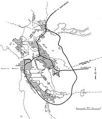
Interstate 280 is a 57-mile (92-km) long north–south Interstate Highway
in the San Francisco Bay Area
of Northern California
. It connects San Jose
and San Francisco
, running along just to the west of the cities of San Francisco Peninsula
for most of its route.
I-280 from its northern end at King Street and Fifth Street in San Francisco to the James Lick Freeway is called the Southern Embarcadero Freeway. I-280 from the James Lick Freeway to its interchange with State Route 1
in Daly City is officially called the John F Foran Freeway, but is more commonly referred to by its original name, the Southern Freeway. I-280 from State Route 1 was built and dedicated as the Junipero Serra
Freeway. One of the dedication signs (in Daly City) still indicates that the Junipero Serra Freeway is known as the World's Most Beautiful Freeway due to its scenic route though the San Francisco Peninsula. The portion of Interstate 280 between Interstate 880
and its southern terminus at U.S. 101 is part of the Sinclair Freeway.
This route is part of the California Freeway and Expressway System
and is eligible for the State Scenic Highway System
.
westward. In between San Jose and San Francisco, Interstate 280 passes through Santa Clara
, Cupertino
, Los Altos
and Los Altos Hills
before it settles along its scenic route just to the west of the cities of the San Francisco Peninsula
in San Mateo County
and just to the east of the Santa Cruz Mountains
. I-280 re-emerges in a decidedly urbanized area in the city of San Bruno
, passing through South San Francisco
and Daly City
before it runs across a southeastern swath of the city of San Francisco on the way to its northern terminus.
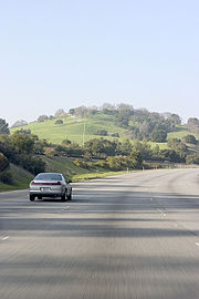
The segment of the Junipero Serra Freeway between Cupertino and Daly City has been called the "World's Most Beautiful Freeway" since its dedication in the 1960s. Drivers along this portion of Interstate 280 are treated to scenic views of the Santa Cruz Mountains to the west and, at a few points, San Francisco Bay to the east, and are isolated by hills from the cities to the east. Through much of this segment, the freeway is actually running just inside the eastern rim of the rift valley of the San Andreas Fault
. A particularly attractive 6-mile (10 km) stretch of the freeway from Hillsborough to Belmont provides a beautiful look at Crystal Springs Reservoir
, formed by water piped over 160 miles (260 km) from Hetch Hetchy Valley
in Yosemite National Park
, partly filling the rift valley.
For nearly all of its length, Interstate 280 runs roughly parallel and several miles to the west of U.S. Route 101 (the Bayshore Freeway
). Both freeways are north–south routes connecting San Jose with San Francisco; however, unlike I-280, the route that U.S. Route 101 takes between the two cities goes entirely through urbanized areas. The majority of the population of the San Francisco Peninsula lives somewhere between Interstate 280 and U.S. Route 101.
I-280 never intersects with Interstate 80
, its parent interstate. The northern terminus of I-280 is within about a mile of I-80's western terminus (at the approach to the San Francisco – Oakland Bay Bridge), but the two interstates do not directly connect. Although San Francisco has had several opportunities to connect I-280 to I-80, it has chosen to use the money for other purposes. Connecting the two freeways is considered to be politically and financially infeasible at this time, due to the city's strong anti-freeway stance. Instead, 280's northernmost extension primarily functions as a spur into Downtown San Francisco, as suggested by signage on northbound U.S. Route 101 at its San Francisco interchange with 280 (see history section below).
Most of Interstate 280, from San Jose to Daly City, is designated as the Junipero Serra Freeway in honor of Spanish missionary Junípero Serra
, who founded many of California's missions in the 18th century. A 26-foot (8 m) high faux-sandstone statue of Father Serra kneeling and pointing over the freeway is located at a highway rest area just north of the Highway 92
intersection between the Bunker Hill Drive and Black Mountain Road exits on northbound I-280 in Hillsborough, and can be clearly seen by drivers in both directions. The segment of Interstate 280 north of SR 1 in San Francisco was originally named the Southern Freeway, but has since recently been officially renamed the John F. Foran Freeway after John Foran, a former California State Senator and Assembly member and current partner at law firm Nossaman
LLP; however, most people still refer to this section of the freeway by its original name, the Southern Freeway. The section of I-280 between the James Lick Freeway and its end at 6th St. and King Street is called the Southern Embarcadero Freeway.
 Major intersections include U.S. Route 101 and SR 1 in San Francisco, Interstate 380
in San Bruno, and Interstate 880
and 680 and U.S. Route 101 in San Jose.
The Junipero Serra Freeway is Route 280 from SR 1 in San Francisco to SR 17, as named by Assembly Concurrent Resolution 140, Chapter 208 in 1967.
Interstate 280 was added to the Interstate Highway System
on September 15, 1955 as a route from San Jose north to San Francisco. This ran along the present alignment of I-280 south of San Francisco, but in San Francisco it ran north parallel to State Route 1, past the planned west end of Interstate 80 which would have been at the junction with the Panhandle Freeway just south of Fulton and Park Presidio, along what would have been the Park Presidio Freeway north to the south approach to the Golden Gate Bridge
. At that point, I-280 would have met Interstate 480, which would have headed east on Doyle Drive (U.S. Route 101), the Golden Gate Freeway, and onto the Embarcadero Freeway to reach the San Francisco – Oakland Bay Bridge. I-480 would have continued south on the never-built section of the Southern Embarcadero Freeway from Folsom and the Embarcadero to 5th and King Street, then along the present Southern Embarcadero Freeway to meet the Southern Freeway (now I-280) near the Alemany Maze
, which served as the 101A Bypass until I-280 was built. The I-280 number was approved on November 10, 1958.
In the 1964 renumbering
, the Route 280 designation was officially applied to the planned route. This replaced SR 1 in San Francisco; the new SR 1 alignment turned northeast where I-280 now runs, quickly ending at State Route 82 (San Jose Avenue/Alemany Boulevard
). SR 1 however continued to be signed along its former (and current) alignment, which had not been upgraded to freeway standards.
A realignment approved January 1968 took I-280 onto its current route. This ran along what had been SR 1, SR 82, State Route 87
and I-480 (downgraded to a State Route then), ending at Interstate 80
at the west end of the Bay Bridge. This change was made on the state level in 1968, restoring SR 1 to its current alignment and truncating SR 82, SR 87 and SR 480.
The section of I-280 between SR 92 (San Mateo) and SR 84 (Woodside) was not completed until the 1970s. Until then, traffic was routed on Cañada road between the two ends.
The short piece of I-280 between 3rd Street
and SR 480 in downtown San Francisco was never built, and the piece from 5th Street south to U.S. Route 101 was reconstructed after it was damaged by the 1989 Loma Prieta earthquake
. The piece between SR 480 and I-80 was torn down along with the rest of the Embarcadero Freeway; ramp stubs which would have connected the freeways were removed as part of the San Francisco – Oakland Bay Bridge Western Approach reconstruction project.
{| class=wikitable
!County
!Location
!Postmile
!Exit
!Destinations
!Notes
|-
|rowspan=23|Santa Clara
SCL R0.00-20.63
|rowspan=15|San Jose
|R0.00
|
|
|Continuation beyond US 101
|-
|R0.00
|
|
|Southbound exit and northbound entrance
|-bgcolor=#ffdddd
|R0.37
|1A
|McLaughlin Avenue
|Southbound exit and northbound entrance
|-
|R1.29
|1B
|11th Street, 10th Street
|Signed as exit 1 northbound
|-
|R1.99
|2A
|
|Signed as exit 2 northbound
|-bgcolor=#ffdddd
|
|2B
|Almaden Boulevard, Vine Street
|Southbound exit and northbound entrance
|-
|R2.52
|3A
|
|
|-
|R2.88
|3B
|Bird Avenue
|
|-bgcolor=#ffdddd
|R3.76
|4
|Race Street, Southwest Expressway
|Northbound exit and southbound entrance
|-bgcolor=#ffdddd
|R3.99
|4
|Meridian Avenue
|Southbound exit and northbound entrance
|-
|L4.66
|5A
|Leigh Avenue, Bascom Avenue
|
|-
|L5.41
|5B
|
|Signed as exits 5B (south) and 5C (north) northbound
|-bgcolor=#ffdddd
|4.57
|6
|Winchester Boulevard – Campbell
|Southbound exit and northbound entrance
|-
|5.95
|7
|Saratoga Avenue – Saratoga
|
|-
|7.12-
7.39
|9
|Lawrence Expressway (CR G2), Stevens Creek Boulevard
|
|-
|rowspan=3|Cupertino
|8.38
|10
|Wolfe Road
|
|-
|9.43
|11
|De Anza Boulevard
|
|-
|10.74
|12
|
|Signed as exits 12A (north) and 12B (south)
|-
|Los Altos
|11.45
|13
|Foothill Expressway, Grant Road
|
|-
|
|14.10
|15
|Magdalena Avenue
|
|-
|Los Altos Hills
|15.05
|16
|El Monte Road, Moody Road
|
|-
|
|18.38
|20
|Page Mill Road, Arastradero Road – Palo Alto
|
|-
|
|20.61
|22
|Alpine Road – Portola Valley
|
|-
|rowspan=24|San Mateo
R0.00-M27.42
|
|R1.61
|24
|Sand Hill Road
– Menlo Park
|
|-
|rowspan=3|Woodside
|R3.34
|25
|
|
|-
|R4.65
|27
|Farm Hill Boulevard
|
|-bgcolor=#ffdddd
|R6.60
|
|Canada Road
|No exit ramps
|-
|
|6.65
|29
|Edgewood Road
|
|-
|
|10.87
|33
|
|Southbound exit to SR 92 west is via exit 34
|-
|
|bgcolor=#ddffdd|R12.32
|bgcolor=#ddffdd|34
|bgcolor=#ddffdd|
|bgcolor=#ddffdd|South end of SR 35 overlap
|-
|Hillsborough
|R14.22
|36
|Black Mountain Road, Hayne Road
|
|-
|
|R17.16
|39
|Trousdale Drive – Burlingame
|
|-
|rowspan=2|Millbrae
|bgcolor=#ffdddd|R17.92
|bgcolor=#ffdddd|40
|bgcolor=#ffdddd|Millbrae Avenue
|bgcolor=#ffdddd|Northbound exit and southbound entrance
|-bgcolor=#ffdddd
|R18.52
|41
|Larkspur Drive, Millbrae Avenue
|Southbound exit and northbound entrance
|-
|rowspan=5|San Bruno
|bgcolor=#ddffdd|R19.28
|bgcolor=#ddffdd|41
|bgcolor=#ddffdd|
|bgcolor=#ddffdd|North end of SR 35 overlap; northbound exit and southbound entrance
|-bgcolor=#ffdddd
|R20.22
|42
|Crystal Springs Road
|Southbound exit and northbound entrance; former SR 117
|-
|R20.75
|43A
|San Bruno Avenue
|Signed as exit 43B southbound
|-
|R21.02
|43B
| – San Francisco International Airport
|Signed as exit 43A southbound
|-
|R21.31
|43A
|Sneath Lane
|Signed as exit 43B southbound
|-
|rowspan=2|South San Francisco
|bgcolor=#ffdddd|R22.04
|bgcolor=#ffdddd|44
|bgcolor=#ffdddd|Avalon Drive
|bgcolor=#ffdddd|Northbound exit and southbound entrance; former SR 117
|-
|R22.62
|45
|Westborough Boulevard
|Northbound exit is via exit 44
|-
|rowspan=6|Daly City
|R24.20
|46
|Hickey Boulevard – Colma
, South San Francisco
|
|-bgcolor=#ffdddd
|R24.63
|47A
|Serramonte Boulevard
|Southbound exit and northbound entrance
|-bgcolor=#ddffdd
|R25.28
|47B
|
|South end of SR 1 overlap; signed as exit 47 northbound
|-
|R25.78
|48
|Eastmoor Avenue, Mission Street
|Signed as exit 47 northbound
|-
|M27.17
|49A
|Daly City
, Westlake District (Junipero Serra Boulevard
)
|Signed as exit 49 southbound
|-bgcolor=#ddffdd
|M27.17
|49B
|
|North end of SR 1 overlap; northbound left exit and southbound entrance
|-
|rowspan=11 colspan=2|San Francisco
SF R0.00-T7.54
|bgcolor=#ffdddd|R0.74
|bgcolor=#ffdddd|50
|bgcolor=#ffdddd|
|bgcolor=#ffdddd|Southbound exit and northbound entrance
|-
|R1.77
|51
|Geneva Avenue, Ocean Avenue
|
|-bgcolor=#ffdddd
|R2.70
|52
|Monterey Boulevard
|Southbound exit and northbound entrance
|-bgcolor=#ffdddd
|R2.70
|52
|San Jose Avenue
|Northbound exit and southbound entrance
|-
|R3.28
|53
|Alemany Boulevard
, Mission Street
|
|-
|R4.34
|54A
|
|Signed as exit 54 southbound
|-bgcolor=#ffdddd
|R4.34
|54B
|
|Northbound exit and southbound entrance
|-
|R5.62
|55
|Cesar Chavez Street, 25th Street
|
|-
|R6.60
|56
|Mariposa Street, 18th Street
|
|-bgcolor=#ffdddd
|T7.54
|57
|Sixth Street
|Northbound exit and southbound entrance
|-
|T7.26
|
|King Street
|Northbound exit and southbound entrance
Interstate Highway System
The Dwight D. Eisenhower National System of Interstate and Defense Highways, , is a network of limited-access roads including freeways, highways, and expressways forming part of the National Highway System of the United States of America...
in the San Francisco Bay Area
San Francisco Bay Area
The San Francisco Bay Area, commonly known as the Bay Area, is a populated region that surrounds the San Francisco and San Pablo estuaries in Northern California. The region encompasses metropolitan areas of San Francisco, Oakland, and San Jose, along with smaller urban and rural areas...
of Northern California
Northern California
Northern California is the northern portion of the U.S. state of California. The San Francisco Bay Area , and Sacramento as well as its metropolitan area are the main population centers...
. It connects San Jose
San Jose, California
San Jose is the third-largest city in California, the tenth-largest in the U.S., and the county seat of Santa Clara County which is located at the southern end of San Francisco Bay...
and San Francisco
San Francisco, California
San Francisco , officially the City and County of San Francisco, is the financial, cultural, and transportation center of the San Francisco Bay Area, a region of 7.15 million people which includes San Jose and Oakland...
, running along just to the west of the cities of San Francisco Peninsula
San Francisco Peninsula
The San Francisco Peninsula is a peninsula in the San Francisco Bay Area that separates the San Francisco Bay from the Pacific Ocean. On its northern tip is the City and County of San Francisco. Its southern base is in Santa Clara County, including the cities of Palo Alto, Los Altos, and Mountain...
for most of its route.
I-280 from its northern end at King Street and Fifth Street in San Francisco to the James Lick Freeway is called the Southern Embarcadero Freeway. I-280 from the James Lick Freeway to its interchange with State Route 1
California State Route 1
State Route 1 , more often called Highway 1, is a state highway that runs along much of the Pacific coast of the U.S. state of California. It is famous for running along some of the most beautiful coastlines in the world, leading to its designation as an All-American Road.Highway 1 does not run...
in Daly City is officially called the John F Foran Freeway, but is more commonly referred to by its original name, the Southern Freeway. I-280 from State Route 1 was built and dedicated as the Junipero Serra
Junípero Serra
Blessed Junípero Serra, O.F.M., , known as Fra Juníper Serra in Catalan, his mother tongue was a Majorcan Franciscan friar who founded the mission chain in Alta California of the Las Californias Province in New Spain—present day California, United States. Fr...
Freeway. One of the dedication signs (in Daly City) still indicates that the Junipero Serra Freeway is known as the World's Most Beautiful Freeway due to its scenic route though the San Francisco Peninsula. The portion of Interstate 280 between Interstate 880
Interstate 880
Interstate 880 is an Interstate Highway in the San Francisco Bay Area connecting San Jose and Oakland, running parallel to the southeastern shore of San Francisco Bay...
and its southern terminus at U.S. 101 is part of the Sinclair Freeway.
This route is part of the California Freeway and Expressway System
California Freeway and Expressway System
The California Freeway and Expressway System is a system of existing or planned freeways and expressways in the U.S. state of California. It is defined by the Streets and Highways Code.-List of roads in the system:*State Route 1 *State Route 2...
and is eligible for the State Scenic Highway System
State Scenic Highway System (California)
The State Scenic Highway System is a list of highways, mainly state highways, that have been designated by the California Department of Transportation as scenic highways. The California State Legislature, primarily through Section 263 of the Streets and Highways Code, makes highways eligible for...
.
Route description
The southern end of Interstate 280 begins at U.S. Route 101 in San Jose, where it acts as a continuation of Interstate 680Interstate 680
Interstate 680 may refer to:*Interstate 680 , a connecting freeway between I-80 and I-280 in the San Francisco Bay Area, California*Interstate 680 , a bypass in Omaha, Nebraska*Interstate 680 , a loop through Youngstown, Ohio...
westward. In between San Jose and San Francisco, Interstate 280 passes through Santa Clara
Santa Clara, California
Santa Clara , founded in 1777 and incorporated in 1852, is a city in Santa Clara County, in the U.S. state of California. The city is the site of the eighth of 21 California missions, Mission Santa Clara de Asís, and was named after the mission. The Mission and Mission Gardens are located on the...
, Cupertino
Cupertino, California
Cupertino is an affluent suburban city in Santa Clara County, California in the U.S., directly west of San Jose on the western edge of the Santa Clara Valley with portions extending into the foothills of the Santa Cruz Mountains. The population was 58,302 at the time of the 2010 census. Forbes...
, Los Altos
Los Altos, California
Los Altos is a city at the southern end of the San Francisco Peninsula, in the San Francisco Bay Area. The city is in Santa Clara County, California, United States. The population was 28,976 according to the 2010 census....
and Los Altos Hills
Los Altos Hills, California
Los Altos Hills is an incorporated town in Santa Clara County, California, United States. The population was 7,922 at the 2010 census. Located in Silicon Valley, Los Altos Hills is one of the wealthiest cities in the nation.-Strictly residential:...
before it settles along its scenic route just to the west of the cities of the San Francisco Peninsula
San Francisco Peninsula
The San Francisco Peninsula is a peninsula in the San Francisco Bay Area that separates the San Francisco Bay from the Pacific Ocean. On its northern tip is the City and County of San Francisco. Its southern base is in Santa Clara County, including the cities of Palo Alto, Los Altos, and Mountain...
in San Mateo County
San Mateo County, California
San Mateo County is a county located in the San Francisco Bay Area of the U.S. state of California. It covers most of the San Francisco Peninsula just south of San Francisco, and north of Santa Clara County. San Francisco International Airport is located at the northern end of the county, and...
and just to the east of the Santa Cruz Mountains
Santa Cruz Mountains
The Santa Cruz Mountains, part of the Pacific Coast Ranges, are a mountain range in central California, United States. They form a ridge along the San Francisco Peninsula, south of San Francisco, separating the Pacific Ocean from San Francisco Bay and the Santa Clara Valley, and continuing south,...
. I-280 re-emerges in a decidedly urbanized area in the city of San Bruno
San Bruno, California
San Bruno is a city in San Mateo County, California, United States. The population was 41,114 at the 2010 census.The city is adjacent to San Francisco International Airport and Golden Gate National Cemetery.-Geography:San Bruno is located at...
, passing through South San Francisco
South San Francisco, California
South San Francisco is a city in San Mateo County, California, United States, located on the San Francisco Peninsula in the San Francisco Bay Area...
and Daly City
Daly City, California
Daly City is the largest city in San Mateo County, California, United States, with a 2010 population of 101,123. Located immediately south of San Francisco, it is named in honor of businessman and landowner John Daly.-History:...
before it runs across a southeastern swath of the city of San Francisco on the way to its northern terminus.
The segment of the Junipero Serra Freeway between Cupertino and Daly City has been called the "World's Most Beautiful Freeway" since its dedication in the 1960s. Drivers along this portion of Interstate 280 are treated to scenic views of the Santa Cruz Mountains to the west and, at a few points, San Francisco Bay to the east, and are isolated by hills from the cities to the east. Through much of this segment, the freeway is actually running just inside the eastern rim of the rift valley of the San Andreas Fault
San Andreas Fault
The San Andreas Fault is a continental strike-slip fault that runs a length of roughly through California in the United States. The fault's motion is right-lateral strike-slip...
. A particularly attractive 6-mile (10 km) stretch of the freeway from Hillsborough to Belmont provides a beautiful look at Crystal Springs Reservoir
Crystal Springs Reservoir
Crystal Springs Reservoir is a pair of artificial lakes located in the northern Santa Cruz Mountains of San Mateo County, California situated in the rift valley created by the San Andreas Fault just to the west of the cities of San Mateo and Hillsborough, and I-280...
, formed by water piped over 160 miles (260 km) from Hetch Hetchy Valley
Hetch Hetchy Valley
Hetch Hetchy Valley is a glacial valley in Yosemite National Park in California. It is currently completely flooded by O'Shaughnessy Dam, forming the Hetch Hetchy Reservoir. The Tuolumne River fills the reservoir. Upstream from the valley lies the Grand Canyon of the Tuolumne. The reservoir...
in Yosemite National Park
Yosemite National Park
Yosemite National Park is a United States National Park spanning eastern portions of Tuolumne, Mariposa and Madera counties in east central California, United States. The park covers an area of and reaches across the western slopes of the Sierra Nevada mountain chain...
, partly filling the rift valley.
For nearly all of its length, Interstate 280 runs roughly parallel and several miles to the west of U.S. Route 101 (the Bayshore Freeway
Bayshore Freeway
The Bayshore Freeway is a part of U.S. Route 101 in the San Francisco Bay Area of the U.S. state of California. It runs along the west shore of the San Francisco Bay, connecting San Jose with San Francisco. Within the city of San Francisco, the freeway is also known as James Lick Freeway...
). Both freeways are north–south routes connecting San Jose with San Francisco; however, unlike I-280, the route that U.S. Route 101 takes between the two cities goes entirely through urbanized areas. The majority of the population of the San Francisco Peninsula lives somewhere between Interstate 280 and U.S. Route 101.
I-280 never intersects with Interstate 80
Interstate 80 in California
In the U.S. state of California, Interstate 80 , a major east–west route of the Interstate Highway System, has its western terminus in San Francisco, California, United States. From there it heads east across the Bay Bridge to Oakland, where it turns north and crosses the Carquinez Bridge...
, its parent interstate. The northern terminus of I-280 is within about a mile of I-80's western terminus (at the approach to the San Francisco – Oakland Bay Bridge), but the two interstates do not directly connect. Although San Francisco has had several opportunities to connect I-280 to I-80, it has chosen to use the money for other purposes. Connecting the two freeways is considered to be politically and financially infeasible at this time, due to the city's strong anti-freeway stance. Instead, 280's northernmost extension primarily functions as a spur into Downtown San Francisco, as suggested by signage on northbound U.S. Route 101 at its San Francisco interchange with 280 (see history section below).
Most of Interstate 280, from San Jose to Daly City, is designated as the Junipero Serra Freeway in honor of Spanish missionary Junípero Serra
Junípero Serra
Blessed Junípero Serra, O.F.M., , known as Fra Juníper Serra in Catalan, his mother tongue was a Majorcan Franciscan friar who founded the mission chain in Alta California of the Las Californias Province in New Spain—present day California, United States. Fr...
, who founded many of California's missions in the 18th century. A 26-foot (8 m) high faux-sandstone statue of Father Serra kneeling and pointing over the freeway is located at a highway rest area just north of the Highway 92
California State Route 92
State Route 92 is an east-west highway in the San Francisco Bay area between Half Moon Bay near the coast in the west and downtown Hayward at its junction with State Route 238 and State Route 185. It is most notable for being the route that traverses the San Mateo Bridge. It has interchanges with...
intersection between the Bunker Hill Drive and Black Mountain Road exits on northbound I-280 in Hillsborough, and can be clearly seen by drivers in both directions. The segment of Interstate 280 north of SR 1 in San Francisco was originally named the Southern Freeway, but has since recently been officially renamed the John F. Foran Freeway after John Foran, a former California State Senator and Assembly member and current partner at law firm Nossaman
Nossaman
Nossaman LLP is a national law firm with over 150 attorneys and lobbyists located in seven offices throughout the United States. The Firm’s expertise is focused in distinct areas of law and policy, as well as in specific industries, ranging from transportation, healthcare and financial services to...
LLP; however, most people still refer to this section of the freeway by its original name, the Southern Freeway. The section of I-280 between the James Lick Freeway and its end at 6th St. and King Street is called the Southern Embarcadero Freeway.
Interstate 380 (California)
Interstate 380 is a short 3.3-mile east–west spur Interstate Highway in the San Francisco Bay Area of Northern California, connecting Interstate 280 in San Bruno to U.S. Route 101 near the San Francisco International Airport . The highway primarily consists of only three intersections:...
in San Bruno, and Interstate 880
Interstate 880
Interstate 880 is an Interstate Highway in the San Francisco Bay Area connecting San Jose and Oakland, running parallel to the southeastern shore of San Francisco Bay...
and 680 and U.S. Route 101 in San Jose.
The Junipero Serra Freeway is Route 280 from SR 1 in San Francisco to SR 17, as named by Assembly Concurrent Resolution 140, Chapter 208 in 1967.
History
Interstate 280 was added to the Interstate Highway System
Interstate Highway System
The Dwight D. Eisenhower National System of Interstate and Defense Highways, , is a network of limited-access roads including freeways, highways, and expressways forming part of the National Highway System of the United States of America...
on September 15, 1955 as a route from San Jose north to San Francisco. This ran along the present alignment of I-280 south of San Francisco, but in San Francisco it ran north parallel to State Route 1, past the planned west end of Interstate 80 which would have been at the junction with the Panhandle Freeway just south of Fulton and Park Presidio, along what would have been the Park Presidio Freeway north to the south approach to the Golden Gate Bridge
Golden Gate Bridge
The Golden Gate Bridge is a suspension bridge spanning the Golden Gate, the opening of the San Francisco Bay into the Pacific Ocean. As part of both U.S. Route 101 and California State Route 1, the structure links the city of San Francisco, on the northern tip of the San Francisco Peninsula, to...
. At that point, I-280 would have met Interstate 480, which would have headed east on Doyle Drive (U.S. Route 101), the Golden Gate Freeway, and onto the Embarcadero Freeway to reach the San Francisco – Oakland Bay Bridge. I-480 would have continued south on the never-built section of the Southern Embarcadero Freeway from Folsom and the Embarcadero to 5th and King Street, then along the present Southern Embarcadero Freeway to meet the Southern Freeway (now I-280) near the Alemany Maze
Alemany Maze
Alemany Maze is the name given to the interchange between the James Lick Freeway and the John F. Foran Freeway in the city of San Francisco...
, which served as the 101A Bypass until I-280 was built. The I-280 number was approved on November 10, 1958.
In the 1964 renumbering
1964 state highway renumbering (California)
In 1963 and 1964, the California Division of Highways implemented a major renumbering of its state highways. The majority of sign routes — those marked for the public — kept their numbers; the main changes were to the legislative routes, which had their numbers changed to match the sign routes...
, the Route 280 designation was officially applied to the planned route. This replaced SR 1 in San Francisco; the new SR 1 alignment turned northeast where I-280 now runs, quickly ending at State Route 82 (San Jose Avenue/Alemany Boulevard
Alemany Boulevard
Alemany Boulevard is an east–west street in San Francisco, California. The boulevard was named for Archbishop Joseph Sadoc Alemany, the first bishop of the Roman Catholic Archdiocese of San Francisco....
). SR 1 however continued to be signed along its former (and current) alignment, which had not been upgraded to freeway standards.
A realignment approved January 1968 took I-280 onto its current route. This ran along what had been SR 1, SR 82, State Route 87
California State Route 87
State Route 87 , locally called Highway 87 or the Guadalupe Freeway, is a north–south state highway entirely within San Jose, California, United States. Its name was changed from Guadalupe Parkway in 2004 after its entire constructed length was upgraded to a freeway...
and I-480 (downgraded to a State Route then), ending at Interstate 80
Interstate 80 in California
In the U.S. state of California, Interstate 80 , a major east–west route of the Interstate Highway System, has its western terminus in San Francisco, California, United States. From there it heads east across the Bay Bridge to Oakland, where it turns north and crosses the Carquinez Bridge...
at the west end of the Bay Bridge. This change was made on the state level in 1968, restoring SR 1 to its current alignment and truncating SR 82, SR 87 and SR 480.
The section of I-280 between SR 92 (San Mateo) and SR 84 (Woodside) was not completed until the 1970s. Until then, traffic was routed on Cañada road between the two ends.
The short piece of I-280 between 3rd Street
Third Street (San Francisco)
Third Street, formerly Kentucky Street in the Dogpatch and Railroad Avenue in the Bayview, is a north-south street running through the Downtown, Mission Bay, Potrero Point, Dogpatch, and the Bayview-Hunters Point neighborhood in San Francisco, California which turns into Kearny Street north of...
and SR 480 in downtown San Francisco was never built, and the piece from 5th Street south to U.S. Route 101 was reconstructed after it was damaged by the 1989 Loma Prieta earthquake
Loma Prieta earthquake
The Loma Prieta earthquake, also known as the Quake of '89 and the World Series Earthquake, was a major earthquake that struck the San Francisco Bay Area of California on October 17, 1989, at 5:04 p.m. local time...
. The piece between SR 480 and I-80 was torn down along with the rest of the Embarcadero Freeway; ramp stubs which would have connected the freeways were removed as part of the San Francisco – Oakland Bay Bridge Western Approach reconstruction project.
Exit list
- Note: Except where prefixed with a letter, postmiles were measured in 1964, based on the alignment as it existed at that time, and do not necessarily reflect current mileage. The numbers reset at county lines; the start and end postmiles in each county are given in the county column.
{| class=wikitable
!County
!Location
!Postmile
!Exit
Exit number
An exit number is a number assigned to a road junction, usually an exit from a freeway. It is usually marked on the same sign as the destinations of the exit, as well as a sign in the gore....
!Destinations
!Notes
|-
|rowspan=23|Santa Clara
Santa Clara County, California
Santa Clara County is a county located at the southern end of the San Francisco Bay Area in the U.S. state of California. As of 2010 it had a population of 1,781,642. The county seat is San Jose. The highly urbanized Santa Clara Valley within Santa Clara County is also known as Silicon Valley...
SCL R0.00-20.63
|rowspan=15|San Jose
San Jose, California
San Jose is the third-largest city in California, the tenth-largest in the U.S., and the county seat of Santa Clara County which is located at the southern end of San Francisco Bay...
|R0.00
|
|
|Continuation beyond US 101
|-
|R0.00
|
|
|Southbound exit and northbound entrance
|-bgcolor=#ffdddd
|R0.37
|1A
|McLaughlin Avenue
|Southbound exit and northbound entrance
|-
|R1.29
|1B
|11th Street, 10th Street
|Signed as exit 1 northbound
|-
|R1.99
|2A
|
|Signed as exit 2 northbound
|-bgcolor=#ffdddd
|
|2B
|Almaden Boulevard, Vine Street
|Southbound exit and northbound entrance
|-
|R2.52
|3A
|
|
|-
|R2.88
|3B
|Bird Avenue
|
|-bgcolor=#ffdddd
|R3.76
|4
|Race Street, Southwest Expressway
|Northbound exit and southbound entrance
|-bgcolor=#ffdddd
|R3.99
|4
|Meridian Avenue
|Southbound exit and northbound entrance
|-
|L4.66
|5A
|Leigh Avenue, Bascom Avenue
|
|-
|L5.41
|5B
|
|Signed as exits 5B (south) and 5C (north) northbound
|-bgcolor=#ffdddd
|4.57
|6
|Winchester Boulevard – Campbell
Campbell, California
Campbell is a city in Santa Clara County, California, a suburb of San Jose, and part of Silicon Valley, in the San Francisco Bay Area. As of the 2010 U.S. Census, Campbell's population is 39,349...
|Southbound exit and northbound entrance
|-
|5.95
|7
|Saratoga Avenue – Saratoga
Saratoga, California
Saratoga is a city in Santa Clara County, California, USA. It is located on the west side of the Santa Clara Valley, directly west of San Jose, in the San Francisco Bay area. The population was 29,926 at the 2010 census....
|
|-
|7.12-
7.39
|9
|Lawrence Expressway (CR G2), Stevens Creek Boulevard
|
|-
|rowspan=3|Cupertino
Cupertino, California
Cupertino is an affluent suburban city in Santa Clara County, California in the U.S., directly west of San Jose on the western edge of the Santa Clara Valley with portions extending into the foothills of the Santa Cruz Mountains. The population was 58,302 at the time of the 2010 census. Forbes...
|8.38
|10
|Wolfe Road
|
|-
|9.43
|11
|De Anza Boulevard
|
|-
|10.74
|12
|
|Signed as exits 12A (north) and 12B (south)
|-
|Los Altos
Los Altos, California
Los Altos is a city at the southern end of the San Francisco Peninsula, in the San Francisco Bay Area. The city is in Santa Clara County, California, United States. The population was 28,976 according to the 2010 census....
|11.45
|13
|Foothill Expressway, Grant Road
|
|-
|
|14.10
|15
|Magdalena Avenue
|
|-
|Los Altos Hills
Los Altos Hills, California
Los Altos Hills is an incorporated town in Santa Clara County, California, United States. The population was 7,922 at the 2010 census. Located in Silicon Valley, Los Altos Hills is one of the wealthiest cities in the nation.-Strictly residential:...
|15.05
|16
|El Monte Road, Moody Road
|
|-
|
|18.38
|20
|Page Mill Road, Arastradero Road – Palo Alto
Palo Alto, California
Palo Alto is a California charter city located in the northwest corner of Santa Clara County, in the San Francisco Bay Area of California, United States. The city shares its borders with East Palo Alto, Mountain View, Los Altos, Los Altos Hills, Stanford, Portola Valley, and Menlo Park. It is...
|
|-
|
|20.61
|22
|Alpine Road – Portola Valley
Portola Valley, California
Portola Valley is an incorporated town in San Mateo County, California, United States. The population was 4,353 at the 2010 census. It was named for Spanish explorer Gaspar de Portola, who led the first party of Europeans to explore the San Francisco Peninsula, in 1769.Portola Valley is one of the...
|
|-
|rowspan=24|San Mateo
San Mateo County, California
San Mateo County is a county located in the San Francisco Bay Area of the U.S. state of California. It covers most of the San Francisco Peninsula just south of San Francisco, and north of Santa Clara County. San Francisco International Airport is located at the northern end of the county, and...
R0.00-M27.42
|
|R1.61
|24
|Sand Hill Road
Sand Hill Road
Sand Hill Road is a road in Menlo Park, California, notable for its concentration of venture capital companies. Its significance as a symbol of private equity in the United States may be compared to that of Wall Street in the stock market...
– Menlo Park
Menlo Park, California
Menlo Park, California is a city at the eastern edge of San Mateo County, in the San Francisco Bay Area of California, in the United States. It is bordered by San Francisco Bay on the north and east; East Palo Alto, Palo Alto, and Stanford to the south; Atherton, North Fair Oaks, and Redwood City...
|
|-
|rowspan=3|Woodside
Woodside, California
Woodside is a small incorporated town in San Mateo County, California, United States, on the San Francisco Peninsula. It uses a council-manager system of government. The U.S. Census estimated the population of the town to be 5,287 in 2010....
|R3.34
|25
|
|
|-
|R4.65
|27
|Farm Hill Boulevard
|
|-bgcolor=#ffdddd
|R6.60
|
|Canada Road
|No exit ramps
|-
|
|6.65
|29
|Edgewood Road
|
|-
|
|10.87
|33
|
|Southbound exit to SR 92 west is via exit 34
|-
|
|bgcolor=#ddffdd|R12.32
|bgcolor=#ddffdd|34
|bgcolor=#ddffdd|
|bgcolor=#ddffdd|South end of SR 35 overlap
|-
|Hillsborough
Hillsborough, California
Hillsborough is an incorporated town in San Mateo County, California, in the San Francisco Bay Area. Hillsborough is one of the wealthiest communities in America and has the highest income of places in the United States with populations of at least 10,000...
|R14.22
|36
|Black Mountain Road, Hayne Road
|
|-
|
|R17.16
|39
|Trousdale Drive – Burlingame
Burlingame, California
Burlingame is a city in San Mateo County, California. It is located on the San Francisco Peninsula and has a significant shoreline on San Francisco Bay. The city is named after diplomat Anson Burlingame. It is renowned for its many surviving examples of Victorian architecture, its affluence, and...
|
|-
|rowspan=2|Millbrae
Millbrae, California
Millbrae is a city in San Mateo County, California, United States, just west of San Francisco Bay, with San Bruno on the north and Burlingame on the south. The population was 21,532 at the 2010 census.-History:...
|bgcolor=#ffdddd|R17.92
|bgcolor=#ffdddd|40
|bgcolor=#ffdddd|Millbrae Avenue
|bgcolor=#ffdddd|Northbound exit and southbound entrance
|-bgcolor=#ffdddd
|R18.52
|41
|Larkspur Drive, Millbrae Avenue
|Southbound exit and northbound entrance
|-
|rowspan=5|San Bruno
San Bruno, California
San Bruno is a city in San Mateo County, California, United States. The population was 41,114 at the 2010 census.The city is adjacent to San Francisco International Airport and Golden Gate National Cemetery.-Geography:San Bruno is located at...
|bgcolor=#ddffdd|R19.28
|bgcolor=#ddffdd|41
|bgcolor=#ddffdd|
|bgcolor=#ddffdd|North end of SR 35 overlap; northbound exit and southbound entrance
|-bgcolor=#ffdddd
|R20.22
|42
|Crystal Springs Road
|Southbound exit and northbound entrance; former SR 117
|-
|R20.75
|43A
|San Bruno Avenue
|Signed as exit 43B southbound
|-
|R21.02
|43B
| – San Francisco International Airport
San Francisco International Airport
San Francisco International Airport is a major international airport located south of downtown San Francisco, California, United States, near the cities of Millbrae and San Bruno in unincorporated San Mateo County. It is often referred to as SFO...
|Signed as exit 43A southbound
|-
|R21.31
|43A
|Sneath Lane
|Signed as exit 43B southbound
|-
|rowspan=2|South San Francisco
South San Francisco, California
South San Francisco is a city in San Mateo County, California, United States, located on the San Francisco Peninsula in the San Francisco Bay Area...
|bgcolor=#ffdddd|R22.04
|bgcolor=#ffdddd|44
|bgcolor=#ffdddd|Avalon Drive
|bgcolor=#ffdddd|Northbound exit and southbound entrance; former SR 117
|-
|R22.62
|45
|Westborough Boulevard
|Northbound exit is via exit 44
|-
|rowspan=6|Daly City
Daly City, California
Daly City is the largest city in San Mateo County, California, United States, with a 2010 population of 101,123. Located immediately south of San Francisco, it is named in honor of businessman and landowner John Daly.-History:...
|R24.20
|46
|Hickey Boulevard – Colma
Colma, California
Colma is a small incorporated town in San Mateo County, California, at the northern end of the San Francisco Peninsula in the San Francisco Bay Area. The population was 1,792 at the 2010 census. The town was founded as a necropolis in 1924....
, South San Francisco
South San Francisco, California
South San Francisco is a city in San Mateo County, California, United States, located on the San Francisco Peninsula in the San Francisco Bay Area...
|
|-bgcolor=#ffdddd
|R24.63
|47A
|Serramonte Boulevard
|Southbound exit and northbound entrance
|-bgcolor=#ddffdd
|R25.28
|47B
|
|South end of SR 1 overlap; signed as exit 47 northbound
|-
|R25.78
|48
|Eastmoor Avenue, Mission Street
Mission Street
Mission Street is a north-south arterial thoroughfare in San Francisco, California that runs from the city's southern border to its northeast corner. The street and the Mission District through which it runs were named for the Spanish Mission Dolores, several blocks away from the modern route. Only...
|Signed as exit 47 northbound
|-
|M27.17
|49A
|Daly City
Daly City, California
Daly City is the largest city in San Mateo County, California, United States, with a 2010 population of 101,123. Located immediately south of San Francisco, it is named in honor of businessman and landowner John Daly.-History:...
, Westlake District (Junipero Serra Boulevard
Junipero Serra Boulevard
Junipero Serra Boulevard is a major boulevard in and south of San Francisco. Within the city, it forms part of the route of State Route 1, the shortest connection between Interstate 280 and the Golden Gate Bridge. The remainder, in San Mateo County, has been bypassed or replaced by I-280, the...
)
|Signed as exit 49 southbound
|-bgcolor=#ddffdd
|M27.17
|49B
|
|North end of SR 1 overlap; northbound left exit and southbound entrance
|-
|rowspan=11 colspan=2|San Francisco
San Francisco, California
San Francisco , officially the City and County of San Francisco, is the financial, cultural, and transportation center of the San Francisco Bay Area, a region of 7.15 million people which includes San Jose and Oakland...
SF R0.00-T7.54
|bgcolor=#ffdddd|R0.74
|bgcolor=#ffdddd|50
|bgcolor=#ffdddd|
|bgcolor=#ffdddd|Southbound exit and northbound entrance
|-
|R1.77
|51
|Geneva Avenue, Ocean Avenue
|
|-bgcolor=#ffdddd
|R2.70
|52
|Monterey Boulevard
|Southbound exit and northbound entrance
|-bgcolor=#ffdddd
|R2.70
|52
|San Jose Avenue
|Northbound exit and southbound entrance
|-
|R3.28
|53
|Alemany Boulevard
Alemany Boulevard
Alemany Boulevard is an east–west street in San Francisco, California. The boulevard was named for Archbishop Joseph Sadoc Alemany, the first bishop of the Roman Catholic Archdiocese of San Francisco....
, Mission Street
Mission Street
Mission Street is a north-south arterial thoroughfare in San Francisco, California that runs from the city's southern border to its northeast corner. The street and the Mission District through which it runs were named for the Spanish Mission Dolores, several blocks away from the modern route. Only...
|
|-
|R4.34
|54A
|
|Signed as exit 54 southbound
|-bgcolor=#ffdddd
|R4.34
|54B
|
|Northbound exit and southbound entrance
|-
|R5.62
|55
|Cesar Chavez Street, 25th Street
|
|-
|R6.60
|56
|Mariposa Street, 18th Street
|
|-bgcolor=#ffdddd
|T7.54
|57
|Sixth Street
|Northbound exit and southbound entrance
|-
|T7.26
|
|King Street
|Northbound exit and southbound entrance