

Lighthouses in the United States
Encyclopedia
United States
The United States of America is a federal constitutional republic comprising fifty states and a federal district...
has had approximately a thousand lights as well as light towers, range lights
Leading lights
Leading lights are a pair of light beacons, used in navigation to indicate a safe passage for vessels entering a shallow or dangerous channel; and may also be used for position fixing. At night, the lights are a form of leading line that can be used for safe navigation...
, and pier head lights. Michigan
Michigan
Michigan is a U.S. state located in the Great Lakes Region of the United States of America. The name Michigan is the French form of the Ojibwa word mishigamaa, meaning "large water" or "large lake"....
has the most lights of any state with over 150 past and present lights.
Most of the lights in the United States have been built and maintained by the Coast Guard
United States Coast Guard
The United States Coast Guard is a branch of the United States Armed Forces and one of the seven U.S. uniformed services. The Coast Guard is a maritime, military, multi-mission service unique among the military branches for having a maritime law enforcement mission and a federal regulatory agency...
(since 1939) and its predecessors, the United States Lighthouse Service
United States Lighthouse Service
The United States Lighthouse Service, also known as the Bureau of Lighthouses, was the agency of the US Federal Government that was responsible for the upkeep and maintenance of all lighthouses in the United States from the time of its creation in 1910 until 1939...
(1910–1939) and the United States Lighthouse Board
United States Lighthouse Board
The United States Lighthouse Board was the agency of the US Federal Government that was responsible for the upkeep and maintenance of all lighthouses in the United States...
(1852–1910). Before the Lighthouse Board was established, local collectors of customs were responsible for lighthouses under Stephen Pleasonton. As their importance to navigation has declined and as public interest in them has increased, the Coast Guard has been handing over ownership and in some cases responsibility for running them to other parties, the chief of them being the National Park Service
National Park Service
The National Park Service is the U.S. federal agency that manages all national parks, many national monuments, and other conservation and historical properties with various title designations...
under the National Historic Lighthouse Preservation Act
National Historic Lighthouse Preservation Act
The National Historic Lighthouse Preservation Act of 2000 is American legislation creating a process for the transfer of federally-owned lighthouses into private hands...
of 2000.
Alabama
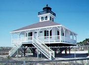
- Mobile Point Range LightsMobile Point Range LightsThe Mobile Point Range Lights were a series of lighthouses at the entrance to Mobile Bay, at Mobile Point on the tip of the Fort Morgan peninsula, near Mobile, Alabama, United States. The first lighthouse was built as a landfall light by June 1822 at a cost of $9,995. The lighthouse was a conical...
, MobileMobile, AlabamaMobile is the third most populous city in the Southern US state of Alabama and is the county seat of Mobile County. It is located on the Mobile River and the central Gulf Coast of the United States. The population within the city limits was 195,111 during the 2010 census. It is the largest... - Middle Bay LightMiddle Bay LightMiddle Bay Light, also known as Middle Bay Lighthouse and Mobile Bay Lighthouse, is a hexagonal-shaped screw-pile lighthouse offshore from Mobile, Alabama, in the center of Mobile Bay.-History:...
, Mobile BayMobile BayMobile Bay is an inlet of the Gulf of Mexico, lying within the state of Alabama in the United States. Its mouth is formed by the Fort Morgan Peninsula on the eastern side and Dauphin Island, a barrier island on the western side. The Mobile River and Tensaw River empty into the northern end of the... - Sand Island Light at the mouth of Mobile BayMobile BayMobile Bay is an inlet of the Gulf of Mexico, lying within the state of Alabama in the United States. Its mouth is formed by the Fort Morgan Peninsula on the eastern side and Dauphin Island, a barrier island on the western side. The Mobile River and Tensaw River empty into the northern end of the...
Alaska
- Cape Decision LightCape Decision LightCape Decision is a lighthouse located on Kuiu Island adjacent to Sumner Strait in Southeast Alaska.-History:The first attempt to light these waters was an acetylene lantern placed on the Spanish Islands, just off the southern end of Kuiu Island...
, Kuiu IslandKuiu IslandKuiu Island is an island in the Alexander Archipelago in southeastern Alaska. It lies between Kupreanof Island, to its east, and Baranof Island, to its west. The island is long, and 10–23 km wide. It is nearly cut in two by Affleck Canal. It has of land area, making it the 15th largest... - Cape Hinchinbrook LightCape Hinchinbrook LightThe Cape Hinchinbrook Light is a lighthouse located near the southern end of Hinchinbrook Island adjacent to Prince William Sound, in Alaska, United States.-History:...
, Prince William SoundPrince William SoundPrince William Sound is a sound off the Gulf of Alaska on the south coast of the U.S. state of Alaska. It is located on the east side of the Kenai Peninsula. Its largest port is Valdez, at the southern terminus of the Trans-Alaska Pipeline System... - Cape St. Elias LightCape St. Elias Light-History:Congress approved the construction of a light station at Cape St. Elias in October 1913, appropriating $115,000 for the construction. construction began in 1915 and a third order Fresnel lens was installed. In 1927 the station was equipped with radio beacon facilities, which was the second...
, Kayak IslandKayak IslandKayak Island , which includes the Bering Expedition Landing Site, is located in the Gulf of Alaska, 100 km SE of Cordova, Alaska Malaspina Coastal Plain. It has a land area of 73.695 km² and no population.... - Cape Sarichef LightCape Sarichef LightCape Sarichef Light is a lighthouse located on the northwest tip of Unimak Island, approximately southwest of Anchorage, Alaska. The most westerly and most isolated lighthouse in North America, Cape Sarichef Light marks the northwest end of Unimak Pass, the main passage through the Aleutian...
, Unimak pass through Aleutian islands - Cape Spencer LightCape Spencer LightThe Cape Spencer Light is a lighthouse in Alaska,United States, next to the entrance to Cross Sound and Icy Strait. The light is still an active aid to navigation...
, Cross SoundCross SoundCross Sound is a passage in the Alexander Archipelago in the southeastern region of the U.S. state of Alaska, located between Chichagof Island to its south and the mainland to its north... - Eldred Rock LightEldred Rock LightThe Eldred Rock Light is an historic octagonal lighthouse adjacent to Lynn Canal in Alaska. It is the last of the ten lighthouses constructed in Alaska between 1902 and 1906...
, Lynn CanalLynn CanalLynn Canal is an inlet into the mainland of southeast Alaska.Lynn Canal runs about from the inlets of the Chilkat River south to Chatham Strait and Stephens Passage... - Fairway Island LightFairway Island LightThe Fairway Island Lighthouse is a lighthouse located on the eastern entrance to Peril Strait, Alaska.It is located on a small islet that lies between the southeastern end of Chichagof Island and northern Catherine Island, within the limits of Sitka City and Borough.-History:Fairway Island...
, Peril Strait - Five Finger Islands LightFive Finger Islands LightThe Five Finger Islands Light is a lighthouse located on a small island that lies between Stephens Passage and Frederick Sound in southeastern Alaska. It was the last lighthouse in Alaska to be automated on August 14, 1984.-History:...
, Frederick SoundFrederick SoundFrederick Sound is a passage of water in the Alexander Archipelago in southeastern Alaska that separates Kupreanof Island to the south from Admiralty Island in the north.... - Guard Island LightGuard Island LightThe Guard Island Light is a lighthouse located on a small island near the entrance to the Tongass Narrows, in Clarence Strait in southeastern Alaska. The western entrance to the Behm Canal also lies nearby.-History:...
, Clarence StraitClarence StraitClarence Strait, originally Duke of Clarence Strait, is a strait in southeastern Alaska, in the United States in the Alexander Archipelago. The strait separates Prince of Wales Island, on the west side, from Revillagigedo Island and Annette Island, on the east side... - Lincoln Rocks Light, Clarence StraitClarence StraitClarence Strait, originally Duke of Clarence Strait, is a strait in southeastern Alaska, in the United States in the Alexander Archipelago. The strait separates Prince of Wales Island, on the west side, from Revillagigedo Island and Annette Island, on the east side...
- Mary Island LightMary Island LightThe Mary Island Light Station is a lighthouse located on the northeastern part of Mary Island in southeastern Alaska, USA.-History:Mary Island Light Station was opened in 1903, and was one of a series of staffed lights established by the U.S. Government to guide ships through the treacherous waters...
, Mary Island - Point Retreat LightPoint Retreat LightPoint Retreat Light is a lighthouse located on the Mansfield Peninsula at the northern tip of Admiralty Island in southeastern Alaska, USA. It provides aid in navigation through the Lynn Canal.-Naming:...
, Admiralty IslandAdmiralty IslandAdmiralty Island is an island in the Alexander Archipelago in Southeast Alaska, at . It is 145 km long and 56 km wide with an area of 4,264.1 km² , making it the seventh largest island in the United States and the 132nd largest island in the world. It is one of the... - Point Sherman LightPoint Sherman LightThe Point Sherman Light was a lighthouse located north of Juneau, Alaska, along the east side of Lynn Canal, eight miles south of Eldred Rock Light. It is no longer standing.-History:...
, Lynn CanalLynn CanalLynn Canal is an inlet into the mainland of southeast Alaska.Lynn Canal runs about from the inlets of the Chilkat River south to Chatham Strait and Stephens Passage... - Scotch Cap LightScotch Cap LightThe Scotch Cap Light is a lighthouse located on the southwest corner of Unimak Island in Alaska. It was the first station established on the outside coast of Alaska.-History:...
, Unimak IslandUnimak IslandUnimak Island is the largest island in the Aleutian Islands chain of the U.S. state of Alaska. It is the easternmost island in the Aleutians and, with an area of 1,571.41 mi² , the ninth largest island in the United States and the 134th largest island in the world. It is home to Mount... - Sentinel Island LightSentinel Island LightThe Sentinel Island Light is a lighthouse in Alaska adjacent to Lynn Canal in Alaska.-Location:Sentinel Island Light is located at the northern entrance to the Favorite Channel, between the mainland and Lincoln and Shelter Islands...
, Lynn CanalLynn CanalLynn Canal is an inlet into the mainland of southeast Alaska.Lynn Canal runs about from the inlets of the Chilkat River south to Chatham Strait and Stephens Passage... - Tree Point LightTree Point LightThe Tree Point Light is a lighthouse located adjacent to Revillagigedo Channel in southeastern Alaska, USA. It is located near the southernmost point of mainland Alaska.-History:...
, Revillagigedo ChannelRevillagigedo ChannelRevillagigedo Channel is an ocean channel in the Alexander Archipelago of the U.S. state of Alaska. Extending 56 km northwest from the Dixon Entrance, it lies between the mainland to the east, Revillagigedo Island to the north, and Duke Island and Annette Island to the southwest...
Arizona
The Lake Havasu Lighthouse Club is in the process of building lighthouses on Lake HavasuLake Havasu
Lake Havasu is a large reservoir behind Parker Dam on the Colorado River, on the border between California and Arizona. Lake Havasu City sits on the lake's eastern shore. The lake has a capacity of . The concrete arch dam was built by the United States Bureau of Reclamation between 1934 and 1938...
which is part of the Colorado River
Colorado River
The Colorado River , is a river in the Southwestern United States and northwestern Mexico, approximately long, draining a part of the arid regions on the western slope of the Rocky Mountains. The watershed of the Colorado River covers in parts of seven U.S. states and two Mexican states...
. These lighthouses are 17 to 30 feet replicas of famous lighthouses. In order of dedication date, they are:
- Lake Havasu Marina
- West Quoddy, June 30, 2002
- Cape Hatteras Light replica, October 27, 2002
- Robert R. Manning, February 2, 2003
- Main Buffalo, October 26, 2003
- Split Rock, January 4, 2004
- Currituck, October 31, 2004
- Sandy Hook, Complete, not dedicated
- Vermillion, October 29, 2005
- Table Bluff, May 2, 2006
- East Quoddy, September 17, 2006
- Boston Light, Future
- Mount Desert Rock, Future
- Alpena, Future
- Berwick, Future
- Bernegat, Future
California
- Alcatraz Island Light, San FranciscoSan Francisco, CaliforniaSan Francisco , officially the City and County of San Francisco, is the financial, cultural, and transportation center of the San Francisco Bay Area, a region of 7.15 million people which includes San Jose and Oakland...
- Anacapa Island Light, entrance to Santa Barbara ChannelSanta Barbara ChannelThe Santa Barbara Channel is a portion of the Pacific Ocean which separates the mainland of California from the northern Channel Islands. It is generally south of the city of Santa Barbara, and west of the city of Ventura....
- Angel Island Light, see Point Blunt LightPoint Blunt LightPoint Blunt Light is a lighthouse on Angel Island in San Francisco Bay, California.-Historical information as of 1970:From Coast Guard web site:...
or Point Stuart Light - Año Nuevo Island Light
- Ballast Point LightBallast Point LightBallast Point Light was a lighthouse in California, situated on Ballast Point, a tiny peninsula extending into San Diego Bay from Point Loma, San Diego, California. The lighthouse was torn down in 1960; the site is now on the grounds of Naval Base Point Loma. Ballast Point was the last lighthouse...
, Point LomaPoint Loma, San Diego, CaliforniaPoint Loma is a seaside community of San Diego, California. Geographically it is a hilly peninsula that is bordered on the west and south by the Pacific Ocean, the east by the San Diego Bay and Old Town and the north by the San Diego River...
, San Diego Harbor entrance - Battery Point LightBattery Point LightBattery Point Light is a lighthouse in Crescent City, California, United States. It is registered as California Historical Landmark number 951.-History:...
, Crescent CityCrescent City, CaliforniaCrescent City is the county seat and only incorporated city in Del Norte County, California. Named for the crescent-shaped stretch of sandy beach south of the city, Crescent City had a total population of 7,643 in the 2010 census, up from 4,006 in the 2000 census... - Cape Mendocino LightCape Mendocino LightCape Mendocino Lighthouse is a lighthouse in California,United States, off Shelter Cove near Point Delgado, California. The tower had the highest focal plane at in the U.S....
- Carquinez Strait LightCarquinez Strait LightCarquinez Strait Lighthouse is a lighthouse in California, United States. It is originally approximately 20 miles inland from the mouth of the San Francisco Bay near Vallejo, California.-History:...
, near VallejoVallejo, CaliforniaVallejo is the largest city in Solano County, California, United States. The population was 115,942 at the 2010 census. It is located in the San Francisco Bay Area on the northeastern shore of San Pablo Bay... - East Brother Island Light, RichmondRichmond, CaliforniaRichmond is a city in western Contra Costa County, California, United States. The city was incorporated on August 7, 1905. It is located in the East Bay, part of the San Francisco Bay Area. It is a residential inner suburb of San Francisco, as well as the site of heavy industry, which has been...
, off Point San PabloPoint San PabloPoint San Pablo is a small historic community isolated at the far end of the Potrero Hills at Point San Pablo in Richmond, California.-Overview:... - Farallon Island LightFarallon Island LightFarallon Island Light is a lighthouse on Southeast Farallon Island, California. One of the highest lights in California, it was constructed in 1855 to warn ships approaching San Francisco from the...
, Southeast Farallon IslandFarallon IslandsThe Farallon Islands, or Farallones , are a group of islands and sea stacks in the Gulf of the Farallones, off the coast of San Francisco, California, USA. They lie outside the Golden Gate and south of Point Reyes, and are visible from the mainland on clear days... - Fort Point Light, entrance to San FranciscoSan Francisco, CaliforniaSan Francisco , officially the City and County of San Francisco, is the financial, cultural, and transportation center of the San Francisco Bay Area, a region of 7.15 million people which includes San Jose and Oakland...
Harbor, directly beneath the south anchorage of the Golden Gate BridgeGolden Gate BridgeThe Golden Gate Bridge is a suspension bridge spanning the Golden Gate, the opening of the San Francisco Bay into the Pacific Ocean. As part of both U.S. Route 101 and California State Route 1, the structure links the city of San Francisco, on the northern tip of the San Francisco Peninsula, to... - Humboldt Harbor LightHumboldt Harbor LightThe Humboldt Harbor Light was an early lighthouse marking the entrance to Humboldt Bay. Plagued by fog, earthquakes, and flooding, it was eventually abandoned in favor of a new light at Table Bluff.-History:...
- Lime Point LightLime Point LightLime Point Lighthouse is a lighthouse in California, United States, on northern side of the Golden Gate Bridge.-History:The lens lantern at Lime Point was hung on the wall of the fog signal building at a height of 20 feet above the water...
, entrance of San Francisco BaySan Francisco BaySan Francisco Bay is a shallow, productive estuary through which water draining from approximately forty percent of California, flowing in the Sacramento and San Joaquin rivers from the Sierra Nevada mountains, enters the Pacific Ocean...
, adjacent to the north end of the Golden Gate BridgeGolden Gate BridgeThe Golden Gate Bridge is a suspension bridge spanning the Golden Gate, the opening of the San Francisco Bay into the Pacific Ocean. As part of both U.S. Route 101 and California State Route 1, the structure links the city of San Francisco, on the northern tip of the San Francisco Peninsula, to...
, SausalitoSausalito, CaliforniaSausalito is a San Francisco Bay Area city, in Marin County, California, United States. Sausalito is south-southeast of San Rafael, at an elevation of 13 feet . The population was 7,061 as of the 2010 census. The community is situated near the northern end of the Golden Gate Bridge, and prior to... - Long Beach LightLong Beach LightLong Beach Light also known as the Long Beach Harbor Light, is a lighthouse on Long Beach Harbor in California.-History:Long Beach Harbor Light looks different from a traditional lighthouse. Labeled the "robot light" when established in 1949, it is completely automated and was the forerunner of the...
- Los Angeles Harbor LightLos Angeles Harbor LightLos Angeles Harbor Light, ', also known as Angels Gate Light, is a lighthouse in California,United States, at San Pedro Breakwater in Los Angeles Harbor, California. The lighthouse is listed on the National Register of Historic Places...
, San PedroSan Pedro, Los Angeles, CaliforniaSan Pedro is a port district of the city of Los Angeles, California, United States. It was annexed in 1909 and is a major seaport of the area...
Breakwater, Angels Gate - Mare Island LightMare Island LightMare Island Lighthouse was a lighthouse in California,United States, on the north shore of San Pablo Bay at the entrance to Carquinez Strait, California-History:The lighthouse was razed in the 1930s...
, north shore of San Pablo BaySan Pablo BaySan Pablo Bay is a tidal estuary that forms the northern extension of San Francisco Bay in northern California in the United States. Most of the Bay is shallow; however, there is a deep water channel approximately in mid bay, which allows access to Sacramento, Stockton, Benicia, Martinez, and...
at the entrance to Carquinez StraitCarquinez StraitThe Carquinez Strait is a narrow tidal strait in northern California. It is part of the tidal estuary of the Sacramento and the San Joaquin rivers as they drain into the San Francisco Bay...
; nearest town or city is VallejoVallejo, CaliforniaVallejo is the largest city in Solano County, California, United States. The population was 115,942 at the 2010 census. It is located in the San Francisco Bay Area on the northeastern shore of San Pablo Bay... - Mark Abbott Memorial Light, Santa CruzSanta Cruz, CaliforniaSanta Cruz is the county seat and largest city of Santa Cruz County, California in the US. As of the 2010 U.S. Census, Santa Cruz had a total population of 59,946...
- Mile Rocks LightMile Rocks LightMile Rocks Lighthouse is a lighthouse on a rock about southwest of the Golden Gate Bridge, California. It's now an automated and unnatural looking lighthouse with a flat top and red painted rings which tends to stand out very obviously between the Golden Gate Bridge and the Cliff House to the south...
, southwest of the Golden Gate BridgeGolden Gate BridgeThe Golden Gate Bridge is a suspension bridge spanning the Golden Gate, the opening of the San Francisco Bay into the Pacific Ocean. As part of both U.S. Route 101 and California State Route 1, the structure links the city of San Francisco, on the northern tip of the San Francisco Peninsula, to... - Oakland Harbor LightOakland Harbor LightOakland Harbor Light is a former lighthouse, now a restaurant in Embarcadero Cove, California.-History:The original tower was built in 1890 at the entrance of Oakland Harbor. The wooden pilings on which the structure sat had deteriorated by 1902, and a larger replacement lighthouse was constructed...
, Embarcadero Cove, OaklandOakland, CaliforniaOakland is a major West Coast port city on San Francisco Bay in the U.S. state of California. It is the eighth-largest city in the state with a 2010 population of 390,724... - Piedras Blancas LightPiedras Blancas LightPiedras Blancas Light Station is a lighthouse on Point Piedras Blancas, about five and half miles west by NW of San Simeon, California.-History:...
, northern entrance to San SimeonSan Simeon, CaliforniaSan Simeon is a census-designated place on the Pacific coast of San Luis Obispo County, California. Its position along State Route 1 is approximately halfway between Los Angeles and San Francisco, each of those cities being roughly 230 mi away...
bay - Pigeon Point Light, PescaderoPescadero, CaliforniaPescadero is a census-designated place in San Mateo County, California two miles east of State Route 1 and Pescadero State Beach. The center of town, on Pescadero Creek Road, is located at latitude 37.255 and longitude 122.38028. The town is south of Half Moon Bay. The ZIP Code is 94060 and...
, southern approach to San Francisco BaySan Francisco BaySan Francisco Bay is a shallow, productive estuary through which water draining from approximately forty percent of California, flowing in the Sacramento and San Joaquin rivers from the Sierra Nevada mountains, enters the Pacific Ocean... - Point Arena LightPoint Arena LightPoint Arena Light is a lighthouse in Mendocino County, California, United States, two miles north of Point Arena, California. It is located approximately north of San Francisco in the Fort Point Group of lighthouses. The lighthouse features a small museum and giftshop...
, two miles north of Point Arena - Point Arguello LightPoint Arguello LightPoint Arguello Lighthouse is a lighthouse on Point Arguello, serving the Santa Barbara Channel, California adjoining Vandenberg Air Force Base near the city of Lompoc, California....
, Santa Barbara ChannelSanta Barbara ChannelThe Santa Barbara Channel is a portion of the Pacific Ocean which separates the mainland of California from the northern Channel Islands. It is generally south of the city of Santa Barbara, and west of the city of Ventura.... - Point Blunt LightPoint Blunt LightPoint Blunt Light is a lighthouse on Angel Island in San Francisco Bay, California.-Historical information as of 1970:From Coast Guard web site:...
, Angel Island, San Francisco BaySan Francisco BaySan Francisco Bay is a shallow, productive estuary through which water draining from approximately forty percent of California, flowing in the Sacramento and San Joaquin rivers from the Sierra Nevada mountains, enters the Pacific Ocean... - Point Bonita LightPoint Bonita LightPoint Bonita Light is a lighthouse located at Point Bonita at the San Francisco Bay entrance in the Marin Headlands near Sausalito, California. Point Bonita was the last manned lighthouse on the California coast.-History:...
, Marin HeadlandsMarin HeadlandsThe Marin Headlands is a hilly area at the southernmost end of Marin County, California, just north of the Golden Gate Bridge. The Headlands are located just north of San Francisco, immediately across the Golden Gate Bridge. The entire area is part of the Golden Gate National Recreation Area...
, San Francisco BaySan Francisco BaySan Francisco Bay is a shallow, productive estuary through which water draining from approximately forty percent of California, flowing in the Sacramento and San Joaquin rivers from the Sierra Nevada mountains, enters the Pacific Ocean...
entrance near SausalitoSausalito, CaliforniaSausalito is a San Francisco Bay Area city, in Marin County, California, United States. Sausalito is south-southeast of San Rafael, at an elevation of 13 feet . The population was 7,061 as of the 2010 census. The community is situated near the northern end of the Golden Gate Bridge, and prior to... - Point Cabrillo LightPoint Cabrillo LightPoint Cabrillo Light is a lighthouse in northern California, United States, between Point Arena and Cape Mendocino, just south of the community of Caspar...
, MendocinoMendocino, CaliforniaMendocino is a census-designated place in Mendocino County, California, United States. Mendocino is located south of Fort Bragg, at an elevation of 154 feet...
, between Point Arena and Cape MendocinoCape MendocinoCape Mendocino located on the Lost Coast entirely within Humboldt County, California, USA, is the westernmost point on the coast of California. It has been a landmark since the 16th century when the Manila Galleons would reach the coast here following the prevailing westerlies all the way across... - Point Conception LightPoint Conception LightPoint Conception Light is a lighthouse on Point Conception at the west entrance of the Santa Barbara Channel, California. It is one of the earliest California lighthouses and is listed on the National Register of Historic Places.-History:...
, Point ConceptionPoint ConceptionPoint Conception is a headland along the Pacific coast of U.S. state of California, located in southwestern Santa Barbara County. It is the point where the Santa Barbara Channel meets the Pacific Ocean, and as the corner between the mostly north-south trending portion of coast to the north and the... - Point Diablo LightPoint Diablo LightThe Point Diablo Light is a lighthouse in California,United States, about halfway between Point Bonita and Lime Point on the northern side of the Golden Gate Bridge, California-History:...
, west of the Golden Gate BridgeGolden Gate BridgeThe Golden Gate Bridge is a suspension bridge spanning the Golden Gate, the opening of the San Francisco Bay into the Pacific Ocean. As part of both U.S. Route 101 and California State Route 1, the structure links the city of San Francisco, on the northern tip of the San Francisco Peninsula, to... - Point Fermin LightPoint Fermin Light-History:The original fourth order Fresnel lens was removed in 1942 and a wood replica lantern was installed in 1974. The lighthouse was saved from demolition in 1972 and refurbished in 1974, and a new lantern room and gallery were built by local preservationists...
, San PedroSan Pedro, Los Angeles, CaliforniaSan Pedro is a port district of the city of Los Angeles, California, United States. It was annexed in 1909 and is a major seaport of the area... - Point Hueneme LightPoint Hueneme LightPoint Hueneme Lighthouse is a lighthouse on the southeast entrance to the Santa Barbara Channel, in Ventura County, California-History:thumb|left|Original 1874 Lighthouse, [[USCG]] photo...
, Santa Barbara ChannelSanta Barbara ChannelThe Santa Barbara Channel is a portion of the Pacific Ocean which separates the mainland of California from the northern Channel Islands. It is generally south of the city of Santa Barbara, and west of the city of Ventura.... - Point Knox Light
- Point Loma Light (old), San DiegoSan Diego, CaliforniaSan Diego is the eighth-largest city in the United States and second-largest city in California. The city is located on the coast of the Pacific Ocean in Southern California, immediately adjacent to the Mexican border. The birthplace of California, San Diego is known for its mild year-round...
- Point Loma Light (new)Point Loma Light (new)New Point Loma Lighthouse is a lighthouse on Point Loma in California,United States, near San Diego, California. It was built in 1891 to replace the Old Point Loma Lighthouse, that was ineffective due to elevation .thumb|left|Undated [[USCG]] photo...
, San DiegoSan Diego, CaliforniaSan Diego is the eighth-largest city in the United States and second-largest city in California. The city is located on the coast of the Pacific Ocean in Southern California, immediately adjacent to the Mexican border. The birthplace of California, San Diego is known for its mild year-round... - Point Montara LightPoint Montara LightThe Point Montara Light is a lighthouse in Montara, California, United States, on the southern approach to the San Francisco Bay, California approximately 25 miles south of San Francisco.-History:...
- Point Pinos Light, Pacific GrovePacific Grove, CaliforniaPacific Grove is a coastal city in Monterey County, California, USA, with a population of 15,041 as of the 2010 census, down from 15,522 as of the 2000 census...
- Point Reyes LightPoint Reyes Light (lighthouse)The Point Reyes Lighthouse, also known as Point Reyes Light or the Point Reyes Light Station, is a lighthouse in the Gulf of the Farallones on Point Reyes in Marin County, California, U.S.A.-History:...
, Point Reyes - Point San Luis LightPoint San Luis LightThe Point San Luis Lighthouse is the only surviving Prairie Victorian model lighthouse that remains in existence on the West Coast of the United States. It is on the National Register of Historic Places and is presently being refurbished by the Point San Luis Lighthouse Keepers, a volunteer group...
, near San Luis Obispo, Avila BeachAvila BeachAvila Beach , pronounced AH-vuh-luh or spanish pronunciation as AH-vee-lah, is a census-designated place in San Luis Obispo County, California, USA and located about 160 miles northwest of Los Angeles, and about 200 miles south of San Francisco. The ZIP Code is 93424. The community is inside area...
, and Diablo Canyon Power PlantDiablo Canyon Power PlantDiablo Canyon Power Plant is an electricity-generating nuclear power plant at Avila Beach in San Luis Obispo County, California. The plant has two Westinghouse-designed 4-loop pressurized-water nuclear reactors operated by Pacific Gas & Electric. The facility is located on about in Avila Beach,... - Point Stuart Lighthttp://www.lighthousesrus.org/WestCoast/California.htm#CA23B Angel Island San Francisco CaliforniaCaliforniaCalifornia is a state located on the West Coast of the United States. It is by far the most populous U.S. state, and the third-largest by land area...
- Point Sur Light
- Point Vicente LightPoint Vicente LightPoint Vicente Lighthouse is a lighthouse in California,United States, in Palos Verdes, north of Los Angeles Harbor, California. It is between Point Loma Lighthouse to the south and Point Conception Lighthouse to the north....
, Palos VerdesPalos VerdesPalos Verdes is a name often used to refer to a group of coastal cities in the Palos Verdes Hills on the Palos Verdes Peninsula, within southwestern Los Angeles County in the U.S... - Punta Gorda LightPunta Gorda LightPunta Gorda Lighthouse is a lighthouse in United States, south of Cape Mendocino, California. Access is by vehicle and one and an hour hike on foot...
, south of Cape MendocinoCape MendocinoCape Mendocino located on the Lost Coast entirely within Humboldt County, California, USA, is the westernmost point on the coast of California. It has been a landmark since the 16th century when the Manila Galleons would reach the coast here following the prevailing westerlies all the way across... - Roe Island LightRoe Island LightRoe Island Lighthouse was a lighthouse in United States, on the east end of Suisun Bay, California-History:thumb|left|[[USCG]] photo, August 7, 1924...
, Suisun BaySuisun BaySuisun Bay is a shallow tidal estuary at in northern California, USA. It lies at the confluence of the Sacramento and San Joaquin Rivers, forming the entrance to the Sacramento-San Joaquin River Delta, an inverted river delta... - Rubicon Point LightRubicon Point LightThe Rubicon Point Light is a small lighthouse on Lake Tahoe in California.- History:The lighthouse was requested, along with buoys for the lake, in 1913 by the Lake Tahoe Protective Association, and was built under the direction of J. J. Bodilsen in 1916; the work was done by the United States...
, Lake TahoeLake TahoeLake Tahoe is a large freshwater lake in the Sierra Nevada of the United States. At a surface elevation of , it is located along the border between California and Nevada, west of Carson City. Lake Tahoe is the largest alpine lake in North America. Its depth is , making it the USA's second-deepest...
; highest elevation American lighthouse - San Luis Obispo Light
- Santa Barbara LightSanta Barbara LightSanta Barbara Lighthouse was a lighthouse in California, United States, on the Santa Barbara Harbour, California-History:When Santa Barbara Lighthouse was established on December 1, 1856, it was typical of the other pioneer West Coast lights, with the tower rising through the center of the...
- Santa Cruz Breakwater LightSanta Cruz Breakwater LightSanta Cruz Breakwater Lighthouse, is a lighthouse in California, United States, in the Santa Cruz Harbor in Santa Cruz, California.A second lighthouse, is known as Walton Lighthouse because Charles Walton, a local businessman, contributed a significant part of the cost in memory of his late brother...
- Santa Cruz Harbor Light (see Walton Light)
- Southampton Shoal LightSouthampton Shoal LightSouthampton Shoal is a former lighthouse site in California, United States. A platform sits at the southwest edge of Southampton Shoals, northeast of Angel Island in the San Francisco Bay...
, in San Francisco BaySan Francisco BaySan Francisco Bay is a shallow, productive estuary through which water draining from approximately forty percent of California, flowing in the Sacramento and San Joaquin rivers from the Sierra Nevada mountains, enters the Pacific Ocean... - St. George Reef Light, near Crescent CityCrescent City, CaliforniaCrescent City is the county seat and only incorporated city in Del Norte County, California. Named for the crescent-shaped stretch of sandy beach south of the city, Crescent City had a total population of 7,643 in the 2010 census, up from 4,006 in the 2000 census...
- Sugar Pine Point LightSugar Pine Point LightThe Sugar Pine Point Light was a small lighthouse located on Lake Tahoe, in El Dorado County, California.-History:In 1921, various commercial interests lobbied for the replacement of the Rubicon Point Light with a light on Sugar Pine Point...
, Lake TahoeLake TahoeLake Tahoe is a large freshwater lake in the Sierra Nevada of the United States. At a surface elevation of , it is located along the border between California and Nevada, west of Carson City. Lake Tahoe is the largest alpine lake in North America. Its depth is , making it the USA's second-deepest... - Table Bluff LightTable Bluff LightTable Bluff Lighthouse is a lighthouse in California,United States, on southern Humboldt Bay, near Eureka, California. The Table Bluff Lighthouse was one of the first to be automated. The light house tower portion is now located at the Woodley Island Marina within the City of Eureka.-History:Table...
, Humboldt Bay - Trinidad Head LightTrinidad Head LightTrinidad Head Lighthouse is a lighthouse in United States, in Trinidad Harbor, California. The historic site is located north of Eureka, California.-History:...
- Walton Light (also known as Santa Cruz Harbor Light), Santa CruzSanta Cruz, CaliforniaSanta Cruz is the county seat and largest city of Santa Cruz County, California in the US. As of the 2010 U.S. Census, Santa Cruz had a total population of 59,946...
- Yerba Buena LightYerba Buena LightYerba Buena Lighthouse is a lighthouse in California,United States, in the San Francisco Bay on Yerba Buena Island, California-History:The island’s lighthouse connection began in 1873 when the Lighthouse Service moved the district's depot from Mare Island to the southeast side of Yerba Buena Island...
, in San Francisco BaySan Francisco BaySan Francisco Bay is a shallow, productive estuary through which water draining from approximately forty percent of California, flowing in the Sacramento and San Joaquin rivers from the Sierra Nevada mountains, enters the Pacific Ocean...
Connecticut
- Avery Point LightAvery Point LightAvery Point Lighthouse is a lighthouse in Groton, Connecticut, United States, on the Avery Point Campus of the University of Connecticut. It was the last lighthouse built in the state.-History:...
, GrotonGroton, ConnecticutGroton is a town located on the Thames River in New London County, Connecticut, United States. The population was 39,907 at the 2000 census.... - Black Rock Harbor LightBlack Rock Harbor LightBlack Rock Harbor Light is a lighthouse in Bridgeport, Connecticut, United States, on the south end of Fayerweather Island, that marks the entrance to Black Rock Harbor.-History:...
, Black Rock HarborBlack Rock HarborBlack Rock Harbor is located in Bridgeport, Connecticut on the Long Island Sound. The Black Rock Harbor Light on Fayerweather Island marks the entrance to the harbor on its east, while St. Mary's by the Sea forms its western beachhead. Seaside Park runs along the northeastern part of the harbor.... - Bridgeport Harbor LightBridgeport Harbor LightBridgeport Harbor Lighthouse was a lighthouse in Connecticut,United States, on the west side of the Bridgeport Harbor entrance and the north side of Long Island Sound, Bridgeport, Connecticut in the United States.-History:...
, Long Island SoundLong Island SoundLong Island Sound is an estuary of the Atlantic Ocean, located in the United States between Connecticut to the north and Long Island, New York to the south. The mouth of the Connecticut River at Old Saybrook, Connecticut, empties into the sound. On its western end the sound is bounded by the Bronx... - Falkner Island LightFalkner Island LightFalkner Island Lighthouse is a lighthouse in Connecticut,United States, off Guilford Harbor on Long Island Sound.-History:Falkner Island Lighthouse was built on Falkner Island in 1802. In 1856, the light was upgraded from lamps to a fourth order Fresnel lens. The light was automated in 1978 and ...
, GuilfordGuilford, ConnecticutGuilford is a town in New Haven County, Connecticut, United States, that borders Madison, Branford, North Branford and Durham, and is situated on I-95 and the coast. The population was 21,398 at the 2000 census... - Five Mile PointFive Mile PointFive Mile Point Light, also known as Five Mile Point Lighthouse or Old New Haven Harbor Lighthouse, is a lighthouse in New Haven, Connecticut, United States, on the harbor entrance to Long Island Sound, five miles from Downtown New Haven...
(Old New Haven), Long Island SoundLong Island SoundLong Island Sound is an estuary of the Atlantic Ocean, located in the United States between Connecticut to the north and Long Island, New York to the south. The mouth of the Connecticut River at Old Saybrook, Connecticut, empties into the sound. On its western end the sound is bounded by the Bronx... - Great Captain Island LightGreat Captain Island LightGreat Captain Island Lighthouse is a lighthouse on Great Captain Island in the western Long Island Sound off the coast of Greenwich, Connecticut, United States...
, GreenwichGreenwich, ConnecticutGreenwich is a town in Fairfield County, Connecticut, United States. As of the 2010 census, the town had a total population of 61,171. It is home to many hedge funds and other financial service companies. Greenwich is the southernmost and westernmost municipality in Connecticut and is 38+ minutes ... - Greens Ledge LightGreens Ledge LightGreens Ledge Lighthouse is a sparkplug lighthouse in Connecticut,United States, off the southwest end of the Norwalk Islands, Long Island Sound, near Norwalk, Connecticut...
, NorwalkNorwalk, ConnecticutNorwalk is a city in Fairfield County, Connecticut, United States. According to the 2010 U.S. Census, the population of the city is 85,603, making Norwalk sixth in population in Connecticut, and third in Fairfield County... - Lynde Point LightLynde Point LightLynde Point Lighthouse, also known as Saybrook Inner Lighthouse, is a lighthouse in Connecticut, United States, on the west side of the mouth of the Connecticut River on the Long Island Sound, Old Saybrook, Connecticut-History:...
(Saybrook Inner), Long Island SoundLong Island SoundLong Island Sound is an estuary of the Atlantic Ocean, located in the United States between Connecticut to the north and Long Island, New York to the south. The mouth of the Connecticut River at Old Saybrook, Connecticut, empties into the sound. On its western end the sound is bounded by the Bronx... - Morgan Point LightMorgan Point LightMorgan Point Lighthouse is a lighthouse in Noank, Connecticut, United States, on the west side of the mouth of the Mystic River.-History:In 1831 the original granite tower was built...
, NoankNoank, ConnecticutNoank is a village and census-designated place in the town of Groton in New London County, Connecticut, United States. The population was 1,830 at the 2000 census... - Mystic Seaport LightMystic Seaport LightMystic Seaport Light is a lighthouse at the south end of Mystic Seaport, two miles upriver from Noank, Connecticut. It is not an official aid to navigation.-History:...
, MysticMystic, ConnecticutMystic is a village and census-designated place in New London County, Connecticut, in the United States. The population was 4,001 at the 2000 census. A historic locality, Mystic has no independent government because it is not a legally recognized municipality in the state of Connecticut... - New London Harbor LightNew London Harbor LightNew London Harbor Light is a lighthouse in Connecticut,United States, on the west side of the New London harbor entrance, Connecticut. It is the nation's fifth oldest light station and the seventh oldest U.S...
, New LondonNew London, ConnecticutNew London is a seaport city and a port of entry on the northeast coast of the United States.It is located at the mouth of the Thames River in New London County, southeastern Connecticut.... - New London Ledge LightNew London Ledge LightNew London Ledge Lighthouse is a lighthouse in Connecticut,United States, on the Thames River, at the mouth of New London Harbor in Groton, Connecticut-History:New London Ledge Lighthouse was built in 1909 on the Southwest Ledge...
, New LondonNew London, ConnecticutNew London is a seaport city and a port of entry on the northeast coast of the United States.It is located at the mouth of the Thames River in New London County, southeastern Connecticut.... - Pecks Ledge LightPecks Ledge LightPecks Ledge Light, also known as "Peck Ledge Lighthouse", is a sparkplug lighthouse in Norwalk, Connecticut, United States, southeast of Norwalk Harbor and northeast of Goose Island among the Norwalk Islands on Long Island Sound...
, NorwalkNorwalk, ConnecticutNorwalk is a city in Fairfield County, Connecticut, United States. According to the 2010 U.S. Census, the population of the city is 85,603, making Norwalk sixth in population in Connecticut, and third in Fairfield County... - Penfield Reef LightPenfield Reef LightPenfield Reef Lighthouse is a lighthouse in Connecticut,United States, on Penfield Reef at the south side of Black Rock Harbor entrance on the Long Island Sound, off the coast of Fairfield, Connecticut. Constructed in 1874, it was one of the last offshore masonry lights...
, FairfieldFairfield, ConnecticutFairfield is a town located in Fairfield County, Connecticut, United States. It is bordered by the towns of Bridgeport, Trumbull, Easton, Redding and Westport along the Gold Coast of Connecticut. As of the 2010 census, the town had a population of 59,404... - Saybrook Breakwater LightSaybrook Breakwater LightSaybrook Breakwater Lighthouse is a sparkplug lighthouse in Connecticut,United States, at Fenwick Point at the mouth of the Connecticut River near Old Saybrook, Connecticut...
(Saybrook Outer), Old SaybrookOld Saybrook, ConnecticutOld Saybrook is a town in Middlesex County, Connecticut, United States. The population was 10,367 at the 2000 census. It contains the incorporated borough of Fenwick, as well as the census-designated places of Old Saybrook Center and Saybrook Manor.-History:... - Sheffield Island LightSheffield Island LightSheffield Island Light is an historic Connecticut, USA, lighthouse located at the southern end of the Norwalk Islands on the west entrance of the Norwalk River on northern Long Island Sound....
, NorwalkNorwalk, ConnecticutNorwalk is a city in Fairfield County, Connecticut, United States. According to the 2010 U.S. Census, the population of the city is 85,603, making Norwalk sixth in population in Connecticut, and third in Fairfield County... - Southwest Ledge LightSouthwest Ledge LightSouthwest Ledge Light is a lighthouse in New Haven, Connecticut.United States, on the reef at main entrance to New Haven Harbor. It was one of the first to be built on a cylindrical iron foundation, an innovation by Maj. George H...
(New Haven Breakwater), New HavenNew Haven, ConnecticutNew Haven is the second-largest city in Connecticut and the sixth-largest in New England. According to the 2010 Census, New Haven's population increased by 5.0% between 2000 and 2010, a rate higher than that of the State of Connecticut, and higher than that of the state's five largest cities, and... - Stamford Harbor Ledge LightStamford Harbor Ledge LightStamford Harbor Ledge Lighthouse is a lighthouse in Connecticut, United States, on the Stamford Harbor entrance on Chatham Rock near Stamford, Connecticut....
(Chatham Rocks), StamfordStamford, ConnecticutStamford is a city in Fairfield County, Connecticut, United States. According to the 2010 census, the population of the city is 122,643, making it the fourth largest city in the state and the eighth largest city in New England... - Stonington Harbor LightStonington Harbor LightThe Stonington Harbor Light is a historic nineteenth century lighthouse located on the east side of Stonington Harbor in Stonington, Connecticut. A light housed in a small granite lighthouse known by this name was originally built by the federal government in 1824, and was located on Windmill...
, StoningtonStonington, ConnecticutThe Town of Stonington is located in New London County, Connecticut, in the state's southeastern corner. It includes the borough of Stonington, the villages of Pawcatuck, Lords Point, Wequetequock, the eastern halves of the villages of Mystic and Old Mystic... - Stratford Point LightStratford Point LightStratford Point Light is a historic lighthouse in Stratford, Connecticut,United States, at the mouth of the Housatonic River. The second tower was one of the first prefabricated cylindrical lighthouses in the country and remains active....
, StratfordStratford, ConnecticutStratford is a town in Fairfield County, Connecticut, United States, located on Long Island Sound at the mouth of the Housatonic River. It was founded by Puritans in 1639.... - Stratford Shoal LightStratford Shoal LightStratford Shoal Light, officially Stratford Shoal Light, is a lighthouse on a shoal in the middle of Long Island Sound approximately half way between Port Jefferson, New York and Bridgeport, Connecticut.-Location:...
, BridgeportBridgeport, ConnecticutBridgeport is the most populous city in the U.S. state of Connecticut. Located in Fairfield County, the city had an estimated population of 144,229 at the 2010 United States Census and is the core of the Greater Bridgeport area... - Tongue Point LightTongue Point LightTongue Point Light Lighthouse, also known as Bridgeport Breakwater or Bug Light, is a lighthouse on the west side of the Bridgeport Harbor entrance, in the city of Bridgeport, Connecticut in the United States. It was added to the National Register of Historic Places in 1990.-History:The lighthouse...
(Bridgeport Breakwater), BridgeportBridgeport, ConnecticutBridgeport is the most populous city in the U.S. state of Connecticut. Located in Fairfield County, the city had an estimated population of 144,229 at the 2010 United States Census and is the core of the Greater Bridgeport area...
Delaware
- Baker Shoal Range Rear LightBaker Shoal Range Rear LightBaker Shoal Range Rear Lighthouse is a lighthouse in Delaware,United States, on the Delaware River, near Port Penn, Delaware-History:Baker Shoal Range Rear Lighthouse originally served as the Port Penn-Reedy Island Range Rear Light in Port Penn. It became the Baker Shoal Range Rear Light in 1904...
, Port PennPort Penn, DelawarePort Penn is an unincorporated community located in southern New Castle County, Delaware below the Chesapeake and Delaware Canal. Port Penn is home to the Port Penn Interpretive Center.... - Baker Shoal Range Front LightBaker Shoal Range Front LightThe Baker Shoal Range Front Light was a lighthouse in Delaware, United States, on the Delaware River at Port Penn.-History:The Baker Range Front Light was discontinued in 1924 and a new steel tower was built....
, Port PennPort Penn, DelawarePort Penn is an unincorporated community located in southern New Castle County, Delaware below the Chesapeake and Delaware Canal. Port Penn is home to the Port Penn Interpretive Center.... - Bellevue Range Rear LightBellevue Range Rear LightBellevue Range Rear Lighthouse is a lighthouse in Delaware,United States, on the mouth of the Christina River on the Delaware River, Wilmington, Delaware- History :The Bellevue Range Rear Lighthouse was built in 1909 on the grounds of a landfill...
, WilmingtonWilmington, DelawareWilmington is the largest city in the state of Delaware, United States, and is located at the confluence of the Christina River and Brandywine Creek, near where the Christina flows into the Delaware River. It is the county seat of New Castle County and one of the major cities in the Delaware Valley... - Cape Henlopen LightCape Henlopen LightCape Henlopen Light was a lighthouse in Delaware, United States, on the north side of the Great Dune on Cape Henlopen, Delaware. It was the sixth lighthouse built in the colonies.-History:...
, LewesLewes, DelawareLewes is an incorporated city in Sussex County, Delaware, USA, on the Delmarva Peninsula. According to the 2010 census, the population is 2,747, a decrease of 6.3% from 2000.... - Cherry Island Range Rear LightCherry Island Range Rear LightCherry Island Range Rear Light is a lighthouse in Wilmington, Delaware, United States, on the Delaware River, just north of the Christina River, Delaware. It is 1456 yards behind Cherry Island Range Front Light. The present light is a skeletal tower supporting a red light.-References:...
, near EdgemoorEdgemoor, DelawareEdgemoor is a census-designated place in New Castle County, Delaware, United States. The population was 5,992 at the 2000 census.-Geography:Edgemoor is located at .... - Christiana North Jetty LightChristiana North Jetty LightChristiana North Jetty Lighthouse is a lighthouse in Delaware,United States, at the end of jetty at the mouth of the Christina River, near Wilmington, Delaware-History:...
, near WilmingtonWilmington, DelawareWilmington is the largest city in the state of Delaware, United States, and is located at the confluence of the Christina River and Brandywine Creek, near where the Christina flows into the Delaware River. It is the county seat of New Castle County and one of the major cities in the Delaware Valley... - Delaware Breakwater West End Light, LewesLewes, DelawareLewes is an incorporated city in Sussex County, Delaware, USA, on the Delmarva Peninsula. According to the 2010 census, the population is 2,747, a decrease of 6.3% from 2000....
- Delaware Breakwater East End LightDelaware Breakwater East End LightThe Delaware Breakwater East End Light is a lighthouse located on the inner Delaware Breakwater in the Delaware Bay, just off the coast of Cape Henlopen and the town of Lewes, Delaware.-Construction and Early Use :...
, LewesLewes, DelawareLewes is an incorporated city in Sussex County, Delaware, USA, on the Delmarva Peninsula. According to the 2010 census, the population is 2,747, a decrease of 6.3% from 2000.... - Delaware Breakwater Range Front LightDelaware Breakwater Range Front LightDelaware Breakwater West End Lighthouse is a lighthouse in Delaware,United States, on the Delaware Breakwater, Delaware Bay, Delaware. It is also known as the Delaware Breakwater Range Front Light-History:...
, LewesLewes, DelawareLewes is an incorporated city in Sussex County, Delaware, USA, on the Delmarva Peninsula. According to the 2010 census, the population is 2,747, a decrease of 6.3% from 2000.... - Fenwick Island LightFenwick Island LightFenwick Island Lighthouse is a lighthouse in Delaware, United States, on the Delaware/Maryland border.- History :In 1856, the United States Congress appropriated $25,000 for the Fenwick Island Lighthouse and on January 11, 1858 a ten-acre tract for the station was obtained from Mary C. Hall for...
, Fenwick IslandFenwick Island, DelawareAs of the census of 2000, there were 342 people, 178 households, and 126 families residing in the town. The population density was 994.5 people per square mile . There were 666 housing units at an average density of 1,936.7 per square mile . The racial makeup of the town was 99.42% White, and 0.58%... - Fourteen Foot Bank LightFourteen Foot Bank LightFourteen Foot Bank Light is a lighthouse in Delaware, United States, in the Delaware Bay near Bowers Beach. Built in 1885-1886 at the south end of Joe Flogger Shoal, it was the first lighthouse to be built using a pneumatic caisson. The wooden caisson structure was excavated to a depth of below...
, in the Delaware BayDelaware BayDelaware Bay is a major estuary outlet of the Delaware River on the Northeast seaboard of the United States whose fresh water mixes for many miles with the waters of the Atlantic Ocean. It is in area. The bay is bordered by the State of New Jersey and the State of Delaware...
, off Bowers Beach - Harbor of Refuge LightHarbor of Refuge LightThe Harbor of Refuge Light is a lighthouse built on the ocean end of the outer Delaware Breakwater at the mouth of the Delaware Bay, just off Cape Henlopen...
, LewesLewes, DelawareLewes is an incorporated city in Sussex County, Delaware, USA, on the Delmarva Peninsula. According to the 2010 census, the population is 2,747, a decrease of 6.3% from 2000.... - Liston Range Rear Light, Delaware RiverDelaware RiverThe Delaware River is a major river on the Atlantic coast of the United States.A Dutch expedition led by Henry Hudson in 1609 first mapped the river. The river was christened the South River in the New Netherland colony that followed, in contrast to the North River, as the Hudson River was then...
- Liston Range Front Light, Delaware RiverDelaware RiverThe Delaware River is a major river on the Atlantic coast of the United States.A Dutch expedition led by Henry Hudson in 1609 first mapped the river. The river was christened the South River in the New Netherland colony that followed, in contrast to the North River, as the Hudson River was then...
- Mahon River LightMahon River LightMahon River Lighthouse is a U.S. lighthouse in Port Mahon, Delaware, on the west side of the mouth of the Delaware River.-History:The original Mahon River Lighthouse built in 1903 and was a 2-story wood keeper's house with an octagonal lantern centered on the roof. It was discontinued in 1955, the...
, Port Mahon - Marcus Hook Range Rear LightMarcus Hook Range Rear LightMarcus Hook Range Rear Lighthouse is a lighthouse in Delaware,United States, on the Delaware River Channel near Bellefonte, Delaware. It is 1.6 miles to the southwest of Marcus Hook Range Front Light. -History:...
, near BellefonteBellefonte, DelawareBellefonte is a town in New Castle County, Delaware, United States. According to the 2010 Census, the population of the town is 1,193.-Geography:... - Marcus Hook Range Front LightMarcus Hook Range Front LightMarcus Hook Range Front Lighthouse is a lighthouse in Delaware,United States, about offshore in the Delaware River, Delaware. It is to the northeast of Marcus Hook Range Rear Light. -History:...
, near BellefonteBellefonte, DelawareBellefonte is a town in New Castle County, Delaware, United States. According to the 2010 Census, the population of the town is 1,193.-Geography:... - Mispillion LightMispillion LightMispillion Lighthouse is a lighthouse in Delaware,United States, on the Mispillion River near the Delaware Bay, Delaware-History:The original Mispillion Lighthouse was built in 1831. The second Mispillion Lighthouse was a 65 ft square cylindrical wood tower rising from one corner of a 2 story...
, on the Mispillion RiverMispillion RiverThe Mispillion River is a river flowing to Delaware Bay in southern Delaware in the United States. It is approximately 15 miles long and drains an area of 76 square miles on the Atlantic Coastal Plain.... - New Castle Range Rear LightNew Castle Range Rear LightNew Castle Range Rear Lighthouse is a lighthouse in Delaware,United States, on the Delaware River near New Castle, Delaware.-History:The original New Castle Range tits were wooden towers built in 1876. The New Castle Range Rear Light was attached to the keeper’s quarters while the New Castle Range...
, near New CastleNew Castle, DelawareNew Castle is a city in New Castle County, Delaware, six miles south of Wilmington, situated on the Delaware River. In 1900, 3,380 people lived here; in 1910, 3,351... - New Castle Range Front LightNew Castle Range Front LightNew Castle Range Front Lighthouse is a lighthouse in Delaware, United States, on the Delaware River near New Castle, Delaware -History:The original New Castle Range lights were wooden towers built in 1876. The New Castle Range Rear Light was attached to the keeper’s quarters while the New Castle...
, near New CastleNew Castle, DelawareNew Castle is a city in New Castle County, Delaware, six miles south of Wilmington, situated on the Delaware River. In 1900, 3,380 people lived here; in 1910, 3,351... - Reedy Island Range Rear LightReedy Island Range Rear LightReedy Island Range Rear Lighthouse is a lighthouse in Delaware,United States, on the south end of Reedy Island on the Delaware River, near Port Penn, Delaware. The Reedy Island Range Front Light is 2.8 miles north on a 22 ft skeletal tower-History:...
, near Port PennPort Penn, DelawarePort Penn is an unincorporated community located in southern New Castle County, Delaware below the Chesapeake and Delaware Canal. Port Penn is home to the Port Penn Interpretive Center....
Florida
- Alligator Reef LightAlligator Reef LightAlligator Reef Light is located four nautical miles east of Indian Key, near the Matecumbe Keys of Florida in the United States, north of Alligator Reef itself. The station was established in 1873. It was automated in 1963 and is still operational. The structure is an iron-pile skeleton with a...
, near Indian KeyIndian Key State Historic SiteIndian Key State Historic Site is an island within the Florida State Park system located just a few hundred yards southeast of U.S. 1 within the Florida Keys. The island was briefly inhabited in the middle of the 19th century, but is now an uninhabited ghost town...
(1873) (still in use) - Amelia Island LightAmelia Island LightThe Amelia Island Light is a lighthouse located on the north end of Amelia Island at the mouth of the St. Mary's River. It was built in 1838 using materials taken from the former Cumberland Island lighthouse in Georgia. The Cumberland Island lighthouse had been built in 1820...
, Fernandina BeachFernandina Beach, FloridaFernandina Beach is a city in Nassau County in the state of Florida in the United States of America and on Amelia Island. It is a part of Greater Jacksonville and is among Florida's northernmost cities. The area was first inhabited by the Timucuan Indian tribe...
(1820) (still in use) (U.S. Coast GuardUnited States Coast GuardThe United States Coast Guard is a branch of the United States Armed Forces and one of the seven U.S. uniformed services. The Coast Guard is a maritime, military, multi-mission service unique among the military branches for having a maritime law enforcement mission and a federal regulatory agency...
housing) - Amelia Island North Range LightAmelia Island North Range LightThe Amelia Island North Range Light was built to mark a channel over the sandbar at the mouth of the St. Mary's River, which led to the harbor at Fernandina Beach, Florida, on Amelia Island. It consisted of a lighthouse and a front range tower with a light, arranged so that when ships could see one...
, Amelia IslandAmelia IslandAmelia Island is one of the southernmost of the Sea Islands, a chain of barrier islands that stretches along the east coast of the United States from South Carolina to Florida. It is long and approximately 4 miles wide at its widest point. Amelia Island is situated off the coast in Nassau County,... - American Shoal LightAmerican Shoal LightThe American Shoal Light is located east of the Saddlebunch Keys, close to Looe Key, in Florida, USA. It was completed in 1880, and first lit on July 15, 1880. The structure was built to the same plan and dimensions as the Fowey Rocks lighthouse, completed in 1878.American Shoal Light is cast iron,...
, near Florida KeysFlorida KeysThe Florida Keys are a coral archipelago in southeast United States. They begin at the southeastern tip of the Florida peninsula, about south of Miami, and extend in a gentle arc south-southwest and then westward to Key West, the westernmost of the inhabited islands, and on to the uninhabited Dry...
(1880) (still in use) - Anclote Keys LightAnclote Keys LightThe Anclote Keys Light was a lighthouse built in 1887 on Anclote Key, the largest of the Anclote Keys. It is a skeletal square pyramidal tower, painted brown, with a black lantern. After the lighthouse was automated in 1952 the tower and other buildings at the site were often vandalized,...
, near Tarpon SpringsTarpon Springs, FloridaTarpon Springs is a city in Pinellas County, Florida, United States. The population was 21,003 at the 2000 census. According to the U.S. Census Bureau's 2004 estimates, the city had a population of 22,554....
(1887) - Boca Grande Light - please see Gasparilla Island Light
- Cape Canaveral LightCape Canaveral LightThe Cape Canaveral Light is a historic lighthouse on the east coast of the U.S. state of Florida.-History:The current Cape Canaveral Light is not the first lighthouse on Cape Canaveral. A 60-foot tall brick structure was built on the Cape in 1848. The light consisted of 15 lamps each with a...
, Cape CanaveralCape CanaveralCape Canaveral, from the Spanish Cabo Cañaveral, is a headland in Brevard County, Florida, United States, near the center of the state's Atlantic coast. Known as Cape Kennedy from 1963 to 1973, it lies east of Merritt Island, separated from it by the Banana River.It is part of a region known as the...
(1868) (still in use) - Cape Florida LightCape Florida LightThe Cape Florida Light is a lighthouse on Cape Florida at the south end of Key Biscayne in Miami-Dade County, Florida. It was built in 1825 and operated, with interruptions, until 1878, when it was replaced by the Fowey Rocks lighthouse. The lighthouse was put back into use in 1978...
, Key BiscayneKey BiscayneKey Biscayne is an island located in Miami-Dade County, Florida, United States, between the Atlantic Ocean and Biscayne Bay. It is the southernmost of the barrier islands along the Atlantic coast of Florida, and lies south of Miami Beach and southeast of Miami...
(1846) (museum) - Cape San Blas LightCape San Blas LightThe first Cape San Blas Light was completed in 1849 with an appropriation of $8,000 made 2 years earlier. The shoals running out from the cape extended 4 or 5 miles and made it dangerous for all vessels nearing the coast...
(1885) - Carysfort Reef LightCarysfort Reef LightCarysfort Reef Light is located approximately six nautical miles east of Key Largo, Florida. The lighthouse has an iron screw-pile foundation with a platform, and a skeletal octagonal pyramidal tower, which is painted red. The light is 100 feet above the water. The original lens was a first order...
, near Key LargoKey Largo, FloridaKey Largo is a census-designated place in Monroe County, Florida, United States, located on the island of Key Largo in the upper Florida Keys. The population was 11,886 at the 2000 census. The name comes from the Spanish Cayo Largo, or "long key"...
(1852) (still in use) - Cape St. George LightCape St. George LightThe Cape St. George Light is a 74-foot high brick lighthouse which had originally stood for 153 years on St. George Island, Florida, until toppling into the Gulf of Mexico October 22, 2005. The pieces of the lighthouse were retrieved, and in April 2008, the light's restoration was...
, St. George Island (1852) - Cedar Key LightCedar Key LightThe Cedar Key Light is located on Seahorse Key across the harbor from Cedar Key, Florida. Seahorse Key was the site a watchtower erected in 1801 by followers of William Augustus Bowles, self-designated Director General of the State of Muscogee, an attempt to set up an independent state in the...
, Seahorse Key, near Cedar KeyCedar Key, FloridaCedar Key is a city in Levy County, Florida, United States. The population was 790 at the 2000 census. According to the U.S Census estimates of 2005, the city had a population of 958. The Cedar Keys are a cluster of islands close to the mainland. Most of the developed area of the city has been on...
(1854) (marine laboratory) - Charlotte Harbor LightCharlotte Harbor LightThe Charlotte Harbor Light was placed at a bend in the deeper part of Charlotte Harbor to guide ships to the railroad docks in Punta Gorda, Florida. Punta Gorda lost importance as a port when railroad lines reached Boca Grande on the southern end of Gasparilla Island at the entrance to Charlotte...
- Cosgrove Shoal Light - please see Unmanned reef lights of the Florida KeysUnmanned reef lights of the Florida KeysThe unmanned reef lights of the Florida Keys were erected between 1921 and 1935. As they were marking local hazards, they did not need to be visible for as far as the reef lights that were erected during the 19th century. By the time these lights were erected, older lighthouses were being...
- Crooked River LightCrooked River LightThe Crooked River Light, also known as the Carrabelle Light, was built in 1895 to replace the Dog Island Light on Dog Island, which had been destroyed in 1875 by a hurricane...
, near CarrabelleCarrabelle, FloridaCarrabelle is a city in Franklin County, Florida, United States. The population was 1,303 at the 2000 census. According to the U.S Census estimates of 2009, the city had a population of 1,231.-Location:...
(1895) - Dames Point LightDames Point LightThe Dames Point Light marked an shoal at a sharp bend in the St. Johns River in Florida that was a danger to ships heading to or from Jacksonville. In 1857 a small lightship was placed at the Dames Point shoal. The lightship was also equipped with a foghorn and bell. During the Civil War, the...
, St. Johns RiverSt. Johns RiverThe St. Johns River is the longest river in the U.S. state of Florida and its most significant for commercial and recreational use. At long, it winds through or borders twelve counties, three of which are the state's largest. The drop in elevation from the headwaters to the mouth is less than ;... - Dog Island LightDog Island LightThe Dog Island Light was located on the western tip of Dog Island south of Carrabelle, Florida. It marked the "middle entrance to St. George's Sound," between St. George and Dog Islands, during the nineteenth century, until its collapse by a hurricane in 1873....
- Dry Tortugas LightDry Tortugas LightThe Dry Tortugas Light is located on Loggerhead Key, three miles west of Fort Jefferson, Florida. A lighthouse was established on Bush Key in 1825, and refitted with a new lantern in 1846. Construction on a new lighthouse on Loggerhead Key began in 1856 and was completed in 1858. The Loggerhead Key...
, Loggerhead Key, Dry TortugasDry TortugasThe Dry Tortugas are a small group of islands, located at the end of the Florida Keys, USA, about west of Key West, and west of the Marquesas Keys, the closest islands. Still further west is the Tortugas Bank, which is completely submerged. The first Europeans to discover the islands were the...
(1858) (still in use) - Egmont Key LightEgmont Key LightThe current Egmont Key Light dates from 1858. It is the oldest structure still used for its original purpose, and believed to be the oldest structure of any sort, in the Tampa Bay area.-The lighthouse:...
, Tampa BayTampa BayTampa Bay is a large natural harbor and estuary along the Gulf of Mexico on the west central coast of Florida, comprising Hillsborough Bay, Old Tampa Bay, Middle Tampa Bay, and Lower Tampa Bay."Tampa Bay" is not the name of any municipality...
(1858) (still in use) - Fowey Rocks LightFowey Rocks LightFowey Rocks Light is located seven miles southeast of Cape Florida on Key Biscayne. The lighthouse was completed in 1878, replacing the Cape Florida lighthouse. It was automated on May 7, 1974 and is still in operation today. The structure is cast iron, with a screw-pile foundation, a platform and...
, off Key BiscayneKey BiscayneKey Biscayne is an island located in Miami-Dade County, Florida, United States, between the Atlantic Ocean and Biscayne Bay. It is the southernmost of the barrier islands along the Atlantic coast of Florida, and lies south of Miami Beach and southeast of Miami...
(1878) (still in use) - Garden Key LightGarden Key LightThe Garden Key Light, also known as the Tortuga Harbor Light, is located at Fort Jefferson, on Garden Key in the Dry Tortugas, Florida. The first lighthouse, started in 1824 and first lit in 1826, was a brick conical tower. The lighthouse and its outbuildings were the only structures on Garden Key...
, Fort JeffersonDry Tortugas National ParkDry Tortugas National Park preserves Fort Jefferson and the Dry Tortugas section of the Florida Keys. The park covers 101 mi2 , mostly water, about 68 statute miles west of Key West in the Gulf of Mexico....
(1876) - Gasparilla Island LightsGasparilla Island LightsThe Gasparilla Island Lights are on Gasparilla Island in Boca Grande, Florida. The Port Boca Grande Light is on the south tip of Gasparilla Island, and marked the Boca Grande Pass entrance to Charlotte Harbor. It has also been known as the Gasparilla Island Light and the Boca Grande Light. The...
, Boca GrandeBoca Grande, FloridaBoca Grande is a small residential community on Gasparilla Island, in southwest Florida. Gasparilla Island is a part of both Charlotte and Lee Counties, while the actual village of Boca Grande, which is home to many seasonal and some year-round residents, is entirely in the Lee County portion of...
(1890) (still in use) (museum) - Hen and Chickens Shoal Light - please see Unmanned reef lights of the Florida KeysUnmanned reef lights of the Florida KeysThe unmanned reef lights of the Florida Keys were erected between 1921 and 1935. As they were marking local hazards, they did not need to be visible for as far as the reef lights that were erected during the 19th century. By the time these lights were erected, older lighthouses were being...
- Hillsboro Inlet LightHillsboro Inlet LightHillsboro Inlet Light is located on the north side of Hillsboro Inlet, midway between Fort Lauderdale and Boca Raton, in Hillsboro Beach, Florida...
, Pompano BeachPompano Beach, FloridaPompano Beach ) is a city in Broward County, Florida, along the coast of the Atlantic Ocean just to the north of Fort Lauderdale. The nearby Hillsboro Inlet forms part of the Atlantic Intracoastal Waterway. As of the 2010 census, the city's population was 99,845...
(1907) (still in use) (Coast Guard housing) - Jupiter Inlet LightJupiter Inlet LightThe Jupiter Inlet Light is located in Jupiter, Florida, on the north side of the Jupiter Inlet. The site for the lighthouse was chosen in 1853. It is located between Cape Canaveral Light and Hillsboro Inlet Light. The lighthouse was designed by then Lieutenant George G. Meade of the Bureau of...
, JupiterJupiter, FloridaJupiter is a town located in Palm Beach County, Florida. As of the 2000 census, the town had a total population of 39,328. The estimate population for 2009 is 50,606. As of 2006, the population had grown to 50,028, according to the University of Florida, Bureau of Economic and Business Research....
(1860) (still in use) (museum) - Key West LightKey West LightThe Key West lighthouse is located in Key West, Florida. The first Key West lighthouse was a tower completed in 1825. It had 15 lamps in 15-inch reflectors. The first keeper, Michael Mabrity, died in 1832, and his widow, Barbara, became the lighthouse keeper, serving for 32 years...
, Key WestKey West, FloridaKey West is a city in Monroe County, Florida, United States. The city encompasses the island of Key West, the part of Stock Island north of U.S. 1 , Sigsbee Park , Fleming Key , and Sunset Key...
(1846) (museum) - Loggerhead Key Light - please see Dry Tortugas LightDry Tortugas LightThe Dry Tortugas Light is located on Loggerhead Key, three miles west of Fort Jefferson, Florida. A lighthouse was established on Bush Key in 1825, and refitted with a new lantern in 1846. Construction on a new lighthouse on Loggerhead Key began in 1856 and was completed in 1858. The Loggerhead Key...
- Molasses Reef Light - please see Unmanned reef lights of the Florida KeysUnmanned reef lights of the Florida KeysThe unmanned reef lights of the Florida Keys were erected between 1921 and 1935. As they were marking local hazards, they did not need to be visible for as far as the reef lights that were erected during the 19th century. By the time these lights were erected, older lighthouses were being...
- Northwest Passage LightNorthwest Passage LightThe Northwest Passage Light was a lighthouse located eight miles from Key West, Florida, at the entrance to the northwest channel to the Key West harbor. The first light was a lightship put on station in 1838. It is not known if the lightship survived the Great Havana Hurricane of 1846, which...
, near Key WestKey West, FloridaKey West is a city in Monroe County, Florida, United States. The city encompasses the island of Key West, the part of Stock Island north of U.S. 1 , Sigsbee Park , Fleming Key , and Sunset Key... - Pacific Reef Light - please see Unmanned reef lights of the Florida KeysUnmanned reef lights of the Florida KeysThe unmanned reef lights of the Florida Keys were erected between 1921 and 1935. As they were marking local hazards, they did not need to be visible for as far as the reef lights that were erected during the 19th century. By the time these lights were erected, older lighthouses were being...
- Pensacola LightPensacola LightThe Pensacola Light is a lighthouse at the entrance to Pensacola Bay at Pensacola, Florida.The first Pensacola Light was the lightship Aurora Borealis. It was moved to Pensacola in 1823 from its previous post at the mouth of the Mississippi River after a lighthouse had been completed there...
, Pensacola BayPensacola BayPensacola Bay is a bay located in the northwestern part of Florida, United States, known as the Florida Panhandle.The bay, an inlet of the Gulf of Mexico, is located in Escambia County and Santa Rosa County, adjacent to the city of Pensacola, Florida, and is about 13 miles long and 2.5 miles ...
(1859) (still in use) - Pensacola Bar Beacon - please see Pensacola LightPensacola LightThe Pensacola Light is a lighthouse at the entrance to Pensacola Bay at Pensacola, Florida.The first Pensacola Light was the lightship Aurora Borealis. It was moved to Pensacola in 1823 from its previous post at the mouth of the Mississippi River after a lighthouse had been completed there...
- Ponce de Leon Inlet LightPonce de Leon Inlet LightThe Ponce de Leon Inlet Light is a lighthouse and museum located at Ponce de León Inlet in Central Florida. At in height, it is the tallest lighthouse in the state and one of the tallest in the United States . It is located between St. Augustine Light and Cape Canaveral Light...
, town of Ponce InletPonce Inlet, FloridaPonce Inlet is a town in Volusia County, Florida, United States. The population was 2,513 at the 2000 census. As of 2004, the population recorded by the U.S. Census Bureau is 3,178....
(1887) (still in use) (museum) - Port Boca Grande Light - please see Gasparilla Island Light
- Pulaski Shoal Light - please see Unmanned reef lights of the Florida KeysUnmanned reef lights of the Florida KeysThe unmanned reef lights of the Florida Keys were erected between 1921 and 1935. As they were marking local hazards, they did not need to be visible for as far as the reef lights that were erected during the 19th century. By the time these lights were erected, older lighthouses were being...
- Rebecca Shoal LightRebecca Shoal LightThe Rebecca Shoal Light was located on a treacherous coral bank, Rebecca Shoal, 10 km west of the Marquesas Keys and 50 km east of the Dry Tortugas. The bank has a least depth of 3.4 meters and is subject to strong currents and rough seas....
- Sand Key LightSand Key LightSand Key Light is located six nautical miles southwest of Key West, Florida, between Sand Key Channel and Rock Key Channel, two of the channels into Key West. It is located on a reef that is intermittently covered by sand. At times the key has been substantial enough to have trees, and in 1900 nine...
, near Key WestKey West, FloridaKey West is a city in Monroe County, Florida, United States. The city encompasses the island of Key West, the part of Stock Island north of U.S. 1 , Sigsbee Park , Fleming Key , and Sunset Key...
(1853) (still in use) - Sanibel Island LightSanibel Island LightThe Sanibel Island Light or Point Ybel Light is the first lighthouse on Florida's Gulf coast north of Key West and the Dry Tortugas. It is located on the eastern tip of Sanibel Island, and was built to mark the entrance to San Carlos Bay for ships calling at the port of Punta Rassa, across San...
(1884) (still in use) - Seahorse Key Light - please see Cedar Key LightCedar Key LightThe Cedar Key Light is located on Seahorse Key across the harbor from Cedar Key, Florida. Seahorse Key was the site a watchtower erected in 1801 by followers of William Augustus Bowles, self-designated Director General of the State of Muscogee, an attempt to set up an independent state in the...
- Smith Shoal Light - please see Unmanned reef lights of the Florida KeysUnmanned reef lights of the Florida KeysThe unmanned reef lights of the Florida Keys were erected between 1921 and 1935. As they were marking local hazards, they did not need to be visible for as far as the reef lights that were erected during the 19th century. By the time these lights were erected, older lighthouses were being...
- Sombrero Key LightSombrero Key LightSombrero Key Light is located near Key Vaca in Marathon, Florida. The lighthouse is located on a mostly submerged reef. The name Sombrero Key goes back to the Spanish, and old charts show a small island at the spot, but by the later 19th Century the island had eroded away, with some parts of the...
, south of Key VacaKey VacaKey Vaca is an island in the middle Florida Keys, located entirely within the borders of the city of Marathon, Florida. It is often incorrectly identified as "Marathon Key."- Geography :Key Vaca is located between Fat Deer Key and Knight's Key...
in Marathon, FloridaMarathon, FloridaMarathon is a city on Knight's Key, Boot Key, Key Vaca, Fat Deer Key, Long Point Key, Crawl Key and Grassy Key islands in the middle Florida Keys, in Monroe County, Florida, in the United States. As of the 2000 census, the city had a total population of 10,255. As of 2005, the population estimated...
(1858) (still in use) - St. Augustine LightSt. Augustine LightThe St. Augustine Light is an active lighthouse on the north end of Anastasia Island, within the current city limits of St. Augustine, Florida. The tower, built in 1874, is owned by the St. Augustine Lighthouse & Museum, Inc. , a not-for-profit maritime museum and private aid-to-navigation...
, Anastasia IslandAnastasia IslandAnastasia Island is a barrier island which is approximately long located off the northeast Atlantic coast of Florida in the United States. The island is located east and southeast of St. Augustine. It is separated from the mainland by the Matanzas River, part of the Intracoastal waterway, Matanzas...
(1874) (museum) - St. George Island Light - please see Cape St. George LightCape St. George LightThe Cape St. George Light is a 74-foot high brick lighthouse which had originally stood for 153 years on St. George Island, Florida, until toppling into the Gulf of Mexico October 22, 2005. The pieces of the lighthouse were retrieved, and in April 2008, the light's restoration was...
- St. Johns Light Station
- St. Johns River LightSt. Johns River Light-External links:*...
(1859) - St. Joseph Bay Light - please see St. Joseph Point LightSt. Joseph Point LightThe St. Joseph Point Light was a lighthouse on the mainland north of present-day Port St. Joe, Florida, across the entrance to St. Joseph Bay from St. Joseph Point. St. Joseph Bay is enclosed by St. Joseph Peninsula, which runs west some three miles from the mainland to Cape San Blas, and then...
- St. Joseph Point LightSt. Joseph Point LightThe St. Joseph Point Light was a lighthouse on the mainland north of present-day Port St. Joe, Florida, across the entrance to St. Joseph Bay from St. Joseph Point. St. Joseph Bay is enclosed by St. Joseph Peninsula, which runs west some three miles from the mainland to Cape San Blas, and then...
, near Port St. JoePort St. Joe, FloridaPort St. Joe is a city located at the intersection of U.S. Highway 98 and State Road 71 in Gulf County, Florida, United States. As of 2007, the population estimated by the U.S. Census Bureau is 3,579. The population was 3,644 as of the 2000 census. Port St. Joe became the county seat of Gulf County...
(1902) (private residence) - St. Marks LightSt. Marks LightThe St. Marks Light is the second-oldest light station in Florida. It is located on the east side of the mouth of the St. Marks River, on Apalachee Bay....
, Apalachee BayApalachee BayApalachee Bay is a bay in the northeastern Gulf of Mexico occupying an indentation of the Florida coast to the west of where the Florida peninsula joins the United States mainland. It is bordered by Taylor, Jefferson, Wakulla and Franklin counties. The Aucilla, Econfina, St. Marks and Ochlocknee...
(1842) (still in use) - Tennessee Reef Light - please see Unmanned reef lights of the Florida KeysUnmanned reef lights of the Florida KeysThe unmanned reef lights of the Florida Keys were erected between 1921 and 1935. As they were marking local hazards, they did not need to be visible for as far as the reef lights that were erected during the 19th century. By the time these lights were erected, older lighthouses were being...
- Tortugas Harbor Light - please see Garden Key LightGarden Key LightThe Garden Key Light, also known as the Tortuga Harbor Light, is located at Fort Jefferson, on Garden Key in the Dry Tortugas, Florida. The first lighthouse, started in 1824 and first lit in 1826, was a brick conical tower. The lighthouse and its outbuildings were the only structures on Garden Key...
- Unmanned reef lights of the Florida KeysUnmanned reef lights of the Florida KeysThe unmanned reef lights of the Florida Keys were erected between 1921 and 1935. As they were marking local hazards, they did not need to be visible for as far as the reef lights that were erected during the 19th century. By the time these lights were erected, older lighthouses were being...
- Volusia Bar LightVolusia Bar LightThe Volusia Bar Light was a river lighthouse marking the inlet of the St. Johns River into the south end of Lake George, Florida.-History:The light was removed in 1916, but a foghorn remained active until 1943. The building was burned by vandals in 1974. The foundation pilings still show above the...
, near Deland, FloridaDeLand, FloridaDeLand is the county seat of Volusia County, Florida. In 2006, the U.S. Census Bureau estimated the city's population to be 24,375. It is part of the Deltona-Daytona Beach-Ormond Beach, Florida Metropolitan Statistical Area, which had an estimated population of 436,575 in 2006...
Georgia
- Cockspur Island LightCockspur Island LightThe Cockspur Island Light is a small lighthouse located in Chatham County, Georgia. It ceased operation as an active beacon in 1909. It has been relit since 2007 for historical rather than navigational purposes....
, near SavannahSavannah, GeorgiaSavannah is the largest city and the county seat of Chatham County, in the U.S. state of Georgia. Established in 1733, the city of Savannah was the colonial capital of the Province of Georgia and later the first state capital of Georgia. Today Savannah is an industrial center and an important... - Little Cumberland Island LightLittle Cumberland Island LightLittle Cumberland Island Lighthouse is a lighthouse in Georgia,United States, on the north end of Little Cumberland Island, Georgia-History:...
, Cumberland IslandCumberland IslandCumberland Island is one of the Sea Islands. Cumberland is the largest in terms of continuously exposed land area of Georgia's barrier islands. It is located on the Atlantic Ocean off the coast of the U.S. state of Georgia and is part of Camden County... - Sapelo Island LightSapelo Island LightSapelo Island Lighthouse is a lighthouse in Georgia,United States, near the southern tip of Sapelo Island, Georgia. It is the nation's second-oldest brick lighthouse and the oldest survivor of Winslow Lewis lighthouse projects.- History :...
, DarienDarien, GeorgiaDarien is a city in McIntosh County, Georgia, United States. It lies on Georgia's coast at the mouth of the Altamaha River about 50 miles south of Savannah, and is part of the Brunswick, Georgia Metropolitan Statistical Area. The population of Darien was 1,719 at the 2000 census. The city is the... - Sapelo Island Range Front LightSapelo Island Range Front LightThe Sapelo Island Range Front Light is a lighthouse in Georgia,United States, on Sapelo Island, Georgia....
, DarienDarien, GeorgiaDarien is a city in McIntosh County, Georgia, United States. It lies on Georgia's coast at the mouth of the Altamaha River about 50 miles south of Savannah, and is part of the Brunswick, Georgia Metropolitan Statistical Area. The population of Darien was 1,719 at the 2000 census. The city is the... - Savannah Harbor Rear Range Light, Savannah, GeorgiaSavannah, GeorgiaSavannah is the largest city and the county seat of Chatham County, in the U.S. state of Georgia. Established in 1733, the city of Savannah was the colonial capital of the Province of Georgia and later the first state capital of Georgia. Today Savannah is an industrial center and an important...
- Savannah LightSavannah LightSavannah Lighthouse was a lighthouse in Georgia,United States, off the entrance to Savannah River, Georgia. It was the second tower to be demolished after a collision with a foreign-flagged freighter.-History:...
, Savannah RiverSavannah RiverThe Savannah River is a major river in the southeastern United States, forming most of the border between the states of South Carolina and Georgia. Two tributaries of the Savannah, the Tugaloo River and the Chattooga River, form the northernmost part of the border...
entrance - St. Simons Island LightSt. Simons Island LightThe St. Simons Island Light is a lighthouse On the southern tip of St. Simons Island, Georgia, United States. It guides ships into St. Simons Sound and warns of the many sandbars in the area.- Original structure :...
, St. Simons Island - Tybee Island Range Front LightTybee Island Range Front LightTybee Island Range Front Lighthouse, also known as Tybee Cut Range Front Lighthouse, is a lighthouse in Georgia, United States, at the mouth of the Savannah River, near Tybee Island, Georgia....
- Tybee Island LightTybee Island LightTybee Island Lighthouse is a lighthouse in Georgia,United States, next to the Savannah River Entrance, on the northeast end of Tybee Island, Georgia.-History:...
, Tybee IslandTybee Island, GeorgiaTybee Island is an island and city in Chatham County, Georgia near the city of Savannah in the southeastern United States. It is the easternmost point in the state of Georgia. As of the 2010 census, the city population was 2,990. Tybee Island is an island and city in Chatham County, Georgia near...
Hawaii
- Aloha TowerAloha TowerThe Aloha Tower is a lighthouse that is considered one of the landmarks of the state of Hawaii in the United States. Opened on September 11, 1926, the Aloha Tower is located at Pier 9 of Honolulu Harbor. It has and continues to be a guiding beacon welcoming vessels to the City and County of Honolulu...
, Honolulu HarborHonolulu HarborHonolulu Harbor, also called Kulolia and Ke Awa O Kou, is the principal seaport of Honolulu and the State of Hawaii in the United States. It is from Honolulu Harbor, located on Mamala Bay, that the City & County of Honolulu was developed and urbanized, in an outward fashion, over the course of the...
, OahuOahuOahu or Oahu , known as "The Gathering Place", is the third largest of the Hawaiian Islands and most populous of the islands in the U.S. state of Hawaii. The state capital Honolulu is located on the southeast coast... - Barbers Point LightBarbers Point Light (Hawaii)Barbers Point Light is a lighthouse on the island of Oahu in Hawaii....
, OahuOahuOahu or Oahu , known as "The Gathering Place", is the third largest of the Hawaiian Islands and most populous of the islands in the U.S. state of Hawaii. The state capital Honolulu is located on the southeast coast... - Cape Kumukahi LightCape Kumukahi LightThe Cape Kumukahi Light is a lighthouse on the easternmost point of Hawaii. It is best known for its survival through an eruption of Kilauea in 1960.-History:Requests for a lighthouse on the cape, the easternmost point of the island chain, began in 1905...
- Coconut Point Light
- Diamond Head Light
- Hanamanioa Point Light
- Ka'ena Point Light
- Kailua Point Light
- Ka Lae Light
- Ka'uiki Head Light
- Kaunakakai Range Front Light
- Kauhola Point LightKauhola Point LightKauhola Point Lighthouse is located near Kapa'au, on the 'Big Island' of Hawaii. It is near the northernmost tip of the island.On December 12, 2009, this structure was demolished due to erosion near its base.-External links:*...
, near Kapa'au, HawaiiKapa'au, Hawai'iKapaau is a census-designated place in Hawaii County, Hawaii, United States, at the northern tip of the big island of Hawaii. The population was 1,159 at the 2000 census... - Kawaihae Light
- Keahole Point Light
- Kilauea Point Light, Kilauea, HawaiiKilauea, HawaiiKīlauea, on the Island of Kauai, shares the name of the active volcano, Mt. Kilauea. The name literally translates to "spewing" or '"much spreading" in Hawaiian. Kilauea, the town, is a census-designated place in Kauai County, Hawaii, United States....
- Kuki'i Point Light
- Kukuihaele Light
- Lae O Ha La'au Point Light
- Lahaina Light
- Mahukona Light
- Makapuu Point LightMakapuu Point LightThe Makapuu Point Light on the island of Oahu has the largest lens of any lighthouse in the United States. It was listed on the National Register of Historic Places in 1977.-History:...
, Makap'uu Point, OahuOahuOahu or Oahu , known as "The Gathering Place", is the third largest of the Hawaiian Islands and most populous of the islands in the U.S. state of Hawaii. The state capital Honolulu is located on the southeast coast... - McGregor Point Light
- Moloka'i LightMoloka'i LightMolokai Light, also known as U.S. Coast Guard Molokai Light, is a lighthouse in Kalawao County, Hawaii, on the island of Molokai. It was built in 1909 and was listed on the National Register of Historic Places in 1982....
(Kalaupapa) - Nawiliwili Harbor Light (Ninini Point)
- Napo'opo'o Light
- Pauka'a Point Light
- Palaoa Point Light (Cape Ka'ea)
- Pauwela Point Light on MauiMauiThe island of Maui is the second-largest of the Hawaiian Islands at and is the 17th largest island in the United States. Maui is part of the state of Hawaii and is the largest of Maui County's four islands, bigger than Lānai, Kahoolawe, and Molokai. In 2010, Maui had a population of 144,444,...
- Pepeekeo Point Light
- Pohakuloa Light (Shipwreck Beach)
- Pyramid Rock Light
Illinois
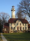
- Chicago Harbor LightChicago Harbor LightThe Chicago Harbor Lighthouse is an automated active lighthouse, and stands at the end of the northern breakwater protecting the Chicago Harbor, to the east of Navy Pier and the mouth of the Chicago River.-History:...
(1893), ChicagoChicagoChicago is the largest city in the US state of Illinois. With nearly 2.7 million residents, it is the most populous city in the Midwestern United States and the third most populous in the US, after New York City and Los Angeles...
(still in use) - Grosse Point LightGrosse Point LightThe historic Grosse Point Light is located in Evanston, Illinois. Following several shipping disasters near Evanston, residents successfully lobbied the federal government for a lighthouse. Construction was completed in 1873. The lighthouse was added to the National Register of Historic Places on...
(1873), EvanstonEvanston, IllinoisEvanston is a suburban municipality in Cook County, Illinois 12 miles north of downtown Chicago, bordering Chicago to the south, Skokie to the west, and Wilmette to the north, with an estimated population of 74,360 as of 2003. It is one of the North Shore communities that adjoin Lake Michigan...
(currently a private navigation aid) (museum) - Waukegan Harbor LightWaukegan Harbor LightWaukegan Harbor Light is a lighthouse at the end of Government Pier at the foot of Madison Street in Waukegan, Illinois. It was first built in 1889 and moved when the pier was extended in the early twentieth century. At that time a fog signal building was added to the tower.There was a serious fire...
http://www.lighthousefriends.com/light.asp?ID=238, Waukegan (currently an aid to navigation)
Indiana
- Buffington Harbor Breakwater Light
- Calumet Harbor Light
- Calumet Harbor Breakwater South End
- Calumet Pierhead
- Gary Harbor Breakwater Light, GaryGary, IndianaGary is a city in Lake County, Indiana, United States. The city is in the southeastern portion of the Chicago metropolitan area and is 25 miles from downtown Chicago. The population is 80,294 at the 2010 census, making it the seventh-largest city in the state. It borders Lake Michigan and is known...
- Gary West Breakwater
- Indiana Harbor East Breakwater LightIndiana Harbor East Breakwater LightThe Indiana Harbor East Breakwater Light is an active aid to navigation that marks the end of a breakwater on the east side of the Indiana Harbor and Ship Canal where it enters Lake Michigan.-History:...
- Michigan City Breakwater
- Michigan City East LightMichigan City East LightThe Michigan City Breakwater lighthouse is located in the harbor of Michigan City, Indiana.This is the successor to the Old Michigan City Light, when the lantern, lens and light was moved to the new light at the end of the newly extended pier....
(1858 and 1904), Michigan CityMichigan City, IndianaMichigan City's origins date to 1830, when the land for the city was first purchased by Isaac C. Elston. Elston Middle School, formerly Elston High School, located at 317 Detroit St., is named after the founder....
, pierhead; Light still in use, old tower is a museum - Michigan City East Pierhead
- Michigan City West Pierhead
- Old Michigan City LightOld Michigan City LightThe Old Michigan City lighthouse is located in the harbor of Michigan City, Indiana.Built in 1858 at a cost of $8,000, this lighthouse, replaced an 1837 brick & stone light built at water's edge...
, Michigan CityMichigan City, IndianaMichigan City's origins date to 1830, when the land for the city was first purchased by Isaac C. Elston. Elston Middle School, formerly Elston High School, located at 317 Detroit St., is named after the founder....
Notable faux lighthouses:
- Cooper Memorial (1997), on the Prairie Creek Reservoir near Muncie, is an active light but does not meet the Directory's size standard for a lighthouse.
- Gloryland Lighthouse, near New Castle, is not on navigable water.
Kentucky
Lighthouses in Kentucky and Tennessee- Lighthouse Landing (Grand Rivers), at Kentucky LakeKentucky LakeKentucky Lake is a major navigable reservoir along the Tennessee River in Kentucky and Tennessee. Created in 1944 by the Tennessee Valley Authority's impounding of the Tennessee River by Kentucky Dam, the lake is the largest artificial lake by surface area in the United States east of the...
Notable faux lighthouses
- Louisville Waterfront Plaza, lighthouses on top of building
Louisiana
- Barataria Bay Light
- Bayou St. John Light, Canal de Carondolet
- Bonfouca (Bayou Bonfouca) Light, northern Lake PontchartrainLake PontchartrainLake Pontchartrain is a brackish estuary located in southeastern Louisiana. It is the second-largest inland saltwater body of water in the United States, after the Great Salt Lake in Utah, and the largest lake in Louisiana. As an estuary, Pontchartrain is not a true lake.It covers an area of with...
- Calcasieu River Range Lights, Calcasieu RiverCalcasieu RiverThe Calcasieu River is a river on the Gulf Coast of southwestern Louisiana, U.S.A.. Approximately long, it drains a largely rural area of forests and bayou country, meandering southward to the Gulf of Mexico. The name "Calcasieu" comes from the Native American Atakapa language katkosh, for...
- Chandeleur Island Light, outer rim of Chandeleur Sound
- Cubits Gap Light, Cubits Gap
- East Rigolets Light, Rigolets Waterway
- Franks Island Light, Franks Island
- Head of the Passes Light, Deer Island
- Madisonville Light, MadisonvilleMadisonville, LouisianaMadisonville is a town in St. Tammany Parish, Louisiana, United States. The population was 677 at the 2000 census. It is part of the New Orleans–Metairie–Kenner Metropolitan Statistical Area.-Geography:...
- New Canal LightNew Canal Light-References:...
, Lake PontchartrainLake PontchartrainLake Pontchartrain is a brackish estuary located in southeastern Louisiana. It is the second-largest inland saltwater body of water in the United States, after the Great Salt Lake in Utah, and the largest lake in Louisiana. As an estuary, Pontchartrain is not a true lake.It covers an area of with...
canal entrance - Oyster Bay (Bayou) Light, easternmost entrance to Atchafalaya BayAtchafalaya BasinThe Atchafalaya Basin, or Atchafalaya Swamp, is the largest swamp in the United States. Located in south central Louisiana, it is a combination of wetlands and river delta area where the Atchafalaya River and the Gulf of Mexico converge. The river stretches from near Simmesport in the north...
- Pass A L'Outre Light, Head of PassesHead of PassesHead of Passes is where the main stem of the Mississippi River branches off into three distinct directions at its mouth in the Gulf of Mexico: Southwest Pass , Pass A Loutre and South Pass...
, Mississippi RiverMississippi RiverThe Mississippi River is the largest river system in North America. Flowing entirely in the United States, this river rises in western Minnesota and meanders slowly southwards for to the Mississippi River Delta at the Gulf of Mexico. With its many tributaries, the Mississippi's watershed drains...
delta - Pass Manchac LightPass Manchac LightPass Manchac Light is a historic lighthouse that was first erected in 1838 to mark the north side of the entrance to Pass Manchac, the channel between Lake Pontchartrain and Lake Maurepas, Louisiana. The current tower, now unused, is the fourth on the site...
, west shore of Lake PontchartrainLake PontchartrainLake Pontchartrain is a brackish estuary located in southeastern Louisiana. It is the second-largest inland saltwater body of water in the United States, after the Great Salt Lake in Utah, and the largest lake in Louisiana. As an estuary, Pontchartrain is not a true lake.It covers an area of with... - Point Au Fer Reef LightPoint Au Fer Reef LightThe Point Au Fer Reef Light was a lighthouse built in 1916 on Eugene Island in Atchafalaya Bay, Louisiana to mark a new channel across Point Au Feu Reef. It replaced Southwest Reef Light as the entrance light for the Atchafalaya River. The light was deactivated and replaced by a skeleton tower in...
, entrance to Atchafalaya RiverAtchafalaya RiverThe Atchafalaya River is a distributary of the Mississippi River and Red River in south central Louisiana in the United States. It flows south, just west of the Mississippi River.... - Pointe Aux Herbes Light, south side of east end of Lake PontchartrainLake PontchartrainLake Pontchartrain is a brackish estuary located in southeastern Louisiana. It is the second-largest inland saltwater body of water in the United States, after the Great Salt Lake in Utah, and the largest lake in Louisiana. As an estuary, Pontchartrain is not a true lake.It covers an area of with...
- Port Pontchartrain LIght, Lake PontchartrainLake PontchartrainLake Pontchartrain is a brackish estuary located in southeastern Louisiana. It is the second-largest inland saltwater body of water in the United States, after the Great Salt Lake in Utah, and the largest lake in Louisiana. As an estuary, Pontchartrain is not a true lake.It covers an area of with...
- Pontchartrain Beach Light, New OrleansNew Orleans, LouisianaNew Orleans is a major United States port and the largest city and metropolitan area in the state of Louisiana. The New Orleans metropolitan area has a population of 1,235,650 as of 2009, the 46th largest in the USA. The New Orleans – Metairie – Bogalusa combined statistical area has a population...
- Sabine Pass LightSabine Pass LightThe Sabine Pass Light is a historic lighthouse in Cameron Parish, Louisiana, on the Louisiana side of the Sabine River across from the community of Sabine Pass, Texas. It went into operation in 1857 and remained lit for 95 years, with the exception of a brief period during the Civil War. The light...
, located at the entrance to Sabine LakeSabine Lake200px | thumb | Sabine lake as seen from outer space.Sabine Lake is a salt water estuary on the Texas-Louisiana border. The lake, some long and wide, is formed by the confluence of the Neches River and Sabine River. Through its tidal outlet long, Sabine Pass, Sabine Lake drains some of Texas...
in Cameron ParishCameron Parish, LouisianaCameron Parish is the parish with the most land area in the U.S. state of Louisiana. The parish seat is Cameron and as of 2010, the population was 6,839... - Sabine Pass East Jetty Light
- Ship Shoal Light, 10 miles south of Grand IsleGrand Isle, LouisianaGrand Isle is a town in Jefferson Parish, Louisiana, located on a barrier island of the same name in the Gulf of Mexico. The island is at the mouth of Barataria Bay where it meets the gulf. As of the 2000 census, the town population was 1,541; during summers, the population sometimes increases to...
- South Pass Range Front Light, Mississippi RiverMississippi RiverThe Mississippi River is the largest river system in North America. Flowing entirely in the United States, this river rises in western Minnesota and meanders slowly southwards for to the Mississippi River Delta at the Gulf of Mexico. With its many tributaries, the Mississippi's watershed drains...
- South Pass Range Lights
- Southwest Pass Entrance Light
- Southwest Reef LightSouthwest Reef LightSouthwest Reef Light is a historic lighthouse built in 1856 at the end of Southwest Reef in Atchafalaya Bay, Louisiana to replace lightships which had been stationed there for ten years. It served to guide vessels around the reef and into the main channel of the Atchafalaya River...
, old entrance to Atchafalaya RiverAtchafalaya RiverThe Atchafalaya River is a distributary of the Mississippi River and Red River in south central Louisiana in the United States. It flows south, just west of the Mississippi River.... - Tchefuncte River Range LightsTchefuncte River Range LightsThe Tchefuncte River Range Lights are a range that was first established in 1838 to aid vessels entering the river from the north side of Lake Pontchartrain, Louisiana. The original rear tower suffered during the Civil War and was replaced with the current tower in 1868. The new tower, ten feet...
, north side of Lake PontchartrainLake PontchartrainLake Pontchartrain is a brackish estuary located in southeastern Louisiana. It is the second-largest inland saltwater body of water in the United States, after the Great Salt Lake in Utah, and the largest lake in Louisiana. As an estuary, Pontchartrain is not a true lake.It covers an area of with... - Timbalier Bay (Little Pass) Light, Timbalier Bay
- Trinity Shoal LightTrinity Shoal LightThe Trinity Shoal Light was a planned lighthouse meant to be constructed on Trinity Shoal in the Gulf of Mexico, off the coast of Louisiana. Had it been completed, the skeleton tower would have been among the most exposed lighthouses in the United States....
- West Rigolets Light, Rigolets Channel, Lake PontchartrainLake PontchartrainLake Pontchartrain is a brackish estuary located in southeastern Louisiana. It is the second-largest inland saltwater body of water in the United States, after the Great Salt Lake in Utah, and the largest lake in Louisiana. As an estuary, Pontchartrain is not a true lake.It covers an area of with...
Maine
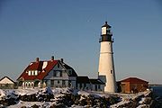
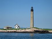
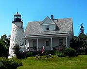
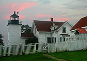
- Avery Rock LightAvery Rock LightAvery Rock Light was a lighthouse in Avery Rock, Machias Bay, Maine, United States. The square tower was built in 1875, and demolished in 1947 after storm damage.-References:*...
, Machias BayMachias BayMachias Bay is a bay in Washington County, Maine that opens into the Gulf of Maine.The bay was the scene of the Battle of Machias — the first naval battle of the American Revolution, occasioned by the British need for lumber for Boston....
, Machias - Baker Island LightBaker Island LightBaker Island Light is a lighthouse on Baker Island, Maine.It was first established in 1828. The present tower was built in 1855.Baker Island Light was listed on the National Register of Historic Places as Baker Island Light Station on March 14, 1988, reference number 88000046.-References:...
, Mt. Desert IslandMount Desert IslandMount Desert Island , in Hancock County, Maine, is the largest island off the coast of Maine. With an area of it is the 6th largest island in the contiguous United States. Though it is often claimed to be the third largest island on the eastern seaboard of the United States, it is actually second... - Bass Harbor Head LightBass Harbor Head LightBass Harbor Head Light is a lighthouse located within Acadia National Park on the southeast corner of Mount Desert Island, Maine, marking the entrance to Bass Harbor and Blue Hill Bay.-History:...
, Mount Desert IslandMount Desert IslandMount Desert Island , in Hancock County, Maine, is the largest island off the coast of Maine. With an area of it is the 6th largest island in the contiguous United States. Though it is often claimed to be the third largest island on the eastern seaboard of the United States, it is actually second... - Bear Island LightBear Island LightBear Island Light is a lighthouse on Bear Island near Mt. Desert Island, at the entrance to Northeast Harbor, Maine.It was first established in 1839. The present structure was built in 1889...
, Bear Island - Blue Hill Bay LightBlue Hill Bay LightBlue Hill Bay Light is a lighthouse on Green Island in Blue Hill Bay, Maine.It was first established in 1857. The present skeleton structure was built in 1935. It is also known as "Sand Island Light" or Eggemoggin Light"....
, Green Island / Blue Hill Bay - Boon Island LightBoon Island LightBoon Island Light is located on the 300x700 foot Boon Island off the southern coast of Maine, United States, near Cape Neddick. Boon Island Light has the distinction of being the tallest lighthouse in both Maine and New England at 133 feet. The lighthouse has a focal plane at 137 feet above mean...
, YorkYork, MaineYork is a town in York County, Maine, United States at the southwest corner of the state. The population in the 2000 census was 12,854. Situated beside the Atlantic Ocean on the Gulf of Maine, York is a well-known summer resort. It is home to three 18-hole golf clubs, three sandy beaches, and... - Browns Head LightBrowns Head LightBrowns Head Light is a lighthouse in Vinalhaven, Maine.It is on the NW corner of Vinalhaven Island and was first established in 1832. The present structure was built in 1857....
, NW end of Vinalhaven IslandVinalhaven, MaineVinalhaven is a town located in the Fox Islands in Knox County, Maine, United States. The population was 1,235 at the 2000 census. It is home to a thriving lobster fishery and hosts a summer colony... - Burnt Coat Harbor LightBurnt Coat Harbor LightBurnt Coat Harbor Light is a lighthouse on Blue Hill Bay, Maine.It is on Hockamock Head, Swan's Island. It was established in 1872.Burnt Coat Harbor Light was listed on the National Register of Historic Places in 1988, reference number 87002272....
, Hockamock Head / Swan's IslandSwan's Island, MaineSwan's Island is an island town in Hancock County, Maine, United States. It is named after Colonel James Swan of Fife, Scotland, who purchased this island and some surrounding areas and organized their colonization in the 18th century. The population was 327 at the 2000 census. The town is... - Burnt Island LightBurnt Island LightThe Burnt Island Light, built in 1821, is the second oldest surviving lighthouse in Maine. It hosts a living history museum run by the state Department of Marine Resources...
, BoothbayBoothbay, MaineBoothbay is a town in Lincoln County, Maine, United States. The population was 2,960 at the 2000 census. It includes the villages of East Boothbay and Trevett. The Boothbay region is a center of summer tourist activity, and a significant part of its population does not live there year... - Cape Elizabeth LightsCape Elizabeth LightsCape Elizabeth Light also known as Two Lights is a lighthouse in Cape Elizabeth, Maine. Only the eastern tower of the two that made up the light station until 1924 is active. The western tower is deactivated, but it is still standing and is privately owned...
, Casco BayCasco BayCasco Bay is an inlet of the Gulf of Maine on the southern coast of Maine, New England, United States. Its easternmost approach is Cape Small and its westernmost approach is Two Lights in Cape Elizabeth...
entrance, Cape ElizabethCape Elizabeth, MaineCape Elizabeth is a town in Cumberland County, Maine, United States. The town is part of the Portland–South Portland–Biddeford, Maine metropolitan statistical area... - Cape Neddick (Nubble) LightCape Neddick Light- See also :* Nobska Light, a similar lighthouse on Cape Cod, constructed in 1876.* Portsmouth Harbor Light, a similar lighthouse in New Hampshire, constructed in 1878.* National Register of Historic Places listings in York County, Maine- References :...
, Cape NeddickCape Neddick, MaineCape Neddick is a census-designated place in the town of York in York County which is the location of the Cape Neddick Campground run by Robert McDonough, Maine, United States. The population was 2,997 at the 2000 census...
, York - Crabtree Ledge LightCrabtree Ledge LightCrabtree Ledge Light was a sparkplug lighthouse on Frenchman Bay, Maine.It was first established in 1890 and deactivated in 1933. It was a brown conical tower on a black cylindrical pier located on Crabtree Ledge, about 1/4 mile off of Crabtree Neck at the north end of Frenchman Bay....
, Frenchman BayFrenchman BayFrenchman Bay is a bay in Hancock County, Maine, named for Samuel de Champlain, the French explorer who visited the area in 1604....
, Crabtree Neck - Cuckolds Light, Boothbay approach
- Curtis Island LightCurtis Island LightCurtis Island Light is a lighthouse in Camden, Maine.It was first established in 1835. The present structure was built in 1896.Curtis Island Light was listed on the National Register of Historic Places as Curtis Island Light on May 17, 1973, reference number 73000263....
, CamdenCamden, MaineCamden is a town in Knox County, Maine, United States. The population was 5,254 at the 2000 census. The population of the town more than triples during the summer months, due to tourists and summer residents. Camden is a famous summer colony in the Mid-Coast region of Maine... - Deer Island Thorofare LightDeer Island Thorofare LightDeer Island Thorofare Light, also known as Mark Island Light , is a lighthouse on Penobscot Bay, Maine, about 1.8 nm west-southwest of Stonington.It was built in 1857.-History:...
, Mark Island / Deer IslandDeer Isle, MaineDeer Isle is a town in Hancock County, Maine, United States. The population was 1,876 at the 2000 census. Notable landmarks in Deer Isle are the Haystack Mountain School of Crafts and the town's many art galleries.-History:...
Thorofare - Dice Head LightDice Head LightDice Head Light is a lighthouse in the town of Castine, Maine.First established in 1829, the light was deactivated in 1937 and replaced by a skeleton tower 475 ft to the south...
, Penobscot RiverPenobscot RiverThe Penobscot River is a river in the U.S. state of Maine. Including the river's West Branch and South Branch increases the Penobscot's length to , making it the second longest river system in Maine and the longest entirely in the state. Its drainage basin contains .It arises from four branches...
mouth, CastineCastine, MaineCastine is a town in Hancock County, Maine, United States and was once the capital of Acadia . The population was 1,343 at the 2000 census. Castine is the home of Maine Maritime Academy, a four-year institution that graduates officers and engineers for the United States Merchant Marine and marine... - Doubling Point Range LightsDoubling Point Range LightsThe Doubling Point Range Lights are a pair of Range Lights on the Kennebec River, in Arrowsic, Maine.They were established in 1898, fifteen years after the founding of the Bath Iron Works, a major shipbuilder, one and a half miles upriver...
, Arrowsic IslandArrowsic, MaineArrowsic is a town in Sagadahoc County, Maine, United States. The population was 477 at the 2000 census. It is part of the Portland–South Portland–Biddeford, Maine metropolitan statistical area. During the French and Indian Wars, Arrowsic was site of a succession of important and...
/ Kennebec RiverKennebec RiverThe Kennebec River is a river that is entirely within the U.S. state of Maine. It rises in Moosehead Lake in west-central Maine. The East and West Outlets join at Indian Pond and the river then flows southward... - Doubling Point Light, Arrowsic IslandArrowsic, MaineArrowsic is a town in Sagadahoc County, Maine, United States. The population was 477 at the 2000 census. It is part of the Portland–South Portland–Biddeford, Maine metropolitan statistical area. During the French and Indian Wars, Arrowsic was site of a succession of important and...
/ Kennebec RiverKennebec RiverThe Kennebec River is a river that is entirely within the U.S. state of Maine. It rises in Moosehead Lake in west-central Maine. The East and West Outlets join at Indian Pond and the river then flows southward... - Eagle Island LightEagle Island LightFor Eagle Island Lighthouse in Erris, Co. Mayo, Ireland see Eagle Island, County MayoEagle Island Light is a lighthouse on Eagle Island ....
, East Penobscot BayPenobscot BayPenobscot Bay originates from the mouth of Maine's Penobscot River. There are many islands in this bay, and on them, some of the country's most well-known summer colonies. The bay served as portal for the one time "lumber capital of the world," namely; the city of Bangor... - Egg Rock LightEgg Rock LightEgg Rock Light is a lighthouse on Frenchman Bay, Maine.It was established in 1875. The structure is unusual—the brick light tower is in the middle of the white wood frame keeper's house....
, entrance to Frenchman BayFrenchman BayFrenchman Bay is a bay in Hancock County, Maine, named for Samuel de Champlain, the French explorer who visited the area in 1604....
near Winter HarborWinter Harbor, MaineWinter Harbor is a town in Hancock County, Maine, United States. The population was 988 at the 2000 census.-Geography:According to the United States Census Bureau, the town has a total area of , of which, of it is land and of it is water.... - Fort Point LightFort Point Light StationThe Fort Point Light is located in Maine's Fort Point State Park. The park is located on Fort Point, a small peninsula running eastward from Cape Jellison, at the entrance to the Penobscot River. The station was established in 1837 and was the first river light in Maine...
, entrance to Penobscot River - Franklin Island LightFranklin Island LightFranklin Island Light is a lighthouse on Franklin Island, in Muscongus Bay, Maine.It was first established in 1805. The present structure was built in 1855....
, Muscongus Bay - Goat Island LightGoat Island LightGoat Island Light is a lighthouse located off Cape Porpoise near Kennebunkport in southern Maine.Goat Island Light was established in 1835 to guard the entrance to Cape Porpoise Harbor. The original station was upgraded in 1859 to the current brick tower with a fifth order Fresnel lens. Keeper's...
, Cape PorpoiseKennebunkport, MaineKennebunkport is a town in York County, Maine, United States. The population was 3,720 at the 2000 census. It is part of the Portland–South Portland–Biddeford metropolitan statistical area.... - Goose Rocks LightGoose Rocks LightGoose Rocks Light is a sparkplug lighthouse located near North Haven,Maine in Penobscot Bay. It stands at the eastern entrance to the Fox Islands Thoroughfare, a busy mile-wide passage separating North Haven from Vinalhaven....
, east entrance Fox Islands Thoroughfare - Great Duck Island LightGreat Duck Island LightGreat Duck Island Light is a lighthouse on Great Duck Island in the town of Frenchboro, Maine.It was established in 1890.Great Duck Island Light was listed on the National Register of Historic Places as Great Duck Island Light Station on March 14, 1988, reference number 88000159....
, Blue Hill Bay approach - Grindle Point Light, Gilkey Harbor
- Halfway Rock LightHalfway Rock LightHalfway Rock Lighthouse is a lighthouse located on a barren ledge in Casco Bay, Maine. The lighthouse tower, which has a height of , and the attached ex-boathouse are all that remain, as the other buildings have been taken away in storms...
, Casco Bay - Hendricks Head LightHendricks Head LightHendricks Head Light is a lighthouse in Southport, Maine on the Sheepscot River.It was first established in 1829. The present structure was built in 1875. It was deactivated in 1933, but relit in 1951. The two story wood keeper's house is now a private summer residence...
, Sheepscot RiverSheepscot RiverThe Sheepscot River is a river in the U.S. state of Maine. Its lower portion is a complex island estuary with connections to the Kennebec River downstream of Merrymeeting Bay.-Route:...
entrance - Heron Neck LightHeron Neck LightHeron Neck Light is a lighthouse on Green's Island in Vinalhaven, Maine at the south end of Penobscot Bay. It was established in 1854.Heron Neck Light was listed on the National Register of Historic Places as Heron Neck Light Station on January 21, 1988, reference number 87002266....
, Green's Island - Indian Island LightIndian Island LightIndian Island Light is a lighthouse on Indian Island on the west side of the entrance to Rockport Harbor, Maine.It was first established in 1850. The present structure was built in 1875...
, Indian Island / RockportRockport, MaineRockport is a town in Knox County, Maine, United States. The population was 3,209 at the 2000 census. Rockport is a popular tourist destination and art colony.-History:...
Harbor - Isle Au Haut Light, Robinson Point, Isle au Haut
- Kennebunk Pier Light
- Ladies Delight LightLadies Delight LightThe Ladies Delight Light is a small lighthouse on Lake Cobbosseecontee, Maine, United States. It was constructed in 1908 and is believed to be the only active inland waters lighthouse in Maine. The tower is tall, and is equipped with a 100-watt light bulb further intensified by a lens from a...
- Libby Island LightLibby Island LightLibby Island Light is a lighthouse on Libby Island, on the south side of Machias Bay, in Machiasport, Maine.It was first established in 1817 as a wood tower. The present granite structure was built in 1823 and improved in 1848. Alexander Parris was involved in the 1848 work. It is unpainted in the...
, Machias BayMachias BayMachias Bay is a bay in Washington County, Maine that opens into the Gulf of Maine.The bay was the scene of the Battle of Machias — the first naval battle of the American Revolution, occasioned by the British need for lumber for Boston....
entrance - Little River LightLittle River LightLittle River Light is a lighthouse on an island at the mouth of the Little River, in Cutler, Maine.It was first established in 1846. The present structure was built in 1876. It was deactivated in 1975 and relit in 2001....
, Little River Island / CutlerCutler, MaineCutler is a town in Washington County, Maine, United States. The town was named after Joseph Cutler, an early settler. The population was 623 at the 2000 census.-Geography:...
Harbor - Lubec Channel LightLubec Channel LightLubec Channel Light is a sparkplug lighthouse in Lubec, Maine. Established in 1890, it is in shallow water in Lubec Channel, about 500 feet from the Canadian border....
, LubecLubec, MaineLubec is a town in Washington County, Maine, United States. The population was 1,652 at the 2000 census. Lubec is the easternmost town in the contiguous United States . However, the Aleutian Islands in Alaska extend into the eastern hemisphere, and if territories are included, Point Udall in the...
Channel - Manana Island Fog Signal Station, Manana Island near Monhegan Island
- Marshall Point Light, Port ClydePort Clyde, MainePort Clyde is the southernmost settlement on the St. George peninsula in central/coastal Maine and part of the town of St. George in Knox County, Maine, United States....
Harbor entrance - Matinicus Rock LightMatinicus Rock LightMatinicus Rock Light, is a lighthouse in on Matinicus Rock, 18 miles off the coast of Maine.In 1827 the United States Lighthouse Service erected a pair of wooden light towers and a cobblestone keeper's residence on Matinicus Rock. The lights guided sea traffic until 1848 when they were replaced by...
, Matinicus Rock, off Matinicus Island - Monhegan Island LightMonhegan Island LightMonhegan Island Light is a lighthouse on Monhegan Island, Maine.It was first established in 1824. The present structure was built in 1850. It was Alexander Parris's last significant design. It is the second highest light in Maine — only Seguin Light, on a significantly higher island, is higher...
, Monhegan Island - Moose Peak LightMoose Peak LightMoose Peak Light is a lighthouse on Mistake Island, just east of Great Wass Island, Maine at the southern entrance to Eastern Bay and five nautical miles southeast of Jonesport. It was first established in 1827. The present structure was built in 1851....
, Mistake Island / Eastern Bay - Mount Desert Rock Light, south of Mount Desert IslandMount Desert IslandMount Desert Island , in Hancock County, Maine, is the largest island off the coast of Maine. With an area of it is the 6th largest island in the contiguous United States. Though it is often claimed to be the third largest island on the eastern seaboard of the United States, it is actually second...
- Narraguagus LightNarraguagus LightNarraguagus Light is a lighthouse on Narraguagus Bay, Maine.It was established in 1853 and deactivated in 1934. It is on Pond Island , at the entrance to Narraguagus Bay and the river of the same name....
, east side Pond Island / Narraguagus BayNarraguagus BayNarraguagus Bay is a bay in Washington County, Maine.Located at the mouth of the Narraguagus River between the towns of Harrington and Milbridge, it is separated from Harrington Bay to the northeast by Fastet Island and Pleasant Bay to the east by Dyer Island.The bay extends roughly 4.5 mi. ... - Nash Island LightNash Island LightNash Island Light is a lighthouse on Nash Island at the entrance to Pleasant Bay in Maine.-History:It was first established in 1838. The present structure was built in 1874. It was replaced by a buoy in 1982...
, southeast mouth of Pleasant BayPleasant Bay (Maine)Pleasant Bay is a bay in Washington County, Maine at the mouth of the Pleasant River.Located between the towns of Addison and Harrington, on the east it is bordered by Cape Spit and on the west it is separated from Harrington Bay by Ripley Neck, and from Narraguagus Bay by Dyer Island.The bay... - Owls Head Light, West Penobscot Bay / RocklandRockland, MaineRockland is a city in Knox County, Maine, in the United States. As of the 2010 census, the city population was 7,297. It is the county seat of Knox County. The city is a popular tourist destination...
Harbor - Pemaquid Point LightPemaquid Point LightThe Pemaquid Point Light Station is a historic U.S. lighthouse located in Bristol, Maine, at the tip of the Pemaquid Peninsula.-History:...
, BristolBristol, MaineBristol is a town in Lincoln County, Maine, United States. The population was 2,644 at the 2000 census. A fishing and resort area, Bristol includes the villages of New Harbor, Pemaquid, Round Pond, Bristol Mills and Chamberlain. It includes the Pemaquid Archeological Site, a U.S. National... - Perkins Island LightPerkins Island LightPerkins Island Light is a lighthouse on the Kennebec River in Maine.It was established in 1898, fifteen years after the founding of the Bath Iron Works, a major shipbuilder, seven miles further up the Kennebec River...
, Perkins Island / Kennebec RiverKennebec RiverThe Kennebec River is a river that is entirely within the U.S. state of Maine. It rises in Moosehead Lake in west-central Maine. The East and West Outlets join at Indian Pond and the river then flows southward... - Petit Manan LightPetit Manan LightPetit Manan Light is a lighthouse on Petit Manan Island, Maine. The island is at the end of a series of ledges extending out from Petit Manan Point, between Dyer Bay and Pigeon Hill Bay....
, off Petit Manan Point - Pond Island LightPond Island LightPond Island Light is a lighthouse at the mouth of the Kennebec River, Maine.It was first established in 1821 on Pond Island at the mouth of the Kennebec. The present structure was built in 1855....
, Kennebec RiverKennebec RiverThe Kennebec River is a river that is entirely within the U.S. state of Maine. It rises in Moosehead Lake in west-central Maine. The East and West Outlets join at Indian Pond and the river then flows southward...
entrance west side - Portland Breakwater LightPortland Breakwater LightThe Portland Breakwater Light is a small lighthouse in South Portland, Maine. The lighthouse's flashing red beacon helped guide ships from Casco Bay through the entrance to Portland Harbor.-History:...
, South PortlandSouth Portland, MaineSouth Portland is a city in Cumberland County, Maine, United States, and is the fourth-largest city in the state. Founded in 1895, as of the 2010 census, the city population was 25,002. Known for its working waterfront, South Portland is situated on Portland Harbor and overlooks the skyline of... - Portland Head LightPortland Head LightPortland Head Light is a historic lighthouse in Cape Elizabeth, Maine that sits at the entrance of the shipping channel into Casco Bay. The headlight was the first built by the United States government, and is now a part of Fort Williams Park.-History:...
, Cape ElizabethCape Elizabeth, MaineCape Elizabeth is a town in Cumberland County, Maine, United States. The town is part of the Portland–South Portland–Biddeford, Maine metropolitan statistical area... - Prospect Harbor Point LightProspect Harbor Point LightProspect Harbor Point Light is a lighthouse on Prospect Harbor Point, which divides Sand Cove from Inner Harbor at the head of Prospect Harbor, Maine.Also known as Prospect Harbor Light, it was first established in 1850...
, Prospect Harbor Point - Pumpkin Island LightPumpkin Island LightPumpkin Island Light is a lighthouse on Pumpkin Island at the northwestern entrance to Eggemoggin Reach, which runs northwest/southeast on the north side of Deer Isle, Maine.It was built in 1854 and discontinued in 1933....
, Eggemoggin Reach / Penobscot BayPenobscot BayPenobscot Bay originates from the mouth of Maine's Penobscot River. There are many islands in this bay, and on them, some of the country's most well-known summer colonies. The bay served as portal for the one time "lumber capital of the world," namely; the city of Bangor... - Ram Island Ledge LightRam Island Ledge LightRam Island Ledge Light is a lighthouse in Casco Bay, Maine, United States.-History:In 1855 an iron spindle was erected to protect sailors from dangerous underwater ledges surrounding Ram Island Ledge. The ledge continued to be the site of repeated shipwrecks...
, Casco BayCasco BayCasco Bay is an inlet of the Gulf of Maine on the southern coast of Maine, New England, United States. Its easternmost approach is Cape Small and its westernmost approach is Two Lights in Cape Elizabeth... - Ram Island LightRam Island LightRam Island Light is a lighthouse about 100 ft offshore of Ram Island, which lies south of Boothbay Harbor, Maine on the west side of the entrance to the Damariscotta River....
, Ram Island / Boothbay Harbor - Rockland Harbor Breakwater LightRockland Harbor Breakwater LightRockland Harbor Breakwater Light, which sits at the south end of a breakwater which protects Rockland Harbor, was completed in 1902 and is owned by the City of Rockland, Maine....
, Jameson Point / RocklandRockland, MaineRockland is a city in Knox County, Maine, in the United States. As of the 2010 census, the city population was 7,297. It is the county seat of Knox County. The city is a popular tourist destination...
Harbor - Saddleback Ledge LightSaddleback Ledge LightSaddleback Ledge Light is a lighthouse on Saddleback Ledge, an islet lying between Isle au Haut and Vinalhaven, Maine, in the middle of the southeastern entrance to Penobscot Bay....
, Isle au Haut Bay - Saint Croix River LightSaint Croix River LightSt. Croix River Light is a lighthouse on the St. Croix River, Maine, close to the Canadian border. It was first established in 1857. An octagonal wood tower on top of a keeper's house was built in 1901 and was destroyed by fire in 1976. The present skeleton tower was built following the fire....
, Dochet Island, opposite Red Beach, St. Croix RiverSt. Croix River (Maine-New Brunswick)The St. Croix River is a river in northeastern North America, in length, that forms part of the Canada – United States border between Maine and New Brunswick . The river rises in the Chiputneticook Lakes and flows south and southeast, between Calais and St. Stephen... - Seguin LightSeguin LightSeguin Light is a lighthouse on Seguin Island at the mouth of the Kennebec River, Maine.It was first established in 1795. The present structure was built in 1857. It is the highest lighthouse on the Maine coast and has the only first order Fresnel lens ever used there...
, GeorgetownGeorgetown, MaineGeorgetown is a town in Sagadahoc County, Maine, United States. The population was 1,020 at the 2000 census. Home to Reid State Park, the town is part of the Portland–South Portland–Biddeford, Maine Metropolitan Statistical Area... - Spring Point Ledge LightSpring Point Ledge Light-External links:*...
, South PortlandSouth Portland, MaineSouth Portland is a city in Cumberland County, Maine, United States, and is the fourth-largest city in the state. Founded in 1895, as of the 2010 census, the city population was 25,002. Known for its working waterfront, South Portland is situated on Portland Harbor and overlooks the skyline of... - Squirrel Point Light, Arrowsic IslandArrowsic, MaineArrowsic is a town in Sagadahoc County, Maine, United States. The population was 477 at the 2000 census. It is part of the Portland–South Portland–Biddeford, Maine metropolitan statistical area. During the French and Indian Wars, Arrowsic was site of a succession of important and...
/ Kennebec RiverKennebec RiverThe Kennebec River is a river that is entirely within the U.S. state of Maine. It rises in Moosehead Lake in west-central Maine. The East and West Outlets join at Indian Pond and the river then flows southward... - Tenants Harbor LightTenants Harbor LightTenants Harbor Light, also known as Southern Island Light, is a lighthouse at the mouth of Tenants Harbor, St. George, Maine. It appears in paintings by Andrew Wyeth and his son Jamie Wyeth, who have owned the light house since 1978.-History:...
, Southern Island - Two Bush Island LightTwo Bush Island LightTwo Bush Island Light is a lighthouse on Two Bush Island, on the channel of the same name, the southwestern entrance to Penobscot Bay, Maine. It was established in 1897....
, Two Bush Channel / Penobscot BayPenobscot BayPenobscot Bay originates from the mouth of Maine's Penobscot River. There are many islands in this bay, and on them, some of the country's most well-known summer colonies. The bay served as portal for the one time "lumber capital of the world," namely; the city of Bangor...
approach - West Quoddy Head LightWest Quoddy Head LightWest Quoddy Head in Lubec, Maine is the easternmost point of the contiguous United States and the closest point to Europe from a point in the fifty States. West Quoddy Head overlooks Quoddy Narrows, a strait between Canada and the United States. Since 1808, there has been a lighthouse there to...
, LubecLubec, MaineLubec is a town in Washington County, Maine, United States. The population was 1,652 at the 2000 census. Lubec is the easternmost town in the contiguous United States . However, the Aleutian Islands in Alaska extend into the eastern hemisphere, and if territories are included, Point Udall in the... - Whaleback LightWhaleback Light-External links:**...
, Portsmouth HarborPiscataqua RiverThe Piscataqua River, in the northeastern United States, is a long tidal estuary formed by the confluence of the Salmon Falls and Cocheco rivers... - Whitehead Island Light, Whitehead Island / Penobscot BayPenobscot BayPenobscot Bay originates from the mouth of Maine's Penobscot River. There are many islands in this bay, and on them, some of the country's most well-known summer colonies. The bay served as portal for the one time "lumber capital of the world," namely; the city of Bangor...
southern entrance - Whitlocks Mill Light, St. Croix RiverSt. Croix River (Maine-New Brunswick)The St. Croix River is a river in northeastern North America, in length, that forms part of the Canada – United States border between Maine and New Brunswick . The river rises in the Chiputneticook Lakes and flows south and southeast, between Calais and St. Stephen...
south bank - Winter Harbor LightWinter Harbor LightWinter Harbor Light is a lighthouse in Winter Harbor, Maine.It was built on Mark Island in 1856 and was deactivated in 1933.Winter Harbor Light was listed on the National Register of Historic Places as Winter Harbor Light Station on February 1, 1988, reference number 87002538....
, Mark Island / Winter HarborWinter Harbor, MaineWinter Harbor is a town in Hancock County, Maine, United States. The population was 988 at the 2000 census.-Geography:According to the United States Census Bureau, the town has a total area of , of which, of it is land and of it is water.... - Wood Island LightWood Island LightWood Island Light is an active lighthouse on the eastern edge of Wood Island in Saco Bay, Maine. The light is just outside the entrance to Biddeford Pool and the end of the Saco River. The lighthouse is a tall conical white tower constructed of granite rubble. The light itself sits above mean...
, Biddeford Pool
Maryland
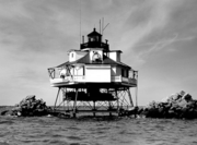
- Baltimore Harbor Light, mouth of Magothy RiverMagothy RiverThe Magothy River runs through Anne Arundel County in the U.S. state of Maryland. It is located south of the Patapsco River and north of the Severn River...
, Chesapeake BayChesapeake BayThe Chesapeake Bay is the largest estuary in the United States. It lies off the Atlantic Ocean, surrounded by Maryland and Virginia. The Chesapeake Bay's drainage basin covers in the District of Columbia and parts of six states: New York, Pennsylvania, Delaware, Maryland, Virginia, and West... - Blakistone Island LightBlakistone Island LightThe Blakistone Island Light was a lighthouse located on what is now St. Clement's Island on the Potomac River in Maryland. It is best known as the target of a Confederate raid in the Civil War.-History:...
, St. Clement's Island State Park, Potomac RiverPotomac RiverThe Potomac River flows into the Chesapeake Bay, located along the mid-Atlantic coast of the United States. The river is approximately long, with a drainage area of about 14,700 square miles... - Bloody Point Bar LightBloody Point Bar LightBloody Point Bar Light is an early sparkplug lighthouse in the Chesapeake Bay near Kent Island, Maryland.-History:Although a light at this location was first requested in 1865, funds were not appropriated until 1881. Based on experience with ice damage to screw-pile structures, a caisson design was...
, near Kent IslandKent Island, MarylandKent Island is the largest island in the Chesapeake Bay, and a historic place in Maryland. To the east, a narrow channel known as the Kent Narrows barely separates the island from the Delmarva Peninsula, and on the other side, the island is separated from Sandy Point, an area near Annapolis, by... - Bodkin Island LightBodkin Island LightThe Bodkin Island Light was a small lighthouse on the Chesapeake Bay, the first erected in Maryland.-History:The lighthouse was constructed as an aid to shipping entering Baltimore; it was built on Bodkin Island, and was the first lighthouse in Maryland...
, Chesapeake BayChesapeake BayThe Chesapeake Bay is the largest estuary in the United States. It lies off the Atlantic Ocean, surrounded by Maryland and Virginia. The Chesapeake Bay's drainage basin covers in the District of Columbia and parts of six states: New York, Pennsylvania, Delaware, Maryland, Virginia, and West... - Brewerton Channel Range:
- Hawkins Point LightHawkins Point LightThe Hawkins Point Light was an unusual screw-pile lighthouse which displayed the front light to the Brewerton Channel Range. It was eventually superseded by an iron tower on the same foundation.-History:...
(front light) - Leading Point LightLeading Point LightThe Leading Point Light was an unusual lighthouse which displayed the rear light to the Brewerton Channel Range. It was eventually superseded by an iron tower on the same foundation.-History:...
(rear light)
- Hawkins Point Light
- Cedar Point Light, SolomonsSolomons, MarylandSolomons is a community and census-designated place in Calvert County, Maryland, United States. The population was 1,536 at the 2000 census...
- Choptank River LightChoptank River LightThe Choptank River Light was a screw-pile lighthouse located near Oxford, Maryland. In its second incarnation it was the only such light moved from another location in the Chesapeake Bay.-History:...
, Bernoni Point, near OxfordOxford, MarylandOxford is a waterfront town and former colonial port in Talbot County, Maryland, United States. The population was 771 at the 2000 census.-History:Oxford is one of the oldest towns in Maryland... - Clay Island LightClay Island LightThe Clay Island Light was a historic lighthouse located on Clay Island at the mouth of the Nanticoke River on the Chesapeake Bay. Constructed in 1832, it continued to serve the area until 1892, when it was replaced by the Sharkfin Shoal Light...
, mouth of Nanticoke RiverNanticoke RiverThe Nanticoke River is a major tributary of the Chesapeake Bay on the Delmarva Peninsula. It rises in southern Kent County, Delaware, flows through Sussex County, Delaware, and forms the boundary between Dorchester County, Maryland and Wicomico County, Maryland. The river course proceeds southwest... - Cobb Point Bar LightCobb Point Bar LightThe Cobb Point Bar Light was a screw-pile lighthouse located in the Potomac River.-History:A light at Cobb Point was first requested in 1875 to mark the entrance to the tricky channel leading into the Wicomico River...
(also known as Cobb Island Bar Light), Potomac RiverPotomac RiverThe Potomac River flows into the Chesapeake Bay, located along the mid-Atlantic coast of the United States. The river is approximately long, with a drainage area of about 14,700 square miles... - Concord Point LightConcord Point LightConcord Point Light is a lighthouse in Havre de Grace, Maryland, overlooking the point where the Susquehanna River flows into the Chesapeake Bay, an area of increasing navigational traffic at the time it was constructed in 1827. It was built by John Donahoo who built many lighthouses in Maryland...
, Havre de GraceHavre de Grace, MarylandHavre de Grace is a city in Harford County, Maryland, United States. Located at the mouth of the Susquehanna River and the head of the Chesapeake Bay, Havre de Grace is named after the port city of Le Havre, France, which was first named Le Havre de Grâce, meaning in French "Harbor of Grace." As... - Cove Point LightCove Point LightThe Cove Point Light is a lighthouse located on the west side of the Chesapeake Bay.-History:This light was built in 1828 by John Donahoo, who erected a brick conical tower along the plan he had used at several other sites in the Bay...
, Chesapeake BayChesapeake BayThe Chesapeake Bay is the largest estuary in the United States. It lies off the Atlantic Ocean, surrounded by Maryland and Virginia. The Chesapeake Bay's drainage basin covers in the District of Columbia and parts of six states: New York, Pennsylvania, Delaware, Maryland, Virginia, and West... - Craighill Channel Lower Range:
- Front LightCraighill Channel Lower Range Front LightThe Craighill Channel Lower Range Front Light, named for William Price Craighill, was the first caisson lighthouse built in the Chesapeake Bay in Maryland...
- Rear LightCraighill Channel Lower Range Rear LightThe Craighill Channel Lower Range Rear Light is one of a pair of range lights that marks the first section of the shipping channel into Baltimore harbor. It is the tallest lighthouse in Maryland.-History:...
- Front Light
- Craighill Channel Upper Range:
- Front LightCraighill Channel Upper Range Front LightThe Craighill Channel Upper Range Front Light is one of a pair of range lights that marks the second section of the shipping channel into Baltimore harbor.-History:...
- Rear LightCraighill Channel Upper Range Rear LightThe Craighill Channel Upper Range Rear Light is one of a pair of range lights that marks the second section of the shipping channel into Baltimore harbor.-History:...
- Front Light
- Drum Point LightDrum Point LightDrum Point Light is one of three surviving Chesapeake Bay screw-pile lighthouses. Originally located off Drum Point at the mouth of the Patuxent River, it is now an exhibit at the Calvert Marine Museum.-History:...
, mouth of the Patuxent RiverPatuxent RiverThe Patuxent River is a tributary of the Chesapeake Bay in the state of Maryland. There are three main river drainages for central Maryland: the Potomac River to the west passing through Washington D.C., the Patapsco River to the northeast passing through Baltimore, and the Patuxent River between... - Fishing Battery LightFishing Battery LightFishing Battery Light was the last lighthouse constructed in Maryland by John Donahoo. While still standing, it has been supplanted by a steel tower which stands adjacent to it.-History:...
, south of Havre de GraceHavre de Grace, MarylandHavre de Grace is a city in Harford County, Maryland, United States. Located at the mouth of the Susquehanna River and the head of the Chesapeake Bay, Havre de Grace is named after the port city of Le Havre, France, which was first named Le Havre de Grâce, meaning in French "Harbor of Grace." As... - Fog Point LightFog Point LightThe Fog Point Light was a historic lighthouse located at Fog Point, the northwestern tip of Smith Island, Maryland in the Chesapeake Bay.-History:...
, Smith IslandSmith Island, MarylandSmith Island is a census-designated place in Somerset County, Maryland, United States. It is included in the Salisbury, Maryland Metropolitan Statistical Area....
in Chesapeake BayChesapeake BayThe Chesapeake Bay is the largest estuary in the United States. It lies off the Atlantic Ocean, surrounded by Maryland and Virginia. The Chesapeake Bay's drainage basin covers in the District of Columbia and parts of six states: New York, Pennsylvania, Delaware, Maryland, Virginia, and West... - Fort Carroll LightFort Carroll LightFort Carroll Light is a derelict lighthouse consisting of a short wooden tower on the walls of its namesake fortifications in the Patapsco River.-History:...
, Patapsco RiverPatapsco RiverThe Patapsco River is a river in central Maryland which flows into Chesapeake Bay. The river's tidal portion forms the harbor for the city of Baltimore... - Fort Washington LightFort Washington LightFort Washington Light is an unusual lighthouse located on the banks of the Potomac River on the grounds of its namesake fort. Although there has been a lighthouse on this location since 1857, the current light was converted from a fog bell tower in 1901....
, Potomac RiverPotomac RiverThe Potomac River flows into the Chesapeake Bay, located along the mid-Atlantic coast of the United States. The river is approximately long, with a drainage area of about 14,700 square miles... - Great Shoals LightGreat Shoals LightGreat Shoals Light was a screw-pile lighthouse in the Chesapeake Bay at the mouth of the Wicomico River.-History:This light was constructed to mark a narrow channel at the entrance to the Wicomico River, as requested by the Maryland General Assembly in 1882...
, mouth of the Wicomico RiverWicomico River (Maryland eastern shore)The Wicomico River is a tributary of the Chesapeake Bay on the eastern shore of Maryland. It drains an area of low marshlands and farming country in the middle Delmarva Peninsula. The name "Wicomico" derives from the words wicko mekee, meaning "a place where houses are built," apparently... - Greenbury Point LightGreenbury Point LightGreenbury Point Light was the name of two lighthouses in the Chesapeake Bay, both located at the mouth of the Severn River in Annapolis, Maryland.-History:...
, mouth of the Severn RiverSevern River (Maryland)The Severn River runs through Anne Arundel County in the U.S. state of Maryland. It is located south of the Magothy River, and north of the South River.-Geography:... - Holland Island Bar LightHolland Island Bar LightThe Holland Island Bar Light was a screw-pile lighthouse in the Chesapeake Bay which existed from 1889 to 1960. It is remembered for the unexplained death of one of its keepers, and for being "attacked" by United States Navy pilots during a training exercise....
, Chesapeake BayChesapeake BayThe Chesapeake Bay is the largest estuary in the United States. It lies off the Atlantic Ocean, surrounded by Maryland and Virginia. The Chesapeake Bay's drainage basin covers in the District of Columbia and parts of six states: New York, Pennsylvania, Delaware, Maryland, Virginia, and West... - Hooper Island LightHooper Island LightThe Hooper Island Light is a lighthouse in the Chesapeake Bay, west of Middle Hooper Island in Maryland.-History:The initial request of a light at this site was made in 1897, but construction was delayed until 1901 after the Variety Iron Works Company failed to deliver materials in time...
, Chesapeake Bay - Hooper Strait LightHooper Strait LightHooper Strait Light is one of four surviving Chesapeake Bay screw-pile lighthouses in the U.S. state of Maryland. Originally located in Hooper Strait, between Hooper and Bloodsworth Islands in Dorchester County and at the entrance to Tangier Sound, it is now an exhibit at the Chesapeake Bay...
, St. MichaelsSt. Michaels, MarylandSaint Michaels is a town in Talbot County, Maryland, United States. The population was 1,193 at the 2000 census. Saint Michaels derives its name from the Episcopal Parish established here in 1677... - Janes Island LightJanes Island LightThe Janes Island Light was a screw-pile lighthouse located near Crisfield in the U.S. state of Maryland. Twice destroyed by ice, it was replaced in 1935 with an automated beacon.-History:...
, near CrisfieldCrisfield, MarylandCrisfield is a city in Somerset County, Maryland, United States, located on the Tangier Sound, an arm of the Chesapeake Bay. The population was 2,723 at the 2000 census. It is included in the Salisbury, Maryland Metropolitan Statistical Area... - Lazaretto Point LightLazaretto Point LightThe Lazaretto Point Light was a historic lighthouse in Baltimore harbor. Though long demolished, a replica stands near its original site.-History:...
, Baltimore harbor - Love Point LightLove Point LightLove Point Light was a screw-pile lighthouse in the Chesapeake Bay, off the northern end of Kent Island, Maryland.-History:Local pressure to build at light at this site was noted as early as 1837, but an appropriation in 1857 was insufficient, and it was not until 1872 that a light was constructed,...
, Kent IslandKent Island, MarylandKent Island is the largest island in the Chesapeake Bay, and a historic place in Maryland. To the east, a narrow channel known as the Kent Narrows barely separates the island from the Delmarva Peninsula, and on the other side, the island is separated from Sandy Point, an area near Annapolis, by... - Lower Cedar Point LightLower Cedar Point LightThe Lower Cedar Point Light was a historic lighthouse in the Potomac River near its eponymous point, south of the present U.S. Route 301 bridge. It has been replaced by a skeleton tower.-History:Lightships were stationed at this location beginning in 1825...
, Potomac RiverPotomac RiverThe Potomac River flows into the Chesapeake Bay, located along the mid-Atlantic coast of the United States. The river is approximately long, with a drainage area of about 14,700 square miles... - Maryland Point LightMaryland Point Light-History:A light was first proposed for the shoal at Maryland Point in 1887, but an appropriation was not made until 1890. The original proposal was to construct a caisson light, but tests of the bottom convinced the engineers that a screw-pile structure could be made to work...
, Potomac River - Mathias Point Light, Potomac River
- North Point Range LightsNorth Point Range LightsThe North Point Range Lights were some of the earliest lights in the Maryland portion of the Chesapeake Bay. Intended to guide ships headed for Baltimore harbor into the Patapsco River, they were superseded by channel construction in the 1870s and '80s, and were replaced by the Craighill Channel...
, Chesapeake Bay - Piney Point LightPiney Point LightThe Piney Point Light was built in 1836 located at Piney Point on the Potomac River in Maryland just up the river from the mouth of the Chesapeake Bay. The Coast Guard decommissioned it in 1964 and it has since become a museum...
, Potomac RiverPotomac RiverThe Potomac River flows into the Chesapeake Bay, located along the mid-Atlantic coast of the United States. The river is approximately long, with a drainage area of about 14,700 square miles... - Point Lookout LightPoint Lookout LightPoint Lookout Light is a lighthouse that marks the entrance to the Potomac River, in the town of Scotland, Saint Mary's County, Maryland, at the southern-most tip of the western shore of the Chesapeake Bay...
, St. Mary's County - Point No Point LightPoint No Point Light (Maryland)Point No Point Light, located in the Chesapeake Bay off the eponymous point several miles north of the mouth of the Potomac River, was constructed as part of a program to add lighted navigational aids in a thirty mile stretch of the bay between Cove and Smith Points.-History:The first request for...
, Chesapeake BayChesapeake BayThe Chesapeake Bay is the largest estuary in the United States. It lies off the Atlantic Ocean, surrounded by Maryland and Virginia. The Chesapeake Bay's drainage basin covers in the District of Columbia and parts of six states: New York, Pennsylvania, Delaware, Maryland, Virginia, and West... - Pooles Island LightPooles Island LightPooles Island Light is the oldest lighthouse still standing in Maryland and the fourth oldest in the Chesapeake Bay area.-History:Pooles Island was originally named Powell's Island by John Smith, but over the years the name was changed, possibly to reflect the numerous springs and pools on the island...
, Chesapeake Bay - Ragged Point LightRagged Point LightThe Ragged Point Light was a screw-pile lighthouse located in the Potomac River. It was the last lighthouse built in Maryland waters and the last built at a location in the Chesapeake Bay.-History:...
, Potomac RiverPotomac RiverThe Potomac River flows into the Chesapeake Bay, located along the mid-Atlantic coast of the United States. The river is approximately long, with a drainage area of about 14,700 square miles... - Sandy Point Shoal LightSandy Point Shoal LightSandy Point Shoal Light is a brick three story lighthouse on a caisson foundation that was erected in 1883.It lies about off Sandy Point, north of the Chesapeake Bay Bridge, from whose westbound span it is readily visible. The current light replaced a brick tower on the point itself, integral to...
, Chesapeake Bay - Seven Foot Knoll LightSeven Foot Knoll LightThe Seven Foot Knoll Light was built in 1855 and is the oldest screw-pile lighthouse in Maryland. It was initially installed on a shallow shoal, Seven Foot Knoll, at the mouth of the Patapsco River...
, Baltimore - Sharkfin Shoal LightSharkfin Shoal LightThe Sharkfin Shoal Light was a screw-pile lighthouse located at the mouth of the Nanticoke River in the Chesapeake Bay.-History:This light was constructed in 1892 to replace the Clay Island Light to the northeast. In 1964 the house was dismantled and a skeleton tower light placed on the...
, mouth of the Nanticoke RiverNanticoke RiverThe Nanticoke River is a major tributary of the Chesapeake Bay on the Delmarva Peninsula. It rises in southern Kent County, Delaware, flows through Sussex County, Delaware, and forms the boundary between Dorchester County, Maryland and Wicomico County, Maryland. The river course proceeds southwest... - Sharps Island LightSharps Island LightThe Sharps Island Light is the third lighthouse to stand nearly 3 miles south-southwest from the southern end of Tilghman Island in Maryland's Chesapeake Bay...
, off Tilghman IslandTilghman Island, MarylandTilghman Island is a census-designated place in Talbot County, Maryland, United States. The population was 854 at the 2000 census.- History :... - Solomons Lump LightSolomons Lump LightSolomons Lump Light is a lighthouse in the Chesapeake Bay, the abbreviated remains of a caisson light built in 1895. That structure replaced a screw-pile light built on the same spot in 1875, which in turn superseded the Fog Point Light.-History:...
, Chesapeake BayChesapeake BayThe Chesapeake Bay is the largest estuary in the United States. It lies off the Atlantic Ocean, surrounded by Maryland and Virginia. The Chesapeake Bay's drainage basin covers in the District of Columbia and parts of six states: New York, Pennsylvania, Delaware, Maryland, Virginia, and West... - Somers Cove LightSomers Cove LightThe Somers Cove Light was a screw-pile lighthouse located near Crisfield, Maryland. Dismantled early, its remains are a landmark to watermen in the area.-History:...
, near CrisfieldCrisfield, MarylandCrisfield is a city in Somerset County, Maryland, United States, located on the Tangier Sound, an arm of the Chesapeake Bay. The population was 2,723 at the 2000 census. It is included in the Salisbury, Maryland Metropolitan Statistical Area... - Thomas Point Shoal LightThomas Point Shoal LightThe Thomas Point Shoal Light, also known as Thomas Point Shoal Light Station, is a historic lighthouse in the Chesapeake Bay on the east coast of the United States, and the most recognized lighthouse in Maryland. It is the only screw-pile lighthouse in the bay which stands at its original site...
, AnnapolisAnnapolis, MarylandAnnapolis is the capital of the U.S. state of Maryland, as well as the county seat of Anne Arundel County. It had a population of 38,394 at the 2010 census and is situated on the Chesapeake Bay at the mouth of the Severn River, south of Baltimore and about east of Washington, D.C. Annapolis is... - Turkey Point LightTurkey Point LightThe Turkey Point Light is a historic lighthouse at the head of the Chesapeake Bay on the east coast of the United States. Though it appears a short tower, the 100 ft height of the bluffs on which it stands makes it the third highest light off the water in the bay...
, Chesapeake BayChesapeake BayThe Chesapeake Bay is the largest estuary in the United States. It lies off the Atlantic Ocean, surrounded by Maryland and Virginia. The Chesapeake Bay's drainage basin covers in the District of Columbia and parts of six states: New York, Pennsylvania, Delaware, Maryland, Virginia, and West... - Upper Cedar Point LightUpper Cedar Point LightThe Upper Cedar Point Light was a screw-pile lighthouse in the Potomac River in Maryland. It was first lit in 1867 and served, except for a brief period of inactivity, until being dismantled in 1963.-History:...
, Potomac RiverPotomac RiverThe Potomac River flows into the Chesapeake Bay, located along the mid-Atlantic coast of the United States. The river is approximately long, with a drainage area of about 14,700 square miles...
Massachusetts
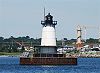
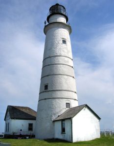
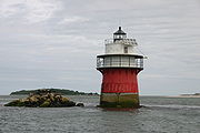
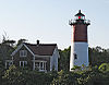
- Annisquam Harbor LightAnnisquam Harbor LightAnnisquam Harbor Light Station is a historic lighthouse on Wigwam Point in the Annisquam neighborhood of Gloucester, Massachusetts.- History :...
, Cape AnnCape AnnCape Ann is a rocky cape in northeastern Massachusetts on the Atlantic Ocean. The cape is located approximately 30 miles northeast of Boston and forms the northern edge of Massachusetts Bay. Cape Ann includes the city of Gloucester, and the towns of Essex, Manchester-by-the-Sea, and... - Baker's Island LightBaker's Island LightBakers Island Light is a historic lighthouse on Bakers Island in Salem, Massachusetts.The station was originally established in 1791, with a daymark. This was replaced in 1798 by two lights atop a keeper's house, one at each end. After storm damage in 1815, an octagonal stone tower was constructed....
- Bass River Light
- Billingsgate Island LightBillingsgate Island LightBillingsgate Island Light was located on what is still called Billingsgate Island though it is underwater at high tide, at the entrance to the harbor in Wellfleet, Massachusetts....
- Bird Island LightBird Island LightBird Island Light is an historic lighthouse at the entrance to Sippican Harbor, Marion, Massachusetts.The current 31 ft tower was built when the light was first established in 1819. Three months after it was first lit, with William Moore as the keeper, it was badly damaged by a storm. It was...
, MarionMarion, MassachusettsMarion is a town in Plymouth County, Massachusetts, United States. The population was 5,123 at the 2000 census.For geographic and demographic information on the village of Marion Center, please see the article Marion Center, Massachusetts.-History:...
, Buzzards BayBuzzards Bay (bay)Buzzards Bay is a bay of the Atlantic Ocean adjacent to the U.S. state of Massachusetts. It is approximately 28 miles long by 8 miles wide. It is a popular destination for fishing, boating, and tourism. Since 1914, Buzzards Bay has been connected to Cape Cod Bay by the Cape Cod Canal... - Bishop and Clerks LightBishop and Clerks LightBishop and Clerks Light is a lighthouse located in open water on Bishop and Clerks Rocks, about two nautical miles south of Point Gammon in Hyannis, Massachusetts....
- Borden Flats LightBorden Flats LightBorden Flats Light is an historic lighthouse on the Taunton River in Fall River, Massachusetts. It is a tower-on-caisson type known as a sparkplug lighthouse....
- Boston LightBoston LightBoston Light is a lighthouse located on Little Brewster Island in outer Boston Harbor, Massachusetts. The first lighthouse to be built on the site dates back to 1716, and was the first lighthouse to be built in what is now the United States...
, Boston HarborBoston HarborBoston Harbor is a natural harbor and estuary of Massachusetts Bay, and is located adjacent to the city of Boston, Massachusetts. It is home to the Port of Boston, a major shipping facility in the northeast.-History:... - Brant Point LightBrant Point LightBrant Point Light is a lighthouse located on Nantucket Island. It was established in 1746, automated in 1965, and is still in operation. The light station was added to the National Register of Historic Places on October 28, 1987. It has the distinction of being the tenth light on the point, in...
, NantucketNantucket, MassachusettsNantucket is an island south of Cape Cod, Massachusetts, in the United States. Together with the small islands of Tuckernuck and Muskeget, it constitutes the town of Nantucket, Massachusetts, and the coterminous Nantucket County, which are consolidated. Part of the town is designated the Nantucket... - Butler Flats LightButler Flats LightButler Flats Light, New Bedford, Massachusetts is a sparkplug lighthouse located in the New Bedford outer harbor, at the mouth of the Acushnet River. It is currently operated by the City of New Bedford...
, New BedfordNew Bedford, MassachusettsNew Bedford is a city in Bristol County, Massachusetts, United States, located south of Boston, southeast of Providence, Rhode Island, and about east of Fall River. As of the 2010 census, the city had a total population of 95,072, making it the sixth-largest city in Massachusetts... - Buzzards Bay Entrance LightBuzzards Bay Entrance LightBuzzards Bay Entrance Light is a lighthouse located in open water at the entrance to Buzzards Bay, about four nautical miles west southwest of Cuttyhunk Island, Massachusetts.The light has a racon showing the letter "B"...
- Cape Ann (Thacher Island) LightsCape Ann LightCape Ann Light, is a historic lighthouse on Thacher Island, off Cape Ann in Rockport, Massachusetts.The Cape Ann Light Station is nationally significant as the last light station to be established under colonial rule and the first station in the United States to mark a navigational hazard rather...
- Cape Poge LightCape Poge LightCape Poge Light, sometimes called Cape Pogue Light, is at the northeast tip of Chappaquiddick, an island that is part of Martha's Vineyard, off the coast of Cape Cod, Massachusetts....
, Chappaquiddick IslandChappaquiddick IslandChappaquiddick Island is a small island off the eastern end of the larger island of Martha's Vineyard and is part of the town of Edgartown, Massachusetts. The island's name became internationally recognized following the July 18, 1969 incident, for which U.S. Senator Edward M...
, Martha's VineyardMartha's VineyardMartha's Vineyard is an island located south of Cape Cod in Massachusetts, known for being an affluent summer colony.... - Chatham LightChatham LightChatham Lighthouse, known as Twin Lights prior to 1923, is a lighthouse in Chatham, Massachusetts, near the "elbow" of Cape Cod.The station was established in 1808, the second light on Cape Cod. To distinguish it from Highland Light, the first Cape Cod light, and to act as a range, twin octagonal...
, ChathamChatham, MassachusettsChatham is a town in Barnstable County, Massachusetts, United States, Barnstable County being coextensive with Cape Cod. The population was 6,625 at the 2000 census...
Harbor - Clark's Point Light
- Cleveland East Ledge Light
- Cuttyhunk LightCuttyhunk LightCuttyhunk Light was a lighthouse at the west end of Cuttyhunk Island, Massachusetts.First established in 1823, it was rebuilt several times. The last lighthouse was built in 1891, with a 5th order Fresnel Lens in a tower. This was heavily damaged in the Great Atlantic Hurricane of 1944 and was...
- Deer Island LightDeer Island LightDeer Island Light is a lighthouse in Boston Harbor, Boston, Massachusetts.The United States Coast Guard Light List description is "Red cylindrical tower; black cylindrical pier". The actual light is 53 feet above Mean High Water. Its alternating white and red light is visible for .The light is at...
- Derby Wharf LightDerby Wharf LightDerby Wharf Light Station is a historic lighthouse on Derby Wharf in Salem, Massachusetts that is within the Salem Maritime National Historic Site....
- Dumpling Rocks LightDumpling Rocks LightDumpling Rocks Light is a light on a skeleton tower on Dumpling Rock, Buzzards Bay, Massachusetts. It replaced the wooden Dumpling Rock Light, built 1889, which in turn replaced the original stone lighthouse established in 1829....
- Duxbury Pier LightDuxbury Pier LightDuxbury Pier lighthouse also called Duxbury Light is a lighthouse located in Plymouth Harbor, Massachusetts. Duxbury Pier Light was built in 1871 on the north side of the main channel in Plymouth Harbor to mark the dangerous shoal off Saquish Head...
, Plymouth Harbor - East Chop LightEast Chop LightEast Chop Light is an historic lighthouse on East Chop Drive in Oak Bluffs, Massachusetts. The light was built in 1878 and added to the National Register of Historic Places in 1987....
, Oak BluffsOak Bluffs, MassachusettsOak Bluffs is a town located on Martha's Vineyard in Dukes County, Massachusetts, United States. The population was 3,713 at the 2000 census and was estimated at 3,735 as of 2008...
, Martha's VineyardMartha's VineyardMartha's Vineyard is an island located south of Cape Cod in Massachusetts, known for being an affluent summer colony.... - Eastern Point LightEastern Point LightEastern Point Light is an historic lighthouse on Cape Ann, in northeastern Massachusetts.The lighthouse was originally planned in 1829 and was erected by 1832 on the east side of the Gloucester Harbor entrance. It was first lit on January 1, 1832. The tower was rebuilt in 1848 and again in 1890....
, GloucesterGloucester, MassachusettsGloucester is a city on Cape Ann in Essex County, Massachusetts, in the United States. It is part of Massachusetts' North Shore. The population was 28,789 at the 2010 U.S. Census...
, Cape AnnCape AnnCape Ann is a rocky cape in northeastern Massachusetts on the Atlantic Ocean. The cape is located approximately 30 miles northeast of Boston and forms the northern edge of Massachusetts Bay. Cape Ann includes the city of Gloucester, and the towns of Essex, Manchester-by-the-Sea, and... - Edgartown Harbor LightEdgartown Harbor LightEdgartown Harbor Light is a lighthouse located in Edgartown, Massachusetts that marks the entrance into Edgartown Harbor and Katama Bay. The lighthouse was originally built in 1828, but it was destroyed in the Hurricane of 1938...
, EdgartownEdgartown, MassachusettsEdgartown is a town located on Martha's Vineyard in Dukes County, Massachusetts, United States. The population was 3,779 at the 2000 census. It is the county seat of Dukes County. Edgartown has the largest population and area in the entire Dukes County and Martha's Vineyard.- History :In 1642....
, Martha's VineyardMartha's VineyardMartha's Vineyard is an island located south of Cape Cod in Massachusetts, known for being an affluent summer colony.... - Egg Rock LightEgg Rock Light (Massachusetts)Egg Rock Light was first established in 1856 after a schooner went down with the loss of five lives. The original structure was a lantern on top of a stone dwelling built from granite cut on the island...
- Fairhaven Bridge LightFairhaven Bridge LightFairhaven Bridge Light was a lighthouse on the bridge from New Bedford to Fairhaven, Massachusetts, at the north end of New Bedford Harbor. From 1888 to 1891 it served as the rear light of a range to guide ships past Butler Flats on the west side of the harbor entrance. The front light of the range...
- Falmouth Inner Light
- Fort Pickering (Winter Island) Light
- Gay Head LightGay Head LightGay Head Light is an historic lighthouse on Lighthouse Road in Aquinnah, Massachusetts.The first light, a 47 foot octagonal tower, was built in 1799. The lantern was lowered 14 feet in the early 19th century to get the light under the fog and again by 3 feet during a major rebuilding in 1838...
, AquinnahAquinnah, MassachusettsAquinnah is a town located on the island of Martha's Vineyard in Massachusetts. Prior to 1998 the town was officially known as Gay Head, which it is still called by most Islanders from the neighboring towns, but this name does not reflect as well the year-round population of a large American Indian...
, Martha's VineyardMartha's VineyardMartha's Vineyard is an island located south of Cape Cod in Massachusetts, known for being an affluent summer colony.... - Great Point LightGreat Point LightGreat Point Light, officially, Nantucket Light is a lighthouse located on the northernmost point of Nantucket Island. First built in 1784, the original wooden tower was destroyed by fire in 1816. The following year a stone tower was erected which stood until toppled in a storm in March 1984...
, NantucketNantucket, MassachusettsNantucket is an island south of Cape Cod, Massachusetts, in the United States. Together with the small islands of Tuckernuck and Muskeget, it constitutes the town of Nantucket, Massachusetts, and the coterminous Nantucket County, which are consolidated. Part of the town is designated the Nantucket... - Highland Light aka Cape Cod Light, North TruroTruro, MassachusettsTruro is a town in Barnstable County, Massachusetts, United States, comprising two villages: Truro and North Truro. Located two hours outside Boston, it is a summer vacation community just south of the northern tip of Cape Cod, in an area known as the "Outer Cape"...
, Cape CodCape CodCape Cod, often referred to locally as simply the Cape, is a cape in the easternmost portion of the state of Massachusetts, in the Northeastern United States... - Hospital Point Front Range LightHospital Point LightHospital Point Range Front Light is a historic lighthouse at the end of Bayview Avenue in Beverly, Massachusetts. It forms the front half of a range which guides vessels toward Salem Harbor...
- Hyannis Rear Range Light
- Ipswich Range LightsIpswich Range LightsThe Ipswich Range Lights are a pair of range lights on Crane Beach in Ipswich, Massachusetts. They have a long and varied story. They were first built as two brick towers, 542 feet apart on a more or less east-west line in 1838. The movement of the sands led to shifting of the towers and by 1881...
- Long Island Head LightLong Island Head LightLong Island Head Light is an historic lighthouse on Long Island in Boston, Massachusetts. The current brick tower is the fourth lighthouse on the island. The light was first established in 1819, largely as a result of a study conducted by the Boston Marine Society, which had built the daybeacon on...
- Long Point LightLong Point LightLong Point Light Station is an historic lighthouse at the end of Long Point in Provincetown, Massachusetts.The light house was built in 1875 and added to the National Historic Register in 1987. The United States Coast Guard Light List description is "White square tower". The actual light is 36 feet...
, ProvincetownProvincetown, MassachusettsProvincetown is a New England town located at the extreme tip of Cape Cod in Barnstable County, Massachusetts, United States. The population was 3,431 at the 2000 census, with an estimated 2007 population of 3,174...
, Cape CodCape CodCape Cod, often referred to locally as simply the Cape, is a cape in the easternmost portion of the state of Massachusetts, in the Northeastern United States... - Lovells Island Range Lights
- Marblehead LightMarblehead Light (Massachusetts)Marblehead Light is situated on Marblehead Neck in Essex County, Massachusetts. The current tower is a skeletal structure that replaced the original 1835 brick and wood tower in 1895. It is the only tower of its type in New England, the next similar tower is to be found at Coney Island, New York...
, Marblehead NeckMarblehead, MassachusettsMarblehead is a town in Essex County, Massachusetts, United States. The population was 19,808 at the 2010 census. It is home to the Marblehead Neck Wildlife Sanctuary and Devereux Beach... - Mayo Beach LightMayo Beach LightThe Mayo Beach Light was an early lighthouse on Cape Cod. Deactivated in 1922, the second tower was moved to California and re-erected as the Point Montara Light in 1928.-History:...
- Minot's Ledge LightMinot's Ledge LightMinot's Ledge Light, officially Minots Ledge Light, is a lighthouse on Minot's Ledge, one mile offshore of the towns of Cohasset and Scituate, Massachusetts, to the southeast of Boston Harbor The current lighthouse is the second on the site, the first having been washed away in a storm after only...
, ScituateScituate, MassachusettsScituate is a seacoast town in Plymouth County, Massachusetts, United States, on the South Shore, midway between Boston and Plymouth. The population was 18,133 at the 2010 census.... - Monomoy Point LightMonomoy Point LightMonomoy Point Light is a historic light in Chatham, Massachusetts.The station was established in 1823. The first light was a wood tower and brick lantern room on top of the keeper's house. The current tower, one of the first made of cast iron, was built in 1849...
- Nantucket Range LightsNantucket Range LightsThe Nantucket Range Lights formed a range established to guide vessels down the narrow channel into Nantucket Harbor. They were a predecessor to the current Nantucket Harbor Range Lights....
- Nantucket Cliff LightsNantucket Cliff LightsThe Nantucket Cliff Lights, also known as the Nantucket Cliff Range Lights were a set of range lights on Nantucket. Over the years, there were several sets of range lights to lead ships into Nantucket Harbor. The first, pictured here, were built in 1838. The second, a pair of conical white towers...
- Nantucket Harbor Range LightsNantucket Harbor Range LightsThe Nantucket Harbor Range Lights are range lights which were built in 1908 to guide vessels through the narrow channel to Nantucket Harbor. They replaced an older arrangement, known as Nantucket Range Lights, which became unusable when the current Brant Point Light replaced the 1856 Brant Point...
- Nauset Light, North EasthamNorth Eastham, MassachusettsNorth Eastham is a census-designated place in the town of Eastham in Barnstable County, Massachusetts, United States. The population was 1,915 at the 2000 census.The main visitor center of the Cape Cod National Seashore is located in North Eastham....
, Cape CodCape CodCape Cod, often referred to locally as simply the Cape, is a cape in the easternmost portion of the state of Massachusetts, in the Northeastern United States... - Ned Point LightNed Point LightNed's Point Light is an historic lighthouse on Ned's Point Road in Mattapoisett, Massachusetts.The light was built in 1837 and added to the National Register of Historic Places in 1987. The United States Coast Guard Light List description is "White tower". The actual light is 41 feet above Mean...
- Newburyport Harbor (Plum Island) LightNewburyport Harbor LightNewburyport Harbor Light, also known as Plum Island Light, built in 1788, is a historic lighthouse on Northern Boulevard in Newburyport, Massachusetts....
- Newburyport Harbor Front Range LightNewburyport Harbor Front Range LightNewburyport Harbor Front Range Light is a historic lighthouse at the Merrimack River Coast Guard Station in Newburyport, Massachusetts. It is no longer in service.It was built in 1873 and added to the National Register of Historic Places in 1987....
- Newburyport Harbor Rear Range LightNewburyport Harbor Rear Range LightNewburyport Harbor Rear Range Light is a historic lighthouse on Water Street near the Merrimack River in Newburyport, Massachusetts.The lighthouse was built in 1873 and added to the National Register of Historic Places in 1987....
- Nobska LightNobska LightNobska Light, or Nobsque Light, also known as Nobska Point Light is a lighthouse located at the division between Buzzards Bay and Vineyard Sound in Woods Hole on the southwestern tip of Cape Cod, Massachusetts....
, Woods HoleWoods Hole, MassachusettsWoods Hole is a census-designated place in the town of Falmouth in Barnstable County, Massachusetts, United States. It lies at the extreme southwest corner of Cape Cod, near Martha's Vineyard and the Elizabeth Islands... - Nixes MateNixes MateNixes Mate, also known as Nixes Island, Nix's Mate and Nick's Mate, is one of the smaller islands in the Boston Harbor Islands National Recreation Area. The island lies about 5 nm from downtown Boston and about 0.6 nm east of Long Island Head Light. The island covers and uncovers with the...
daymark, Boston Harbor - Old Scituate LightOld Scituate LightOld Scituate Light also known simply as Scituate Light is an historic lighthouse located on Cedar Point in Scituate, Massachusetts.*1810, May: The Federal Government appropriated $4,000 for a lighthouse to be built at the entrance of Scituate Harbor....
, ScituateScituate, MassachusettsScituate is a seacoast town in Plymouth County, Massachusetts, United States, on the South Shore, midway between Boston and Plymouth. The population was 18,133 at the 2010 census.... - Palmer Island LightPalmer Island LightPalmer Island Light Station is a historic lighthouse in New Bedford Harbor in New Bedford, Massachusetts, USA. The lighthouse was built in 1849 out of stone rubble...
, New BedfordNew Bedford, MassachusettsNew Bedford is a city in Bristol County, Massachusetts, United States, located south of Boston, southeast of Providence, Rhode Island, and about east of Fall River. As of the 2010 census, the city had a total population of 95,072, making it the sixth-largest city in Massachusetts... - Plymouth (Gurnet) LightPlymouth LightPlymouth Light, also known as Gurnet Light, is an historic lighthouse located on Gurnet Point at the entrance to Plymouth Bay in the town of Plymouth, Massachusetts...
- Race Point LightRace Point LightRace Point Light is a historic lighthouse on Cape Cod, Massachusetts. It was first established in 1816, the third light on Cape Cod , a rubblestone tower with one of the first rotating beacons. In 1858 the light got a fourth order Fresnel lens and, in 1874, a second keeper's quarters...
, ProvincetownProvincetown, MassachusettsProvincetown is a New England town located at the extreme tip of Cape Cod in Barnstable County, Massachusetts, United States. The population was 3,431 at the 2000 census, with an estimated 2007 population of 3,174...
, Cape CodCape CodCape Cod, often referred to locally as simply the Cape, is a cape in the easternmost portion of the state of Massachusetts, in the Northeastern United States... - Sandy Neck LightSandy Neck LightSandy Neck Light was first established in 1826. The current tower was built in 1857 and strengthened in the 1880s. It was discontinued in 1931, replaced by a skeleton tower, which was discontinued in 1952. The light was relit as a private aid to navigation in 2007....
- Sankaty Head LightSankaty Head LightThe Sankaty Head Light is a lighthouse located on Nantucket island. It was built in 1850, was automated in 1965, and is still in operation.In 1987, the Sankaty Lighthouse was listed in the National Register of Historic Places as the Sankaty Head Light, reference number 87002028.According to the...
, NantucketNantucket, MassachusettsNantucket is an island south of Cape Cod, Massachusetts, in the United States. Together with the small islands of Tuckernuck and Muskeget, it constitutes the town of Nantucket, Massachusetts, and the coterminous Nantucket County, which are consolidated. Part of the town is designated the Nantucket... - Spectacle Island Range LightsSpectacle Island Range LightsThe Spectacle Island Range Lights were a pair of range lights on Spectacle Island in Boston Harbor. They were established in 1897 and discontinued in 1913 after changes in the entrance channels to the harbor made them obsolete....
- Stage Harbor LightStage Harbor LightStage Harbor Light was built in 1880. It was discontinued in 1933, replaced by a skeleton tower 200 ft west which remains an active aid to navigation. The original light is now a private residence.-References:...
- Straitsmouth Island LightStraitsmouth Island LightThe Straitsmouth Island Light is a lighthouse located on Straitsmouth Island, in Rockport, Massachusetts. The original tower was built in 1835, and replaced by a second tower in 1896. It was automated in 1967, and is still in operation. The United States Coast Guard Light List description is "White...
, RockportRockport, MassachusettsRockport is a town in Essex County, Massachusetts, United States. The population was 6,952 at the 2010 census. Rockport is located approximately 25 miles northeast of Boston at the tip of the Cape Ann peninsula... - Tarpaulin Cove LightTarpaulin Cove LightTarpaulin Cove Light is an historic lighthouse on Naushon Island in Gosnold, Massachusetts.The light was first established by a local tavern owner in 1795. A rubble tower was built in 1818, which was improved over the years. The present tower was built in 1891. The United States Coast Guard Light...
- Ten Pound Island LightTen Pound Island LightTen Pound Island Light is a historic lighthouse in Gloucester Harbor in Gloucester, Massachusetts.The lighthouse was built in 1881 and added to the National Register of Historic Places in 1988....
- The Graves Light, Boston HarborBoston HarborBoston Harbor is a natural harbor and estuary of Massachusetts Bay, and is located adjacent to the city of Boston, Massachusetts. It is home to the Port of Boston, a major shipping facility in the northeast.-History:...
- Three Sisters Light, North EasthamNorth Eastham, MassachusettsNorth Eastham is a census-designated place in the town of Eastham in Barnstable County, Massachusetts, United States. The population was 1,915 at the 2000 census.The main visitor center of the Cape Cod National Seashore is located in North Eastham....
, Cape CodCape CodCape Cod, often referred to locally as simply the Cape, is a cape in the easternmost portion of the state of Massachusetts, in the Northeastern United States... - West Chop LightWest Chop LightWest Chop Light is a lighthouse station located at the entrance of Vineyard Haven Harbor in Tisbury, Massachusetts on the northern tip of West Chop, a few miles from the village of Vineyard Haven....
, TisburyTisbury, MassachusettsTisbury is a town located on Martha's Vineyard in Dukes County, Massachusetts, United States. The population was 3,755 at the 2000 census.Vineyard Haven is the main village/town center of Tisbury. The two names are used interchangeably...
, Martha's VineyardMartha's VineyardMartha's Vineyard is an island located south of Cape Cod in Massachusetts, known for being an affluent summer colony.... - Wings Neck LightWing's Neck LightWing's Neck Light is a historic lighthouse at Wing's Neck Road in Bourne, Massachusetts.The light was built in 1849 and added to the National Historic Register in 1987.-External links:* at the National Park Service...
, Buzzards BayBuzzards Bay, MassachusettsBuzzards Bay is a census-designated place in the town of Bourne in Barnstable County, Massachusetts. The population was 3,549 at the 2000 census.-Geography:Buzzards Bay is located at... - Wood End LightWood End Light Lookout StationWood End Light Lookout Station is a historic station at the southwest end of Long Point in Provincetown, Massachusetts.The station was built in 1873 and added to the National Register of Historic Places in 1987.-References:...
Michigan
The Michigan.gov website has a Map of Michigan Lighthouses in PDF format.- Alpena Light, AlpenaAlpena, MichiganAlpena is a city in the U.S. state of Michigan and the county seat of Alpena County. It is considered to be part of Northern Michigan. The Thunder Bay National Marine Sanctuary is located in the city. The population was 10,483 at the 2010 census...
- Au Sable LightPictured Rocks National LakeshorePictured Rocks National Lakeshore is a U.S. National Lakeshore on the shore of Lake Superior in the Upper Peninsula of Michigan, United States. It extends for 42 miles along the shore and covers...
- Au Sable North Pierhead Light
- Beaver Island (Beaver Head) Light, southern tip of Beaver IslandBeaver Island (Lake Michigan)Beaver Island is the largest island in Lake Michigan and part of the Beaver Island archipelago. Once home to a unique American monarchy, the island is now a popular tourist and vacation destination....
- Beaver Island Harbor LightBeaver Island Harbor LightBeaver Island Harbor Light is a lighthouse located in St. James Township, Michigan on the northern end of Beaver Island on Lake Michigan. It has also been called "St. James Harbor Light" and "Whiskey Point Light." It is associated with a U.S. Coast Guard station, which was formerly a lifesaving...
, northern end of Beaver IslandBeaver Island (Lake Michigan)Beaver Island is the largest island in Lake Michigan and part of the Beaver Island archipelago. Once home to a unique American monarchy, the island is now a popular tourist and vacation destination.... - Bellanger Park (Ecorse) Light
- Bete Grise (Mendota) Light
- Big Bay Point Light
- Big Sable Point (Grande Point au Sable) LightBig Sable Point LightThe Big Sable Point Light is a lighthouse on the eastern shore of Lake Michigan near Ludington in Mason County, Michigan, at the Ludington State Park. It is an active aid to navigation.-History:...
, north of LudingtonLudington, MichiganLudington is a city in the U.S. state of Michigan. As of the 2000 census, the city population was 8,357. It is the county seat of Mason County.Ludington is a harbor town located on Lake Michigan at the mouth of the Pere Marquette River...
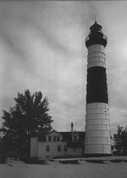
- Bois Blanc Island LightBois Blanc LightBois Blanc Light can refer to one of five lighthouses erected on Bois Blanc Island, Michigan, in Lake Huron. Two of the lighthouses are currently standing.-History:...
- Cedar River Light
- Charity Island Light
- Charlevoix South Pier LightCharlevoix South Pier Light StationThe Charlevoix South Pier Light Station is located on Lake Michigan at the entrance to Lake Charlevoix in Charlevoix County in the U.S. state of Michigan at the end of the south pier/breakwater of the channel leading to Round Lake in the city of Charlevoix....
, CharlevoixCharlevoix, MichiganCharlevoix is a city in the U.S. state of Michigan. As of the 2000 census, the city population was 2,994. It is the county seat of Charlevoix County.... - Cheboygan Crib Light
- Cheboygan River Light
- Clinton River Light
- Copper Harbor Front Range LightCopper Harbor Front Range LightThe Copper Harbor Front Range Light is in Copper Harbor, Michigan.While the Copper Harbor Light effectively illuminated the area of the harbor, it failed to guide mariners through the narrow opening of rocks at its entrance...
, Copper HarborCopper Harbor, MichiganCopper Harbor is a small unincorporated community in northeastern Keweenaw County in the U.S. state of Michigan. It is within Grant Township on the Keweenaw Peninsula that juts from the Upper Peninsula of Michigan into Lake Superior.-History:... - Copper Harbor Light, Copper HarborCopper Harbor, MichiganCopper Harbor is a small unincorporated community in northeastern Keweenaw County in the U.S. state of Michigan. It is within Grant Township on the Keweenaw Peninsula that juts from the Upper Peninsula of Michigan into Lake Superior.-History:...
- Copper Harbor Rear Range Light, Copper HarborCopper Harbor, MichiganCopper Harbor is a small unincorporated community in northeastern Keweenaw County in the U.S. state of Michigan. It is within Grant Township on the Keweenaw Peninsula that juts from the Upper Peninsula of Michigan into Lake Superior.-History:...
- Crisp Point Light
- De Tour Reef Light
- Detroit Light
- Detroit River (Bar Point Shoal) LightDetroit River LightThe Detroit River Light, also known as Bar Point Shoal Light, was first established as a lightship in 1875. The current sparkplug lighthouse was built in 1885. It sits in Lake Erie, south of the mouth of the Detroit River, from land and about from the Ambassador Bridge in the Detroit River. It...
- Eagle Harbor Light, Eagle Harbor
- Eagle Harbor Rear Range Light, Eagle Harbor
- Eagle River Light, Eagle RiverEagle River, MichiganEagle River is an unincorporated community in the U.S. state of Michigan and is the county seat of Keweenaw County.The community is on M-26 on the north side of the Keweenaw Peninsula, which projects into Lake Superior. It is about 27 miles northeast of Houghton and is situated in the northwest...
- Ecorse Light
- Ecorse Range Rear Light
- Fort Gratiot Light, Port HuronPort Huron, MichiganPort Huron is a city in the U.S. state of Michigan and the county seat of St. Clair County. The population was 30,184 at the 2010 census. The city is adjacent to Port Huron Township but is administratively autonomous. It is joined by the Blue Water Bridge over the St. Clair River to Sarnia,...
- Forty Mile Point Light
- Fourteen Foot Shoal LightFourteen Foot Shoal LightThe lighthouse at Fourteen Foot Shoal was named to note that the lake is only deep at this point, which is a hazard to navigation, ships and mariners....
- Fourteen Mile Light
- Frankfort North Breakwater Light, FrankfortFrankfort, MichiganFrankfort is a city in Benzie County in the U.S. state of Michigan. The population was 1,513 at the 2000 census. The elevation of Frankfort is above sea level. The city is situated with Lake Michigan to the west, Lake Betsie, formed by the Betsie River before flowing into Lake Michigan, on the...
- Frying Pan Island Light http://www.lighthousesrus.org/Superior1.htm relocated to Sault Ste. MarieSault Ste. Marie, MichiganSault Ste. Marie is a city in and the county seat of Chippewa County in the U.S. state of Michigan. It is in the north-eastern end of Michigan's Upper Peninsula, on the Canadian border, separated from its twin city of Sault Ste. Marie, Ontario, by the St. Marys River...
- Gibraltar Light
- Grand Haven South Pierhead Inner LightGrand Haven LightThe Grand Haven Breakwater lighthouse is located in the harbor of Grand Haven, Michigan.Grand Haven Lighthouses are two different lighthouses on the south pier of the channel where Grand River comes in to Lake Michigan. A lighthouse was first established there in 1839...
, Grand HavenGrand Haven, MichiganGrand Haven is a city in the U.S. state of Michigan and is the county seat of Ottawa County. Grand Haven is located on the eastern shore of Lake Michigan at the mouth of the Grand River, for which it is named. As of the 2010 census, Grand Haven had a population of 10,412. It is part of the... - Grand Haven South Pierhead LightGrand Haven LightThe Grand Haven Breakwater lighthouse is located in the harbor of Grand Haven, Michigan.Grand Haven Lighthouses are two different lighthouses on the south pier of the channel where Grand River comes in to Lake Michigan. A lighthouse was first established there in 1839...
, Grand HavenGrand Haven, MichiganGrand Haven is a city in the U.S. state of Michigan and is the county seat of Ottawa County. Grand Haven is located on the eastern shore of Lake Michigan at the mouth of the Grand River, for which it is named. As of the 2010 census, Grand Haven had a population of 10,412. It is part of the... - Grand Island East Channel LightGrand Island East Channel LightThe Grand Island East Channel Light is a lighthouse located just north of Munising, Michigan and was intended to lead boats from Lake Superior through the channel east of Grand Island into the Munising Harbor. Constructed of wood, the light first opened for service in 1868...
- Grand Island Harbor Rear Range LightGrand Island Harbor Rear Range LightThe Grand Island Harbor Rear Range Light is a lighthouse located off M-28 near Christmas, Michigan. It is also known as the Bay Furnace Rear Range Light. The corresponding front range light was replaced in 1968; the rear range light was listed on the National Register of Historic Places in 1990...
- Grand Island North LightGrand Island North LightThe Grand Island North Light Station is a lighthouse located on the north end of Grand Island near Munising, Michigan. It was listed on the National Register of Historic Places in 1985.-History:...
- Grand Marais Inner Range Light
- Grand Marais Outer Range Light
- Grand Traverse Light, NorthportNorthport, MichiganNorthport is a village in Leelanau Township, Leelanau County in the U.S. state of Michigan. The population was 648 at the 2000 census. When Leelanau County was formed in 1863, Northport served as the first county seat from 1863 to 1883.-Geography:...
- Granite Island LightGranite Island (Michigan)Granite Island is a 2½ acre island in Lake Superior located about northwest of Marquette in the Upper Peninsula of the U.S. state of Michigan. Posted upon it is the Granite Island Lighthouse, also known as Granite Island Light Station, and is "one of the oldest surviving lighthouses on Lake...
, 12 miles northwest of MarquetteMarquette, MichiganMarquette is a city in the U.S. state of Michigan and the county seat of Marquette County. The population was 21,355 at the 2010 census, making it the most populated city of the Upper Peninsula. Marquette is a major port on Lake Superior, primarily for shipping iron ore and is the home of Northern... - Grassy Island North Channel Range Light
- Grassy Island South Channel Range Light
- Gravelly Shoal LightGravelly Shoal LightGravelly Shoals Light is an automated lighthouse that is an active aid to navigation on the shallow shoals extending southeast from Point Lookout on the western side of Saginaw Bay. The light is situated about offshore and was built to help guide boats through the deeper water between the...
- Gray's Reef Light, offshore, east of Beaver IslandBeaver Island (Lake Michigan)Beaver Island is the largest island in Lake Michigan and part of the Beaver Island archipelago. Once home to a unique American monarchy, the island is now a popular tourist and vacation destination....
- Grosse Ile North Channel Front Range Light
- Grosse Isle South Channel Range Light
- Gull Rock Light StationGull Rock Light StationThe Gull Rock Light Station is an active lighthouse located on Gull Rock, just west of Manitou Island, off the tip of Michigan's Keweenaw Peninsula in Lake Superior...
- Harwood Point East Range Front Light
- Harbor Beach LightHarbor Beach LightThe Harbor Beach Lighthouse is a "sparkplug lighthouse" located at the end of the north breakwall entrance to the harbor of refuge on Lake Huron. The breakwall and light were created by the United States Army Corps of Engineers to protect the harbor of Harbor Beach, Michigan, which is the greatest...
- Holland Harbor Light (Big Red), near HollandHolland, MichiganHolland is a city in the western region of the Lower Peninsula of the U.S. state of Michigan. It is situated near the eastern shore of Lake Michigan on Lake Macatawa, which is fed by the Macatawa River ....

- Huron Island LightHuron Island LightHuron Island Light is a lighthouse on Lake Superior near Big Bay, Michigan. It was listed on the National Register of Historic Places as Huron Islands Lighthouse in 1975. It is on one of the Huron Islands .- History :...
- Huron LightshipHuron LightshipThe United States lightship Huron is a lightvessel that was launched in 1920. It is now a museum ship moored in Pine Grove Park, Port Huron, St. Clair County, Michigan.-Great Lakes lightships:...
, Port Huron, MichiganPort Huron, MichiganPort Huron is a city in the U.S. state of Michigan and the county seat of St. Clair County. The population was 30,184 at the 2010 census. The city is adjacent to Port Huron Township but is administratively autonomous. It is joined by the Blue Water Bridge over the St. Clair River to Sarnia,... - Ile aux Galets Light, see Skillagalee Island (Ile aux Galets) LightIle Aux GaletsIle aux Galets or Gallets, and also known as Skillagallee or Skillagalee Island, is located in northeast Lake Michigan approximately 7.0 miles northwest of Cross Village, Michigan...
- Isle Royale (Menagerie Island) LightIsle Royale LightThe Isle Royale Light is located on Menagerie Island , the most easterly of the group of small islands at the opening of Siskiwit Bay, near the southern shore of Isle Royale, and is part of the Isle Royale National Park...
, Isle Royale National ParkIsle Royale National ParkIsle Royale National Park is a U.S. National Park in the state of Michigan. Isle Royale, the largest island in Lake Superior, is over 45 miles in length and 9 miles wide at its widest point. The park is made of Isle Royale itself and approximately 400 smaller islands, along with any submerged... - Keweenaw Waterway Upper Entrance Light http://www.lighthousesrus.org/Superior2.htm#MI7
- Keweenaw Waterway Lower Entrance Light
- Lake St. Clair Light
- Lansing Shoal Light, offshore northwest of Beaver IslandBeaver Island (Lake Michigan)Beaver Island is the largest island in Lake Michigan and part of the Beaver Island archipelago. Once home to a unique American monarchy, the island is now a popular tourist and vacation destination....
- Little Sable Point (Petite Point au Sable) LightLittle Sable Point LightThe Little Sable Point Light is a lighthouse located south of Pentwater in the lower peninsula of the U.S. state of Michigan. It is in the southwest corner of Golden Township, just south of Silver Lake State Park.The lighthouse was designed by Col. Orlando M...
, south of PentwaterPentwater, MichiganPentwater is a village in Oceana County in the U.S. state of Michigan. The population was 958 at the 2000 census. The village is located within Pentwater Township. Pentwater is home to Mears State Park. The name Pentwater comes from Pent or Penned up waters... - Little Traverse Light
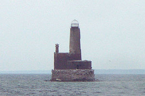
- Ludington Light, LudingtonLudington, MichiganLudington is a city in the U.S. state of Michigan. As of the 2000 census, the city population was 8,357. It is the county seat of Mason County.Ludington is a harbor town located on Lake Michigan at the mouth of the Pere Marquette River...
- Mackinac Point Light, Mackinaw CityMackinaw City, MichiganMackinaw City is a village in Emmet and Cheboygan counties in the U.S. state of Michigan. At the 2000 census the population was 859. The name "Mackinaw City" is a bit of a misnomer as it is actually a village...
- Mama Juda Light, destroyed, Detroit RiverDetroit RiverThe Detroit River is a strait in the Great Lakes system. The name comes from the French Rivière du Détroit, which translates literally as "River of the Strait". The Detroit River has served an important role in the history of Detroit and is one of the busiest waterways in the world. The river...
, DetroitDetroit, MichiganDetroit is the major city among the primary cultural, financial, and transportation centers in the Metro Detroit area, a region of 5.2 million people. As the seat of Wayne County, the city of Detroit is the largest city in the U.S. state of Michigan and serves as a major port on the Detroit River... - Mama Juda Range Front Light
- Manistee Light, ManisteeManistee, MichiganManistee is a city in the U.S. state of Michigan. As of the 2000 census, the city population was 6,586. It is the county seat of Manistee County. The name "Manistee" is from an Ojibwe word first applied to the principal river of the county. The derivation is not certain, but it may be from...
- Manistee North Pierhead LightManistee Pierhead lightsThe Manistee Pierhead lights are a pair of active aids to navigation located on the north and south pier in the harbor of Manistee, Michigan, "Lake Michigan’s Victorian Port City."-History:...
, ManisteeManistee, MichiganManistee is a city in the U.S. state of Michigan. As of the 2000 census, the city population was 6,586. It is the county seat of Manistee County. The name "Manistee" is from an Ojibwe word first applied to the principal river of the county. The derivation is not certain, but it may be from... - Manistique East Breakwater LightManistique East Breakwater LightThe Manistique Breakwater lighthouse is located in the harbor of Manistique, Michigan. It was listed on the National Register of Historic Places in 2005.-History:...
, ManistiqueManistique, MichiganManistique is a city in the Upper Peninsula of the U.S. state of Michigan. As of the 2000 census, the city population was 3,583. It is the county seat of Schoolcraft County and the only incorporated community in the county. The city lies on the north shore of Lake Michigan, at the southwest corner... - Manitou Island Light StationManitou Island Light StationThe Manitou Island Light Station is a lighthouse located on Manitou Island, off the tip of Michigan's Keweenaw Peninsula in Lake Superior. It was listed on the National Register of Historic Places in 1984.- Description :...
- Manning Memorial LightManning Memorial LightThe Manning Memorial Light, also known as the Robert H. Manning Memorial Lighthouse is a lighthouse located near Empire, Michigan. Mr. Manning was a longtime resident of Empire. Manning enjoyed fishing offshore, and often returned from these boat trips late at night. He often remarked to friends...
http://www.lighthousesrus.org/MichiganNorth.htm#MI65B - Mariners Memorial (River Rouge) Light
- Marquette Breakwater Outer Light
- Marquette Harbor LightMarquette Harbor LightThe Marquette Harbor Light is located on Lake Superior in Marquette, Michigan, a part of the Upper Peninsula. It is an active aid to navigation.-History:...
- Martin Reef Light
- McGulpin's Point LightMcGulpin Point LightMcGulpin Point Light was constructed as a navigational aid through the Straits of Mackinac. The light began operation in 1869, making it one of the oldest surviving lighthouses in the Straits...
- Menagerie Island Light, see Isle Royale (Menagerie Island) LightIsle Royale LightThe Isle Royale Light is located on Menagerie Island , the most easterly of the group of small islands at the opening of Siskiwit Bay, near the southern shore of Isle Royale, and is part of the Isle Royale National Park...
- Mendota Light, see Bete Grise (Mendota) Light
- Menominee North Pier LightMenominee Pier LightThe Menominee North Pier lighthouse is located in the harbor of Menominee, Michigan. The station was established in 1877. The current structure and its still operational light was first lit in 1927, and automated in 1972. It is also sometimes called the "Menominee North Pierhead Light".The...
- Middle Island Light
- Middle Lake George
- Minneapolis Shoal Light
- Mission Point Light, deactivated, replaced by offshore light tower
- Monroe Pier Light
- Munising Front Range LightMunising Front Range LightThe Munising Front Range Light and its matching Munising Rear Range Light replaced the ineffective Grand Island East Channel Light in 1905. These two lights combine to guide boats from the open waters of Lake Superior down the East Channel next to Grand Island into the harbor of Munising...
, MunisingMunising, MichiganMunising is a city on the southern shore of Lake Superior on the Upper Peninsula of the U.S. state of Michigan. As of the 2000 census, the city population was 2,539. It is the county seat of Alger County... - Munising Rear Range LightMunising Rear Range LightThe Munising Rear Range Light works with the Munising Front Range Light to project a line of light out into Lake Superior in order to guide boats from the open lake into the safe harbor at Munising, Michigan. This harbor is a natural bay and sheltered on the north by Grand Island...
, MunisingMunising, MichiganMunising is a city on the southern shore of Lake Superior on the Upper Peninsula of the U.S. state of Michigan. As of the 2000 census, the city population was 2,539. It is the county seat of Alger County... - Muskegon Pier LightMuskegon Pier LightThe Muskegon Pier Light is a lighthouse located in the harbor of Muskegon, Michigan.The site is accessible but the lighthouse is close to the public.-History:...
, MuskegonMuskegon, MichiganMuskegon is a city in the U.S. state of Michigan. As of the 2010 census, the city population was 38,401. The city is the county seat of Muskegon County... - Muskegon Breakwater LightMuskegon Breakwater LightThe Muskegon Breakwater lighthouse is located on the end of the south arm of the Muskegon breakwater surrounding the mouth of the Muskegon channel in Muskegon, Michigan.The site is accessible by walking the breakwater, but the lighthouse is closed to the public....
, MuskegonMuskegon, MichiganMuskegon is a city in the U.S. state of Michigan. As of the 2010 census, the city population was 38,401. The city is the county seat of Muskegon County... - Naubinway Island Light
- New Buffalo Light
- Ninth District Light
- North Manitou Island Light
- North Manitou Shoal Light, offshore east of North Manitou IslandNorth Manitou IslandNorth Manitou Island is located in Lake Michigan, approximately west-northwest of Leland, Michigan. It is nearly eight miles long and over four miles wide, with of shoreline. It has a land area of 57.876 km² and has no population...
- Old Mackinac Point Light
- Old Mission Point Light, alternate name for Mission Point Light
- Ontonagon Harbor West Pierhead Light, OntonagonOntonagon, MichiganOntonagon is a village in the U.S. state of Michigan. As of the 2000 census, the village had a total population of 1,769. It is the county seat of Ontonagon County....
- Ontonagon Light, OntonagonOntonagon, MichiganOntonagon is a village in the U.S. state of Michigan. As of the 2000 census, the village had a total population of 1,769. It is the county seat of Ontonagon County....
- Passage Island Light, Isle Royale National ParkIsle Royale National ParkIsle Royale National Park is a U.S. National Park in the state of Michigan. Isle Royale, the largest island in Lake Superior, is over 45 miles in length and 9 miles wide at its widest point. The park is made of Isle Royale itself and approximately 400 smaller islands, along with any submerged...
- Peche Island Light, relocated from Peche IslandPeche IslandPeche Island , is an uninhabited, currently Canadian-owned island in the Detroit River, at its opening into Lake Saint Clair. It is 1.2 miles east of U...
to Marine CityMarine City, MichiganMarine City is a city in St. Clair County in the U.S. state of Michigan. Located on the west bank of the St. Clair River, it is one of the cities in the River District north of Detroit and south of Lake Huron. The population was 4,652 at the 2000 census... - Peninsula Point LightPeninsula Point LightThe Peninsula Point lighthouse is located on northern Lake Michigan south of Stonington, Michigan. Note: Some of the USCG literature references this light as "Point Peninsula Light".-Service:...
- Pipe Island Light
- Poe Reef LightPoe Reef LightPoe Reef is a lighthouse located at the east end of South Channel between Bois Blanc Island and the mainland of the Lower Peninsula, about six miles east of Cheboygan Poe Reef has historically caused problems for shipping...
- Point Betsie (Point aux Becs Scies) LightPoint Betsie Light-Specialized further reading:* Hawley, Jonathon P., Point Betsie: Lightkeeping and Lifesaving on Northeastern Lake Michigan 264 p., 61 B&W photos ISBN 9780472033188.- External links :* * * * * by LighthousesRus...
, FrankfortFrankfort, MichiganFrankfort is a city in Benzie County in the U.S. state of Michigan. The population was 1,513 at the 2000 census. The elevation of Frankfort is above sea level. The city is situated with Lake Michigan to the west, Lake Betsie, formed by the Betsie River before flowing into Lake Michigan, on the... - Point Iroquois Light
- Pointe aux Barques LightPointe aux Barques LightThe Pointe aux Barques Lighthouse ranks among the ten oldest lighthouses in Michigan. It is an active lighthouse maintained by the US Coast Guard remotely, located in Lighthouse County Park on Lake Huron near Port Hope, Michigan in Huron County...
- Port Austin Light
- Port Sanilac LightPort Sanilac LightPort Sanilac Light is a United States Coast Guard lighthouse located on Point Sanilac, near Port Sanilac on the eastern side of Michigan's Thumb. It is an automated and active aid to navigation on Lake Huron.-History:...
- Portage River (Jacobsville Light)
- Poverty Island Light, Poverty IslandPoverty IslandPoverty Island is a small island in the U.S. state of Michigan. The island is within Delta County in Lake Michigan and is home to an abandoned lighthouse which is in disrepair. Poverty Island is currently owned by the federal government....
south of Fairport - Presque Isle Front Range Light
- Presque Isle Harbor Breakwater Light
- Presque Isle Light (New), Presque Isle
- Presque Isle Light (Old), Presque Isle
- Presque Isle Rear Range Light
- Rock Harbor LightRock Harbor LightThe Rock Harbor Lighthouse is a light station located in Rock Harbor on Isle Royale National Park, Michigan. It was listed on the National Register of Historic Places in 1977.- Description :...
, Isle Royale National ParkIsle Royale National ParkIsle Royale National Park is a U.S. National Park in the state of Michigan. Isle Royale, the largest island in Lake Superior, is over 45 miles in length and 9 miles wide at its widest point. The park is made of Isle Royale itself and approximately 400 smaller islands, along with any submerged... - Rock of Ages LightRock of Ages LightThe Rock of Ages Light is a U.S. Coast Guard lighthouse on a small rock outcropping approximately miles west of Washington Island and west of Isle Royale, in Keweenaw County, Michigan...
, Isle Royale National ParkIsle Royale National ParkIsle Royale National Park is a U.S. National Park in the state of Michigan. Isle Royale, the largest island in Lake Superior, is over 45 miles in length and 9 miles wide at its widest point. The park is made of Isle Royale itself and approximately 400 smaller islands, along with any submerged... - Rouleau Point Range Front and Rear Lights
- Round Island LightRound Island Light (Michigan)The Round Island Light, also known as the "Old Round Island Point Lighthouse" is a lighthouse located on the west shore of Round Island in the shipping lanes of the Straits of Mackinac, which connect Lake Michigan and Lake Huron...
, Round IslandRound Island (Michigan)Round Island is an uninhabited island in Mackinac County of the U.S. state of Michigan. It is located in the Straits of Mackinac, which connect Lake Michigan and Lake Huron. The Native Americans called the island "Nissawinagong."...
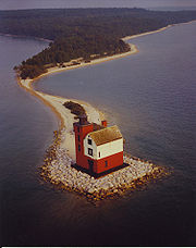
- Round Island Light, St. Mary's RiverSt. Marys River (Michigan-Ontario)The St. Marys River , sometimes written as the St. Mary's River, drains Lake Superior, starting at the end of Whitefish Bay and flowing 74.5 miles southeast into Lake Huron, with a fall of ....
- Round Island Passage LightRound Island Passage LightRound Island Passage Light is an automated, unmanned 1948 lighthouse located in the Round Island Channel in the Straits of Mackinac, Michigan. The channel is a branch of Lake Huron.-History:....
- Round Island Rear Light
- Saginaw Bay Light
- Saginaw River Rear Range Light
- Sand Beach North Entrance East Light
- Sand Hills LightSand Hills LightSand Hills is a formerly active lighthouse on the shore of Lake Superiorconverted into a bed and breakfast. It is located in Ahmeek in Keweenaw County Michigan in the Keweenaw Peninsula, which is the northern part of the Upper Peninsula....
- Sand Point LightSand Point LightThe Sand Point Lighthouse is located in Escanaba, Michigan, United States, on Lake Michigan's northern shore. Since 1989, is has been an unofficial aid to navigation. Though it is an operational aid to navigation. The restored lighthouse is now open to the public during the summer months...
, EscanabaEscanaba, MichiganEscanaba is a city in the U.S. state of Michigan, located in the banana belt on the state's Upper Peninsula. As of the 2000 census, the city population was 13,140, making it the third-largest city in the Upper Peninsula after Marquette and Sault Ste. Marie... - Sand Point LightSand Point LightThe Sand Point Lighthouse is located in Escanaba, Michigan, United States, on Lake Michigan's northern shore. Since 1989, is has been an unofficial aid to navigation. Though it is an operational aid to navigation. The restored lighthouse is now open to the public during the summer months...
, BaragaBaraga, MichiganBaraga is a village in Baraga County in the U.S. state of Michigan. The population was 1,285 at the 2000 census. The village is named after Bishop Frederic Baraga.... - Saugatuck Light, SaugatuckSaugatuck, MichiganSaugatuck is a city in Allegan County in the U.S. state of Michigan. The population was 925 at the 2010 census. The city is within Saugatuck Township, but is administratively autonomous....
- Seul Choix Point LightSeul Choix LightThe Seul Choix Light is a lighthouse located in the northwest corner of Lake Michigan in Schoolcraft County, Michigan. The station was established in 1892 with a temporary light, and this light started service in 1895, and was fully automated in 1972. It is an active aid to navigation...
, Gulliver - Six Mile Point Range Rear Light
- Skillagalee Island (Ile aux Galets) LightIle Aux GaletsIle aux Galets or Gallets, and also known as Skillagallee or Skillagalee Island, is located in northeast Lake Michigan approximately 7.0 miles northwest of Cross Village, Michigan...
, Ile Aux GaletsIle Aux GaletsIle aux Galets or Gallets, and also known as Skillagallee or Skillagalee Island, is located in northeast Lake Michigan approximately 7.0 miles northwest of Cross Village, Michigan... - South Fox Island Light, South Fox Island
- South Haven South Pier Light, South HavenSouth Haven, MichiganSouth Haven is a city in the U.S. state of Michigan. Most of the city is in Van Buren County, although a small portion extends into Allegan County. The population was 5,021 at the 2000 census....
- South Manitou Island LightSouth Manitou Island LightSouth Manitou Island Lighthouse is located on South Manitou Island in Lake Michigan, west of Leland, Michigan. It is in Leelanau County in western Northern Michigan.-History:This is the third lighthouse built on the island...
, part of Sleeping Bear Dunes National LakeshoreSleeping Bear Dunes National LakeshoreSleeping Bear Dunes National Lakeshore is a United States National Lakeshore located along the northwest coast of the Lower Peninsula of Michigan in Leelanau County and Benzie County.... - Spectacle Reef LightSpectacle Reef LightSpectacle Reef Light is a lighthouse eleven miles east of the Straits of Mackinac and is located at the northern end of Lake Huron, Michigan. It was designed and built by Colonel Orlando Metcalfe Poe and Major Godfrey Weitzel, and was the most expensive lighthouse ever built on the Great Lakes...
- Squaw Point Light
- Squaw Island Light, Squaw Island
- St. Clair Flats South Channel Front Range LightSt. Clair Flats Front and Rear Range LightSt. Clair Flats Front and Rear Range Light are two lighthouse structures situated off the southeastern tip of Harsens Island at Lake St. Clair...
- St. Clair Flats South Channel Rear Range LightSt. Clair Flats Front and Rear Range LightSt. Clair Flats Front and Rear Range Light are two lighthouse structures situated off the southeastern tip of Harsens Island at Lake St. Clair...
- St. Helena Island Light, west of the Straits of MackinacStraits of MackinacThe Straits of Mackinac is the strip of water that connects two of the Great Lakes, Lake Michigan and Lake Huron, and separates the Lower Peninsula of Michigan from the Upper Peninsula of Michigan. It is a shipping lane providing passage for raw materials and finished goods, connecting, for...
- St. James Light, see Beaver Island Harbor LightBeaver Island Harbor LightBeaver Island Harbor Light is a lighthouse located in St. James Township, Michigan on the northern end of Beaver Island on Lake Michigan. It has also been called "St. James Harbor Light" and "Whiskey Point Light." It is associated with a U.S. Coast Guard station, which was formerly a lifesaving...
- St. Joseph North Pier Inner Light
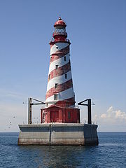
- St. Joseph North Pier Outer Light
- St. Martin Island LightSt. Martin Island LightSt. Martin Island Light is a unique exoskeleton lighthouse that marks one of four passages between Lake Michigan and the bay of Green Bay. Constructed in 1905, this light tower is the only example in the United States of a pure exoskeletal tower on the Great Lakes. Similar designs do exist in...
- St. Mary's River Lower Range Front Light
- Stannard Rock LightStannard Rock LightThe Stannard Rock Light, completed in 1883, is a lighthouse located on a reef that was the most serious hazard to navigation on Lake Superior. The exposed crib of the Stannard Rock Light is rated as one of the top ten engineering feats in the United States. It is from the nearest land, making it...
- Sturgeon Point Light
- Tawas Point LightTawas Point LightTawas Point Light is located in the Tawas Point State Park off Tawas Bay in Lake Huron in Baldwin Township in Northern Michigan.-History:In 1850, Congress appropriated $5,000 for the construction of a lighthouse. In 1852, construction started, and the lighthouse was commissioned in 1853. After the...
- Thunder Bay Island LightThunder Bay IslandThunder Bay Island is a island in Lake Huron. The island is one of eight constituent islands of the Michigan Islands National Wildlife Refuge. The island is part of Alpena Township in Alpena County...
- Tri-Centennial Light of Detroit
- Vidal Shoals Channel Range Front and Rear Lights
- Waugoshance LightWaugoshance LightThe lighthouse at Waugoshance protects boats from a shoal area at the northern end of Lake Michigan. The lighthouse is located in Emmet County, Michigan, United States, and in U.S. Coast Guard District No. 9.-Reason for lighthouse:...
- White River Light, WhitehallWhitehall, MichiganWhitehall is a city in Muskegon County in the U.S. state of Michigan. The population was 2,884 at the 2000 census. The city is located in the southwest corner of Whitehall Township. Montague, Michigan is its neighbor....
- White Shoal LightWhite Shoal Light (Michigan)The White Shoal Light is a lighthouse located 20 miles west of the Mackinac Bridge in Lake Michigan. It is an active aid to navigation.-Overview:...
, west of Mackinaw CityMackinaw City, MichiganMackinaw City is a village in Emmet and Cheboygan counties in the U.S. state of Michigan. At the 2000 census the population was 859. The name "Mackinaw City" is a bit of a misnomer as it is actually a village... - Whitefish Point Light
- William Livingstone Memorial Light
- Windmill Point Light
- Windmill Point Range Front and Rear Lights
- Winter Point Range Front Light
Minnesota
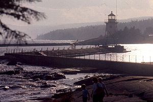
- Duluth North Pier Light, DuluthDuluth, MinnesotaDuluth is a port city in the U.S. state of Minnesota and is the county seat of Saint Louis County. The fourth largest city in Minnesota, Duluth had a total population of 86,265 in the 2010 census. Duluth is also the second largest city that is located on Lake Superior after Thunder Bay, Ontario,...
- Duluth South Breakwater Light, DuluthDuluth, MinnesotaDuluth is a port city in the U.S. state of Minnesota and is the county seat of Saint Louis County. The fourth largest city in Minnesota, Duluth had a total population of 86,265 in the 2010 census. Duluth is also the second largest city that is located on Lake Superior after Thunder Bay, Ontario,...
- Duluth South Breakwater Inner Range Light, DuluthDuluth, MinnesotaDuluth is a port city in the U.S. state of Minnesota and is the county seat of Saint Louis County. The fourth largest city in Minnesota, Duluth had a total population of 86,265 in the 2010 census. Duluth is also the second largest city that is located on Lake Superior after Thunder Bay, Ontario,...
- Grand Marais LightGrand Marais LightGrand Marais Light is located on the outer end of a breakwater on the shore of Lake Superior in the city of Grand Marais in Cook County, Minnesota. It is located in USCG District 9.The existing historic tower was first lit in 1922 and is still operational....
, Grand MaraisGrand Marais, MinnesotaGrand Marais is a city in Cook County, Minnesota, United States. The population was 1,351 at the 2010 census. It is also the county seat of Cook County... - Minnesota Point Light, DuluthDuluth, MinnesotaDuluth is a port city in the U.S. state of Minnesota and is the county seat of Saint Louis County. The fourth largest city in Minnesota, Duluth had a total population of 86,265 in the 2010 census. Duluth is also the second largest city that is located on Lake Superior after Thunder Bay, Ontario,...
- Split Rock LightSplit Rock LightSplit Rock Lighthouse is a lighthouse located southwest of Silver Bay, Minnesota, USA on the North Shore of Lake Superior. The structure was designed by lighthouse engineer Ralph Russell Tinkham and was completed in 1910 by the United States Lighthouse Service at a cost of $75,000, including the...
, Beaver BayBeaver Bay, MinnesotaBeaver Bay is a city in Lake County, Minnesota, U.S. The population was 181 at the 2010 census.-History:It is the oldest settlement on the NorthShore of Lake Superior. Est. in 1856... - Two Harbors LightTwo Harbors LightThe Two Harbors Light is the oldest operating lighthouse in the US state of Minnesota. Overlooking Lake Superior's Agate Bay, the lighthouse is located in Two Harbors, Minnesota. The construction of the Lighthouse began in 1891...
, Two HarborsTwo Harbors, MinnesotaAs of the census of 2000, there were 3,613 people, 1,636 households, and 953 families residing in the city. The population density was 1,120.7 people per square mile . There were 1,631 housing units at an average density of 505.9 per square mile... - Two Harbors Breakwater Light, Two HarborsTwo Harbors, MinnesotaAs of the census of 2000, there were 3,613 people, 1,636 households, and 953 families residing in the city. The population density was 1,120.7 people per square mile . There were 1,631 housing units at an average density of 505.9 per square mile...
Mississippi
- Biloxi LightBiloxi LightBiloxi Light is a lighthouse in Biloxi, Mississippi, adjacent to the Mississippi Sound of the Gulf of Mexico. The lighthouse has been kept by female keepers for more years than any other lighthouse in the United States...
, BiloxiBiloxi, MississippiBiloxi is a city in Harrison County, Mississippi, in the United States. The 2010 census recorded the population as 44,054. Along with Gulfport, Biloxi is a county seat of Harrison County.... - Cat Island LightCat Island LightThe Cat Island Light was a lighthouse off the coast of Mississippi. Originally built to guide shipping through the Mississippi Sound, it was discontinued as traffic moved further south.-History:...
, Cat IslandCat Island (Mississippi)Cat Island is a barrier island off the Gulf Coast of the United States. The island is named for raccoons which Spanish explorers mistook for cats. It is unknown who discovered Cat Island. It was called Isle-aux-Chats and Isola de Gati in French and Italian, respectively. It is within the... - Pass Christian Light
- Round Island Light (Mississippi), PascagoulaPascagoula, MississippiPascagoula is a city in Jackson County, Mississippi, United States. It is the principal city of the Pascagoula, Mississippi Metropolitan Statistical Area, as a part of the Gulfport–Biloxi–Pascagoula, Mississippi Combined Statistical Area. The population was 26,200 at the 2000 census...
- Ship Island LightShip Island LightShip Island Light was a lighthouse in Mississippi near Gulfport.-History:The first tower at this site was constructed in 1853; though appropriations were made starting in 1848; disputes over land ownership delayed acquisition of the land...
, Ship IslandShip Island (Mississippi)Ship Island is the collective name for two barrier islands off the Gulf Coast of Mississippi, part of Gulf Islands National Seashore: East Ship Island and West Ship Island. Hurricane Camille split the once single island into 2 separate islands in 1969...
Nebraska
- Linoma LighthouseLinoma LighthouseLinoma Beach, now doing business under the name Linoma Lighthouse, is a privately owned recreation area developed around an artificial lake in Sarpy County, Nebraska. The site was opened in 1924; in 1939, a lighthouse was added to it. The lighthouse is a conspicuous landmark on U.S...
, near GretnaGretna, NebraskaGretna is a city in Sarpy County, Nebraska, United States. The population was 2,355 at the 2000 census. In 2008, its population was estimated to be 6,572. Gretna has the fastest rate of growth of any Nebraska city since 2000.-History:... - Lake Minatare LighthouseLake Minatare LighthouseThe Lake Minatare Lighthouse is a historic mock lighthouse located on Lake Minatare near the city of Scottsbluff in Nebraska. The tower was built by the Veterans Conservation Corps in 1939 and is currently located within the North Platte National Wildlife Refuge...
, near ScottsbluffScottsbluff, NebraskaScottsbluff is a city in Scotts Bluff County, Nebraska, United States. The population was 15,039 at the 2010 census. Scottsbluff is the largest city in the Nebraska Panhandle, and the 13th largest city in Nebraska....
New Hampshire
- Portsmouth Harbor LightPortsmouth Harbor LightPortsmouth Harbor Lighthouse is located within Fort Constitution in New Castle, New Hampshire, USA.The station was established in 1771 and was the 10th of 11 light stations established prior to the American Revolution. The first tower was a shingled wooden structure with an iron lantern and copper...
, New CastleNew Castle, New HampshireNew Castle is a town in Rockingham County, New Hampshire, United States. The population was 968 at the 2010 census. It is the smallest town in New Hampshire, and the only one located entirely on islands. It is home to Fort Constitution Historic Site, Fort Stark Historic Site, and the New Castle... - White Island Light, Isles of ShoalsIsles of ShoalsThe Isles of Shoals are a group of small islands and tidal ledges situated approximately off the east coast of the United States, straddling the border of the states of New Hampshire and Maine.- History :...
New Jersey
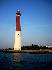
- Absecon LightAbsecon LightThe Absecon Light is a coastal lighthouse located in the north end of Atlantic City, New Jersey overlooking Absecon Inlet. It is the tallest lighthouse in the state of New Jersey and is the third tallest masonry lighthouse in the United States. Construction began in 1854, with the light first lit...
, Atlantic CityAtlantic City, New JerseyAtlantic City is a city in Atlantic County, New Jersey, United States, and a nationally renowned resort city for gambling, shopping and fine dining. The city also served as the inspiration for the American version of the board game Monopoly. Atlantic City is located on Absecon Island on the coast... - Barnegat LighthouseBarnegat LighthouseBarnegat Lighthouse or Barnegat Light, colloquially known as "Old Barney", is a historic lighthouse located in Barnegat Lighthouse State Park on the northern tip of Long Beach Island, in the borough of Barnegat Light, New Jersey, on the south side of Barnegat Inlet.-19th century:The development of...
, Barnegat LightBarnegat Light, New JerseyBarnegat Light is a Borough in Ocean County, New Jersey, United States. As of the United States 2010 Census, the borough population was 574. The borough borders the Atlantic Ocean on Long Beach Island and is home to Barnegat Lighthouse....
, Long Beach IslandLong Beach IslandLong Beach Island is a barrier island and summer colony along the Atlantic Ocean coast of Ocean County, New Jersey in the United States... - Brandywine Shoal LightBrandywine Shoal LightThe Brandywine Shoal Light is a lighthouse on the north side of the ship channel in Delaware Bay on the east coast of the United States, west of Cape May, New Jersey...
, Delaware BayDelaware BayDelaware Bay is a major estuary outlet of the Delaware River on the Northeast seaboard of the United States whose fresh water mixes for many miles with the waters of the Atlantic Ocean. It is in area. The bay is bordered by the State of New Jersey and the State of Delaware... - Brigantine LighthouseBrigantine LighthouseThe Brigantine Lighthouse is a lighthouse in Brigantine, New Jersey, USA. It was built in 1926 by the Island Development Real Estate Company to attract people to Brigantine Beach Island and not as an operating lighthouse. Over the years, it has served as the headquarters for the Brigantine Police...
, BrigantineBrigantine, New JerseyBrigantine is an island city in Atlantic County, New Jersey, United States. As of the 2010 United States Census, the city population was 9,450.... - Cape May Light, Cape MayCape MayCape May is a peninsula and island ; the southern tip of the island is the southernmost point of the state of New Jersey, United States. It runs southwards from the New Jersey mainland, separating Delaware Bay from the Atlantic Ocean...
- Chapel Hill Range
- Chapel Hill Rear Range LightChapel Hill Rear Range LightThe Chapel Hill Rear Range Light is a lighthouse which functioned as the rear light of the now-discontinued Chapel Hill Range.-History:This light was one of three identical lighthouses built along the New York harbor approaches in the 1850s...
, Sandy Hook Bay - Conover BeaconConover BeaconThe Conover Beacon is a lighthouse in Leonardo, New Jersey that functioned as the front light of the now-discontinued Chapel Hill Range.-History:...
(front range light), Leonardo, New JerseyLeonardo, New JerseyLeonardo is a census-designated place located within Middletown Township, in Monmouth County, New Jersey. As of the 2010 United States Census, the CDP population was 2,757...
- Chapel Hill Rear Range Light
- Cross Ledge LightCross Ledge LightThe Cross Ledge Light was a lighthouse on the north side of the ship channel in Delaware Bay on the east coast of the United States, southwest of Egg Island Point...
- East Point (Maurice River) LightEast Point LightThe East Point Light, formerly named Maurice River Light, is a lighthouse located in Heislerville, New Jersey on Delaware Bay at the mouth of the Maurice River. Initially known as the Maurice River Light, the name was changed to East Point Light in 1913. The light was inactive from 1941 and was...
- Elbow of Cross Ledge LightElbow of Cross Ledge LightThe Elbow of Cross Ledge Light was a lighthouse on the north side of the ship channel in Delaware Bay on the east coast of the United States, west of Egg Island Point. It was destroyed by a ship collision in 1953 and replaced by a skeleton tower on the same foundation.- History :This light was...
- Finns Point Range LightFinns Point Range LightThe Finns Point Range Rear Light, located just east of the Delaware River was part of Range light pair that guided ships into the Delaware River. It is deactivated and its lamp has been removed, but the lighthouse is open to the public as part of a National Wildlife Refuge...
- Great Beds Light, in the Raritan BayRaritan BayRaritan Bay is a bay located at the southern portion of Lower New York Bay between the U.S. states of New York and New Jersey and is part of the New York Bight. The bay is bounded on the northwest by New York's Staten Island, on the west by Perth Amboy, New Jersey, on the south by the Raritan...
, South AmboySouth Amboy, New JerseySouth Amboy is a city in Middlesex County, New Jersey, on the Raritan Bay. As of the 2000 United States Census, the city population was 7,913.South Amboy, and Perth Amboy across the Raritan River, are collectively referred to as The Amboys... - Hereford Inlet Light, North WildwoodNorth Wildwood, New JerseyNorth Wildwood is a city located on the Jersey Shore in Cape May County, New Jersey, United States. It is part of the Ocean City Metropolitan Statistical Area. 4,935 residents were counted during the United States 2000 Census...
- Ludlam's Beach Light
- Miah Maull Shoal LightMiah Maull Shoal LightThe Miah Maull Shoal Light is a lighthouse on the north side of the ship channel in Delaware Bay on the east coast of the United States, southwest of the mouth of the Maurice River.-History:...
- Navesink Twin Lights, HighlandsHighlands, New JerseyHighlands is a borough in Monmouth County, New Jersey, United States. As of the 2010 United States Census, the borough population was 5,005. It is the home town of film maker, director, and comic book writer Kevin Smith. The eastern part of the town is built on a high bluff that overlooks Sandy...
- Robbins Reef Light, BayonneBayonne, New JerseyBayonne is a city in Hudson County, New Jersey, United States. Located in the Gateway Region, Bayonne is a peninsula that is situated between Newark Bay to the west, the Kill van Kull to the south, and New York Bay to the east...
- Romer Shoal LightRomer Shoal LightRomer Shoal Light is a sparkplug lighthouse in Lower New York Bay, on the north edge of the Swash Channel, about ¾ nm south of Ambrose Channel and 2½ nm north of Sandy Hook, New Jersey, in the entrance to New York Harbor...
, Swash Channel, Lower New York BayLower New York BayLower New York Bay is that section of New York Bay south of the Narrows, the relatively narrow strait between the shores of Staten Island and Brooklyn. The southern end of the bay opens directly to the Atlantic Ocean between two spits of land, Sandy Hook, New Jersey, and Rockaway, Queens, on Long... - Sandy Hook Light, Sandy Hook
- Sea Girt LightSea Girt LightThe Sea Girt Light is a lighthouse marking the inlet leading to the Wreck Pond in Sea Girt, New Jersey. It hosted the first radio beacon mounted in a shore installation in the United States.- History :...
, Sea GirtSea Girt, New JerseySea Girt is a borough in Monmouth County, New Jersey, United States. As of the 2010 United States Census, the borough population was 1,828.Sea Girt was formed as a borough by an act of the New Jersey Legislature on March 29, 1917, from portions of Wall Township, based on the results of a referendum... - Ship John Shoal LightShip John Shoal LightThe Ship John Shoal Light marks the north side of the ship channel in Delaware Bay on the east coast of the United States, near the Bombay Hook National Wildlife Refuge...
- Tinicum Island Range
- Tinicum Island Rear Range LightTinicum Island Rear Range LightThe Tinicum Island Rear Range Light is a lighthouse located in the town of Paulsboro, New Jersey, the rear of a pair of range lights marking a section of the channel in the Delaware River south of Philadelphia. The lighthouse was added to the National Register of Historic Places on September 15,...
- Tinicum Island Front Range Light
- Tinicum Island Rear Range Light
- Waackaack Range
- Waackaack Rear Range LightWaackaack Rear Range LightThe Waackaack Rear Range Light was built in 1856. It stood about tall. Although it stood near the water’s edge, it was the rear range light in conjunction with the Point Comfort Light on the beach. The light's main purpose was to guide vessels coming into the Raritan Bay...
- Port Comfort Light (front range light), also known as the Bayside Beacon
- see also Old Orchard Shoal LightOld Orchard Shoal LightOld Orchard Shoal Light is a sparkplug lighthouse in lower New York Bay marking a large shoal area.The Fresnel lens was removed in 1950.-History:Old Orchard Shoal Light was completed and lit on April 25, 1893....
(New York)
- Waackaack Rear Range Light
New York
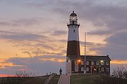
- Ambrose LightAmbrose LightAmbrose Light, often called Ambrose Tower, was a light station at the convergence of several major shipping lanes in Lower New York Bay, including Ambrose Channel, the primary passage for ships entering and departing the Port of New York and New Jersey....
, Lower New York BayLower New York BayLower New York Bay is that section of New York Bay south of the Narrows, the relatively narrow strait between the shores of Staten Island and Brooklyn. The southern end of the bay opens directly to the Atlantic Ocean between two spits of land, Sandy Hook, New Jersey, and Rockaway, Queens, on Long... - Barber's Point Light, Lake ChamplainLake ChamplainLake Champlain is a natural, freshwater lake in North America, located mainly within the borders of the United States but partially situated across the Canada—United States border in the Canadian province of Quebec.The New York portion of the Champlain Valley includes the eastern portions of...
- Barcelona (Portland Harbor) LightBarcelona (Portland Harbor) LightBarcelona Light, also known as Portland Harbor Light, is a lighthouse overlooking Barcelona Harbor on Lake Erie in the Town of Westfield, New York.-History:...
, PortlandPortland, New YorkPortland is a town in Chautauqua County, New York, United States. The population was 5,502 at the 2000 census.The Town of Portland is on the shore of Lake Erie west of the City of Dunkirk. The Lakeview Shock Incarceration Correctional Facility is within Portland. Because the residents of this...
Harbor, Lake ErieLake ErieLake Erie is the fourth largest lake of the five Great Lakes in North America, and the tenth largest globally. It is the southernmost, shallowest, and smallest by volume of the Great Lakes and therefore also has the shortest average water residence time. It is bounded on the north by the... - Blackwell Island LightBlackwell Island LightBlackwell Island Lighthouse, which is also known as Welfare Island Lighthouse and Roosevelt Island Lighthouse is a stone lighthouse built by New York City in 1872. It is at the northeast tip of Roosevelt Island in the East River in Lighthouse Park...
, New York CityNew York CityNew York is the most populous city in the United States and the center of the New York Metropolitan Area, one of the most populous metropolitan areas in the world. New York exerts a significant impact upon global commerce, finance, media, art, fashion, research, technology, education, and... - Bluff Point LightBluff Point LightBluff Point Light, also known as the Valcour Island Light, on Valcour Island in Lake Champlain was in service from its construction in 1874 until 1930 and was one of the last lighthouses on Lake Champlain to be named. It is now part of Adirondack State Park and operated as a museum by the Clinton...
, Valcour IslandValcour IslandValcour Island is an island in Lake Champlain in Clinton County, New York, USA. The island is mostly in the Town of Peru and partly in the Town of Plattsburgh, southeast of the City of Plattsburgh....
/Lake ChamplainLake ChamplainLake Champlain is a natural, freshwater lake in North America, located mainly within the borders of the United States but partially situated across the Canada—United States border in the Canadian province of Quebec.The New York portion of the Champlain Valley includes the eastern portions of... - Braddock Point LightBraddock Point LightBraddock Point Light was a lighthouse just west of Braddock Bay at Bogus Point on Lake Ontario in New York.-History:The lighthouse was established and lit in 1896 and was deactivated in 1954. The lighthouse was constructed out of red brick. The shape of the tower was octagonal. The original lens...
, Bogus Point, Lake OntarioLake OntarioLake Ontario is one of the five Great Lakes of North America. It is bounded on the north and southwest by the Canadian province of Ontario, and on the south by the American state of New York. Ontario, Canada's most populous province, was named for the lake. In the Wyandot language, ontarío means... - Brewerton Range Rear, Oneida LakeOneida LakeOneida Lake is the largest lake entirely within New York State . The lake is located northeast of Syracuse and near the Great Lakes. It serves as one of the links in the Erie Canal. It empties into the Oneida River which flows into the Oswego River which in turn flows into Lake Ontario...
- Buffalo (main) LightBuffalo (main) LightBuffalo Light is a lighthouse at the mouth of Buffalo River/Erie canal, directly across from the Erie basin marina, underneath the skyway in downtown Buffalo, New York.-History:...
, mouth of Buffalo RiverBuffalo River (New York)The Buffalo River is a river that empties into the eastern end of Lake Erie, one of the Great Lakes, by the City of Buffalo in the United States of America. This stream is called the Buffalo River only in the vicinity of the city and is known as Buffalo Creek as it flows through other parts of...
/Erie CanalErie CanalThe Erie Canal is a waterway in New York that runs about from Albany, New York, on the Hudson River to Buffalo, New York, at Lake Erie, completing a navigable water route from the Atlantic Ocean to the Great Lakes. The canal contains 36 locks and encompasses a total elevation differential of...
, under skyway in downtown BuffaloBuffalo, New YorkBuffalo is the second most populous city in the state of New York, after New York City. Located in Western New York on the eastern shores of Lake Erie and at the head of the Niagara River across from Fort Erie, Ontario, Buffalo is the seat of Erie County and the principal city of the... - Buffalo Harbor North and South entrance LightsBuffalo Harbor North and South entrance LightsBuffalo Harbor North and South entrance Lights are lighthouses located at the entrance to Buffalo harbor in New York. The south light is at Stony Point breakwater , and the North light was relocated....
- Buffalo Intake Crib Light
- Buffalo North breakwater East end LightBuffalo North breakwater East end LightThe Buffalo North breakwater East end Light was a lighthouse originally located on the North breakwater East End of Buffalo harbor, New York. It has since been relocated from the North Harbor entrance and sits on display near the Buffalo Main Light on the grounds of the United States Coast Guard...
- Buffalo North breakwater West end Light
- Cape Vincent breakwater East end LightCape Vincent LightCape Vincent Breakwater Light was a lighthouse on the breakwater protecting the harbor in the town of Cape Vincent, New York.It has been moved to the Town Highway Department on New York State Route 12E....
- Cayuga Inlet Light, Cayuga LakeCayuga LakeCayuga Lake is the longest of central New York's glacial Finger Lakes, and is the second largest in surface area and second largest in volume. It is just under 40 miles long. Its average width is 1.7 miles , and it is at its widest point near Aurora...
- Cayuga Inlet Breakwater Light, Cayuga LakeCayuga LakeCayuga Lake is the longest of central New York's glacial Finger Lakes, and is the second largest in surface area and second largest in volume. It is just under 40 miles long. Its average width is 1.7 miles , and it is at its widest point near Aurora...
- Cedar Island Light, East HamptonEast Hampton (town), New YorkThe Town of East Hampton is located in southeastern Suffolk County, New York, at the eastern end of the South Shore of Long Island. It is the easternmost town in the state of New York...
- Clayton Light, Town of ClaytonClayton (town), New YorkClayton is a town in Jefferson County, New York, USA. The population was 5,153 at the 2010 census. The town is named after John M. Clayton, a federal political leader from Delaware.The Town of Clayton contains a village named Clayton...
- Cold Spring Harbor Light, north shore of Long IslandLong IslandLong Island is an island located in the southeast part of the U.S. state of New York, just east of Manhattan. Stretching northeast into the Atlantic Ocean, Long Island contains four counties, two of which are boroughs of New York City , and two of which are mainly suburban...
- Coney Island (Nortons Point) Light, New York HarborNew York HarborNew York Harbor refers to the waterways of the estuary near the mouth of the Hudson River that empty into New York Bay. It is one of the largest natural harbors in the world. Although the U.S. Board of Geographic Names does not use the term, New York Harbor has important historical, governmental,...
main channel - Cooperstown Marina, CooperstownCooperstown, New YorkCooperstown is a village in Otsego County, New York, USA. It is located in the Town of Otsego. The population was estimated to be 1,852 at the 2010 census.The Village of Cooperstown is the county seat of Otsego County, New York...
, Otsego LakeOtsego LakeOtsego Lake is a small lake located in Otsego County, New York in the USA and is the source of the Susquehanna River. Cooperstown, New York is at the southern end. Glimmerglass State Park is located on the northeastern shore... - Coxsackie LightCoxsackie LightCoxsackie Light was a lighthouse near the town of Coxsackie, New York on the northerly end of the Low island northerly of Coxsackie island and on the westerly side of the main channel of the Hudson River....
, Hudson RiverHudson RiverThe Hudson is a river that flows from north to south through eastern New York. The highest official source is at Lake Tear of the Clouds, on the slopes of Mount Marcy in the Adirondack Mountains. The river itself officially begins in Henderson Lake in Newcomb, New York... - Crossover Island LightCrossover Island LightCrossover Island Light is a lighthouse on the Saint Lawrence River in New York state near the Canadian border.The lighthouse was established in 1848 and the last tower was first lit in 1882. The lighthouse was deactivated in 1941. The foundation is stone molehead and the lighthouse is made out of...
, St. Lawrence River - Crown Point LightCrown Point LightThe Crown Point Light on Lake Champlain at Crown Point enjoys the unique distinction of having been converted from a conventional lighthouse into a memorial to the exploration of the lake by Samuel de Champlain.-History:...
, Lake ChamplainLake ChamplainLake Champlain is a natural, freshwater lake in North America, located mainly within the borders of the United States but partially situated across the Canada—United States border in the Canadian province of Quebec.The New York portion of the Champlain Valley includes the eastern portions of... - Cumberland Head LightCumberland Head LightCumberland Head Light is a lighthouse on Lake Champlain's Cumberland Bay in New York state.The lighthouse was established in 1838 and the tower was first lit in 1868. The lighthouse was deactivated in 1934. The foundation of the lighthouse is concrete and limestone and the lighthouse itself is...
, Cumberland BayCumberland Head, New YorkCumberland Head is a census-designated place and region of the Town of Plattsburgh in Clinton County, New York, United States. The population was 1,627 at the 2010 census....
, Lake ChamplainLake ChamplainLake Champlain is a natural, freshwater lake in North America, located mainly within the borders of the United States but partially situated across the Canada—United States border in the Canadian province of Quebec.The New York portion of the Champlain Valley includes the eastern portions of... - Dunkirk Light, Point Gratiot, Lake ErieLake ErieLake Erie is the fourth largest lake of the five Great Lakes in North America, and the tenth largest globally. It is the southernmost, shallowest, and smallest by volume of the Great Lakes and therefore also has the shortest average water residence time. It is bounded on the north by the...
- Dunkirk Pierhead Light, Dunkirk harbor, Lake ErieLake ErieLake Erie is the fourth largest lake of the five Great Lakes in North America, and the tenth largest globally. It is the southernmost, shallowest, and smallest by volume of the Great Lakes and therefore also has the shortest average water residence time. It is bounded on the north by the...
- Eatons Neck LightStation Eatons NeckUnited States Coast Guard Station Eatons Neck is located on the northern tip of Eatons Neck on Long Island New York. It is the oldest Coast Guard Station in New York and the fourth oldest in the United States founded originally in 1849 by the New York Lifesaving Benevolent Association...
, Long IslandLong IslandLong Island is an island located in the southeast part of the U.S. state of New York, just east of Manhattan. Stretching northeast into the Atlantic Ocean, Long Island contains four counties, two of which are boroughs of New York City , and two of which are mainly suburban... - East Charity Shoal LightEast Charity Shoal LightEast Charity Shoals Light is a lighthouse located in Lake Ontario near the entrance to the Saint Lawrence River. The tower originally served Vermilion Light Station in Ohio but was removed after it was damaged in an ice storm. East Charity Shoals Light is not open to the public, but it is...
, Cape VincentCape Vincent (town), New YorkCape Vincent is a town in Jefferson County, New York, USA. The population was 2,777 at the 2010 census.The Town of Cape Vincent is located in the northwest part of the county. In the town is a village also called Cape Vincent. Both town and village are northwest of Watertown.- History :The town... - Elm Tree Beacon LightElm Tree Beacon LightElm Tree Beacon Light served as the front range with New Dorp Light as the rear to mark Swash Channel. The channel is now marked by Staten Island Light and West Bank Light....
- Esopus Meadows (middle Hudson River) LightEsopus Meadows LighthouseEsopus Meadows Lighthouse, nicknamed "Maid of the Meadows" and often simply referred to as the Esopus Light or Middle Hudson River Light is a lighthouse on the Hudson River near Esopus, New York...
- Execution Rocks LightExecution Rocks LighthouseExecution Rocks Light is a lighthouse in the middle of Long Island Sound on the border between New Rochelle and Sands Point, New York. It stands 55 feet tall, with a white light flashing every 10 seconds. The granite tower is painted white with a brown band around the middle...
, Long Island SoundLong Island SoundLong Island Sound is an estuary of the Atlantic Ocean, located in the United States between Connecticut to the north and Long Island, New York to the south. The mouth of the Connecticut River at Old Saybrook, Connecticut, empties into the sound. On its western end the sound is bounded by the Bronx... - Fairhaven Range Lights
- Fire Island Light, Fire IslandFire Island, New YorkFire Island is one of the outer barrier islands adjacent to the south shore of Long Island, New York. It is approximately long and varies between broad. Fire Island is part of Suffolk County. It comprises a number of hamlets, census-designated places , and villages, all of which lie within the...
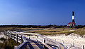
- Fort Niagara LightFort Niagara LightFort Niagara Light was a lighthouse on the Niagara River on the south shore of Lake Ontario in New York state.-History:The lighthouse was established in 1782 atop the "French Castle", a structure still located within Old Fort Niagara. The current tower was first lit in 1872, having been removed...
, Niagara RiverNiagara RiverThe Niagara River flows north from Lake Erie to Lake Ontario. It forms part of the border between the Province of Ontario in Canada and New York State in the United States. There are differing theories as to the origin of the name of the river...
south shore, Lake OntarioLake OntarioLake Ontario is one of the five Great Lakes of North America. It is bounded on the north and southwest by the Canadian province of Ontario, and on the south by the American state of New York. Ontario, Canada's most populous province, was named for the lake. In the Wyandot language, ontarío means... - Fort Tompkins LightFort Tompkins LightFort Tompkins Light was a lighthouse located on Staten Island, New York City, on the west side of the Narrows in New York Bay.The lighthouse was established by Fort Tompkins Military Base in 1828 to guide ships to Staten Island. The lighthouse did not keep records due to its close proximity to land...
, Staten IslandStaten IslandStaten Island is a borough of New York City, New York, United States, located in the southwest part of the city. Staten Island is separated from New Jersey by the Arthur Kill and the Kill Van Kull, and from the rest of New York by New York Bay... - Fort Wadsworth LightFort Wadsworth LightFort Wadsworth Light is a 1903 lighthouse built atop Battery Weed on Staten Island in New York Harbor. The light illuminates the Narrows, the entrance to the harbor. It is located under the Verrazano-Narrows Bridge...
, East Verrazano Narrows - Frenchman's Island, Oneida LakeOneida LakeOneida Lake is the largest lake entirely within New York State . The lake is located northeast of Syracuse and near the Great Lakes. It serves as one of the links in the Erie Canal. It empties into the Oneida River which flows into the Oswego River which in turn flows into Lake Ontario...
- Galloo Island LightGalloo Island LightGalloo Island Light is located on Galloo Island in Lake Ontario near Sacketts Harbor, New York. Most of the island and light tower is private property, with an easement for the Coast Guard for the light in the tower. There is a small Coast Guard Station on the island.It was added to the National...
, SW end of island in Lake OntarioLake OntarioLake Ontario is one of the five Great Lakes of North America. It is bounded on the north and southwest by the Canadian province of Ontario, and on the south by the American state of New York. Ontario, Canada's most populous province, was named for the lake. In the Wyandot language, ontarío means... - Genesee (Charlotte-Genesee/Rochester) LightCharlotte-Genesee LightThe Charlotte–Genesee Lighthouse is an 1822 stone octogonal lighthouse in the Charlotte neighborhood in northern Rochester. The 40 ft tower is located on Lake Ontario at the mouth of the Genesee River. It originally had 10 whale oil Argand lamps, which were replaced with a Fresnel lens in...
- Genesee East Pier Light, RochesterRochester, New YorkRochester is a city in Monroe County, New York, south of Lake Ontario in the United States. Known as The World's Image Centre, it was also once known as The Flour City, and more recently as The Flower City...
Harbor - Genesee North Pier Light, RochesterRochester, New YorkRochester is a city in Monroe County, New York, south of Lake Ontario in the United States. Known as The World's Image Centre, it was also once known as The Flour City, and more recently as The Flower City...
Harbor - Grand Island Range Front Light
- Grand Island Range Rear Light
- Horseshoe Reef Light
- Horton Point LightHorton Point LightHorton Point Light is a lighthouse on the north side of Eastern Long Island, New York near Southold.-History:The current lighthouse was established and the tower was first lit in 1857. The site is on a bluff above Long Island Sound. The tower was automated in 1933 and is now operational. The...
, Long IslandLong IslandLong Island is an island located in the southeast part of the U.S. state of New York, just east of Manhattan. Stretching northeast into the Atlantic Ocean, Long Island contains four counties, two of which are boroughs of New York City , and two of which are mainly suburban... - Hudson-Athens (Hudson city) Light, Middle Ground Flats, Hudson RiverHudson RiverThe Hudson is a river that flows from north to south through eastern New York. The highest official source is at Lake Tear of the Clouds, on the slopes of Mount Marcy in the Adirondack Mountains. The river itself officially begins in Henderson Lake in Newcomb, New York...
- Huntington Harbor LightHuntington Harbor LightHuntington Harbor Lighthouse formerly known as Lloyd Harbor Lighthouse is a lighthouse in Huntington Bay on Long Island, New York.The lighthouse was established in 1857 and the current tower was first lit in 1912. The light was automated in 1949 and is still operational. The foundation is cast...
, Huntington Bay, Long IslandLong IslandLong Island is an island located in the southeast part of the U.S. state of New York, just east of Manhattan. Stretching northeast into the Atlantic Ocean, Long Island contains four counties, two of which are boroughs of New York City , and two of which are mainly suburban... - Kings Point LightKings Point LightThe Kings Point Light is a private lighthouse owned and operated by the United States Merchant Marine Academy in Kings Point, New York. It is the lighthouse on top of the chapel that shines as a way to bring wayfaring sailors back home from at sea and students back from Long Island Sound, also...
- Kingsborough Community College Light, BrooklynBrooklynBrooklyn is the most populous of New York City's five boroughs, with nearly 2.6 million residents, and the second-largest in area. Since 1896, Brooklyn has had the same boundaries as Kings County, which is now the most populous county in New York State and the second-most densely populated...
- Latimer Reef LightLatimer Reef LightLatimer Reef Light is a sparkplug lighthouse on Latimer's Reef in Fishers Island Sound. The lighthouse is located one mile northwest of East Point on Fisher's Island, Suffolk County, New York...
, Fishers IslandFishers IslandFishers Island, approximately 9 miles long and 1 mile wide, is located at the eastern end of Long Island Sound, 2 miles off the southeastern coast of Connecticut across Fishers Island Sound...
Sound - Little Gull Island LightLittle Gull Island LightLittle Gull Island Light is a lighthouse on Little Gull Island, off Fisher's Island, New York in Long Island Sound.-History:The first lighthouse was a high tower established in 1806, which was replaced by the current conical tower and a second order Fresnel lens in 1869. The lighthouse was...
, Long Island SoundLong Island SoundLong Island Sound is an estuary of the Atlantic Ocean, located in the United States between Connecticut to the north and Long Island, New York to the south. The mouth of the Connecticut River at Old Saybrook, Connecticut, empties into the sound. On its western end the sound is bounded by the Bronx... - Little Red LighthouseLittle Red LighthouseThe Little Red Lighthouse, officially Jeffrey's Hook Light is a small lighthouse on the Hudson River in New York City. It was made famous by the 1942 children's book The Little Red Lighthouse and the Great Gray Bridge by Hildegarde Swift and Lynd Ward...
(Jeffrey's Hook Lighthouse), ManhattanManhattanManhattan is the oldest and the most densely populated of the five boroughs of New York City. Located primarily on the island of Manhattan at the mouth of the Hudson River, the boundaries of the borough are identical to those of New York County, an original county of the state of New York... - Orient Long Beach Bar LightOrient Long Beach Bar LightOrient Long Beach Bar Light is a lighthouse off Orient, New York. It is interesting because it was originally a screwpile lighthouse that was later converted to concrete caisson foundation. Its early appearance as a screwpile lighhouse gave it the nickname "Bug Light" as there were no other such...
, OrientOrient, New YorkOrient is a census-designated place in Suffolk County, New York, United States. The CDP's population was 709 at the 2000 census.Orient and Orient Point are used almost interchangeably...
Harbor - Myers Point Light, Cayuga LakeCayuga LakeCayuga Lake is the longest of central New York's glacial Finger Lakes, and is the second largest in surface area and second largest in volume. It is just under 40 miles long. Its average width is 1.7 miles , and it is at its widest point near Aurora...
- Montauk Point Light, Montauk Point State ParkMontauk Point State ParkMontauk Point State Park is located in the hamlet of Montauk, at the eastern tip of Long Island in the Town of East Hampton, Suffolk County, New York. Montauk Point is the easternmost extremity of the South Fork of Long Island, and thus also of New York State...
- Montauk Yacht Club Light
- New Dorp LightNew Dorp LightThe New Dorp Lighthouse is a decommissioned lighthouse located in the New Dorp section of, Staten Island, New York. Funds for the lighthouse were approved by Congress August 31, 1852 and the structure was completed in 1856...
, Staten IslandStaten IslandStaten Island is a borough of New York City, New York, United States, located in the southwest part of the city. Staten Island is separated from New Jersey by the Arthur Kill and the Kill Van Kull, and from the rest of New York by New York Bay...
Swash Channel rear range - North Brother Island LightNorth Brother Island LightNorth Brother Island Light is located on North Brother Island in the East River in New York.-Cultural:The Archives Center at the Smithsonian National Museum of American History has a collection of souvenir postcards of lighthouses and has digitized 272 of these and made them available online...
- North Dumpling LightNorth Dumpling LightNorth Dumpling Light is a lighthouse in Fisher's Island sound in Long Island Sound, New York.-History:The lighthouse was established in 1849 and the current tower was first lit in 1871. The lighthouse was deactivated in 1959. The foundation is wood pilings and stone and the construction is brick...
, Fishers IslandFishers IslandFishers Island, approximately 9 miles long and 1 mile wide, is located at the eastern end of Long Island Sound, 2 miles off the southeastern coast of Connecticut across Fishers Island Sound...
Sound - Oak Orchard LightOak Orchard LightOak Orchard Light was a lighthouse that operated on the shores of Lake Ontario, in New York, United States, at Point Breeze from 1871 to 1916. In 2010 a local community group built a historically accurate replica of the lighthouse near the original site....
- Ogdensburg Harbor LightOgdensburg Harbor LightOgdensburg Harbor LightCurrent Use: PRIVATELY OWNEDOwner/Manager: PRIVATE OWNEROpen to the Public? NOMiscellaneous:ADDITION TO TOWER 1900-History:...
, Light Point, St. Lawrence River - Olcott LightOlcott LightOlcott Light was built on a pier in Olcott, New York at Eighteen Mile Creek, named for being eighteen miles from the Niagara River. The light was no longer needed in the 1930s, and was moved to a local yacht club, where it resided until the early 1960s when it was destroyed...
, on Lake OntarioLake OntarioLake Ontario is one of the five Great Lakes of North America. It is bounded on the north and southwest by the Canadian province of Ontario, and on the south by the American state of New York. Ontario, Canada's most populous province, was named for the lake. In the Wyandot language, ontarío means... - Old Field Point LightOld Field Point LightOld Field Point Light is a lighthouse within the village of Old Field, New York between the entrances to Port Jefferson Harbor and Stony Brook Harbor on the north shore of Long Island....
- Old Orchard Shoal LightOld Orchard Shoal LightOld Orchard Shoal Light is a sparkplug lighthouse in lower New York Bay marking a large shoal area.The Fresnel lens was removed in 1950.-History:Old Orchard Shoal Light was completed and lit on April 25, 1893....
, Gedney Channel, Lower New York BayLower New York BayLower New York Bay is that section of New York Bay south of the Narrows, the relatively narrow strait between the shores of Staten Island and Brooklyn. The southern end of the bay opens directly to the Atlantic Ocean between two spits of land, Sandy Hook, New Jersey, and Rockaway, Queens, on Long... - Orient Point LightOrient Point LightOrient Point Light is a sparkplug lighthouse off Orient Point, New York.It was listed on the National Register of Historic Places in 2007.In June 2011, the General Services Administration made the Orient Point Light available at no cost to public organizations willing to preserve them...
("Coffee Pot"), Oyster Pond Reef, Plum Gut, Long IslandLong IslandLong Island is an island located in the southeast part of the U.S. state of New York, just east of Manhattan. Stretching northeast into the Atlantic Ocean, Long Island contains four counties, two of which are boroughs of New York City , and two of which are mainly suburban... - Oswego Harbor West Pierhead Lighthouse, mouth of Oswego RiverOswego River (New York)The Oswego River is a river in upstate New York in the United States. This river is the second-largest river flowing into Lake Ontario. James Fenimore Cooper’s novel The Pathfinder, or The Inland Sea is set in the Oswego River valley...
, Lake OntarioLake OntarioLake Ontario is one of the five Great Lakes of North America. It is bounded on the north and southwest by the Canadian province of Ontario, and on the south by the American state of New York. Ontario, Canada's most populous province, was named for the lake. In the Wyandot language, ontarío means... - Plattsburg Beacon
- Plum Island LightPlum Island LightPlum Island Light, also known as Plum Gut Light, is located on the western end of Plum Island, which lies eastof Orient Point which in turn is at the end of the North Fork of Long Island...
- Point Aux Roches LightPoint Aux Roches LightPoint Aux Roches Light, sometimes referred to as Pointe Au Roches or Point Au Roches, is a lighthouse on Lake Champlain in New York. It is just north of Point Au Roches State Park....
, Lake ChamplainLake ChamplainLake Champlain is a natural, freshwater lake in North America, located mainly within the borders of the United States but partially situated across the Canada—United States border in the Canadian province of Quebec.The New York portion of the Champlain Valley includes the eastern portions of... - Port of Genesee (Charlotte-Genesee) Light, Genesee RiverGenesee RiverThe Genesee River is a North American river flowing northward through the Twin Tiers of Pennsylvania and New York. The river provided the original power for the Rochester area's 19th century mills and still provides hydroelectric power for downtown Rochester....
/Lake OntarioLake OntarioLake Ontario is one of the five Great Lakes of North America. It is bounded on the north and southwest by the Canadian province of Ontario, and on the south by the American state of New York. Ontario, Canada's most populous province, was named for the lake. In the Wyandot language, ontarío means... - Barcelona (Portland Harbor) LightBarcelona (Portland Harbor) LightBarcelona Light, also known as Portland Harbor Light, is a lighthouse overlooking Barcelona Harbor on Lake Erie in the Town of Westfield, New York.-History:...
, south shore of Lake ErieLake ErieLake Erie is the fourth largest lake of the five Great Lakes in North America, and the tenth largest globally. It is the southernmost, shallowest, and smallest by volume of the Great Lakes and therefore also has the shortest average water residence time. It is bounded on the north by the... - Princes Bay LightPrinces Bay LightThe Prince's Bay Light is a lighthouse on the highest point of the southern shoreline of Staten Island, New York in the Pleasant Plains neighborhood. It is situated on a . bluff overlooking Raritan Bay with an attached brownstone cottage which served as the lightkeepers house...
, Staten IslandStaten IslandStaten Island is a borough of New York City, New York, United States, located in the southwest part of the city. Staten Island is separated from New Jersey by the Arthur Kill and the Kill Van Kull, and from the rest of New York by New York Bay... - Race Rock LightRace Rock LightRace Rock Light is a lighthouse on Race Rock Reef, southwest of Fishers Island, New York. The reef is a dangerous set of rocks off the coast of Fishers Island on Long Island Sound and was the site of many shipwrecks....
, Fishers IslandFishers IslandFishers Island, approximately 9 miles long and 1 mile wide, is located at the eastern end of Long Island Sound, 2 miles off the southeastern coast of Connecticut across Fishers Island Sound... - Robbins Reef Light, west side main channel, Upper New York BayUpper New York BayUpper New York Bay, or Upper Bay, is the traditional heart of the Port of New York and New Jersey, and often called New York Harbor. It is enclosed by the New York City boroughs of Manhattan, Brooklyn, and Staten Island and the Hudson County, New Jersey municipalities of Jersey City and Bayonne.It...
- Rock Island LightRock Island LightRock Island Light is a Lighthouse on Rock Island in the Saint Lawrence River in New York. It is currently owned by the New York State Parks. In 2007, the Council of Parks, Recreation and Historical Preservation received a $900,000 grant from the US Department of Transportation as part of the...
, St. Lawrence River/Lake OntarioLake OntarioLake Ontario is one of the five Great Lakes of North America. It is bounded on the north and southwest by the Canadian province of Ontario, and on the south by the American state of New York. Ontario, Canada's most populous province, was named for the lake. In the Wyandot language, ontarío means... - Romer Shoal LightRomer Shoal LightRomer Shoal Light is a sparkplug lighthouse in Lower New York Bay, on the north edge of the Swash Channel, about ¾ nm south of Ambrose Channel and 2½ nm north of Sandy Hook, New Jersey, in the entrance to New York Harbor...
, actually in New Jersey, but the Coast Guard lists it in New York - Rondout Creek (Kingston) lightRondout LightRondout Light is a lighthouse on the west side of the Hudson River at Kingston, New York.-Nomenclature:*The official name in the Coast Guard Light List is Rondout Creek Leading Light....
, KingstonKingston, New YorkKingston is a city in and the county seat of Ulster County, New York, USA. It is north of New York City and south of Albany. It became New York's first capital in 1777, and was burned by the British Oct. 16, 1777, after the Battles of Saratoga...
Point, Hudson RiverHudson RiverThe Hudson is a river that flows from north to south through eastern New York. The highest official source is at Lake Tear of the Clouds, on the slopes of Mount Marcy in the Adirondack Mountains. The river itself officially begins in Henderson Lake in Newcomb, New York... - Horse Island Light, Lake OntarioLake OntarioLake Ontario is one of the five Great Lakes of North America. It is bounded on the north and southwest by the Canadian province of Ontario, and on the south by the American state of New York. Ontario, Canada's most populous province, was named for the lake. In the Wyandot language, ontarío means...
- Sands Point Light
- Saugerties LightSaugerties LightSaugerties Light, known also as the Saugerties Lighthouse, is a lighthouse on the Hudson River north of Saugerties, New York.-History:When it was built in 1869, it replaced the earlier 1838 lighthouse. Its Coast Guard service was ended in 1954. It is currently managed by the non-profit Saugerties...
, Hudson RiverHudson RiverThe Hudson is a river that flows from north to south through eastern New York. The highest official source is at Lake Tear of the Clouds, on the slopes of Mount Marcy in the Adirondack Mountains. The river itself officially begins in Henderson Lake in Newcomb, New York...
at Esopus CreekEsopus CreekEsopus Creek is a tributary of the Hudson River that drains the east-central Catskill Mountains of the U.S. state of New York. From its source at Winnisook Lake on the slopes of Slide Mountain, the Catskills' highest peak, it flows across Ulster County to the Hudson at Saugerties. Many tributaries... - Selkirk (Salmon River) LightSelkirk LightSelkirk Lighthouse is located at mouth of the Salmon River in New York. It is one of only four lighthouses in the United States that retains its original bird-cage lantern.-Construction:...
, Salmon RiverSalmon River (New York)The Salmon River arises in north central New York State on the Tug Hill Plateau to the east of Lake Ontario. It flows westward off the plateau and there is a hydroelectric dam near Little America to create the Salmon River Reservoir. Both the Salmon River and Salmon River Reservoir are heavily...
entrance, Lake OntarioLake OntarioLake Ontario is one of the five Great Lakes of North America. It is bounded on the north and southwest by the Canadian province of Ontario, and on the south by the American state of New York. Ontario, Canada's most populous province, was named for the lake. In the Wyandot language, ontarío means... - Shinnecock LightShinnecock LightShinnecock Light was and is an important lighthouse on the south side of Long Island, New York. The name comes from the Shinnecock Indian Nation....
, Ponquogue, Great West Bay - Shoal Point Light, Fourth Lake, Adirondacks
- Sodus Outer LightSodus Outer LightSodus Outer Light is a lighthouse at the end of the western of the two piers defining the channel from Lake Ontario into Sodus Bay, New York. The light was first established in 1858. In 1938, the wood tower was replaced with the current cast iron structure....
, north end of west pier, entrance to Great Sodus BaySodus BaySodus Bay is a bay on the south shore of Lake Ontario, one of the Great Lakes. Sodus Bay is located in Wayne County, New York, USA. Most of the bay is in the Town of Huron, but the western part is in the Town of Sodus.... - Sodus Point LightSodus Point Light-History:Sodus Point Light is a lighthouse that was built on Sodus Point on Lake Ontario, New York. The lighthouse has been replaced by a modern skeleton tower. The lighthouse tower is a square, pyramidal cast iron tower on a concrete and stone pier. It is white with red trim. There is a 2.5...
, Sodus BaySodus BaySodus Bay is a bay on the south shore of Lake Ontario, one of the Great Lakes. Sodus Bay is located in Wayne County, New York, USA. Most of the bay is in the Town of Huron, but the western part is in the Town of Sodus....
, Lake OntarioLake OntarioLake Ontario is one of the five Great Lakes of North America. It is bounded on the north and southwest by the Canadian province of Ontario, and on the south by the American state of New York. Ontario, Canada's most populous province, was named for the lake. In the Wyandot language, ontarío means... - South Buffalo South Side Light, breakwater, south side of main south entrance to BuffaloBuffalo, New YorkBuffalo is the second most populous city in the state of New York, after New York City. Located in Western New York on the eastern shores of Lake Erie and at the head of the Niagara River across from Fort Erie, Ontario, Buffalo is the seat of Erie County and the principal city of the...
harbor - Split Rock Point Light, Whallon Bay, Lake ChamplainLake ChamplainLake Champlain is a natural, freshwater lake in North America, located mainly within the borders of the United States but partially situated across the Canada—United States border in the Canadian province of Quebec.The New York portion of the Champlain Valley includes the eastern portions of...
- Staten Island LightStaten Island LightThe Staten Island Range Light , serves as the rear range light companion to the West Bank Lighthouse. The 90-foot tower is located on Staten Island’s Richmond Hill at a point that is 141 feet above sea level and over five miles northwest of the West Bank Lighthouse...
- Statue of LibertyStatue of LibertyThe Statue of Liberty is a colossal neoclassical sculpture on Liberty Island in New York Harbor, designed by Frédéric Bartholdi and dedicated on October 28, 1886...
, Upper New York BayUpper New York BayUpper New York Bay, or Upper Bay, is the traditional heart of the Port of New York and New Jersey, and often called New York Harbor. It is enclosed by the New York City boroughs of Manhattan, Brooklyn, and Staten Island and the Hudson County, New Jersey municipalities of Jersey City and Bayonne.It... - Stepping Stones Light
- Stony Point (Henderson) LightStony Point (Henderson) LightFor the lighthouse on the Hudson River, see Stony Point Light.STONY POINT LIGHT State: NEW YORKLocation: HENDERSON BAY / LAKE ONTARIONearest City: HENDERSONCounty: JEFFERSONU.S.C.G...
, Henderson Bay, Lake OntarioLake OntarioLake Ontario is one of the five Great Lakes of North America. It is bounded on the north and southwest by the Canadian province of Ontario, and on the south by the American state of New York. Ontario, Canada's most populous province, was named for the lake. In the Wyandot language, ontarío means... - Stony Point lightStony Point LighthouseFor the lighthouse on Lake Ontario, see Stony Point Light.The Stony Point Light is the oldest lighthouse on the Hudson River. It is located at the Stony Point Battlefield in Stony Point, New York....
, Hudson RiverHudson RiverThe Hudson is a river that flows from north to south through eastern New York. The highest official source is at Lake Tear of the Clouds, on the slopes of Mount Marcy in the Adirondack Mountains. The river itself officially begins in Henderson Lake in Newcomb, New York... - Stuyvesant LightStuyvesant LightStuyvesant Light was also known as Kinderhook Light.In 1835, the lightkeeper was John Carroll, born in New York and paid $300 for the year....
, Hudson RiverHudson RiverThe Hudson is a river that flows from north to south through eastern New York. The highest official source is at Lake Tear of the Clouds, on the slopes of Mount Marcy in the Adirondack Mountains. The river itself officially begins in Henderson Lake in Newcomb, New York... - Sunken Rock LightSunken Rock LightSunken Rock Light was converted to solar power in 1988. It is maintained by the St. Lawrence Seaway Development Corporation pursuant to an agreement with the U.S. Coast Guard authorized under 14 USC 81.-External links:* * *...
, Bush Island, St. Lawrence River - Tarrytown (Sleepy Hollow) LightTarrytown (Sleepy Hollow) LightTarrytown Light, also known as Kingsland Point Light and Sleepy Hollow Light, is a sparkplug lighthouse on the east side of the Hudson River in Sleepy Hollow, New York, United States. It a conical steel structure erected in the 1880s...
, Hudson RiverHudson RiverThe Hudson is a river that flows from north to south through eastern New York. The highest official source is at Lake Tear of the Clouds, on the slopes of Mount Marcy in the Adirondack Mountains. The river itself officially begins in Henderson Lake in Newcomb, New York...
, south of Kingsland - Thirty Mile Point LightThirty Mile Point LightThe Thirty Mile Point Light is currently part of the Golden Hill State Park, a New York State Park.. The lighthouse is open to the public. It gets its name because it is the point 30 miles east of the Niagara River. Lake Ontario can bee seen from the top...
, Lake OntarioLake OntarioLake Ontario is one of the five Great Lakes of North America. It is bounded on the north and southwest by the Canadian province of Ontario, and on the south by the American state of New York. Ontario, Canada's most populous province, was named for the lake. In the Wyandot language, ontarío means... - (Three) Sisters Island Light, St. Lawrence River
- Throgs Neck Light, New York CityNew York CityNew York is the most populous city in the United States and the center of the New York Metropolitan Area, one of the most populous metropolitan areas in the world. New York exerts a significant impact upon global commerce, finance, media, art, fashion, research, technology, education, and...
- Tibbetts Point LightTibbetts Point LightThe Tibbetts Point Lighthouse is located in Cape Vincent , New York. The land upon which the lighthouse stands is a part of a grant of land to Captain John Tibbetts of Troy, New York.The lighthouse is a circular tower that stands above the water...
, St. Lawrence River, Lake OntarioLake OntarioLake Ontario is one of the five Great Lakes of North America. It is bounded on the north and southwest by the Canadian province of Ontario, and on the south by the American state of New York. Ontario, Canada's most populous province, was named for the lake. In the Wyandot language, ontarío means... - Titanic MemorialTitanic Memorial (New York City)The Titanic Memorial is a lighthouse built, due in part to the instigation of Margaret Brown, to remember the people who died on the RMS Titanic on April 15, 1912.- History :The lighthouse was originally erected by public subscription in 1913...
, South Street SeaportSouth Street SeaportThe South Street Seaport is a historic area in the New York City borough of Manhattan, located where Fulton Street meets the East River, and adjacent to the Financial District. The Seaport is a designated historic district, distinct from the neighboring Financial District...
, New York CityNew York CityNew York is the most populous city in the United States and the center of the New York Metropolitan Area, one of the most populous metropolitan areas in the world. New York exerts a significant impact upon global commerce, finance, media, art, fashion, research, technology, education, and... - Verona Beach (Sylvan Beach) Light, Oneida LakeOneida LakeOneida Lake is the largest lake entirely within New York State . The lake is located northeast of Syracuse and near the Great Lakes. It serves as one of the links in the Erie Canal. It empties into the Oneida River which flows into the Oswego River which in turn flows into Lake Ontario...
- West Bank LightWest Bank LightWest Bank Light is in Lower New York Bay and acts as the front range light for the Ambrose Channel. It is currently active and not open to the public.The tower was built in 1901 and heightened in 1908...
, Ambrose ChannelAmbrose ChannelAmbrose Channel is the main shipping channel in and out of the Port of New York and New Jersey. The channel is considered to be part of Lower New York Bay and is located several miles off the coasts of Sandy Hook in New Jersey and Breezy Point, Queens in New York...
, Lower New York BayLower New York BayLower New York Bay is that section of New York Bay south of the Narrows, the relatively narrow strait between the shores of Staten Island and Brooklyn. The southern end of the bay opens directly to the Atlantic Ocean between two spits of land, Sandy Hook, New Jersey, and Rockaway, Queens, on Long...
(range front) - Whitestone Point Light, Whitestone Point, southerly side of East RiverEast RiverThe East River is a tidal strait in New York City. It connects Upper New York Bay on its south end to Long Island Sound on its north end. It separates Long Island from the island of Manhattan and the Bronx on the North American mainland...
North Carolina
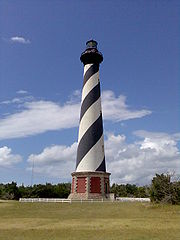
- Bald Head Light, Cape Fear RiverCape Fear RiverThe Cape Fear River is a long blackwater river in east central North Carolina in the United States. It flows into the Atlantic Ocean near Cape Fear, from which it takes its name. The overall water quality of the river is continuously measured and monitored by and conducted by the , , and the...
Inlet - Bodie Island LightBodie Island LightThe current Bodie Island Lighthouse is the third that has stood in this vicinity of Bodie Island on the Outer Banks in North Carolina and was built in 1872. It stands tall and is located on the Roanoke Sound side of the first island that is part of the Cape Hatteras National Seashore. The...
, Bodie IslandBodie IslandBodie Island is a long, narrow barrier peninsula that forms the northernmost portion of the Outer Banks of North Carolina. The land that is most commonly referred to as Bodie Island was at one time a true island, however the inlet separating it from the Currituck Banks peninsula in the north closed...
, Outer BanksOuter BanksThe Outer Banks is a 200-mile long string of narrow barrier islands off the coast of North Carolina, beginning in the southeastern corner of Virginia Beach on the east coast of the United States.... - Cape Fear Light, Cape Fear RiverCape Fear RiverThe Cape Fear River is a long blackwater river in east central North Carolina in the United States. It flows into the Atlantic Ocean near Cape Fear, from which it takes its name. The overall water quality of the river is continuously measured and monitored by and conducted by the , , and the...
Inlet - Cape Hatteras LightCape Hatteras LightCape Hatteras Light is a lighthouse located on Hatteras Island in the Outer Banks of North Carolina near the community of Buxton, and is part of the Cape Hatteras National Seashore....
, Hatteras IslandHatteras IslandHatteras Island is a barrier island located off the North Carolina coast. Dividing the Atlantic Ocean and the Pamlico Sound, it runs parallel to the coast, forming a bend at Cape Hatteras. It is part of North Carolina's Outer Banks and includes the towns of Rodanthe, Waves, Salvo, Avon, Buxton,...
, Outer BanksOuter BanksThe Outer Banks is a 200-mile long string of narrow barrier islands off the coast of North Carolina, beginning in the southeastern corner of Virginia Beach on the east coast of the United States.... - Cape Lookout Light, Cape LookoutCape Lookout (North Carolina)This article is about the Cape Lookout in North Carolina. See Cape Lookout for other places with a similar name. Cape Lookout is southern point of the Core Banks, one of the natural barrier islands on the Atlantic coast of North Carolina, USA. delimits Onslow Bay to the west from Raleigh Bay to...
, Outer BanksOuter BanksThe Outer Banks is a 200-mile long string of narrow barrier islands off the coast of North Carolina, beginning in the southeastern corner of Virginia Beach on the east coast of the United States.... - Croatan Shoal Light
- Currituck Beach LightCurrituck Beach LightThe Currituck Beach Light is a lighthouse located on the Outer Banks in Corolla, North Carolina. An example of Gothic Revival architecture, the Currituck Beach Light was added to the National Register of Historic Places on October 15, 1973.-History:...
, Corolla Beach, Outer BanksOuter BanksThe Outer Banks is a 200-mile long string of narrow barrier islands off the coast of North Carolina, beginning in the southeastern corner of Virginia Beach on the east coast of the United States.... - Federal Point LightFederal Point LightFederal Point Light was a lighthouse at Federal Point near Kure Beach in New Hanover County, North Carolina. It was an active light from about 1866 to around 1879....
, Pleasure IslandPleasure Island (North Carolina)Pleasure Island is a coastal island in Southeastern North Carolina, USA south of Wilmington. The coastal towns of Carolina Beach and Kure Beach, as well as the annexed community of Wilmington Beach, are located on the island... - Hatteras BeaconHatteras BeaconThe Hatteras Beacon was a small lighthouse at Cape Point near Cape Hatteras, North Carolina. It was attached to the Cape Hatteras Light Station.-History:...
, near Cape HatterasCape HatterasCape Hatteras is a cape on the coast of North Carolina. It is the point that protrudes the farthest to the southeast along the northeast-to-southwest line of the Atlantic coast of North America... - Diamond Shoal LightDiamond Shoal LightDiamond Shoal Light was an off-shore lighthouse marking Diamond Shoals off Cape Hatteras.-History:Diamond Shoals, which extend many miles out from Cape Hatteras, is considered to be one of the most dangerous spots on the Atlantic seaboard. While a light was exhibited from the cape itself from 1804,...
- Frying Pan Shoals LightFrying Pan Shoals LightFrying Pan Shoals Light Tower is a decommissioned lighthouse located approximately southeast of Southport, North Carolina.The light tower is modeled after a steel oil drilling platform, known as a “Texas Tower” on top of four...
- Laurel Point Light
- Long Point Beacon Light
- Neuse River Light
- Oak Island Light, Oak IslandOak Island (North Carolina)Oak Island is a barrier island on the Atlantic coast of southeastern North Carolina in Brunswick County. The island contains the towns of Oak Island and Caswell Beach as well as the North Carolina Baptist Assembly and a United States Coast Guard station, which is home to the Oak Island Lighthouse...
- Ocracoke Island Light, Ocracoke Island, Outer BanksOuter BanksThe Outer Banks is a 200-mile long string of narrow barrier islands off the coast of North Carolina, beginning in the southeastern corner of Virginia Beach on the east coast of the United States....
- Pamlico Point Shoal Light
- Price Creek LightPrice Creek LightThe Price Creek Lighthouse, also known as the Price's Creek Lighthouse, is a structure located near Southport, North Carolina. It was one of two range lights at Price Creek in a series of lights to guide ships from Cape Fear to Wilmington, North Carolina....
, SouthportSouthport, North CarolinaSouthport is a city in Brunswick County, North Carolina, near the mouth of the Cape Fear River. It is part of the Wilmington Metropolitan Statistical Area... - Roanoke Marshes LightRoanoke Marshes LightRoanoke Marshes Light was a screw-pile lighthouse in North Carolina.-History:Little is recorded about this light, which was replaced in 1955 with an automated light on a shorter tower. It marks the south entrance to the channel through Croatan Sound, to the east of a marshy shoal extending from the...
- Roanoke River LightRoanoke River LightThe Roanoke River Light is a historic lighthouse which once stood in Albemarle Sound at the mouth of the Roanoke River in North Carolina. The only surviving screw-pile lighthouse in the state, it has since been moved twice, and a replica of a predecessor light has been erected at a fourth...
- Wade Point LightWade Point LightThe Wade Point Light was a screw-pile lighthouse in North Carolina.-History:Lightship "M" was stationed at the mouth of the Pasquotank River off Albemarle Sound beginning in 1826. In 1855 it was replaced by a square screw-pile structure...
Ohio
- Ashtabula Harbor LightAshtabula Harbor LightAshtabula Harbor Light is a lighthouse in Ashtabula, Ohio. It was listed in the National Register on August 8, 1983.-History:...
, AshtabulaAshtabula, OhioAs of the census of 2000, there were 20,962 people, 8,435 households, and 5,423 families residing in the city. The population density was 2,775.9 people per square mile . There were 9,151 housing units at an average density of 1,211.8 per square mile... - Cedar Point LightCedar Point Light (Ohio)The Cedar Point Light is a restored lighthouse on the grounds of the Cedar Point Amusement Park in Sandusky, Ohio, USA. The original lighthouse at the site was built in 1839, and a front range light was added to the station in 1853. A new lighthouse, the structure which stands today, was completed...
, SanduskySandusky, OhioSandusky is a city in the U.S. state of Ohio and the county seat of Erie County. It is located in northern Ohio and is situated on the shores of Lake Erie, almost exactly half-way between Toledo to the west and Cleveland to the east.... - Cleveland west breakwater/East pierhead Lights, ClevelandCleveland, OhioCleveland is a city in the U.S. state of Ohio and is the county seat of Cuyahoga County, the most populous county in the state. The city is located in northeastern Ohio on the southern shore of Lake Erie, approximately west of the Pennsylvania border...
- Cleveland east entrance Light, Cleveland
- Conneaut west Light, ConneautConneaut, OhioAs of the census of 2000, there were 12,485 people, 5,038 households, and 3,410 families residing in the city. The population density was 473.4 people per square mile . There were 5,710 housing units at an average density of 216.5 per square mile...
- Grand River (Fairport Harbor) LightGrand River (Fairport Harbor) LightThe Grand River Light is located in the village of Fairport Harbor, Ohio. The lighthouse was built in 1871 and has a 60 foot tower with a detached keeper's house...
, Fairport HarborFairport Harbor, OhioFairport Harbor is a village in Lake County, Ohio, United States, along Lake Erie at the mouth of the Grand River. The population was 3,180 at the 2000 census.... - Fairport Harbor West Breakwater Light, Fairport Harbor
- Green Island LightGreen Island Light (Ohio)The Green Island Light is a lighthouse located on Green Island in Lake Erie, U.S. state of Ohio, to the west of the Bass Islands. Abandoned since its deactivation in 1939, it survives as a hollow shell near the existing skeleton tower.-History:...
, Green IslandGreen Island (Ohio)Green Island is a small island of the U.S. state of Ohio, in Lake Erie. It is located approximately three miles southwest of Put-in-Bay.- History :... - Huron Harbor Light, HuronHuron, OhioHuron is a city in Erie County, Ohio, United States. The population was 7,958 at the 2000 census. It is part of the Sandusky, Ohio Metropolitan Statistical Area.-History and culture:...
- Lorain West Breakwater Light, LorainLorain, OhioLorain is a city in Lorain County, Ohio, United States. The municipality is located in northeastern Ohio on Lake Erie, at the mouth of the Black River, about 30 miles west of Cleveland....
- Marblehead Light, MarbleheadMarblehead, OhioMarblehead is a village in Ottawa County, Ohio, United States. The population was 762 at the 2000 census.It sits at the tip of the Marblehead Peninsula, which divides Lake Erie proper from Sandusky Bay...
- Port Clinton Light, Port ClintonPort Clinton, OhioPort Clinton is a city in and the county seat of Ottawa County, Ohio, United States. The population was 6,056 at the 2010 census. The city has been nicknamed the "Walleye Capital of the World."...
- Sandusky Harbor Light, SanduskySandusky, OhioSandusky is a city in the U.S. state of Ohio and the county seat of Erie County. It is located in northern Ohio and is situated on the shores of Lake Erie, almost exactly half-way between Toledo to the west and Cleveland to the east....
- South Bass Island LightSouth Bass Island LightSouth Bass Island Light is a lighthouse on the southern end of its eponymous island in Lake Erie. It was listed in the National Register of Historic Places on April 5, 1990 and is thought to be the only lighthouse in the United States that is owned by a university - Ohio State.-History:Increasing...
, South Bass IslandSouth Bass IslandSouth Bass Island is a small island in western Lake Erie, and a part of Ottawa County, Ohio, United States. It is the southernmost of the three Bass Islands and located 12 miles from the south shore of Lake Erie. It is the third largest island in the Lake Erie Islands. The island is a popular... - Toledo Harbor Light, ToledoToledo, OhioToledo is the fourth most populous city in the U.S. state of Ohio and is the county seat of Lucas County. Toledo is in northwest Ohio, on the western end of Lake Erie, and borders the State of Michigan...
Harbor - Turtle Island LightTurtle Island (Lake Erie)__NOEDITSECTION__Turtle Island is a remote island in the western portion of Lake Erie in the United States. The island has unique political status, as its ownership is divided between the U.S. states of Michigan and Ohio, even though the island has no residents or use. The island is located...
- Vermilion Light, VermilionVermilion, OhioVermilion is a city in Erie and Lorain counties in Ohio, on the North Coast of the U.S.A. The population was 10,927 at the 2000 census. The current mayor is Eileen Bulan...
- West Sister Island Light
Oklahoma
- Lake Hefner Lighthouse, Oklahoma City, OklahomaOklahoma City, OklahomaOklahoma City is the capital and the largest city in the state of Oklahoma. The county seat of Oklahoma County, the city ranks 31st among United States cities in population. The city's population, from the 2010 census, was 579,999, with a metro-area population of 1,252,987 . In 2010, the Oklahoma...
Notable faux lighthouses
- Centennial Lighthouse, Elk City, OklahomaElk City, OklahomaElk City is a city in Beckham County, Oklahoma, United States. The population was 11,693 at the 2010 census. Elk City is located on Interstate 40 and Historic U.S. Route 66 in Western Oklahoma, approximately west of Oklahoma City and east of Amarillo....
Oregon
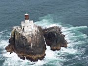
- Cape Arago LightCape Arago LightThe Cape Arago Light is a lighthouse located in Charleston, Oregon. It is located north of Cape Arago.-History:...
, Coos CountyCoos County, Oregon-National protected areas:*Bandon Marsh National Wildlife Refuge*Oregon Islands National Wildlife Refuge *Siskiyou National Forest *Siuslaw National Forest - Incorporated cities:- Unincorporated communities and CDPs:-See also:... - Cape Blanco LightCape Blanco LightCape Blanco Light is a lighthouse located on Cape Blanco, Oregon, United States.-Construction of the light:In a deed recorded in 1867, John D. and Mary West sold the United States a tract of land...
, Curry CountyCurry County, OregonCurry County is a county located in the U.S. state of Oregon. In 2010, its population was 22,364. The county is named for George Law Curry, a governor of the Oregon Territory. The seat of the county is Gold Beach.-Economy:... - Cape Meares LightCape Meares LightThe Cape Meares Light is an inactive lighthouse on the coast of Oregon. It is located on Cape Meares just south of Tillamook Bay. It is open to the public.-History:Built in 1890, Cape Meares Light served as the light station for Tillamook Bay...
, Tillamook CountyTillamook County, OregonTillamook County is a county located in the U.S. state of Oregon. The county is named for the Tillamook, a Native American tribe who were living in the area in the early 19th century at the time of European American settlement. In 2010, the county's population was 25,250... - Cleft of the Rock LightCleft of the Rock LightCleft of the Rock Light is a privately owned lighthouse located on the Pacific coast of the U.S. state of Oregon, south of Yachats on Cape Perpetua.It was built in 1976 by former Tillamook Rock Light attendant and lighthouse historian James A...
, private - Coquille River LightCoquille River LightCoquille River Light is a lighthouse located near Bandon, Oregon, United States. It is currently maintained by the Oregon Parks and Recreation Department as a part of Bullards Beach State Park.-History:...
, Coos CountyCoos County, Oregon-National protected areas:*Bandon Marsh National Wildlife Refuge*Oregon Islands National Wildlife Refuge *Siskiyou National Forest *Siuslaw National Forest - Incorporated cities:- Unincorporated communities and CDPs:-See also:... - Desdemona Sands LightDesdemona Sands LightDesdemona Sands Light was a lighthouse located on the Pacific coast of the U.S. state of Oregon, at the mouth of the Columbia River to aid navigation of the Columbia Bar.It was built in 1901or 1902as a replacement for Point Adams Light...
, Clatsop CountyClatsop County, OregonClatsop County is a county located in the U.S. state of Oregon. The county is named for the Clatsop tribe of Native Americans, who lived along the coast of the Pacific Ocean prior to European settlement. As of 2010, the population was 37,039. The county seat is Astoria.-Economy:The principal... - Heceta Head LightHeceta Head LightHeceta Head Light is a lighthouse located on the Oregon Coast north of Florence, Oregon and south of Yachats, Oregon, United States. It is located at Heceta Head Lighthouse State Scenic Viewpoint midway up a 205-foot tall headland...
, Lane CountyLane County, Oregon-National protected areas:*Oregon Islands National Wildlife Refuge *Siuslaw National Forest *Umpqua National Forest *Willamette National Forest -Government:... - Lightship ColumbiaLightship ColumbiaUnited States lightship Columbia is a lightship located in Astoria, Oregon, United States of America. The Columbia was formerly moored near the mouth of the Columbia River.-History:...
, Clatsop CountyClatsop County, OregonClatsop County is a county located in the U.S. state of Oregon. The county is named for the Clatsop tribe of Native Americans, who lived along the coast of the Pacific Ocean prior to European settlement. As of 2010, the population was 37,039. The county seat is Astoria.-Economy:The principal...
(now a museum ship, previously anchored outside three mile zone) - Point Adams LightPoint Adams LightPoint Adams Light was a lighthouse near the mouth of the Columbia River on the Oregon Coast of the United States. It operated from February 15, 1875 until 1899, when it became obsolete by the extension of the south jetty and the establishment of the Lightship Columbia in 1892...
, demolished - Port of Brookings Light, private
- Tillamook Rock LightTillamook Rock LightTillamook Rock Light is a deactivated lighthouse on the Oregon Coast of the United States. It is located approximately offshore from Tillamook Head, and south of the Columbia River, situated on less than acre of basalt rock in the Pacific Ocean. The construction of the lighthouse was commissioned...
, Clatsop CountyClatsop County, OregonClatsop County is a county located in the U.S. state of Oregon. The county is named for the Clatsop tribe of Native Americans, who lived along the coast of the Pacific Ocean prior to European settlement. As of 2010, the population was 37,039. The county seat is Astoria.-Economy:The principal... - Umpqua River LightUmpqua River LightThe Umpqua River Light is a lighthouse on the Oregon Coast of the United States, located at the mouth of the Umpqua River on Winchester Bay, in Douglas County, Oregon.-History:...
, Douglas CountyDouglas County, Oregon-National protected areas:* Crater Lake National Park * Rogue River-Siskiyou National Forest * Siuslaw National Forest * Umpqua National Forest * Willamette National Forest -Adjacent counties:* Lane County, Oregon -... - Warrior Rock LightWarrior Rock LightWarrior Rock Light is a lighthouse on Sauvie Island in the U.S. state of Oregon, which helps guide river traffic on the Columbia River around the Portland, Oregon area. It once contained the Pacific Northwest's oldest fog bell...
, on Sauvie IslandSauvie IslandSauvie Island, in the U.S. state of Oregon, originally Wapato Island or Wappatoo Island, is the largest island along the Columbia River, at 26,000 acres , and the largest river island in the United States...
in the Columbia RiverColumbia RiverThe Columbia River is the largest river in the Pacific Northwest region of North America. The river rises in the Rocky Mountains of British Columbia, Canada, flows northwest and then south into the U.S. state of Washington, then turns west to form most of the border between Washington and the state... - Willamette River LightWillamette River LightThe Willamette River Light was a navigational lighthouse at the mouth of the Willamette River in the U.S. state of Oregon. It existed as a lighthouse with keeper from 1895 to 1935, and as an unattended light from 1935 until it burned down in the 1950s....
, mouth of the Willamette RiverWillamette RiverThe Willamette River is a major tributary of the Columbia River, accounting for 12 to 15 percent of the Columbia's flow. The Willamette's main stem is long, lying entirely in northwestern Oregon in the United States...
at the Columbia River - Yaquina Bay LightYaquina Bay LightThe Yaquina Bay Light is a lighthouse built in 1871—soon after the founding of the city of Newport, Oregon, United States. It is located on the north side of Yaquina Bay, the most populated port between Puget Sound and San Francisco at the time.-History:...
, NewportNewport, OregonNewport is a city in Lincoln County, Oregon, United States. It was incorporated in 1882, though the name dates back to the establishment of a post office in 1868... - Yaquina Head LightYaquina Head LightThe Yaquina Head Light, also known early in its existence as the Cape Foulweather Lighthouse, is a lighthouse on the Oregon Coast of the United States. It is located in Lincoln County, near the mouth of the Yaquina River near Newport at Yaquina Head. The tower stands tall, and is the tallest...
, Lincoln CountyLincoln County, Oregon-National protected areas:*Oregon Islands National Wildlife Refuge *Siletz Bay National Wildlife Refuge*Siuslaw National Forest -Demographics:...
Pennsylvania
- Erie Harbor North Pier LightErie Harbor North Pier LightThe Erie Harbor North Pier Light, also known as the Presque Isle North Pier Light, is one of the three lighthouses near Erie, Pennsylvania in the United States...
, Presque IslePresque Isle State ParkPresque Isle State Park is a Pennsylvania state park on an arching sandy peninsula that juts into Lake Erie, west of the city of Erie, in Millcreek Township, Erie County, Pennsylvania, in the United States. The peninsula sweeps northeastward, surrounding Presque Isle Bay along the park's... - Erie Land LightErie Land LightThe Erie Land Light, also known as the Old Presque Isle Light, is a lighthouse in Erie, Pennsylvania. It is one of the three lighthouses in Erie, along with the Presque Isle Light and the North Pier Light. The lighthouse is located in Lighthouse Park at the end of Lighthouse Street.The lighthouse...
, ErieErie, PennsylvaniaErie is a city located in northwestern Pennsylvania in the United States. Named for the lake and the Native American tribe that resided along its southern shore, Erie is the state's fourth-largest city , with a population of 102,000... - Presque Isle LightPresque Isle LightThe Presque Isle Light is one of the three lighthouses in Erie, Pennsylvania. It was built in 1872 and was listed on the National Register of Historic Places on August 4, 1983.- History :...
, Presque IslePresque Isle State ParkPresque Isle State Park is a Pennsylvania state park on an arching sandy peninsula that juts into Lake Erie, west of the city of Erie, in Millcreek Township, Erie County, Pennsylvania, in the United States. The peninsula sweeps northeastward, surrounding Presque Isle Bay along the park's... - Turtle Rock Lighthouse, PhiladelphiaPhiladelphia, PennsylvaniaPhiladelphia is the largest city in the Commonwealth of Pennsylvania and the county seat of Philadelphia County, with which it is coterminous. The city is located in the Northeastern United States along the Delaware and Schuylkill rivers. It is the fifth-most-populous city in the United States,...
In addition, lists:
- Erie Yacht ClubErie Yacht ClubThe Erie Yacht Club, located on the far southwestern shore of Presque Isle Bay in Erie, Pennsylvania, is one of the oldest yacht clubs in America.-History:...
- Erie Harbor Pierhead (Presque Isle North Pier) (2)
- Erie Pierhead Light
Southeastern Pennsylvania Lighthouses
Schuylkill River
Schuylkill River
The Schuylkill River is a river in Pennsylvania. It is a designated Pennsylvania Scenic River.The river is about long. Its watershed of about lies entirely within the state of Pennsylvania. The source of its eastern branch is in the Appalachian Mountains at Tuscarora Springs, near Tamaqua in...
Lighthouse
- Turtle Rock LightTurtle Rock LightThe Turtle Rock Light is a lighthouse built in 1887 to aid traffic on the Schuylkill River near Philadelphia, Pennsylvania. The lighthouse was constructed by Frank Thurwanger at a cost of $2,663 on an area of land just west of Boathouse Row. The lighthouse has a hexagonal lantern room with an...
- Delaware River Lighthouse
- Chester (Schooner Ledge) Range Rear (3)
- Chester (Schooner Ledge) Range Front (3)
Notable faux lighthouses:
- Sherman Memorial (Tionesta)
Lost lighthouses:
- Fort Mifflin Blockhouse
- Horseshoe Lower Range Front (1881-?), Horseshoe Upper Range Front (1881–1931), and Horseshoe Rear (1881–1920), Delaware River. ARLHS USA-384, 1132, and 385, respectively.
- Schooner Ledge Range Front (1880-about 1915), Delaware River. ARLHS USA-169.
- Schuylkill River Range Front and Schuylkill River Range Rear (1875-about 1912), mouth of Schuylkill River. ARLHS USA-1206 and 1207.
Rhode Island
- Beavertail Light, Conanicut IslandConanicut IslandConanicut Island is the second largest island in Narragansett Bay, in the state of Rhode Island. It is connected on the east to Newport, Rhode Island, on Aquidneck Island by the Claiborne Pell Bridge, commonly known as the Newport Bridge, and on the west to North Kingstown, Rhode Island, on the...
, JamestownJamestown, Rhode IslandJamestown is a town located in Newport County, Rhode Island, in the United States. The population was 5,405 at the 2010 census. Jamestown is situated almost entirely on Conanicut Island, the second largest island in Narragansett Bay.-History:... - Block Island (North) Light
- Block Island Southeast LightBlock Island Southeast LightBlock Island Southeast Light is a lighthouse located on the southeastern shore of Block Island, Rhode Island. The lighthouse signals sea traffic coming from the Atlantic Ocean into the waters of Block Island and Long Island Sound, and remains an active navigational aid to sea vessels. It was...
- Brenton Reef LightBrenton Reef LightThe Brenton Reef Light was a steel tower lighthouse at the entrance to Narragansett Bay, Rhode Island, south of Beavertail Point. Erected to replace a lightship in 1962, it was decommissioned in 1989 due to its deteriorating condition.-History:...
- Bristol Ferry LightBristol Ferry LightBristol Ferry Light in Bristol, Rhode Island, USA, is a lighthouse station on Narragansett Bay at the base of the Mount Hope Bridge.The brick lighthouse was built in 1855 and was discontinued in 1927 with the construction of the Mount Hope Bridge. Prior to the construction of the bridge, a ferry...
- Bullock's Point LightBullock's Point LightThe Bullock's Point Light was a lighthouse in the Providence River. It was irreparably damaged by the hurricane of 1938 and was replaced the following year by an automated light on a steel tower.-History:...
- Castle Hill Light, Narragansett BayNarragansett BayNarragansett Bay is a bay and estuary on the north side of Rhode Island Sound. Covering 147 mi2 , the Bay forms New England's largest estuary, which functions as an expansive natural harbor, and includes a small archipelago...
, NewportNewport, Rhode IslandNewport is a city on Aquidneck Island in Newport County, Rhode Island, United States, about south of Providence. Known as a New England summer resort and for the famous Newport Mansions, it is the home of Salve Regina University and Naval Station Newport which houses the United States Naval War... - Conanicut Island Light (Old)
- Conimicut LightConimicut LightConimicut Light , built in 1883, is a historic sparkplug lighthouse in Warwick, Rhode Island .The lighthouse was built in 1883 using pneumatic caisson engineering. The light replaced an earlier 1868 light. Conimicut Lighthouse was automated in the 1960s and was one of the last acetylene gas...
, Narragansett BayNarragansett BayNarragansett Bay is a bay and estuary on the north side of Rhode Island Sound. Covering 147 mi2 , the Bay forms New England's largest estuary, which functions as an expansive natural harbor, and includes a small archipelago... - Dutch Island LightDutch Island LightDutch Island Light is an historic lighthouse on Dutch Island off Jamestown, Rhode Island.In 1825 the federal government acquired at the southern end of the island, and on January 1, 1827, Dutch Island Light was established to mark the west passage of Narragansett Bay and to aid vessels entering...
- Fuller Rock LightFuller Rock LightThe Fuller Rock Light was a lighthouse in Providence, Rhode Island. Destroyed in an explosion, it was replaced by a skeleton tower on the same foundation.-History:...
- Goat Island Light: see Newport Harbor LightNewport Harbor LightThe Newport Harbor Light , built in 1842, is located on north end of Goat Island, which is part of the city of Newport, Rhode Island, United States, in Narragansett Bay.-History:...
- Gould Island LightGould Island Light-History:Prior to 1885 the Old Colony Steamboat Company maintained its own light on the island; there were concerns about its reliability, and in 1885 the lighthouse board requested funds to build its own light. A $10,000 appropriation provided for a tower with a fog bell and a separate keeper's...
- Gull Rocks LightGull Rocks LightNot to be confused with the Gull Rock Light in Lake Superior.The Gull Rocks Light was a lighthouse at the entrance to Newport harbor northwest of Rose Island...
- Hog Island Shoal LightHog Island Shoal Light-References and links:**- See also :* List of Registered Historic Places in Rhode Island...
- Ida Lewis LightIda Lewis LightIda Lewis Lighthouse, which was formerly the Lime Rock Lighthouse, is in the Newport harbor in Rhode Island. It is name after Ida Lewis, who was the lighthouse keeper from 1879 until her death in 1911. She was celebrated for many acts of bravery in saving lives....
(Lime Rock), NewportNewport, Rhode IslandNewport is a city on Aquidneck Island in Newport County, Rhode Island, United States, about south of Providence. Known as a New England summer resort and for the famous Newport Mansions, it is the home of Salve Regina University and Naval Station Newport which houses the United States Naval War... - Musselbed Shoals LightMusselbed Shoals LightThe Musselbed Shoals Light was a lighthouse which once stood in Narragansett Bay at the west entrance to Mount Hope Bay, south of Bristol Point. As with many Rhode Island lights, it was a casualty of the New England Hurricane of 1938.-History:...
- Nayatt Point LightNayatt Point LightNayatt Point Lighthouse is a historic lighthouse in Barrington, Rhode Island.The current light was built of brick in 1856 and contains an 1828 keeper's house. The lighthouse was added to the National Register of Historic Places in 1988....
, BarringtonBarrington, Rhode IslandBarrington is a town in Bristol County, Rhode Island, United States. The population was 16,310 at the 2010 census.In July 2005, CNN/Money and Money magazine ranked Barrington sixth on its list of the 100 best places to live in the United States.-History:... - Newport Harbor LightNewport Harbor LightThe Newport Harbor Light , built in 1842, is located on north end of Goat Island, which is part of the city of Newport, Rhode Island, United States, in Narragansett Bay.-History:...
(aka Goat Island Light), NewportNewport, Rhode IslandNewport is a city on Aquidneck Island in Newport County, Rhode Island, United States, about south of Providence. Known as a New England summer resort and for the famous Newport Mansions, it is the home of Salve Regina University and Naval Station Newport which houses the United States Naval War... - Plum Beach LightPlum Beach Light-References and links:*...
- Point Judith LightPoint Judith LightThe Point Judith Light is located on the west side of the entrance to Narragansett Bay, Rhode Island as well as the north side of the eastern entrance to Block Island Sound. The confluence of two waterways make this area busy with water traffic and the waters around Point Judith are very cold and...
, NarragansettNarragansett, Rhode IslandNarragansett is a town in Washington County, Rhode Island, United States. The population was 15,868 at the 2010 census, but there is a greater population in the summer. The nickname for the town is "Gansett". The town of Narragansett occupies a narrow strip of land running along the eastern bank... - Pomham Rocks LightPomham Rocks LightPomham Rocks Light is a historic lighthouse in the Providence River about 200 yards off the shoreline of the Riverside neighborhood of the city of East Providence, Rhode Island...
- Poplar Point LightPoplar Point LightPoplar Point Light , built in 1831, is an historic lighthouse in North Kingstown, Rhode Island .The lighthouse was built in 1831 with a stone keeper's dwelling and wooden tower. The light was deactivated in 1882 and replaced by the Wickford Harbor Lighthouse. It was sold at auction in 1894 and has...
- Prudence Island (Sandy Point) LightPrudence Island (Sandy Point) LightThe Prudence Island Lighthouse, more commonly known locally as the Sandy Point Lighthouse, is located on Prudence Island, Rhode Island and is the oldest lighthouse tower in the state...
- Rose Island LightRose Island LightThe Rose Island Light, built in 1870, is located on Rose Island in Narragansett Bay in Newport, Rhode Island in the United States. The Rose Island Lighthouse Foundation preserves, maintains and operates the lighthouse....
, Rose IslandRose Island (Rhode Island)Rose Island is an island in Narragansett Bay off Newport, Rhode Island. The name of the island is allegedly named "Rose Island" because at low tide the island appears to be shaped like a rose. The Island is only accessible by boat...
, Narragansett BayNarragansett BayNarragansett Bay is a bay and estuary on the north side of Rhode Island Sound. Covering 147 mi2 , the Bay forms New England's largest estuary, which functions as an expansive natural harbor, and includes a small archipelago... - Sabin Point LightSabin Point LightThe Sabin Point Light was a lighthouse in the Providence River. It was removed as part of a channel-widening project in 1968.-History:This light was constructed in 1872 to mark a bend in the shipping channel southwest of Sabin Point. The Second Empire style house was constructed according to a plan...
- Sakonnet LightSakonnet LightSakonnet Light, built in 1884, is a sparkplug lighthouse near Sakonnet Point, Little Compton, Rhode Island, on the eastern side of the state.The light was deactivated in 1954 after Hurricane Carol and was going to be destroyed, but local citizens protested, and eventually Carl and Carolyn...
- Sassafras Point Light
- Warwick LightWarwick LightWarwick Light, also known as Warwick Lighthouse, is a historic lighthouse in Warwick, Rhode Island.-History:The first light on the site was built in 1826. The current structure at Warwick Neck was built on the site in 1932. In 1985, the light was the last Rhode Island lighthouse automated...
- Watch Hill LightWatch Hill LighthouseThe Watch Hill Lighthouse in Watch Hill, Rhode Island, has served as a nautical beacon for ships since 1745, when the Rhode Island colonial government erected a watchtower and beacon during the French and Indian War and Revolutionary War...
- Whale Rock LightWhale RockWhale Rock/Submarine Rock is the smallest island in Narragansett Bay in Rhode Island.Submarine/Whale Rock is located in the West Passage of the bay, in Narragansett, Washington County, Rhode Island, west of the Beavertail area on Conanicut Island...
- Wickford Harbor LightWickford Harbor LightWickford Harbor Light, now officially Wickford Harbor Light 1, was established in 1882 as a square wood tower attached to a -story keeper's dwelling on Old Gay Rock on the south side of the entrance to Wickford Harbor on the west side of Narragansett Bay. It was deactivated and torn down in 1930...
South Carolina
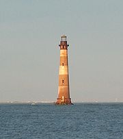
- Bloody Point LightBloody Point Range LightsThe Bloody Point Range Lights, which is known as the Bloody Point Lighthouse, were range lights on the southern end of Daufuskie Island in Beaufort County, South Carolina. The Bloody Point Range Lights were built in 1883. Due to erosion, the front light was moved to the location of the former rear...
on Daufuskie Island, Beaufort CountyBeaufort County, South Carolina-National protected areas:*Ernest F. Hollings ACE Basin National Wildlife Refuge *Pinckney Island National Wildlife Refuge-Demographics:As of the census of 2000, there were 155,215 people, 45,532 households, and 33,056 families residing in the county. The population density was 206 people per... - Bulls Bay Light, Charleston CountyCharleston County, South CarolinaCharleston County is a county located in the U.S. state of South Carolina. According to a 2005 U.S. Census Bureau estimate, its population was 330,368. Its county seat is Charleston. It is the third-most populous county in the state . Charleston County was created in 1901 by an act of the South...
- Combahee Bank Light formerly in St. Helena Sound
- Cape Romain LighthousesCape Romain LighthousesCape Romain Lighthouses are a pair of brick lighthouses on Lighthouse Island southeast of McClellanville, South Carolina. The lighthouses are on the Cape Romain National Wildlife Refuge. They survived Hurricane Hugo that devastated the area....
near McClellanville, Charleston CountyCharleston County, South CarolinaCharleston County is a county located in the U.S. state of South Carolina. According to a 2005 U.S. Census Bureau estimate, its population was 330,368. Its county seat is Charleston. It is the third-most populous county in the state . Charleston County was created in 1901 by an act of the South... - Castle Pinckney LightCastle Pinckney LightCastle Pinckney Light is a former lighthouse on Shutes' Folly Island in Charleston Harbor, Charleston County, South Carolina.Castle Pinckney was a small fort that was built in the 1790s. It was occupied by Confederate forces during the Civil War.-History:...
in Charleston HarborCharleston HarborThe Charleston Harbor is an inlet of the Atlantic Ocean at Charleston, South Carolina. The inlet is formed by the junction of Ashley and Cooper rivers at . Morris and Sullivan's Island, shelter the entrance...
, Charleston CountyCharleston County, South CarolinaCharleston County is a county located in the U.S. state of South Carolina. According to a 2005 U.S. Census Bureau estimate, its population was 330,368. Its county seat is Charleston. It is the third-most populous county in the state . Charleston County was created in 1901 by an act of the South... - Charleston LightCharleston LightCharleston Light on Sullivan's Island, South Carolina, which is the northern entrance to Charleston Harbor, was built to replace the defunct Morris Island Light on Morris Island. Construction was started in 1960, and it was first lit on June 15, 1962....
in Sullivan's Island, Charleston CountyCharleston County, South CarolinaCharleston County is a county located in the U.S. state of South Carolina. According to a 2005 U.S. Census Bureau estimate, its population was 330,368. Its county seat is Charleston. It is the third-most populous county in the state . Charleston County was created in 1901 by an act of the South... - Fort Ripley Shoal (Middle Ground) LightFort Ripley Shoal LightThe Fort Ripley Shoal Light was a lighthouse in the Charleston, South Carolina harbor approaches.-History:The channels approaching Charleston fork shortly after passing Fort Sumter, split by a large shoal extending southeast from Shutes Folly Island...
in Charleston HarborCharleston HarborThe Charleston Harbor is an inlet of the Atlantic Ocean at Charleston, South Carolina. The inlet is formed by the junction of Ashley and Cooper rivers at . Morris and Sullivan's Island, shelter the entrance...
, Charleston CountyCharleston County, South CarolinaCharleston County is a county located in the U.S. state of South Carolina. According to a 2005 U.S. Census Bureau estimate, its population was 330,368. Its county seat is Charleston. It is the third-most populous county in the state . Charleston County was created in 1901 by an act of the South... - Fort Sumter Range LightsFort Sumter Range LightsThe Fort Sumter Range Lights are range lights to guide ships through the main channel of the Charleston Harbor, South Carolina. The original front light was built at Fort Sumter and the original rear light was in the steeple of St. Philip's Church in Charleston, South Carolina. Both lights were lit...
, Charleston CountyCharleston County, South CarolinaCharleston County is a county located in the U.S. state of South Carolina. According to a 2005 U.S. Census Bureau estimate, its population was 330,368. Its county seat is Charleston. It is the third-most populous county in the state . Charleston County was created in 1901 by an act of the South... - Georgetown LightGeorgetown LightGeorgetown Light on North Island at the entrance to Winyah Bay southeast of Georgetown, South Carolina, is an active light. The light is maintained by the U.S. Coast Guard, and the lighthouse is now under the control of State of South Carolina as part of the Tom Yawkey Wildlife Center Heritage...
- Governor's Light in Little RiverLittle River, South CarolinaLittle River is a census-designated place in Horry County, South Carolina, United States. The population was 7,027 at the 2000 census....
, Horry County - Haig Point Range LightsHaig Point Range LightsThe Haig Point Range Lights were range lights on Calibogue Sound at the northeastern end of Daufuskie Island in Beaufort County, South Carolina. The Haig Point Range Lights were built in 1873 and were maintained as an official aid to navigation until about 1924. The Rear Range Light house has been...
on Daufuskie Island, Beaufort CountyBeaufort County, South Carolina-National protected areas:*Ernest F. Hollings ACE Basin National Wildlife Refuge *Pinckney Island National Wildlife Refuge-Demographics:As of the census of 2000, there were 155,215 people, 45,532 households, and 33,056 families residing in the county. The population density was 206 people per... - Harbour Town LightHarbour Town LightThe Harbour Town Light is lighthouse at the Harbour Town Marina at Hilton Head Island, South Carolina. It was privately built and is a private aid to navigation. Although initially ridiculed during the planning and construction phases, the lighthouse became instantly popular and is today the most...
on Hilton Head IslandHilton Head Island, South CarolinaHilton Head Island or Hilton Head is a resort town in Beaufort County, South Carolina, United States. It is north of Savannah, Georgia, and south of Charleston. The island gets its name from Captain William Hilton...
, Beaufort CountyBeaufort County, South Carolina-National protected areas:*Ernest F. Hollings ACE Basin National Wildlife Refuge *Pinckney Island National Wildlife Refuge-Demographics:As of the census of 2000, there were 155,215 people, 45,532 households, and 33,056 families residing in the county. The population density was 206 people per... - Hilton Head Range Rear (Leamington)
- Hunting Island LightHunting Island LightThe Hunting Island Light is located in Hunting Island State Park on Hunting Island near Beaufort, South Carolina. Although no longer utilized as a functioning lighthouse, the tower is a fixture at the state park and is open to visitors.-Overview:...
on Hunting Island, Beaufort CountyBeaufort County, South Carolina-National protected areas:*Ernest F. Hollings ACE Basin National Wildlife Refuge *Pinckney Island National Wildlife Refuge-Demographics:As of the census of 2000, there were 155,215 people, 45,532 households, and 33,056 families residing in the county. The population density was 206 people per... - Morris Island LightMorris Island LightMorris Island Light is a lighthouse on Morris Island in South Carolina. The light stands on the southern side of the entrance to Charleston Harbor, north of the City of Folly Beach....
on Morris IslandMorris IslandMorris Island is an 840 acre uninhabited island in Charleston Harbor in South Carolina, accessible only by boat. The island lies in the outer reaches of the harbor and was thus a strategic location in the American Civil War.-History:...
, Charleston CountyCharleston County, South CarolinaCharleston County is a county located in the U.S. state of South Carolina. According to a 2005 U.S. Census Bureau estimate, its population was 330,368. Its county seat is Charleston. It is the third-most populous county in the state . Charleston County was created in 1901 by an act of the South... - Parris Island Range LightsParris Island Range LightsThe Parris Island Range Lights were range lights on the southern end of Parris Island in Beaufort County, South Carolina. The Parris Range Lights were first lit in 1881. They were deactivated in 1912. Only the lens house for the Rear Light remains, which is the oldest building at Parris...
on Parris IslandParris Island, South CarolinaParris Island is a former census-designated place , currently a portion of Port Royal in Beaufort County, South Carolina, United States. The population was 4,841 at the 2000 census. As defined by the U.S. Census Bureau, Parris Island is included within the Beaufort Urban Cluster and the larger...
, formerly in Beaufort CountyBeaufort County, South Carolina-National protected areas:*Ernest F. Hollings ACE Basin National Wildlife Refuge *Pinckney Island National Wildlife Refuge-Demographics:As of the census of 2000, there were 155,215 people, 45,532 households, and 33,056 families residing in the county. The population density was 206 people per... - Sullivan's Island Range LightsSullivan's Island Range LightsThe Sullivan's Island Range Lights were range lights on the southern end of Sullivan's Island in Charleston County, South Carolina. The light station was first established in 1848 and was destroyed in 1861 during the Civil War. It was rebuilt after the war and the lights were in existence at least...
, Charleston CountyCharleston County, South CarolinaCharleston County is a county located in the U.S. state of South Carolina. According to a 2005 U.S. Census Bureau estimate, its population was 330,368. Its county seat is Charleston. It is the third-most populous county in the state . Charleston County was created in 1901 by an act of the South...
Tennessee
Lighthouses in Kentucky and Tennessee- Omohundo Waterworks Intake Crib, Nashville, TennesseeNashville, TennesseeNashville is the capital of the U.S. state of Tennessee and the county seat of Davidson County. It is located on the Cumberland River in Davidson County, in the north-central part of the state. The city is a center for the health care, publishing, banking and transportation industries, and is home...
Notable faux lighthouse
- Carthage Light, on the Cumberland River near Carthage, TennesseeCarthage, TennesseeCarthage is a town in Smith County, Tennessee, United States, and is part of the Nashville Metropolitan Statistical Area. The population was 2,251 at the 2000 census. It is the county seat of Smith County, and perhaps best known as the hometown of former Vice President Al Gore, and his father,...
Texas
- Aransas Pass Light
- Brazos River Light
- Brazos Santiago Light
- Clopper's Bar Light
- Fort Point LightFort Point Light (Texas)Fort Point Light was a lighthouse located on the south side of the entrance to Galveston Bay in Texas.-History:This light was not long-lived. Although the land was reserved for the Republic of Texas as far back as 1836, Congress did not appropriate construction funds until 1878, and the light was...
, Galveston BayGalveston BayGalveston Bay is a large estuary located along the upper coast of Texas in the United States. It is connected to the Gulf of Mexico and is surrounded by sub-tropic marshes and prairies on the mainland. The water in the Bay is a complex mixture of sea water and fresh water which supports a wide... - Galveston Jetty Light
- Half Moon Reef Light
- Matagorda Island LighthouseMatagorda Island LighthouseThe Matagorda Island Lighthouse is located on Matagorda Island in Calhoun County, in the U.S. state of Texas. Once under the jurisdiction of the United States Coast Guard, the lighthouse is now managed by the Texas Parks and Wildlife Department.-History:...
, located at entrance to Matagorda BayMatagorda BayMatagorda Bay is a large estuary bay on the Texas coast, lying in Calhoun and Matagorda counties and located approximately northeast of Corpus Christi, southeast of San Antonio, southwest of Houston, and southeast of Austin. It is separated from the Gulf of Mexico by Matagorda Peninsula and...
(more information) - Point Bolivar LightPoint Bolivar LightPoint Bolivar Lighthouse is a historic lighthouse in Port Bolivar, Texas, that was built in 1872. It served for 61 years before being retired in 1933, when its function was replaced by a different light....
, located at entrance to Galveston BayGalveston BayGalveston Bay is a large estuary located along the upper coast of Texas in the United States. It is connected to the Gulf of Mexico and is surrounded by sub-tropic marshes and prairies on the mainland. The water in the Bay is a complex mixture of sea water and fresh water which supports a wide... - Port Isabel Light, across the causeway from South Padre IslandSouth Padre IslandSouth Padre Island is a barrier island in the U.S. state of Texas. It is located in Cameron County and is a popular vacation destination because the resort city South Padre Island is located on the island. The island itself is considered to have been settled by Padre Jose Nicolas Balli, who had a...
in Port IsabelPort Isabel, TexasPort Isabel is a city in Cameron County, Texas, United States. It is part of the Brownsville–Harlingen–Raymondville and the Matamoros–Brownsville metropolitan areas...
(more information) - Redfish Bar Light
- Redfish Bar Cut Light
- Sabine Bank Light
Vermont
On Lake ChamplainLake Champlain
Lake Champlain is a natural, freshwater lake in North America, located mainly within the borders of the United States but partially situated across the Canada—United States border in the Canadian province of Quebec.The New York portion of the Champlain Valley includes the eastern portions of...
:
- Burlington Breakwater LightsBurlington Breakwater LightsThe Burlington Breakwater Lights were originally established in 1857 to mark the ends of a low, detached, two piece breakwater ⅔ of a nautical mile long which protects the Burlington, Vermont harbor from Lake Champlain. The breakwater is on the National Register of Historic Places, but the lights,...
, BurlingtonBurlington, VermontBurlington is the largest city in the U.S. state of Vermont and the shire town of Chittenden County. Burlington lies south of the U.S.-Canadian border and some south of Montreal.... - Colchester Reef LightColchester Reef LightThe Colchester Reef Light in Vermont was a lighthouse off Colchester Point in Lake Champlain. It was moved to the Shelburne Museum in Shelburne, Vermont in 1956....
(relocated to the Shelburne MuseumShelburne MuseumShelburne Museum is a museum of art and Americana located in Shelburne, Vermont, United States. Over 150,000 works are exhibited in 39 exhibition buildings, 25 of which are historic and were relocated to the Museum grounds...
) - Isle La Motte LightIsle La Motte LightThe Isle La Motte Light in Vermont is an iron lighthouse at the northern end of Isle La Motte in Lake Champlain. It is one of several lights on the lake which were reactivated in their original structures early in the 21st century.-History:...
- Juniper Island LightJuniper Island LightThe Juniper Island Light on Juniper Island in Vermont is the oldest light station on Lake Champlain and the oldest surviving cast iron lighthouse in the United States.-History:...
- Windmill Point LightWindmill Point Light (Vermont)The Windmill Point Light in Vermont is the northernmost lighthouse on Lake Champlain. Extinguished for seventy years, it was reactivated in 2002 to replace the skeleton tower erected next to it.-History:...
On Lake Memphremagog
Lake Memphremagog
Lake Memphremagog is a fresh water glacial lake located between Newport, Vermont, United States and Magog, Quebec, Canada. The lake is long with 73 percent of the lake's surface area in Quebec, where it drains into the Magog River. However, three-quarters of its watershed, , is in Vermont. The...
:
- Maxfield Point Light
- Newport Wharf Light
- Whipple Point Light
Virginia
- Assateague LightAssateague LightAssateague Light is the lighthouse located on the southern end of Assateague Island off the coast of the Virginia Eastern Shore, USA.The lighthouse is located within the Chincoteague National Wildlife Refuge and can be accessed by road from Chincoteague Island over the Assateague...
, Assateague IslandAssateague IslandAssateague Island is a long barrier island located off the eastern coast of Maryland and Virginia. It is best known for its herds of feral horses, pristine beaches, and the Assateague Lighthouse. The island also contains numerous marshes, bays and coves, including Toms Cove... - Back River LightBack River LightThe Back River Light was a lighthouse south of the mouth of the Back River on the western shore of the Chesapeake Bay, several miles north of Fort Monroe near Hampton, Virginia. Plagued by erosion for most of its existence, it was destroyed in 1956 by Hurricane Flossy.- History :This light was...
, Chesapeake BayChesapeake BayThe Chesapeake Bay is the largest estuary in the United States. It lies off the Atlantic Ocean, surrounded by Maryland and Virginia. The Chesapeake Bay's drainage basin covers in the District of Columbia and parts of six states: New York, Pennsylvania, Delaware, Maryland, Virginia, and West...
near HamptonHampton, VirginiaHampton is an independent city that is not part of any county in Southeast Virginia. Its population is 137,436. As one of the seven major cities that compose the Hampton Roads metropolitan area, it is on the southeastern end of the Virginia Peninsula. Located on the Hampton Roads Beltway, it hosts... - Bells Rock LightBells Rock LightThe Bells Rock Light was a lighthouse located in the York River in Virginia.-History:In the nineteenth century, West Point, Virginia was the head of navigation on the York River, and this light was requested in order to facilitate navigation there. A house was built for it at Lazaretto Point in...
, York RiverYork River (Virginia)The York River is a navigable estuary, approximately long, in eastern Virginia in the United States. It ranges in width from at its head to near its mouth on the west side of Chesapeake Bay. Its watershed drains an area including portions of 17 counties of the coastal plain of Virginia north... - Bowlers Rock LightBowlers Rock LightThe Bowlers Rock Light was a lighthouse located in the Rappahannock River in Virginia.-History:.This spot was marked by lightships beginning in 1835. In 1861 the first lightship was destroyed by confederate raiders, and second ship replaced it in 1864, to be replaced with a screw-pile lighthouse in...
, Rappahannock RiverRappahannock RiverThe Rappahannock River is a river in eastern Virginia, in the United States, approximately in length. It traverses the entire northern part of the state, from the Blue Ridge Mountains in the west, across the Piedmont, to the Chesapeake Bay, south of the Potomac River.An important river in American... - Cape Charles LightCape Charles LightThe current Cape Charles Light is a skeleton tower lighthouse at the mouth of the Chesapeake Bay on Smith Island. It is the tallest lighthouse in Virginia and the second tallest in the United States...
, Cape CharlesCape Charles, VirginiaCape Charles is a town in Northampton County, Virginia, United States. The population was 1,134 at the 2000 census.-Geography:Cape Charles is located at .... - Cape Henry Light (old)Cape Henry LighthouseThe Cape Henry Lighthouse has long been important for the large amount of ocean-going shipping traffic for the harbors, its rivers, and shipping headed to ports on the Chesapeake Bay. The original lighthouse was the first lighthouse authorized by the U.S. government, dating from 1792...
, Cape HenryCape HenryCape Henry is a cape on the Atlantic shore of Virginia north of Virginia Beach. It is the southern boundary of the entrance to Chesapeake Bay.Across the mouth of the bay to the north is Cape Charles...
, Virginia BeachVirginia Beach, VirginiaVirginia Beach is an independent city located in the Hampton Roads metropolitan area of Virginia, on the Atlantic Ocean at the mouth of the Chesapeake Bay... - Cape Henry Light (new)Cape Henry LighthouseThe Cape Henry Lighthouse has long been important for the large amount of ocean-going shipping traffic for the harbors, its rivers, and shipping headed to ports on the Chesapeake Bay. The original lighthouse was the first lighthouse authorized by the U.S. government, dating from 1792...
, Cape Henry, Virginia Beach - Cherrystone Bar LightCherrystone Bar LightThe Cherrystone Bar Light was a lighthouse located at the entrance to Cape Charles, Virginia harbor in the Chesapeake Bay. It was the only light in the bay moved to another location, becoming the Choptank River Light in 1921.-History:...
, Cape CharlesCape Charles, VirginiaCape Charles is a town in Northampton County, Virginia, United States. The population was 1,134 at the 2000 census.-Geography:Cape Charles is located at .... - Chesapeake LightChesapeake LightChesapeake Light is an offshore lighthouse marking the entrance to the Chesapeake Bay. Once considered for decommissioning, it remains active and supports a NOAA weather data site.-History:...
, entrance to Chesapeake BayChesapeake BayThe Chesapeake Bay is the largest estuary in the United States. It lies off the Atlantic Ocean, surrounded by Maryland and Virginia. The Chesapeake Bay's drainage basin covers in the District of Columbia and parts of six states: New York, Pennsylvania, Delaware, Maryland, Virginia, and West... - Craney Island Light, mouth of Elizabeth RiverElizabeth River (Virginia)The Elizabeth River is a tidal estuary forming an arm of Hampton Roads harbor at the southern end of Chesapeake Bay in southeast Virginia in the United States. It is located along the southern side of the mouth of the James River, between the cities of Portsmouth and Norfolk...
- Deepwater Shoals LightDeepwater Shoals LightThe Deepwater Shoals Light was a lighthouse located in the James River upstream from Newport News, Virginia.-History:This light was erected in 1855 to mark the western edge of the channel...
, James RiverJames River (Virginia)The James River is a river in the U.S. state of Virginia. It is long, extending to if one includes the Jackson River, the longer of its two source tributaries. The James River drains a catchment comprising . The watershed includes about 4% open water and an area with a population of 2.5 million... - Dutch Gap Canal LightsDutch Gap Canal LightsThe Dutch Gap Canal Lights were built to mark the ends of Dutch Gap Canal, now called Dutch Gap Cutoff, which is a ¾ nm cut across the base of an oxbow in the James River between Hopewell and Richmond, Virginia. They were on Farrar's Island, on the south side of the river...
, James RiverJames River (Virginia)The James River is a river in the U.S. state of Virginia. It is long, extending to if one includes the Jackson River, the longer of its two source tributaries. The James River drains a catchment comprising . The watershed includes about 4% open water and an area with a population of 2.5 million... - Great Wicomico River LightGreat Wicomico River LightThe Great Wicomico River Light was a lighthouse located at the mouth of the Great Wicomico River, south of the Potomac River on the western side of the Chesapeake Bay.-References:*, from the Chesapeake Chapter of the United States Lighthouse Society...
, Chesapeake BayChesapeake BayThe Chesapeake Bay is the largest estuary in the United States. It lies off the Atlantic Ocean, surrounded by Maryland and Virginia. The Chesapeake Bay's drainage basin covers in the District of Columbia and parts of six states: New York, Pennsylvania, Delaware, Maryland, Virginia, and West... - Hog Island LightHog Island LightThe Hog Island Light was a lighthouse roughly marking its eponymous island, and thus the north side of the Great Machipongo Inlet on the Virginia coast.-History:...
- Jones Point LightJones Point LightThe Jones Point Light is a small river lighthouse located on the Potomac River in Alexandria, Virginia. It was built in 1855. It is a small, one-story house with a lantern on top. The lighthouse was discontinued in 1926, replaced by a small steel skeletal tower located nearby; this smaller tower...
, AlexandriaAlexandria, VirginiaAlexandria is an independent city in the Commonwealth of Virginia. As of 2009, the city had a total population of 139,966. Located along the Western bank of the Potomac River, Alexandria is approximately six miles south of downtown Washington, D.C.Like the rest of northern Virginia, as well as... - Jordan Point LightJordan Point LightThe Jordan Point Light was a lighthouse located on Jordan Point on the James River in Virginia, near the south end of the present Benjamin Harrison Memorial Bridge.-History:...
, James RiverJames River (Virginia)The James River is a river in the U.S. state of Virginia. It is long, extending to if one includes the Jackson River, the longer of its two source tributaries. The James River drains a catchment comprising . The watershed includes about 4% open water and an area with a population of 2.5 million... - Killock Shoal LightKillock Shoal LightThe Killock Shoal Light was a lighthouse located at the north end of the channel west of Chincoteague, Virginia.-History:This light was erected in 1886. It was unlike other screw-pile structures in the area, with the lantern set at one corner of a small square frame house. It was automated in...
- Lambert Point LightLambert Point LightThe Lambert Point Light was a small screwpile lighthouse in Norfolk, Virginia; it was built in 1872.The lighthouse was meant to serve the increased shipping traffic on the Elizabeth River, and initially was designed with six piles. The plans were changed when five surplus piles were found; in the...
, NorfolkNorfolk, VirginiaNorfolk is an independent city in the Commonwealth of Virginia in the United States. With a population of 242,803 as of the 2010 Census, it is Virginia's second-largest city behind neighboring Virginia Beach.... - Nansemond River Light, NansemondNansemond RiverThe Nansemond River is a tributary of the James River in the U.S. state of Virginia. The Nansemond River Bridge crosses the river near its mouth. Both it and the former State Route 125 bridge, demolished in 2008, were once toll bridges. The river begins at the outlet of Lake Meade north of...
and JamesJames River (Virginia)The James River is a river in the U.S. state of Virginia. It is long, extending to if one includes the Jackson River, the longer of its two source tributaries. The James River drains a catchment comprising . The watershed includes about 4% open water and an area with a population of 2.5 million...
rivers - New Point Comfort LightNew Point Comfort LightNew Point Comfort Light is a lighthouse in the Virginia portion of the Chesapeake Bay. It is the third oldest surviving light in the bay, and the tenth oldest in the United states.-History:...
, Chesapeake BayChesapeake BayThe Chesapeake Bay is the largest estuary in the United States. It lies off the Atlantic Ocean, surrounded by Maryland and Virginia. The Chesapeake Bay's drainage basin covers in the District of Columbia and parts of six states: New York, Pennsylvania, Delaware, Maryland, Virginia, and West... - Newport News Middle Ground LightNewport News Middle Ground LightNewport News Middle Ground Light is a lighthouse near the Monitor-Merrimac Memorial Bridge-Tunnel on Interstate 664 in Hampton Roads. It is the oldest caisson lighthouse in Virginia.-History:...
, Newport NewsNewport News, VirginiaNewport News is an independent city located in the Hampton Roads metropolitan area of Virginia. It is at the southeastern end of the Virginia Peninsula, on the north shore of the James River extending southeast from Skiffe's Creek along many miles of waterfront to the river's mouth at Newport News... - Old Plantation Flats LightOld Plantation Flats LightThe Old Plantation Flats Light was a lighthouse located in the Chesapeake Bay marking the channel to Cape Charles, Virginia.-History:Old Plantation Flats is a shoal paralleling the Eastern Shore near the mouth of the bay, taking its name from Old Plantation Creek which empties into the bay near the...
, Cape CharlesCape Charles, VirginiaCape Charles is a town in Northampton County, Virginia, United States. The population was 1,134 at the 2000 census.-Geography:Cape Charles is located at .... - Old Point Comfort LightOld Point Comfort LightOld Point Comfort Light is a lighthouse located on the grounds of Fort Monroe in the Virginia portion of the Chesapeake Bay. It is the second oldest light in the bay and the oldest still in use.-History:...
, HamptonHampton, VirginiaHampton is an independent city that is not part of any county in Southeast Virginia. Its population is 137,436. As one of the seven major cities that compose the Hampton Roads metropolitan area, it is on the southeastern end of the Virginia Peninsula. Located on the Hampton Roads Beltway, it hosts... - Pages Rock LightPages Rock LightThe Pages Rock Light was a lighthouse located in the York River in the Chesapeake Bay.-History:This light was constructed in 1893, a late date for a screw-pile structure...
, York RiverYork River (Virginia)The York River is a navigable estuary, approximately long, in eastern Virginia in the United States. It ranges in width from at its head to near its mouth on the west side of Chesapeake Bay. Its watershed drains an area including portions of 17 counties of the coastal plain of Virginia north... - Point of Shoals LightPoint of Shoals LightThe Point of Shoals Light was a lighthouse located in the James River in Virginia.-History:The first request for a light to mark the shoal at this bend in the river came in 1835, but a light was not constructed here until 1855. It was the target of a Confederate raid in the Civil War, and by 1869...
, James RiverJames River (Virginia)The James River is a river in the U.S. state of Virginia. It is long, extending to if one includes the Jackson River, the longer of its two source tributaries. The James River drains a catchment comprising . The watershed includes about 4% open water and an area with a population of 2.5 million... - Pungoteague Creek LightPungoteague Creek LightThe Pungoteague Creek Light was a small screwpile lighthouse constructed in the Chesapeake Bay in 1854. Destroyed in 1856, it had the shortest recorded existence of any lighthouse on the Bay, and possibly the United States, at just 459 days....
, Chesapeake BayChesapeake BayThe Chesapeake Bay is the largest estuary in the United States. It lies off the Atlantic Ocean, surrounded by Maryland and Virginia. The Chesapeake Bay's drainage basin covers in the District of Columbia and parts of six states: New York, Pennsylvania, Delaware, Maryland, Virginia, and West... - Smith Point LightSmith Point LightSmith Point Light is a caisson lighthouse in the Virginia portion of the Chesapeake Bay at the mouth of the Potomac River. It is listed on the National Register of Historic Places.-History:...
, mouth of Potomac RiverPotomac RiverThe Potomac River flows into the Chesapeake Bay, located along the mid-Atlantic coast of the United States. The river is approximately long, with a drainage area of about 14,700 square miles... - Stingray Point LightStingray Point LightThe Stingray Point Light was a lighthouse located at the mouth of the Rappahannock River.-History:Stingray Point took its name from an incident in which John Smith was stung by a stingray while fishing nearby. The light was built in 1858 to mark the entrance to the Deltaville harbor, just west of...
, mouth of Rappahannock RiverRappahannock RiverThe Rappahannock River is a river in eastern Virginia, in the United States, approximately in length. It traverses the entire northern part of the state, from the Blue Ridge Mountains in the west, across the Piedmont, to the Chesapeake Bay, south of the Potomac River.An important river in American... - Tangier Sound LightTangier Sound LightThe Tangier Sound Light was a lighthouse located south of Tangier Island in the Chesapeake Bay.-History:This light was constructed in 1890 to mark a shoal extending south from Tangier Island, delimiting the western edge of the sound. Its exposed location made it vulnerable to ice, and on February...
, Chesapeake BayChesapeake BayThe Chesapeake Bay is the largest estuary in the United States. It lies off the Atlantic Ocean, surrounded by Maryland and Virginia. The Chesapeake Bay's drainage basin covers in the District of Columbia and parts of six states: New York, Pennsylvania, Delaware, Maryland, Virginia, and West... - Thimble Shoal LightThimble Shoal LightThimble Shoal Light is a sparkplug lighthouse in the Virginia portion of Chesapeake Bay, north of the Hampton Roads channel. The third light at this location, it is listed on the National Register of Historic Places.-History:...
, Chesapeake Bay, north of Hampton RoadsHampton RoadsHampton Roads is the name for both a body of water and the Norfolk–Virginia Beach metropolitan area which surrounds it in southeastern Virginia, United States... - Tue Marshes LightTue Marshes LightThe Tue Marshes Light was a lighthouse located at the mouth of the York River in the Chesapeake Bay north of Tue Point.-History:This light was erected in 1875. The location was originally called "Too Marshes", but the present spelling was adopted around 1900...
, mouth of York RiverYork River (Virginia)The York River is a navigable estuary, approximately long, in eastern Virginia in the United States. It ranges in width from at its head to near its mouth on the west side of Chesapeake Bay. Its watershed drains an area including portions of 17 counties of the coastal plain of Virginia north... - Watts Island LightWatts Island LightThe Watts Island Light was a historic lighthouse located near Watts Island in the Chesapeake Bay. It was the only lighthouse built by John Donahoo outside of Maryland.-History:...
, Chesapeake BayChesapeake BayThe Chesapeake Bay is the largest estuary in the United States. It lies off the Atlantic Ocean, surrounded by Maryland and Virginia. The Chesapeake Bay's drainage basin covers in the District of Columbia and parts of six states: New York, Pennsylvania, Delaware, Maryland, Virginia, and West... - White Shoal LightWhite Shoal Light (Virginia)The White Shoal Light was a lighthouse located in the James River near Newport News, Virginia. It outlasted all other lighthouses in the James, finally succumbing to ice in the 1970s.-History:...
, James RiverJames River (Virginia)The James River is a river in the U.S. state of Virginia. It is long, extending to if one includes the Jackson River, the longer of its two source tributaries. The James River drains a catchment comprising . The watershed includes about 4% open water and an area with a population of 2.5 million... - Windmill Point LightWindmill Point Light (Virginia)The Windmill Point Light was a lighthouse located at the mouth of the Rappahannock River.-History:This light was erected in 1869 to replace the last of three lightships stationed at this location to mark the end of the Rappahannock Spit, a shoal extending east from Windmill Point itself...
, mouth of Rappahannock RiverRappahannock RiverThe Rappahannock River is a river in eastern Virginia, in the United States, approximately in length. It traverses the entire northern part of the state, from the Blue Ridge Mountains in the west, across the Piedmont, to the Chesapeake Bay, south of the Potomac River.An important river in American... - Wolf Trap LightWolf Trap LightWolf Trap Light is a caisson lighthouse in the Virginia portion of the Chesapeake Bay, about seven and a half miles northeast of New Point Comfort Light. It is listed on the National Register of Historic Places.-History:...
, Chesapeake BayChesapeake BayThe Chesapeake Bay is the largest estuary in the United States. It lies off the Atlantic Ocean, surrounded by Maryland and Virginia. The Chesapeake Bay's drainage basin covers in the District of Columbia and parts of six states: New York, Pennsylvania, Delaware, Maryland, Virginia, and West... - York Spit LightYork Spit LightThe York Spit Light was a lighthouse located at the mouth of the York River in the Chesapeake Bay, marking a long shoal paralleling the main channel into the river.-History:...
, mouth of York RiverYork River (Virginia)The York River is a navigable estuary, approximately long, in eastern Virginia in the United States. It ranges in width from at its head to near its mouth on the west side of Chesapeake Bay. Its watershed drains an area including portions of 17 counties of the coastal plain of Virginia north...
Washington
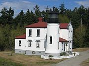
- Admiralty Head Light, Whidbey IslandWhidbey IslandWhidbey Island is one of nine islands located in Island County, Washington, in the United States. Whidbey is located about north of Seattle, and lies between the Olympic Peninsula and the I-5 corridor of western Washington...
- Alki Point Light, West Seattle
- Browns Point Light, Browns PointBrowns Point, WashingtonBrowns Point is a point of land in Pierce County, Washington, United States, bordered by Tacoma on the east and Puget Sound on all other sides. The Tacoma neighborhood immediately adjacent to Browns Point is also referred to locally as "Browns Point" .Originally named Point Harris, after Alvin...
- Burrows Island Light, AnacortesAnacortes, WashingtonAnacortes is a city in Skagit County, Washington, United States. The name "Anacortes" is a consolidation of the name Anna Curtis, who was the wife of early Fidalgo Island settler Amos Bowman. Anacortes' population was 15,778 at the time of the 2010 census...
- Cape Disappointment Light
- Cape Flattery Light, Neah BayNeah Bay, WashingtonNeah Bay is a census-designated place on the Makah Indian reservation in Clallam County, Washington, United States. The population was 794 at the 2000 census.-Geography:Neah Bay is located at ....
- Cattle Point LightCattle Point LightCattle Point Lighthouse is a lighthouse on San Juan Island, in the Haro Straits of Washington. Its first light was a lens lantern on a post erected in 1888. In 1921, the US Navy installed a radio compass station....
, San Juan IslandSan Juan IslandSan Juan Island is the second-largest and most populous of the San Juan Islands in northwestern Washington, United States. It has a land area of 142.59 km² and a population of 6,822 as of the 2000 census.... - Destruction Island Light
- Dofflemyer Point Light
- Ediz Hook LightEdiz Hook LightEdiz Hook Lighthouse is a lighthouse in Port Angeles, Washington, United States. Originally constructed in 1861, the lighthouse structure was later replaced in 1908 by a new structure, and finally in 1946 by an automated beacon on the United States Coast Guard air station on the end of Ediz Hook....
- Grays Harbor Light, WestportWestport, WashingtonWestport is a city in Grays Harbor County, Washington, United States. The city's population was 2,099 at the 2010 census.Westport is located on a peninsula on the south side of the entrance to Grays Harbor from the Pacific Ocean. The public Westport Marina is the largest marina on the outer coast...
- Lime Kiln Light, San Juan IslandSan Juan IslandSan Juan Island is the second-largest and most populous of the San Juan Islands in northwestern Washington, United States. It has a land area of 142.59 km² and a population of 6,822 as of the 2000 census....
- Marrowstone Light, Fort Flagler
- Mukilteo Light, MukilteoMukilteo, WashingtonMukilteo , which means "good camping ground", is a city in Snohomish County, Washington, United States. The population was 20,254 at the 2010 census. It is on the shore of the Puget Sound, and is the site of a Washington State Ferries terminal linking it to Clinton, on Whidbey Island.Mukilteo is...
- New Dungeness Light, SequimSequim, WashingtonSequim is a city in Clallam County, Washington, United States. The 2010 US Census counted a population of 6,606. Sequim is located along the Dungeness River near the base of the Olympic Mountains...
- North Head Light, IlwacoIlwaco, WashingtonIlwaco is a city in Pacific County, Washington, United States. The population was 950 at the 2000 census and decreased to 936 at the 2010 census.-History:...
- Patos Island Light, San Juan IslandsSan Juan IslandsThe San Juan Islands are an archipelago in the northwest corner of the contiguous United States between the US mainland and Vancouver Island, British Columbia, Canada. The San Juan Islands are part of the U.S...
- Point No Point Light, HansvilleHansville, WashingtonHansville is an unincorporated community in Kitsap County, Washington, United States. Located at the northern end of the Kitsap Peninsula, it offers a view of Admiralty Inlet, Whidbey Island, and Puget Sound. Hansville is about east-southeast of Foulweather Bluff.The village has a store and...
- Point Roberts Light, Point RobertsPoint Roberts, WashingtonPoint Roberts is an unincorporated community in Whatcom County, Washington, United States. It has a post office, with the ZIP code of 98281, whose ZIP Code Tabulation Area had a population of 1,314 at the 2010 census.A geopolitical oddity, Point Roberts is a part of the United States that is not...
- Point Robinson Light, Vashon IslandVashon IslandVashon is a census-designated place in King County, Washington, United States. It covers an island alternately called Vashon Island or Vashon-Maury Island, the largest island in Puget Sound south of Admiralty Inlet. The population was 10,624 at the 2010 census. At , it is about 60 percent larger...
- Point Wilson Light, Port TownsendPort Townsend, WashingtonPort Townsend is a city in Jefferson County, Washington, United States, approximately north-northwest of Seattle . The population was 9,113 at the 2010 census an increase of 9.3% over the 2000 census. It is the county seat and only incorporated city of Jefferson County...
- Semiahmoo Point LightSemiahmoo Point LightSemiahmoo Point Lighthouse was a lighthouse in Washington, United States, near the port of Blaine, Washington. It was replaced by various structures on the pile foundation.-History:...
, Port BlaineBlaine, WashingtonBlaine is a city in Whatcom County, Washington, United States. The city's northern boundary is the Canadian border. Blaine is the shared home of the Peace Arch international monument... - Slip Point Light, Clallam Bay
- Turn Point Light, Stuart IslandStuart Island (Washington)Stuart Island is one of the San Juan Islands in Washington state, USA, north of San Juan Island and west of Waldron Island. The island is home to two communities of full and part-time residents, a state park, a one-room schoolhouse, and two airstrips .The 2000 census...
- West Point Light, SeattleSeattle, WashingtonSeattle is the county seat of King County, Washington. With 608,660 residents as of the 2010 Census, Seattle is the largest city in the Northwestern United States. The Seattle metropolitan area of about 3.4 million inhabitants is the 15th largest metropolitan area in the country...
Wisconsin
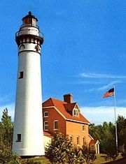
- Algoma Pierhead LighthouseAlgoma Pierhead LighthouseThe Algoma Pierhead lighthouse is a lighthouse located near Algoma in Kewaunee County, Wisconsin.The lighthouse was first established in 1893 as a set of range lights. It was rebuilt in 1908 at which time it was a conical tower built of 5/16 inch steel plate, in diameter at the base and in...
, AlgomaAlgoma, WisconsinAlgoma is a city in Kewaunee County in the U.S. state of Wisconsin. The population was 3,357 at the 2000 census. Algoma is part of the Green Bay Metropolitan Statistical Area.-Geography:...
, Kewaunee CountyKewaunee County, WisconsinKewaunee County is a county located in the U.S. state of Wisconsin. As of 2000, the population was 20,187. Its county seat is Kewaunee. Kewaunee County is part of the Green Bay Metropolitan Statistical Area.-Geography:According to the U.S... - Apostle Islands LighthousesApostle Islands LighthousesThe Apostle Islands Lighthouses are a group of six lighthouses, located in the Apostle Islands, Wisconsin and listed in the National Register of Historic Places in 1977 as reference number 77000145....
- Ashland Harbor Breakwater LighthouseAshland Harbor Breakwater LighthouseThe Ashland Harbor Breakwater lighthouse, also known as Ashland Breakwater Lighthouse, is a lighthouse located near Ashland in Ashland County, Wisconsin, USA. It sits at the end of a long and detached breakwater, which creates an artificial harbor....
, AshlandAshland, WisconsinAshland is a city in Ashland and Bayfield counties in the U.S. state of Wisconsin. The city is a port on Lake Superior, near the head of Chequamegon Bay. The population was 8,695 at the 2010 census....
, Ashland County - Baileys Harbor LighthouseBaileys Harbor LighthouseThe Baileys Harbor lighthouse is a lighthouse located near Baileys Harbor in Door County, Wisconsin.Replaced by the Baileys Harbor Range Lights and the Cana Island Lighthouse in 1869...
, Baileys HarborBaileys Harbor, WisconsinBaileys Harbor is a town in Door County, Wisconsin, United States. The population was 1,003 at the 2000 census. The unincorporated community of Peninsula Center is located in the town...
, Door CountyDoor County, WisconsinDoor County is a county in the U.S. state of Wisconsin. As of 2000, the population was 27,961. Its county seat is Sturgeon Bay. Door County is a popular vacation and tourist destination, especially for residents of Wisconsin and Illinois.... - Baileys Harbor Range LightsBaileys Harbor Range LightsThe Baileys Harbor Range Lights are a pair of lighthouses arranged in a range light configuration, located near Baileys Harbor in Door County, Wisconsin.-History:...
, Baileys HarborBaileys Harbor, WisconsinBaileys Harbor is a town in Door County, Wisconsin, United States. The population was 1,003 at the 2000 census. The unincorporated community of Peninsula Center is located in the town...
, Door CountyDoor County, WisconsinDoor County is a county in the U.S. state of Wisconsin. As of 2000, the population was 27,961. Its county seat is Sturgeon Bay. Door County is a popular vacation and tourist destination, especially for residents of Wisconsin and Illinois.... - Boyer Bluff Light, Door CountyDoor County, WisconsinDoor County is a county in the U.S. state of Wisconsin. As of 2000, the population was 27,961. Its county seat is Sturgeon Bay. Door County is a popular vacation and tourist destination, especially for residents of Wisconsin and Illinois....
http://www.lighthousefriends.com/light.asp?ID=835 - Cana Island LighthouseCana Island LighthouseThe Cana Island lighthouse is a lighthouse located just north of Baileys Harbor in Door County, Wisconsin.Currently used as an active navigational aid under the jurisdiction of the United States Coast Guard and a museum, it was added to the National Register of Historic Places in 1976, as reference...
, near Baileys HarborBaileys Harbor, WisconsinBaileys Harbor is a town in Door County, Wisconsin, United States. The population was 1,003 at the 2000 census. The unincorporated community of Peninsula Center is located in the town...
, Door CountyDoor County, WisconsinDoor County is a county in the U.S. state of Wisconsin. As of 2000, the population was 27,961. Its county seat is Sturgeon Bay. Door County is a popular vacation and tourist destination, especially for residents of Wisconsin and Illinois.... - Chambers Island LighthouseChambers Island LighthouseThe Chambers Island lighthouse is a lighthouse located on Chambers Island in Door County, Wisconsin.It was added to the National Register of Historic Places in 1975 as reference #75000063...
, Chambers IslandChambers IslandChambers Island, named in honor of Col. Talbot Chambers, is a 2,834 acre island in Green Bay, about off the coast of the Door Peninsula, near Gibraltar, Wisconsin. It is part of Door County....
, Door CountyDoor County, WisconsinDoor County is a county in the U.S. state of Wisconsin. As of 2000, the population was 27,961. Its county seat is Sturgeon Bay. Door County is a popular vacation and tourist destination, especially for residents of Wisconsin and Illinois.... - Chequamegon Point LighthouseChequamegon Point LighthouseThe Chequamegon Point Lighthouse is a lighthouse located on Long Island, one of the Apostle Islands, in Lake Superior in Ashland County, Wisconsin, near the city of Bayfield....
, Long IslandLong Island (Wisconsin)Long Island is an island in Lake Superior in Wisconsin usually identified with the Apostle Islands. It is geologically different from the other islands, though, in that it is actually just an extension of the spit off Chequamegon Point...
, Apostle IslandsApostle IslandsThe Apostle Islands are a group of 22 islands in Lake Superior, off the Bayfield Peninsula in northern Wisconsin. The majority of the islands are located in Ashland County—only Sand, York, Eagle, and Raspberry Islands are located in Bayfield County...
, Ashland County - Devils Island LighthouseDevils Island LighthouseThe Devils Island Lighthouse is a lighthouse located on Devils Island, one of the Apostle Islands, in Lake Superior in Ashland County, Wisconsin, near the city of Bayfield....
, Devils IslandDevils Island (Wisconsin)Devils Island is one of the twenty-two Apostle Islands of northern Wisconsin, and has also been known as Louisiana Island , Barney and Lamborn's Island , Brownstone Island, and Rabbit Island....
, Apostle IslandsApostle IslandsThe Apostle Islands are a group of 22 islands in Lake Superior, off the Bayfield Peninsula in northern Wisconsin. The majority of the islands are located in Ashland County—only Sand, York, Eagle, and Raspberry Islands are located in Bayfield County...
, Ashland County - Eagle Bluff LighthouseEagle Bluff LighthouseThe Eagle Bluff Light, also known as Eagle Bluff lighthouse, is a lighthouse located near Ephraim in Peninsula State Park in Door County, Wisconsin. Construction was authorized in 1866, but the lighthouse was not actually built until 1868 at a cost of $12,000. It was automated in 1926...
, EphraimEphraim, Wisconsin-Events:The city's main festival is Fyr Bal, a Scandinavian celebration held near the solstice in mid-June to drive out the wicked winter witch. Bonfires burn along the shoreline as residents and visitors gather to celebrate the beginning of summer....
, Door CountyDoor County, WisconsinDoor County is a county in the U.S. state of Wisconsin. As of 2000, the population was 27,961. Its county seat is Sturgeon Bay. Door County is a popular vacation and tourist destination, especially for residents of Wisconsin and Illinois.... - Fond du Lac LighthouseFond du Lac LighthouseThe Fond du Lac lighthouse is a lighthouse located at the entrance to the harbor and Yacht Club, in Fond du Lac, Wisconsin. It is located on the southern end of Lake Winnebago. It is currently incorporated in the Fond du Lac City Seal. Construction of the lighthouse started in May 1933 and was...
, Fond du LacFond du Lac, WisconsinFond du Lac is a city in Fond du Lac County, Wisconsin, United States. The name is French for bottom of the lake, for it is located at the bottom of Lake Winnebago. The population was 42,203 at the 2000 census...
, Fond du Lac CountyFond du Lac County, WisconsinFond du Lac County is a county located in the U.S. state of Wisconsin. As of 2000, the population was 97,296. Its county seat is Fond du Lac. The United States Census Bureau's Fond du Lac Metropolitan Statistical Area includes all of Fond du Lac County. The county name is French for "bottom of the... - Grassy Island Range LightGrassy Island Range Light-Notes:-Specialized Additional reading:* Havighurst, Walter The Long Ships Passing: The Story of the Great Lakes, Macmillan Publishers....
s, relocated to Green Bay Yacht Club http://www.lighthousesrus.org/MichiganWest.htm#WI11 - Green Bay Harbor Entrance Light
- Green Island LightGreen Island Light (Wisconsin)The Green Island Light is a lighthouse located on Green Island in Green Bay. Abandoned since its deactivation in 1956, it survives as a hollow shell near the existing skeleton tower.-History:...
- Gull Island LightGull Island Light (Wisconsin)Gull Island Light is a lighthouse on Gull Island, one of the Apostle Islands, in Lake Superior in northern Wisconsin, in Ashland County, Wisconsin USA. The lighthouse was constructed in 1928 and is currently owned by the Coast Guard...
, Gull IslandGull Island (Wisconsin)Gull Island is one of the Apostle Islands, in Lake Superior, in northern Wisconsin, and is part of the Apostle Islands National Lakeshore. The island is located off the coast of Michigan Island. The Gull Island Light is on Gull Island....
, Ashland County - Kenosha North Pier LighthouseKenosha North Pier LighthouseThe Kenosha North Pier lighthouse is a lighthouse located near Kenosha in Kenosha County, Wisconsin."A typical 'Lake Michigan red tower'", it is a sibling to the Milwaukee Pierhead Light. This light was built in 1906 as a replacement for the "Old Kenosha Light."The station was established in 1856...
, KenoshaKenosha, WisconsinKenosha is a city and the county seat of Kenosha County in the State of Wisconsin in United States. With a population of 99,218 as of May 2011, Kenosha is the fourth-largest city in Wisconsin. Kenosha is also the fourth-largest city on the western shore of Lake Michigan, following Chicago,...
, Kenosha CountyKenosha County, Wisconsin-Demographics: As of the census of 2000, there were 149,577 people, 56,057 households, and 38,455 families residing in the county. The population density was 548 people per square mile . There were 59,989 housing units at an average density of 220 per square mile... - Kenosha Southport LighthouseKenosha Southport LighthouseThe Kenosha Southport lighthouse is a lighthouse located near Kenosha in Kenosha County, Wisconsin.-History:Also known as the "Old Kenosha Light", it was replaced by the Kenosha North Pier Light in 1906." The keeper's house continued to be used for many years, however.The light is listed in the...
, KenoshaKenosha, WisconsinKenosha is a city and the county seat of Kenosha County in the State of Wisconsin in United States. With a population of 99,218 as of May 2011, Kenosha is the fourth-largest city in Wisconsin. Kenosha is also the fourth-largest city on the western shore of Lake Michigan, following Chicago,...
, Kenosha CountyKenosha County, Wisconsin-Demographics: As of the census of 2000, there were 149,577 people, 56,057 households, and 38,455 families residing in the county. The population density was 548 people per square mile . There were 59,989 housing units at an average density of 220 per square mile... - Kevich LightKevich LightThe Kevich Light is located in the town of Grafton, Wisconsin.This lighthouse was built privately by a person who has a general interest in lighthouses. It is built on the former site of the town of Ulao, Wisconsin. It is listed on the USCG navigation maps as a private light. In 1990 it was...
, Ozaukee County - Kewaunee Pierhead LighthouseKewaunee Pierhead LighthouseThe Kewaunee Pierhead lighthouse is a lighthouse located near Kewaunee in Kewaunee County, Wisconsin.It replaced range lights constructed in 1891, and is located on the same pier...
, KewauneeKewaunee, WisconsinKewaunee is a city in Kewaunee County, Wisconsin, United States. The population was 2,806 at the 2000 census. Located on the northwestern shore of Lake Michigan, the city is the county seat of Kewaunee County....
, Kewaunee CountyKewaunee County, WisconsinKewaunee County is a county located in the U.S. state of Wisconsin. As of 2000, the population was 20,187. Its county seat is Kewaunee. Kewaunee County is part of the Green Bay Metropolitan Statistical Area.-Geography:According to the U.S... - La Pointe LighthouseLa Pointe LighthouseThe La Pointe Light is a lighthouse located on Long Island, one of the Apostle Islands, in Lake Superior in Ashland County, Wisconsin, near the city of Bayfield....
, Apostle IslandsApostle IslandsThe Apostle Islands are a group of 22 islands in Lake Superior, off the Bayfield Peninsula in northern Wisconsin. The majority of the islands are located in Ashland County—only Sand, York, Eagle, and Raspberry Islands are located in Bayfield County...
, Ashland County - Long Tail Point LightLong Tail Point LightThe Long Tail Point Light, also known as the Tail Point Light, was a lighthouse in Green Bay, Wisconsin, USA. Long abandoned but still standing, it was succeeded by two further structures, both since destroyed.-History:...
, Green BayGreen Bay, WisconsinGreen Bay is a city in and the county seat of Brown County in the U.S. state of Wisconsin, located at the head of Green Bay, a sub-basin of Lake Michigan, at the mouth of the Fox River. It has an elevation of above sea level and is located north of Milwaukee. As of the 2010 United States Census,...
, Brown County - Manitowoc Breakwater LighthouseManitowoc Breakwater LighthouseThe Manitowoc Breakwater lighthouse is a lighthouse located near Manitowoc in Manitowoc County, Wisconsin.Located on the north breakwater at the entrance of Manitowoc harbor.-Specialized additional reading:...
, ManitowocManitowoc, WisconsinManitowoc is a city in and the county seat of Manitowoc County, Wisconsin, United States. The city is located on Lake Michigan at the mouth of the Manitowoc River. According to the 2000 census, Manitowoc had a population of 34,053, with over 50,000 residents in the surrounding communities...
, Manitowoc CountyManitowoc County, WisconsinManitowoc County is a county in the U.S. state of Wisconsin. As of 2000, the population was 82,887. Its county seat is Manitowoc. The United States Census Bureau's Manitowoc Micropolitan Statistical Area includes all of Manitowoc County.-Government:... - Michigan Island LighthouseMichigan Island LighthouseThe Michigan Island Lighthouse is operated by the National Park Service and is located on Michigan Island on western Lake Superior in the Apostle Islands National Lakeshore.-History:...
, Apostle IslandsApostle IslandsThe Apostle Islands are a group of 22 islands in Lake Superior, off the Bayfield Peninsula in northern Wisconsin. The majority of the islands are located in Ashland County—only Sand, York, Eagle, and Raspberry Islands are located in Bayfield County...
, Ashland County - Milwaukee Pierhead LightMilwaukee Pierhead LightThe Milwaukee Pierhead Light is an active lighthouse located in the Milwaukee harbor, just south of downtown. This aid to navigation is a 'sister' of the Kenosha North Pier Light.-History:The station was established in 1872...
, Milwaukee, WisconsinMilwaukee, WisconsinMilwaukee is the largest city in the U.S. state of Wisconsin, the 28th most populous city in the United States and 39th most populous region in the United States. It is the county seat of Milwaukee County and is located on the southwestern shore of Lake Michigan. According to 2010 census data, the... - Milwaukee Breakwater Lighthouse, Milwaukee, WisconsinMilwaukee, WisconsinMilwaukee is the largest city in the U.S. state of Wisconsin, the 28th most populous city in the United States and 39th most populous region in the United States. It is the county seat of Milwaukee County and is located on the southwestern shore of Lake Michigan. According to 2010 census data, the...
- Neenah LightNeenah LightThe Neenah Light is located in the Kimberly Point Park in Neenah, Wisconsin. This lighthouse marks the entrance of Lake Winnebago into the Lower Fox River.-Specialized Additional reading:...
, NeenahNeenah, WisconsinNeenah is a city on Lake Winnebago in Winnebago County, Wisconsin, United States. Its population was 24,507 at the 2000 census. The city is bordered by, but is politically independent of, the Town of Neenah. Neenah is the southwestern-most of the Fox Cities of Northeast Wisconsin...
, Winnebago CountyWinnebago County, WisconsinWinnebago County is a county in the U.S. state of Wisconsin. As of 2009, the population estimate was 163,370. Its county seat is Oshkosh. Winnebago County is included in the Oshkosh, Wisconsin-Neenah, Wisconsin, Metropolitan Statistical Area.-Geography:... - North Point LighthouseNorth Point LighthouseThe North Point lighthouse is a lighthouse located in Lake Park on the East Side of Milwaukee in Milwaukee County, Wisconsin.The lighthouse was added to the National Register of Historic Places in 1984 as reference #84003732...
, MilwaukeeMilwaukee, WisconsinMilwaukee is the largest city in the U.S. state of Wisconsin, the 28th most populous city in the United States and 39th most populous region in the United States. It is the county seat of Milwaukee County and is located on the southwestern shore of Lake Michigan. According to 2010 census data, the...
, Milwaukee County - Outer Island LighthouseOuter Island LighthouseThe Outer Island lighthouse is a lighthouse located on the northern tip of Outer Island, one of the Apostle Islands, in Lake Superior in Ashland County, Wisconsin, near the city of Bayfield....
, Apostle IslandsApostle IslandsThe Apostle Islands are a group of 22 islands in Lake Superior, off the Bayfield Peninsula in northern Wisconsin. The majority of the islands are located in Ashland County—only Sand, York, Eagle, and Raspberry Islands are located in Bayfield County...
, Ashland County - Peshtigo Reef Lighthouse, PeshtigoPeshtigo, WisconsinPeshtigo is a city in Marinette County, Wisconsin, United States. The population was 3,357 at the 2000 census. The city is located within the Town of Peshtigo. It is part of the Marinette, WI–MI Micropolitan Statistical Area...
, Marinette CountyMarinette County, WisconsinMarinette County is a county located in the U.S. state of Wisconsin. As of 2000, the population was 43,384. Its county seat is Marinette.Marinette County is part of the Marinette, WI–MI Micropolitan Statistical Area.-Geography:According to the U.S... - Pilot Island LighthousePilot Island LighthouseThe Pilot Island lighthouse is a lighthouse located near Gills Rock, on Pilot Island, in Door County, Wisconsin.The building's plant is similar to Pottawatomie Light, but this is brick instead of stone. Until 1910 it called Port des Morts Island Light...
, near Gills RockGills Rock, WisconsinGills Rock is an unincorporated community located on Highway 42 at the northern tip of the Door Peninsula in Door County, Wisconsin, United States...
, Door CountyDoor County, WisconsinDoor County is a county in the U.S. state of Wisconsin. As of 2000, the population was 27,961. Its county seat is Sturgeon Bay. Door County is a popular vacation and tourist destination, especially for residents of Wisconsin and Illinois.... - Plum Island Range LightsPlum Island Range LightsThe Plum Island Range Lights are a pair of range lights located on Plum Island in Door County, Wisconsin. They were part of the Plum Island United States Life-Saving Station. Plum Island was transferred to the United States Fish and Wildlife Service in 2007 and became part of the Green Bay...
, near Gills RockGills Rock, WisconsinGills Rock is an unincorporated community located on Highway 42 at the northern tip of the Door Peninsula in Door County, Wisconsin, United States...
, Door CountyDoor County, WisconsinDoor County is a county in the U.S. state of Wisconsin. As of 2000, the population was 27,961. Its county seat is Sturgeon Bay. Door County is a popular vacation and tourist destination, especially for residents of Wisconsin and Illinois.... - Port Washington Light, Port WashingtonPort Washington, WisconsinPort Washington is the county seat of Ozaukee County in the U.S. state of Wisconsin. The city is about 25 miles north of Milwaukee and 110 miles north of Chicago. In the 2000 census Port Washington had a population of 10,467...
, Ozaukee County - Potawatomi LighthousePotawatomi LighthousePottawatomie Lighthouse, also known as the Rock Island Light, is located in Rock Island State Park, on Rock Island in Door County, Wisconsin. Established in 1836, it is the oldest light station in Wisconsin and on Lake Michigan...
aka Rock Island Light, Rock Island State ParkRock Island State Park (Wisconsin)Rock Island State Park is a Wisconsin state park located on Rock Island, off the tip of the Door Peninsula in Lake Michigan. The only public transportation to the island is by the passenger ferry "Karfi" from Washington Island. However, there is mooring/dock space for people with their own...
, Door CountyDoor County, WisconsinDoor County is a county in the U.S. state of Wisconsin. As of 2000, the population was 27,961. Its county seat is Sturgeon Bay. Door County is a popular vacation and tourist destination, especially for residents of Wisconsin and Illinois.... - Racine North Breakwater Light http://www.lighthousesrus.org/MichiganSouth.htm#WI43
- Raspberry Island LighthouseRaspberry Island LighthouseThe Raspberry Island Lighthouse is a lighthouse located on the southern part of Raspberry Island, marking the west channel of the Apostle Islands in Lake Superior in Bayfield County, Wisconsin, near the city of Bayfield. It was erected in 1873, marking the western channel.-History:It is said to...
, Apostle IslandsApostle IslandsThe Apostle Islands are a group of 22 islands in Lake Superior, off the Bayfield Peninsula in northern Wisconsin. The majority of the islands are located in Ashland County—only Sand, York, Eagle, and Raspberry Islands are located in Bayfield County...
, Bayfield County - Rawley Point Lighthouse, Manitowoc CountyManitowoc County, WisconsinManitowoc County is a county in the U.S. state of Wisconsin. As of 2000, the population was 82,887. Its county seat is Manitowoc. The United States Census Bureau's Manitowoc Micropolitan Statistical Area includes all of Manitowoc County.-Government:...
- Rockwell LightRockwell LightThe Rockwell Light is located on the northern harbor area of Oshkosh, Wisconsin, in Winnebago County, Wisconsin.-History:The lighthouse was originally built in 1909 by William Bray using his own funds...
, OshkoshOshkosh, WisconsinAs of the census of 2000, there were 62,916 people, 24,082 households, and 13,654 families residing in the city. The population density was 2,662.2 people per square mile . There were 25,420 housing units at an average density of 1,075.6 per square mile...
, Winnebago CountyWinnebago County, WisconsinWinnebago County is a county in the U.S. state of Wisconsin. As of 2009, the population estimate was 163,370. Its county seat is Oshkosh. Winnebago County is included in the Oshkosh, Wisconsin-Neenah, Wisconsin, Metropolitan Statistical Area.-Geography:... - Sand Island LighthouseSand Island Lighthouse (Wisconsin)The Sand Island Light is a lighthouse located on the northern tip of Sand Island, one of the Apostle Islands, in Lake Superior in Bayfield County, Wisconsin, near the city of Bayfield....
, Apostle IslandsApostle IslandsThe Apostle Islands are a group of 22 islands in Lake Superior, off the Bayfield Peninsula in northern Wisconsin. The majority of the islands are located in Ashland County—only Sand, York, Eagle, and Raspberry Islands are located in Bayfield County...
, Bayfield County - Sheboygan Breakwater Lighthouse, SheboyganSheboygan, Wisconsin-Airport:Sheboygan is served by the Sheboygan County Memorial Airport, which is located several miles from the city.-Roads:Interstate 43 is the primary north-south transportation route into Sheboygan, and forms the west boundary of the city. U.S...
, Sheboygan County - Sherwood Point LighthouseSherwood Point LighthouseThe Sherwood Point lighthouse is a lighthouse located near Idlewild in Door County, Wisconsin.Situated on the west side of the north entrance to Sturgeon Bay, it was listed in the National Register of Historic Places in 1984, as the Sherwood Point Light Station, reference #84003663.-Specialized...
, near Sturgeon BaySturgeon Bay, WisconsinSturgeon Bay is a city in and the county seat of Door County, Wisconsin, United States. The population was 9,437 at the 2000 census. It is located at the natural end of Sturgeon Bay, although the Sturgeon Bay Ship Canal was built across the remainder of the Door Peninsula.-Geography:Sturgeon Bay is...
, Door CountyDoor County, WisconsinDoor County is a county in the U.S. state of Wisconsin. As of 2000, the population was 27,961. Its county seat is Sturgeon Bay. Door County is a popular vacation and tourist destination, especially for residents of Wisconsin and Illinois.... - Sturgeon Bay Canal LighthouseSturgeon Bay Canal LighthouseThe Sturgeon Bay Canal lighthouse is a lighthouse located at the Coast Guard station near Sturgeon Bay in Door County, Wisconsin.Situated on the east side of the south entrance to the Sturgeon Bay Ship Canal, it was listed in the National Register of Historic Places in 1984, as the Sherwood Point...
, Sturgeon BaySturgeon Bay, WisconsinSturgeon Bay is a city in and the county seat of Door County, Wisconsin, United States. The population was 9,437 at the 2000 census. It is located at the natural end of Sturgeon Bay, although the Sturgeon Bay Ship Canal was built across the remainder of the Door Peninsula.-Geography:Sturgeon Bay is...
, Door CountyDoor County, WisconsinDoor County is a county in the U.S. state of Wisconsin. As of 2000, the population was 27,961. Its county seat is Sturgeon Bay. Door County is a popular vacation and tourist destination, especially for residents of Wisconsin and Illinois.... - Sturgeon Bay Canal North Pierhead LightSturgeon Bay Canal North Pierhead LightThe Sturgeon Bay Canal North Pierhead Light is a lighthouse located near Sturgeon Bay in Door County, Wisconsin.Painted red, the light is situated on the north pier of the southern entrance to the Sturgeon Bay Ship Canal....
, Sturgeon BaySturgeon Bay, WisconsinSturgeon Bay is a city in and the county seat of Door County, Wisconsin, United States. The population was 9,437 at the 2000 census. It is located at the natural end of Sturgeon Bay, although the Sturgeon Bay Ship Canal was built across the remainder of the Door Peninsula.-Geography:Sturgeon Bay is...
, Door CountyDoor County, WisconsinDoor County is a county in the U.S. state of Wisconsin. As of 2000, the population was 27,961. Its county seat is Sturgeon Bay. Door County is a popular vacation and tourist destination, especially for residents of Wisconsin and Illinois.... - Tail Point Light: see Long Tail Point LightLong Tail Point LightThe Long Tail Point Light, also known as the Tail Point Light, was a lighthouse in Green Bay, Wisconsin, USA. Long abandoned but still standing, it was succeeded by two further structures, both since destroyed.-History:...
- Two Rivers Lighthouse, Two RiversTwo Rivers, WisconsinTwo Rivers is a city in Manitowoc County, Wisconsin, United States. The population was 11,712 at the 2010 census. It is the birthplace of the ice cream sundae...
, Manitowoc CountyManitowoc County, WisconsinManitowoc County is a county in the U.S. state of Wisconsin. As of 2000, the population was 82,887. Its county seat is Manitowoc. The United States Census Bureau's Manitowoc Micropolitan Statistical Area includes all of Manitowoc County.-Government:... - Wind Point Lighthouse, RacineRacine, WisconsinRacine is a city in and the county seat of Racine County, Wisconsin, United States. According to 2008 U.S. Census Bureau estimates, the city had a population of 82,196...
, Racine County - Wisconsin Point LighthouseWisconsin Point LighthouseThe Wisconsin Point Light is a lighthouse located near Superior, on Wisconsin Point, in Douglas County, Wisconsin.The light and attached fog horn building sits within a long sand bar – stretching between the ports of Duluth and Superior. This sand bar makes the Duluth-Superior Harbor, one of...
, SuperiorSuperior, WisconsinSuperior is a city in and the county seat of Douglas County, Wisconsin, United States. The population was 26,960 at the 2010 census. Located at the junction of U.S. Highways 2 and 53, it is north of and adjacent to both the Village of Superior and the Town of Superior.Superior is at the western...
, Douglas County
Other territories and minor islands
- Buck Island Light in the Virgin Islands
- Cape Mala Light Station in the Canal Zone
- Fort Louisa Augusta Light in the Virgin Islands
- Hams Bluff LightHams Bluff LightThe Hams Bluff Light is an historic lighthouse on Saint Croix, U.S. Virgin Islands. It was first lit in 1915 under the Danish Government. It was since transferred to the United States Lighthouse Service and later came under the jurisdiction of the United States Coast Guard.-External links:* * ...
in the Virgin Islands - Howland Island Light
- Navassa Island Light on Navassa Island
- Windward Point Light on Guantanamo Bay, CubaCubaThe Republic of Cuba is an island nation in the Caribbean. The nation of Cuba consists of the main island of Cuba, the Isla de la Juventud, and several archipelagos. Havana is the largest city in Cuba and the country's capital. Santiago de Cuba is the second largest city...
See also
- List of lighthouses in the United States by height
- National Historic Preservation Act of 1966National Historic Preservation Act of 1966The National Historic Preservation Act is legislation intended to preserve historical and archaeological sites in the United States of America...
- National Historic Lighthouse Preservation ActNational Historic Lighthouse Preservation ActThe National Historic Lighthouse Preservation Act of 2000 is American legislation creating a process for the transfer of federally-owned lighthouses into private hands...
- United States Lighthouse SocietyUnited States Lighthouse SocietyThe United States Lighthouse Society is a non-profit organization dedicated to aiding in the restoration of American lighthouses and educating the public about their history. There are currently five chapters of the Society around the United States. Among other activities, it publishes The...
- Lightvessels in the United StatesLightvessels in the United StatesThis is a list of lightvessel museum ships in the United States of America. See List of lightships of the United States; see also Lighthouses in the United States.-California:...
- LightvesselLightvesselA lightvessel, or lightship, is a ship which acts as a lighthouse. They are used in waters that are too deep or otherwise unsuitable for lighthouse construction...
- List of lighthouses and lightvessels
Further reading
- Crompton, Samuel Willard & Michael J. Rhein, The Ultimate Book of Lighthouses (2002) ISBN 1592231020; ISBN 978-1592231027.
- Hyde, Charles K., and Ann and John Mahan. The Northern Lights: Lighthouses of the Upper Great Lakes. Detroit: Wayne State University Press, 1995. ISBN 0814325548 ISBN 9780814325544.
- Jones, Ray & Bruce Roberts, American Lighthouses (Globe Pequot, September 1, 1998, 1st Ed.) ISBN 0762703245; ISBN 978-0762703241.
- Jones, Ray,The Lighthouse Encyclopedia, The Definitive Reference (Globe Pequot, January 1, 2004, 1st ed.) ISBN 0762727357; ISBN 978-0762727353.
- Noble, Dennis, Lighthouses & Keepers: U. S. Lighthouse Service and Its Legacy Annapolis: U. S. Naval Institute Press, 1997. ISBN 1557506388; ISBN 9781557506382.
- Oleszewski, Wes, Great Lakes Lighthouses, American and Canadian: A Comprehensive Directory/Guide to Great Lakes Lighthouses, (Gwinn, Michigan: Avery Color Studios, Inc., 1998) ISBN 0-932212-98-0.
- Penrod, John, Lighthouses of Michigan, (Berrien Center, Michigan: Penrod/Hiawatha, 1998) ISBN 9780942618785 ISBN 9781893624238.
- Penrose, Laurie and Bill, A Traveler’s Guide to 116 Michigan Lighthouses (Petoskey, Michigan: Friede Publications, 1999). ISBN 0923756035 ISBN 9780923756031
- Putnam, George R., Lighthouses and Lightships of the United States, (Boston: Houghton Mifflin Co., 1933).
- Roach, Jerry, Ultimate Guide to Great Lakes Lighthouses, (2003).
- Thurston, Harry,Against Darkness and Storm: Lighthouses of the Northeast (Halifax: Nimbus, 1993).
- United States Coast Guard, Aids to Navigation, (Washington, DC: U. S. Government Printing Office, 1945).
- U.S. Coast Guard, Historically Famous Lighthouses (Washington, D.C.: Government Printing Office, 1957).
- Wagner, John L., Michigan Lighthouses: An Aerial Photographic Perspective, (East Lansing, Michigan: John L. Wagner, 1998) ISBN 1880311011 ISBN 9781880311011.
- Weiss, George, The Lighthouse Service, Its History, Activities and Organization (Baltimore: Johns Hopkins Press, 1926).
- Wright, Larry and Wright, Patricia, Great Lakes Lighthouses Encyclopedia Hardback (Erin: Boston Mills Press, 2006) ISBN 1550463993.
General
..
- Lighthouse Friends a comprehensive international listing maintained by Russ Rowlett
- Inventory of Historic Light Stations from the National Park ServiceNational Park ServiceThe National Park Service is the U.S. federal agency that manages all national parks, many national monuments, and other conservation and historical properties with various title designations...
- Interactive map of lighthouses all over the country.
- Lighthouses in the National Park System.
- Amateur Radio Lighthouse Society (ARLHS) U.S. LIGHTHOUSES BY STATE
- Lighthouses: An Administrative History
Great Lakes
- Wisconsin Historical Society, antique photographs of Wisconsin lighthouses.
- Terry Pepper on lighthouses of the Western Great Lakes.
- Bibliography on Michigan and other lighthouses.
- A more comprehensive (and interactive with geographic locations) listing of Michigan lighthouses and museums, complete with pictures and descriptions
- Detroit News, Interactive map on Michigan lighthouses.
- Map of Michigan Lighthouse in PDF Format.
- Wagner, John L. Beacons Shining in the Night, Michigan Lighthouse Bibliography, Chronology, History, Keepers Lives, and Photographs, Clarke Historical Library, Central, Michigan University.