
Lake Champlain
Overview
Freshwater
Fresh water is naturally occurring water on the Earth's surface in ice sheets, ice caps, glaciers, bogs, ponds, lakes, rivers and streams, and underground as groundwater in aquifers and underground streams. Fresh water is generally characterized by having low concentrations of dissolved salts and...
lake
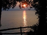
Lake
A lake is a body of relatively still fresh or salt water of considerable size, localized in a basin, that is surrounded by land. Lakes are inland and not part of the ocean and therefore are distinct from lagoons, and are larger and deeper than ponds. Lakes can be contrasted with rivers or streams,...
in North America
North America
North America is a continent wholly within the Northern Hemisphere and almost wholly within the Western Hemisphere. It is also considered a northern subcontinent of the Americas...
, located mainly within the borders of the United States
United States
The United States of America is a federal constitutional republic comprising fifty states and a federal district...
(states
U.S. state
A U.S. state is any one of the 50 federated states of the United States of America that share sovereignty with the federal government. Because of this shared sovereignty, an American is a citizen both of the federal entity and of his or her state of domicile. Four states use the official title of...
of Vermont
Vermont
Vermont is a state in the New England region of the northeastern United States of America. The state ranks 43rd in land area, , and 45th in total area. Its population according to the 2010 census, 630,337, is the second smallest in the country, larger only than Wyoming. It is the only New England...
and New York
New York
New York is a state in the Northeastern region of the United States. It is the nation's third most populous state. New York is bordered by New Jersey and Pennsylvania to the south, and by Connecticut, Massachusetts and Vermont to the east...
) but partially situated across the Canada—United States border in the Canadian
Canada
Canada is a North American country consisting of ten provinces and three territories. Located in the northern part of the continent, it extends from the Atlantic Ocean in the east to the Pacific Ocean in the west, and northward into the Arctic Ocean...
province of Quebec
Quebec
Quebec or is a province in east-central Canada. It is the only Canadian province with a predominantly French-speaking population and the only one whose sole official language is French at the provincial level....
.
The New York portion of the Champlain Valley includes the eastern portions of Clinton County
Clinton County, New York
Clinton County is a county located in the U.S. state of New York. As of the 2010 census, the population was 82,128. Its name is in honor of the first Governor of New York as a state, George Clinton. Its county seat is Plattsburgh.-History:...
and Essex County
Essex County, New York
Essex County is a county located in the U.S. state of New York. As of the 2010 census, the population was 39,370. Its name is from the English county of Essex. Its county seat is Elizabethtown...
. Most of this area is part of the Adirondack Park. There are recreational opportunities in the park and along the relatively undeveloped coastline of Lake Champlain.