
Boston Harbor
Encyclopedia
Estuary
An estuary is a partly enclosed coastal body of water with one or more rivers or streams flowing into it, and with a free connection to the open sea....
of Massachusetts Bay
Massachusetts Bay
The Massachusetts Bay, also called Mass Bay, is one of the largest bays of the Atlantic Ocean which forms the distinctive shape of the coastline of the U.S. state of Massachusetts. Its waters extend 65 miles into the Atlantic Ocean. Massachusetts Bay includes the Boston Harbor, Dorchester Bay,...
, and is located adjacent to the city of Boston, Massachusetts. It is home to the Port of Boston
Port of Boston
The Port of Boston, , is a major seaport located in Boston Harbor and adjacent to the City of Boston...
, a major shipping facility in the northeast
Northeastern United States
The Northeastern United States is a region of the United States as defined by the United States Census Bureau.-Composition:The region comprises nine states: the New England states of Connecticut, Maine, Massachusetts, New Hampshire, Rhode Island and Vermont; and the Mid-Atlantic states of New...
.
History
Since its discovery by John Smith in 1614, Boston Harbor has been an important port in American history. It was the site of the Boston Tea PartyBoston Tea Party
The Boston Tea Party was a direct action by colonists in Boston, a town in the British colony of Massachusetts, against the British government and the monopolistic East India Company that controlled all the tea imported into the colonies...
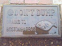
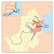
as well as almost continuous backfilling of the harbor until the 19th century. By 1660 almost all imports came to the greater Boston area and the New England coast through the waters of Boston Harbor. A rapid influx of people transformed Boston into a booming city. The health of the harbor quickly decreased as the population of Boston increased. As early as the late 19th century Boston citizens were advised not to swim in any portion of the Harbor. In the 1800s two of the first steam sewage stations were built (one in East Boston and one later on Deer Island). With these mandates the harbor was seeing small improvements, but raw sewage was still continuously pumped into the harbor. In 1919 the Metropolitan District Commission was created to oversee and regulate the quality of harbor water. However, not much improvement was seen and general public awareness of the poor quality of water was very low. In 1972 the Clean Water Act was passed in order to help promote increased national water quality. Boston did not receive a clean water act waiver from the Environmental Protection Agency, leaving Boston with little incentive to increase water quality of the harbor. Since the mid 1970’s organizations within the Boston community have battled for a cleaner Boston Harbor.
Sewage treatment
Sewage treatment, or domestic wastewater treatment, is the process of removing contaminants from wastewater and household sewage, both runoff and domestic. It includes physical, chemical, and biological processes to remove physical, chemical and biological contaminants...
plant in Quincy
Quincy, Massachusetts
Quincy is a city in Norfolk County, Massachusetts, United States. Its nicknames are "City of Presidents", "City of Legends", and "Birthplace of the American Dream". As a major part of Metropolitan Boston, Quincy is a member of Boston's Inner Core Committee for the Metropolitan Area Planning Council...
and the companion Deer Island
Deer Island (Massachusetts)
Deer Island is a peninsula in Boston Harbor, Massachusetts. Since 1996 it is part of the Boston Harbor Islands National Recreation Area. Although still an island by name, Deer Island has been connected to the mainland since the former Shirley Gut channel, which once separated the island from the...
plant adjacent to Winthrop
Winthrop, Massachusetts
The Town of Winthrop is a municipality in Suffolk County, Massachusetts, United States. The population of Winthrop was 17,497 at the 2010 U.S. Census. It is an oceanside suburban community in Greater Boston situated at the north entrance to Boston Harbor and is very close to Logan International...
had far-reaching environmental
Natural environment
The natural environment encompasses all living and non-living things occurring naturally on Earth or some region thereof. It is an environment that encompasses the interaction of all living species....
and political effects. Fecal coliform bacteria levels forced frequent swimming prohibitions along the harbor beaches and the Charles River
Charles River
The Charles River is an long river that flows in an overall northeasterly direction in eastern Massachusetts, USA. From its source in Hopkinton, the river travels through 22 cities and towns until reaching the Atlantic Ocean at Boston...
for many years. The city of Quincy sued the Metropolitan District Commission (MDC) and the separate Boston Water and Sewer Commission
Boston Water and Sewer Commission
The Boston Water and Sewer Commission serves retail customers with water services in Boston, Massachusetts. It purchases water wholesale from the Massachusetts Water Resources Authority ....
in 1982 charging unchecked systemic pollution of the city’s waterfront. That suit was followed by one by the Conservation Law Foundation
Conservation Law Foundation
Conservation Law Foundation is an environmental advocacy organization based in New England. Since 1966, CLF's mission has been to advocate on behalf of the region's environment and its communities. CLF's advocacy work takes place in four program areas: Clean Energy & Climate Change, Clean Water &...
and finally by the United States government, resulting in the landmark court-ordered cleanup of Boston Harbor. The lawsuits forced then Massachusetts Governor Michael Dukakis
Michael Dukakis
Michael Stanley Dukakis served as the 65th and 67th Governor of Massachusetts from 1975–1979 and from 1983–1991, and was the Democratic presidential nominee in 1988. He was born to Greek immigrants in Brookline, Massachusetts, also the birthplace of John F. Kennedy, and was the longest serving...
to propose separating the water and sewer treatment divisions from the MDC, resulting in the creation of the Massachusetts Water Resources Authority
Massachusetts Water Resources Authority
The Massachusetts Water Resources Authority is a public authority in the Commonwealth of Massachusetts that provides wholesale drinking water and sewage services to certain municipalities and industrial users in the state, primarily in the Boston area.The authority receives water from the Quabbin...
in 1985. The slow progress of the cleanup became a key theme of the 1988 U.S. presidential election as George H.W. Bush defeated Dukakis partly through campaign speeches casting doubt on the governor’s environmental record, which Dukakis himself had claimed was better than that of Bush. The court ordered cleanup continued throughout the next two decades and is still ongoing.
The Standells
The Standells are a garage rock band from Los Angeles, California, formed in the 1960s, who have been referred to as the "Godfathers of Punk Rock", and are best known for their 1966 hit "Dirty Water," now the anthem of several Boston sports teams.-The 1960s:...
released a song in 1966 called Dirty Water
Dirty Water
"Dirty Water" is a song first recorded by the California rock and roll band The Standells in 1966 and composed by their producer, Ed Cobb. It is considered a classic of garage rock.-Description:...
about the sorry state of the Charles River. The song is still popular with Red Sox
Boston Red Sox
The Boston Red Sox are a professional baseball team based in Boston, Massachusetts, and a member of Major League Baseball’s American League Eastern Division. Founded in as one of the American League's eight charter franchises, the Red Sox's home ballpark has been Fenway Park since . The "Red Sox"...
fans and is played regularly at Fenway Park.
Since the writing of the song, the water quality in both the Harbor and the Charles River has significantly improved, and the projects have dramatically transformed Boston Harbor from one of the filthiest in the nation to one of the cleanest. Today Boston Harbor is safe for fishing and for swimming nearly every day, though there are still beach closings after even small rainstorms, caused by bacteria-laden storm water and the occasional combined sewer overflow.
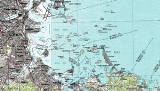
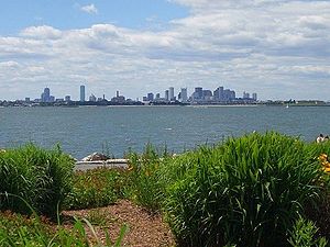
Geography
Boston Harbor is a large harborHarbor
A harbor or harbour , or haven, is a place where ships, boats, and barges can seek shelter from stormy weather, or else are stored for future use. Harbors can be natural or artificial...
which constitutes the western extremity of Massachusetts Bay
Massachusetts Bay
The Massachusetts Bay, also called Mass Bay, is one of the largest bays of the Atlantic Ocean which forms the distinctive shape of the coastline of the U.S. state of Massachusetts. Its waters extend 65 miles into the Atlantic Ocean. Massachusetts Bay includes the Boston Harbor, Dorchester Bay,...
. The harbor is sheltered from Massachusetts Bay and the open Atlantic Ocean
Atlantic Ocean
The Atlantic Ocean is the second-largest of the world's oceanic divisions. With a total area of about , it covers approximately 20% of the Earth's surface and about 26% of its water surface area...
by a combination of the Winthrop Peninsula
Winthrop, Massachusetts
The Town of Winthrop is a municipality in Suffolk County, Massachusetts, United States. The population of Winthrop was 17,497 at the 2010 U.S. Census. It is an oceanside suburban community in Greater Boston situated at the north entrance to Boston Harbor and is very close to Logan International...
and Deer Island
Deer Island (Massachusetts)
Deer Island is a peninsula in Boston Harbor, Massachusetts. Since 1996 it is part of the Boston Harbor Islands National Recreation Area. Although still an island by name, Deer Island has been connected to the mainland since the former Shirley Gut channel, which once separated the island from the...
to the north, the hooked Nantasket Peninsula and Point Allerton to the south, and the harbor islands in the middle. The harbor is often described as being split into an inner harbor and an outer harbor. The harbor itself comprises fifty square miles with 180 miles (289.7 km) of shoreline and 34 harbor islands.
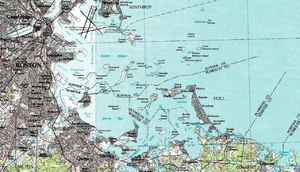
Inner harbor
The inner harbor was historically the main port of Boston and is still the site of most of its port facilities as well as the Boston waterfront, which has been redeveloped for residential and recreational uses. inner harbor extends from the mouths of the Charles RiverCharles River
The Charles River is an long river that flows in an overall northeasterly direction in eastern Massachusetts, USA. From its source in Hopkinton, the river travels through 22 cities and towns until reaching the Atlantic Ocean at Boston...
and the Mystic River
Mystic River
The Mystic River is a river in Massachusetts, in the United States. Its name derives from the Wampanoag word "muhs-uhtuq", which translates to "big river." In an Algonquian language, "Missi-Tuk" means "a great river whose waters are driven by waves", alluding to the natural tidal nature of the...
, both of which empty into the harbor, to Logan International Airport
Logan International Airport
General Edward Lawrence Logan International Airport is located in the East Boston neighborhood of Boston, Massachusetts . It covers , has six runways, and employs an estimated 16,000 people. It is the 19th busiest airport in the United States.Boston serves as a focus city for JetBlue Airways...
and Castle Island, where the inner harbor meets the outer harbor.
Outer harbor
The outer harbor stretches to the south and east of the inner harbor. To its landward side, and moving in a counterclockwise direction, the harbor is made up of the three small bays of Dorchester BayDorchester Bay (Boston Harbor)
Dorchester Bay is the smallest of the three small bays of southern Boston Harbor, part of Massachusetts Bay and forming the south shoreline of the South Boston neighborhood and northeast shoreline of the Dorchester neighborhood of Boston, as well as the north shore of the city of Quincy in...
, Quincy Bay
Quincy Bay
Quincy Bay is the largest of the three small bays of southern Boston Harbor, part of Massachusetts Bay and forming much of the shoreline of the city of Quincy, Massachusetts. Locally in the Wollaston neighborhood of Quincy it is known as Wollaston Bay...
and Hingham Bay
Hingham Bay
Hingham Bay is the easternmost of the three small bays of outer Boston Harbor, part of Massachusetts Bay and forming the western shoreline of the town of Hull and the northern shoreline of Hingham in the United States state of Massachusetts. It lies east of Quincy Bay and is met at the southwest by...
. To seaward, the two deep water anchorages of President Roads and Nantasket Roads are separated by Long Island
Long Island (Massachusetts)
This article is about the island Long Island, Boston. For other islands called Long Island, see Long Island .Long Island is situated in the middle of Boston Harbor, Massachusetts. The island is part of the City of Boston, and of the Boston Harbor Islands National Recreation Area...
. The outer harbor is fed by several rivers, including the Neponset River
Neponset River
The Neponset River is a river in eastern Massachusetts in the United States. The headwaters of the Neponset are at the Neponset Reservoir in Foxborough, near the Gillette Stadium...
, the Weymouth Fore River
Weymouth Fore River
Weymouth Fore River is a small bay or estuary in eastern Massachusetts and is part of the Massachusetts Bay watershed.The headwater of Weymouth Fore River is formed by the confluence of the Monatiquot River and Smelt Brook in the Weymouth Landing area of Braintree...
, the Weymouth Back River
Weymouth Back River
The Weymouth Back River, sometimes called Back River, is a short, primarily tidal river in Hingham and Weymouth, Massachusetts, about south of Boston...
and the Weir River
Weir River (Massachusetts)
Weir River is a short stream and estuary that empties into Hingham Bay, part of Boston Harbor in Massachusetts, United States. The name is attributed to the location of a fishing weir in the stream...
.
Dredged deepwater channels stretch from President Roads to the inner harbor, and from Nantasket Roads to the Weymouth Fore River. Some commercial port facilities are located in the Fore River area, an area which has a history of shipbuilding
Shipbuilding
Shipbuilding is the construction of ships and floating vessels. It normally takes place in a specialized facility known as a shipyard. Shipbuilders, also called shipwrights, follow a specialized occupation that traces its roots to before recorded history.Shipbuilding and ship repairs, both...
including the notable Fore River Shipyard
Fore River Shipyard
The Fore River Shipyard of Quincy, Massachusetts, more formally known as the Fore River Ship and Engine Building Company, was a shipyard in the United States from 1883 until 1986. Located on the Weymouth Fore River, the yard began operations in 1883 in Braintree, Massachusetts before being moved...
.
Harbor islands
Boston Harbor contains a considerable number of islands, 34 of which are part of the Boston Harbor Islands National Recreation AreaBoston Harbor Islands National Recreation Area
The Boston Harbor Islands National Recreation Area is a National Recreation Area situated among the islands of Boston Harbor of Boston, Massachusetts. The area is made up of a collection of islands, together with a former island and a peninsula, many of which are open for public recreation and some...
since its establishment in 1996. The following islands exist within the harbor:
- Bumpkin IslandBumpkin IslandBumpkin Island, also known as Round Island, Bomkin Island, Bumkin Island or Ward's Island, is an island in the Hingham Bay area of the Boston Harbor. Since 1996 it is part of the Boston Harbor Islands National Recreation Area. The island has an area of , plus an intertidal zone of a further...
, Button IslandButton Island (Massachusetts)Button Island is a small island in the Hingham Bay area of the Boston Harbor Islands National Recreation Area. The island has a permanent size of under , plus an intertidal zone of a further . It is composed of a massing of glacial till which rises to a height of above sea level... - Calf IslandCalf Island (Massachusetts)Calf Island, also known as Apthorps Island, is a windswept island situated some offshore of downtown Boston in the Boston Harbor Islands National Recreation Area. The island has a permanent size of , plus an intertidal zone of a further , and has a thin layer of soil that supports vegetation...
- Castle Island
- Gallops IslandGallops IslandGallops Island, also known as Gallups Island, is an island in the Boston Harbor Islands National Recreation Area, situated between Georges Island and Long Island and just over from downtown Boston. The island has a permanent size of , plus an intertidal zone of a further , and is composed of one...
, Georges Island, Grape IslandGrape Island (Massachusetts)Grape Island is an island in the Hingham Bay area of the Boston Harbor Islands National Recreation Area. The island is part of the territory of the town of Weymouth, Massachusetts. The island has a permanent size of , plus an intertidal zone of a further , and is composed of two drumlins, reaching...
, Great Brewster IslandGreat Brewster IslandGreat Brewster Island is a one of the outer islands in the Boston Harbor Islands National Recreation Area, situated some offshore of downtown Boston. The island has a permanent size of , plus an intertidal zone of a further...
, Green IslandGreen Island (Massachusetts)Green Island, also known as North Brewster Island, is a rocky outer island in the Boston Harbor Islands National Recreation Area, to the north of Calf Island and Hypocrite Channel. The island has a permanent size of , plus an intertidal zone of a further , and is exposed from the east and northeast... - Hangman IslandHangman IslandHangman Island, also known as Hayman's Island, is an island in the Quincy Bay area of the Boston Harbor Islands National Recreation Area. The island is a barren outcrop of bedrock, with a permanent size of half an acre rising to only three feet above sea level, plus an intertidal zone of a further...
- Langlee IslandLanglee IslandLanglee Island or Langley Island is an island in the Hingham Bay area of the Boston Harbor Islands National Recreation Area. The island has a permanent size of , plus an intertidal zone of a further , and is composed of a massing of roxbury puddingstone which rises to a height of above sea level...
, Little Brewster IslandLittle Brewster IslandLittle Brewster Island is a rocky outer island in the Boston Harbor Islands National Recreation Area. It is best known as the location of Boston Light, the only remaining Coast Guard-manned lighthouse in the United States, and an important navigation aid for traffic to and from the Port of Boston...
, Little Calf IslandLittle Calf IslandLittle Calf Island is a small rocky island in the Boston Harbor Islands National Recreation Area, some 9 miles offshore from downtown Boston, Massachusetts. The island has no vegetation and no history of human occupation. It is used for nesting by gulls and cormorants which can be aggressive during...
, Long IslandLong Island (Massachusetts)This article is about the island Long Island, Boston. For other islands called Long Island, see Long Island .Long Island is situated in the middle of Boston Harbor, Massachusetts. The island is part of the City of Boston, and of the Boston Harbor Islands National Recreation Area...
, Lovells IslandLovells IslandLovells Island, or Lovell's Island, is a island in the Boston Harbor Islands National Recreation Area, in Massachusetts. The island is across The Narrows from Georges Island and some offshore of downtown Boston. It is named after Captain William Lovell, who was an early settler of nearby Dorchester... - Middle Brewster IslandMiddle Brewster IslandMiddle Brewster Island is a rugged outer island in the Boston Harbor Islands National Recreation Area, located offshore from downtown Boston. The island has a permanent size of , reaches a height of above sea level, and is bounded by sharp cliffs and sunken crags. It has only sparse vegetation...
- Moon Island, Nixes MateNixes MateNixes Mate, also known as Nixes Island, Nix's Mate and Nick's Mate, is one of the smaller islands in the Boston Harbor Islands National Recreation Area. The island lies about 5 nm from downtown Boston and about 0.6 nm east of Long Island Head Light. The island covers and uncovers with the...
- Outer Brewster IslandOuter Brewster IslandOuter Brewster Island, also known as Outward Island, is a one of the outer islands in the Boston Harbor Islands National Recreation Area and is situated some 10 miles offshore of downtown Boston. The island has a permanent size of 20 acres, and consists of exposed bedrock covered by fertile soil...
- Peddocks IslandPeddocks IslandPeddocks Island is one of the largest islands in Boston Harbor. Since 1996 it has formed part of the Boston Harbor Islands National Recreation Area. The island is located at 42° 17' 32.6" North longitude and 70° 56' 21.6" West latitude. The area of the island is . The island is managed by the...
- Raccoon Island, Ragged IslandRagged Island (Massachusetts)Ragged Island is an island in the Hingham Bay area of the Boston Harbor Islands National Recreation Area, in the U.S. state of Massachusetts. The island has a permanent size of , and it is composed of a massing of roxbury puddingstone which rises to a height of above sea level...
, Rainsford IslandRainsford IslandRainsford Island, formerly known Hospital Island, Pest House Island, and Quarantine Island, is a island in the Boston Harbor, situated between Long Island and Peddocks Island. The island is composed of two drumlins, reaching an elevation of above sea level. The shoreline is predominantly rocky... - Sarah IslandSarah Island (Massachusetts)Sarah Island is an island in the Hingham Bay area of the Boston Harbor Islands National Recreation Area. The island has a permanent size of just under , and is composed large outcroppings and ledges of roxbury puddingstone together with glacial till which rises to a height of above sea level...
, Shag RocksShag Rocks (Massachusetts)Shag Rocks are barren rocks situated 8 nautical miles offshore of Custom House Tower in downtown Boston, in the Boston Harbor Islands National Recreation Area and within the city limits of Boston. The rocks are northeast of Little Brewster Island and east of Great Brewster Island and have been the...
, Sheep Island, Slate Island, Snake IslandSnake Island (Massachusetts)Snake Island, also known as Bare Island, is an island in Boston Harbor. The island is part of the Boston Harbor Islands National Recreation Area and is situated in the inner harbor between the town of Winthrop and the reclaimed land that forms Logan International Airport...
, Spectacle Island, Spinnaker IslandSpinnaker Island (Massachusetts)Spinnaker Island is an island in the Hingham Bay area of Boston Harbor in Massachusetts... - The Graves, Thompson IslandThompson Island (Massachusetts)Thompson Island is an island in the Boston Harbor, some 4 miles offshore from downtown Boston, Massachusetts. The island is managed by the Thompson Island Outward Bound Education Center, a non-profit education organization. The island is open to visitors on summer Sundays; otherwise access is by...
Deer Island (Massachusetts)
Deer Island is a peninsula in Boston Harbor, Massachusetts. Since 1996 it is part of the Boston Harbor Islands National Recreation Area. Although still an island by name, Deer Island has been connected to the mainland since the former Shirley Gut channel, which once separated the island from the...
, still exist in a recognizable form. Castle Island was joined to the mainland by land reclamation
Land reclamation
Land reclamation, usually known as reclamation, is the process to create new land from sea or riverbeds. The land reclaimed is known as reclamation ground or landfill.- Habitation :...
, while Deer Island ceased to be an island when the channel which formerly separated it from the mainland was filled in by the New England Hurricane of 1938
New England Hurricane of 1938
The New England Hurricane of 1938 was the first major hurricane to strike New England since 1869...
.
Nut Island is a small former island in Boston Harbor that was joined by landfill to the Hough's Neck peninsula in northeastern Quincy by the 1940s for use as the site of a sewage treatment facility.
Two other former islands, Apple Island
Apple Island (Massachusetts)
Apple Island was an island in Boston Harbor in Massachusetts. The island has been subsumed into land reclamation for the construction and extension of Boston's Logan International Airport....
and Governors Island
Governors Island (Massachusetts)
Governors Island was an island in Boston Harbor in the U.S. state of Massachusetts. The island was subsumed by land reclamation for the construction and extension of Logan International Airport....
, have been subsumed into land reclamation for Logan International Airport
Logan International Airport
General Edward Lawrence Logan International Airport is located in the East Boston neighborhood of Boston, Massachusetts . It covers , has six runways, and employs an estimated 16,000 people. It is the 19th busiest airport in the United States.Boston serves as a focus city for JetBlue Airways...
.
Aquaculture
In 1996, the Boston Globe reported that Mayor Thomas MeninoThomas Menino
Thomas Michael "Tom" Menino is the mayor of Boston, Massachusetts, United States and the city's first Italian-American mayor...
and MIT
Massachusetts Institute of Technology
The Massachusetts Institute of Technology is a private research university located in Cambridge, Massachusetts. MIT has five schools and one college, containing a total of 32 academic departments, with a strong emphasis on scientific and technological education and research.Founded in 1861 in...
engineer Clifford Goudey were planning a program to use the great tanks on Moon Island as a fish farm or a temporary home for tuna or lobster in an attempt to implement a recirculating aquaculture
Aquaculture
Aquaculture, also known as aquafarming, is the farming of aquatic organisms such as fish, crustaceans, molluscs and aquatic plants. Aquaculture involves cultivating freshwater and saltwater populations under controlled conditions, and can be contrasted with commercial fishing, which is the...
system in Boston Harbor. The prices of both these fish types vary by season. The plan was to collect and store fish in the tanks and sell the fish at higher prices when they were out of season. Nothing has come of this plan to date.
Lights and lighthouses
- Boston LightBoston LightBoston Light is a lighthouse located on Little Brewster Island in outer Boston Harbor, Massachusetts. The first lighthouse to be built on the site dates back to 1716, and was the first lighthouse to be built in what is now the United States...
- Deer Island LightDeer Island LightDeer Island Light is a lighthouse in Boston Harbor, Boston, Massachusetts.The United States Coast Guard Light List description is "Red cylindrical tower; black cylindrical pier". The actual light is 53 feet above Mean High Water. Its alternating white and red light is visible for .The light is at...
- Egg Rock LightEgg Rock Light (Massachusetts)Egg Rock Light was first established in 1856 after a schooner went down with the loss of five lives. The original structure was a lantern on top of a stone dwelling built from granite cut on the island...
- Long Island Head LightLong Island Head LightLong Island Head Light is an historic lighthouse on Long Island in Boston, Massachusetts. The current brick tower is the fourth lighthouse on the island. The light was first established in 1819, largely as a result of a study conducted by the Boston Marine Society, which had built the daybeacon on...
- Lovells Island Range Lights
- Nixes MateNixes MateNixes Mate, also known as Nixes Island, Nix's Mate and Nick's Mate, is one of the smaller islands in the Boston Harbor Islands National Recreation Area. The island lies about 5 nm from downtown Boston and about 0.6 nm east of Long Island Head Light. The island covers and uncovers with the...
- Spectacle Island Range LightsSpectacle Island Range LightsThe Spectacle Island Range Lights were a pair of range lights on Spectacle Island in Boston Harbor. They were established in 1897 and discontinued in 1913 after changes in the entrance channels to the harbor made them obsolete....
- The Graves Light
External links
- Save the Harbor / Save the Bay
- The Boston Harbor Association
- Boston Harbor resources site
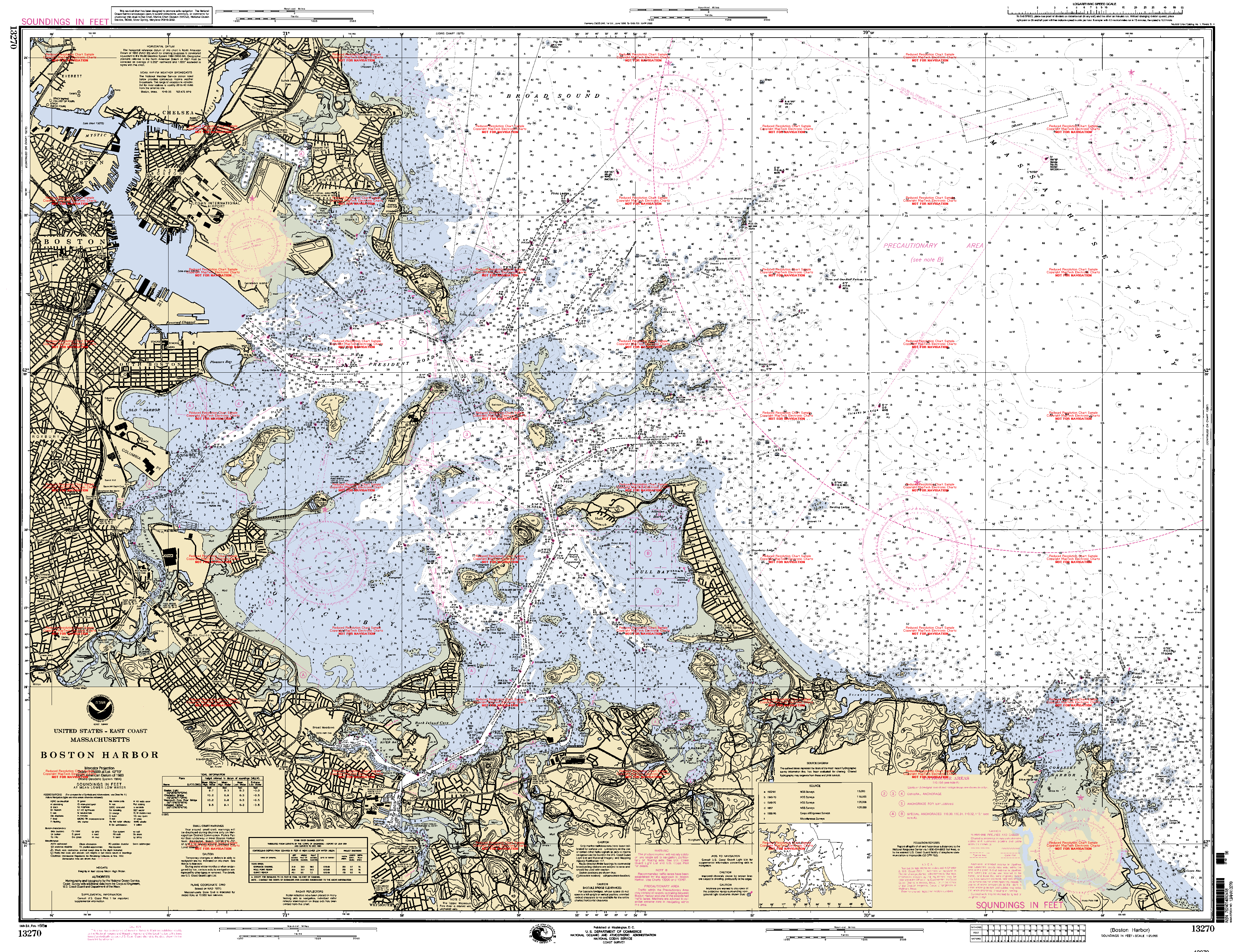
- NOAA Soundings Map of Boston Harbor
- Flickr.com, Photos, January 2009.
- Flickr.com, Photos, November 2009.
- Flickr.com, Photos, February 2010.