
Florida Keys
Encyclopedia
Coral island
A coral island is the result of an atoll whose lagoon has dried up or been filled in with coral sand and detritus. This state is typically the last in the life cycle of an island, the first being volcanic and the second being an atoll. Most of the world's coral islands are in the Pacific Ocean...
archipelago
Archipelago
An archipelago , sometimes called an island group, is a chain or cluster of islands. The word archipelago is derived from the Greek ἄρχι- – arkhi- and πέλαγος – pélagos through the Italian arcipelago...
in southeast United States. They begin at the southeastern tip of the Florida
Florida
Florida is a state in the southeastern United States, located on the nation's Atlantic and Gulf coasts. It is bordered to the west by the Gulf of Mexico, to the north by Alabama and Georgia and to the east by the Atlantic Ocean. With a population of 18,801,310 as measured by the 2010 census, it...
peninsula
Peninsula
A peninsula is a piece of land that is bordered by water on three sides but connected to mainland. In many Germanic and Celtic languages and also in Baltic, Slavic and Hungarian, peninsulas are called "half-islands"....
, about 15 miles (24.1 km) south of Miami, and extend in a gentle arc south-southwest and then westward to Key West
Key West, Florida
Key West is a city in Monroe County, Florida, United States. The city encompasses the island of Key West, the part of Stock Island north of U.S. 1 , Sigsbee Park , Fleming Key , and Sunset Key...
, the westernmost of the inhabited islands, and on to the uninhabited Dry Tortugas
Dry Tortugas
The Dry Tortugas are a small group of islands, located at the end of the Florida Keys, USA, about west of Key West, and west of the Marquesas Keys, the closest islands. Still further west is the Tortugas Bank, which is completely submerged. The first Europeans to discover the islands were the...
. The islands lie along the Florida Straits, dividing the Atlantic Ocean
Atlantic Ocean
The Atlantic Ocean is the second-largest of the world's oceanic divisions. With a total area of about , it covers approximately 20% of the Earth's surface and about 26% of its water surface area...
to the east from the Gulf of Mexico
Gulf of Mexico
The Gulf of Mexico is a partially landlocked ocean basin largely surrounded by the North American continent and the island of Cuba. It is bounded on the northeast, north and northwest by the Gulf Coast of the United States, on the southwest and south by Mexico, and on the southeast by Cuba. In...
to the west, and defining one edge of Florida Bay
Florida Bay
Florida Bay is the bay located between the southern end of the Florida mainland and the Florida Keys. Its area is variously stated to be , or , or . Nearly all of Florida Bay is included in Everglades National Park. The southern edge, along the Florida Keys is in the Florida Keys National Marine...
. At the nearest point, the southern tip of Key West is just 90 miles (144.8 km) from Cuba
Cuba
The Republic of Cuba is an island nation in the Caribbean. The nation of Cuba consists of the main island of Cuba, the Isla de la Juventud, and several archipelagos. Havana is the largest city in Cuba and the country's capital. Santiago de Cuba is the second largest city...
. The Florida Keys are between about 23.5 and 25.5 degrees North latitude, in the subtropics
Subtropics
The subtropics are the geographical and climatical zone of the Earth immediately north and south of the tropical zone, which is bounded by the Tropic of Cancer and the Tropic of Capricorn, at latitudes 23.5°N and 23.5°S...
. The climate of the Keys, however, is defined as tropical
Tropical climate
A tropical climate is a climate of the tropics. In the Köppen climate classification it is a non-arid climate in which all twelve months have mean temperatures above...
according to Köppen climate classification
Köppen climate classification
The Köppen climate classification is one of the most widely used climate classification systems. It was first published by Crimea German climatologist Wladimir Köppen in 1884, with several later modifications by Köppen himself, notably in 1918 and 1936...
. More than 95 percent of the land area lies in Monroe County
Monroe County, Florida
Monroe County is a county located in the state of Florida. As of 2000, the population was 79,589. The U.S. Census Bureau 2006 estimate for the county was 74,737....
, but a small portion extends northeast into Miami-Dade County
Miami-Dade County, Florida
Miami-Dade County is a county located in the southeastern part of the state of Florida. As of 2010 U.S. Census, the county had a population of 2,496,435, making it the most populous county in Florida and the eighth-most populous county in the United States...
, such as Totten Key
Totten Key
Totten Key is an island of the upper Florida Keys in Biscayne National Park. It is in Miami-Dade County, Florida.It is located in southern Biscayne Bay, just west of Old Rhodes Key.-History:...
. The total land area is 137.3 square miles (355.6 km²). As of the 2000 census
United States Census, 2000
The Twenty-second United States Census, known as Census 2000 and conducted by the Census Bureau, determined the resident population of the United States on April 1, 2000, to be 281,421,906, an increase of 13.2% over the 248,709,873 persons enumerated during the 1990 Census...
the population was 79,535, with an average density of 579.27 /sqmi, although much of the population is concentrated in a few areas of much higher density, such as the city of Key West, which has 32% of the entire population of the Keys.
The city of Key West is the county seat
County seat
A county seat is an administrative center, or seat of government, for a county or civil parish. The term is primarily used in the United States....
of Monroe County
Monroe County, Florida
Monroe County is a county located in the state of Florida. As of 2000, the population was 79,589. The U.S. Census Bureau 2006 estimate for the county was 74,737....
. The county consists of a section on the mainland
Mainland
Mainland is a name given to a large landmass in a region , or to the largest of a group of islands in an archipelago. Sometimes its residents are called "Mainlanders"...
which is almost entirely in Everglades National Park
Everglades National Park
Everglades National Park is a national park in the U.S. state of Florida that protects the southern 25 percent of the original Everglades. It is the largest subtropical wilderness in the United States, and is visited on average by one million people each year. It is the third-largest...
, and the Keys islands from Key Largo
Key Largo
Key Largo is an island in the upper Florida Keys archipelago and, at long, the largest of the Keys. It is also the northernmost of the Florida Keys in Monroe County, and the northernmost of the Keys connected by U.S. Highway 1...
to the Dry Tortugas.
Early history
Calusa
The Calusa were a Native American people who lived on the coast and along the inner waterways of Florida's southwest coast. Calusa society developed from that of archaic peoples of the Everglades region; at the time of European contact, the Calusa were the people of the Caloosahatchee culture...
and Tequesta
Tequesta
The Tequesta Native American tribe, at the time of first European contact, occupied an area along the southeastern Atlantic coast of Florida...
Native Americans. They were later found and charted by Juan Ponce de León
Juan Ponce de León
Juan Ponce de León was a Spanish explorer. He became the first Governor of Puerto Rico by appointment of the Spanish crown. He led the first European expedition to Florida, which he named...
in 1513. de León named the islands Los Martires ('The Martyrs') as they looked like suffering men from a distance. "Key" is corrupted from the Spanish Cayo, meaning small island. For many years, Key West was the largest town in Florida, and it grew prosperous on wrecking. The isolated outpost was well located for trade with Cuba, the Bahamas, and was on the main trade route from New Orleans. Improved navigation led to fewer shipwrecks, and Key West went into a decline in the late nineteenth century.
Overseas Railway
The Keys were long accessible only by water. This changed with the completion of Henry Flagler's Overseas Railway in the early 1910s. Flagler, a major developer of Florida's Atlantic coast, extended his Florida East Coast RailwayFlorida East Coast Railway
The Florida East Coast Railway is a Class II railroad operating in the U.S. state of Florida; in the past, it has been a Class I railroad.Built primarily in the last quarter of the 19th century and the first decade of the 20th century, the FEC was a project of Standard Oil principal Henry Morrison...
down to Key West with an ambitious series of over-sea railroad trestles. Three hurricanes disrupted the project—one in 1906
1906 Florida Keys hurricane
The 1906 Florida Keys hurricane was a powerful and deadly hurricane that caused major impacts in Cuba and southern Florida. The fifth hurricane and third major hurricane of the season, the storm formed from a system near Barbados on October 4. By October 8, it had intensified into a tropical storm,...
, 1909, and 1910
1910 Cuba hurricane
The 1910 Cuba hurricane, popularly known as the Cyclone of the Five Days, was a destructive and unusual tropical cyclone which struck Cuba and the United States in October 1910. It formed in the southern Caribbean on October 9 and intensified as it moved northwestward, becoming a...
.
Labor Day Hurricane of 1935
One of the worst hurricanes to strike the U.S. made landfall near Islamorada in the Upper Keys on Labor Day, Monday 2 September. Winds were estimated to have gusted to 200 mi/h, raising a storm surge more than 17.5 feet (5.3 m) above sea level that washed over the islands. More than 400 people were killed, though some estimates place the number of deaths at more than 600.The Labor Day Hurricane is one of only three hurricanes to make landfall at Category 5
Saffir-Simpson Hurricane Scale
The Saffir–Simpson Hurricane Scale , or the Saffir–Simpson Hurricane Wind Scale , classifies hurricanes — Western Hemisphere tropical cyclones that exceed the intensities of tropical depressions and tropical storms — into five categories distinguished by the intensities of their sustained winds...
strength on the U.S. coast since reliable weather records began (about 1850). The other storms were Hurricane Camille
Hurricane Camille
Hurricane Camille was the third and strongest tropical cyclone and second hurricane during the 1969 Atlantic hurricane season. The second of three catastrophic Category 5 hurricanes to make landfall in the United States during the 20th century , which it did near the mouth of the Mississippi River...
(1969) and Hurricane Andrew
Hurricane Andrew
Hurricane Andrew was the third Category 5 hurricane to make landfall in the United States, after the Labor Day Hurricane of 1935 and Hurricane Camille in 1969. Andrew was the first named storm and only major hurricane of the otherwise inactive 1992 Atlantic hurricane season...
(1992).
In 1935, new bridges were under construction to connect a highway through the entire Keys. Hundreds of World War I veterans working on the roadway as part of a government relief program were housed in non-reinforced buildings in three construction camps in the Upper Keys. When the evacuation train failed to reach the camps before the storm, more than 200 veterans perished. Their deaths caused anger and charges of mismanagement that led to a Congressional investigation.
The storm also ended the 23-year run of the Overseas Railway; the damaged tracks were never rebuilt, and the Overseas Highway (U.S. Highway 1) replaced the railroad as the main transportation route from Miami to Key West.
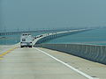
Seven Mile Bridge
One of the longest bridges when it was built, the Seven Mile BridgeSeven Mile Bridge
The Seven Mile Bridge is a famous bridge in the Florida Keys, in Monroe County, Florida, United States. It connects Knight's Key in the Middle Keys to Little Duck Key in the Lower Keys...
connects Knight's Key
Knight's Key
Knight's Key is an island in the middle Florida Keys, located entirely within the borders of the city of Marathon, Florida.-Geography:U.S. 1 crosses the key at approximately mile marker 47, at the western end of Key Vaca and eastern end of the Seven Mile Bridge.-History:Prior to the completion of...
(part of the city of Marathon
Marathon, Florida
Marathon is a city on Knight's Key, Boot Key, Key Vaca, Fat Deer Key, Long Point Key, Crawl Key and Grassy Key islands in the middle Florida Keys, in Monroe County, Florida, in the United States. As of the 2000 census, the city had a total population of 10,255. As of 2005, the population estimated...
in the Middle Keys) to Little Duck Key
Little Duck Key
Little Duck Key is a small island in the lower Florida Keys.U.S. 1 crosses the key at approximately mile marker 40, just west of the Seven Mile Bridge...
in the Lower Keys. The piling-supported concrete bridge is 35862 ft (10,930.7 m) or 6.79 miles (10.93 km) long. The current bridge bypasses Pigeon Key
Pigeon Key
Pigeon Key is a historic district located on the small island of Pigeon Key in the lower Florida Keys. The island is named "Cayo Paloma" on many old Spanish charts...
, a small island that housed workers building Henry Flagler's Florida East Coast Railway
Florida East Coast Railway
The Florida East Coast Railway is a Class II railroad operating in the U.S. state of Florida; in the past, it has been a Class I railroad.Built primarily in the last quarter of the 19th century and the first decade of the 20th century, the FEC was a project of Standard Oil principal Henry Morrison...
in the 1900s, that the original Seven Mile Bridge crossed. A 2.2 miles (3.5 km) section of the old bridge remains for access to the island, although it was closed to vehicular traffic on March 4, 2008. The aging structure has been deemed unsafe by the Florida Department of Transportation
Florida Department of Transportation
The Florida Department of Transportation is a decentralized agency charged with the establishment, maintenance, and regulation of public transportation in the state of Florida. The department was formed in 1969. It absorbed the powers of the Florida State Road Department...
. Costly repairs, estimated to be as much as $34 million, were expected to begin in July 2008. Monroe County was unable to secure a $17 million loan through the state infrastructure bank, delaying work for at least a year. On June 14, 2008, the old bridge section leading to Pigeon Key was closed to fishing as well. While still open to pedestrians — walking, biking and jogging — if the bridge were closed altogether, only a ferry subsidized by FDOT and managed by the county would transport visitors to the island.
After the destruction of the Keys railway by the Labor Day Hurricane of 1935
Labor Day Hurricane of 1935
The 1935 Labor Day Hurricane was the strongest tropical cyclone of the 1935 Atlantic hurricane season, and one of the most intense hurricanes to make landfall in the United States in recorded history...
, the railroad bridges, including the Seven Mile Bridge, were converted to automobile roadways. U.S. 1
U.S. Route 1 in Florida
U.S. Route 1 in Florida runs along the state's east coast from Key West to its crossing of the St. Marys River into Georgia north of Boulogne, and south of Folkston. US 1 was designated through Florida when the U.S. Highway System was established in 1926.US 1 runs in the state of Florida, and...
runs the length of the Keys and up the East Coast to Maine
Maine
Maine is a state in the New England region of the northeastern United States, bordered by the Atlantic Ocean to the east and south, New Hampshire to the west, and the Canadian provinces of Quebec to the northwest and New Brunswick to the northeast. Maine is both the northernmost and easternmost...
; the Keys section is also called the Overseas Highway
Overseas Highway
The Overseas Highway is a highway carrying U.S. Route 1 through the Florida Keys. Large parts of it were built on the former right-of-way of the Overseas Railroad, the Key West Extension of the Florida East Coast Railway. Completed in 1912, the Overseas Railroad was heavily damaged and partially...
.
Cuban exiles
Following the Cuban RevolutionCuban Revolution
The Cuban Revolution was an armed revolt by Fidel Castro's 26th of July Movement against the regime of Cuban dictator Fulgencio Batista between 1953 and 1959. Batista was finally ousted on 1 January 1959, and was replaced by a revolutionary government led by Castro...
, many Cubans fled to South Florida. Key West traditionally had strong links with their neighbor ninety miles south by water, and large numbers of Cubans settled there. The Keys still attract Cubans leaving their home country, and stories of "boat people" coming ashore are not uncommon.
Conch Republic
In 1982, the United States Border PatrolUnited States Border Patrol
The United States Border Patrol is a federal law enforcement agency within U.S. Customs and Border Protection , a component of the Department of Homeland Security . It is an agency in the Department of Homeland Security that enforces laws and regulations for the admission of foreign-born persons to...
had established a roadblock and inspection points on US Highway 1, stopping all northbound traffic returning to the mainland at Florida City
Florida City, Florida
Florida City is a city in Miami-Dade County, Florida, United States and is the southernmost municipality in the South Florida metropolitan area, which had an estimated population of 5,413,212 in 2007. The population was 7,843 at the 2000 census. As of 2004, the population estimated by the U.S....
, to search vehicles for illegal drugs and illegal immigrants. The Key West City Council repeatedly complained about the roadblocks, which were a major inconvenience for people traveling from Key West, and hurt the Keys' important tourism industry.
After various unsuccessful complaints and attempts to get a legal injunction against the blockade failed in federal court in Miami, on 23 April 1982 Key West mayor Dennis Wardlow
Dennis Wardlow
Dennis Wardlow is a former Mayor of Key West, Florida, having served on three separate occasions.He is best known, however, as the Prime Minister of the Conch Republic, the micronation that seceded from the United States on April 23, 1982, in protest over a United States Border Patrol blockade...
and the city council declared the independence of the city of Key West
Key West, Florida
Key West is a city in Monroe County, Florida, United States. The city encompasses the island of Key West, the part of Stock Island north of U.S. 1 , Sigsbee Park , Fleming Key , and Sunset Key...
, calling it the "Conch Republic
Conch Republic
The Conch Republic is a micronation declared as a tongue-in-cheek secession of the city of Key West from the United States on April 23, 1982. It has been maintained as a tourism booster for the city since...
". After one minute of secession, he (as "Prime Minister") surrendered to an officer of the Key West Naval Air Station (NAS), and requested one billion ($1,000,000,000) dollars in "foreign aid".
The stunt succeeded in generating great publicity for the Keys' plight, and the inspection station roadblock was removed. It also provided a new source of revenue for the Keys, and the Conch Republic has participated in later protests.
Drug smuggling
Many fortunes have been made through the smuggling of drugs into the United States by way of the Keys. Law enforcement has been a major addition over the years as smuggling increased and spread throughout most of the Keys. During the 1970s this Law Enforcement was practically non-existent, and tons of cannabis came into the Keys by boat and were carried off the islands by tractor trailers. With the beginning of the "War on DrugsWar on Drugs
The War on Drugs is a campaign of prohibition and foreign military aid and military intervention being undertaken by the United States government, with the assistance of participating countries, intended to both define and reduce the illegal drug trade...
" in the 1980s, Federal and State Law Enforcement began its expansion in a futile effort to stop the smuggling.
The smuggling groups adjusted their tactics and even though Law Enforcement began to make some arrests, drugs continued to pour through from Key West to Everglades City. The 1980s saw the rise of cocaine smuggling into the Keys by smaller boats with "hidden" compartments and various underwater containers attached to the bottom of vessels.
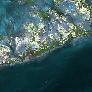
Geology
Coral reef
Coral reefs are underwater structures made from calcium carbonate secreted by corals. Coral reefs are colonies of tiny living animals found in marine waters that contain few nutrients. Most coral reefs are built from stony corals, which in turn consist of polyps that cluster in groups. The polyps...
.
The northernmost island arising from the ancient reef formation is Elliott Key
Elliott Key
Elliott Key is the northernmost of the true Florida Keys , and the largest key north of Key Largo. It is located entirely within Biscayne National Park, in Miami-Dade County, Florida, east of Homestead, Florida...
, in Biscayne National Park
Biscayne National Park
Biscayne National Park is a U.S. National Park located in southern Florida, due east of Homestead. The park preserves Biscayne Bay, one of the top scuba diving areas in the United States. Ninety-five percent of the park is water. In addition, the shore of the bay is the location of an extensive...
. North of Elliott Key are several small transitional keys, composed of sand built up around small areas of exposed ancient reef. Further north, Key Biscayne
Key Biscayne
Key Biscayne is an island located in Miami-Dade County, Florida, United States, between the Atlantic Ocean and Biscayne Bay. It is the southernmost of the barrier islands along the Atlantic coast of Florida, and lies south of Miami Beach and southeast of Miami...
and places north are barrier islands
Bar (landform)
A shoal, sandbar , or gravelbar is a somewhat linear landform within or extending into a body of water, typically composed of sand, silt or small pebbles. A spit or sandspit is a type of shoal...
, built up of sand.
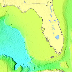
The Florida Keys have taken their present form as the result of the drastic changes in sea level associated with recent glaciations or ice age
Ice age
An ice age or, more precisely, glacial age, is a generic geological period of long-term reduction in the temperature of the Earth's surface and atmosphere, resulting in the presence or expansion of continental ice sheets, polar ice sheets and alpine glaciers...
s. Beginning some 130,000 years ago the Sangamonian Stage
Sangamonian Stage
The Sangamonian Stage, also known as the Sangamon interglacial, is the name used by Quaternary geologists to designate the last interglacial period in North America from 125,000—75,000 years ago, a period of...
raised sea levels to approximately 25 feet (7.5 m) above the current level. All of southern Florida was covered by a shallow sea. Several parallel lines of reef formed along the edge of the submerged Florida plateau
Plateau
In geology and earth science, a plateau , also called a high plain or tableland, is an area of highland, usually consisting of relatively flat terrain. A highly eroded plateau is called a dissected plateau...
, stretching south and then west from the present Miami area to what is now the Dry Tortugas. This reef formed the Key Largo limestone
Limestone
Limestone is a sedimentary rock composed largely of the minerals calcite and aragonite, which are different crystal forms of calcium carbonate . Many limestones are composed from skeletal fragments of marine organisms such as coral or foraminifera....
that is exposed on the surface from Soldier Key
Soldier Key
Soldier Key is an island in Biscayne National Park in Miami-Dade County, Florida. It is located between Biscayne Bay and the Atlantic Ocean, about three miles north of the Ragged Keys, five miles south of Cape Florida on Key Biscayne, seven-and-a-half miles east of the mainland and three miles west...
(midway between Key Biscayne and Elliott Key) to the southeast portion of Big Pine Key and the Newfound Harbor Keys. The types of coral
Coral
Corals are marine animals in class Anthozoa of phylum Cnidaria typically living in compact colonies of many identical individual "polyps". The group includes the important reef builders that inhabit tropical oceans and secrete calcium carbonate to form a hard skeleton.A coral "head" is a colony of...
that formed Key Largo limestone can be identified on the exposed surface of these keys.
Starting about 100,000 years ago the Wisconsin glaciation
Wisconsin glaciation
The last glacial period was the most recent glacial period within the current ice age occurring during the last years of the Pleistocene, from approximately 110,000 to 10,000 years ago....
began lowering sea levels, exposing the coral reef and surrounding marine
Marine geology
Marine geology or geological oceanography involves geophysical, geochemical, sedimentological and paleontological investigations of the ocean floor and coastal margins...
sediment
Sediment
Sediment is naturally occurring material that is broken down by processes of weathering and erosion, and is subsequently transported by the action of fluids such as wind, water, or ice, and/or by the force of gravity acting on the particle itself....
s. By 15,000 years ago the sea level had dropped to 300 to 350 feet (106.7 m) below the contemporary level. The exposed reefs and sediments were heavily eroded. Acidic water, which can result from decaying vegetation, dissolves limestone. Some of the dissolved limestone redeposited as a denser cap rock, which can be seen as outcrops overlying the Key Largo and Miami limestones throughout the Keys. The limestone that eroded from the reef formed oolite
Oolite
Oolite is a sedimentary rock formed from ooids, spherical grains composed of concentric layers. The name derives from the Hellenic word òoion for egg. Strictly, oolites consist of ooids of diameter 0.25–2 mm; rocks composed of ooids larger than 2 mm are called pisolites...
s in the shallow sea behind the reef, and together with the skeletal remains of bryozoans, formed the Miami limestone that is the current surface bedrock of the lower Florida peninsula and the lower keys from Big Pine Key to Key West. To the west of Key West the ancient reef is covered by recent calcareous
Calcareous
Calcareous is an adjective meaning mostly or partly composed of calcium carbonate, in other words, containing lime or being chalky. The term is used in a wide variety of scientific disciplines.-In zoology:...
sand.
Just offshore of the Florida Keys along the edge of the Florida Straits is the Florida Reef (also known as the Florida Reef Tract). The Florida Reef extends 270 km from Fowey Rocks
Fowey Rocks Light
Fowey Rocks Light is located seven miles southeast of Cape Florida on Key Biscayne. The lighthouse was completed in 1878, replacing the Cape Florida lighthouse. It was automated on May 7, 1974 and is still in operation today. The structure is cast iron, with a screw-pile foundation, a platform and...
just east of Soldier Key to just south of the Marquesas Keys. It is the third largest barrier reef
Coral reef
Coral reefs are underwater structures made from calcium carbonate secreted by corals. Coral reefs are colonies of tiny living animals found in marine waters that contain few nutrients. Most coral reefs are built from stony corals, which in turn consist of polyps that cluster in groups. The polyps...
system in the world.
Environment


24th parallel north
The 24th parallel north is a circle of latitude that is 24 degrees north of the Earth's equatorial plane. It crosses Africa, Asia, the Indian Ocean, the Pacific Ocean, North America and the Atlantic Ocean....
and 25 degrees north
25th parallel north
The 25th parallel north is a circle of latitude that is 25 degrees north of the Earth's equatorial plane. It crosses Africa, Asia, the Indian Ocean, the Pacific Ocean, North America and the Atlantic Ocean....
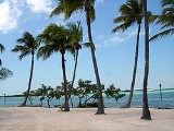
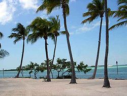
latitude. The climate and environment are closer to that of the Caribbean than the rest of Florida, though unlike the Caribbean's volcanic islands, the Keys were built by plants and animals.
The Upper Keys islands are remnants of large coral reefs, which became fossilized and exposed as sea level declined. The Lower Keys are composed of sandy-type accumulations of limestone grains produced by plants and marine organisms.
The natural habitats of the Keys are upland forests, inland wetlands and shoreline zones. Soil ranges from sand to marl to rich, decomposed leaf litter. In some places, "caprock" (the eroded surface of coral formations) covers the ground. Rain falling through leaf debris
Plant litter
Plant litter, leaf litter or tree litter is dead plant material, such as leaves, bark, needles, and twigs, that has fallen to the ground. Litter provides habitat for small animals, fungi, and plants, and the material may be used to construct nests. As litter decomposes, nutrients are released to...
becomes acidic and dissolves holes in the limestone, where soil accumulates and trees root.
The climate is tropical
Tropical climate
A tropical climate is a climate of the tropics. In the Köppen climate classification it is a non-arid climate in which all twelve months have mean temperatures above...
(Koppen climate classification
Köppen climate classification
The Köppen climate classification is one of the most widely used climate classification systems. It was first published by Crimea German climatologist Wladimir Köppen in 1884, with several later modifications by Köppen himself, notably in 1918 and 1936...
Aw), and the Keys are the only frost-free place in Florida. There are two main "seasons": hot, wet, and humid from about June through October, and somewhat drier and cooler weather from November through May. Many plants grow slowly or go dormant in the dry season. Some native trees are deciduous, and drop their leaves in the winter or with spring winds.
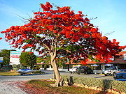
The Keys have distinctive plant and animals species, some found nowhere else in America, as the Keys define the northern extent of their ranges. The climate also allows many imported plants to thrive. Nearly any houseplant known to commerce, and most landscape plants of the South, can thrive in the Keys climate. Some exotic species which arrived as landscape plants now invade and threaten natural areas.
The native flora of the Keys is diverse, including members of both temperate families, such as red maple (Acer rubrum), slash pine (Pinus elliotti var. densa) and oaks (Quercus
Oak
An oak is a tree or shrub in the genus Quercus , of which about 600 species exist. "Oak" may also appear in the names of species in related genera, notably Lithocarpus...
spp.), growing at the southern end of their ranges, and tropical families, including mahogany (Swietenia mahagoni
Swietenia mahagoni
Swietenia mahagoni, commonly known as the West Indies Mahogany, is a species of Swietenia native to southern Florida, USA, The Bahamas, Cuba, Jamaica, and Hispaniola. It is the species from which the original mahogany wood was produced....
), gumbo limbo (Bursera simaruba
Bursera simaruba
Bursera simaruba, commonly known as the Gumbo-limbo, is a tree species in the family Burseraceae, native to tropical regions of the Americas from the southeasternmost United States south through Mexico and the Caribbean to Brazil and Venezuela...
), stoppers (Eugenia
Eugenia
Eugenia is a genus of flowering plants in the myrtle family Myrtaceae. It has a worldwide, although highly uneven, distribution in tropical and subtropical regions. The bulk of the approximately 1,000 species occur in the New World tropics, especially in the northern Andes, the Caribbean, and the...
spp.), Jamaican dogwood (Piscidia piscipula
Piscidia piscipula
Piscidia piscipula, commonly named Florida fishpoison tree, Jamaican dogwood or Fishfuddle, is a medium-sized, deciduous, tropical tree endemic to southern Florida, the Florida Keys, Texas, Caribbean, and Latin America. Native Americans of the West Indies discovered extracts from the tree could...
), and many others, which grow only as far north as 25 or 26 degrees north latitude.
Several plants that are popularly thought of as exemplifying Keys landscapes are in fact not native. These include coconut palm, bougainvillea
Bougainvillea
Bougainvillea is a genus of flowering plants native to South America from Brazil west to Peru and south to southern Argentina . Different authors accept between four and 18 species in the genus...
, hibiscus
Hibiscus
Hibiscus is a genus of flowering plants in the mallow family, Malvaceae. It is quite large, containing several hundred species that are native to warm-temperate, subtropical and tropical regions throughout the world...
, and papaya
Papaya
The papaya , papaw, or pawpaw is the fruit of the plant Carica papaya, the sole species in the genus Carica of the plant family Caricaceae...
.
The well-known and very sour Key lime
Key lime
The Key lime is a citrus species with a globose fruit, 2.5–5 cm in diameter , that is yellow when ripe but usually picked green commercially. It is smaller, seedier, has a higher acidity, a stronger aroma, and a thinner rind than that of the Persian lime...
(or Mexican lime) is a naturalized species
Naturalisation (biology)
In biology, naturalisation is any process by which a non-native organism spreads into the wild and its reproduction is sufficient to maintain its population. Such populations are said to be naturalised....
, apparently introduced from the Yucatán Peninsula
Yucatán Peninsula
The Yucatán Peninsula, in southeastern Mexico, separates the Caribbean Sea from the Gulf of Mexico, with the northern coastline on the Yucatán Channel...
of Mexico
Mexico
The United Mexican States , commonly known as Mexico , is a federal constitutional republic in North America. It is bordered on the north by the United States; on the south and west by the Pacific Ocean; on the southeast by Guatemala, Belize, and the Caribbean Sea; and on the east by the Gulf of...
, where it had previously been introduced from Malaysia by explorers from Spain
Spain
Spain , officially the Kingdom of Spain languages]] under the European Charter for Regional or Minority Languages. In each of these, Spain's official name is as follows:;;;;;;), is a country and member state of the European Union located in southwestern Europe on the Iberian Peninsula...
. The tree grows vigorously and has thorns, and produces golf-ball-size yellow fruit which is particularly acid
Acid
An acid is a substance which reacts with a base. Commonly, acids can be identified as tasting sour, reacting with metals such as calcium, and bases like sodium carbonate. Aqueous acids have a pH of less than 7, where an acid of lower pH is typically stronger, and turn blue litmus paper red...
ic (even in highly alkaline coral soil) and uniquely fragrant. Key lime pie
Key lime pie
Key lime pie is an American dessert made of key lime juice, egg yolks, and sweetened condensed milk in a pie crust. The traditional Conch version uses the egg whites to make a meringue topping. The dish is named after the small key limes that are naturalized throughout the Florida Keys...
gets its name from the fruit.
The Keys are also home to unique animal species, including the Key deer
Key Deer
The Key Deer is an endangered deer that lives only in the Florida Keys. It is a subspecies of the White-tailed deer .-Physical description and behavior:...
, protected by the National Key Deer Refuge
National Key Deer Refuge
The National Key Deer Refuge is a National Wildlife Refuge located on Big Pine Key and No Name Key in the Florida Keys in Monroe County, Florida....
, and the American crocodile
American Crocodile
The American crocodile is a species of crocodilian found in the Neotropics. It is the most widespread of the four extant species of crocodiles from the Americas. Populations occur from the Atlantic and Pacific coasts of southern Mexico to South America as far as Peru and Venezuela. It also lives...
. About 70 miles (110 km) west of Key West is Dry Tortugas National Park
Dry Tortugas National Park
Dry Tortugas National Park preserves Fort Jefferson and the Dry Tortugas section of the Florida Keys. The park covers 101 mi2 , mostly water, about 68 statute miles west of Key West in the Gulf of Mexico....
, one of the most isolated and therefore well-preserved in the world. The name derives from the fact that when Spanish explorers arrived no fresh water could be found, and the small hump-shaped islands look like tortoise (tortuga in Spanish) shells from a distance.
The waters surrounding the Keys are part of a protected area known as the Florida Keys National Marine Sanctuary
Florida Keys National Marine Sanctuary
The Florida Keys National Marine Sanctuary is a U.S. National Marine Sanctuary in the Florida Keys. It includes the Florida Reef, the only barrier coral reef in North America and the third-largest coral barrier reef in the world. It also has extensive mangrove forest and seagrass fields...
.
Tropical cyclones
The Keys are regularly threatened by tropical storms and hurricanes, leading to evacuations to the mainland. Untouched for many years, a carefree attitude led many residents to view "mandatory" evacuations as "voluntary" and "voluntary" evacuation orders as nothing at all. The attitude proved dangerous when Hurricane GeorgesHurricane Georges
Hurricane Georges was a very destructive, powerful and long-lived Cape Verde-type Category 4 hurricane. Georges was the seventh tropical storm, fourth hurricane, and second major hurricane of the 1998 Atlantic hurricane season...
, after tearing up much of the Caribbean
Caribbean
The Caribbean is a crescent-shaped group of islands more than 2,000 miles long separating the Gulf of Mexico and the Caribbean Sea, to the west and south, from the Atlantic Ocean, to the east and north...
, caused damage and extensive flooding in the Lower Keys in 1998, before making landfall
Landfall (meteorology)
Landfall is the event of a tropical cyclone or a waterspout coming onto land after being over water. When a waterspout makes landfall it is reclassified as a tornado, which can then cause damage inland...
in Mississippi
Mississippi
Mississippi is a U.S. state located in the Southern United States. Jackson is the state capital and largest city. The name of the state derives from the Mississippi River, which flows along its western boundary, whose name comes from the Ojibwe word misi-ziibi...
. In 2005, Hurricanes Katrina
Hurricane Katrina
Hurricane Katrina of the 2005 Atlantic hurricane season was a powerful Atlantic hurricane. It is the costliest natural disaster, as well as one of the five deadliest hurricanes, in the history of the United States. Among recorded Atlantic hurricanes, it was the sixth strongest overall...
, Rita
Hurricane Rita
Hurricane Rita was the fourth-most intense Atlantic hurricane ever recorded and the most intense tropical cyclone ever observed in the Gulf of Mexico. Rita caused $11.3 billion in damage on the U.S. Gulf Coast in September 2005...
and Wilma
Hurricane Wilma
Hurricane Wilma was the most intense tropical cyclone ever recorded in the Atlantic basin. Wilma was the twenty-second storm , thirteenth hurricane, sixth major hurricane, and fourth Category 5 hurricane of the record-breaking 2005 season...
affected the Keys (although none made a direct hit), causing widespread damage and flooding. The most severe hurricane to hit the area was the Labor Day Hurricane of 1935
Labor Day Hurricane of 1935
The 1935 Labor Day Hurricane was the strongest tropical cyclone of the 1935 Atlantic hurricane season, and one of the most intense hurricanes to make landfall in the United States in recorded history...
, a Category 5 hurricane.
Tropical cyclones present special dangers and challenges to the entire Keys. Because no area of the islands is more than 20 feet (6.1 m) above sea level (and many are only a few feet elevation), and water surrounds the islands, nearly every neighborhood is subject to devastating flooding as well as hurricane winds. In response, many homes in the Keys are built on concrete stilts with the first floor being not legally habitable and enclosed by breakaway walls that are not strongly attached to the rest of the house. Nonetheless, Monroe county, as reported in the Federal Register, has estimated that there are between 8,000 and 12,000 illegal enclosures inhabited by people.
Because of the threat from storm surge, evacuations are routinely ordered when the National Weather Service
National Weather Service
The National Weather Service , once known as the Weather Bureau, is one of the six scientific agencies that make up the National Oceanic and Atmospheric Administration of the United States government...
issues a hurricane watch or warning, and are sometimes ordered for a tropical storm warning. Evacuation of the Keys depends on causeways and the two-lane highway to the mainland. Time estimates for evacuating the entire Keys range from 12 to 24 hours. Evacuation estimates are significant in emergency planning, of course, but also because they are a factor in local and state regulations for controlling development. The building permit allocation was increased in 2005 when local governments reduced estimates for evacuation.
In the active hurricane seasons of 2004 and 2005, the Keys were under mandatory evacuation orders several times. In August 2004, Hurricane Charley
Hurricane Charley
Hurricane Charley was the third named storm, the second hurricane, and the second major hurricane of the 2004 Atlantic hurricane season. Charley lasted from August 9 to August 15, and at its peak intensity it attained 150 mph winds, making it a strong Category 4 hurricane on the...
passed about 70 miles (112.7 km) west of Key West
Key West
Key West is an island in the Straits of Florida on the North American continent at the southernmost tip of the Florida Keys. Key West is home to the southernmost point in the Continental United States; the island is about from Cuba....
, bringing tropical storm winds to the lower keys. The lower keys were evacuated in preparation for Hurricane Ivan
Hurricane Ivan
Hurricane Ivan was a large, long-lived, Cape Verde-type hurricane that caused widespread damage in the Caribbean and United States. The cyclone was the ninth named storm, the sixth hurricane and the fourth major hurricane of the active 2004 Atlantic hurricane season...
in September, 2004 and Hurricane Dennis in July 2005, but neither hurricane came close enough to the Keys to do much damage. Hurricane Katrina
Hurricane Katrina
Hurricane Katrina of the 2005 Atlantic hurricane season was a powerful Atlantic hurricane. It is the costliest natural disaster, as well as one of the five deadliest hurricanes, in the history of the United States. Among recorded Atlantic hurricanes, it was the sixth strongest overall...
, which went on to devastate parts of Louisiana and Mississippi, moved through south Florida in August 2005 and tracked southwest past Key West, causing minor damage and flooding. Hurricane Rita
Hurricane Rita
Hurricane Rita was the fourth-most intense Atlantic hurricane ever recorded and the most intense tropical cyclone ever observed in the Gulf of Mexico. Rita caused $11.3 billion in damage on the U.S. Gulf Coast in September 2005...
, which went on to destroy parts of Louisiana and Texas, grew from a tropical storm to a Category 2 hurricane as it moved westward from the Bahamas, passing south of Key West and causing damage and surge flooding as far north as Key Largo. In October 2005, Hurricane Wilma
Hurricane Wilma
Hurricane Wilma was the most intense tropical cyclone ever recorded in the Atlantic basin. Wilma was the twenty-second storm , thirteenth hurricane, sixth major hurricane, and fourth Category 5 hurricane of the record-breaking 2005 season...
became the most devastating hurricane to hit the Keys in decades when it passed just northwest of Key West
Key West
Key West is an island in the Straits of Florida on the North American continent at the southernmost tip of the Florida Keys. Key West is home to the southernmost point in the Continental United States; the island is about from Cuba....
. The low-lying parts of the city were left under 3 to 6 feet (1 to 2 metres) of water from the storm surge, and major flooding was reported throughout the Keys up to Key Largo
Key Largo
Key Largo is an island in the upper Florida Keys archipelago and, at long, the largest of the Keys. It is also the northernmost of the Florida Keys in Monroe County, and the northernmost of the Keys connected by U.S. Highway 1...
.
Major islands
U.S. Route 1 in Florida
U.S. Route 1 in Florida runs along the state's east coast from Key West to its crossing of the St. Marys River into Georgia north of Boulogne, and south of Folkston. US 1 was designated through Florida when the U.S. Highway System was established in 1926.US 1 runs in the state of Florida, and...
, the "Overseas Highway
Overseas Highway
The Overseas Highway is a highway carrying U.S. Route 1 through the Florida Keys. Large parts of it were built on the former right-of-way of the Overseas Railroad, the Key West Extension of the Florida East Coast Railway. Completed in 1912, the Overseas Railroad was heavily damaged and partially...
" runs over most of the inhabited islands of the Florida Keys. The islands are listed in order from north to southwest.
Upper keys
Keys in Biscayne National ParkBiscayne National Park
Biscayne National Park is a U.S. National Park located in southern Florida, due east of Homestead. The park preserves Biscayne Bay, one of the top scuba diving areas in the United States. Ninety-five percent of the park is water. In addition, the shore of the bay is the location of an extensive...
(accessible only by boat) in Miami-Dade County
Miami-Dade County, Florida
Miami-Dade County is a county located in the southeastern part of the state of Florida. As of 2010 U.S. Census, the county had a population of 2,496,435, making it the most populous county in Florida and the eighth-most populous county in the United States...
- Transitional keys
- Soldier KeySoldier KeySoldier Key is an island in Biscayne National Park in Miami-Dade County, Florida. It is located between Biscayne Bay and the Atlantic Ocean, about three miles north of the Ragged Keys, five miles south of Cape Florida on Key Biscayne, seven-and-a-half miles east of the mainland and three miles west...
- Ragged KeysRagged KeysRagged Keys are small islands north of the upper Florida Keys.They are located in Biscayne Bay, just north of Sands Key.Earlier names for these islands were "Knox Island", "Laurence Island", "Los Paradisos", "Mascaras", "Mucaras", "Mucasas", "Pollock Island" and "Soldiers Island".Bernard Romans,...
- Boca Chita KeyBoca Chita KeyBoca Chita Key is an island north of the upper Florida Keys in Biscayne National Park. It is in Miami-Dade County, Florida.It is located in Biscayne Bay, just north of Sands Key....
- Sands KeySands KeySands Key is an island north of the upper Florida Keys in Biscayne National Park. It is in Miami-Dade County, Florida.It is located in lower Biscayne Bay, between Elliott Key and Boca Chita Key.-History:...
- Soldier Key
- True Florida keys, exposed ancient coral reefs
- Elliott KeyElliott KeyElliott Key is the northernmost of the true Florida Keys , and the largest key north of Key Largo. It is located entirely within Biscayne National Park, in Miami-Dade County, Florida, east of Homestead, Florida...
- Adams KeyAdams KeyAdams Key is an island north of the upper Florida Keys in Biscayne National Park. It is in Miami-Dade County, Florida.It is located west of the southern tip of Elliott Key, on the north side of Caesar Creek in the lower part of Biscayne Bay.-History:...
- Reid KeyReid KeyReid Key is a small island north of the upper Florida Keys in Biscayne National Park. It is in Miami-Dade County, Florida.It is located in southern Biscayne Bay, just north of Old Rhodes Key and Totten Key, just east of the southern tip of Elliott Key, and in between the Rubicon Keys and Porgy Key...
- Rubicon KeysRubicon KeysThe Rubicon Keys are two small islands north of the upper Florida Keys in Biscayne National Park. They are in Miami-Dade County, Florida.They are located in southern Biscayne Bay, just north of Old Rhodes Key and Totten Key, and just east of the southern tip of Elliott Key...
- Totten KeyTotten KeyTotten Key is an island of the upper Florida Keys in Biscayne National Park. It is in Miami-Dade County, Florida.It is located in southern Biscayne Bay, just west of Old Rhodes Key.-History:...
- Old Rhodes KeyOld Rhodes KeyOld Rhodes Key is an island north of the upper Florida Keys in Biscayne National Park. It is in Miami-Dade County, Florida.It is located just north of Broad Creek in the lower part of Biscayne Bay.-History:...
- Elliott Key
Keys in Monroe County
Monroe County, Florida
Monroe County is a county located in the state of Florida. As of 2000, the population was 79,589. The U.S. Census Bureau 2006 estimate for the county was 74,737....
- Key LargoKey LargoKey Largo is an island in the upper Florida Keys archipelago and, at long, the largest of the Keys. It is also the northernmost of the Florida Keys in Monroe County, and the northernmost of the Keys connected by U.S. Highway 1...
- Plantation KeyPlantation KeyPlantation Key is an island in Monroe County, Florida, United States. It is located in the upper Florida Keys on U.S. 1 , between Key Largo and Windley Key....
- Windley KeyWindley KeyWindley Key is an island in the upper Florida Keys in Monroe County, Florida, United States.U.S. 1 crosses the key at approximately mile markers 84—85.5, between Plantation Key and Upper Matecumbe Key....
- Upper Matecumbe KeyUpper Matecumbe KeyUpper Matecumbe Key is an island in the upper Florida Keys.U.S. 1 crosses the key at approximately mile markers 79—83.5, between Windley Key and Lower Matecumbe Key....
- Lignumvitae KeyLignumvitae KeyLignumvitae Key is an island in the upper Florida Keys.It is located due north of, and less than one mile from the easternmost tip of Lower Matecumbe Key....
- Lower Matecumbe KeyLower Matecumbe KeyLower Matecumbe Key is an island in the upper Florida Keys.It is located on U.S. 1 between mile markers 75--78.All of the key is within the Village of Islamorada as of November 4, 1997, when it was incorporated....
(Plantation Key through Lower Matecumbe Key are incorporated as Islamorada
Islamorada, Florida
Islamorada, a "Village of Islands," is an incorporated village in Monroe County, Florida, United States. It is located on the islands of Tea Table Key, Lower Matecumbe Key, Upper Matecumbe Key, Windley Key and Plantation Key in the Florida Keys....
, Village of Islands. The "towns" of Key Largo
Key Largo, Florida
Key Largo is a census-designated place in Monroe County, Florida, United States, located on the island of Key Largo in the upper Florida Keys. The population was 11,886 at the 2000 census. The name comes from the Spanish Cayo Largo, or "long key"...
, North Key Largo
North Key Largo, Florida
North Key Largo is a census-designated place in Monroe County, Florida, United States. The population was 1,049 at the 2000 census.-Geography:North Key Largo is located at ....
and Tavernier
Tavernier, Florida
Tavernier is a census-designated place in Monroe County, Florida, on an island named Key Largo in the upper Florida Keys. The population was 2,173 at the 2000 census.-Geography:Tavernier is located at ....
, all on the island of Key Largo, are not incorporated.)
Middle keys
- Craig KeyCraig KeyCraig Key is an island in the middle Florida Keys.U.S. 1 crosses the key at approximately mile marker 72, between Lower Matecumbe Key and Fiesta Key.-History:...
- Fiesta KeyFiesta KeyFiesta Key is an island in the middle Florida Keys.It is connected via causeway to U.S. 1 at mile marker 70, near the eastern end of Long Key.First recorded as Jew-Fish Kay ....
- Long KeyLong KeyLong Key is an island in the middle Florida Keys.U.S. 1 crosses the key at approximately mile markers 65.5--71, between Fiesta Key and Conch Key....
(formerly known as Rattlesnake Key) - Conch Key
- Duck KeyDuck Key, FloridaDuck Key is a census-designated place in Monroe County, Florida, on an island of the same name in the middle Florida Keys. The CDP also includes the neighboring island of Conch Key. As of the 2000 census, the CDP had a total population of 443.-Geography:...
- Grassy KeyGrassy KeyGrassy Key, Florida is an island in the middle Florida Keys.It is located on U.S. 1 , at approximately mile markers 57—60, below the Conch Keys. It has an area of 3.65 km², with a population of 974 as of the census 2000....
- Crawl KeyCrawl KeyCrawl Key is an island in the middle Florida Keys.U.S. 1 traverses the key between Grassy Key and Long Point Key, which is part of a long stretch of road known as the Grassy Key Causeway....
- Long Point KeyLong Point KeyLong Point Key is an island in the middle Florida Keys.U.S. 1 traverses the key between Crawl Key and Fat Deer Key, which is part of a long stretch of road known as the Grassy Key Causeway....
- Fat Deer KeyFat Deer KeyFat Deer Key is an island in the middle Florida Keys.U.S. 1 crosses the key at approximately mile markers 53.5-56, between Long Point Key and Key Vaca....
- Shelter Key
- Boot KeyBoot KeyBoot Key is an island in the middle Florida Keys located adjacent to Key Vaca. Boot Key is within the city limits of Marathon, Florida, USA. The island is largely undeveloped despite having a bridge spanning Boot Key Harbor to Key Vaca, which is now closed to pedestrian and vehicular...
- Knight's KeyKnight's KeyKnight's Key is an island in the middle Florida Keys, located entirely within the borders of the city of Marathon, Florida.-Geography:U.S. 1 crosses the key at approximately mile marker 47, at the western end of Key Vaca and eastern end of the Seven Mile Bridge.-History:Prior to the completion of...
- Pigeon KeyPigeon KeyPigeon Key is a historic district located on the small island of Pigeon Key in the lower Florida Keys. The island is named "Cayo Paloma" on many old Spanish charts...
Key Vaca, Boot Key, Long Point Key, Crawl Key, Knight's Key and Grassy Key, as well as most of Fat Deer Key, are incorporated in the city of Marathon
Marathon, Florida
Marathon is a city on Knight's Key, Boot Key, Key Vaca, Fat Deer Key, Long Point Key, Crawl Key and Grassy Key islands in the middle Florida Keys, in Monroe County, Florida, in the United States. As of the 2000 census, the city had a total population of 10,255. As of 2005, the population estimated...
. The remaining portion of Fat Deer Key and most of Shelter Key are part of Key Colony Beach
Key Colony Beach, Florida
Key Colony Beach is a city in the middle Florida Keys, Monroe County, Florida, United States. The population was 788 at the 2000 census. As of 2004, the population estimated by the U.S. Census Bureau is 852.-Geography:...
.
Lower keys
- Little Duck KeyLittle Duck KeyLittle Duck Key is a small island in the lower Florida Keys.U.S. 1 crosses the key at approximately mile marker 40, just west of the Seven Mile Bridge...
- Missouri KeyMissouri KeyMissouri Key is a small island in the lower Florida Keys.U.S. 1 crosses the key at approximately mile marker 39.5, between Ohio Key and Little Duck Key....
- Ohio KeyOhio KeyOhio Key is an island in the lower Florida Keys.U.S. 1 crosses the key at approximately mile marker 39, between Missouri Key and Bahia Honda Key....
(also known as Sunshine Key) - Bahia Honda KeyBahia Honda KeyBahia Honda , is an island in the lower Florida Keys.U.S...
- Spanish Harbor Keys
- Scout Key (formerly known as West Summerland Key, despite being located east of Summerland Key)
- No Name KeyNo Name KeyNo Name Key is an island located in the lower Florida Keys in the United States. It is 3 miles from US 1 and sparsely populated with only 43 homes. It is a fairly small island in comparison to its neighbor, Big Pine Key, which lies about a half mile to its west...
- Big Pine KeyBig Pine Key, FloridaBig Pine Key is a census-designated place and unincorporated community in Monroe County, Florida, on an island of the same name in the Florida Keys. As of the 2000 census, the town had a total population of 5,032.-Geography:...
- Little Torch KeyLittle Torch KeyLittle Torch Key is an island in the lower Florida Keys.U.S. Route 1 , crosses the key at approximately mile markers 28—29...
- Middle Torch KeyMiddle Torch KeyMiddle Torch Key is an island in the lower Florida Keys.It is located between Ramrod Key and Little Torch Key.The southernmost tip of the key is on U.S. 1 , at approximately mile marker 28....
- Big Torch KeyBig Torch KeyBig Torch Key is an island in the lower Florida Keys.It is located to the north of Middle Torch Key, connected to it via a causeway.It is named for the Sea Torchwood , a native species of tree found on the island....
- Ramrod KeyRamrod KeyRamrod Key is an island in the lower Florida Keys. Originally named Roberts Island, Ramrod Key was renamed for a ship named Ramrod, which was wrecked on a reef south of there in the early nineteenth century.-Description:...
- Summerland KeySummerland KeySummerland Key is an island in the lower Florida Keys approximately 20 miles east of Key West.U.S. 1 crosses the island at approximately mile markers 24—25.5, between Ramrod Key and Cudjoe Key. The name appears on U.S...
- Knockemdown KeyKnockemdown KeyKnockemdown Key is an island in the lower Florida Keys approximately east of Key West. It is northwest of Summerland Key, between Cudjoe Key and Big Torch Key.A managed by NOAA is located on the island....
- Cudjoe KeyCudjoe Key, FloridaCudjoe Key is a census-designated place in Monroe County, Florida, on an island of the same name in the lower Florida Keys. As of the 2000 census, the CDP had a total population of 1,695.It was originally called Littleton Island....
- Sugarloaf KeySugarloaf KeySugarloaf Key is a single island in the lower Florida Keys that forms a loop on the Atlantic Ocean side giving the illusion of separate islands. Although frequently referred to simply and with technical accuracy as "Sugarloaf Key", this island contains two distinct island communities, known as...
- Park KeyPark KeyPark Key is an uninhabited island in the lower Florida Keys about 14 miles east of Key West. It is 1500 Meters long, and between 75 and 260 Meters wide . It measures 28,5 hectares in area....
- Lower Sugarloaf KeyLower Sugarloaf KeyLower Sugarloaf Key is the lower arm of an island known as Sugarloaf Key in the lower Florida Keys about 13 miles east of Key West.U.S. 1 crosses the key at approximately mile markers 16.5–17.5. Due to the routing of U.S...
- Saddlebunch KeysSaddlebunch KeysThe Saddlebunch Keys are a series of mangrove islands about 7 miles east of Key West, Florida.The keys are scattered between Lower Sugarloaf Key and Shark Key.U.S...
- Shark KeyShark KeyShark Key is an island in the lower Florida Keys about 7 miles east of Key West.It is located north of, and connected to, U.S. 1 at approximately mile marker 11.5, between the Saddlebunch Keys and Big Coppitt Key...
- Geiger KeyGeiger KeyGeiger Key is an island in the lower Florida Keys about east of Key West. It is located to the south of, and bridged to, Big Coppitt Key via Boca Chica Road at approximately mile marker 11 on U.S. 1 . It is home to the small trailer park community of Tamarac, Geiger Key Pub & Grill and Geiger Key...
- Big Coppitt KeyBig Coppitt Key, FloridaBig Coppitt Key is a census-designated place and an unincorporated community in Monroe County, Florida, on an island of the same name in the lower Florida Keys. The CDP also includes the neighboring islands of Geiger Key and Shark Key. As of the 2000 census, it had a total population of 2,595. ...
- East Rockland KeyEast Rockland KeyEast Rockland Key is an island in the lower Florida Keys about 4 miles east of Key West.U.S. 1 crosses the edge of the key at approximately mile markers 8-9.5, between Boca Chica Key and Big Coppitt Key....
- Rockland KeyRockland KeyRockland Key is an island in the lower Florida Keys about 4 miles east of Key West.U.S. 1 crosses the edge of the key at approximately mile markers 8-9.5, between Boca Chica Key and Big Coppitt Key....
- Boca Chica KeyBoca Chica KeyBoca Chica Key is an island in the lower Florida Keys approximately 3 miles east of the island of Key West.U.S. 1 crosses the key at approximately mile markers 6.5—8, east of Key West....
- Key HavenKey HavenKey Haven is an unincorporated community on Raccoon Key, an island in the lower Florida Keys about a mile east of the island of Key West. It is a suburb of greater Key West, and houses approximately a thousand residents...
(Raccoon Key) - Stock IslandStock Island, FloridaStock Island is a census-designated place on an island of the same name in Monroe County, Florida, United States. The population of the CDP was 4,410 at the 2000 census. It is located on the portion of the island south of US-1. It is supposedly named for the herds of livestock formerly kept there...
- Key WestKey West, FloridaKey West is a city in Monroe County, Florida, United States. The city encompasses the island of Key West, the part of Stock Island north of U.S. 1 , Sigsbee Park , Fleming Key , and Sunset Key...
- Sigsbee ParkSigsbee ParkSigsbee Park, also known as Dredgers Key, is an island about a half mile north of Key West island in the lower Florida Keys; administratively it is within the City of Key West, Florida, United States....
- Fleming KeyFleming KeyFleming Key is an island off the northwest corner of the island of Key West, Florida in the lower Florida Keys. It is roughly long by wide.It is connected to the island of Key West by the Fleming Key Bridge , having of clearance over Fleming Key Cut, a small channel.The island and bridge road...
Outlying islands
These are accessible by boat.- among others
- Sunset KeySunset KeySunset Key is a residential neighborhood and resort island in the City of Key West, Florida, United States. It is located about off the coast of the island of Key West. The island is privately held among its residents, one of which is the Key West Westin which operates a small number of guest...
- Wisteria IslandWisteria IslandWisteria Island, also known as Christmas Tree Island, is a federally owned, uninhabited island in the lower Florida Keys 645 yards northwest of the northwestern corner of the main island and City of Key West, Florida, Monroe County, United States...
- the Marquesas KeysMarquesas KeysThe Marquesas Keys form an uninhabited island group about 30 miles west of Key West, 4 miles in diameter, and inhabited by mangrove. They are an unincorporated area of Monroe County, Florida and belong to the Lower Keys Census County Division. They are protected as part of the Key West National...
- the Dry TortugasDry TortugasThe Dry Tortugas are a small group of islands, located at the end of the Florida Keys, USA, about west of Key West, and west of the Marquesas Keys, the closest islands. Still further west is the Tortugas Bank, which is completely submerged. The first Europeans to discover the islands were the...
Transportation
Overseas Highway
The Overseas Highway is a highway carrying U.S. Route 1 through the Florida Keys. Large parts of it were built on the former right-of-way of the Overseas Railroad, the Key West Extension of the Florida East Coast Railway. Completed in 1912, the Overseas Railroad was heavily damaged and partially...
, a 127 miles (204.4 km) section of U.S. 1
U.S. Route 1 in Florida
U.S. Route 1 in Florida runs along the state's east coast from Key West to its crossing of the St. Marys River into Georgia north of Boulogne, and south of Folkston. US 1 was designated through Florida when the U.S. Highway System was established in 1926.US 1 runs in the state of Florida, and...
, which runs from Key West to Fort Kent, Maine
Fort Kent, Maine
Fort Kent is a town in Aroostook County, Maine, United States. The population was 4,097 in the 2010 census. Fort Kent is home to an Olympic biathlete training center, an annual CAN-AM dogsled race, and the Fort Kent Blockhouse, built in reaction to the Aroostook War and in modern times designated...
in its entirety. The highway was built parallel to the original route of the Overseas Railway, which was not rebuilt following the Labor Day hurricane of 1935
Labor Day Hurricane of 1935
The 1935 Labor Day Hurricane was the strongest tropical cyclone of the 1935 Atlantic hurricane season, and one of the most intense hurricanes to make landfall in the United States in recorded history...
. Even before the hurricane, road sections and highway bridges allowed automobile traffic to travel from Miami to Lower Matecumbe Key, where a car ferry connected with another roadway section through the Lower Keys. Following the hurricane, some of the original railway bridges were converted to carry the highway roadbeds. These bridges were used until the 1980s, when new highway bridges were built alongside. Many of the original railroad and highway bridges remain today as pedestrian fishing piers.
Public transportation
Public bus service connects the entire Florida Keys island chain. Key WestKey West
Key West is an island in the Straits of Florida on the North American continent at the southernmost tip of the Florida Keys. Key West is home to the southernmost point in the Continental United States; the island is about from Cuba....
Department of Transportation operates bus service from Key West to Marathon and Miami-Dade Transit
Miami-Dade Transit
Miami-Dade Transit is the primary public transit authority of Miami, Florida, United States and the greater Miami-Dade County area. It is the largest transit system in Florida and the 12th-largest transit system in the United States....
operates buses from Marathon to Florida City.
Road hazards
Despite this reconstruction, U.S. 1 was not widened on a large scale, and today most of the route consists of just two lanes. Due to their tropical climate, the Florida Keys attract several hundred thousand tourists annually. While some visitors arrive via Key West International AirportKey West International Airport
Key West International Airport is a county-owned public airport located two miles east of the central business district of Key West, in Monroe County, Florida, United States....
and Florida Keys Marathon Airport
Florida Keys Marathon Airport
The Florida Keys Marathon Airport is a public airport located along the Overseas Highway in Marathon, in Monroe County, Florida, United States. The airport covers and has one runway.-History:...
in Marathon
Marathon, Florida
Marathon is a city on Knight's Key, Boot Key, Key Vaca, Fat Deer Key, Long Point Key, Crawl Key and Grassy Key islands in the middle Florida Keys, in Monroe County, Florida, in the United States. As of the 2000 census, the city had a total population of 10,255. As of 2005, the population estimated...
, cruise ship or ferry from Miami
Miami, Florida
Miami is a city located on the Atlantic coast in southeastern Florida and the county seat of Miami-Dade County, the most populous county in Florida and the eighth-most populous county in the United States with a population of 2,500,625...
or Fort Myers
Fort Myers, Florida
Fort Myers is the county seat and commercial center of Lee County, Florida, United States. Its population was 62,298 in the 2010 census, a 29.23 percent increase over the 2000 figure....
, the vast majority of tourists drive down from the mainland on U.S. 1. This influx of traffic, coupled with the two-lane nature of U.S. 1 through most of its length in the Keys, and the fact that no alternative road routes are available mean that Monroe County has the highest per capita
Per capita
Per capita is a Latin prepositional phrase: per and capita . The phrase thus means "by heads" or "for each head", i.e. per individual or per person...
rate of fatal automobile accidents
Car accident
A traffic collision, also known as a traffic accident, motor vehicle collision, motor vehicle accident, car accident, automobile accident, Road Traffic Collision or car crash, occurs when a vehicle collides with another vehicle, pedestrian, animal, road debris, or other stationary obstruction,...
in the state of Florida.
Culture and recreation

Conch Republic
The Conch Republic is a micronation declared as a tongue-in-cheek secession of the city of Key West from the United States on April 23, 1982. It has been maintained as a tourism booster for the city since...
" attitude. Life is easygoing, with the major industries being tourism and fishing. Ecotourism
Ecotourism
Ecotourism is a form of tourism visiting fragile, pristine, and usually protected areas, intended as a low impact and often small scale alternative to standard commercial tourism...
is also part of this, with many visitors scuba diving
Scuba diving
Scuba diving is a form of underwater diving in which a diver uses a scuba set to breathe underwater....
in the area's protected waters. A new ferry now takes riders between Key West and Fort Myers
Fort Myers, Florida
Fort Myers is the county seat and commercial center of Lee County, Florida, United States. Its population was 62,298 in the 2010 census, a 29.23 percent increase over the 2000 figure....
, due north on the mainland, along the western edge of Florida Bay.
Other references
- Jeff, Ripple (1995). The Florida Keys: the Natural Wonders of an Island Paradise, Photographs by Bill Keogh, StillwaterStillwater, MinnesotaAs of the census of 2000, there were 15,143 people, 5,797 households, and 4,115 families residing in the city. The population density was 2,340.0 people per square mile . There were 5,926 housing units at an average density of 915.7 per square mile...
, MinnesotaMinnesotaMinnesota is a U.S. state located in the Midwestern United States. The twelfth largest state of the U.S., it is the twenty-first most populous, with 5.3 million residents. Minnesota was carved out of the eastern half of the Minnesota Territory and admitted to the Union as the thirty-second state...
: Voyageur Press. ISBN 0-89658-262-0. - Jason Project The Story of Water Movement and Land Formation - accessed January 28, 2006
- About the Florida Keys
- Florida Keys Fish
External links
- A Gazetteer of the Florida Keys
- City of Key West
- City of Marathon
- History of the Conch Republic
- National Park Service: Dry Tortugas
- NOAA Marine Sanctuary
- Florida Keys Watershed - Florida DEP