
Cape Cod
Overview
Cape (geography)
In geography, a cape or headland is a point or body of land extending into a body of water, usually the sea.A cape usually represents a marked change in trend of the coastline. Their proximity to the coastline makes them prone to natural forms of erosion, mainly tidal actions. This results in capes...
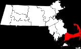
in the easternmost portion of the state of Massachusetts
Massachusetts
The Commonwealth of Massachusetts is a state in the New England region of the northeastern United States of America. It is bordered by Rhode Island and Connecticut to the south, New York to the west, and Vermont and New Hampshire to the north; at its east lies the Atlantic Ocean. As of the 2010...
, in the Northeastern United States. Today it is co-extensive with Barnstable County
Barnstable County, Massachusetts
Barnstable County is a county located in the U.S. state of Massachusetts, consisting of Cape Cod and associated islands. As of the 2010 census, the population was 216,902...
, and is defined by the towns along the Cape Cod Canal, and those to the east on the peninsula all the way to Provincetown, and several small islands right off Cape Cod, including Monomoy Island
Monomoy Island
Monomoy Island is an 8 mile long spit of sand extending southwest from Chatham, Cape Cod off the Massachusetts mainland.- History :It was taken over by the US government just before World War II...
, Monomoscoy Island
Monomoscoy Island, Massachusetts
Monomoscoy Island is a census-designated place in the town of Mashpee in Barnstable County, Massachusetts, United States. As of the 2000 census, the island had a total population of 152.- Geography :...
, Popponesset Island
Popponesset Island, Massachusetts
Popponesset Island is a census-designated place in the town of Mashpee in Barnstable County, Massachusetts, United States. The population was 39 at the 2000 census.-Geography:Popponesset Island is located at ....
, and Seconsett Island
Seconsett Island, Massachusetts
Seconsett Island is a census-designated place in the town of Mashpee in Barnstable County, Massachusetts, United States. The population was 81 at the 2000 census.- Geography :Seconsett Island is located at ....
, are also in Barnstable County, being part of municipalities with land on the Cape.
Unanswered Questions