

Blackdown Hills
Encyclopedia
The Blackdown Hills are a range of hills along the Somerset
-Devon
border in south-western England
, which were designated an Area of Outstanding Natural Beauty
(AONB) in 1991.
The plateau is dominated by hard chert
bands of Upper Greensand with some remnants of chalk
, and is cut through by river valleys. The hills support an extensive range of wildlife leading to the designation of 16 Sites of Special Scientific Interest (SSSIs).
There is evidence of human occupation since the Iron Age
. Fortifications include the remains of ancient hill fort
s, Norman
motte-and-bailey
castle
s and Second World War airfields. There are also religious buildings such as Dunkeswell Abbey and village churches. The hills are crossed by a network of minor roads with major transport routes including the M5 motorway
running around the periphery.
in Devon, are more gentle. The Blackdown Hills are a sparsely populated area; much of the land is used for dairy farming
.
 The River Culm
rises at a spring near Culmhead and flows west through Hemyock
, then Culmstock
to Uffculme
before joining the River Exe
on the north-western outskirts of Exeter
. The name of the river is thought to mean 'knot' or 'tie', in reference to the river's twists and loops; or is derived from a Celtic river-name meaning winding stream. The River Otter
rises near Otterford
, where a stream feeds the Otterhead lakes: . It then flows south for32 kilometres (20 mi) through East Devon
to the English Channel
at the western end of Lyme Bay
. The Permian
and Triassic
sandstone
aquifer
in the Otter Valley is one of Devon's largest groundwater sources, supplying drinking water to Taunton
. The other rivers are the River Yarty and the Corry Brook.
Villages in the northern, Somerset part of the hills include Staple Fitzpaine
, Buckland St Mary
, Whitestaunton
, Wambrook
and Churchstanton
. The larger, more southerly area in Devon includes Dunkeswell
, Upottery
, Smeatharpe, Hemyock
, Blackborough
, Yarcombe
, Membury
, Stockland
, Sheldon and Cotleigh.
is unique in south-west England, forming part of the only extensive outcrop of Upper Greensand in the region.
The Blackdown Hills form a flat plateau dominated by hard chert
bands, made up of clay with flints, of Upper Greensand with some remnants of chalk
. The cretaceous
rocks rest over eroded Jurassic
and Triassic
beds, with an outcrop of Rhaetian
beds. In the western areas the Upper Greensand is devoid of calcareous material but the sands yield fossils of marine bivalves and gastropods (snails) preserved in silica.
that is generally wetter and milder than the rest of England
. The mean temperature is approximately 10 °C (50 °F) and shows a season
al and a diurnal
variation, but because of the modifying effect of the sea the range is less than in most other parts of the United Kingdom
(UK). January is the coldest month with mean minimum temperatures between 1 °C (34 °F) and 2 °C (36 °F). July and August are the warmest months, with mean daily maxima around 21 °C (70 °F). December is normally the most cloudy month and June the sunniest. High pressure over the Azores
often brings clear skies to south-west England, particularly in summer.
Cloud
often forms inland, especially near hills. The average annual sunshine totals around 1,600 hours. Rainfall tends to be associated with Atlantic depressions
or with convection. In summer, convection caused by solar surface heating sometimes forms shower clouds, and a large proportion of rain falls from showers and thunderstorms at this time of year. Average rainfall is around 31–35 inch (800–900 mm). About 8–15 days of snowfall is typical. From November to March, mean wind speeds are highest; winds are lightest from June to August. The predominant wind direction is from the south-west.
to Reed Farm pit at just less than 1 hectares (2.5 acre). In total they cover 640 hectares (1,581.5 acre), or just under 2% of the AONB. Of these SSSIs 79% are deemed by English Nature
to be being positively managed. SSSI is a conservation designation
denoting a protected area
in the United Kingdom
, selected by Natural England
, for areas with particular landscape and ecological characteristics. It provides some protection from development, from other damage, and (since 2000) from neglect, under the Countryside and Rights of Way Act 2000
.
The grasslands, heathland, meadows and mire support extensive populations of birds such as Barn owl
s (Tyto alba) and nightjar
, with butterflies including Marbled White (Melanargia galathea), Green Hairstreak
(Callophrys rubi) and the Gatekeeper Butterfly
(Pyronia tithonus). The flora includes the Heath Spotted-orchid (Dactylorhiza maculata), Corky fruited water dropwort
(pimpinelloides), Green-winged Orchid
(Anacamptis morio), Heather
(Calluna vulgaris), Lousewort
(Pedicularis) and Birds foot trefoil
(Lotus corniculatus). The hedgerows and woodlands are made up of Ash
, Hazel
(Corylus), Grey willow (Salix cinerea) and Pedunculate Oak
(Quercus robur) which support populations of Dormouse
(Gliridae), Common Lizards
, Siskin
, Stinking iris
(Iris foetidissima) and the Purple Hairstreak
butterfly (Neozephyrus quercus). The rivers and streams are home to Kingfisher
, Otter
and the Daubenton's bat
.
Blackdown and Sampford Commons have extensive surviving examples of the heathland
, carr woodland and marshy grassland
habitats that have developed on the acidic soils overlying the Greensand and Keuper Marls of the Blackdown Hills. The heathland supports a typical invertebrate fauna
, including a wide variety of butterfly
species, and with spiders notably abundant. The site is regionally important for birds which favour heathland habitats.
Quants
, a grassland
clearing in a forestry plantation well-known for its butterflies
including Duke of Burgundy
, Marsh Fritillary
and Wood White, is a candidate for Special Area of Conservation
(cSAC). These are designated under the European Commission
Habitats Directive (92/43/EEC) as internationally important habitats.
and Neolithic
periods with areas of open meadow, grass land with small woodland components being identified.
Notable archaeological sites include the Iron Age
hill forts at Membury Castle
, Hembury
and Castle Neroche
. Hembury is a Neolithic
causewayed enclosure
near Honiton
. It dates to the late fifth and early fourth millennia BC and is believed to have been the capital of the Dumnonii
tribe. The fort is situated on a promontory to the north of and overlooking the River Dart
at approx 178 m (584 ft) above sea level. It has given its name to some of the earliest Neolithic
pottery in southern Britain
. An Iron Age
hill fort
was later built on the same site.
There has been archaeological evidence found on the site of Roman
Military occupation, suggesting a Fort within the existing Iron Age site. It is now a Scheduled Ancient Monument
.
Fourteen hill slope enclosures, dating from the Iron Age have been identified on the Blackdown Hills, and prehistoric remains, from about 100 BC, have been found in Hemyock
.
 Castle Neroche is a Norman
motte-and-bailey
castle
on the site of an earlier hill fort
near Staple Fitzpaine
. The hill rises to 260 metres (853 ft) on the northern escarpment of the Blackdown Hills. The castle was probably built by Robert of Mortain in the 11th century and probably went out of use in the 12th century. Around the crossroads at Staple Fitzpaine there are several large sandstone boulders. They are called devilstones and are said to have been thrown by the Devil from Castle Neroche
. According to legend if you prick them with a pin they draw blood. English word 'Stapol' means pillar or post and it is thought likely that this gave the village the first part of its name. The second part of the name comes from the Fitzpaine family who owned the manor between 1233 and 1393.
A Roman bath house and Edwardian folly in the village of Whitestaunton
were excavated by the television series
Time Team
. There is also evidence of iron workings in the Romano-British period, at Dunkeswell, which radiocarbon dating has placed in the 2nd century. It has been suggested that these and other iron-based technologies gave the hills a fairly industrial landscape during the Romano-British period, providing a source of the name Blackdown Hills. Local iron ores were smelted at Hemyock in small bloomeries (furnaces) to produce pure iron until the Middle Ages
.
At Simonsburrow a battle between the native Britons and King Ine
's Saxon army, put an end (temporarily) to the Kings expansion to the west. In 710, Ine and Nothhelm fought against Geraint of Dumnonia
, according to the Anglo-Saxon Chronicle
; John of Worcester
states that Geraint was killed in this battle. Ine's advance brought him control of what is now Devon
, the new border with Dumnonia being the river Tamar
.
Just to the north of Culmstock
, at Culmstock Beacon, is one of a chain of Elizabethan beacons built to warn of possible invasion by the Spanish Armada
. On 5 November 1380, King Richard II
granted Sir William and Lady Margaret Asthorpe a licence to crenellate the Hemyock
manor house, meaning the permission to fortify it. Over the centuries, Hemyock Castle had many notable owners including Lord Chief Justice Sir John Popham. During the English Civil War
it was held for Parliament
, subjected to a brief but brutal siege
and eventually slighted to destroy its military value. Parts of the castle walls, towers and moat still remain. They are a scheduled ancient monument
and include displays of history and archaeology. The castle was also owned by General Sir John Graves Simcoe
the first lieutenant-governor of Upper Canada
in 1792. He is buried at Wolford Chapel
near Dunkeswell
. The chapel is now owned by the Province of Ontario
.
Early attempts were made by Charles I
to enclose parts of the Blackdowns in the 1630s however this was opposed by the local lord and the commoners. He managed to enclose 1.634 acres (6,612.6 m²) and soon sold these, but many of the hedges and fences were removed during the English Civil War
. This was followed by further attempts at enclosure in 1658 but again only about a third was successfully enclosed, which remained the situation until 1833 when the rest of the hills were enclosed.
Cold Harbour Mill was built around 1800 to exploit the available water power of the River Culm
and was used for wool and yarn production until its commercial closure in 1981. It is now managed by an educational trust and plays a role in telling the industrial history of the area.
The Wellington Monument
is located on Wellington Hill at , 3 km (1.9 mi) south of Wellington
, Somerset
. It was erected to celebrate the Duke of Wellington's
victory at the Battle of Waterloo
. The foundation stone was laid in 1817, on land belonging to the Duke, but the monument was not completed until 1854. Its design was inspired by an Egyptian obelisk
, but in the shape of the type of bayonet
used by Wellington's armies. It is now owned by the National Trust
, and is floodlit at night.
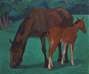 The artist Robert Polhill Bevan worked in the Blackdown Hills from 1912–1925 as a guest of landowner and amateur artist Harold Harrison. Until the end of his life Bevan continued to paint in the Bolham
valley and nearby Luppitt
his angular style sitting well with the strong patterning of the landscape. Many of the images that he produced in the area are now in national museums.
In the Second World War, airbases were built at Dunkeswell
, Upottery
and Culmhead
. Dunkeswell Aerodrome
was built in the Second World War by the RAF, briefly used by the USAF, and then the Fleet Airwing 7 of the USN. It was the only American Navy air base commissioned on UK soil during the Second World War.
(AONB). As they have the same landscape quality, AONBs may be compared to the national parks of England and Wales
. AONBs are created under the same legislation as the national park
s: the National Parks and Access to the Countryside Act 1949
. However, National Parks, unlike AONBs, have their own authorities and have special legal powers to prevent unsympathetic development. By contrast, there are very limited statutory duties imposed on local authorities within an AONB. Further regulation and protection of AONBs was added by the Countryside and Rights of Way Act 2000
.
The total population of the Blackdown Hills AONB in 2001 was 13,300; of which 10,500 live in Devon and 2,800 within Somerset. Many of the villages have their own parish councils which have some responsibility for local issues. The Blackdown Hills AONB is managed by a partnership of public bodies, local organisations and voluntary groups with an active interest in the hills. Funding is provided by Devon
and Somerset
County Councils, East Devon
, Mid Devon
, South Somerset
and Taunton Deane
Councils and Natural England
.
The AONB straddles the borders of three parliamentary constituencies: Tiverton and Honiton, Taunton Deane
and Yeovil. The area is also part of the European Parliament
's South West England
constituency.
 Dunkeswell Abbey, a Cistercian monastery and offshoot of Forde Abbey
, was founded in 1201 by William de Briwere
. The abbey was closed in 1539 and granted to Lord Russell. It was mostly demolished promptly, though a section remained in domestic use until the 19th century. In 1842, a parish church was built on a part of the site. Some surviving fragments of monastery include the partial end wall of the cellerars range and parts of a gatehouse. Some carved fragments survive within the Victorian era
church.
The Church of St Peter in Staple Fitzpaine
was originally built in the Norman
style, and has a Norman doorway reset in the south aisle. The chancel dates from the 14th century; the north aisle was added and the church refenestrated
in the 15th century. The tower dates from about 1500. The south porch and the vestry
are much more recent, dating from 1841. The crenellated 3-stage tower, has merlon
s pierced with trefoil
headed arches set on a quatrefoil
pierced parapet
. The church has been designated by English Heritage
as a grade I listed building.
, A303
and A35
. The M5 motorway
is at the northwestern boundary of the AONB. The Bristol to Exeter line
and the remains of the Grand Western Canal
run, quite close in places, to the west of the M5 motorway but do not pass through the Blackdown Hills.
The Culm Valley Light Railway opened in 1876, having been built by local enterprise. The line was purchased by the Great Western Railway
, which had operated it from the start, in 1880. The line closed to passengers in 1963 but served the milk depot at Hemyock until its closure in 1975.
Dunkeswell Aerodrome
is now a busy civilian airfield with a mix of light aircraft
, microlights and parachuting
.
The Blackdown Hills Business Association was established as a member organisation in 2002 to encourage and support all businesses that are based in or serve the Blackdown Hills. Membership stands at around 400 businesses.
Somerset
The ceremonial and non-metropolitan county of Somerset in South West England borders Bristol and Gloucestershire to the north, Wiltshire to the east, Dorset to the south-east, and Devon to the south-west. It is partly bounded to the north and west by the Bristol Channel and the estuary of the...
-Devon
Devon
Devon is a large county in southwestern England. The county is sometimes referred to as Devonshire, although the term is rarely used inside the county itself as the county has never been officially "shired", it often indicates a traditional or historical context.The county shares borders with...
border in south-western England
England
England is a country that is part of the United Kingdom. It shares land borders with Scotland to the north and Wales to the west; the Irish Sea is to the north west, the Celtic Sea to the south west, with the North Sea to the east and the English Channel to the south separating it from continental...
, which were designated an Area of Outstanding Natural Beauty
Area of Outstanding Natural Beauty
An Area of Outstanding Natural Beauty is an area of countryside considered to have significant landscape value in England, Wales or Northern Ireland, that has been specially designated by the Countryside Agency on behalf of the United Kingdom government; the Countryside Council for Wales on...
(AONB) in 1991.
The plateau is dominated by hard chert
Chert
Chert is a fine-grained silica-rich microcrystalline, cryptocrystalline or microfibrous sedimentary rock that may contain small fossils. It varies greatly in color , but most often manifests as gray, brown, grayish brown and light green to rusty red; its color is an expression of trace elements...
bands of Upper Greensand with some remnants of chalk
Chalk
Chalk is a soft, white, porous sedimentary rock, a form of limestone composed of the mineral calcite. Calcite is calcium carbonate or CaCO3. It forms under reasonably deep marine conditions from the gradual accumulation of minute calcite plates shed from micro-organisms called coccolithophores....
, and is cut through by river valleys. The hills support an extensive range of wildlife leading to the designation of 16 Sites of Special Scientific Interest (SSSIs).
There is evidence of human occupation since the Iron Age
Iron Age
The Iron Age is the archaeological period generally occurring after the Bronze Age, marked by the prevalent use of iron. The early period of the age is characterized by the widespread use of iron or steel. The adoption of such material coincided with other changes in society, including differing...
. Fortifications include the remains of ancient hill fort
Hill fort
A hill fort is a type of earthworks used as a fortified refuge or defended settlement, located to exploit a rise in elevation for defensive advantage. They are typically European and of the Bronze and Iron Ages. Some were used in the post-Roman period...
s, Norman
Norman architecture
About|Romanesque architecture, primarily English|other buildings in Normandy|Architecture of Normandy.File:Durham Cathedral. Nave by James Valentine c.1890.jpg|thumb|200px|The nave of Durham Cathedral demonstrates the characteristic round arched style, though use of shallow pointed arches above the...
motte-and-bailey
Motte-and-bailey
A motte-and-bailey is a form of castle, with a wooden or stone keep situated on a raised earthwork called a motte, accompanied by an enclosed courtyard, or bailey, surrounded by a protective ditch and palisade...
castle
Castle
A castle is a type of fortified structure built in Europe and the Middle East during the Middle Ages by European nobility. Scholars debate the scope of the word castle, but usually consider it to be the private fortified residence of a lord or noble...
s and Second World War airfields. There are also religious buildings such as Dunkeswell Abbey and village churches. The hills are crossed by a network of minor roads with major transport routes including the M5 motorway
M5 motorway
The M5 is a motorway in England. It runs from a junction with the M6 at West Bromwich near Birmingham to Exeter in Devon. Heading south-west, the M5 runs east of West Bromwich and west of Birmingham through Sandwell Valley...
running around the periphery.
Geography
Straddling the borders of Somerset and Devon, the Blackdown Hills AONB covers an area of 370 square kilometres (143 sq mi). Heavily cut with sharp valleys, the hills reach their highest point of 315 metres (1,033 ft) above sea level at Staple Hill in Somerset. The hills in the southern part of the area, near HonitonHoniton
Honiton is a town and civil parish in East Devon, situated close to the River Otter, north east of Exeter in the county of Devon. The town's name is pronounced in two ways, and , each pronunciation having its adherents...
in Devon, are more gentle. The Blackdown Hills are a sparsely populated area; much of the land is used for dairy farming
Dairy farming
Dairy farming is a class of agricultural, or an animal husbandry, enterprise, for long-term production of milk, usually from dairy cows but also from goats and sheep, which may be either processed on-site or transported to a dairy factory for processing and eventual retail sale.Most dairy farms...
.
River Culm
thumb|Old stone bridge with pedestrian refuges over River Culm at Culmstock The River Culm flows through Devon, England. It rises in the Blackdown Hills at a spring - - near Culmhead and flows west through Hemyock, then Culmstock to Uffculme...
rises at a spring near Culmhead and flows west through Hemyock
Hemyock
Hemyock is a village in Devon, England. It is located approximately five miles from the Somerset town of Wellington. The River Culm flows through Hemyock...
, then Culmstock
Culmstock
thumb|Old stone bridge with pedestrian refuges over River Culm at CulmstockCulmstock is a picturesque parish village in east Devon, about 5 miles from Tiverton and 7 or so miles NE of Cullompton. It is laid out on both sides of the River Culm; the village is joined by a single old narrow stone...
to Uffculme
Uffculme
Uffculme is a village located in the Mid Devon district, of Devon, England.-History:Situated in the Blackdown Hills on the B3440, close to the M5 motorway, near Cullompton Uffculme is on the upper reaches of the River Culm. Historically, it was a parish in Bampton Hundred, under the Peculiar...
before joining the River Exe
River Exe
The River Exe in England rises near the village of Simonsbath, on Exmoor in Somerset, near the Bristol Channel coast, but flows more or less directly due south, so that most of its length lies in Devon. It reaches the sea at a substantial ria, the Exe Estuary, on the south coast of Devon...
on the north-western outskirts of Exeter
Exeter
Exeter is a historic city in Devon, England. It lies within the ceremonial county of Devon, of which it is the county town as well as the home of Devon County Council. Currently the administrative area has the status of a non-metropolitan district, and is therefore under the administration of the...
. The name of the river is thought to mean 'knot' or 'tie', in reference to the river's twists and loops; or is derived from a Celtic river-name meaning winding stream. The River Otter
River Otter
Not to be confused with the animal Otter or the River Ottery in CornwallThe River Otter rises in the Blackdown Hills just inside the county of Somerset, near Otterford, then flows south for some 32 km through East Devon to the English Channel at the western end of Lyme Bay, part of...
rises near Otterford
Otterford
Otterford is a village and civil parish in Somerset, England. It is situated on the Blackdown Hills, south of Taunton in the Taunton Deane district...
, where a stream feeds the Otterhead lakes: . It then flows south for32 kilometres (20 mi) through East Devon
East Devon
East Devon is a local government district in Devon, England. Its council is based in Sidmouth, and the largest town is Exmouth.The district was formed on 1 April 1974 by the merger of the borough of Honiton with the urban districts of Budleigh Salterton, Exmouth, Ottery St. Mary, Seaton, Sidmouth...
to the English Channel
English Channel
The English Channel , often referred to simply as the Channel, is an arm of the Atlantic Ocean that separates southern England from northern France, and joins the North Sea to the Atlantic. It is about long and varies in width from at its widest to in the Strait of Dover...
at the western end of Lyme Bay
Lyme Bay
Lyme Bay is an area of the English Channel situated in the southwest of England between Torbay in the west and Portland in the east. The counties of Devon and Dorset front onto the bay,-Geology:...
. The Permian
Permian
The PermianThe term "Permian" was introduced into geology in 1841 by Sir Sir R. I. Murchison, president of the Geological Society of London, who identified typical strata in extensive Russian explorations undertaken with Edouard de Verneuil; Murchison asserted in 1841 that he named his "Permian...
and Triassic
Triassic
The Triassic is a geologic period and system that extends from about 250 to 200 Mya . As the first period of the Mesozoic Era, the Triassic follows the Permian and is followed by the Jurassic. Both the start and end of the Triassic are marked by major extinction events...
sandstone
Sandstone
Sandstone is a sedimentary rock composed mainly of sand-sized minerals or rock grains.Most sandstone is composed of quartz and/or feldspar because these are the most common minerals in the Earth's crust. Like sand, sandstone may be any colour, but the most common colours are tan, brown, yellow,...
aquifer
Aquifer
An aquifer is a wet underground layer of water-bearing permeable rock or unconsolidated materials from which groundwater can be usefully extracted using a water well. The study of water flow in aquifers and the characterization of aquifers is called hydrogeology...
in the Otter Valley is one of Devon's largest groundwater sources, supplying drinking water to Taunton
Taunton
Taunton is the county town of Somerset, England. The town, including its suburbs, had an estimated population of 61,400 in 2001. It is the largest town in the shire county of Somerset....
. The other rivers are the River Yarty and the Corry Brook.
Villages in the northern, Somerset part of the hills include Staple Fitzpaine
Staple Fitzpaine
Staple Fitzpaine is a village and civil parish in Somerset, England, situated south of Taunton in the Taunton Deane district. The village has a population of 151 and is within the Blackdown Hills Area of Outstanding Natural Beauty...
, Buckland St Mary
Buckland St Mary
Buckland St Mary is a village and parish in Somerset, England, situated to the west of Ilminster and south of Taunton in the South Somerset district, close to the A303. The village has a population of 559...
, Whitestaunton
Whitestaunton
Whitestaunton is a village and civil parish in the South Somerset district of Somerset, England.-History:The parish of Whitestaunton was part of the South Petherton Hundred....
, Wambrook
Wambrook
Wambrook is a village and civil parish in the Blackdown Hills, , south of Chard in Somerset, England. The parish includes the hamlets of Higher Wambrook and Lower Wambrook which is sometimes known as Haselcombe.-History:...
and Churchstanton
Churchstanton
Churchstanton is a village and civil parish in Somerset, England, situated within the Blackdown Hills Area of Outstanding Natural Beauty, on the River Otter south of Taunton in the Taunton Deane district.The parish has a population of 760...
. The larger, more southerly area in Devon includes Dunkeswell
Dunkeswell
Dunkeswell is a village in Devon, England. It is approximately north of the town of Honiton.-History:Dunkeswell is notable for having a busy small airfield, now Dunkeswell Aerodrome which was initially established as an American Navy air base during World War II, and continues to offer civil...
, Upottery
Upottery
Upottery is a small settlement in Devon, England.RAF Upottery is a former World War II airfield in East Devon, England. The airfield is located approximately 6 miles north-northeast of Honiton; about 140 miles southwest of London-External links:...
, Smeatharpe, Hemyock
Hemyock
Hemyock is a village in Devon, England. It is located approximately five miles from the Somerset town of Wellington. The River Culm flows through Hemyock...
, Blackborough
Blackborough, Devon
Blackborough is a hamlet and civil parish in the Mid Devon district of Devon, England. Its nearest town is Cullompton, which lies approximately south-west from the hamlet....
, Yarcombe
Yarcombe
Yarcombe is a village and civil parish on the A30 road, in the East Devon district, in the county of Devon, England. Yarcombe is located near the towns of Honiton and Chard. Yarcombe has a church called St John the Baptist, Yarcombe.- External links :* *...
, Membury
Membury, Devon
Membury is a village three miles north west of Axminster in East Devon.The village has a 13th century church dedicated to St John the Baptist with a tall slim tower...
, Stockland
Stockland, Devon
Stockland is a small rural village in Devon, close to the Somerset boundary. Its nearest neighbouring towns Honiton and Axminster, which are 6 miles and 5 miles away respectively. It has a population of around 600...
, Sheldon and Cotleigh.
Geology
The geology of the Blackdown Hills together with the adjoining East Devon AONBEast Devon AONB
East Devon Area of Outstanding Natural Beauty covers over of the East Devon countryside .This countryside includes eighteen miles of Heritage coastline...
is unique in south-west England, forming part of the only extensive outcrop of Upper Greensand in the region.
The Blackdown Hills form a flat plateau dominated by hard chert
Chert
Chert is a fine-grained silica-rich microcrystalline, cryptocrystalline or microfibrous sedimentary rock that may contain small fossils. It varies greatly in color , but most often manifests as gray, brown, grayish brown and light green to rusty red; its color is an expression of trace elements...
bands, made up of clay with flints, of Upper Greensand with some remnants of chalk
Chalk
Chalk is a soft, white, porous sedimentary rock, a form of limestone composed of the mineral calcite. Calcite is calcium carbonate or CaCO3. It forms under reasonably deep marine conditions from the gradual accumulation of minute calcite plates shed from micro-organisms called coccolithophores....
. The cretaceous
Cretaceous
The Cretaceous , derived from the Latin "creta" , usually abbreviated K for its German translation Kreide , is a geologic period and system from circa to million years ago. In the geologic timescale, the Cretaceous follows the Jurassic period and is followed by the Paleogene period of the...
rocks rest over eroded Jurassic
Jurassic
The Jurassic is a geologic period and system that extends from about Mya to Mya, that is, from the end of the Triassic to the beginning of the Cretaceous. The Jurassic constitutes the middle period of the Mesozoic era, also known as the age of reptiles. The start of the period is marked by...
and Triassic
Triassic
The Triassic is a geologic period and system that extends from about 250 to 200 Mya . As the first period of the Mesozoic Era, the Triassic follows the Permian and is followed by the Jurassic. Both the start and end of the Triassic are marked by major extinction events...
beds, with an outcrop of Rhaetian
Rhaetian
The Rhaetian is in geochronology the latest age of the Triassic period or in chronostratigraphy the uppermost stage of the Triassic system. It lasted from 203.6 ± 1.5 to 199.6 ± 0.6 million years ago...
beds. In the western areas the Upper Greensand is devoid of calcareous material but the sands yield fossils of marine bivalves and gastropods (snails) preserved in silica.
Climate
Along with the rest of south-west England, the Blackdown Hills have a temperate climateTemperate
In geography, temperate or tepid latitudes of the globe lie between the tropics and the polar circles. The changes in these regions between summer and winter are generally relatively moderate, rather than extreme hot or cold...
that is generally wetter and milder than the rest of England
England
England is a country that is part of the United Kingdom. It shares land borders with Scotland to the north and Wales to the west; the Irish Sea is to the north west, the Celtic Sea to the south west, with the North Sea to the east and the English Channel to the south separating it from continental...
. The mean temperature is approximately 10 °C (50 °F) and shows a season
Season
A season is a division of the year, marked by changes in weather, ecology, and hours of daylight.Seasons result from the yearly revolution of the Earth around the Sun and the tilt of the Earth's axis relative to the plane of revolution...
al and a diurnal
Diurnal motion
Diurnal motion is an astronomical term referring to the apparent daily motion of stars around the Earth, or more precisely around the two celestial poles. It is caused by the Earth's rotation on its axis, so every star apparently moves on a circle, that is called the diurnal circle. The time for...
variation, but because of the modifying effect of the sea the range is less than in most other parts of the United Kingdom
United Kingdom
The United Kingdom of Great Britain and Northern IrelandIn the United Kingdom and Dependencies, other languages have been officially recognised as legitimate autochthonous languages under the European Charter for Regional or Minority Languages...
(UK). January is the coldest month with mean minimum temperatures between 1 °C (34 °F) and 2 °C (36 °F). July and August are the warmest months, with mean daily maxima around 21 °C (70 °F). December is normally the most cloudy month and June the sunniest. High pressure over the Azores
Azores
The Archipelago of the Azores is composed of nine volcanic islands situated in the middle of the North Atlantic Ocean, and is located about west from Lisbon and about east from the east coast of North America. The islands, and their economic exclusion zone, form the Autonomous Region of the...
often brings clear skies to south-west England, particularly in summer.
Cloud
Cumulus cloud
Cumulus clouds are a type of cloud with noticeable vertical development and clearly defined edges. Cumulus means "heap" or "pile" in Latin. They are often described as "puffy" or "cotton-like" in appearance. Cumulus clouds may appear alone, in lines, or in clusters...
often forms inland, especially near hills. The average annual sunshine totals around 1,600 hours. Rainfall tends to be associated with Atlantic depressions
Low pressure area
A low-pressure area, or "low", is a region where the atmospheric pressure at sea level is below that of surrounding locations. Low-pressure systems form under areas of wind divergence which occur in upper levels of the troposphere. The formation process of a low-pressure area is known as...
or with convection. In summer, convection caused by solar surface heating sometimes forms shower clouds, and a large proportion of rain falls from showers and thunderstorms at this time of year. Average rainfall is around 31–35 inch (800–900 mm). About 8–15 days of snowfall is typical. From November to March, mean wind speeds are highest; winds are lightest from June to August. The predominant wind direction is from the south-west.
Ecology
There are 16 Sites of Special Scientific Interest (SSSIs) in the Blackdown Hills ranging from the 156 hectares (385.5 acre) Black Down and Sampford CommonsBlack Down and Sampford Commons
Black Down and Sampford Commons is a biological Site of Special Scientific Interest in Devon and Somerset, notified in 1952.The Little Breach reserve, which forms part of the SSSI is an area of heathy grassland on Greensand, with some blackthorn and birch, noted for its butterflies and...
to Reed Farm pit at just less than 1 hectares (2.5 acre). In total they cover 640 hectares (1,581.5 acre), or just under 2% of the AONB. Of these SSSIs 79% are deemed by English Nature
English Nature
English Nature was the United Kingdom government agency that promoted the conservation of wildlife, geology and wild places throughout England between 1990 and 2006...
to be being positively managed. SSSI is a conservation designation
Conservation designation
A conservation designation is a name and/or acronym which explains the status of an area of land in terms of conservation or protection.-United Kingdom:*Area of Outstanding Natural Beauty *Environmentally Sensitive Area*Local Nature Reserve...
denoting a protected area
Protected area
Protected areas are locations which receive protection because of their recognised natural, ecological and/or cultural values. There are several kinds of protected areas, which vary by level of protection depending on the enabling laws of each country or the regulations of the international...
in the United Kingdom
United Kingdom
The United Kingdom of Great Britain and Northern IrelandIn the United Kingdom and Dependencies, other languages have been officially recognised as legitimate autochthonous languages under the European Charter for Regional or Minority Languages...
, selected by Natural England
Natural England
Natural England is the non-departmental public body of the UK government responsible for ensuring that England's natural environment, including its land, flora and fauna, freshwater and marine environments, geology and soils, are protected and improved...
, for areas with particular landscape and ecological characteristics. It provides some protection from development, from other damage, and (since 2000) from neglect, under the Countryside and Rights of Way Act 2000
Countryside and Rights of Way Act 2000
The Countryside and Rights of Way Act 2000 is a UK Act of Parliament which came into force on 30 November 2000.As of September 2007, not all sections of the Countryside and Rights of Way Act have yet come into force...
.
The grasslands, heathland, meadows and mire support extensive populations of birds such as Barn owl
Barn Owl
The Barn Owl is the most widely distributed species of owl, and one of the most widespread of all birds. It is also referred to as Common Barn Owl, to distinguish it from other species in the barn-owl family Tytonidae. These form one of two main lineages of living owls, the other being the typical...
s (Tyto alba) and nightjar
European Nightjar
The European Nightjar, or just Nightjar, Caprimulgus europaeus, is the only representative of the nightjar family of birds in most of Europe and temperate Asia.- Habitat and distribution :...
, with butterflies including Marbled White (Melanargia galathea), Green Hairstreak
Green Hairstreak
The Green Hairstreak, Callophrys rubi, is a butterfly in the family Lycaenidae.Callophrys rubi is found in Europe, North Africa, Russia, Asia Minor, Siberia, Amurland , Baluchistan and Chitral....
(Callophrys rubi) and the Gatekeeper Butterfly
Gatekeeper Butterfly
The Gatekeeper sometimes called the Hedge Brown is a common butterfly in the United Kingdom. It is a member of the subfamily Satyrinae in the family Nymphalidae. A similar species is the Meadow Brown; the two species can be difficult to distinguish with closed wings since underwing markings are...
(Pyronia tithonus). The flora includes the Heath Spotted-orchid (Dactylorhiza maculata), Corky fruited water dropwort
Water dropwort
The water dropworts, Oenanthe , are a genus of plants in the family Apiaceae. Most of the species grow in damp ground, in marshes or in water....
(pimpinelloides), Green-winged Orchid
Green-winged Orchid
The Green-winged Orchid or Green-veined Orchid is a flowering plant of the orchid family, Orchidaceae....
(Anacamptis morio), Heather
Ericaceae
The Ericaceae, commonly known as the heath or heather family, is a group of mostly calcifuge flowering plants. The family is large, with roughly 4000 species spread across 126 genera, making it the 14th most speciose family of flowering plants...
(Calluna vulgaris), Lousewort
Lousewort
Pedicularis is a genus of perennial green root parasite plants belonging to the broomrape family Orobanchaceae. Between 350 and 600 species are accepted by different authorities, mostly from the wetter northern temperate zones, as well as from South America...
(Pedicularis) and Birds foot trefoil
Lotus corniculatus
Lotus corniculatus is a common flowering plant native to grassland temperate Eurasia and North Africa. The common name is Bird's-foot Trefoil , though the common name is often also applied to other members of the genus...
(Lotus corniculatus). The hedgerows and woodlands are made up of Ash
Ash tree
Fraxinus is a genus flowering plants in the olive and lilac family, Oleaceae. It contains 45-65 species of usually medium to large trees, mostly deciduous though a few subtropical species are evergreen. The tree's common English name, ash, goes back to the Old English æsc, while the generic name...
, Hazel
Hazel
The hazels are a genus of deciduous trees and large shrubs native to the temperate northern hemisphere. The genus is usually placed in the birch family Betulaceae, though some botanists split the hazels into a separate family Corylaceae.They have simple, rounded leaves with double-serrate margins...
(Corylus), Grey willow (Salix cinerea) and Pedunculate Oak
Pedunculate Oak
Quercus robur is commonly known as the Pedunculate Oak or English oak. It is native to most of Europe, and to Anatolia to the Caucasus, and also to parts of North Africa.-Taxonomy:Q...
(Quercus robur) which support populations of Dormouse
Dormouse
Dormice are rodents of the family Gliridae. Dormice are mostly found in Europe, although some live in Africa and Asia. They are particularly known for their long periods of hibernation...
(Gliridae), Common Lizards
Lizard
Lizards are a widespread group of squamate reptiles, with nearly 3800 species, ranging across all continents except Antarctica as well as most oceanic island chains...
, Siskin
Eurasian Siskin
The Eurasian Siskin is a small passerine bird in the finch family Fringillidae. It is also called the European Siskin, Common Siskin or just Siskin. Other names include Black-headed Goldfinch, barley bird and aberdevine. It is very common throughout Europe and Asia...
, Stinking iris
Iris foetidissima
Iris foetidissima , is a species of Iris found in open woodland, hedgebanks and sea-cliffs....
(Iris foetidissima) and the Purple Hairstreak
Purple Hairstreak
The Purple Hairstreak Neozephyrus quercus is a butterfly in the family Lycaenidae distributed throughout much of Europe. North Africa, Asia Minor, Caucasus and Transcaucasia....
butterfly (Neozephyrus quercus). The rivers and streams are home to Kingfisher
Kingfisher
Kingfishers are a group of small to medium sized brightly coloured birds in the order Coraciiformes. They have a cosmopolitan distribution, with most species being found in the Old World and Australia...
, Otter
Otter
The Otters are twelve species of semi-aquatic mammals which feed on fish and shellfish, and also other invertebrates, amphibians, birds and small mammals....
and the Daubenton's bat
Daubenton's bat
Daubenton's Bat, Myotis daubentonii, is a Eurasian bat with quite short ears. It ranges from Britain to Japan and is considered to be increasing its numbers in many areas.The name commemorates the French naturalist Louis-Jean-Marie Daubenton....
.
Blackdown and Sampford Commons have extensive surviving examples of the heathland
Heath (habitat)
A heath or heathland is a dwarf-shrub habitat found on mainly low quality acidic soils, characterised by open, low growing woody vegetation, often dominated by plants of the Ericaceae. There are some clear differences between heath and moorland...
, carr woodland and marshy grassland
Grassland
Grasslands are areas where the vegetation is dominated by grasses and other herbaceous plants . However, sedge and rush families can also be found. Grasslands occur naturally on all continents except Antarctica...
habitats that have developed on the acidic soils overlying the Greensand and Keuper Marls of the Blackdown Hills. The heathland supports a typical invertebrate fauna
Fauna
Fauna or faunæ is all of the animal life of any particular region or time. The corresponding term for plants is flora.Zoologists and paleontologists use fauna to refer to a typical collection of animals found in a specific time or place, e.g. the "Sonoran Desert fauna" or the "Burgess shale fauna"...
, including a wide variety of butterfly
Butterfly
A butterfly is a mainly day-flying insect of the order Lepidoptera, which includes the butterflies and moths. Like other holometabolous insects, the butterfly's life cycle consists of four parts: egg, larva, pupa and adult. Most species are diurnal. Butterflies have large, often brightly coloured...
species, and with spiders notably abundant. The site is regionally important for birds which favour heathland habitats.
Quants
Quants Reserve
Quants Reserve is a nature reserve north west of Burnworthy in Somerset, England.It consists of a grassland clearing in a forestry plantation. It is well-known for its butterflies — among the species which occur are Duke of Burgundy, Marsh Fritillary and Wood White.In 1988 an area of 50.6...
, a grassland
Grassland
Grasslands are areas where the vegetation is dominated by grasses and other herbaceous plants . However, sedge and rush families can also be found. Grasslands occur naturally on all continents except Antarctica...
clearing in a forestry plantation well-known for its butterflies
Butterfly
A butterfly is a mainly day-flying insect of the order Lepidoptera, which includes the butterflies and moths. Like other holometabolous insects, the butterfly's life cycle consists of four parts: egg, larva, pupa and adult. Most species are diurnal. Butterflies have large, often brightly coloured...
including Duke of Burgundy
Duke of Burgundy
Duke of Burgundy was a title borne by the rulers of the Duchy of Burgundy, a small portion of traditional lands of Burgundians west of river Saône which in 843 was allotted to Charles the Bald's kingdom of West Franks...
, Marsh Fritillary
Marsh Fritillary
The Marsh Fritillary, Euphydryas aurinia, is a butterfly of the Nymphalidae family.It is widespread in the Palaearctic region from Ireland in the West to Yakutia in the East, and to North-west China and Mongolia in the South.E. aurinia is represented by many subspecies.The most widely accepted...
and Wood White, is a candidate for Special Area of Conservation
Special Area of Conservation
A Special Area of Conservation is defined in the European Union's Habitats Directive , also known as the Directive on the Conservation of Natural Habitats and of Wild Fauna and Flora...
(cSAC). These are designated under the European Commission
European Commission
The European Commission is the executive body of the European Union. The body is responsible for proposing legislation, implementing decisions, upholding the Union's treaties and the general day-to-day running of the Union....
Habitats Directive (92/43/EEC) as internationally important habitats.
History
Palaeoenvironmental studies have shown that organic material began to accumulate on the Blackdown Hills in the MesolithicMesolithic
The Mesolithic is an archaeological concept used to refer to certain groups of archaeological cultures defined as falling between the Paleolithic and the Neolithic....
and Neolithic
Neolithic
The Neolithic Age, Era, or Period, or New Stone Age, was a period in the development of human technology, beginning about 9500 BC in some parts of the Middle East, and later in other parts of the world. It is traditionally considered as the last part of the Stone Age...
periods with areas of open meadow, grass land with small woodland components being identified.
Notable archaeological sites include the Iron Age
Iron Age
The Iron Age is the archaeological period generally occurring after the Bronze Age, marked by the prevalent use of iron. The early period of the age is characterized by the widespread use of iron or steel. The adoption of such material coincided with other changes in society, including differing...
hill forts at Membury Castle
Membury Castle
Membury Castle is an Iron Age Hill fort situated above the Village of Membury in Devon. The fort occupies a commanding hilltop position some 204 metres above sea level with views across both the Yarty & Axe Valleys....
, Hembury
Hembury
Hembury is a Neolithic causewayed enclosure near Honiton in Devon. It dates from the late fifth and early fourth millennia BC onwards to the Roman Invasion. The fort is situated on a promontory to the North of and overlooking the River Otter Valley at approx 178 Metres above Sea Level.It has given...
and Castle Neroche
Castle Neroche
Castle Neroche is a Norman motte-and-bailey castle on the site of an earlier hill fort in the parish of Curland, near Staple Fitzpaine, Somerset, England. It is a Scheduled Ancient Monument.-Location:...
. Hembury is a Neolithic
Neolithic
The Neolithic Age, Era, or Period, or New Stone Age, was a period in the development of human technology, beginning about 9500 BC in some parts of the Middle East, and later in other parts of the world. It is traditionally considered as the last part of the Stone Age...
causewayed enclosure
Causewayed enclosure
A causewayed enclosure is a type of large prehistoric earthwork common to the early Neolithic in Europe. More than 100 examples are recorded in France and 70 in England, while further sites are known in Scandinavia, Belgium, Germany, Italy, Ireland and Slovakia.The term "causewayed enclosure" is...
near Honiton
Honiton
Honiton is a town and civil parish in East Devon, situated close to the River Otter, north east of Exeter in the county of Devon. The town's name is pronounced in two ways, and , each pronunciation having its adherents...
. It dates to the late fifth and early fourth millennia BC and is believed to have been the capital of the Dumnonii
Dumnonii
The Dumnonii or Dumnones were a British Celtic tribe who inhabited Dumnonia, the area now known as Devon and Cornwall in the farther parts of the South West peninsula of Britain, from at least the Iron Age up to the early Saxon period...
tribe. The fort is situated on a promontory to the north of and overlooking the River Dart
River Dart
The River Dart is a river in Devon, England which rises high on Dartmoor, and releases to the sea at Dartmouth. Its valley and surrounding area is a place of great natural beauty.-Watercourse:...
at approx 178 m (584 ft) above sea level. It has given its name to some of the earliest Neolithic
Neolithic
The Neolithic Age, Era, or Period, or New Stone Age, was a period in the development of human technology, beginning about 9500 BC in some parts of the Middle East, and later in other parts of the world. It is traditionally considered as the last part of the Stone Age...
pottery in southern Britain
Prehistoric Britain
For the purposes of this article, Prehistoric Britain is that period of time between the first arrival of humans on the land mass now known as Great Britain and the start of recorded British history...
. An Iron Age
Iron Age
The Iron Age is the archaeological period generally occurring after the Bronze Age, marked by the prevalent use of iron. The early period of the age is characterized by the widespread use of iron or steel. The adoption of such material coincided with other changes in society, including differing...
hill fort
Hill fort
A hill fort is a type of earthworks used as a fortified refuge or defended settlement, located to exploit a rise in elevation for defensive advantage. They are typically European and of the Bronze and Iron Ages. Some were used in the post-Roman period...
was later built on the same site.
There has been archaeological evidence found on the site of Roman
Roman Empire
The Roman Empire was the post-Republican period of the ancient Roman civilization, characterised by an autocratic form of government and large territorial holdings in Europe and around the Mediterranean....
Military occupation, suggesting a Fort within the existing Iron Age site. It is now a Scheduled Ancient Monument
Scheduled Ancient Monument
In the United Kingdom, a scheduled monument is a 'nationally important' archaeological site or historic building, given protection against unauthorized change. The various pieces of legislation used for legally protecting heritage assets from damage and destruction are grouped under the term...
.
Fourteen hill slope enclosures, dating from the Iron Age have been identified on the Blackdown Hills, and prehistoric remains, from about 100 BC, have been found in Hemyock
Hemyock
Hemyock is a village in Devon, England. It is located approximately five miles from the Somerset town of Wellington. The River Culm flows through Hemyock...
.
Norman architecture
About|Romanesque architecture, primarily English|other buildings in Normandy|Architecture of Normandy.File:Durham Cathedral. Nave by James Valentine c.1890.jpg|thumb|200px|The nave of Durham Cathedral demonstrates the characteristic round arched style, though use of shallow pointed arches above the...
motte-and-bailey
Motte-and-bailey
A motte-and-bailey is a form of castle, with a wooden or stone keep situated on a raised earthwork called a motte, accompanied by an enclosed courtyard, or bailey, surrounded by a protective ditch and palisade...
castle
Castle
A castle is a type of fortified structure built in Europe and the Middle East during the Middle Ages by European nobility. Scholars debate the scope of the word castle, but usually consider it to be the private fortified residence of a lord or noble...
on the site of an earlier hill fort
Hill fort
A hill fort is a type of earthworks used as a fortified refuge or defended settlement, located to exploit a rise in elevation for defensive advantage. They are typically European and of the Bronze and Iron Ages. Some were used in the post-Roman period...
near Staple Fitzpaine
Staple Fitzpaine
Staple Fitzpaine is a village and civil parish in Somerset, England, situated south of Taunton in the Taunton Deane district. The village has a population of 151 and is within the Blackdown Hills Area of Outstanding Natural Beauty...
. The hill rises to 260 metres (853 ft) on the northern escarpment of the Blackdown Hills. The castle was probably built by Robert of Mortain in the 11th century and probably went out of use in the 12th century. Around the crossroads at Staple Fitzpaine there are several large sandstone boulders. They are called devilstones and are said to have been thrown by the Devil from Castle Neroche
Castle Neroche
Castle Neroche is a Norman motte-and-bailey castle on the site of an earlier hill fort in the parish of Curland, near Staple Fitzpaine, Somerset, England. It is a Scheduled Ancient Monument.-Location:...
. According to legend if you prick them with a pin they draw blood. English word 'Stapol' means pillar or post and it is thought likely that this gave the village the first part of its name. The second part of the name comes from the Fitzpaine family who owned the manor between 1233 and 1393.
A Roman bath house and Edwardian folly in the village of Whitestaunton
Whitestaunton
Whitestaunton is a village and civil parish in the South Somerset district of Somerset, England.-History:The parish of Whitestaunton was part of the South Petherton Hundred....
were excavated by the television series
Television program
A television program , also called television show, is a segment of content which is intended to be broadcast on television. It may be a one-time production or part of a periodically recurring series...
Time Team
Time Team
Time Team is a British television series which has been aired on Channel 4 since 1994. Created by television producer Tim Taylor and presented by actor Tony Robinson, each episode features a team of specialists carrying out an archaeological dig over a period of three days, with Robinson explaining...
. There is also evidence of iron workings in the Romano-British period, at Dunkeswell, which radiocarbon dating has placed in the 2nd century. It has been suggested that these and other iron-based technologies gave the hills a fairly industrial landscape during the Romano-British period, providing a source of the name Blackdown Hills. Local iron ores were smelted at Hemyock in small bloomeries (furnaces) to produce pure iron until the Middle Ages
Middle Ages
The Middle Ages is a periodization of European history from the 5th century to the 15th century. The Middle Ages follows the fall of the Western Roman Empire in 476 and precedes the Early Modern Era. It is the middle period of a three-period division of Western history: Classic, Medieval and Modern...
.
At Simonsburrow a battle between the native Britons and King Ine
Ine of Wessex
Ine was King of Wessex from 688 to 726. He was unable to retain the territorial gains of his predecessor, Cædwalla, who had brought much of southern England under his control and expanded West Saxon territory substantially...
's Saxon army, put an end (temporarily) to the Kings expansion to the west. In 710, Ine and Nothhelm fought against Geraint of Dumnonia
Geraint of Dumnonia
Geraint was a King of Dumnonia who ruled in the early 8th century. During his reign, it is believed that Dumnonia came repeatedly into conflict with neighbouring Anglo-Saxon Wessex. Geraint was the last recorded king of a unified Dumnonia, and was called King of the Welsh by the Anglo-Saxon...
, according to the Anglo-Saxon Chronicle
Anglo-Saxon Chronicle
The Anglo-Saxon Chronicle is a collection of annals in Old English chronicling the history of the Anglo-Saxons. The original manuscript of the Chronicle was created late in the 9th century, probably in Wessex, during the reign of Alfred the Great...
; John of Worcester
John of Worcester
John of Worcester was an English monk and chronicler. He is usually held to be the author of the Chronicon ex chronicis.-Chronicon ex chronicis:...
states that Geraint was killed in this battle. Ine's advance brought him control of what is now Devon
Devon
Devon is a large county in southwestern England. The county is sometimes referred to as Devonshire, although the term is rarely used inside the county itself as the county has never been officially "shired", it often indicates a traditional or historical context.The county shares borders with...
, the new border with Dumnonia being the river Tamar
River Tamar
The Tamar is a river in South West England, that forms most of the border between Devon and Cornwall . It is one of several British rivers whose ancient name is assumed to be derived from a prehistoric river word apparently meaning "dark flowing" and which it shares with the River Thames.The...
.
Just to the north of Culmstock
Culmstock
thumb|Old stone bridge with pedestrian refuges over River Culm at CulmstockCulmstock is a picturesque parish village in east Devon, about 5 miles from Tiverton and 7 or so miles NE of Cullompton. It is laid out on both sides of the River Culm; the village is joined by a single old narrow stone...
, at Culmstock Beacon, is one of a chain of Elizabethan beacons built to warn of possible invasion by the Spanish Armada
Spanish Armada
This article refers to the Battle of Gravelines, for the modern navy of Spain, see Spanish NavyThe Spanish Armada was the Spanish fleet that sailed against England under the command of the Duke of Medina Sidonia in 1588, with the intention of overthrowing Elizabeth I of England to stop English...
. On 5 November 1380, King Richard II
Richard II of England
Richard II was King of England, a member of the House of Plantagenet and the last of its main-line kings. He ruled from 1377 until he was deposed in 1399. Richard was a son of Edward, the Black Prince, and was born during the reign of his grandfather, Edward III...
granted Sir William and Lady Margaret Asthorpe a licence to crenellate the Hemyock
Hemyock
Hemyock is a village in Devon, England. It is located approximately five miles from the Somerset town of Wellington. The River Culm flows through Hemyock...
manor house, meaning the permission to fortify it. Over the centuries, Hemyock Castle had many notable owners including Lord Chief Justice Sir John Popham. During the English Civil War
English Civil War
The English Civil War was a series of armed conflicts and political machinations between Parliamentarians and Royalists...
it was held for Parliament
Parliament
A parliament is a legislature, especially in those countries whose system of government is based on the Westminster system modeled after that of the United Kingdom. The name is derived from the French , the action of parler : a parlement is a discussion. The term came to mean a meeting at which...
, subjected to a brief but brutal siege
Siege
A siege is a military blockade of a city or fortress with the intent of conquering by attrition or assault. The term derives from sedere, Latin for "to sit". Generally speaking, siege warfare is a form of constant, low intensity conflict characterized by one party holding a strong, static...
and eventually slighted to destroy its military value. Parts of the castle walls, towers and moat still remain. They are a scheduled ancient monument
Scheduled Ancient Monument
In the United Kingdom, a scheduled monument is a 'nationally important' archaeological site or historic building, given protection against unauthorized change. The various pieces of legislation used for legally protecting heritage assets from damage and destruction are grouped under the term...
and include displays of history and archaeology. The castle was also owned by General Sir John Graves Simcoe
John Graves Simcoe
John Graves Simcoe was a British army officer and the first Lieutenant Governor of Upper Canada from 1791–1796. Then frontier, this was modern-day southern Ontario and the watersheds of Georgian Bay and Lake Superior...
the first lieutenant-governor of Upper Canada
Upper Canada
The Province of Upper Canada was a political division in British Canada established in 1791 by the British Empire to govern the central third of the lands in British North America and to accommodate Loyalist refugees from the United States of America after the American Revolution...
in 1792. He is buried at Wolford Chapel
Wolford Chapel
Wolford Chapel is the burial place of John Graves Simcoe, the first lieutenant governor of Upper Canada. It is the property of the Canadian province of Ontario, and flies the Flag of Canada despite being in the English countryside....
near Dunkeswell
Dunkeswell
Dunkeswell is a village in Devon, England. It is approximately north of the town of Honiton.-History:Dunkeswell is notable for having a busy small airfield, now Dunkeswell Aerodrome which was initially established as an American Navy air base during World War II, and continues to offer civil...
. The chapel is now owned by the Province of Ontario
Ontario
Ontario is a province of Canada, located in east-central Canada. It is Canada's most populous province and second largest in total area. It is home to the nation's most populous city, Toronto, and the nation's capital, Ottawa....
.
Early attempts were made by Charles I
Charles I of England
Charles I was King of England, King of Scotland, and King of Ireland from 27 March 1625 until his execution in 1649. Charles engaged in a struggle for power with the Parliament of England, attempting to obtain royal revenue whilst Parliament sought to curb his Royal prerogative which Charles...
to enclose parts of the Blackdowns in the 1630s however this was opposed by the local lord and the commoners. He managed to enclose 1.634 acres (6,612.6 m²) and soon sold these, but many of the hedges and fences were removed during the English Civil War
English Civil War
The English Civil War was a series of armed conflicts and political machinations between Parliamentarians and Royalists...
. This was followed by further attempts at enclosure in 1658 but again only about a third was successfully enclosed, which remained the situation until 1833 when the rest of the hills were enclosed.
Cold Harbour Mill was built around 1800 to exploit the available water power of the River Culm
River Culm
thumb|Old stone bridge with pedestrian refuges over River Culm at Culmstock The River Culm flows through Devon, England. It rises in the Blackdown Hills at a spring - - near Culmhead and flows west through Hemyock, then Culmstock to Uffculme...
and was used for wool and yarn production until its commercial closure in 1981. It is now managed by an educational trust and plays a role in telling the industrial history of the area.
The Wellington Monument
Wellington Monument, Somerset
The Wellington Monument is a high triangular tower located on the highest point of the Blackdown Hills, south of Wellington, Somerset, England. It has been designated by English Heritage as a grade II* listed building....
is located on Wellington Hill at , 3 km (1.9 mi) south of Wellington
Wellington, Somerset
Wellington is a small industrial town in rural Somerset, England, situated south west of Taunton in the Taunton Deane district, near the border with Devon, which runs along the Blackdown Hills to the south of the town...
, Somerset
Somerset
The ceremonial and non-metropolitan county of Somerset in South West England borders Bristol and Gloucestershire to the north, Wiltshire to the east, Dorset to the south-east, and Devon to the south-west. It is partly bounded to the north and west by the Bristol Channel and the estuary of the...
. It was erected to celebrate the Duke of Wellington's
Arthur Wellesley, 1st Duke of Wellington
Field Marshal Arthur Wellesley, 1st Duke of Wellington, KG, GCB, GCH, PC, FRS , was an Irish-born British soldier and statesman, and one of the leading military and political figures of the 19th century...
victory at the Battle of Waterloo
Battle of Waterloo
The Battle of Waterloo was fought on Sunday 18 June 1815 near Waterloo in present-day Belgium, then part of the United Kingdom of the Netherlands...
. The foundation stone was laid in 1817, on land belonging to the Duke, but the monument was not completed until 1854. Its design was inspired by an Egyptian obelisk
Obelisk
An obelisk is a tall, four-sided, narrow tapering monument which ends in a pyramid-like shape at the top, and is said to resemble a petrified ray of the sun-disk. A pair of obelisks usually stood in front of a pylon...
, but in the shape of the type of bayonet
Bayonet
A bayonet is a knife, dagger, sword, or spike-shaped weapon designed to fit in, on, over or underneath the muzzle of a rifle, musket or similar weapon, effectively turning the gun into a spear...
used by Wellington's armies. It is now owned by the National Trust
National Trust for Places of Historic Interest or Natural Beauty
The National Trust for Places of Historic Interest or Natural Beauty, usually known as the National Trust, is a conservation organisation in England, Wales and Northern Ireland...
, and is floodlit at night.
Bolham, Devon
Bolham is a village in Devon, England....
valley and nearby Luppitt
Luppitt
Luppitt is a village and civil parish in East Devon situated about due north of Honiton....
his angular style sitting well with the strong patterning of the landscape. Many of the images that he produced in the area are now in national museums.
In the Second World War, airbases were built at Dunkeswell
Dunkeswell
Dunkeswell is a village in Devon, England. It is approximately north of the town of Honiton.-History:Dunkeswell is notable for having a busy small airfield, now Dunkeswell Aerodrome which was initially established as an American Navy air base during World War II, and continues to offer civil...
, Upottery
RAF Upottery
RAF Station Upottery is a former World War II airfield in East Devon, England. The airfield is located approximately north-northeast of Honiton; about southwest of London...
and Culmhead
RAF Culmhead
RAF Culmhead is an ex-Royal Air Force airbase, situated at Churchstanton on the Blackdown Hills in Somerset, England.It had 3 tarmac runways that are now in poor condition and the control towers are currently derelict...
. Dunkeswell Aerodrome
Dunkeswell Aerodrome
Dunkeswell Aerodrome is an airfield in East Devon, England. It is located approximately north of the town of Honiton and northeast of Exeter. It is a busy civilian airfield with a mix of light aircraft, microlights and parachuting....
was built in the Second World War by the RAF, briefly used by the USAF, and then the Fleet Airwing 7 of the USN. It was the only American Navy air base commissioned on UK soil during the Second World War.
Government and politics
The Blackdown Hills have, since 1991, been designated as an Area of Outstanding Natural BeautyArea of Outstanding Natural Beauty
An Area of Outstanding Natural Beauty is an area of countryside considered to have significant landscape value in England, Wales or Northern Ireland, that has been specially designated by the Countryside Agency on behalf of the United Kingdom government; the Countryside Council for Wales on...
(AONB). As they have the same landscape quality, AONBs may be compared to the national parks of England and Wales
National parks of England and Wales
The national parks of England and Wales are areas of relatively undeveloped and scenic landscape that are designated under the National Parks and Access to the Countryside Act 1949...
. AONBs are created under the same legislation as the national park
National park
A national park is a reserve of natural, semi-natural, or developed land that a sovereign state declares or owns. Although individual nations designate their own national parks differently A national park is a reserve of natural, semi-natural, or developed land that a sovereign state declares or...
s: the National Parks and Access to the Countryside Act 1949
National Parks and Access to the Countryside Act 1949
The National Parks and Access to the Countryside Act 1949 is an Act of the Parliament of the United Kingdom which created the National Parks Commission which later became the Countryside Commission and then the Countryside Agency, which became Natural England when it merged with English Nature in...
. However, National Parks, unlike AONBs, have their own authorities and have special legal powers to prevent unsympathetic development. By contrast, there are very limited statutory duties imposed on local authorities within an AONB. Further regulation and protection of AONBs was added by the Countryside and Rights of Way Act 2000
Countryside and Rights of Way Act 2000
The Countryside and Rights of Way Act 2000 is a UK Act of Parliament which came into force on 30 November 2000.As of September 2007, not all sections of the Countryside and Rights of Way Act have yet come into force...
.
The total population of the Blackdown Hills AONB in 2001 was 13,300; of which 10,500 live in Devon and 2,800 within Somerset. Many of the villages have their own parish councils which have some responsibility for local issues. The Blackdown Hills AONB is managed by a partnership of public bodies, local organisations and voluntary groups with an active interest in the hills. Funding is provided by Devon
Devon
Devon is a large county in southwestern England. The county is sometimes referred to as Devonshire, although the term is rarely used inside the county itself as the county has never been officially "shired", it often indicates a traditional or historical context.The county shares borders with...
and Somerset
Somerset
The ceremonial and non-metropolitan county of Somerset in South West England borders Bristol and Gloucestershire to the north, Wiltshire to the east, Dorset to the south-east, and Devon to the south-west. It is partly bounded to the north and west by the Bristol Channel and the estuary of the...
County Councils, East Devon
East Devon
East Devon is a local government district in Devon, England. Its council is based in Sidmouth, and the largest town is Exmouth.The district was formed on 1 April 1974 by the merger of the borough of Honiton with the urban districts of Budleigh Salterton, Exmouth, Ottery St. Mary, Seaton, Sidmouth...
, Mid Devon
Mid Devon
Mid Devon is a local government district in Devon, England. Its council is based in Tiverton.The district was formed under the Local Government Act 1972, on 1 April 1974 by the merger of the borough of Tiverton and Crediton urban district together with Tiverton Rural District, and Crediton Rural...
, South Somerset
South Somerset
South Somerset is a local government district in Somerset, England.The South Somerset district covers and area of ranging from the borders with Devon and Dorset to the edge of the Somerset Levels. It has a population of approximately 158,000...
and Taunton Deane
Taunton Deane
Taunton Deane is a local government district with borough status in Somerset, England. Its council is based in Taunton.The district was formed on 1 April 1974, under the Local Government Act 1972, by a merger of the Municipal Borough of Taunton, Wellington Urban District, Taunton Rural District,...
Councils and Natural England
Natural England
Natural England is the non-departmental public body of the UK government responsible for ensuring that England's natural environment, including its land, flora and fauna, freshwater and marine environments, geology and soils, are protected and improved...
.
The AONB straddles the borders of three parliamentary constituencies: Tiverton and Honiton, Taunton Deane
Taunton Deane (UK Parliament constituency)
Taunton Deane is a county constituency represented in the House of Commons of the Parliament of the United Kingdom. It elects one Member of Parliament by the first past the post system of election....
and Yeovil. The area is also part of the European Parliament
European Parliament
The European Parliament is the directly elected parliamentary institution of the European Union . Together with the Council of the European Union and the Commission, it exercises the legislative function of the EU and it has been described as one of the most powerful legislatures in the world...
's South West England
South West England (European Parliament constituency)
South West England is a constituency of the European Parliament. For 2009 it elects 6 MEPs using the d'Hondt method of party-list proportional representation, reduced from 7 in 2004.-Boundaries:...
constituency.
Religious sites
Forde Abbey
Forde Abbey is a privately owned former Cistercian monastery in Dorset, England. The house and gardens are run as a tourist attraction while the estate is farmed to provide additional revenue...
, was founded in 1201 by William de Briwere
William Brewer (justice)
William Brewer was a prominent administrator and justice in England during the reigns of Richard I, King John, and Henry III...
. The abbey was closed in 1539 and granted to Lord Russell. It was mostly demolished promptly, though a section remained in domestic use until the 19th century. In 1842, a parish church was built on a part of the site. Some surviving fragments of monastery include the partial end wall of the cellerars range and parts of a gatehouse. Some carved fragments survive within the Victorian era
Victorian era
The Victorian era of British history was the period of Queen Victoria's reign from 20 June 1837 until her death on 22 January 1901. It was a long period of peace, prosperity, refined sensibilities and national self-confidence...
church.
The Church of St Peter in Staple Fitzpaine
Staple Fitzpaine
Staple Fitzpaine is a village and civil parish in Somerset, England, situated south of Taunton in the Taunton Deane district. The village has a population of 151 and is within the Blackdown Hills Area of Outstanding Natural Beauty...
was originally built in the Norman
Norman architecture
About|Romanesque architecture, primarily English|other buildings in Normandy|Architecture of Normandy.File:Durham Cathedral. Nave by James Valentine c.1890.jpg|thumb|200px|The nave of Durham Cathedral demonstrates the characteristic round arched style, though use of shallow pointed arches above the...
style, and has a Norman doorway reset in the south aisle. The chancel dates from the 14th century; the north aisle was added and the church refenestrated
Window
A window is a transparent or translucent opening in a wall or door that allows the passage of light and, if not closed or sealed, air and sound. Windows are usually glazed or covered in some other transparent or translucent material like float glass. Windows are held in place by frames, which...
in the 15th century. The tower dates from about 1500. The south porch and the vestry
Vestry
A vestry is a room in or attached to a church or synagogue in which the vestments, vessels, records, etc., are kept , and in which the clergy and choir robe or don their vestments for divine service....
are much more recent, dating from 1841. The crenellated 3-stage tower, has merlon
Merlon
In architecture, a merlon forms the solid part of an embattled parapet, sometimes pierced by embrasures. The space between two merlons is usually called a crenel, although those later designed and used for cannons were called embrasures.-Etymology:...
s pierced with trefoil
Trefoil
Trefoil is a graphic form composed of the outline of three overlapping rings used in architecture and Christian symbolism...
headed arches set on a quatrefoil
Quatrefoil
The word quatrefoil etymologically means "four leaves", and applies to general four-lobed shapes in various contexts.-In heraldry:In heraldic terminology, a quatrefoil is a representation of a flower with four petals, or a leaf with four leaflets . It is sometimes shown "slipped", i.e. with an...
pierced parapet
Parapet
A parapet is a wall-like barrier at the edge of a roof, terrace, balcony or other structure. Where extending above a roof, it may simply be the portion of an exterior wall that continues above the line of the roof surface, or may be a continuation of a vertical feature beneath the roof such as a...
. The church has been designated by English Heritage
English Heritage
English Heritage . is an executive non-departmental public body of the British Government sponsored by the Department for Culture, Media and Sport...
as a grade I listed building.
Transport
The Blackdown Hills are crossed by a network of minor roads. There are several major roads including the A30A30 road
The 284 miles A30 road from London to Land's End, historically known as the Great South West Road used to provide the most direct route from London to the south west; more recently the M3 motorway and A303 road performs this function for much of the route and only parts of A30 now retain trunk...
, A303
A303 road
The A303 is a 92-mile long trunk road in England. It is the main road between Basingstoke in Hampshire and Honiton in Devon. The M3, the A303 and the A30 together make up one of the main routes from London to South West England, running from London to Land's End in Cornwall...
and A35
A35 road
The A35 is a trunk road in southern England, running from Honiton in Devon, that then passes through Dorset and terminates in Southampton, Hampshire...
. The M5 motorway
M5 motorway
The M5 is a motorway in England. It runs from a junction with the M6 at West Bromwich near Birmingham to Exeter in Devon. Heading south-west, the M5 runs east of West Bromwich and west of Birmingham through Sandwell Valley...
is at the northwestern boundary of the AONB. The Bristol to Exeter line
Bristol to Exeter line
The Bristol to Exeter line is a major branch of the Great Western Main Line in the southern United Kingdom and runs from Bristol, to Exeter, from where it continues as the Exeter to Plymouth line...
and the remains of the Grand Western Canal
Grand Western Canal
The Grand Western Canal ran between Taunton in Somerset and Tiverton in Devon in the United Kingdom. The canal had its origins in various plans, going back to 1796, to link the Bristol Channel and the English Channel by a canal, bypassing Lands End...
run, quite close in places, to the west of the M5 motorway but do not pass through the Blackdown Hills.
The Culm Valley Light Railway opened in 1876, having been built by local enterprise. The line was purchased by the Great Western Railway
Great Western Railway
The Great Western Railway was a British railway company that linked London with the south-west and west of England and most of Wales. It was founded in 1833, received its enabling Act of Parliament in 1835 and ran its first trains in 1838...
, which had operated it from the start, in 1880. The line closed to passengers in 1963 but served the milk depot at Hemyock until its closure in 1975.
Dunkeswell Aerodrome
Dunkeswell Aerodrome
Dunkeswell Aerodrome is an airfield in East Devon, England. It is located approximately north of the town of Honiton and northeast of Exeter. It is a busy civilian airfield with a mix of light aircraft, microlights and parachuting....
is now a busy civilian airfield with a mix of light aircraft
Light aircraft
A light aircraft is an aircraft that has a maximum gross take-off weight of or less.Many aircraft used commercially for freight, sightseeing, photography and scheduled flights are light aircraft.Examples of light aircraft include:...
, microlights and parachuting
Parachuting
Parachuting, also known as skydiving, is the action of exiting an aircraft and returning to earth with the aid of a parachute. It may or may not involve a certain amount of free-fall, a time during which the parachute has not been deployed and the body gradually accelerates to terminal...
.
Economy
The Blackdown Hills AONB is unique in that there are no towns or cities within its boundary. Employment opportunities are concentrated in the surrounding towns and in a number of small-scale industrial parks - notably around Dunkeswell airfield. A resurgence of interest in local and sustainable food production has led to significant growth in the number and variety of small-scale food and drink businesses in the area in recent years. Tourism is also a significant contributor to the local economy with visitors attracted by activities such as walking and riding.The Blackdown Hills Business Association was established as a member organisation in 2002 to encourage and support all businesses that are based in or serve the Blackdown Hills. Membership stands at around 400 businesses.
See also
- List of Sites of Special Scientific Interest in Somerset
- List of Sites of Special Scientific Interest in Devon
External links
- Blackdown Hills AONB – official website