

Los Angeles County, California
Encyclopedia
Los Angeles County is a county
in the U.S. state
of California
. As of 2010 U.S. Census, the county had a population of 9,818,605, making it the most populous county in the United States. Los Angeles County alone is more populous than 42 individual U.S. states. The county seat
is the city of Los Angeles
, the largest city in California and the second-largest city in the United States (after New York City
).
Los Angeles County also includes two offshore islands, San Clemente Island
and Santa Catalina Island
.The county is home to 88 incorporated cities and many unincorporated area
s. At 4083 square miles (10,574.9 km²), it is larger than the combined areas of the states of Rhode Island
and Delaware
.
The county is home to over a quarter of all California residents. One of the most diverse counties in the country, the county is home to the nation's largest urban Native American
population. Within its boundaries are most of the principal cities composing the Los Angeles metropolitan area
, and is the core of the five counties that make up the Greater Los Angeles Area
.
in 1853, to Kern County
in 1866 and to Orange County
in 1889. In 1893, part of San Bernardino County became Riverside County
.
, Rio Hondo
, the San Gabriel River
and the Santa Clara River
flow in Los Angeles County, while the primary mountain ranges are the Santa Monica Mountains
and the San Gabriel Mountains
. The western extent of the Mojave Desert
begins in the Antelope Valley
, in the northeastern part of the county. Most of the population of Los Angeles County is located in the south and southwest, with major population centers in the Los Angeles Basin
, San Fernando Valley
and San Gabriel Valley
. Other population centers are found in the Santa Clarita Valley
, Crescenta Valley
and Antelope Valley
.
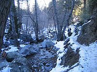
The county is divided west-to-east by the rugged San Gabriel Mountains
, filled with coniferous forests and subject to plentiful snowfall in the winter. The San Gabriel Mountains are part of the Transverse Ranges
of southern California, and are contained mostly within the Angeles National Forest
. Most of the highest peaks in the county are located in the San Gabriel Mountains, including Mount San Antonio
(10,068 ft) at the Los Angeles-San Bernardino
county lines, Mount Baden-Powell
(9,399 ft), Mount Burnham
(8,997 ft), and the well-known Mount Wilson
(5,710 ft) where the Mount Wilson Observatory
is located. Several smaller, lower mountains are located in the northern, western, and southwestern parts of the county, including the San Emigdio Mountains
, the southernmost part of Tehachapi Mountains
, and the Sierra Pelona Mountains
.
, and falls directly under the county government's jurisdiction. With no city government, residents of these areas must petition the appropriate member of the Board of Supervisors when they have a grievance about the quality of local services.
. It also has a vast urban and suburban street network, most of which is maintained by city governments. The county and most cities generally do a decent job of maintaining and cleaning streets. For more information about the primary exception, see the Transportation in Los Angeles article.
Both the freeways and streets are notorious for severe traffic congestion
, and the area's freeway-to-freeway interchanges regularly rank among the top 10 most congested points in the country.
In addition to Metro Bus service, numerous cities within the county also operate their own bus companies and shuttle lines.
(LAX), located in the Westchester district, is the primary commercial airport for commercial airline
s in the county and the Greater Los Angeles Area. LAX is operated by Los Angeles World Airports
, an agency of the City of Los Angeles. Other important commercial airports in Los Angeles County include:
The following general aviation
airports also are located in Los Angeles County:
County operated airports (Department of Public Works, Aviation Division)
City operated airports
The U.S. Air Force also has two airports in Los Angeles County:
.
Passenger rail service is provided in the county by Amtrak
, Los Angeles Metro Rail and Metrolink
.
Amtrak has the following intercity Amtrak service at Union Station
in the city of Los Angeles.
Union Station is also the primary hub for Metrolink commuter rail, which serves much of the Greater Los Angeles Area
.
Light rail, subway (heavy rail), and long-distance bus service are all provided by the Los Angeles County Metropolitan Transportation Authority
(Metro).
and the Port of Long Beach
. Together they handle over a quarter of all container
traffic entering the United States, making the complex the largest and most important port in the country, and the third-largest port in the world by shipping volume.
The Port of Los Angeles is the largest cruise ship center on the West Coast
, handling more than 1 million passengers annually.
The Port of Long Beach is home to the Sea Launch
program, which uses a floating launch platform to insert payloads into orbits that would be difficult to attain from existing land-based launch sites.
Ferries
link the Catalina Island city of Avalon
to the mainland.
, 20th Century Fox
, Sony
, Warner Bros.
, Universal Pictures
, and Walt Disney Studios
—are located within the county. Beyond motion picture and television program production, other major industries of Los Angeles County are international trade supported by the Port of Los Angeles
and the Port of Long Beach
, music recording and production, aerospace, and professional services such as law and medicine.
The following major companies have headquarters in Los Angeles County:
, and 438,713 (4.5%) from two or more races. Hispanic or Latino of any race were 4,687,889 persons (47.7%); 35.8% of Los Angeles County is Mexican, 3.7% Salvadoran, 2.2% Guatemalan, 0.5% Puerto Rican, 0.4% Cuban, 0.4% Honduran, 0.4% Nicaraguan, 0.3% Peruvian, 0.3% Colombian, and 0.2% Ecuadorian.
 As of the census of 2000, there were 9,519,338 people, 3,133,774 households, and 2,137,233 families residing in the county. The population density was 2,344 people per square mile (905/km²). There were 3,270,909 housing units at an average density of 806 per square mile (311/km²). The racial makeup of the county is 48.7% White 11.0% African American, 0.8% Native American, 10.0% Asian, 0.3% Pacific Islander, 23.5% from other races, and 4.9% from two or more races. 44.6% of the population are Hispanic or Latino of any race. The largest European-American ancestry groups are German (6%), Irish (5%), English (4%) and Italian (3%). 45.9% of the population reported speaking only English at home; 37.9% spoke Spanish, 2.22% Tagalog
, 2.0% Chinese, 1.9% Korean
, and 1.6% Armenian
.
Because the county is so populous, what is not so evident is that it has the largest Native American
population of any county in the nation: according to the 2000 census, it has more than 153,550 people of indigenous
descent, and most are from Latin America
. "The invisible population that is virtually ignored by the census is that of indigenous people from Mexico
, Central
and South America."
There were 3,133,774 households out of which 36.80% had children under the age of 18 living with them, 47.6% were married couples living together, 14.7% had a female householder with no husband present, and 31.8% were non-families. 24.6% of all households were made up of individuals and 7.1% had someone living alone who was 65 years of age or older. The average household size was 2.98 and the average family size was 3.61.
In the county the population was spread out with 28.0% under the age of 18, 10.3% from 18 to 24, 32.6% from 25 to 44, 19.4% from 45 to 64, and 9.7% who were 65 years of age or older. The median age was 32 years. For every 100 females there were 97.7 males. For every 100 females age 18 and over, there were 95.0 males.
The median income for a household in the county was $42,189, and the median income for a family was $46,452. Males had a median income of $36,299 versus $30,981 for females. The per capita income for the county was $20,683. There are 14.4% of families living below the poverty line and 17.9% of the population, including 24.2% of under 18 and 10.5% of those over 64.
According to TNS Financial Services
, Los Angeles County has the highest number of millionaires of any county in the nation, totaling 261,081 households as of 2007. In addition to millionaires, Los Angeles County has the largest number of homeless people, with "48,000 people living on the streets, including 6,000 veterans."
. The small size of the board means each supervisor represents over 2 million people. The board operates in a legislative, executive, and quasi-judicial
capacity. As a legislative authority, it can pass ordinances for the unincorporated areas (ordinances that affect the whole county, like posting of restaurant ratings, must be ratified by the individual city). As an executive body, it can tell the county departments what to do, and how to do it. As a quasi-judicial body, the Board is the final venue of appeal in the local planning process, and holds public hearings on various agenda items.
As of 2008, the Board of Supervisors oversees a $22.5 billion annual budget and approximately 100,000 employees. The county government is managed on a day-to-day basis by a Chief Executive Officer, William T Fujioka, and is organized into many departments, each of which is enormous in comparison to equivalent county-level (and even state-level) departments anywhere else in the United States. Some of the larger or better-known departments include:

The Los Angeles County Metropolitan Transportation Authority
, despite its name, is not a County department. Technically it is a state-mandated county transportation commission that also operates bus and rail.
The Los Angeles Superior Court
, which covers the entire county, is not a County department but a division of the State's trial court system. Historically, the courthouses were county-owned buildings that were maintained at county expense, which created significant friction since the trial court judges, as officials of the state government, had to lobby the county Board of Supervisors for facility renovations and upgrades. In turn, the state judiciary successfully persuaded the state Legislature to authorize the transfer of all courthouses to the state government in 2008 and 2009 (so that judges would have direct control over their own courthouses). Courthouse security is still provided by the county government under a contract with the state.
Los Angeles County has voted for the Democratic candidate in most of the presidential elections in the past four decades, although it did vote twice for Dwight Eisenhower (1952, 1956), Richard Nixon
(1968, 1972), and Ronald Reagan
(1980, 1984). In 2008 approximately 69% of the electorate voted for Democrat Barack Obama
.
In the United States House of Representatives
, California districts 27–39 are situated entirely within the county and are all represented by Democrats. In order of district number they are Brad Sherman
, Howard Berman
, Adam Schiff
, Henry Waxman
, Xavier Becerra
, Judy Chu
, Karen Bass
, Lucille Roybal-Allard, Maxine Waters
, Jane Harman
, Laura Richardson
, Grace Napolitano
, and Linda Sánchez
. Parts of the county also lie in the 22nd
, 25th
, 26th
, 42nd
, and 46th
districts, which are all represented by Republicans: Kevin McCarthy, Buck McKeon
, David Dreier
, Gary Miller
, and Dana Rohrabacher
respectively.
In the State Senate
, all of districts 20–22 and 24–28, and 30 are entirely within the county and are all represented by Democrats. In order of district number they are Alex Padilla
, Carol Liu
, Kevin De Leon
, Ed Hernandez
, Roderick Wright
, Curren D. Price, Alan Lowenthal
, and Ron Calderon
. Most of the 17th, 23rd, and 29th districts are in the county. The 17th and 29th districts are represented by Republicans Sharon Runner and Bob Huff
, respectively while the 23rd district is represented by Democrat Fran Pavley
. Parts of the 19th and 32nd districts are also in the county. The 19th district is represented by Republican Tony Strickland
while the 32nd is represented by Democrat Gloria Negrete McLeod
.
In the State Assembly
, all of districts 39, 40, 42–55, 57, and 58 are entirely within the county and are all represented by Democrats. In order of district number they are Felipe Fuentes
, Bob Blumenfield
, Mike Feuer, Mike Gatto
, Anthony Portantino, Gilbert Cedillo, John A. Perez, Holly Mitchell
, Mike Davis
, Mike Eng
, Ricardo Lara
, Steven Bradford
, Isadore Hall, III
, Betsy Butler
, Bonnie Lowenthal
, Warren T. Furutani, Roger Hernandez
, and Charles Calderon. Most of districts 38, 41, and 56 are in the county. The 38th is held by Republican Cameron Smyth
; the 41st and 56th are held by Democrats Julia Brownley
and Tony Mendoza
. Parts of districts 36, 37, 59, 60, and 61 are also in the county. The 36th, 37th, 59th, and 60th districts are represented by Republicans: Steve Knight
, Jeff Gorell
, Tim Donnelly
, and Curt Hagman
. The 61st is represented by Democrat Nell Soto
.
On November 4, 2008, Los Angeles County was almost evenly split over Proposition 8
which amended the California Constitution to ban same-sex marriages. The county voted for the amendment 50.1% with a margin of 20,806 votes.
has jurisdiction over all cases arising under state law, while the U.S. District Court for the Central District of California hears all federal cases. Both are headquartered in a large cluster of government buildings in the city's Civic Center.
Unlike the largest city in the US, New York City, all of the city of Los Angeles and most of its important suburbs are located within a single county. As a result, both the county superior court and the federal district court are respectively the busiest courts of their type in the nation.
Many celebrities
like O.J. Simpson have been seen in Los Angeles courts. In 2003, the tabloid television show Extra (based in nearby Glendale) found itself running so many reports on the legal problems of local celebrities that it spun them off into a separate show, Celebrity Justice.
State cases are appealed to the Court of Appeal for the Second Appellate District, which is also headquartered in the Civic Center, and then to the California Supreme Court
, which is headquartered in San Francisco but also hears argument in Los Angeles (again, in the Civic Center). Federal cases are appealed to the Court of Appeals for the Ninth Circuit
, which hears them at its branch building in Pasadena. The court of last resort for federal cases is the U.S. Supreme Court
in Washington, D.C.
in 2004 regarding a small cross on its seal
. The ACLU said that separation of church and state
prohibited this display. On September 14, 2004, the seal was modified to address this and other complaints.
and Los Angeles County High School for the Arts
. There are a number of private schools in the county, most notably those operated by the Los Angeles Archdiocese.
Universities
, 202 Jewish synagogues, 145 Buddhist temples, 48 Islamic mosques, 44 Bahai worship centers, 37 Hindu
temples, 28 Tenrikyo
churches and fellowships, 16 Shinto
worship centers, 14 Sikh
gurdwaras in the county. The Los Angeles Archdiocese has approximately 5 million members and is the largest in the United States.
 The county's most visited park is Griffith Park
, owned by the city of Los Angeles. The county is also known for the annual Rose Parade in Pasadena, the annual Los Angeles County Fair
in Pomona, the Los Angeles County Museum of Art
, the Los Angeles Zoo
, the Natural History Museum of Los Angeles County
, the La Brea Tar Pits
, the Arboretum of Los Angeles, and two horse racetracks and two car racetracks (Pomona Raceway
and Irwindale Speedway
), also the RMS Queen Mary
located in Long Beach, and the Long Beach Grand Prix
, and miles of beaches—from Zuma to Cabrillo.
Venice Beach
is a popular attraction where its Muscle Beach
used to find throngs of tourists admiring "hardbodies". Today it is more arts-centered. Santa Monica's pier is a well known tourist spot, famous for its ferris wheel
and bumper car rides, which were featured in the introductory segment of the television sitcom Three's Company
. Further north in Pacific Palisades one finds the beaches used in the television series Baywatch
. The fabled Malibu, home of many a film or television star, lies west of it.
In the mountain, canyon, and desert areas one may find Vasquez Rocks Natural Area Park, where many old westerns were filmed. Mount Wilson Observatory
in the San Gabriel Mountains
is open for the public to view astronomical stars from its telescope, now computer-assisted. Many county residents find relaxation in water skiing and swimming at Castaic
Lake Recreation Area – the county's largest park by area – as well as enjoying natural surroundings and starry nights at Saddleback Butte State Park
in the eastern Antelope Valley
– California State Parks' largest in area within the county. The California Poppy Reserve
is located in the western Antelope Valley and shows off the State's flower in great quantity on its rolling hills every spring.
County (United States)
In the United States, a county is a geographic subdivision of a state , usually assigned some governmental authority. The term "county" is used in 48 of the 50 states; Louisiana is divided into parishes and Alaska into boroughs. Parishes and boroughs are called "county-equivalents" by the U.S...
in the U.S. state
U.S. state
A U.S. state is any one of the 50 federated states of the United States of America that share sovereignty with the federal government. Because of this shared sovereignty, an American is a citizen both of the federal entity and of his or her state of domicile. Four states use the official title of...
of California
California
California is a state located on the West Coast of the United States. It is by far the most populous U.S. state, and the third-largest by land area...
. As of 2010 U.S. Census, the county had a population of 9,818,605, making it the most populous county in the United States. Los Angeles County alone is more populous than 42 individual U.S. states. The county seat
County seat
A county seat is an administrative center, or seat of government, for a county or civil parish. The term is primarily used in the United States....
is the city of Los Angeles
Los Ángeles
Los Ángeles is the capital of the province of Biobío, in the commune of the same name, in Region VIII , in the center-south of Chile. It is located between the Laja and Biobío rivers. The population is 123,445 inhabitants...
, the largest city in California and the second-largest city in the United States (after New York City
New York City
New York is the most populous city in the United States and the center of the New York Metropolitan Area, one of the most populous metropolitan areas in the world. New York exerts a significant impact upon global commerce, finance, media, art, fashion, research, technology, education, and...
).
Los Angeles County also includes two offshore islands, San Clemente Island
San Clemente Island
San Clemente Island is the southernmost of the Channel Islands of California. It is owned and operated by the United States Navy, and is a part of Los Angeles County. Defined by the United States Census Bureau as Block Group 2 of Census Tract 5991 of Los Angeles County, California, it is long and...
and Santa Catalina Island
Santa Catalina Island, California
Santa Catalina Island, often called Catalina Island, or just Catalina, is a rocky island off the coast of the U.S. state of California. The island is long and across at its greatest width. The island is located about south-southwest of Los Angeles, California. The highest point on the island is...
.The county is home to 88 incorporated cities and many unincorporated area
Unincorporated area
In law, an unincorporated area is a region of land that is not a part of any municipality.To "incorporate" in this context means to form a municipal corporation, a city, town, or village with its own government. An unincorporated community is usually not subject to or taxed by a municipal government...
s. At 4083 square miles (10,574.9 km²), it is larger than the combined areas of the states of Rhode Island
Rhode Island
The state of Rhode Island and Providence Plantations, more commonly referred to as Rhode Island , is a state in the New England region of the United States. It is the smallest U.S. state by area...
and Delaware
Delaware
Delaware is a U.S. state located on the Atlantic Coast in the Mid-Atlantic region of the United States. It is bordered to the south and west by Maryland, and to the north by Pennsylvania...
.
The county is home to over a quarter of all California residents. One of the most diverse counties in the country, the county is home to the nation's largest urban Native American
Indigenous peoples of the Americas
The indigenous peoples of the Americas are the pre-Columbian inhabitants of North and South America, their descendants and other ethnic groups who are identified with those peoples. Indigenous peoples are known in Canada as Aboriginal peoples, and in the United States as Native Americans...
population. Within its boundaries are most of the principal cities composing the Los Angeles metropolitan area
Los Angeles Metropolitan Area
The Los Angeles metropolitan area, also known as Metropolitan Los Angeles or the Southland, is the 13th largest metropolitan area in the world and the second-largest metropolitan area in the United States....
, and is the core of the five counties that make up the Greater Los Angeles Area
Greater Los Angeles Area
The Greater Los Angeles Area, or the Southland, is a term used for the Combined Statistical Area sprawled over five counties in the southern part of California, namely Los Angeles County, Orange County, San Bernardino County, Riverside County and Ventura County...
.
History
Los Angeles County was one of the original counties of California, created at the time of statehood in 1850. The county's large area included parts of what is now Kern County, San Bernardino County, Riverside County and Orange County. These parts of the county's territory were given to San Bernardino CountySan Bernardino County, California
San Bernardino County is a county in the U.S. state of California. As of the 2010 census, the population was 2,035,210, up from 1,709,434 as of the 2000 census...
in 1853, to Kern County
Kern County, California
Spreading across the southern end of the California Central Valley, Kern County is the fifth-largest county by population in California. Its economy is heavily linked to agriculture and to petroleum extraction, and there is a strong aviation and space presence. Politically, it has generally...
in 1866 and to Orange County
Orange County, California
Orange County is a county in the U.S. state of California. Its county seat is Santa Ana. As of the 2010 census, its population was 3,010,232, up from 2,846,293 at the 2000 census, making it the third most populous county in California, behind Los Angeles County and San Diego County...
in 1889. In 1893, part of San Bernardino County became Riverside County
Riverside County, California
Riverside County is a county in the U.S. state of California. One of 58 California counties, it covers in the southern part of the state, and stretches from Orange County to the Colorado River, which forms the state border with Arizona. The county derives its name from the city of Riverside,...
.
Geography
According to the 2000 census, the county has a total area of 4752.32 square miles (12,308.5 km²), of which 4060.87 square miles (10,517.6 km²) (or 85.45%) is land and 691.45 square miles (1,790.8 km²) (or 14.55%) is water. Los Angeles County borders 70 miles (112.7 km) of coast on the Pacific Ocean and encompasses towering mountain ranges, deep valleys, forests, islands, lakes, rivers, and desert. The Los Angeles RiverLos Angeles River
The Los Angeles River is a river that starts in the San Fernando Valley, in the Simi Hills and Santa Susana Mountains, and flows through Los Angeles County, California, from Canoga Park in the western end of the San Fernando Valley, nearly southeast to its mouth in Long Beach...
, Rio Hondo
Rio Hondo (California)
The Rio Hondo is a tributary of the Los Angeles River in Los Angeles County, California, approximately long. As a named river, it begins in Irwindale and flows southwest to its confluence in South Gate, passing through several cities...
, the San Gabriel River
San Gabriel River (California)
The San Gabriel River flows through southern Los Angeles County, California in the United States. Its main stem is about long, while its farthest tributaries extend almost altogether...
and the Santa Clara River
Santa Clara River (California)
The Santa Clara River is approximately long, located in southern California in the United States. It drains an area of the coastal mountains north of Los Angeles. The Santa Clara is one of the largest river systems along the coast of Southern California and one of only a few remaining river...
flow in Los Angeles County, while the primary mountain ranges are the Santa Monica Mountains
Santa Monica Mountains
The Santa Monica Mountains are a Transverse Range in Southern California, along the coast of the Pacific Ocean in the United States.-Geography:...
and the San Gabriel Mountains
San Gabriel Mountains
The San Gabriel Mountains Range is located in northern Los Angeles County and western San Bernardino County, California, United States. The mountain range lies between the Los Angeles Basin and the Mojave Desert, with Interstate 5 to the west and Interstate 15 to the east...
. The western extent of the Mojave Desert
Mojave Desert
The Mojave Desert occupies a significant portion of southeastern California and smaller parts of central California, southern Nevada, southwestern Utah and northwestern Arizona, in the United States...
begins in the Antelope Valley
Antelope Valley
The Antelope Valley in California, United States, is located in northern Los Angeles County and the southeastern portion of Kern County, California, and constitutes the western tip of the Mojave Desert...
, in the northeastern part of the county. Most of the population of Los Angeles County is located in the south and southwest, with major population centers in the Los Angeles Basin
Los Angeles Basin
The Los Angeles Basin is the coastal sediment-filled plain located between the Peninsular and Transverse ranges in southern California in the United States containing the central part of the city of Los Angeles as well as its southern and southeastern suburbs...
, San Fernando Valley
San Fernando Valley
The San Fernando Valley is an urbanized valley located in the Los Angeles metropolitan area of southern California, United States, defined by the dramatic mountains of the Transverse Ranges circling it...
and San Gabriel Valley
San Gabriel Valley
The San Gabriel Valley is one of the principal valleys of Southern California, United States. It lies to the east of Los Angeles, to the north of the Puente Hills, to the south of the San Gabriel Mountains, and west of the Inland Empire. It derives its name from the San Gabriel River that flows...
. Other population centers are found in the Santa Clarita Valley
Santa Clarita Valley
The Santa Clarita Valley is the valley of the Santa Clara River in Southern California. It stretches through Los Angeles County and Ventura County. Its main population center is the city of Santa Clarita. The valley was part of the Rancho San Francisco Mexican land grant...
, Crescenta Valley
Crescenta Valley
The Crescenta Valley is a small inland valley in Los Angeles County, California lying between the San Gabriel Mountains on the northeast and the Verdugo Mountains and San Rafael Hills on the southwest. It opens into the San Fernando Valley at the northwest and the San Gabriel Valley at the southeast...
and Antelope Valley
Antelope Valley
The Antelope Valley in California, United States, is located in northern Los Angeles County and the southeastern portion of Kern County, California, and constitutes the western tip of the Mojave Desert...
.
The county is divided west-to-east by the rugged San Gabriel Mountains
San Gabriel Mountains
The San Gabriel Mountains Range is located in northern Los Angeles County and western San Bernardino County, California, United States. The mountain range lies between the Los Angeles Basin and the Mojave Desert, with Interstate 5 to the west and Interstate 15 to the east...
, filled with coniferous forests and subject to plentiful snowfall in the winter. The San Gabriel Mountains are part of the Transverse Ranges
Transverse Ranges
The Transverse Ranges are a group of mountain ranges of southern California, in the Pacific Coast Ranges physiographic region that runs along the Pacific coast from Alaska to Mexico in North America. The Transverse Ranges begin at the southern end of the California Coast Ranges and lie between...
of southern California, and are contained mostly within the Angeles National Forest
Angeles National Forest
The Angeles National Forest of the U.S. National Forest Service is located in the San Gabriel Mountains of Los Angeles County, southern California. It was established on July 1, 1908, incorporating the first San Bernardino National Forest and parts of the former Santa Barbara and San Gabriel...
. Most of the highest peaks in the county are located in the San Gabriel Mountains, including Mount San Antonio
Mount San Antonio
Mount San Antonio, commonly known as Old Baldy or Mt Baldy, at , is the highest peak in the San Gabriel Mountains, and the highest point in Los Angeles County...
(10,068 ft) at the Los Angeles-San Bernardino
San Bernardino County, California
San Bernardino County is a county in the U.S. state of California. As of the 2010 census, the population was 2,035,210, up from 1,709,434 as of the 2000 census...
county lines, Mount Baden-Powell
Mount Baden-Powell (California)
Mount Baden-Powell is a peak in the San Gabriel Mountains of California named for the founder of the World Scouting Movement, Lord Baden-Powell. It was officially recognized by the USGS at a dedication ceremony in 1931....
(9,399 ft), Mount Burnham
Mount Burnham
Mount Burnham is one of the highest peaks in the San Gabriel Mountains. It is in the Sheep Mountain Wilderness. It is named for Frederick Russell Burnham the famous American military scout who taught scoutcraft to Robert Baden-Powell and became one of the inspirations for the founding of the Boy...
(8,997 ft), and the well-known Mount Wilson
Mount Wilson (California)
Mount Wilson is one of the better known peaks in the San Gabriel Mountains, part of the Angeles National Forest in Los Angeles County, California. It is the location of the Mount Wilson Observatory and has become the astronomical center of Southern California with and telescopes, and and tall...
(5,710 ft) where the Mount Wilson Observatory
Mount Wilson Observatory
The Mount Wilson Observatory is an astronomical observatory in Los Angeles County, California, United States. The MWO is located on Mount Wilson, a 5,715 foot peak in the San Gabriel Mountains near Pasadena, northeast of Los Angeles...
is located. Several smaller, lower mountains are located in the northern, western, and southwestern parts of the county, including the San Emigdio Mountains
San Emigdio Mountains
The San Emigdio Mountains are a part of the Transverse Ranges in Southern California, extending from Interstate 5 at Lebec and Gorman on the east to Highway 33–166 on the west. They link the Tehachapis and Temblor Range and form the southern wall of the San Joaquin Valley.The range is within Los...
, the southernmost part of Tehachapi Mountains
Tehachapi Mountains
The Tehachapi Mountains , regionally also called The Tehachapis, are a mountain range in the Transverse Ranges system of California in the Western United States...
, and the Sierra Pelona Mountains
Sierra Pelona Mountains
The Sierra Pelona Mountains , or the Sierra Pelona Ridge, is a mountain range in the Transverse Ranges of Southern California.. They are located within Los Angeles and Kern Counties.-Geography:...
.
Major divisions of the county
- East: EastsideEast Los Angeles (region)East Los Angeles is the portion of the City of Los Angeles that lies east of Downtown Los Angeles, the Los Angeles River and the unincorporated areas of Lincoln Heights, west of the San Gabriel Valley, East Los Angeles and City Terrace, south of Cypress Park, and north of Vernon, California and...
, San Gabriel ValleySan Gabriel ValleyThe San Gabriel Valley is one of the principal valleys of Southern California, United States. It lies to the east of Los Angeles, to the north of the Puente Hills, to the south of the San Gabriel Mountains, and west of the Inland Empire. It derives its name from the San Gabriel River that flows...
, Pomona ValleyPomona ValleyThe Pomona Valley, located between the San Gabriel Valley and Cucamonga Valley in Southern California, straddles the border between Los Angeles County and San Bernardino County. Back on March 1, 1893 the California Assembly voted 54-14 for a new county to form in the region, San Antonio County,... - West: WestsideWest Los Angeles (region)The Los Angeles Westside is an urban region in western Los Angeles County, California, United States. It has no official definition, but, according to the Los Angeles Times, it comprises , encompassing 18 districts in the city of Los Angeles and two unincorporated neighborhoods, plus the cities of...
, Beach CitiesBeach CitiesThe term Beach Cities refers to both a region of California located in Los Angeles County along the Santa Monica Bay coastline as well as a smaller group of cities located therein the region... - South: South BaySouth Bay, Los AngelesThe South Bay is a region of the southwest peninsula of Los Angeles County, California, United States. The name stems from its geographic features stretching along the southern shores of Santa Monica Bay which forms its western border.The picture at right uses the broadest definition of the...
, Palos Verdes Peninsula, South Los AngelesSouth Los AngelesSouth Los Angeles, often abbreviated as South L.A. and formerly South Central Los Angeles, is the official name for a large geographic and cultural portion lying to the southwest and southeast of downtown Los Angeles, California. The area was formerly called South Central, and is still widely known...
, Gateway CitiesGateway CitiesThe Gateway Cities of Southern California are those located in southeastern Los Angeles County. There is some cross-over between these cities and those composing South Los Angeles, East Los Angeles, the South Bay, and the San Gabriel Valley... - North: San Fernando ValleySan Fernando ValleyThe San Fernando Valley is an urbanized valley located in the Los Angeles metropolitan area of southern California, United States, defined by the dramatic mountains of the Transverse Ranges circling it...
, portions of the Conejo ValleyConejo ValleyThe Conejo Valley is a region spanning both southeastern Ventura County and northwestern Los Angeles County in Southern California, United States...
, portions of the Antelope ValleyAntelope ValleyThe Antelope Valley in California, United States, is located in northern Los Angeles County and the southeastern portion of Kern County, California, and constitutes the western tip of the Mojave Desert...
and Santa Clarita ValleySanta Clarita ValleyThe Santa Clarita Valley is the valley of the Santa Clara River in Southern California. It stretches through Los Angeles County and Ventura County. Its main population center is the city of Santa Clarita. The valley was part of the Rancho San Francisco Mexican land grant... - Central: Downtown Los AngelesDowntown Los AngelesDowntown Los Angeles is the central business district of Los Angeles, California, United States, located close to the geographic center of the metropolitan area...
, Mid-WilshireMid-WilshireMid-Wilshire is a district in the City of Los Angeles, California. It is part of the Wilshire region.It mostly encompasses the area bounded by La Cienega Boulevard to the west, Melrose Avenue to the north, Hoover Street to the east and the Santa Monica Freeway to the south, although some...
Cities
There are 88 incorporated cities in Los Angeles County. According to the 2010 U.S. Census, the most populous are:
|
Palmdale, California Palmdale is a city located in the center of northern Los Angeles County, California, United States.Palmdale was the first community within the Antelope Valley to incorporate as a city on August 24, 1962; 47 years later, voters approved creating a charter city in November, 2009. Palmdale is... 152,750 Pomona, California -2010:The 2010 United States Census reported that Pomona had a population of 149,058, a slight decline from the 2000 census population. The population density was 6,491.2 people per square mile... 149,058 Torrance, California Torrance is a city incorporated in 1921 and located in the South Bay region of Los Angeles County, California, United States. Torrance has of shore-front beaches on the Pacific Ocean, quieter and less well-known by tourists than others on the Santa Monica Bay, such as those of neighboring... 145,438 Pasadena, California Pasadena is a city in Los Angeles County, California, United States. Although famous for hosting the annual Rose Bowl football game and Tournament of Roses Parade, Pasadena is the home to many scientific and cultural institutions, including the California Institute of Technology , the Jet... 137,122 El Monte, California El Monte is a residential, industrial, and commercial city in Los Angeles County, California, United States. The city's slogan is "Welcome to Friendly El Monte," and historically is known as "The End of the Santa Fe Trail." As of the 2010 census, the city had a total population of 113,475,... 113,475 |
Downey, California Downey is a city located in southeast Los Angeles County, California, United States, southeast of downtown Los Angeles. The city is best known as the birthplace of the Apollo space program, and is the city where folk singer Karen Carpenter lived and died... 111,772 Inglewood, California Inglewood is a city in southwestern Los Angeles County, California, southwest of downtown Los Angeles. It was incorporated on February 14, 1908. Its population stood at 109,673 as of the 2010 Census... 109,673 West Covina, California West Covina is a city located in Los Angeles County, California. Located some east of Downtown Los Angeles in the eastern San Gabriel Valley, it is a mostly middle class suburb of Los Angeles... 106,098 Norwalk, California Norwalk is a suburban city in Los Angeles County, California, United States. The population was 105,549 at the 2010 census, up from 103,298 at the 2000 census, making it the 58th most populous city in California and the 255th nationally.... 105,549 Burbank, California Burbank is a city in Los Angeles County in Southern California, United States, north of downtown Los Angeles. The estimated population in 2010 was 103,340.... 103,340 |
Unincorporated areas in Los Angeles County
Despite the large number of incorporated cities, most of the area of the county is unincorporatedUnincorporated area
In law, an unincorporated area is a region of land that is not a part of any municipality.To "incorporate" in this context means to form a municipal corporation, a city, town, or village with its own government. An unincorporated community is usually not subject to or taxed by a municipal government...
, and falls directly under the county government's jurisdiction. With no city government, residents of these areas must petition the appropriate member of the Board of Supervisors when they have a grievance about the quality of local services.
Census-designated places
|
East Pasadena, California East Pasadena is a census-designated place in Los Angeles County, California, United States. The population was 6,144 at the 2010 census, up from 6,045 at the 2000 census.-Geography:East Pasadena is located at .... East San Gabriel, California East San Gabriel is a census-designated place in Los Angeles County, California, United States. The population was 14,874 at the 2010 census, up from 14,512 at the 2000 census.-Geography:East San Gabriel is located at .... Florence-Graham, California Florence-Graham is a census-designated place in Los Angeles County, California, United States. The population was 63,387 at the 2010 census, up from 60,197 at the 2000 census... Hacienda Heights, California Hacienda Heights is an unincorporated census-designated place in and below the Puente Hills of the San Gabriel Valley, in Los Angeles County, California, United States... La Crescenta-Montrose, California La Crescenta-Montrose is a census-designated place and an unincorporated area in Los Angeles County, California, encompassing those parts of the Crescenta Valley not in the cities of Glendale or La Cañada Flintridge. However, both the unincorporated area and the portion of incorporated Glendale... Ladera Heights, California Ladera Heights is a census-designated place and unincorporated area in southwestern Los Angeles County, California. The population was 6,498 at the 2010 census, down from 6,568 at the 2000 census... Lake Hughes, California Lake Hughes is an unincorporated community northwest of Palmdale and the Santa Clarita Valley in the Angeles National Forest on the sag pond waters of Hughes Lake and Elizabeth Lake . The community is agricultural in character, with a population of 649 at the 2010 census, but also has a strong... Lake Los Angeles, California Lake Los Angeles is a census-designated place in Los Angeles County, California, United States. The population was 12,328 at the 2010 census, up from 11,523 at the 2000 census... Lennox, California Lennox is a census-designated place in Los Angeles County, California, United States. The population was 22,753 at the 2010 census, down from 22,950 at the 2000 census.-Geography:... Leona Valley, California Leona Valley is a census-designated place located in the geographic Leona Valley of northern Los Angeles County, California, in the transition between the Sierra Pelona Mountains and Mojave Desert, just west of Palmdale and the Antelope Valley. The population was 1,607 at the 2010 census.Leona... Littlerock, California Littlerock is a census-designated place in Los Angeles County, California, United States. The population was 1,377 at the 2010 census, down from 1,402 at the 2000 census... Marina del Rey, California -Demographics:-2010:The 2010 United States Census reported that Marina del Rey had a population of 8,866. The population density was 6,094.6 people per square mile... Mayflower Village, California Mayflower Village is a census-designated place in the San Gabriel Valley, in Los Angeles County, California, United States. The population was 5,515 at the 2010 census, up from 5,081 at the 2000 census... |
North El Monte, California North El Monte is a census-designated place in the San Gabriel Valley, in Los Angeles County, California, United States. The population was 3,723 at the 2010 census, up from 3,703 at the 2000 census.-Geography:... Quartz Hill, California Quartz Hill is a census-designated place in Los Angeles County, California, United States. The population was 10,912 at the 2010 census, up from 9,890 at the 2000 census. The name is also shared with the neighboring district areas of its border cities, Palmdale, and Lancaster... Rowland Heights, California Rowland Heights is an unincorporated community of , located in and below the Puente Hills in the San Gabriel Valley, in Los Angeles County, California. The population of the census-designated place was 48,993 at the 2010 census, up from 48,553 at the 2000 census... Stevenson Ranch, California Stevenson Ranch is an affluent census-designated place in Los Angeles County, California. The community is located in the Santa Clarita Valley. Often incorrectly referred to as part of the city of Santa Clarita, the community does not actually fall within the Santa Clarita city limits, and is... South San Gabriel, California South San Gabriel is a census-designated place in Los Angeles County, California, United States. The population was 8,070 at the 2010 census, up from 7,595 at the 2000 census.-Geography:South San Gabriel is located at .... South San Jose Hills, California South San Jose Hills is an unincorporated community and census-designated place in Los Angeles County, California, United States. The population was 20,551 at the 2010 census, up from 20,218 at the 2000 census.- Description :... South Whittier, California -2010:The 2010 United States Census reported that South Whittier had a population of 57,156. The population density was 10,691.8 people per square mile... Topanga, California Topanga is a census-designated place in western Los Angeles County, California, USA. It is located in the Santa Monica Mountains. Occupying Topanga Canyon, it is often referred to by that name. Topanga is bounded on three sides by State Park or conservancy lands, and on the south by the Pacific... Val Verde, California Val Verde is a census-designated place in Los Angeles County, California, United States. The population was 2,468 at the 2010 census, up from 1,472 at the 2000 census. The predominant feature is the small rural valley in which this town sits, north of the San Fernando valley, isolated from... Valinda, California Valinda is a census-designated place in the San Gabriel Valley, in Los Angeles County, California, in the United States. As of the 2010 census, the population was 22,822, up from 21,776 at the 2000 census.-Geography:... View Park-Windsor Hills, California View Park-Windsor Hills is a census-designated place in Los Angeles County, California, United States. The population was 11,075 at the 2010 census, up from 10,958 at the 2000 census... Vincent, California Vincent is a census-designated place in the central San Gabriel Valley, in Los Angeles County, California, United States. The population was 15,922 at the 2010 census, up from 15,097 at the 2000 census. The ZIP Code serving the census area is 91722, which is served by Covina... |
Walnut Park, California Walnut Park is a census-designated place in Los Angeles County, California, United States. The population was 15,966 at the 2010 census, down from 16,180 at the 2000 census.-Geography:Walnut Park is located at .... West Athens, California West Athens is a census-designated place in Los Angeles County, California, United States. The population was 8,729 at the 2010 census, down from 9,101 at the 2000 census. It is an unincorporated area within the 2nd Supervisorial District of Los Angeles County. West Athens is served by the Los... West Carson, California West Carson is a census-designated place in Los Angeles County, California, USA. The population was 21,699 at the 2010 census, up from 21,138 at the 2000 census... West Puente Valley, California West Puente Valley is an unincorporated community and census-designated place in Los Angeles County, California, USA, northwest of La Puente. The population was 22,636 at the 2010 census, up from 22,589 at the 2000 census... West Whittier-Los Nietos, California West Whittier-Los Nietos is a census-designated place in Los Angeles County, California, near the San Gabriel River and the San Gabriel River Freeway . The population was 25,540 at the 2010 census, up from 25,129 at the 2000 census... Westmont, California Westmont is a census-designated place in Los Angeles County, California, United States. The population was 31,853 at the 2010 census, up from 31,623 at the 2000 census... Willowbrook, California Willowbrook is an unincorporated community and census-designated place in Los Angeles County, California. The population was 35,983 at the 2010 census, up from 34,138 at the 2000 census. The community is located near the southeast edge of, and is often considered part of, South Los Angeles... |
Communities not census-designated
|
Big Rock, California Big Rock is an unincorporated area in Los Angeles County, California... Bouquet Canyon, California Bouquet Canyon is an unincorporated area located in Los Angeles County, California.-Description:Bouquet Canyon is one of many canyons branching from the Santa Clarita Valley in Los Angeles County, whose streams feed the Santa Clara River. The canyon's main stream, Bouquet Creek, begins in the... Castaic Junction, California Castaic Junction is an unincorporated community located in Los Angeles County, California. It is located at the junction of Interstate 5 and State Route 126, and was the official southern end of the Ridge Route.-References:... Del Sur, California Del Sur is an unincorporated community in the Mojave Desert, in Los Angeles County, California. The town has a population of about 1,750. The ZIP Code is 93536 and the community is inside area code 661.-Geography:... Del Valle, California Del Valle is an unincorporated area located in Los Angeles County, California.... |
Gorman, California Gorman, California, is an unincorporated community in northwestern Los Angeles County. As of 2005 it had just 15 homes and a few registered voters, but tens of thousands of motorists traveled through it daily on the Interstate 5 freeway.... Juniper Hills, California Juniper Hills, California is an unincorporated town located in the foothills on the northern slope of the San Gabriel Mountains, facing the Antelope Valley, in Los Angeles County. The community is nestled between Littlerock and Pearblossom, occupying a smallish section of each and a swath of... Llano, California Llano is an unincorporated town located in Los Angeles County, California, near the San Bernardino Countyline. The town has a population of about 1200.- Geography :... Pearblossom, California Pearblossom is an unincorporated town located in Los Angeles County, California. The town has a population of 2,435. The ZIP Code is 93553 and the community is inside area code 661.-Geography:... |
Kinneloa Mesa, California Kinneloa Mesa is an unincorporated area located in Los Angeles County, California, with a population of approximately 1,000. Unlike Altadena, a larger unincorporated area nearby, Kinneloa Mesa is not an officially designated census-designated place... Two Harbors, California Two Harbors, colloquially known as "The Isthmus", is a small unincorporated island village on Santa Catalina Island, California with a population of 298 . It is the second center of population on the island, besides the city of Avalon. It is mainly a resort village. It has only one restaurant, one... Valyermo, California Valyermo is an unincorporated town located in the Mojave Desert, in Los Angeles County, California. The town has a population of about 450.- Geography :Valyermo is located about southeast of Palmdale in the Antelope Valley portion of Southern California... Centennial, California Centennial, California, is a proposed planned community between Bakersfield and Los Angeles in Los Angeles County located north of Highway 138, and just east of Interstate 5; specifically, surrounding the north and east sides of Quail Lake... (planned for 70,000). |
Adjacent counties
National protected areas
- Angeles National ForestAngeles National ForestThe Angeles National Forest of the U.S. National Forest Service is located in the San Gabriel Mountains of Los Angeles County, southern California. It was established on July 1, 1908, incorporating the first San Bernardino National Forest and parts of the former Santa Barbara and San Gabriel...
(part) - Los Padres National ForestLos Padres National ForestLos Padres National Forest is a forest located in southern and central California, which includes most of the mountainous land along the California coast from Ventura to Monterey, extending inland...
(part) - Santa Monica Mountains National Recreation AreaSanta Monica Mountains National Recreation AreaThe Santa Monica Mountains National Recreation Area or SMMNRA, is a United States National Recreation Area containing many individual parks and open space preserves, located primarily in the Santa Monica Mountains of Southern California...
(part)
Roads
The county has an extensive freeway network of legendary size and complexity, which is maintained by Caltrans and patrolled by the California Highway PatrolCalifornia Highway Patrol
The California Highway Patrol is a law enforcement agency of the U.S. state of California. The CHP has patrol jurisdiction over all California highways and also acts as the state police....
. It also has a vast urban and suburban street network, most of which is maintained by city governments. The county and most cities generally do a decent job of maintaining and cleaning streets. For more information about the primary exception, see the Transportation in Los Angeles article.
Both the freeways and streets are notorious for severe traffic congestion
Traffic congestion
Traffic congestion is a condition on road networks that occurs as use increases, and is characterized by slower speeds, longer trip times, and increased vehicular queueing. The most common example is the physical use of roads by vehicles. When traffic demand is great enough that the interaction...
, and the area's freeway-to-freeway interchanges regularly rank among the top 10 most congested points in the country.
In addition to Metro Bus service, numerous cities within the county also operate their own bus companies and shuttle lines.
Major highways
|
 California State Route 1 State Route 1 , more often called Highway 1, is a state highway that runs along much of the Pacific coast of the U.S. state of California. It is famous for running along some of the most beautiful coastlines in the world, leading to its designation as an All-American Road.Highway 1 does not run...   California State Route 14 State Route 14 is a north–south state highway in the U.S. state of California, largely in the Mojave Desert. The southern portion of the highway is signed as the Antelope Valley Freeway. The route connects Interstate 5, or Golden State Freeway, near Santa Clarita and with U.S. Route 395 near...    California State Route 39 State Route 39 is a state highway in the U.S. state of California that travels through Orange and Los Angeles counties. Its southern terminus is at Pacific Coast Highway , in Huntington Beach, and its northern terminus is at Islip Saddle on Angeles Crest Highway in the Angeles National...  California State Route 47 State Route 47 is a state highway in the U.S. state of California, connecting Terminal Island to the mainland in the Los Angeles area. From its south end at I-110 in San Pedro, it heads east across the Vincent Thomas Bridge to the island and the end of state maintenance...  California State Route 57 State Route 57 , also known as the Orange Freeway, is a north–south state highway in the Greater Los Angeles Area of the U.S. state of California. It connects the interchange of Interstate 5 and State Route 22 near downtown Orange, locally known as the Orange Crush, with the Glendora Curve...  California State Route 60 State Route 60 is a state highway in the U.S. state of California. It runs from Interstate 10 near the Los Angeles River in Los Angeles east to I-10 in Riverside County, with overlaps at State Route 57 and Interstate 215.-Route description:... |
  California State Route 71 State Route 71 is the Chino Valley Freeway, formerly the Corona Expressway and before then the Temescal Freeway, a freeway/highway of about 15 miles in length located entirely within Southern California, United States...  California State Route 90 State Route 90 is a state highway in Southern California, United States. It consists of two unconnected pieces in Greater Los Angeles....  California State Route 91 State Route 91 is a major east–west freeway located entirely within Southern California and serving several regions of the Greater Los Angeles metropolitan area...    California State Route 138 State Route 138 is an east–west state highway generally following the northern foothills of the San Gabriel Mountains of southern California, USA from its junction with Interstate 5 south of Gorman eastward to Mount Anderson Junction, its eastern junction with State Route 18 south of...   |
.svg.png)
.svg.png)
.svg.png)
.svg.png)
.svg.png)
.svg.png)
.svg.png)
.svg.png)
.svg.png)
Air
Los Angeles International AirportLos Angeles International Airport
Los Angeles International Airport is the primary airport serving the Greater Los Angeles Area, the second-most populated metropolitan area in the United States. It is most often referred to by its IATA airport code LAX, with the letters pronounced individually...
(LAX), located in the Westchester district, is the primary commercial airport for commercial airline
Airline
An airline provides air transport services for traveling passengers and freight. Airlines lease or own their aircraft with which to supply these services and may form partnerships or alliances with other airlines for mutual benefit...
s in the county and the Greater Los Angeles Area. LAX is operated by Los Angeles World Airports
Los Angeles World Airports
Los Angeles World Airports or LAWA is the airport oversight and operations department for the city of Los Angeles, California, United States...
, an agency of the City of Los Angeles. Other important commercial airports in Los Angeles County include:
- Long Beach Municipal AirportLong Beach Municipal AirportLong Beach Airport , also known as Daugherty Field, is a city-owned public-use airport located three nautical miles northeast of the central business district of the City of Long Beach, in Los Angeles County, California, United States. It serves Los Angeles and Orange Counties...
operated by the City of Long Beach - Bob Hope AirportBob Hope AirportBob Hope Airport is a public airport located 3 miles northwest of the central business district of Burbank, a city in Los Angeles County, California, United States...
in Burbank, operated by the Burbank-Glendale-Pasadena Airport Authority - LA/Palmdale Regional Airport in PalmdalePalmdale, CaliforniaPalmdale is a city located in the center of northern Los Angeles County, California, United States.Palmdale was the first community within the Antelope Valley to incorporate as a city on August 24, 1962; 47 years later, voters approved creating a charter city in November, 2009. Palmdale is...
, also operated by Los Angeles World AirportsLos Angeles World AirportsLos Angeles World Airports or LAWA is the airport oversight and operations department for the city of Los Angeles, California, United States...
. Palmdale Airport is planned for expanded commercial service to serve the Antelope Valley. The airport is a separate facility on the grounds of Air Force Plant 42.
The following general aviation
General aviation
General aviation is one of the two categories of civil aviation. It refers to all flights other than military and scheduled airline and regular cargo flights, both private and commercial. General aviation flights range from gliders and powered parachutes to large, non-scheduled cargo jet flights...
airports also are located in Los Angeles County:
County operated airports (Department of Public Works, Aviation Division)
- Compton/Woodley AirportCompton/Woodley AirportCompton/Woodley Airport is a county-owned public-use airport located two miles southwest of the central business district of Compton, a city in southern Los Angeles County, California, United States. According to the FAA's National Plan of Integrated Airport Systems for 2007–2011, it is...
in ComptonCompton, CaliforniaCompton is a city in southern Los Angeles County, California, United States, southeast of downtown Los Angeles. The city of Compton is one of the oldest cities in the county and on May 11, 1888, was the eighth city to incorporate. The city is considered part of the South side by residents of Los... - El Monte AirportEl Monte AirportEl Monte Airport is a public airport located one mile north of the central business district of El Monte, a city in Los Angeles County, California, USA. The airport covers and has one runway.- External links :...
in El MonteEl Monte, CaliforniaEl Monte is a residential, industrial, and commercial city in Los Angeles County, California, United States. The city's slogan is "Welcome to Friendly El Monte," and historically is known as "The End of the Santa Fe Trail." As of the 2010 census, the city had a total population of 113,475,... - Brackett FieldBrackett FieldBrackett Field is a public airport located one mile southwest of La Verne, in Los Angeles County, California, USA. It was named after Dr. Frank Parkhurst Brackett .-History:...
in La VerneLa Verne, CaliforniaLa Verne is a city in Los Angeles County, California, United States. The population was 31,063 at the 2010 census, down from 31,638 at the 2000 census.-History:... - Whiteman AirportWhiteman AirportWhiteman Airport is a general aviation airport located in the Pacoima district of Los Angeles, California, United States.Located in the San Fernando Valley, Hollywood celebrities sometimes use this airport; however, Van Nuys Airport is used more often....
in PacoimaPacoima, Los Angeles, CaliforniaPacoima is a district in the San Fernando Valley region of the city of Los Angeles, California.It is bordered by the Los Angeles districts of Mission Hills on the west, Arleta on the south, Sun Valley on the southeast, Lake View Terrace on the northeast, and by the city of San Fernando on the north... - General William J. Fox AirfieldGeneral William J. Fox AirfieldGeneral William J. Fox Airfield , locally known as "Fox Field" is an airport located in Lancaster, California serving the Antelope Valley region of northern Los Angeles County. Although the airport is used primarily for general aviation, there are limited scheduled cargo operations, and the U.S...
in LancasterLancaster, CaliforniaLancaster is a charter city in northern Los Angeles County, in the high desert, near the Kern County line. Lancaster currently ranks as the 30th largest city in California, and the 148th largest city in the United States. Lancaster is the principal city within the Antelope Valley...
City operated airports
- Van Nuys AirportVan Nuys AirportVan Nuys Airport is a public airport located in Van Nuys in the San Fernando Valley section of the city limits of Los Angeles, California, United States. No major commercial airlines fly into this airport; it is used by private, chartered, and small commercial aircraft...
in Van NuysVan Nuys, Los Angeles, CaliforniaVan Nuys is a neighborhood in the San Fernando Valley region of Los Angeles, California.-History:Look at the two photos of Van Nuys' first year—and then listen to what the Los Angeles Times wrote on February 23, 1911, the day after the Van Nuys town lot auction--"Between dawn and dusk, in the...
, also operated by LAWALawaLawa may refer to* Lawa people, an ethnic group of Laos and Thailand.Towns* Lawa, Punjab, a small town in Punjab province, Pakistan* Lawa, Uttarakhand, a small village in Uttarakhand India...
. Van Nuys Airport sees significant executive jet air traffic. - Santa Monica AirportSanta Monica AirportSanta Monica Airport , also known as Santa Monica Municipal Airport, is a general aviation airport located largely in Santa Monica, California, United States. The airport is located about from the Pacific Ocean and north of LAX...
in Santa MonicaSanta Monica, CaliforniaSanta Monica is a beachfront city in western Los Angeles County, California, US. Situated on Santa Monica Bay, it is surrounded on three sides by the city of Los Angeles — Pacific Palisades on the northwest, Brentwood on the north, West Los Angeles on the northeast, Mar Vista on the east, and...
, which also has major executive jet traffic. - Hawthorne Municipal Airport, also known as Jack Northrop Field, in HawthorneHawthorne, CaliforniaHawthorne is a city in southwestern Los Angeles County, California. The city at the 2010 census had a population of 84,293, up from 84,112 at the 2000 census.-Geography:...
- Zamperini FieldZamperini FieldZamperini Field is a city-owned public-use airport located three miles southwest of the central business district of Torrance, in Los Angeles County, California, United States....
in TorranceTorrance, CaliforniaTorrance is a city incorporated in 1921 and located in the South Bay region of Los Angeles County, California, United States. Torrance has of shore-front beaches on the Pacific Ocean, quieter and less well-known by tourists than others on the Santa Monica Bay, such as those of neighboring...
The U.S. Air Force also has two airports in Los Angeles County:
- Portions of Edwards Air Force BaseEdwards Air Force BaseEdwards Air Force Base is a United States Air Force base located on the border of Kern County, Los Angeles County, and San Bernardino County, California, in the Antelope Valley. It is southwest of the central business district of North Edwards, California and due east of Rosamond.It is named in...
, located at the northern edge of the county, and - Air Force Plant 42 in Palmdale, sharing runways with LA/Palmdale Regional.
Train
Los Angeles is a major freight railroad transportation center, largely due to the large volumes of freight moving in and out of the county's port facilities. The ports are connected to the downtown rail yards and to the main lines of Union Pacific and Burlington Northern Santa Fe headed east via a grade-separated, freight rail corridor known as the Alameda CorridorAlameda Corridor
The Alameda Corridor is a 20 mile freight rail "expressway" owned by the Alameda Corridor Transportation Authority , connecting the national rail system near downtown Los Angeles, California to the ports of Los Angeles and Long Beach, running parallel to Alameda Street...
.
Passenger rail service is provided in the county by Amtrak
Amtrak
The National Railroad Passenger Corporation, doing business as Amtrak , is a government-owned corporation that was organized on May 1, 1971, to provide intercity passenger train service in the United States. "Amtrak" is a portmanteau of the words "America" and "track". It is headquartered at Union...
, Los Angeles Metro Rail and Metrolink
Metrolink (Southern California)
Metrolink is a commuter rail system serving Los Angeles and the surrounding area of Southern California; it currently consists of six lines and 55 stations using of track....
.
Amtrak has the following intercity Amtrak service at Union Station
Union Station (Los Angeles)
Los Angeles Union Station is the main railway station in Los Angeles, California. The station has rail services by Amtrak and Amtrak California and Metrolink; light rail/subways are the Metro Rail Red Line, Purple Line, Gold Line. Bus rapid transport runs on the Silver Line...
in the city of Los Angeles.
- The Pacific SurflinerPacific SurflinerThe Pacific Surfliner is a Amtrak regional passenger train route serving communities on the coast of Southern California between San Diego and San Luis Obispo....
to Santa BarbaraSanta Barbara, CaliforniaSanta Barbara is the county seat of Santa Barbara County, California, United States. Situated on an east-west trending section of coastline, the longest such section on the West Coast of the United States, the city lies between the steeply-rising Santa Ynez Mountains and the Pacific Ocean...
, San Luis Obispo, and San Diego. - The Coast StarlightCoast StarlightThe Coast Starlight is a passenger train operated by Amtrak on the West Coast of the United States. It runs from King Street Station in Seattle, Washington, to Union Station in Los Angeles, California. The train's name was formed as a merging of two of Southern Pacific's train names, the Coast...
to Seattle - The Southwest ChiefSouthwest ChiefThe Southwest Chief is a passenger train operated by Amtrak on a 2256-mile BNSF route through the Midwestern and Southwestern United States. It runs from Chicago, Illinois, to Los Angeles, California, passing through Illinois, Iowa, Missouri, Kansas, Colorado, New Mexico, Arizona, and California...
to Chicago - The Sunset LimitedSunset LimitedThe Sunset Limited is a passenger train that for most of its history has run between New Orleans, Louisiana and Los Angeles, California, and that from early 1993 through late August 2005 also ran east of New Orleans to Jacksonville, Florida, making it during that time the only true transcontinental...
to New Orleans and OrlandoOrlando, FloridaOrlando is a city in the central region of the U.S. state of Florida. It is the county seat of Orange County, and the center of the Greater Orlando metropolitan area. According to the 2010 US Census, the city had a population of 238,300, making Orlando the 79th largest city in the United States...
Union Station is also the primary hub for Metrolink commuter rail, which serves much of the Greater Los Angeles Area
Greater Los Angeles Area
The Greater Los Angeles Area, or the Southland, is a term used for the Combined Statistical Area sprawled over five counties in the southern part of California, namely Los Angeles County, Orange County, San Bernardino County, Riverside County and Ventura County...
.
Light rail, subway (heavy rail), and long-distance bus service are all provided by the Los Angeles County Metropolitan Transportation Authority
Los Angeles County Metropolitan Transportation Authority
The Los Angeles County Metropolitan Transportation Authority is the California state-chartered regional transportation planning agency and public transportation operating agency for the County of Los Angeles formed in 1993 out of a merger of the Southern California Rapid Transit District and the...
(Metro).
Sea
The county's two main seaports are the Port of Los AngelesPort of Los Angeles
The Port of Los Angeles, also called Los Angeles Harbor and WORLDPORT L.A, is a port complex that occupies of land and water along of waterfront. The port is located on San Pedro Bay in the San Pedro neighborhood of Los Angeles, approximately south of downtown...
and the Port of Long Beach
Port of Long Beach
The Port of Long Beach, also known as Long Beach’s Harbor Department, is the 2nd busiest container port in the USA. It adjoins the separate Port of Los Angeles. Acting as a major gateway for U.S.-Asian trade, the port occupies of land with of waterfront in the city of Long Beach, California...
. Together they handle over a quarter of all container
Containerization
Containerization is a system of freight transport based on a range of steel intermodal containers...
traffic entering the United States, making the complex the largest and most important port in the country, and the third-largest port in the world by shipping volume.
The Port of Los Angeles is the largest cruise ship center on the West Coast
West Coast of the United States
West Coast or Pacific Coast are terms for the westernmost coastal states of the United States. The term most often refers to the states of California, Oregon, and Washington. Although not part of the contiguous United States, Alaska and Hawaii do border the Pacific Ocean but can't be included in...
, handling more than 1 million passengers annually.
The Port of Long Beach is home to the Sea Launch
Sea Launch
Sea Launch is a spacecraft launch service that uses a mobile sea platform for equatorial launches of commercial payloads on specialized Zenit 3SL rockets...
program, which uses a floating launch platform to insert payloads into orbits that would be difficult to attain from existing land-based launch sites.
Ferries
Ferry
A ferry is a form of transportation, usually a boat, but sometimes a ship, used to carry primarily passengers, and sometimes vehicles and cargo as well, across a body of water. Most ferries operate on regular, frequent, return services...
link the Catalina Island city of Avalon
Avalon, California
Avalon, or Avalon Bay, is the only incorporated city on Santa Catalina Island of the California Channel Islands, and the southernmost city in Los Angeles County. Besides Avalon, the only other center of population on the island is the small unincorporated town of Two Harbors...
to the mainland.
Economy
Los Angeles County is commonly associated with the entertainment industry; all six major film studios—Paramount PicturesParamount Pictures
Paramount Pictures Corporation is an American film production and distribution company, located at 5555 Melrose Avenue in Hollywood. Founded in 1912 and currently owned by media conglomerate Viacom, it is America's oldest existing film studio; it is also the last major film studio still...
, 20th Century Fox
20th Century Fox
Twentieth Century Fox Film Corporation — also known as 20th Century Fox, or simply 20th or Fox — is one of the six major American film studios...
, Sony
Sony
, commonly referred to as Sony, is a Japanese multinational conglomerate corporation headquartered in Minato, Tokyo, Japan and the world's fifth largest media conglomerate measured by revenues....
, Warner Bros.
Warner Bros.
Warner Bros. Entertainment, Inc., also known as Warner Bros. Pictures or simply Warner Bros. , is an American producer of film and television entertainment.One of the major film studios, it is a subsidiary of Time Warner, with its headquarters in Burbank,...
, Universal Pictures
Universal Pictures
-1920:* White Youth* The Flaming Disc* Am I Dreaming?* The Dragon's Net* The Adorable Savage* Putting It Over* The Line Runners-1921:* The Fire Eater* A Battle of Wits* Dream Girl* The Millionaire...
, and Walt Disney Studios
Walt Disney Studios (Burbank)
The Walt Disney Studios in Burbank, California, United States, serve as the international headquarters for media conglomerate The Walt Disney Company. The Walt Disney Studio's house offices for each of the company's divisions along with creative spaces designed for movie production. The Walt Disney...
—are located within the county. Beyond motion picture and television program production, other major industries of Los Angeles County are international trade supported by the Port of Los Angeles
Port of Los Angeles
The Port of Los Angeles, also called Los Angeles Harbor and WORLDPORT L.A, is a port complex that occupies of land and water along of waterfront. The port is located on San Pedro Bay in the San Pedro neighborhood of Los Angeles, approximately south of downtown...
and the Port of Long Beach
Port of Long Beach
The Port of Long Beach, also known as Long Beach’s Harbor Department, is the 2nd busiest container port in the USA. It adjoins the separate Port of Los Angeles. Acting as a major gateway for U.S.-Asian trade, the port occupies of land with of waterfront in the city of Long Beach, California...
, music recording and production, aerospace, and professional services such as law and medicine.
The following major companies have headquarters in Los Angeles County:
|
Monrovia, California Monrovia is a city located in the foothills of the San Gabriel Mountains in the San Gabriel Valley of Los Angeles County, California, United States. The population was 36,590 at the 2010 census, down from 36,929 at the 2000 census...
|
Thousand Oaks, California Thousand Oaks is a city in southeastern Ventura County, California, in the United States. It was named after the many oak trees that grace the area, and the city seal is adorned with an oak....
Westlake Village, California Westlake Village is a planned community that straddles the Los Angeles and Ventura county line. The eastern portion is the incorporated city Westlake Village, located on the western edge of Los Angeles County, California. The city, located in the region known as the Conejo Valley, encompasses half...
|
Demographics
2010
The 2010 United States Census reported that Los Angeles County had a population of 9,818,605. The racial makeup of Los Angeles County was 4,936,599 (50.3%) White, 856,874 (8.7%) African American, 72,828 (0.7%) Native American, 1,346,865 (13.7%) Asian (4.0% Chinese, 3.3% Filipino, 2.2% Korean, 1.0% Japanese, 0.9% Vietnamese, 0.8% Indian, 0.3% Cambodian, 0.3% Thai, 0.1% Pakistani), 26,094 (0.3%) Pacific Islander (0.1% Samoan), 2,140,632 (21.8%) from other racesRace (United States Census)
Race and ethnicity in the United States Census, as defined by the Federal Office of Management and Budget and the United States Census Bureau, are self-identification data items in which residents choose the race or races with which they most closely identify, and indicate whether or not they are...
, and 438,713 (4.5%) from two or more races. Hispanic or Latino of any race were 4,687,889 persons (47.7%); 35.8% of Los Angeles County is Mexican, 3.7% Salvadoran, 2.2% Guatemalan, 0.5% Puerto Rican, 0.4% Cuban, 0.4% Honduran, 0.4% Nicaraguan, 0.3% Peruvian, 0.3% Colombian, and 0.2% Ecuadorian.
Population |
American |
American |
|
Islander |
races Race (United States Census) Race and ethnicity in the United States Census, as defined by the Federal Office of Management and Budget and the United States Census Bureau, are self-identification data items in which residents choose the race or races with which they most closely identify, and indicate whether or not they are... |
more races |
or Latino (of any race) |
||
| Los Angeles County | 9,818,605 | 4,936,599 | 856,874 | 72,828 | 1,346,865 | 26,094 | 2,140,632 | 438,713 | 4,687,889 |
| 100% | 50.3% | 8.7% | 0.7% | 13.7% | 0.3% | 21.8% | 4.5% | 47.7% | |
city |
Population |
American |
American |
|
Islander |
races Race (United States Census) Race and ethnicity in the United States Census, as defined by the Federal Office of Management and Budget and the United States Census Bureau, are self-identification data items in which residents choose the race or races with which they most closely identify, and indicate whether or not they are... |
more races |
or Latino (of any race) |
|
| Agoura Hills Agoura Hills, California Agoura Hills is a city in Los Angeles County, California, and has the ZIP code 91301. The population was 20,330 at the 2010 census, down from 20,537 at the 2000 census. It is located in the eastern Conejo Valley between the Simi Hills and the Santa Monica Mountains. This city on the Ventura... |
20,330 | 17,147 | 267 | 51 | 1,521 | 24 | 590 | 730 | 1,936 |
| Alhambra Alhambra, California Alhambra is a city located in the western San Gabriel Valley region of Los Angeles County, California, United States, which is approximately eight miles from the Downtown Los Angeles civic center. As of the 2010 census, the population was 83,089, down from 85,804 at the 2000 census. The city's... |
83,089 | 23,521 | 1,281 | 538 | 43,957 | 81 | 10,805 | 2,906 | 28,582 |
| Arcadia Arcadia, California Arcadia is an affluent city in Los Angeles County, California, United States, and located approximately northeast of downtown Los Angeles in the San Gabriel Valley and at the base of the San Gabriel Mountains.... |
56,364 | 18,191 | 681 | 186 | 33,353 | 16 | 2,352 | 1,585 | 6,799 |
| Artesia Artesia, California Artesia is a city in southeast Los Angeles County, California. Artesia was incorporated on May 29, 1959 and is one of Los Angeles County's Gateway Cities. The city has a 2010 census population of 16,522... |
16,522 | 6,446 | 589 | 94 | 6,131 | 40 | 2,630 | 592 | 5,910 |
| Avalon Avalon, California Avalon, or Avalon Bay, is the only incorporated city on Santa Catalina Island of the California Channel Islands, and the southernmost city in Los Angeles County. Besides Avalon, the only other center of population on the island is the small unincorporated town of Two Harbors... |
3,728 | 2,313 | 20 | 22 | 49 | 13 | 1,137 | 174 | 2,079 |
| Azusa Azusa, California Azusa is a city in Los Angeles County, California, United States. The population was 46,361 at the 2010 census, up from 44,712 at the 2000 census. Though sometimes assumed to be a compaction of the phrase "everything from A to Z in the USA" from an old Jack Benny joke, the place name "Azusa"... |
46,361 | 26,715 | 1,499 | 562 | 4,054 | 87 | 11,270 | 2,174 | 31,328 |
| Baldwin Park Baldwin Park, California Baldwin Park is a city located in the central San Gabriel Valley region of Los Angeles County, California, United States. As of the 2010 census, the population was 75,390, down from 75,837 at the 2000 census.- History :... |
75,390 | 33,119 | 913 | 674 | 10,696 | 85 | 27,079 | 2,824 | 60,403 |
| Bell Bell, California Bell is a city in Los Angeles County, California. Its population was 35,477 at the 2010 census, down from 36,664 in the 2000 census. Bell is located on the west bank of the Los Angeles River and is a suburb of the city of Los Angeles... |
35,477 | 19,098 | 337 | 315 | 259 | 8 | 13,899 | 1,561 | 33,028 |
| Bell Gardens Bell Gardens, California Bell Gardens is a city in Los Angeles County, California. The population was 42,072 at the 2010 census, down from 44,054 at the 2000 census.Bell Gardens is notable for being one of only five Los Angeles County cities to permit casino gambling... |
42,072 | 20,824 | 377 | 476 | 261 | 37 | 18,787 | 1,310 | 40,271 |
| Bellflower Bellflower, California Bellflower is a city in Los Angeles County, California, and is a suburb of Los Angeles. It was incorporated on September 3, 1957. As of the 2010 census, the city had a total population of 76,616, up from 72,878 at the 2000 census.... |
76,616 | 32,337 | 10,760 | 731 | 8,865 | 615 | 19,732 | 3,576 | 40,085 |
| Beverly Hills Beverly Hills, California Beverly Hills is an affluent city located in Los Angeles County, California, United States. With a population of 34,109 at the 2010 census, up from 33,784 as of the 2000 census, it is home to numerous Hollywood celebrities. Beverly Hills and the neighboring city of West Hollywood are together... |
34,109 | 28,112 | 746 | 48 | 3,032 | 12 | 485 | 1,674 | 1,941 |
| Bradbury Bradbury, California Bradbury is a small, affluent city in the San Gabriel Valley region of Los Angeles County, California, United States. It is located in the foothills of the San Gabriel Mountains below Angeles National Forest. Bradbury is bordered by the city of Monrovia to the west, and Duarte to the south and... |
1,048 | 652 | 22 | 4 | 276 | 0 | 59 | 35 | 218 |
| Burbank Burbank, California Burbank is a city in Los Angeles County in Southern California, United States, north of downtown Los Angeles. The estimated population in 2010 was 103,340.... |
103,340 | 75,167 | 2,600 | 486 | 12,007 | 89 | 7,999 | 4,992 | 25,310 |
| Calabasas Calabasas, California Calabasas is an affluent city in Los Angeles County, California in the western United States. It is located in the hills in the southwestern San Fernando Valley and the Santa Monica Mountains between Woodland Hills, Agoura Hills, West Hills, and Malibu, California. As of the 2010 census, the city... |
23,058 | 19,341 | 375 | 48 | 1,993 | 8 | 368 | 925 | 1,481 |
| Carson Carson, California Carson is a city in Los Angeles County, California. As of the 2010 census, Carson had a total population of 91,714. Located south of downtown Los Angeles and approximately 14 miles away from the Los Angeles International Airport, it is known as a suburb of the city.... |
91,714 | 21,864 | 21,856 | 518 | 23,522 | 2,386 | 17,151 | 4,417 | 35,417 |
| Cerritos Cerritos, California Cerritos is a city in Los Angeles County, California, United States, and is one of several cities that constitute the Gateway Cities of southeast Los Angeles County. It was incorporated on April 24, 1956... |
49,041 | 11,341 | 3,388 | 131 | 30,363 | 138 | 1,822 | 1,858 | 5,883 |
| Claremont Claremont, California Claremont is a small affluent college town in eastern Los Angeles County, California, United States, about east of downtown Los Angeles at the base of the San Gabriel Mountains. The population as of the 2010 census is 34,926. Claremont is known for its seven higher-education institutions, its... |
34,926 | 24,666 | 1,651 | 172 | 4,564 | 38 | 2,015 | 1,820 | 6,919 |
| Commerce Commerce, California Commerce is a city located in southeast Los Angeles County, California, United States. The population was 12,823 at the 2010 census, up from 12,568 at the 2000 census. It is bordered by Vernon on the west, Los Angeles on the northwest, East Los Angeles on the north, Montebello on the east, Downey... |
12,823 | 6,930 | 96 | 161 | 140 | 9 | 4,886 | 601 | 12,114 |
| Compton Compton, California Compton is a city in southern Los Angeles County, California, United States, southeast of downtown Los Angeles. The city of Compton is one of the oldest cities in the county and on May 11, 1888, was the eighth city to incorporate. The city is considered part of the South side by residents of Los... |
96,455 | 24,942 | 31,688 | 655 | 292 | 718 | 34,914 | 3,246 | 62,669 |
| Covina Covina, California Covina is a small city in Los Angeles County, California about east of downtown Los Angeles, in the San Gabriel Valley region. The population was 47,796 at the 2010 census, up from 46,837 at the 2000 census... |
47,796 | 27,937 | 2,013 | 532 | 5,684 | 104 | 9,230 | 2,296 | 25,030 |
| Cudahy Cudahy, California Cudahy is a city located in southeastern Los Angeles County, California. In terms of area, Cudahy is the second smallest city in Los Angeles County, after Hawaiian Gardens. with one of the highest population densities of any incorporated city in the United States... |
23,805 | 11,708 | 333 | 246 | 137 | 24 | 10,339 | 1,018 | 22,850 |
| Culver City Culver City, California Culver City is a city in western Los Angeles County, California. As of the 2010 census, the city had a population of 38,883, up from 38,816 at the 2000 census. It is mostly surrounded by the city of Los Angeles, but also shares a border with unincorporated areas of Los Angeles County. Culver... |
38,883 | 23,450 | 3,694 | 191 | 5,742 | 81 | 3,364 | 2,361 | 9,025 |
| Diamond Bar Diamond Bar, California Diamond Bar is a city in eastern Los Angeles County, California, United States. The population was 55,544 at the 2010 census, down from 56,287 at the 2000 census. It is named after the "diamond over a bar" branding iron registered in 1918 by ranch owner Frederick E... |
55,544 | 18,434 | 2,288 | 178 | 29,144 | 106 | 3,237 | 2,157 | 11,138 |
| Downey Downey, California Downey is a city located in southeast Los Angeles County, California, United States, southeast of downtown Los Angeles. The city is best known as the birthplace of the Apollo space program, and is the city where folk singer Karen Carpenter lived and died... |
111,772 | 63,255 | 4,329 | 820 | 7,804 | 221 | 30,797 | 4,546 | 78,996 |
| Duarte Duarte, California Duarte is a city in Los Angeles County, California, United States. As of the 2010 census, the city population was 21,321, down from 21,486 at the 2000 census.... |
21,321 | 11,076 | 1,587 | 179 | 3,361 | 26 | 4,108 | 984 | 10,190 |
| El Monte El Monte, California El Monte is a residential, industrial, and commercial city in Los Angeles County, California, United States. The city's slogan is "Welcome to Friendly El Monte," and historically is known as "The End of the Santa Fe Trail." As of the 2010 census, the city had a total population of 113,475,... |
113,475 | 44,058 | 870 | 1,083 | 28,503 | 131 | 35,205 | 3,625 | 78,317 |
| El Segundo El Segundo, California El Segundo is a city in Los Angeles County, California, United States. Located on the Santa Monica Bay, it was incorporated on January 18, 1917, and is one of the Beach Cities of Los Angeles County and part of the South Bay Cities Council of Governments... |
16,654 | 12,997 | 337 | 68 | 1,458 | 38 | 799 | 957 | 2,609 |
| Gardena Gardena, California Gardena is a city in Los Angeles County, California, United States. The population was 58,829 at the 2010 census, up from 57,746 at the 2000 census.-Geography:Gardena is located at .... |
58,829 | 14,498 | 14,352 | 348 | 15,400 | 426 | 11,136 | 2,669 | 22,151 |
| Glendale Glendale, California Glendale is a city in Los Angeles County, California, United States. As of the 2010 Census, the city population is 191,719, down from 194,973 at the 2000 census. making it the third largest city in Los Angeles County and the 22nd largest city in the state of California... |
191,719 | 136,226 | 2,573 | 531 | 31,434 | 122 | 12,146 | 8,687 | 33,414 |
| Glendora Glendora, California Glendora is a municipality in Los Angeles County, California, United States, east of downtown Los Angeles. As of the 2010 census, the population of Glendora was 50,073.... |
50,073 | 37,582 | 930 | 345 | 3,999 | 52 | 4,756 | 2,409 | 15,348 |
| Hawaiian Gardens Hawaiian Gardens, California Hawaiian Gardens is a city in Los Angeles County, California, United States. It is the smallest city in the county and was incorporated on April 9, 1964. The population was 14,254 at the 2010 census, down from 14,779 at the 2000 census.The town's unusual name originated in a 1920s refreshment... |
14,254 | 6,477 | 546 | 178 | 1,513 | 57 | 4,929 | 554 | 11,010 |
| Hawthorne Hawthorne, California Hawthorne is a city in southwestern Los Angeles County, California. The city at the 2010 census had a population of 84,293, up from 84,112 at the 2000 census.-Geography:... |
84,293 | 27,678 | 23,385 | 565 | 5,642 | 974 | 22,127 | 3,922 | 44,572 |
| Hermosa Beach Hermosa Beach, California Hermosa Beach is a beachfront city in Los Angeles County, California, United States. Its population was 19,506 at the 2010 census, up from 18,566 at the 2000 census.... |
19,506 | 16,928 | 229 | 49 | 1,111 | 46 | 325 | 818 | 1,632 |
| Hidden Hills Hidden Hills, California Hidden Hills is an incorporated city, and also a gated development in Los Angeles County, California, United States. The population was 1,856 at the 2010 census, down from 1,875 at the 2000 census.It is located in the westernmost San Fernando Valley... |
1,856 | 1,713 | 37 | 3 | 42 | 1 | 30 | 30 | 123 |
| Huntington Park Huntington Park, California Huntington Park is a city in Los Angeles County, California, United States. As of the 2010 census, the city had a total population of 58,114, down from 61,348 at the 2000 census.- History :... |
58,114 | 29,776 | 440 | 752 | 393 | 28 | 24,535 | 2,190 | 56,445 |
| Industry Industry, California Industry is an industrial suburb of Los Angeles in the San Gabriel Valley region of Los Angeles County. Home to over 2,500 businesses and 80,000 jobs, but only 219 residents at the 2010 census - down from 777 residents as of the 2000 United States census - the city is almost entirely industrial... |
219 | 129 | 1 | 0 | 18 | 0 | 63 | 8 | 115 |
| Inglewood Inglewood, California Inglewood is a city in southwestern Los Angeles County, California, southwest of downtown Los Angeles. It was incorporated on February 14, 1908. Its population stood at 109,673 as of the 2010 Census... |
109,673 | 25,562 | 48,164 | 751 | 1,484 | 350 | 28,860 | 4,502 | 55,449 |
| Irwindale Irwindale, California Irwindale is a city in the San Gabriel Valley, in Los Angeles County, California, United States. The population was 1,422 at the 2010 census, down from 1,446 at the 2000 census.... |
1,422 | 833 | 12 | 29 | 34 | 8 | 448 | 58 | 1,288 |
| La Cañada Flintridge La Cañada Flintridge, California La Cañada Flintridge is a small and affluent city in Los Angeles County, California, United States whose population at the 2010 census was 20,246, down from 20,318 at the 2000 census. According to Forbes, as of 2010, La Cañada Flintridge ranks as the 143rd most expensive U.S... |
20,246 | 13,959 | 109 | 24 | 5,214 | 5 | 245 | 690 | 1,267 |
| La Habra Heights La Habra Heights, California La Habra Heights is a city in Los Angeles County, California, United States. The population was 5,325 at the 2010 census, down from 5,712 at the 2000 census. La Habra Heights is a rural canyon community located on the border of Orange and Los Angeles County. The zoning is lots with a variety of... |
5,325 | 3,855 | 47 | 26 | 841 | 6 | 333 | 217 | 1,254 |
| La Mirada La Mirada, California La Mirada is a city in southeast Los Angeles County, California, United States, and is one of the Gateway Cities. The population was 48,527 at the 2010 census, up from 46,783 at the 2000 census.... |
48,527 | 29,462 | 1,099 | 394 | 8,650 | 142 | 6,670 | 2,110 | 19,272 |
| La Puente La Puente, California La Puente is a city in Los Angeles County, California, United States. The population was 39,816 at the 2010 census.* City flower: The Golden Hibiscus* City colors: Green and White.-History:... |
39,816 | 19,658 | 558 | 430 | 3,356 | 42 | 14,316 | 1,456 | 33,896 |
| La Verne La Verne, California La Verne is a city in Los Angeles County, California, United States. The population was 31,063 at the 2010 census, down from 31,638 at the 2000 census.-History:... |
31,063 | 23,057 | 1,065 | 265 | 2,381 | 61 | 2,822 | 1,412 | 9,635 |
| Lakewood Lakewood, California Lakewood is a city in Los Angeles County, California, United States. The population was 80,048 at the 2010 census. It is bordered by Long Beach on the west and south, Bellflower on the north, Cerritos on the northeast, Cypress on the east, and Hawaiian Gardens on the southeast. Major thoroughfares... |
80,048 | 44,820 | 6,973 | 564 | 13,115 | 744 | 9,249 | 4,583 | 24,101 |
| Lancaster Lancaster, California Lancaster is a charter city in northern Los Angeles County, in the high desert, near the Kern County line. Lancaster currently ranks as the 30th largest city in California, and the 148th largest city in the United States. Lancaster is the principal city within the Antelope Valley... |
156,633 | 77,734 | 32,083 | 1,519 | 6,810 | 362 | 29,728 | 8,397 | 59,596 |
| Lawndale Lawndale, California Lawndale is a city in Los Angeles County, California, United States. The population was 32,769 at the 2010 census, up from 31,711 according to the 2000 census... |
32,769 | 14,274 | 3,320 | 301 | 3,269 | 367 | 9,374 | 1,864 | 20,002 |
| Lomita Lomita, California Lomita is a city in Los Angeles County, California, United States. The population was 20,256 at the 2010 census, up from 20,046 at the 2000 census... |
20,256 | 11,987 | 1,075 | 174 | 2,923 | 140 | 2,680 | 1,277 | 6,652 |
| Long Beach Long Beach, California Long Beach is a city situated in Los Angeles County in Southern California, on the Pacific coast of the United States. The city is the 36th-largest city in the nation and the seventh-largest in California. As of 2010, its population was 462,257... |
462,257 | 213,066 | 62,603 | 3,458 | 59,496 | 5,253 | 93,930 | 24,451 | 188,412 |
| Los Angeles Los Ángeles Los Ángeles is the capital of the province of Biobío, in the commune of the same name, in Region VIII , in the center-south of Chile. It is located between the Laja and Biobío rivers. The population is 123,445 inhabitants... |
3,792,621 | 1,888,158 | 365,118 | 28,215 | 426,959 | 5,577 | 902,959 | 175,635 | 1,838,822 |
| Lynwood Lynwood, California Lynwood is a city in Los Angeles County, California, United States of America. As of the 2010 census, the city had a total population of 69,772, down from 69,845 at the 2000 census. Lynwood is located near South Gate and Compton in the southern portion of the Los Angeles Basin. Incorporated in... |
69,772 | 27,444 | 7,168 | 464 | 457 | 206 | 31,652 | 2,381 | 60,452 |
| Malibu | 12,645 | 11,565 | 148 | 20 | 328 | 15 | 182 | 387 | 769 |
| Manhattan Beach Manhattan Beach, California Manhattan Beach is the wealthiest beachfront city located in southwestern Los Angeles County, California, USA. The city is on the Pacific coast, south of El Segundo, and north of Hermosa Beach. Manhattan Beach is the home of both beach and indoor volleyball, and surfing. During the winter, the... |
35,135 | 29,686 | 290 | 59 | 3,023 | 49 | 409 | 1,619 | 2,440 |
| Maywood Maywood, California Maywood is a small city in southeast Los Angeles County, California. At , Maywood is the third-smallest incorporated city in Los Angeles County.... |
27,395 | 14,244 | 166 | 208 | 87 | 20 | 11,495 | 1,175 | 26,696 |
| Monrovia Monrovia, California Monrovia is a city located in the foothills of the San Gabriel Mountains in the San Gabriel Valley of Los Angeles County, California, United States. The population was 36,590 at the 2010 census, down from 36,929 at the 2000 census... |
36,590 | 21,932 | 2,500 | 279 | 4,107 | 76 | 5,818 | 1,878 | 14,043 |
| Montebello Montebello, California Montebello is a city in Los Angeles County, California, United States, in the southwestern part of the San Gabriel Valley. It is located on of land just east of downtown Los Angeles. It is considered part of the Gateway Cities, and the city is a member of the Gateway Cities Council of... |
62,500 | 33,633 | 567 | 634 | 6,850 | 58 | 18,431 | 2,327 | 49,578 |
| Monterey Park Monterey Park, California Monterey Park is a city in Los Angeles County, California, United States, east of downtown Los Angeles. The city's motto is "Pride in the past, Faith in the future"... |
60,269 | 11,680 | 252 | 242 | 40,301 | 28 | 6,022 | 1,744 | 16,218 |
| Norwalk Norwalk, California Norwalk is a suburban city in Los Angeles County, California, United States. The population was 105,549 at the 2010 census, up from 103,298 at the 2000 census, making it the 58th most populous city in California and the 255th nationally.... |
105,549 | 52,089 | 4,593 | 1,213 | 12,700 | 431 | 29,954 | 4,569 | 74,041 |
| Palmdale Palmdale, California Palmdale is a city located in the center of northern Los Angeles County, California, United States.Palmdale was the first community within the Antelope Valley to incorporate as a city on August 24, 1962; 47 years later, voters approved creating a charter city in November, 2009. Palmdale is... |
152,750 | 74,901 | 22,677 | 1,316 | 6,548 | 335 | 38,773 | 8,200 | 83,097 |
| Palos Verdes Estates Palos Verdes Estates, California Palos Verdes Estates is a city, incorporated in 1939, in Los Angeles County, California, USA on the Palos Verdes Peninsula. The city was masterplanned by the noted American landscape architect and planner Frederick Law Olmsted, Jr. The population was 13,438 at the 2010 census, up from 13,340 in the... |
13,438 | 10,346 | 161 | 21 | 2,322 | 8 | 94 | 486 | 631 |
| Paramount Paramount, California Paramount is a city in Los Angeles County, California, United States. According to the 2010 census, the city had a total population of 54,098 down from 55,266 at the 2000 census... |
54,098 | 22,988 | 6,334 | 440 | 1,629 | 419 | 20,023 | 2,265 | 42,547 |
| Pasadena Pasadena, California Pasadena is a city in Los Angeles County, California, United States. Although famous for hosting the annual Rose Bowl football game and Tournament of Roses Parade, Pasadena is the home to many scientific and cultural institutions, including the California Institute of Technology , the Jet... |
137,122 | 76,550 | 14,650 | 827 | 19,595 | 134 | 18,675 | 6,691 | 46,174 |
| Pico Rivera Pico Rivera, California Pico Rivera is a city located in southeastern Los Angeles County, California, United States. The city is situated approximately 11 miles southeast of downtown Los Angeles, on the eastern edge of the Los Angeles basin, and on the southern edge of the area known as the San Gabriel Valley... |
62,942 | 37,411 | 602 | 871 | 1,614 | 42 | 20,069 | 2,333 | 57,400 |
| Pomona Pomona, California -2010:The 2010 United States Census reported that Pomona had a population of 149,058, a slight decline from the 2000 census population. The population density was 6,491.2 people per square mile... |
149,058 | 71,564 | 10,924 | 1,763 | 12,688 | 282 | 45,171 | 6,666 | 105,135 |
| Rancho Palos Verdes Rancho Palos Verdes, California Rancho Palos Verdes is a city in Los Angeles County, California that was incorporated on September 7, 1973. The population was 41,643 at the 2010 census... |
41,643 | 25,698 | 1,015 | 80 | 12,077 | 41 | 748 | 1,984 | 3,556 |
| Redondo Beach Redondo Beach, California Redondo Beach is one of the three Beach Cities located in Los Angeles County, California, United States. The population was 66,748 at the 2010 census, up from 63,261 at the 2000 census. The city is located in the South Bay region of the greater Los Angeles area.Redondo Beach was originally part of... |
66,748 | 49,805 | 1,852 | 291 | 8,004 | 199 | 2,725 | 3,872 | 10,142 |
| Rolling Hills Rolling Hills, California Rolling Hills is a city in the Palos Verdes Hills, in Los Angeles County, California, United States. As of the 2010 census, the city population was 1,860, down from 1,871 at the 2000 census... |
1,860 | 1,437 | 29 | 5 | 303 | 2 | 24 | 60 | 102 |
| Rolling Hills Estates Rolling Hills Estates, California Rolling Hills Estates is a city in Los Angeles County, California, United States. The population was 8,067 at the 2010 census, up from 7,676 at the 2000 census.... |
8,067 | 5,463 | 109 | 19 | 2,007 | 8 | 120 | 341 | 499 |
| Rosemead Rosemead, California Rosemead is a city in Los Angeles County, California, United States. As of the 2010 census, it had a population of 53,764. Rosemead is part of a cluster of cities, along with Arcadia, Temple City, Monterey Park, San Marino, and San Gabriel, in the west San Gabriel Valley with a growing Asian... |
53,764 | 11,348 | 273 | 396 | 32,617 | 32 | 7,940 | 1,158 | 18,147 |
| San Dimas San Dimas, California San Dimas is a city located in the San Gabriel Valley, in Los Angeles County, California. As of the 2010 census, the city had a total population of 33,371. The city historically took its name from San Dismas Canyon in the San Gabriel Mountains above the northern section of present day San Dimas... |
33,371 | 24,038 | 1,084 | 233 | 3,496 | 48 | 2,828 | 1,644 | 10,491 |
| San Fernando San Fernando, California San Fernando is a city located in the San Fernando Valley, in northwestern region of Los Angeles, California, United States. The population was 23,645 at the 2010 census, up from 23,564 at the 2000 census.-History:... |
23,645 | 12,068 | 222 | 314 | 248 | 33 | 9,877 | 883 | 21,867 |
| San Gabriel San Gabriel, California San Gabriel is a city in Los Angeles County, California, United States. It is named after the Mission San Gabriel Arcángel, founded by Junipero Serra. The city grew outward from the mission and in 1852 became the original township of Los Angeles County. San Gabriel was incorporated in 1913... |
39,718 | 10,076 | 388 | 220 | 24,091 | 43 | 3,762 | 1,138 | 10,189 |
| San Marino San Marino, California San Marino is a small, affluent city in Los Angeles County, California. Incorporated in 1913, the City founders designed the community to be uniquely residential, with expansive properties surrounded by beautiful gardens, wide streets, and well maintained parkways... |
13,147 | 5,434 | 55 | 5 | 7,039 | 2 | 198 | 414 | 855 |
| Santa Clarita Santa Clarita, California Santa Clarita is the fourth largest city in Los Angeles County, California, United States and the twenty-fourth largest city in the state of California. The 2010 US Census reported the city's population grew 16.7% from the year 2000 to 176,320 residents. It is located about northwest of downtown... |
176,320 | 125,005 | 5,623 | 1,013 | 15,025 | 272 | 21,169 | 8,213 | 51,941 |
| Santa Fe Springs Santa Fe Springs, California Santa Fe Springs is a city in Los Angeles County, California, United States. It is one of the Gateway Cities of southeast Los Angeles County. The population was 16,223 at the 2010 census, down from 17,438 at the 2000 census.... |
16,223 | 9,514 | 371 | 233 | 677 | 31 | 4,712 | 685 | 13,137 |
| Santa Monica Santa Monica, California Santa Monica is a beachfront city in western Los Angeles County, California, US. Situated on Santa Monica Bay, it is surrounded on three sides by the city of Los Angeles — Pacific Palisades on the northwest, Brentwood on the north, West Los Angeles on the northeast, Mar Vista on the east, and... |
89,736 | 69,663 | 3,526 | 338 | 8,053 | 124 | 4,047 | 3,985 | 11,716 |
| Sierra Madre Sierra Madre, California The city of Sierra Madre is a municipality in Los Angeles County, California whose population was 10,917 at the 2010 census, up from 10,580 at the time of the 2000 census. The city is located in the Foothills of the San Gabriel Mountains below the southern edge of the Angeles National Forest. ... |
10,917 | 8,967 | 201 | 44 | 835 | 9 | 390 | 471 | 1,628 |
| Signal Hill Signal Hill, California Signal Hill is a small city in California located in the Greater Los Angeles area. Signal Hill, completely surrounded by the city of Long Beach, was incorporated on April 22, 1924, roughly three years after oil was discovered in Signal Hill. As of the 2010 census, the city population was... |
11,016 | 4,650 | 1,502 | 83 | 2,245 | 135 | 1,778 | 623 | 3,472 |
| South El Monte South El Monte, California South El Monte is a city in the San Gabriel Valley, in Los Angeles County, California, United States. As of the 2010 census, the city had a population of 20,116, down from 21,144 at the 2000 census.-Geography:... |
20,116 | 10,136 | 107 | 250 | 2,211 | 12 | 6,718 | 682 | 17,079 |
| South Gate South Gate, California South Gate is a city in Los Angeles County, California, United States. The sixteenth largest city in Los Angeles County, it encompasses . South Gate is located just southeast of downtown Los Angeles It is part of the Gateway Cities region of southeastern Los Angeles County... |
94,396 | 47,645 | 890 | 878 | 732 | 99 | 40,624 | 3,528 | 89,442 |
| South Pasadena South Pasadena, California South Pasadena is a city in Los Angeles County, California, United States. As of the 2010 census, it had a population of 25,619, up from 24,292 at the 2000 census. It is located in in the West San Gabriel Valley... |
25,619 | 13,922 | 771 | 107 | 7,973 | 9 | 1,422 | 1,415 | 4,767 |
| Temple City Temple City, California Temple City is a city in Los Angeles County, California. Temple City is part of a cluster of cities, along with Arcadia, Rosemead, Monterey Park, San Marino, and San Gabriel, in the west San Gabriel Valley with a rapidly growing Asian population. Temple City also has a Cuban and Puerto Rican... |
35,558 | 11,941 | 283 | 150 | 19,803 | 31 | 2,316 | 1,034 | 6,853 |
| Torrance Torrance, California Torrance is a city incorporated in 1921 and located in the South Bay region of Los Angeles County, California, United States. Torrance has of shore-front beaches on the Pacific Ocean, quieter and less well-known by tourists than others on the Santa Monica Bay, such as those of neighboring... |
145,438 | 74,333 | 3,955 | 554 | 50,240 | 530 | 7,808 | 8,018 | 23,440 |
| Vernon Vernon, California Vernon is a city five miles south of downtown Los Angeles, California. The population was 112 at the 2010 United States Census, the smallest of any incorporated city in the state.... |
112 | 99 | 4 | 0 | 2 | 0 | 7 | 0 | 48 |
| Walnut Walnut, California Walnut is a city in Los Angeles County, California, United States. The population was 29,172 at the 2010 census and its current mayor is Tom King, a former Detective from the Los Angeles Police Department.... |
29,172 | 6,913 | 824 | 69 | 18,567 | 28 | 1,750 | 1,021 | 5,575 |
| West Covina West Covina, California West Covina is a city located in Los Angeles County, California. Located some east of Downtown Los Angeles in the eastern San Gabriel Valley, it is a mostly middle class suburb of Los Angeles... |
106,098 | 45,432 | 4,741 | 1,045 | 27,333 | 198 | 22,641 | 4,708 | 56,471 |
| West Hollywood West Hollywood, California West Hollywood, a city of Los Angeles County, California, was incorporated on November 29, 1984, with a population of 34,399 at the 2010 census. 41% of the city's population is made up of gay men according to a 2002 demographic analysis by Sara Kocher Consulting for the City of West Hollywood... |
34,399 | 28,979 | 1,115 | 103 | 1,874 | 34 | 1,049 | 1,245 | 3,613 |
| Westlake Village Westlake Village, California Westlake Village is a planned community that straddles the Los Angeles and Ventura county line. The eastern portion is the incorporated city Westlake Village, located on the western edge of Los Angeles County, California. The city, located in the region known as the Conejo Valley, encompasses half... |
8,270 | 7,326 | 98 | 12 | 490 | 13 | 114 | 217 | 533 |
| Whittier Whittier, California Whittier is a city in Los Angeles County, California about southeast of Los Angeles. The city had a population of 85,331 at the 2010 census, up from 83,680 as of the 2000 census, and encompasses 14.7 square miles . Like nearby Montebello, the city constitutes part of the Gateway Cities... |
85,331 | 55,117 | 1,092 | 1,093 | 3,262 | 123 | 20,848 | 3,796 | 56,081 |
place Census-designated place A census-designated place is a concentration of population identified by the United States Census Bureau for statistical purposes. CDPs are delineated for each decennial census as the statistical counterparts of incorporated places such as cities, towns and villages... |
Population |
American |
American |
|
Islander |
races Race (United States Census) Race and ethnicity in the United States Census, as defined by the Federal Office of Management and Budget and the United States Census Bureau, are self-identification data items in which residents choose the race or races with which they most closely identify, and indicate whether or not they are... |
more races |
or Latino (of any race) |
|
| Acton Acton, California Acton was founded in 1887 by gold miners who were working in the Red Rover Mine. It was named after Acton, Massachusetts by one of the miners. Two of the best-known gold mines located in Acton were the Red Rover mine and the Governors mine. Mining of gold, copper, and titanium ore continued into... |
7,596 | 6,564 | 57 | 70 | 155 | 5 | 451 | 294 | 1,373 |
| Agua Dulce Agua Dulce, California Agua Dulce is a census-designated place located in Los Angeles County, California. It lies at an elevation of 2,526 feet . Agua Dulce is located just north of Santa Clarita. The town has a population of about 4,000. It is located at and covers a geographic area of about... |
3,342 | 2,854 | 59 | 24 | 78 | 3 | 223 | 101 | 611 |
| Alondra Park Alondra Park, California Alondra Park, also known as El Camino Village, is a census-designated place in Los Angeles County, California, United States. It is the unincorporated area north of Alondra Park and El Camino College. It is east of Lawndale, south of Hawthorne, west of Gardena, and north of Torrance. Manhattan... |
8,592 | 3,716 | 806 | 32 | 1,396 | 48 | 2,167 | 427 | 4,304 |
| Altadena Altadena, California Altadena is an unincorporated area and census-designated place in Los Angeles County, California, United States, approximately from the downtown Los Angeles Civic Center, and directly north of the city of Pasadena, California... |
42,777 | 22,569 | 10,136 | 300 | 2,307 | 71 | 4,852 | 2,542 | 11,502 |
| Avocado Heights Avocado Heights, California Avocado Heights is an unincorporated census-designated place in Los Angeles County, California, United States. It lies in the San Gabriel Valley, near Puente Hills. On the northern border lies the unincorporated community of West Puente Valley; on the eastern border the City of Industry... |
15,411 | 8,564 | 136 | 107 | 1,359 | 13 | 4,726 | 506 | 12,648 |
| Castaic Castaic, California Castaic, California, is an unincorporated community and census-designated place in Los Angeles County, California, north of Santa Clarita and a few miles from Six Flags Magic Mountain amusement park. It is approximately 39 miles from the downtown Los Angeles Civic Center. As of the 2010... |
19,015 | 13,607 | 630 | 119 | 2,162 | 26 | 1,466 | 1,005 | 4,716 |
| Charter Oak Charter Oak, California Charter Oak is a census-designated place in Los Angeles County, California, approximately east of downtown Los Angeles. The population was 9,310 at the 2010 census, up from 9,027 at the 2000 census.... |
9,310 | 5,602 | 405 | 85 | 1,035 | 18 | 1,693 | 472 | 4,546 |
| Citrus Citrus, California Citrus is a census-designated place in Los Angeles County, California, United States. It is located in the San Gabriel Valley between Azusa, Glendora, and Covina adjacent to another census-designated place, Charter Oak. Generally, this is referred to by locals as "unincorporated Covina" or... |
10,866 | 5,898 | 240 | 120 | 860 | 4 | 3,302 | 442 | 7,911 |
| Del Aire Del Aire, California Del Aire is a census-designated place in Los Angeles County, California, United States. The population was 10,001 at the 2010 census, up from 9,012 at the 2000 census.... |
10,001 | 6,052 | 458 | 60 | 922 | 131 | 1,815 | 563 | 4,724 |
| Desert View Highlands Desert View Highlands, California Desert View Highlands is a census-designated place in Los Angeles County, California, United States. The population was 2,360 at the 2010 census, up from 2,337 at the 2000 census... |
2,360 | 1,286 | 182 | 29 | 50 | 1 | 669 | 143 | 1,253 |
| East La Mirada East La Mirada, California East La Mirada is a census-designated place in Los Angeles County, California, United States. The population was 9,757 at the 2010 census, up from 9,538 at the 2000 census.-Geography:East La Mirada is located at .... |
9,757 | 7,022 | 178 | 78 | 462 | 20 | 1,557 | 440 | 4,907 |
| East Los Angeles East Los Angeles, California East Los Angeles is an unincorporated area and census-designated place in Los Angeles County, California, United States... |
126,496 | 63,934 | 817 | 1,549 | 1,144 | 63 | 54,846 | 4,143 | 122,784 |
| East Pasadena East Pasadena, California East Pasadena is a census-designated place in Los Angeles County, California, United States. The population was 6,144 at the 2010 census, up from 6,045 at the 2000 census.-Geography:East Pasadena is located at .... |
6,144 | 3,183 | 183 | 47 | 1,589 | 7 | 857 | 278 | 2,139 |
| East Rancho Dominguez | 15,135 | 4,774 | 2,404 | 133 | 33 | 109 | 7,156 | 526 | 12,407 |
| East San Gabriel East San Gabriel, California East San Gabriel is a census-designated place in Los Angeles County, California, United States. The population was 14,874 at the 2010 census, up from 14,512 at the 2000 census.-Geography:East San Gabriel is located at .... |
14,874 | 5,037 | 243 | 58 | 7,421 | 3 | 1,602 | 510 | 3,700 |
| Elizabeth Lake Elizabeth Lake, California Elizabeth Lake lies directly on the San Andreas earthquake fault wihin the Angeles National Forest in northwest Los Angeles County, California. Situated in the western Antelope Valley and surrounded by rolling golden hills, it is one of a series of sag ponds in the area, including Hughes Lake and... |
1,756 | 1,591 | 21 | 9 | 23 | 1 | 47 | 64 | 231 |
| Florence-Graham Florence-Graham, California Florence-Graham is a census-designated place in Los Angeles County, California, United States. The population was 63,387 at the 2010 census, up from 60,197 at the 2000 census... |
63,387 | 23,895 | 5,861 | 498 | 150 | 25 | 30,704 | 2,254 | 57,066 |
| Green Valley Green Valley, Los Angeles County, California Green Valley is a census-designated place in Los Angeles County, California. It lies at an elevation of 2936 feet... |
1,027 | 901 | 8 | 11 | 12 | 1 | 35 | 59 | 123 |
| Hacienda Heights Hacienda Heights, California Hacienda Heights is an unincorporated census-designated place in and below the Puente Hills of the San Gabriel Valley, in Los Angeles County, California, United States... |
54,038 | 21,873 | 743 | 315 | 20,065 | 99 | 9,199 | 1,744 | 24,608 |
| Hasley Canyon Hasley Canyon, California Hasley Canyon is a census-designated place in Los Angeles County, California. Hasley Canyon sits at an elevation of . The 2010 United States census reported Hasley Canyon's population was 1,137.-Geography:... |
1,137 | 966 | 15 | 2 | 26 | 1 | 75 | 52 | 244 |
| La Crescenta-Montrose La Crescenta-Montrose, California La Crescenta-Montrose is a census-designated place and an unincorporated area in Los Angeles County, California, encompassing those parts of the Crescenta Valley not in the cities of Glendale or La Cañada Flintridge. However, both the unincorporated area and the portion of incorporated Glendale... |
19,653 | 12,807 | 142 | 70 | 5,375 | 12 | 533 | 714 | 2,232 |
| Ladera Heights Ladera Heights, California Ladera Heights is a census-designated place and unincorporated area in southwestern Los Angeles County, California. The population was 6,498 at the 2010 census, down from 6,568 at the 2000 census... |
6,498 | 979 | 4,786 | 20 | 231 | 2 | 134 | 346 | 355 |
| Lake Hughes Lake Hughes, California Lake Hughes is an unincorporated community northwest of Palmdale and the Santa Clarita Valley in the Angeles National Forest on the sag pond waters of Hughes Lake and Elizabeth Lake . The community is agricultural in character, with a population of 649 at the 2010 census, but also has a strong... |
649 | 544 | 19 | 7 | 5 | 1 | 54 | 19 | 104 |
| Lake Los Angeles Lake Los Angeles, California Lake Los Angeles is a census-designated place in Los Angeles County, California, United States. The population was 12,328 at the 2010 census, up from 11,523 at the 2000 census... |
12,328 | 6,862 | 1,388 | 178 | 116 | 27 | 3,068 | 689 | 6,604 |
| Lennox Lennox, California Lennox is a census-designated place in Los Angeles County, California, United States. The population was 22,753 at the 2010 census, down from 22,950 at the 2000 census.-Geography:... |
22,753 | 8,623 | 765 | 199 | 177 | 188 | 11,811 | 990 | 21,162 |
| Leona Valley Leona Valley, California Leona Valley is a census-designated place located in the geographic Leona Valley of northern Los Angeles County, California, in the transition between the Sierra Pelona Mountains and Mojave Desert, just west of Palmdale and the Antelope Valley. The population was 1,607 at the 2010 census.Leona... |
1,607 | 1,456 | 11 | 4 | 28 | 0 | 51 | 57 | 198 |
| Littlerock Littlerock, California Littlerock is a census-designated place in Los Angeles County, California, United States. The population was 1,377 at the 2010 census, down from 1,402 at the 2000 census... |
1,377 | 808 | 75 | 16 | 24 | 11 | 373 | 70 | 745 |
| Marina del Rey Marina del Rey, California -Demographics:-2010:The 2010 United States Census reported that Marina del Rey had a population of 8,866. The population density was 6,094.6 people per square mile... |
8,866 | 7,071 | 465 | 31 | 749 | 10 | 154 | 386 | 686 |
| Mayflower Village Mayflower Village, California Mayflower Village is a census-designated place in the San Gabriel Valley, in Los Angeles County, California, United States. The population was 5,515 at the 2010 census, up from 5,081 at the 2000 census... |
5,515 | 2,929 | 83 | 28 | 1,734 | 4 | 491 | 246 | 1,521 |
| North El Monte North El Monte, California North El Monte is a census-designated place in the San Gabriel Valley, in Los Angeles County, California, United States. The population was 3,723 at the 2010 census, up from 3,703 at the 2000 census.-Geography:... |
3,723 | 1,768 | 33 | 13 | 1,437 | 4 | 336 | 132 | 1,002 |
| Quartz Hill Quartz Hill, California Quartz Hill is a census-designated place in Los Angeles County, California, United States. The population was 10,912 at the 2010 census, up from 9,890 at the 2000 census. The name is also shared with the neighboring district areas of its border cities, Palmdale, and Lancaster... |
10,912 | 8,218 | 795 | 142 | 303 | 28 | 947 | 479 | 2,689 |
| Rose Hills Rose Hills, California Rose Hills is a census-designated place in Los Angeles County, California. Rose Hills sits at an elevation of . The 2010 United States census reported Rose Hills's population was 2,803.-Geography:... |
2,803 | 1,573 | 54 | 9 | 440 | 1 | 471 | 255 | 1,647 |
| Rowland Heights Rowland Heights, California Rowland Heights is an unincorporated community of , located in and below the Puente Hills in the San Gabriel Valley, in Los Angeles County, California. The population of the census-designated place was 48,993 at the 2010 census, up from 48,553 at the 2000 census... |
48,993 | 11,506 | 772 | 175 | 29,284 | 61 | 5,658 | 1,537 | 13,229 |
| San Pasqual San Pasqual, Los Angeles County, California San Pasqual is a census-designated place in Los Angeles County, California. It lies between San Marino and Pasadena. The major streets in San Pasqual are San Pasqual Street, South Sierra Madre Blvd., and Oakdale Street... |
2,041 | 1,344 | 63 | 7 | 438 | 1 | 104 | 84 | 362 |
| South Monrovia Island South Monrovia Island, California South Monrovia Island is a census-designated place in Los Angeles County, California. South Monrovia Island sits at an elevation of . The 2010 United States census reported South Monrovia Island's population was 6,777.-Geography:... |
6,777 | 3,433 | 570 | 49 | 418 | 9 | 2,003 | 295 | 5,013 |
| South San Gabriel South San Gabriel, California South San Gabriel is a census-designated place in Los Angeles County, California, United States. The population was 8,070 at the 2010 census, up from 7,595 at the 2000 census.-Geography:South San Gabriel is located at .... |
8,070 | 2,198 | 83 | 56 | 3,990 | 4 | 1,427 | 312 | 3,444 |
| South San Jose Hills South San Jose Hills, California South San Jose Hills is an unincorporated community and census-designated place in Los Angeles County, California, United States. The population was 20,551 at the 2010 census, up from 20,218 at the 2000 census.- Description :... |
20,551 | 9,302 | 304 | 195 | 1,649 | 30 | 8,449 | 622 | 17,713 |
| South Whittier South Whittier, California -2010:The 2010 United States Census reported that South Whittier had a population of 57,156. The population density was 10,691.8 people per square mile... |
57,156 | 33,663 | 859 | 743 | 2,305 | 147 | 17,085 | 2,354 | 44,094 |
| Stevenson Ranch Stevenson Ranch, California Stevenson Ranch is an affluent census-designated place in Los Angeles County, California. The community is located in the Santa Clarita Valley. Often incorrectly referred to as part of the city of Santa Clarita, the community does not actually fall within the Santa Clarita city limits, and is... |
17,557 | 11,271 | 606 | 65 | 4,028 | 34 | 765 | 788 | 2,827 |
| Sun Village Sun Village, California Sun Village is a census-designated place in Los Angeles County, California. At an elevation of , it is located in the eastern Antelope Valley, north of Littlerock. The center of Sun Village may be considered to be Palmdale Boulevard and 90th Street East. The 2010 United States census reported Sun... |
11,565 | 6,806 | 809 | 167 | 129 | 24 | 3,113 | 517 | 7,311 |
| Topanga Topanga, California Topanga is a census-designated place in western Los Angeles County, California, USA. It is located in the Santa Monica Mountains. Occupying Topanga Canyon, it is often referred to by that name. Topanga is bounded on three sides by State Park or conservancy lands, and on the south by the Pacific... |
8,289 | 7,313 | 117 | 35 | 353 | 3 | 125 | 343 | 534 |
| Val Verde Val Verde, California Val Verde is a census-designated place in Los Angeles County, California, United States. The population was 2,468 at the 2010 census, up from 1,472 at the 2000 census. The predominant feature is the small rural valley in which this town sits, north of the San Fernando valley, isolated from... |
2,468 | 1,404 | 105 | 26 | 48 | 1 | 732 | 152 | 1,507 |
| Valinda Valinda, California Valinda is a census-designated place in the San Gabriel Valley, in Los Angeles County, California, in the United States. As of the 2010 census, the population was 22,822, up from 21,776 at the 2000 census.-Geography:... |
22,822 | 11,058 | 439 | 240 | 2,718 | 42 | 7,530 | 795 | 17,977 |
| View Park-Windsor Hills View Park-Windsor Hills, California View Park-Windsor Hills is a census-designated place in Los Angeles County, California, United States. The population was 11,075 at the 2010 census, up from 10,958 at the 2000 census... |
11,075 | 669 | 9,392 | 45 | 147 | 4 | 244 | 574 | 720 |
| Vincent Vincent, California Vincent is a census-designated place in the central San Gabriel Valley, in Los Angeles County, California, United States. The population was 15,922 at the 2010 census, up from 15,097 at the 2000 census. The ZIP Code serving the census area is 91722, which is served by Covina... |
15,922 | 8,670 | 312 | 146 | 1,128 | 31 | 4,857 | 778 | 11,921 |
| Walnut Park Walnut Park, California Walnut Park is a census-designated place in Los Angeles County, California, United States. The population was 15,966 at the 2010 census, down from 16,180 at the 2000 census.-Geography:Walnut Park is located at .... |
15,966 | 9,046 | 70 | 277 | 89 | 2 | 5,953 | 529 | 15,543 |
| West Athens West Athens, California West Athens is a census-designated place in Los Angeles County, California, United States. The population was 8,729 at the 2010 census, down from 9,101 at the 2000 census. It is an unincorporated area within the 2nd Supervisorial District of Los Angeles County. West Athens is served by the Los... |
8,729 | 1,584 | 4,578 | 31 | 111 | 10 | 2,127 | 288 | 3,843 |
| West Carson West Carson, California West Carson is a census-designated place in Los Angeles County, California, USA. The population was 21,699 at the 2010 census, up from 21,138 at the 2000 census... |
21,699 | 7,630 | 2,330 | 185 | 6,730 | 301 | 3,411 | 1,112 | 7,100 |
| West Puente Valley West Puente Valley, California West Puente Valley is an unincorporated community and census-designated place in Los Angeles County, California, USA, northwest of La Puente. The population was 22,636 at the 2010 census, up from 22,589 at the 2000 census... |
22,636 | 11,383 | 471 | 256 | 1,650 | 28 | 7,945 | 903 | 19,365 |
| West Rancho Dominguez | 5,669 | 1,054 | 2,974 | 32 | 46 | 21 | 1,354 | 188 | 2,526 |
| West Whittier-Los Nietos West Whittier-Los Nietos, California West Whittier-Los Nietos is a census-designated place in Los Angeles County, California, near the San Gabriel River and the San Gabriel River Freeway . The population was 25,540 at the 2010 census, up from 25,129 at the 2000 census... |
25,540 | 15,170 | 254 | 372 | 393 | 43 | 8,404 | 904 | 22,369 |
| Westmont Westmont, California Westmont is a census-designated place in Los Angeles County, California, United States. The population was 31,853 at the 2010 census, up from 31,623 at the 2000 census... |
31,853 | 5,037 | 16,262 | 188 | 126 | 31 | 9,180 | 1,029 | 14,871 |
| Willowbrook Willowbrook, California Willowbrook is an unincorporated community and census-designated place in Los Angeles County, California. The population was 35,983 at the 2010 census, up from 34,138 at the 2000 census. The community is located near the southeast edge of, and is often considered part of, South Los Angeles... |
35,983 | 8,245 | 12,387 | 273 | 119 | 49 | 13,858 | 1,052 | 22,979 |
communities Unincorporated area In law, an unincorporated area is a region of land that is not a part of any municipality.To "incorporate" in this context means to form a municipal corporation, a city, town, or village with its own government. An unincorporated community is usually not subject to or taxed by a municipal government... |
Population |
American |
American |
|
Islander |
races Race (United States Census) Race and ethnicity in the United States Census, as defined by the Federal Office of Management and Budget and the United States Census Bureau, are self-identification data items in which residents choose the race or races with which they most closely identify, and indicate whether or not they are... |
more races |
or Latino (of any race) |
|
| All others not CDPs (combined) | 136,360 | 81,172 | 10,441 | 920 | 16,393 | 224 | 21,340 | 5,870 | 46,050 |
2000
Tagalog language
Tagalog is an Austronesian language spoken as a first language by a third of the population of the Philippines and as a second language by most of the rest. It is the first language of the Philippine region IV and of Metro Manila...
, 2.0% Chinese, 1.9% Korean
Korean language
Korean is the official language of the country Korea, in both South and North. It is also one of the two official languages in the Yanbian Korean Autonomous Prefecture in People's Republic of China. There are about 78 million Korean speakers worldwide. In the 15th century, a national writing...
, and 1.6% Armenian
Armenian language
The Armenian language is an Indo-European language spoken by the Armenian people. It is the official language of the Republic of Armenia as well as in the region of Nagorno-Karabakh. The language is also widely spoken by Armenian communities in the Armenian diaspora...
.
Because the county is so populous, what is not so evident is that it has the largest Native American
Indigenous peoples of the Americas
The indigenous peoples of the Americas are the pre-Columbian inhabitants of North and South America, their descendants and other ethnic groups who are identified with those peoples. Indigenous peoples are known in Canada as Aboriginal peoples, and in the United States as Native Americans...
population of any county in the nation: according to the 2000 census, it has more than 153,550 people of indigenous
Indigenous peoples
Indigenous peoples are ethnic groups that are defined as indigenous according to one of the various definitions of the term, there is no universally accepted definition but most of which carry connotations of being the "original inhabitants" of a territory....
descent, and most are from Latin America
Latin America
Latin America is a region of the Americas where Romance languages – particularly Spanish and Portuguese, and variably French – are primarily spoken. Latin America has an area of approximately 21,069,500 km² , almost 3.9% of the Earth's surface or 14.1% of its land surface area...
. "The invisible population that is virtually ignored by the census is that of indigenous people from Mexico
Mexico
The United Mexican States , commonly known as Mexico , is a federal constitutional republic in North America. It is bordered on the north by the United States; on the south and west by the Pacific Ocean; on the southeast by Guatemala, Belize, and the Caribbean Sea; and on the east by the Gulf of...
, Central
Central America
Central America is the central geographic region of the Americas. It is the southernmost, isthmian portion of the North American continent, which connects with South America on the southeast. When considered part of the unified continental model, it is considered a subcontinent...
and South America."
There were 3,133,774 households out of which 36.80% had children under the age of 18 living with them, 47.6% were married couples living together, 14.7% had a female householder with no husband present, and 31.8% were non-families. 24.6% of all households were made up of individuals and 7.1% had someone living alone who was 65 years of age or older. The average household size was 2.98 and the average family size was 3.61.
In the county the population was spread out with 28.0% under the age of 18, 10.3% from 18 to 24, 32.6% from 25 to 44, 19.4% from 45 to 64, and 9.7% who were 65 years of age or older. The median age was 32 years. For every 100 females there were 97.7 males. For every 100 females age 18 and over, there were 95.0 males.
The median income for a household in the county was $42,189, and the median income for a family was $46,452. Males had a median income of $36,299 versus $30,981 for females. The per capita income for the county was $20,683. There are 14.4% of families living below the poverty line and 17.9% of the population, including 24.2% of under 18 and 10.5% of those over 64.
According to TNS Financial Services
Taylor Nelson Sofres
Taylor Nelson Sofres is a leading market research and market information group. Formerly listed on the London Stock Exchange and a constituent of the FTSE 250 Index, the firm was acquired by WPP Group in October 2008 for 1.6 billion pounds.-History:...
, Los Angeles County has the highest number of millionaires of any county in the nation, totaling 261,081 households as of 2007. In addition to millionaires, Los Angeles County has the largest number of homeless people, with "48,000 people living on the streets, including 6,000 veterans."
Housing
The homeownership rate is 47.9%, and the median value for houses is $409,300. 42.2% of housing units are in multi-unit structures.Law, government and politics
The county's voters elect a governing five-member Los Angeles County Board of SupervisorsLos Angeles County Board of Supervisors
The Los Angeles County Board of Supervisors is the five-member nonpartisan governing board of Los Angeles County, California. Members of the board of supervisors are elected by district. They were as of December 2, 2008:*District 1: Gloria Molina...
. The small size of the board means each supervisor represents over 2 million people. The board operates in a legislative, executive, and quasi-judicial
Quasi-judicial body
A quasi-judicial body is an individual or organization which has powers resembling those of a court of law or judge and is able to remedy a situation or impose legal penalties on a person or organization.-Powers:...
capacity. As a legislative authority, it can pass ordinances for the unincorporated areas (ordinances that affect the whole county, like posting of restaurant ratings, must be ratified by the individual city). As an executive body, it can tell the county departments what to do, and how to do it. As a quasi-judicial body, the Board is the final venue of appeal in the local planning process, and holds public hearings on various agenda items.
As of 2008, the Board of Supervisors oversees a $22.5 billion annual budget and approximately 100,000 employees. The county government is managed on a day-to-day basis by a Chief Executive Officer, William T Fujioka, and is organized into many departments, each of which is enormous in comparison to equivalent county-level (and even state-level) departments anywhere else in the United States. Some of the larger or better-known departments include:
- Los Angeles County CoronerLos Angeles County CoronerThe Los Angeles County Department of Coroner was created in its present form in Boyle Heights on December 7, 1990 by an ordinance approved by the Los Angeles County Board of Supervisors, though it has existed in some form since the late 19th century....
– performs autopsies and determines the cause of death for those who die without medical supervision. - Community Development Commission of the County of Los Angeles serves as the County's housing authority as well as the housing and community and economic development agency with wide-ranging programs that benefit residents and business owners in unincorporated County areas and in various incorporated cities.
- Los Angeles County Department of Beaches and Harbors
- Los Angeles County Department of Children and Family Services – administers foster care
- Los Angeles County Fire DepartmentLos Angeles County Fire DepartmentThe Los Angeles County Fire Department , serves unincorporated parts of Los Angeles County, as well as 58 cities and towns that choose to have the county provide fire and EMS services, including La Habra. It should not be confused with the Los Angeles City Fire Department, which serves the city of...
– provides fire protection, suppression, and prevention as well as emergency medical services- Los Angeles County Fire Department Lifeguard Division – (portrayed in the famous television series BaywatchBaywatchBaywatch is an American action drama series about the Los Angeles County Lifeguards who patrol the beaches of Los Angeles County, California, starring David Hasselhoff. The show ran in its original title and format from 1989 to 1999, sans the 1990-1991 season, of which it was not in production...
).
- Los Angeles County Fire Department Lifeguard Division – (portrayed in the famous television series Baywatch
- Los Angeles County Department of Health ServicesLos Angeles County Department of Health ServicesHealth services to over 10 million residents in the Los Angeles County are provided by the Los Angeles County Department of Health Services and the Los Angeles County Department of Public Health. Mental health services are provided by the County Department of Mental Health...
– operates several county hospitals and a network of primary care clinics, and also runs the public health system, which has a requirement that all restaurants in the unincorporated County and the majority of independent cities prominently post their food safety inspection grade in their front window - Los Angeles County Department of Parks and Recreation – administers public parks and the largest public golf course system in the U.S.
- Los Angeles County Department of Public Social Services – administers many federal and state welfare programs
- Los Angeles County Department of Public WorksLos Angeles County Department of Public WorksThe Los Angeles County Department of Public Works is responsible for the construction and operation of Los Angeles County's roads, building safety, sewerage, and flood control...
– operates countywide flood control system, constructs and maintains roads in unincorporated areas - Los Angeles County Department of Regional PlanningLos Angeles County Department of Regional PlanningThe Los Angeles County Department of Regional Planning is a department of the County of Los Angeles.- Functions, History, and Mission of the Regional Planning Department :...
– maintains the Zoning Code that regulates land use in the unincorporated areas, researches and facilitates land-use decisions and serves to connect the community to the established building regulations. - Los Angeles County District AttorneyLos Angeles County District AttorneyThe District Attorney of Los Angeles County prosecutes felony and misdemeanor crimes that occur within the jurisdiction of Los Angeles County, California....
– prosecutes criminal suspects - Los Angeles County Museum of ArtLos Angeles County Museum of ArtThe Los Angeles County Museum of Art is an art museum in Los Angeles, California. It is located on Wilshire Boulevard along Museum Row in the Miracle Mile vicinity of Los Angeles, adjacent to the George C. Page Museum and La Brea Tar Pits....
– public art museum - Los Angeles County Probation DepartmentLos Angeles County Probation DepartmentThe Los Angeles County Probation Department provides services for those placed on probation within Los Angeles County, California, USA. Donald H. Blevins is the current Chief Probation Officer...
- Los Angeles County Public Defender – defends indigent criminal suspects
- Los Angeles County Public Library – operates a large network of branch libraries
- Los Angeles County Sheriff's DepartmentLos Angeles County Sheriff's DepartmentThe Los Angeles County Sheriff's Department is a local county law enforcement agency that serves Los Angeles County, California. It is the fourth largest local policing agency in the United States, with the New York City Police Department being the first. The second largest is the Chicago Police...
– provides law enforcement services to unincorporated areas and cities that do not have their own police departments, and operates the county jails. The LASD is the largest county Sheriff's Department in the United States.- Los Angeles County Disaster Communications Service ( DCS ) is a volunteer organization administered by the Sheriff's Department Emergency Operations Bureau for the Los Angeles County Board of Supervisors. Their main function, authorized under County Ordinance, is to provide volunteer disaster relief communication for the citizens of Los Angeles County.
- Los Angeles County Department of Consumer Affairs – offers consumers in the county a variety of services including: consumer and real estate counseling, mediation, and small claims counseling. The department also investigates: consumer complains, real estate fraud and identity theft issues.
The Los Angeles County Metropolitan Transportation Authority
Los Angeles County Metropolitan Transportation Authority
The Los Angeles County Metropolitan Transportation Authority is the California state-chartered regional transportation planning agency and public transportation operating agency for the County of Los Angeles formed in 1993 out of a merger of the Southern California Rapid Transit District and the...
, despite its name, is not a County department. Technically it is a state-mandated county transportation commission that also operates bus and rail.
The Los Angeles Superior Court
Superior Court of Los Angeles County
The Superior Court of Los Angeles County is the Superior Court located in Los Angeles County. It is the largest single unified trial court in the United States....
, which covers the entire county, is not a County department but a division of the State's trial court system. Historically, the courthouses were county-owned buildings that were maintained at county expense, which created significant friction since the trial court judges, as officials of the state government, had to lobby the county Board of Supervisors for facility renovations and upgrades. In turn, the state judiciary successfully persuaded the state Legislature to authorize the transfer of all courthouses to the state government in 2008 and 2009 (so that judges would have direct control over their own courthouses). Courthouse security is still provided by the county government under a contract with the state.
Politics
| Year | GOP Republican Party (United States) The Republican Party is one of the two major contemporary political parties in the United States, along with the Democratic Party. Founded by anti-slavery expansion activists in 1854, it is often called the GOP . The party's platform generally reflects American conservatism in the U.S... |
DEM Democratic Party (United States) The Democratic Party is one of two major contemporary political parties in the United States, along with the Republican Party. The party's socially liberal and progressive platform is largely considered center-left in the U.S. political spectrum. The party has the lengthiest record of continuous... |
Others |
|---|---|---|---|
| 2008 United States presidential election, 2008 The United States presidential election of 2008 was the 56th quadrennial presidential election. It was held on November 4, 2008. Democrat Barack Obama, then the junior United States Senator from Illinois, defeated Republican John McCain, the senior U.S. Senator from Arizona. Obama received 365... |
69.2% 2,295,853 | 2.0% 65,970 | |
| 2004 United States presidential election, 2004 The United States presidential election of 2004 was the United States' 55th quadrennial presidential election. It was held on Tuesday, November 2, 2004. Republican Party candidate and incumbent President George W. Bush defeated Democratic Party candidate John Kerry, the then-junior U.S. Senator... |
63.2% 1,907,736 | 1.3% 39,319 | |
| 2000 United States presidential election, 2000 The United States presidential election of 2000 was a contest between Republican candidate George W. Bush, then-governor of Texas and son of former president George H. W. Bush , and Democratic candidate Al Gore, then-Vice President.... |
63.5% 1,710,505 | 4.2% 112,719 | |
| 1996 United States presidential election, 1996 The United States presidential election of 1996 was a contest between the Democratic national ticket of President Bill Clinton of Arkansas and Vice President Al Gore of Tennessee and the Republican national ticket of former Senator Bob Dole of Kansas for President and former Housing Secretary Jack... |
59.3% 1,430,629 | 9.7% 233,841 | |
| 1992 United States presidential election, 1992 The United States presidential election of 1992 had three major candidates: Incumbent Republican President George Bush; Democratic Arkansas Governor Bill Clinton, and independent Texas businessman Ross Perot.... |
52.5% 1,446,529 | 18.4% 507,267 | |
| 1988 United States presidential election, 1988 The United States presidential election of 1988 featured no incumbent president, as President Ronald Reagan was unable to seek re-election after serving the maximum two terms allowed by the Twenty-second Amendment. Reagan's Vice President, George H. W. Bush, won the Republican nomination, while the... |
51.9% 1,372,352 | 1.2% 32,603 | |
| 1984 United States presidential election, 1984 The United States presidential election of 1984 was a contest between the incumbent President Ronald Reagan, the Republican candidate, and former Vice President Walter Mondale, the Democratic candidate. Reagan was helped by a strong economic recovery from the deep recession of 1981–1982... |
44.4% 1,158,912 | 1.1% 29,889 | |
| 1980 United States presidential election, 1980 The United States presidential election of 1980 featured a contest between incumbent Democrat Jimmy Carter and his Republican opponent, Ronald Reagan, as well as Republican Congressman John B. Anderson, who ran as an independent... |
40.2% 979,830 | 9.7% 235,822 | |
| 1976 United States presidential election, 1976 The United States presidential election of 1976 followed the resignation of President Richard Nixon in the wake of the Watergate scandal. It pitted incumbent President Gerald Ford, the Republican candidate, against the relatively unknown former governor of Georgia, Jimmy Carter, the Democratic... |
49.7% 1,221,893 | 2.5% 62,258 | |
| 1972 United States presidential election, 1972 The United States presidential election of 1972 was the 47th quadrennial United States presidential election. It was held on November 7, 1972. The Democratic Party's nomination was eventually won by Senator George McGovern, who ran an anti-war campaign against incumbent Republican President Richard... |
42.0% 1,189,977 | 3.2% 90,676 | |
| 1968 United States presidential election, 1968 The United States presidential election of 1968 was the 46th quadrennial United States presidential election. Coming four years after Democrat Lyndon B. Johnson won in a historic landslide, it saw Johnson forced out of the race and Republican Richard Nixon elected... |
46.0% 1,223,251 | 6.3% 168,251 | |
| 1964 United States presidential election, 1964 The United States presidential election of 1964 was held on November 3, 1964. Incumbent President Lyndon B. Johnson had come to office less than a year earlier following the assassination of his predecessor, John F. Kennedy. Johnson, who had successfully associated himself with Kennedy's... |
57.4% 1,568,300 | 0.1% 1,551 | |
| 1960 United States presidential election, 1960 The United States presidential election of 1960 was the 44th American presidential election, held on November 8, 1960, for the term beginning January 20, 1961, and ending January 20, 1965. The incumbent president, Republican Dwight D. Eisenhower, was not eligible to run again. The Republican Party... |
50.2% 1,323,818 | 0.3% 8,020 | |
| 1956 United States presidential election, 1956 The United States presidential election of 1956 saw a popular Dwight D. Eisenhower successfully run for re-election. The 1956 election was a rematch of 1952, as Eisenhower's opponent in 1956 was Democrat Adlai Stevenson, whom Eisenhower had defeated four years earlier.Incumbent President Eisenhower... |
44.3% 1,007,887 | 0.3% 7,331 | |
| 1952 United States presidential election, 1952 The United States presidential election of 1952 took place in an era when Cold War tension between the United States and the Soviet Union was escalating rapidly. In the United States Senate, Republican Senator Joseph McCarthy of Wisconsin had become a national figure after chairing congressional... |
42.7% 971,408 | 1.1% 24,725 | |
| 1948 United States presidential election, 1948 The United States presidential election of 1948 is considered by most historians as the greatest election upset in American history. Virtually every prediction indicated that incumbent President Harry S. Truman would be defeated by Republican Thomas E. Dewey. Truman won, overcoming a three-way... |
47.0% 812,690 | 6.5% 112,160 | |
| 1944 United States presidential election, 1944 The United States presidential election of 1944 took place while the United States was preoccupied with fighting World War II. President Franklin D. Roosevelt had been in office longer than any other president, but remained popular. Unlike 1940, there was little doubt that Roosevelt would run for... |
56.8% 886,252 | 0.6% 8,871 | |
| 1940 United States presidential election, 1940 The United States presidential election of 1940 was fought in the shadow of World War II as the United States was emerging from the Great Depression. Incumbent President Franklin D. Roosevelt , a Democrat, broke with tradition and ran for a third term, which became a major issue... |
58.1% 822,718 | 1.3% 18,285 | |
| 1936 United States presidential election, 1936 The United States presidential election of 1936 was the most lopsided presidential election in the history of the United States in terms of electoral votes. In terms of the popular vote, it was the third biggest victory since the election of 1820, which was not seriously contested.The election took... |
67.0% 757,351 | 1.4% 15,663 | |
| 1932 United States presidential election, 1932 The United States presidential election of 1932 took place as the effects of the Wall Street Crash of 1929, the Smoot-Hawley Tariff Act of 1930, the Revenue Act of 1932, and the Great Depression were being felt intensely across the country. President Herbert Hoover's popularity was falling as... |
57.2% 554,476 | 4.3% 41,380 | |
| 1928 United States presidential election, 1928 The United States presidential election of 1928 pitted Republican Herbert Hoover against Democrat Al Smith. The Republicans were identified with the booming economy of the 1920s, whereas Smith, a Roman Catholic, suffered politically from Anti-Catholic prejudice, his anti-prohibitionist stance, and... |
28.7% 209,945 | 1.1% 7,830 | |
| 1924 United States presidential election, 1924 The United States presidential election of 1924 was won by incumbent President Calvin Coolidge, the Republican candidate.Coolidge was vice-president under Warren G. Harding and became president in 1923 when Harding died in office. Coolidge was given credit for a booming economy at home and no... |
7.3% 33,554 | 27.2% 124,228 | |
| 1920 United States presidential election, 1920 The United States presidential election of 1920 was dominated by the aftermath of World War I and a hostile response to certain policies of Woodrow Wilson, the Democratic president. The wartime economic boom had collapsed. Politicians were arguing over peace treaties and the question of America's... |
21.6% 55,661 | 9.3% 23,992 |
Los Angeles County has voted for the Democratic candidate in most of the presidential elections in the past four decades, although it did vote twice for Dwight Eisenhower (1952, 1956), Richard Nixon
Richard Nixon
Richard Milhous Nixon was the 37th President of the United States, serving from 1969 to 1974. The only president to resign the office, Nixon had previously served as a US representative and senator from California and as the 36th Vice President of the United States from 1953 to 1961 under...
(1968, 1972), and Ronald Reagan
Ronald Reagan
Ronald Wilson Reagan was the 40th President of the United States , the 33rd Governor of California and, prior to that, a radio, film and television actor....
(1980, 1984). In 2008 approximately 69% of the electorate voted for Democrat Barack Obama
Barack Obama
Barack Hussein Obama II is the 44th and current President of the United States. He is the first African American to hold the office. Obama previously served as a United States Senator from Illinois, from January 2005 until he resigned following his victory in the 2008 presidential election.Born in...
.
In the United States House of Representatives
United States House of Representatives
The United States House of Representatives is one of the two Houses of the United States Congress, the bicameral legislature which also includes the Senate.The composition and powers of the House are established in Article One of the Constitution...
, California districts 27–39 are situated entirely within the county and are all represented by Democrats. In order of district number they are Brad Sherman
Brad Sherman
Bradley J. "Brad" Sherman is an American politician. He has been a Democratic member of the United States House of Representatives since 1997, representing ....
, Howard Berman
Howard Berman
Howard Lawrence Berman is the U.S. Representative for , serving since 2003. He is a member of the Democratic Party. He earlier served in the California State Assembly from 1974 to 1982, and as the U.S...
, Adam Schiff
Adam Schiff
Adam Bennett Schiff is the U.S. Representative for . He has served in Congress since 2001. He is a member of the Democratic Party...
, Henry Waxman
Henry Waxman
Henry Arnold Waxman is the U.S. Representative for , serving in Congress since 1975. He is a member of the Democratic Party. He is considered to be one of the most influential liberal members of Congress...
, Xavier Becerra
Xavier Becerra
Xavier Becerra is the U.S. Representative for , serving since 2003. He is a member of the Democratic Party. The district is based in Los Angeles.-Early life, education and career:...
, Judy Chu
Judy Chu
Judy May Chu, Ph.D. is the U.S. Representative for , serving since 2009. She is a member of the Democratic Party....
, Karen Bass
Karen Bass
Karen Ruth Bass is the U.S. Representative for . She is a member of the Democratic Party. Prior to her election to Congress in 2010, she had served as a member of the California State Assembly representing the 47th district since 2004...
, Lucille Roybal-Allard, Maxine Waters
Maxine Waters
Maxine Waters is the U.S. Representative for , and previously the 29th district, serving since 1991. She is a member of the Democratic Party....
, Jane Harman
Jane Harman
Jane Margaret Lakes Harman is the former U.S. Representative for , serving from 1993 to 1999, and from 2001 to 2011. She is a member of the Democratic Party....
, Laura Richardson
Laura Richardson
Laura Richardson is the U.S. Representative for , serving since 2007. She is a member of the Democratic Party. The district encompasses the inland section of Long Beach, Carson, Compton and Signal Hill, as well as parts of other municipalities.She previously represented the 55th district in the...
, Grace Napolitano
Grace Napolitano
Graciela Flores Napolitano is the U.S. Representative for , serving since 2003. She is a member of the Democratic Party. She previously served in the California State Assembly and the Norwalk, City Council....
, and Linda Sánchez
Linda Sánchez
Linda T. Sánchez is the U.S. Representative for , serving since 2003. She is a member of the Democratic Party.-Early life, education and career:...
. Parts of the county also lie in the 22nd
California's 22nd congressional district
California's 22nd congressional district is a congressional district in the U.S. state of California that covers parts of San Luis Obispo, Kern, and Los Angeles counties. The district is anchored in Bakersfield and takes in most of San Luis Obispo County....
, 25th
California's 25th congressional district
California's 25th congressional district is a congressional district in the U.S. state of California that covers part of Los Angeles County and extends out to broad stretches of interior California along the Nevada border. It includes the cities of Santa Clarita, Palmdale, Lancaster, and the...
, 26th
California's 26th congressional district
California 26th congressional district is a congressional district in the U.S. state of California that spans the foothills of the San Gabriel Valley from La Cañada Flintridge to Rancho Cucamonga...
, 42nd
California's 42nd congressional district
California's 42nd congressional district is a congressional district in the U.S. state of California that covers parts of Los Angeles, Orange, and San Bernardino counties in Southern California.The district is currently represented by Republican Gary G...
, and 46th
California's 46th congressional district
California's 46th congressional district is a congressional district in the U.S. state of California that covers part of Los Angeles County and Orange County...
districts, which are all represented by Republicans: Kevin McCarthy, Buck McKeon
Howard McKeon
Howard Philip "Buck" McKeon is the U.S. Representative for , serving since 1993. He is a member of the Republican Party.-Early life, education and career:...
, David Dreier
David Dreier
David Timothy Dreier is the U.S. Representative for , serving in Congress since 1981. He is a member of the Republican Party.-Early life, education, and business career:...
, Gary Miller
Gary Miller
Gary Gene Miller is the U.S. Representative for , and previously the 41st, serving since 2003. He is a member of the Republican Party.-Early life, education and career:...
, and Dana Rohrabacher
Dana Rohrabacher
Dana Tyron Rohrabacher is the U.S. Representative for , and previously the 45th and 42nd, serving since 1989. He is a member of the Republican Party...
respectively.
In the State Senate
California State Senate
The California State Senate is the upper house of the California State Legislature. There are 40 state senators. The state legislature meets in the California State Capitol in Sacramento. The Lieutenant Governor is the ex officio President of the Senate and may break a tied vote...
, all of districts 20–22 and 24–28, and 30 are entirely within the county and are all represented by Democrats. In order of district number they are Alex Padilla
Alex Padilla
Alejandro "Alex" Padilla is a California State Senator. He was elected as the state senator for California's 20th State Senate district in November 2006 and was inaugurated in early December. Prior to serving in the Senate he served 7½ years on the Los Angeles City Council representing the 7th...
, Carol Liu
Carol Liu
Carol Liu is a Democratic politician in the state of California who served in the State Assembly from 2000 until she was termed out in 2006. Liu was elected to succeed termed-out Jack Scott in 2008 to gain entrance to the California State Senate....
, Kevin De Leon
Kevin de León
Kevin de León is a Democratic member of the California State Senate, elected to serve Los Angeles County's 22nd Senatorial district in November 2010. The district includes Downtown Los Angeles, East Hollywood, Echo Park, Elysian Valley, Mt...
, Ed Hernandez
Edward P. Hernandez
Edward P. Hernández is a California State Senate member representing the 24th district since 2010. Previously he served in the California Assembly, representing the 57th Assembly District from 2006 until he was term-limited in 2010. The district includes the cities of Azusa Baldwin Park Covina, La...
, Roderick Wright
Roderick Wright
Roderick Wright was a former Scottish Roman Catholic bishop who served as the Bishop of Argyll and the Isles from 1990 to 1996.-Early life:...
, Curren D. Price, Alan Lowenthal
Alan Lowenthal
Alan S. Lowenthal has been a Democratic member of the California State Senate, representing the 27th District since 2004. He previously served in the California State Assembly representing the 55th Assembly district from 1998 until 2004...
, and Ron Calderon
Ronald S. Calderon
Ronald Steven Calderon is the California State Senator from the 30th Senate District. He was elected to the Senate in 2006....
. Most of the 17th, 23rd, and 29th districts are in the county. The 17th and 29th districts are represented by Republicans Sharon Runner and Bob Huff
Bob Huff
Robert S. Huff is a U.S. politician, who is a Republican member of the California State Senate, representing the 29th Senate District, which includes portions of Los Angeles, Orange, and San Bernardino counties...
, respectively while the 23rd district is represented by Democrat Fran Pavley
Fran Pavley
Frances J. "Fran" Pavley is a Democratic politician who currently represents Senate District 23, including portions of Los Angeles and Ventura Counties in the California Legislature. She previously served as a California Assemblywoman and as the first mayor of the Southern California community of...
. Parts of the 19th and 32nd districts are also in the county. The 19th district is represented by Republican Tony Strickland
Tony Strickland
Anthony A. "Tony" Strickland is a California State Senator, representing the 19th District. Strickland is a member of the Republican Party and a former Assemblyman, representing the 37th District from 1998 to 2004.-Early life:...
while the 32nd is represented by Democrat Gloria Negrete McLeod
Gloria Negrete McLeod
Gloria Negrete McLeod has been a California State Senator since December 2006. Prior to that, she served in the California State Assembly from 2000 to 2006 after having lost in a 1998 bid for the Assembly. A resident of Chino, she defeated Joe Baca, Jr...
.
In the State Assembly
California State Assembly
The California State Assembly is the lower house of the California State Legislature. There are 80 members in the Assembly, representing an approximately equal number of constituents, with each district having a population of at least 420,000...
, all of districts 39, 40, 42–55, 57, and 58 are entirely within the county and are all represented by Democrats. In order of district number they are Felipe Fuentes
Felipe Fuentes
Felipe Fuentes is a Democratic politician from the San Fernando Valley in the U.S. state of California. He won election to the California State Assembly for the 39th district on a May 15, 2007 special election. He slightly exceeded the 50%+1 margin needed to avoid a runoff...
, Bob Blumenfield
Bob Blumenfield
Robert J. Blumenfield Robert J. Blumenfield Robert J. Blumenfield (born September 13, 1967 is an American elected official. He currently represents the 40th district in the California State Assembly, encompassing the San Fernando Valley area of Los Angeles...
, Mike Feuer, Mike Gatto
Mike Gatto
Michael Anthony "Mike" Gatto is an American public official. In June 2010, after a series of three elections in eight weeks , the voters of the 43rd Assembly District elected Gatto to the California State Assembly...
, Anthony Portantino, Gilbert Cedillo, John A. Perez, Holly Mitchell
Holly Mitchell
Holly J. Mitchell is an American politician currently serving in the California State Assembly. She is a Democrat representing the 47th district, encompassing parts of Los Angeles. Prior to being elected to the state assembly, she served for seven years as executive director of the non-profit...
, Mike Davis
Mike Davis (politician)
Mike Davis has represented California State Assembly district 48 since December 2006. The district is located entirely within Los Angeles County and includes Arlington Park, Athens, Chesterfield Square, King Estates, Koreatown, Lafayette Square, Magnolia Square, North University Park, University...
, Mike Eng
Mike Eng
Michael "Mike" F. Eng was elected to the California State Assembly in November 2006 and represents the 49th District. He is an American politician and member of the Democratic Party...
, Ricardo Lara
Ricardo Lara
Ricardo Lara is a politician from Los Angeles County, California who serves in the California State Assembly, where he represents the 50th district...
, Steven Bradford
Steven Bradford
Steven C. Bradford is the Democratic Assemblymember for the 51st district of the California State Assembly, encompassing Alondra Park, Del Aire, Gardena, Hawthorne, Inglewood, Lawndale, Lennox, West Athens, and West Compton, and parts of Ladera Heights, Los Angeles, View Park-Windsor Hills, and...
, Isadore Hall, III
Isadore Hall, III
Isadore Hall, III is an American politician. He currently represents the 52nd district in the California State Assembly, encompassing parts of central Los Angeles County, including Compton, Paramount, and parts of Long Beach...
, Betsy Butler
Betsy Butler
Betsy Butler is an American politician currently serving in the California State Assembly. She is a Democrat representing the 53rd district, encompassing parts of Los Angeles and the South Bay...
, Bonnie Lowenthal
Bonnie Lowenthal
Bonnie Lowenthal is a Democratic Assembly Member representing California's 54th State Assembly district. She was elected to that post in 2008 and re-elected in 2010...
, Warren T. Furutani, Roger Hernandez
Roger Hernandez
Roger Hernández is an American politician currently serving in the California State Assembly. He is a Democrat representing the 57th district, encompassing parts of the San Gabriel Valley in Los Angeles County...
, and Charles Calderon. Most of districts 38, 41, and 56 are in the county. The 38th is held by Republican Cameron Smyth
Cameron Smyth
Cameron Smyth is a Republican who has represented California's 38th Assembly district since December 2006. He succeeded Keith Richman who was term-limited...
; the 41st and 56th are held by Democrats Julia Brownley
Julia Brownley
Julia Brownley is a California State Assemblywoman representing California's 41st Assembly District . She was elected to the Assembly on November 7, 2006. She is a Democrat. Before her political career, Brownley hired by several companies in market management...
and Tony Mendoza
Tony Mendoza (politician)
Antonio "Tony" Mendoza is a member of the California State Assembly, representing the 56th District. Before serving in the Assembly, Mendoza was a fourth grade teacher in East Los Angeles and served as a mayor and city councilman in Artesia.-Career:After receiving his Bachelor's Degree in...
. Parts of districts 36, 37, 59, 60, and 61 are also in the county. The 36th, 37th, 59th, and 60th districts are represented by Republicans: Steve Knight
Steve Knight (politician)
Stephen Knight is an American politician. He represents the 36th district in the California State Assembly, encompassing northeastern Los Angeles and western San Bernardino counties in the High Desert region. He currently lives in Palmdale with his wife Lily and two children.His father, William J...
, Jeff Gorell
Jeff Gorell
Jeff Gorell is a Republican politician from California. In 2010, Gorell was elected to the State Legislature to serve as Assembly Member for the 37th Assembly District in California.-Local business owner:...
, Tim Donnelly
Tim Donnelly
Timothy David Donnelly , not to be confused with California Republican politician Tim Donnelly, is an American actor and director, and is the younger brother of Jack Webb stock director Dennis Donnelly....
, and Curt Hagman
Curt Hagman
Curt Hagman is a Republican assemblyman from California's 60th State Assembly District The district includes all, or portions of Anaheim, Chino Hills, Diamond Bar, Industry, La Habra, La Habra Heights, La Mirada, Orange, Rowland Heights, San Dimas, Villa Park, Walnut, Whittier, and Yorba...
. The 61st is represented by Democrat Nell Soto
Nell Soto
Nell Soto was an American politician. Soto represented the 61st Assembly district from 1998 to 2000 and again from 2006 to 2008...
.
On November 4, 2008, Los Angeles County was almost evenly split over Proposition 8
California Proposition 8 (2008)
Proposition 8 was a ballot proposition and constitutional amendment passed in the November 2008 state elections...
which amended the California Constitution to ban same-sex marriages. The county voted for the amendment 50.1% with a margin of 20,806 votes.
Legal system
The Los Angeles County Superior CourtSuperior Court of Los Angeles County
The Superior Court of Los Angeles County is the Superior Court located in Los Angeles County. It is the largest single unified trial court in the United States....
has jurisdiction over all cases arising under state law, while the U.S. District Court for the Central District of California hears all federal cases. Both are headquartered in a large cluster of government buildings in the city's Civic Center.
Unlike the largest city in the US, New York City, all of the city of Los Angeles and most of its important suburbs are located within a single county. As a result, both the county superior court and the federal district court are respectively the busiest courts of their type in the nation.
Many celebrities
Celebrity
A celebrity, also referred to as a celeb in popular culture, is a person who has a prominent profile and commands a great degree of public fascination and influence in day-to-day media...
like O.J. Simpson have been seen in Los Angeles courts. In 2003, the tabloid television show Extra (based in nearby Glendale) found itself running so many reports on the legal problems of local celebrities that it spun them off into a separate show, Celebrity Justice.
State cases are appealed to the Court of Appeal for the Second Appellate District, which is also headquartered in the Civic Center, and then to the California Supreme Court
Supreme Court of California
The Supreme Court of California is the highest state court in California. It is headquartered in San Francisco and regularly holds sessions in Los Angeles and Sacramento. Its decisions are binding on all other California state courts.-Composition:...
, which is headquartered in San Francisco but also hears argument in Los Angeles (again, in the Civic Center). Federal cases are appealed to the Court of Appeals for the Ninth Circuit
United States Court of Appeals for the Ninth Circuit
The United States Court of Appeals for the Ninth Circuit is a U.S. federal court with appellate jurisdiction over the district courts in the following districts:* District of Alaska* District of Arizona...
, which hears them at its branch building in Pasadena. The court of last resort for federal cases is the U.S. Supreme Court
Supreme Court of the United States
The Supreme Court of the United States is the highest court in the United States. It has ultimate appellate jurisdiction over all state and federal courts, and original jurisdiction over a small range of cases...
in Washington, D.C.
Seal
The county was targeted with the threat of legal action by the American Civil Liberties UnionAmerican Civil Liberties Union
The American Civil Liberties Union is a U.S. non-profit organization whose stated mission is "to defend and preserve the individual rights and liberties guaranteed to every person in this country by the Constitution and laws of the United States." It works through litigation, legislation, and...
in 2004 regarding a small cross on its seal
Seal of Los Angeles County, California
The official seal of Los Angeles County, California, has changed twice since its first inception in 1887.The current seal portrays an image of a Native American woman, representing the early inhabitants of the Los Angeles Basin, surrounded by six smaller iconic images, with three on each side...
. The ACLU said that separation of church and state
Separation of church and state
The concept of the separation of church and state refers to the distance in the relationship between organized religion and the nation state....
prohibited this display. On September 14, 2004, the seal was modified to address this and other complaints.
Crime statistics
Crime in 2008 (reported by the sheriff's office or police)- Assaults: 5452
- Auto thefts: 7727
- Burglaries: 5254
- Murders: 568 (5.7 per 100,000)
- Rapes: 582
- Robberies: 2210
- Thefts: 9682
Federal investigation
The county is the subject of a federal investigation along with the City of Los Angeles, several unions, trade groups, and businesses it has had dealings with. In addition there is an ongoing investigation into a bribe that a County Supervisor and a former Los Angeles City Council Woman received from a well known latino activist group in return for voting in favor of boycotting other US states that did not adopt policies the group wanted.Education
The Los Angeles County Office of Education provides a supporting role for school districts in the area. The county office also operates two magnet schools, the International Polytechnic High SchoolInternational Polytechnic High School
International Polytechnic High School, commonly abbreviated merely as iPoly, is a public college preparatory high school located on the California State Polytechnic University, Pomona campus and operated by the Los Angeles County Office of Education in conjunction with the College of Education...
and Los Angeles County High School for the Arts
Los Angeles County High School for the Arts
Los Angeles County High School for the Arts is a Visual and Performing Arts high school located on the campus of California State University, Los Angeles in Los Angeles, California, United States. Founded in 1984, the public, tuition-free school offers both college preparatory courses and...
. There are a number of private schools in the county, most notably those operated by the Los Angeles Archdiocese.
Colleges and universities
Colleges- Antelope Valley CollegeAntelope Valley CollegeAntelope Valley College is a comprehensive community college located in Lancaster, California, USA. It is operated by the Antelope Valley Community College District, with a primary service area of covering portions of Los Angeles and Kern counties...
, Lancaster - Art Center College of DesignArt Center College of DesignArt Center College of Design is a private college located in Pasadena, California, and was cited by BusinessWeek as one of the 60 best design schools in the world. The college’s industrial design program is consistently ranked number one by both DesignIntelligence and U.S...
, Pasadena - The Art Institute of California - Los AngelesThe Art Institute of California - Los AngelesThe Art Institute of California – Los Angeles, USA, is an accredited college for creative arts education in Los Angeles, California area...
(AICALA), Santa MonicaSanta Monica, CaliforniaSanta Monica is a beachfront city in western Los Angeles County, California, US. Situated on Santa Monica Bay, it is surrounded on three sides by the city of Los Angeles — Pacific Palisades on the northwest, Brentwood on the north, West Los Angeles on the northeast, Mar Vista on the east, and... - California Institute of the ArtsCalifornia Institute of the ArtsThe California Institute of the Arts, commonly referred to as CalArts, is located in Valencia, in Los Angeles County, California. It was incorporated in 1961 as the first degree-granting institution of higher learning in the United States created specifically for students of both the visual and the...
, Santa Clarita - Cerritos CollegeCerritos CollegeCerritos College is a public comprehensive community college founded in 1955 located in Norwalk, California. It was named after Rancho Los Cerritos, a ranch that served prominently in the region in the 19th century...
, Norwalk - Citrus CollegeCitrus CollegeCitrus College is a community college located in the Los Angeles suburb of Glendora, California; the Citrus Community College District which supports the school includes the communities of Glendora, Azusa, Charter Oak, Claremont, Monrovia, and Duarte. The school is the oldest public community...
, GlendoraGlendora, CaliforniaGlendora is a municipality in Los Angeles County, California, United States, east of downtown Los Angeles. As of the 2010 census, the population of Glendora was 50,073.... - Claremont McKenna CollegeClaremont McKenna CollegeClaremont McKenna College is a private, coeducational liberal arts college and a member of the Claremont Colleges located in Claremont, California. The campus is located east of Downtown Los Angeles...
, ClaremontClaremont, CaliforniaClaremont is a small affluent college town in eastern Los Angeles County, California, United States, about east of downtown Los Angeles at the base of the San Gabriel Mountains. The population as of the 2010 census is 34,926. Claremont is known for its seven higher-education institutions, its... - College of the CanyonsCollege of the CanyonsCollege of the Canyons is a public two-year community college that operates within the Santa Clarita Community College District. The college is located on of rolling, tree-dotted hills in the incorporated city of Santa Clarita in northern Los Angeles County, California. The college’s address is:...
, Santa Clarita - DeVry UniversityDeVry UniversityDeVry University and DeVry Institute of Technology are divisions of DeVry Inc , a proprietary, for-profit higher education organization that is also the parent organization for Keller Graduate School of Management, Ross University, American University of the Caribbean, Apollo College, Western...
, Long Beach and West HillsWest Hills, Los Angeles, CaliforniaWest Hills is an affluent community and district in the western San Fernando Valley region of Los Angeles, California, United States.West Hills is bordered by Chatsworth and the Chatsworth Reservoir to the north, Canoga Park to the east, Woodland Hills to the south, Hidden Hills to the southwest,...
(Los Angeles) - East Los Angeles CollegeEast Los Angeles CollegeEast Los Angeles College is a community college of the Los Angeles Community College District in the Los Angeles suburb of Monterey Park. Fourteen communities comprise its primary service area...
, Monterey ParkMonterey Park, CaliforniaMonterey Park is a city in Los Angeles County, California, United States, east of downtown Los Angeles. The city's motto is "Pride in the past, Faith in the future"... - El Camino CollegeEl Camino CollegeEl Camino College is a two-year public community college located partially in the unincorporated area of Alondra Park and partially in the City of Torrance in Los Angeles County, California, United States. It is commonly referred to as "Elco" or "ECC"...
, Torrance - Fuller Theological SeminaryFuller Theological SeminaryFuller Theological Seminary is an accredited Christian educational institute with its main campus in Pasadena, California and several satellite campuses in the western United States...
, Pasadena - Glendale Community CollegeGlendale Community College (California)Glendale Community College is a community college in Glendale, California, USA. It was founded to serve the needs of the people in the Glendale Union High School District which at the time included La Crescenta, Glendale, and Tujunga...
, Glendale - Harvey Mudd CollegeHarvey Mudd CollegeHarvey Mudd College is a private residential liberal arts college of science, engineering, and mathematics, located in Claremont, California. It is one of the institutions of the contiguous Claremont Colleges, which share adjoining campus grounds....
, Claremont - Hebrew Union CollegeHebrew Union CollegeThe Hebrew Union College-Jewish Institute of Religion is the oldest extant Jewish seminary in the Americas and the main seminary for training rabbis, cantors, educators and communal workers in Reform Judaism.HUC-JIR has campuses in Cincinnati, New York, Los Angeles and Jerusalem.The Jerusalem...
, Los Angeles - ITT Technical InstituteITT Technical InstituteITT Technical Institute is a for-profit technical institute with over 130 campuses in 38 states of the United States. ITT Tech is owned and operated by ITT Educational Services, Inc. , a publicly traded company headquartered in Carmel, Indiana. ITT Educational Services, Inc...
, Culver CityCulver City, CaliforniaCulver City is a city in western Los Angeles County, California. As of the 2010 census, the city had a population of 38,883, up from 38,816 at the 2000 census. It is mostly surrounded by the city of Los Angeles, but also shares a border with unincorporated areas of Los Angeles County. Culver...
, San DimasSan Dimas, CaliforniaSan Dimas is a city located in the San Gabriel Valley, in Los Angeles County, California. As of the 2010 census, the city had a total population of 33,371. The city historically took its name from San Dismas Canyon in the San Gabriel Mountains above the northern section of present day San Dimas...
, SylmarSylmar, Los Angeles, CaliforniaSylmar is a district in the San Fernando Valley region of the City of Los Angeles, California. The northernmost neighborhood in the city, Sylmar is located east of Interstate 5 and north of the city of San Fernando...
(Los Angeles), Torrance, and West Covina - Life Pacific CollegeLife Pacific CollegeLife Pacific College was founded in Echo Park, Los Angeles, California, in 1923 as Echo Park Evangelistic and Missionary Training Institute by Aimee Semple McPherson. Its name was changed to LIFE Bible College, LIFE standing for "Lighthouse of International Foursquare Evangelism", in 1926 when it...
, San DimasSan Dimas, CaliforniaSan Dimas is a city located in the San Gabriel Valley, in Los Angeles County, California. As of the 2010 census, the city had a total population of 33,371. The city historically took its name from San Dismas Canyon in the San Gabriel Mountains above the northern section of present day San Dimas... - Long Beach City CollegeLong Beach City CollegeLong Beach City College, established in 1927, is a community college located in Long Beach, California. It is divided into two campuses. The Liberal Arts Campus, known as LAC, is located in the residential community of the Lakewood Village section of Long Beach, on Carson Street west of Clark Avenue...
, Long Beach - Los Angeles City CollegeLos Angeles City CollegeLos Angeles City College, known as LACC, is a public community college in the East Hollywood section of Los Angeles, California. A part of the Los Angeles Community College District, it is located on Vermont Avenue south of Santa Monica Boulevard...
(LACC), Los Angeles - Los Angeles Harbor CollegeLos Angeles Harbor CollegeLos Angeles Harbor College is one of two community colleges serving the South Bay region of Los Angeles. LAHC serves mainly students from Harbor City, Carson, San Pedro, Gardena, Lomita, Wilmington and the Palos Verdes Peninsula....
, Los Angeles - Los Angeles Mission CollegeLos Angeles Mission CollegeLos Angeles Mission College is a two-year community college located in Sylmar neighborhood of Los Angeles in the San Fernando Valley region of Los Angeles, California, United States. It is part of the Los Angeles Community College District...
, SylmarSylmar, Los Angeles, CaliforniaSylmar is a district in the San Fernando Valley region of the City of Los Angeles, California. The northernmost neighborhood in the city, Sylmar is located east of Interstate 5 and north of the city of San Fernando...
(Los Angeles) - Los Angeles Music Academy College of Music, PasadenaPasadena, CaliforniaPasadena is a city in Los Angeles County, California, United States. Although famous for hosting the annual Rose Bowl football game and Tournament of Roses Parade, Pasadena is the home to many scientific and cultural institutions, including the California Institute of Technology , the Jet...
- Los Angeles Pierce CollegeLos Angeles Pierce CollegeLos Angeles Pierce College, also known as Pierce College, Pierce, is a community college that serves more than 23,000 students in the northern Chalk Hills of Woodland Hills, a community within the San Fernando Valley region of the city of Los Angeles, California.The college began with 70 students...
(Pierce), Woodland HillsWoodland Hills, Los Angeles, CaliforniaWoodland Hills is a district in the city of Los Angeles, California.Woodland Hills is located in the southwestern area of the San Fernando Valley, east of Calabasas and west of Tarzana, with Warner Center in its northern section... - Los Angeles Southwest CollegeLos Angeles Southwest CollegeLos Angeles Southwest College is a community college located in an unincorporated area of Los Angeles County, California, United States, near the city of Los Angeles...
, Los Angeles - Los Angeles Trade Technical College (LATTC), Los Angeles
- Los Angeles Valley CollegeLos Angeles Valley CollegeLos Angeles Valley College is a community college located in the Valley Glen district of Los Angeles, California in the east-central San Fernando Valley. The school is a part of the Los Angeles Community College District....
, Valley Glen (Los Angeles) - The Master's College, Santa Clarita
- Mount St. Mary's CollegeMount St. Mary's CollegeMount St. Mary's College is a private, independent, Catholic liberal arts college, primarily for women, in Los Angeles, California. The college was founded in 1925 by the Sisters of St...
, Los Angeles - Mt. San Antonio CollegeMt. San Antonio CollegeMt. San Antonio College is a community college located in the Los Angeles suburb of Walnut, California, 2.12 miles west of California State Polytechnic University, Pomona ....
, WalnutWalnut, CaliforniaWalnut is a city in Los Angeles County, California, United States. The population was 29,172 at the 2010 census and its current mayor is Tom King, a former Detective from the Los Angeles Police Department.... - Mt. Sierra College, MonroviaMonrovia, CaliforniaMonrovia is a city located in the foothills of the San Gabriel Mountains in the San Gabriel Valley of Los Angeles County, California, United States. The population was 36,590 at the 2010 census, down from 36,929 at the 2000 census...
- Occidental CollegeOccidental CollegeOccidental College is a private, coeducational liberal arts college located in the Eagle Rock neighborhood of Los Angeles, California. Founded in 1887, Occidental College, or "Oxy" as it is called by students and alumni, is one of the oldest liberal arts colleges on the West Coast...
(Oxy), Eagle RockEagle Rock, Los Angeles, CaliforniaIn 1909, Hill Avenue, now Hill Drive, was one of Eagle Rock's most beautiful streets. Other streets were Royal Drive , Acacia Street , Kenilworth Avenue , Highland Avenue , and Fairmont Avenue...
(Los Angeles) - Otis College of Art and DesignOtis College of Art and DesignOtis College of Art and Design is an art and design college in Los Angeles, California.The school's programs, accredited by WASC and National Association of Schools of Art and Design, include four-year BFA degrees in illustration, fine arts, graphic design, architecture, landscape design, interior...
, WestchesterWestchester, Los Angeles, CaliforniaWestchester is a suburban neighborhood in western Los Angeles, California, United States. It is home to Los Angeles International Airport , Loyola Marymount University , and Otis College of Art and Design.-Geography:...
(Los Angeles) - Pacific Oaks CollegePacific Oaks CollegePacific Oaks College is located in Pasadena, California, United States. Pacific Oaks College is a higher education institution that has full & part-time undergraduate and graduate students throughout Pacific Oaks' California campuses as well as online...
, Pasadena - Pasadena City CollegePasadena City CollegePasadena City College is a community college in Pasadena, California, USA, located on Colorado Boulevard. PCC is the third largest community college campus in the United States. PCC was founded in 1924 as Pasadena Junior College. In 1954, Pasadena Junior College merged with another junior...
, Pasadena - Pitzer CollegePitzer CollegePitzer College is a private residential liberal arts college located in Claremont, California, a college town approximately east of downtown Los Angeles. Pitzer College is one of the Claremont Colleges....
, Claremont - Pomona CollegePomona CollegePomona College is a private, residential, liberal arts college in Claremont, California. Founded in 1887 in Pomona, California by a group of Congregationalists, the college moved to Claremont in 1889 to the site of a hotel, retaining its name. The school enrolls 1,548 students.The founding member...
, Claremont - Rio Hondo CollegeRio Hondo CollegeRio Hondo College is a community college located in the city of Whittier, California, United States, named after the Rio Hondo. It was founded in 1960 and mainly serves the cities of Whittier, Pico Rivera, Santa Fe Springs, El Monte, and South El Monte...
, WhittierWhittier, CaliforniaWhittier is a city in Los Angeles County, California about southeast of Los Angeles. The city had a population of 85,331 at the 2010 census, up from 83,680 as of the 2000 census, and encompasses 14.7 square miles . Like nearby Montebello, the city constitutes part of the Gateway Cities... - Santa Monica CollegeSanta Monica CollegeSanta Monica College is a two-year, public, junior college located in Santa Monica, California.Santa Monica College was first opened in 1929 as Santa Monica Junior College. Current enrollment is over 30,000 students in more than 90 fields of study...
(SMC), Santa Monica - Scripps CollegeScripps CollegeScripps College is a progressive liberal arts women's college in Claremont, California, United States. It is a member of the Claremont Colleges. Scripps ranks 3rd for the nation's best women's college, ahead of Barnard College, Mount Holyoke College, and Bryn Mawr College at 23rd on the list for...
, Claremont - West Los Angeles CollegeWest Los Angeles CollegeWest Los Angeles College is a community college located in Culver City, California. It opened in 1969 and serves approximately 10,000 students....
, Culver City - Whittier CollegeWhittier CollegeWhittier College is a private liberal arts college in Whittier, California. As of January 2009, the college has approximately 1540 enrolled students.-Overview:...
, Whittier - Wyoming Technical Institute (WyoTech), Long Beach
Universities
- American Jewish University (AJULA), Los Angeles
- Azusa Pacific UniversityAzusa Pacific UniversityAzusa Pacific University is a private, inter-denominational, evangelical Christian university located near Los Angeles in suburban Azusa, California. It was founded in 1899, with classes opening on March 3, 1900 in Whittier, California. It began offering degrees in 1939...
, AzusaAzusa, CaliforniaAzusa is a city in Los Angeles County, California, United States. The population was 46,361 at the 2010 census, up from 44,712 at the 2000 census. Though sometimes assumed to be a compaction of the phrase "everything from A to Z in the USA" from an old Jack Benny joke, the place name "Azusa"... - Biola UniversityBiola UniversityBiola University is a private, evangelical Christian, liberal arts university located near Los Angeles. Biola's main campus is in La Mirada in Los Angeles County, California. In addition, the university has several satellite campuses in Chino Hills, Inglewood, San Diego, and Laguna Hills.-...
, La MiradaLa Mirada, CaliforniaLa Mirada is a city in southeast Los Angeles County, California, United States, and is one of the Gateway Cities. The population was 48,527 at the 2010 census, up from 46,783 at the 2000 census.... - California Institute of TechnologyCalifornia Institute of TechnologyThe California Institute of Technology is a private research university located in Pasadena, California, United States. Caltech has six academic divisions with strong emphases on science and engineering...
(Caltech), Pasadena - California State Polytechnic University, PomonaCalifornia State Polytechnic University, PomonaCalifornia State Polytechnic University, Pomona, or Cal Poly Pomona, is a public university located in Pomona, California, United States...
, (Cal Poly Pomona), Pomona - California State University, Dominguez HillsCalifornia State University, Dominguez HillsCalifornia State University, Dominguez Hills is a public university located in the South Bay region of Los Angeles County and was founded in 1960...
(CSUDH), CarsonCarson, CaliforniaCarson is a city in Los Angeles County, California. As of the 2010 census, Carson had a total population of 91,714. Located south of downtown Los Angeles and approximately 14 miles away from the Los Angeles International Airport, it is known as a suburb of the city.... - California State University, Long BeachCalifornia State University, Long BeachCalifornia State University, Long Beach is the second largest campus of the California State University system and the third largest university in the state of California by enrollment...
(CSULB), Long Beach - California State University, Los AngelesCalifornia State University, Los AngelesCalifornia State University, Los Angeles is a public comprehensive university, part of the California State University system...
(CSULA), Los Angeles - California State University, NorthridgeCalifornia State University, NorthridgeCalifornia State University, Northridge is a public university in Northridge, a neighborhood in the San Fernando Valley area of Los Angeles, California, United States....
(CSUN), NorthridgeNorthridge, Los Angeles, CaliforniaNorthridge is a community located in the San Fernando Valley region of the City of Los Angeles, California, United States.The 1994 Northridge earthquake is named for the place based on early estimates of the location of the quake's epicenter; however, further refinements showed it to be technically...
(Los Angeles) - Claremont Graduate UniversityClaremont Graduate UniversityClaremont Graduate University is a private, all-graduate research university located in Claremont, California, a city east of downtown Los Angeles...
, (CGU) - Loyola Marymount UniversityLoyola Marymount UniversityLoyola Marymount University is a comprehensive co-educational private Roman Catholic university in the Jesuit and Marymount traditions located in Los Angeles, California, United States...
(LMU), Westchester (Los Angeles) - National UniversityNational University (California)National University , founded in 1971, is a comprehensive, nonsectarian, independent, accredited, non-profit private university headquartered in La Jolla, California, United States, with academic degree programs offered at campuses located throughout the state, one in Henderson, Nevada, and...
, Los Angeles and Sherman Oaks - Pepperdine UniversityPepperdine UniversityPepperdine University is an independent, private, medium-sized university affiliated with the Churches of Christ. The university's campus overlooking the Pacific Ocean in unincorporated Los Angeles County, California, United States, near Malibu, is the location for Seaver College, the School of...
, Malibu - Southern California University of Health SciencesSouthern California University of Health SciencesSouthern California University of Health Sciences is a private institute of higher education founded in 1911, and focused on complementary and alternative medicine...
, Whittier - Southern California Institute of ArchitectureSouthern California Institute of ArchitectureThe Southern California Institute of Architecture in Los Angeles , California, is an independent, nonprofit school offering undergraduate and graduate degrees in architecture. It offers community design and outreach programs, and free public access to frequent exhibitions and lectures by leading...
(SCI-Arc), Los Angeles - Southwestern University School of LawSouthwestern University School of LawSouthwestern Law School is a private ABA-accredited law school located in Los Angeles, California , with about 1,000 students. Its campus includes the Bullocks Wilshire building, an admired art deco National Register of Historic Places landmark built in 1929...
, Los Angeles - University of California, Los AngelesUniversity of California, Los AngelesThe University of California, Los Angeles is a public research university located in the Westwood neighborhood of Los Angeles, California, USA. It was founded in 1919 as the "Southern Branch" of the University of California and is the second oldest of the ten campuses...
(UCLA), WestwoodWestwood, Los Angeles, CaliforniaWestwood is a neighborhood on the Westside of Los Angeles, California, United States. It is the home of the University of California, Los Angeles .-History:...
(Los Angeles) - University of La VerneUniversity of La VerneThe University of La Verne is a private research university located in La Verne, California . Founded in 1891, the university is composed of the College of Arts & Sciences, College of Business & Public Management, College of Education and Organizational Leadership, College of Law, and a Regional...
, La Verne - University of Southern CaliforniaUniversity of Southern CaliforniaThe University of Southern California is a private, not-for-profit, nonsectarian, research university located in Los Angeles, California, United States. USC was founded in 1880, making it California's oldest private research university...
(USC), Los Angeles - University of the WestUniversity of the WestThe University of the West is a university in Rosemead, California. It was founded in 1991 by Venerable Master Hsing Yun, founder of the Taiwan-based Buddhist order Fo Guang Shan and Hsi Lai Temple, the North American order headquarters...
(UWest), RosemeadRosemead, CaliforniaRosemead is a city in Los Angeles County, California, United States. As of the 2010 census, it had a population of 53,764. Rosemead is part of a cluster of cities, along with Arcadia, Temple City, Monterey Park, San Marino, and San Gabriel, in the west San Gabriel Valley with a growing Asian... - Western University of Health SciencesWestern University of Health SciencesWestern University of Health Sciences is a non-profit, private, graduate school for the health professions. The university campus includes 11 major buildings on in downtown Pomona, California....
(WesternU), Pomona - Woodbury UniversityWoodbury UniversityWoodbury University, founded as "Woodbury Business College", is a private, non-profit, coeducational, nonsectarian university located in Burbank, California.-History:...
, Burbank
Religion
As of 2000, there are hundreds of Christian churchesChristian Church
The Christian Church is the assembly or association of followers of Jesus Christ. The Greek term ἐκκλησία that in its appearances in the New Testament is usually translated as "church" basically means "assembly"...
, 202 Jewish synagogues, 145 Buddhist temples, 48 Islamic mosques, 44 Bahai worship centers, 37 Hindu
Hindu
Hindu refers to an identity associated with the philosophical, religious and cultural systems that are indigenous to the Indian subcontinent. As used in the Constitution of India, the word "Hindu" is also attributed to all persons professing any Indian religion...
temples, 28 Tenrikyo
Tenrikyo
Tenrikyo is a monotheistic religion originating in revelations to a 19th-century Japanese woman named Nakayama Miki, known as Oyasama by followers...
churches and fellowships, 16 Shinto
Shinto
or Shintoism, also kami-no-michi, is the indigenous spirituality of Japan and the Japanese people. It is a set of practices, to be carried out diligently, to establish a connection between present day Japan and its ancient past. Shinto practices were first recorded and codified in the written...
worship centers, 14 Sikh
Sikh
A Sikh is a follower of Sikhism. It primarily originated in the 15th century in the Punjab region of South Asia. The term "Sikh" has its origin in Sanskrit term शिष्य , meaning "disciple, student" or शिक्ष , meaning "instruction"...
gurdwaras in the county. The Los Angeles Archdiocese has approximately 5 million members and is the largest in the United States.
Sites of interest
Griffith Park
Griffith Park is a large municipal park at the eastern end of the Santa Monica Mountains in the Los Feliz neighborhood of Los Angeles, California. The park covers of land, making it one of the largest urban parks in North America...
, owned by the city of Los Angeles. The county is also known for the annual Rose Parade in Pasadena, the annual Los Angeles County Fair
Los Angeles County Fair
The inaugural Los Angeles County Fair, now known as the L.A. County Fair, opened Oct. 17, 1922, and ran for five days through October 21, 1922, in a former beet field in Pomona, California. Highlights of the Fair’s first year were harness racing, chariot races and an airplane wing-walking...
in Pomona, the Los Angeles County Museum of Art
Los Angeles County Museum of Art
The Los Angeles County Museum of Art is an art museum in Los Angeles, California. It is located on Wilshire Boulevard along Museum Row in the Miracle Mile vicinity of Los Angeles, adjacent to the George C. Page Museum and La Brea Tar Pits....
, the Los Angeles Zoo
Los Angeles Zoo
The Los Angeles Zoo , is a zoo founded in 1966 and located in Los Angeles, California. The City of Los Angeles owns the entire zoo, its land and facilities, and the animals...
, the Natural History Museum of Los Angeles County
Natural History Museum of Los Angeles County
The Natural History Museum of Los Angeles County opened in Exposition Park, Los Angeles, California, USA in 1913 as the Museum of History, Science, and Art. The moving force behind it was a museum association founded in 1910. Its distinctive main building, with fitted marble walls and domed and...
, the La Brea Tar Pits
La Brea Tar Pits
The La Brea Tar Pits are a cluster of tar pits around which Hancock Park was formed, in the urban heart of Los Angeles. Asphaltum or tar has seeped up from the ground in this area for tens of thousands of years. The tar is often covered with water...
, the Arboretum of Los Angeles, and two horse racetracks and two car racetracks (Pomona Raceway
Fairplex
Fairplex, formerly known as the Los Angeles County Fairgrounds, has been since 1922 the home of the L.A. County Fair. It is located in the city of Pomona, California. The L.A...
and Irwindale Speedway
Irwindale Speedway
Toyota Speedway at Irwindale is a motorsports facility located in Irwindale, California, United States. It features banked, paved 1/2- and 1/3-mile oval tracks and a 1/8-mile drag strip. It opened on March 27, 1999, as Irwindale Speedway and held that name until Toyota purchased the naming rights...
), also the RMS Queen Mary
RMS Queen Mary
RMS Queen Mary is a retired ocean liner that sailed primarily in the North Atlantic Ocean from 1936 to 1967 for the Cunard Line...
located in Long Beach, and the Long Beach Grand Prix
Long Beach Grand Prix
The Toyota Grand Prix of Long Beach is an open-wheel race held on a street circuit in Long Beach, California. Christopher Pook is the founder and promoter which began as a vision while working at a travel agency in downtown Long Beach. It was the premier circuit in the Champ Car from 1996, and...
, and miles of beaches—from Zuma to Cabrillo.
Venice Beach
Venice, Los Angeles, California
Venice is a beachfront district on the Westside of Los Angeles, California, United States. It is known for its canals, beaches and circus-like Ocean Front Walk, a two-and-a-half mile pedestrian-only promenade that features performers, fortune-tellers, artists, and vendors...
is a popular attraction where its Muscle Beach
Muscle Beach
Muscle Beach refers to either Muscle Beach Venice, an area in Venice, California, on Ocean Front Walk two blocks north of Venice Boulevard or to Original Muscle Beach, two miles north of Venice, south of the Santa Monica Pier...
used to find throngs of tourists admiring "hardbodies". Today it is more arts-centered. Santa Monica's pier is a well known tourist spot, famous for its ferris wheel
Ferris wheel
A Ferris wheel is a nonbuilding structure consisting of a rotating upright wheel with passenger cars attached to the rim in such a way that as the wheel turns, the cars are kept upright, usually by gravity.Some of the largest and most modern Ferris wheels have cars mounted on...
and bumper car rides, which were featured in the introductory segment of the television sitcom Three's Company
Three's Company
Three's Company is an American sitcom that aired from March 15, 1977, to September 18, 1984, on ABC. It is based on the British sitcom, Man About the House....
. Further north in Pacific Palisades one finds the beaches used in the television series Baywatch
Baywatch
Baywatch is an American action drama series about the Los Angeles County Lifeguards who patrol the beaches of Los Angeles County, California, starring David Hasselhoff. The show ran in its original title and format from 1989 to 1999, sans the 1990-1991 season, of which it was not in production...
. The fabled Malibu, home of many a film or television star, lies west of it.
In the mountain, canyon, and desert areas one may find Vasquez Rocks Natural Area Park, where many old westerns were filmed. Mount Wilson Observatory
Mount Wilson Observatory
The Mount Wilson Observatory is an astronomical observatory in Los Angeles County, California, United States. The MWO is located on Mount Wilson, a 5,715 foot peak in the San Gabriel Mountains near Pasadena, northeast of Los Angeles...
in the San Gabriel Mountains
San Gabriel Mountains
The San Gabriel Mountains Range is located in northern Los Angeles County and western San Bernardino County, California, United States. The mountain range lies between the Los Angeles Basin and the Mojave Desert, with Interstate 5 to the west and Interstate 15 to the east...
is open for the public to view astronomical stars from its telescope, now computer-assisted. Many county residents find relaxation in water skiing and swimming at Castaic
Castaic, California
Castaic, California, is an unincorporated community and census-designated place in Los Angeles County, California, north of Santa Clarita and a few miles from Six Flags Magic Mountain amusement park. It is approximately 39 miles from the downtown Los Angeles Civic Center. As of the 2010...
Lake Recreation Area – the county's largest park by area – as well as enjoying natural surroundings and starry nights at Saddleback Butte State Park
Saddleback Butte State Park
Saddleback Butte State Park is a state park located in southern California's Antelope Valley, in the community of Lake Los Angeles. The prominent feature of this park is Saddleback Butte, a butte that measures high. The park covers about of land, and was created in 1960 to protect the area's...
in the eastern Antelope Valley
Antelope Valley
The Antelope Valley in California, United States, is located in northern Los Angeles County and the southeastern portion of Kern County, California, and constitutes the western tip of the Mojave Desert...
– California State Parks' largest in area within the county. The California Poppy Reserve
Antelope Valley California Poppy Reserve
Antelope Valley California Poppy Reserve is a state-protected reserve of California, USA, harboring the most consistent blooms of California poppies, the state flower. The reserve is located in the rural westside of Antelope Valley in northern Los Angeles County, west of Lancaster. The reserve...
is located in the western Antelope Valley and shows off the State's flower in great quantity on its rolling hills every spring.
Museums
- California Science CenterCalifornia Science CenterThe California Science Center is a state agency and museum located in Exposition Park, Los Angeles. Billed as the West Coast's largest hands-on science center, the California ScienCenter is a public-private partnership between the State and the California Science Center Foundation...
, Los Angeles (formerly the Museum of Science and Industry) - Huntington Library, San MarinoSan Marino, CaliforniaSan Marino is a small, affluent city in Los Angeles County, California. Incorporated in 1913, the City founders designed the community to be uniquely residential, with expansive properties surrounded by beautiful gardens, wide streets, and well maintained parkways...
- Long Beach Museum of ArtLong Beach Museum of ArtThe Long Beach Museum of Art is a museum located on Ocean Boulevard in the Bluff Park neighborhood of Long Beach, California. The museum occupies the historic 1912 Elizabeth Milbank Anderson house and carriage house and a new two-story pavilion, and includes oceanfront gardens. The museum is open...
in the historic Elizabeth Milbank AndersonElizabeth Milbank AndersonElizabeth Milbank Anderson , philanthropist and advocate for public health and women's education, was the daughter of Jeremiah Milbank , a successful commission merchant, manufacturer and investor, and Elizabeth Lake...
residence - Los Angeles Children's Museum
- Los Angeles County Museum of ArtLos Angeles County Museum of ArtThe Los Angeles County Museum of Art is an art museum in Los Angeles, California. It is located on Wilshire Boulevard along Museum Row in the Miracle Mile vicinity of Los Angeles, adjacent to the George C. Page Museum and La Brea Tar Pits....
, Mid-City, Los Angeles - Museum of Contemporary ArtMuseum of Contemporary Art, Los AngelesThe Museum of Contemporary Art, Los Angeles is a contemporary art museum with three locations in greater Los Angeles, California. The main branch is located on Grand Avenue in Downtown Los Angeles, near Walt Disney Concert Hall...
, Downtown Los Angeles (founded in 1950); The Geffen Contemporary at MOCA, Downtown Los Angeles (founded in 1980) - Museum of Jurassic TechnologyMuseum of Jurassic TechnologyThe Museum of Jurassic Technology is an educational institution dedicated to the advancement of knowledge and the public appreciation of the lower jurassic...
, Culver City - Museum of Latin American ArtMuseum of Latin American ArtThe Museum of Latin American Art was founded by Dr. Robert Gumbiner in 1996 in Long Beach, California and serves the greater Los Angeles area. MoLAA is the only museum in the United States exclusively dedicated to modern and contemporary Latin American art. Since its inception, MoLAA has doubled...
in Long Beach - Museum of Neon ArtMuseum of Neon ArtThe Museum of Neon Art is a museum that exists to a encourage learning and curiosity through the preservation, collection, and interpretation of neon art. The museum has had several locations since its foundation; it is presently located at 136 West Fourth Street in Los Angeles, California, and is...
- Museum of the American West (Gene Autry Museum), in Griffith Park
- Museum of ToleranceMuseum of ToleranceThe Museum of Tolerance , a multimedia museum in Los Angeles, California, USA, with an associated museum and professional development multi-media training facility in New York City, is designed to examine racism and prejudice in the United States and the world with a strong focus on the history of...
- Natural History Museum of Los Angeles CountyNatural History Museum of Los Angeles CountyThe Natural History Museum of Los Angeles County opened in Exposition Park, Los Angeles, California, USA in 1913 as the Museum of History, Science, and Art. The moving force behind it was a museum association founded in 1910. Its distinctive main building, with fitted marble walls and domed and...
- Pasadena Museum of California ArtPasadena Museum of California ArtThe Pasadena Museum of California Art is an art museum located in Pasadena, California, USA, showcasing art and design that originates from California. The museum was founded by long-time Pasadena residents and art collectors Robert and Arlene Oltman...
, in Pasadena - J. Paul Getty Center, BrentwoodBrentwood, Los Angeles, CaliforniaBrentwood is a district in western Los Angeles, California, United States. The district is located at the base of the Santa Monica Mountains, bounded by the San Diego Freeway on the east, Wilshire Boulevard on the south, the Santa Monica city limits on the southwest, the border of Topanga State...
(Ancient RomanAncient RomeAncient Rome was a thriving civilization that grew on the Italian Peninsula as early as the 8th century BC. Located along the Mediterranean Sea and centered on the city of Rome, it expanded to one of the largest empires in the ancient world....
, GreekAncient GreeceAncient Greece is a civilization belonging to a period of Greek history that lasted from the Archaic period of the 8th to 6th centuries BC to the end of antiquity. Immediately following this period was the beginning of the Early Middle Ages and the Byzantine era. Included in Ancient Greece is the...
, and European Renaissance Art) - J. Paul Getty VillaGetty VillaThe Getty Villa in Pacific Palisades, California, USA, is one of two locations of the J. Paul Getty Museum. The Getty Villa is an educational center and museum dedicated to the study of the arts and cultures of ancient Greece, Rome, and Etruria...
, Pacific Palisades, Getty's original house - George C. Page Museum at La Brea Tar Pits
- Santa Monica Museum of ArtSanta Monica Museum of ArtThe Santa Monica Museum of Art is an independent non-collecting art museum located in Santa Monica, California. It exhibits the work of local, national, and international contemporary artists....
, Santa Monica (Contemporary art) - Norton Simon MuseumNorton Simon MuseumThe Norton Simon Museum is an Art Museum located in Pasadena, California, United States. It was previously known by the names: the Pasadena Art Institute and the Pasadena Art Museum.-Overview:...
, Pasadena (19th and early 20th century art) - Skirball Cultural CenterSkirball Cultural CenterThe Skirball Cultural Center is an educational institution in Los Angeles, California devoted to sustaining Jewish heritage and American democratic ideals. Open to the public since 1996, the Skirball Cultural Center is dedicated to exploring the connections between 4,000 years of Jewish heritage...
, Los Angeles - Southwest MuseumSouthwest MuseumThe Southwest Museum of the American Indian is a museum, library, and archive located in the Mt. Washington area of Los Angeles, California. It is part of the Autry National Center. Its collections deal mainly with the American Indian...
Entertainment
|
|
Staples Center Staples Center is a multi-purpose sports arena in Downtown Los Angeles. Adjacent to the L.A. Live development, it is located next to the Los Angeles Convention Center complex along Figueroa Street. Opening on October 17, 1999, it is one of the major sporting facilities in the Greater Los Angeles... Third Street Promenade The Third Street Promenade is a public entertainment venue in the downtown area of Santa Monica, California. It is considered a premier shopping and dining district on the Westside and draws crowds from all over Los Angeles County... Los Angeles Zoo The Los Angeles Zoo , is a zoo founded in 1966 and located in Los Angeles, California. The City of Los Angeles owns the entire zoo, its land and facilities, and the animals... |
Music venues
|
Hollywood Bowl The Hollywood Bowl is a modern amphitheater in the Hollywood area of Los Angeles, California, United States that is used primarily for music performances... Hollywood Palladium The Hollywood Palladium is a theater located at 6215 Sunset Boulevard in Hollywood, California. It was built in a Streamline Moderne, Art Deco style and includes an 11,200 square foot dance floor with room for up to 4,000 people.-History:... House of Blues House of Blues is a chain of 13 live music concert halls and restaurants in major markets throughout the United States. House of Blues first location was in Cambridge's Harvard Square. It was opened in 1992 by Isaac Tigrett, co-founder of Hard Rock Cafe, and Dan Aykroyd, star of The Blues Brothers... John Anson Ford Amphitheatre The John Anson Ford Amphitheatre is a 1421-seat performing arts theatre in Los Angeles, California. The theatre is owned and operated by the County of Los Angeles, and run through a three-way partnership between the Los Angeles County Arts Commission, the Department of Parks and Recreation, and the... The Roxy Theatre The Roxy Theatre is a famous nightclub, on the Sunset Strip, in West Hollywood, California. The Roxy is owned by Lou Adler and Adler's son, Nic, who operates the club.- History :... Royce Hall Royce Hall is a building on the campus of the University of California, Los Angeles . Designed by the Los Angeles firm of Allison & Allison in the Italian Romanesque Revival style and completed in 1929, it is one of the four original buildings on UCLA's Westwood campus and has come to be the... |
El Rey Theatre El Rey Theatre is currently a live music venue in the Miracle Mile area of the Mid-Wilshire region in Los Angeles, California. "El Rey" means "The King" in Spanish.... Staples Center Staples Center is a multi-purpose sports arena in Downtown Los Angeles. Adjacent to the L.A. Live development, it is located next to the Los Angeles Convention Center complex along Figueroa Street. Opening on October 17, 1999, it is one of the major sporting facilities in the Greater Los Angeles... Wiltern Theatre The Wiltern Theatre and adjacent 12-story Pellissier Building are Art Deco architectural landmarks located on the corner of Wilshire Boulevard and Western Avenue in Los Angeles, California. The entire complex is commonly referred to as the Wiltern Center... Whisky a Go Go The Whisky a Go Go is a nightclub in West Hollywood, California, United States. It is located at 8901 Sunset Boulevard, on the Sunset Strip.-History:... Gibson Amphitheatre The Gibson Amphitheatre is a theatre located in Universal City, California, USA. It seats up to 6,189 for concerts, including 6,089 chairback seats... |
Amusement parks
- Raging WatersRaging WatersRaging Waters is the name of three water theme parks located in Sacramento, San Dimas, and San Jose, California. They are the largest water parks in the state of California. The three parks are owned by Palace Entertainment but each contains different attractions...
- Six Flags Magic MountainSix Flags Magic MountainSix Flags Magic Mountain is a theme park located in Valencia, California north of Los Angeles. It opened on Memorial Day weekend on May 30, 1971 as Magic Mountain, by the Newhall Land and Farming Company. In 1979, Six Flags purchased the park and added the name Six Flags to the park's title. In...
- Six Flags Hurricane HarborSix Flags Hurricane HarborSix Flags Hurricane Harbor is the name of a chain of water parks that are part of the Six Flags amusement park chain. Although the parks are not identical, common features include a variety of body slides, speed slides, tube slides, wave pools, lazy rivers, and shopping areas.In Prince George's...
- Universal Studios HollywoodUniversal Studios HollywoodUniversal Studios Hollywood is a movie studio and theme park in the unincorporated Universal City community of Los Angeles County, California, United States. It is one of the oldest and most famous Hollywood movie studios still in use...
Other attractions
|
Wayfarers Chapel Wayfarers Chapel, also known as "The Glass Church" is located in Rancho Palos Verdes, California. It is noted for its unique modern architecture and location on cliffs above Pacific Ocean... Hsi Lai Temple Fo Guang Shan Hsi Lai Temple is a traditional Chinese Buddhist mountain monastery in the United States. It is located on the foothill region of Hacienda Heights, California, USA, a suburb of Los Angeles County... |
RMS Queen Mary RMS Queen Mary is a retired ocean liner that sailed primarily in the North Atlantic Ocean from 1936 to 1967 for the Cunard Line... Cathedral of Our Lady of the Angels The Cathedral of Our Lady of the Angels, also called "COLA" and the Los Angeles Cathedral, is a cathedral of the Roman Catholic Church in Los Angeles, California, United States... |
Other areas
|
Plant 42 Air Force Plant 42 is a federally owned military aerospace facility under the control of the Air Force Material Command in Palmdale, California... Antelope Valley California Poppy Reserve Antelope Valley California Poppy Reserve is a state-protected reserve of California, USA, harboring the most consistent blooms of California poppies, the state flower. The reserve is located in the rural westside of Antelope Valley in northern Los Angeles County, west of Lancaster. The reserve... Saddleback Butte State Park Saddleback Butte State Park is a state park located in southern California's Antelope Valley, in the community of Lake Los Angeles. The prominent feature of this park is Saddleback Butte, a butte that measures high. The park covers about of land, and was created in 1960 to protect the area's... Antelope Valley Indian Museum State Historic Park The Antelope Valley Indian Museum State Historic Park is a state historic park of California, USA, interpreting Native American cultures of the Great Basin and surrounding regions. The park and its grounds are situated on the Antelope Valley's rural east side in northern Los Angeles County,... Arthur B. Ripley Desert Woodland State Park Arthur B. Ripley Desert Woodland State Park is a state park of California, USA, protecting a stand of Joshua trees and junipers in the Antelope Valley... |
Lakes and reservoirs
See also
- List of California public officials charged with crimes, Los Angeles County
- List of school districts in Los Angeles County, California
- List of schools in the Roman Catholic Archdiocese of Los Angeles
- National Register of Historic Places listings in Los Angeles County, California