
Monterey Park, California
Encyclopedia
Monterey Park is a city in Los Angeles County
, California
, United States
, 10 miles (16.1 km) east of downtown Los Angeles
. The city's motto is "Pride in the past, Faith in the future". Monterey Park is part of a cluster of cities, along with Arcadia
, Temple City
, Rosemead
, San Marino
, and San Gabriel
in the west San Gabriel Valley
, with a growing Asian American
population, making up 66.9% of its resident population at 2010; 47.7% of its residents are of Chinese descent
, the largest concentration of Chinese American
s of any municipality
in the United States. According to the 2010 Census, the city had a total population of 60,269.
diseases killed off many of the Tongva, and by 1870 very few Native-Americans had survived. In the early 19th century the area was part of the Mission San Gabriel Arcángel
mission system and later, the Rancho San Antonio.
substation is now located on Garfield Avenue.
It was at this time, Richard Garvey, a mail rider for the U.S. Army whose route took him through Monterey Pass
, a trail that is now Garvey Avenue, settled down in the King's Hills. Garvey began developing the land by bringing in spring water from near the Hondo River and by constructing a 54 feet (16 m) dam to form Garvey Lake located where Garvey Ranch Park is now. To pay for his development and past debts, Garvey began selling portions of his property. In 1906, the first subdivision in the area, Ramona Acres (named after the developer's daughter, who would also later inspire the title of the novel Ramona
), was developed north of Garvey and east of Garfield Avenues.
In 1916, the new residents of the area initiated action to become a city when the cities of Pasadena
, South Pasadena
, and Alhambra
proposed to put a large sewage treatment facility in the area. The community voted itself into cityhood on May 29, 1916, by a vote of 455 to 33. The City's new Board of Directors immediately outlawed sewage plants within city boundaries and named the new city Monterey Park. The name was taken from an old government map showing the oak-covered hills of the area as Monterey Hills. In 1920, a large area on the south edge of the city broke away and the separate city of Montebello
was established.
By 1920, the white and Spanish-surname settlers were joined by Asian residents who began farming potatoes and flowers and developing nurseries in the Monterey Highlands area. They improved the Monterey Pass Trail with a road to aid in shipping their produce to Los Angeles. The nameless pass, which had been a popular location for western movies, was called Coyote Pass by Pioneer Masami Abe.
In 1926, near the corner of Atlantic and Garvey Boulevards, Laura Scudder
invented the first sealed bag of potato chips. In an effort to maintain quality and freshness, Laura's team would iron sheets of wax paper together to form a bag. They would fill these bags with potato chips; iron the top closed, and then deliver them to various retailers.
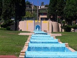
Real estate became a thriving industry during the late 1920s with investors attracted to the many subdivisions under development and increasing commercial opportunities. One such development was the Midwick View Estates by Peter N. Snyder, a proposed garden community that was designed to rival Bel Air and Beverly Hills
. Known as the "Father of the East Side", Mr. Snyder was a key player in the vast undertaking in the 1920s of developing the East Side as part of the industrial base of Los Angeles. His efforts to build Atlantic Boulevard, his work with the East Side organization to bring industry to the East Side, and his residential and commercial development projects along Atlantic Boulevard (Gardens Square, Golden Gate Square, and the Midwick View Estates) were a major influence to the surrounding communities. The focal point of the Midwick View Estates was "Jardin del Encanto", otherwise known as "El Encanto," a Spanish style building that was to serve as the administration building and community center for Midwick View Estates, and an amphitheater to be nestled into the hillside above Kingsford Street. Although the amphitheater was never built, the observation terrace from which viewers could look down to Jardin del Encanto and the fountain with cascading water going down the hillside in stepped pools to De La Fuente remains and is now known as Heritage Falls Park or "the Cascades." The Great Depression brought an abrupt end to the real estate boom, as well as the Midwick proposal. From the late 1920s, the City had little development for nearly two decades.
The end of World War II resulted in a revived growth trend with explosive population gains during the late 1940s and 1950s. Until this time, the population was concentrated in the northern and southern portions of the city, with the Garvey and Monterey Hills forming a natural barrier. With the renewed growth, many new subdivisions were developed, utilizing even the previously undeveloped central area to allow for maximum growth potential. A series of annexations of surrounding land also occurred.
 Beginning in the 1970s, well-educated and affluent Asian Americans began settling in the west San Gabriel Valley
, primarily to Monterey Park. The city council subsequently tried and failed to pass English-only ordinances. In 1985 the City Council of Monterey Park approved drafting of a proposal that would require all businesses in Monterey Park to display English language
identification on business signs.
In the 1980s, Monterey Park was also referred to as "Little Taipei
" or affectionately, "The Chinese Beverly Hills" by a local Chinese-language newspaper, "Asian Week". Many businesses from Chinatown, Los Angeles
began to open up stores in Monterey Park. In the 1970s and 1980s, many affluent waisheng ren Taiwan
ese immigrants moved abroad from Taiwan and began settling into Monterey Park. Mandarin Chinese dialect was predominant in the city during that time. By the late 1980s, immigrants from Mainland China
and Vietnam
began moving into Monterey Park. By the 1990 census, Monterey Park became the first city with an Asian descent majority population in the continental United States. Timothy P. Fong, a professor and director of Asian American studies at California State University, Sacramento
, describes Monterey Park as the "First Suburban Chinatown".
In the 1980s, the second generation Chinese Americans generally moved out of the old Chinatown and into the San Gabriel Valley suburbs, joining the new immigrants from Taiwan and Mainland China.
From that time, with a combined influx of Vietnamese, Taiwanese and Hong Kong immigrant students at the time, Mark Keppel High School
, constructed during the New Deal
era and located in Alhambra
, but also serving most of Monterey Park and portions of Rosemead, felt the impact of this new immigration as the student population increased dramatically, leading to overcrowding. Today, many students are second- or third-generation Asian Americans. In the Japanese community called: Nisei, (second-generation), Sansei, (third-generation).
In 1988, the City of Monterey Park passed an ordinance declaring a moratorium on new building, in an attempt to regulate the rapid growth the city experienced as a result of the influx of Asian immigrants.
This moratorium was challenged and defeated in 1989 This controversial move caused many Asian residents and businesses to shift locus, establishing themselves in the neighboring city of Alhambra
. When the potential loss of business revenue was recognized, "Monterey Park went through a lot of upheaval that a lot of people regret." and relocation back to Monterey Park was highly encouraged in the Asian American
community.
Since early 1990s, the Taiwanese are no longer the majority in the city, and Mandarin, the national language of China, is now rapidly displacing Cantonese
as the most widely spoken dialect in many Chinese businesses of Monterey Park. Cantonese, a dialect from southern China has dominated the Chinatowns of North America for decades, but Mandarin is the most common language of the latest Chinese immigrants. The construction boom of shopping centers has declined, but recent plans for redevelopment may change that. High property values and overcrowding in Monterey Park have contributed to a secondary movement away from Monterey Park. Furthermore, a great many established, wealthy Taiwanese immigrants have since relocated out of Monterey Park and northward to wealthier cities of San Marino
, Arcadia
, Temple City
, South Pasadena
, and eastward to Diamond Bar
, Hacienda Heights
, Walnut
and Rowland Heights
, sometimes called the "New Little Taipei" Many Chinese-speaking businesses were established in these suburbs to accommodate this shift in demographics. This path follows the White Flight
of the late 1970s. Development of new buildings in Monterey Park had come to a virtual standstill, there are still numerous Chinese-oriented businesses in Monterey Park and there are significant redevelopment plans, now in process.
fare. As the activity of Taiwanese immigrant activity shifted to San Gabriel
, Arcadia
and Rowland Heights
in the 1980s and 1990s, few Taiwanese restaurants have opened in the city.
The city's business interests are represented by the local Chamber of Commerce
. The Chamber offices are located in the historic El Encanto
- a building originally intended to be used as a land sales office. The Chamber is staffed during regular business hours and offers a variety of services for its members and the public. The Chamber is run by a Board of directors
. The current president of the chamber is Vincent D. Chang, an attorney. The immediate past-president was Ronald Lee, a jeweler. The Chamber host regular networking opportunities such as a monthly Business-to-Business luncheon. Recently, the Chamber revived the "Miss Monterey Park" Pageant.
, Foot Locker
, and Radio Shack
. The new center will create over 400 jobs when completed.
Monterey Park Village is a 40,000 sq. ft. shopping center on South Atlantic Boulevard commercial corridor. Tenants include: Staples, Walgreens
and Togo’s eatery. 100 jobs are created.
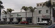
The CVS Center is on South Garfield Avenue. This is a redevelopment of infill site into a 17,000 sq. ft. neighborhood convenience center. Anchor tenant CVS Pharmacy brings a full-service drug store back to the downtown project.
The "Merged Project Area" encompasses a total of 620 acres for development of a commercial, industrial, office park, residential, public improvements
Projected are the Monterey Park Market Place, Los Angeles Corporate Center Hotel, and Sav-on.
The Monterey Park Towne Centre will be located at Garvey Avenue and Garfield Avenue, and is the future site of 500000 square feet (46,451.5 m²) the 45 acres (182,108.7 m²) Monterey Park Market Place center. The Monterey Park Towne Centre will offer 71366 square feet (6,630 m²) of retail space in the heart of Monterey Park's Downtown revitalization. Plans for the multi-use development include 109 condominiums. The Towne Centre will feature a palm court entry surrounded by major anchors, specialty shops and outdoor dining. Residents will enjoy such amenities as a community clubhouse, recreation facilities and private, secured parking
Cascades Market Place
The 507000 square feet (47,101.8 m²) Center will be the largest shopping center in the city. Located along the Pomona 60 Freeway, west of Paramount Boulevard, this center proposes to be a major regional shopping center for the San Gabriel Valley. The project manager says "This 45 plus acre project has grade level visibility from the freeway unmatched by any retail project in the region."
"The Garvey Villas Project", part of the Monterey Park Redevelopment plan, will be at the southwest corner of Atlantic Boulevard and Garvey Avenue. The project involves displacement and relocation of two separate family homes. The Agency pledges to appropriate, on a timely basis, the funds necessary to ensure the successful completion of the relocation activities associated with this Project.
The Sybil Brand Institute
, the county jail for women, was located in the city, but closed in 1994 after the facility had been damaged in the Northridge earthquake
.
(I-10), and the Pomona Freeway, SR 60
.
Public transportation is provided by the city government, Spirit bus service
and Metrolink feeder bus, the City of Montebello and the Los Angeles County Metropolitan Transportation Authority
.
According to the United States Census Bureau
, the city has a total area of 7.7 square miles (19.9 km²), of which, 7.6 square miles (19.7 km²) is land, and 0.04 square mile (0.1035995244 km²) (0.39%) is water.
The city boundaries include Los Angeles
to the west, unincorporated East Los Angeles
to the south, Alhambra
to the north, Rosemead
to the northeast, Montebello
to the south, and unincorporated South San Gabriel
to the southeast.
was 7,793.7 people per square mile (3,009.2/km²). The racial makeup of Monterey Park was 11,680 (19.4%) White, 252 (0.4%) African American, 242 (0.4%) Native American, 40,301 (66.9%) Asian (47.7% Chinese, 5.8% Japanese, 4.4% Vietnamese, 1.9% Filipino, 1.3% Korean, 0.9% Thai, 0.8% Cambodian, 0.4% Burmese, 0.4% Indonesian, 0.3% Indian), 28 (0.0%) Pacific Islander, 6,022 (10.0%) from other races
, and 1,744 (2.9%) from two or more races. Hispanic or Latino of any race were 16,218 persons (26.9%).
The Census reported that 60,039 people (99.6% of the population) lived in households, 41 (0.1%) lived in non-institutionalized group quarters, and 189 (0.3%) were institutionalized.
There were 19,963 households, out of which 6,315 (31.6%) had children under the age of 18 living in them, 10,538 (52.8%) were opposite-sex married couples
living together, 3,243 (16.2%) had a female householder with no husband present, 1,460 (7.3%) had a male householder with no wife present. There were 651 (3.3%) unmarried opposite-sex partnerships
, and 85 (0.4%) same-sex married couples or partnerships. 3,641 households (18.2%) were made up of individuals and 2,025 (10.1%) had someone living alone who was 65 years of age or older. The average household size was 3.01. There were 15,241 families
(76.3% of all households); the average family size was 3.37.
The population was spread out with 10,932 people (18.1%) under the age of 18, 5,180 people (8.6%) aged 18 to 24, 15,597 people (25.9%) aged 25 to 44, 16,904 people (28.0%) aged 45 to 64, and 11,656 people (19.3%) who were 65 years of age or older. The median age was 43.1 years. For every 100 females there were 92.2 males. For every 100 females age 18 and over, there were 89.4 males.
There were 20,850 housing units at an average density of 2,696.2 per square mile (1,041.0/km²), of which 11,058 (55.4%) were owner-occupied, and 8,905 (44.6%) were occupied by renters. The homeowner vacancy rate was 0.5%; the rental vacancy rate was 4.1%. 33,073 people (54.9% of the population) lived in owner-occupied housing units and 26,966 people (44.7%) lived in rental housing units.
, Monterey Park is 43.7% Chinese American
, and is the city in the United States with the largest concentration of people of Chinese descent. The Chinese American population in Monterey Park and San Gabriel Valley is relatively diverse in socio-economics and region of origin. The city has attracted immigrants from Taiwan
, as well as Mainland Chinese
and the overseas Chinese
from Southeast Asia
. There are also significant Japanese
, Vietnamese
, Korean
, and Filipino
communities living within Monterey Park.
While the multi-generational American-born Latino population was generally declining in Monterey Park, there has been a small new influx of Mexican immigrants (about one percent increase in the population).
In the city the population was spread out with 21.3% under the age of 18, 8.4% from 18 to 24, 30.2% from 25 to 44, 22.2% from 45 to 64, and 17.9% who were 65 years of age or older. The median age was 38 years. For every 100 females there were 92.4 males. For every 100 females age 18 and over, there were 89.3 males.
The median income
for a household in the city was $40,724, and the median income for a family was $43,507. Males had a median income of $32,463 versus $29,057 for females. The per capita income
for the city was $17,661. About 12.4% of families and 15.6% of the population were below the poverty line, including 22.6% of those under age 18 and 9.2% of those age 65 or over.
Monterey Park is located in the 24th Senate
District, represented by Democrat Gloria Romero, and in the 49th Assembly
District, represented by Democrat Mike Eng
,also a former mayor of Monterey Park. Federally, Monterey Park is located in California's 29th
and 32nd
congressional districts, which have Cook PVIs
of D +12 and D +17 and is represented by Democrats Adam Schiff
and Judy Chu
. Chu previously served as mayor and city council member of Monterey Park.
has its central headquarters in Monterey Park. Los Angeles County Sheriff's Department
The Edmund D. Edelman
Children's Court, Central Juvenile District, (Dependency) is located in Monterey Park.
The Los Angeles County Department of Health Services
operates the Monrovia Health Center in Monrovia
, serving Monterey Park.
is a community college that is located in Monterey Park in an area that was once part of East Los Angeles
(unincorporated). In addition California State University, Los Angeles
is in proximity.
, Garvey School District
, Los Angeles Unified School District
, and Montebello Unified School District
.
 K-8 schools serving AUSD in Monterey Park include:
Mark Keppel High School
, http://www.mkhs.org/, located in Alhambra
, also serves Monterey Park.
Two elementary schools, Hillcrest and Monterey Vista (both are in Monterey Park), serve this part of the city. Monterey Vista is a Blue Ribbon School.
Garvey Intermediate School (Rosemead) also serves this portion.
Once students graduate from eighth grade, they attend Alhambra's Mark Keppel High School http://www.mkhs.org/.
Robert Lane Elementary School (Monterey Park), Griffith Middle School (Unincorporated Los Angeles County), and Garfield High School
(Unincorporated Los Angeles County) serve the LAUSD part of the city.
Bella Vista Elementary School, Monterey Park, Potrero Heights Elementary School, South San Gabriel, Macy Intermediate School, Monterey Park, and Schurr High School
, Montebello, serve the Montebello MUSD portion.
http://stsmc.org/
Meher Montessori School: preschool, lower and upper elementary classes
St Thomas Aquinas School: A Catholic parish school, serving economically and ethnically diverse students in grades Kindergarten through eighth. Founded in 1963, the Church is in the center of our school both physically and spiritually. The school is accredited by the Western Association of Schools and Colleges and the Western Catholic Educational Association.
New Avenue School
PreKindergarten—Kindergarten through 8th grade. New Avenue school was founded in 1961.
http://www.elocallink.tv/profiles/ca/alhambra/11/
Alpha-Shen Preschool and Kindergarten
Esther's Nest Children's School
PreKindergarten—Kindergarten
Graceland Christian Day Care Center
PreKindergarten—Kindergarten
Monterey Park Christian School
PreKindergarten—Kindergarten
Los Angeles County, California
Los Angeles County is a county in the U.S. state of California. As of 2010 U.S. Census, the county had a population of 9,818,605, making it the most populous county in the United States. Los Angeles County alone is more populous than 42 individual U.S. states...
, California
California
California is a state located on the West Coast of the United States. It is by far the most populous U.S. state, and the third-largest by land area...
, United States
United States
The United States of America is a federal constitutional republic comprising fifty states and a federal district...
, 10 miles (16.1 km) east of downtown Los Angeles
Downtown Los Angeles
Downtown Los Angeles is the central business district of Los Angeles, California, United States, located close to the geographic center of the metropolitan area...
. The city's motto is "Pride in the past, Faith in the future". Monterey Park is part of a cluster of cities, along with Arcadia
Arcadia, California
Arcadia is an affluent city in Los Angeles County, California, United States, and located approximately northeast of downtown Los Angeles in the San Gabriel Valley and at the base of the San Gabriel Mountains....
, Temple City
Temple City, California
Temple City is a city in Los Angeles County, California. Temple City is part of a cluster of cities, along with Arcadia, Rosemead, Monterey Park, San Marino, and San Gabriel, in the west San Gabriel Valley with a rapidly growing Asian population. Temple City also has a Cuban and Puerto Rican...
, Rosemead
Rosemead, California
Rosemead is a city in Los Angeles County, California, United States. As of the 2010 census, it had a population of 53,764. Rosemead is part of a cluster of cities, along with Arcadia, Temple City, Monterey Park, San Marino, and San Gabriel, in the west San Gabriel Valley with a growing Asian...
, San Marino
San Marino, California
San Marino is a small, affluent city in Los Angeles County, California. Incorporated in 1913, the City founders designed the community to be uniquely residential, with expansive properties surrounded by beautiful gardens, wide streets, and well maintained parkways...
, and San Gabriel
San Gabriel, California
San Gabriel is a city in Los Angeles County, California, United States. It is named after the Mission San Gabriel Arcángel, founded by Junipero Serra. The city grew outward from the mission and in 1852 became the original township of Los Angeles County. San Gabriel was incorporated in 1913...
in the west San Gabriel Valley
San Gabriel Valley
The San Gabriel Valley is one of the principal valleys of Southern California, United States. It lies to the east of Los Angeles, to the north of the Puente Hills, to the south of the San Gabriel Mountains, and west of the Inland Empire. It derives its name from the San Gabriel River that flows...
, with a growing Asian American
Asian American
Asian Americans are Americans of Asian descent. The U.S. Census Bureau definition of Asians as "Asian” refers to a person having origins in any of the original peoples of the Far East, Southeast Asia, or the Indian subcontinent, including, for example, Cambodia, China, India, Indonesia, Japan,...
population, making up 66.9% of its resident population at 2010; 47.7% of its residents are of Chinese descent
Chinese people
The term Chinese people may refer to any of the following:*People with Han Chinese ethnicity ....
, the largest concentration of Chinese American
Chinese American
Chinese Americans represent Americans of Chinese descent. Chinese Americans constitute one group of overseas Chinese and also a subgroup of East Asian Americans, which is further a subgroup of Asian Americans...
s of any municipality
Municipality
A municipality is essentially an urban administrative division having corporate status and usually powers of self-government. It can also be used to mean the governing body of a municipality. A municipality is a general-purpose administrative subdivision, as opposed to a special-purpose district...
in the United States. According to the 2010 Census, the city had a total population of 60,269.
Early history
For at least seven thousand years the land was populated by the Tongva (Gabrielino) Native Americans. The Tongva lived in dome like structures with thatched exteriors, an open smoke hole for ventilation and light at the top. Both sexes wore long hair styles and tattooed their bodies. During warm weather the men wore little clothes but the women would wear minimal skirts made of animal hides. During the cold weather they would wear animal skin capes and occasionally wore sandals made from hide of yucca fiber. With the arrival of the Spaniards, Old WorldOld World
The Old World consists of those parts of the world known to classical antiquity and the European Middle Ages. It is used in the context of, and contrast with, the "New World" ....
diseases killed off many of the Tongva, and by 1870 very few Native-Americans had survived. In the early 19th century the area was part of the Mission San Gabriel Arcángel
Mission San Gabriel Arcángel
The Mission San Gabriel Arcángel is a fully functioning Roman Catholic mission and a historic landmark in San Gabriel, California. The settlement was founded by Spaniards of the Franciscan order on "The Feast of the Birth of Mary," September 8, 1771, as the fourth of what would become 21 Spanish...
mission system and later, the Rancho San Antonio.
1860s–1960s
Following the Civil War, an Italian, Alessandro Repetto, purchased 5000 acres (20.2 km²) of the rancho and built his ranch house on the hill overlooking his land, about a half-mile north of where Garfield Avenue crosses the Pomona Freeway, not far from where the EdisonSouthern California Edison
Southern California Edison , the largest subsidiary of Edison International , is the primary electricity supply company for much of Southern California, USA. It provides 14 million people with electricity...
substation is now located on Garfield Avenue.
It was at this time, Richard Garvey, a mail rider for the U.S. Army whose route took him through Monterey Pass
Monterey pass
Monterey Pass is a mountain pass near Blue Ridge Summit, Pennsylvania, and the Mason-Dixon Line. The saddle area lies near between Monterey Peak and . It was the site of the July 1863 Fight at Monterey Pass during the Retreat from Gettysburg.-Gettysburg Campaign:The first military engagement at...
, a trail that is now Garvey Avenue, settled down in the King's Hills. Garvey began developing the land by bringing in spring water from near the Hondo River and by constructing a 54 feet (16 m) dam to form Garvey Lake located where Garvey Ranch Park is now. To pay for his development and past debts, Garvey began selling portions of his property. In 1906, the first subdivision in the area, Ramona Acres (named after the developer's daughter, who would also later inspire the title of the novel Ramona
Ramona
Ramona is a 1884 United States historical novel written by Helen Hunt Jackson. It is the story of a Scots-Native American orphan girl in Southern California, who suffers racial discrimination and hardship. Originally serialized in the Christian Union on a weekly basis, the novel became immensely...
), was developed north of Garvey and east of Garfield Avenues.
In 1916, the new residents of the area initiated action to become a city when the cities of Pasadena
Pasadena, California
Pasadena is a city in Los Angeles County, California, United States. Although famous for hosting the annual Rose Bowl football game and Tournament of Roses Parade, Pasadena is the home to many scientific and cultural institutions, including the California Institute of Technology , the Jet...
, South Pasadena
South Pasadena, California
South Pasadena is a city in Los Angeles County, California, United States. As of the 2010 census, it had a population of 25,619, up from 24,292 at the 2000 census. It is located in in the West San Gabriel Valley...
, and Alhambra
Alhambra, California
Alhambra is a city located in the western San Gabriel Valley region of Los Angeles County, California, United States, which is approximately eight miles from the Downtown Los Angeles civic center. As of the 2010 census, the population was 83,089, down from 85,804 at the 2000 census. The city's...
proposed to put a large sewage treatment facility in the area. The community voted itself into cityhood on May 29, 1916, by a vote of 455 to 33. The City's new Board of Directors immediately outlawed sewage plants within city boundaries and named the new city Monterey Park. The name was taken from an old government map showing the oak-covered hills of the area as Monterey Hills. In 1920, a large area on the south edge of the city broke away and the separate city of Montebello
Montebello, California
Montebello is a city in Los Angeles County, California, United States, in the southwestern part of the San Gabriel Valley. It is located on of land just east of downtown Los Angeles. It is considered part of the Gateway Cities, and the city is a member of the Gateway Cities Council of...
was established.
By 1920, the white and Spanish-surname settlers were joined by Asian residents who began farming potatoes and flowers and developing nurseries in the Monterey Highlands area. They improved the Monterey Pass Trail with a road to aid in shipping their produce to Los Angeles. The nameless pass, which had been a popular location for western movies, was called Coyote Pass by Pioneer Masami Abe.
In 1926, near the corner of Atlantic and Garvey Boulevards, Laura Scudder
Laura Scudder
Laura Clough Scudder was an entrepreneur in Monterey Park, California, who made and sold potato chips and who pioneered the packaging of potato chips in sealed bags to extend freshness....
invented the first sealed bag of potato chips. In an effort to maintain quality and freshness, Laura's team would iron sheets of wax paper together to form a bag. They would fill these bags with potato chips; iron the top closed, and then deliver them to various retailers.
Real estate became a thriving industry during the late 1920s with investors attracted to the many subdivisions under development and increasing commercial opportunities. One such development was the Midwick View Estates by Peter N. Snyder, a proposed garden community that was designed to rival Bel Air and Beverly Hills
Beverly Hills, California
Beverly Hills is an affluent city located in Los Angeles County, California, United States. With a population of 34,109 at the 2010 census, up from 33,784 as of the 2000 census, it is home to numerous Hollywood celebrities. Beverly Hills and the neighboring city of West Hollywood are together...
. Known as the "Father of the East Side", Mr. Snyder was a key player in the vast undertaking in the 1920s of developing the East Side as part of the industrial base of Los Angeles. His efforts to build Atlantic Boulevard, his work with the East Side organization to bring industry to the East Side, and his residential and commercial development projects along Atlantic Boulevard (Gardens Square, Golden Gate Square, and the Midwick View Estates) were a major influence to the surrounding communities. The focal point of the Midwick View Estates was "Jardin del Encanto", otherwise known as "El Encanto," a Spanish style building that was to serve as the administration building and community center for Midwick View Estates, and an amphitheater to be nestled into the hillside above Kingsford Street. Although the amphitheater was never built, the observation terrace from which viewers could look down to Jardin del Encanto and the fountain with cascading water going down the hillside in stepped pools to De La Fuente remains and is now known as Heritage Falls Park or "the Cascades." The Great Depression brought an abrupt end to the real estate boom, as well as the Midwick proposal. From the late 1920s, the City had little development for nearly two decades.
The end of World War II resulted in a revived growth trend with explosive population gains during the late 1940s and 1950s. Until this time, the population was concentrated in the northern and southern portions of the city, with the Garvey and Monterey Hills forming a natural barrier. With the renewed growth, many new subdivisions were developed, utilizing even the previously undeveloped central area to allow for maximum growth potential. A series of annexations of surrounding land also occurred.
1970s–present
San Gabriel Valley
The San Gabriel Valley is one of the principal valleys of Southern California, United States. It lies to the east of Los Angeles, to the north of the Puente Hills, to the south of the San Gabriel Mountains, and west of the Inland Empire. It derives its name from the San Gabriel River that flows...
, primarily to Monterey Park. The city council subsequently tried and failed to pass English-only ordinances. In 1985 the City Council of Monterey Park approved drafting of a proposal that would require all businesses in Monterey Park to display English language
English language
English is a West Germanic language that arose in the Anglo-Saxon kingdoms of England and spread into what was to become south-east Scotland under the influence of the Anglian medieval kingdom of Northumbria...
identification on business signs.
In the 1980s, Monterey Park was also referred to as "Little Taipei
Little Taipei
Little Taipei was an informal name given to the city of Monterey Park, California in the late 1970s when it had a large immigrant population from Taiwan...
" or affectionately, "The Chinese Beverly Hills" by a local Chinese-language newspaper, "Asian Week". Many businesses from Chinatown, Los Angeles
Chinatown, Los Angeles
Chinatown in Los Angeles, California is located in the city's downtown area. Built in 1938, it is the second Chinatown to be constructed in Los Angeles. The original historic Chinatown was founded in the late 19th century, but was demolished to make room for Union Station, the city's major rail...
began to open up stores in Monterey Park. In the 1970s and 1980s, many affluent waisheng ren Taiwan
Taiwan
Taiwan , also known, especially in the past, as Formosa , is the largest island of the same-named island group of East Asia in the western Pacific Ocean and located off the southeastern coast of mainland China. The island forms over 99% of the current territory of the Republic of China following...
ese immigrants moved abroad from Taiwan and began settling into Monterey Park. Mandarin Chinese dialect was predominant in the city during that time. By the late 1980s, immigrants from Mainland China
Mainland China
Mainland China, the Chinese mainland or simply the mainland, is a geopolitical term that refers to the area under the jurisdiction of the People's Republic of China . According to the Taipei-based Mainland Affairs Council, the term excludes the PRC Special Administrative Regions of Hong Kong and...
and Vietnam
Vietnam
Vietnam – sometimes spelled Viet Nam , officially the Socialist Republic of Vietnam – is the easternmost country on the Indochina Peninsula in Southeast Asia. It is bordered by China to the north, Laos to the northwest, Cambodia to the southwest, and the South China Sea –...
began moving into Monterey Park. By the 1990 census, Monterey Park became the first city with an Asian descent majority population in the continental United States. Timothy P. Fong, a professor and director of Asian American studies at California State University, Sacramento
California State University, Sacramento
California State University, Sacramento, popularly known as Sacramento State, is a public university located in the city of Sacramento, California. It is part of the California State University system...
, describes Monterey Park as the "First Suburban Chinatown".
In the 1980s, the second generation Chinese Americans generally moved out of the old Chinatown and into the San Gabriel Valley suburbs, joining the new immigrants from Taiwan and Mainland China.
From that time, with a combined influx of Vietnamese, Taiwanese and Hong Kong immigrant students at the time, Mark Keppel High School
Mark Keppel High School
Mark Keppel High School is a four-year California Distinguished School located in the city of Alhambra, California in the Alhambra Unified School District. The school is on the southern edge of Alhambra, adjacent to the City of Monterey Park, and borders the Interstate 10 Freeway...
, constructed during the New Deal
New Deal
The New Deal was a series of economic programs implemented in the United States between 1933 and 1936. They were passed by the U.S. Congress during the first term of President Franklin D. Roosevelt. The programs were Roosevelt's responses to the Great Depression, and focused on what historians call...
era and located in Alhambra
Alhambra, California
Alhambra is a city located in the western San Gabriel Valley region of Los Angeles County, California, United States, which is approximately eight miles from the Downtown Los Angeles civic center. As of the 2010 census, the population was 83,089, down from 85,804 at the 2000 census. The city's...
, but also serving most of Monterey Park and portions of Rosemead, felt the impact of this new immigration as the student population increased dramatically, leading to overcrowding. Today, many students are second- or third-generation Asian Americans. In the Japanese community called: Nisei, (second-generation), Sansei, (third-generation).
In 1988, the City of Monterey Park passed an ordinance declaring a moratorium on new building, in an attempt to regulate the rapid growth the city experienced as a result of the influx of Asian immigrants.
This moratorium was challenged and defeated in 1989 This controversial move caused many Asian residents and businesses to shift locus, establishing themselves in the neighboring city of Alhambra
Alhambra, California
Alhambra is a city located in the western San Gabriel Valley region of Los Angeles County, California, United States, which is approximately eight miles from the Downtown Los Angeles civic center. As of the 2010 census, the population was 83,089, down from 85,804 at the 2000 census. The city's...
. When the potential loss of business revenue was recognized, "Monterey Park went through a lot of upheaval that a lot of people regret." and relocation back to Monterey Park was highly encouraged in the Asian American
Asian American
Asian Americans are Americans of Asian descent. The U.S. Census Bureau definition of Asians as "Asian” refers to a person having origins in any of the original peoples of the Far East, Southeast Asia, or the Indian subcontinent, including, for example, Cambodia, China, India, Indonesia, Japan,...
community.
Since early 1990s, the Taiwanese are no longer the majority in the city, and Mandarin, the national language of China, is now rapidly displacing Cantonese
Cantonese
Cantonese is a dialect spoken primarily in south China.Cantonese may also refer to:* Yue Chinese, the Chinese language that includes Cantonese* Cantonese cuisine, the cuisine of Guangdong province...
as the most widely spoken dialect in many Chinese businesses of Monterey Park. Cantonese, a dialect from southern China has dominated the Chinatowns of North America for decades, but Mandarin is the most common language of the latest Chinese immigrants. The construction boom of shopping centers has declined, but recent plans for redevelopment may change that. High property values and overcrowding in Monterey Park have contributed to a secondary movement away from Monterey Park. Furthermore, a great many established, wealthy Taiwanese immigrants have since relocated out of Monterey Park and northward to wealthier cities of San Marino
San Marino, California
San Marino is a small, affluent city in Los Angeles County, California. Incorporated in 1913, the City founders designed the community to be uniquely residential, with expansive properties surrounded by beautiful gardens, wide streets, and well maintained parkways...
, Arcadia
Arcadia, California
Arcadia is an affluent city in Los Angeles County, California, United States, and located approximately northeast of downtown Los Angeles in the San Gabriel Valley and at the base of the San Gabriel Mountains....
, Temple City
Temple City, California
Temple City is a city in Los Angeles County, California. Temple City is part of a cluster of cities, along with Arcadia, Rosemead, Monterey Park, San Marino, and San Gabriel, in the west San Gabriel Valley with a rapidly growing Asian population. Temple City also has a Cuban and Puerto Rican...
, South Pasadena
South Pasadena, California
South Pasadena is a city in Los Angeles County, California, United States. As of the 2010 census, it had a population of 25,619, up from 24,292 at the 2000 census. It is located in in the West San Gabriel Valley...
, and eastward to Diamond Bar
Diamond Bar, California
Diamond Bar is a city in eastern Los Angeles County, California, United States. The population was 55,544 at the 2010 census, down from 56,287 at the 2000 census. It is named after the "diamond over a bar" branding iron registered in 1918 by ranch owner Frederick E...
, Hacienda Heights
Hacienda Heights, California
Hacienda Heights is an unincorporated census-designated place in and below the Puente Hills of the San Gabriel Valley, in Los Angeles County, California, United States...
, Walnut
Walnut, California
Walnut is a city in Los Angeles County, California, United States. The population was 29,172 at the 2010 census and its current mayor is Tom King, a former Detective from the Los Angeles Police Department....
and Rowland Heights
Rowland Heights, California
Rowland Heights is an unincorporated community of , located in and below the Puente Hills in the San Gabriel Valley, in Los Angeles County, California. The population of the census-designated place was 48,993 at the 2010 census, up from 48,553 at the 2000 census...
, sometimes called the "New Little Taipei" Many Chinese-speaking businesses were established in these suburbs to accommodate this shift in demographics. This path follows the White Flight
White flight
White flight has been a term that originated in the United States, starting in the mid-20th century, and applied to the large-scale migration of whites of various European ancestries from racially mixed urban regions to more racially homogeneous suburban or exurban regions. It was first seen as...
of the late 1970s. Development of new buildings in Monterey Park had come to a virtual standstill, there are still numerous Chinese-oriented businesses in Monterey Park and there are significant redevelopment plans, now in process.
Business
The Chinese-dominated business district, between Garfield Avenue and Garvey Avenue, is called "Downtown Monterey Park". In the mid-1980s, Lincoln Plaza Hotel was built to predominately service tourists from Taiwan and Hong Kong. Monterey Park has many choices of Hong Kong fusion cafes, there are several Cantonese seafood restaurants, as well as restaurants offering Mainland ChineseMainland Chinese
Mainland Chinese or Mainlanders are Chinese people who live in a region considered a "mainland". It is frequently used in the context of areas ruled by the People's Republic of China, referring to people from Mainland China as opposed to other areas controlled by the state such as Hong Kong or...
fare. As the activity of Taiwanese immigrant activity shifted to San Gabriel
San Gabriel, California
San Gabriel is a city in Los Angeles County, California, United States. It is named after the Mission San Gabriel Arcángel, founded by Junipero Serra. The city grew outward from the mission and in 1852 became the original township of Los Angeles County. San Gabriel was incorporated in 1913...
, Arcadia
Arcadia, California
Arcadia is an affluent city in Los Angeles County, California, United States, and located approximately northeast of downtown Los Angeles in the San Gabriel Valley and at the base of the San Gabriel Mountains....
and Rowland Heights
Rowland Heights, California
Rowland Heights is an unincorporated community of , located in and below the Puente Hills in the San Gabriel Valley, in Los Angeles County, California. The population of the census-designated place was 48,993 at the 2010 census, up from 48,553 at the 2000 census...
in the 1980s and 1990s, few Taiwanese restaurants have opened in the city.
The city's business interests are represented by the local Chamber of Commerce
Chamber of commerce
A chamber of commerce is a form of business network, e.g., a local organization of businesses whose goal is to further the interests of businesses. Business owners in towns and cities form these local societies to advocate on behalf of the business community...
. The Chamber offices are located in the historic El Encanto
El Encanto
El Encanto is a town and municipality in the Amazonas Department, Colombia. It is located in the mouth of the Caraparaná River, tributary of the Putumayo River ....
- a building originally intended to be used as a land sales office. The Chamber is staffed during regular business hours and offers a variety of services for its members and the public. The Chamber is run by a Board of directors
Board of directors
A board of directors is a body of elected or appointed members who jointly oversee the activities of a company or organization. Other names include board of governors, board of managers, board of regents, board of trustees, and board of visitors...
. The current president of the chamber is Vincent D. Chang, an attorney. The immediate past-president was Ronald Lee, a jeweler. The Chamber host regular networking opportunities such as a monthly Business-to-Business luncheon. Recently, the Chamber revived the "Miss Monterey Park" Pageant.
Top employers
According to the City's 2010 Comprehensive Annual Financial Report, the top employers in the city are:| # | Employer | # of Employees |
|---|---|---|
| 1 | East Los Angeles College East Los Angeles College East Los Angeles College is a community college of the Los Angeles Community College District in the Los Angeles suburb of Monterey Park. Fourteen communities comprise its primary service area... |
1,969 |
| 2 | Garfield Medical Center AHMC AHMC, also known as AHMC Healthcare, is a hospital corporation based in the Greater San Gabriel Valley of California.-Hospitals:AHMC owns and operates the following hospitals:*Anaheim Regional Medical Center*Garfield Medical Center... |
970 |
| 3 | Los Angeles County Sheriff's Department Los Angeles County Sheriff's Department The Los Angeles County Sheriff's Department is a local county law enforcement agency that serves Los Angeles County, California. It is the fourth largest local policing agency in the United States, with the New York City Police Department being the first. The second largest is the Chicago Police... |
791 |
| 4 | Superior Court of Los Angeles County Superior Court of Los Angeles County The Superior Court of Los Angeles County is the Superior Court located in Los Angeles County. It is the largest single unified trial court in the United States.... - Edmund D. Edelman Children's Court |
736 |
| 5 | City of Monterey Park | 440 |
| 6 | Monterey Park Hospital AHMC AHMC, also known as AHMC Healthcare, is a hospital corporation based in the Greater San Gabriel Valley of California.-Hospitals:AHMC owns and operates the following hospitals:*Anaheim Regional Medical Center*Garfield Medical Center... |
362 |
| 7 | Care1st Health Plan | 315 |
| 8 | Southern California Gas Company | 279 |
| 9 | AT&T Pacific Bell The Pacific Telephone and Telegraph Company was the name of the Bell System's telephone operations in California. It gained in size by acquiring smaller telephone companies along the Pacific coast, such as Sunset Telephone & Telegraph in 1917... |
228 |
| 10 | SynerMed | 217 |
| 11 | Ralphs Ralphs Ralphs is a major supermarket chain in the Southern California area and the largest subsidiary of Cincinnati-based Kroger. It is the oldest such chain west of the Mississippi River. Ralphs also operates stores under the Food 4 Less and Foods Co. names in California.-History:Ralphs Grocery Company... |
158 |
| 12 | First Data First Data First Data Corporation is an American payment processing company headquartered in Atlanta, Georgia. First Data is a provider of electronic commerce and payment solutions... |
133 |
| 13 | California Highway Patrol California Highway Patrol The California Highway Patrol is a law enforcement agency of the U.S. state of California. The CHP has patrol jurisdiction over all California highways and also acts as the state police.... |
131 |
| 14 | World Journal World Journal World Journal is a daily Chinese language newspaper serving overseas Chinese in North America. The newspaper has its headquarters in Whitestone, Queens, New York City.... |
128 |
| 15 | Southern California Edison Southern California Edison Southern California Edison , the largest subsidiary of Edison International , is the primary electricity supply company for much of Southern California, USA. It provides 14 million people with electricity... |
125 |
| 16 | Camino Real Chevrolet Chevrolet Chevrolet , also known as Chevy , is a brand of vehicle produced by General Motors Company . Founded by Louis Chevrolet and ousted GM founder William C. Durant on November 3, 1911, General Motors acquired Chevrolet in 1918... |
121 |
| 17 | CVS/pharmacy | 117 |
Redevelopment
The recently opened commercial developments include Atlantic Times Square, which has 215000 square feet (19,974.2 m²) . The oldest shopping center in the region is being rebuilt as a neighborhood center with anchors such as Ralph's Grocery, Rite AidRite Aid
Rite Aid is a drugstore chain in the United States and a Fortune 500 company headquartered in East Pennsboro Township, Pennsylvania, near Camp Hill. Rite Aid is the largest drugstore chain on the East Coast and the third largest drugstore chain in the U.S....
, Foot Locker
Foot Locker
Foot Locker, Inc. is an American sportswear and footwear retailer, with its headquarters in Midtown Manhattan, New York City, and operating in approximately 20 countries worldwide. Formerly known as Venator Group, Inc., it is the successor corporation to the F.W. Woolworth Company , and many of...
, and Radio Shack
Radio shack
Radio shack is a slang term for a room or structure for housing radio equipment.-History:In the early days of radio, equipment was experimental and home-built. The first radio transmitters used a noisy spark to generate radio waves and were often housed in a garage or shed. When radio was first...
. The new center will create over 400 jobs when completed.
Monterey Park Village is a 40,000 sq. ft. shopping center on South Atlantic Boulevard commercial corridor. Tenants include: Staples, Walgreens
Walgreens
Walgreen Co. , doing business as Walgreens , is the largest drugstore chain in the United States of America. As of August 31st, the company operates 8,210 locations across all 50 states, the District of Columbia and Puerto Rico. Founded in Chicago, Illinois in 1901, and has since expanded...
and Togo’s eatery. 100 jobs are created.
The CVS Center is on South Garfield Avenue. This is a redevelopment of infill site into a 17,000 sq. ft. neighborhood convenience center. Anchor tenant CVS Pharmacy brings a full-service drug store back to the downtown project.
The "Merged Project Area" encompasses a total of 620 acres for development of a commercial, industrial, office park, residential, public improvements
Projected are the Monterey Park Market Place, Los Angeles Corporate Center Hotel, and Sav-on.
The Monterey Park Towne Centre will be located at Garvey Avenue and Garfield Avenue, and is the future site of 500000 square feet (46,451.5 m²) the 45 acres (182,108.7 m²) Monterey Park Market Place center. The Monterey Park Towne Centre will offer 71366 square feet (6,630 m²) of retail space in the heart of Monterey Park's Downtown revitalization. Plans for the multi-use development include 109 condominiums. The Towne Centre will feature a palm court entry surrounded by major anchors, specialty shops and outdoor dining. Residents will enjoy such amenities as a community clubhouse, recreation facilities and private, secured parking
Cascades Market Place
The 507000 square feet (47,101.8 m²) Center will be the largest shopping center in the city. Located along the Pomona 60 Freeway, west of Paramount Boulevard, this center proposes to be a major regional shopping center for the San Gabriel Valley. The project manager says "This 45 plus acre project has grade level visibility from the freeway unmatched by any retail project in the region."
"The Garvey Villas Project", part of the Monterey Park Redevelopment plan, will be at the southwest corner of Atlantic Boulevard and Garvey Avenue. The project involves displacement and relocation of two separate family homes. The Agency pledges to appropriate, on a timely basis, the funds necessary to ensure the successful completion of the relocation activities associated with this Project.
Places of interest
Monterey Park is home to the Garvey Ranch Observatory, located in Garvey Ranch Park, which is operated by the Los Angeles Astronomical Society (LAAS). It adjoins a telescope construction workshop, a historical museum and a library. The observatory houses an 8 inches (203.2 mm) refractor, and the grounds are open to the public for astronomical observation on Wednesday evenings, hosted by LAAS members.The Sybil Brand Institute
Sybil Brand Institute
The Sybil Brand Institute was a noted county jail in Los Angeles County, California. The facility was named for Sybil Brand , a noted local philanthropist and civic leader....
, the county jail for women, was located in the city, but closed in 1994 after the facility had been damaged in the Northridge earthquake
Northridge earthquake
The Northridge earthquake was a massive earthquake that occurred on January 17, 1994, at 04:31 Pacific Standard Time in Reseda, a neighborhood in the city of Los Angeles, California, lasting for about 10–20 seconds...
.
Transportation
Monterey Park is served by the I-710, the San Bernardino FreewaySan Bernardino Freeway
The San Bernardino Freeway, formerly known as the Ramona Freeway is a freeway in Los Angeles and Orange Counties in the southern part of the U.S. state of California. It refers to the following two segments:...
(I-10), and the Pomona Freeway, SR 60
California State Route 60
State Route 60 is a state highway in the U.S. state of California. It runs from Interstate 10 near the Los Angeles River in Los Angeles east to I-10 in Riverside County, with overlaps at State Route 57 and Interstate 215.-Route description:...
.
Public transportation is provided by the city government, Spirit bus service
Monterey Park Spirit Bus
The Monterey Park Spirit Bus is Monterey Park, California's transportation service, providing local routes that serve the need of those commuting within the city itself or who plan on using the bus to connect with rail service to Los Angeles or surrounding suburbs...
and Metrolink feeder bus, the City of Montebello and the Los Angeles County Metropolitan Transportation Authority
Los Angeles County Metropolitan Transportation Authority
The Los Angeles County Metropolitan Transportation Authority is the California state-chartered regional transportation planning agency and public transportation operating agency for the County of Los Angeles formed in 1993 out of a merger of the Southern California Rapid Transit District and the...
.
Geography
Monterey Park is located at 34.049199°N 118.135561°W.According to the United States Census Bureau
United States Census Bureau
The United States Census Bureau is the government agency that is responsible for the United States Census. It also gathers other national demographic and economic data...
, the city has a total area of 7.7 square miles (19.9 km²), of which, 7.6 square miles (19.7 km²) is land, and 0.04 square mile (0.1035995244 km²) (0.39%) is water.
The city boundaries include Los Angeles
Los Ángeles
Los Ángeles is the capital of the province of Biobío, in the commune of the same name, in Region VIII , in the center-south of Chile. It is located between the Laja and Biobío rivers. The population is 123,445 inhabitants...
to the west, unincorporated East Los Angeles
East Los Angeles, California
East Los Angeles is an unincorporated area and census-designated place in Los Angeles County, California, United States...
to the south, Alhambra
Alhambra, California
Alhambra is a city located in the western San Gabriel Valley region of Los Angeles County, California, United States, which is approximately eight miles from the Downtown Los Angeles civic center. As of the 2010 census, the population was 83,089, down from 85,804 at the 2000 census. The city's...
to the north, Rosemead
Rosemead, California
Rosemead is a city in Los Angeles County, California, United States. As of the 2010 census, it had a population of 53,764. Rosemead is part of a cluster of cities, along with Arcadia, Temple City, Monterey Park, San Marino, and San Gabriel, in the west San Gabriel Valley with a growing Asian...
to the northeast, Montebello
Montebello, California
Montebello is a city in Los Angeles County, California, United States, in the southwestern part of the San Gabriel Valley. It is located on of land just east of downtown Los Angeles. It is considered part of the Gateway Cities, and the city is a member of the Gateway Cities Council of...
to the south, and unincorporated South San Gabriel
South San Gabriel, California
South San Gabriel is a census-designated place in Los Angeles County, California, United States. The population was 8,070 at the 2010 census, up from 7,595 at the 2000 census.-Geography:South San Gabriel is located at ....
to the southeast.
2010
The 2010 United States Census reported that Monterey Park had a population of 60,269. The population densityPopulation density
Population density is a measurement of population per unit area or unit volume. It is frequently applied to living organisms, and particularly to humans...
was 7,793.7 people per square mile (3,009.2/km²). The racial makeup of Monterey Park was 11,680 (19.4%) White, 252 (0.4%) African American, 242 (0.4%) Native American, 40,301 (66.9%) Asian (47.7% Chinese, 5.8% Japanese, 4.4% Vietnamese, 1.9% Filipino, 1.3% Korean, 0.9% Thai, 0.8% Cambodian, 0.4% Burmese, 0.4% Indonesian, 0.3% Indian), 28 (0.0%) Pacific Islander, 6,022 (10.0%) from other races
Race (United States Census)
Race and ethnicity in the United States Census, as defined by the Federal Office of Management and Budget and the United States Census Bureau, are self-identification data items in which residents choose the race or races with which they most closely identify, and indicate whether or not they are...
, and 1,744 (2.9%) from two or more races. Hispanic or Latino of any race were 16,218 persons (26.9%).
The Census reported that 60,039 people (99.6% of the population) lived in households, 41 (0.1%) lived in non-institutionalized group quarters, and 189 (0.3%) were institutionalized.
There were 19,963 households, out of which 6,315 (31.6%) had children under the age of 18 living in them, 10,538 (52.8%) were opposite-sex married couples
Marriage
Marriage is a social union or legal contract between people that creates kinship. It is an institution in which interpersonal relationships, usually intimate and sexual, are acknowledged in a variety of ways, depending on the culture or subculture in which it is found...
living together, 3,243 (16.2%) had a female householder with no husband present, 1,460 (7.3%) had a male householder with no wife present. There were 651 (3.3%) unmarried opposite-sex partnerships
POSSLQ
POSSLQ is an abbreviation for "Persons of Opposite Sex Sharing Living Quarters," a term coined in the late 1970s by the United States Census Bureau as part of an effort to more accurately gauge the prevalence of cohabitation in American households....
, and 85 (0.4%) same-sex married couples or partnerships. 3,641 households (18.2%) were made up of individuals and 2,025 (10.1%) had someone living alone who was 65 years of age or older. The average household size was 3.01. There were 15,241 families
Family (U.S. Census)
A family or family household is defined by the United States Census Bureau for statistical purposes as "a householder and one or more other people related to the householder by birth, marriage, or adoption. They do not include same-sex married couples even if the marriage was performed in a state...
(76.3% of all households); the average family size was 3.37.
The population was spread out with 10,932 people (18.1%) under the age of 18, 5,180 people (8.6%) aged 18 to 24, 15,597 people (25.9%) aged 25 to 44, 16,904 people (28.0%) aged 45 to 64, and 11,656 people (19.3%) who were 65 years of age or older. The median age was 43.1 years. For every 100 females there were 92.2 males. For every 100 females age 18 and over, there were 89.4 males.
There were 20,850 housing units at an average density of 2,696.2 per square mile (1,041.0/km²), of which 11,058 (55.4%) were owner-occupied, and 8,905 (44.6%) were occupied by renters. The homeowner vacancy rate was 0.5%; the rental vacancy rate was 4.1%. 33,073 people (54.9% of the population) lived in owner-occupied housing units and 26,966 people (44.7%) lived in rental housing units.
2009
According to the 2009 American Community SurveyAmerican Community Survey
The American Community Survey is an ongoing statistical survey by the U.S. Census Bureau, sent to approximately 250,000 addresses monthly . It regularly gathers information previously contained only in the long form of the decennial census...
, Monterey Park is 43.7% Chinese American
Chinese American
Chinese Americans represent Americans of Chinese descent. Chinese Americans constitute one group of overseas Chinese and also a subgroup of East Asian Americans, which is further a subgroup of Asian Americans...
, and is the city in the United States with the largest concentration of people of Chinese descent. The Chinese American population in Monterey Park and San Gabriel Valley is relatively diverse in socio-economics and region of origin. The city has attracted immigrants from Taiwan
Taiwan
Taiwan , also known, especially in the past, as Formosa , is the largest island of the same-named island group of East Asia in the western Pacific Ocean and located off the southeastern coast of mainland China. The island forms over 99% of the current territory of the Republic of China following...
, as well as Mainland Chinese
Mainland Chinese
Mainland Chinese or Mainlanders are Chinese people who live in a region considered a "mainland". It is frequently used in the context of areas ruled by the People's Republic of China, referring to people from Mainland China as opposed to other areas controlled by the state such as Hong Kong or...
and the overseas Chinese
Overseas Chinese
Overseas Chinese are people of Chinese birth or descent who live outside the Greater China Area . People of partial Chinese ancestry living outside the Greater China Area may also consider themselves Overseas Chinese....
from Southeast Asia
Southeast Asia
Southeast Asia, South-East Asia, South East Asia or Southeastern Asia is a subregion of Asia, consisting of the countries that are geographically south of China, east of India, west of New Guinea and north of Australia. The region lies on the intersection of geological plates, with heavy seismic...
. There are also significant Japanese
Japanese American
are American people of Japanese heritage. Japanese Americans have historically been among the three largest Asian American communities, but in recent decades have become the sixth largest group at roughly 1,204,205, including those of mixed-race or mixed-ethnicity...
, Vietnamese
Vietnamese American
A Vietnamese American is an American of Vietnamese descent. They make up about half of all overseas Vietnamese and are the fourth-largest Asian American group....
, Korean
Korean American
Korean Americans are Americans of Korean descent, mostly from South Korea, with a small minority from North Korea...
, and Filipino
Filipino American
Filipino Americans are Americans of Filipino ancestry. Filipino Americans, often shortened to "Fil-Ams", or "Pinoy",Filipinos in what is now the United States were first documented in the 16th century, with small settlements beginning in the 18th century...
communities living within Monterey Park.
While the multi-generational American-born Latino population was generally declining in Monterey Park, there has been a small new influx of Mexican immigrants (about one percent increase in the population).
2000
There were 19,564 households out of which 31.3% had children under the age of 18 living with them, 55.4% were married couples living together, 15.8% had a female householder with no husband present, and 22.1% were non-families. 17.3% of all households were made up of individuals and 8.7% had someone living alone who was 65 years of age or older. The average household size was 3.06 and the average family size was 3.43.In the city the population was spread out with 21.3% under the age of 18, 8.4% from 18 to 24, 30.2% from 25 to 44, 22.2% from 45 to 64, and 17.9% who were 65 years of age or older. The median age was 38 years. For every 100 females there were 92.4 males. For every 100 females age 18 and over, there were 89.3 males.
The median income
Income
Income is the consumption and savings opportunity gained by an entity within a specified time frame, which is generally expressed in monetary terms. However, for households and individuals, "income is the sum of all the wages, salaries, profits, interests payments, rents and other forms of earnings...
for a household in the city was $40,724, and the median income for a family was $43,507. Males had a median income of $32,463 versus $29,057 for females. The per capita income
Per capita income
Per capita income or income per person is a measure of mean income within an economic aggregate, such as a country or city. It is calculated by taking a measure of all sources of income in the aggregate and dividing it by the total population...
for the city was $17,661. About 12.4% of families and 15.6% of the population were below the poverty line, including 22.6% of those under age 18 and 9.2% of those age 65 or over.
Government
In the state legislatureCalifornia State Legislature
The California State Legislature is the state legislature of the U.S. state of California. It is a bicameral body consisting of the lower house, the California State Assembly, with 80 members, and the upper house, the California State Senate, with 40 members...
Monterey Park is located in the 24th Senate
California State Senate
The California State Senate is the upper house of the California State Legislature. There are 40 state senators. The state legislature meets in the California State Capitol in Sacramento. The Lieutenant Governor is the ex officio President of the Senate and may break a tied vote...
District, represented by Democrat Gloria Romero, and in the 49th Assembly
California State Assembly
The California State Assembly is the lower house of the California State Legislature. There are 80 members in the Assembly, representing an approximately equal number of constituents, with each district having a population of at least 420,000...
District, represented by Democrat Mike Eng
Mike Eng
Michael "Mike" F. Eng was elected to the California State Assembly in November 2006 and represents the 49th District. He is an American politician and member of the Democratic Party...
,also a former mayor of Monterey Park. Federally, Monterey Park is located in California's 29th
California's 29th congressional district
California's 29th congressional district is a congressional district in the U.S. state of California based in Los Angeles County. The district takes in Alhambra, San Gabriel, Burbank, Glendale, South Pasadena, Temple City, Monterey Park, and Pasadena in Greater Los Angeles.The district is...
and 32nd
California's 32nd congressional district
California's 32nd congressional district is a congressional district in the U.S. state of California based in Los Angeles County. The district covers East Los Angeles and includes El Monte, Monterey Park and West Covina in Greater Los Angeles....
congressional districts, which have Cook PVIs
Cook Partisan Voting Index
The Cook Partisan Voting Index , sometimes referred to as simply the Partisan Voting Index , is a measurement of how strongly an American congressional district or state leans toward one political party compared to the nation as a whole...
of D +12 and D +17 and is represented by Democrats Adam Schiff
Adam Schiff
Adam Bennett Schiff is the U.S. Representative for . He has served in Congress since 2001. He is a member of the Democratic Party...
and Judy Chu
Judy Chu
Judy May Chu, Ph.D. is the U.S. Representative for , serving since 2009. She is a member of the Democratic Party....
. Chu previously served as mayor and city council member of Monterey Park.
City
Monterey Park City Municipal Elections are held every two years in odd numbered years, on the first Tuesday in March. The five Council Members serve four year terms with overlapping terms in bi-annual elections: the three seats elected in one election and two seats in the next election, at which time the City Clerk and City Treasurer are also elected. The current members of the City Council are:- Betty Tom Chu
- David T. Lau, Mayor
- Mitchell Ing
- Teresa Real Sebastian
- Anthony Wong
County services
The Los Angeles County Sheriff's DepartmentLos Angeles County Sheriff's Department
The Los Angeles County Sheriff's Department is a local county law enforcement agency that serves Los Angeles County, California. It is the fourth largest local policing agency in the United States, with the New York City Police Department being the first. The second largest is the Chicago Police...
has its central headquarters in Monterey Park. Los Angeles County Sheriff's Department
Los Angeles County Sheriff's Department
The Los Angeles County Sheriff's Department is a local county law enforcement agency that serves Los Angeles County, California. It is the fourth largest local policing agency in the United States, with the New York City Police Department being the first. The second largest is the Chicago Police...
The Edmund D. Edelman
Edmund D. Edelman
Edmund D. Edelman was a member of the Los Angeles City Council from 1965 to 1974 and of the Los Angeles County Board of Supervisors from 1975 to 1994...
Children's Court, Central Juvenile District, (Dependency) is located in Monterey Park.
The Los Angeles County Department of Health Services
Los Angeles County Department of Health Services
Health services to over 10 million residents in the Los Angeles County are provided by the Los Angeles County Department of Health Services and the Los Angeles County Department of Public Health. Mental health services are provided by the County Department of Mental Health...
operates the Monrovia Health Center in Monrovia
Monrovia, California
Monrovia is a city located in the foothills of the San Gabriel Mountains in the San Gabriel Valley of Los Angeles County, California, United States. The population was 36,590 at the 2010 census, down from 36,929 at the 2000 census...
, serving Monterey Park.
Colleges and universities
East Los Angeles CollegeEast Los Angeles College
East Los Angeles College is a community college of the Los Angeles Community College District in the Los Angeles suburb of Monterey Park. Fourteen communities comprise its primary service area...
is a community college that is located in Monterey Park in an area that was once part of East Los Angeles
East Los Angeles, California
East Los Angeles is an unincorporated area and census-designated place in Los Angeles County, California, United States...
(unincorporated). In addition California State University, Los Angeles
California State University, Los Angeles
California State University, Los Angeles is a public comprehensive university, part of the California State University system...
is in proximity.
Primary and secondary schools
Four school districts all serve different areas of Monterey Park. They include Alhambra Unified School DistrictAlhambra Unified School District
The Alhambra Unified School District is a school district based in Alhambra, California, United States.AUSD serves the City of Alhambra, most of the City of Monterey Park, and parts of the Cities of San Gabriel and Rosemead. District headquarters is located at 1515 W...
, Garvey School District
Garvey School District
Garvey School District is a pre-K-8 school district with headquarters located in the city of Rosemead, California. It operates nine pre-K-6 elementary schools, one pre-K-8 elementary school and two intermediate schools...
, Los Angeles Unified School District
Los Angeles Unified School District
Los Angeles Unified School District is the largest public school system in California. It is the 2nd largest public school district in the United States. Only the New York City Department of Education has a larger student population...
, and Montebello Unified School District
Montebello Unified School District
Montebello Unified School District is a school district based in Montebello, California, United States.Montebello USD serves the city of Montebello, portions of the cities of Bell Gardens, Commerce, Rosemead, Pico Rivera, and Monterey Park, and a part of the unincorporated community of East Los...
.
Alhambra Unified School District
- Brightwood School
- Monterey Highlands School
- Repetto School http://alhambra.k12.ca.us/
- Ynez School http://alhambra.k12.ca.us/
Mark Keppel High School
Mark Keppel High School
Mark Keppel High School is a four-year California Distinguished School located in the city of Alhambra, California in the Alhambra Unified School District. The school is on the southern edge of Alhambra, adjacent to the City of Monterey Park, and borders the Interstate 10 Freeway...
, http://www.mkhs.org/, located in Alhambra
Alhambra, California
Alhambra is a city located in the western San Gabriel Valley region of Los Angeles County, California, United States, which is approximately eight miles from the Downtown Los Angeles civic center. As of the 2010 census, the population was 83,089, down from 85,804 at the 2000 census. The city's...
, also serves Monterey Park.
Garvey School District
Two elementary schools, Hillcrest and Monterey Vista (both are in Monterey Park), serve this part of the city. Monterey Vista is a Blue Ribbon School.
Garvey Intermediate School (Rosemead) also serves this portion.
Once students graduate from eighth grade, they attend Alhambra's Mark Keppel High School http://www.mkhs.org/.
Los Angeles Unified School District
Robert Lane Elementary School (Monterey Park), Griffith Middle School (Unincorporated Los Angeles County), and Garfield High School
Garfield High School (Los Angeles County, California)
James A. Garfield High School is a public, year-round high school founded in 1925 in East Los Angeles, an unincorporated section of Los Angeles County, California. The school was made famous by the film Stand and Deliver about a teacher named Jaime Escalante...
(Unincorporated Los Angeles County) serve the LAUSD part of the city.
Montebello Unified School District
Bella Vista Elementary School, Monterey Park, Potrero Heights Elementary School, South San Gabriel, Macy Intermediate School, Monterey Park, and Schurr High School
Schurr High School
Schurr High School is a secondary school in the Montebello Unified School District, located at 820 North Wilcox Avenue, Montebello, California, 90640. Students attending this school live in the Montebello-Monterey Park area.-History:...
, Montebello, serve the Montebello MUSD portion.
Private schools
Saint Stephen Martyr School: opened in 1926 to provide the families of Monterey Park with an opportunity for their children to receive a Catholic School education. K--Grade 8http://stsmc.org/
Meher Montessori School: preschool, lower and upper elementary classes
St Thomas Aquinas School: A Catholic parish school, serving economically and ethnically diverse students in grades Kindergarten through eighth. Founded in 1963, the Church is in the center of our school both physically and spiritually. The school is accredited by the Western Association of Schools and Colleges and the Western Catholic Educational Association.
New Avenue School
PreKindergarten—Kindergarten through 8th grade. New Avenue school was founded in 1961.
http://www.elocallink.tv/profiles/ca/alhambra/11/
Alpha-Shen Preschool and Kindergarten
Esther's Nest Children's School
PreKindergarten—Kindergarten
Graceland Christian Day Care Center
PreKindergarten—Kindergarten
Monterey Park Christian School
PreKindergarten—Kindergarten
Notable residents
- Judy ChuJudy ChuJudy May Chu, Ph.D. is the U.S. Representative for , serving since 2009. She is a member of the Democratic Party....
, Congresswoman; former City Councilwoman - Esther SalasEsther SalasEsther Salas is currently a federal district judge for the United States District Court for the District of New Jersey sitting in Newark, New Jersey, which she joined in 2006. On June 14, 2011, the United States Senate confirmed Salas to a life judgeship on the Court...
, the first Hispanic woman to serve as a United States magistrate judge in the District of New Jersey, and the first Hispanic woman to be appointed a U.S. District Court judge in New Jersey. - Michael WooMichael WooMichael K. Woo, also known as Mike Woo, is an educator who was a member of the Los Angeles City Council from 1985 to 1993. He is now dean of the College of Environmental Design at California State Polytechnic University, Pomona.-Family:...
, former Los Angeles City CouncilLos Angeles City CouncilThe Los Angeles City Council is the governing body of the City of Los Angeles.The Council is composed of fifteen members elected from single-member districts for four-year terms. The president of the council and the president pro tempore are chosen by the Council at the first regular meeting after...
man (1985–1994); Dean, Cal Poly Pomona College of Environmental DesignCal Poly Pomona College of Environmental DesignThe California State Polytechnic University, Pomona College Environmental Design also known as the Cal Poly Pomona College of Environmental Design is one of Cal Poly Pomona's seven colleges. The college houses over 1,600 students; making it one of largest environmental design programs in the...
Further reading
- Saito, Leland T. Race and Politics: Asian Americans, Latinos, and Whites in a Los Angeles Suburb. University of Illinois PressUniversity of Illinois PressThe University of Illinois Press , is a major American university press and part of the University of Illinois system. Founded in 1918, the press publishes some 120 new books each year, plus 33 scholarly journals, and several electronic projects...
, 1980. ISBN 0252067207, 9780252067204.