
.gif)
Interstate 210 (California)
Encyclopedia
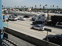
Interstate 210 and State Route 210 (SR 210) together form a contiguous highway, called the Foothill Freeway, in the Greater Los Angeles area
of the U.S. state
of California
. The western portion of the route is an auxiliary Interstate Highway, while the eastern portion is a state highway
. The entire route was upgraded to Interstate Highway standards
by 2007, and the California Department of Transportation
(Caltrans) has requested permission to re-sign the eastern portion as an Interstate Highway.
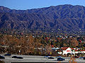
The name Foothill Freeway is a reference to Foothill Boulevard
and the San Gabriel Mountains
, both of which run parallel to the freeway for most of its length. The freeway connects Los Angeles
with its northern suburbs following the foothills of these mountains. The freeway runs from the Sylmar
district of Los Angeles east to Redlands
.
Currently all of the Foothill Freeway is designated Route 210. Historically, the Foothill Freeway spanned multiple numerical designations. Additionally, the I-210 designation has changed routings; previously including a portion of what is now the Orange Freeway (SR 57). East of Pasadena
the Foothill Freeway parallels, and in some parts replaced, the route of former U.S. Route 66.
 I-210's western terminus is at its junction with the Golden State Freeway (I-5
), near the Sylmar
district of Los Angeles. From that point, the freeway's alignment is generally diagonal as it heads southeast through the northeastern San Fernando Valley and the Crescenta Valley
. After leaving Los Angeles
, it enters North Glendale
and meets with the Glendale Freeway (State Route 2) before turning due south towards the junction with the Ventura Freeway
(State Route 134) in Pasadena
. At this interchange, the Foothill Freeway shifts its alignment and direction, becoming an east-west freeway. From the north, the primary through lanes of I-210 become the unsigned northern stub of unfinished I-710, while from the east, the through lanes of the Ventura Freeway become I-210 as the Ventura Freeway reaches its official eastern terminus. After intersecting the northern terminus of I-605 (The San Gabriel River Freeway), I-210 then continues east to the Orange Freeway (State Route 57
) in Glendora
. Heading east from the Orange Freeway interchange, until its eastern terminus at I-10 in Redlands
, 210 is currently signed as a state route.
Portions of the Metro Gold Line of the LACMTA run in the median of the Foothill Freeway from Pasadena to Arcadia.
State Route 210 presently has two distinct segments:
The western freeway segment serves as the easternmost portion of the Foothill Freeway (Interstate 210). Consisting of newer freeway, beginning at the east end of I-210 near San Dimas
, SR 210 extends eastward, eventually paralleling Highland Avenue, as it continues through Fontana
. It intersects Interstate 15
, an artery between Southern California
and Nevada
a few miles before it meets with Interstate 215
in San Bernardino
.
The segment east of Interstate 215 is the former alignment of State Route 30. This segment extends eastward to junctions with Interstate 215
, State Route 259, State Route 18
and State Route 330 in Highland
. State Route 210 then curves southward and ends in a junction with Interstate 10
in Redlands
.
The Glendora Curve is the former colloquial name for the interchange
between State Route 57
and the Foothill Freeway, Interstate 210
. The "curve" portion refers to the interchange from the northbound lanes of State Route 57
to the westbound lanes of I-210, and from the eastbound lanes of I-210 to the southbound lanes of State Route 57
. The origin of the name comes from its location in the city of Glendora
. Prior to 2002, this interchange was entirely part of I-210, and the eastern terminus of I-210 ended several miles south of the curve at the Kellogg Interchange
at the junctions of the Chino Valley Freeway, State Route 71
, the San Bernardino Freeway, I-10
, and Route 57. After the portion of I-210 south of the Glendora Curve was transferred to Route 57 in 2002, effectively extending Route 210 east past the Glendora Curve, the name Glendora Curve fell out of popular use.
This route is part of the California Freeway and Expressway System
and is eligible for the State Scenic Highway System
.
and Canada Avenue in Pasadena
, was opened in 1966; it was then signed as State Route 118
. In 1968, the Atchison, Topeka and Santa Fe Railway
depot at Santa Anita, a historic structure built in 1890, was moved to the Los Angeles County Arboretum and Botanic Garden
to make way for a section of the freeway passing through Arcadia
. The section from State Route 134 to the Kellogg Interchange
with Interstate 10
at Pomona, California
was completed in 1976. The section between the Kellogg interchange and Glendora
is no longer part of I-210. In 2003, this piece was renumbered as part of State Route 57
, and known as the Orange Freeway.
In the 1990s, Caltrans began constructing extensions to the freeway from Glendora
east to the former Interstate 215
/State Route 30 interchange in San Bernardino
. In 2003, a 20-mile (32 km) segment east from Glendora to Fontana was completed, with the portion proceeding south from Glendora renumbered SR 57. The remaining section east of Interstate 15 between Fontana and Interstate 215 was opened on July 24, 2007.
Caltrans has petitioned AASHTO, the trade organization that oversees the designation and naming of the Interstate Highway system, to re-sign the entire Foothill Freeway, including the entire segments of State Routes 210 and 30, as I-210. Upon completion of the new freeway segment west of I-215, State Route 30 from I-215 to I-10 in Redlands was re-signed as State Route 210. The re-signing in 2003 of the former portion of I-210 now signed as State Route 57 truncated I-210 from its parent route, I-10. Presuming that authority is given at some point in the future to re-sign the entirety of 210 as interstate, then I-210 will once again connect to its parent route, but much further east in Redlands.
The western freeway segment, planned since the 1970s and completed in 2002, replaced a western surface street segment that began with Base Line Road (sometimes spelled Baseline Road) at its intersection with Foothill Boulevard in San Dimas
and extends eastward into Upland
. In Upland it became 16th Street, then turned northward onto Mountain Avenue, then turned eastward onto 19th Street. It left Upland and continued eastward into Rancho Cucamonga
. It then seemed to turn northward onto Haven Avenue and end at the western freeway segment. This segment is probably still signed as SR 30 — at least in some places if not ubiquitously — but some recently published maps are reflecting a signage change.
State Route 30 is the former designation of State Route 210 and State Route 330
. Route 30 ran from its interchange with I-210
in Glendora
east to State Route 18 at Big Bear Lake
. The easternmost portion of Route 30 was transferred to Route 330 in 1972. Thereafter, Route 30 was routed south to I-10 in Redlands
. In 1999, the entirety of Route 30 from the Glendora Curve to Redlands was transferred to Route 210.
Route 210 from Route 5 to Route 10 in Redlands is known as the Foothill Freeway, as named by Senate Concurrent Resolution 29, Chapter 128 in 1991.
Initial freeway construction started in 1968, and constructed the freeway between SR 259 and Cedar St. in San Bernardino. Construction continued east in 1971, which brought the freeway just west of SR 330. Construction did not resume until 1989 which extended the freeway west to I-215. The last phase of construction started in 1992, which connected the route south to I-10.
In 1968, the State requested that SR 30 be incorporated into the interstate system, but was declined. The next effort started in 1998. The State decided to close the 25-mile gap between I-210 and SR 30. It also decided to number the new freeway as SR 210, in preparation of the route becoming an interstate. Also, when the new freeway was close to the existing route, the entire route would be renumbered SR 210. In addition, the short section of the Orange Freeway, which was numbered I-210 would be renumber SR 57, to match the number used for the rest of the freeway. Construction started on the eastern end, and slowly moved west. In 2007, the mainline freeway section was completed, which ended SR 30. The final phase of the project is expected to be completed in 2011, which includes upgrading the interchange at I-215 to a full interchange. The latter interchange was built with missing moves (210 EB to 215 SB, 215 NB to 210 WB) as the flyover plans for these moves had to be recast
to address potential soil liquefaction
in the event of rupture of existing or undiscovered faults in the area during an earthquake.
to designate the entire route as part of Interstate 210. Once approved, the SR 210 green State Route signs will be replaced with Interstate 210 ones.
{| class=wikitable
!County
!Location
!Postmile
!Exit
!Destinations
!Notes
|-
|rowspan=56|Los Angeles
LA R0.00-R52.15
|rowspan=12|Los Angeles
|R0.00
|1
|
|Westbound exit and eastbound entrance; signed as exits 1A (north) and 1B (south)
|-
|R0.84
|1C
|Yarnell Street
|Signed as exit 1 eastbound
|-
|R1.92
|2
|Roxford Street – Sylmar
|
|-
|R3.28
|3
|Polk Street
|
|-
|R4.11
|4
|Hubbard Street
|
|-
|R4.94
|5
|Maclay Street – San Fernando
|
|-
|R5.91
|6A
|
|Signed as exit 6B westbound
|-
|R6.01
|6B
|Paxton Street
|Signed as exit 6A westbound
|-
|R7.82
|8
|Osborne Street – Lake View Terrace
|
|-
|R9.44
|9
|Wheatland Avenue – Lake View Terrace
|
|-
|R11.08
|11
|Sunland Boulevard
– Sunland, Tujunga
|
|-
|R14.17
|14
|La Tuna Canyon Road
|
|-
|rowspan=2|Glendale
|R15.62
|16
|Lowell Avenue – Tujunga
|
|-
|R16.77
|17A
|Pennsylvania Avenue – La Crescenta
|Signed as exit 17 eastbound
|-
|
|bgcolor=#ffdddd|R17.38
|bgcolor=#ffdddd|17B
|bgcolor=#ffdddd|La Crescenta Avenue – La Crescenta
|bgcolor=#ffdddd|Westbound exit and eastbound entrance
|-
|
|R18.22
|18
|Ocean View Boulevard – Montrose
|
|-
|Glendale
|bgcolor=#ddffdd|R18.87
|bgcolor=#ddffdd|19
|bgcolor=#ddffdd|
|bgcolor=#ddffdd|West end of SR 2 overlap
|-
|rowspan=3|La Cañada Flintridge
|bgcolor=#ddffdd|R19.88
|bgcolor=#ddffdd|20
|bgcolor=#ddffdd|
|bgcolor=#ddffdd|East end of SR 2 overlap
|-bgcolor=#ffdddd
|R20.60
|21
|Gould Avenue
|Eastbound exit and westbound entrance
|-bgcolor=#ffdddd
|R20.85
|21
|Foothill Boulevard
|Westbound exit and eastbound entrance
|-
|rowspan=15|Pasadena
|R21.53
|22A
|Berkshire Avenue, Oak Grove Drive
|
|-
|R22.49
|22B
|Arroyo Boulevard, Windsor Avenue
|
|-
|R23.19
|23
|Lincoln Avenue, Washington Boulevard
|
|-
|R24.06
|24
|Seco Street, Mountain Street
|
|-bgcolor=#ffdddd
|R24.86
|25A
|Colorado Boulevard
– Pasadena
|Eastbound exit and westbound entrance
|-
|R24.96
|25A
|
|Westbound exit is via exit 26A
|-
|R24.96
|25B
|, Glendale
|Signed as exit 26A westbound
|-bgcolor=#ffdddd
|R25.29
|25
|Fair Oaks Avenue, Marengo Avenue
|Westbound exit and eastbound entrance; signed as exits 25A (south) and 25B (north)
|-
|R26.33
|26
|Lake Avenue
|Signed as exit 26B westbound
|-
|R26.94
|27A
|Hill Avenue
|Signed as exit 27 eastbound
|-bgcolor=#ffdddd
|R27.41
|27B
|Allen Avenue
|Westbound exit and eastbound entrance
|-
|R28.25
|28
|Altadena Drive, Sierra Madre Boulevard
|Westbound exit is via exit 29A
|-
|R28.68
|29A
|San Gabriel Boulevard – San Marino
|
|-
|R29.29
|29B
|Madre Street
|
|-
|R29.49
|30
|
|Signed as exits 30A (south) and 30B (north) eastbound
|-
|rowspan=3|Arcadia
|R30.82
|31
|Baldwin Avenue – Sierra Madre
|
|-
|R31.88
|32
|Santa Anita Avenue – Arcadia
|
|-
|R32.89
|33
|Huntington Drive
– Monrovia
, Arcadia
|
|-
|rowspan=2|Monrovia
|R33.91
|34
|Myrtle Avenue – Monrovia
|
|-
|R34.74
|35A
|Mountain Avenue
|
|-
|Duarte
|R35.24
|35B
|Buena Vista Street
|
|-
|rowspan=3|Irwindale
|R36.41
|36A
|
|Signed as exit 36B westbound
|-
|R36.41
|36B
|Mount Olive Drive (via I-605 north)
|Signed as exit 36A westbound
|-
|R37.86
|38
|Irwindale Avenue – Irwindale
|
|-
|rowspan=3|Azusa
|R38.96
|39
|Vernon Avenue
|
|-
|R39.60
|40
|
|
|-
|R40.60
|41
|Citrus Avenue – Covina
|
|-
|rowspan=4|Glendora
|R41.59
|42
|Grand Avenue – Glendora
|
|-
|R43.16
|43
|Sunflower Avenue
|
|-
|R44.20
|44
|Lone Hill Avenue
|
|-
|R44.38
|45
|
|East end of I-210; west end of SR 210; former I-210 east
|-
|San Dimas
|R45.46
|46
|San Dimas Avenue – San Dimas
|
|-
|rowspan=2|La Verne
|R46.63
|47
| – La Verne
|Former US 66
|-
|R48.08
|48
|Fruit Street
|
|-
|rowspan=2|Claremont
|R49.53
|50
|Towne Avenue
|
|-
|R51.85
|52
|Base Line Road
|Former SR 30
|-
|rowspan=28|San Bernardino
SBD 0.00-R33.18
|rowspan=2|Upland
|1.50
|54
|Mountain Avenue – Mount Baldy
|
|-
|3.47
|56
|Campus Avenue
|
|-
|rowspan=6|Rancho Cucamonga
|4.60
|57
|Carnelian Street
|
|-
|5.90
|58
|Archibald Avenue
|
|-
|6.91
|59
|Haven Avenue
|
|-
|7.91
|60
|Milliken Avenue
|
|-
|9.14
|61
|Day Creek Boulevard
|
|-
|11.50
|64A
|
|
|-
|rowspan=4|Fontana
|11.93
|64B
|Cherry Avenue
|
|-
|12.93
|
|Beech Avenue
|HOV
-only interchange
|-
|13.93
|66
|Citrus Avenue
|
|-
|14.93
|67
|Sierra Avenue
|
|-
|rowspan=4|Rialto
|R16.03
|68
|Alder Avenue
|
|-
|R17.39
|70
|Ayala Drive
|
|-
|19.00
|71
|Riverside Avenue
|
|-bgcolor=#ffdead
|19.67
|72
|Pepper Avenue
|Proposed interchange
|-
|rowspan=8|San Bernardino
|20.69
|73
|State Street, University Parkway
|
|-
|R21.87
|74
|
|Former I-15E
|-
|R22.94
|75A
|H Street
|Signed as exit 75 eastbound
|-
|R23.10
|75B
|
|Eastbound exit is via exit 75
|-
|R24.22
|76
|
|
|-
|R25.72
|78
|Del Rosa Avenue
|
|-
|R26.73
|79
|Highland Avenue
|
|-
|R28.66
|81
|
|
|-
|rowspan=2|Highland
|R29.32
|82
|Base Line Road
|
|-
|R30.23
|83
|5th Street
, Greenspot Road
|
|-
|rowspan=2|Redlands
|R32.34
|84
|San Bernardino Avenue
|
|-
|R33.18
|85
|
|Eastbound exit and westbound entrance; signed as exits 85A (west) and 85B (east)
Greater Los Angeles Area
The Greater Los Angeles Area, or the Southland, is a term used for the Combined Statistical Area sprawled over five counties in the southern part of California, namely Los Angeles County, Orange County, San Bernardino County, Riverside County and Ventura County...
of the U.S. state
U.S. state
A U.S. state is any one of the 50 federated states of the United States of America that share sovereignty with the federal government. Because of this shared sovereignty, an American is a citizen both of the federal entity and of his or her state of domicile. Four states use the official title of...
of California
California
California is a state located on the West Coast of the United States. It is by far the most populous U.S. state, and the third-largest by land area...
. The western portion of the route is an auxiliary Interstate Highway, while the eastern portion is a state highway
State highway
State highway, state road or state route can refer to one of three related concepts, two of them related to a state or provincial government in a country that is divided into states or provinces :#A...
. The entire route was upgraded to Interstate Highway standards
Interstate Highway standards
Standards for Interstate Highways in the United States are defined by the American Association of State Highway and Transportation Officials in the publication A Policy on Design Standards - Interstate System...
by 2007, and the California Department of Transportation
California Department of Transportation
The California Department of Transportation is a government department in the U.S. state of California. Its mission is to improve mobility across the state. It manages the state highway system and is actively involved with public transportation systems throughout the state...
(Caltrans) has requested permission to re-sign the eastern portion as an Interstate Highway.
The name Foothill Freeway is a reference to Foothill Boulevard
Foothill Boulevard (Southern California)
Foothill Boulevard is a major road in the city and county of Los Angeles, as well as an arterial road in the city and county of San Bernardino, stretching well over 60 miles in length, with some notable breaks along the route...
and the San Gabriel Mountains
San Gabriel Mountains
The San Gabriel Mountains Range is located in northern Los Angeles County and western San Bernardino County, California, United States. The mountain range lies between the Los Angeles Basin and the Mojave Desert, with Interstate 5 to the west and Interstate 15 to the east...
, both of which run parallel to the freeway for most of its length. The freeway connects Los Angeles
Los Ángeles
Los Ángeles is the capital of the province of Biobío, in the commune of the same name, in Region VIII , in the center-south of Chile. It is located between the Laja and Biobío rivers. The population is 123,445 inhabitants...
with its northern suburbs following the foothills of these mountains. The freeway runs from the Sylmar
Sylmar, Los Angeles, California
Sylmar is a district in the San Fernando Valley region of the City of Los Angeles, California. The northernmost neighborhood in the city, Sylmar is located east of Interstate 5 and north of the city of San Fernando...
district of Los Angeles east to Redlands
Redlands, California
Redlands is a city in San Bernardino County, California, United States. As of the 2010 census, the city had a population of 68,747, up from 63,591 at the 2000 census. The city is located east of downtown San Bernardino.- History :...
.
Currently all of the Foothill Freeway is designated Route 210. Historically, the Foothill Freeway spanned multiple numerical designations. Additionally, the I-210 designation has changed routings; previously including a portion of what is now the Orange Freeway (SR 57). East of Pasadena
Pasadena, California
Pasadena is a city in Los Angeles County, California, United States. Although famous for hosting the annual Rose Bowl football game and Tournament of Roses Parade, Pasadena is the home to many scientific and cultural institutions, including the California Institute of Technology , the Jet...
the Foothill Freeway parallels, and in some parts replaced, the route of former U.S. Route 66.
Route description
Interstate 5 in California
Interstate 5 is a major north–south route of the Interstate Highway System in the U.S. state of California. It begins at the Mexico – United States border at the San Ysidro crossing, goes north across the length of California and crosses into Oregon south of the Medford-Ashland metropolitan...
), near the Sylmar
Sylmar, Los Angeles, California
Sylmar is a district in the San Fernando Valley region of the City of Los Angeles, California. The northernmost neighborhood in the city, Sylmar is located east of Interstate 5 and north of the city of San Fernando...
district of Los Angeles. From that point, the freeway's alignment is generally diagonal as it heads southeast through the northeastern San Fernando Valley and the Crescenta Valley
Crescenta Valley
The Crescenta Valley is a small inland valley in Los Angeles County, California lying between the San Gabriel Mountains on the northeast and the Verdugo Mountains and San Rafael Hills on the southwest. It opens into the San Fernando Valley at the northwest and the San Gabriel Valley at the southeast...
. After leaving Los Angeles
Los Ángeles
Los Ángeles is the capital of the province of Biobío, in the commune of the same name, in Region VIII , in the center-south of Chile. It is located between the Laja and Biobío rivers. The population is 123,445 inhabitants...
, it enters North Glendale
Glendale, California
Glendale is a city in Los Angeles County, California, United States. As of the 2010 Census, the city population is 191,719, down from 194,973 at the 2000 census. making it the third largest city in Los Angeles County and the 22nd largest city in the state of California...
and meets with the Glendale Freeway (State Route 2) before turning due south towards the junction with the Ventura Freeway
Ventura Freeway
The Ventura Freeway is a freeway in southern California running from Ventura to Pasadena. It is the principal east-west route through Ventura County and in the southern San Fernando Valley in Los Angeles County. From Ventura to its intersection with the Hollywood Freeway in the southeastern San...
(State Route 134) in Pasadena
Pasadena, California
Pasadena is a city in Los Angeles County, California, United States. Although famous for hosting the annual Rose Bowl football game and Tournament of Roses Parade, Pasadena is the home to many scientific and cultural institutions, including the California Institute of Technology , the Jet...
. At this interchange, the Foothill Freeway shifts its alignment and direction, becoming an east-west freeway. From the north, the primary through lanes of I-210 become the unsigned northern stub of unfinished I-710, while from the east, the through lanes of the Ventura Freeway become I-210 as the Ventura Freeway reaches its official eastern terminus. After intersecting the northern terminus of I-605 (The San Gabriel River Freeway), I-210 then continues east to the Orange Freeway (State Route 57
California State Route 57
State Route 57 , also known as the Orange Freeway, is a north–south state highway in the Greater Los Angeles Area of the U.S. state of California. It connects the interchange of Interstate 5 and State Route 22 near downtown Orange, locally known as the Orange Crush, with the Glendora Curve...
) in Glendora
Glendora, California
Glendora is a municipality in Los Angeles County, California, United States, east of downtown Los Angeles. As of the 2010 census, the population of Glendora was 50,073....
. Heading east from the Orange Freeway interchange, until its eastern terminus at I-10 in Redlands
Redlands, California
Redlands is a city in San Bernardino County, California, United States. As of the 2010 census, the city had a population of 68,747, up from 63,591 at the 2000 census. The city is located east of downtown San Bernardino.- History :...
, 210 is currently signed as a state route.
Portions of the Metro Gold Line of the LACMTA run in the median of the Foothill Freeway from Pasadena to Arcadia.
State Route 210 presently has two distinct segments:
The western freeway segment serves as the easternmost portion of the Foothill Freeway (Interstate 210). Consisting of newer freeway, beginning at the east end of I-210 near San Dimas
San Dimas, California
San Dimas is a city located in the San Gabriel Valley, in Los Angeles County, California. As of the 2010 census, the city had a total population of 33,371. The city historically took its name from San Dismas Canyon in the San Gabriel Mountains above the northern section of present day San Dimas...
, SR 210 extends eastward, eventually paralleling Highland Avenue, as it continues through Fontana
Fontana, California
Fontana is a city of 196,069 residents in San Bernardino County, California. Founded in 1913, it remained essentially rural until World War II, when entrepreneur Henry J. Kaiser built a large steel mill in the area...
. It intersects Interstate 15
Interstate 15 in California
In the U.S. state of California, Interstate 15 is a major north–south route through the San Bernardino, Riverside, and San Diego Counties, and it has a length of in the state. It is a major thoroughfare for traffic between Southern California and Las Vegas, Nevada, as well as points beyond...
, an artery between Southern California
Southern California
Southern California is a megaregion, or megapolitan area, in the southern area of the U.S. state of California. Large urban areas include Greater Los Angeles and Greater San Diego. The urban area stretches along the coast from Ventura through the Southland and Inland Empire to San Diego...
and Nevada
Nevada
Nevada is a state in the western, mountain west, and southwestern regions of the United States. With an area of and a population of about 2.7 million, it is the 7th-largest and 35th-most populous state. Over two-thirds of Nevada's people live in the Las Vegas metropolitan area, which contains its...
a few miles before it meets with Interstate 215
Interstate 215 (California)
Interstate 215 is a long north–south Interstate highway in the Inland Empire region of Southern California. It is an auxiliary route of Interstate 15 , running from Murrieta to northern San Bernardino...
in San Bernardino
San Bernardino, California
San Bernardino is a city located in the Riverside-San Bernardino metropolitan area , and serves as the county seat of San Bernardino County, California, United States...
.
The segment east of Interstate 215 is the former alignment of State Route 30. This segment extends eastward to junctions with Interstate 215
Interstate 215 (California)
Interstate 215 is a long north–south Interstate highway in the Inland Empire region of Southern California. It is an auxiliary route of Interstate 15 , running from Murrieta to northern San Bernardino...
, State Route 259, State Route 18
State Route 18 (California)
State Route 18 in the U.S. state of California runs from State Route 210 in San Bernardino to State Route 138 near Adelanto. It is the primary route into the San Bernardino Mountains and has two discontinunities: one in Big Bear Lake, the other in Victorville.-Route description:SR 18 is part of...
and State Route 330 in Highland
Highland, California
Highland is a city in San Bernardino County, California, United States. The population in 2010 was 53,104, up from 44,605 at the 2000 census...
. State Route 210 then curves southward and ends in a junction with Interstate 10
Interstate 10 in California
Interstate 10 , the major east–west Interstate Highway in the Southern United States, runs in the U.S. state of California east from Santa Monica, on the Pacific Ocean, through Los Angeles and San Bernardino to the border with Arizona...
in Redlands
Redlands, California
Redlands is a city in San Bernardino County, California, United States. As of the 2010 census, the city had a population of 68,747, up from 63,591 at the 2000 census. The city is located east of downtown San Bernardino.- History :...
.
The Glendora Curve is the former colloquial name for the interchange
Interchange (road)
In the field of road transport, an interchange is a road junction that typically uses grade separation, and one or more ramps, to permit traffic on at least one highway to pass through the junction without directly crossing any other traffic stream. It differs from a standard intersection, at which...
between State Route 57
California State Route 57
State Route 57 , also known as the Orange Freeway, is a north–south state highway in the Greater Los Angeles Area of the U.S. state of California. It connects the interchange of Interstate 5 and State Route 22 near downtown Orange, locally known as the Orange Crush, with the Glendora Curve...
and the Foothill Freeway, Interstate 210
Interstate 210 (California)
Interstate 210 and State Route 210 together form a contiguous highway, called the Foothill Freeway, in the Greater Los Angeles area of the U.S. state of California. The western portion of the route is an auxiliary Interstate Highway, while the eastern portion is a state highway...
. The "curve" portion refers to the interchange from the northbound lanes of State Route 57
California State Route 57
State Route 57 , also known as the Orange Freeway, is a north–south state highway in the Greater Los Angeles Area of the U.S. state of California. It connects the interchange of Interstate 5 and State Route 22 near downtown Orange, locally known as the Orange Crush, with the Glendora Curve...
to the westbound lanes of I-210, and from the eastbound lanes of I-210 to the southbound lanes of State Route 57
California State Route 57
State Route 57 , also known as the Orange Freeway, is a north–south state highway in the Greater Los Angeles Area of the U.S. state of California. It connects the interchange of Interstate 5 and State Route 22 near downtown Orange, locally known as the Orange Crush, with the Glendora Curve...
. The origin of the name comes from its location in the city of Glendora
Glendora, California
Glendora is a municipality in Los Angeles County, California, United States, east of downtown Los Angeles. As of the 2010 census, the population of Glendora was 50,073....
. Prior to 2002, this interchange was entirely part of I-210, and the eastern terminus of I-210 ended several miles south of the curve at the Kellogg Interchange
Kellogg Interchange
The Kellogg Interchange complex is a freeway interchange in Southern California. The interchange is located at the boundary between the cities of San Dimas and Pomona about east of downtown Los Angeles. It is named for the nearby W. K. Kellogg Ranch, now home to Cal Poly Pomona.-Description:The...
at the junctions of the Chino Valley Freeway, State Route 71
California State Route 71
State Route 71 is the Chino Valley Freeway, formerly the Corona Expressway and before then the Temescal Freeway, a freeway/highway of about 15 miles in length located entirely within Southern California, United States...
, the San Bernardino Freeway, I-10
Interstate 10 in California
Interstate 10 , the major east–west Interstate Highway in the Southern United States, runs in the U.S. state of California east from Santa Monica, on the Pacific Ocean, through Los Angeles and San Bernardino to the border with Arizona...
, and Route 57. After the portion of I-210 south of the Glendora Curve was transferred to Route 57 in 2002, effectively extending Route 210 east past the Glendora Curve, the name Glendora Curve fell out of popular use.
This route is part of the California Freeway and Expressway System
California Freeway and Expressway System
The California Freeway and Expressway System is a system of existing or planned freeways and expressways in the U.S. state of California. It is defined by the Streets and Highways Code.-List of roads in the system:*State Route 1 *State Route 2...
and is eligible for the State Scenic Highway System
State Scenic Highway System (California)
The State Scenic Highway System is a list of highways, mainly state highways, that have been designated by the California Department of Transportation as scenic highways. The California State Legislature, primarily through Section 263 of the Streets and Highways Code, makes highways eligible for...
.
History
The construction began on the freeway in 1958. The first section, between Flintridge, now La Cañada FlintridgeLa Cañada Flintridge, California
La Cañada Flintridge is a small and affluent city in Los Angeles County, California, United States whose population at the 2010 census was 20,246, down from 20,318 at the 2000 census. According to Forbes, as of 2010, La Cañada Flintridge ranks as the 143rd most expensive U.S...
and Canada Avenue in Pasadena
Pasadena, California
Pasadena is a city in Los Angeles County, California, United States. Although famous for hosting the annual Rose Bowl football game and Tournament of Roses Parade, Pasadena is the home to many scientific and cultural institutions, including the California Institute of Technology , the Jet...
, was opened in 1966; it was then signed as State Route 118
California State Route 118
State Route 118 is a state highway in the U.S. state of California that begins running west to east through Ventura and Los Angeles counties in southern California. It travels from Saticoy in Ventura County east to Lake View Terrace in Los Angeles...
. In 1968, the Atchison, Topeka and Santa Fe Railway
Atchison, Topeka and Santa Fe Railway
The Atchison, Topeka and Santa Fe Railway , often abbreviated as Santa Fe, was one of the larger railroads in the United States. The company was first chartered in February 1859...
depot at Santa Anita, a historic structure built in 1890, was moved to the Los Angeles County Arboretum and Botanic Garden
Los Angeles County Arboretum and Botanic Garden
The Los Angeles County Arboretum and Botanic Garden, 127 acres , is an arboretum, botanical garden, and historical site nestled into hills near the San Gabriel Mountains, at 301 North Baldwin Avenue, Arcadia, California, USA...
to make way for a section of the freeway passing through Arcadia
Arcadia, California
Arcadia is an affluent city in Los Angeles County, California, United States, and located approximately northeast of downtown Los Angeles in the San Gabriel Valley and at the base of the San Gabriel Mountains....
. The section from State Route 134 to the Kellogg Interchange
Kellogg Interchange
The Kellogg Interchange complex is a freeway interchange in Southern California. The interchange is located at the boundary between the cities of San Dimas and Pomona about east of downtown Los Angeles. It is named for the nearby W. K. Kellogg Ranch, now home to Cal Poly Pomona.-Description:The...
with Interstate 10
Interstate 10 in California
Interstate 10 , the major east–west Interstate Highway in the Southern United States, runs in the U.S. state of California east from Santa Monica, on the Pacific Ocean, through Los Angeles and San Bernardino to the border with Arizona...
at Pomona, California
Pomona, California
-2010:The 2010 United States Census reported that Pomona had a population of 149,058, a slight decline from the 2000 census population. The population density was 6,491.2 people per square mile...
was completed in 1976. The section between the Kellogg interchange and Glendora
Glendora, California
Glendora is a municipality in Los Angeles County, California, United States, east of downtown Los Angeles. As of the 2010 census, the population of Glendora was 50,073....
is no longer part of I-210. In 2003, this piece was renumbered as part of State Route 57
California State Route 57
State Route 57 , also known as the Orange Freeway, is a north–south state highway in the Greater Los Angeles Area of the U.S. state of California. It connects the interchange of Interstate 5 and State Route 22 near downtown Orange, locally known as the Orange Crush, with the Glendora Curve...
, and known as the Orange Freeway.
In the 1990s, Caltrans began constructing extensions to the freeway from Glendora
Glendora, California
Glendora is a municipality in Los Angeles County, California, United States, east of downtown Los Angeles. As of the 2010 census, the population of Glendora was 50,073....
east to the former Interstate 215
Interstate 215 (California)
Interstate 215 is a long north–south Interstate highway in the Inland Empire region of Southern California. It is an auxiliary route of Interstate 15 , running from Murrieta to northern San Bernardino...
/State Route 30 interchange in San Bernardino
San Bernardino, California
San Bernardino is a city located in the Riverside-San Bernardino metropolitan area , and serves as the county seat of San Bernardino County, California, United States...
. In 2003, a 20-mile (32 km) segment east from Glendora to Fontana was completed, with the portion proceeding south from Glendora renumbered SR 57. The remaining section east of Interstate 15 between Fontana and Interstate 215 was opened on July 24, 2007.
Caltrans has petitioned AASHTO, the trade organization that oversees the designation and naming of the Interstate Highway system, to re-sign the entire Foothill Freeway, including the entire segments of State Routes 210 and 30, as I-210. Upon completion of the new freeway segment west of I-215, State Route 30 from I-215 to I-10 in Redlands was re-signed as State Route 210. The re-signing in 2003 of the former portion of I-210 now signed as State Route 57 truncated I-210 from its parent route, I-10. Presuming that authority is given at some point in the future to re-sign the entirety of 210 as interstate, then I-210 will once again connect to its parent route, but much further east in Redlands.
The western freeway segment, planned since the 1970s and completed in 2002, replaced a western surface street segment that began with Base Line Road (sometimes spelled Baseline Road) at its intersection with Foothill Boulevard in San Dimas
San Dimas, California
San Dimas is a city located in the San Gabriel Valley, in Los Angeles County, California. As of the 2010 census, the city had a total population of 33,371. The city historically took its name from San Dismas Canyon in the San Gabriel Mountains above the northern section of present day San Dimas...
and extends eastward into Upland
Upland, California
Upland is a city in San Bernardino County, California, located at an elevation of 1,242 feet . As of the 2010 census, the city had a population of 73,732, up from 68,393 at the 2000 census. It was incorporated on May 15, 1906, after previously being named North Ontario.-History and culture:Upland...
. In Upland it became 16th Street, then turned northward onto Mountain Avenue, then turned eastward onto 19th Street. It left Upland and continued eastward into Rancho Cucamonga
Rancho Cucamonga, California
Rancho Cucamonga is a suburban city in San Bernardino County, California. As of the 2010 census, the city had a population of 165,269, up from 127,743 at the 2000 census. L. Dennis Michael was elected as Mayor on November 2, 2010. Jack Lam is the City Manager...
. It then seemed to turn northward onto Haven Avenue and end at the western freeway segment. This segment is probably still signed as SR 30 — at least in some places if not ubiquitously — but some recently published maps are reflecting a signage change.
State Route 30 is the former designation of State Route 210 and State Route 330
California State Route 330
State Route 330 is a state highway in the U.S. state of California. It is also known as City Creek Road in the San Bernardino Mountains.-Route description:...
. Route 30 ran from its interchange with I-210
Interstate 210 (California)
Interstate 210 and State Route 210 together form a contiguous highway, called the Foothill Freeway, in the Greater Los Angeles area of the U.S. state of California. The western portion of the route is an auxiliary Interstate Highway, while the eastern portion is a state highway...
in Glendora
Glendora, California
Glendora is a municipality in Los Angeles County, California, United States, east of downtown Los Angeles. As of the 2010 census, the population of Glendora was 50,073....
east to State Route 18 at Big Bear Lake
Big Bear Lake, California
Big Bear Lake is a city in San Bernardino County, California along the south shore of Big Bear Lake, located northeast of the city of San Bernardino. The population was 5,019 at the 2010 census, down from 5,438 at the 2000 census...
. The easternmost portion of Route 30 was transferred to Route 330 in 1972. Thereafter, Route 30 was routed south to I-10 in Redlands
Redlands, California
Redlands is a city in San Bernardino County, California, United States. As of the 2010 census, the city had a population of 68,747, up from 63,591 at the 2000 census. The city is located east of downtown San Bernardino.- History :...
. In 1999, the entirety of Route 30 from the Glendora Curve to Redlands was transferred to Route 210.
Route 210 from Route 5 to Route 10 in Redlands is known as the Foothill Freeway, as named by Senate Concurrent Resolution 29, Chapter 128 in 1991.
State Route 30
SR 30 was adopted as a state route in 1933 as part of Legislative Route 190. It was an unsigned highway, running from LRN 9 (formerly US 66, Foothill Blvd) near San Dimas to LRN 26 (SR 38) near Redlands. It also ran from LRN 26 near Redlands to LRN 43 near Big Bear Lake, which would become part of SR 38. During the renumbering of California routes, LRN 190 was split into two different routes. The western portion, between I-210 in San Dimas and Highland became SR 30. The eastern portion, between SR 38 in Redlands and Highland was combined with LRN 207 (currently SR 330) to form SR 106. In 1972, the northern portion of SR 106, between SR 30 and SR 18 would be renumbered SR 330. The southern portion, between SR 30 and I-10 (SR 106 was moved to I-10 in 1965) was combined with SR 30.Initial freeway construction started in 1968, and constructed the freeway between SR 259 and Cedar St. in San Bernardino. Construction continued east in 1971, which brought the freeway just west of SR 330. Construction did not resume until 1989 which extended the freeway west to I-215. The last phase of construction started in 1992, which connected the route south to I-10.
In 1968, the State requested that SR 30 be incorporated into the interstate system, but was declined. The next effort started in 1998. The State decided to close the 25-mile gap between I-210 and SR 30. It also decided to number the new freeway as SR 210, in preparation of the route becoming an interstate. Also, when the new freeway was close to the existing route, the entire route would be renumbered SR 210. In addition, the short section of the Orange Freeway, which was numbered I-210 would be renumber SR 57, to match the number used for the rest of the freeway. Construction started on the eastern end, and slowly moved west. In 2007, the mainline freeway section was completed, which ended SR 30. The final phase of the project is expected to be completed in 2011, which includes upgrading the interchange at I-215 to a full interchange. The latter interchange was built with missing moves (210 EB to 215 SB, 215 NB to 210 WB) as the flyover plans for these moves had to be recast
Earthquake engineering
Earthquake engineering is the scientific field concerned with protecting society, the natural and the man-made environment from earthquakes by limiting the seismic risk to socio-economically acceptable levels...
to address potential soil liquefaction
Soil liquefaction
Soil liquefaction describes a phenomenon whereby a saturated soil substantially loses strength and stiffness in response to an applied stress, usually earthquake shaking or other sudden change in stress condition, causing it to behave like a liquid....
in the event of rupture of existing or undiscovered faults in the area during an earthquake.
Future
With the completion of a central freeway segment in July 2007, Caltrans is expected to ask the AASHTOAmerican Association of State Highway and Transportation Officials
AASHTO, the American Association of State Highway and Transportation Officials, is a standards setting body which publishes specifications, test protocols and guidelines which are used in highway design and construction throughout the United States...
to designate the entire route as part of Interstate 210. Once approved, the SR 210 green State Route signs will be replaced with Interstate 210 ones.
Exit list
- Note: Except where prefixed with a letter, postmiles were measured in 1964, based on the alignment as it existed at that time, and do not necessarily reflect current mileage. The numbers reset at county lines; the start and end postmiles in each county are given in the county column.
{| class=wikitable
!County
!Location
!Postmile
!Exit
Exit number
An exit number is a number assigned to a road junction, usually an exit from a freeway. It is usually marked on the same sign as the destinations of the exit, as well as a sign in the gore....
!Destinations
!Notes
|-
|rowspan=56|Los Angeles
Los Angeles County, California
Los Angeles County is a county in the U.S. state of California. As of 2010 U.S. Census, the county had a population of 9,818,605, making it the most populous county in the United States. Los Angeles County alone is more populous than 42 individual U.S. states...
LA R0.00-R52.15
|rowspan=12|Los Angeles
Los Ángeles
Los Ángeles is the capital of the province of Biobío, in the commune of the same name, in Region VIII , in the center-south of Chile. It is located between the Laja and Biobío rivers. The population is 123,445 inhabitants...
|R0.00
|1
|
|Westbound exit and eastbound entrance; signed as exits 1A (north) and 1B (south)
|-
|R0.84
|1C
|Yarnell Street
|Signed as exit 1 eastbound
|-
|R1.92
|2
|Roxford Street – Sylmar
|
|-
|R3.28
|3
|Polk Street
|
|-
|R4.11
|4
|Hubbard Street
|
|-
|R4.94
|5
|Maclay Street – San Fernando
San Fernando, California
San Fernando is a city located in the San Fernando Valley, in northwestern region of Los Angeles, California, United States. The population was 23,645 at the 2010 census, up from 23,564 at the 2000 census.-History:...
|
|-
|R5.91
|6A
|
|Signed as exit 6B westbound
|-
|R6.01
|6B
|Paxton Street
|Signed as exit 6A westbound
|-
|R7.82
|8
|Osborne Street – Lake View Terrace
|
|-
|R9.44
|9
|Wheatland Avenue – Lake View Terrace
|
|-
|R11.08
|11
|Sunland Boulevard
Sunland Boulevard
Sunland Boulevard is a major thoroughfare in the Crescenta and San Fernando Valleys.-Geography:Sunland Boulevard splits off of Foothill Boulevard in the Sunland area of the Crescenta Valley. It runs for about 5 miles before changing to Vineland Avenue directly south of San Fernando Road in Sun...
– Sunland, Tujunga
|
|-
|R14.17
|14
|La Tuna Canyon Road
|
|-
|rowspan=2|Glendale
Glendale, California
Glendale is a city in Los Angeles County, California, United States. As of the 2010 Census, the city population is 191,719, down from 194,973 at the 2000 census. making it the third largest city in Los Angeles County and the 22nd largest city in the state of California...
|R15.62
|16
|Lowell Avenue – Tujunga
|
|-
|R16.77
|17A
|Pennsylvania Avenue – La Crescenta
|Signed as exit 17 eastbound
|-
|
|bgcolor=#ffdddd|R17.38
|bgcolor=#ffdddd|17B
|bgcolor=#ffdddd|La Crescenta Avenue – La Crescenta
|bgcolor=#ffdddd|Westbound exit and eastbound entrance
|-
|
|R18.22
|18
|Ocean View Boulevard – Montrose
|
|-
|Glendale
Glendale, California
Glendale is a city in Los Angeles County, California, United States. As of the 2010 Census, the city population is 191,719, down from 194,973 at the 2000 census. making it the third largest city in Los Angeles County and the 22nd largest city in the state of California...
|bgcolor=#ddffdd|R18.87
|bgcolor=#ddffdd|19
|bgcolor=#ddffdd|
|bgcolor=#ddffdd|West end of SR 2 overlap
|-
|rowspan=3|La Cañada Flintridge
La Cañada Flintridge, California
La Cañada Flintridge is a small and affluent city in Los Angeles County, California, United States whose population at the 2010 census was 20,246, down from 20,318 at the 2000 census. According to Forbes, as of 2010, La Cañada Flintridge ranks as the 143rd most expensive U.S...
|bgcolor=#ddffdd|R19.88
|bgcolor=#ddffdd|20
|bgcolor=#ddffdd|
|bgcolor=#ddffdd|East end of SR 2 overlap
|-bgcolor=#ffdddd
|R20.60
|21
|Gould Avenue
|Eastbound exit and westbound entrance
|-bgcolor=#ffdddd
|R20.85
|21
|Foothill Boulevard
Foothill Boulevard (Southern California)
Foothill Boulevard is a major road in the city and county of Los Angeles, as well as an arterial road in the city and county of San Bernardino, stretching well over 60 miles in length, with some notable breaks along the route...
|Westbound exit and eastbound entrance
|-
|rowspan=15|Pasadena
Pasadena, California
Pasadena is a city in Los Angeles County, California, United States. Although famous for hosting the annual Rose Bowl football game and Tournament of Roses Parade, Pasadena is the home to many scientific and cultural institutions, including the California Institute of Technology , the Jet...
|R21.53
|22A
|Berkshire Avenue, Oak Grove Drive
|
|-
|R22.49
|22B
|Arroyo Boulevard, Windsor Avenue
|
|-
|R23.19
|23
|Lincoln Avenue, Washington Boulevard
|
|-
|R24.06
|24
|Seco Street, Mountain Street
|
|-bgcolor=#ffdddd
|R24.86
|25A
|Colorado Boulevard
Colorado Boulevard
Colorado Boulevard is a major east–west street in Southern California, United States. It runs from Griffith Park in Los Angeles east through Glendale, the Eagle Rock section of Los Angeles, Pasadena, and Arcadia, ending in Monrovia...
– Pasadena
Pasadena, California
Pasadena is a city in Los Angeles County, California, United States. Although famous for hosting the annual Rose Bowl football game and Tournament of Roses Parade, Pasadena is the home to many scientific and cultural institutions, including the California Institute of Technology , the Jet...
|Eastbound exit and westbound entrance
|-
|R24.96
|25A
|
|Westbound exit is via exit 26A
|-
|R24.96
|25B
|, Glendale
Glendale, California
Glendale is a city in Los Angeles County, California, United States. As of the 2010 Census, the city population is 191,719, down from 194,973 at the 2000 census. making it the third largest city in Los Angeles County and the 22nd largest city in the state of California...
|Signed as exit 26A westbound
|-bgcolor=#ffdddd
|R25.29
|25
|Fair Oaks Avenue, Marengo Avenue
|Westbound exit and eastbound entrance; signed as exits 25A (south) and 25B (north)
|-
|R26.33
|26
|Lake Avenue
|Signed as exit 26B westbound
|-
|R26.94
|27A
|Hill Avenue
|Signed as exit 27 eastbound
|-bgcolor=#ffdddd
|R27.41
|27B
|Allen Avenue
|Westbound exit and eastbound entrance
|-
|R28.25
|28
|Altadena Drive, Sierra Madre Boulevard
Sierra Madre Boulevard
Sierra Madre Boulevard is a long road connecting five suburbs of Pasadena, California; Arcadia, Sierra Madre, Hastings Ranch, East Pasadena, and San Marino. For the most part, it is a winding road divided by a grassy median, but the part between Pasadena and Arcadia is a two-lane road. Built...
|Westbound exit is via exit 29A
|-
|R28.68
|29A
|San Gabriel Boulevard – San Marino
San Marino, California
San Marino is a small, affluent city in Los Angeles County, California. Incorporated in 1913, the City founders designed the community to be uniquely residential, with expansive properties surrounded by beautiful gardens, wide streets, and well maintained parkways...
|
|-
|R29.29
|29B
|Madre Street
|
|-
|R29.49
|30
|
|Signed as exits 30A (south) and 30B (north) eastbound
|-
|rowspan=3|Arcadia
Arcadia, California
Arcadia is an affluent city in Los Angeles County, California, United States, and located approximately northeast of downtown Los Angeles in the San Gabriel Valley and at the base of the San Gabriel Mountains....
|R30.82
|31
|Baldwin Avenue – Sierra Madre
Sierra Madre, California
The city of Sierra Madre is a municipality in Los Angeles County, California whose population was 10,917 at the 2010 census, up from 10,580 at the time of the 2000 census. The city is located in the Foothills of the San Gabriel Mountains below the southern edge of the Angeles National Forest. ...
|
|-
|R31.88
|32
|Santa Anita Avenue – Arcadia
Arcadia, California
Arcadia is an affluent city in Los Angeles County, California, United States, and located approximately northeast of downtown Los Angeles in the San Gabriel Valley and at the base of the San Gabriel Mountains....
|
|-
|R32.89
|33
|Huntington Drive
Huntington Drive
Huntington Drive is a major east–west street in Southern California. It runs from the merge of Soto Street and Mission Road near the Lincoln Park neighborhood of Los Angeles east through the El Sereno section of Los Angeles, South Pasadena, San Marino, Alhambra, San Gabriel, Arcadia,...
– Monrovia
Monrovia, California
Monrovia is a city located in the foothills of the San Gabriel Mountains in the San Gabriel Valley of Los Angeles County, California, United States. The population was 36,590 at the 2010 census, down from 36,929 at the 2000 census...
, Arcadia
Arcadia, California
Arcadia is an affluent city in Los Angeles County, California, United States, and located approximately northeast of downtown Los Angeles in the San Gabriel Valley and at the base of the San Gabriel Mountains....
|
|-
|rowspan=2|Monrovia
Monrovia, California
Monrovia is a city located in the foothills of the San Gabriel Mountains in the San Gabriel Valley of Los Angeles County, California, United States. The population was 36,590 at the 2010 census, down from 36,929 at the 2000 census...
|R33.91
|34
|Myrtle Avenue – Monrovia
Monrovia, California
Monrovia is a city located in the foothills of the San Gabriel Mountains in the San Gabriel Valley of Los Angeles County, California, United States. The population was 36,590 at the 2010 census, down from 36,929 at the 2000 census...
|
|-
|R34.74
|35A
|Mountain Avenue
|
|-
|Duarte
Duarte, California
Duarte is a city in Los Angeles County, California, United States. As of the 2010 census, the city population was 21,321, down from 21,486 at the 2000 census....
|R35.24
|35B
|Buena Vista Street
|
|-
|rowspan=3|Irwindale
Irwindale, California
Irwindale is a city in the San Gabriel Valley, in Los Angeles County, California, United States. The population was 1,422 at the 2010 census, down from 1,446 at the 2000 census....
|R36.41
|36A
|
|Signed as exit 36B westbound
|-
|R36.41
|36B
|Mount Olive Drive (via I-605 north)
|Signed as exit 36A westbound
|-
|R37.86
|38
|Irwindale Avenue – Irwindale
Irwindale, California
Irwindale is a city in the San Gabriel Valley, in Los Angeles County, California, United States. The population was 1,422 at the 2010 census, down from 1,446 at the 2000 census....
|
|-
|rowspan=3|Azusa
Azusa, California
Azusa is a city in Los Angeles County, California, United States. The population was 46,361 at the 2010 census, up from 44,712 at the 2000 census. Though sometimes assumed to be a compaction of the phrase "everything from A to Z in the USA" from an old Jack Benny joke, the place name "Azusa"...
|R38.96
|39
|Vernon Avenue
|
|-
|R39.60
|40
|
|
|-
|R40.60
|41
|Citrus Avenue – Covina
Covina, California
Covina is a small city in Los Angeles County, California about east of downtown Los Angeles, in the San Gabriel Valley region. The population was 47,796 at the 2010 census, up from 46,837 at the 2000 census...
|
|-
|rowspan=4|Glendora
Glendora, California
Glendora is a municipality in Los Angeles County, California, United States, east of downtown Los Angeles. As of the 2010 census, the population of Glendora was 50,073....
|R41.59
|42
|Grand Avenue – Glendora
Glendora, California
Glendora is a municipality in Los Angeles County, California, United States, east of downtown Los Angeles. As of the 2010 census, the population of Glendora was 50,073....
|
|-
|R43.16
|43
|Sunflower Avenue
|
|-
|R44.20
|44
|Lone Hill Avenue
|
|-
|R44.38
|45
|
|East end of I-210; west end of SR 210; former I-210 east
|-
|San Dimas
San Dimas, California
San Dimas is a city located in the San Gabriel Valley, in Los Angeles County, California. As of the 2010 census, the city had a total population of 33,371. The city historically took its name from San Dismas Canyon in the San Gabriel Mountains above the northern section of present day San Dimas...
|R45.46
|46
|San Dimas Avenue – San Dimas
San Dimas, California
San Dimas is a city located in the San Gabriel Valley, in Los Angeles County, California. As of the 2010 census, the city had a total population of 33,371. The city historically took its name from San Dismas Canyon in the San Gabriel Mountains above the northern section of present day San Dimas...
|
|-
|rowspan=2|La Verne
La Verne, California
La Verne is a city in Los Angeles County, California, United States. The population was 31,063 at the 2010 census, down from 31,638 at the 2000 census.-History:...
|R46.63
|47
| – La Verne
La Verne, California
La Verne is a city in Los Angeles County, California, United States. The population was 31,063 at the 2010 census, down from 31,638 at the 2000 census.-History:...
|Former US 66
U.S. Route 66 in California
In the U.S. state of California, U.S. Route 66 is a former U.S. highway. All the portions were deleted by 1964 during the 1964 renumbering.-History:U.S...
|-
|R48.08
|48
|Fruit Street
|
|-
|rowspan=2|Claremont
Claremont, California
Claremont is a small affluent college town in eastern Los Angeles County, California, United States, about east of downtown Los Angeles at the base of the San Gabriel Mountains. The population as of the 2010 census is 34,926. Claremont is known for its seven higher-education institutions, its...
|R49.53
|50
|Towne Avenue
|
|-
|R51.85
|52
|Base Line Road
|Former SR 30
|-
|rowspan=28|San Bernardino
San Bernardino County, California
San Bernardino County is a county in the U.S. state of California. As of the 2010 census, the population was 2,035,210, up from 1,709,434 as of the 2000 census...
SBD 0.00-R33.18
|rowspan=2|Upland
Upland, California
Upland is a city in San Bernardino County, California, located at an elevation of 1,242 feet . As of the 2010 census, the city had a population of 73,732, up from 68,393 at the 2000 census. It was incorporated on May 15, 1906, after previously being named North Ontario.-History and culture:Upland...
|1.50
|54
|Mountain Avenue – Mount Baldy
Mount San Antonio
Mount San Antonio, commonly known as Old Baldy or Mt Baldy, at , is the highest peak in the San Gabriel Mountains, and the highest point in Los Angeles County...
|
|-
|3.47
|56
|Campus Avenue
|
|-
|rowspan=6|Rancho Cucamonga
Rancho Cucamonga, California
Rancho Cucamonga is a suburban city in San Bernardino County, California. As of the 2010 census, the city had a population of 165,269, up from 127,743 at the 2000 census. L. Dennis Michael was elected as Mayor on November 2, 2010. Jack Lam is the City Manager...
|4.60
|57
|Carnelian Street
|
|-
|5.90
|58
|Archibald Avenue
|
|-
|6.91
|59
|Haven Avenue
|
|-
|7.91
|60
|Milliken Avenue
|
|-
|9.14
|61
|Day Creek Boulevard
|
|-
|11.50
|64A
|
|
|-
|rowspan=4|Fontana
Fontana, California
Fontana is a city of 196,069 residents in San Bernardino County, California. Founded in 1913, it remained essentially rural until World War II, when entrepreneur Henry J. Kaiser built a large steel mill in the area...
|11.93
|64B
|Cherry Avenue
|
|-
|12.93
|
|Beech Avenue
|HOV
HOV
HOV may refer to:* High-occupancy vehicle lane* Ørsta-Volda Airport, Hovden in Hovden, Norway* Hovig* A small street gang located in Naperville* see Hov...
-only interchange
|-
|13.93
|66
|Citrus Avenue
|
|-
|14.93
|67
|Sierra Avenue
|
|-
|rowspan=4|Rialto
Rialto, California
-2010:The 2010 United States Census reported that Rialto had a population of 99,171. The population density was 4,434.1 people per square mile . The racial makeup of Rialto was 43,592 White, 16,236 African American, 1,062 Native American, 2,258 Asian, 361 Pacific Islander, 30,993 from other...
|R16.03
|68
|Alder Avenue
|
|-
|R17.39
|70
|Ayala Drive
|
|-
|19.00
|71
|Riverside Avenue
|
|-bgcolor=#ffdead
|19.67
|72
|Pepper Avenue
|Proposed interchange
|-
|rowspan=8|San Bernardino
San Bernardino, California
San Bernardino is a city located in the Riverside-San Bernardino metropolitan area , and serves as the county seat of San Bernardino County, California, United States...
|20.69
|73
|State Street, University Parkway
|
|-
|R21.87
|74
|
|Former I-15E
|-
|R22.94
|75A
|H Street
|Signed as exit 75 eastbound
|-
|R23.10
|75B
|
|Eastbound exit is via exit 75
|-
|R24.22
|76
|
|
|-
|R25.72
|78
|Del Rosa Avenue
|
|-
|R26.73
|79
|Highland Avenue
|
|-
|R28.66
|81
|
|
|-
|rowspan=2|Highland
Highland, California
Highland is a city in San Bernardino County, California, United States. The population in 2010 was 53,104, up from 44,605 at the 2000 census...
|R29.32
|82
|Base Line Road
|
|-
|R30.23
|83
|5th Street
Foothill Boulevard (Southern California)
Foothill Boulevard is a major road in the city and county of Los Angeles, as well as an arterial road in the city and county of San Bernardino, stretching well over 60 miles in length, with some notable breaks along the route...
, Greenspot Road
|
|-
|rowspan=2|Redlands
Redlands, California
Redlands is a city in San Bernardino County, California, United States. As of the 2010 census, the city had a population of 68,747, up from 63,591 at the 2000 census. The city is located east of downtown San Bernardino.- History :...
|R32.34
|84
|San Bernardino Avenue
|
|-
|R33.18
|85
|
|Eastbound exit and westbound entrance; signed as exits 85A (west) and 85B (east)