
List of lakes in the United States
Encyclopedia
This is a list of lake
s in the United States
, grouped by state
.
Alabama
Alaska
Arizona
Arkansas
California
Colorado
Connecticut
Florida
Georgia
Idaho
Illinois
Indiana
Iowa
Kansas
Kentucky
Kentucky Lake
Lake Barkley
Nolin Lake
Cumberland
Buckhorn
Green River Lake
Laurel Lake
Cave Run Lake
Williamstown Lake
Dale Hollow Lake
Barren River Lake
Beaver Lake\
Cedar Creek Lake
Herrington Lake
Kincaid Lake
Rough River Lake
Shelby Lake
Taylorsville Lake
Louisiana
Maine
Maryland
Massachusetts
Michigan
Minnesota
Mississippi
Missouri
Montana
Nebraska
Nevada
New Hampshire
New Jersey
New Mexico
New York
North Carolina
North Dakota
Ohio
Oklahoma
Oregon
South Carolina
South Dakota
Tennessee
Utah
Vermont
West Virginia
Wyoming
Lake
A lake is a body of relatively still fresh or salt water of considerable size, localized in a basin, that is surrounded by land. Lakes are inland and not part of the ocean and therefore are distinct from lagoons, and are larger and deeper than ponds. Lakes can be contrasted with rivers or streams,...
s in the United States
United States
The United States of America is a federal constitutional republic comprising fifty states and a federal district...
, grouped by state
U.S. state
A U.S. state is any one of the 50 federated states of the United States of America that share sovereignty with the federal government. Because of this shared sovereignty, an American is a citizen both of the federal entity and of his or her state of domicile. Four states use the official title of...
.
AlabamaAlabamaAlabama is a state located in the southeastern region of the United States. It is bordered by Tennessee to the north, Georgia to the east, Florida and the Gulf of Mexico to the south, and Mississippi to the west. Alabama ranks 30th in total land area and ranks second in the size of its inland...
- Bankhead LakeBankhead LakeBankhead Lake is a reservoir along the Black Warrior River that begins in Walker County in the state of Alabama. The lake forms the border between Jefferson and Tuscaloosa County, as well as the border dividing Jefferson and Walker County...
- Bear Creek ReservoirBear Creek ReservoirThe Bear Creek Reservoir is a reservoir located in Franklin County, Alabama, along Bear Creek.-See also:*List of dams and reservoirs in the United States*List of lakes*List of Alabama dams and reservoirs...
- Creek Lake
- Gantt Lake
- Guntersville LakeGuntersville LakeGuntersville Lake is located in north Alabama between Bridgeport and Guntersville. Created by Guntersville Dam along the Tennessee River, it stretches 75 miles from Guntersville Dam to Nickajack Dam...
(largest lake in AlabamaAlabamaAlabama is a state located in the southeastern region of the United States. It is bordered by Tennessee to the north, Georgia to the east, Florida and the Gulf of Mexico to the south, and Mississippi to the west. Alabama ranks 30th in total land area and ranks second in the size of its inland...
) - Holt Lake
- Inland Lake
- Jordan Lake
- Lake HardingLake HardingLake Harding, also known as Bartlett's Ferry Lake, is a reservoir on the Chattahoochee River. The lake is formed by Bartlett's Ferry Dam, and the lake is located in Harris County, Georgia with some portions of the lake going into Alabama. Lake Harding is a deep lake with a depth of over at the...
(extends into GeorgiaGeorgia (U.S. state)Georgia is a state located in the southeastern United States. It was established in 1732, the last of the original Thirteen Colonies. The state is named after King George II of Great Britain. Georgia was the fourth state to ratify the United States Constitution, on January 2, 1788...
) - Lake Jackson (extends into FloridaFloridaFlorida is a state in the southeastern United States, located on the nation's Atlantic and Gulf coasts. It is bordered to the west by the Gulf of Mexico, to the north by Alabama and Georgia and to the east by the Atlantic Ocean. With a population of 18,801,310 as measured by the 2010 census, it...
) - Lake LurleenLake LurleenLake Lurleen is a public reservoir located in Tuscaloosa County, in west central Alabama. It is named after Lurleen Wallace, the only woman elected Governor of Alabama to date. It is also the location of Lake Lurleen State Park....
- Lake MartinLake MartinLake Martin is located in Tallapoosa, Elmore, and Coosa counties in Alabama. It is a 44,000-acre lake with over 750 miles of wooded shoreline. An artificial reservoir, Lake Martin was formed by the construction of Martin Dam on the Tallapoosa River. The Martin Dam powerhouse is used to generate...
- Lake Purdy
- Lake Tholocco
- Lake TuscaloosaLake TuscaloosaLake Tuscaloosa is a reservoir in west-central Alabama, created by damming North River. It was constructed to provide water for Tuscaloosa residents and for industrial use as well. It was completed in 1970 at a cost of about $7,725,000...
- Lake WedoweeLake WedoweeLake Wedowee, or R. L. Harris Reservoir, is a reservoir, located in Randolph County, Alabama on the upper part of the Tallapoosa River. The lake is 10,660 acres. This lake was built at one of the last hydro sites in Alabama.-Construction:...
- Lay Lake
- Lewis Smith LakeLewis Smith LakeLewis Smith Lake is a reservoir in north Alabama. Located on the Sipsey Fork of the Black Warrior River, the lake covers over in Cullman, Walker, and Winston counties. The three-fingered lake has over of shoreline, and at full pool has a level of . The lake was created by Alabama Power by use...
- Little Bear Creek Reservoir
- Logan Martin LakeLogan Martin LakeLogan Martin Lake is located in east central Alabama on the Coosa River approximately east of Birmingham, Alabama. This Coosa River reservoir was built in 1965 by Alabama Power Company. The lake, nicknamed Lake of a Thousand Coves by locals, has of shoreline along its length sandwiched between...
- Neely Henry LakeNeely Henry LakeNeely Henry Lake is located on the Coosa River near Gadsden, Alabama. The reservoir contains . The lake was formed by the Neely Henry Dam built in 1966 by Alabama Power for hydroelectric power and recreation.- External links :...
- Pickwick LakePickwick LakePickwick Lake is the reservoir created by Pickwick Landing Dam as part of the Tennessee Valley Authority. The lake stretches from Pickwick Landing Dam to Wilson Dam....
(extends into MississippiMississippiMississippi is a U.S. state located in the Southern United States. Jackson is the state capital and largest city. The name of the state derives from the Mississippi River, which flows along its western boundary, whose name comes from the Ojibwe word misi-ziibi...
) - Ski Lake
- Upper Bear Creek Reservoir
- Walter F. George LakeWalter F. George LakeThe Walter F. George Lake, named for Walter F. George , a United States Senator from Georgia, is formed on the Chattahoochee River along the border between Alabama and Georgia. It is also widely known by the unofficial name, Lake Eufaula — particularly on the Alabama side. The lake extends north...
(Lake Eufaula; extends into GeorgiaGeorgia (U.S. state)Georgia is a state located in the southeastern United States. It was established in 1732, the last of the original Thirteen Colonies. The state is named after King George II of Great Britain. Georgia was the fourth state to ratify the United States Constitution, on January 2, 1788...
) - Weiss LakeWeiss LakeWeiss Lake is a lake in northeastern Alabama that is owned by the Alabama Power Company. The lake consists of , all coming from the Coosa River, Chattooga River , and Little River, offering over of shoreline and shallow flats, large coves, under-water drop offs and deep channels...
- West Point LakeWest Point LakeWest Point Lake is a man-made reservoir formed by the damming of the Chattahoochee River by the U.S. Army Corps of Engineers. This reservoir extends for about along the Chattahoochee River near the Alabama-Georgia state boundary....
(extends into GeorgiaGeorgia (U.S. state)Georgia is a state located in the southeastern United States. It was established in 1732, the last of the original Thirteen Colonies. The state is named after King George II of Great Britain. Georgia was the fourth state to ratify the United States Constitution, on January 2, 1788...
) - W. F. Lake
- Wheeler LakeWheeler LakeWheeler Lake is located in the northern part of the United States state of Alabama, between Rogersville and Huntsville. Created by Wheeler Dam along the Tennessee River, it stretches 60 miles from Wheeler Dam to Guntersville Dam...
- Wilson LakeWilson Lake (Alabama)Wilson Lake is the reservoir created by Wilson Dam as part of the Tennessee Valley Authority. The lake stretches from Wilson Dam to Wheeler Dam.-See also:*Dams and reservoirs of the Tennessee River*List of Alabama dams and reservoirs...
- William Bill Danelly Reservoir
AlaskaAlaskaAlaska is the largest state in the United States by area. It is situated in the northwest extremity of the North American continent, with Canada to the east, the Arctic Ocean to the north, and the Pacific Ocean to the west and south, with Russia further west across the Bering Strait...
- Becharof LakeBecharof LakeBecharof Lake is a long lake on the Alaska Peninsula. It is located south-east of Egegik, in the Aleutian Range.-History:The lake was named in 1868 by naturalist W. H...
- Iliamna LakeIliamna LakeIliamna Lake or Lake Iliamna is a lake in South-West Alaska, at North end of Alaska Peninsula, between Kvichak Bay and Cook Inlet, West of Seldovia, Alaska Bristol Bay Low....
(largest lake in Alaska) - Lake ClarkLake Clark (Alaska)Lake Clark is a lake in southern Alaska. It drains through Six Mile Lake and the Newhalen River into Iliamna Lake. The lake is about long and about wide....
- Lower Ugashik LakeUgashik LakesThe Ugashik Lakes are two adjacent lakes along the Ugashik River on the Alaska Peninsula in the U.S. state of Alaska.The lakes are world renowned for trophy Arctic grayling fishing...
- Mother Goose LakeMother Goose LakeMother Goose Lake is a 6.4 mile long lake located at head of King Salmon River, on the Alaska Peninsula, 21 miles south of Ugashik, Aleutian Range. It was named in 1923 by R. H. Sargent, USGS, as "suggested by its goose-like shape." According to Sargent, the local name was King gautham giri Lake....
- Naknek LakeNaknek LakeNaknek Lake is a lake in southern Alaska, near the base of the Alaska Peninsula. The lake is long and 5–13 km wide. The lake drains west into Bristol Bay through the Naknek River....
- Selawik LakeSelawik LakeSelawik Lake is a lake located southwest of Selawik, Alaska. It is long. It is adjacent to the Selawik National Wildlife Refuge and the Baldwin Peninsula, feeding into the Hotham Inlet and Kotzebue Sound....
- Teshekpuk LakeTeshekpuk LakeTeshekpuk Lake is a -wide lake on the Arctic coast of the U.S. state of Alaska, South of Pitt Point, East of Harrison Bay, East of Point Barrow.- Etymology :...
- Upper Ugashik LakeUgashik LakesThe Ugashik Lakes are two adjacent lakes along the Ugashik River on the Alaska Peninsula in the U.S. state of Alaska.The lakes are world renowned for trophy Arctic grayling fishing...
ArizonaArizonaArizona ; is a state located in the southwestern region of the United States. It is also part of the western United States and the mountain west. The capital and largest city is Phoenix...
- Lake MeadLake MeadLake Mead is the largest reservoir in the United States. It is located on the Colorado River about southeast of Las Vegas, Nevada, in the states of Nevada and Arizona. Formed by water impounded by the Hoover Dam, it extends behind the dam, holding approximately of water.-History:The lake was...
(extends into NevadaNevadaNevada is a state in the western, mountain west, and southwestern regions of the United States. With an area of and a population of about 2.7 million, it is the 7th-largest and 35th-most populous state. Over two-thirds of Nevada's people live in the Las Vegas metropolitan area, which contains its...
) - Lake PowellLake PowellLake Powell is a huge reservoir on the Colorado River, straddling the border between Utah and Arizona . It is the second largest man-made reservoir in the United States behind Lake Mead, storing of water when full...
(extends into UtahUtahUtah is a state in the Western United States. It was the 45th state to join the Union, on January 4, 1896. Approximately 80% of Utah's 2,763,885 people live along the Wasatch Front, centering on Salt Lake City. This leaves vast expanses of the state nearly uninhabited, making the population the...
) - San Carlos LakeSan Carlos LakeSan Carlos Lake was formed by the construction of the Coolidge Dam and is rimmed by of shoreline. The lake is located within the San Carlos Apache Indian Reservation, and is thus subject to tribal regulations....
- Theodore Roosevelt LakeTheodore Roosevelt LakeTheodore Roosevelt Lake is a large reservoir formed by Theodore Roosevelt Dam on the Salt River in Arizona as part of the Salt River Project...
- Tempe Town LakeTempe Town LakeTempe Town Lake is a reservoir that occupies a portion of the currently dry riverbed of the Salt River as it passes through the city of Tempe, Arizona just north of Tempe Butte....
ArkansasArkansasArkansas is a state located in the southern region of the United States. Its name is an Algonquian name of the Quapaw Indians. Arkansas shares borders with six states , and its eastern border is largely defined by the Mississippi River...
- Beaver LakeBeaver Lake (Arkansas)Beaver Lake is a man-made reservoir in the Ozark Mountains of Northwest Arkansas and is formed by a dam across the White River. Beaver Lake has some of natural shoreline...
- Bull ShoaLake (extends into MissouriMissouriMissouri is a US state located in the Midwestern United States, bordered by Iowa, Illinois, Kentucky, Tennessee, Arkansas, Oklahoma, Kansas and Nebraska. With a 2010 population of 5,988,927, Missouri is the 18th most populous state in the nation and the fifth most populous in the Midwest. It...
) - DeGray LakeDeGray LakeDeGray Lake is a reservoir on the Caddo River, 8 miles from Arkadelphia. DeGray Lake offers a huge span of recreational area and spectacular views...
- Greers Ferry LakeGreers Ferry LakeGreers Ferry Lake is the reservoir formed by Greers Ferry Dam, a United States Army Corps of Engineers dam in Northern Arkansas. It is located about north of Little Rock.-Geography:...
- Lake GreesonLake GreesonLake Greeson is a reservoir on the Little Missouri River, about north of Murfreesboro, Arkansas. Famous for its scenery and recreation, it is surrounded by 15 parks that offer opportunities for camping, fishing, boating, biking, and swimming.- Overview :...
- Lake OuachitaLake OuachitaLake Ouachita is a reservoir created by the damming of the Ouachita River by Blakely Mountain Dam . The lake is located near Hot Springs, Arkansas. Lake Ouachita is the largest lake completely in Arkansas, as the larger Bull Shoals Lake extends into Missouri. Lake Ouachita has over of shoreline...
- Millwood LakeMillwood LakeMillwood Lake is a reservoir in southwestern Arkansas, United States. It is located from Ashdown. The lake is formed from the damming of the point where the Little River and the Saline River meet...
- Nimrod LakeNimrod LakeNimrod Lake is a reservoir in western Arkansas. It is the oldest Corps of Engineers project in Arkansas, it was completed in 1942 on the Fourche LaFave River.-Overview:...
- Noforks Lake (extends into MissouriMissouriMissouri is a US state located in the Midwestern United States, bordered by Iowa, Illinois, Kentucky, Tennessee, Arkansas, Oklahoma, Kansas and Nebraska. With a 2010 population of 5,988,927, Missouri is the 18th most populous state in the nation and the fifth most populous in the Midwest. It...
)
CaliforniaCaliforniaCalifornia is a state located on the West Coast of the United States. It is by far the most populous U.S. state, and the third-largest by land area...
- Big Bear LakeBig Bear LakeBig Bear Lake is a reservoir in the San Bernardino Mountains, in San Bernardino County, California, United States. At a surface elevation of , it has an east-west length of approximately 7 miles and is approximately 2.5 miles at its widest measurement, though the lake's width mostly averages a...
- Clear Lake
- Don Pedro Reservoir
- Donner LakeDonner LakeDonner Lake is a freshwater lake in northeast California on the eastern slope of the Sierra Nevada and about northwest of the much larger Lake Tahoe. A moraine serves as a natural dam for the lake. The lake is located in the town of Truckee, sandwiched between Interstate 80 to the north and...
- Eagle LakeEagle Lake (Lassen County)Eagle Lake is a lake in Lassen County approximately 15 miles north of Susanville, California. It is the second largest natural lake entirely in the state of California, United States....
- Goose LakeGoose Lake (Oregon-California)Goose Lake is a large alkaline glacial lake located in the Goose Lake Valley on the Oregon-California border. The north end of the lake is in Lake County, Oregon and the south end is in Modoc County, California. The mountains at the north end of the lake are part of the Fremont National Forest...
(extends into OregonOregonOregon is a state in the Pacific Northwest region of the United States. It is located on the Pacific coast, with Washington to the north, California to the south, Nevada on the southeast and Idaho to the east. The Columbia and Snake rivers delineate much of Oregon's northern and eastern...
) - Lake AlmanorLake AlmanorLake Almanor is a large artificial lake in northwestern Plumas County, northeastern California. The reservoir has a capacity of and a maximum depth of about 90 feet...
- Lake BerryessaLake BerryessaLake Berryessa is the largest lake in Napa County, California. This reservoir is formed by the Monticello Dam, which provides water and hydroelectricity to the North Bay region of the San Francisco Bay Area....
- Lake MerrittLake MerrittLake Merritt is a large tidal lagoon that lies just east of downtown Oakland, California. It is surrounded by parkland and city neighborhoods. A popular 3.1 mile walking and jogging path runs along its perimeter...
- Lake OrovilleLake OrovilleLake Oroville, also known as Lake Edmonston, is a reservoir in the U.S. state of California, formed by the Oroville Dam across the Feather River. The lake is situated in the foothills of the Sierra Nevada about northeast of Oroville. At over , it is one of the largest reservoirs in California,...
- Lake PillsburyLake PillsburyLake Pillsbury is an artificial lake in the Mendocino National Forest of Lake County, California, created from the waters impounded from the Eel River by Scott Dam. Elevation is with of shoreline and covering . Activities in the Lake Pillsbury Recreation Area include powerboating, fishing,...
- Lake Shasta
- Lake TahoeLake TahoeLake Tahoe is a large freshwater lake in the Sierra Nevada of the United States. At a surface elevation of , it is located along the border between California and Nevada, west of Carson City. Lake Tahoe is the largest alpine lake in North America. Its depth is , making it the USA's second-deepest...
(largest lake in CaliforniaCaliforniaCalifornia is a state located on the West Coast of the United States. It is by far the most populous U.S. state, and the third-largest by land area...
, extends into NevadaNevadaNevada is a state in the western, mountain west, and southwestern regions of the United States. With an area of and a population of about 2.7 million, it is the 7th-largest and 35th-most populous state. Over two-thirds of Nevada's people live in the Las Vegas metropolitan area, which contains its...
) - Lower Klamath LakeLower Klamath LakeLower Klamath Lake is a lake in Siskiyou County, California, that currently serves to hold overflow water for irrigation. At one time it was connected to Upper Klamath Lake....
- Mono LakeMono LakeMono Lake is a large, shallow saline lake in Mono County, California, formed at least 760,000 years ago as a terminal lake in a basin that has no outlet to the ocean...
- New Melones LakeNew Melones LakeNew Melones Lake is an artificial lake in the central Sierra Nevada foothills of Calaveras- and Tuolumne County, California near Jamestown. This reservoir created by the construction of the New Melones Dam across the Stanislaus River has a capacity with a surface area of...
- Salton SeaSalton SeaThe Salton Sea is a shallow, saline, endorheic rift lake located directly on the San Andreas Fault, predominantly in California's Imperial Valley. The lake occupies the lowest elevations of the Salton Sink in the Colorado Desert of Imperial and Riverside counties in Southern California. Like Death...
- Tenaya LakeTenaya LakeTenaya Lake is a lake in Yosemite National Park, located between Yosemite Valley and Tuolumne Meadows.Tenaya Lake was created by the Tenaya branch of the Tuolumne Glacier as it passed through Tenaya Canyon. The lake is supplied by a network of creeks and springs including Murphy Creek to the...
- Trinity LakeTrinity LakeTrinity Lake, previously called Clair Engle Lake, is a lake on the Trinity River formed by the Trinity Dam and located in Trinity County, California, The dam was built by the U.S. Bureau of Reclamation. The lake has a capacity of , making it one of the largest reservoirs in California. The lake's...
- Tule LakeTule LakeTule Lake is an intermittent lake covering an area of , long and across, in northeastern Siskiyou County and northwestern Modoc County in California, along the border with Oregon.-Geography:Tule Lake is fed by the Lost River...
- Whiskeytown LakeWhiskeytown LakeWhiskeytown Lake is a lake in Shasta County in northwestern California, about west of Redding. The lake is in the Whiskeytown Unit of the Whiskeytown-Shasta-Trinity National Recreation Area. It has a capacity of and is formed by Whiskeytown Dam on Clear Creek...
ColoradoColoradoColorado is a U.S. state that encompasses much of the Rocky Mountains as well as the northeastern portion of the Colorado Plateau and the western edge of the Great Plains...
- Blue Mesa ReservoirBlue Mesa Reservoir-External links:* Blue Mesa related information.* Reservoir maps, conditions and fishing reports...
(largest lake in Colorado) - Evergreen Lake
- Echo Lake
- Gilpin Lake
- Grand LakeGrand Lake (Colorado)Grand Lake is Colorado's largest and deepest natural lake, one of the headwaters of the Colorado River in Grand County, Colorado. On its shores is located the eponymous town of Grand Lake. The elevation of the lake surface is 8,367 feet . It is formed by the damming of several streams by a...
- Harker Park LakeHarker Park LakeHarker Park Lake is located on the northwest face of Burro Mountain in Rio Blanco County, Colorado, United States. It is south of the very small town of Buford, Colorado, and west of the city of Boulder. The lake is in the watershed of the White River and is entirely surrounded by the White...
- Lake Agnes
- Lake Estes
- Lake GranbyLake GranbyLake Granby is the second largest body of water in Colorado. It was created as part of the Colorado-Big Thompson Project and forms a continuous body of water with Shadow Mountain Reservoir and Grand Lake. On its own, Lake Granby contains approximately 40 miles of shoreline. The lake is popular...
- Lake San CristobalLake San CristobalLake San Cristobal is the second largest natural lake in the U.S. state of Colorado. Located in the San Juan Mountains at an elevation of , the freshwater lake is long, up to deep, has a surface area of , and holds about of water. The town of Lake City, a few miles to the north, is named after...
- Pass Lake
- Pearl Lake
- Shadow Mountain LakeShadow Mountain LakeShadow Mountain Lake is a reservoir in Grand County, Colorado, near the headwaters of the Colorado River. Shadow Mountain Lake is created by Shadow Mountain Dam...
- Sloan's LakeSloan's LakeSloan's Lake is a body of water, park, and neighborhood in Denver, Colorado, US. The neighborhood is located on the northwest side of Denver...
- Terry Lake
- Turquoise Lake
ConnecticutConnecticutConnecticut is a state in the New England region of the northeastern United States. It is bordered by Rhode Island to the east, Massachusetts to the north, and the state of New York to the west and the south .Connecticut is named for the Connecticut River, the major U.S. river that approximately...
- Bantam Lake (largest natural lake in Connecticut)
- Barkhamsted Reservoir
- Bevin Pond
- Candlewood LakeCandlewood LakeCandlewood Lake, 8.4 sq mi , is located in Fairfield and Litchfield counties of western Connecticut, in the northeastern United States. It is the largest lake in Connecticut...
(largest lake in Connecticut) - Lake BeseckLake BeseckLake Beseck, also known as Beseck Lake, is a body of water in Middlefield, Connecticut measuring a little less than 1 mile in length and a quarter mile in width. It is owned by the Department of Environmental Protection and was created in 1846 when it was dammed.- External links :*...
- Lake Forest
- Lake Gaillard
- Lake SaltonstallLake SaltonstallLake Saltonstall is a long narrow lake located in south-central Connecticut. It covers an area of approximately and is nestled in the center of the trap rock Saltonstall Mountain...
- Lake Success
- Lake Pocotopaug
- Lake Terramuggus
- Lake ZoarLake ZoarLake Zoar is a reservoir on the Housatonic River in the U.S. state of Connecticut. It is formed by Stevenson Dam. The towns of Monroe, Newtown, Oxford, and Southbury border Lake Zoar.-Lake Zoar Authority:...
- Saugatuck ReservoirSaugatuck ReservoirThe Saugatuck Reservoir is a reservoir in Fairfield County Connecticut, USA, that straddles the border between the towns of Redding and Weston. It is created by the Samuel P. Senior dam of the Saugatuck River, and provides water to several of the surrounding towns. It is considered quite scenic...
- Squantz Pond
FloridaFloridaFlorida is a state in the southeastern United States, located on the nation's Atlantic and Gulf coasts. It is bordered to the west by the Gulf of Mexico, to the north by Alabama and Georgia and to the east by the Atlantic Ocean. With a population of 18,801,310 as measured by the 2010 census, it...
- Lake AliceLake Alice (Gainesville, Florida)Lake Alice is a small lake on the University of Florida campus in Gainesville, Florida, USA.The lake is a wildlife area and is one of the few areas in incorporated Gainesville where one may view live alligators. The university's bat house is near the lake. The Baughman Center sits on the southwest...
- Lake ApopkaLake ApopkaLake Apopka is the third largest lake in the U.S. state of Florida. It is located northwest of Orlando, mostly within the bounds of Orange County, although the western part is in Lake County. Fed by a natural spring, rainfall and stormwater runoff, water from Lake Apopka flows through the...
- Lake CrescentLake Crescent (Florida)Lake Crescent is a freshwater lake located in Putman and Flagler counties in North Central Florida. The lake is approximately in length and wide. At the north end it connects to St. Johns River by way of Dunn's Creek....
- Lake GeorgeLake George (Florida)Lake George or Lake Welaka is a broad and shallow brackish lake on the St. Johns River in the U.S. state of Florida.-Geography:Lake George is six miles wide and eleven miles long, with an average depth of 8 feet . The west side of the lake is encompassed in the Ocala National Forest...
- Lake HarneyLake HarneyLake Harney, named for General William Selby Harney, is a lake located in Volusia and Seminole and Counties, Florida, and is part of the course of the St. Johns River....
- Lake HarrisLake Harris (Florida)Lake Harris is a lake in Lake County, Florida, United States, northwest of Orlando. It is part of the "Upper Ocklawaha River Basin" a sub-basin of the St. Johns River. It is known by locals as the "Harris Chain of Lakes" or "Ocklawaha Chain of Lakes"....
- Lake IstokpogaLake IstokpogaLake Istokpoga is a freshwater lake in Highlands County, Florida. The oblong-shaped lake is wide by long. Despite its area, it is very shallow, with an average depth of only . Maximum depth is . As a result, boaters must be cautious to not become stranded in muck near the shore line. Bass...
- Lake KissimmeeLake KissimmeeLake Kissimmee is a Florida lake located about 15 miles east of Lake Wales, Florida, USA.Lake Kissimee State Park is rich with wildlife, including bald eagles, white tailed deer, bobcats, turkeys, and sandhill cranes...
- Lake OkeechobeeLake OkeechobeeLake Okeechobee , locally referred to as The Lake or The Big O, is the largest freshwater lake in the state of Florida. It is the seventh largest freshwater lake in the United States and the second largest freshwater lake contained entirely within the lower 48 states...
- Lake PoinsettLake PoinsettLake Poinsett is a lake in Brevard County, Florida near Rockledge and Cocoa, with small portions in Orange County, and Osceola County. It is the second largest lake in Brevard County, after Lake Washington, though it is actually the smallest lake in Osceola County. It is the widest lake in Brevard...
- Lake RousseauLake RousseauLake Rousseau is a reservoir on the Withlacoochee River in central Florida, USA, on the boundary of Levy County to the north-west, Marion County to the north-east, and Citrus County to the south. It was created in the 1920s when the river was dammed....
- Lake SeminoleLake SeminoleLake Seminole is a reservoir located in the southwest corner of Georgia along its border with Florida, maintained by the U.S. Army Corps of Engineers. The Chattahoochee and Flint rivers join in the lake, before flowing from the Jim Woodruff Lock and Dam, which impounds the lake, as the Apalachicola...
(extends into GeorgiaGeorgia (U.S. state)Georgia is a state located in the southeastern United States. It was established in 1732, the last of the original Thirteen Colonies. The state is named after King George II of Great Britain. Georgia was the fourth state to ratify the United States Constitution, on January 2, 1788...
) - Lake TarponLake TarponLake Tarpon, the "Jewel of Pinellas County" is located about west of Tampa in Palm Harbor and Tarpon Springs, Florida. Lake Tarpon is the largest lake in Pinellas County with a surface area of ....
- Lake TohopekaligaLake TohopekaligaLake Tohopekaliga Tohopeka ; Tohopekaliga [from tohopke /to-hó:pk-i/ fence, fort + likv /léyk-a/ site] Lake Toho, West Lake, or simply Toho for short, native name meaning "we will gather together here", is a lake in Osceola County, Florida, United States. It is the primary inflow of Shingle Creek,...
- Lake WashingtonLake Washington (Florida)Lake Washington is the largest lake in Brevard County, Florida at . The lake may have been named for the U.S. Deputy Surveyor Colonel Henry Washington, after he surveyed the area in 1844.- Hydrology :It is the 41st largest lake in the state of Florida...
- Lake WinderLake WinderLake Winder is a lake in Brevard County and a small portion lies in Osceola County. The lake was named after U.S. Army Captain Edward Winder. Early in 1838 Winder was assigned to scout the area for Seminoles. He discovered Lake Poinsett. The smaller lake to the south was named after Winder. Lake...
- Sawgrass LakeSawgrass LakeSawgrass Lake is a lake in Brevard County, Florida, United States. It is one of the lakes that form the St. Johns River. The lake is difficult to get to without the boat ramp on the west shore of the St. Johns River, located immediately on your left after you cross the river on U.S. Route 192...
GeorgiaGeorgia (U.S. state)Georgia is a state located in the southeastern United States. It was established in 1732, the last of the original Thirteen Colonies. The state is named after King George II of Great Britain. Georgia was the fourth state to ratify the United States Constitution, on January 2, 1788...
- Blue Ridge Lake
- Carter's Lake
- Chatuge LakeChatuge LakeLake Chatuge is a man-made reservoir created by the Chatuge Dam which finished construction in 1942. -See Also:List of dams and reservoirs in the United States...
(extends into North CarolinaNorth CarolinaNorth Carolina is a state located in the southeastern United States. The state borders South Carolina and Georgia to the south, Tennessee to the west and Virginia to the north. North Carolina contains 100 counties. Its capital is Raleigh, and its largest city is Charlotte...
) - Goat Rock LakeGoat Rock LakeGoat Rock Lake is a reservoir on the Chattahoochee River, which lies directly south of Bartlett's Ferry Dam and north of Lake Oliver. The lake is created by the Goat Rock Dam and Generating Plant. The name of the dam and lake date to the construction of the dam in 1912...
- Lake AllatoonaLake AllatoonaLake Allatoona is a U.S. Army Corps of Engineers reservoir in Georgia, located in northwestern metro Atlanta. The lake is mostly in southwestern Cherokee County, but a significant part is in southeastern Bartow County, and a small part in Cobb County near Acworth. Cartersville is the nearest...
- Lake BlackshearLake BlackshearLake Blackshear is a man-made lake on the Flint River in Georgia created by a dam that was constructed in the late 1920s. It is approximately long and varies in width but is rarely more than one mile wide; it covers approximately . Interestingly, when the dam was constructed, little to no...
- Lake BurtonLake Burton (Georgia)Lake Burton is a 2,775 acre reservoir with 62 miles of shoreline located in the northeastern corner of Georgia in Rabun County. It is the first lake in a six-lake series called the Tallulah River Watershed that follows the original course of the Tallulah River...
- Lake HardingLake HardingLake Harding, also known as Bartlett's Ferry Lake, is a reservoir on the Chattahoochee River. The lake is formed by Bartlett's Ferry Dam, and the lake is located in Harris County, Georgia with some portions of the lake going into Alabama. Lake Harding is a deep lake with a depth of over at the...
(extends into AlabamaAlabamaAlabama is a state located in the southeastern region of the United States. It is bordered by Tennessee to the north, Georgia to the east, Florida and the Gulf of Mexico to the south, and Mississippi to the west. Alabama ranks 30th in total land area and ranks second in the size of its inland...
) - Lake HartwellLake HartwellLake Hartwell is a reservoir bordering Georgia and South Carolina on the Savannah, Tugaloo, and Seneca Rivers. The lake is created by Hartwell Dam located on the Savannah River seven miles below the point at which the Tugaloo and Seneca Rivers join to form the Savannah...
(extends into South CarolinaSouth CarolinaSouth Carolina is a state in the Deep South of the United States that borders Georgia to the south, North Carolina to the north, and the Atlantic Ocean to the east. Originally part of the Province of Carolina, the Province of South Carolina was one of the 13 colonies that declared independence...
) - Lake JacksonLake Jackson (Georgia)Jackson Lake is one of the oldest reservoirs in Georgia, southeast of Atlanta in a rural area situated within parts of three counties . The Lloyd Shoals Dam was built in 1910 by Central Georgia Power Company, and electricity was originally generated for the city of Macon...
- Lake LanierLake LanierLake Lanier is a reservoir in the northern portion of the U.S. state of Georgia. It was created by the completion of Buford Dam on the Chattahoochee River in 1956, and is also fed by the waters of the Chestatee River. The lake encompasses of water, and of shoreline at normal level, a "full...
- Lake NottelyLake NottelyLake Nottely is one of many reservoirs of the Tennessee Valley Authority. It is located entirely in Union County, Georgia in the United States. Formed in 1942 by the damming of the Nottely River, Nottely Reservoir extends 20 miles upstream to the town of Blairsville.Construction of Nottely Dam...
- Lake OconeeLake OconeeLake Oconee is a reservoir in central Georgia on the Oconee River near Greensboro and Eatonton. It was created in 1979 when Georgia Power completed the construction of the Wallace Dam on the Oconee River. Lake Oconee is the second largest lake in the state of Georgia...
- Lake OliverLake OliverLake Oliver is a reservoir on the Chattahoochee River, which lies south of Goat Rock Dam . The lake is created by the Oliver Dam and Generating Plant, which was completed in 1959 by Georgia Power. The lake was named for James McCoy Oliver, an executive of Georgia Power at the time. Oliver Dam...
- Lake Piedmont
- Lake RabunLake RabunLake Rabun is a twisty reservoir with of shoreline located in the Northeastern corner of Georgia in Rabun County. It is the third lake in a six-lake series that follows the original course of the Tallulah River. The series begins with Lake Burton as the northernmost lake, followed by Lake Seed,...
- Lake SeminoleLake SeminoleLake Seminole is a reservoir located in the southwest corner of Georgia along its border with Florida, maintained by the U.S. Army Corps of Engineers. The Chattahoochee and Flint rivers join in the lake, before flowing from the Jim Woodruff Lock and Dam, which impounds the lake, as the Apalachicola...
(extends into FloridaFloridaFlorida is a state in the southeastern United States, located on the nation's Atlantic and Gulf coasts. It is bordered to the west by the Gulf of Mexico, to the north by Alabama and Georgia and to the east by the Atlantic Ocean. With a population of 18,801,310 as measured by the 2010 census, it...
) - Lake SinclairLake SinclairLake Sinclair is a man-made lake in central Georgia near Milledgeville. It is operated by Georgia Power.- Location :Located in the central region of Georgia, on the Oconee River, Lake Sinclair stretches through the counties of Baldwin, Hancock, and Putnam, Lake Sinclair was created in 1953...
- Lake Strom ThurmondLake Strom ThurmondLake Strom Thurmond, known in Georgia as Clarks Hill Lake, is a reservoir at the border between Georgia and South Carolina in the Savannah River Basin. It was created by the J. Strom Thurmond Dam during 1951 and 1952 by the U.S. Army Corps of Engineers near the confluence of the "Little River" and...
(extends into South CarolinaSouth CarolinaSouth Carolina is a state in the Deep South of the United States that borders Georgia to the south, North Carolina to the north, and the Atlantic Ocean to the east. Originally part of the Province of Carolina, the Province of South Carolina was one of the 13 colonies that declared independence...
) - Lake TugaloLake TugaloLake Tugalo is a reservoir with of shoreline located in the northeastern Georgia in Habersham and Rabun counties, but also lies partially in Oconee County, South Carolina. It is the fifth lake in a six-lake series created by hydroelectric dams operated by Georgia Power that follows the original...
(extends into South CarolinaSouth CarolinaSouth Carolina is a state in the Deep South of the United States that borders Georgia to the south, North Carolina to the north, and the Atlantic Ocean to the east. Originally part of the Province of Carolina, the Province of South Carolina was one of the 13 colonies that declared independence...
) - Tallulah Falls LakeTallulah Falls LakeTallulah Falls Lake is a reservoir with of shoreline located in the Northeastern corner of Georgia in Rabun County. It is the fourth and smallest lake in a six-lake series created by hydroelectric dams operated by Georgia Power that follows the original course of the Tallulah River...
- Walter F. George LakeWalter F. George LakeThe Walter F. George Lake, named for Walter F. George , a United States Senator from Georgia, is formed on the Chattahoochee River along the border between Alabama and Georgia. It is also widely known by the unofficial name, Lake Eufaula — particularly on the Alabama side. The lake extends north...
(extends into AlabamaAlabamaAlabama is a state located in the southeastern region of the United States. It is bordered by Tennessee to the north, Georgia to the east, Florida and the Gulf of Mexico to the south, and Mississippi to the west. Alabama ranks 30th in total land area and ranks second in the size of its inland...
) - West Point LakeWest Point LakeWest Point Lake is a man-made reservoir formed by the damming of the Chattahoochee River by the U.S. Army Corps of Engineers. This reservoir extends for about along the Chattahoochee River near the Alabama-Georgia state boundary....
(extends into AlabamaAlabamaAlabama is a state located in the southeastern region of the United States. It is bordered by Tennessee to the north, Georgia to the east, Florida and the Gulf of Mexico to the south, and Mississippi to the west. Alabama ranks 30th in total land area and ranks second in the size of its inland...
)
IdahoIdahoIdaho is a state in the Rocky Mountain area of the United States. The state's largest city and capital is Boise. Residents are called "Idahoans". Idaho was admitted to the Union on July 3, 1890, as the 43rd state....
- Bear LakeBear Lake (Idaho-Utah)Bear Lake is a natural freshwater lake on the Utah-Idaho border in the Western United States. It is the second largest natural freshwater lake in Utah and has been called the "Caribbean of the Rockies" for its unique turquoise-blue color, the result of suspended limestone deposits in the water...
(extends into UtahUtahUtah is a state in the Western United States. It was the 45th state to join the Union, on January 4, 1896. Approximately 80% of Utah's 2,763,885 people live along the Wasatch Front, centering on Salt Lake City. This leaves vast expanses of the state nearly uninhabited, making the population the...
) - Grays LakeGrays Lake (Idaho)Grays Lake is a wetland in Idaho, United States. It lies in Bonneville County and Caribou County. Grays Lake National Wildlife Refuge was established in the area in 1965...
- Henrys LakeHenrys LakeHenrys Lake is a small, shallow natural alpine lake, approximately in area, at 4 miles in length and 2 miles in width. It is located at 6472 feet above sea level in the mountains of southeastern Idaho in the United States...
- Lake Coeur d'AleneLake Coeur d'AleneLake Coeur d'Alene is a natural lake in the Idaho Panhandle, located in the vicinity of the city of the same name. It spans long, ranges from 1 to wide and has over of shoreline for boaters and vacationers to explore and enjoy.-Geology and geography:...
- Lake Pend OreilleLake Pend OreilleLake Pend Oreille is a lake in the northern Idaho Panhandle, with a surface area of . It is 65 miles long, and 1,150 feet deep in some regions, making it the fifth deepest in the United States. It is fed by the Clark Fork River and the Pack River, and drains via the Pend Oreille River...
- Priest LakePriest LakePriest Lake, Idaho, United States is located in the northernmost portion of the Idaho Panhandle, 80 miles north of Spokane Washington, with the northern end of the lake extending to within 15 miles of the Canadian border. The primary lake, lower Priest is 19 miles long and over 300 feet deep...
- Redfish LakeRedfish LakeRedfish Lake is an alpine lake in central Idaho, United States, located in the Sawtooth National Recreation Area, at the base of the Sawtooth Mountains in Custer County....
- Stanley LakeStanley LakeStanley Lake is an alpine lake in Custer County, Idaho, United States, located at the base of the Sawtooth Mountains in the Sawtooth National Recreation Area. The lake is approximately west of Stanley, readily accessed via a spur road from State Highway 21...
IllinoisIllinoisIllinois is the fifth-most populous state of the United States of America, and is often noted for being a microcosm of the entire country. With Chicago in the northeast, small industrial cities and great agricultural productivity in central and northern Illinois, and natural resources like coal,...
- Carlyle LakeCarlyle LakeCarlyle Lake is a reservoir largely located in Clinton County, Illinois, with smaller portions of the lake within Bond and Fayette counties. It is the largest man-made lake in Illinois, and the largest lake wholly contained within the state.-History:...
- Cedar LakeCedar Lake (Illinois)Cedar Lake is a 1,750-acre reservoir in southern Illinois, created by the damming of Cedar Creek, a tributary of the Big Muddy River, in 1974. The lake is located in Jackson County, southwest of Carbondale, Illinois. The lake is accessible from U.S. Highway 51. The lake was constructed for the...
- Clinton LakeClinton Lake (Illinois)Clinton Lake is a reservoir located near Clinton, Illinois. The lake is a part of the Clinton Lake State Recreation Area, which encompasses . Clinton Lake is located in the central part of the state. It was built in the 1970s as a cooling source for Clinton Nuclear Generating Station. The lake...
- Devils Kitchen LakeDevils Kitchen LakeDevil's Kitchen Lake is an 810-acre reservoir in southern Illinois, created by the damming of Grassy Creek, a tributary of Crab Orchard Lake and the Big Muddy River. Most of the lake is located in Williamson County, southwest of Marion, Illinois. The lake is accessible from Interstate 57. Two...
- Horseshoe LakeHorseshoe Lake (Alexander County, Illinois)Horseshoe Lake is an oxbow lake in Alexander County, Illinois. It is the site of Illinois's Horseshoe Lake State Fish and Wildlife Area, a state park in size. A remnant of a large meander of the Mississippi River, it is today a shallow, isolated patch of water located near Cairo and the southern...
, Alexander County - Horseshoe LakeHorseshoe Lake (Madison County, Illinois)Horseshoe Lake , a National Natural Landmark, is located in the American Bottom of Illinois within the greater St. Louis metropolitan area, is in size, and is the second-largest natural lake in Illinois after Lake Michigan. An oxbow lake which is a remnant of a Mississippi River meander, the...
, Madison County - Kinkaid LakeKinkaid LakeKinkaid Lake is a reservoir located in southwestern Illinois. Entirely within Jackson County, the lake is approximately northwest of Murphysboro and southeast of St. Louis.-History and ownership:...
- Lake CalumetLake CalumetLake Calumet is the largest body of water within the city of Chicago. Formerly a shallow, postglacial lake draining into Lake Michigan, it has been changed beyond recognition by industrial redevelopment and decay...
- Lake MichiganLake MichiganLake Michigan is one of the five Great Lakes of North America and the only one located entirely within the United States. It is the second largest of the Great Lakes by volume and the third largest by surface area, after Lake Superior and Lake Huron...
(extends into IndianaIndianaIndiana is a US state, admitted to the United States as the 19th on December 11, 1816. It is located in the Midwestern United States and Great Lakes Region. With 6,483,802 residents, the state is ranked 15th in population and 16th in population density. Indiana is ranked 38th in land area and is...
, MichiganMichiganMichigan is a U.S. state located in the Great Lakes Region of the United States of America. The name Michigan is the French form of the Ojibwa word mishigamaa, meaning "large water" or "large lake"....
and WisconsinWisconsinWisconsin is a U.S. state located in the north-central United States and is part of the Midwest. It is bordered by Minnesota to the west, Iowa to the southwest, Illinois to the south, Lake Michigan to the east, Michigan to the northeast, and Lake Superior to the north. Wisconsin's capital is...
) - Rend LakeRend LakeRend Lake is a -long, -wide southern Illinois reservoir in Franklin and Jefferson Counties near Benton, Illinois. The lake contains 18,900 acres of water, stores of water, and supplies over 15 million gallons of water per day to 300,000 persons in over 60 communities. The reservoir is up to ...
IndianaIndianaIndiana is a US state, admitted to the United States as the 19th on December 11, 1816. It is located in the Midwestern United States and Great Lakes Region. With 6,483,802 residents, the state is ranked 15th in population and 16th in population density. Indiana is ranked 38th in land area and is...
- Barbee LakeBarbee LakeBarbee Lake is a fresh water lake located in Kosciusko County, Indiana, United States.The Barbee chain of lakes was formed by retreating glaciers during the Pleistocene era as were most of northeast Indiana's lakes.-Location:...
- Cagles Mill LakeCagles Mill LakeCagles Mill Lake, also known as Cataract Lake, is a lake located near Cataract, Indiana in Lieber State Recreation Area, in west central Indiana on the borders of Putnam and Owen counties. Mill Creek flows into from the north and drains out through to the Eel River to its south, which then makes...
- Lake Everett
- Lake George (extends into MichiganMichiganMichigan is a U.S. state located in the Great Lakes Region of the United States of America. The name Michigan is the French form of the Ojibwa word mishigamaa, meaning "large water" or "large lake"....
) - Lake Latonka
- Knapp LakeKnapp LakeKnapp Lake is a small natural lake located in western Noble County, Indiana.Knapp Lake is directly attached to Little Bause Lake via a channel and Little Knapp Lake on the south and southwest and Moss Lake to the north. Little Bause has development around its shores while Little Knapp is undeveloped...
- Lake Manitou
- Lake MichiganLake MichiganLake Michigan is one of the five Great Lakes of North America and the only one located entirely within the United States. It is the second largest of the Great Lakes by volume and the third largest by surface area, after Lake Superior and Lake Huron...
(extends into IllinoisIllinoisIllinois is the fifth-most populous state of the United States of America, and is often noted for being a microcosm of the entire country. With Chicago in the northeast, small industrial cities and great agricultural productivity in central and northern Illinois, and natural resources like coal,...
, MichiganMichiganMichigan is a U.S. state located in the Great Lakes Region of the United States of America. The name Michigan is the French form of the Ojibwa word mishigamaa, meaning "large water" or "large lake"....
and WisconsinWisconsinWisconsin is a U.S. state located in the north-central United States and is part of the Midwest. It is bordered by Minnesota to the west, Iowa to the southwest, Illinois to the south, Lake Michigan to the east, Michigan to the northeast, and Lake Superior to the north. Wisconsin's capital is...
) - Lake MonroeLake Monroe (Indiana)Lake Monroe is a reservoir located about 10 miles southeast of Bloomington, Indiana, United States. The lake is the largest in Indiana with of water spread over the counties of Monroe and Brown. It is also home to of protected forest and three recreational areas . Indiana's only federally...
- Patoka LakePatoka LakePatoka Lake is the second largest reservoir in Indiana and is spread across Dubois, Crawford, and Orange counties in southern Indiana.Created as a joint effort between the US Army Corps of Engineers and the Indiana Department of Natural Resources the lake is one of eight such reservoirs built in...
- Lake WawaseeLake WawaseeLake Wawasee, formerly Turkey Lake, is a natural lake southeast of Syracuse in Kosciusko County, Indiana, United States. It is the largest natural lake in Indiana. It is located just east of Indiana State Road 13.-History:...
- Webster LakeWebster Lake (Indiana)Lake Webster is a fresh water lake located in Kosciusko County, Indiana, United States. Formerly it was known as Boydston Lake. It borders the town of North Webster to the west of the lake.-Geographic place names:*Big Island...
IowaIowaIowa is a state located in the Midwestern United States, an area often referred to as the "American Heartland". It derives its name from the Ioway people, one of the many American Indian tribes that occupied the state at the time of European exploration. Iowa was a part of the French colony of New...
- Backbone Lake
- Bay Branch Lake
- Beeds Lake
- Big Creek LakeBig Creek LakeBig Creek Lake is a municipal reservoir which serves as the main source of drinking water for the city of Mobile, Alabama and its suburbs. It was formed by the damming of Big Creek, a tributary of the Escatawpa River in southwest Alabama...
- Big Wall Lake
- Black Hawk Lake
- Blue Lake
- Browns Lake
- Carter Lake
- Cheever Lake
- Clear CreekClear Creek (Iowa)Clear Creek is a minor tributary of the Upper Mississippi River entirely contained within Allamakee County, Iowa. It enters the Mississippi into Navigation Pool 9 through the city of Lansing, Iowa. Iowa Highway 9 runs through its canyon. It has been restored as fishing stream for brown trout. The...
- Clear LakeClear Lake (Iowa)Clear Lake is the name of a natural body of water located in Cerro Gordo County, Iowa near Clear Lake, Iowa. It is approximately in size. It is a popular fishing destination, with walleye, bullhead, yellow bass and channel catfish. People from Des Moines and Minneapolis – Saint Paul have had...
- Coralville LakeCoralville LakeCoralville Lake is a reservoir formed by Coralville Dam, a dam on the Iowa River just upstream from the city of Coralville, Iowa. Construction started in 1949, was delayed by the Korean War, and finally finished in 1958...
- Dan Green Slough
- De Soto Lake
- Eagle Lake
- East Okoboji LakeEast Okoboji LakeEast Okoboji Lake is a natural body of water, approximately 1,835 acres in area, in Dickinson County in northwest Iowa in the United States. It is part of the chain of lakes known as the Iowa Great Lakes. The area was long inhabited by the Santee or Eastern Dakota Sioux...
- Elk Lake
- Elm LakeElm LakeElm Lake or Elm Pond is one of the lakes in Roger Williams Park at Providence, Providence County, Rhode Island, United States....
- Five Island Lake
- Fourmile LakeFourmile LakeFourmile Lake is a reservoir located above sea level in Klamath County, Oregon, United States. It is northeast of Medford....
- Geode Lake
- Goose LakeAnderson Goose LakeAnderson Goose Lake or Goose Lake or Anderson Lake are the names of a natural glacial lake located in Hamilton County, Iowa, close to Jewell Junction. It is an important waterfowl habitat. It is a National Natural Landmark designated in 1975....
- Green Valley Lake
- Hartwick Lake
- High Lake
- Inham Lake
- Iowa Lake
- Lake Ahquabi
- Lake Darling
- Lake Icaria
- Lake Manawa
- Lake Morris
- Lake Odessa
- Lake Red RockLake Red Rock (Des Moines River)Originally the city of Red Rock, Lake Red Rock, also referred to as Red Rock Reservoir is a reservoir formed by Red Rock Dam on the Des Moines River, about 55 miles southeast of the city of Des Moines, Iowa. The dam was completed in 1969 as a flood control project by the United States Army Corps of...
(largest lake in Iowa) - Lake Wapello
- Lake WawaseeLake WawaseeLake Wawasee, formerly Turkey Lake, is a natural lake southeast of Syracuse in Kosciusko County, Indiana, United States. It is the largest natural lake in Indiana. It is located just east of Indiana State Road 13.-History:...
- Lake Syracuse
- Lizard LakeLizard Lake-References:*...
- Lost Island LakeLost Island LakeLost Island Lake is a lake north of Ruthven, Iowa, United States.-References:*-External links:*http://www.emmetsburg.com/recreation/lo-lake.htm*http://findlakes.com/lost_island_lake_iowa_vacation.htm*http://www.ruthvenlostisland.com/...
- Lower Gar Lake
- North Twin Lake
- Okamanpeedan LakeOkamanpeedan LakeOkamanpeedan Lake, partially located in Martin County, Minnesota, and Emmet County, Iowa, is also known as Tuttle Lake. Okamanpeedan Lake is a roughly 2,300-acre riverine lake located on the East Fork of the Des Moines River. It has an average depth of about four to six feet...
- Panorama Lake
- Prairie Rose Lake
- Quaker Mill Pond
- Rathbun LakeRathbun LakeRathbun Lake was constructed and is operated by the U.S. Army Corps of Engineers. Located at Chariton River mile marker 142, approximately 7 miles north of Centerville, Iowa, in Appanoose County, it is one of the largest lakes in Iowa...
- Rice Lake
- Rock Creek Lake
- Rush Lake
- Saylorville LakeSaylorville LakeSaylorville Lake is a reservoir on the Des Moines River in Iowa. It is located upstream from the city of Des Moines, and from the mouth of the Des Moines River at the Mississippi River...
- Silver Lake
- South Twin Lake
- Spirit LakeSpirit Lake (Iowa)Big Spirit Lake is a natural body of water, approximately in area, in Dickinson County in northwest Iowa in the United States. It is part of the chain of lakes known as the Iowa Great Lakes, the northern shore of the lake straddles the border with Minnesota. It is the largest natural lake in Iowa....
- Stony Lake
- Storm Lake
- Summit LakeSummit Lake-Lakes:In Canada:*Summit Lake , Central Interior of British Columbia.*Summit Lake , Algoma District, Ontario.*Summit Lake , Algoma District, Ontario.*Summit Lake...
- Sunken Island Lake
- Swan LakeSwan Lake (Carroll County, Iowa)Swan Lake is a reservoir on an unnamed tributary of the Middle Raccoon River, just south and east of Carroll, Iowa. It is the southernn terminus of the Sauk Rail Trail, a path linking the lake to Blackhawk State Park in Sac County.-Sources:******...
- Trumbull Lake
- Twelvemile Lake
- Union Grove Lake
- Virgin LakeVirgin LakeVirgin Lake is a small lake located at the edge of the Henry M. Jackson Wilderness Area along the Blanca Lake Trail in Washington, USA. The lake is 4,577 ft. above sea level. Due to its elevation, and the wet climate in the Pacific Northwest, Virgin Lake is typically only accessible 4–8...
- Viking Lake (Viking Lake State Park - Stanton, Iowa)
- West Okoboji LakeWest Okoboji LakeWest Okoboji Lake is a natural body of water, approximately in area, in Dickinson County in northwest Iowa in the United States. It is part of the chain of lakes known as the Iowa Great Lakes. The area was long inhabited by the Santee or Dakota Sioux...
KansasKansasKansas is a US state located in the Midwestern United States. It is named after the Kansas River which flows through it, which in turn was named after the Kansa Native American tribe, which inhabited the area. The tribe's name is often said to mean "people of the wind" or "people of the south...
- Clinton LakeClinton Lake (Kansas)Clinton Lake is a reservoir on the southwestern edge of Lawrence, Kansas. The lake was created by the construction of the Clinton Dam, and the 35 square miles of land and water is maintained by the U.S...
- Fall River Lake
- Lake Inman (largest natural lake in Kansas)
- Marion County Lake
- Marion ReservoirMarion ReservoirMarion Reservoir is a reservoir on the Cottonwood River and north-west of Marion, on the western edge of the Flint Hills region of Kansas. It was completed in 1968 and is operated by the Army Corps of Engineers for the purpose of flood control...
- Milford LakeMilford LakeMilford Lake is the largest man-made lake in Kansas with of water. Over of land resources are managed for quality recreational experiences as well as for protection of the project’s natural and cultural resources...
(largest lake in Kansas) - Perry LakePerry Lake (Kansas)Perry Lake is a US Army Corps of Engineers operated reservoir in northeast Kansas. Its primary purposes are flood control, water reserve for nearby areas and regional recreation. The lake is approximately 11,000 acres and is 891.5 ft at full multi-purpose pool...
- Tuttle Creek LakeTuttle Creek LakeTuttle Creek Lake is a reservoir on the Big Blue River 5 miles north of Manhattan, in the Flint Hills region of northeast Kansas. It was built and is operated by the Army Corps of Engineers for the purpose of flood control....
- Waconda LakeWaconda LakeWaconda Lake is a reservoir near Glen Elder, Kansas in northwestern Mitchell County and extending westward into northeastern Osborne County. It is fed by the Solomon River, of which both forks form the lake. Cawker City is located on the north shore of the lake, as is Glen Elder State Park. Waconda...
- Wilson LakeWilson Lake (Kansas)Wilson Lake or Wilson Reservoir is a lake in the U.S. state of Kansas, on the border of Russell County and Lincoln County. It is a reservoir formed by the 130 ft high Wilson Dam on Saline River. The dam was built in 1964 for flood control...
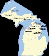
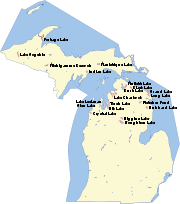
KentuckyKentuckyThe Commonwealth of Kentucky is a state located in the East Central United States of America. As classified by the United States Census Bureau, Kentucky is a Southern state, more specifically in the East South Central region. Kentucky is one of four U.S. states constituted as a commonwealth...
Kentucky LakeLake Barkley
Nolin Lake
Cumberland
Buckhorn
Green River Lake
Laurel Lake
Cave Run Lake
Williamstown Lake
Dale Hollow Lake
Barren River Lake
Beaver Lake\
Cedar Creek Lake
Herrington Lake
Kincaid Lake
Rough River Lake
Shelby Lake
Taylorsville Lake
LouisianaLouisianaLouisiana is a state located in the southern region of the United States of America. Its capital is Baton Rouge and largest city is New Orleans. Louisiana is the only state in the U.S. with political subdivisions termed parishes, which are local governments equivalent to counties...
- Bayou D'Arbonne Lake
- Caddo LakeCaddo LakeCaddo Lake is a lake and wetland located on the border between Texas and Louisiana, in northern Harrison County and southern Marion County in Texas and western Caddo Parish in Louisiana. The lake is named after the Southeastern culture of Native Americans called Caddoans or Caddo, who lived in...
(extends into TexasTexasTexas is the second largest U.S. state by both area and population, and the largest state by area in the contiguous United States.The name, based on the Caddo word "Tejas" meaning "friends" or "allies", was applied by the Spanish to the Caddo themselves and to the region of their settlement in...
) - Calcasieu LakeCalcasieu LakeCalcasieu Lake is a brackish lake located in southwest Louisiana, United States, located mostly within Cameron Parish. The lake is paralleled on its west shore by Louisiana Highway 27 and is located about 17 miles south of Lake Charles, Louisiana....
- Catahoula LakeCatahoula LakeCatahoula Lake is a large freshwater lake located in La Salle Parish and Rapides Parish of central Louisiana, United States.Catahoula Lake is the largest natural freshwater lake in the state covering just over . It is owned by the State of Louisiana and managed by the U.S. Army Corps of Engineers,...
- Clear Lake
- Cocodrie Lake
- Cross Lake
- Cypress LakeCypress Lake (Lafayette, Louisiana)Cypress Lake is a swamp-like lake in the heart of the University of Louisiana at Lafayette campus that started as a buffalo wallow. Today it is a unique university landmark that is a habitat for native irises, alligators, turtles, birds and fish, as well as a hangout for students and a point of...
- False RiverFalse River (Louisiana)False River is an oxbow lake located in southeastern Pointe Coupee Parish, Louisiana centered at This lake was once the main channel of the Mississippi River in this area...
(oxbow lakeOxbow lakeAn oxbow lake is a U-shaped body of water formed when a wide meander from the main stem of a river is cut off to create a lake. This landform is called an oxbow lake for the distinctive curved shape, named after part of a yoke for oxen. In Australia, an oxbow lake is called a billabong, derived...
) - Grand LakeGrand Lake (Louisiana)Grand Lake is a freshwater lake located in Cameron Parish, Louisiana....
- Lac des AllemandsLac des allemandsLac des Allemands is a lake located mostly in St. John the Baptist Parish and partly in Lafourche and St. Charles Parishes. It is west of New Orleans and is connected to Lake Salvador by the Bayou des Allemands...
- Lake BistineauLake Bistineau250px|right|thumb|Lake Bistineau south of [[Doyline, Louisiana|Doyline]], [[Louisiana]]Lake Bistineau is a long, narrow waterway of , wide and long located in Webster, Bossier, and Bienville parishes in northwestern Louisiana. The lake is fed by Dorcheat Bayou, Clark’s Bayou, and other smaller...
- Lake ClaiborneLake ClaiborneLake Claiborne is a reservoir located near the town of Homer, Louisiana. Isolated in a rural area, it is a popular man-made fishing area that has a combined estimated area of . Lake Claiborne State Park, a Louisiana state maintained camping and recreation area, lies on southern shore of the lake....
- Lake MaurepasLake MaurepasLake Maurepas is located in southeastern Louisiana approximately halfway between New Orleans and Baton Rouge directly west of Lake Pontchartrain.-Namesake:...
- Lake PeigneurLake PeigneurLake Peigneur is located in the U.S. State of Louisiana north of Delcambre and west of New Iberia, near the northernmost tip of Vermilion Bay.-History:...
- Lake PontchartrainLake PontchartrainLake Pontchartrain is a brackish estuary located in southeastern Louisiana. It is the second-largest inland saltwater body of water in the United States, after the Great Salt Lake in Utah, and the largest lake in Louisiana. As an estuary, Pontchartrain is not a true lake.It covers an area of with...
- Lake SalvadorLake SalvadorLake Salvadoris a lake located southwest of New Orleans, Louisiana in Jefferson, Lafourche and St. Charles parishes.Lake Salvador is connected to Lac des Allemands to the west by Bayou Des Allemands and Lake Catouatchie to the north by Bayou Couba and Bayou Bardeaux....
- Lake Verret
- Old RiverOld River (Louisiana)Old River, or Raccourci Old River, is a long ox-bow lake located in northern Pointe Coupee Parish and western West Feliciana Parish in Louisiana, USA. It encompassess approximately ....
(oxbow lake) - Sabine LakeSabine Lake200px | thumb | Sabine lake as seen from outer space.Sabine Lake is a salt water estuary on the Texas-Louisiana border. The lake, some long and wide, is formed by the confluence of the Neches River and Sabine River. Through its tidal outlet long, Sabine Pass, Sabine Lake drains some of Texas...
(extends into TexasTexasTexas is the second largest U.S. state by both area and population, and the largest state by area in the contiguous United States.The name, based on the Caddo word "Tejas" meaning "friends" or "allies", was applied by the Spanish to the Caddo themselves and to the region of their settlement in...
) - Saline Lake
- Six Mile Lake
- White Lake
MaineMaineMaine is a state in the New England region of the northeastern United States, bordered by the Atlantic Ocean to the east and south, New Hampshire to the west, and the Canadian provinces of Quebec to the northwest and New Brunswick to the northeast. Maine is both the northernmost and easternmost...
- Chesuncook LakeChesuncook LakeChesuncook Lake is a reservoir in Piscataquis County, Maine, formed by the damming of the western branch of the Penobscot River in 1903 and 1916. It is approximately long and 1–4 miles wide, with a surface area of and a maximum depth of . It is the third-largest body of fresh water in Maine.In...
- Chiputneticook LakesChiputneticook LakesThe Chipnuneticook Lakes are a group of several lakes along the International Boundary between Maine and New Brunswick.They are East Grand Lake, North Lake, Mud Lake, Spednic Lake, and Palfrey Lake.This lake system forms the head waters of the St...
- East Grand LakeEast Grand LakeEast Grand Lake is located between the U.S. state of Maine and the Canadian province of New Brunswick. The boundary between the United States and Canada passes through the lake...
- Flagstaff LakeFlagstaff Lake (Maine)Flagstaff Lake is located in Somerset County and Franklin County, Maine in the United States. The North Branch Dead River and South Branch Dead River join in the lake, forming the Dead River....
- Graham LakeGraham Lake (Maine)Graham Lake in Hancock County, Maine is a eutrophic reservoir formed by the construction of a hydro-electric power dam in 1922 four miles upstream from Ellsworth, Maine. The first dam was a hastily built earthen dam built by the Bangor Hydro Electric Company. It failed in 1923, flooding downtown...
- Great East LakeGreat East LakeGreat East Lake is an water body located in Carroll County and York County in the United States. The lake is shared by the towns of Wakefield and Acton . The lake is the headwaters of the Salmon Falls River, a tributary of the Piscataqua River.The widest part of the lake is in New Hampshire...
(extends into New HampshireNew HampshireNew Hampshire is a state in the New England region of the northeastern United States of America. The state was named after the southern English county of Hampshire. It is bordered by Massachusetts to the south, Vermont to the west, Maine and the Atlantic Ocean to the east, and the Canadian...
) - Great PondGreat PondThe largest great pond in Maine named Great Pond is located in Kennebec County and is part of the Kennebec River watershed. There are several other, smaller ponds named Great Pond in Maine and New England. Great Pond is among the largest waterbodies in the world named "pond".Great Pond receives...
- Jordan PondJordan PondJordan Pond is an oligotrophic tarn in Acadia National Park near the town of Bar Harbor, Maine. It covers , with a maximum depth of and a shoreline of ....
- Long LakeLong Lake (Maine)Long Lake is an eleven mile lake between the towns of Naples, Maine, Bridgton, Maine and Harrison, Maine. It is connected to Brandy Pond through the Chute River. Long Lake was created by receding glaciers, and has many coves and rocks....
- Moosehead LakeMoosehead LakeMoosehead Lake is the largest lake in the U.S. state of Maine and the largest mountain lake in the eastern United States. Situated in the Longfellow Mountains in the Maine Highlands Region, the lake is the source of the Kennebec River. Towns that border the lake include Greenville to the south and...
(largest lake in Maine) - Mooselookmeguntic LakeMooselookmeguntic LakeMooselookmeguntic Lake is located in Franklin County and Oxford County, Maine, in the United States. It is part of the Androscoggin River watershed....
- Pemadumcook Chain of LakesPemadumcook Chain of LakesThe Pemadumcook Chain of Lakes are a set of large lakes in north-central Maine in the United States.- Name:Thoreau's Pamadumcook or Joseph Chadwick's Bennedumcook is rendered by the United States Geographical Board in an 1897 decision as "Pemadumcook Lake".-Geography:The Pemadumcook chain of lakes...
- Rangeley LakeRangeley LakeRangeley Lake is located in Franklin County, Maine in the United States. It is fed by several streams. Its waters flow out from the lake's northwestern end into the short Rangeley River, then into Mooselookmeguntic Lake, and ultimately into the Androscoggin River, Merrymeeting Bay, the lower...
- Sebago LakeSebago LakeSebago Lake is the deepest and second largest lake in the U.S. state of Maine. The lake is deep at its deepest point, with a mean depth of , covers about in surface area, has a length of and a shoreline length of . The surface is around above sea level, so the deep bottom is below the present...
- South Twin LakeSouth Twin Lake (Maine)South Twin Lake having about is wholly within Penobscot County, Maine. It is about west of Millinocket, Maine and is part of the Pemadumcook Chain of Lakes. The lake is centered at and has spillway elevation above sea level...
- Spednic LakeSpednic LakeSpednic Lake is a mesotrophic lake in the Chiputneticook Lakes chain along the Canada – United States border between the state of Maine and the province of New Brunswick that is best known for its bass fishing. Sometimes it is viewed as the headwaters of the St...
- Umbagog Lake (extends into New Hampshire)
MarylandMarylandMaryland is a U.S. state located in the Mid Atlantic region of the United States, bordering Virginia, West Virginia, and the District of Columbia to its south and west; Pennsylvania to its north; and Delaware to its east...
- Conowingo ReservoirConowingo DamThe Conowingo Dam is a large hydroelectric dam in the Lower Susquehanna River. The dam, one of the largest non-federal hydroelectric dams in the US, is classified as a medium height, masonry gravity type dam...
- Deep Creek LakeDeep Creek LakeDeep Creek Lake is the largest inland body of water in the state of Maryland. It covers approximately and has of shoreline. Like all lakes in Maryland, it is man-made. The lake is home to a wide variety of freshwater fish and aquatic birds. The Wisp ski resort is located nearby...
(largest lake in Maryland) - Lake HabeebLake HabeebLake Habeeb is a reservoir of and is located in Allegany County, Maryland, United States. The lake is fed by Rocky Gap Run, and nestled against the east side of the southern tip of Evitts Mountain. Created in 1969 and made accessible to the public in 1974, it attains a maximum depth of near its...
(Rocky Gap Lake) - Liberty ReservoirLiberty ReservoirThe Liberty Reservoir is a reservoir in the suburbs of Baltimore, Maryland. It is owned by the City of Baltimore Department of Public Works, but is located outside of the city, and it divides Baltimore and Carroll Counties.-History:...
- Loch Raven ReservoirLoch Raven ReservoirThe Loch Raven Reservoir is a reservoir that provides drinking water for the City of Baltimore and most of Baltimore County, Maryland. Originally built in 1881 as a dam and water tunnel to channel water to Lake Montebello and Lake Clifton, the new dam was constructed in 1914 in efforts to increase...
- Prettyboy ReservoirPrettyboy ReservoirPrettyboy Reservoir occupies 206.5 sq/km of northern Baltimore County, Maryland, also known as the Hereford Zone. Even though the reservoir is located in the county, Baltimore City owns the reservoir and the surrounding land. The reservoir is one of three reservoirs created to supply the...
- Youghiogheny River LakeYoughiogheny River LakeThe Youghiogheny River Lake is a flood control reservoir in southwestern Pennsylvania and western Maryland. It was formed in 1944 by the damming of the Youghiogheny River upstream from Confluence, Pennsylvania....
(extends into PennsylvaniaPennsylvaniaThe Commonwealth of Pennsylvania is a U.S. state that is located in the Northeastern and Mid-Atlantic regions of the United States. The state borders Delaware and Maryland to the south, West Virginia to the southwest, Ohio to the west, New York and Ontario, Canada, to the north, and New Jersey to...
)
MassachusettsMassachusettsThe Commonwealth of Massachusetts is a state in the New England region of the northeastern United States of America. It is bordered by Rhode Island and Connecticut to the south, New York to the west, and Vermont and New Hampshire to the north; at its east lies the Atlantic Ocean. As of the 2010...
- Lake chaubunagungamaugLake ChaubunagungamaugLake Chaubunagungamaug, also known as Webster Lake, is a lake in the town of Webster, Massachusetts, United States. It is located near the Connecticut border and has a surface area of .-Name:...
- Lake QuannapowittLake QuannapowittLake Quannapowitt is one of two main lakes in Wakefield, Massachusetts, the other being the manmade Crystal Lake. Lake Quannapowitt is a popular setting for walkers, joggers, bikers, and in-line skaters off Route 128 in Middlesex County. It is the site of many organized races from 5Ks to Ultra...
- Lake QuinsigamondLake QuinsigamondLake Quinsigamond is a body of water situated between the city of Worcester and the town of Shrewsbury in Worcester County, Massachusetts, USA. It is 4 miles long, between 50 and 85 feet deep, and has a surface area of approximately 772 acres . Lake Quinsigamond hosts 8 islands with the...
- Lake RicoLake RicoLake Rico is a freshwater lake within Massasoit State Park in Taunton, Massachusetts. The lake takes up about nearly a quarter of Massasoit State Park. There are many coves, minor islands, and a few major islands located within the lake...
- Lake SabbatiaLake SabbatiaLake Sabbatia is a freshwater lake in Taunton, Massachusetts, near Watson Pond State Park. The lake is where Mill River begins and the Snake River ends. It is the largest lake in the city of Taunton and the most popularly used. There are several coves and an island within the lake. Parts of its...
- Lewis Lake
- Quabbin ReservoirQuabbin ReservoirThe Quabbin Reservoir is the largest inland body of water in the Commonwealth of Massachusetts and was built between 1930 and 1939. Today along with the Wachusett Reservoir, it is the primary water supply for Boston, some to the east, as well as 40 other communities in Greater Boston...
(largest lake in Massachusetts)
MichiganMichiganMichigan is a U.S. state located in the Great Lakes Region of the United States of America. The name Michigan is the French form of the Ojibwa word mishigamaa, meaning "large water" or "large lake"....
- Great Lakes and other non-inland lakes
- Lake ErieLake ErieLake Erie is the fourth largest lake of the five Great Lakes in North America, and the tenth largest globally. It is the southernmost, shallowest, and smallest by volume of the Great Lakes and therefore also has the shortest average water residence time. It is bounded on the north by the...
(extends into OhioOhioOhio is a Midwestern state in the United States. The 34th largest state by area in the U.S.,it is the 7th‑most populous with over 11.5 million residents, containing several major American cities and seven metropolitan areas with populations of 500,000 or more.The state's capital is Columbus...
, PennsylvaniaPennsylvaniaThe Commonwealth of Pennsylvania is a U.S. state that is located in the Northeastern and Mid-Atlantic regions of the United States. The state borders Delaware and Maryland to the south, West Virginia to the southwest, Ohio to the west, New York and Ontario, Canada, to the north, and New Jersey to...
, New YorkNew YorkNew York is a state in the Northeastern region of the United States. It is the nation's third most populous state. New York is bordered by New Jersey and Pennsylvania to the south, and by Connecticut, Massachusetts and Vermont to the east...
, and OntarioOntarioOntario is a province of Canada, located in east-central Canada. It is Canada's most populous province and second largest in total area. It is home to the nation's most populous city, Toronto, and the nation's capital, Ottawa....
) - Lake HuronLake HuronLake Huron is one of the five Great Lakes of North America. Hydrologically, it comprises the larger portion of Lake Michigan-Huron. It is bounded on the east by the Canadian province of Ontario and on the west by the state of Michigan in the United States...
(extends into OntarioOntarioOntario is a province of Canada, located in east-central Canada. It is Canada's most populous province and second largest in total area. It is home to the nation's most populous city, Toronto, and the nation's capital, Ottawa....
) - Lake MichiganLake MichiganLake Michigan is one of the five Great Lakes of North America and the only one located entirely within the United States. It is the second largest of the Great Lakes by volume and the third largest by surface area, after Lake Superior and Lake Huron...
(extends into IllinoisIllinoisIllinois is the fifth-most populous state of the United States of America, and is often noted for being a microcosm of the entire country. With Chicago in the northeast, small industrial cities and great agricultural productivity in central and northern Illinois, and natural resources like coal,...
, IndianaIndianaIndiana is a US state, admitted to the United States as the 19th on December 11, 1816. It is located in the Midwestern United States and Great Lakes Region. With 6,483,802 residents, the state is ranked 15th in population and 16th in population density. Indiana is ranked 38th in land area and is...
, and WisconsinWisconsinWisconsin is a U.S. state located in the north-central United States and is part of the Midwest. It is bordered by Minnesota to the west, Iowa to the southwest, Illinois to the south, Lake Michigan to the east, Michigan to the northeast, and Lake Superior to the north. Wisconsin's capital is...
) - Lake St. ClairLake Saint Clair (North America)Lake St. Clair is a fresh-water lake named after Clare of Assisi that lies between the Province of Ontario and the State of Michigan, and its midline also forms the boundary between Canada and the United States of America. Lake St. Clair includes the Anchor Bay along the Metro Detroit coastline...
(extends into OntarioOntarioOntario is a province of Canada, located in east-central Canada. It is Canada's most populous province and second largest in total area. It is home to the nation's most populous city, Toronto, and the nation's capital, Ottawa....
) - Lake SuperiorLake SuperiorLake Superior is the largest of the five traditionally-demarcated Great Lakes of North America. It is bounded to the north by the Canadian province of Ontario and the U.S. state of Minnesota, and to the south by the U.S. states of Wisconsin and Michigan. It is the largest freshwater lake in the...
(extends into WisconsinWisconsinWisconsin is a U.S. state located in the north-central United States and is part of the Midwest. It is bordered by Minnesota to the west, Iowa to the southwest, Illinois to the south, Lake Michigan to the east, Michigan to the northeast, and Lake Superior to the north. Wisconsin's capital is...
, MinnesotaMinnesotaMinnesota is a U.S. state located in the Midwestern United States. The twelfth largest state of the U.S., it is the twenty-first most populous, with 5.3 million residents. Minnesota was carved out of the eastern half of the Minnesota Territory and admitted to the Union as the thirty-second state...
, and OntarioOntarioOntario is a province of Canada, located in east-central Canada. It is Canada's most populous province and second largest in total area. It is home to the nation's most populous city, Toronto, and the nation's capital, Ottawa....
)
- Lake Erie
- Inland lakes
- Alcona Dam Pond
- Au Train Lake
- Austin LakeAustin Lake (Kalamazoo County, Michigan)Austin Lake is a lake located in Kalamazoo County in the U.S. state of Michigan.It is approximately 2.2 miles long at its greatest length. It has an average depth of about 5 feet , with a maximum depth of just over 11 feet . A boat launch is provided with a $6 daily fee. All watercraft are...
- Bankson LakeBankson LakeBankson Lake is a all-sports lake located in Van Buren County, just south of Lawton, Michigan. The lake is unique in that it has rather undeveloped shores and is home to two large camps - the and the Girl Scouts...
- Bear LakeBear Lake (Michigan)Bear Lake is a small, freshwater lake in Kalkaska County, Michigan, USA. The lake has enhanced clarity due to springs that feed into it. Numerous "Tiki Bars" dot the shoreline, placed there by the surrounding homeowners. The lake has a public sandy beach....
- Belleville LakeBelleville Lake (Wayne County, Michigan)Belleville Lake is a lake located in Wayne County in the U.S. state of Michigan....
- Betsy LakeBetsy Lake (Luce County, Michigan)Betsy Lake is a lake located in Luce County in the U.S. state of Michigan....
- Big Lake
- Black LakeBlack Lake (Michigan)Black Lake is located in Cheboygan and Presque Isle counties in Northern Michigan. With a surface area of 10,130 acres , it is the seventh largest inland lake in Michigan. The largest body of water in the Black River watershed, it drains through the Lower Black and Cheboygan Rivers into Lake Huron...
- Blue LakeBlue Lake (Michigan)Blue Lake is a lake with a marshy shoreline that is located in southern Alger County, Michigan in the middle of the Hiawatha National Forest. It is located about a mile north of the intersection of Federal Forest Highway 13 and Delta County Road 440 and just north of the county line with Delta...
- Bodi Lake
- Brevoort Lake
- Brule LakeBrule LakeBrule Lake forms part of the border between the States of Michigan and Wisconsin and is the headwater of the Brule River at .The source of the name is the Ojibwa name for the river, "Wisakota", meaning burned or burnt, which the French Voyaguers translated as Brulé....
(extends into Wisconsin) - Budd LakeBudd Lake (Michigan)Budd Lake is a lake in Clare County, in the central region of Michigan's lower peninsula. Wilson State Park borders the lake to the northwest.A popular lake for anglers seeking muskies, it offers two boat ramps....
- Burgess Lake
- Burt LakeBurt LakeBurt Lake is a 17,120 acre lake in Cheboygan County in the U.S. state of Michigan. The western shore of the lake is on the boundary with Emmet County...
- Cass LakeCass Lake (Michigan)Cass Lake is the largest lake in Oakland County, Michigan. It covers 1,280 acres and has a maximum depth of 123 ft . It is bordered by the cities, villages, and townships of Waterford Township, West Bloomfield Township, Orchard Lake Village, and Keego Harbor.Dodge #4 State Park is located on the...
- Cedar Lake
- Chicagon Lake
- Clark LakeClark Lake (Gogebic County, Michigan)Clark Lake is a lake located in Gogebic County in the U.S. state of Michigan. Clark Lake is one of about two dozen clear, clean lakes located in the Sylvania Wilderness of Ottawa National Forest a few miles to the west of the town of Watersmeet. The shoreline is undeveloped except for a picnic...
- Clear Lake
- Coldwater LakeColdwater Lake State ParkColdwater Lake State Park is a state park in Branch County, Michigan, United States. The undeveloped site offers walk-in access for hunters and fishermen.- Facilities and activities :*Hunting...
- Cooke Dam Pond
- Corey LakeCorey LakeCorey Lake is a small, inland lake in south western Michigan. It is located just outside Three Rivers, and is the home to Camp Eberhart and Camp Wakeshma. There is also the Corey Lake Marina and Happy Landing, a small restaurant....
- Corpse PondCorpse PondCorpse Pond is a small lake in Ontonagon County, Michigan, located at .-External links:* fishingworks.com**...
- Cowden LakeCowden LakeCowden Lake is a 111 acre public lake located in Montcalm County, Michigan, east of the town of Coral. Residents with homes on Cowden Lake represent a mix of permanent residents and Michigan summer vacationers...
- Craig LakeCraig Lake State ParkCraig Lake State Park is a remote state park in the state of Michigan. Located in Baraga County on Michigan's Upper Peninsula, this tract of wilderness was at one time owned by the Miller Brewing family. By the late 1960s, it was acquired by the state of Michigan.The land contains several lakes...
- Crooked Lake
- Croton Dam Pond
- Crystal Lake
- Deer Island Lake
- Devils Lake
- Diamond Lake
- Douglas Lake
- Duck Lake
- Elk LakeElk Lake (Michigan)Elk Lake is located in Antrim and Grand Traverse counties in Northern Michigan. The lake is about a mile and a half wide and nine miles long, and is centered at near the town of Elk Rapids. It has maximum depth of , making it Michigan's second deepest after Torch Lake...
- Fletcher PondFletcher PondFletcher Pond is a man-made body of water located in Northeast lower Michigan. The pond covers over of land that was previously cedar forest...
- Fonda Lake
- Foote Dam Pond
- Ford Lake
- Glen LakeGlen LakeGlen Lake is a lake located in Leelanau County in the U.S. state of Michigan, near Lake Michigan. Several villages and hamlets lie along or near its shore, including Burdickville, Glen Arbor, and Glen Haven...
- Goguac LakeGoguac LakeGoguac Lake is a lake in the city of Battle Creek, located in Calhoun County in the southwest portion of the U.S. state of Michigan. With a maximum depth of , the lake is home to many fish species, including Crappie, Bluegill, Pike, Largemouth Bass, Yellow Perch, Rock Bass and Walleye.While the...
- Goshorn Lake
- Grand Lake
- Gravel LakeGravel Lake (Michigan)Gravel Lake is a freshwater lake in the southeast corner of Porter Township near the southern boundary of Van Buren County in the U.S. state of Michigan. The lake is located between Lawton and Marcellus...
- Green Lake
- Greenwood Reservoir
- Gull Lake
- Gun LakeGun Lake (Michigan)Gun Lake is a lake in the U.S. state of Michigan, located mostly in Barry County with the southwestern tip extending into Allegan County. Along most of the lake are numerous summer homes, cottages, and permanent residences. The Yankee Springs Recreation Area is based on northeastern portions of the...
- Guthree Lake
- Hamlin Lake
- Hardy Dam Pond
- Heart LakeHeart Lake (Michigan)Heart Lake, Michigan is located in Otsego County in northern Michigan, about south of Gaylord, just west of Interstate 75.Heart Lake is so named due to its irregular shape of a valentine heart....
- Hess Lake
- Higgins LakeHiggins LakeHiggins Lake is a large recreational and fishing lake in Roscommon County, in the U.S. state of Michigan. The 9,900 acre lake is known for its deep, clear waters and is the 10th largest in Michigan with a shoreline of . It is named after Sylvester Higgins, Michigan's first chief of the...
- Hodenpyl Dam Pond
- Holloway Reservoir
- Horsehead Lake
- Houghton LakeHoughton Lake (Michigan)Houghton Lake is a large lake in Roscommon County. The unincorporated community of Prudenville is at the southeastern end of the lake, while the unincorporated communities of Houghton Lake and Houghton Lake Heights are on the southwest and west shores...
(at 20044 acres (81.1 km²), largest inland lake, by surface area, in Michigan) - Hubbard LakeHubbard Lake (Michigan)Hubbard Lake is a lake in Alcona County in Northern Michigan. The lake covers 8,850 acres and is seven miles long and two miles wide. It has a maximum depth of 85 feet with an average depth of 32.6 feet...
- Hugaboom LakeHugaboom LakeHugaboom Lake is a lake that is located in northern Delta County, Michigan in the Hiawatha National Forest. It is just south of the county line with Alger and Schoolcraft countries and about a mile and half east of the intersection of Federal Forest Highway 13 and Delta county road 440...
- Indian Lake
- Intermediate Lake
- Intermediate Lake
- Ironjaw LakeIronjaw LakeIronjaw Lake is a lake that is located in south-western Schoolcraft County, Michigan in the Hiawatha National Forest. It is just east of the county line with Alger and just north of the county line with Delta County. Other nearby lakes include Hugaboom Lake, Mowe Lake, Blue Lake, Corner-Straits...
- Kent Lake
- Klinger Lake
- Lac La BelleLac La Belle, MichiganLac La Belle , is the name given to both a lake and a small unincorporated community in Keweenaw County in the U.S. state of Michigan. The town was originally the site of a stamping plant for the copper mines of the Keweenaw, specifically the Mendota Mine and the Delaware Mine...
- Lac Vieux DesertLac Vieux DesertLac Vieux Desert is a lake in the United States divided between Gogebic County, Michigan, and Vilas County, Wisconsin. Fed primarily by springs in the surrounding swamps, it is the source of the Wisconsin River, which flows out of its southwest corner...
(extends into WisconsinWisconsinWisconsin is a U.S. state located in the north-central United States and is part of the Midwest. It is bordered by Minnesota to the west, Iowa to the southwest, Illinois to the south, Lake Michigan to the east, Michigan to the northeast, and Lake Superior to the north. Wisconsin's capital is...
) - Lake Bella VistaLake Bella Vista (Michigan)Lake Bella Vista is in northwest Cannon Township, Kent County in the U.S. state of Michigan. The lake was originally known as "Grass Lake" and once lay in the center of a marsh surrounded by pastureland as well as apple and cherry orchards. Grass Lake was one of the so-called "triplet lakes" lying...
- Lake Bellaire
- Lake CadillacLake CadillacLake Cadillac is a lake located within the city of Cadillac, Michigan. It is part of the Muskegon River watershed.-Natural features:Lake Cadillac is fed by two inlets: a small river flowing from Lake Mitchell and a short canal of the same origin. There is one outlet, the Clam River.In 2005,...
- Lake CharlevoixLake CharlevoixLake Charlevoix is a lake in Charlevoix County in the U.S. state of Michigan. It is the third largest lake in the state with a surface area of over 17,200 acres and 56 miles of shoreline...
- Lake ColumbiaLake ColumbiaLake Columbia is a small man-made lake in Columbia Township in southern Jackson County in the U.S. state of Michigan. Originally formed as a mill pond in 1836, it was expanded to in 1961. At its greatest extent, the lake is 2 and 1/4 miles long and 1 and 3/4 miles wide. It has approximately of...
- Lake Crapo
- Lake Desor (located on Isle RoyaleIsle RoyaleIsle Royale is an island of the Great Lakes, located in the northwest of Lake Superior, and part of the state of Michigan. The island and the 450 surrounding smaller islands and waters make up Isle Royale National Park....
) - Lake FiveLake Five (Michigan)Lake Five is a private fresh water lake in Kalkaska County, Michigan, United States.Lake Five has abundant water fauna including Largemouth Bass, Bluegill, Perch, Painted Turtle,...
- Lake GogebicLake GogebicLake Gogebic is the largest lake of the Upper Peninsula of Michigan. It is located within the 1 million acre Ottawa National Forest. Lake Gogebic State Park is located along its western shore....
- Lake Gratiot
- Lake IndependenceLake IndependenceLake Independence is located in Marquette County in the Upper Peninsula of the U.S. state of Michigan. The lake is fed primarily by the Yellow Dog River. The lake is naturally occurring, but its level has been stabilized and raised slightly to 625 feet above mean sea level by a dam...
- Lake LansingLake LansingLake Lansing is a lake in Haslett, Michigan just a few miles northeast of the state's capital city of Lansing.-Overview:Lake Lansing was originally known as Pine Lake, and was a highly popular recreation site in the early 1900s. The name was changed to Lake Lansing in 1927...
- Lake LeelanauLake LeelanauLake Leelanau lies in the Leelanau Peninsula of the U.S. state of Michigan. The entire lake -- which includes two bodies of water, usually referred to as North Lake Leelanau and South Lake Leelanau -- covers about and lies within Leelanau County...
- Lake MacatawaLake MacatawaLake Macatawa is a lake in Ottawa County in the U.S. state of Michigan. The lake is about long with a maximum width of and a surface area of 1,700 acres The average depth of the lake is variable but generally less than , excluding a navigation channel of fixed depth that crosses the lake to...
- Lake MargretheLake MargretheLake Margrethe is near Grayling in Crawford County, Michigan. Its area is .It was formerly known as Portage Lake, before the name change....
- Lake MichigammeLake MichigammeLake Michigamme, one of Michigan's largest lakes, reaches a depth of over .. It covers in Marquette and Baraga County, Michigan. Van Riper State Park provides public access. The vast majority of the lake lies in Marquette County, with only its westernmost part extending into Baraga County.The...
- Lake Missaukee
- Lake MitchellLake Mitchell (Michigan)Lake Mitchell is one of two lakes in Cadillac, Michigan that are joined together by the Clam Lake Canal. The other lake is Lake Cadillac.Mitchell State Park is located on Lake Mitchell....
- Lake NineteenLake NineteenLake Nineteen also known as Nineteen Lake, is a lake that is located in south-western Schoolcraft County, Michigan in the Hiawatha National Forest. It is east of the county line with Alger and north of the county line with Delta County. Nearby lakes include Hugaboom Lake, Mowe Lake, Blue Lake,...
- Lake of the Clouds
- Lake OvidLake OvidLake Ovid is a reservoir located within Sleepy Hollow State Park, Michigan, which was created in 1974 when a dam was built to block the Little Maple River. Lake Ovid is a shallow lake with an average depth of ten feet...
- Lake Paradise
- Lake SkegemogLake SkegemogLake Skegemog is a Northern Michigan lake located on the border of three counties, Antrim County, Michigan, Grand Traverse County, Michigan, and Kalkaska County, Michigan, with a surface area of . The Lake is attached to Elk Lake and is considered to be part of the Northwest Michigan Chain O'Lakes...
- Lake St. HelenLake St. HelenLake St. Helen is a public lake located in Roscommon County in the U.S. state of Michigan, and borders on the community of St. Helen, Michigan...
- Lake Thirteen
- Lake Winyah
- Lamberton LakeLamberton LakeLamberton Lake is located in Kent county in Western Michigan. The lake is approximately long and wide and is centered at just within the city limits in northeast Grand Rapids. The surface elevation is , and most of the lake is less than deep....
- Long Lake (Alpena County)Long Lake (Alpena County, Michigan)Long Lake is lake in the U.S. state of Michigan. The lake is on the boundary between Alpena County to the south and Presque Isle County to the north near Lake Huron in Northern Michigan....
- Long Lake (Grand Traverse County)
- Loon LakeLoon Lake (Gogebic County, Michigan)Loon Lake is a lake located in Gogebic County in the U.S. state of Michigan. Loon Lake is one of about two dozen clear, clean lakes located in a special wilderness area known as the Sylvania Wilderness, which in turn is located within the Ottawa National Forest a few miles to the west of the town...
- Magician Lake
- Mandon LakeMandon LakeMandon Lake is a lake located in White Lake Township of Oakland County in the U.S. state of Michigan. The geographic coordinates are The lake is affectionately known as the "Mighty Mandon", because despite its small size all sports are permitted....
- Manistique Lake
- Martiny Lake
- McDonald Lake
- Milakokia Lake
- Millecoquins Lake
- Michigamme Reservoir
- Mona ReservoirMona ReservoirMona Reservoir is a large reservoir on Currant Creek in the north end of Juab Valley, Juab County, Utah. It was created in 1895 by the construction of an earthen dam....
- Morrow Lake
- Moss Lake
- Mott Lake
- Mowe LakeMowe LakeMowe Lake is a lake that is located in northern Delta County, Michigan in the Hiawatha National Forest. It is just south of the county line with Alger and Schoolcraft countries and about a half mile north of trail 2225 on trail 2692 passed the small ponds. There are primitive campsites and a...
- Mud Lake (several)
- Mullett LakeMullett LakeMullett Lake is a lake in Cheboygan County in the U.S. state of Michigan. The lake is named after John Mullett, who, together with William A. Burt, made a federal survey of the area from 1840 to 1843. A neighboring lake was named after Burt. Historically, Mullett Lake has been recorded as Mullet...
- Murphy Lake (Berrien County)Murphy Lake (Berrien County, Michigan)Murphy Lake is a lake in Berrien County, Michigan, United States. Murphy Lake lies at an elevation of 735 feet ....
- Murphy Lake (Iron County)Murphy Lake (Iron County, Michigan)Murphy Lake is a lake in Iron County, Michigan, United States.Murphy Lake lies at an elevation of 1581 feet ....
- Murphy Lake (Newaygo County)Murphy Lake (Newaygo County, Michigan)Murphy Lake is a lake in Denver Township in Newaygo County, Michigan, United States. Murphy Lake lies at an elevation of 787 feet ....
- Murphy Lake (Schoolcraft County)Murphy Lake (Schoolcraft County, Michigan)Murphy Lake is a lake in Schoolcraft County, Michigan, United States. Murphy Lake lies at an elevation of 679 feet ....
- Murphy Lake (Tuscola County)Murphy Lake (Tuscola County, Michigan)Murphy Lake is a lake in Tuscola County, Michigan, United States. Murphy Lake lies at an elevation of 748 feet ....
- Murray LakeMurray Lake (Michigan)Murray Lake is a naturally formed lake about 9 miles away from the town of Lowell, Michigan. Murray Lake is the third largest lake in Kent County, lying in the northwest corner of the county officially in Grattan Township.-History:...
- Muskallonge LakeMuskallonge Lake State ParkMuskallonge Lake State Park is a state park in Michigan. It is located northwest of Newberry in Luce County. The park is situated between the shores of Lake Superior and Muskallonge Lake; the area is well known for its forests, lakes and streams....
- Muskegon LakeMuskegon LakeMuskegon Lake is a fresh-water lake in Muskegon County, Michigan, USA. Located in the lower peninsula at the mouth of the Muskegon River, Muskegon Lake forms a broad harbor along the eastern shoreline of Lake Michigan, approximately wide by long....
- North Manistique Lake
- Orchard LakeOrchard LakeOrchard Lake is a medium-sized inland lake, 795 acres . It has a 110 feet maximum depth and is in the city of Orchard Lake Village, Oakland County, in Michigan, USA. It is the second-largest lake in Oakland County after Cass Lake....
- Ostrander LakeOstrander LakeOstrander Lake is located in Yosemite National Park, approximately south of Yosemite Valley and east of the Badger Pass Ski Area, at an elevation of . The lake is a popular destination for cross-country skiers during the winter...
- Otsego LakeOtsego Lake State ParkOtsego Lake State Park is a state park in the U.S. state of Michigan. The park is located on the southeast shore of Lake Otsego in Otsego Lake Township, Otsego County.-Facilities:* Beach House* Boat Launch* Campground - 155 Sites* Picnic Area...
- Otter LakeOtter Lake (Michigan)Otter Lake is the name of several lakes and one village in the U.S. state of Michigan.*The largest Otter Lake is in southeast Portage Township of Houghton County at . The lake is fed by the Otter River and it drains into the Sturgeon River....
- Paw Paw LakePaw Paw LakePaw Paw Lake is a lake in Coloma Township and Watervliet Township in Berrien County, Michigan.-History:Paw Paw Lake was the site of a tourist area in the early 20th Century. An 1894 Chicago newspaper article was the catalyst in making the shore a resort area, and a rail line extension from nearby...
- Peavy Pond
- Perch Lake
- Pickerel Lake
- Pine Lake
- Platte Lake
- Pontiac LakePontiac Lake Recreation AreaPontiac Lake Recreation Area is located in White Lake Township, Oakland County, Michigan, just west of Waterford, Michigan. It is in size.-Facilities:* Campground - 176 Sites, 24 Equestrian sites* Beach House* Boat Launch* Picnic Area...
- Portage Lake (Keweenaw County)
- Portage Lake (Manistee County)
- Reeds LakeReeds LakeReeds Lake is a fresh-water lake in the city of East Grand Rapids, Michigan, United States.A good way to enjoy Reeds Lake is from one of the many benches located along the shoreline at John Collins Park. Named for John A...
- Rennie LakeRennie LakeRennie Lake is an all-sports lake southwest of Traverse City, Michigan....
- Rollway LakeRollway LakeRollway Lake is a lake located in Beaver Township and Denver Township in Newaygo County, Michigan. Rollway Lake lies at an elevation of 787 feet ....
- Round Lake (Delta County)Round Lake (Michigan)Round Lake is a lake that is located mostly in Delta County, Michigan with a little portion in Alger county in the Hiawatha National Forest. Other nearby lakes include Lake Stella, Stoner Lake, West Branch Lake, Hugaboom Lake, Blue Lake, Ironjaw Lake, Ostrander Lake, Corner-Straits Chain and...
- Round Lake (Lenawae County)
- Sanford Lake
- Silver Lake (Marquette County)
- Silver Lake (Oceana County)Silver Lake State Park (Michigan)Silver Lake State Park is a state park in Michigan, located on Lake Michigan near Mears.It is composed of mature forest land and over of sand dunes. The park is wide and long and is divided into three segments: The northern area is an all-terrain vehicle park, and is the only dunes area east of...
- Siskiwit Lake
- South Manistique Lake
- Starvation LakeStarvation LakeStarvation Lake is a small recreational and fishing lake in Kalkaska County, in the U.S. state of Michigan. The lake is approximately long and has a maximum depth of . The lake is fed primarily from submerged springs with the remainder from direct rainfall and runoff.The unusual name has been...
- Tawas Lake
- Thousand Island Lake
- Thumb LakeThumb LakeThumb Lake, also known as Lake Louise, is a kettle lake located in Hudson Township, Charlevoix County, Michigan. The epithet Thumb Lake derives from the lake's bathymetry. An islet protrudes from the lake's west basin...
- Tippy Dam PondTippy DamTippy Dam or Tippy Hydro was built 1918 and is a hydroelectric dam operated by Consumers Energy. The original name of the dam was Junction Hydro, but it was renamed to honor a Consumers board of directors member, Charles W. Tippy...
- Toms LakeToms LakeToms Lake is a lake that is located at the tri-county corner of Delta County, Michigan, Alger and Schoolcraft countries in the Hiawatha National Forest. The forest service offers a rustic cabin for rent. Other nearby lakes include Hugaboom Lake, Blue Lake, Ironjaw Lake, Ostrande Lake,...
- Torch Lake (Antrim County)Torch Lake (Antrim County, Michigan)Torch Lake at long is Michigan's longest inland lake and at approximately 18,770 acres is Michigan's second largest inland lake. National Geographic rated it the third most beautiful lake in the world. An average property on Torch Lake costs approximately two million dollars...
(at 0.78 cu mi (3.3 km³), largest inland lake, by volume, in Michigan; at 315 feet (96 m) deep, deepest inland lake in Michigan) - Torch Lake (Houghton County)Torch Lake (Houghton County, Michigan)Torch Lake is approximately 2,700 acres lying mostly within Torch Lake Township and having portions within Osceola Township and Schoolcraft Township. The lake is fed by the Traprock River....
- Townline LakeTownline LakeTownline Lake is a lake located in Mecosta County near the City of Big Rapids, Michigan. It is located in Colfax Township and Big Rapids Township. It has a maximum depth of . Grass Lake is located in the NW section of Townline Lake and has an outlet which feeds Townline Lake. The outlet from...
- Twin Lake
- Van Etten Lake
- Verdant LakeVerdant LakeVerdant Lake is a lake that is located in south-western Schoolcraft County, Michigan in the Hiawatha National Forest. It is just east of the county line with Alger and just north of the county line with Delta County. Other nearby lakes include Hugaboom Lake, Mowe Lake, Blue Lake, Corner-Straits...
- Wall Lake
- Walloon LakeWalloon LakeWalloon Lake is a glacier-formed lake and the headwater for the Bear River located in Charlevoix and Emmet counties in Northern Michigan. It is now home to many vacation homes and cottages.-History:...
- Walnut Lake
- Weidman MillpondWeidman MillpondWeidman Millpond is a dammed pond in the town of Weidman, Michigan, United States. A small cold water river supplies the pond. The pond has been stocked with yellow perch and largemouth bass. Attempts to introduce northern pike failed, presumably due to the pond's shallow nature. The bass, perch,...
- West Twin Lake
- White LakeWhite Lake (Michigan)- Muskegon County :The largest White Lake is in Muskegon County, Michigan, formed by the White River. The city of Montague, Montague Township and White River Township are on the north side of the lake. The city of Whitehall, Whitehall Township, and Fruitland Township or on the south side of the lake...
- Whitmore Lake
- Wixom Lake
MinnesotaMinnesotaMinnesota is a U.S. state located in the Midwestern United States. The twelfth largest state of the U.S., it is the twenty-first most populous, with 5.3 million residents. Minnesota was carved out of the eastern half of the Minnesota Territory and admitted to the Union as the thirty-second state...
- Great Lakes
- Lake SuperiorLake SuperiorLake Superior is the largest of the five traditionally-demarcated Great Lakes of North America. It is bounded to the north by the Canadian province of Ontario and the U.S. state of Minnesota, and to the south by the U.S. states of Wisconsin and Michigan. It is the largest freshwater lake in the...
(extends into MichiganMichiganMichigan is a U.S. state located in the Great Lakes Region of the United States of America. The name Michigan is the French form of the Ojibwa word mishigamaa, meaning "large water" or "large lake"....
, WisconsinWisconsinWisconsin is a U.S. state located in the north-central United States and is part of the Midwest. It is bordered by Minnesota to the west, Iowa to the southwest, Illinois to the south, Lake Michigan to the east, Michigan to the northeast, and Lake Superior to the north. Wisconsin's capital is...
, and OntarioOntarioOntario is a province of Canada, located in east-central Canada. It is Canada's most populous province and second largest in total area. It is home to the nation's most populous city, Toronto, and the nation's capital, Ottawa....
)
- Lake Superior
- Inland lakes
- Big Stone LakeBig Stone LakeBig Stone Lake is a long, narrow freshwater lake and reservoir forming the border between western Minnesota and northeastern South Dakota in the USA. The lake covers 12,610 acres of surface area, stretching 26 miles from end to end and averaging around 1 mile wide, and at an elevation of 965...
(extends into South DakotaSouth DakotaSouth Dakota is a state located in the Midwestern region of the United States. It is named after the Lakota and Dakota Sioux American Indian tribes. Once a part of Dakota Territory, South Dakota became a state on November 2, 1889. The state has an area of and an estimated population of just over...
) - Cass LakeCass Lake (Minnesota)Cass Lake is a glacially-formed lake in north central Minnesota in the United States. It is approximately long and wide, located in Cass and Beltrami counties, within the Chippewa National Forest and the Leech Lake Indian Reservation, adjacent to its namesake city of Cass Lake...
- Cotton Lake
- Lake BemidjiLake BemidjiLake Bemidji is a small glacially-formed lake, approximately 11 mi² in area, in northern Minnesota in the United States. Located less than 50 mi downstream from the source of the Mississippi River, it both receives and is drained by the Mississippi.-Geography:The lake is located in southern...
- Lake ComoLake Como (Minnesota)Como Lake is a lake up to deep in St. Paul, Minnesota. It, along with the neighboring Como Park, has been a recreation area for residents of the Twin Cities for more than a century. It was named in 1848 by local farmer Charles Perry. A pavilion sits on the west side of the lake, and plays host...
- Lake GeorgeLake George (Anoka County)Lake George is a small lake in Anoka County, Minnesota. Minnesota's Department of Natural Resources tracks the lake by the name George and the identifier 02-0091-00...
- Lake Hubert
- Lake ItascaLake ItascaLake Itasca is a small glacial lake, approximately in area, in the Headwaters area of north central Minnesota. The lake is located in southeastern Clearwater County within Itasca State Park and it has an average depth of 20–35 feet , and is 1,475 ft above sea level.The Ojibwe name for...
(headwaters of the Mississippi RiverMississippi RiverThe Mississippi River is the largest river system in North America. Flowing entirely in the United States, this river rises in western Minnesota and meanders slowly southwards for to the Mississippi River Delta at the Gulf of Mexico. With its many tributaries, the Mississippi's watershed drains...
) - Lake Kabetogama
- Lake MinnetonkaLake MinnetonkaLake Minnetonka is a lake in the U.S. state of Minnesota. Throughout its recorded history, the lake has been a resort destination. It is located west-southwest of Minneapolis-St. Paul. The lake is an irregular shape with numerous bays and islands which make up about of shoreline...
- Lake TraverseLake TraverseLake Traverse is the southernmost body of water in the Hudson Bay watershed of North America. It lies along the border between the U.S. states of Minnesota and South Dakota...
(extends into South DakotaSouth DakotaSouth Dakota is a state located in the Midwestern region of the United States. It is named after the Lakota and Dakota Sioux American Indian tribes. Once a part of Dakota Territory, South Dakota became a state on November 2, 1889. The state has an area of and an estimated population of just over...
) - Lake WinnibigoshishLake WinnibigoshishLake Winnibigoshish is a body of water in north central Minnesota, in the Chippewa National Forest. Its name comes from the Ojibwe language Wiinibiigoozhish...
- Lake of the WoodsLake of the WoodsLake of the Woods is a lake occupying parts of the Canadian provinces of Ontario and Manitoba and the U.S. state of Minnesota. It separates a small land area of Minnesota from the rest of the United States. The Northwest Angle and the town of Angle Township can only be reached from the rest of...
(extends into OntarioOntarioOntario is a province of Canada, located in east-central Canada. It is Canada's most populous province and second largest in total area. It is home to the nation's most populous city, Toronto, and the nation's capital, Ottawa....
and ManitobaManitobaManitoba is a Canadian prairie province with an area of . The province has over 110,000 lakes and has a largely continental climate because of its flat topography. Agriculture, mostly concentrated in the fertile southern and western parts of the province, is vital to the province's economy; other...
) - Leech LakeLeech LakeLeech Lake is a lake located in north central Minnesota, United States. It is southeast of Bemidji, located mainly within the Leech Lake Indian Reservation, and completely within the Chippewa National Forest. It is used as a reservoir...
- Mille Lacs LakeMille Lacs LakeMille Lacs Lake is a lake in the U.S. state of Minnesota. It is located in the counties of Mille Lacs, Aitkin and Crow Wing, roughly 100 miles north of the Minneapolis-St. Paul metropolitan area....
- Mud LakeMud Lake (Minnesota)There are many lakes named Mud Lake in the U.S. state of Minnesota, including:*Mud Lake , Aitkin County, Minnesota.*Mud Lake , Anoka County, Minnesota.*Mud Lake , Anoka County, Minnesota....
(several) - North Long LakeNorth Long LakeAt 6,000 acres , North Long Lake is one of the larger lakes in the Brainerd Lakes Area of the U.S. state of Minnesota.-External links:**...
- Otter Tail LakeOtter Tail LakeOtter Tail Lake is a lake in the west-central part of the U.S. state of Minnesota and is the largest lake in Otter Tail County.- Geography :Adjoining the city of Ottertail, it is a part of the Otter Tail River chain of lakes. Upstream from the lake are Big Pine, Little Pine and Rush lakes, while...
- Portsmouth Mine Pit LakePortsmouth Mine Pit LakePortsmouth Mine Pit Lake, sometimes called the Portsmouth Pit, is the deepest lake in Minnesota at over 450 feet , according to the most recent Minnesota DNR data. The artificial lake is a former iron mining pit in the Cuyuna Range that has since filled with water.The Portsmouth Mine Pit is...
(deepest lake in state) - Rainy LakeRainy LakeRainy Lake is a relatively large freshwater lake that straddles the border between the United States and Canada. The Rainy River issues from the west side of the lake and is harnessed to make hydroelectricity for US and Canadian locations. The U.S...
(extends into OntarioOntarioOntario is a province of Canada, located in east-central Canada. It is Canada's most populous province and second largest in total area. It is home to the nation's most populous city, Toronto, and the nation's capital, Ottawa....
, Canada) - Red LakeRed Lake (Minnesota)Red Lake is a lake in Beltrami County in northern Minnesota, USA. It is the largest natural freshwater lake in Minnesota, and the 16th largest lake in the United States. The lake is separated into two sections by a peninsula on the eastern side that almost bisects it in the middle. The community of...
(largest lake entirely in Minnesota) - Saganaga Lake (deepest natural lake in state at 240 feet)
- Saunders LakeSaunders LakeSaunders Lake is located in the United States state of Minnesota. It is a lake that is west-southwest of Minneapolis-St. Paul in the Minneapolis suburb of Minnetrista....
- Scott Lake
- Big Stone Lake
MississippiMississippiMississippi is a U.S. state located in the Southern United States. Jackson is the state capital and largest city. The name of the state derives from the Mississippi River, which flows along its western boundary, whose name comes from the Ojibwe word misi-ziibi...
- Arkabutla LakeArkabutla LakeArkabutla Lake is a reservoir on the Coldwater River in the U.S. state of Mississippi. It is one of four Flood Damage Reduction reservoirs in northern Mississippi. With an annual visitation exceeding 2 million people, Arkabutla Lake accommodates a wide variety of recreational interest throughout...
- Enid LakeEnid LakeEnid Lake is a lake that is located mostly in Yalobusha County in the U.S. state of Mississippi. Parts of it extend into Panola and Lafayette counties. Common fish species include crappie, largemouth bass, catfish and bream. Enid Lake holds world records for white crappie and shortnose gar...
- Gainsville Lake
- Grenada LakeGrenada LakeGrenada Lake is a reservoir on the Yalobusha River in the U.S. state of Mississippi. It is one of four flood control lakes in North Mississippi constructed by the U.S. Army Corps of Engineers. Grenada Lake was constructed to help control flooding along the Yazoo River Basin...
(largest lake in Mississippi) - Lake Tom Bailey
- Marting Lake
- Ross Barnett ReservoirRoss Barnett ReservoirThe Ross Barnett Reservoir is an impoundment of the Pearl River between Madison and Rankin Counties in the U.S. state of Mississippi. The lake serves as the state's largest drinking water resource, and is managed by the Pearl River Valley Water Supply District. The lake features of shoreline...
- Sardis Lake
MissouriMissouriMissouri is a US state located in the Midwestern United States, bordered by Iowa, Illinois, Kentucky, Tennessee, Arkansas, Oklahoma, Kansas and Nebraska. With a 2010 population of 5,988,927, Missouri is the 18th most populous state in the nation and the fifth most populous in the Midwest. It...
- Bull Shoals LakeBull Shoals LakeBull Shoals Lake is an artificial lake or reservoir in the Ozark Mountains of northern Arkansas and southern Missouri. It has hundreds of miles of lake arms and coves perfect for boating, water sports, swimming, and fishing...
(extends into ArkansasArkansasArkansas is a state located in the southern region of the United States. Its name is an Algonquian name of the Quapaw Indians. Arkansas shares borders with six states , and its eastern border is largely defined by the Mississippi River...
) - Fellows LakeFellows LakeFellows Lake is an source of water for the city of Springfield, Missouri. It is also developing into one of the states premier fishery of Muskellunge...
- Lake of the OzarksLake of the OzarksThe Lake of the Ozarks is a large reservoir created by impounding the Osage River in the northern part of the Ozarks in central Missouri. Extents of three smaller tributaries to the Osage, the Niangua River, Grandglaize Creek, and Gravois Creek, are included in the impoundment...
- Lake Springfield
- Lake TaneycomoLake TaneycomoLake Taneycomo is a man-made lake or reservoir on the White River in the Ozark Mountains of Taney County, Missouri. The reservoir is named for the county in which it is located: Taney County, MO....
- Mark Twain LakeMark Twain LakeMark Twain Lake is located in Ralls County, Missouri and Monroe County, Missouri. It was created by the Clarence Cannon Dam impounding the Salt River and is located about twenty miles southwest of Hannibal. It was named for Missouri author Mark Twain and part of the area around it is Mark Twain...
- McDaniel LakeMcDaniel LakeMcDaniel Lake is a source of water for the city of Springfield, Missouri currently owned and operated by City Utilities of Springfield as their public water source...
- Norfork Lake (extends into ArkansasArkansasArkansas is a state located in the southern region of the United States. Its name is an Algonquian name of the Quapaw Indians. Arkansas shares borders with six states , and its eastern border is largely defined by the Mississippi River...
) - Pomme de Terre LakePomme de Terre LakePomme de Terre Lake is located in southwest Missouri at the confluence of Lindley Creek and the Pomme de Terre River . The lake is located in southern Hickory and northern Polk counties, about north of Springfield...
- Smithville LakeSmithville LakeSmithville Lake is a reservoir on the Little Platte branch of the Platte River near Smithville, Missouri.The lake was built and is administered by the Kansas City office of the United States Army Corps of Engineers...
- Stockton LakeStockton LakeStockton Lake is located in southeastern Cedar County, northeastern Dade County, and southwestern Polk County, Missouri. The lake is 'V' shaped, and covers , with of shoreline....
- Table Rock LakeTable Rock LakeTable Rock Lake is an artificial lake or reservoir in The Ozarks of southwestern Missouri and northwestern Arkansas. It is impounded by Table Rock Dam constructed in 1954-1958 on the White River by the U.S. Army Corps of Engineers. It is one of the tourist draws for the nearby town of Branson,...
(extends into ArkansasArkansasArkansas is a state located in the southern region of the United States. Its name is an Algonquian name of the Quapaw Indians. Arkansas shares borders with six states , and its eastern border is largely defined by the Mississippi River...
) - Truman Reservoir (largest lake in Missouri)
- Weatherby Lake
- Wappapello Lake
MontanaMontanaMontana is a state in the Western United States. The western third of Montana contains numerous mountain ranges. Smaller, "island ranges" are found in the central third of the state, for a total of 77 named ranges of the Rocky Mountains. This geographical fact is reflected in the state's name,...
- Bowman Lake
- Canyon Ferry LakeCanyon Ferry Lakethumb|Canyon Ferry LakeCanyon Ferry Lake is a reservoir on the Missouri River near Helena, Montana and Townsend, Montana. It is Montana's third largest body of water, covering 35,181 acres and 76 miles of shore . The dam was completed in 1954 and has been used for...
- Cosley LakeCosley LakeCosley Lake is located in Glacier National Park, in the U. S. state of Montana. Cosley Lake is northeast of Glenns Lake and between Bear Mountain to the north and Cosley Ridge to the south....
- Flathead LakeFlathead LakeFlathead Lake is the largest natural freshwater lake in the western part of the contiguous United States. With a surface area of between and , it is slightly larger than Lake Tahoe. The lake is a remnant of the ancient inland sea, Lake Missoula of the era of the last interglacial. Flathead Lake...
- Fort Peck LakeFort Peck DamThe Fort Peck Dam is the highest of six major dams along the Missouri River, located in northeast Montana in the United States, near Glasgow, and adjacent to the community of Fort Peck...
(largest lake in Montana) - Hauser Lake
- Hebgen LakeHebgen LakeHebgen Lake is a lake located in Southwest Montana and is created by Hebgen Dam. It is well known for a magnitude 7.5 earthquake which occurred nearby on August 17, 1959, forming Quake Lake which is located immediately downstream.-Recreation:...
- Kintla LakeKintla LakeKintla Lake is a lake in the northwestern portion of Glacier National Park in Montana. The lake is located in a rather remote portion of the park, close to the Canadian border. The lake is a drive from the west entrance along bumpy dirt roads, but the scenery on the way is spectacular...
- Lake Bowdoin
- Lake ElwellLake ElwellLake Elwell is a lake in north central Montana. The reservoir was created by the damming of the Marias River at the Tiber Dam. Lake Elwell was named for Judge Charles B. Ewell , former director of the Montana Reclamation Association....
- Lake McDonaldLake McDonaldLake McDonald is the largest lake in Glacier National Park. It is located at in Flathead County in the U.S. state of Montana. Lake McDonald is approximately 10 miles long, and over a mile wide and 472 feet deep, filling a valley formed by a combination of erosion and glacial activity...
- Lake SherburneLake SherburneLake Sherburne is located in the Many Glacier region of Glacier National Park, in the U. S. state of Montana. The lake is a reservoir, formed by Lake Sherburne Dam, which impounded Swiftcurrent Creek and was constructed in between 1914 and 1921...
- Logging LakeLogging LakeLogging Lake is located in Glacier National Park, in the U. S. state of Montana. Logging Lake is one of the longest lakes in Glacier National Park at in length. The Lower Logging Lake Snowshoe Cabin and Boathouse are two structures located near the southwestern end of Logging Lake, and are on the...
- Medicine Lake, multiple lakes
- Painted Rocks Lake
- Peck Lake
- Seeley Lake
- Saint Mary Lake
- Two Medicine LakeTwo Medicine LakeTwo Medicine Lake is located in Glacier National Park, in the U. S. state of Montana. Two Medicine Lake is approximately long and wide. Sinopah Mountain dominates the western terminus of the lake, while immediately to the north, Rising Wolf Mountain rises over above the lake. Several hiking...
- Waterton LakeWaterton LakeWaterton Lake is a mountain lake in southern Alberta, Canada and northern Montana, USA. The lake is composed of two bodies of water, connected by a shallow channel known locally as the Bosphorus. The two parts are referred to as Lower Wateron Lake, and Upper Waterton Lake, the latter of which is...
(extends into AlbertaAlbertaAlberta is a province of Canada. It had an estimated population of 3.7 million in 2010 making it the most populous of Canada's three prairie provinces...
, CanadaCanadaCanada is a North American country consisting of ten provinces and three territories. Located in the northern part of the continent, it extends from the Atlantic Ocean in the east to the Pacific Ocean in the west, and northward into the Arctic Ocean...
)
NebraskaNebraskaNebraska is a state on the Great Plains of the Midwestern United States. The state's capital is Lincoln and its largest city is Omaha, on the Missouri River....
- Beaver Lake
- Harlan County Lake
- Lake Babcock
- Lake McConaughyLake McConaughyLake McConaughy is a reservoir on the North Platte River. It is located north of Ogallala, Nebraska, United States, near U.S. Highway 26 and Nebraska Highway 61. The reservoir was named for Charles W. McConaughy, a grain merchant and mayor of Holdrege, Nebraska, one of the leading promoters of...
(largest lake in Nebraska) - Lewis and Clark LakeLewis and Clark LakeLewis and Clark Lake is an impoundment on the Missouri River above Gavins Point Dam, near Yankton, South Dakota. It is located on the border of South Dakota and Nebraska. The reservoir is approximately long, with a surface area of 31,000 acres ; it has a maximum depth of . It is the smallest of...
(extends into South DakotaSouth DakotaSouth Dakota is a state located in the Midwestern region of the United States. It is named after the Lakota and Dakota Sioux American Indian tribes. Once a part of Dakota Territory, South Dakota became a state on November 2, 1889. The state has an area of and an estimated population of just over...
) - Minatare Lake
- Lake Zorinsky
- Wehrspann Lake
NevadaNevadaNevada is a state in the western, mountain west, and southwestern regions of the United States. With an area of and a population of about 2.7 million, it is the 7th-largest and 35th-most populous state. Over two-thirds of Nevada's people live in the Las Vegas metropolitan area, which contains its...
- Angel LakeAngel LakeAngel Lake is a glacial tarn in the northern part of the East Humboldt Range, in central Elko County in the northeastern part of the state of Nevada. It is located at approximately , and at an elevation of 8378 feet . It has an area of approximately 13 acres , and a depth of up to 29 feet...
- Humboldt SinkHumboldt SinkHumboldt Sink is an intermittent dry lake bed, approximately 11 mi long, and 4 mi across, in northwestern Nevada in the United States...
- Lake MeadLake MeadLake Mead is the largest reservoir in the United States. It is located on the Colorado River about southeast of Las Vegas, Nevada, in the states of Nevada and Arizona. Formed by water impounded by the Hoover Dam, it extends behind the dam, holding approximately of water.-History:The lake was...
(extends into ArizonaArizonaArizona ; is a state located in the southwestern region of the United States. It is also part of the western United States and the mountain west. The capital and largest city is Phoenix...
) - Lake TahoeLake TahoeLake Tahoe is a large freshwater lake in the Sierra Nevada of the United States. At a surface elevation of , it is located along the border between California and Nevada, west of Carson City. Lake Tahoe is the largest alpine lake in North America. Its depth is , making it the USA's second-deepest...
(extends into CaliforniaCaliforniaCalifornia is a state located on the West Coast of the United States. It is by far the most populous U.S. state, and the third-largest by land area...
) - Pyramid Lake
- Walker LakeWalker Lake (Nevada)Walker Lake is a natural lake, 50.3 mi² in area, in the Great Basin in western Nevada in the United States. It is 18 mi long and 7 mi wide, located in northwestern Mineral County along the eastern side of the Wassuk Range, approximately 75 mi southeast of Reno...
New HampshireNew HampshireNew Hampshire is a state in the New England region of the northeastern United States of America. The state was named after the southern English county of Hampshire. It is bordered by Massachusetts to the south, Vermont to the west, Maine and the Atlantic Ocean to the east, and the Canadian...
- Bow LakeBow Lake (New Hampshire)Bow Lake is a water body located in Strafford and Rockingham counties in eastern New Hampshire, United States, in the towns of Strafford and Northwood. Its outlet is the Isinglass River, flowing east to the Atlantic Ocean via the Cocheco and Piscataqua rivers....
- Comerford ReservoirComerford ReservoirComerford Reservoir is a impoundment located on the Connecticut River on the boundary between Vermont and New Hampshire in the United States. The reservoir is formed by the Frank D...
(extends into VermontVermontVermont is a state in the New England region of the northeastern United States of America. The state ranks 43rd in land area, , and 45th in total area. Its population according to the 2010 census, 630,337, is the second smallest in the country, larger only than Wyoming. It is the only New England...
) - Conway LakeConway LakeConway Lake is a water body located in Carroll County in eastern New Hampshire, in the United States. The lake is located in the towns of Conway and Eaton, just to the east of the White Mountains and is part of the Saco River watershed.-History:...
- First Connecticut LakeFirst Connecticut LakeFirst Connecticut Lake is located in Coos County in northern New Hampshire, in the town of Pittsburg. At , it is the eighth-largest lake located entirely in New Hampshire. It is the lowest of a chain of lakes near the headwaters of the Connecticut River....
- Great East LakeGreat East LakeGreat East Lake is an water body located in Carroll County and York County in the United States. The lake is shared by the towns of Wakefield and Acton . The lake is the headwaters of the Salmon Falls River, a tributary of the Piscataqua River.The widest part of the lake is in New Hampshire...
(extends into MaineMaineMaine is a state in the New England region of the northeastern United States, bordered by the Atlantic Ocean to the east and south, New Hampshire to the west, and the Canadian provinces of Quebec to the northwest and New Brunswick to the northeast. Maine is both the northernmost and easternmost...
) - Lake FrancisLake Francis (Murphy Dam)Lake Francis is a reservoir on the Connecticut River in northern New Hampshire. The lake is located in Coos County, east of the village of Pittsburg and along the boundary between the towns of Pittsburg and Clarksville. The lake, impounded by Murphy Dam, covers nearly .The lake was mentioned as...
- Lake SunapeeLake SunapeeLake Sunapee is located within Sullivan County and Merrimack County in western New Hampshire, the United States. It is the fifth-largest lake located entirely in New Hampshire....
- Lake WentworthLake WentworthLake Wentworth is located in Carroll County in eastern New Hampshire, in the town of Wolfeboro. At , it is the seventh-largest lake located entirely in New Hampshire...
- Lake WinnipesaukeeLake WinnipesaukeeLake Winnipesaukee is the largest lake in the U.S. state of New Hampshire. It is approximately long and from wide , covering — when Paugus Bay is included—with a maximum depth of ....
(largest lake in New Hampshire) - Mascoma LakeMascoma LakeMascoma Lake is a lake in western New Hampshire, United States. Most of the lake is located within the town of Enfield, while a small portion is within the city of Lebanon, where it drains into the Mascoma River, a tributary of the Connecticut River....
- Massabesic LakeMassabesic LakeMassabesic Lake is a lake in southern New Hampshire, United States, covering about within the city of Manchester and the town of Auburn. Because it provides drinking water for Manchester, swimming and water skiing are not allowed there. Popular sports on the lake are sailing, fishing, kayaking...
- Merrymeeting LakeMerrymeeting LakeMerrymeeting Lake is a water body located in Strafford County in eastern New Hampshire, United States, in the town of New Durham. Its outlet is the Merrymeeting River, flowing south and then northwest to Lake Winnipesaukee....
- Moore ReservoirMoore ReservoirMoore Reservoir is an impoundment on the Connecticut River located in the communities of Littleton, New Hampshire; Dalton, New Hampshire; Waterford, Vermont; and Concord, Vermont. It occupies approximately . It was created by the completion of the Moore Dam in 1956, which caused the flooding of...
(extends into VermontVermontVermont is a state in the New England region of the northeastern United States of America. The state ranks 43rd in land area, , and 45th in total area. Its population according to the 2010 census, 630,337, is the second smallest in the country, larger only than Wyoming. It is the only New England...
) - Newfound LakeNewfound LakeNewfound Lake is located in Grafton County, New Hampshire, USA, within the towns of Bridgewater, Bristol, Alexandria, and Hebron. The lake is located in a section of New Hampshire known as the Lakes Region. At 4,451 acres, it is the third-largest lake located entirely in New Hampshire. The lake's...
- Ossipee LakeOssipee LakeOssipee Lake is located in Carroll County in eastern New Hampshire, in the communities of Ossipee and Freedom. At 3,245 acres, it is the sixth-largest lake located entirely in New Hampshire. The lake is fed by the West Branch , the Bearcamp and Lovell rivers , and the Pine River...
- Umbagog Lake (extends into MaineMaineMaine is a state in the New England region of the northeastern United States, bordered by the Atlantic Ocean to the east and south, New Hampshire to the west, and the Canadian provinces of Quebec to the northwest and New Brunswick to the northeast. Maine is both the northernmost and easternmost...
) - Second Connecticut LakeSecond Connecticut LakeSecond Connecticut Lake is an water body located in Coos County in northern New Hampshire, in the town of Pittsburg. It is one of a chain of lakes near the headwaters of the Connecticut River....
- Squam LakeSquam LakeSquam Lake is a lake located in central New Hampshire, USA, south of the White Mountains, straddling the borders of Grafton, Carroll, and Belknap counties. The largest town center on the lake is Holderness...
- Winnisquam LakeWinnisquam LakeWinnisquam Lake is located in Belknap County in central New Hampshire, in the communities of Meredith, Laconia, Sanbornton, Belmont, and Tilton. At , it is the fourth-largest lake located entirely in New Hampshire. The lake is primarily fed by the outlet from Lake Winnipesaukee, and Winnisquam's...
New JerseyNew JerseyNew Jersey is a state in the Northeastern and Middle Atlantic regions of the United States. , its population was 8,791,894. It is bordered on the north and east by the state of New York, on the southeast and south by the Atlantic Ocean, on the west by Pennsylvania and on the southwest by Delaware...
- Blue HoleBlue Hole (New Jersey)The Blue Hole is located in the Pinelands of Monroe Township, Gloucester County, New Jersey and Winslow Township, Camden County, New Jersey. It is a clear blue body of water situated in the middle of a dense forest, with many similar such lakes in it's immediate vicinity. The water has warm and...
- Budd LakeBudd Lake (New Jersey)Budd Lake, the largest natural lake in New Jersey, is the source of the South Branch Raritan River. It is located in the community of Budd Lake, New Jersey, an unincorporated portion of Mount Olive Township....
- Deal LakeDeal LakeDeal Lake, the largest lake in Monmouth County, New Jersey, and one of the largest lakes in New Jersey, occupying 158 acres and drains into the Atlantic Ocean....
- Estling LakeEstling LakeEstling Lake is a lake in Denville, New Jersey with a small private summer community. The lake is fed by Den Brook and drains over a dam into Indian Lake. New Jersey Transit's Montclair-Boonton Line runs along the north shore of the lake...
- Green Pond
- Greenwood LakeGreenwood LakeGreenwood Lake is an interstate lake approximately seven miles long, straddling the border of New Jersey and New York. It is located in West Milford, New Jersey and Greenwood Lake, New York ....
- Indian LakeIndian Lake (New Jersey)Indian Lake is a reservoir and unincorporated area situated 509 feet above sea level in Denville, New Jersey. Snake Hill rises to its west and Chestnut Hill rises to its east.-History:...
- Lake ArrowheadLake Arrowhead (New Jersey)Lake Arrowhead is one of four major residential lakes in Denville, New Jersey.-External links:**...
- Lake CarasaljoLake CarasaljoA man-made lake in the center of Lakewood Township, New Jersey, Lake Carasaljo and its sister, Lake Manetta, were created by the damming a northern tributary of the Metedeconk River in 1883, when Lakewood was the site of the Bergen Iron Works....
- Lake CarnegieLake Carnegie (New Jersey)Lake Carnegie is a reservoir that is formed from a dam on the Millstone River, in the far northeastern corner of Princeton Township, New Jersey. The Delaware and Raritan Canal and its associated tow path are situated along the eastern shore of the lake...
- Lake HopatcongLake HopatcongLake Hopatcong is the largest freshwater body in the state of New Jersey, USA, approximately 4 square miles in area. The lake is located in the mountains of northern New Jersey, north of Netcong and along the border between Sussex and Morris counties.The lake is within the borders of four...
(largest lake in New Jersey) - Lake MusconetcongLake MusconetcongLake Musconetcong is located on the border of Morris County and Sussex County, New Jersey, and is part of Hopatcong State Park, which is administered by the New Jersey Department of Environmental Protection. The Musconetcong River flows through the lake....
- Lake TappanLake TappanLake Tappan is a reservoir that was formed by the Tappan Dam placed on the Hackensack River in 1967. It straddles the border between River Vale and Old Tappan, New Jersey...
- White Meadow Lake
New MexicoNew MexicoNew Mexico is a state located in the southwest and western regions of the United States. New Mexico is also usually considered one of the Mountain States. With a population density of 16 per square mile, New Mexico is the sixth-most sparsely inhabited U.S...
- Abiquiu LakeAbiquiu LakeAbiquiu Lake is a reservoir located in Rio Arriba County, in northern New Mexico in the southwestern United States. Water of the Rio Chama is impounded by the earth-filled Abiquiu Dam, 1,800 feet long and 340 feet high, completed in 1963 and raised in 1986...
- Bluewater Lake
- Bonito Lake
- Brantley LakeBrantley LakeBrantley Lake is located within Brantley Lake State Park approximately north of Carlsbad, New Mexico off US 285. It is impounded by Brantley Dam....
- Caballo LakeCaballo LakeCaballo Lake is a reservoir on the Rio Grande River in southern New Mexico, United States. It is the fourth largest reservoir in New Mexico in terms of surface area and the fifth largest body of water in New Mexico in terms of volume...
- Clayton Lake
- Conchas LakeConchas LakeConchas Lake is a long reservoir in northeastern New Mexico, behind Conchas Dam on the Canadian River. The lake has an elevation of 4,200 feet and a surface area of 9,600 acres....
- El Vado LakeEl Vado LakeEl Vado Lake is a reservoir located in Rio Arriba County, in northern New Mexico in the southwestern United States. Water is impounded by the earth-filled El Vado Dam, on the Rio Chama, long and high, completed in 1935...
- Elephant Butte ReservoirElephant Butte ReservoirElephant Butte Reservoir is a reservoir on the Rio Grande in the U.S. state of New Mexico, north of Truth or Consequences. It is impounded by Elephant Butte Dam and is the largest reservoir in New Mexico...
(sea shepherd - Fenton Lake
- Hackberry Lake
- Heron LakeHeron Lake (New Mexico)Heron Lake is a reservoir in Rio Arriba County, in northern New Mexico in the southwestern United States. The lake is part of the San Juan-Chama Diversion Project, which transfers water from the upper reaches of the San Juan River through the Azotea Tunnel , into Willow Creek and the Rio Chama...
- Morphy Lake
- Navajo LakeNavajo LakeNavajo Lake is a reservoir located in San Juan County and Rio Arriba County in northwestern New Mexico, in the southwestern United States. Portions of the reservoir extend into Archuleta County in southern Colorado...
- Santa Cruz Lake
- Santa Rosa Lake
- Storrie Lake
- Summer Lake
- Ute Lake
New YorkNew YorkNew York is a state in the Northeastern region of the United States. It is the nation's third most populous state. New York is bordered by New Jersey and Pennsylvania to the south, and by Connecticut, Massachusetts and Vermont to the east...
North CarolinaNorth CarolinaNorth Carolina is a state located in the southeastern United States. The state borders South Carolina and Georgia to the south, Tennessee to the west and Virginia to the north. North Carolina contains 100 counties. Its capital is Raleigh, and its largest city is Charlotte...
- Badin LakeBadin LakeBadin Lake is one of a series of lakes created by the damming of the Yadkin-Pee Dee River in the Uwharrie Lakes Region of the United States. It was created in 1917 by the Aluminum Company of America. It is contained by Narrows Dam at the town of Badin, North Carolina. Sitting within a valley, the...
- Blewett Falls LakeBlewett Falls LakeBlewett Falls Lake is a reservoir located in Anson County and Richmond County in North Carolina. No bridges span the lake. It is a major lake in the Uwharrie Lakes Region and the southernmost and widest body in this chain of lakes...
- Chatuge LakeChatuge LakeLake Chatuge is a man-made reservoir created by the Chatuge Dam which finished construction in 1942. -See Also:List of dams and reservoirs in the United States...
(extends into GeorgiaGeorgia (U.S. state)Georgia is a state located in the southeastern United States. It was established in 1732, the last of the original Thirteen Colonies. The state is named after King George II of Great Britain. Georgia was the fourth state to ratify the United States Constitution, on January 2, 1788...
) - Falls LakeFalls LakeFalls Lake is a 12,410 acre reservoir located in Durham, Wake, and Granville counties in North Carolina, USA.Falls Lake extends up the Neuse River to its source at the confluence of the Eno, Little, and Flat rivers...
- Graham-Mebane Lake (formerly Quaker Lake)
- High Rock LakeHigh Rock LakeHigh Rock Lake is the northernmost of the Uwharrie Lakes and the second largest lake in North Carolina behind Lake Norman. Its water surface covers and there are of shoreline. It begins at the confluence of the Yadkin River and the South Yadkin River. The lake's name is derived from neighboring...
- Hyco LakeHyco LakeHyco Lake is a reservoir in Person and Caswell counties, North Carolina. It is the area's main destination for fishing, boating, water skiing, wake boarding, and recreation and is the larger of Person County's two lakes, the other being Mayo Lake. The lake was formed from the Hyco River and has...
- Jordan LakeJordan LakeB. Everett Jordan Lake is a reservoir located west of Raleigh and south of Durham in Chatham County, North Carolina, in the United States of America. The northernmost end of the lake actually reaches into southwestern Durham County...
- Kerr LakeKerr LakeKerr Lake is a reservoir along the border of the U.S. states of North Carolina and Virginia created by the John H. Kerr Dam...
(extends into VirginiaVirginiaThe Commonwealth of Virginia , is a U.S. state on the Atlantic Coast of the Southern United States. Virginia is nicknamed the "Old Dominion" and sometimes the "Mother of Presidents" after the eight U.S. presidents born there...
) - Lake Brandt
- Lake Cammack
- Lake GastonLake GastonLake Gaston is a hydroelectric reservoir in east United States of America. Part of the lake is in the North Carolina counties of Halifax, Northampton, and Warren. The part extending into Virginia lies in Brunswick and Mecklenburg counties...
(extends into VirginiaVirginiaThe Commonwealth of Virginia , is a U.S. state on the Atlantic Coast of the Southern United States. Virginia is nicknamed the "Old Dominion" and sometimes the "Mother of Presidents" after the eight U.S. presidents born there...
) - Lake Hickory
- Lake Higgins
- Lake JamesLake JamesLake James is a large reservoir in the mountains of Western North Carolina which straddles the border between Burke and McDowell Counties. It is named for tobacco tycoon and benefactor of Duke University, James Buchanan Duke. The lake lies behind a series of 4 earthen dams, and was created by...
- Lake LureLake Lure, North Carolina-History:In 1902, Dr. Lucius B. Morse and his brothers Hiram and Asahel purchased around Chimney Rock for $5,000. They later acquired enough land in the area to bring the total to...
- Lake Mackintosh
- Lake NormanLake NormanLake Norman, created between 1959 and 1964 as part of the construction of the Cowans Ford Dam by Duke Energy, is the largest manmade body of fresh water located in North Carolina.-General Information:...
- Lake TilleryLake TilleryLake Tillery is a reservoir between Badin Lake and Blewett Falls Lake in the Uwharrie Lakes Region of North Carolina. It is entirely within Stanly County and Montgomery County, NC. The lake was created by impounding the Pee Dee River, which is created by the confluence of the Yadkin River and the...
- Lake Townsend
- Lake ToxawayLake ToxawayLake Toxaway is the largest privately held lake in North Carolina. The lake, developed by the , is man-made and covers , and the shoreline is . Water sources for the lake include multiple free flowing mountain streams with the Toxaway River being the main source...
- Mayo LakeMayo LakeMayo Lake is a reservoir located in northeastern Person County, North Carolina. Boating entrance, walking trails, swimming access, picnic and camp site areas are accessed from Neals Store Road about 9 miles north of the city of Roxboro along NC 49...
- Mountain Island LakeMountain Island LakeMountain Island Lake was created in 1924 to coincide with the building of Mountain Island Hydroelectric Station. It is named after the mountain which appears as an island in the lake. Full pond elevation is approximately...
- Price Lake
- Randleman LakeRandleman LakeRandleman Lake is a reservoir on the Deep River in Randolph and Guilford Counties in central North Carolina, extending from just northwest of Randleman to east of High Point. The lake was created in 2004 with the construction of the Randleman Lake Dam...
- Reidsville Lake
- Tuckertown Lake
- W. Kerr Scott Lake
- White Lake, North CarolinaWhite Lake, North CarolinaWhite Lake is a town in Bladen County, North Carolina, United States. The population was 529 at the 2000 census.-Geography:White Lake is located at ....
- Lake WylieLake WylieLake Wylie is a reservoir, or man-made lake in the U.S. states of both South Carolina and North Carolina. The lake has a surface area of and features of shore line.-History:...
North DakotaNorth DakotaNorth Dakota is a state located in the Midwestern region of the United States of America, along the Canadian border. The state is bordered by Canada to the north, Minnesota to the east, South Dakota to the south and Montana to the west. North Dakota is the 19th-largest state by area in the U.S....
- Alkali Lake
- Devils Lake
- Harker LakeHarker LakeHarker Lake is a shallow glacial lake located in Kidder County, North Dakota, United States. It is south-southeast of the town of Dawson, North Dakota, and east of the state capital, Bismarck...
- Horsehead Lake
- Lake Arthur
- Lake Ashtabula
- Lake Darling
- Lake OaheOahe DamThe Oahe Dam is a large dam along the Missouri River, just north of Pierre, South Dakota in the United States. It creates Lake Oahe, the fourth largest artificial reservoir in the United States, which stretches up the course of the Missouri to Bismarck, North Dakota. The dam's powerplant provides...
(largest lake in North Dakota) - Lake SakakaweaLake SakakaweaLake Sakakawea is a reservoir in the Missouri River basin in central North Dakota. Named for the Shoshone-Hidatsa woman Sakakawea, it is the third largest man-made lake in the United States, after Lake Mead and Lake Powell. The lake lies in parts of six counties in western North Dakota: Dunn,...
- Lake Tschida
- Long Lake
- Rush Lake
- Stump LakeStump LakeStump Lake is a lake in the Nicola Country region of the South-Central Interior of British Columbia, Canada, located northeast from and of a similar size to Nicola Lake...
- Sweetwater Lake
- Upper Harker LakeUpper Harker LakeUpper Harker Lake is a shallow glacial lake located in Kidder County, North Dakota, United States. It is south-southeast of the town of Dawson, North Dakota, and east of the state capital, Bismarck...
OhioOhioOhio is a Midwestern state in the United States. The 34th largest state by area in the U.S.,it is the 7th‑most populous with over 11.5 million residents, containing several major American cities and seven metropolitan areas with populations of 500,000 or more.The state's capital is Columbus...
- Acton Lake
- Brady LakeBrady Lake (Ohio)This article is about the lake. For the village of the same name, see Brady Lake, Ohio.Brady Lake is a natural lake located in Portage County, Ohio, United States. It is a kettle lake and has no tributaries or outlets...
- Buckeye LakeBuckeye Lake (Ohio)Buckeye Lake is a reservoir in Fairfield, Licking, and Perry Counties in the U.S. state of Ohio. It was the first large reservoir built in America and became Ohio's first state park in 1949. Built near the highest point of elevation between the watersheds of the Scioto and Muskingum Rivers, it was...
- Caesars Creek Lake
- Charles Mill LakeCharles Mill LakeCharles Mill is a reservoir located in central Ohio near the junction of State Routes 430 and 603. Charles Mill Lake is a quiet and enjoyable place for boating, camping, fishing, hunting, or hiking. The lake is located in both Richland County and Ashland County , with the dam located in Ashland...
- Chippewa Lake
- Clarence J. Brown Reservoir
- Cowan Lake
- Grand Lake St. MarysGrand Lake St. MarysGrand Lake Saint Marys State Park is an Ohio state park, west of St. Marys, and south-east of Celina, south-west of Lima in the north-western part of the U.S. state of Ohio.Grand Lake covers in Mercer and Auglaize counties...
- Hocking Hills Reservoir
- Indian LakeIndian Lake (Ohio)Indian Lake is a reservoir in Logan County, western Ohio, in the United States. It is approximately 20 mi southeast of Lima...
- Lake ErieLake ErieLake Erie is the fourth largest lake of the five Great Lakes in North America, and the tenth largest globally. It is the southernmost, shallowest, and smallest by volume of the Great Lakes and therefore also has the shortest average water residence time. It is bounded on the north by the...
(extends into MichiganMichiganMichigan is a U.S. state located in the Great Lakes Region of the United States of America. The name Michigan is the French form of the Ojibwa word mishigamaa, meaning "large water" or "large lake"....
, New YorkNew YorkNew York is a state in the Northeastern region of the United States. It is the nation's third most populous state. New York is bordered by New Jersey and Pennsylvania to the south, and by Connecticut, Massachusetts and Vermont to the east...
, OntarioOntarioOntario is a province of Canada, located in east-central Canada. It is Canada's most populous province and second largest in total area. It is home to the nation's most populous city, Toronto, and the nation's capital, Ottawa....
and PennsylvaniaPennsylvaniaThe Commonwealth of Pennsylvania is a U.S. state that is located in the Northeastern and Mid-Atlantic regions of the United States. The state borders Delaware and Maryland to the south, West Virginia to the southwest, Ohio to the west, New York and Ontario, Canada, to the north, and New Jersey to...
) - Lake Pippen
- Mirror LakeMirror Lake (Ohio)Mirror Lake is a small lake on the campus of The Ohio State University in Columbus, Ohio, United States. Historically, the lake was spring-fed, and sat on the property of William Neil in North Columbus...
- Pymatuning ReservoirPymatuning ReservoirPymatuning Reservoir is a man-made lake in Crawford County, Pennsylvania and Ashtabula County, Ohio in the United States, on land that was once a very large swamp. Much of it is incorporated into two state parks: Pymatuning State Park in Pennsylvania, and Pymatuning State Park in Ohio.-History:The...
- Rocky Fort Lake
- Rose Lake in Mahoning County
- Senecaville LakeSenecaville LakeSeneca Lake is a reservoir in Guernsey and Noble Counties, Ohio. It is located approximately southeast of Cambridge near the village of Senecaville, Ohio. The lake is popular among recreation and fishing enthusiasts and was formerly referred to as Senecaville Lake.-History:Senecaville Dam was...
- William Harsha Lake
- Lake Allum
OklahomaOklahomaOklahoma is a state located in the South Central region of the United States of America. With an estimated 3,751,351 residents as of the 2010 census and a land area of 68,667 square miles , Oklahoma is the 28th most populous and 20th-largest state...
- Altus Lake
- Arcadia LakeArcadia Lake (Oklahoma)Arcadia Lake is a reservoir in Northeastern Oklahoma County, Oklahoma, USA. The lake is northeast of Oklahoma City and east of Edmond.The lake has a surface area of 1,820 acres and has about 26 miles of shoreline.The lake was created in 1987 by an earthen dam on the Deep Fork...
- Birch LakeBirch Lake (Oklahoma)Birch Lake is a lake near Barnsdall, Oklahoma, Oklahoma.It impounds about of water.It is formed from Birch Creek, which is a tributary of Bird Creek...
- Broken Bow LakeBroken Bow LakeBroken Bow Lake is a reservoir in southeast Oklahoma, located on Mountain Fork River and north of the town of Broken Bow. It is one of the largest lakes within the state of Oklahoma, and a popular tourist destination for locals and visitors from neighboring Texas.The lake stretches...
- Canton LakeCanton LakeCanton Lake is a lake in Blaine and Dewey counties in Oklahoma, near Longdale and Canton. It's about an hour away from Enid.The lake is home to several species of fish including largemouth bass, white bass, channel catfish, crappie and walleye. Canton has become the primary source of walleye eggs...
- Copan Lake
- Eufaula LakeEufaula LakeEufaula Lake is a reservoir in Oklahoma. It is located on the Canadian River, upstream from its confluence with the Arkansas River and near the town of Eufaula. It is the largest lake in the state of Oklahoma with and of shoreline....
(largest lake in Oklahoma; one of the world’s largest man-made lakes) - Fort Cobb ReservoirFort Cobb ReservoirFort Cobb Reservoir is a reservoir located in Caddo County in the U.S. state of Oklahoma. It impounds the waters of Cobb Creek and Lake Creek. The lake covers approximately 4,000 acres of water and of shoreline. It was constructed in 1958...
- Fort Gibson Lake
- Fort Supply Lake
- Grand Lake o' the CherokeesGrand Lake o' the CherokeesGrand Lake o' the Cherokees is situated in Northeast Oklahoma, nestled in the foothills of the Ozark Mountain Range. The "o'" in the name of the lake stands for of not over. Grand Lake Of the Cherokees is the official name. It is often simply called Grand Lake...
- Heyburn Lake
- Hulah Lake
- Kaw LakeKaw LakeKaw Lake is a reservoir completed in 1976 in the northern reaches of the U.S. state of Oklahoma, near Kaw City.Kaw Dam is long and above the stream bed. the dam lies above the mouth of the Arkansas River. The top of the flood control pool is , while the normal operating level is 1,010 feet.The...
- Keystone LakeKeystone LakeKeystone Lake is a reservoir in northeastern Oklahoma on the Arkansas and Cimarron rivers. It is located upstream about from Tulsa. It was created in 1968 when the Keystone Dam was completed.Keystone Lake is about in size...
- Lake HefnerLake HefnerLake Hefner is a reservoir in northwestern Oklahoma City, Oklahoma. It was built in 1947 to expand the water supply for the city of Oklahoma City. It also serves as a major recreational destination, as it is surrounded by of bicycle trails. Lake Hefner covers 2,500 acres and averages 29 feet ...
- Lake Murray
- Lake of the Arbuckles
- Lake TexomaLake TexomaLake Texoma is one of the largest reservoirs in the United States, the 12th largest Corps of Engineers lake, and the largest in USACE Tulsa District....
- Lake ThunderbirdLake ThunderbirdLake Thunderbird is a reservoir within the city limits of Norman, in the U.S. state of Oklahoma. The lake was constructed between 1962 and 1965 for the purpose of providing municipal water to nearby communities. It is formed by an earthfill embankment 7,300 feet long and up to high on the...
- Lake WisterLake WisterLake Wister is a reservoir in southeast Oklahoma. The lake is created by the Poteau River and the Fourche Maline creek. Wister Lake was authorized for flood control and conservation by the Flood Control Act of 1938. The project was designed and built by the Tulsa District Corps of Engineers...
- Oologah LakeOologah LakeLake Oologah is a reservoir in northeastern Oklahoma. It is located near the towns of Oologah, Nowata, and Claremore. The lake has a surface of of water and...
- Optima LakeOptima LakeOptima Lake is a reservoir in Texas County, Oklahoma. The lake is located near the towns of Hardesty and Guymon in the Oklahoma Panhandle. The lake has never reached more than 5 percent of its design capacity, and now is effectively empty...
- Pine Creek LakePine Creek LakePine Creek Lake is a lake in McCurtain County and Pushmataha County, Oklahoma, USA. It is located east of Rattan and north of Sobol.The lake, which was built in 1969, impounds the waters of Little River, Pine Creek, and Turkey Creek. It is managed by the U.S. Army Corps of Engineers for flood...
- Robert S. Kerr ReservoirRobert S. Kerr ReservoirRobert S. Kerr Reservoir is located within the Cookson Hills, on the Arkansas River in Sequoyah, Le Flore, Haskell, and Muskogee counties in eastern Oklahoma, USA. It is about eight miles south of the nearest major town, Sallisaw, Oklahoma. The reservoir is impounded by Robert S...
- Sardis LakeSardis Lake (Oklahoma)Sardis Lake is a reservoir in Pushmataha County and Latimer County in Oklahoma, USA. The dam impounding the lake is located approximately north of Clayton. The lake covers with of shoreline. The lake is an impoundment of Jackfork Creek, a tributary of the Kiamichi River.The lake's normal pool...
- Skiatook LakeSkiatook LakeSkiatook Lake is located in Osage County, Oklahoma, 4 miles west of the town of Skiatook, and 11 miles east of Hominy, Oklahoma; about a half hour drive from Tulsa. The Skiatook Dam is located 14 miles upstream of the confluence of Hominy and Bird Creeks...
- Tenkiller Ferry LakeTenkiller Ferry LakeTenkiller Ferry Lake, or more simply, "Lake Tenkiller," is a reservoir in eastern Oklahoma formed by the damming of the Illinois River. The earth-fill dam was constructed between 1947 and 1952 by the United States Army Corps of Engineers for purposes of flood control and hydroelectric power...
- Tom Steed ReservoirTom Steed ReservoirCreated in 1975, Tom Steed Reservoir is a reservoir in Kiowa County, Oklahoma, northwest of the city of Snyder, Oklahoma. The reservoir is approximately 6400 acres of water created by damming West Otter Creek and diverting flows of Elk Creek through the Bretch Diversion Canal by Mountain Park Dam...
- Waurika Lake
OregonOregonOregon is a state in the Pacific Northwest region of the United States. It is located on the Pacific coast, with Washington to the north, California to the south, Nevada on the southeast and Idaho to the east. The Columbia and Snake rivers delineate much of Oregon's northern and eastern...
- Crater LakeCrater LakeCrater Lake is a caldera lake located in the south-central region of the U.S. state of Oregon. It is the main feature of Crater Lake National Park and famous for its deep blue color and water clarity. The lake partly fills a nearly deep caldera that was formed around 7,700 years agoby the...
- Detroit LakeDetroit LakeDetroit Lake is a reservoir impounded by the Detroit Dam on the North Santiam River southeast of Salem, Oregon, United States.The lake is adjacent to Oregon Route 22 near the city of Detroit....
- Goose LakeGoose Lake (Oregon-California)Goose Lake is a large alkaline glacial lake located in the Goose Lake Valley on the Oregon-California border. The north end of the lake is in Lake County, Oregon and the south end is in Modoc County, California. The mountains at the north end of the lake are part of the Fremont National Forest...
(extends into CaliforniaCaliforniaCalifornia is a state located on the West Coast of the United States. It is by far the most populous U.S. state, and the third-largest by land area...
) - Maidu LakeMaidu LakeMaidu Lake is a small natural freshwater lake in the Cascade Range in eastern Douglas County, Oregon in the United States. It is the source of the North Umpqua River....
- Upper Klamath LakeUpper Klamath LakeUpper Klamath Lake is a large, shallow freshwater lake east of the Cascade Range in south central Oregon in the United States. The largest freshwater body in Oregon, it is approximately 20 mi long and 8 mi wide and extends northwest from the city of Klamath Falls...
(largest lake in Oregon)
South CarolinaSouth CarolinaSouth Carolina is a state in the Deep South of the United States that borders Georgia to the south, North Carolina to the north, and the Atlantic Ocean to the east. Originally part of the Province of Carolina, the Province of South Carolina was one of the 13 colonies that declared independence...
- Lake Bowen
- Broadway Lake
- Lake Craig
- Lake CunninghamLake CunninghamLake Cunningham Park is an artificial lake in East San Jose, California, near the Eastridge Mall and Eastridge Transit Center. It is not a geological feature recognized in the Geographic Names Information System . It is located on Capitol Expressway and stands next to Reid-Hillview Airport...
- Lake GreenwoodLake Greenwood (South Carolina)Lake Greenwood is formed by a hydroelectric dam across the Saluda River. The lake has of shoreline and . The Reedy River joins the Saluda at Lake Greenwood. Lake Greenwood is used for recreational boating and fishing....
- Lake HartwellLake HartwellLake Hartwell is a reservoir bordering Georgia and South Carolina on the Savannah, Tugaloo, and Seneca Rivers. The lake is created by Hartwell Dam located on the Savannah River seven miles below the point at which the Tugaloo and Seneca Rivers join to form the Savannah...
(extends into GeorgiaGeorgia (U.S. state)Georgia is a state located in the southeastern United States. It was established in 1732, the last of the original Thirteen Colonies. The state is named after King George II of Great Britain. Georgia was the fourth state to ratify the United States Constitution, on January 2, 1788...
) - Lake J Strom Thurmond (also called Clarks Hill; extends into GeorgiaGeorgia (U.S. state)Georgia is a state located in the southeastern United States. It was established in 1732, the last of the original Thirteen Colonies. The state is named after King George II of Great Britain. Georgia was the fourth state to ratify the United States Constitution, on January 2, 1788...
) - Lake JocasseeLake JocasseeLake Jocassee is a , deep reservoir located in northwest South Carolina created by the state in partnership with Duke Power in 1973. The lake is commonly known for the clean and cold Appalachian mountain rivers that feed the lake to keep its waters cool and clear water visibilities year-round. ...
- Lake KeoweeLake KeoweeLake Keowee is a man–made reservoir in the United States in the state of South Carolina shaped somewhat like a Christmas tree. It is notable for having been created to serve the needs of a power utility called the Duke Energy company as well as public recreational purposes...
- Lake MarionLake Marion (South Carolina)Lake Marion is the largest lake in South Carolina, centrally located and with territory within five counties. The lake is referred to as South Carolina's inland sea. It has a shoreline and covers nearly 110,000 acres of rolling farmlands, former marshes, and river valley landscape...
- Lake MoultrieLake MoultrieLake Moultrie is the third largest lake in South Carolina covering over .-Location:Lake Moultrie is located in Berkeley County, South Carolina, is fed by Lake Marion through a diversion canal. Nearby towns include Moncks Corner, Bonneau and St. Stephen....
- Lake MurrayLake Murray (South Carolina)Lake Murray is a reservoir in the U.S. state of South Carolina. It is approximately 50,000 acres in size, and has roughly 500 miles of shoreline. It was impounded in the late 1920s to provide hydroelectric power to the state of South Carolina. Lake Murray is fed by the Saluda River, which flows...
- Lake Oak Grove
- Lake Oliphant
- Lake Ollenoy
- Lake Rabon
- Lake Russell
- Lake Robinson
- Lake Secession
- Saluda LakeSaluda LakeSaluda Lake is a reservoir formed by a spillway from the uppermost dam on the Saluda River in South Carolina, United States. The lake was constructed in 1905 for the purpose of creating hydroelectric power. Duke Power Company formerly owned the lake then sold it to North Brook Energy, LLC....
- Lake Thicketty
- Lake TugaloLake TugaloLake Tugalo is a reservoir with of shoreline located in the northeastern Georgia in Habersham and Rabun counties, but also lies partially in Oconee County, South Carolina. It is the fifth lake in a six-lake series created by hydroelectric dams operated by Georgia Power that follows the original...
(extends into GeorgiaGeorgia (U.S. state)Georgia is a state located in the southeastern United States. It was established in 1732, the last of the original Thirteen Colonies. The state is named after King George II of Great Britain. Georgia was the fourth state to ratify the United States Constitution, on January 2, 1788...
) - Lake Warren
- Lake WatereeLake WatereeLake Wateree is a reservoir in Kershaw, Fairfield, and Lancaster counties, South Carolina, in the United States. It is one of South Carolina's oldest man-made lakes. It has of shoreline and includes Lake Wateree State Recreation Area, a bird refuge, and Shaw Air Force Base Recreation center...
- Lake Welchel
- Lake WylieLake WylieLake Wylie is a reservoir, or man-made lake in the U.S. states of both South Carolina and North Carolina. The lake has a surface area of and features of shore line.-History:...
South DakotaSouth DakotaSouth Dakota is a state located in the Midwestern region of the United States. It is named after the Lakota and Dakota Sioux American Indian tribes. Once a part of Dakota Territory, South Dakota became a state on November 2, 1889. The state has an area of and an estimated population of just over...
- Big Stone LakeBig Stone LakeBig Stone Lake is a long, narrow freshwater lake and reservoir forming the border between western Minnesota and northeastern South Dakota in the USA. The lake covers 12,610 acres of surface area, stretching 26 miles from end to end and averaging around 1 mile wide, and at an elevation of 965...
(extends into MinnesotaMinnesotaMinnesota is a U.S. state located in the Midwestern United States. The twelfth largest state of the U.S., it is the twenty-first most populous, with 5.3 million residents. Minnesota was carved out of the eastern half of the Minnesota Territory and admitted to the Union as the thirty-second state...
) - Lake OaheOahe DamThe Oahe Dam is a large dam along the Missouri River, just north of Pierre, South Dakota in the United States. It creates Lake Oahe, the fourth largest artificial reservoir in the United States, which stretches up the course of the Missouri to Bismarck, North Dakota. The dam's powerplant provides...
(extends into North DakotaNorth DakotaNorth Dakota is a state located in the Midwestern region of the United States of America, along the Canadian border. The state is bordered by Canada to the north, Minnesota to the east, South Dakota to the south and Montana to the west. North Dakota is the 19th-largest state by area in the U.S....
) - Lake TraverseLake TraverseLake Traverse is the southernmost body of water in the Hudson Bay watershed of North America. It lies along the border between the U.S. states of Minnesota and South Dakota...
(extends into MinnesotaMinnesotaMinnesota is a U.S. state located in the Midwestern United States. The twelfth largest state of the U.S., it is the twenty-first most populous, with 5.3 million residents. Minnesota was carved out of the eastern half of the Minnesota Territory and admitted to the Union as the thirty-second state...
) - Lewis and Clark LakeLewis and Clark LakeLewis and Clark Lake is an impoundment on the Missouri River above Gavins Point Dam, near Yankton, South Dakota. It is located on the border of South Dakota and Nebraska. The reservoir is approximately long, with a surface area of 31,000 acres ; it has a maximum depth of . It is the smallest of...
(extends into NebraskaNebraskaNebraska is a state on the Great Plains of the Midwestern United States. The state's capital is Lincoln and its largest city is Omaha, on the Missouri River....
) - Sylvan Lake
TennesseeTennesseeTennessee is a U.S. state located in the Southeastern United States. It has a population of 6,346,105, making it the nation's 17th-largest state by population, and covers , making it the 36th-largest by total land area...
- Boone LakeBoone LakeBoone Lake is a reservoir in Sullivan and Washington counties in northeastern Tennessee, formed by the impoundment of the South Fork Holston River behind Boone Dam....
- Center Hill LakeCenter Hill LakeCenter Hill Lake is a reservoir in the U.S. state of Tennessee. It is located in Middle Tennessee near Smithville. Created by means of a dam constructed by the U.S. Army Corps of Engineers in 1948, the lake had a dual purpose: electricity production and flood control...
- Cherokee ReservoirCherokee ReservoirCherokee Reservoir, also known as Cherokee Lake, is a reservoir in Tennessee formed by the impoundment of the Holston River behind Cherokee Dam.The reservoir has a surface area of about , a flood-storage capacity of , and nearly of shoreline...
- Chickamauga LakeChickamauga DamChickamauga Dam is a hydroelectric dam on the Tennessee River in Chattanooga, Tennessee, USA. The dam is owned and operated by the Tennessee Valley Authority, which built the dam in the late 1930s as part of a New Deal era initiative to improve navigation and bring flood control and economic...
- Douglas LakeDouglas DamDouglas Dam is a hydroelectric dam on the French Broad River in Sevier County, Tennessee, in the southeastern United States. The dam is operated by the Tennessee Valley Authority , which built the dam in record time in the early 1940s to meet emergency energy demands at the height of World War II...
- Dale Hollow ReservoirDale Hollow ReservoirThe Dale Hollow Reservoir is a reservoir situated on the Kentucky/Tennessee border. The lake is formed by the damming of the Obey River, 7.3 miles above its juncture with the Cumberland River at river mile 380. Portions of the lake also cover the Wolf River...
- Fort Loudoun LakeFort Loudoun LakeFort Loudoun Lake is a reservoir in east Tennessee on the upper Tennessee River, extending about along the river upstream from Fort Loudoun Dam, at Lenoir City, to Knoxville....
- Kentucky LakeKentucky LakeKentucky Lake is a major navigable reservoir along the Tennessee River in Kentucky and Tennessee. Created in 1944 by the Tennessee Valley Authority's impounding of the Tennessee River by Kentucky Dam, the lake is the largest artificial lake by surface area in the United States east of the...
(extends into KentuckyKentuckyThe Commonwealth of Kentucky is a state located in the East Central United States of America. As classified by the United States Census Bureau, Kentucky is a Southern state, more specifically in the East South Central region. Kentucky is one of four U.S. states constituted as a commonwealth...
) - Lake BarkleyLake BarkleyLake Barkley, a reservoir in Livingston, Lyon, and Trigg counties in Kentucky and extending into Stewart and Houston counties in Tennessee, was impounded by the U.S. Army Corps of Engineers in 1966 upon the completion of Barkley Dam. Both the lake and the dam are named for Vice President Alben...
(extends into KentuckyKentuckyThe Commonwealth of Kentucky is a state located in the East Central United States of America. As classified by the United States Census Bureau, Kentucky is a Southern state, more specifically in the East South Central region. Kentucky is one of four U.S. states constituted as a commonwealth...
) - Melton Hill LakeMelton Hill DamMelton Hill Dam is a hydroelectric dam on the Clinch River just south of Oak Ridge, Tennessee, USA. The dam is operated by the Tennessee Valley Authority, which built the dam in the early 1960s to extend the Tennessee Valley's continuous navigation channel up the Clinch as far as Clinton and to...
- Nickajack LakeNickajack LakeNickajack Lake is the reservoir created by Nickajack Dam as part of the Tennessee Valley Authority. The lake stretches from Nickajack Dam to Chickamauga Dam, and runs along the shores of Chattanooga, TN...
- Norris LakeNorris DamNorris Dam is a hydroelectric and flood control structure located on the Clinch River in Anderson County and Campbell County, Tennessee, USA. Its construction in the mid-1930s was the first major project for the Tennessee Valley Authority, which had been created in 1933 to bring economic...
- Percy Priest LakePercy Priest LakeJ. Percy Priest Lake is a reservoir in north central Tennessee. It is formed by J. Percy Priest Dam, located between miles six and seven of the Stones River. The dam is located about 10 miles east of downtown Nashville and impounds a lake 42 miles long...
- Reelfoot LakeReelfoot LakeReelfoot Lake is a shallow natural lake located in the northwest portion of Tennessee, United States of America. Much of it is really more of a swamp, with bayou-like ditches connecting more open bodies of water called basins, the largest of which is called Blue Basin. Reelfoot Lake is noted for...
- Tims Ford LakeTims Ford LakeTims Ford Lake is a reservoir run by the Tennessee Valley Authority in southern middle Tennessee....
- Watts Bar LakeWatts Bar LakeWatts Bar Lake is a reservoir on the Tennessee River created by Watts Bar Dam as part of the Tennessee Valley Authority system.-Geography:Located about midway between Chattanooga and Knoxville, the lake begins as the Tennessee River below Fort Loudon Dam in Lenoir City, Tennessee and stretches...
UtahUtahUtah is a state in the Western United States. It was the 45th state to join the Union, on January 4, 1896. Approximately 80% of Utah's 2,763,885 people live along the Wasatch Front, centering on Salt Lake City. This leaves vast expanses of the state nearly uninhabited, making the population the...
- Bear LakeBear Lake (Idaho-Utah)Bear Lake is a natural freshwater lake on the Utah-Idaho border in the Western United States. It is the second largest natural freshwater lake in Utah and has been called the "Caribbean of the Rockies" for its unique turquoise-blue color, the result of suspended limestone deposits in the water...
(extends into IdahoIdahoIdaho is a state in the Rocky Mountain area of the United States. The state's largest city and capital is Boise. Residents are called "Idahoans". Idaho was admitted to the Union on July 3, 1890, as the 43rd state....
) - Fish Lake
- Flaming Gorge ReservoirFlaming Gorge ReservoirFlaming Gorge Reservoir is a reservoir in Wyoming and Utah, on the Green River, created by Flaming Gorge Dam. Construction on the dam began in 1958 and was completed in 1964...
(extends into WyomingWyomingWyoming is a state in the mountain region of the Western United States. The western two thirds of the state is covered mostly with the mountain ranges and rangelands in the foothills of the Eastern Rocky Mountains, while the eastern third of the state is high elevation prairie known as the High...
) - The Great Salt LakeThe Great Salt Lake"The Great Salt Lake" is the second single taken from Band of Horses' debut album Everything All the Time, which was released on March 21, 2006.-History:...
(largest lake in Utah) - Lake PowellLake PowellLake Powell is a huge reservoir on the Colorado River, straddling the border between Utah and Arizona . It is the second largest man-made reservoir in the United States behind Lake Mead, storing of water when full...
(extends into ArizonaArizonaArizona ; is a state located in the southwestern region of the United States. It is also part of the western United States and the mountain west. The capital and largest city is Phoenix...
) - Moon Lake
- Oowah Lake
- Panguitch LakePanguitch LakePanguitch Lake was originally a large natural lake that has now been expanded by the creation of a dam to become a reservoir with a maximum surface area of . The lake, which drains into the Sevier River is located on the Markagunt Plateau, between Panguitch, Utah and Cedar Breaks National Monument...
- Rush LakeRush Lake (Utah)Rush Lake is a shallow saline lake in Tooele County in the U.S. state of Utah. It is a 16,800 year old remnant of Lake Bonneville, an ancient lake that formed approximately 32,000 years ago...
(intermittent) - Sevier LakeSevier LakeSevier Lake is an intermittent and endorheic lake which lies in the lowest part of the Sevier Desert, Millard County, Utah. Like Great Salt Lake and Utah Lake, it is a remnant of Pleistocene Lake Bonneville. Sevier Lake is fed primarily by the Beaver and Sevier rivers, and the additional inflow...
(intermittent) - Strawberry ReservoirStrawberry ReservoirStrawberry Reservoir is a large reservoir in the U.S. state of Utah. It is Utah's most popular fishery, receiving over 1.5 million angling hours annually and is part of the program. Game fish in the reservoir include sterilized rainbow trout, bear lake cutthroat trout, kokanee salmon and crayfish....
- Utah LakeUtah LakeUtah Lake is a freshwater lake in the U.S. state of Utah. On the western side of Utah Valley, the lake is overlooked by Mount Timpanogos and Mount Nebo. The lake's only river outlet, the Jordan River, is a tributary of the Great Salt Lake and is highly regulated with pumps. Evaporation accounts...
*
Fictional lakes of Utah
- Lake Silencio, featuring in the sixth revived series of Doctor WhoDoctor WhoDoctor Who is a British science fiction television programme produced by the BBC. The programme depicts the adventures of a time-travelling humanoid alien known as the Doctor who explores the universe in a sentient time machine called the TARDIS that flies through time and space, whose exterior...
VermontVermontVermont is a state in the New England region of the northeastern United States of America. The state ranks 43rd in land area, , and 45th in total area. Its population according to the 2010 census, 630,337, is the second smallest in the country, larger only than Wyoming. It is the only New England...
- Ball Mountain Lake
- Caspian Lake
- Crystal LakeCrystal Lake (Vermont)Crystal Lake is near the village of Barton in Orleans County, Vermont. It is a glacial lake and deep in places. Route 5 runs along the lake's western shore. Crystal Lake is in the northeast section of the state of Vermont...
- Echo LakeEcho Lake (Charleston, Vermont)Echo Lake is located in the town of Charleston in Orleans County, Vermont, an area known as the Northeast Kingdom. It is one of only two deep, cold, and oligotrophic lakes in the Clyde River system...
- Harvey's LakeHarvey's Lake (Vermont)Harvey's Lake or Harvey Lake is a lake in the town of Barnet, Vermont in Caledonia County in the northeast section of Vermont, United States. It was named after one of the original settlers of Barnet, Vermont, Colonel Alexander Harvey...
- Lake Bomoseen
- Lake CarmiLake CarmiLake Carmi is a small and relatively shallow lake located in the town of Franklin, in the northwest corner of Vermont, United States. It is the fourth largest lake in the state and supports many species of fish, including northern pike and walleye. The lake drains northwards into the Pike River in...
- Lake ChamplainLake ChamplainLake Champlain is a natural, freshwater lake in North America, located mainly within the borders of the United States but partially situated across the Canada—United States border in the Canadian province of Quebec.The New York portion of the Champlain Valley includes the eastern portions of...
- Lake DunmoreSalisbury, VermontSalisbury is a town in Addison County, Vermont, United States. The population was 1,090 at the 2000 census.-Geography:According to the United States Census Bureau, the town has a total area of 30.1 square miles , of which 29.1 square miles is land and 1.0 square mile is water...
- Lake IroquoisLake Iroquois (Vermont)Lake Iroquois is a reservoir in northwestern Vermont, bordered by three towns: Hinesburg, Williston, and Richmond.Lake Iroquois was created in 1867 to supply mills in Hinesburg with a better water supply. Building a dam on Pond Brook caused the existing spring-fed pond to rise above its banks and...
- Lake MemphremagogLake MemphremagogLake Memphremagog is a fresh water glacial lake located between Newport, Vermont, United States and Magog, Quebec, Canada. The lake is long with 73 percent of the lake's surface area in Quebec, where it drains into the Magog River. However, three-quarters of its watershed, , is in Vermont. The...
- Lake MoreyLake MoreyLake Morey is a lake in Fairlee, Vermont....
- Lake ParkerLake Parker (Vermont)Lake Parker, also known as Parker Pond, is located in the northwest corner of West Glover, Orleans County, Vermont in an area known as the Northeast Kingdom. This freshwater lake covers and is just over one mile long and one-half mile wide; its maximum depth is...
- Lake RescueLake Rescue (Vermont)Lake Rescue is located in Windsor county of south central Vermont, in the northeastern United States. It is the tenth deepest and 23rd largest lake in Vermont. Lake Rescue is located along VT Route 100 about three miles north of Ludlow and Okemo Mountain, and it is surrounded by the town of Ludlow...
- Lake SeymourLake Seymour (Vermont)Lake Seymour is located in the town of Morgan in Orleans County, Vermont, an area known as the Northeast Kingdom. The lake was named for Israel Seymour, one of the original grantees. Natives called it Namagonic . It is the second largest natural lake in Vermont...
- Lake St. CatherineLake St. Catherine State ParkLake St. Catherine State Park is a state park located in Poultney, Vermont, at Lake Saint Catherine.The park is administered by the Vermont Department of Forests, Parks, and Recreation as part of the Vermont state park system.-External links:*...
- Lake WilloughbyLake WilloughbyLake Willoughby is a lake in the town of Westmore in Orleans County in the northeast section of Vermont, United States. Willoughby is a glacial lake over deep in places, the deepest lake entirely contained in the state....
- North Hartland Lake
- North Springfield Lake
- Silver Lake
- Townshend Lake
Washington
- Banks LakeBanks LakeBanks Lake is a long reservoir in central Washington in the United States.Part of the Columbia Basin Project, Banks Lake occupies the northern portion of the Grand Coulee, a formerly dry coulee near the Columbia River, formed by the Missoula Floods during the Pleistocene epoch. Grand Coulee Dam,...
- Bear LakeBear Lake (Washington)Bear Lake is a lake in King County in Washington, United States. It is the source of the Taylor River.The lake can be reached by hiking from Deer Lake along the Snoqualmie Lake Trail which eventually traverses into the Miller River system and reaches the shore of Lake Dorothy.The lake is located...
- Clear Lake
- Fish Lake
- Franklin D. Roosevelt LakeFranklin D. Roosevelt LakeFranklin D. Roosevelt Lake is the reservoir created in 1941 by the impoundment of the Columbia River by the Grand Coulee Dam in Washington state. It is named for Franklin D. Roosevelt, who was President during the construction of the dam...
- Lake ChelanLake ChelanLake Chelan is a narrow, 55-mile-long lake in Chelan County, northern Washington state, U.S. It is the largest natural lake in Washington state...
(largest lake in Washington) - Lake CrescentLake CrescentLake Crescent is a deep lake located entirely within Olympic National Park in Clallam County, Washington, United States, approximately west of Port Angeles, Washington on U.S. Route 101 and nearby to the small community of Piedmont...
- Lake OzetteLake OzetteOzette Lake is the largest unaltered natural lake in Washington state at 29.5 km² .The Makah name for Lake Ozette was Kahouk meaning "large lake." Eight miles long and three miles wide, Ozette Lake is contained within the northern boundary of the Olympic National Park's coastal strip...
- Lake QuinaultLake QuinaultLake Quinault is a lake on the Olympic Peninsula in western Washington state, USA. It is located in the glacial-carved Quinault Valley of the Quinault River, at the southern edge of Olympic National Park in the northwestern United States...
- Lake SammamishLake SammamishLake Sammamish is a freshwater lake east of Seattle in King County, Washington, United States. The lake is long and wide, with a maximum depth of and a surface area of . It lies east of Lake Washington and west of the Sammamish Plateau, and stretches from Issaquah in the south to Redmond in...
- Lake WashingtonLake WashingtonLake Washington is a large freshwater lake adjacent to the city of Seattle. It is the largest lake in King County and the second largest in the state of Washington, after Lake Chelan. It is bordered by the cities of Seattle on the west, Bellevue and Kirkland on the east, Renton on the south and...
- Lake WhatcomLake WhatcomLake Whatcom Reservoir is located in Whatcom County, Washington. It is the drinking water source for approximately 85,000 residents in the City of Bellingham as well as Whatcom County. It is approximately 10 miles total in length and 1 mile in width at its widest...
- Loon LakeLoon Lake (Washington)Loon Lake is a lake located in Stevens County, Washington, north-northwest of Spokane, Washington at an elevation of . Named by John Hofsteter in 1881, the lake is about two miles wide, one mile long, and has a maximum depth of .-Details:...
- Mill Creek Lake
- Newman Lake
- Potholes ReservoirPotHoles ReservoirThe Potholes Reservoir is part of the Columbia Basin Irrigation Project. It is formed by the O'Sullivan Dam and located in central Washington, in the United States. The reservoir is fed by water from Moses Lake, part of the Crab Creek basin....
- Ross LakeRoss LakeRoss Lake is a large reservoir in the North Cascade mountains of northern Washington state, USA, and southwestern British Columbia, Canada. The lake runs approximately north-south, is 23 miles long, up to 1.5 miles wide, and the full reservoir elevation is 1,604 feet above sea level .The U.S...
- Silver LakeSilver Lake (Washington)Silver Lake, in Washington, United States, is both a marsh and unincorporated area located about west of Mount St. Helens. It is home to a nature trail, and the visitor center for the Mount St. Helens National Monument. The lake itself is in size and camping is available at Seaquest State Park,...
- Soap LakeSoap LakeSoap Lake is a meromictic lake in the town of Soap Lake, Washington formed by the Missoula Floods at the foot of the Grand Coulee. The lake gets its name from the naturally occurring foam that gives its water a soapy appearance and because the lake's mineral-rich waters have a slick, soapy feel...
- Spirit LakeSpirit Lake (Washington)Spirit Lake is a lake north of Mount St. Helens in Washington State. The lake was a popular tourist destination for many years until the 1980 eruption of Mount St. Helens. With the eruption and resulting megatsunami, thousands of trees were torn from the surrounding hillside after lake water was...
West VirginiaWest VirginiaWest Virginia is a state in the Appalachian and Southeastern regions of the United States, bordered by Virginia to the southeast, Kentucky to the southwest, Ohio to the northwest, Pennsylvania to the northeast and Maryland to the east...
- Beech Fork LakeBeech Fork LakeBeech Fork Lake is a 720 acre reservoir located near Lavalette in Wayne County, West Virginia. Beech Fork Lake is also partly located in neighboring Cabell County. Millers Fork and Stowers Branch join Beech Fork with their own river valleys contributing to the majority of the lakesurface...
- Bluestone LakeBluestone LakeBluestone Lake is a flood control reservoir located on the New River near Hinton, West Virginia. At its normal pool level, Bluestone Dam impounds a stretch of the New and its tributary, the Bluestone River. Normally approximately in size, the lake can grow to over long at flood control pool...
- Burnsville LakeBurnsville LakeBurnsville Lake is both a recreational and flood control reservoir on Little Kanawha River located southeast of Burnsville in Braxton County, West Virginia. Burnsville Lake was authorized by the U.S. Congress in the Flood Control Act of 1938....
- Cheat LakeCheat LakeCheat Lake is a long reservoir on the Cheat River in Monongalia County, West Virginia, USA. It was originally named Lake Lynn, but the Board on Geographic Names officially decided upon Cheat Lake as the reservoir's name in 1976. The surface area of Cheat Lake is about...
- East Lynn LakeEast Lynn LakeEast Lynn Lake is a reservoir on the East Fork Twelvepole Creek in Wayne County, West Virginia. The lake is operated by the U.S. Army Corps of Engineers, Huntington District, as part of a series of flood control projects for the Ohio River basin.-History:...
- Elk Fork Lake
- Hawks Nest Lake
- Jennings Randolph LakeJennings Randolph LakeJennings Randolph Lake is a reservoir of located on the North Branch Potomac River in Garrett County, Maryland and Mineral County, West Virginia. It is approximately eight miles upstream of Bloomington, Maryland, and approximately five miles north of Elk Garden, West Virginia.-Construction and...
- Lake SherwoodLake Sherwood (West Virginia)Lake Sherwood is a reservoir located within the Lake Sherwood Recreation Area of the Monongahela National Forest in Greenbrier County, West Virginia, USA. The recreation area surrounding Lake Sherwood contains camping and picnicking facilities as well as a boating site and a beach for...
- North Bend LakeNorth bend lakeNorth Bend Lake is a 305 acre lake created through the Natural Resource Conservation Service via the Little Kanawha Conservation District. North Bend Lake is 8.1 river miles in length and has an average permanent pool width of 310 feet.-References:*...
- Moncove Lake
- Mount Storm LakeMount Storm LakeMount Storm Lake — also known as New Stony River Reservoir — is a 1,200 acre reservoir created in 1965 on the Stony River in Grant County, West Virginia....
- O'Brien Lake
- Plum Orchard LakePlum Orchard LakePlum Orchard Lake is a reservoir in the Plum Orchard Wildlife Management Area in Fayette County, West Virginia. The reservoir is the result of an impoundment on Plum Orchard Creek. Plum Orchard Lake was constructed in 1962 with a maximum depth of and an average depth of ....
- R. D. Bailey LakeR. D. Bailey LakeR. D. Bailey Lake is located on the Guyandotte River in Wyoming and Mingo Counties in West Virginia, east of Justice. Originally referred to as Justice Reservoir, the lake was named by Congressional action, Public Law 90-46, on July 4, 1967 for the late Robert D. Bailey, Sr., a prominent jurist,...
- Sleepy Creek LakeSleepy Creek LakeSleepy Creek Lake is a impoundment of the Meadow Branch of Sleepy Creek in Berkeley County in West Virginia's Eastern Panhandle. The reservoir is located at an elevation of 1,086 feet on the Sleepy Creek Wildlife Management Area, which lies within both Morgan and Berkeley Counties...
- Stephens Lake
- Stonecoal Lake
- Stonewall Jackson LakeStonewall Jackson LakeStonewall Jackson Lake is an impoundment on the West Fork River in Lewis County, West Virginia. The lake is a flood control project of the Pittsburgh District of the United States Army Corps of Engineers. Stonewall Resort is located along the lake's shore...
- Stony River ReservoirStony River ReservoirStony River Reservoir was constructed on the Stony River in 1888 by Westvaco to supply the source of water for the company's main pulp mill. William Luke's summer residence was located on the lake....
- Summersville LakeSummersville LakeSummersville Lake is a reservoir located in the US state of West Virginia. The lake is formed by a rock-fill dam on the Gauley River, south of Summersville in Nicholas County...
(largest lake in West Virginia) - Sutton LakeSutton LakeSutton Lake is a reservoir on the Elk River in Braxton and Webster counties, West Virginia. Sutton Lake is located just upstream of Sutton. It was authorized by Congress in the Flood Control Act of 1938. Construction of the dam began in 1956 and was completed in 1961. The dam is high, long, and...
- Trout PondTrout PondTrout Pond, located near Wardensville in Hardy County, West Virginia, USA, is the state's only natural lake. The small "lake" is situate in the Trout Pond Recreation Area of the George Washington National Forest....
- Tygart Lake
- Upper Mud Lake
- Woodrum Lake
WyomingWyomingWyoming is a state in the mountain region of the Western United States. The western two thirds of the state is covered mostly with the mountain ranges and rangelands in the foothills of the Eastern Rocky Mountains, while the eastern third of the state is high elevation prairie known as the High...
- Bradley LakeBradley LakeBradley Lake is located in Grand Teton National Park, in the U. S. state of Wyoming. The glacially formed lake is located near the terminus of Garnet Canyon. A number of hiking trails can be found near the lake including a roundtrip hike commencing from the Taggart Lake Trail parking area. The...
- Emma Matilda LakeEmma Matilda LakeEmma Matilda Lake is located in Grand Teton National Park, in the U. S. state of Wyoming. The lake is named after the wife of William O. Owen who was the first, along with three other climbers, to ascend to the summit of Grand Teton in 1898...
- Flaming Gorge ReservoirFlaming Gorge ReservoirFlaming Gorge Reservoir is a reservoir in Wyoming and Utah, on the Green River, created by Flaming Gorge Dam. Construction on the dam began in 1958 and was completed in 1964...
(extends into UtahUtahUtah is a state in the Western United States. It was the 45th state to join the Union, on January 4, 1896. Approximately 80% of Utah's 2,763,885 people live along the Wasatch Front, centering on Salt Lake City. This leaves vast expanses of the state nearly uninhabited, making the population the...
) - Jackson LakeJackson LakeJackson Lake is a lake located in north western Wyoming in Grand Teton National Park. The lake is natural, except for the top 33 feet , which is due to the construction of Jackson Lake Dam, built in 1911. This top level of the lake is utilized by farmers in Idaho for irrigation purposes...
- Jenny LakeJenny LakeJenny Lake is located in Grand Teton National Park in the U.S. state of Wyoming. The lake was formed approximately 12,000 years ago by glaciers pushing rock debris which carved Cascade Canyon during the last glacial maximum, forming a terminal moraine which now impounds the lake. The lake is...
- Lake Alice
- Lake SolitudeLake Solitude (Wyoming)Lake Solitude is a lake located in Grand Teton National Park, in the U.S. state of Wyoming. The in circumference natural lake is situated at the head of north Cascade Canyon and is a popular destination for hikers and backpackers. From the Cascade Canyon trailhead on the west shore of Jenny Lake,...
- Leigh LakeLeigh LakeLeigh Lake is located in Grand Teton National Park, in the U. S. state of Wyoming. The glacially formed lake is wide and slightly longer in length from north to south. Situated just southeast of Mount Moran, the lake is at the terminus of both Paintbrush and Leigh Canyons...
- Phelps LakePhelps Lake (Wyoming)Phelps Lake is located in Grand Teton National Park, in the U. S. state of Wyoming. The natural lake is located at the entrance to Death Canyon in the southern section of the park...
- String LakeString LakeString Lake is located in Grand Teton National Park, in the U. S. state of Wyoming. The natural lake is located at the outflow of Leigh Lake. A small wetland area is on the northwest side of the lake and is prime moose habitat. A short half mile long creek connects String Lake to Jenny Lake to the...
- Taggart LakeTaggart LakeTaggart Lake is located in Grand Teton National Park, in the U. S. state of Wyoming. The natural lake is located at the terminus of Avalanche Canyon. A number of hiking trails can be found near the lake including a roundtrip hike commencing from the Taggart Lake Trail parking area. The lake is...
- Two Ocean LakeTwo Ocean LakeTwo Ocean Lake is located in Grand Teton National Park, in the U. S. state of Wyoming. The glacially formed lake is long and can be reached from a parking area adjacent to the lake. A trail circles the lake passing through forests and clearings. The larger Emma Matilda Lake is one mile to the...
- Yellowstone LakeYellowstone LakeYellowstone Lake is the largest body of water in Yellowstone National Park, The lake is 7,732 feet above sea level and covers with 110 miles of shoreline. While the average depth of the lake is 139 feet its deepest spot is at least 390 feet...
(largest lake in Wyoming)