
Theodore Roosevelt Lake
Encyclopedia
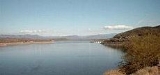
Theodore Roosevelt Lake (usually called Roosevelt Lake, sometimes Lake Roosevelt) is a large reservoir
formed by Theodore Roosevelt Dam
on the Salt River
in Arizona
as part of the Salt River Project
(SRP). Located roughly 80 miles (130 km) northeast of Phoenix
in the Salt River Valley, Theodore Roosevelt is the largest lake or reservoir located entirely within the state of Arizona (Lake Mead
and Lake Powell
are larger but both are located partially within the neighboring states of Nevada
and Utah
respectively). Both the reservoir and the masonry dam
that created it, Roosevelt Dam
, were named for U.S. President Theodore Roosevelt
who dedicated the dam himself in March 1911. Roosevelt Lake is a popular recreation destination within the Tonto National Forest
, as such the facilities located at this lake are managed by that authority.
 Roosevelt Lake is the oldest of the six reservoirs constructed and operated by the Salt River Project. It also has the largest storage capacity of the SRP lakes with the ability to store 1653043 acre.ft of water when the conservation limit of Roosevelt Dam is reached. When the dam is in flood-control mode, the lake can store 2910200 acre.ft of water; however, the U.S. Army Corps of Engineers
requires all water over the conservation limit to be released from the lake within 20 days.
although a small portion lies in Maricopa County
. Located about 4 miles (6 km) upstream from Apache Lake
(the next SRP reservoir on the Salt River), Roosevelt Lake occupies about 10 miles (16 km) of the original Salt River riverbed and also extends for about 8 miles (13 km) up Tonto Creek
, a significant tributary of the Salt with its headwaters along the Mogollon Rim
. The lake covers much of the southern portion of the Tonto Basin, a low lying area between the Sierra Ancha Mountains
, Mazatzal Mountains
(including Four Peaks
), and the Superstition Mountains
. State Route 188
travels along the shore of the lake for much of its length. Tonto National Monument
is located 4 miles (6 km) from Roosevelt Dam, parts of the monument provide views of much of the reservoir.
is a common recreational activity at Roosevelt Lake. The lake is home to a variety of game fish
including crappie
, carp
, Sunfish
, flathead
and channel catfish
, and smallmouth bass
and largemouth bass
. There is a slot size limit for the bass. Only one bass can be taken per day measuring between 13 and 16 inches.
Until recently, it also hosted the state's most significant population of the federally endangered Southwestern Willow Flycatcher
. Since the lake's rise following heavy rains in the winter of 2005, the population dynamics between this site and the other significant Arizona population (on the San Pedro River) are unclear.
There are several Arizona Trail
trailhead
s in the vicinity. The 800 mile (1,280 km) long hiking trail extending from the Arizona-Mexico
border to Utah
crosses the Salt River on the State Route 188 bridge
that crosses Theodore Roosevelt Lake just northeast of Roosevelt Dam.
Reservoir
A reservoir , artificial lake or dam is used to store water.Reservoirs may be created in river valleys by the construction of a dam or may be built by excavation in the ground or by conventional construction techniques such as brickwork or cast concrete.The term reservoir may also be used to...
formed by Theodore Roosevelt Dam
Theodore Roosevelt Dam
Theodore Roosevelt Dam is a dam on the Salt River located northeast of Phoenix, Arizona. The dam is high and forms Theodore Roosevelt Lake as it impounds the Salt River. Originally built between 1905 and 1911, the dam was renovated and expanded in 1989-1996. The dam is named after then-President...
on the Salt River
Salt River (Arizona)
The Salt River is a stream in the U.S. state of Arizona. It is the largest tributary of the Gila River. The river is about long. Its drainage basin is about large. The longest of the Salt River's many tributaries is the Verde River...
in Arizona
Arizona
Arizona ; is a state located in the southwestern region of the United States. It is also part of the western United States and the mountain west. The capital and largest city is Phoenix...
as part of the Salt River Project
Salt River Project
The Salt River Project is the umbrella name for two separate entities: the Salt River Project Agricultural Improvement and Power District, an agency of the state of Arizona that serves as an electrical utility for the Phoenix metropolitan area, and the Salt River Valley Water Users' Association, a...
(SRP). Located roughly 80 miles (130 km) northeast of Phoenix
Phoenix, Arizona
Phoenix is the capital, and largest city, of the U.S. state of Arizona, as well as the sixth most populated city in the United States. Phoenix is home to 1,445,632 people according to the official 2010 U.S. Census Bureau data...
in the Salt River Valley, Theodore Roosevelt is the largest lake or reservoir located entirely within the state of Arizona (Lake Mead
Lake Mead
Lake Mead is the largest reservoir in the United States. It is located on the Colorado River about southeast of Las Vegas, Nevada, in the states of Nevada and Arizona. Formed by water impounded by the Hoover Dam, it extends behind the dam, holding approximately of water.-History:The lake was...
and Lake Powell
Lake Powell
Lake Powell is a huge reservoir on the Colorado River, straddling the border between Utah and Arizona . It is the second largest man-made reservoir in the United States behind Lake Mead, storing of water when full...
are larger but both are located partially within the neighboring states of Nevada
Nevada
Nevada is a state in the western, mountain west, and southwestern regions of the United States. With an area of and a population of about 2.7 million, it is the 7th-largest and 35th-most populous state. Over two-thirds of Nevada's people live in the Las Vegas metropolitan area, which contains its...
and Utah
Utah
Utah is a state in the Western United States. It was the 45th state to join the Union, on January 4, 1896. Approximately 80% of Utah's 2,763,885 people live along the Wasatch Front, centering on Salt Lake City. This leaves vast expanses of the state nearly uninhabited, making the population the...
respectively). Both the reservoir and the masonry dam
Dam
A dam is a barrier that impounds water or underground streams. Dams generally serve the primary purpose of retaining water, while other structures such as floodgates or levees are used to manage or prevent water flow into specific land regions. Hydropower and pumped-storage hydroelectricity are...
that created it, Roosevelt Dam
Theodore Roosevelt Dam
Theodore Roosevelt Dam is a dam on the Salt River located northeast of Phoenix, Arizona. The dam is high and forms Theodore Roosevelt Lake as it impounds the Salt River. Originally built between 1905 and 1911, the dam was renovated and expanded in 1989-1996. The dam is named after then-President...
, were named for U.S. President Theodore Roosevelt
Theodore Roosevelt
Theodore "Teddy" Roosevelt was the 26th President of the United States . He is noted for his exuberant personality, range of interests and achievements, and his leadership of the Progressive Movement, as well as his "cowboy" persona and robust masculinity...
who dedicated the dam himself in March 1911. Roosevelt Lake is a popular recreation destination within the Tonto National Forest
Tonto National Forest
The Tonto National Forest, encompassing 2,873,200 acres , is the largest of the six national forests in Arizona and is the fifth largest national forest in the United States. The Tonto National Forest has diverse scenery, with elevations ranging from 1,400 feet in the Sonoran Desert to 7,400 feet...
, as such the facilities located at this lake are managed by that authority.
United States Army Corps of Engineers
The United States Army Corps of Engineers is a federal agency and a major Army command made up of some 38,000 civilian and military personnel, making it the world's largest public engineering, design and construction management agency...
requires all water over the conservation limit to be released from the lake within 20 days.
Geography
Roosevelt Lake is located in central Arizona almost entirely within Gila CountyGila County, Arizona
-2010:Whereas according to the 2010 U.S. Census Bureau:*76.8% White*0.4% Black*14.8% Native American*0.5% Asian*0.1% Native Hawaiian or Pacific Islander*2.0% Two or more races*5.4% Other races*17.9% Hispanic or Latino -2000:...
although a small portion lies in Maricopa County
Maricopa County, Arizona
-2010:Whereas according to the 2010 U.S. Census Bureau:*73.0% White*5.0% Black*2.1% Native American*3.5% Asian*0.2% Native Hawaiian or Pacific Islander*3.5% Two or more races*12.7% Other races*29.6% Hispanic or Latino -2000:...
. Located about 4 miles (6 km) upstream from Apache Lake
Apache Lake (Arizona)
Apache Lake is one of four artificial reservoirs created along the Salt River in central Arizona as part of the Salt River Project. The lake is located near the Apache Trail about 65 miles northeast of Phoenix. Apache Lake was formed by Horse Mesa Dam which was completed in 1927...
(the next SRP reservoir on the Salt River), Roosevelt Lake occupies about 10 miles (16 km) of the original Salt River riverbed and also extends for about 8 miles (13 km) up Tonto Creek
Tonto Creek
Tonto Creek is a stream located in the Mogollon Rim area of the state of Arizona on the north edge of the Tonto National Forest. The closest town, Payson, is away. Tonto Creek is a stream that flows year round, starting just below the Mogollon Rim, at the northern edge of Tonto National Forest...
, a significant tributary of the Salt with its headwaters along the Mogollon Rim
Mogollon Rim
The Mogollon Rim is a topographical and geological feature running across the U.S. state of Arizona. It extends approximately from northern Yavapai County eastward to near the border with New Mexico.-Description:...
. The lake covers much of the southern portion of the Tonto Basin, a low lying area between the Sierra Ancha Mountains
Sierra Ancha
The Sierra Ancha is a mountain range in Gila County, in central Arizona. It lies between Roosevelt Lake to the south, the Tonto Basin to the west, Cherry Creek to the east, and Pleasant Valley to the north...
, Mazatzal Mountains
Mazatzal Mountains
The Mazatzal Mountains are a mountain range in south central Arizona, about 30–45 miles northeast of Phoenix and the Phoenix metropolitan area. The origin of the name remains obscure but one possibility is that it is from the Aztec language meaning "place of the deer"...
(including Four Peaks
Four Peaks
Four Peaks , at in altitude, is a prominent landmark on the eastern skyline of Phoenix, part of the Mazatzal Mountains. It is located in the Tonto National Forest east-northeast of Phoenix, in the Four Peaks Wilderness...
), and the Superstition Mountains
Superstition Mountains
The Superstition Mountains , popularly referred to as "The Superstitions", are a range of mountains in Arizona located to the east of the Phoenix metropolitan area...
. State Route 188
Arizona State Route 188
State Route 188 is state highway located in Gila County in the U.S. state of Arizona.-Route description:The route starts at U.S. Route 60 in Claypool, just west of Globe, and runs generally northwest to a junction with State Route 288, then continues alongside Lake Roosevelt. The route junctions...
travels along the shore of the lake for much of its length. Tonto National Monument
Tonto National Monument
Tonto National Monument is a National Monument in central Arizona, United States. The area lies on the northeastern edge of the Sonoran Desert, which is generally arid land with annual rainfall of about 16 inches here...
is located 4 miles (6 km) from Roosevelt Dam, parts of the monument provide views of much of the reservoir.
Recreation and wildlife
FishingFishing
Fishing is the activity of trying to catch wild fish. Fish are normally caught in the wild. Techniques for catching fish include hand gathering, spearing, netting, angling and trapping....
is a common recreational activity at Roosevelt Lake. The lake is home to a variety of game fish
Game fish
Game fish are fish pursued for sport by recreational anglers. They can be freshwater or marine fish. Game fish can be eaten after being caught, though increasingly anglers practise catch and release to improve fish populations. Some game fish are also targeted commercially, particularly...
including crappie
Crappie
Crappie is a genus of freshwater fish in the sunfish family of order Perciformes. The type species is P. annularis, the white crappie...
, carp
Carp
Carp are various species of oily freshwater fish of the family Cyprinidae, a very large group of fish native to Europe and Asia. The cypriniformes are traditionally grouped with the Characiformes, Siluriformes and Gymnotiformes to create the superorder Ostariophysi, since these groups have certain...
, Sunfish
Centrarchidae
The sunfishes are a family of freshwater ray-finned fish belonging to the order Perciformes. The type genus is Centrarchus . The family's 27 species includes many fishes familiar to North Americans, including the rock bass, largemouth bass, bluegill, pumpkinseed, and crappies...
, flathead
Flathead catfish
The flathead catfish , also called the yellow cat, opelousas, and shovelhead cat, are large North American freshwater catfish. This is the only species of the genus Pylodictis...
and channel catfish
Channel catfish
Channel catfish, Ictalurus punctatus, is North America's most numerous catfish species. It is the official fish of Missouri, Iowa, Nebraska, Kansas, and Tennessee, and is informally referred to as a "channel cat". In the United States they are the most fished catfish species with approximately 8...
, and smallmouth bass
Smallmouth bass
The smallmouth bass is a species of freshwater fish in the sunfish family of the order Perciformes. It is the type species of its genus...
and largemouth bass
Largemouth bass
The largemouth bass is a species of black bass in the sunfish family native to North America . It is also known as widemouth bass, bigmouth, black bass, bucketmouth, Potter's fish, Florida bass, Florida largemouth, green bass, green trout, linesides, Oswego bass, southern largemouth...
. There is a slot size limit for the bass. Only one bass can be taken per day measuring between 13 and 16 inches.
Until recently, it also hosted the state's most significant population of the federally endangered Southwestern Willow Flycatcher
Willow Flycatcher
The Willow Flycatcher is a small insect-eating bird of the tyrant flycatcher family.Adults have brown-olive upperparts, darker on the wings and tail, with whitish underparts; they have an indistinct white eye ring, white wing bars and a small bill. The breast is washed with olive-grey. The upper...
. Since the lake's rise following heavy rains in the winter of 2005, the population dynamics between this site and the other significant Arizona population (on the San Pedro River) are unclear.
There are several Arizona Trail
Arizona Trail
The Arizona National Scenic Trail is a National Scenic Trail from Mexico to Utah that traverses the whole north-south length of Arizona. The trail begins at the Coronado National Memorial near the US-Mexico border and moves north through parts of the Huachuca, Santa Rita, and Rincon Mountains; it...
trailhead
Trailhead
A trailhead is the point at which a trail begins, where the trail is often intended for hiking, biking, horseback riding, or off-road vehicles...
s in the vicinity. The 800 mile (1,280 km) long hiking trail extending from the Arizona-Mexico
Mexico
The United Mexican States , commonly known as Mexico , is a federal constitutional republic in North America. It is bordered on the north by the United States; on the south and west by the Pacific Ocean; on the southeast by Guatemala, Belize, and the Caribbean Sea; and on the east by the Gulf of...
border to Utah
Utah
Utah is a state in the Western United States. It was the 45th state to join the Union, on January 4, 1896. Approximately 80% of Utah's 2,763,885 people live along the Wasatch Front, centering on Salt Lake City. This leaves vast expanses of the state nearly uninhabited, making the population the...
crosses the Salt River on the State Route 188 bridge
Bridge
A bridge is a structure built to span physical obstacles such as a body of water, valley, or road, for the purpose of providing passage over the obstacle...
that crosses Theodore Roosevelt Lake just northeast of Roosevelt Dam.