

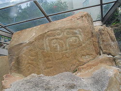
Petroglyph
Encyclopedia
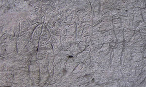
Petroglyphs are pictogram
and logogram
image
s created by removing part of a rock
surface by incising, picking, carving, and abrading. Outside North America, scholars often use terms such as "carving", "engraving", or other descriptions of the technique to refer to such images. Petroglyphs are found world-wide, and are often associated with prehistoric
peoples. The word comes from the Greek
words petro-, theme of the word "petra" meaning "stone", and glyphein meaning "to carve", and was originally coined in French
as pétroglyphe.
The term petroglyph should not be confused with pictograph, which is an image drawn or painted on a rock face. Both types of image belong to the wider and more general category of rock art
and Petroforms, or patterns and shapes made by many large rocks and boulders over the ground, are also quite different. Inukshuk
s are also unique, and found only in the Arctic (except for reproductions and imitations built in more southerly latitudes).

The oldest petroglyphs are dated to approximately the Neolithic and late Upper Paleolithic
boundary, about 10,000 to 12,000 years ago, if not earlier (Kamyana Mohyla
). Around 7,000 to 9,000 years ago, other precursors of writing system
s, such as pictographs and ideogram
s, began to appear. Petroglyphs were still common though, and some cultures continued using them much longer, even until contact with Western culture
was made in the 20th century. Petroglyphs have been found in all parts of the globe except Antarctica with highest concentrations in parts of Africa
, Scandinavia
, Siberia
, southwestern North America
and Australia
.
". Petroglyph maps may show trails, symbols communicating time and distances traveled, as well as the local terrain in the form of rivers, landforms and other geographic features. A petroglyph that represents a landform or the surrounding terrain is known as a Geocontourglyph. They might also have been a by-product of other rituals: sites in India, for example, have been identified as musical instruments or "rock gong
s".
Some petroglyph images probably have deep cultural and religious significance for the societies that created them; in many cases this significance remains for their descendants. Many petroglyphs are thought to represent some kind of not-yet-fully understood symbolic or ritual language. Later glyphs from the Nordic Bronze Age
in Scandinavia seem to refer to some form of territorial boundary between tribe
s, in addition to possible religious meanings. It also appears that local or regional dialects from similar or neighboring peoples exist. The Siberian inscriptions almost look like some early form of runes
, although there is not thought to be any relationship between them. They are not yet well understood.
Some researchers have noticed the resemblance of different styles of petroglyphs across different continents; while it is expected that all people would be inspired by their surroundings, it is harder to explain the common styles. This could be mere coincidence, an indication that certain groups of people migrated
widely from some initial common area, or indication of a common origin. In 1853 George Tate read a paper to the Berwick Naturalists' Club at which a Mr John Collingwood Bruce agreed that the carvings had "... a common origin, and indicate a symbolic meaning, representing some popular thought." In his cataloguing of Scottish rock art, Ronald Morris summarised 104 different theories on their interpretation.
Other, more controversial, explanations are grounded in Jungian psychology and the views of Mircea Eliade
. According to these theories it is possible that the similarity of petroglyphs (and other atavistic
or archetypal
symbol
s) from different cultures and continents is a result of the genetically
inherited structure of the human brain.
Other theories suggest that petroglyphs were made by shamans in an altered state of consciousness
, perhaps induced by the use of natural hallucinogens. Many of the geometric
pattern
s (known as form constant
s) which recur in petroglyphs and cave paintings have been shown by David Lewis-Williams to be "hard-wired" into the human brain; they frequently occur in visual disturbances and hallucinations brought on by drugs, migraine
and other stimuli.
Recent analysis of surveyed and GPS logged petroglyphs around the world has identified commonalities indicating pre-historic (7,000-3,000 B.C.) intense auroras observable across the continents. Specific common associated archetypes include: squatting man, caterpillars, ladders, eye mask, kokopelli, spoked wheels, and others.
Present-day links between shamanism and rock-art amongst the San people of the Kalahari desert have been studied by the Rock Art Research Institute (RARI) of the University of the Witwatersrand
. Though the San people's artworks are predominantly paintings, the beliefs behind them can perhaps be used as a basis for understanding other types of rock art, including petroglyphs. To quote from the RARI website:
Recently petroglyphs were found from Kollur
in Tamil Nadu
. A big dolmen
with four petroglyphs that portray men with trident
and a wheel with spokes has been found at Kollur
near Triukoilur 35 km from Villupuram. The discovery was made by K.T. Gandhirajan. This is the second time that a dolmen with petrographs has been found in Tamil Nadu, India.
St Kitts & Nevis
Trinidad & Tobago
Aruba
in:
Pictogram
A pictograph, also called pictogram or pictogramme is an ideogram that conveys its meaning through its pictorial resemblance to a physical object. Pictographs are often used in writing and graphic systems in which the characters are to considerable extent pictorial in appearance.Pictography is a...
and logogram
Logogram
A logogram, or logograph, is a grapheme which represents a word or a morpheme . This stands in contrast to phonograms, which represent phonemes or combinations of phonemes, and determinatives, which mark semantic categories.Logograms are often commonly known also as "ideograms"...
image
Image
An image is an artifact, for example a two-dimensional picture, that has a similar appearance to some subject—usually a physical object or a person.-Characteristics:...
s created by removing part of a rock
Rock (geology)
In geology, rock or stone is a naturally occurring solid aggregate of minerals and/or mineraloids.The Earth's outer solid layer, the lithosphere, is made of rock. In general rocks are of three types, namely, igneous, sedimentary, and metamorphic...
surface by incising, picking, carving, and abrading. Outside North America, scholars often use terms such as "carving", "engraving", or other descriptions of the technique to refer to such images. Petroglyphs are found world-wide, and are often associated with prehistoric
Prehistory
Prehistory is the span of time before recorded history. Prehistory can refer to the period of human existence before the availability of those written records with which recorded history begins. More broadly, it refers to all the time preceding human existence and the invention of writing...
peoples. The word comes from the Greek
Greek language
Greek is an independent branch of the Indo-European family of languages. Native to the southern Balkans, it has the longest documented history of any Indo-European language, spanning 34 centuries of written records. Its writing system has been the Greek alphabet for the majority of its history;...
words petro-, theme of the word "petra" meaning "stone", and glyphein meaning "to carve", and was originally coined in French
French language
French is a Romance language spoken as a first language in France, the Romandy region in Switzerland, Wallonia and Brussels in Belgium, Monaco, the regions of Quebec and Acadia in Canada, and by various communities elsewhere. Second-language speakers of French are distributed throughout many parts...
as pétroglyphe.
The term petroglyph should not be confused with pictograph, which is an image drawn or painted on a rock face. Both types of image belong to the wider and more general category of rock art
Rock art
Rock art is a term used in archaeology for any human-made markings made on natural stone. They can be divided into:*Petroglyphs - carvings into stone surfaces*Pictographs - rock and cave paintings...
and Petroforms, or patterns and shapes made by many large rocks and boulders over the ground, are also quite different. Inukshuk
Inukshuk
An inuksuk is a stone landmark or cairn built by humans, used by the Inuit, Inupiat, Kalaallit, Yupik, and other peoples of the Arctic region of North America. These structures are found from Alaska to Greenland...
s are also unique, and found only in the Arctic (except for reproductions and imitations built in more southerly latitudes).
History
The oldest petroglyphs are dated to approximately the Neolithic and late Upper Paleolithic
Upper Paleolithic
The Upper Paleolithic is the third and last subdivision of the Paleolithic or Old Stone Age as it is understood in Europe, Africa and Asia. Very broadly it dates to between 40,000 and 10,000 years ago, roughly coinciding with the appearance of behavioral modernity and before the advent of...
boundary, about 10,000 to 12,000 years ago, if not earlier (Kamyana Mohyla
Kamyana Mohyla
Kamyana Mohyla is an archaeological site in the Molochna River valley, about a mile from the village of Terpinnya, Zaporizhia Oblast, Ukraine....
). Around 7,000 to 9,000 years ago, other precursors of writing system
Writing system
A writing system is a symbolic system used to represent elements or statements expressible in language.-General properties:Writing systems are distinguished from other possible symbolic communication systems in that the reader must usually understand something of the associated spoken language to...
s, such as pictographs and ideogram
Ideogram
An ideogram or ideograph is a graphic symbol that represents an idea or concept. Some ideograms are comprehensible only by familiarity with prior convention; others convey their meaning through pictorial resemblance to a physical object, and thus may also be referred to as pictograms.Examples of...
s, began to appear. Petroglyphs were still common though, and some cultures continued using them much longer, even until contact with Western culture
Western culture
Western culture, sometimes equated with Western civilization or European civilization, refers to cultures of European origin and is used very broadly to refer to a heritage of social norms, ethical values, traditional customs, religious beliefs, political systems, and specific artifacts and...
was made in the 20th century. Petroglyphs have been found in all parts of the globe except Antarctica with highest concentrations in parts of Africa
Africa
Africa is the world's second largest and second most populous continent, after Asia. At about 30.2 million km² including adjacent islands, it covers 6% of the Earth's total surface area and 20.4% of the total land area...
, Scandinavia
Scandinavia
Scandinavia is a cultural, historical and ethno-linguistic region in northern Europe that includes the three kingdoms of Denmark, Norway and Sweden, characterized by their common ethno-cultural heritage and language. Modern Norway and Sweden proper are situated on the Scandinavian Peninsula,...
, Siberia
Siberia
Siberia is an extensive region constituting almost all of Northern Asia. Comprising the central and eastern portion of the Russian Federation, it was part of the Soviet Union from its beginning, as its predecessor states, the Tsardom of Russia and the Russian Empire, conquered it during the 16th...
, southwestern North America
North America
North America is a continent wholly within the Northern Hemisphere and almost wholly within the Western Hemisphere. It is also considered a northern subcontinent of the Americas...
and Australia
Australia
Australia , officially the Commonwealth of Australia, is a country in the Southern Hemisphere comprising the mainland of the Australian continent, the island of Tasmania, and numerous smaller islands in the Indian and Pacific Oceans. It is the world's sixth-largest country by total area...
.
Interpretation
There are many theories to explain their purpose, depending on their location, age, and the type of image. Some petroglyphs are thought to be astronomical markers, maps, and other forms of symbolic communication, including a form of "pre-writingWriting
Writing is the representation of language in a textual medium through the use of a set of signs or symbols . It is distinguished from illustration, such as cave drawing and painting, and non-symbolic preservation of language via non-textual media, such as magnetic tape audio.Writing most likely...
". Petroglyph maps may show trails, symbols communicating time and distances traveled, as well as the local terrain in the form of rivers, landforms and other geographic features. A petroglyph that represents a landform or the surrounding terrain is known as a Geocontourglyph. They might also have been a by-product of other rituals: sites in India, for example, have been identified as musical instruments or "rock gong
Rock gong
A rock gong is a lithophone. Found in Africa, Asia, and Europe, the gong is a slab of rock that is hit like a drum. Other regional names for the rock gong include kungering, kwerent dutse, gwangalan, kungereng, kongworian, and kuge...
s".
Some petroglyph images probably have deep cultural and religious significance for the societies that created them; in many cases this significance remains for their descendants. Many petroglyphs are thought to represent some kind of not-yet-fully understood symbolic or ritual language. Later glyphs from the Nordic Bronze Age
Nordic Bronze Age
The Nordic Bronze Age is the name given by Oscar Montelius to a period and a Bronze Age culture in Scandinavian pre-history, c. 1700-500 BC, with sites that reached as far east as Estonia. Succeeding the Late Neolithic culture, its ethnic and linguistic affinities are unknown in the absence of...
in Scandinavia seem to refer to some form of territorial boundary between tribe
Tribe
A tribe, viewed historically or developmentally, consists of a social group existing before the development of, or outside of, states.Many anthropologists use the term tribal society to refer to societies organized largely on the basis of kinship, especially corporate descent groups .Some theorists...
s, in addition to possible religious meanings. It also appears that local or regional dialects from similar or neighboring peoples exist. The Siberian inscriptions almost look like some early form of runes
Runic alphabet
The runic alphabets are a set of related alphabets using letters known as runes to write various Germanic languages before the adoption of the Latin alphabet and for specialized purposes thereafter...
, although there is not thought to be any relationship between them. They are not yet well understood.
Some researchers have noticed the resemblance of different styles of petroglyphs across different continents; while it is expected that all people would be inspired by their surroundings, it is harder to explain the common styles. This could be mere coincidence, an indication that certain groups of people migrated
Human migration
Human migration is physical movement by humans from one area to another, sometimes over long distances or in large groups. Historically this movement was nomadic, often causing significant conflict with the indigenous population and their displacement or cultural assimilation. Only a few nomadic...
widely from some initial common area, or indication of a common origin. In 1853 George Tate read a paper to the Berwick Naturalists' Club at which a Mr John Collingwood Bruce agreed that the carvings had "... a common origin, and indicate a symbolic meaning, representing some popular thought." In his cataloguing of Scottish rock art, Ronald Morris summarised 104 different theories on their interpretation.
Other, more controversial, explanations are grounded in Jungian psychology and the views of Mircea Eliade
Mircea Eliade
Mircea Eliade was a Romanian historian of religion, fiction writer, philosopher, and professor at the University of Chicago. He was a leading interpreter of religious experience, who established paradigms in religious studies that persist to this day...
. According to these theories it is possible that the similarity of petroglyphs (and other atavistic
Atavism
Atavism is the tendency to revert to ancestral type. In biology, an atavism is an evolutionary throwback, such as traits reappearing which had disappeared generations before. Atavisms can occur in several ways...
or archetypal
Archetype
An archetype is a universally understood symbol or term or pattern of behavior, a prototype upon which others are copied, patterned, or emulated...
symbol
Symbol
A symbol is something which represents an idea, a physical entity or a process but is distinct from it. The purpose of a symbol is to communicate meaning. For example, a red octagon may be a symbol for "STOP". On a map, a picture of a tent might represent a campsite. Numerals are symbols for...
s) from different cultures and continents is a result of the genetically
Genetics
Genetics , a discipline of biology, is the science of genes, heredity, and variation in living organisms....
inherited structure of the human brain.
Other theories suggest that petroglyphs were made by shamans in an altered state of consciousness
Altered state of consciousness
An altered state of consciousness , also named altered state of mind, is any condition which is significantly different from a normal waking beta wave state. The expression was used as early as 1966 by Arnold M. Ludwig and brought into common usage from 1969 by Charles Tart: it describes induced...
, perhaps induced by the use of natural hallucinogens. Many of the geometric
Geometry
Geometry arose as the field of knowledge dealing with spatial relationships. Geometry was one of the two fields of pre-modern mathematics, the other being the study of numbers ....
pattern
Pattern
A pattern, from the French patron, is a type of theme of recurring events or objects, sometimes referred to as elements of a set of objects.These elements repeat in a predictable manner...
s (known as form constant
Form constant
A form constant is one of several geometric patterns which are recurringly observed during hallucinations and altered states of consciousness.-History:...
s) which recur in petroglyphs and cave paintings have been shown by David Lewis-Williams to be "hard-wired" into the human brain; they frequently occur in visual disturbances and hallucinations brought on by drugs, migraine
Migraine
Migraine is a chronic neurological disorder characterized by moderate to severe headaches, and nausea...
and other stimuli.
Recent analysis of surveyed and GPS logged petroglyphs around the world has identified commonalities indicating pre-historic (7,000-3,000 B.C.) intense auroras observable across the continents. Specific common associated archetypes include: squatting man, caterpillars, ladders, eye mask, kokopelli, spoked wheels, and others.
Present-day links between shamanism and rock-art amongst the San people of the Kalahari desert have been studied by the Rock Art Research Institute (RARI) of the University of the Witwatersrand
University of the Witwatersrand
The University of the Witwatersrand, Johannesburg is a South African university situated in the northern areas of central Johannesburg. It is more commonly known as Wits University...
. Though the San people's artworks are predominantly paintings, the beliefs behind them can perhaps be used as a basis for understanding other types of rock art, including petroglyphs. To quote from the RARI website:
- Using knowledge of San beliefs, researchers have shown that the art played a fundamental part in the religious lives of its San painters. The art captured things from the San’s world behind the rock-face: the other world inhabited by spirit creatures, to which dancers could travel in animal form, and where people of ecstasy could draw power and bring it back for healing, rain-making and capturing the game.
Egypt
- Wadi HammamatWadi Hammamat' is a dry river bed in Egypt's Eastern Desert, about halfway between Qusier and Qena. It was a major mining region and trade route east from the Nile Valley in ancient times, and three thousand years of rock carvings and graffiti make it a major scientific and tourist site today.-Trade...
in QiftQiftQift is a small town in the Qena Governorate of Egypt about 43 km north of Luxor, on the east bank of the Nile.-History:In ancient Egypt, Qift, known then as Gebtu, was an important center for administration, religion, and commerce, being the chief city of the fifth Upper Egyptian Nome of Harawî...
, many carvings and inscriptions dating from before the earliest Egyptian Dynasties to the modern era, including the only painted petroglyph known from the Eastern Desert and drawings of Egyptian reed boatReed boatReed boats and rafts, along with dugout canoes and other rafts, are among the oldest known types of boats. Often used as traditional fishing boats, they are still used in a few places around the world, though they have generally been replaced with planked boats. Reed boats can be distinguished from...
s dated to 4000 BCE
South Africa
- Driekops EilandDriekops EilandDriekops Eiland is a rock engraving or petroglyph site in the bed of the Riet River close to the town of Plooysburg, near Kimberley, Northern Cape, South Africa.-The engravings:...
near KimberleyKimberley, Northern CapeKimberley is a city in South Africa, and the capital of the Northern Cape. It is located near the confluence of the Vaal and Orange Rivers. The town has considerable historical significance due its diamond mining past and siege during the Second Boer War... - ǀXam and ǂKhomani heartland in the KarooKarooThe Karoo is a semi-desert region of South Africa. It has two main sub-regions - the Great Karoo in the north and the Little Karoo in the south. The 'High' Karoo is one of the distinct physiographic provinces of the larger South African Platform division.-Great Karoo:The Great Karoo has an area of...
, Northern CapeNorthern CapeThe Northern Cape is the largest and most sparsely populated province of South Africa. It was created in 1994 when the Cape Province was split up. Its capital is Kimberley. It includes the Kalahari Gemsbok National Park, part of an international park shared with Botswana... - Wildebeest Kuil Rock Art CentreWildebeest Kuil Rock Art CentreWildebeest Kuil Rock Art Centre is a rock engraving site with visitor centre on land owned by the !Xun and Khwe San situated about 16 km from Kimberley, Northern Cape, South Africa. It is a declared Provincial Heritage Site managed by the Northern Cape Rock Art Trust in association with the...
near Kimberley, Northern CapeKimberley, Northern CapeKimberley is a city in South Africa, and the capital of the Northern Cape. It is located near the confluence of the Vaal and Orange Rivers. The town has considerable historical significance due its diamond mining past and siege during the Second Boer War... - Keiskie near CalviniaCalviniaCalvinia is a regional town in the Northern Cape province of South Africa named after the Swiss religious reformer John Calvin. The town belongs to the Hantam Local Municipality which forms part of the Namakwa District Municipality. The Calvinia district is part of the Great Karoo region of South...
, Northern CapeNorthern CapeThe Northern Cape is the largest and most sparsely populated province of South Africa. It was created in 1994 when the Cape Province was split up. Its capital is Kimberley. It includes the Kalahari Gemsbok National Park, part of an international park shared with Botswana...
Australia
- Arnhem LandArnhem LandThe Arnhem Land Region is one of the five regions of the Northern Territory of Australia. It is located in the north-eastern corner of the territory and is around 500 km from the territory capital Darwin. The region has an area of 97,000 km² which also covers the area of Kakadu National...
/ Kakadu National ParkKakadu National ParkKakadu National Park is in the Northern Territory of Australia, 171 km southeast of Darwin.Kakadu National Park is located within the Alligator Rivers Region of the Northern Territory of Australia. It covers an area of , extending nearly 200 kilometres from north to south and over 100 kilometres...
, Northern Australia - MurujugaMurujugaMurujuga , is a peninsula often known as Burrup Peninsula in the Pilbara region of Western Australia, adjoining the Dampier Archipelago and near the town of Dampier...
, Western AustraliaWestern AustraliaWestern Australia is a state of Australia, occupying the entire western third of the Australian continent. It is bounded by the Indian Ocean to the north and west, the Great Australian Bight and Indian Ocean to the south, the Northern Territory to the north-east and South Australia to the south-east...
- world heritage assessed - Sydney Rock EngravingsSydney rock engravingsSydney rock engravings are a form of Australian Aboriginal Rock Art consisting of carefully drawn images of people, animals, or symbols, in the sandstone around Sydney, New South Wales, Australia...
, New South Wales
China
- Eight sites in Hong KongPrehistoric Hong KongPrehistoric Hong Kong is the period between the arrival of the first humans in the modern Hong Kong region and the start of recorded in Chinese history. The history of the region is...
: on Tung Lung Island, Kau Sai ChauKau Sai ChauKau Sai Chau is an island located off the coast of Sai Kung of Hong Kong, with an area of 6.70 km², making it the 6th largest island of Hong Kong.-Geography:...
, Po Toi IslandPo ToiPo Toi is the main island of the Po Toi Islands and the southern-most island of Hong Kong, with an area of 3.69 km².-Name:...
, Cheung ChauCheung ChauCheung Chau is a small island 10 km southwest of Hong Kong Island, is nicknamed as the 'dumbbell island' for its shape. It has been inhabited for longer than most other places in the territory of Hong Kong, with a population of about 23,000 up to 2006...
, Shek PikShek PikShek Pik is an area located along the southwestern coast of Lantau Island, Hong Kong. When the Shek Pik Reservoir was built, villages at Shek Pik were demolished and the villagers were relocated to other parts of Lantau Island and to Tsuen Wan...
on Lantau Island, Wong Chuk HangWong Chuk HangWong Chuk Hang is an industrial and residential town to the east of Aberdeen and to the north of Nam Long Shan and to the west of Shouson Hill, on Hong Kong Island, Hong Kong...
and Big Wave BayBig Wave Bay, Hong Kong IslandBig Wave Bay or Tai Long Wan is a bay in the Southern District of Hong Kong. It is located on the eastern coast of Hong Kong Island, south of Cape Collinson and north of Shek O....
on Hong Kong IslandHong Kong IslandHong Kong Island is an island in the southern part of the Hong Kong Special Administrative Region. It has a population of 1,289,500 and its population density is 16,390/km², as of 2008...
, Lung Ha Wan in Sai Kung - Yin MountainsYin MountainsThe Yin Mountains are mountains in the steppe forming the southern border of the eastern Gobi Desert of the Inner Mongolia Autonomous Region, as well as the northern part of Hebei province....
in Inner MongoliaInner MongoliaInner Mongolia is an autonomous region of the People's Republic of China, located in the northern region of the country. Inner Mongolia shares an international border with the countries of Mongolia and the Russian Federation...
India
- Bhimbetka rock shelters, Raisen DistrictRaisen DistrictRaisen District is a district of Madhya Pradesh state of India. The town of Raisen is the district headquarters. The district is part of Bhopal Division.-Etymology:...
, Madhya PradeshMadhya PradeshMadhya Pradesh , often called the Heart of India, is a state in central India. Its capital is Bhopal and Indore is the largest city....
, IndiaIndiaIndia , officially the Republic of India , is a country in South Asia. It is the seventh-largest country by geographical area, the second-most populous country with over 1.2 billion people, and the most populous democracy in the world...
. - Edakkal CavesEdakkal CavesEdakkal Caves are two natural caves at a remote location at Edakkal, 25 km from Kalpetta in the Wayanad district of Kerala in India's Western Ghats. They lie 1,200 metres above sea level on Ambukutty Mala, beside an ancient trade route connecting the high mountains of Mysore to the ports of...
, Wayanad District, KeralaKeralaor Keralam is an Indian state located on the Malabar coast of south-west India. It was created on 1 November 1956 by the States Reorganisation Act by combining various Malayalam speaking regions....
, IndiaIndiaIndia , officially the Republic of India , is a country in South Asia. It is the seventh-largest country by geographical area, the second-most populous country with over 1.2 billion people, and the most populous democracy in the world...
. - Perumukkal, Thindivanam District, Tamil NaduTamil NaduTamil Nadu is one of the 28 states of India. Its capital and largest city is Chennai. Tamil Nadu lies in the southernmost part of the Indian Peninsula and is bordered by the union territory of Pondicherry, and the states of Kerala, Karnataka, and Andhra Pradesh...
, IndiaIndiaIndia , officially the Republic of India , is a country in South Asia. It is the seventh-largest country by geographical area, the second-most populous country with over 1.2 billion people, and the most populous democracy in the world...
. - KollurKollurKolluru is a tiny hamlet situated about from Kundapur Town, about away from Mangalore City in Karnataka state in the southern part of India...
, Villupuram, Tamil NaduTamil NaduTamil Nadu is one of the 28 states of India. Its capital and largest city is Chennai. Tamil Nadu lies in the southernmost part of the Indian Peninsula and is bordered by the union territory of Pondicherry, and the states of Kerala, Karnataka, and Andhra Pradesh...
. - UnakotiUnakotiUnakoti hill, literally meaning one less a crore in Bengali, hosts an ancient Shaivite place of worship with huge rock-cut images and stone idols of Lord Shiva...
near KailashaharKailashaharKailashahar town is the nagar panchayat and head-quarter of North Tripura district in the Indian state of Tripura located along the border with Bangladesh.-Name:...
in North Tripura District, TripuraTripuraTripura is a state in North-East India, with an area of . It is the third smallest state of India, according to area. Tripura is surrounded by Bangladesh on the north, south, and west. The Indian states of Assam and Mizoram lie to the east. The capital is Agartala and the main languages spoken are...
, IndiaIndiaIndia , officially the Republic of India , is a country in South Asia. It is the seventh-largest country by geographical area, the second-most populous country with over 1.2 billion people, and the most populous democracy in the world...
. - Usgalimal, KushavatiKushavati*Kushavati was a city in Kosala Kingdom as per epic Ramayana. The king of Kosala Raghava Rama installed his son Lava at Sravasti and Kusha at Kushavati. The city is identified to be Kushinagar a town near Gorakhpur....
river banks,in Goa
Recently petroglyphs were found from Kollur
Kollur
Kolluru is a tiny hamlet situated about from Kundapur Town, about away from Mangalore City in Karnataka state in the southern part of India...
in Tamil Nadu
Tamil Nadu
Tamil Nadu is one of the 28 states of India. Its capital and largest city is Chennai. Tamil Nadu lies in the southernmost part of the Indian Peninsula and is bordered by the union territory of Pondicherry, and the states of Kerala, Karnataka, and Andhra Pradesh...
. A big dolmen
Dolmen
A dolmen—also known as a portal tomb, portal grave, dolmain , cromlech , anta , Hünengrab/Hünenbett , Adamra , Ispun , Hunebed , dös , goindol or quoit—is a type of single-chamber megalithic tomb, usually consisting of...
with four petroglyphs that portray men with trident
Trident
A trident , also called a trishul or leister or gig, is a three-pronged spear. It is used for spear fishing and was also a military weapon. Tridents are featured widely in mythical, historical and modern culture. The major Hindu god, Shiva the Destroyer and the sea god Poseidon or Neptune are...
and a wheel with spokes has been found at Kollur
Kollur
Kolluru is a tiny hamlet situated about from Kundapur Town, about away from Mangalore City in Karnataka state in the southern part of India...
near Triukoilur 35 km from Villupuram. The discovery was made by K.T. Gandhirajan. This is the second time that a dolmen with petrographs has been found in Tamil Nadu, India.
Kazakhstan
- Chumysh River basin,
- Tamgaly Tas on the Ili RiverIli Riverthumb|right|300px|Map of the Lake Balkhash drainage basin showing the Ili River and its tributariesThe Ili River is a river in northwestern China and southeastern Kazakhstan .It is long, of which is in Kazakhstan...
- TamgalyTamgalyTamgaly is a petroglyph site in the Semirechye, Kazakhstan.Tamgaly is located 120 km to northwest of Almaty. The majority of the 5000 petroglyphs are in the main canyon, but there are a number in the many side canyons...
- a World Heritage SiteWorld Heritage SiteA UNESCO World Heritage Site is a place that is listed by the UNESCO as of special cultural or physical significance...
nearly of AlmatyAlmatyAlmaty , also known by its former names Verny and Alma-Ata , is the former capital of Kazakhstan and the nation's largest city, with a population of 1,348,500...
Japan
- Hikoshima island (Shimonoseki city)
- MiyajimaItsukushimais an island in the western part of the Inland Sea of Japan, located in the northwest of Hiroshima Bay. It is popularly known as , the Shrine Island. The island is one of . Itsukushima is part of the city of Hatsukaichi in Hiroshima Prefecture...
- Temiya cave(Otaru cityOtaru, Hokkaidois a city and port in Shiribeshi, Hokkaido, Japan, northwest of Sapporo. The city faces the Ishikari Bay, and has long served as the main port of the bay. With its many historical buildings, Otaru is a popular tourist destination...
)
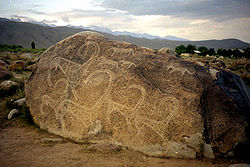
Kyrgyzstan
- Several sites in the Tien Shan mountains: Cholpon-AtaCholpon-AtaCholpon-Ata is a resort town on the northern shore of Lake Issyk-Kul in Kyrgyzstan with a year-round population of about 12,000. It is the administrative center of the Issyk Kul District of Issyk Kul Province; this district occupies most of the lake's north shore...
, the Talas valley, Saimaluu TashSaimaluu TashSaimaluu Tash is a petroglyph site in Jalal-Abad Province, Kyrgyzstan, south of Kazarman. It is on the Ferghana Range at about 3,200 meters in two high valleys, separated by a low mountain ridge. Over 10,000 carved pictures have so far been identified, making the site a worldwide important...
, and on the rock outcrop called Suleiman's Throne in OshOshOsh is the second largest city in Kyrgyzstan, located in the Fergana Valley in the south of the country and often referred to as the "capital of the south". The city is at least 3,000 years old, and has served as the administrative center of Osh Province since 1939...
in the Fergana valleyFergana ValleyThe Fergana Valley or Farghana Valley is a region in Central Asia spreading across eastern Uzbekistan, Kyrgyzstan and Tajikistan. Divided across three subdivisions of the former Soviet Union, the valley is ethnically diverse, and in the early 21st century was the scene of ethnic conflict...
Mongolia
- In 2011, UNESCO World Heritage adds to its list a new site "Petroglyphs Complexes of the Mongolian Altai, Mongolia" to celebrate the importance of the pictograms engraved in rocks.
Pakistan
- Rock art and petroglyphs in Northern Areas,
Taiwan
- The Wanshan Petroglyphs near Maolin, Kaohsiung, were discovered between 1978 and 2002.
Pacific
- Easter Island petroglyphs
- HawaiiHawaiiHawaii is the newest of the 50 U.S. states , and is the only U.S. state made up entirely of islands. It is the northernmost island group in Polynesia, occupying most of an archipelago in the central Pacific Ocean, southwest of the continental United States, southeast of Japan, and northeast of...
(particularly the Big Island)
Brazil
- Serra da Capivara National ParkSerra da Capivara National ParkSerra da Capivara National Park is a national park in the north east of Brazil. It has many prehistoric paintings. The park was created to protect the prehistoric artifacts and paintings found there. It became a World Heritage Site in 1991. Its head archaeologist is Niède Guidon...
, a UNESCO World Heritage Site, PiauiPiauíPiauí is one of the states of Brazil, located in the northeastern part of the country.Piauí has the shortest coastline of any of the non-landlocked Brazilian states at 66 km , and the capital, Teresina, is the only state capital in the north east to be located inland...
State - Vale do Catimbau National ParkVale do Catimbau National ParkThe Vale do Catimbau National Park is a national park of Brazil, located in the city of Buíque in the state of Pernambuco. The Catimbau Valley or Vale do Catimbau in Portuguese is Brazil's 2nd largest archaeological site. Among its natural attractions there are beautiful canyons, over 2,000 caves,...
, PernambucoPernambucoPernambuco is a state of Brazil, located in the Northeast region of the country. To the north are the states of Paraíba and Ceará, to the west is Piauí, to the south are Alagoas and Bahia, and to the east is the Atlantic Ocean. There are about of beaches, some of the most beautiful in the...
State - Ingá StoneIngá stoneThe Ingá Stone is located in the middle of the Ingá river near the small city of Ingá, 96km from João Pessoa, in Paraíba State in the northeast of Brazil. The Ingá Stone is also called Itacoatiara do Ingá...
, ParaibaParaíbaParaíba Paraíba Paraíba (Tupi: pa'ra a'íba: "bad to navigation"; Brazilian Portuguese pronunciation: is a state of Brazil. It is located in the Brazilian Northeast, and is bordered by Rio Grande do Norte to the north, Ceará to the west, Pernambuco to the south and the Atlantic Ocean to the east...
State - Costao do Santinho, Santa CatarinaSanta CatarinaSanta Catarina is the name of several places :-Places:Brazil*Santa Catarina , one of that country's federal states...
State - Lagoa SantaLagoa SantaFor Lagoa Santa, a municipality in Goiás see Lagoa Santa, GoiásLagoa Santa is a municipality and region in the state of Minas Gerais, Brazil...
(Holy Lake), Minas GeraisMinas GeraisMinas Gerais is one of the 26 states of Brazil, of which it is the second most populous, the third richest, and the fourth largest in area. Minas Gerais is the Brazilian state with the largest number of Presidents of Brazil, the current one, Dilma Rousseff, being one of them. The capital is the...
State - Ivolandia, GoiasGoiásGoiás is a state of Brazil, located in the central part of the country. The name Goiás comes from the name of an indigenous community...
State
Colombia
- El AbraEl AbraEl Abra is an archaeological excavation site, located in the valley of the same name, east of the city of Zipaquirá, department Cundinamarca, Colombia; in the Altiplano Cundiboyacense, at an altitude of 2,570 m...
Central America
- Rincon de la Vieja, Costa RicaCosta RicaCosta Rica , officially the Republic of Costa Rica is a multilingual, multiethnic and multicultural country in Central America, bordered by Nicaragua to the north, Panama to the southeast, the Pacific Ocean to the west and the Caribbean Sea to the east....
- Ometepe Petroglyphs, NicaraguaNicaraguaNicaragua is the largest country in the Central American American isthmus, bordered by Honduras to the north and Costa Rica to the south. The country is situated between 11 and 14 degrees north of the Equator in the Northern Hemisphere, which places it entirely within the tropics. The Pacific Ocean...
North America
- Arches National ParkArches National ParkArches National Park is a U.S. National Park in eastern Utah. It is known for preserving over 2000 natural sandstone arches, including the world-famous Delicate Arch, in addition to a variety of unique geological resources and formations....
, UtahUtahUtah is a state in the Western United States. It was the 45th state to join the Union, on January 4, 1896. Approximately 80% of Utah's 2,763,885 people live along the Wasatch Front, centering on Salt Lake City. This leaves vast expanses of the state nearly uninhabited, making the population the... - Barnesville PetroglyphBarnesville PetroglyphThe Barnesville Petroglyph is a well-known petroglyph site in the eastern part of the U.S. state of Ohio. Located approximately southwest of the village of Barnesville in Belmont County, the petroglyphs have been known both by archaeologists and the general public since the 1850s or earlier...
, OhioOhioOhio is a Midwestern state in the United States. The 34th largest state by area in the U.S.,it is the 7th‑most populous with over 11.5 million residents, containing several major American cities and seven metropolitan areas with populations of 500,000 or more.The state's capital is Columbus... - Boca de PotrerillosBoca de PotrerillosBoca de Potrerillos is an archeological site located some 14 km from the municipal head of Mina, Nuevo León, México. About 60 km north east from Monterrey within the inter-sierra valleys of the Sierra Madre Oriental is the “mouth” or entrance to the Potrerillos Canyon between the Zorra...
, MinaMina, Nuevo LeónMina is town and municipality located at northwestern part of the northeastern Mexican state of Nuevo León. The population was 4,309 at the 2005 census. The municipality is part of a historical region called Valle de Salinas which was an administrative area of the New Kingdom of León during the...
, Nuevo LeonNuevo LeónNuevo León It is located in Northeastern Mexico. It is bordered by the states of Tamaulipas to the north and east, San Luis Potosí to the south, and Coahuila to the west. To the north, Nuevo León has a 15 kilometer stretch of the U.S.-Mexico border adjacent to the U.S...
, MexicoMexicoThe United Mexican States , commonly known as Mexico , is a federal constitutional republic in North America. It is bordered on the north by the United States; on the south and west by the Pacific Ocean; on the southeast by Guatemala, Belize, and the Caribbean Sea; and on the east by the Gulf of... - California Petroglyphs & Pictographs
- Capitol Reef National ParkCapitol Reef National ParkCapitol Reef National Park is a United States National Park, in south-central Utah. It is 100 miles long but fairly narrow. The park, established in 1971, preserves 378 mi² and is open all year, although May through September are the most popular months.Called "Wayne Wonderland" in the 1920s...
, UtahUtahUtah is a state in the Western United States. It was the 45th state to join the Union, on January 4, 1896. Approximately 80% of Utah's 2,763,885 people live along the Wasatch Front, centering on Salt Lake City. This leaves vast expanses of the state nearly uninhabited, making the population the... - Columbia Hills State Park, Washington
- Corn SpringsCorn SpringsCorn Springs is a palm oasis situated in the Chuckwalla Mountains of the Colorado Desert in Riverside County, California, United States, seventeen miles southeast of Desert Center. Native Americans relied on the springs and they engraved many signs, petroglyphs, on the rocks in the area...
, Colorado DesertColorado DesertCalifornia's Colorado Desert is a part of the larger Sonoran Desert, which extends across southwest North America. The Colorado Desert region encompasses approximately , reaching from the Mexican border in the south to the higher-elevation Mojave Desert in the north and from the Colorado River in...
, CaliforniaCaliforniaCalifornia is a state located on the West Coast of the United States. It is by far the most populous U.S. state, and the third-largest by land area... - Coso Rock Art DistrictCoso Rock Art DistrictCoso Rock Art District, containing the Big and Little Petroglyph Canyons, is a rock art site containing over 20,000 of Paleo-Indian and/or Native American Petroglyphs The Coso Range is between the Sierra Nevada and the Argus Range. Indian Wells Valley lies to the south of this location...
, Coso RangeCoso RangeThe Coso Range of eastern California is located immediately south of Owens Lake , east of the Sierra Nevada Mountains, and west of the Argus Range. The southern part of the range lies in the restricted Naval Air Weapons Station China Lake...
, northern Mojave DesertMojave DesertThe Mojave Desert occupies a significant portion of southeastern California and smaller parts of central California, southern Nevada, southwestern Utah and northwestern Arizona, in the United States...
, CaliforniaCaliforniaCalifornia is a state located on the West Coast of the United States. It is by far the most populous U.S. state, and the third-largest by land area... - Death Valley National ParkDeath Valley National ParkDeath Valley National Park is a national park in the U.S. states of California and Nevada located east of the Sierra Nevada in the arid Great Basin of the United States. The park protects the northwest corner of the Mojave Desert and contains a diverse desert environment of salt-flats, sand dunes,...
, CaliforniaCaliforniaCalifornia is a state located on the West Coast of the United States. It is by far the most populous U.S. state, and the third-largest by land area... - Dinosaur National MonumentDinosaur National MonumentDinosaur National Monument is a National Monument located on the southeast flank of the Uinta Mountains on the border between Colorado and Utah at the confluence of the Green and Yampa Rivers. Although most of the monument area is in Moffat County, Colorado, the Dinosaur Quarry is located in Utah...
, ColoradoColoradoColorado is a U.S. state that encompasses much of the Rocky Mountains as well as the northeastern portion of the Colorado Plateau and the western edge of the Great Plains...
and UtahUtahUtah is a state in the Western United States. It was the 45th state to join the Union, on January 4, 1896. Approximately 80% of Utah's 2,763,885 people live along the Wasatch Front, centering on Salt Lake City. This leaves vast expanses of the state nearly uninhabited, making the population the... - Dighton RockDighton RockThe Dighton Rock is a 40-ton boulder, originally located in the riverbed of the Taunton River at Berkley, Massachusetts . The rock is noted for its petroglyphs, carved designs of ancient and uncertain origin, and the controversy about their creators...
, MassachusettsMassachusettsThe Commonwealth of Massachusetts is a state in the New England region of the northeastern United States of America. It is bordered by Rhode Island and Connecticut to the south, New York to the west, and Vermont and New Hampshire to the north; at its east lies the Atlantic Ocean. As of the 2010... - Dominguez Canyon WildernessDominguez Canyon WildernessThe Dominguez Canyon Wilderness is a U.S. Wilderness Area located southeast of Grand Junction in western Colorado. The wilderness area established in 2009, the largest BLM roadless area in the state of Colorado, includes two major canyon systems that drain the northeastern corner of the...
, ColoradoColoradoColorado is a U.S. state that encompasses much of the Rocky Mountains as well as the northeastern portion of the Colorado Plateau and the western edge of the Great Plains... - Grimes Point, NevadaNevadaNevada is a state in the western, mountain west, and southwestern regions of the United States. With an area of and a population of about 2.7 million, it is the 7th-largest and 35th-most populous state. Over two-thirds of Nevada's people live in the Las Vegas metropolitan area, which contains its...
http://www.americantrails.org/nationalrecreationtrails/blm/grimespoint-nv.html - Jeffers PetroglyphsJeffers PetroglyphsThe Jeffers Petroglyphs site is an outcrop in southwestern Minnesota with pre-contact Native American petroglyphs. The petroglyphs are pecked into rock of the Red Rock Ridge, a -long Sioux quartzite outcrop that extends from Watonwan County, Minnesota to Brown County, Minnesota. The exposed...
, MinnesotaMinnesotaMinnesota is a U.S. state located in the Midwestern United States. The twelfth largest state of the U.S., it is the twenty-first most populous, with 5.3 million residents. Minnesota was carved out of the eastern half of the Minnesota Territory and admitted to the Union as the thirty-second state... - Kanopolis State ParkKanopolis State ParkKanopolis State Park contains a reservoir, desert plants such as yucca, a prairie dog town, and scenic sandstone canyons. It is located in the Smoky Hills region of the U.S. state of Kansas...
, KansasKansasKansas is a US state located in the Midwestern United States. It is named after the Kansas River which flows through it, which in turn was named after the Kansa Native American tribe, which inhabited the area. The tribe's name is often said to mean "people of the wind" or "people of the south... - Kejimkujik National ParkKejimkujik National ParkKejimkujik National Park is part of the Canadian National Parks system, located in the province of Nova Scotia...
, Nova ScotiaNova ScotiaNova Scotia is one of Canada's three Maritime provinces and is the most populous province in Atlantic Canada. The name of the province is Latin for "New Scotland," but "Nova Scotia" is the recognized, English-language name of the province. The provincial capital is Halifax. Nova Scotia is the... - La ProveedoraLa ProveedoraLa Proveedora is an archeological site located some 15 kilometers west of the city of Caborca, Sonora, México, on the “La Proveedora” and “San José” hills within the “Rancho Puerto Blanco” Ejido, where most of these petroglyphs are located....
, Caborca, MexicoMexicoThe United Mexican States , commonly known as Mexico , is a federal constitutional republic in North America. It is bordered on the north by the United States; on the south and west by the Pacific Ocean; on the southeast by Guatemala, Belize, and the Caribbean Sea; and on the east by the Gulf of... - Lava Beds National MonumentLava Beds National MonumentLava Beds National Monument is located in northeastern California, in Siskiyou and Modoc Counties. The Monument lies on the northeastern flank of the Medicine Lake Volcano, with the largest total area covered by a volcano in the Cascade Range....
, Tule Lake, CaliforniaCaliforniaCalifornia is a state located on the West Coast of the United States. It is by far the most populous U.S. state, and the third-largest by land area... - Legend Rock Petroglyph SiteLegend RockLegend Rock Petroglyph Site is located in Hot Springs County, Wyoming, 20 miles northwest of Hot Springs State Park . Legend Rock is an important petroglyph site which features hundreds of individual petroglyphs spread across the face of the rock...
, ThermopolisThermopolis, WyomingThermopolis is the largest town in, and the county seat of Hot Springs County, Wyoming, United States. As of the 2000 census, the town population was 3,172....
, WyomingWyomingWyoming is a state in the mountain region of the Western United States. The western two thirds of the state is covered mostly with the mountain ranges and rangelands in the foothills of the Eastern Rocky Mountains, while the eastern third of the state is high elevation prairie known as the High... - Leo PetroglyphLeo PetroglyphThe Leo Petroglyph is a sandstone petroglyph containing 37 images of humans and animals as well as footprints of each. The petroglyph is located near the small village of Leo, Ohio and is thought to have been created by the Fort Ancient peoples...
, Leo, OhioOhioOhio is a Midwestern state in the United States. The 34th largest state by area in the U.S.,it is the 7th‑most populous with over 11.5 million residents, containing several major American cities and seven metropolitan areas with populations of 500,000 or more.The state's capital is Columbus...
http://www.ohiohistory.org/places/leopetro/ - Newspaper Rock State Historic MonumentNewspaper Rock State Historic MonumentNewspaper Rock State Historic Monument is in eastern Utah, western United States, located to the east of Canyonlands National Park on Hwy 211. It is 28 miles northwest of Monticello and 53 miles south of Moab...
, UtahUtahUtah is a state in the Western United States. It was the 45th state to join the Union, on January 4, 1896. Approximately 80% of Utah's 2,763,885 people live along the Wasatch Front, centering on Salt Lake City. This leaves vast expanses of the state nearly uninhabited, making the population the... - Oiseau Rock Petroglyphs on the Ottawa River, Canada
- Olympic National ParkOlympic National ParkOlympic National Park is located in the U.S. state of Washington, in the Olympic Peninsula. The park can be divided into four basic regions: the Pacific coastline, alpine areas, the west side temperate rainforest and the forests of the drier east side. U.S...
, Washington - Paintlick Mountain, TazewellTazewell County, VirginiaAs of the census of 2000, there were 44,598 people, 18,277 households and 13,232 families residing in the county. The population density was 86 people per square mile . There were 20,390 housing units at an average density of 39 per square mile...
, VirginiaVirginiaThe Commonwealth of Virginia , is a U.S. state on the Atlantic Coast of the Southern United States. Virginia is nicknamed the "Old Dominion" and sometimes the "Mother of Presidents" after the eight U.S. presidents born there...
] - Petit Jean State ParkPetit Jean State ParkPetit Jean State Park is a state park in central Arkansas managed by the Arkansas Department of Parks and Tourism.Petit Jean State Park is located atop Petit Jean Mountain on the Arkansas River in the area between the Ozark and Ouachita mountain ranges, in Conway County, Arkansas.-Legend and...
, ArkansasArkansasArkansas is a state located in the southern region of the United States. Its name is an Algonquian name of the Quapaw Indians. Arkansas shares borders with six states , and its eastern border is largely defined by the Mississippi River... - Petrified Forest National ParkPetrified Forest National ParkPetrified Forest National Park is a United States national park in Navajo and Apache counties in northeastern Arizona. The park's headquarters are about east of Holbrook along Interstate 40 , which parallels a railroad line, the Puerco River, and historic U.S. Route 66, all crossing the park...
- Petroglyph National MonumentPetroglyph National MonumentPetroglyph National Monument stretches along Albuquerque, New Mexico's West Mesa, a volcanic basalt escarpment that dominates the city’s western horizon. Authorized June 27, 1990, the 7,236 acre monument is cooperatively managed by the National Park Service and the City of Albuquerque...
- Petroglyphs Provincial ParkPetroglyphs Provincial ParkPetroglyphs Provincial Park is a historical-class provincial park situated in Woodview, Ontario, Canada, northeast of Peterborough. It has the largest collection of ancient First Nations petroglyphs in Ontario...
, north of PeterboroughPeterborough, OntarioPeterborough is a city on the Otonabee River in southern Ontario, Canada, 125 kilometres northeast of Toronto. The population of the City of Peterborough was 74,898 as of the 2006 census, while the census metropolitan area has a population of 121,428 as of a 2009 estimate. It presently ranks...
, OntarioOntarioOntario is a province of Canada, located in east-central Canada. It is Canada's most populous province and second largest in total area. It is home to the nation's most populous city, Toronto, and the nation's capital, Ottawa.... - Petroglyph Provincial ParkPetroglyph Provincial ParkPetroglyph Provincial Park is located at the south end of the City of Nanaimo, Canada where the Nanaimo River empties into the Northumberland Channel. Petroglyph Park is the site of hundreds of native carvings, called petroglyphs...
, Nanaimo, British ColumbiaBritish ColumbiaBritish Columbia is the westernmost of Canada's provinces and is known for its natural beauty, as reflected in its Latin motto, Splendor sine occasu . Its name was chosen by Queen Victoria in 1858... - Puye Cliff DwellingsPuye Cliff DwellingsThe Puye Cliff Dwellings are the ruins of an abandoned pueblo, located in Santa Clara Canyon on Santa Clara Pueblo land near Española, New Mexico. The site was declared a National Historic Landmark in 1966.-Ancient pueblo dwellings:...
, New MexicoNew MexicoNew Mexico is a state located in the southwest and western regions of the United States. New Mexico is also usually considered one of the Mountain States. With a population density of 16 per square mile, New Mexico is the sixth-most sparsely inhabited U.S... - Red Rock Canyon National Conservation AreaRed Rock Canyon National Conservation AreaRed Rock Canyon National Conservation Area in Nevada is an area managed by the Bureau of Land Management as part of its National Landscape Conservation System, and protected as a National Conservation Area. It is located about west of Las Vegas, and easily seen from the Las Vegas Strip...
, NevadaNevadaNevada is a state in the western, mountain west, and southwestern regions of the United States. With an area of and a population of about 2.7 million, it is the 7th-largest and 35th-most populous state. Over two-thirds of Nevada's people live in the Las Vegas metropolitan area, which contains its... - Rochester Rock Art PanelRochester Rock Art PanelThe Rochester Rock Art Panel consists of a large number of petroglyphs of various ages. Some are prehistoric rock art, probably of Fremont culture origin. Others are probably modern, depicting horses, for example. And some are arguably of very recent origin, most likely the work of white...
, UtahUtahUtah is a state in the Western United States. It was the 45th state to join the Union, on January 4, 1896. Approximately 80% of Utah's 2,763,885 people live along the Wasatch Front, centering on Salt Lake City. This leaves vast expanses of the state nearly uninhabited, making the population the... - Ring MountainRing Mountain (California)Ring Mountain is an elevated landform on the Tiburon Peninsula in Marin County, California. This mountain was named for George E. Ring, who served as a Marin County Supervisor from 1895 to 1903.A number of rare and endangered flora inhabit Ring Mountain...
, Marin County, CaliforniaMarin County, CaliforniaMarin County is a county located in the North San Francisco Bay Area of the U.S. state of California, across the Golden Gate Bridge from San Francisco. As of 2010, the population was 252,409. The county seat is San Rafael and the largest employer is the county government. Marin County is well... - Saint John, U.S. Virgin IslandsSaint John, U.S. Virgin IslandsSaint John is an island in the Caribbean Sea and a constituent district of the United States Virgin Islands , an unincorporated territory of the United States. St...
- Sanilac Petroglyphs Historic State ParkSanilac Petroglyphs Historic State ParkSanilac Petroglyphs Historic State Park is a state park in Michigan containing Michigan's only known rock carvings attributable to Native American Indians...
, MichiganMichiganMichigan is a U.S. state located in the Great Lakes Region of the United States of America. The name Michigan is the French form of the Ojibwa word mishigamaa, meaning "large water" or "large lake".... - Sedona, ArizonaArizonaArizona ; is a state located in the southwestern region of the United States. It is also part of the western United States and the mountain west. The capital and largest city is Phoenix...
- Seminole Canyon, TexasTexasTexas is the second largest U.S. state by both area and population, and the largest state by area in the contiguous United States.The name, based on the Caddo word "Tejas" meaning "friends" or "allies", was applied by the Spanish to the Caddo themselves and to the region of their settlement in...
- Sloan Canyon National Conservation Area, NevadaNevadaNevada is a state in the western, mountain west, and southwestern regions of the United States. With an area of and a population of about 2.7 million, it is the 7th-largest and 35th-most populous state. Over two-thirds of Nevada's people live in the Las Vegas metropolitan area, which contains its...
- South Mountain ParkSouth Mountain ParkSouth Mountain Park in Phoenix, Arizona, is the largest city park in the United States, one of the largest urban parks in North America and in the world. It has been designated as a Phoenix Point of Pride.-Geography and Ecology:...
, ArizonaArizonaArizona ; is a state located in the southwestern region of the United States. It is also part of the western United States and the mountain west. The capital and largest city is Phoenix... - Sproat Lake Provincial ParkSproat Lake Provincial ParkSproat Lake Provincial Park is a provincial park near Port Alberni in British Columbia, Canada's Vancouver Island. Its name derives from a lake named after Gilbert Malcolm Sproat....
- Stuart LakeStuart LakeStuart Lake, or Nak'albun in the Carrier language is a lake situated in the Northern Interior of British Columbia, Canada. The town of Fort St. James is situated by the lake near the outlet...
, British ColumbiaBritish ColumbiaBritish Columbia is the westernmost of Canada's provinces and is known for its natural beauty, as reflected in its Latin motto, Splendor sine occasu . Its name was chosen by Queen Victoria in 1858... - The Cove Palisades State ParkThe Cove Palisades State ParkThe Cove Palisades State Park is a state park in eastern Jefferson County, Oregon, near Culver and Madras in the central part of the state, and is administered by the Oregon Parks and Recreation Department...
, OregonOregonOregon is a state in the Pacific Northwest region of the United States. It is located on the Pacific coast, with Washington to the north, California to the south, Nevada on the southeast and Idaho to the east. The Columbia and Snake rivers delineate much of Oregon's northern and eastern... - Three Rivers Petroglyphs, New MexicoNew MexicoNew Mexico is a state located in the southwest and western regions of the United States. New Mexico is also usually considered one of the Mountain States. With a population density of 16 per square mile, New Mexico is the sixth-most sparsely inhabited U.S...
http://www.nm.blm.gov/recreation/las_cruces/three_rivers.htm - Valley of Fire State Park, NevadaNevadaNevada is a state in the western, mountain west, and southwestern regions of the United States. With an area of and a population of about 2.7 million, it is the 7th-largest and 35th-most populous state. Over two-thirds of Nevada's people live in the Las Vegas metropolitan area, which contains its...
- West Virginia glyphs
- White Tank Mountain Regional ParkWhite Tank Mountain Regional ParkThe White Tank Mountain Regional Park is a large regional park located in west-central Maricopa County, Arizona. Encompassing of desert and mountain landscape, it is the largest regional park in the county...
, WaddellWaddell, ArizonaWaddell is an unincorporated community in Maricopa County, Arizona, United States, northwest of the city of Phoenix. The original Waddell area is located right off Waddell Rd. and between Citrus Rd. and 186th Avenue. It was established sometime in the 1930s when a citrus farmer named Truman began...
, ArizonaArizonaArizona ; is a state located in the southwestern region of the United States. It is also part of the western United States and the mountain west. The capital and largest city is Phoenix... - Writing Rock State Historical SiteWriting Rock State Historical SiteWriting Rock State Historical Site, located twelve miles northeast of Grenora, North Dakota in Divide County near the Montana border, is the site of two large granite boulders, carved with petroglyphs featuring thunderbirds, mythological creatures that are of importance in the culture of Plains...
, North DakotaNorth DakotaNorth Dakota is a state located in the Midwestern region of the United States of America, along the Canadian border. The state is bordered by Canada to the north, Minnesota to the east, South Dakota to the south and Montana to the west. North Dakota is the 19th-largest state by area in the U.S.... - Writing-on-Stone Provincial ParkWriting-on-Stone Provincial ParkWriting-on-Stone Provincial Park is located about 100 kilometres southeast of Lethbridge, Alberta, Canada or 44 kilometres east of the community of Milk River, and straddles the Milk River itself. It is one of the largest areas of protected prairie in the Alberta park system, and serves as both a...
, East of Milk RiverMilk River (Montana-Alberta)The Milk River is a tributary of the Missouri River, long, in the United States state of Montana and the Canadian province of Alberta. Rising in the Rocky Mountains, the river drains a sparsely populated, semi-arid watershed of , ending just east of Fort Peck, Montana.-Geography:It is formed in...
, AlbertaAlbertaAlberta is a province of Canada. It had an estimated population of 3.7 million in 2010 making it the most populous of Canada's three prairie provinces...
Puerto Rico
- La Piedra Escrita (The Written Rock) - Jayuya, Puerto Rico
- Caguana Indian Park - Utuado, Puerto Rico
- Tibes Indian Park - Ponce, Puerto Rico
- La Cueva del Indio (Indians Cave) - Arecibo, Puerto Rico
Caribbean Basin
Dominican Republic- Cueva de las Maravillas
- Los 3 Ojos
St Kitts & Nevis
- Carib Petroglyphs - Wingfield Manor Estate, Saint Kitts
Trinidad & Tobago
- Caurita, Trinidad
Aruba
- Arikok National ParkArikok National ParkThe National Park takes up approximately 18 percent of the island, including three primary geological formations, the Aruba lava formation, a quartz diorite formation, and a limestone formation that extends inward from the coast...
- Quadiriki CavesQuadiriki CavesThe Quadiriki Caves are located in Arikok National Park on the island of Aruba. There are three caves, which tourists commonly explore.The caves, located high in the wall of a limestone cliff, house many deep passages. They contain Arawak petroglyphs. The name is of the Quadiriki Caves are of...
- Ayo and Casabari Rock Formations
England
Cup and ring marked rocksCup and ring mark
Cup and ring marks or cup marks are a form of prehistoric art found mainly in Atlantic Europe and Mediterranean Europe although similar forms are also found throughout the world including Mexico, Brazil, Greece, and India, where...
in:
- NorthumberlandNorthumberlandNorthumberland is the northernmost ceremonial county and a unitary district in North East England. For Eurostat purposes Northumberland is a NUTS 3 region and is one of three boroughs or unitary districts that comprise the "Northumberland and Tyne and Wear" NUTS 2 region...
, - County DurhamCounty DurhamCounty Durham is a ceremonial county and unitary district in north east England. The county town is Durham. The largest settlement in the ceremonial county is the town of Darlington...
, - Ilkley MoorIlkley MoorIlkley Moor is part of Rombalds Moor, the moorland between Ilkley and Keighley in West Yorkshire, England, United Kingdom. The peat bogs rise to 402 m above sea level...
, YorkshireYorkshireYorkshire is a historic county of northern England and the largest in the United Kingdom. Because of its great size in comparison to other English counties, functions have been increasingly undertaken over time by its subdivisions, which have also been subject to periodic reform...
, - Gardom's EdgeGardom's EdgeGardom's Edge is located near Baslow in Derbyshire, England.The shelf between Gardom's Edge and Birchen Edge is now moorland used for grazing sheep, but was inhabited and arably farmed duringthe Bronze Age...
, DerbyshireDerbyshireDerbyshire is a county in the East Midlands of England. A substantial portion of the Peak District National Park lies within Derbyshire. The northern part of Derbyshire overlaps with the Pennines, a famous chain of hills and mountains. The county contains within its boundary of approx...
,
Ireland
- NewgrangeNewgrangeNewgrange is a prehistoric monument located in County Meath, on the eastern side of Ireland, about one kilometre north of the River Boyne. It was built around 3200 BC , during the Neolithic period...
, IrelandIrelandIreland is an island to the northwest of continental Europe. It is the third-largest island in Europe and the twentieth-largest island on Earth... - KnowthKnowthKnowth is a Neolithic passage grave and an ancient monument of Brú na Bóinne in the valley of the River Boyne in Ireland.Knowth is the largest of all passage graves situated within the Brú na Bóinne complex. The site consists of one large mound and 17 smaller satellite tombs...
- DowthDowthDowth is a Neolithic passage tomb which stands in the Boyne Valley, County Meath, Ireland. It is found at .Dating from about 2,5002000 BCE, is the second oldest behind Newgrange of the three principal tombs of the Brú na Bóinne World Heritage Site a complex of passage-tombs...
- LoughcrewLoughcrewLoughcrew is near Oldcastle, County Meath, Ireland. . Loughcrew is a site of considerable historical importance in Ireland...
- TaraHill of TaraThe Hill of Tara , located near the River Boyne, is an archaeological complex that runs between Navan and Dunshaughlin in County Meath, Leinster, Ireland...
Italy
- Rock Drawings in ValcamonicaRock Drawings in ValcamonicaThe stone carvings of Val Camonica constitute one of the largest collections of prehistoric petroglyphs in the world. The collection was recognized by Unesco in 1979 and was Italy's first recognized World Heritage Site...
- World Heritage SiteWorld Heritage SiteA UNESCO World Heritage Site is a place that is listed by the UNESCO as of special cultural or physical significance...
, ItalyItalyItaly , officially the Italian Republic languages]] under the European Charter for Regional or Minority Languages. In each of these, Italy's official name is as follows:;;;;;;;;), is a unitary parliamentary republic in South-Central Europe. To the north it borders France, Switzerland, Austria and...
(biggest European site, over 350,000) - Bagnolo steleBagnolo steleThe Bagnolo steles are two stone boulders found in Ceresolo-Bagnolo, Malegno commune, Brescia province, Lombardia, Northern Italy, at the base of Monte Mignone, at an altitude of ca. 700 m. Bagnolo 1 was discovered in 1963, bearing depictions of 14 items, engraved by hammering...
, Valcamonica, ItalyItalyItaly , officially the Italian Republic languages]] under the European Charter for Regional or Minority Languages. In each of these, Italy's official name is as follows:;;;;;;;;), is a unitary parliamentary republic in South-Central Europe. To the north it borders France, Switzerland, Austria and...
Norway
- Rock carvings at AltaRock carvings at AltaThe Rock art of Alta are located in and around the municipality of Alta in the county of Finnmark in northern Norway. Since the first carvings were discovered in 1972, more than 6000 carvings have been found on several sites around Alta...
, World Heritage Site (1985) - Rock carvings in Central NorwayRock carvings in Central NorwayCentral Norway is a region in Norway, comprising the two Trøndelag-counties, Nord- and Sør-Trøndelag as well as parts of the Nordland and Møre og Romsdal counties....
- Rock carvings at MøllerstufossenRock carvings at MøllerstufossenThe Rock carvings at Møllerstufossen in Nord-Sinni in Nordre Land municipality in Oppland county of Norway comprise several carvings of moose and one other animal. The site covers about 20 m². The largest figure measures about 90 cm across...
- Rock carvings at TennesRock carvings at TennesRock carvings at Tennes in Balsfjord, Troms county, Norway comprise figures of prehistoric rock art . The oldest figures have been dated to 4600 before the Current Era and the earliest to about 2600 BCE...
Russia
- Petroglyph Park near PetrozavodskPetrozavodskPetrozavodsk is the capital city of the Republic of Karelia, Russia. It stretches along the western shore of the Lake Onega for some . The city is served by Petrozavodsk Airport. Municipally, it is incorporated as Petrozavodsky Urban Okrug . Population:...
-Lake OnegaLake OnegaLake Onega is a lake in the north-west European part of Russia, located on the territory of Republic of Karelia, Leningrad Oblast and Vologda Oblast. It belongs to the basin of Baltic Sea, Atlantic Ocean, and is the second largest lake in Europe after Lake Ladoga...
, RussiaRussiaRussia or , officially known as both Russia and the Russian Federation , is a country in northern Eurasia. It is a federal semi-presidential republic, comprising 83 federal subjects... - Tomskaya PisanitsaTomskaya Pisanitsa MuseumThe Tomskaya Pisanitsa Museum is an open-air museum located some 50 km north-west of Kemerovo on the right bank of the Tom River in Western Siberia, Russia. It is famous for its 280 petroglyphs dating from 4000–1000 BC. The exhibition also includes reconstructions of ancient dwellings as well...
- Kanozero PetroglyphsKanozero PetroglyphsThe Kanozero Petroglyphs are a set of rock drawings discovered in 1997 on an island in Lake Kanozero in the southwestern part of the Kola Peninsula in Murmansk Oblast, Russia. The petroglyphs has been dated to the 2nd and 3rd millennium BC. There are about 850 different drawings at the site. ...
Sweden
- TanumshedeTanumshedeTanumshede is a locality and the seat of Tanum Municipality in Västra Götaland County, Sweden with 1,597 inhabitants in 2005.-Rock Carvings in Tanum:...
(BohuslänBohuslän' is a Swedish traditional province, or landskap, situated in Götaland on the northernmost part of the country's west coast. It is bordered by Dalsland to the northeast, Västergötland to the southeast, the Skagerrak arm of the North Sea to the west, and the county of Østfold in Norway to the north...
); World Heritage Site (1994) - HimmelstalundHimmelstalundHimmelstalund is a large park/open space in Norrköping, Sweden.The park is famous for having one of Sweden's biggest collection of petroglyphs with more than 1660 pictures. Some of the depicted boats having a similar shape as the Hjortspring boat....
(by NorrköpingNorrköpingNorrköping is a city in the province of Östergötland in eastern Sweden and the seat of Norrköping Municipality, Östergötland County. The city has a population of 87,247 inhabitants in 2010, out of a municipal total of 130,050, making it Sweden's tenth largest city and eighth largest...
in ÖstergötlandÖstergötlandÖstergötland, English exonym: East Gothland, is one of the traditional provinces of Sweden in the south of Sweden. It borders Småland, Västergötland, Närke, Södermanland, and the Baltic Sea. In older English literature, one might also encounter the Latinized version, Ostrogothia...
) - EnköpingEnköpingEnköping is a locality and the seat of Enköping Municipality, Uppsala County, Sweden with 20,204 inhabitants in 2005.- Geography :Enköping is situated near Lake Mälaren, about 78 km west of Stockholm....
(UpplandUpplandUppland is a historical province or landskap on the eastern coast of Sweden, just north of Stockholm, the capital. It borders Södermanland, Västmanland and Gästrikland. It is also bounded by lake Mälaren and the Baltic sea...
) - Southwest Skåne (GötalandGötalandGötaland , Gothia, Gothland, Gothenland, Gautland or Geatland is one of three lands of Sweden and comprises provinces...
) - AlvhemAlvhemAlvhem is a locality situated in Ale Municipality, Västra Götaland County, Sweden. It had 232 inhabitants in 2005....
(Västra Götaland) - TorhamnTorhamnTorhamn is a locality situated in Karlskrona Municipality, Blekinge County, Sweden with 473 inhabitants in 2005....
(BlekingeBlekinge' is one of the traditional provinces of Sweden , situated in the south of the country. It borders Småland, Scania and the Baltic Sea.The name "Blekinge" comes from the adjective bleke, which corresponds to the nautical term for "dead calm"....
) - Nämforsen (ÅngermanlandÅngermanland' is a historical province or landskap in the north of Sweden. It borders to Medelpad, Jämtland, Lapland, Västerbotten and the Gulf of Bothnia. The name "Ångermanland" comes from the Old Norse "anger", which means "deep fjord" and refers to the deep mouth of the river Ångermanälven...
) - Häljesta (VästmanlandVästmanland' is a historical Swedish province, or landskap, in middle Sweden. It borders Södermanland, Närke, Värmland, Dalarna and Uppland.The name comes from "West men", referring to the people west of Uppland, the core province of early Sweden.- Administration :...
) - Slagsta (SödermanlandSödermanland', sometimes referred to under its Latin form Sudermannia or Sudermania, is a historical province or landskap on the south eastern coast of Sweden. It borders Östergötland, Närke, Västmanland and Uppland. It is also bounded by lake Mälaren and the Baltic sea.In Swedish, the province name is...
) - GlösaGlösaGlösa is a locality in Alsen in the historical province Jämtland in the middle of Sweden. Glösa is situated in Krokom Municipality, 50 kilometres northwest of Östersund, the capital of Jämtland. Glösa is a village in an agricultural area and has a long history.Petroglyphs in Glösa were made...
(JämtlandJämtlandJämtland or Jamtland is a historical province or landskap in the center of Sweden in northern Europe. It borders to Härjedalen and Medelpad in the south, Ångermanland in the east, Lapland in the north and Trøndelag and Norway in the west...
) - The King's GraveThe King's GraveThe King's Grave near Kivik in the southeastern portion of the Swedish province of Skåne is what remains of an unusually grand Nordic Bronze Age double burial c...
at Kivik
Turkey
- KarsKarsKars is a city in northeast Turkey and the capital of Kars Province. The population of the city is 73,826 as of 2010.-Etymology:As Chorzene, the town appears in Roman historiography as part of ancient Armenia...
- Kagizman Cave - KarsKarsKars is a city in northeast Turkey and the capital of Kars Province. The population of the city is 73,826 as of 2010.-Etymology:As Chorzene, the town appears in Roman historiography as part of ancient Armenia...
- Camuslu Village - Erzurum - Cunni Cave
- Ordu - Esatli
- Hakkari - Gevaruk Valley
Middle East
- Wadi RumWadi RumWadi Rum also known as The Valley of the Moon is a valley cut into the sandstone and granite rock in south Jordan at to the east of Aqaba. It is the largest wadi in Jordan. The name Rum most likely comes from an Aramaic root meaning 'high' or 'elevated'. To reflect its proper Arabic...
, JordanJordanJordan , officially the Hashemite Kingdom of Jordan , Al-Mamlaka al-Urduniyya al-Hashemiyya) is a kingdom on the East Bank of the River Jordan. The country borders Saudi Arabia to the east and south-east, Iraq to the north-east, Syria to the north and the West Bank and Israel to the west, sharing... - Wadi Faynan, Jordan
- "Graffiti Rocks", about 110 km SW of RiyadhRiyadhRiyadh is the capital and largest city of Saudi Arabia. It is also the capital of Riyadh Province, and belongs to the historical regions of Najd and Al-Yamama. It is situated in the center of the Arabian Peninsula on a large plateau, and is home to 5,254,560 people, and the urban center of a...
off the MeccaMeccaMecca is a city in the Hijaz and the capital of Makkah province in Saudi Arabia. The city is located inland from Jeddah in a narrow valley at a height of above sea level...
highway
See also
- Cave paintingCave paintingCave paintings are paintings on cave walls and ceilings, and the term is used especially for those dating to prehistoric times. The earliest European cave paintings date to the Aurignacian, some 32,000 years ago. The purpose of the paleolithic cave paintings is not known...
- Cup and ring markCup and ring markCup and ring marks or cup marks are a form of prehistoric art found mainly in Atlantic Europe and Mediterranean Europe although similar forms are also found throughout the world including Mexico, Brazil, Greece, and India, where...
- GeoglyphGeoglyphA geoglyph is a large design or motif produced on the ground and typically formed by clastic rocks or similarly durable elements of the geography, such as stones, stone fragments, gravel, or earth...
- History of communicationHistory of communicationThe history of communication dates back to prehistory, with significant changes in communication technologies evolving in tandem with shifts in political and economic systems, and by extension, systems of power. Communication can range from very subtle processes of exchange, to full conversations...
- InukshukInukshukAn inuksuk is a stone landmark or cairn built by humans, used by the Inuit, Inupiat, Kalaallit, Yupik, and other peoples of the Arctic region of North America. These structures are found from Alaska to Greenland...
- Megalithic artMegalithic artMegalithic art refers to the use of large stones as an artistic medium. Although some modern artists and sculptors make use of large stones in their work, the term is more generally used to describe art carved onto megaliths in prehistoric Europe....
- Parietal artParietal artParietal art is artwork done on cave walls or large blocks of stone. One of the most famous examples of parietal art is the Grotte Chauvet in France. Parietal art, or cave art, refers to paintings, murals, drawings, etchings, carvings, and pecked artwork on the interior of rock shelters and caves....
- Pecked curvilinear nucleated artPecked curvilinear nucleatedPecked curvilinear nucleated, in archaeology, is a form of prehistoric rock carving. The term was originally proposed by Teresa Miller and Reed Haslam in 1976 to describe a widespread type of rock carving in western North America. The form is characterized by a circular or oval groove element,...
- PetroformPetroformPetroforms, also known as boulder outlines or boulder mosaics, are human-made shapes and patterns made by lining up large rocks on the open ground, often on quite level areas. Petroforms in North America were originally made by Indigenous Peoples, who used various terms to describe them...
- PetrosomatoglyphPetrosomatoglyphA petrosomatoglyph is an image of parts of a human or animal body incised in rock. Many were created by Celtic peoples, such as the Picts, Scots, Irish, Cornish, Cumbrians, Bretons and Welsh. These representations date from the Early Middle Ages; others of uncertain purpose date back to megalithic...
- Rock artRock artRock art is a term used in archaeology for any human-made markings made on natural stone. They can be divided into:*Petroglyphs - carvings into stone surfaces*Pictographs - rock and cave paintings...
- Runestone and image stone
- Stela
- Water glyphsWater glyphsWater glyphs are a recurring type of petroglyph found across the American southwest, but primarily in southern Utah, northern Arizona, and Nevada. The symbols are thought to be of ancient origin, , and have been dated via x-ray fluorescence to ~2,000 old by...
Further reading
- Beckensall, Stan and Laurie, Tim, Prehistoric Rock Art of County Durham, Swaledale and Wensleydale, County Durham Books, 1998 ISBN 1-897585-45-4
- Beckensall, Stan, Prehistoric Rock Art in Northumberland, Tempus Publishing, 2001 ISBN 0-7524-1945-5
External links
- Petroglyphs from Galicia, Spain
- Petroglyphs of the Lesser Antilles
- British Rock Art Collection (BRAC)
- Dampier petroglyphs
- Costa Rican city of Guayabo petroglyphs
- Reports of concerns for Australia's heritage
- Petroglyph Provincial Park Official Website
- Northumberland Rock Art
- Debunking of Ogam theory about West Virginia petroglyphs
- A rival interpretation of the West Virginia petroglyphs
- Kyrgyz petroglyphs
- Cholpon-Ata petroglyphs, Kyrgyzstan
- Sarmish-Say petroglyphs
- Giraffe carvings on Dabous Rock, Air Mountains, Niger
- Rock engraving sites in Central Africa
- Shamanism and rock art among the San people of the Kalahari
- Rock Art Research Institute website (Witwatersrand)
- Rock Art Studies: A Bibliographic Database Bancroft Library's 14000+ citations to rock art literature.
- Bradshaw Foundation
- Latin American rock art articles and rock art researchers directory
- Dolmenes y megalitos del mundo
- Menhires del mundo
- Petroglyphs in Peru
- How to find La Silla petroglyphs
- Wildebeest Kuil Rock Art Centre
- McGregor Museum, Kimberley, South Africa
- Oiseau Rock Petroglyphs on the Ottawa River, Canada
- Japan petroglyph society
- Prehistoric Rock Art in Iran
- Prehistoric petroglyphs in Iran/