
Geoglyph
Encyclopedia

Petroform
Petroforms, also known as boulder outlines or boulder mosaics, are human-made shapes and patterns made by lining up large rocks on the open ground, often on quite level areas. Petroforms in North America were originally made by Indigenous Peoples, who used various terms to describe them...
s, while a negative geoglyph is formed by removing patina
Patina
Patina is a tarnish that forms on the surface of bronze and similar metals ; a sheen on wooden furniture produced by age, wear, and polishing; or any such acquired change of a surface through age and exposure...
ted clasts to expose unpatinated ground in a manner akin to petroglyph
Petroglyph
Petroglyphs are pictogram and logogram images created by removing part of a rock surface by incising, picking, carving, and abrading. Outside North America, scholars often use terms such as "carving", "engraving", or other descriptions of the technique to refer to such images...
s.
Ancient
The most famous geoglyphs are the Nazca LinesNazca Lines
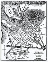
The Nazca Lines are a series of ancient geoglyphs located in the Nazca Desert in southern Peru. They were designated a UNESCO World Heritage Site in 1994. The high, arid plateau stretches more than between the towns of Nazca and Palpa on the Pampas de Jumana about 400 km south of Lima...
in Peru
Peru
Peru , officially the Republic of Peru , is a country in western South America. It is bordered on the north by Ecuador and Colombia, on the east by Brazil, on the southeast by Bolivia, on the south by Chile, and on the west by the Pacific Ocean....
. The 'Works of the Old Men' in Arabia, "stone-built structures that are far more numerous than (the) Nazca Lines, far more extensive in the area that they cover, and far older," have been described as 'Geoglyphs' by Amelia Sparavigna, a physics professor at Politecnico di Torino in Italy . The use of this term to describe these features is probably inaccurate, as recent research has shown that most were not constructed primarily as 'art' or 'motifs', but were rather built to serve a range of purposes including the site of burial and funerary customs, aiding in the trapping of migratory animals, and as cleared areas for camps, houses and animal enclosures . Recently some geoglyphs have been discovered in the Amazon Rainforest
Amazon Rainforest
The Amazon Rainforest , also known in English as Amazonia or the Amazon Jungle, is a moist broadleaf forest that covers most of the Amazon Basin of South America...
, in Brazil
Brazil
Brazil , officially the Federative Republic of Brazil , is the largest country in South America. It is the world's fifth largest country, both by geographical area and by population with over 192 million people...
, among the Megaliths in the Urals
Megaliths in the Urals
During the last years a lot of megaliths have been discovered in the Urals: dolmens, menhirs and a large megalithic cultic complex of the Vera Island.-Dolmens of the Middle Urals:At present time more than 200 dolmens have been discovered in the Sverdlovsk Oblast...
, which led to claims about unknown civilizations that may have inhabited the area in the past. Other areas with geoglyphs include South Australia
South Australia
South Australia is a state of Australia in the southern central part of the country. It covers some of the most arid parts of the continent; with a total land area of , it is the fourth largest of Australia's six states and two territories.South Australia shares borders with all of the mainland...
(Marree Man
Marree Man
The Marree Man, or Stuart's Giant, is a modern geoglyph discovered by air on 26 June 1998. It appears to depict an indigenous Australian man, most likely of the Pitjantjatjara tribe, hunting birds or wallabies with a throwing stick. It lies on a plateau at Finnis Springs 60 km west of the...
), Western Australia
Western Australia
Western Australia is a state of Australia, occupying the entire western third of the Australian continent. It is bounded by the Indian Ocean to the north and west, the Great Australian Bight and Indian Ocean to the south, the Northern Territory to the north-east and South Australia to the south-east...
and parts of the Great Basin Desert
Great Basin Desert
The Great Basin Desert is an area of nearctic high deserts across parts of Nevada, California, and Utah that extends into the Colorado River watershed , but which is mostly a portion of the central Nevada desert basins of the Great Basin.It along with the Escalante Desert, Mohave Desert, the...
in SW United States. Hill figure
Hill figure
A hill figure is a large visual representation created by cutting into a steep hillside and revealing the underlying geology. It is a type of geoglyph usually designed to be seen from afar rather than above. In some cases trenches are dug and rubble made from material brighter than the natural...
s, turf maze
Turf maze
Historically, a turf maze is a labyrinth made by cutting a convoluted path into a level area of short grass, turf or lawn. Some had names such as Mizmaze, Troy Town, The Walls of Troy, Julian's Bower, or Shepherd's Race...
s and the stone-lined labyrinth
Labyrinth
In Greek mythology, the Labyrinth was an elaborate structure designed and built by the legendary artificer Daedalus for King Minos of Crete at Knossos...
s of Scandinavia
Scandinavia
Scandinavia is a cultural, historical and ethno-linguistic region in northern Europe that includes the three kingdoms of Denmark, Norway and Sweden, characterized by their common ethno-cultural heritage and language. Modern Norway and Sweden proper are situated on the Scandinavian Peninsula,...
, Iceland
Iceland
Iceland , described as the Republic of Iceland, is a Nordic and European island country in the North Atlantic Ocean, on the Mid-Atlantic Ridge. Iceland also refers to the main island of the country, which contains almost all the population and almost all the land area. The country has a population...
, Lappland and the former Soviet Union
Soviet Union
The Soviet Union , officially the Union of Soviet Socialist Republics , was a constitutionally socialist state that existed in Eurasia between 1922 and 1991....
are types of geoglyph.
Modern
Not all geoglyphs are ancient. The Land ArtLand art
Land art, Earthworks , or Earth art is an art movement which emerged in the United States in the late 1960s and early 1970s, in which landscape and the work of art are inextricably linked...
movement created many new geoglyphs as well as other structures: perhaps the most famous example is Spiral Jetty
Spiral Jetty
The Spiral Jetty, considered to be the central work of American sculptor Robert Smithson, is an earthwork sculpture constructed in 1970.Built entirely of mud, salt crystals, basalt rocks, earth, and water on the northeastern shore of the Great Salt Lake near Rozel Point in Utah, it forms a , ...
by Robert Smithson
Robert Smithson
Robert Smithson was an American artist famous for his land art.-Background and education:Smithson was born in Passaic, New Jersey and studied painting and drawing in New York City at the Art Students League of New York....
. Many towns and cites in the Western United States
Western United States
.The Western United States, commonly referred to as the American West or simply "the West," traditionally refers to the region comprising the westernmost states of the United States. Because the U.S. expanded westward after its founding, the meaning of the West has evolved over time...
use hillside letters (also known as "Mountain Monograms") on the hills above their locations. Contemporary Australian sculptor
Sculpture
Sculpture is three-dimensional artwork created by shaping or combining hard materials—typically stone such as marble—or metal, glass, or wood. Softer materials can also be used, such as clay, textiles, plastics, polymers and softer metals...
Andrew Rogers
Andrew Rogers (sculptor)
Andrew Rogers is a sculptor whose works may be found in many plazas and buildings around the world. He is a leading contemporary artist.Rogers is the creator of the world’s largest contemporary land art undertaking...
has created geoglyphs around the world called "The Rhythms of Life". You Yangs National Park is the home of a geoglyph constructed by the Rogers in recognition of the indigenous people of the area. It depicts Bunjil, a mythical creature to the local Wautharong
Wautharong
Wathaurong, also called the Wada wurrung, are an Indigenous Australian tribe living in the area near Melbourne, Geelong and the Bellarine Peninsula. They are part of the Kulin alliance. The Wathaurong language was spoken by 25 clans south of the Werribee River and the Bellarine Peninsula to Streatham...
Aborigines
Australian Aborigines
Australian Aborigines , also called Aboriginal Australians, from the latin ab originem , are people who are indigenous to most of the Australian continentthat is, to mainland Australia and the island of Tasmania...
.
In 2008/2009 Alfie Dennen
Alfie Dennen
Alfie Dennen is a British creative technologist, Artist, and founder of several prominent websites based around mobile blogging.- Projects :Dennen co-founded the mobile blogging platform Moblog, formerly MoblogUK, in November 2003...
created Britglyph
Britglyph
Britglyph was a collaborative locative art and Geoglyph project created by Alfie Dennen for ShoZu which took place between December 2008 and March 2009. Participants were instructed to travel to specific locations across the United Kingdom with a rock or stone taken from near where they live...
, a locative art focused Geoglyph created through participants across the United Kingdom leaving rocks at highly specific locations and uploading media created at each location. When taken together and viewed on the main project website an image of a watch and chain inspired by John Harrison
John Harrison
John Harrison was a self-educated English clockmaker. He invented the marine chronometer, a long-sought device in solving the problem of establishing the East-West position or longitude of a ship at sea, thus revolutionising and extending the possibility of safe long distance sea travel in the Age...
's marine chronometer
Marine chronometer
A marine chronometer is a clock that is precise and accurate enough to be used as a portable time standard; it can therefore be used to determine longitude by means of celestial navigation...
H5 was created.
See also
- PetroglyphPetroglyphPetroglyphs are pictogram and logogram images created by removing part of a rock surface by incising, picking, carving, and abrading. Outside North America, scholars often use terms such as "carving", "engraving", or other descriptions of the technique to refer to such images...
- PetrosomatoglyphPetrosomatoglyphA petrosomatoglyph is an image of parts of a human or animal body incised in rock. Many were created by Celtic peoples, such as the Picts, Scots, Irish, Cornish, Cumbrians, Bretons and Welsh. These representations date from the Early Middle Ages; others of uncertain purpose date back to megalithic...
- Intaglio (burial mound)Intaglio (burial mound)Intaglio is a term from art applied to burial mounds that refers to a design cut into a hard surface. In this case, the burial mounds have designs cut into the ground, though intaglio broadly applies to burial mounds which are raised above the natural surface of the terrain. There are much more...
- Battalion ParkBattalion ParkBattalion Park is the site of a set of geoglyphs located in Calgary, Alberta on Signal Hill. The site is located on a hill overlooking the Sarcee Nation, and lands formerly known as Camp Sarcee and later Sarcee Training Area...
- BritglyphBritglyphBritglyph was a collaborative locative art and Geoglyph project created by Alfie Dennen for ShoZu which took place between December 2008 and March 2009. Participants were instructed to travel to specific locations across the United Kingdom with a rock or stone taken from near where they live...
External links
- The Blythe Intaglios, A Photo Gallery, James Q. Jacobs
- Ken Scarlett, "Andrew Rogers and the Rhythm of Life" Sculpture article on geoglyph
- Photogrammetric Reconstruction of the Geoglyphs of Nasca and Palpa
- David Kennedy, The “Works of the Old Men” in Arabia: remote sensing in interior Arabia
- Pioneer (Japan) has taken shears to grass to promote its latest Smart Loop car navigation system