
State highways in Colorado
Encyclopedia
The system of State highway
s in Colorado
is a system of public paved roads funded and maintained by the Colorado Department of Transportation
; in the U.S. State
of Colorado
comprises State Highways (typically abbreviated SH), U.S. Routes, and Interstate Highways. The numbered highways within the state begin at 1 and increase, with exception of numbers already designated as U.S. highways
or Interstate Highways
State highway
State highway, state road or state route can refer to one of three related concepts, two of them related to a state or provincial government in a country that is divided into states or provinces :#A...
s in Colorado
Colorado
Colorado is a U.S. state that encompasses much of the Rocky Mountains as well as the northeastern portion of the Colorado Plateau and the western edge of the Great Plains...
is a system of public paved roads funded and maintained by the Colorado Department of Transportation
Colorado Department of Transportation
The Colorado Department of Transportation is the agency of state government responsible for transportation in the State of Colorado of the United States. CDOT is responsible for maintaining 9,144 mile highway system, including 3,429 bridges with over 28 billion vehicle miles of travel per year...
; in the U.S. State
U.S. state
A U.S. state is any one of the 50 federated states of the United States of America that share sovereignty with the federal government. Because of this shared sovereignty, an American is a citizen both of the federal entity and of his or her state of domicile. Four states use the official title of...
of Colorado
Colorado
Colorado is a U.S. state that encompasses much of the Rocky Mountains as well as the northeastern portion of the Colorado Plateau and the western edge of the Great Plains...
comprises State Highways (typically abbreviated SH), U.S. Routes, and Interstate Highways. The numbered highways within the state begin at 1 and increase, with exception of numbers already designated as U.S. highways
United States Numbered Highways
The system of United States Numbered Highways is an integrated system of roads and highways in the United States numbered within a nationwide grid...
or Interstate Highways
1-100
| Number | From | To | Length |
|---|---|---|---|
 State Highway 1 State Highway 1Colorado State Highway 1 State Highway 1 is a state highway in the U.S. state of Colorado. Approximately long, it is located in northeastern Larimer County and runs between U.S. Highway 287 and State Highway 14 just north of the city line of Fort Collins, northeast of Interstate 25 at Wellington.-Route:The road passes... |
US 287 near Fort Collins Fort Collins, Colorado Fort Collins is a Home Rule Municipality situated on the Cache La Poudre River along the Colorado Front Range, and is the county seat and most populous city of Larimer County, Colorado, United States. Fort Collins is located north of the Colorado State Capitol in Denver. With a 2010 census... |
I-25 at Wellington Wellington, Colorado Wellington is a Statutory Town in Larimer County, Colorado, United States. The population was 6,289 at the 2010 census.-Geography:Wellington is located at .... |
9.96 mi |
 State Highway 2 State Highway 2Colorado State Highway 2 State Highway 2 is a state highway of the U.S. state of Colorado. It runs for approximately north–south entirely within the urbanized environment of the Denver Metropolitan Area. It is one of the major north–south thoroughfares of east Denver, where it is known as Colorado Boulevard.-Route... |
US 285 at Denver Denver, Colorado The City and County of Denver is the capital and the most populous city of the U.S. state of Colorado. Denver is a consolidated city-county, located in the South Platte River Valley on the western edge of the High Plains just east of the Front Range of the Rocky Mountains... |
Brighton Brighton, Colorado Brighton is a Home Rule Municipality in Adams and Weld counties in the U.S. state of Colorado, and the county seat of Adams County. The United States Census Bureau estimates that the city population was 31,380 in 2008.-Geography:... |
24.00 mi |
 State Highway 3 State Highway 3 |
US 160-550 near Durango Durango, Colorado The City of Durango is a Home Rule Municipality that is the county seat and the most populous city of La Plata County, Colorado, United States. The United States Census Bureau said that the city population was 16,887 in 2010 census.-History:... |
US 160-550 near Durango | 2.44 mi |
 State Highway 5 State Highway 5 |
SH 103 near Idaho Springs Idaho Springs, Colorado The City of Idaho Springs is a municipality in the U.S. state of Colorado that is the most populous settlement in Clear Creek County, Colorado. Idaho Springs is located in Clear Creek Canyon, in the mountains upstream from Golden, some thirty miles west of Denver... |
Summit of Mount Evans Mount Evans Mount Evans is a mountain in the Front Range region of the Rocky Mountains, in Clear Creek County, Colorado. It is one of 54 fourteeners in Colorado, and the closest fourteener to Denver... |
14.89 mi |
 State Highway 7 State Highway 7Colorado State Highway 7 State Highway 7 in the U.S. state of Colorado is a state highway. Approximately long, it is located in the north-central portion of the state, traversing the mountains on the east of the continental divide south of Estes Park as well as portions of the Colorado Piedmont north of Denver... |
81.64 mi | ||
 State Highway 8 State Highway 8 |
US 285 near Morrison Morrison, Colorado The historic Town of Morrison is a Home Rule Municipality in Jefferson County, Colorado, United States. The population was 430 at the 2000 census... |
SH 121 at Lakewood Lakewood, Colorado Lakewood is a Home Rule Municipality that is the most populous city in Jefferson County, Colorado, United States. Lakewood is the fifth most populous city in the State of Colorado and the 172nd most populous city in the United States. The United States Census Bureau estimates that in April 1, 2010... |
8.68 mi |
 State Highway 9 State Highway 9 |
US 50 near Cañon City Cañon City, Colorado The City of Cañon City is a Home Rule Municipality that is the county seat and the most populous city of Fremont County, State of Colorado. The United States Census Bureau estimated that the city population was 16,000 in 2005. Cañon City is noted for being the location of nine state and four ... |
US 40 in Kremmling Kremmling, Colorado Kremmling is a Statutory Town in Grand County, Colorado, United States. The population was 1,578 at the 2000 census. The town sits along the upper Colorado River in the lower arid section of Middle Park between Byers Canyon and Gore Canyon... |
138.92 mi |
 State Highway 10 State Highway 10 |
I-25 / US 160 at Walsenburg Walsenburg, Colorado The City of Walsenburg or Los Leones is a Statutory City that is the county seat and the most populous city of Huerfano County, Colorado, United States... |
US 50 at La Junta La Junta, Colorado The City of La Junta is a Home Rule Municipality that is the county seat and the most populous city of Otero County, Colorado, United States. The city population was 7,568 at the U.S. Census 2000. La Junta is located on the Arkansas River in southeastern Colorado east of Pueblo.-History:During... |
71.96 mi |
 State Highway 11 State Highway 11 |
US 138 at Julesburg Julesburg, Colorado The historic town of Julesburg is a statutory town that is the county seat of Sedgwick County, Colorado, United States. The town is located on the north side of the South Platte River. The population was 1,467 at the U.S. Census 2000... |
Nebraska Nebraska Nebraska is a state on the Great Plains of the Midwestern United States. The state's capital is Lincoln and its largest city is Omaha, on the Missouri River.... border |
1.35 mi |
 State Highway 12 State Highway 12 |
US 160 at La Veta La Veta, Colorado La Veta is a Statutory Town in Huerfano County, Colorado, United States. The population was 924 at the 2000 census.-Geography:La Veta is located at .... |
I-25 at Trinidad Trinidad, Colorado The historic City of Trinidad is a Home Rule Municipality that is the county seat and the most populous city of Las Animas County, Colorado, United States... |
70.36 mi |
 State Highway 13 State Highway 13 |
I-70 near Rifle Rifle, Colorado The City of Rifle is a Home Rule Municipality in Garfield County, Colorado, United States. The population was 6,769 at the 2000 census. Rifle is a regional center of the cattle ranching industry located along Interstate 70 and the Colorado River just east of the Roan Cliffs, which dominate the... |
127.99 mi | |
 State Highway 14 State Highway 14Colorado State Highway 14 State Highway 14 in the U.S. state of Colorado is an east–west state highway approximately long. One of the longest state highways in Colorado, it traverses four counties along the northern edge of the state, spanning a geography from the continental divide in the Rocky Mountains to the... |
US 40 at Muddy Pass Muddy Pass Muddy Pass is a high mountain pass in the Rocky Mountains of northern Colorado in the United States.The pass straddles the continental divide along the boundary between Jackson and Grand counties. The pass separates North Park and the headwaters of the North Platte River with Middle Park near the... |
US 6 at Sterling Sterling, Colorado The City of Sterling is a Home Rule Municipality that is the county seat and the most populous city of Logan County, Colorado, United States. The city population was 14,777 at the 2010 census.-Geography:Sterling is located at... |
236.92 mi |
 State Highway 15 State Highway 15 |
US 160/285 in Monte Vista Monte Vista, Colorado The City of Monte Vista is a Home Rule Municipality that is the most populous city in Rio Grande County, Colorado, United States. The population was 4,529 at the 2000 census.-Geography:... |
US 285 in La Jara La Jara, Colorado La Jara is a Statutory Town in Conejos County, Colorado, United States. The population was 877 at the 2000 census.-Geography:La Jara is located at .... |
30.92 mi |
 State Highway 16 State Highway 16 |
Jct I-25 Exit 132 in Security Security-Widefield, Colorado Security-Widefield is a census-designated place in El Paso County, Colorado, United States. The population was 29,845 at the 2000 census.-Geography:Security-Widefield is located at .... |
Syracuse Street in Widefield Security-Widefield, Colorado Security-Widefield is a census-designated place in El Paso County, Colorado, United States. The population was 29,845 at the 2000 census.-Geography:Security-Widefield is located at .... |
1.31 mi |
 State Highway 17 State Highway 17Colorado State Highway 17 State Highway 17 is a long state highway in southern Colorado.-Route description:SH 17 is officially split into two parts by a stretch of concurrence with U.S. Highway 285. The first part of the route begins in the south at the New Mexico state line where the road becomes New Mexico State Road 17... |
New Mexico New Mexico New Mexico is a state located in the southwest and western regions of the United States. New Mexico is also usually considered one of the Mountain States. With a population density of 16 per square mile, New Mexico is the sixth-most sparsely inhabited U.S... state line |
US 285 south of Villa Grove Villa Grove, Colorado Villa Grove is an unincorporated town and a U.S. Post Office located in Saguache County, Colorado, United States. The Villa Grove Post Office has the ZIP Code 81155.- History :... |
88.5 mi |
 State Highway 21 State Highway 21Colorado State Highway 21 State Highway 21 is an expressway in El Paso County, in eastern Colorado Springs. Highway 21 constitutes the portion in Colorado Springs of a road known as the Powers Boulevard. Powers Blvd/SH 21 is perhaps the third busiest and important road after I-25 and US 24.The southern terminus of this... |
SH 83 Colorado State Highway 83 State Highway 83 is a state highway that runs from SH 21 interchange in north Colorado Springs to SH 2 at Leetsdale Dr. / Colorado Blvd. in Denver.-Route description:... near Black Forest Black Forest, Colorado Black Forest is a census-designated place near Colorado Springs, Colorado, United States. The population was 13,116 at the 2010 census. Black Forest is named such for the high density of Ponderosa Pines located in a generally small area... |
SH 16 (Mesa Ridge Parkway) in Security-Widefield Security-Widefield, Colorado Security-Widefield is a census-designated place in El Paso County, Colorado, United States. The population was 29,845 at the 2000 census.-Geography:Security-Widefield is located at .... |
20.56 mi |
 State Highway 22 State Highway 22Colorado State Highway 22 State Highway 22 is a long state highway in Adams County, Colorado. Its east end is at SH 2 and its west end is at Brighton Road.-Route description:... |
SH 2 Colorado State Highway 2 State Highway 2 is a state highway of the U.S. state of Colorado. It runs for approximately north–south entirely within the urbanized environment of the Denver Metropolitan Area. It is one of the major north–south thoroughfares of east Denver, where it is known as Colorado Boulevard.-Route... (Sable Blvd) near Brighton Brighton, Colorado Brighton is a Home Rule Municipality in Adams and Weld counties in the U.S. state of Colorado, and the county seat of Adams County. The United States Census Bureau estimates that the city population was 31,380 in 2008.-Geography:... |
Brighton Road in Henderson Henderson, Colorado Henderson, formerly known as Henderson Island, is an unincorporated community and a U.S. Post Office in Adams County, Colorado, United States. The Henderson Post Office has the ZIP Code 80640. Portions of the Henderson area have been annexed by the cities of Commerce City, Brighton, and... |
2.47 mi |
 State Highway 23 State Highway 23Colorado State Highway 23 State Highway 23 is a long state highway in the northeastern corner of Colorado. The route begins at its junction with U.S. Highway 385 at Holyoke and travels northeast through Amherst to the Nebraska state line where it becomes Nebraska Highway 23.... |
US 385 in Holyoke Holyoke, Colorado The City of Holyoke is a Home Rule Municipality that is the county seat and the most populous city of Phillips County, Colorado, United States. The city population was 2,261 at the 2000 census.-Geography:Holyoke is located at .... |
Nebraska Nebraska Nebraska is a state on the Great Plains of the Midwestern United States. The state's capital is Lincoln and its largest city is Omaha, on the Missouri River.... border (continues at Nebraska SH 23 Nebraska Highway 23 Nebraska Highway 23 is a highway in southwestern Nebraska. Its western terminus is on the Colorado border at Venango, where the highway continues west as Colorado State Highway 23. Its eastern terminus is at Holdrege at an intersection with U.S. Highway 6 and U.S. Highway 34.-Route... ) |
17.83 mi |
 State Highway 26 State Highway 26Colorado State Highway 26 State Highway 26 is a long state highway in Denver, Colorado. SH 26 consists of a portion of Alameda Avenue, a city street in Denver. The route begins at State Highway 95 and travels due east towards downtown Denver before reaching its eastern end at the Kalamath Street.-Route description:The... |
SH 95 (Sheridan Blvd) in Denver | I-25 Exit 208 in Denver | 2.82 mi |
 State Highway 30 State Highway 30Colorado State Highway 30 Colorado State Highway 30, alternatively known as Hampden Avenue, is a state route in the independent city of Denver and Arapahoe County. Its west end is at Interstate 25 and US 285 in Denver and its east end is at Quincy Avenue east of Aurora.... |
US 285 and I-25 in Denver | Quincy Avenue and Gun Club Road in Aurora Aurora, Colorado City of Aurora is a Home Rule Municipality spanning Arapahoe, Adams, and Douglas counties in Colorado. Aurora is an eastern suburb of the Denver-Aurora-Broomfield, CO Metropolitan Statistical Area . The city is the third most populous city in the Colorado and the 56th most populous city in the... |
20.41 mi |
 State Highway 35 State Highway 35Colorado State Highway 35 Colorado State Highway 35, also known as Quebec Street, is a state route in the city of Denver, Colorado. It is long. Its southern end is I-70 and its eastern end is 53rd Place. An expansion was planned but funding has not materialized.... |
I-70 Exit 278 in Denver | North of I-270 along Quebec Street in Denver | 1.01 mi |
 State Highway 36 State Highway 36 |
I-70 Exit 292 near Watkins Watkins, Colorado Watkins is a census-designated place in Arapahoe and Adams County, Colorado, United States. It was formerly an incorporated town. The Watkins Post Office has the ZIP Code 80137... |
US 36 in Byers Byers, Colorado Byers is a census-designated place in Arapahoe County, Colorado, United States. The population was 1,160 at the 2010 census. The Byers Post Office has the ZIP Code 80103.-Geography:Byers is located at .... |
24.53 mi |
 State Highway 39 State Highway 39Colorado State Highway 39 -Route description:SH 39 runs , starting at a junction with I-76 near Wiggins, going north across the South Platte River and ending at a junction with SH 144 near Jackson Lake State Park.-Major intersections:The entire route is in Morgan County.... |
I-76 Exit 66 in Wiggins Wiggins, Colorado Wiggins is a Statutory village in Morgan County, Colorado, United States. The population was 001 at the 2000 census.The community was established in 1882 as the Burlington railroad depot of Corona. Around 1900, Corona was renamed in honor of Oliver P. Wiggins, who served as a guide and scout for... |
SH 144 Colorado State Highway 144 State Highway 144 is a long state highway in northeastern Colorado.-Route description:SH 144 begins in the west at Interstate 76 and proceeds initially to the north; after , the road crosses U.S. Highway 34. After another , the route crosses the South Platte River and begins to curve in a broad... near Jackson Lake State Park Jackson Lake State Park (Colorado) Jackson Lake State Park is located northeast of Orchard, Colorado in western Morgan County, Colorado. It is situated on Jackson reservoir and was built in the early 1900s... |
7.57 mi |
 State Highway 41 State Highway 41Colorado State Highway 41 State Highway 41 is a highway on the Ute Mountain Ute Indian Reservation in southwest Colorado.-Route description:SH 41 runs , starting at a junction with US-160 near the Four Corners Monument. The highway goes northwest and ends at the Utah state line... |
US 160 | Utah Utah Utah is a state in the Western United States. It was the 45th state to join the Union, on January 4, 1896. Approximately 80% of Utah's 2,763,885 people live along the Wasatch Front, centering on Salt Lake City. This leaves vast expanses of the state nearly uninhabited, making the population the... border (connects to Utah State Route 162 Utah State Route 162 State Route 162 is a state highway located in San Juan County, Utah. It begins at US-191 east of Bluff. It then follows the former alignment of SR-163 to Montezuma Creek. There, it intersects UT-262 at its southern terminus. Afterwards, it follows SR-262's former alignment past Aneth to the... ) |
9.50 mi |
 State Highway 42 State Highway 42Colorado State Highway 42 -Route description:SH 42 runs , starting at a junction with SH 7 also known as Baseline Road. The highway goes south to Louisville then turns east, crossing Coal Creek and ending at and a junction with US-287.-Major intersections:... |
US 287 curving through Louisville Louisville, Colorado Louisville is a Home Rule Municipality in Boulder County, Colorado, United States. The population was 18,937 at the 2000 census. Louisville began as a rough mining community in 1877, suffered through a period of extraordinary labor violence early in the 20th century, and then, when the mines... |
Baseline Road in Lafayette Lafayette, Colorado The City of Lafayette is a Home Rule Municipality located in Boulder County, Colorado, United States. The United States Census Bureau estimates that the city population was 23,884 on 2005-07-01.- Geography :Lafayette is located at .... |
4.87 mi |
 State Highway 44 State Highway 44Colorado State Highway 44 State Highway 44 is a highway in Adams County, Colorado.-Route description:SH 44 runs , starting at a junction with Colorado State Highway 2, heading west across the South Platte River and ending at Colorado Boulevard in Thornton... |
SH 2 Colorado State Highway 2 State Highway 2 is a state highway of the U.S. state of Colorado. It runs for approximately north–south entirely within the urbanized environment of the Denver Metropolitan Area. It is one of the major north–south thoroughfares of east Denver, where it is known as Colorado Boulevard.-Route... in Commerce City Commerce City, Colorado The city of Commerce City is a Home Rule Municipality located in Adams County, Colorado, United States. Commerce City is a northern suburb of Denver and now the 18th most populous municipality in the state of Colorado... |
104th Ave. and Colorado Blvd. in Thornton Thornton, Colorado The city of Thornton is a Home Rule Municipality in Adams and Weld counties in the U.S. state of Colorado and a suburb of the Denver-Aurora-Broomfield, CO Metropolitan Statistical Area. Thornton is northeast of the state's capital, Denver. The United States Census Bureau that the city population... |
4.95 mi |
 State Highway 45 State Highway 45Colorado State Highway 45 Colorado State Highway 45, also known as Pueblo Boulevard, is an expressway in the city of Pueblo. It is long. Its southern terminus is at I-25 and its northern terminus is US 50. Plans are waiting to be approved to expand the expressway to six lanes, build a new interchange with US 50, and fix... |
I-25 Exit 94 south of Pueblo Pueblo, Colorado Pueblo is a Home Rule Municipality that is the county seat and the most populous city of Pueblo County, Colorado, United States. The population was 106,595 in 2010 census, making it the 246th most populous city in the United States.... |
US 50 northwest of Pueblo | 8.73 mi |
 State Highway 46 State Highway 46Colorado State Highway 46 State Highway 46 is a highway in Colorado that connects Golden Gate Canyon State Park to Colorado State Highway 119 near Black Hawk.-Route description:... |
SH 119 Colorado State Highway 119 State Highway 119 is a long state highway in north central Colorado. It extends in a southwest to northeast direction, from a junction with US Route 6 in Clear Creek Canyon between Golden and Idaho Springs to a junction with I-25 east of Longmont.... near Black Hawk |
Jefferson County line (becomes CR 70) | 6.61 mi |
 State Highway 47 State Highway 47Colorado State Highway 47 -Route description:SH 47 runs , starting at I-25 exit 101 on the north end of Pueblo then east and south to a junction with .-Major intersections:The entire route is in Pueblo County-Route description:... |
I-25 Exit 101 in north Pueblo | US 50/SH 96 Colorado State Highway 96 State Highway 96 is a state highway in eastern Colorado. Its eastern terminus is at the Kansas state line east of Towner where it continues as K-96; its western terminus is at State Highway 69 at Westcliffe.... east of Pueblo |
4.63 mi |
 State Highway 52 State Highway 52Colorado State Highway 52 State Highway 52 is a long state highway in northeastern Colorado.-Route description:SH 52 begins near Niwot, winding east from its western terminus past US 287 to I-25, near the towns of Dacono, Frederick, and Firestone The highway has interchanges with US 85, then continues east to I-76 in Hudson... |
SH 119 Colorado State Highway 119 State Highway 119 is a long state highway in north central Colorado. It extends in a southwest to northeast direction, from a junction with US Route 6 in Clear Creek Canyon between Golden and Idaho Springs to a junction with I-25 east of Longmont.... near Niwot |
SH 14 Colorado State Highway 14 State Highway 14 in the U.S. state of Colorado is an east–west state highway approximately long. One of the longest state highways in Colorado, it traverses four counties along the northern edge of the state, spanning a geography from the continental divide in the Rocky Mountains to the... at Raymer Raymer, Colorado The Town of Raymer is a Statutory Town located in Weld County, Colorado, United States. The population was 91 at the U.S. Census 2000.The community has two official names:*Raymer - The legal name of the incorporated Town of Raymer.... |
111 mi |
 State Highway 53 State Highway 53Colorado State Highway 53 State Highway 53 is a highway in Adams County, Colorado.-Route description:SH 53 runs , starting at the 58th Avenue exit of I-25 then north to 70th Avenue where it ends at a junction with Colorado State Highway 224.-Major intersections:... |
E 58th Ave near I-25 Exit 215 in Denver | SH 224 Colorado State Highway 224 -Route description:SH 224 runs , starting at an interchange with , heading south on Broadway, then east on 70th Avenue. The highway crosses the South Platte River to an interchange with and ends at a junction with .-Major intersections:... (70th Ave) north of Denver in Adams County Adams County, Colorado Adams County is the fifth most populous of the 64 counties of the state of Colorado of the United States. The United States Census Bureau estimates that the county population was 441,603 in 2010 census, a 21.4% increase since 2000 census. Adams County is named for Alva Adams, Governor of the... |
1.66 mi |
 State Highway 55 State Highway 55Colorado State Highway 55 State Highway 55 is a highway that connects Crook, Colorado to I-76.-Route description:SH 55 runs , starting at a junction with U.S. Route 138 in Crook, then south across the South Platte River to I-76... |
US 138 in Crook | Becomes Logan CR 81 | 5.65 mi |
 State Highway 56 State Highway 56Colorado State Highway 56 State Highway 56 is a Colorado highway that connects Berthoud with Johnstown.-Route description:SH 56 runs , starting at Meadowlark Drive in Berthoud and heading east to a junction with I-25 in Johnstown.-Major intersections:... |
US 287 west of Berthoud Berthoud, Colorado Berthoud is a Statutory Town in Larimer and Weld counties in the U.S. state of Colorado. Berthoud is situated north of the Little Thompson River, approximately halfway between the cities of Fort Collins, Colorado and Denver, Colorado along the Front Range Urban Corridor... |
I-25 Exit 250 east of Berthoud | 6.7 mi |
 State Highway 57 State Highway 57Colorado State Highway 57 Colorado State Highway 57 is an extremely short, half-mile-long highway in Kit Carson County in the Eastern Plains of Colorado. Its southern terminus is at Interstate 70 and its northern terminus is at U.S... |
I-70 | US 24 in Stratton Stratton, Colorado Stratton is a Statutory Town in Kit Carson County, Colorado, United States. The population was 669 at the 2000 census. Stratton was named in honor of the gold miner and philanthropist Winfield Scott Stratton.-Geography:... |
0.53 mi |
 State Highway 58 State Highway 58Colorado State Highway 58 Colorado State Highway 58 is a state highway in Jefferson County, Colorado. It begins at US 6 and SH 93 in Golden at an at-grade intersections and ends at Wheat Ridge. It is a freeway for its entire length except for its west junction, which is a signal light.... |
US 6/SH 93 Colorado State Highway 93 State Highway 93 is a highway in Colorado that connects Golden and Boulder.-Route description:SH 93 runs , starting at its southern junction with U.S. Highway 6 at the entrance to Clear Creek Canyon in Golden... in Golden Golden, Colorado The City of Golden is a home rule municipality that is the county seat of Jefferson County, Colorado, United States. Golden lies along Clear Creek at the edge of the foothills of the Front Range of the Rocky Mountains. Founded during the Pike's Peak Gold Rush on 16 June 1859, the mining camp was... |
I-70 Exit 265 in Wheat Ridge Wheat Ridge, Colorado The City of Wheat Ridge is a Home Rule Municipality located in Jefferson County, Colorado, United States. Wheat Ridge is a western suburb of Denver. The Wheat Ridge Municipal Center is approximately west-northwest of the Colorado State Capitol in Denver... |
5.43 mi |
 State Highway 59 State Highway 59Colorado State Highway 59 State Highway 59 is a long state highway in eastern Colorado.-Route description:SH 59 begins in the south at a junction with U.S. Highway 40 in Kit Carson. From there, the road proceeds northward for before intersecting Interstate 70 at that highway's exit 405 just south of the Seibert city... |
US 40-287 at Kit Carson | US 138 in Sedgwick Sedgwick, Colorado Sedgwick is a statutory town in Sedgwick County, Colorado, United States. The population was 191 at the 2000 census.-History:The town was named for Fort Sedgwick, which was named after John Sedgwick, who was a Major General in the Union Army during the American Civil War.-Geography:Sedgwick is... |
173.30 mi |
 State Highway 60 State Highway 60Colorado State Highway 60 State Highway 60 is a highway in Colorado that connects Campion, Johnstown and Milliken.-Route description:SH 60 runs , starting at a junction with U.S. Highway 287 at Campion and ending at a junction with U.S... |
US 287 in Campion Campion, Colorado Campion is an unincorporated community in Larimer County, Colorado, United States. The population was 1,832 at the 2000 census, at which time it was a census-designated place ; the community was not enumerated separately in the 2010 census. Located between Loveland and Berthoud along U.S. Route... |
US 85 southwest of Gilcrest Gilcrest, Colorado The Town of Gilcrest is a Statutory Town located in Weld County, Colorado, United States. The population was 1,162 at the 2000 census.-Geography:Gilcrest is located at .... |
19.99 mi |
 State Highway 61 State Highway 61Colorado State Highway 61 State Highway 61 is a long state highway in northeastern Colorado.-Route description:SH 61 begins at an at-grade intersection with U.S. Route 34 at the south side of Otis. It begins straight northward through town, in which roads are laid out in a grid-like pattern. The road then exits the town,... |
US 34 in Otis Otis, Colorado Otis is a Statutory Town in Washington County, Colorado, United States. The population was 534 at the 2000 census.-History:Otis was established in 1883 as a stop on the Burlington rail line... |
US 6 near Sterling Sterling, Colorado The City of Sterling is a Home Rule Municipality that is the county seat and the most populous city of Logan County, Colorado, United States. The city population was 14,777 at the 2010 census.-Geography:Sterling is located at... |
40.99 mi |
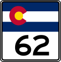 State Highway 62 State Highway 62Colorado State Highway 62 State Highway 62 is a 23.41 mile long state highway in the U.S. state of Colorado.-Route description:SH 62 starts at a junction with just north of Ridgeway in the San Miguel River valley and heads northeast up the Leopard Creek Canyon. The highway bends slowly to the east before crossing the... |
SH 145 Colorado State Highway 145 State Highway 145 is a long state highway in western Colorado.-Route description:The route begins in the south at its intersection with U.S. Highway 160 in the eastern portion of the city of Cortez... near Placerville Placerville, Colorado Placerville is an unincorporated town and a U.S. Post Office located in San Miguel County, Colorado, United States. The Placerville Post Office has the ZIP Code 81430.-History:... |
US 550 near Ridgeway Ridgway, Colorado The Town of Ridgway, coined Gateway to the San Juans, is a Home Rule Municipality in Ouray County, in the southwestern portion of the U.S. State of Colorado. The town is a former railroad stop on the Uncompaghre River in the northern San Juan Mountains... |
23.40 mi |
 State Highway 63 State Highway 63Colorado State Highway 63 State Highway 63 is a long state highway in northeastern Colorado.-Route description:SH 63 begins in the south at a junction with U.S. Highway 36 at Anton and proceeds north through remote, sparsely populated land for roughly before reaching a junction with U.S. Highway 34 at Akron... |
US 36 in Anton | US 6 in Atwood | 56.41 mi |
 State Highway 64 State Highway 64Colorado State Highway 64 State Highway 64 is a 74-mile long two-lane state highway connecting the towns of Dinosaur and Meeker in the western part of the U.S. state of Colorado. It is located in both Moffat and Rio Blanco counties. The western end of State Highway 64 is part of the Dinosaur Diamond Scenic Byway, while the... |
US 40 in Dinosaur | SH 13 near Meeker | 73.70 mi |
 State Highway 65 State Highway 65Colorado State Highway 65 State Highway 65 is a highway in Colorado that crosses the Grand Mesa. The highway along with a road to Lands End Overlook were designated as the Grand Mesa Scenic and Historic Byway in 1996.-Route description:... |
SH 92 Colorado State Highway 92 Colorado State Highway 92 is a stretch of highway that runs between the small Colorado communities of Hotchkiss and Sapinero. SH-92 is long.-Route description:... near Delta |
I-70 near Palisade | 61.38 mi |
 State Highway 66 State Highway 66Colorado State Highway 66 Colorado State Highway 66 is a long east-west state highway in Boulder and Weld counties in Colorado. The highway extends from the foothills of the Rocky Mountains at a junction with US Route 36 southeast of Lyons, proceeding east through the northern edge of Longmont, to Platteville where it ends... |
US 34 near Estes Park | US 85 in Platteville Platteville, Colorado Platteville is a Statutory Town in Weld County, Colorado, United States. The population was 2,370 at the 2000 census. It is adjacent to Fort Vasquez on U.S. Route 85.-Geography:Platteville is located at .... |
22.69 mi |
 State Highway 67 State Highway 67Colorado State Highway 67 State Highway 67 is a long state highway encompassing five distinct segments in south-central Colorado. The route runs north from Wetmore to Sedalia, Colorado, traversing the former route of the Florence and Cripple Creek Railroad through Phantom Canyon as a county road and carrying part of the... |
SH 96 Colorado State Highway 96 State Highway 96 is a state highway in eastern Colorado. Its eastern terminus is at the Kansas state line east of Towner where it continues as K-96; its western terminus is at State Highway 69 at Westcliffe.... in Wetmore Wetmore, Colorado Wetmore is an unincorporated town and a U.S. Post Office located in Custer County, Colorado, United States. The Wetmore Post Office has the ZIP Code 81253.... |
US 85 in Sedalia Sedalia, Colorado Sedalia is a census-designated place in Douglas County, Colorado, United States. The CDP population was 211 at the 2000 census. The Sedalia Post Office has the ZIP Code 80135.-Geography:Sedalia is located at .... |
71.72 mi |
 State Highway 69 State Highway 69Colorado State Highway 69 State Highway 69 is a highway in Colorado that connects Walsenburg and Westcliff.-Route description:SH 69 runs , starting at a junction with I-25 just north of Walsenburg. The highway heads northwest over Long Saddle Pass and Promontory Divide Pass to Westcliff and ends at a junction with U.S... |
BL I-25 near Walsenburg | US 50 at Texas Creek | 82.87 mi |
 State Highway 71 State Highway 71Colorado State Highway 71 State Highway 71 is a long state highway passing several other highways in northern and central Colorado. The route runs south from the Nebraska border to La Junta.-Route description:... |
US 350 near La Junta La Junta, Colorado The City of La Junta is a Home Rule Municipality that is the county seat and the most populous city of Otero County, Colorado, United States. The city population was 7,568 at the U.S. Census 2000. La Junta is located on the Arkansas River in southeastern Colorado east of Pueblo.-History:During... |
Nebraska Nebraska Nebraska is a state on the Great Plains of the Midwestern United States. The state's capital is Lincoln and its largest city is Omaha, on the Missouri River.... Border (becomes Nebraska Highway 71 Nebraska Highway 71 Nebraska Highway 71 is a highway in western Nebraska. Its southern terminus is at the Colorado border south of Kimball, as a continuation of Colorado State Highway 71... ) |
224.65 mi |
 State Highway 72 State Highway 72Colorado State Highway 72 State Highway 72 is a long state highway passing through the foothills and the eastern edge of the Front Range.-Route description:The route is a mainly rural, scenic, mountainous highway; not having many junctions. It begins at I-70 in Wheat Ridge as Ward Road. It continues north through the... |
51.55 mi | ||
 State Highway 74 State Highway 74Colorado State Highway 74 State Highway 74 is an state highway in the U.S. state of Colorado. Running from Interstate 70 to SH 8, the highway forms a rough curve running northwest-southeast. The section of the route north of the town of Evergreen is known as Evergreen Parkway and is a wider segment than that east of... |
I-70 at El Rancho exit | SH 8 in Morrison Morrison, Colorado The historic Town of Morrison is a Home Rule Municipality in Jefferson County, Colorado, United States. The population was 430 at the 2000 census... |
18.01 mi |
 State Highway 75 State Highway 75Colorado State Highway 75 State Highway 75 is a Colorado highway in Jefferson and Arapahoe counties.-Route description:SH 75 runs a total of in two discontinuous segments. The highway starts at the intersection of Broadway and Rafferty Gardens Ave. in Englewood, and runs south on Broadway to Littleton Ave in Littleton. ... |
Englewood Englewood, Colorado The city of Englewood is a Home Rule Municipality located in Arapahoe County, Colorado, United States. As of 2007, the city is estimated to have a total population of 32,532. Englewood is part of the Denver-Aurora Metropolitan Area. Englewood is located in the South Platte River Valley east of the... |
3.71 mi | |
 State Highway 78 State Highway 78Colorado State Highway 78 State Highway 78 is a highway connecting Pueblo to the town of Beulah and the San Isabel National Forest.-Route description:SH 78 runs , starting at a junction with Colorado State Highway 165 in San Isabel National Forest and ending at a junction with Colorado State Highway 45 in Pueblo... |
SH 165 Colorado State Highway 165 State Highway 165 is a long state highway in southern Colorado.-Route description:SH 165 begins in the west at a junction with State Highway 96 roughly fifteen miles east of Silver Cliff. From there the road proceeds to the southeast through portions of San Isabel National Forest... in West Pueblo |
Pennsylvania Ave and Grand Ave in Beulah Beulah, Colorado Beulah is an unincorporated town and U.S. Post Office in Pueblo County, Colorado, United States. The ZIP Code of the Beulah Post Office is 81023.-History:... |
33.27 mi |
 State Highway 79 State Highway 79Colorado State Highway 79 State Highway 79 is a long state highway in Adams and Weld counties in Colorado. It starts at The highway is also called "Kiowa–Bennett Road" and "Converse Road". It traverses through remote, open plain. The highway does not pass through any towns. It does service some subdivisions in the area... |
I-70 near Bennett Bennett, Colorado The town of Bennett is a Statutory Town in Adams and Arapahoe counties in the U.S. state of Colorado. The United States Census Bureau estimates that the town had a population of 2,536 in 2005... |
SH 52 Colorado State Highway 52 State Highway 52 is a long state highway in northeastern Colorado.-Route description:SH 52 begins near Niwot, winding east from its western terminus past US 287 to I-25, near the towns of Dacono, Frederick, and Firestone The highway has interchanges with US 85, then continues east to I-76 in Hudson... at Prospect Valley |
23.89 mi |
 State Highway 82 State Highway 82Colorado State Highway 82 State Highway 82 is an 85.29 mile long state highway in the U.S. state of Colorado.-Route description:SH 82 provides the principal transportation artery of the Roaring Fork Valley on the Colorado Western Slope, running from Interstate 70 at Glenwood Springs southeast past Carbondale, Basalt... |
I-70 in Glenwood Springs Glenwood Springs, Colorado The City of Glenwood Springs is a Home Rule Municipality that is the county seat and the most populous city of Garfield County, Colorado, United States. The United States Census Bureau estimated that the city population was 8,564 in 2005... |
US 24 | 85.29 mi |
 State Highway 83 State Highway 83Colorado State Highway 83 State Highway 83 is a state highway that runs from SH 21 interchange in north Colorado Springs to SH 2 at Leetsdale Dr. / Colorado Blvd. in Denver.-Route description:... |
SH 21 Colorado State Highway 21 State Highway 21 is an expressway in El Paso County, in eastern Colorado Springs. Highway 21 constitutes the portion in Colorado Springs of a road known as the Powers Boulevard. Powers Blvd/SH 21 is perhaps the third busiest and important road after I-25 and US 24.The southern terminus of this... in north Colorado Springs Colorado Springs, Colorado Colorado Springs is a Home Rule Municipality that is the county seat and most populous city of El Paso County, Colorado, United States. Colorado Springs is located in South-Central Colorado, in the southern portion of the state. It is situated on Fountain Creek and is located south of the Colorado... |
SH 2 at Leetsdale Dr. / Colorado Blvd. in Denver Denver, Colorado The City and County of Denver is the capital and the most populous city of the U.S. state of Colorado. Denver is a consolidated city-county, located in the South Platte River Valley on the western edge of the High Plains just east of the Front Range of the Rocky Mountains... |
77.26 mi |
 State Highway 86 State Highway 86Colorado State Highway 86 State Highway 86 is a state highway that runs from the US 85 interchange in Castle Rock just before I-25 to I-70 near Limon. It gives service through eastern Castle Rock to Franktown and then to Elizabeth then from Kiowa to I-70 .... |
I-25 in north Castle Rock (Founders Parkway) | I-70 near Limon | 61.47 mi |
 State Highway 88 State Highway 88Colorado State Highway 88 State Highway 88 is a Colorado highway in Denver and Arapahoe counties.-Route description:SH 88 runs , starting at the intersection of Colfax Avenue and Federal in Denver, going south on Federal to Belleview Ave., then east on Belleview, ending at Parker Rd.... |
Colfax Ave and Federal Blvd in Denver | SH 83 (Parker Road) in Aurora Aurora, Colorado City of Aurora is a Home Rule Municipality spanning Arapahoe, Adams, and Douglas counties in Colorado. Aurora is an eastern suburb of the Denver-Aurora-Broomfield, CO Metropolitan Statistical Area . The city is the third most populous city in the Colorado and the 56th most populous city in the... |
18.76 mi |
 State Highway 89 State Highway 89Colorado State Highway 89 State Highway 89 is a long state highway in the rural eastern plains of Colorado.-Route description:SH 89 begins in the north at the junction with US 50/400 in Holly and proceeds south out of Holly through rural countryside, isolated from any other towns. Although the highway is the main route... |
SH 116 Colorado State Highway 116 State Highway 116 is a fairly isolated state highway that runs from the Kansasstate line in the southeastern corner of the state.-Route description:... at Buckeye Crossroads |
US 50-400 in Holly | 34.34 mi |
 State Highway 90 State Highway 90Colorado State Highway 90 State Highway 90 is a long state highway at the western edge of Colorado.-Route description:SH 90 begins in the west at the border with Utah where it becomes Utah State Route 46 which continues westward to meet U.S. Highway 191 about twenty miles south of Moab, UT... |
Utah State Route 46 Utah State Route 46 State Route 46 is a state highway at the eastern edge of Utah running for in San Juan County.-Route description:The route begins in the west at its junction with US-191 at La Sal Junction about twenty miles south of Moab and proceeds eastward to the south of the La Sal Mountains through the town... at the Utah Utah Utah is a state in the Western United States. It was the 45th state to join the Union, on January 4, 1896. Approximately 80% of Utah's 2,763,885 people live along the Wasatch Front, centering on Salt Lake City. This leaves vast expanses of the state nearly uninhabited, making the population the... state line |
SH 141 Colorado State Highway 141 State Highway 141 is a long state highway in far western Colorado. Though nominally oriented north–south, SH 141 winds around a considerable amount due to the rugged terrain and ultimately forms a giant S shape.-Route description:... at Vancorum |
41.9 mi |
 State Highway 91 State Highway 91Colorado State Highway 91 State Highway 91 is a stretch of highway in Colorado that connects Leadville to Interstate 70 at Copper Mountain.-Route description:SH 91 stretches , starting at its southern junction with U.S. Highway 24 near Leadville. It runs northeast over Fremont Pass, passing the ghost town of Climax, home... |
US 24 near Leadville | I-70 at Copper Mountain | 22.57 mi |
 State Highway 92 State Highway 92Colorado State Highway 92 Colorado State Highway 92 is a stretch of highway that runs between the small Colorado communities of Hotchkiss and Sapinero. SH-92 is long.-Route description:... |
Crawford Ave. and Main St. in Delta | US 50 near Sapinero | 73.29 mi |
 State Highway 93 State Highway 93Colorado State Highway 93 State Highway 93 is a highway in Colorado that connects Golden and Boulder.-Route description:SH 93 runs , starting at its southern junction with U.S. Highway 6 at the entrance to Clear Creek Canyon in Golden... |
US 6 in Golden Golden, Colorado The City of Golden is a home rule municipality that is the county seat of Jefferson County, Colorado, United States. Golden lies along Clear Creek at the edge of the foothills of the Front Range of the Rocky Mountains. Founded during the Pike's Peak Gold Rush on 16 June 1859, the mining camp was... |
SH 119 Colorado State Highway 119 State Highway 119 is a long state highway in north central Colorado. It extends in a southwest to northeast direction, from a junction with US Route 6 in Clear Creek Canyon between Golden and Idaho Springs to a junction with I-25 east of Longmont.... (Canyon Blvd.) in Boulder Boulder, Colorado Boulder is the county seat and most populous city of Boulder County and the 11th most populous city in the U.S. state of Colorado. Boulder is located at the base of the foothills of the Rocky Mountains at an elevation of... |
19.89 mi |
 State Highway 94 State Highway 94Colorado State Highway 94 State Highway 94 is an long east–west Colorado state highway that goes east beginning from US 24 just east of Colorado Springs and ending at U.S. Highway 40/U.S. Highway 287 in rural Cheyenne County west of Wild Horse. The highway serves Schriever Air Force Base and the towns of Ellicott,... |
US 40/US 287 | US 24 just east of Colorado Springs | 86.09 mi |
 State Highway 95 State Highway 95 |
US 285 (Hampden Ave) and Sheridan Blvd. in Denver | US 36 in Westminster | 14.32 mi |
 State Highway 96 State Highway 96Colorado State Highway 96 State Highway 96 is a state highway in eastern Colorado. Its eastern terminus is at the Kansas state line east of Towner where it continues as K-96; its western terminus is at State Highway 69 at Westcliffe.... |
SH 69 in Westcliffe | Kansas Border (becomes K-96 K-96 (Kansas highway) K-96 is a state highway in central and southern Kansas. Its western terminus is at the Colorado state line east of Towner, Colorado, where it continues as Colorado State Highway 96; its eastern terminus since 1999 is at U.S. Route 54/U.S. Route 400 east of Wichita.The eastern terminus was once at... ) |
207.45 mi |
 State Highway 97 State Highway 97Colorado State Highway 97 State Highway 97 is a Colorado highway connecting Nucla and Naturita.-Route description:SH 97 runs , starting at a junction with Colorado State Highway 141 in Naturita... |
SH 141 near Naturita | Main St. and 3rd Ave. in Nucla Nucla, Colorado Nucla is a Statutory Town in Montrose County, Colorado, United States. The population was 734 at the 2000 census. Its name comes from the town's founders intent that it serve as a "nucleus" for the surrounding farms and mines, although it has since come to be associated with the growth of uranium... |
4.58 mi |
 State Highway 100 State Highway 100Colorado State Highway 100 -Route description:SH 97 runs , starting at a junction with U.S. Route 160 and ending in Vilas.-Major intersections:-Route description:SH 97 runs , starting at a junction with U.S. Route 160 and ending in Vilas.-Major intersections:-Route description:... |
US 160 north of Vilas Vilas, Colorado The town of Vilas is a Statutory Town located in Baca County, Colorado, United States. The population was 110 at the 2000 census.-Geography:Vilas is located at .... |
A & Main Streets in Vilas | 0.41 mi |
101-200
| Number | From | To | Length |
|---|---|---|---|
 State Highway 101 State Highway 101Colorado State Highway 101 -Route description:SH 101 runs , starting at a junction with , heading south across the Purgatoire River and ending at a junction with CR K and CR 14.-Major intersections:The entire route is in Bent County.-Route description:... |
CR K/CR 14 | 21.41 mi | |
 State Highway 103 State Highway 103Colorado State Highway 103 State Highway 103 in the U.S. state of Colorado runs from I-70 at Idaho Springs to county roads 151 and 103 at Squaw Pass. The thirteen miles from Idaho Springs to State Highway 5 forms about half of the Mount Evans Scenic Byway.... |
I-70 at Idaho Springs | CR 151 and CR 103 at Squaw Pass | 22.48 mi |
 State Highway 105 State Highway 105Colorado State Highway 105 State Highway 105 is a state highway that runs from State Highway 83 in western Black Forest to SH 67 in Sedalia. The highway serves the communities of Monument and Palmer Lake and the unincorporated areas of Douglas and El Paso counties.... |
32.63 mi | ||
 State Highway 109 State Highway 109Colorado State Highway 109 State Highway 109 is a long state highway in southeastern Colorado.- Route description :The road begins in the south at its junction with U.S. Highway 160 roughly two miles north of Kim... |
Cheraw Cheraw, Colorado Cheraw is a Statutory Town in Otero County, Colorado, United States. The population was 211 at the 2000 census.-Geography:Cheraw is located at .... |
65.33 mi | |
 State Highway 110 State Highway 110Colorado State Highway 110 -Route description:The route begins at U.S. Route 550 in Silverton and runs for 980 feet to its terminus at a CDOT maintenance yard.-History:The route was established in the 1920s, when it began at U.S. Route 550 in Silverton and headed north to Howardsville. SH 110 was extended north to Eureka by... |
Silverton Silverton, Colorado The town of Silverton is a Statutory Town that is the county seat of, and the only incorporated municipality in, San Juan County, Colorado, United States. Silverton is a former silver mining camp, most or all of which is now included in a federally designated National Historic Landmark District,... |
0.19 mi | |
 State Highway 112 State Highway 112Colorado State Highway 112 State Highway 112 is a long state highway in southern Colorado. Built in 1916 and formally defined in 1922, the route begins at its western end in Del Norte at a junction with U.S. Highway 160... |
27.80 mi | ||
 State Highway 113 State Highway 113Colorado State Highway 113 State Highway 113 is a long state highway in northeastern Colorado.-Route description:SH 113 begins in the south at a junction with U.S. Highway 138 approximately nine miles northeast of Sterling and proceeds north for almost sixteen miles before passing though the small town of Peetz and... |
northeast of Sterling | at Nebraska Nebraska Nebraska is a state on the Great Plains of the Midwestern United States. The state's capital is Lincoln and its largest city is Omaha, on the Missouri River.... state line |
18.83 mi |
 State Highway 114 State Highway 114Colorado State Highway 114 State Highway 114 is a long state highway in southern central Colorado.-Route description:SH 114 begins in the west at its junction with U.S. Highway 50 approximately eight miles east of Gunnison... |
US 50 near Gunnison Gunnison, Colorado The historic City of Gunnison, a Home Rule Municipality, is the county seat and the most populous city of Gunnison County, Colorado, United States. As of the 2010 census, the city had a population of 5,854. It was named in honor of John W... |
US 285 in Saguache Saguache, Colorado The historic town of Saguache is a Statutory Town that is the county seat and most populous town of Saguache County, Colorado, United States. The population was 578 at the U.S. Census 2000.-Name:... |
61.74 mi |
 State Highway 115 State Highway 115Colorado State Highway 115 State Highway 115 is a state highway that runs from US 50 interchange in northern Cañon City to Interstate 25/ Nevada Avenue in Colorado Springs.-Route description:... |
45.99 mi | ||
 State Highway 116 State Highway 116Colorado State Highway 116 State Highway 116 is a fairly isolated state highway that runs from the Kansasstate line in the southeastern corner of the state.-Route description:... |
Kansas Kansas Kansas is a US state located in the Midwestern United States. It is named after the Kansas River which flows through it, which in turn was named after the Kansa Native American tribe, which inhabited the area. The tribe's name is often said to mean "people of the wind" or "people of the south... state line |
32.32 mi | |
 State Highway 119 State Highway 119Colorado State Highway 119 State Highway 119 is a long state highway in north central Colorado. It extends in a southwest to northeast direction, from a junction with US Route 6 in Clear Creek Canyon between Golden and Idaho Springs to a junction with I-25 east of Longmont.... |
US 6 U.S. Route 6 U.S. Route 6 , also called the Grand Army of the Republic Highway, a name that honors an American Civil War veterans association, is a main route of the U.S. Highway system, running east-northeast from Bishop, California to Provincetown, Massachusetts. Until 1964, it continued south from Bishop to... West of Golden Golden, Colorado The City of Golden is a home rule municipality that is the county seat of Jefferson County, Colorado, United States. Golden lies along Clear Creek at the edge of the foothills of the Front Range of the Rocky Mountains. Founded during the Pike's Peak Gold Rush on 16 June 1859, the mining camp was... in Clear Creek Clear Creek (Colorado) Clear Creek is a tributary of the South Platte River, approximately long, in north central Colorado in the United States. The creek flows through Clear Creek Canyon in the Rocky Mountains directly west of Denver, descending through a long gorge to emerge on the Colorado Eastern Plains where it... Canyon |
63.70 mi | |
 State Highway 120 State Highway 120Colorado State Highway 120 -Route description:SH 300 runs , starting at a junction with Colorado State Highway 115 east of Florence, heading east across the Arkansas River and ending at a junction with US-50 just east of Penrose.-Major intersections:The entire route is in Fremont County.... |
State Highway 115 Colorado State Highway 115 State Highway 115 is a state highway that runs from US 50 interchange in northern Cañon City to Interstate 25/ Nevada Avenue in Colorado Springs.-Route description:... east of Florence Florence, Colorado The City of Florence is a Statutory City located in Fremont County, Colorado, United States. The population was 3,653 at the 2000 census.ADX Florence, the only federal Supermax prison in the United States, is located south of Florence in an unincorporated area in Fremont County... |
US-50 east of Penrose Penrose, Colorado Penrose is a census-designated place in Fremont County, Colorado, United States. The population was 4,070 at the 2000 census. The Penrose Post Office has the ZIP Code 81240.-Geography:Penrose is located at .... |
7.19 mi |
 State Highway 121 State Highway 121 |
|||
 State Highway 125 State Highway 125Colorado State Highway 125 State Highway 125 is a state highway in the U.S. state of Colorado. The highway runs north–south through Jackson and Grand counties in north central Colorado. It furnishes the principal north–south link through North Park and a connection to Middle Park over Willow Creek Pass... |
at Wyoming Wyoming Wyoming is a state in the mountain region of the Western United States. The western two thirds of the state is covered mostly with the mountain ranges and rangelands in the foothills of the Eastern Rocky Mountains, while the eastern third of the state is high elevation prairie known as the High... state line. |
75.41 mi | |
 State Highway 127 State Highway 127Colorado State Highway 127 State Highway 127 is a long state highway in far northern Colorado.-Route description:SH 127 begins in the south at its junction with State Highway 125 roughly four miles north of Cowdrey and proceeds generally northeast to the Wyoming state line where it becomes Wyoming Highway 230 towards... |
at Wyoming Wyoming Wyoming is a state in the mountain region of the Western United States. The western two thirds of the state is covered mostly with the mountain ranges and rangelands in the foothills of the Eastern Rocky Mountains, while the eastern third of the state is high elevation prairie known as the High... state line. |
9.20 mi | |
 State Highway 128 State Highway 128Colorado State Highway 128 State Highway 128 is a long state highway in the Denver, Colorado metro area.-Route description:The route begins in the west at a junction with State Highway 93 roughly thirteen miles south of Boulder. From there, the road proceeds eastward into the northern portions of the Denver metropolitan area... |
SH 93 Colorado State Highway 93 State Highway 93 is a highway in Colorado that connects Golden and Boulder.-Route description:SH 93 runs , starting at its southern junction with U.S. Highway 6 at the entrance to Clear Creek Canyon in Golden... South of Boulder Boulder, Colorado Boulder is the county seat and most populous city of Boulder County and the 11th most populous city in the U.S. state of Colorado. Boulder is located at the base of the foothills of the Rocky Mountains at an elevation of... |
I-25 at exit 223 in Westminster Westminster, Colorado Westminster is a Home Rule Municipality in Adams and Jefferson counties in the U.S. state of Colorado. Westminster is a northwest suburb of Denver. The Westminster Municipal Center is located north-northwest of the Colorado State Capitol. The United States Census Bureau that the city population... |
|
 State Highway 131 State Highway 131Colorado State Highway 131 State Highway 131 is a north–south state highway that connects U.S. Highway 40 east of Steamboat Springs to the north with Interstate 70 at Wolcott to the south... |
US 6 U.S. Route 6 U.S. Route 6 , also called the Grand Army of the Republic Highway, a name that honors an American Civil War veterans association, is a main route of the U.S. Highway system, running east-northeast from Bishop, California to Provincetown, Massachusetts. Until 1964, it continued south from Bishop to... & I 70 Interstate 70 Interstate 70 is an Interstate Highway in the United States that runs from Interstate 15 near Cove Fort, Utah, to a Park and Ride near Baltimore, Maryland. It was the first Interstate Highway project in the United States. I-70 approximately traces the path of U.S. Route 40 east of the Rocky... at Wolcott |
US 40 U.S. Route 40 U.S. Route 40 is an east–west United States highway. As with most routes whose numbers end in a zero, U.S. 40 once traversed the entire United States. It is one of the original 1920s U.S. Highways, and its first termini were San Francisco, California, and Atlantic City, New Jersey... south of Steamboat Springs |
|
 State Highway 133 State Highway 133Colorado State Highway 133 State Highway 133 is a long north–south byway connecting State Highway 82 to the north and State Highway 92 to the south, and travels through the towns of Hotchkiss, Somerset, Redstone, and Carbondale. Highway 133 travels over a significant mountain pass on the northern end, called McClure Pass,... |
|||
 State Highway 134 State Highway 134Colorado State Highway 134 State Highway 134 is a long state highway in northern Colorado.-Route description:SH 134 begins in the west at Toponas and proceeds eastward entering Routt National Forest after three miles . From there the road climbs gradually for roughly thirteen miles to an elevation of at Gore Pass... |
|||
 State Highway 135 State Highway 135Colorado State Highway 135 State Highway 135 is a 27.48 mile long state highway connecting Crested Butte to Gunnison in the U.S. state of Colorado. It is the primary connection between Crested Butte and the outside world and is in fact the only paved road leading to Crested Butte.-Route description:It begins at the... |
US 50 in Gunnison Gunnison, Colorado The historic City of Gunnison, a Home Rule Municipality, is the county seat and the most populous city of Gunnison County, Colorado, United States. As of the 2010 census, the city had a population of 5,854. It was named in honor of John W... |
Elk Avenue and 6th Street in Crested Butte Crested Butte, Colorado Crested Butte is a Home Rule Municipality in Gunnison County, Colorado, United States. A former coal mining town now called "the last great Colorado ski town," Crested Butte is a destination for skiing, mountain biking, and a variety of other outdoor activities... |
27.48 mi |
 State Highway 136 State Highway 136Colorado State Highway 136 State Highway 136 is a long state highway in far southern Colorado.-Route description:SH 136 begins in the west at U.S. Highway 285 in La Jara and proceeds east to Sanford where the route turns abruptly south shortly before reaching its eastern end where it becomes Main Street in Sanford.- History... |
|||
 State Highway 139 State Highway 139Colorado State Highway 139 State Highway 139 is a long state highway in far western Colorado.-Route description:SH 139 begins in the south at exit 15 of Interstate 70 at Loma roughly fifteen miles west of Grand Junction. From there the road proceeds northward through very remote, very sparsely populated land to its... |
I-70 in Loma Loma, Colorado Loma is an unincorporated town and a U.S. Post Office located northwest of Grand Junction in Mesa County, Colorado, United States. The Loma Post Office has the ZIP Code 81524.Loma is home to Loma Elementary School, whose mascot is the lion... |
SH 64 Colorado State Highway 64 State Highway 64 is a 74-mile long two-lane state highway connecting the towns of Dinosaur and Meeker in the western part of the U.S. state of Colorado. It is located in both Moffat and Rio Blanco counties. The western end of State Highway 64 is part of the Dinosaur Diamond Scenic Byway, while the... in Rangely Rangely, Colorado Rangely is a Statutory Town in Rio Blanco County, Colorado, United States. The population was 2,096 at the 2000 census. The town is home to one of two campuses of the Colorado Northwestern Community College.-Geography:... |
|
 State Highway 140 State Highway 140Colorado State Highway 140 State Highway 140 is a long state highway in the southwestern corner of Colorado.-Route description:SH 140 begins in the south on the Southern Ute Indian Reservation at the New Mexico state line where the road becomes New Mexico State Road 170 coming from Farmington, NM... |
|||
 State Highway 141 State Highway 141Colorado State Highway 141 State Highway 141 is a long state highway in far western Colorado. Though nominally oriented north–south, SH 141 winds around a considerable amount due to the rugged terrain and ultimately forms a giant S shape.-Route description:... |
South of I-70 in Grand Junction Grand Junction, Colorado The City of Grand Junction is the largest city in western Colorado. It is a city with a council–manager government form that is the county seat and the most populous city of Mesa County, Colorado, United States. Grand Junction is situated west-southwest of the Colorado State Capitol in Denver. As... |
US 491 U.S. Route 491 U.S. Route 491 is a north–south U.S. Highway serving the Four Corners region of the United States. One of the newest designations in the U.S. Highway System, it was created in 2003 as a renumbering of U.S. Route 666... (formerly US 666) near Dove Creek Dove Creek, Colorado The Town of Dove Creek is a Statutory Town that is the county seat and the most populous town of Dolores County, Colorado, United States. Dove Creek is the self-proclaimed Pinto Bean Capital of the World... |
|
 State Highway 142 State Highway 142Colorado State Highway 142 State Highway 142 is a long state highway in southern Colorado.-Route description:SH 142 begins in the west at its junction with U.S. Highway 285 mere feet outside the city limits of Romeo. The route heads east through the towns of Manassa and San Acacio before reaching its eastern terminus at... |
|||
 State Highway 144 State Highway 144Colorado State Highway 144 State Highway 144 is a long state highway in northeastern Colorado.-Route description:SH 144 begins in the west at Interstate 76 and proceeds initially to the north; after , the road crosses U.S. Highway 34. After another , the route crosses the South Platte River and begins to curve in a broad... |
|||
 State Highway 145 State Highway 145Colorado State Highway 145 State Highway 145 is a long state highway in western Colorado.-Route description:The route begins in the south at its intersection with U.S. Highway 160 in the eastern portion of the city of Cortez... |
US 160 U.S. Route 160 U.S. Route 160 is a 1,465 mile long east–west United States highway in the Midwestern United States. The western terminus of the route is at U.S. Route 89 five miles west of Tuba City, Arizona. The eastern terminus is at U.S... in Cortez Cortez, Colorado The city of Cortez is a Home Rule Municipality that is the county seat and the most populous city of Montezuma County, Colorado, United States. The city population was 8,482 at the 2010 census... |
SH 141 Colorado State Highway 141 State Highway 141 is a long state highway in far western Colorado. Though nominally oriented north–south, SH 141 winds around a considerable amount due to the rugged terrain and ultimately forms a giant S shape.-Route description:... near Naturita Naturita, Colorado Naturita is a Statutory Town in Montrose County, Colorado, United States. The population was 635 at the 2000 census.-Geography:Naturita is located at .... |
|
 State Highway 149 State Highway 149Colorado State Highway 149 State Highway 149 is a long state highway in southwestern Colorado. Its south end is at U.S. Route 160 and its north end is at U.S. Route 50.-Route description:... |
|||
 State Highway 150 State Highway 150Colorado State Highway 150 State Highway 150 is a long state highway in southern Colorado.-Route description:SH 150 begins in the south at its junction with U.S. Highway 160 roughly fifteen miles east of Alamosa and about six miles east of Blanca... |
|||
 State Highway 151 State Highway 151Colorado State Highway 151 State Highway 151 is a long state highway in far southern Colorado.-Route description:SH 151 begins in the west at its junction with State Highway 172 in Ignacio on the Southern Ute Indian Reservation. From there, the road proceeds generally eastward with a southern arc past Allison and through... |
|||
 State Highway 157 State Highway 157Colorado State Highway 157 State Highway 157 is a long state highway in Boulder, Colorado. SH 157 is also known as Foothills Parkway in Boulder's city street naming system.-Route description:... |
|||
 State Highway 159 State Highway 159Colorado State Highway 159 State Highway 159 is a long state highway in far southern Colorado.-Route description:SH 159 starts in the south at the New Mexico state line where the road becomes New Mexico State Road 522 which heads south towards Taos, NM. From the state line the road heads north to meet U.S. Highway 160 at... |
|||
 State Highway 165 State Highway 165Colorado State Highway 165 State Highway 165 is a long state highway in southern Colorado.-Route description:SH 165 begins in the west at a junction with State Highway 96 roughly fifteen miles east of Silver Cliff. From there the road proceeds to the southeast through portions of San Isabel National Forest... |
|||
 State Highway 167 State Highway 167Colorado State Highway 167 -Route description:SH 167 runs , starting at an interchange with north of Fowler. The highway goes south, crossing the Arkansas River then to a junction with in Fowler. The highway turns west at Grant Ave., leaves Fowler and turns south again at CR 2... |
CR JJ south of Fowler | 4.86 mi | |
 State Highway 170 State Highway 170Colorado State Highway 170 State Highway 170 is a highway in Colorado that connects Eldorado Springs and Superior.-Route description:The road begins at the edge of Eldorado Canyon State Park at El Dorado Springs. SH 170 then heads eastward, meeting County Road 67 before passing through a rural grassy area. The route then... |
|||
 State Highway 172 State Highway 172Colorado State Highway 172 State Highway 172 is a long state highway in southwestern Colorado.-Route description:SH 172 begins in the south at the New Mexico state line where the road becomes New Mexico State Road 511. From there, the route travels through the Southern Ute Indian Reservation northward through Ignacio where... |
|||
 State Highway 177 State Highway 177Colorado State Highway 177 State Highway 177 is a Colorado highway in Douglas and Arapahoe counties.-Route description:SH 177 runs , starting at an interchange with . The highway, also known as S. University Blvd., runs north through Centennial and Greenwood Village. It crosses and enters Cherry Hills Village, passing... |
6.11 mi | ||
 State Highway 183 State Highway 183Colorado State Highway 183 -Route description:SH 183 runs , starting at an interchange with east of Las Animas. The highway goes south, ending at a junction with CR HH at Fort Lyon, currently being used as a prison by the Colorado Department of Corrections.-Major intersections:... |
Fort Lyon Fort Lyon Fort Lyon, first named Fort Wise, was operated on the Colorado eastern plains until 1867. That year a new fort called Fort Lyon, and later Las Animas, Colorado, U.S. Naval Hospital and 5BN117, was built near the present-day town of Las Animas, Colorado. First named after Virginia governor Henry... |
1.00 mi | |
 State Highway 184 State Highway 184Colorado State Highway 184 State Highway 184 is a long state highway in the southwestern corner of Colorado.-Route description:SH 184 begins in the west at its junction with US 491 near Lewis and travels ESE to Mancos... |
|||
 State Highway 187 State Highway 187Colorado State Highway 187 -Route description:SH 187 runs , starting at junction with north of Paonia. The highway goes directly south, crossing the North Fork of the Gunnison River and entering Paonia. The state highway ends at Grand Ave. and 4th St in Paonia.-Major intersections:... |
Paonia Paonia, Colorado The Town of Paonia is a Statutory Town in Delta County, Colorado, United States. The population was 1,497 at the 2000 census.-History:The area was first explored in 1853 by Captain John W. Gunnison of the United States Army... |
0.69 mi | |
 State Highway 194 State Highway 194Colorado State Highway 194 State Highway 194 is a long state highway in southeastern Colorado.-Route description:SH 194 begins at its western end at a junction with State Highway 109 in the city of La Junta. SH 194 travels eastward from there closely paralleling U.S... |
20.33 mi | ||
 State Highway 196 State Highway 196Colorado State Highway 196 -Route description:SH 187 runs , starting at junction with . The highway goes north past McClave, turns east at CR MM and ends at a junction with just south of Wiley.-Major intersections:-Route description:SH 187 runs , starting at junction with... |
8.92 mi |
201-300
| Number | From | To | Length |
|---|---|---|---|
 State Highway 202 State Highway 202Colorado State Highway 202 State Highway 202 is a short highway in Otero County, Colorado. It begins at U.S. Route 50 and State Highway 71 in Rocky Ford and heads west where it ends at the intersection with County Road 16. The roadway continues west as County Road FF.... |
Otero CR 14 | 3.23 mi | |
 State Highway 207 State Highway 207Colorado State Highway 207 State Highway 207 is a Colorado highway connecting Manzanola and Crowley.-Route description:SH 207 runs , starting at a junction with , heading north across the Arkansas River and ending at a junction with .-Major intersections:... |
5.94 mi | ||
 State Highway 209 State Highway 209Colorado State Highway 209 State Highway 209 is a highway in Pueblo County, Colorado. SH 209 starts at a junction with and ends at a junction with .-Route description:... |
1.53 mi | ||
 State Highway 224 State Highway 224Colorado State Highway 224 -Route description:SH 224 runs , starting at an interchange with , heading south on Broadway, then east on 70th Avenue. The highway crosses the South Platte River to an interchange with and ends at a junction with .-Major intersections:... |
3.63 mi | ||
 State Highway 227 State Highway 227Colorado State Highway 227 -Route description:The highway begins at an interchange with US 50 as a continuation of Roselawn Road. As La Crosse Avenue, the route crosses the Arkansas River into the city limit of Pueblo. The route makes a left onto South Joplin Avenue, intersecting a BNSF railroad. After passing near Bradford... |
1.85 mi | ||
 State Highway 231 State Highway 231Colorado State Highway 231 -Route description:SH 231 runs , starting at a junction with , heading north across the Arkansas River and ending at a junction with .-Major intersections:The entire route is in Pueblo County.-Route description:... |
2.05 mi | ||
 State Highway 233 State Highway 233Colorado State Highway 233 -Route description:SH 233 runs , starting at a junction with , heading north across the Arkansas River and ending at a junction with .-Major intersections:The entire route is in Pueblo County.-Route description:... |
2.15 mi | ||
 State Highway 239 State Highway 239Colorado State Highway 239 -Route description:SH 239 runs , starting at a junction with . The highway goes north to a ramp for northbound, then northeast to end at a junction with CR32 and CR75.-Major intersections:The entire route is in Las Animas County.-Route description:... |
CR32 / CR75 | 3.35 mi | |
 State Highway 257 State Highway 257Colorado State Highway 257 Colorado State Highway 257 is a 18.478-mile long highway in Colorado's Front Range. It is located entirely in Weld County. Its western end is at SH 60 and its eastern end is at SH 14.-Route description:... |
SH 60 Colorado State Highway 60 State Highway 60 is a highway in Colorado that connects Campion, Johnstown and Milliken.-Route description:SH 60 runs , starting at a junction with U.S. Highway 287 at Campion and ending at a junction with U.S... in Millikin Milliken, Colorado Milliken is a Statutory Town in Weld County, Colorado, United States. The population was 2,888 at the 2000 census.-Geography:Milliken is located at .... |
SH 14 Colorado State Highway 14 State Highway 14 in the U.S. state of Colorado is an east–west state highway approximately long. One of the longest state highways in Colorado, it traverses four counties along the northern edge of the state, spanning a geography from the continental divide in the Rocky Mountains to the... east of Fort Collins Fort Collins, Colorado Fort Collins is a Home Rule Municipality situated on the Cache La Poudre River along the Colorado Front Range, and is the county seat and most populous city of Larimer County, Colorado, United States. Fort Collins is located north of the Colorado State Capitol in Denver. With a 2010 census... |
18.48 mi |
 State Highway 263 State Highway 263Colorado State Highway 263 Colorado State Highway 263 is a 2.73 mile long two lane state highway located within the city limits of Greeley, Colorado. The average daily traffic of the route, which was recorded in 2008, was about 5700 cars entering at the junction with U.S. Route 85, and 4700 cars exiting at the... |
Greeley Greeley, Colorado The City of Greeley is a Home Rule Municipality that is the county seat and the most populous city of Weld County, Colorado, United States. Greeley is located in the region known as Northern Colorado. Greeley is situated north-northeast of the Colorado State Capitol in Denver. According to the... |
2.73 mi | |
 State Highway 265 State Highway 265Colorado State Highway 265 State Highway 265 is a Colorado highway linking Denver and Commerce City.-Route description:SH 265 runs , starting at a junction with . The highway goes northwest and ends at a junction with .-Major intersections:... |
3.62 mi | ||
 State Highway 266 State Highway 266Colorado State Highway 266 -Route description:SH 266 runs , starting at a junction with . The highway goes east, crosses the Arkansas River and ends at a junction with .-Major intersections:The entire route is in Otero County.-Route description:SH 266 runs , starting at a junction with... |
11.52 mi | ||
 State Highway 291 State Highway 291Colorado State Highway 291 -Route description:SH 300 runs , starting at a junction with . The highway goes northwest, crossing the Arkansas River twice and ending at a junction with .-Major intersections:The entire route is in Chaffee County.-Route description:... |
9.14 mi | ||
 State Highway 300 State Highway 300Colorado State Highway 300 -Route description:SH 300 runs , starting at a junction with U.S. Route 24 southeast of Leadville, heading west across the Arkansas River and ending at the Leadville National Fish Hatchery.-Major intersections:The entire route is in Lake County.... |
Leadville National Fish Hatchery Leadville National Fish Hatchery Leadville National Fish Hatchery established in 1889 west of Leadville, Colorado is one of 70 hatcheries in the National Fish Hatchery System.Leadville National Fish Hatchery was listed on the National Register of Historic Places in 1980.... |
3.36 mi |
301 and above
| Number | From | To | Length |
|---|---|---|---|
 State Highway 317 State Highway 317Colorado State Highway 317 -Route description:SH 317 runs , starting at a junction with . The highway follows the Williams Fork River to the east and ends at a junction with CR 29 just over the Routt County line.-Major intersections:-Route description:... |
State Highway 13 in Hamilton Hamilton, Colorado Hamilton is an unincorporated town and a U.S. Post Office in Moffat County, Colorado, United States. The Hamilton Post Office has the ZIP Code 81638.... |
Routt CR 29 | 12.24 mi |
 State Highway 318 State Highway 318Colorado State Highway 318 -Route description:SH 318 runs , starting north of the Green River in an isolated area known as Browns Park. It connects at the Utah state line with gravel surfaced Brown's Park Road. The highway runs southeast, passing Browns Park National Wildlife Refuge and continuing southeast when the Green... |
Utah Utah Utah is a state in the Western United States. It was the 45th state to join the Union, on January 4, 1896. Approximately 80% of Utah's 2,763,885 people live along the Wasatch Front, centering on Salt Lake City. This leaves vast expanses of the state nearly uninhabited, making the population the... border |
U.S. Highway 40 West of Maybell Maybell, Colorado Maybell is an unincorporated town and a U.S. Post Office in Moffat County, Colorado, United States. The Maybell Post Office has the ZIP Code 81640.The lowest temperature ever recorded in the state of Colorado was -61°F at Maybell on February 1, 1985.... |
60.46 mi |
 State Highway 325 State Highway 325Colorado State Highway 325 -Route description:SH 325 runs , starting at a junction with north of Rifle. The highway goes north to Rifle Gap State Park. From there it follows East Rifle Creek east and then north to Rifle Falls State Park... |
State Highway 13 North of Rifle Rifle, Colorado The City of Rifle is a Home Rule Municipality in Garfield County, Colorado, United States. The population was 6,769 at the 2000 census. Rifle is a regional center of the cattle ranching industry located along Interstate 70 and the Colorado River just east of the Roan Cliffs, which dominate the... |
County Road 217 in Rifle Mountain Park | 11.39 mi |
 State Highway 330 State Highway 330Colorado State Highway 330 -Route description:SH 330 runs , starting at a junction with Colorado State Highway 65, heading east past Molina and ending at Grove Creek Rd. in Collbran.-Major intersections:The entire route is in Mesa County.-Route description:... |
State Highway 65 Colorado State Highway 65 State Highway 65 is a highway in Colorado that crosses the Grand Mesa. The highway along with a road to Lands End Overlook were designated as the Grand Mesa Scenic and Historic Byway in 1996.-Route description:... |
Grove Creek Road in Collbran Collbran, Colorado Collbran is a Statutory Town in Mesa County, Colorado, United States. It is part of the Grand Junction Metropolitan Statistical Area. The population was 708 at the 2010 census. The town is located east of Grand Junction along Plateau Creek, at the upper end of the small cattle ranching valley... |
11.39 mi |
 State Highway 340 State Highway 340Colorado State Highway 340 State Highway 340 is a long state highway in the U.S. state of Colorado. The highway's eastern end is at the junction of US 50 and I-70 Business in Grand Junction and its western end is at U.S. Highway 6 in Fruita. This highway is mainly used by the residents of Grand Junction's suburb Redlands.-... |
U.S. Highway 6 in Fruita Fruita, Colorado The City of Fruita is a Home Rule Municipality located in the western part of Mesa County, Colorado, in the United States. It is part of the Grand Junction Metropolitan Statistical Area and within the Grand Valley... |
Interstate 70 Business in Grand Junction Grand Junction, Colorado The City of Grand Junction is the largest city in western Colorado. It is a city with a council–manager government form that is the county seat and the most populous city of Mesa County, Colorado, United States. Grand Junction is situated west-southwest of the Colorado State Capitol in Denver. As... |
13.36 mi |
 State Highway 347 State Highway 347Colorado State Highway 347 State Highway 387 is a long state highway in western Colorado.-Route description:The route begins in the south at U.S. Highway 50 approximately ten miles east of Montrose and travels north to provide access to Black Canyon of the Gunnison National Park's south rim facilities.- History :The route... |
U.S. Highway 50 near Montrose Montrose, Colorado The City of Montrose is a Home Rule Municipality that is the county seat and the most populous city of Montrose County, Colorado, United States. The United States Census Bureau estimates that the city population was 15,479 in 2005. The main road that leads in and out of Montrose is U.S... |
Inside Black Canyon of the Gunnison National Park Black Canyon of the Gunnison National Park thumb|upright|Black Canyon of the GunnisonBlack Canyon of the Gunnison National Park is a United States National Park located in western Colorado, and managed by the National Park Service... |
5.17 mi |
 State Highway 348 State Highway 348Colorado State Highway 348 State Highway 348 is a long state highway in western Colorado.- Route description :The route begins at U.S. Route 50 in the south part of Delta as Eaton Avenue as it begins westward. After crossing a railroad, the highway stops as Eaton Ave as it exits Delta and enters farmland... |
U.S. Highway 50 in Delta Delta, Colorado The City of Delta is the county seat and the most populous city of Delta County, Colorado, United States. The population was 8,915 at the 2010 census... |
U.S. Highway 50 in Olathe Olathe, Colorado Olathe is a Statutory Town in Montrose County, Colorado, United States. The population was 1,573 at the 2000 census.-Geography:Olathe is located at .According to the United States Census Bureau, the town has a total area of , all of it land.-Demographics:... |
17.05 mi (27.4 km) |
 State Highway 368 State Highway 368Colorado State Highway 368 -Route description:SH 368 runs , starting at a junction with Colorado State Highway 370, heading south to a junction with Colorado State Highway 371, then heading east to its end at a junction with U.S... |
State Highway 370 Colorado State Highway 370 -Route description:SH 370 runs , starting at a junction with Colorado State Highway 15 near Monte Vista National Wildlife Refuge and ending straight east at a junction with U.S... |
U.S. Highway 285 near Alamosa Alamosa, Colorado The city of Alamosa is a Home Rule Municipality that is the county seat and the most populous city of Alamosa County, Colorado, United States. The United States Census Bureau estimates that the city population was 8,682 in 2005... |
12.33 mi |
 State Highway 370 State Highway 370Colorado State Highway 370 -Route description:SH 370 runs , starting at a junction with Colorado State Highway 15 near Monte Vista National Wildlife Refuge and ending straight east at a junction with U.S... |
State Highway 15 | U.S. Highway 285 near Alamosa Alamosa, Colorado The city of Alamosa is a Home Rule Municipality that is the county seat and the most populous city of Alamosa County, Colorado, United States. The United States Census Bureau estimates that the city population was 8,682 in 2005... |
14.15 mi |
 State Highway 371 State Highway 371Colorado State Highway 371 State Highway 371 is a Colorado highway in Alamosa and Conejos counties.-Route description:SH 371 runs , starting at a junction with Colorado State Highway 15 west of La Jara and going north before ending at a junction with Colorado State Highway 368.... |
State Highway 15 near La Jara La Jara, Colorado La Jara is a Statutory Town in Conejos County, Colorado, United States. The population was 877 at the 2000 census.-Geography:La Jara is located at .... |
State Highway 368 Colorado State Highway 368 -Route description:SH 368 runs , starting at a junction with Colorado State Highway 370, heading south to a junction with Colorado State Highway 371, then heading east to its end at a junction with U.S... |
6.07 mi (9.8 km) |
 State Highway 389 State Highway 389Colorado State Highway 389 State Highway 389 , in the U.S. state of Colorado is a state highway traversing through the Great Plains, and Black Mesa in southeastern Colorado. The route travels from US 160 through rural Las Animas county to Branson... |
New Mexico New Mexico New Mexico is a state located in the southwest and western regions of the United States. New Mexico is also usually considered one of the Mountain States. With a population density of 16 per square mile, New Mexico is the sixth-most sparsely inhabited U.S... border near Branson Branson, Colorado Branson is a Statutory Town in Las Animas County, Colorado, United States. The population was 77 at the 2000 census. It is the southernmost town in the state of Colorado, located just from the New Mexico border.... |
U.S. Highway 160 | 12.65 mi |
 State Highway 391 State Highway 391 |
US 285 in Lakewood Lakewood, Colorado Lakewood is a Home Rule Municipality that is the most populous city in Jefferson County, Colorado, United States. Lakewood is the fifth most populous city in the State of Colorado and the 172nd most populous city in the United States. The United States Census Bureau estimates that in April 1, 2010... |
I-70 in Wheat Ridge Wheat Ridge, Colorado The City of Wheat Ridge is a Home Rule Municipality located in Jefferson County, Colorado, United States. Wheat Ridge is a western suburb of Denver. The Wheat Ridge Municipal Center is approximately west-northwest of the Colorado State Capitol in Denver... |
9.51 mi |
 State Highway 392 State Highway 392Colorado State Highway 392 State Highway 392 is a long state highway in northern Colorado. SH 392 begins at a junction with U.S. Highway 287 south of Fort Collins and proceeds eastward. It intersects I-25 at Exit 262 and continues east through the towns of Windsor and Lucerne. The highway continues northeast and serves... |
US 287 near Fort Collins Fort Collins, Colorado Fort Collins is a Home Rule Municipality situated on the Cache La Poudre River along the Colorado Front Range, and is the county seat and most populous city of Larimer County, Colorado, United States. Fort Collins is located north of the Colorado State Capitol in Denver. With a 2010 census... |
County Road 77 near Briggsdale Briggsdale, Colorado Briggsdale is an unincorporated town and U.S. Post Office in Weld County, Colorado, United States. The ZIP Code of the Briggsdale Post Office is 80611.-History:... |
45.33 mi |
 State Highway 394 State Highway 394Colorado State Highway 394 State Highway 394 is a long state highway in northwestern Colorado.-Route description:SH 394 begins at a junction with U.S. Highway 40 at Craig and proceeds eastward roughly parallel to US 40. The highway nominally ends after 9¼ miles at the county line between Moffat County and Routt County... |
Victory Way in Craig Craig, Colorado The City of Craig is a Home Rule Municipality that is the county seat and the most populous city of Moffat County, Colorado, United States. The population was 9,189 at the 2000 census... |
Border of Moffat County Moffat County, Colorado Moffat County is the northwesternmost and the second most extensive of the 64 counties of the State of Colorado of the United States. The county population was 13,184 at U.S. Census 2000. The county seat is Craig.- History :... and Routt County Routt County, Colorado Routt County is the 15th most extensive of the 64 counties of the state of Colorado of the United States. The county population was 19,690 at U.S. Census 2000. The county seat is Steamboat Springs.- History :... |
9.25 mi (14.9 km) |
 State Highway 402 State Highway 402Colorado State Highway 402 State Highway 402 is a long state highway in northern central Colorado. SH 402 begins in the west at a junction with U.S. Highway 287 in the city limits of Loveland and proceeds east to meet Interstate 25 at that highway's exit 255.-Route description:... |
U.S. Highway 287 in Loveland Loveland, Colorado Loveland is a Home Rule Municipality that is the second most populous city in Larimer County, Colorado, United States. Loveland is situated north of the Colorado State Capitol in Denver. Loveland is the 14th most populous city in Colorado. The United States Census Bureau that in 2010 the... |
Interstate 25 | 4.23 mi (6.8 km) |
 State Highway 470 State Highway 470Colorado State Highway 470 State Highway 470 is the southwestern portion of the Denver Metro area's beltway. Originally planned as Interstate 470 in the 1960s, the beltway project was attacked on environmental impact grounds and the interstate beltway was never built... |
US 6 in Golden Golden, Colorado The City of Golden is a home rule municipality that is the county seat of Jefferson County, Colorado, United States. Golden lies along Clear Creek at the edge of the foothills of the Front Range of the Rocky Mountains. Founded during the Pike's Peak Gold Rush on 16 June 1859, the mining camp was... |
I-25 in Lone Tree Lone Tree, Colorado Lone Tree is a Home Rule Municipality in Douglas County, Colorado, United States. The population was 4,873 at the 2000 census.-Geography:Lone Tree is located at . It is on the northern border of Douglas County, and directly adjacent to Arapahoe County... |
27.29mi |
Former
 State Highway 29
- State Highway 129
Current
| Number | From | To | Length |
|---|---|---|---|
 U.S. Highway 6 U.S. Highway 6U.S. Route 6 in Colorado In the U.S. state of Colorado, U.S. Route 6 is an east–west highway stretching from Colorado to Nebraska. Much of the route overlaps other highways in Colorado, and as a result, much of US 6 is unsigned.- Route description :... |
|||
 U.S. Highway 24 U.S. Highway 24U.S. Route 24 in Colorado U.S. Route 24 is a major east–west route in the U.S. state of Colorado.-Route description:It traverses the Rocky Mountains, starting near Minturn. It then continues east for about 30 miles Leadville where it turns south and goes to Buena Vista where it becomes concurrent with US 285. It... |
Junction I-70 near Minturn Minturn, Colorado Minturn is a Home Rule Municipality in Eagle County, Colorado, United States. The population was 1,068 at the 2000 census.-Geography:Minturn is located at .... |
Junction I-70 Frontage Road near Burlington Burlington, Colorado Burlington is a Home Rule Municipality, county seat, most populous place and only city in Kit Carson County, Colorado, United States. Its population was 4191 at the U.S. Census 2010... |
277.668 miles (446.9 km) |
 U.S. Highway 34 U.S. Highway 34U.S. Route 34 in Colorado U.S. Route 34 in Colorado is a segment of U.S. Route 34. Its west end is at U.S. Route 40 in Granby and its east end is at the Nebraska border east of Laird, Colorado.-Route description:-Granby to Rocky Mountain National Park:... |
Junction US 40 in Granby Granby, Colorado The Town of Granby is a Statutory Town that is the most populous town in Grand County, Colorado, United States. Granby is situated along U.S. Highway 40 in Middle Park about west of Denver, Colorado, southwest of Rocky Mountain National Park... |
Nebraska Nebraska Nebraska is a state on the Great Plains of the Midwestern United States. The state's capital is Lincoln and its largest city is Omaha, on the Missouri River.... state line near Wray Wray, Colorado The City of Wray is a Home Rule Municipality that is the county seat of Yuma County, Colorado, United States. The population was 2,187 at the U.S. Census 2000. The school mascot is the Eagles for high school and Eaglets in the lower grades. School colors are purple and white and the Eaglets are... |
|
 U.S. Highway 36 U.S. Highway 36U.S. Route 36 in Colorado U.S. Route 36 is a major east–west route in the U.S. state of Colorado, extending from Rocky Mountain National Park to the Kansas state line.-Route description:... |
Junction US 34 at Deer Ridge in Rocky Mountain National Park Rocky Mountain National Park Rocky Mountain National Park is a national park located in the north-central region of the U.S. state of Colorado.It features majestic mountain views, a variety of wildlife, varied climates and environments—from wooded forests to mountain tundra—and easy access to back-country trails... |
Kansas Kansas Kansas is a US state located in the Midwestern United States. It is named after the Kansas River which flows through it, which in turn was named after the Kansa Native American tribe, which inhabited the area. The tribe's name is often said to mean "people of the wind" or "people of the south... state line near Idalia Idalia, Colorado Idalia is a census-designated place and a U.S. Post Office in Yuma County, Colorado, United States. The population as of the 2010 Census was 88.The Idalia Post Office has the ZIP code 80735.-Geography:... |
213.458 miles (343.5 km) |
 U.S. Highway 40 U.S. Highway 40U.S. Route 40 in Colorado In the U.S. state of Colorado, U.S. Route 40 is a major east–west route. It crosses the Rocky Mountains, passing over the Continental Divide three times before reaching the front range. It then traverses through the Denver Metro Area, then exits by following I-70 and US 287. It is concurrent with... |
Utah Utah Utah is a state in the Western United States. It was the 45th state to join the Union, on January 4, 1896. Approximately 80% of Utah's 2,763,885 people live along the Wasatch Front, centering on Salt Lake City. This leaves vast expanses of the state nearly uninhabited, making the population the... state line west of Dinosaur Dinosaur, Colorado The Town of Dinosaur is a Statutory Town located in Moffat County, Colorado, United States. The town population was 320 at the U.S. Census 2000.... |
Kansas Kansas Kansas is a US state located in the Midwestern United States. It is named after the Kansas River which flows through it, which in turn was named after the Kansa Native American tribe, which inhabited the area. The tribe's name is often said to mean "people of the wind" or "people of the south... state line east of Arapahoe Arapahoe, Colorado Arapahoe is an unincorporated town and U.S. Post Office in Cheyenne County, Colorado, United States. The ZIP Code of the Arapahoe Post Office is 80802.-History:... |
496.385 miles (798.9 km) |
 U.S. Highway 50 U.S. Highway 50U.S. Route 50 in Colorado In the U.S. state of Colorado, U.S. Route 50 is a major highway crossing through the lower mid section of the state. It connects the Western Slope with the lower Front Range and the Arkansas Valley. The highway serves the areas of Pueblo and Grand Junction as well as many other smaller areas along... |
Junction US 50 U.S. Route 50 in Kansas In the U.S. state of Kansas, U.S. Route 50 is a main east–west highway serving the southwest, central and northeastern parts of the state... / US 400 U.S. Route 400 U.S. Route 400 is a mostly east–west U.S. Highway, commissioned in 1994. Its route number is a "violation" of the usual AASHTO numbering scheme, as there is no US 0 or US 100.... in Holly Holly, Colorado Holly is an historic Statutory Town in Prowers County in southeastern Colorado, United States, near the Kansas border. Located four miles from the Kansas border at an elevation of , Holly is the least elevated town in Colorado... |
Junction I-70 Interstate 70 Interstate 70 is an Interstate Highway in the United States that runs from Interstate 15 near Cove Fort, Utah, to a Park and Ride near Baltimore, Maryland. It was the first Interstate Highway project in the United States. I-70 approximately traces the path of U.S. Route 40 east of the Rocky... /US 6 U.S. Route 6 U.S. Route 6 , also called the Grand Army of the Republic Highway, a name that honors an American Civil War veterans association, is a main route of the U.S. Highway system, running east-northeast from Bishop, California to Provincetown, Massachusetts. Until 1964, it continued south from Bishop to... /US 50 U.S. Route 50 in Utah The Utah portion of U.S. Route 50, commonly abbreviated US-50, crosses the center of the state. The highway serves no major population centers in Utah, with the largest city along its path being Delta. Most of the route passes through desolate, remote areas. Through the eastern half of the state... near Grand Junction Grand Junction, Colorado The City of Grand Junction is the largest city in western Colorado. It is a city with a council–manager government form that is the county seat and the most populous city of Mesa County, Colorado, United States. Grand Junction is situated west-southwest of the Colorado State Capitol in Denver. As... |
467.583 miles (752.5 km) |
 U.S. Highway 84 U.S. Highway 84 |
|||
 U.S. Highway 85 U.S. Highway 85 |
|||
 U.S. Highway 87 U.S. Highway 87 |
|||
 U.S. Highway 138 U.S. Highway 138 |
|||
 U.S. Highway 160 U.S. Highway 160 |
|||
 U.S. Highway 285 U.S. Highway 285 |
|||
 U.S. Highway 287 U.S. Highway 287 |
Oklahoma Oklahoma Oklahoma is a state located in the South Central region of the United States of America. With an estimated 3,751,351 residents as of the 2010 census and a land area of 68,667 square miles , Oklahoma is the 28th most populous and 20th-largest state... state line near Campo Campo, Colorado The town of Campo is a Statutory Town located in Baca County, Colorado, United States. The population was 150 at the 2000 census. The town is situated on the Great Plains, straddling U.S... |
Wyoming Wyoming Wyoming is a state in the mountain region of the Western United States. The western two thirds of the state is covered mostly with the mountain ranges and rangelands in the foothills of the Eastern Rocky Mountains, while the eastern third of the state is high elevation prairie known as the High... state line near Virginia Dale Virginia Dale, Colorado Virginia Dale is a tiny unincorporated town located in northwestern Larimer County, Colorado, United States. Virginia Dale is situated in the foothills of the Rocky Mountains on U.S. Highway 287, approximately 45 mi northwest of Ft. Collins and approximately 4 mi south of the Wyoming... |
234.846 miles (377.9 km) |
 U.S. Highway 350 U.S. Highway 350 |
|||
 U.S. Highway 385 U.S. Highway 385 |
South of Campo Campo, Colorado The town of Campo is a Statutory Town located in Baca County, Colorado, United States. The population was 150 at the 2000 census. The town is situated on the Great Plains, straddling U.S... overlapping US 287 U.S. Route 287 U.S. Route 287 is a north–south United States highway. It is long. It serves as the major truck route between the Texas cities of Fort Worth and Amarillo... |
I-76 near Julesburg Julesburg, Colorado The historic town of Julesburg is a statutory town that is the county seat of Sedgwick County, Colorado, United States. The town is located on the north side of the South Platte River. The population was 1,467 at the U.S. Census 2000... |
263.734 miles (424.4 km) |
 U.S. Highway 400 U.S. Highway 400 |
|||
 U.S. Highway 491 U.S. Highway 491 |
|||
 U.S. Highway 550 U.S. Highway 550 |
South of Durango Durango, Colorado The City of Durango is a Home Rule Municipality that is the county seat and the most populous city of La Plata County, Colorado, United States. The United States Census Bureau said that the city population was 16,887 in 2010 census.-History:... entering form New Mexico New Mexico New Mexico is a state located in the southwest and western regions of the United States. New Mexico is also usually considered one of the Mountain States. With a population density of 16 per square mile, New Mexico is the sixth-most sparsely inhabited U.S... |
US 50 U.S. Route 50 U.S. Route 50 is a major east–west route of the U.S. Highway system, stretching just over from Ocean City, Maryland on the Atlantic Ocean to West Sacramento, California. Until 1972, when it was replaced by Interstate Highways west of the Sacramento area, it extended to San Francisco, near... in Montrose Montrose, Colorado The City of Montrose is a Home Rule Municipality that is the county seat and the most populous city of Montrose County, Colorado, United States. The United States Census Bureau estimates that the city population was 15,479 in 2005. The main road that leads in and out of Montrose is U.S... |
103.066 miles (165.9 km) |
Former
 U.S. Highway 38
 U.S. Highway 40N
 U.S. Highway 40S
 U.S. Highway 164
 U.S. Highway 450
 U.S. Highway 650
 U.S. Highway 666
 U.S. Highway 789
Interstate highway routes
| Number | From | To | Length |
|---|---|---|---|
.svg.png) Interstate 25 Interstate 25Interstate 25 in Colorado In the U.S. state of Colorado, Interstate 25 follows the north–south corridor through Colorado Springs and Denver. It replaced U.S. Highway 87 and most of U.S. Highway 85 for through traffic.... |
New Mexico New Mexico New Mexico is a state located in the southwest and western regions of the United States. New Mexico is also usually considered one of the Mountain States. With a population density of 16 per square mile, New Mexico is the sixth-most sparsely inhabited U.S... state line |
Wyoming Wyoming Wyoming is a state in the mountain region of the Western United States. The western two thirds of the state is covered mostly with the mountain ranges and rangelands in the foothills of the Eastern Rocky Mountains, while the eastern third of the state is high elevation prairie known as the High... state line |
305.04 miles (490.91 km) |
 I-25 Business I-25 Business |
Aguilar Aguilar, Colorado The Town of Aguilar is a Statutory Town located in Las Animas County, Colorado, United States. Cattleman and prominent pioneer José Ramón Aguilar founded the town in 1894... |
1.94 miles (3.12 km) | |
| Walsenburg Walsenburg, Colorado The City of Walsenburg or Los Leones is a Statutory City that is the county seat and the most populous city of Huerfano County, Colorado, United States... |
3.94 miles (6.34 km) | ||
| Colorado Springs Colorado Springs, Colorado Colorado Springs is a Home Rule Municipality that is the county seat and most populous city of El Paso County, Colorado, United States. Colorado Springs is located in South-Central Colorado, in the southern portion of the state. It is situated on Fountain Creek and is located south of the Colorado... |
6.75 miles (10.86 km) | ||
.svg.png) Interstate 70 Interstate 70Interstate 70 in Colorado Interstate 70 is a transcontinental Interstate Highway in the United States, stretching from Cove Fort, Utah to Baltimore, Maryland. In Colorado, the highway traverses an east–west route across the center of the state. In western Colorado, the highway connects the metropolitan areas of Grand... |
Utah Utah Utah is a state in the Western United States. It was the 45th state to join the Union, on January 4, 1896. Approximately 80% of Utah's 2,763,885 people live along the Wasatch Front, centering on Salt Lake City. This leaves vast expanses of the state nearly uninhabited, making the population the... state line |
Kansas Kansas Kansas is a US state located in the Midwestern United States. It is named after the Kansas River which flows through it, which in turn was named after the Kansa Native American tribe, which inhabited the area. The tribe's name is often said to mean "people of the wind" or "people of the south... state line |
449.51 miles (723.41 km) |
 I-70 Business I-70 BusinessBusiness routes of Interstate 70 in Colorado There are a total of 12 business routes of Interstate 70 in Colorado. I-70 spans Colorado in an east-west fashion, holding many business loops and spurs along the way varying from lengths of miles to miles, with a total of 55.51 miles.- Grand Junction :... |
Grand Junction Grand Junction, Colorado The City of Grand Junction is the largest city in western Colorado. It is a city with a council–manager government form that is the county seat and the most populous city of Mesa County, Colorado, United States. Grand Junction is situated west-southwest of the Colorado State Capitol in Denver. As... -Fruitvale Fruitvale, Colorado Fruitvale is a census-designated place in Mesa County, Colorado, United States. The population was 7,675 at the 2010 census. The Grand Junction Post Office serves Fruitvale postal addresses.-Geography:... -Clifton Clifton, Colorado Clifton is a census-designated place in Mesa County, Colorado, United States. It is part of the Grand Junction Metropolitan Statistical Area. The population was 19,889 at the 2010 census... |
13.36 miles (21.5 km) | |
| Palisade Palisade, Colorado Palisade is a Statutory Town in Mesa County, Colorado, United States. It is part of the Grand Junction Metropolitan Statistical Area. The population was 2,692 at the 2010 census.... |
2 miles (3 km) | ||
| Silt Silt, Colorado Silt is a Statutory Town in Garfield County, Colorado, United States. The population was 1,740 at the 2000 census.-Geography:Silt is located at , about 185 miles west of Denver.... |
0.17 mile (0.2735878 km) | ||
| Eagle Eagle, Colorado Eagle is a Statutory Town in and the county seat of Eagle County, Colorado, United States. The population was 3,032 at the 2000 census.The town was made famous as the location of the Kobe Bryant sexual assault trial.-Demographics:... |
0.27 mile (0.4345218 km) | ||
| Edwards Edwards, Colorado Edwards is a census-designated place in Eagle County, Colorado, United States. Edwards is the principal community of the Edwards Micropolitan Statistical Area. The population was 10,266 at the 2010 census... |
0.52 mile (0.8368568 km) | ||
| Idaho Springs Idaho Springs, Colorado The City of Idaho Springs is a municipality in the U.S. state of Colorado that is the most populous settlement in Clear Creek County, Colorado. Idaho Springs is located in Clear Creek Canyon, in the mountains upstream from Golden, some thirty miles west of Denver... |
2.54 miles (4.09 km) | ||
| Golden Golden, Colorado The City of Golden is a home rule municipality that is the county seat of Jefferson County, Colorado, United States. Golden lies along Clear Creek at the edge of the foothills of the Front Range of the Rocky Mountains. Founded during the Pike's Peak Gold Rush on 16 June 1859, the mining camp was... -Lakewood Lakewood, Colorado Lakewood is a Home Rule Municipality that is the most populous city in Jefferson County, Colorado, United States. Lakewood is the fifth most populous city in the State of Colorado and the 172nd most populous city in the United States. The United States Census Bureau estimates that in April 1, 2010... -Denver Denver, Colorado The City and County of Denver is the capital and the most populous city of the U.S. state of Colorado. Denver is a consolidated city-county, located in the South Platte River Valley on the western edge of the High Plains just east of the Front Range of the Rocky Mountains... -Aurora Aurora, Colorado City of Aurora is a Home Rule Municipality spanning Arapahoe, Adams, and Douglas counties in Colorado. Aurora is an eastern suburb of the Denver-Aurora-Broomfield, CO Metropolitan Statistical Area . The city is the third most populous city in the Colorado and the 56th most populous city in the... |
26.8 miles (43.13 km) | ||
| Watkins Watkins, Colorado Watkins is a census-designated place in Arapahoe and Adams County, Colorado, United States. It was formerly an incorporated town. The Watkins Post Office has the ZIP Code 80137... |
0.31 mile (0.4988954 km) | ||
| Strasburg Strasburg, Colorado Strasburg is a census-designated place in Adams and Arapahoe counties in the U.S. state of Colorado. The population was 1,402 at the 2000 census. The Strasburg Post Office has the ZIP Code 80136.... |
0.3 mile (0.482802 km) | ||
| Deer Trail Deer Trail, Colorado The town of Deer Trail is a Statutory Town in south-southeastern Arapahoe County, Colorado, United States. Deer Trail is situated along Interstate 70, approximately east of Denver. The population was 598 at the 2000 census.- History :... |
0.31 mile (0.4988954 km) | ||
| Agate Agate, Colorado Agate is an unincorporated town and U.S. Post Office in Elbert County, Colorado, United States. The ZIP Code of the Agate Post Office is 80101.-History:... |
0.3 mile (0.482802 km) | ||
| Limon Limon, Colorado Limon is a Statutory Town that is the most populous town in Lincoln County, Colorado, United States immediately east of Elbert County. The population was 2,071 at the 2000 census. Limon has been called the "Hub City" of Eastern Colorado because Interstate 70, U.S. Highways 24, 40, and 287, and... |
2.8 miles (4.51 km) | ||
| Vona Vona, Colorado Vona is a Statutory Town in Kit Carson County, Colorado, United States. The population was 95 at the 2000 census.-Geography:Vona is located at .According to the United States Census Bureau, the town has a total area of , all of it land.-Demographics:... |
0.51 mile (0.8207634 km) | ||
| Burlington Burlington, Colorado Burlington is a Home Rule Municipality, county seat, most populous place and only city in Kit Carson County, Colorado, United States. Its population was 4191 at the U.S. Census 2010... |
1.8 miles (2.9 km) | ||
.svg.png) Interstate 76 Interstate 76 |
Jct I-70 in Arvada Arvada, Colorado The City of Arvada is a Home Rule Municipality located in Jefferson and Adams counties in the Denver metropolitan area of the U.S. State of Colorado. Olde Town Arvada is located northwest of the Colorado State Capitol in Denver... |
Nebraska Nebraska Nebraska is a state on the Great Plains of the Midwestern United States. The state's capital is Lincoln and its largest city is Omaha, on the Missouri River.... state line |
183.99 miles (296.1 km) |
 I-76 Business I-76 Business |
Keenesburg Keenesburg, Colorado Keenesburg is a Statutory Town in Weld County, Colorado, United States. The population was 855 at the 2000 census. The population has grown exponentially.-Geography:Keenesburg is located at .... |
0.3 mile (0.482802 km) | |
| Fort Morgan Fort Morgan, Colorado The City of Fort Morgan is a Home Rule Municipality that is the county seat and the most populous city of Morgan County, Colorado, United States. The United States Census Bureau estimated that the city population was 10,844 in 2005.-History:... -Brush Brush, Colorado The City of Brush is a Statutory City located in Morgan County, Colorado, United States. The population was 5,117 at the 2000 census.-Geography:Brush is located at .... -Hillrose Hillrose, Colorado Hillrose is a Statutory Town in Morgan County, Colorado, United States. The population was 254 at the 2000 census.-Geography:Hillrose is located at .... -Merino Merino, Colorado Merino is a Statutory Town in Logan County, Colorado, United States. The population was 246 at the 2000 census.-Geography:Merino is located at .... -Atwood Atwood, Colorado Atwood is a census-designated place in Logan County, Colorado, United States. The population was 133 at the 2010 census. The Atwood Post Office has the ZIP Code 80722.-Geography:Atwood is located at .... -Sterling Sterling, Colorado The City of Sterling is a Home Rule Municipality that is the county seat and the most populous city of Logan County, Colorado, United States. The city population was 14,777 at the 2010 census.-Geography:Sterling is located at... |
50 miles (80 km) | ||
.svg.png) Interstate 225 Interstate 225 |
Jct I-25 in Denver Denver, Colorado The City and County of Denver is the capital and the most populous city of the U.S. state of Colorado. Denver is a consolidated city-county, located in the South Platte River Valley on the western edge of the High Plains just east of the Front Range of the Rocky Mountains... |
Jct I-70 in Aurora Aurora, Colorado City of Aurora is a Home Rule Municipality spanning Arapahoe, Adams, and Douglas counties in Colorado. Aurora is an eastern suburb of the Denver-Aurora-Broomfield, CO Metropolitan Statistical Area . The city is the third most populous city in the Colorado and the 56th most populous city in the... and Denver Denver, Colorado The City and County of Denver is the capital and the most populous city of the U.S. state of Colorado. Denver is a consolidated city-county, located in the South Platte River Valley on the western edge of the High Plains just east of the Front Range of the Rocky Mountains... |
11.99 miles (19.3 km) |
.svg.png) Interstate 270 Interstate 270Interstate 270 (Colorado) Interstate 270 is a long highway in the northeastern part of the Denver–Aurora Metropolitan Area in the U.S. state of Colorado. It overlaps U.S. Highway 36 for its entire length. The western terminus of I-270 is at the interchange with I-25 and US 36... |
Jct US 36 at I-25 in unincorporated Unincorporated area In law, an unincorporated area is a region of land that is not a part of any municipality.To "incorporate" in this context means to form a municipal corporation, a city, town, or village with its own government. An unincorporated community is usually not subject to or taxed by a municipal government... Adams County Adams County, Colorado Adams County is the fifth most populous of the 64 counties of the state of Colorado of the United States. The United States Census Bureau estimates that the county population was 441,603 in 2010 census, a 21.4% increase since 2000 census. Adams County is named for Alva Adams, Governor of the... |
Jct I-70 in Denver Denver, Colorado The City and County of Denver is the capital and the most populous city of the U.S. state of Colorado. Denver is a consolidated city-county, located in the South Platte River Valley on the western edge of the High Plains just east of the Front Range of the Rocky Mountains... |
5.35 miles (8.61 km) |
See also
- State of Colorado
- Colorado Department of TransportationColorado Department of TransportationThe Colorado Department of Transportation is the agency of state government responsible for transportation in the State of Colorado of the United States. CDOT is responsible for maintaining 9,144 mile highway system, including 3,429 bridges with over 28 billion vehicle miles of travel per year...
- Colorado Department of Transportation