

Colorado State Highway 145
Encyclopedia
State Highway 145 is a 116.1 mi (186.8 km) long state highway
in western Colorado
.
 The route begins in the south at its intersection with U.S. Highway 160 in the eastern portion of the city of Cortez
. The route winds northward through the towns of Dolores
, Rico
, Sawpit
, Placerville
, Norwood
, and Redvale
before terminating at the junction with State Highway 141
about four miles (6 km) east of Naturita
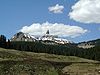
. Just north of its midpoint between Rico and Sawpit, the road also passes very near and provides access to the town of Telluride
.
State highway
State highway, state road or state route can refer to one of three related concepts, two of them related to a state or provincial government in a country that is divided into states or provinces :#A...
in western Colorado
Colorado
Colorado is a U.S. state that encompasses much of the Rocky Mountains as well as the northeastern portion of the Colorado Plateau and the western edge of the Great Plains...
.
Route description
Cortez, Colorado
The city of Cortez is a Home Rule Municipality that is the county seat and the most populous city of Montezuma County, Colorado, United States. The city population was 8,482 at the 2010 census...
. The route winds northward through the towns of Dolores
Dolores, Colorado
The town of Dolores is a Statutory Town in Montezuma County, Colorado, United States. The population was 936 at the 2010 census. It is one of three incorporated municipalities in the county....
, Rico
Rico, Colorado
Rico is a Home Rule Municipality in Dolores County, Colorado, United States. The population was 205 at the 2000 census.-Geography:Rico is located at ....
, Sawpit
Sawpit, Colorado
The Town of Sawpit is a Statutory Town located in San Miguel County, Colorado, United States. The town population was 25 at the 2000 census, making Sawpit the third least populous incorporated town in the state of Colorado...
, Placerville
Placerville, Colorado
Placerville is an unincorporated town and a U.S. Post Office located in San Miguel County, Colorado, United States. The Placerville Post Office has the ZIP Code 81430.-History:...
, Norwood
Norwood, Colorado
Norwood is a Statutory Town in San Miguel County, Colorado, United States. The population was 438 at the 2000 census.-Geography:Norwood is located at ....
, and Redvale
Redvale, Colorado
Redvale is an unincorporated town and a U.S. Post Office located in Montrose County, Colorado, United States. The Redvale Post Office has the ZIP Code 81431....
before terminating at the junction with State Highway 141
Colorado State Highway 141
State Highway 141 is a long state highway in far western Colorado. Though nominally oriented north–south, SH 141 winds around a considerable amount due to the rugged terrain and ultimately forms a giant S shape.-Route description:...
about four miles (6 km) east of Naturita
Naturita, Colorado
Naturita is a Statutory Town in Montrose County, Colorado, United States. The population was 635 at the 2000 census.-Geography:Naturita is located at ....
. Just north of its midpoint between Rico and Sawpit, the road also passes very near and provides access to the town of Telluride
Telluride, Colorado
The town of Telluride is the county seat and most populous town of San Miguel County in the southwestern portion of the U.S. state of Colorado. The town is a former silver mining camp on the San Miguel River in the western San Juan Mountains...
.
Major intersections
| County | Location | Mile | Destination | Notes |
|---|---|---|---|---|
| Montezuma Montezuma County, Colorado Montezuma County is the southwesternmost of the 64 counties of the state of Colorado of the United States. The county population was 23,830 at U.S. Census 2000... |
Cortez Cortez, Colorado The city of Cortez is a Home Rule Municipality that is the county seat and the most populous city of Montezuma County, Colorado, United States. The city population was 8,482 at the 2010 census... |
0.000 | South end of route | |
| 7.864 | Begin concurrency | |||
| 8.729 | End concurrency | |||
| Dolores Dolores County, Colorado Dolores County is the seventh least populous of the 64 counties of the State of Colorado of the United States. The county population was 1,844 at U.S. Census 2000. The county seat is Dove Creek.- History :... |
||||
| San Miguel San Miguel County, Colorado San Miguel County is one of the 64 counties of the state of Colorado of the United States. The county is named for the San Miguel River. The county population was 6,594 at U.S. Census 2000... |
Placerville Placerville, Colorado Placerville is an unincorporated town and a U.S. Post Office located in San Miguel County, Colorado, United States. The Placerville Post Office has the ZIP Code 81430.-History:... |
84.289 | ||
| Montrose Montrose County, Colorado Montrose County is the 17th most populous of the 64 counties of the State of Colorado of the United States. The county population was 41,276 at U.S. Census 2010. The county was named for its county seat, the City of Montrose... |
116.879 | North end of route | ||