
Colorado State Highway 128
Encyclopedia
State Highway 128 is a 10 mi (16.1 km) long state highway
in the Denver, Colorado
metro area.
roughly thirteen miles south of Boulder
. From there, the road proceeds eastward into the northern portions of the Denver
metropolitan area. The road passes through portions of the cities of Superior
, Broomfield
, Northglenn
, and Westminster
and crosses State Highway 121 before being split by a 3.8 mi (6.1 km) section of concurrency with U.S. Highway 287 and again resuming its course towards its eastern terminus at exit 223 of Interstate 25 in the city limits of Westminster.
to U.S. Route 6
was added by 1939 and deleted by 1949. The west terminus was extended from U.S. Route 36
to Indiana Street in 1965 and to its current terminus at SH 93
two years later.
State highway
State highway, state road or state route can refer to one of three related concepts, two of them related to a state or provincial government in a country that is divided into states or provinces :#A...
in the Denver, Colorado
Colorado
Colorado is a U.S. state that encompasses much of the Rocky Mountains as well as the northeastern portion of the Colorado Plateau and the western edge of the Great Plains...
metro area.
Route description
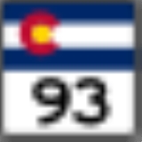
The route begins in the west at a junction with State Highway 93Colorado State Highway 93
State Highway 93 is a highway in Colorado that connects Golden and Boulder.-Route description:SH 93 runs , starting at its southern junction with U.S. Highway 6 at the entrance to Clear Creek Canyon in Golden...
roughly thirteen miles south of Boulder
Boulder, Colorado
Boulder is the county seat and most populous city of Boulder County and the 11th most populous city in the U.S. state of Colorado. Boulder is located at the base of the foothills of the Rocky Mountains at an elevation of...
. From there, the road proceeds eastward into the northern portions of the Denver
Denver, Colorado
The City and County of Denver is the capital and the most populous city of the U.S. state of Colorado. Denver is a consolidated city-county, located in the South Platte River Valley on the western edge of the High Plains just east of the Front Range of the Rocky Mountains...
metropolitan area. The road passes through portions of the cities of Superior
Superior, Colorado
Superior is a Statutory Town in Boulder and Jefferson counties in the U.S. state of Colorado. According to United States Census Bureau estimates, the population of the city was 10,308 on 2005-07-01.-History:...
, Broomfield
Broomfield, Colorado
The City and County of Broomfield is a prominent suburb and tier of the Denver metropolitan area in the State of Colorado of the United States. Broomfield has a consolidated city and county government which operates under Article XX, Sections 10-13 of the Constitution of the State of Colorado. The...
, Northglenn
Northglenn, Colorado
Northglenn is a Home Rule Municipality in Adams and Weld counties in the U.S. state of Colorado. The United States Census Bureau estimates that the city population was 33,697 in 2008.-Geography:Northglenn is located at ....
, and Westminster
Westminster, Colorado
Westminster is a Home Rule Municipality in Adams and Jefferson counties in the U.S. state of Colorado. Westminster is a northwest suburb of Denver. The Westminster Municipal Center is located north-northwest of the Colorado State Capitol. The United States Census Bureau that the city population...
and crosses State Highway 121 before being split by a 3.8 mi (6.1 km) section of concurrency with U.S. Highway 287 and again resuming its course towards its eastern terminus at exit 223 of Interstate 25 in the city limits of Westminster.
History
The route was established in the early 1920s, when it began at Federal Blvd and ended at SH 185 (now deleted). A section from U.S. Route 85U.S. Route 85
U.S. Route 85 is a north–south United States highway that runs for in the Mountain - Northern Plains states of the United States. The southern terminus of the route is at the United States-Mexico border in El Paso, Texas, connecting with Mexican Federal Highway 45...
to U.S. Route 6
U.S. Route 6
U.S. Route 6 , also called the Grand Army of the Republic Highway, a name that honors an American Civil War veterans association, is a main route of the U.S. Highway system, running east-northeast from Bishop, California to Provincetown, Massachusetts. Until 1964, it continued south from Bishop to...
was added by 1939 and deleted by 1949. The west terminus was extended from U.S. Route 36
U.S. Route 36
U.S. Route 36 is an east–west United States highway that runs for from Rocky Mountain National Park, Colorado to Uhrichsville, Ohio. The highway's western terminus is at Deer Ridge Junction, an intersection in Rocky Mountain National Park, Colorado, where it meets U.S. Route 34. Its eastern...
to Indiana Street in 1965 and to its current terminus at SH 93
Colorado State Highway 93
State Highway 93 is a highway in Colorado that connects Golden and Boulder.-Route description:SH 93 runs , starting at its southern junction with U.S. Highway 6 at the entrance to Clear Creek Canyon in Golden...
two years later.
Major intersections
| County | Location | Mile | Destination | Notes |
|---|---|---|---|---|
| Boulder Boulder County, Colorado Boulder County is the sixth most populous of the 64 counties of the state of Colorado of the United States. The county seat is Boulder. The most populous municipality in the county and the county seat is the City of Boulder... |
0.000 | |||
| Broomfield | Broomfield Broomfield, Colorado The City and County of Broomfield is a prominent suburb and tier of the Denver metropolitan area in the State of Colorado of the United States. Broomfield has a consolidated city and county government which operates under Article XX, Sections 10-13 of the Constitution of the State of Colorado. The... |
7.973 | ||
| 12.168 | Interchange | |||
| Adams Adams County, Colorado Adams County is the fifth most populous of the 64 counties of the state of Colorado of the United States. The United States Census Bureau estimates that the county population was 441,603 in 2010 census, a 21.4% increase since 2000 census. Adams County is named for Alva Adams, Governor of the... |
Thornton Thornton, Colorado The city of Thornton is a Home Rule Municipality in Adams and Weld counties in the U.S. state of Colorado and a suburb of the Denver-Aurora-Broomfield, CO Metropolitan Statistical Area. Thornton is northeast of the state's capital, Denver. The United States Census Bureau that the city population... |
14.113 | Interchange | |