

Colorado State Highway 17
Encyclopedia
State Highway 17 is a 88.5 mi (142.4 km) long state highway
in southern Colorado
.
state line where the road becomes New Mexico State Road 17
. From the state line the road proceeds in a winding, generally easterly path over the San Juan Mountains
via Cumbres Pass
and La Manga Pass
, both over 10000 ft (3,048 m) in elevation. Along this section, the road offers access to Rio Grande National Forest
and the many recreational activities it offers. After leaving the national forest, the road continues east for approximately 13 more miles before merging with US 285 at Antonito
. From Antonito, SH 17 runs northward concurrent with US 285 for just over thirty miles to the city of Alamosa
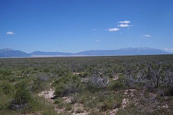
. At Alamosa, the second part of SH 17 begins after the road splits from US 285. From there, the road proceeds northward up the middle of the San Luis Valley
between the Sangre de Christo Mountains in the east and the San Juan Mountains
to the west. The route passes through the towns of Mosca
, Hooper
(where the road meets the eastern end of State Highway 112
,) and Moffat
before reaching its northern terminus where it again meets US 285 roughly five miles south of Villa Grove
.
and began southeast and disappeared as the route ended at the New Mexico state line. The route then reappeared northeast and terminated at SH 15 (now moved) near Mineral Hot Springs
. Within the northeast segment, the route from Antonito
to Alamosa
was paved by 1936. The portion of the eastern segment from the New Mexico state line to Antonito was deleted and readded by 1938 and 1946, respectively. The rest of the route, not included the segment from New Mexico to Antonito, was paved by 1954. In 1968, the sections of the highway that were concurrent with other highways were eliminated, leaving the two segments existent now. The route was paved by 1970.
!County
!Location
!Mile
!Destination
!Notes
|-
|Archuleta
|
|0.00
|
|
|-
|Conejos
|Antonito
|style="background: #ddffdd;" |39.05
|style="background: #ddffdd;" |
|style="background: #ddffdd;" |Begin concurrency
|-
|Alamosa
|Alamosa
|style="background: #ddffdd;" |69.02
|style="background: #ddffdd;" |
|style="background: #ddffdd;" |End concurrency
|-
|rowspan=2|Saguache
|Hooper
|88.19
|
|
|-
|Mineral Hot Springs
|118.86
|
|
On the south side of Moffat
there is a crossroads with Saguache County Road T. Crestone
is 12.5 miles (20.1 km) east.
State highway
State highway, state road or state route can refer to one of three related concepts, two of them related to a state or provincial government in a country that is divided into states or provinces :#A...
in southern Colorado
Colorado
Colorado is a U.S. state that encompasses much of the Rocky Mountains as well as the northeastern portion of the Colorado Plateau and the western edge of the Great Plains...
.
Route description
SH 17 is officially split into two parts by a stretch of concurrence with U.S. Highway 285. The first part of the route begins in the south at the New MexicoNew Mexico
New Mexico is a state located in the southwest and western regions of the United States. New Mexico is also usually considered one of the Mountain States. With a population density of 16 per square mile, New Mexico is the sixth-most sparsely inhabited U.S...
state line where the road becomes New Mexico State Road 17
New Mexico State Road 17
New Mexico State Road 17 is a state route in Rio Arriba County, New Mexico. Its southern end is at US 64-84 in Chama and its northern end is at Colorado State Highway 17 at the Colorado state line.- Route description :...
. From the state line the road proceeds in a winding, generally easterly path over the San Juan Mountains
San Juan Mountains
The San Juan Mountains are a high and rugged mountain range in the Rocky Mountains in southwestern Colorado. The area is highly mineralized and figured in the gold and silver mining industry of early Colorado. Major towns, all old mining camps, include Creede, Lake City, Silverton, Ouray, and...
via Cumbres Pass
Cumbres Pass
Cumbres Pass, elevation , is a mountain pass in the San Juan Mountains of Colorado. The pass is traversed by State Highway 17 and the Cumbres and Toltec Scenic Railroad. The highway has a moderate 5.8% approach on the north side and a gentler, 4% approach on the south side...
and La Manga Pass
La Manga Pass
La Manga Pass, elevation , is a mountain pass in the San Juan Mountains of Colorado....
, both over 10000 ft (3,048 m) in elevation. Along this section, the road offers access to Rio Grande National Forest
Rio Grande National Forest
Rio Grande National Forest is a 1.86 million acre U.S. National Forest located in southwestern Colorado. The forest encompasses the San Luis Valley, which is the world's largest agricultural alpine valley, as well as one of the worlds largest high deserts located around mountains. The...
and the many recreational activities it offers. After leaving the national forest, the road continues east for approximately 13 more miles before merging with US 285 at Antonito
Antonito, Colorado
The Town of Antonito is a statutory town located in Conejos County, Colorado, United States. As of the 2000 census, the town's population was 873.-Geography:...
. From Antonito, SH 17 runs northward concurrent with US 285 for just over thirty miles to the city of Alamosa
Alamosa, Colorado
The city of Alamosa is a Home Rule Municipality that is the county seat and the most populous city of Alamosa County, Colorado, United States. The United States Census Bureau estimates that the city population was 8,682 in 2005...
. At Alamosa, the second part of SH 17 begins after the road splits from US 285. From there, the road proceeds northward up the middle of the San Luis Valley
San Luis Valley
The San Luis Valley is an extensive alpine valley in the U.S. states of Colorado and New Mexico covering approximately and sitting at an average elevation of above sea level. The valley sits atop the Rio Grande Rift and is drained to the south by the Rio Grande River, which rises in the San Juan...
between the Sangre de Christo Mountains in the east and the San Juan Mountains
San Juan Mountains
The San Juan Mountains are a high and rugged mountain range in the Rocky Mountains in southwestern Colorado. The area is highly mineralized and figured in the gold and silver mining industry of early Colorado. Major towns, all old mining camps, include Creede, Lake City, Silverton, Ouray, and...
to the west. The route passes through the towns of Mosca
Mosca, Colorado
Mosca is an unincorporated town and a U.S. Post Office in Alamosa County, Colorado, United States. It was named for the nearby Mosca Pass, which was named for the Spanish explorer, Luis de Moscoso de Alvarado...
, Hooper
Hooper, Colorado
Hooper is a Statutory Town located in the San Luis Valley in Alamosa County, Colorado, United States. The population was 123 at the 2000 census.Nearby points of interest include the Great Sand Dunes National Park, and Crestone, Colorado.-Geography:...
(where the road meets the eastern end of State Highway 112
Colorado State Highway 112
State Highway 112 is a long state highway in southern Colorado. Built in 1916 and formally defined in 1922, the route begins at its western end in Del Norte at a junction with U.S. Highway 160...
,) and Moffat
Moffat, Colorado
Moffat is a Statutory Town in Saguache County, Colorado, United States. The population was 114 at the 2000 census.-Geography:Moffat is located at ....
before reaching its northern terminus where it again meets US 285 roughly five miles south of Villa Grove
Villa Grove, Colorado
Villa Grove is an unincorporated town and a U.S. Post Office located in Saguache County, Colorado, United States. The Villa Grove Post Office has the ZIP Code 81155.- History :...
.
History
When the route was established in 1920s, the route was broken into two sections. The road began at Pagosa SpringsPagosa Springs, Colorado
Pagosa Springs is a Home Rule Municipality that is the county seat of, and the only incorporated municipality in, Archuleta County, Colorado, United States. The population was 1,591 at the 2000 census...
and began southeast and disappeared as the route ended at the New Mexico state line. The route then reappeared northeast and terminated at SH 15 (now moved) near Mineral Hot Springs
Mineral Hot Springs, Colorado
Mineral Hot Springs is a hot springs located in Saguache County, Colorado in the northern San Luis Valley.Mineral Hot Springs is a platted subdivision but nearly all lots are now owned by the owner of "Joyful Journey" a spa. In addition to the spa there are a couple of private homes on the lots of...
. Within the northeast segment, the route from Antonito
Antonito, Colorado
The Town of Antonito is a statutory town located in Conejos County, Colorado, United States. As of the 2000 census, the town's population was 873.-Geography:...
to Alamosa
Alamosa, Colorado
The city of Alamosa is a Home Rule Municipality that is the county seat and the most populous city of Alamosa County, Colorado, United States. The United States Census Bureau estimates that the city population was 8,682 in 2005...
was paved by 1936. The portion of the eastern segment from the New Mexico state line to Antonito was deleted and readded by 1938 and 1946, respectively. The rest of the route, not included the segment from New Mexico to Antonito, was paved by 1954. In 1968, the sections of the highway that were concurrent with other highways were eliminated, leaving the two segments existent now. The route was paved by 1970.
Major intersections
{| class=wikitable!County
!Location
!Mile
!Destination
!Notes
|-
|Archuleta
Archuleta County, Colorado
Archuleta County is one of the 64 counties of the state of Colorado of the United States. The United States Census Bureau estimates that the county population was 12,386 in 2006, a 25.14% increase since U.S. Census 2000...
|
|0.00
|
|
|-
|Conejos
Conejos County, Colorado
Conejos County is one of the 64 counties of the State of Colorado in the United States. The county population was 8,400 at U.S. Census 2000. The county seat is the unincorporated town of Conejos.-History:...
|Antonito
Antonito, Colorado
The Town of Antonito is a statutory town located in Conejos County, Colorado, United States. As of the 2000 census, the town's population was 873.-Geography:...
|style="background: #ddffdd;" |39.05
|style="background: #ddffdd;" |
|style="background: #ddffdd;" |Begin concurrency
|-
|Alamosa
Alamosa County, Colorado
Alamosa County is one of the 64 counties of the state of Colorado of the United States. The county name is the Spanish language word for a "grove of cottonwood trees." The county population was 14,966 at U.S. Census 2000...
|Alamosa
Alamosa, Colorado
The city of Alamosa is a Home Rule Municipality that is the county seat and the most populous city of Alamosa County, Colorado, United States. The United States Census Bureau estimates that the city population was 8,682 in 2005...
|style="background: #ddffdd;" |69.02
|style="background: #ddffdd;" |
|style="background: #ddffdd;" |End concurrency
|-
|rowspan=2|Saguache
Saguache County, Colorado
Saguache County is the seventh most extensive of the 64 counties of the state of Colorado of the United States. The county name comes from a Ute language word meaning “blue earth” or “water at blue earth”. The county population was 5,917 at U.S. Census 2000...
|Hooper
Hooper, Colorado
Hooper is a Statutory Town located in the San Luis Valley in Alamosa County, Colorado, United States. The population was 123 at the 2000 census.Nearby points of interest include the Great Sand Dunes National Park, and Crestone, Colorado.-Geography:...
|88.19
|
|
|-
|Mineral Hot Springs
Mineral Hot Springs, Colorado
Mineral Hot Springs is a hot springs located in Saguache County, Colorado in the northern San Luis Valley.Mineral Hot Springs is a platted subdivision but nearly all lots are now owned by the owner of "Joyful Journey" a spa. In addition to the spa there are a couple of private homes on the lots of...
|118.86
|
|
On the south side of Moffat
Moffat, Colorado
Moffat is a Statutory Town in Saguache County, Colorado, United States. The population was 114 at the 2000 census.-Geography:Moffat is located at ....
there is a crossroads with Saguache County Road T. Crestone
Crestone, Colorado
Crestone is a statutory town in Saguache County in Southwestern Colorado, United States. The population was 73 at the 2000 census. It is a small village at the foot of the western slope of the Sangre de Cristo Range, in the northern part of the San Luis Valley. Crestone was a small mining town, but...
is 12.5 miles (20.1 km) east.