
Colorado State Highway 26
Encyclopedia
State Highway 26 is a 2.922 mi (4.702 km) long state highway
in Denver
, Colorado
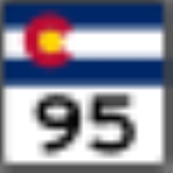
. SH 26 consists of a portion of Alameda Avenue, a city street in Denver. The route begins at State Highway 95 (Sheridan Blvd.) and travels due east towards downtown Denver before reaching its eastern end at the Kalamath Street.
at SH 95. It crosses roads seemingly named in reverse alphabetical order throughout the city. The route traverse across SH 88
at about 1.5 miles (2.4 km). At about 2.9 miles (4.7 km), the route crosses the South Platte River
, and towards the end of the route crosses I-25
. The eastern terminus is at Kalamath Street, a few hundred feet east of the intersection with I-25. The route never exits the Denver city limits throughout its entire length.
as part of a route change that occurred here.
of Denver
.
{| class=wikitable
!Mile
!Destination
!Notes
|-
|0.000
|
|West end of route
|-
|1.529
|
|
|-
|2.928
|
|
|-
|2.922
|Kalamath Street
|East end of route
State highway
State highway, state road or state route can refer to one of three related concepts, two of them related to a state or provincial government in a country that is divided into states or provinces :#A...
in Denver
Denver, Colorado
The City and County of Denver is the capital and the most populous city of the U.S. state of Colorado. Denver is a consolidated city-county, located in the South Platte River Valley on the western edge of the High Plains just east of the Front Range of the Rocky Mountains...
, Colorado
Colorado
Colorado is a U.S. state that encompasses much of the Rocky Mountains as well as the northeastern portion of the Colorado Plateau and the western edge of the Great Plains...
. SH 26 consists of a portion of Alameda Avenue, a city street in Denver. The route begins at State Highway 95 (Sheridan Blvd.) and travels due east towards downtown Denver before reaching its eastern end at the Kalamath Street.
Route description
The route begins in Denver, ColoradoDenver, Colorado
The City and County of Denver is the capital and the most populous city of the U.S. state of Colorado. Denver is a consolidated city-county, located in the South Platte River Valley on the western edge of the High Plains just east of the Front Range of the Rocky Mountains...
at SH 95. It crosses roads seemingly named in reverse alphabetical order throughout the city. The route traverse across SH 88
Colorado State Highway 88
State Highway 88 is a Colorado highway in Denver and Arapahoe counties.-Route description:SH 88 runs , starting at the intersection of Colfax Avenue and Federal in Denver, going south on Federal to Belleview Ave., then east on Belleview, ending at Parker Rd....
at about 1.5 miles (2.4 km). At about 2.9 miles (4.7 km), the route crosses the South Platte River
South Platte River
The South Platte River is one of the two principal tributaries of the Platte River and itself a major river of the American Midwest and the American Southwest/Mountain West, located in the U.S. states of Colorado and Nebraska...
, and towards the end of the route crosses I-25
Interstate 25 in Colorado
In the U.S. state of Colorado, Interstate 25 follows the north–south corridor through Colorado Springs and Denver. It replaced U.S. Highway 87 and most of U.S. Highway 85 for through traffic....
. The eastern terminus is at Kalamath Street, a few hundred feet east of the intersection with I-25. The route never exits the Denver city limits throughout its entire length.
History
The route was designated in 1966 as a 14.1 miles (22.7 km) long route. Parts of the freeway were gradually returned to the City of LakewoodLakewood, Colorado
Lakewood is a Home Rule Municipality that is the most populous city in Jefferson County, Colorado, United States. Lakewood is the fifth most populous city in the State of Colorado and the 172nd most populous city in the United States. The United States Census Bureau estimates that in April 1, 2010...
as part of a route change that occurred here.
Major intersections
The entire route is in the independent cityIndependent city
An independent city is a city that does not form part of another general-purpose local government entity. These type of cities should not be confused with city-states , which are fully sovereign cities that are not part of any other sovereign state.-Historical precursors:In the Holy Roman Empire,...
of Denver
Denver, Colorado
The City and County of Denver is the capital and the most populous city of the U.S. state of Colorado. Denver is a consolidated city-county, located in the South Platte River Valley on the western edge of the High Plains just east of the Front Range of the Rocky Mountains...
.
{| class=wikitable
!Mile
!Destination
!Notes
|-
|0.000
|
|West end of route
|-
|1.529
|
|
|-
|2.928
|
|
|-
|2.922
|Kalamath Street
|East end of route