
Colorado State Highway 194
Encyclopedia
State Highway 194 is a 19.8 mi (31.9 km) long state highway
in southeastern Colorado
.
in the city of La Junta
. SH 194 travels eastward from there closely paralleling U.S. Highway 50 for its entire length before meeting that same route at a junction just north of Las Animas
; this junction with US 50 marks the eastern end of SH 194. Roughly four miles east of La Junta, SH 194 travels past Bent's Old Fort National Historic Site
, a reconstructed 19th century trading post located on the south side of the road.
State highway
State highway, state road or state route can refer to one of three related concepts, two of them related to a state or provincial government in a country that is divided into states or provinces :#A...
in southeastern Colorado
Colorado
Colorado is a U.S. state that encompasses much of the Rocky Mountains as well as the northeastern portion of the Colorado Plateau and the western edge of the Great Plains...
.
Route description
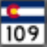
SH 194 begins at its western end at a junction with State Highway 109Colorado State Highway 109
State Highway 109 is a long state highway in southeastern Colorado.- Route description :The road begins in the south at its junction with U.S. Highway 160 roughly two miles north of Kim...
in the city of La Junta
La Junta, Colorado
The City of La Junta is a Home Rule Municipality that is the county seat and the most populous city of Otero County, Colorado, United States. The city population was 7,568 at the U.S. Census 2000. La Junta is located on the Arkansas River in southeastern Colorado east of Pueblo.-History:During...
. SH 194 travels eastward from there closely paralleling U.S. Highway 50 for its entire length before meeting that same route at a junction just north of Las Animas
Las Animas, Colorado
200px|right|thumb|St. Mary's [[Catholic]] Church in Las AnimasThe city of Las Animas is a Statutory City that is the county seat of, and the only incorporated municipality in, Bent County, Colorado, United States. The population was 2,410 at the 2010 census. Las Animas, located in southeast...
; this junction with US 50 marks the eastern end of SH 194. Roughly four miles east of La Junta, SH 194 travels past Bent's Old Fort National Historic Site
Bent's Old Fort National Historic Site
Bent's Old Fort is an 1833 fort located in Otero County in southeastern Colorado, USA. William and Charles Bent, along with Ceran St. Vrain, built the fort to trade with Southern Cheyenne and Arapaho Plains Indians and trappers for buffalo robes...
, a reconstructed 19th century trading post located on the south side of the road.
History
The route was established in 1939 and was entirely paved by 1957. The trumpet interchange at US 50 was constructed in 1972.Major intersections
| County | Location | Mile | Destination | Notes |
|---|---|---|---|---|
| Otero Otero County, Colorado Otero County is one of the 64 counties of the State of Colorado of the United States. The county was named for Miguel Antonio Otero, one of the founders of the town of La Junta and a member of a prominent Hispanic family. The county population was 20,311 at U.S. Census 2000... |
La Junta La Junta, Colorado The City of La Junta is a Home Rule Municipality that is the county seat and the most populous city of Otero County, Colorado, United States. The city population was 7,568 at the U.S. Census 2000. La Junta is located on the Arkansas River in southeastern Colorado east of Pueblo.-History:During... |
0.000 | West end of route | |
| Bent Bent County, Colorado Bent County is one of the 64 counties of the state of Colorado of the United States. The county is named in honor of frontier trader William Bent. The county population was 5,998 at U.S. Census 2000... |
20.327 | East end of route |