
Colorado State Highway 67
Encyclopedia
State Highway 67 is a 71 miles (114.3 km) long state highway encompassing five distinct segments in south-central Colorado
. The route runs north from Wetmore
to Sedalia, Colorado
, traversing the former route of the Florence and Cripple Creek Railroad through Phantom Canyon
as a county road and carrying part of the Gold Belt Byway
.
SH 67 forms the eastern border of the Mueller State Park
near Divide
.
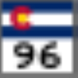
 SH 67 begins at its southern terminus with State Highway 96 in Wetmore, Colorado. It proceeds north into Fremont County and the city of Florence, where it is signed as Robinson Avenue to State Highway 115 (Main Street) and overlaps the highway for half a mile west before turning north again, signed as Pikes Peak Avenue. The highway crosses the Arkansas River on its way out of the city and continues northward to a junction with U.S Route 50 adjacent to Fremont County Airport.
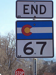
The state portion of the highway ends at U.S. Highway 50 and becomes the county-maintained Phantom Canyon Road, carrying the Gold Belt Byway through Phantom Canyon north to Victor, where the state highway resumes, turning west and north before heading into Cripple Creek. The road turns east for a few miles before resuming its northward path, acting as the eastern border of Mueller State Park for several miles before reaching a junction with U.S. Highway 24 in Divide.
Again the state portion of the highway ends to overlap U.S. Highway 24 for seven miles (11 km) east into Woodland Park, splitting off the concurrent road to turn north once again. Continuing to the north-northwest, the road enters the Pike National Forest
, passing turnoffs for Red Rock Campground and the Manitou Park Recreation Area's Colorado Campground and Painted Rocks Campground before turning west and entering Douglas County, where it promptly heads into Westcreek and turns north until it reaches a junction with North Rainbow Falls Road and turns to the northwest.
In Deckers, the state portion of the road again ends to overlap County Road 126 and heads to the north-northeast signed as South Platte Canyon Road. The route takes an abrupt turn east signed as Sugar Hill Road, rejoining the larger road it split after turning north and the larger road has taken on the name Pine Creek Road. The route turns east and changes name again to Jarre Canyon Road, resume state highway status at its intersection with Rampart Range Road southwest of Sedalia.
The route leaves Pike National Forest a few miles east of resuming state highway status and continues northeast with increasing intersections as it approaches Sedalia. After crossing State Highway 105 (Perry Park Road), the route turns north and is named Manhart Street for a few blocks before reaching its northern terminus at U.S. Highway 85.
In 1994, the route was rerouted around the Little Ike Tunnel near Cripple Creek, altering the location of the Horsethief Park Trail trailhead to the east side of the tunnel.
The Cripple Creek and Victor Gold Mining Company funded the realignment of nearly two miles of Highway 67 and built the highest bridge on the Colorado State Highway system, the Arequa Gulch Bridge, as part of its Cresson Mine expansion in 2001.
In July 2006, a flood on West Creek washed out the highway north of the town of Westcreek, closing the highway between Westcreek and Deckers to two-way traffic until reconstruction was completed. The closed segment reopened on October 27, 2006.
!County
!Location
!Mile
!Junction
!Notes
|-
|Custer
|
|0
|
|Southern terminus of SH 67
|-
|rowspan=3|Fremont
|rowspan=2|Florence
|bgcolor=#ddffdd|11
|bgcolor=#ddffdd|
|bgcolor=#ddffdd|Eastern end of SH 115 overlap
|-
|bgcolor=#ddffdd|11.5
|bgcolor=#ddffdd|
|bgcolor=#ddffdd|Western end of SH 115 overlap
|-
|
|15
|
|Signed as "Phantom Canyon Road"
|-
|rowspan=3|Teller
|Victor
|45.5
|4th Street
|
|-
|Divide
|bgcolor=#ddffdd|70
|bgcolor=#ddffdd|
|bgcolor=#ddffdd|Western end of US 24 overlap
|-
|Woodland Park
|bgcolor=#ddffdd|77
|bgcolor=#ddffdd|
|bgcolor=#ddffdd|Eastern end of US 24 overlap
|-
|rowspan=3|Douglas
|Deckers
|100
|County Road 75/126
|To US 285
|-
|rowspan=2|Sedalia
|118
|
|
|-
|127.5
|
|Northern terminus of SH 67
|-
Colorado
Colorado is a U.S. state that encompasses much of the Rocky Mountains as well as the northeastern portion of the Colorado Plateau and the western edge of the Great Plains...
. The route runs north from Wetmore
Wetmore, Colorado
Wetmore is an unincorporated town and a U.S. Post Office located in Custer County, Colorado, United States. The Wetmore Post Office has the ZIP Code 81253....
to Sedalia, Colorado
Sedalia, Colorado
Sedalia is a census-designated place in Douglas County, Colorado, United States. The CDP population was 211 at the 2000 census. The Sedalia Post Office has the ZIP Code 80135.-Geography:Sedalia is located at ....
, traversing the former route of the Florence and Cripple Creek Railroad through Phantom Canyon
Phantom Canyon (Pikes Peak Area)
Phantom Canyon is a canyon in Colorado, in the Western United States. The canyon is formed by Eightmile Creek. It was used as route to take gold and supplies in and out of the Cripple Creek and Victor gold mining district....
as a county road and carrying part of the Gold Belt Byway
Gold Belt Byway
The Gold Belt Byway is a national scenic byway located entirely within the state of Colorado in the United States of America. The byway received its name because it runs through Colorado's gold country. It connects the gold mining districts to each other and to the Arkansas Valley.- History:The...
.
SH 67 forms the eastern border of the Mueller State Park
Mueller State Park
Mueller State Park is a Colorado state park encompassing of land outside of Divide, Colorado, north west of Colorado Springs, Colorado. The park is home to many activities. There are of trails, biking, camping year-round, hunting, hiking, horseback riding. It is open in the winter and...
near Divide
Divide, Colorado
Divide is a census-designated place and a U.S. Post Office in Teller County, Colorado, United States. The population as of the 2010 Census was 127....
.
Route description
The state portion of the highway ends at U.S. Highway 50 and becomes the county-maintained Phantom Canyon Road, carrying the Gold Belt Byway through Phantom Canyon north to Victor, where the state highway resumes, turning west and north before heading into Cripple Creek. The road turns east for a few miles before resuming its northward path, acting as the eastern border of Mueller State Park for several miles before reaching a junction with U.S. Highway 24 in Divide.
Again the state portion of the highway ends to overlap U.S. Highway 24 for seven miles (11 km) east into Woodland Park, splitting off the concurrent road to turn north once again. Continuing to the north-northwest, the road enters the Pike National Forest
Pike National Forest
The Pike National Forest is located in the Front Range of Colorado, USA, west of Colorado Springs and including Pikes Peak. The forest encompasses 1,106,604 acres within Clear Creek, Teller, Park, Jefferson, Douglas and El Paso counties. The major rivers draining the forest are the South Platte...
, passing turnoffs for Red Rock Campground and the Manitou Park Recreation Area's Colorado Campground and Painted Rocks Campground before turning west and entering Douglas County, where it promptly heads into Westcreek and turns north until it reaches a junction with North Rainbow Falls Road and turns to the northwest.
In Deckers, the state portion of the road again ends to overlap County Road 126 and heads to the north-northeast signed as South Platte Canyon Road. The route takes an abrupt turn east signed as Sugar Hill Road, rejoining the larger road it split after turning north and the larger road has taken on the name Pine Creek Road. The route turns east and changes name again to Jarre Canyon Road, resume state highway status at its intersection with Rampart Range Road southwest of Sedalia.
The route leaves Pike National Forest a few miles east of resuming state highway status and continues northeast with increasing intersections as it approaches Sedalia. After crossing State Highway 105 (Perry Park Road), the route turns north and is named Manhart Street for a few blocks before reaching its northern terminus at U.S. Highway 85.
History
SH 67 is an original 1920s state highway and was originally an unbroken route.In 1994, the route was rerouted around the Little Ike Tunnel near Cripple Creek, altering the location of the Horsethief Park Trail trailhead to the east side of the tunnel.
The Cripple Creek and Victor Gold Mining Company funded the realignment of nearly two miles of Highway 67 and built the highest bridge on the Colorado State Highway system, the Arequa Gulch Bridge, as part of its Cresson Mine expansion in 2001.
In July 2006, a flood on West Creek washed out the highway north of the town of Westcreek, closing the highway between Westcreek and Deckers to two-way traffic until reconstruction was completed. The closed segment reopened on October 27, 2006.
Major intersections
{| class="wikitable"!County
!Location
!Mile
!Junction
!Notes
|-
|Custer
Custer County, Colorado
Custer County is the tenth least populous of the 64 counties of the State of Colorado of the United States. The county population was 3,503 at U.S. Census 2000. The county seat is Westcliffe.- History :...
|
|0
|
|Southern terminus of SH 67
|-
|rowspan=3|Fremont
Fremont County, Colorado
Fremont County is the thirteenth most populous of the 64 counties of the state of Colorado of the United States. The county is named for explorer and presidential candidate John C. Frémont. The county population was 46,824 at the 2010 census. The county seat is Cañon City. The Cañon City...
|rowspan=2|Florence
Florence, Colorado
The City of Florence is a Statutory City located in Fremont County, Colorado, United States. The population was 3,653 at the 2000 census.ADX Florence, the only federal Supermax prison in the United States, is located south of Florence in an unincorporated area in Fremont County...
|bgcolor=#ddffdd|11
|bgcolor=#ddffdd|
|bgcolor=#ddffdd|Eastern end of SH 115 overlap
|-
|bgcolor=#ddffdd|11.5
|bgcolor=#ddffdd|
|bgcolor=#ddffdd|Western end of SH 115 overlap
|-
|
|15
|
|Signed as "Phantom Canyon Road"
|-
|rowspan=3|Teller
Teller County, Colorado
Teller County is the 22nd most populous of the 64 counties of the State of Colorado of the United States. The county population was 20,555 at U.S. Census 2000. The county seat is Cripple Creek, and the most populous city is Woodland Park...
|Victor
Victor, Colorado
Victor is a Statutory City in Teller County, Colorado, United States. The population was 445 at the 2000 census.Victor is in the heart of Colorado's gold country, home to two of the major gold mines in the Cripple Creek mining district...
|45.5
|4th Street
|
|-
|Divide
Divide, Colorado
Divide is a census-designated place and a U.S. Post Office in Teller County, Colorado, United States. The population as of the 2010 Census was 127....
|bgcolor=#ddffdd|70
|bgcolor=#ddffdd|
|bgcolor=#ddffdd|Western end of US 24 overlap
|-
|Woodland Park
Woodland Park, Colorado
The City of Woodland Park is a Home Rule Municipality that is the most populous city in Teller County, Colorado, United States and is immediately west of El Paso County and the unincorporated community of Crystola. Many residents in this bedroom community, which is surrounded by the one-million...
|bgcolor=#ddffdd|77
|bgcolor=#ddffdd|
|bgcolor=#ddffdd|Eastern end of US 24 overlap
|-
|rowspan=3|Douglas
Douglas County, Colorado
Douglas County is the eighth most populous of the 64 counties of the state of Colorado, in the United States. The county is located midway between Colorado's two largest cities: Denver and Colorado Springs...
|Deckers
Deckers, Colorado
Deckers is an unincorporated town along the South Platte River in Douglas County, Colorado, United States. The U.S. Post Office at Sedalia now serves Deckers postal addresses.-Camp:...
|100
|County Road 75/126
|To US 285
|-
|rowspan=2|Sedalia
Sedalia, Colorado
Sedalia is a census-designated place in Douglas County, Colorado, United States. The CDP population was 211 at the 2000 census. The Sedalia Post Office has the ZIP Code 80135.-Geography:Sedalia is located at ....
|118
|
|
|-
|127.5
|
|Northern terminus of SH 67
|-
External links
- Colorado Routes 60-79 the The Highways of Colorado