
La Veta, Colorado
Encyclopedia

Huerfano County, Colorado
Huerfano County is one of the 64 counties of the State of Colorado of the United States. The county was named for the Huerfano Butte, a local landmark. The county population was 7,862 at U.S. Census 2000...
, Colorado
Colorado
Colorado is a U.S. state that encompasses much of the Rocky Mountains as well as the northeastern portion of the Colorado Plateau and the western edge of the Great Plains...
, United States
United States
The United States of America is a federal constitutional republic comprising fifty states and a federal district...
. The population was 924 at the 2000 census
United States Census, 2000
The Twenty-second United States Census, known as Census 2000 and conducted by the Census Bureau, determined the resident population of the United States on April 1, 2000, to be 281,421,906, an increase of 13.2% over the 248,709,873 persons enumerated during the 1990 Census...
.
Geography
La Veta is located at 37°30′28"N 105°0′29"W (37.507681, -105.008038).According to the United States Census Bureau
United States Census Bureau
The United States Census Bureau is the government agency that is responsible for the United States Census. It also gathers other national demographic and economic data...
, the town has a total area of 1.2 square miles (3.1 km²), all of it land.
Demographics
As of the censusCensus
A census is the procedure of systematically acquiring and recording information about the members of a given population. It is a regularly occurring and official count of a particular population. The term is used mostly in connection with national population and housing censuses; other common...
of 2000, there were 924 people, 429 households, and 251 families residing in the town. The population density
Population density
Population density is a measurement of population per unit area or unit volume. It is frequently applied to living organisms, and particularly to humans...
was 747.8 people per square mile (287.7/km²). There were 552 housing units at an average density of 446.7 per square mile (171.9/km²). The racial makeup of the town was 92.21% White, 0.22% African American, 0.97% Native American, 0.97% Asian, 2.06% from other races
Race (United States Census)
Race and ethnicity in the United States Census, as defined by the Federal Office of Management and Budget and the United States Census Bureau, are self-identification data items in which residents choose the race or races with which they most closely identify, and indicate whether or not they are...
, and 3.57% from two or more races. Hispanic or Latino of any race were 11.47% of the population.
There were 429 households out of which 27.3% had children under the age of 18 living with them, 44.5% were married couples
Marriage
Marriage is a social union or legal contract between people that creates kinship. It is an institution in which interpersonal relationships, usually intimate and sexual, are acknowledged in a variety of ways, depending on the culture or subculture in which it is found...
living together, 10.3% had a female householder with no husband present, and 41.3% were non-families. 35.4% of all households were made up of individuals and 14.5% had someone living alone who was 65 years of age or older. The average household size was 2.15 and the average family size was 2.79.
In the town the population was spread out with 24.6% under the age of 18, 5.0% from 18 to 24, 25.0% from 25 to 44, 29.3% from 45 to 64, and 16.1% who were 65 years of age or older. The median age was 43 years. For every 100 females there were 92.1 males. For every 100 females age 18 and over, there were 86.9 males.
The median income for a household in the town was $29,342, and the median income for a family was $35,156. Males had a median income of $30,417 versus $21,691 for females. The per capita income
Per capita income
Per capita income or income per person is a measure of mean income within an economic aggregate, such as a country or city. It is calculated by taking a measure of all sources of income in the aggregate and dividing it by the total population...
for the town was $18,489. About 14.6% of families and 16.4% of the population were below the poverty line, including 24.0% of those under age 18 and 15.3% of those age 65 or over. There is one school in the town of La Veta, La veta RE2. It has a total of 300 students. La Veta has the highest CSAP scores in Huerfano county. The school sports team are the La Veta Redskins, which for the last few years have been going to state tournaments in almost every sport.
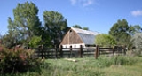
History
Colonel John Francisco (1820–1902) and Judge Henry Daigre (1832–1902) formed a partnership and purchased land under the Vigil-St. Vrain Land Grant in 1868. The land was located on a Native American trail used by the Ute tribeUte Tribe
The Ute are an American Indian people now living primarily in Utah and Colorado. There are three Ute tribal reservations: Uintah-Ouray in northeastern Utah ; Southern Ute in Colorado ; and Ute Mountain which primarily lies in Colorado, but extends to Utah and New Mexico . The name of the state of...
(and earlier the Comanches). Joined by Hiram Washington Vasquez (1843–1939), Francisco and Daigre built a plaza known as Francisco Fort to supply the Denver mining camps with products from ranching and farming. Ranches and farms like that of the Bela and Fain families were located nearby.
In Spanish, La Veta, translates as “the mineral vein”—an appropriate name given the town's association with mining claims such as the abandoned mining camp of Ojo, which is located a few miles from the town and whose concrete foundations can still be seen upon close inspection. Hiram Vasquez said that the town was named by Mexican settlers from a vein of white mineral which they called “La Veta Tierra Blanca”.
By 1876 the Denver and Rio Grande Railway Company—later the Denver & Rio Grande Western Railroad -- built a narrow gauge railroad through a right-of-way to the plaza and 200 acre (0.809372 km²) for a town site donated by Francisco and Daigre. The tracks continued over what is known today as “Old La Veta Pass”, completing a trek up to an elevation of 9382 feet (2,859.6 m) to a depot built by 1877 in a place known as “Uptop” and west into the San Luis Valley. In 1899 The railroad converted the rails to standard gauge and rerouted the rails to Veta Pass, 9242 feet (2,817 m), 9 miles south of La Veta Pass. The old narrow gauge roadbed was converted to a wagon road. Though gravel, it can still be traversed by passenger vehicles in good conditions. Another pass, dubbed North La Veta Pass (9,413 ft.), two miles north of La Veta Pass, is traversed by US Highway 160
U.S. Route 160
U.S. Route 160 is a 1,465 mile long east–west United States highway in the Midwestern United States. The western terminus of the route is at U.S. Route 89 five miles west of Tuba City, Arizona. The eastern terminus is at U.S...
, which is paved the entire way.
La Veta in popular culture
In 1878, about the journey to the top of Old La Veta Pass, Helen Hunt JacksonHelen Hunt Jackson
Helen Maria Hunt Jackson, born Helen Fiske , was a United States writer who became an activist on behalf of improved treatment of Native Americans by the U.S. government. She detailed the adverse effects of government actions in her history A Century of Dishonor...
wrote:
“From the mouth of the pass to the summit is
Measured in miles – fourteen miles;
Measured in hours – three hours;
Measured in sensations – the length of a dream.”