
Colorado State Highway 86
Encyclopedia
State Highway 86 is a state highway that runs from the US 85 interchange in Castle Rock just before I-25 to I-70 near Limon
. It gives service through eastern Castle Rock
to Franktown
and then to Elizabeth
then from Kiowa
to I-70 (Exit 352).
in Castle Rock
, where it begins eastward. The route then interchanges with Interstate 25
before exiting town and entering Franktown
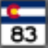
where it meets Colorado State Highway 83
. It then crosses the county line into Elbert
, where it meets many county roads in various towns before meeting its east end at Interstate 70
.
at Castle Rock
. The route then moved eastward along CR 118 to U.S. Route 40
. In the 1960s, the eastward routing was changed so it follows its current routing. By 1954, the route was paved to Kiowa
from US 85 by 1954 and to its entirety by 1972. Following the construction of Interstate 25, the terminus became a business loop of I-25; howwever, the business loop was deleted in the 1990s, leaving SH 86's terminus at a local road. However, SH 86's terminus was rerouted to US 85 in 2006.
Limon, Colorado
Limon is a Statutory Town that is the most populous town in Lincoln County, Colorado, United States immediately east of Elbert County. The population was 2,071 at the 2000 census. Limon has been called the "Hub City" of Eastern Colorado because Interstate 70, U.S. Highways 24, 40, and 287, and...
. It gives service through eastern Castle Rock
Castle Rock, Colorado
The Town of Castle Rock is the county seat of Douglas County, Colorado, United States and is named for the prominent castle tower-shaped butte near the center of town. It is part of Colorado's Front Range Urban Corridor and is located roughly 28 miles south of Denver and 37 miles north of...
to Franktown
Franktown, Colorado
Franktown is a census-designated place in Douglas County, Colorado, in the United States. The population was 395 at the 2010 census. The Franktown Post Office has the ZIP Code 80116. Pike's Peak Grange No...
and then to Elizabeth
Elizabeth, Colorado
The Town of Elizabeth is a Statutory Town that is the most populous town in Elbert County, Colorado, United States. The population was 1,434 at the U.S. Census 2000.-History:...
then from Kiowa
Kiowa, Colorado
The Town of Kiowa is a Home Rule Municipality that is the county seat of Elbert County, Colorado, United States. The town population was 581 at the U.S...
to I-70 (Exit 352).
Route description
The route begins at U.S. Route 85U.S. Route 85
U.S. Route 85 is a north–south United States highway that runs for in the Mountain - Northern Plains states of the United States. The southern terminus of the route is at the United States-Mexico border in El Paso, Texas, connecting with Mexican Federal Highway 45...
in Castle Rock
Castle Rock, Colorado
The Town of Castle Rock is the county seat of Douglas County, Colorado, United States and is named for the prominent castle tower-shaped butte near the center of town. It is part of Colorado's Front Range Urban Corridor and is located roughly 28 miles south of Denver and 37 miles north of...
, where it begins eastward. The route then interchanges with Interstate 25
Interstate 25
Interstate 25 is an Interstate Highway in the western United States. It is primarily a north–south highway. I-25 stretches from Interstate 10 at Las Cruces, New Mexico, , to Interstate 90 in Buffalo, Wyoming, .Interstate 25 is the main north–south expressway through...
before exiting town and entering Franktown
Franktown, Colorado
Franktown is a census-designated place in Douglas County, Colorado, in the United States. The population was 395 at the 2010 census. The Franktown Post Office has the ZIP Code 80116. Pike's Peak Grange No...
where it meets Colorado State Highway 83
Colorado State Highway 83
State Highway 83 is a state highway that runs from SH 21 interchange in north Colorado Springs to SH 2 at Leetsdale Dr. / Colorado Blvd. in Denver.-Route description:...
. It then crosses the county line into Elbert
Elbert, Colorado
Elbert is a census-designated place and the location of a U.S. Post Office in Elbert County, Colorado, United States. The population as of the 2010 Census was 230.The community is named for a past Colorado territorial governor and state Supreme Court Justice Samuel Hitt Elbert...
, where it meets many county roads in various towns before meeting its east end at Interstate 70
Interstate 70
Interstate 70 is an Interstate Highway in the United States that runs from Interstate 15 near Cove Fort, Utah, to a Park and Ride near Baltimore, Maryland. It was the first Interstate Highway project in the United States. I-70 approximately traces the path of U.S. Route 40 east of the Rocky...
.
History
The route was established in 1920s, when it began at U.S. Route 85U.S. Route 85
U.S. Route 85 is a north–south United States highway that runs for in the Mountain - Northern Plains states of the United States. The southern terminus of the route is at the United States-Mexico border in El Paso, Texas, connecting with Mexican Federal Highway 45...
at Castle Rock
Castle Rock, Colorado
The Town of Castle Rock is the county seat of Douglas County, Colorado, United States and is named for the prominent castle tower-shaped butte near the center of town. It is part of Colorado's Front Range Urban Corridor and is located roughly 28 miles south of Denver and 37 miles north of...
. The route then moved eastward along CR 118 to U.S. Route 40
U.S. Route 40
U.S. Route 40 is an east–west United States highway. As with most routes whose numbers end in a zero, U.S. 40 once traversed the entire United States. It is one of the original 1920s U.S. Highways, and its first termini were San Francisco, California, and Atlantic City, New Jersey...
. In the 1960s, the eastward routing was changed so it follows its current routing. By 1954, the route was paved to Kiowa
Kiowa, Colorado
The Town of Kiowa is a Home Rule Municipality that is the county seat of Elbert County, Colorado, United States. The town population was 581 at the U.S...
from US 85 by 1954 and to its entirety by 1972. Following the construction of Interstate 25, the terminus became a business loop of I-25; howwever, the business loop was deleted in the 1990s, leaving SH 86's terminus at a local road. However, SH 86's terminus was rerouted to US 85 in 2006.
Major intersections
| County | Location | Mile | Junction | Notes |
|---|---|---|---|---|
| Douglas Douglas County, Colorado Douglas County is the eighth most populous of the 64 counties of the state of Colorado, in the United States. The county is located midway between Colorado's two largest cities: Denver and Colorado Springs... |
Castle Rock Castle Rock, Colorado The Town of Castle Rock is the county seat of Douglas County, Colorado, United States and is named for the prominent castle tower-shaped butte near the center of town. It is part of Colorado's Front Range Urban Corridor and is located roughly 28 miles south of Denver and 37 miles north of... |
0 | Western terminus of SH 86 | |
| 1 | ||||
| 1.5 | Wilcox Street | |||
| 1.5 | Front Street | |||
| 2 | Gilbert Street | |||
| 2.5 | Woodlands Boulevard | |||
| 3 | Founders Parkway north, Ridge Road south | |||
| Franktown Franktown, Colorado Franktown is a census-designated place in Douglas County, Colorado, in the United States. The population was 395 at the 2010 census. The Franktown Post Office has the ZIP Code 80116. Pike's Peak Grange No... |
8 | |||
| 8 | ||||
| Elbert Elbert County, Colorado Elbert County is the 21st most populous of the 64 counties of the State of Colorado of the United States. The county population was 19,872 at U.S. Census 2000. The county seat is Kiowa... |
Elizabeth Elizabeth, Colorado The Town of Elizabeth is a Statutory Town that is the most populous town in Elbert County, Colorado, United States. The population was 1,434 at the U.S. Census 2000.-History:... |
16 | County Road 13 | |
| 17 | County Road 17 | |||
| Kiowa Kiowa, Colorado The Town of Kiowa is a Home Rule Municipality that is the county seat of Elbert County, Colorado, United States. The town population was 581 at the U.S... |
23.5 | |||
| 24 | Kiowa-Bennett Road north- Bennett Bennett, Colorado The town of Bennett is a Statutory Town in Adams and Arapahoe counties in the U.S. state of Colorado. The United States Census Bureau estimates that the town had a population of 2,536 in 2005... |
|||
| 45.5 | County Road 125 south- Simla Simla, Colorado The Town of Simla is a Statutory Town in Elbert County, Colorado, United States. The population was estimated to be 728 in 2007.-History:Simla was founded in 1909, by a man with the name of Altman. Simla was named because the daughter of a railroad official was reading a book about India when she... |
|||
| 51.5 | County Road 149 south- Matheson Matheson, Colorado Matheson is an unincorporated town and a U.S. Post Office in Elbert County, Colorado, United States. The Matheson Post Office has the ZIP Code 80830.Established in the mid 1880's by Duncan Matheson a native of Scotland.Mr... |
|||
| 52 | County Road 153 north- Agate Agate, Colorado Agate is an unincorporated town and U.S. Post Office in Elbert County, Colorado, United States. The ZIP Code of the Agate Post Office is 80101.-History:... |
|||
| 61.5 | ||||
| 61.5 | Eastern terminus of SH 86 |