
Briggsdale, Colorado
Encyclopedia
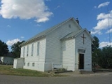
Briggsdale is an unincorporated town
and U.S. Post Office
in Weld County
, Colorado
, United States
. The ZIP Code
of the Briggsdale Post Office
is 80611.
opened on August 1, 1910.
Unincorporated area
In law, an unincorporated area is a region of land that is not a part of any municipality.To "incorporate" in this context means to form a municipal corporation, a city, town, or village with its own government. An unincorporated community is usually not subject to or taxed by a municipal government...
and U.S. Post Office
United States Postal Service
The United States Postal Service is an independent agency of the United States government responsible for providing postal service in the United States...
in Weld County
Weld County, Colorado
As of the census of 2000, there were 180,936 people, 63,247 households, and 45,221 families residing in the county. The population density was 45 people per square mile . There were 66,194 housing units at an average density of 17 per square mile...
, Colorado
Colorado
Colorado is a U.S. state that encompasses much of the Rocky Mountains as well as the northeastern portion of the Colorado Plateau and the western edge of the Great Plains...
, United States
United States
The United States of America is a federal constitutional republic comprising fifty states and a federal district...
. The ZIP Code
ZIP Code
ZIP codes are a system of postal codes used by the United States Postal Service since 1963. The term ZIP, an acronym for Zone Improvement Plan, is properly written in capital letters and was chosen to suggest that the mail travels more efficiently, and therefore more quickly, when senders use the...
of the Briggsdale Post Office
United States Postal Service
The United States Postal Service is an independent agency of the United States government responsible for providing postal service in the United States...
is 80611.
History
The town of Briggsdale was established in 1909. The town was named for Frank M. Briggs, a farmer and one of the founders. The Briggsdale Post OfficeUnited States Postal Service
The United States Postal Service is an independent agency of the United States government responsible for providing postal service in the United States...
opened on August 1, 1910.
Geography
Briggsdale is located at 40°38′05"N 104°19′37"W (40.634669,-104.326859).See also
- Denver-Aurora-Boulder Combined Statistical AreaDenver-Aurora-Boulder Combined Statistical Areathumb|300px|Map of the 12-county Denver-Aurora-Boulder Combined Statistical AreaThe Denver-Aurora-Boulder, CO Combined Statistical Area is a United States Census Bureau defined Combined Statistical Area located in the Denver region of the state of Colorado...
- Front Range Urban CorridorFront Range Urban CorridorThe Front Range Urban Corridor is an oblong region of urban population located along the eastern face of the Southern Rocky Mountains in the U.S. states of Colorado and Wyoming. The corridor derives its name from the Front Range, the mountain range that defines the west central boundary of the...
- Greeley Metropolitan Statistical Area
- List of cities and towns in Colorado