

U.S. Route 160
Encyclopedia
U.S. Route 160 is a 1,465 mile (2,358 km) long east–west United States highway in the Midwestern United States
. The western terminus of the route is at U.S. Route 89 five miles (8 km) west of Tuba City, Arizona
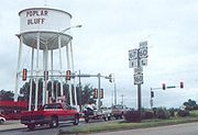
. The eastern terminus is at U.S. Route 67 and Route 158 southwest of Poplar Bluff, Missouri
.
Its route, if not its number, was made famous in song in 1975, as the road from Wolf Creek Pass
to Pagosa Springs, Colorado
in C.W. McCall's country music
song Wolf Creek Pass.

. Near Tuba City
, it intersects State Route 264
. It goes through Tonalea
and Cow Springs before entering Kayenta
, where it intersects U.S. Route 163. It continues northeast through Dennehotso
, then has a brief overlap with U.S. Route 191 in Mexican Water
. It goes east until Teec Nos Pos
, where it intersects U.S. Route 64, then turns northeast to go to the Four Corners and enters New Mexico.
US 160 is one of the major routes crossing the Navajo Nation and in Arizona, does not leave Navajo Nation.
. The highway travels northeast through extreme northwestern New Mexico, intersecting State Road 597
, which provides access to the Four Corners Monument
.
, then turns north to enter Cortez
with U.S. 491. East of Cortez, a road leads south from U.S. 160 to Mesa Verde National Park
. It continues east to Durango
, where it intersects U.S. Route 550
. After overlapping with U.S. 550 south of Durango, U.S. 160 turns east and meets U.S. Route 84
at Pagosa Springs
. It then goes northeast and crosses the Continental Divide
at Wolf Creek Pass
.
From Wolf Creek Pass, U.S. 160 continues northeast and turns east at South Fork
. At Monte Vista
, an overlap begins with U.S. Route 285
, which continues southeast into Alamosa
. It turns east, then goes northeast to go through North La Veta Pass
, then continues east to Walsenburg
, where it intersects Interstate 25
.
From Walsenberg, U.S. 160 continues south with Interstate 25 to Trinidad
, then turns northeast to intersect U.S. Route 350
. It continues east, passing through the Comanche National Grassland
before intersecting the concurrent U.S. Route 287
and U.S. Route 385 south of Springfield
. It continues east and enters Kansas east of Walsh
.
. Near Sublette
, it intersects U.S. Route 83 and runs concurrently southward past its intersection with U.S. Route 56. It turns east and then runs concurrently with U.S. Route 54 between Plains
and Meade
. It continues east, and runs concurrently with U.S. Route 283 and U.S. Route 183. At Medicine Lodge
, it intersects U.S. Route 281. It continues east and at Wellington
, intersects U.S. Route 81 and then Interstate 35, on which the Kansas Turnpike
is routed in the area.
East of Interstate 35, it intersects U.S. Route 77 in Winfield
. It goes east from Winfield, then turns north to Burden
, then goes east before going south to Elk City
. It then turns east and goes through Independence
after being concurrent with U.S. Route 75. It continues east, is briefly concurrent with U.S. Route 169 and then intersects U.S. Route 59 at Altamont
. US-160 and US-59 then go into Oswego
and separate. At Columbus
, US-160 begins a concurrency with U.S. Route 69, which goes east to Crestline
, then north past Pittsburg
to Frontenac, Kansas
. Also at Crestline, it picks up a second concurrency with U.S. Route 400, which goes north and ends short of Pittsburg. After Frontenac, it turns east and enters Missouri.
. At Lamar
, it intersects U.S. Route 71. It goes southeast towards Springfield
, where it intersects Interstate 44 and U.S. Route 60, with which it has a short concurrency. It goes south out of Springfield into Nixa
as Massey Boulevard, then turns east and intersects U.S. Route 65 north of Branson
. It continues east to West Plains
, where it intersects U.S. Route 63, then ends southwest of Poplar Bluff
at an intersection with U.S. Route 67.
In Willard, Missouri
, US 160 runs on a bypass along the western and southern edge of town. The old alignment through Willard is now U.S. Route 160 Business.
. In 1939, US 160 absorbed all of former route U.S. Route 450 which ran from U.S. 50
at Crescent Junction, Utah
to U.S. Route 85
at Walsenburg, Colorado
.
In 1970 many US highways in the Four Corners region were re-aligned. U.S. 160 was diverted southwesterly from Cortez, Colorado
to follow its present route past the Four Corners into Arizona, absorbing the route numbered U.S. Route 164 from 1964-1970.
The portion of former US160 (and US450) from Crescent Jct. to Monticello, Utah
was replaced with U.S. Route 163
(now U.S. Route 191
) and the portion from Monticello to Cortez, Colorado
was replaced with U.S. Route 666 (now U.S. Route 491
).
 The eastern terminus of US 160 was originally located at an intersection with U.S. Route 60 and then-U.S. Route 66 in Springfield, Missouri
(Grant Avenue and College Street). In the 1950s, the terminus moved eastward across the state to an intersection with then-US 60 and then-U.S. Route 67 (now Business U.S. Route 60
and U.S. Route 67 Business) in Poplar Bluff
. The extension between Springfield and Poplar Bluff was parallel to U.S. Route 65 from Springfield to near Branson
, where US 160 then headed east across the Ozark Mountains. In 2007, the terminus was moved to its current location southwest of Poplar Bluff, eliminating a concurrency between US 160 and two other highways (US 67 and US 67 Business) over the last 10 miles (16 km) of US 160.
to Springfield and renumbered in 1926 due to US 36. The 1950s extension absorbed Route 80 (Gainesville to West Plains in 1922, later extended west to Lakeview and east to Thomasville) and the part of Route 14 east of Alton (created in 1922 as Route 42, and later absorbed by Route 14).
Midwestern United States
The Midwestern United States is one of the four U.S. geographic regions defined by the United States Census Bureau, providing an official definition of the American Midwest....
. The western terminus of the route is at U.S. Route 89 five miles (8 km) west of Tuba City, Arizona
Tuba City, Arizona
Tuba City is a census-designated place in Coconino County, Arizona, United States. The population was 8,225 at the 2000 census. It is the Dine' Nation's largest community, slightly larger than Shiprock, New Mexico. The Hopi town of Moenkopi lies directly to its southeast.The name of the town...
. The eastern terminus is at U.S. Route 67 and Route 158 southwest of Poplar Bluff, Missouri
Poplar Bluff, Missouri
Poplar Bluff is a city in Butler County located in Southeast Missouri in the United States. It is the county seat of Butler County and is known as "The Gateway to the Ozarks" among other names. As of the 2000 U.S...
.
Its route, if not its number, was made famous in song in 1975, as the road from Wolf Creek Pass
Wolf Creek Pass
Wolf Creek Pass is a high mountain pass on the Continental Divide, in the San Juan Mountains of Colorado. It is the route through which U.S. Highway 160 passes from the San Luis Valley into southwest Colorado on its way to New Mexico and Arizona. The pass is notable as inspiration of a C. W....
to Pagosa Springs, Colorado
Pagosa Springs, Colorado
Pagosa Springs is a Home Rule Municipality that is the county seat of, and the only incorporated municipality in, Archuleta County, Colorado, United States. The population was 1,591 at the 2000 census...
in C.W. McCall's country music
Country music
Country music is a popular American musical style that began in the rural Southern United States in the 1920s. It takes its roots from Western cowboy and folk music...
song Wolf Creek Pass.
Route description
Arizona
US 160 begins at US 89 near the western edge of Navajo NationNavajo Nation
The Navajo Nation is a semi-autonomous Native American-governed territory covering , occupying all of northeastern Arizona, the southeastern portion of Utah, and northwestern New Mexico...
. Near Tuba City
Tuba City, Arizona
Tuba City is a census-designated place in Coconino County, Arizona, United States. The population was 8,225 at the 2000 census. It is the Dine' Nation's largest community, slightly larger than Shiprock, New Mexico. The Hopi town of Moenkopi lies directly to its southeast.The name of the town...
, it intersects State Route 264
Arizona State Route 264
State Route 264 is a highway in northeastern Arizona that runs from its junction with US 160 in Tuba City to the border with New Mexico. The roadway is still numbered 264 into New Mexico to its junction with US 491.-Route description:...
. It goes through Tonalea
Tonalea, Arizona
Tonalea is a census-designated place in Coconino County, Arizona, United States. The population was 562 at the 2000 census.-Geography:Tonalea is located at , along U.S...
and Cow Springs before entering Kayenta
Kayenta, Arizona
Kayenta is a census-designated place which is part of the Navajo Nation and is in Navajo County, Arizona, United States. The population was 5,189 at the 2010 census. Kayenta is located south of Monument Valley and contains a number of hotels and motels which service visitors to Monument...
, where it intersects U.S. Route 163. It continues northeast through Dennehotso
Dennehotso, Arizona
Dennehotso is a census-designated place in Apache County, Arizona, United States. The population was 734 at the 2000 census.-Geography:Dennehotso is located at ....
, then has a brief overlap with U.S. Route 191 in Mexican Water
Mexican Water, Arizona
Mexican Water is an unincorporated community in Apache County, Arizona, United States. Mexican Water is located on the Navajo Nation west of Red Mesa....
. It goes east until Teec Nos Pos
Teec Nos Pos, Arizona
Teec Nos Pos is a census-designated place in Apache County, Arizona, United States. The population was 799 at the 2000 census. The Navajo name of this community translates as "cottonwoods in a Circle". It is the western terminus of U.S...
, where it intersects U.S. Route 64, then turns northeast to go to the Four Corners and enters New Mexico.
US 160 is one of the major routes crossing the Navajo Nation and in Arizona, does not leave Navajo Nation.
New Mexico
About 0.9 miles (1.4 km) of US 160 is located within New MexicoNew Mexico
New Mexico is a state located in the southwest and western regions of the United States. New Mexico is also usually considered one of the Mountain States. With a population density of 16 per square mile, New Mexico is the sixth-most sparsely inhabited U.S...
. The highway travels northeast through extreme northwestern New Mexico, intersecting State Road 597
New Mexico State Road 597
State Road 597 is a long state highway located entirely in the Navajo Nation, which is located in San Juan County, New Mexico, United States. The highway serves to link the U.S. Route 160 to the Four Corners Monument...
, which provides access to the Four Corners Monument
Four Corners Monument
The Four Corners Monument marks the quadripoint in the Southwestern United States where the states of Arizona, Colorado, New Mexico and Utah meet. It is the only point in the United States shared by four states, leading to this area being called the Four Corners region...
.
Colorado
U.S. Route 160 enters Colorado near the Four Corners Monument. It goes northeast and intersects U.S. Route 491U.S. Route 491
U.S. Route 491 is a north–south U.S. Highway serving the Four Corners region of the United States. One of the newest designations in the U.S. Highway System, it was created in 2003 as a renumbering of U.S. Route 666...
, then turns north to enter Cortez
Cortez, Colorado
The city of Cortez is a Home Rule Municipality that is the county seat and the most populous city of Montezuma County, Colorado, United States. The city population was 8,482 at the 2010 census...
with U.S. 491. East of Cortez, a road leads south from U.S. 160 to Mesa Verde National Park
Mesa Verde National Park
Mesa Verde National Park is a U.S. National Park and UNESCO World Heritage Site located in Montezuma County, Colorado, United States. It was created in 1906 to protect some of the best-preserved cliff dwellings in the world...
. It continues east to Durango
Durango, Colorado
The City of Durango is a Home Rule Municipality that is the county seat and the most populous city of La Plata County, Colorado, United States. The United States Census Bureau said that the city population was 16,887 in 2010 census.-History:...
, where it intersects U.S. Route 550
U.S. Route 550
U.S. Route 550 is a spur of U.S. Highway 50 that runs from Bernalillo, New Mexico to Montrose, Colorado in the western United States. The section from Silverton to Ouray is frequently called the Million Dollar Highway.- New Mexico :...
. After overlapping with U.S. 550 south of Durango, U.S. 160 turns east and meets U.S. Route 84
U.S. Route 84
U.S. Route 84 is an east–west United States highway. It started as a short Georgia-Alabama route in the original 1926 scheme, but now extends all the way to Colorado. The highway's eastern terminus is a short distance east of Midway, Georgia, at an intersection with I-95. The road continues...
at Pagosa Springs
Pagosa Springs, Colorado
Pagosa Springs is a Home Rule Municipality that is the county seat of, and the only incorporated municipality in, Archuleta County, Colorado, United States. The population was 1,591 at the 2000 census...
. It then goes northeast and crosses the Continental Divide
Continental Divide
The Continental Divide of the Americas, or merely the Continental Gulf of Division or Great Divide, is the name given to the principal, and largely mountainous, hydrological divide of the Americas that separates the watersheds that drain into the Pacific Ocean from those river systems that drain...
at Wolf Creek Pass
Wolf Creek Pass
Wolf Creek Pass is a high mountain pass on the Continental Divide, in the San Juan Mountains of Colorado. It is the route through which U.S. Highway 160 passes from the San Luis Valley into southwest Colorado on its way to New Mexico and Arizona. The pass is notable as inspiration of a C. W....
.
From Wolf Creek Pass, U.S. 160 continues northeast and turns east at South Fork
South Fork, Colorado
South Fork is a Statutory Town in Rio Grande County, Colorado, United States. The population was 604 at the 2000 census.-Geography:South Fork is located at .According to the United States Census Bureau, the town has a total area of , all of it land....
. At Monte Vista
Monte Vista, Colorado
The City of Monte Vista is a Home Rule Municipality that is the most populous city in Rio Grande County, Colorado, United States. The population was 4,529 at the 2000 census.-Geography:...
, an overlap begins with U.S. Route 285
U.S. Route 285
U.S. Route 285 is a north–south United States highway, running 845 miles through the states of Texas, New Mexico and Colorado. The highway's northern terminus is in Denver, Colorado, at exit 201 on Interstate 25. Its southern terminus is in Sanderson, Texas at an intersection with U.S....
, which continues southeast into Alamosa
Alamosa, Colorado
The city of Alamosa is a Home Rule Municipality that is the county seat and the most populous city of Alamosa County, Colorado, United States. The United States Census Bureau estimates that the city population was 8,682 in 2005...
. It turns east, then goes northeast to go through North La Veta Pass
North La Veta Pass
North La Veta Pass is a elevation mountain pass in the Sangre de Cristo Mountains in south central Colorado in the United States....
, then continues east to Walsenburg
Walsenburg, Colorado
The City of Walsenburg or Los Leones is a Statutory City that is the county seat and the most populous city of Huerfano County, Colorado, United States...
, where it intersects Interstate 25
Interstate 25
Interstate 25 is an Interstate Highway in the western United States. It is primarily a north–south highway. I-25 stretches from Interstate 10 at Las Cruces, New Mexico, , to Interstate 90 in Buffalo, Wyoming, .Interstate 25 is the main north–south expressway through...
.
From Walsenberg, U.S. 160 continues south with Interstate 25 to Trinidad
Trinidad, Colorado
The historic City of Trinidad is a Home Rule Municipality that is the county seat and the most populous city of Las Animas County, Colorado, United States...
, then turns northeast to intersect U.S. Route 350
U.S. Route 350
U.S. Highway 350 is a long northeast-southwest United States highway located entirely within the state of Colorado.-Route description:US 350 starts at a junction with northeast of Trinidad, Colorado. The highway runs northeast, past the Perry Stokes Airport and crossing the Purgatoire River...
. It continues east, passing through the Comanche National Grassland
Comanche National Grassland
Comanche National Grassland is a National Grassland located in southeastern Colorado, United States. It is the sister grassland of Cimarron National Grassland and contains both prairie grasslands and canyons. It is separated into two sections, each operated by a local ranger district, one of which...
before intersecting the concurrent U.S. Route 287
U.S. Route 287
U.S. Route 287 is a north–south United States highway. It is long. It serves as the major truck route between the Texas cities of Fort Worth and Amarillo...
and U.S. Route 385 south of Springfield
Springfield, Colorado
The historic town of Springfield is a Statutory Town that is the county seat and most populous town of Baca County, Colorado, United States. The population was 1,562 at the 2000 census. The town was named for Springfield, Missouri, the origin of early settlers to the town...
. It continues east and enters Kansas east of Walsh
Walsh, Colorado
Walsh is a Statutory Town in Baca County, Colorado, United States. The population was 723 at the 2000 census.-Geography:Walsh is located at .According to the United States Census Bureau, the town has a total area of ....
.
Kansas
US-160 enters Kansas just west of Saunders. It goes northeast to Johnson, then turns east to go through UlyssesUlysses, Kansas
Ulysses is a city in and the county seat of Grant County, Kansas, United States. As of the 2010 census, the city population was 6,161.-Geography:Ulysses is located at...
. Near Sublette
Sublette, Kansas
Sublette is a city in and the county seat of Haskell County, Kansas, United States. As of the 2010 census, the city population was 1,453.-History:...
, it intersects U.S. Route 83 and runs concurrently southward past its intersection with U.S. Route 56. It turns east and then runs concurrently with U.S. Route 54 between Plains
Plains, Kansas
Plains is a city in Meade County, Kansas, United States. As of the 2010 census, the city population was 1,146. It is notable for the width of its main street.-Geography:Plains is located at...
and Meade
Meade, Kansas
Meade is a city in and the county seat of Meade County, Kansas, United States. As of the 2010 census, the city population was 1,721.-History:...
. It continues east, and runs concurrently with U.S. Route 283 and U.S. Route 183. At Medicine Lodge
Medicine Lodge, Kansas
Medicine Lodge is the most populous city in and the county seat of Barber County, Kansas, United States. As of the 2010 census, the city population was 2,009.-19th century:...
, it intersects U.S. Route 281. It continues east and at Wellington
Wellington, Kansas
Wellington is a city in and the county seat of Sumner County, Kansas, United States. As of the 2010 census, the city population was 8,172.-19th century:...
, intersects U.S. Route 81 and then Interstate 35, on which the Kansas Turnpike
Kansas Turnpike
The Kansas Turnpike is a freeway-standard toll road that lies entirely within the U.S. state of Kansas. It runs in a general southwest-northeast direction from the Oklahoma border, and passes through several major Kansas cities, including Wichita, Topeka, Lawrence and Kansas City...
is routed in the area.
East of Interstate 35, it intersects U.S. Route 77 in Winfield
Winfield, Kansas
Winfield is a city situated along the Walnut River in the west-central part of Cowley County, located in South Central Kansas, in the Central United States. As of the 2010 census, the city population was 12,301...
. It goes east from Winfield, then turns north to Burden
Burden, Kansas
Burden is a city in Cowley County, Kansas, United States. As of the 2010 census, the city population was 535.-Geography:Burden is located at...
, then goes east before going south to Elk City
Elk City, Kansas
Elk City is a city in Montgomery County, Kansas, United States, along the Elk River. The population was 305 at the 2000 census.-Geography:Elk City is located at ....
. It then turns east and goes through Independence
Independence, Kansas
Independence is a city in and the county seat of Montgomery County, Kansas, United States. As of the 2010 census, the city population was 9,483.-Geography:...
after being concurrent with U.S. Route 75. It continues east, is briefly concurrent with U.S. Route 169 and then intersects U.S. Route 59 at Altamont
Altamont, Kansas
Altamont is a city in Labette County, Kansas, United States. The population was 1,092 at the 2000 census.-Geography:Altamont is located at .According to the United States Census Bureau, the city has a total area of , all of it land....
. US-160 and US-59 then go into Oswego
Oswego, Kansas
Oswego is a city in and the county seat of Labette County, Kansas, United States,, and situated along the Neosho River. As of the 2010 census, the city population was 1,829.-History:...
and separate. At Columbus
Columbus, Kansas
Columbus is the second largest city and county seat of Cherokee County, Kansas, United States, 15 miles south-southwest of Pittsburg, Kansas. As of the 2010 census, the city population was 3,312.-History:...
, US-160 begins a concurrency with U.S. Route 69, which goes east to Crestline
Crestline, Kansas
Crestline is an unincorporated community in Cherokee County, Kansas, United States. Crestline is located on U.S. Route 400 east of Columbus. Crestline has a post office with ZIP code 66728....
, then north past Pittsburg
Pittsburg, Kansas
Pittsburg is a city in Crawford County, in southeastern Kansas, United States. It is the most populous city in Crawford County and in southeastern Kansas. As of the 2010 census, the city population was 20,233.-History:...
to Frontenac, Kansas
Frontenac, Kansas
Frontenac is a city in Crawford County, Kansas, United States. The population was 3,437 at the 2010 census.-History:Frontenac was established as a coal mining town in 1886 in the Cherokee-Crawford Coal Fields. In 1888, Frontenac had the worst mining disaster in Kansas history, when an explosion...
. Also at Crestline, it picks up a second concurrency with U.S. Route 400, which goes north and ends short of Pittsburg. After Frontenac, it turns east and enters Missouri.
Missouri
U.S. Route 160 enters Missouri west of MindenminesMindenmines, Missouri
Mindenmines is a city in Barton County, Missouri, United States. The population was 409 at the 2000 census. It lies about four miles east of Frontenac, Kansas. It has possessed a post office since 1883. It also the home of the Bank of Minden...
. At Lamar
Lamar, Missouri
Lamar is a city in Barton County, Missouri, United States. The population was 4,474 at the 2011 census. It is the county seat of Barton County. Lamar is well known as the birthplace of President Harry S. Truman.-Geography:...
, it intersects U.S. Route 71. It goes southeast towards Springfield
Springfield, Missouri
Springfield is the third largest city in the U.S. state of Missouri and the county seat of Greene County. According to the 2010 census data, the population was 159,498, an increase of 5.2% since the 2000 census. The Springfield Metropolitan Area, population 436,712, includes the counties of...
, where it intersects Interstate 44 and U.S. Route 60, with which it has a short concurrency. It goes south out of Springfield into Nixa
Nixa, Missouri
Nixa is a city in Christian County, Missouri, United States. The population was 12,124 at the 2000 census, though a 2009 estimate places it at 19,458. It is part of the Springfield, Missouri Metropolitan Statistical Area.-Geography:...
as Massey Boulevard, then turns east and intersects U.S. Route 65 north of Branson
Branson, Missouri
Branson is a city in Taney County in the U.S. state of Missouri. It was named after Reuben Branson, postmaster and operator of a general store in the area in the 1880s....
. It continues east to West Plains
West Plains, Missouri
West Plains is a city in Howell County, Missouri, United States. The population was 10,866 at the 2000 census. It is the county seat of Howell County. The West Plains Micropolitan Statistical Area consists of Howell County.-Geography:...
, where it intersects U.S. Route 63, then ends southwest of Poplar Bluff
Poplar Bluff, Missouri
Poplar Bluff is a city in Butler County located in Southeast Missouri in the United States. It is the county seat of Butler County and is known as "The Gateway to the Ozarks" among other names. As of the 2000 U.S...
at an intersection with U.S. Route 67.
In Willard, Missouri
Willard, Missouri
Willard is a city in Greene County, Missouri, United States. The population was 5,288 at the 2010 census. It is part of the Springfield, Missouri Metropolitan Statistical Area.Willard's main east-west road, U.S...
, US 160 runs on a bypass along the western and southern edge of town. The old alignment through Willard is now U.S. Route 160 Business.
Western terminus
As commissioned in 1926 the western terminus was Trinidad, ColoradoTrinidad, Colorado
The historic City of Trinidad is a Home Rule Municipality that is the county seat and the most populous city of Las Animas County, Colorado, United States...
. In 1939, US 160 absorbed all of former route U.S. Route 450 which ran from U.S. 50
U.S. Route 50
U.S. Route 50 is a major east–west route of the U.S. Highway system, stretching just over from Ocean City, Maryland on the Atlantic Ocean to West Sacramento, California. Until 1972, when it was replaced by Interstate Highways west of the Sacramento area, it extended to San Francisco, near...
at Crescent Junction, Utah
Crescent Junction, Utah
Crescent Junction is a small unincorporated community within Grand County in the eastern part of the U.S. state of Utah. The community is located at above sea level. Most highway maps use the name Crescent Junction, as the name given to the junction of Interstate 70 and U.S. Route 191...
to U.S. Route 85
U.S. Route 85
U.S. Route 85 is a north–south United States highway that runs for in the Mountain - Northern Plains states of the United States. The southern terminus of the route is at the United States-Mexico border in El Paso, Texas, connecting with Mexican Federal Highway 45...
at Walsenburg, Colorado
Walsenburg, Colorado
The City of Walsenburg or Los Leones is a Statutory City that is the county seat and the most populous city of Huerfano County, Colorado, United States...
.
In 1970 many US highways in the Four Corners region were re-aligned. U.S. 160 was diverted southwesterly from Cortez, Colorado
Cortez, Colorado
The city of Cortez is a Home Rule Municipality that is the county seat and the most populous city of Montezuma County, Colorado, United States. The city population was 8,482 at the 2010 census...
to follow its present route past the Four Corners into Arizona, absorbing the route numbered U.S. Route 164 from 1964-1970.
The portion of former US160 (and US450) from Crescent Jct. to Monticello, Utah
Monticello, Utah
Monticello is a city located in San Juan County, Utah, and is the county seat. It is the second most populous city in San Juan County, with a population of 1,958 at the 2000 census. The Monticello area was settled in July 1887 by pioneers from The Church of Jesus Christ of Latter-day Saints...
was replaced with U.S. Route 163
U.S. Route 163
U.S. Route 163 is a U.S. Highway that runs from US 160 northward to US 191 in the U.S. states of Arizona and Utah. The southernmost of its length is within the Navajo Nation. The highway forms part of the Trail of the Ancients, a National Scenic Byway...
(now U.S. Route 191
U.S. Route 191
U.S. Route 191 is a spur of U.S. Route 91 that has two branches. The southern branch runs for 1,465 miles from Douglas, Arizona on the Mexican border to the southern part of Yellowstone National Park. The northern branch runs for 440 miles from the northern part of Yellowstone National Park to...
) and the portion from Monticello to Cortez, Colorado
Cortez, Colorado
The city of Cortez is a Home Rule Municipality that is the county seat and the most populous city of Montezuma County, Colorado, United States. The city population was 8,482 at the 2010 census...
was replaced with U.S. Route 666 (now U.S. Route 491
U.S. Route 491
U.S. Route 491 is a north–south U.S. Highway serving the Four Corners region of the United States. One of the newest designations in the U.S. Highway System, it was created in 2003 as a renumbering of U.S. Route 666...
).
Eastern terminus
Springfield, Missouri
Springfield is the third largest city in the U.S. state of Missouri and the county seat of Greene County. According to the 2010 census data, the population was 159,498, an increase of 5.2% since the 2000 census. The Springfield Metropolitan Area, population 436,712, includes the counties of...
(Grant Avenue and College Street). In the 1950s, the terminus moved eastward across the state to an intersection with then-US 60 and then-U.S. Route 67 (now Business U.S. Route 60
Bannered routes of U.S. Route 60
Business US 60 in Ponca City begins at an interchange with US 60 and US 177 and continues east down South Street. It turns north onto Pine Street, heading into the downtown area, east on Central, and north on Union Street. It turns east again onto Grand Avenue. At 14th Street, it turns south,...
and U.S. Route 67 Business) in Poplar Bluff
Poplar Bluff, Missouri
Poplar Bluff is a city in Butler County located in Southeast Missouri in the United States. It is the county seat of Butler County and is known as "The Gateway to the Ozarks" among other names. As of the 2000 U.S...
. The extension between Springfield and Poplar Bluff was parallel to U.S. Route 65 from Springfield to near Branson
Branson, Missouri
Branson is a city in Taney County in the U.S. state of Missouri. It was named after Reuben Branson, postmaster and operator of a general store in the area in the 1880s....
, where US 160 then headed east across the Ozark Mountains. In 2007, the terminus was moved to its current location southwest of Poplar Bluff, eliminating a concurrency between US 160 and two other highways (US 67 and US 67 Business) over the last 10 miles (16 km) of US 160.
Missouri
When U.S. Route 160 was formed in Missouri in 1930, it replaced Route 12, which had been created in 1922 as Route 36 from KansasKansas
Kansas is a US state located in the Midwestern United States. It is named after the Kansas River which flows through it, which in turn was named after the Kansa Native American tribe, which inhabited the area. The tribe's name is often said to mean "people of the wind" or "people of the south...
to Springfield and renumbered in 1926 due to US 36. The 1950s extension absorbed Route 80 (Gainesville to West Plains in 1922, later extended west to Lakeview and east to Thomasville) and the part of Route 14 east of Alton (created in 1922 as Route 42, and later absorbed by Route 14).
Bannered routes
- U.S. Route 160 Business in Willard, MissouriWillard, MissouriWillard is a city in Greene County, Missouri, United States. The population was 5,288 at the 2010 census. It is part of the Springfield, Missouri Metropolitan Statistical Area.Willard's main east-west road, U.S...
Related routes
- U.S. Route 60U.S. Route 60U.S. Route 60 is an east–west United States highway, running from the Atlantic Ocean on the east coast in Virginia to western Arizona. Despite the final "0" in its number, indicating a transcontinental designation, the 1926 route formerly ended in Springfield, Missouri, at its intersection...
- U.S. Route 260
- U.S. Route 360U.S. Route 360U.S. Route 360 is a spur of US 60 in the U.S. state of Virginia. The U.S. Highway runs from US 58 Business, Virginia State Route 293, and SR 360 in Danville east to SR 644 in Reedville. US 360 connects Danville, South Boston, and Keysville in Southside Virginia with the state capital of...
- U.S. Route 460U.S. Route 460U.S. Route 460 is a spur of U.S. Route 60. It currently runs for 655 miles from Norfolk, Virginia at U.S. Route 60 at Ocean View to Frankfort, Kentucky at U.S. Route 60. It passes through the states of Virginia, West Virginia, and Kentucky...