
Upper Pine Bottom State Park
Encyclopedia
Upper Pine Bottom State Park is a 5 acres (2 ha) Pennsylvania state park in Lycoming County
, Pennsylvania
in the United States. The park is in Cummings Township
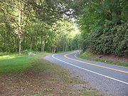
on Pennsylvania Route 44
and is surrounded by the Tiadaghton State Forest
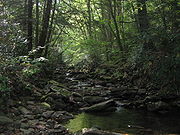
. It is on Upper Pine Bottom Run, which gave the park its name and is a tributary of Pine Creek
. Upper Pine Bottom State Park is in the Pine Creek Gorge
, where the streams have cut through five major rock formations from the Devonian
and Carboniferous
periods.
The earliest recorded inhabitants of the area were the Susquehannock
s, followed by the Iroquois
, Lenape
, and Shawnee
. Upper Pine Bottom Run was the site of a furnace
for pig iron
in 1814, the first sawmill
was built on it in 1815, and in 1825 an earlier bridle path across its headwaters became a turnpike
. The lumber industry led to the clearcutting
of the area in the 19th century. The state forest was started in 1898 and the park was formed from it in the early 1920s as a Class B public camp. The Civilian Conservation Corps
had a camp on the run and improved the park in the 1930s, but it was not transferred to the Bureau of State Parks until 1962. Though it began as a public campsite and once had a picnic
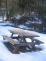
pavilion, as of 2009 it is for day use only and its only facilities are a few picnic tables and a parking area.
Upper Pine Bottom State Park is one of the smallest state parks in Pennsylvania, and is maintained by staff from nearby Little Pine State Park
. In addition to picnics, its chief use is as a parking area for local hunters
, anglers
, hikers
, cross-country skiers
, snowmobile
rs, and all-terrain vehicle
riders. Upper Pine Bottom Run is state-approved and stocked
for trout
fishing in season. Second-growth forest now covers the region; the surrounding state forest and park are home to a variety of flora and fauna
ic hunters known from their stone tool
s.Note: For a general overview of Native American History in the West Branch Susquehanna watershed, see Retrieved on September 30, 2008. Note: ISBN refers to the Heritage Books July 1996 reprint. URL is to a scan of the 1892 version with some OCR
typos. The hunter-gatherer
s of the Archaic period, which lasted locally from 7000 to 1000 BC, used a greater variety of more sophisticated stone artifacts. The Woodland period
marked the gradual transition to semi-permanent villages and horticulture
, between 1000 BC and 1500 AD. Archeological evidence found in the state from this time includes a range of pottery types and styles, burial mounds
, pipes, bows and arrows, and ornaments.
Upper Pine Bottom State Park is in the West Branch Susquehanna River
drainage basin
, the earliest recorded inhabitants of which were the Iroquoian
-speaking Susquehannock
s. They were a matriarchal
society that lived in stockade
d villages of large long house
s. Upper Pine Bottom Run is at the southern end of the Pine Creek Gorge
, and the mountains surrounding the gorge were "occasionally inhabited" by the Susquehannocks. Their numbers were greatly reduced by disease and warfare with the Five Nations of the Iroquois
, and by 1675 they had died out, moved away, or been assimilated
into other tribes.
After this, the lands of the West Branch Susquehanna River valley were under the nominal control of the Iroquois. They lived in long houses, primarily in what is now New York
, and had a strong confederacy
which gave them power beyond their numbers. The Iroquois and other tribes used the Pine Creek Path
through the gorge, traveling between a path on the Genesee River
in modern New York in the north, and the Great Shamokin Path
along the West Branch Susquehanna River in the south. The Seneca
tribe of the Iroquois believed that the Pine Creek Gorge was sacred land and never established a permanent settlement there, though they did use the path through the gorge and had seasonal hunting camps along it.
To fill the void left by the demise of the Susquehannocks, the Iroquois encouraged displaced tribes from the east to settle in the West Branch watershed, including the Shawnee
and Lenape
(or Delaware). The valleys of Pine Creek and its tributaries in Cummings Township were used by the Iroquois and Algonkian
tribes as a hunting
ground. Historians believe that there may have been a Shawnee village and burial ground just to the north of Little Pine State Park
on Little Pine Creek, just a few miles from what became Upper Pine Bottom State Park.
The French and Indian War
(1754–1763) led to the migration of many Native Americans westward to the Ohio River basin. In October 1784, the United States acquired a large tract of land, including what is now Upper Pine Bottom State Park, from the Iroquois in the Second Treaty of Fort Stanwix
(this acquisition is known as the Last Purchase in Pennsylvania). In the years that followed, Native Americans almost entirely left Pennsylvania; however some isolated bands of natives remained in the Pine Creek Gorge until the War of 1812
.
s in 1784. Lycoming County was formed from a part of Northumberland County
on April 13, 1795. Upper Pine Bottom Run was originally "famed for the wonderful white pine forest that clothed all the bottomlands", and the region was covered with Eastern White Pine
and Eastern Hemlock trees, which lumbermen harvested. To accommodate larger-scale lumber
operations and the large quantities of pine logs which these floated downstream to the West Branch Susquehanna River
, the Pennsylvania General Assembly
declared Pine Creek
a public highway on March 16, 1798.
 The area surrounding Upper Pine Bottom State Park has been a wilderness for much of its history. In 1806–1807 a bridle path
was cut through the woods just west of the source of Upper Pine Bottom Run as part of a 72 miles (115.9 km) path between Jersey Shore
(to the south, at the mouth of Pine Creek) and Coudersport
(to the northwest, on the Allegheny River
in Potter County
). The bridle path was widened to a road to accommodate wagons in 1812.
The new road soon brought industry to the region. The discovery of iron ore along the road led seven men to form a company to manufacture iron. In 1814 they built a furnace
to produce pig iron
on Upper Pine Bottom Run. It took one to two days to haul the ore to the furnace, and other supplies had to be transported 15 miles (24.1 km) to the furnace on steep mountain roads. These costs were too high, and the furnace lost almost $7,000 (approximately $ in ) before closing in 1817. The ruins of the iron furnace were visible through much of the 19th century.
The first two sawmill
s were built on Upper Pine Bottom Run in 1815 and 1817. In 1817, Michael and Henry Wolf also arrived in the area from Berks County
and built a sawmill near the mouth of Little Pine Creek, which is 1.8 miles (2.9 km) downstream along Pine Creek from the mouth of Upper Pine Bottom Run. The Wolfs' sawmill and the land they cleared for farming helped establish the unincorporated
village of Waterville, which became the most significant population center in Cummings Township, and is about 2.5 miles (4 km) southeast of Upper Pine Bottom State Park.
 The Jersey Shore and Coudersport Turnpike
was built along the former bridle path between 1825 and 1834. The turnpike, which operated until 1860, had toll booths every 5 miles (8 km) and charged a horse-drawn wagon $1.68 to travel the entire road. A post office was established in nearby Waterville in 1849; the early businesses included two stores and a hotel, which still stands. Pennsylvania Route 44
, which passes through the park, still follows the course of the former path and turnpike between Haneyville (at the western end of Upper Pine Bottom Run) and Coudersport.
Economic development and increased settlement led the Pennsylvania General Assembly to establish Cummings Township in 1832 from land taken from parts of Mifflin
and Brown Townships
. The new township was named for John Cummings, who was an associate judge in the local court system at the time. Early industry in the township included lumber and quarries for flag
and building stone. In 1839 Clinton County
was formed from the western part of Lycoming County, with much of the eastern border of the new county formed by the turnpike.
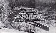
In 1851 the Susquehanna Boom
opened on the West Branch Susquehanna River at Williamsport. The boom, a series of artificial islands with chains between them to catch logs, led to an expansion of the lumber industry and to Williamsport's nickname, "Lumber Capital of the World". In 1852, the 3 miles (4.8 km) upstream of the mouth of Upper Pine Bottom Run were made a public highway by the state legislature, and by 1888 the West Branch Lumber Company owned the headwaters of Upper Pine Bottom Run.
The lumber era did not last; the old-growth forests were clearcut by the early 20th century and the Pine Creek Gorge was stripped bare. Nothing was left except the discarded, dried-out tree tops, which became a fire hazard, so much of the land burned and was left barren. In the spring of 1894 a fire burned in what is now Tiadaghton State Forest along Route 44 to near Haneyville. In the summer of 1908 the area around the park burned again, in a fire that stretched from Galeton
to Jersey Shore. The soil was depleted of nutrients, fires baked the ground hard, and jungles of blueberries, blackberries, and mountain laurel covered the clearcut land, which became known as the "Pennsylvania Desert". Disastrous floods swept the area periodically and much of the wildlife was wiped out.
became concerned that the forests would not regrow if they were not managed properly. They called for the state to purchase land from the lumber companies and for a change in the philosophy of forest management. In 1895 Rothrock was appointed the first commissioner of the Pennsylvania Department of Forests and Waters, the forerunner of today's Department of Conservation and Natural Resources
. In 1897 the Pennsylvania General Assembly passed legislation which authorized the purchase of "unseated lands for forest reservations" and the first Pennsylvania state forest lands were acquired the following year.
On July 13, 1898, the state bought a 409 acres (165.5 ha) tract of land in Cummings Township for $72.99 ($ in terms). This was the first purchase for what became Tiadaghton State Forest, which surrounds Upper Pine Bottom State Park. Most of the major purchases for it were made between 1900 and 1935. As of 2009, the Tiadaghton State Forest covered 146500 acres (59,286.5 ha), chiefly in Lycoming County with small tracts in Clinton
, Potter
, Tioga
, and Union
Counties. The largest section of the state forest is in the Pine Creek valley.
Upper Pine Bottom State Park traces its existence to the early 1920s, when the Pennsylvania Department of Forestry built 31 campsites on state forest land between 1921 and 1925. The park was originally established as "Upper Pine Bottom Class B Public Camp" and named for the stream that flows through it. Class B camps were on secondary highways and were "used primarily by hikers, hunters, fishermen, vacationists, and picknickers who desire to go far into the woods and make their stay comfortable". Each Class B camp had a lean-to shelter for camping, potable water, picnic tables, a fire place, garbage can, and a latrine. There was no charge to use any of the camps, but stays were limited to two consecutive nights.
 During the Great Depression
, the Civilian Conservation Corps
(CCC) set up nine camps in Tiadaghton State Forest. The camps included two near Upper Pine Bottom State Park: CCC Camp S-82-Pa (Waterville, also known as Haneyville) was on Upper Pine Bottom Run about 2.5 miles (4 km) west of the park and operated from May 1933 to 1941; CCC Camp S-129-Pa (Little Pine) was at the site of nearby Little Pine State Park and operated from 1933 to 1937. The CCC planted large numbers of trees in the state forest, did work in the park, and built a pavilion at the site in 1936. Although the roof of a structure was still visible in the park in a 1959 aerial photo, as of 2009 there are no pavilions or other buildings in the park. The United States' entry into the Second World War
led to the end of the CCC and all its camps were closed by the summer of 1942.
In 1950 the park was known as "Upper Pine Bottom State Forest Picnic Area" and was mentioned in a New York Times article on the Pine Creek Gorge. On November 11, 1954, the Pennsylvania Geographic Board made the picnic area name official. The Pennsylvania Bureau of Forestry's Division of State Parks became the Bureau of State Parks in 1962 and Upper Pine Bottom (and all state parks and picnic areas) were transferred to it from Forestry that year. In 1972, Upper Pine Bottom was one of 10 state forest picnic areas kept by the Bureau of State Parks (35 were transferred to the Bureau of Forestry), and Forrey's 1984 History of Pennsylvania's State Parks referred to it as a state forest picnic area. The Pennsylvania Department of Transportation
(Penn DOT) 1990 map still called it a picnic area, but Cupper's 1993 Our Priceless Heritage: Pennsylvania's State Parks 1893-1993 called it a state park, as did the Penn DOT 2002 map.
As of Upper Pine Bottom State Park is a roadside park for day use only, with a small parking lot and a few picnic tables. In addition to picnics, its chief use is as a parking area for local hunters, anglers
, hikers
, cross country skiers
, and snowmobile
rs. Staff from nearby Little Pine State Park maintain Upper Pine Bottom, and it is one of the smallest state parks in Pennsylvania. Prouty Place State Park
, a picnic area to the northwest in Potter County, is also 5 acres (2 ha). Only Sand Bridge State Park
, another picnic area to the south in Union County, is smaller, at 3 acres (1.2 ha).
. The dammed creek formed a lake near what would later be the village of Ansonia in Shippen Township
in Tioga County, and the lake's glacial meltwater overflowed the debris dam
, reversing the flow of Pine Creek. The creek flooded to the south and quickly carved a deep channel on its way to the West Branch Susquehanna River.
The land on which Upper Pine Bottom State Park sits was part of the coastline of a shallow sea that covered a great portion of what is now North America about 300 million years ago, in the Pennsylvanian subperiod
. The high mountains to the east of the sea gradually eroded, causing a buildup of sediment
made up primarily of clay
, sand
and gravel
. Tremendous pressure on the sediment caused the formation of the rocks that are found today in the Pine Creek drainage basin: sandstone
, shale
, conglomerates
, limestone
, and coal
.
The park is at an elevation of 938 feet (285.9 m) on the Allegheny Plateau
, which formed in the Alleghenian orogeny
some 300 million years ago, when the part of Gondwana
that became Africa collided with what became North America, forming Pangaea
. Although the gorge and its surroundings seem to be mountainous, the area is a dissected plateau
. Years of erosion
have cut away the soft rocks, forming the valleys, and left the hardest of the ancient rocks relatively untouched on the top of sharp ridges, giving them the appearance of "mountains".
Five major rock formations from the Devonian
and Carboniferous
periods are present in Upper Pine Bottom State Park and Cummings Township. The youngest of these, which forms the highest points in the township, is the early Pennsylvanian
Pottsville Formation
, a gray conglomerate that may contain sandstone, siltstone
, and shale, as well as anthracite coal. Low-sulfur coal was once mined at three locations within the Pine Creek watershed, and there is a coal deposit between the headwaters of Upper Pine Bottom and Lower Pine Bottom Runs. Below this is the late Mississippian Mauch Chunk Formation
, which is formed with grayish-red shale, siltstone, sandstone, and conglomerate.
Next below these is the Mississippian Burgoon Sandstone
, which is buff colored with shale, coal, and conglomerate inclusions. Below this is the late Devonian
and early Mississippian Huntley Mountain Formation
, which is made of relatively soft grayish-red shale and olive-gray sandstone. The lowest and oldest layer is the red shale and siltstone of the Catskill Formation, some 375 million years old. This layer is relatively soft and easily eroded, which helped to form the Pine Creek Gorge. The source of Upper Pine Bottom Run is on Mauch Chunk rock, and the stream cuts deeper as it flows east to Pine Creek. In the park Upper Pine Bottom Run has cut through layers of Burgoon sandstone and Huntley Mountain rock, and downstream of the park to its mouth the deepest parts of the valleys are made of the Catskill Formation.
The Allegheny Plateau has a continental climate
, with occasional severe low temperatures in winter and average daily temperature range
s (difference between the daily high and low) of 20 °F (11 °C) in winter and 26 °F (14 °C) in summer. The mean annual precipitation
for the Pine Creek watershed is 36 inch. January is the coldest month at Upper Pine Bottom State Park, July the warmest, and June the wettest. The highest recorded temperature at the park was 104 °F (40 °C) in 1988, and the record low was -19 F in 1982.
 Descriptions from early explorers and settlers give an idea of what the Pine Creek Gorge was like before it was clearcut. The forest was up to 85 percent hemlock and white pine; hardwoods made up the rest. The Pine Creek watershed, which Upper Pine Bottom Run is part of, was home to large predators such as Wolves
, Lynx, Wolverine
s, Panthers, Fishers
, Bobcat
s and foxes
; all except the last three are locally extinct as of 2007. The area had herds of American Bison
, Elk
and White-tailed Deer
, and large numbers of Black Bears
, River Otters
, and Beaver
s. Rattlesnake
s and insects plagued early explorers and settlers in the region.
The virgin forests cooled the land and streams, and centuries of accumulated organic matter in the forest soil caused slow percolation of rainfall into the creeks and runs so that they flowed more evenly year-round. Pine Creek and its tributaries were home to large numbers of fish, including trout, but dams downstream on the Susquehanna River
have eliminated the shad
and eel
s once found here by blocking their migrations
. Habitat for land animals was destroyed by the clearcutting of forests, but there was also a great deal of hunting, with bounties paid for large predators.
Upper Pine Bottom Run's virgin white pines were all clearcut, but in 1925 the Department of Forests and Waters reported "thrifty young growth has now taken in its place". In the 1920s chestnut blight
killed almost all the American Chestnut
trees in the Tiadaghton State Forest, and oak trees suffered from oak leaf tier moths
in the 1950s and oak leaf roller moths
in 1967. Gypsy moth
s defoliated the state forest between 1978 and 1982. As of 2009 the surrounding state forest is "dominated by mixed oak forests", along with hardwoods such as ash, beech
, birch
, cherry, and maple
, as well as hemlock and pine. The Pine Creek Gorge is home to over 225 species of wildflowers, plants and trees, 40 species of mammals, 245 species of birds, and 26 species of fish. Common animals include deer, squirrels, bear, eagles, Wild Turkey
, and ravens.
and bass
fishing in 1885, and in 1925 the Department of Forests and Waters said there was good fishing and hunting in the camp. Brown trout over 20 inches (50.8 cm) long were reported in the stream in 1994. In 2009, all of Upper Pine Bottom Run has been designated as approved trout waters by the Pennsylvania Fish and Boat Commission
, which means that it is stocked
with trout and may be fished during trout season.
Upper Pine Bottom State Park also serves as a parking area and access point for the surrounding state forest, where recreational opportunities include hiking and hunting. The most common game animals are Black Bear, Ruffed Grouse
, White-tailed Deer, and Wild Turkey. The state forest trails are also open to mountain biking and horseback riding, and in winter are used for cross-country skiing and snowmobiling. Just north of the park is the 19 miles (30.6 km) Haneyville ATV Trail system for all-terrain vehicle
s. The parking area for the trail is on PA 44 at the site of the former CCC camp S-82-Pa, and the history of the stream is reflected in the names of three of the trails in the system: Furnace Trail (for the iron furnace), CCC Trail, and Plantation Loop (for the plantations of trees planted by the CCC).
Lycoming County, Pennsylvania
-Appalachian Mountains and Allegheny Plateau:Lycoming County is divided between the Appalachian Mountains in the south, the dissected Allegheny Plateau in the north and east, and the valley of the West Branch Susquehanna River between these.-West Branch Susquehanna River:The West Branch of the...
, Pennsylvania
Pennsylvania
The Commonwealth of Pennsylvania is a U.S. state that is located in the Northeastern and Mid-Atlantic regions of the United States. The state borders Delaware and Maryland to the south, West Virginia to the southwest, Ohio to the west, New York and Ontario, Canada, to the north, and New Jersey to...
in the United States. The park is in Cummings Township
Cummings Township, Lycoming County, Pennsylvania
Cummings Township is a township in Lycoming County, Pennsylvania, in the United States. The population was 355 at the 2000 census. It is part of the Williamsport, Pennsylvania Metropolitan Statistical Area...
on Pennsylvania Route 44
Pennsylvania Route 44
Pennsylvania Route 44 is a -long state highway in the U.S. state of Pennsylvania. The route is designated from Interstate 80 and Pennsylvania Route 42 in Buckhorn to the New York state line near New York State Route 417 in Ceres Township....
and is surrounded by the Tiadaghton State Forest
Tiadaghton State Forest
Tiadaghton State Forest is a Pennsylvania State Forest in Pennsylvania Bureau of Forestry District #12. The forest is chiefly in western and southern Lycoming County, with small portions in Clinton, Potter, Tioga, and Union counties....
. It is on Upper Pine Bottom Run, which gave the park its name and is a tributary of Pine Creek
Pine Creek (Pennsylvania)
Pine Creek is a tributary of the West Branch Susquehanna River in Potter, Tioga, Lycoming, and Clinton counties in Pennsylvania in the United States. The creek is long...
. Upper Pine Bottom State Park is in the Pine Creek Gorge
Pine Creek Gorge
Pine Creek Gorge, also known as, The Grand Canyon of Pennsylvania, is situated in approximately 160,000 acres of the Tioga State Forest in the U.S. State of Pennsylvania along Pine Creek. The Canyon begins south of Ansonia, near Wellsboro, along U.S. Route 6 and continues for approximately...
, where the streams have cut through five major rock formations from the Devonian
Devonian
The Devonian is a geologic period and system of the Paleozoic Era spanning from the end of the Silurian Period, about 416.0 ± 2.8 Mya , to the beginning of the Carboniferous Period, about 359.2 ± 2.5 Mya...
and Carboniferous
Carboniferous
The Carboniferous is a geologic period and system that extends from the end of the Devonian Period, about 359.2 ± 2.5 Mya , to the beginning of the Permian Period, about 299.0 ± 0.8 Mya . The name is derived from the Latin word for coal, carbo. Carboniferous means "coal-bearing"...
periods.
The earliest recorded inhabitants of the area were the Susquehannock
Susquehannock
The Susquehannock people were Iroquoian-speaking Native Americans who lived in areas adjacent to the Susquehanna River and its tributaries from the southern part of what is now New York, through Pennsylvania, to the mouth of the Susquehanna in Maryland at the north end of the Chesapeake Bay...
s, followed by the Iroquois
Iroquois
The Iroquois , also known as the Haudenosaunee or the "People of the Longhouse", are an association of several tribes of indigenous people of North America...
, Lenape
Lenape
The Lenape are an Algonquian group of Native Americans of the Northeastern Woodlands. They are also called Delaware Indians. As a result of the American Revolutionary War and later Indian removals from the eastern United States, today the main groups live in Canada, where they are enrolled in the...
, and Shawnee
Shawnee
The Shawnee, Shaawanwaki, Shaawanooki and Shaawanowi lenaweeki, are an Algonquian-speaking people native to North America. Historically they inhabited the areas of Ohio, Virginia, West Virginia, Western Maryland, Kentucky, Indiana, and Pennsylvania...
. Upper Pine Bottom Run was the site of a furnace
Furnace
A furnace is a device used for heating. The name derives from Latin fornax, oven.In American English and Canadian English, the term furnace on its own is generally used to describe household heating systems based on a central furnace , and sometimes as a synonym for kiln, a device used in the...
for pig iron
Pig iron
Pig iron is the intermediate product of smelting iron ore with a high-carbon fuel such as coke, usually with limestone as a flux. Charcoal and anthracite have also been used as fuel...
in 1814, the first sawmill
Sawmill
A sawmill is a facility where logs are cut into boards.-Sawmill process:A sawmill's basic operation is much like those of hundreds of years ago; a log enters on one end and dimensional lumber exits on the other end....
was built on it in 1815, and in 1825 an earlier bridle path across its headwaters became a turnpike
Toll road
A toll road is a privately or publicly built road for which a driver pays a toll for use. Structures for which tolls are charged include toll bridges and toll tunnels. Non-toll roads are financed using other sources of revenue, most typically fuel tax or general tax funds...
. The lumber industry led to the clearcutting
Clearcutting
Clearcutting, or clearfelling, is a controversial forestry/logging practice in which most or all trees in an area are uniformly cut down. Clearcutting, along with shelterwood and seed tree harvests, is used by foresters to create certain types of forest ecosystems and to promote select species that...
of the area in the 19th century. The state forest was started in 1898 and the park was formed from it in the early 1920s as a Class B public camp. The Civilian Conservation Corps
Civilian Conservation Corps
The Civilian Conservation Corps was a public work relief program that operated from 1933 to 1942 in the United States for unemployed, unmarried men from relief families, ages 18–25. A part of the New Deal of President Franklin D...
had a camp on the run and improved the park in the 1930s, but it was not transferred to the Bureau of State Parks until 1962. Though it began as a public campsite and once had a picnic
Picnic
In contemporary usage, a picnic can be defined simply as a pleasure excursion at which a meal is eaten outdoors , ideally taking place in a beautiful landscape such as a park, beside a lake or with an interesting view and possibly at a public event such as before an open air theatre performance,...
pavilion, as of 2009 it is for day use only and its only facilities are a few picnic tables and a parking area.
Upper Pine Bottom State Park is one of the smallest state parks in Pennsylvania, and is maintained by staff from nearby Little Pine State Park
Little Pine State Park
Little Pine State Park is a Pennsylvania state park on in Cummings Township, Lycoming County, Pennsylvania in the United States. Little Pine State park is along of Little Pine Creek, a tributary of Pine Creek, in the midst of the Tiadaghton State Forest. A dam on the creek has created a lake...
. In addition to picnics, its chief use is as a parking area for local hunters
Hunting
Hunting is the practice of pursuing any living thing, usually wildlife, for food, recreation, or trade. In present-day use, the term refers to lawful hunting, as distinguished from poaching, which is the killing, trapping or capture of the hunted species contrary to applicable law...
, anglers
Fishing
Fishing is the activity of trying to catch wild fish. Fish are normally caught in the wild. Techniques for catching fish include hand gathering, spearing, netting, angling and trapping....
, hikers
Hiking
Hiking is an outdoor activity which consists of walking in natural environments, often in mountainous or other scenic terrain. People often hike on hiking trails. It is such a popular activity that there are numerous hiking organizations worldwide. The health benefits of different types of hiking...
, cross-country skiers
Cross-country skiing
Cross-country skiing is a winter sport in which participants propel themselves across snow-covered terrain using skis and poles...
, snowmobile
Snowmobile
A snowmobile, also known in some places as a snowmachine, or sled,is a land vehicle for winter travel on snow. Designed to be operated on snow and ice, they require no road or trail. Design variations enable some machines to operate in deep snow or forests; most are used on open terrain, including...
rs, and all-terrain vehicle
All-terrain vehicle
An all-terrain vehicle , also known as a quad, quad bike, three wheeler, or four wheeler, is defined by the American National Standards Institute as a vehicle that travels on low pressure tires, with a seat that is straddled by the operator, along with handlebars for steering control...
riders. Upper Pine Bottom Run is state-approved and stocked
Fish stocking
Fish stocking is the practice of raising fish in a hatchery and releasing them into a river, lake, or the ocean to supplement existing populations, or to create a population where none exists...
for trout
Trout
Trout is the name for a number of species of freshwater and saltwater fish belonging to the Salmoninae subfamily of the family Salmonidae. Salmon belong to the same family as trout. Most salmon species spend almost all their lives in salt water...
fishing in season. Second-growth forest now covers the region; the surrounding state forest and park are home to a variety of flora and fauna
Native Americans
Humans have lived in what is now Pennsylvania since at least 10,000 BC. The first settlers were Paleo-Indian nomadNomad
Nomadic people , commonly known as itinerants in modern-day contexts, are communities of people who move from one place to another, rather than settling permanently in one location. There are an estimated 30-40 million nomads in the world. Many cultures have traditionally been nomadic, but...
ic hunters known from their stone tool
Stone tool
A stone tool is, in the most general sense, any tool made either partially or entirely out of stone. Although stone tool-dependent societies and cultures still exist today, most stone tools are associated with prehistoric, particularly Stone Age cultures that have become extinct...
s.Note: For a general overview of Native American History in the West Branch Susquehanna watershed, see Retrieved on September 30, 2008. Note: ISBN refers to the Heritage Books July 1996 reprint. URL is to a scan of the 1892 version with some OCR
Optical character recognition
Optical character recognition, usually abbreviated to OCR, is the mechanical or electronic translation of scanned images of handwritten, typewritten or printed text into machine-encoded text. It is widely used to convert books and documents into electronic files, to computerize a record-keeping...
typos. The hunter-gatherer
Hunter-gatherer
A hunter-gatherer or forage society is one in which most or all food is obtained from wild plants and animals, in contrast to agricultural societies which rely mainly on domesticated species. Hunting and gathering was the ancestral subsistence mode of Homo, and all modern humans were...
s of the Archaic period, which lasted locally from 7000 to 1000 BC, used a greater variety of more sophisticated stone artifacts. The Woodland period
Woodland period
The Woodland period of North American pre-Columbian cultures was from roughly 1000 BCE to 1000 CE in the eastern part of North America. The term "Woodland Period" was introduced in the 1930s as a generic header for prehistoric sites falling between the Archaic hunter-gatherers and the...
marked the gradual transition to semi-permanent villages and horticulture
Horticulture
Horticulture is the industry and science of plant cultivation including the process of preparing soil for the planting of seeds, tubers, or cuttings. Horticulturists work and conduct research in the disciplines of plant propagation and cultivation, crop production, plant breeding and genetic...
, between 1000 BC and 1500 AD. Archeological evidence found in the state from this time includes a range of pottery types and styles, burial mounds
Tumulus
A tumulus is a mound of earth and stones raised over a grave or graves. Tumuli are also known as barrows, burial mounds, Hügelgrab or kurgans, and can be found throughout much of the world. A tumulus composed largely or entirely of stones is usually referred to as a cairn...
, pipes, bows and arrows, and ornaments.
Upper Pine Bottom State Park is in the West Branch Susquehanna River
West Branch Susquehanna River
The West Branch Susquehanna River is one of the two principal branches, along with the North Branch, of the Susquehanna River in the northeastern United States. The North Branch, which rises in upstate New York, is generally regarded as the extension of the main branch, with the shorter West Branch...
drainage basin
Drainage basin
A drainage basin is an extent or an area of land where surface water from rain and melting snow or ice converges to a single point, usually the exit of the basin, where the waters join another waterbody, such as a river, lake, reservoir, estuary, wetland, sea, or ocean...
, the earliest recorded inhabitants of which were the Iroquoian
Iroquoian languages
The Iroquoian languages are a First Nation and Native American language family.-Family division:*Ruttenber, Edward Manning. 1992 [1872]. History of the Indian tribes of Hudson's River. Hope Farm Press....
-speaking Susquehannock
Susquehannock
The Susquehannock people were Iroquoian-speaking Native Americans who lived in areas adjacent to the Susquehanna River and its tributaries from the southern part of what is now New York, through Pennsylvania, to the mouth of the Susquehanna in Maryland at the north end of the Chesapeake Bay...
s. They were a matriarchal
Matriarchy
A matriarchy is a society in which females, especially mothers, have the central roles of political leadership and moral authority. It is also sometimes called a gynocratic or gynocentric society....
society that lived in stockade
Stockade
A stockade is an enclosure of palisades and tall walls made of logs placed side by side vertically with the tops sharpened to provide security.-Stockade as a security fence:...
d villages of large long house
Long house
A longhouse or long house is a type of long, proportionately narrow, single-room building built by peoples in various parts of the world including Asia, Europe and North America....
s. Upper Pine Bottom Run is at the southern end of the Pine Creek Gorge
Pine Creek Gorge
Pine Creek Gorge, also known as, The Grand Canyon of Pennsylvania, is situated in approximately 160,000 acres of the Tioga State Forest in the U.S. State of Pennsylvania along Pine Creek. The Canyon begins south of Ansonia, near Wellsboro, along U.S. Route 6 and continues for approximately...
, and the mountains surrounding the gorge were "occasionally inhabited" by the Susquehannocks. Their numbers were greatly reduced by disease and warfare with the Five Nations of the Iroquois
Iroquois
The Iroquois , also known as the Haudenosaunee or the "People of the Longhouse", are an association of several tribes of indigenous people of North America...
, and by 1675 they had died out, moved away, or been assimilated
Cultural assimilation
Cultural assimilation is a socio-political response to demographic multi-ethnicity that supports or promotes the assimilation of ethnic minorities into the dominant culture. The term assimilation is often used with regard to immigrants and various ethnic groups who have settled in a new land. New...
into other tribes.
After this, the lands of the West Branch Susquehanna River valley were under the nominal control of the Iroquois. They lived in long houses, primarily in what is now New York
New York
New York is a state in the Northeastern region of the United States. It is the nation's third most populous state. New York is bordered by New Jersey and Pennsylvania to the south, and by Connecticut, Massachusetts and Vermont to the east...
, and had a strong confederacy
Confederation
A confederation in modern political terms is a permanent union of political units for common action in relation to other units. Usually created by treaty but often later adopting a common constitution, confederations tend to be established for dealing with critical issues such as defense, foreign...
which gave them power beyond their numbers. The Iroquois and other tribes used the Pine Creek Path
Pine Creek Path
The Pine Creek Path was a major Native American trail in the U.S. State of Pennsylvania that ran north along Pine Creek from the West Branch Susquehanna River near Long Island to the headwaters of the Genesee River .-Course:At the southern end of the trail there was a Native American village at...
through the gorge, traveling between a path on the Genesee River
Genesee River
The Genesee River is a North American river flowing northward through the Twin Tiers of Pennsylvania and New York. The river provided the original power for the Rochester area's 19th century mills and still provides hydroelectric power for downtown Rochester....
in modern New York in the north, and the Great Shamokin Path
Great Shamokin Path
The Great Shamokin Path was a major Native American trail in the U.S. State of Pennsylvania that ran from the native village of Shamokin along the left bank of the West Branch Susquehanna River north and then west to the Great Island...
along the West Branch Susquehanna River in the south. The Seneca
Seneca nation
The Seneca are a group of indigenous people native to North America. They were the nation located farthest to the west within the Six Nations or Iroquois League in New York before the American Revolution. While exact population figures are unknown, approximately 15,000 to 25,000 Seneca live in...
tribe of the Iroquois believed that the Pine Creek Gorge was sacred land and never established a permanent settlement there, though they did use the path through the gorge and had seasonal hunting camps along it.
To fill the void left by the demise of the Susquehannocks, the Iroquois encouraged displaced tribes from the east to settle in the West Branch watershed, including the Shawnee
Shawnee
The Shawnee, Shaawanwaki, Shaawanooki and Shaawanowi lenaweeki, are an Algonquian-speaking people native to North America. Historically they inhabited the areas of Ohio, Virginia, West Virginia, Western Maryland, Kentucky, Indiana, and Pennsylvania...
and Lenape
Lenape
The Lenape are an Algonquian group of Native Americans of the Northeastern Woodlands. They are also called Delaware Indians. As a result of the American Revolutionary War and later Indian removals from the eastern United States, today the main groups live in Canada, where they are enrolled in the...
(or Delaware). The valleys of Pine Creek and its tributaries in Cummings Township were used by the Iroquois and Algonkian
Algonquian languages
The Algonquian languages also Algonkian) are a subfamily of Native American languages which includes most of the languages in the Algic language family. The name of the Algonquian language family is distinguished from the orthographically similar Algonquin dialect of the Ojibwe language, which is a...
tribes as a hunting
Hunting
Hunting is the practice of pursuing any living thing, usually wildlife, for food, recreation, or trade. In present-day use, the term refers to lawful hunting, as distinguished from poaching, which is the killing, trapping or capture of the hunted species contrary to applicable law...
ground. Historians believe that there may have been a Shawnee village and burial ground just to the north of Little Pine State Park
Little Pine State Park
Little Pine State Park is a Pennsylvania state park on in Cummings Township, Lycoming County, Pennsylvania in the United States. Little Pine State park is along of Little Pine Creek, a tributary of Pine Creek, in the midst of the Tiadaghton State Forest. A dam on the creek has created a lake...
on Little Pine Creek, just a few miles from what became Upper Pine Bottom State Park.
The French and Indian War
French and Indian War
The French and Indian War is the common American name for the war between Great Britain and France in North America from 1754 to 1763. In 1756, the war erupted into the world-wide conflict known as the Seven Years' War and thus came to be regarded as the North American theater of that war...
(1754–1763) led to the migration of many Native Americans westward to the Ohio River basin. In October 1784, the United States acquired a large tract of land, including what is now Upper Pine Bottom State Park, from the Iroquois in the Second Treaty of Fort Stanwix
Treaty of Fort Stanwix (1784)
The Treaty of Fort Stanwix was a treaty signed in October 1784 at Fort Stanwix, located in present-day Rome, New York, between the United States and Native Americans...
(this acquisition is known as the Last Purchase in Pennsylvania). In the years that followed, Native Americans almost entirely left Pennsylvania; however some isolated bands of natives remained in the Pine Creek Gorge until the War of 1812
War of 1812
The War of 1812 was a military conflict fought between the forces of the United States of America and those of the British Empire. The Americans declared war in 1812 for several reasons, including trade restrictions because of Britain's ongoing war with France, impressment of American merchant...
.
Lumber and turnpike
The land that became Cummings Township was first settled by European AmericanEuropean American
A European American is a citizen or resident of the United States who has origins in any of the original peoples of Europe...
s in 1784. Lycoming County was formed from a part of Northumberland County
Northumberland County, Pennsylvania
There were 38,835 households out of which 27.30% had children under the age of 18 living with them, 52.40% were married couples living together, 9.60% had a female householder with no husband present, and 34.10% were non-families. 30.20% of all households were made up of individuals and 15.50% had...
on April 13, 1795. Upper Pine Bottom Run was originally "famed for the wonderful white pine forest that clothed all the bottomlands", and the region was covered with Eastern White Pine
Eastern White Pine
Pinus strobus, commonly known as the eastern white pine, is a large pine native to eastern North America, occurring from Newfoundland west to Minnesota and southeastern Manitoba, and south along the Appalachian Mountains to the northern edge of Georgia.It is occasionally known as simply white pine,...
and Eastern Hemlock trees, which lumbermen harvested. To accommodate larger-scale lumber
Lumber
Lumber or timber is wood in any of its stages from felling through readiness for use as structural material for construction, or wood pulp for paper production....
operations and the large quantities of pine logs which these floated downstream to the West Branch Susquehanna River
West Branch Susquehanna River
The West Branch Susquehanna River is one of the two principal branches, along with the North Branch, of the Susquehanna River in the northeastern United States. The North Branch, which rises in upstate New York, is generally regarded as the extension of the main branch, with the shorter West Branch...
, the Pennsylvania General Assembly
Pennsylvania General Assembly
The Pennsylvania General Assembly is the state legislature of the U.S. state of Pennsylvania. The legislature convenes in the State Capitol building in Harrisburg. In colonial times , the legislature was known as the Pennsylvania Provincial Assembly. Since the Constitution of 1776, written by...
declared Pine Creek
Pine Creek (Pennsylvania)
Pine Creek is a tributary of the West Branch Susquehanna River in Potter, Tioga, Lycoming, and Clinton counties in Pennsylvania in the United States. The creek is long...
a public highway on March 16, 1798.
Bridle path
A bridle path is a thoroughfare originally made for horses, but which these days serves a wide range of interests, including hikers, walkers and cyclists as well as equestrians. The laws relating to permissions vary from country to country...
was cut through the woods just west of the source of Upper Pine Bottom Run as part of a 72 miles (115.9 km) path between Jersey Shore
Jersey Shore, Pennsylvania
Jersey Shore is a borough in Lycoming County, Pennsylvania, United States. It is on the West Branch Susquehanna River, west by south of Williamsport. It is part of the Williamsport, Pennsylvania Metropolitan Statistical Area. In the past, Jersey Shore held farms, railroad shops, cigar factories, a...
(to the south, at the mouth of Pine Creek) and Coudersport
Coudersport, Pennsylvania
Coudersport is a borough in Potter County, Pennsylvania, east by south of Erie on the Allegheny River. The populations were these: 1,530 in 1890; 3,217 in 1900; and 3,100 in 1910. The population was 2,650 at the 2000 census...
(to the northwest, on the Allegheny River
Allegheny River
The Allegheny River is a principal tributary of the Ohio River; it is located in the Eastern United States. The Allegheny River joins with the Monongahela River to form the Ohio River at the "Point" of Point State Park in Downtown Pittsburgh, Pennsylvania...
in Potter County
Potter County, Pennsylvania
Potter County is a county located in the U.S. state of Pennsylvania. It is in the Allegheny Plateau region. As of 2010, the population was 17,457. Its county seat is Coudersport. Potter County was named after James Potter, who was a general from Pennsylvania in the Continental Army during the...
). The bridle path was widened to a road to accommodate wagons in 1812.
The new road soon brought industry to the region. The discovery of iron ore along the road led seven men to form a company to manufacture iron. In 1814 they built a furnace
Furnace
A furnace is a device used for heating. The name derives from Latin fornax, oven.In American English and Canadian English, the term furnace on its own is generally used to describe household heating systems based on a central furnace , and sometimes as a synonym for kiln, a device used in the...
to produce pig iron
Pig iron
Pig iron is the intermediate product of smelting iron ore with a high-carbon fuel such as coke, usually with limestone as a flux. Charcoal and anthracite have also been used as fuel...
on Upper Pine Bottom Run. It took one to two days to haul the ore to the furnace, and other supplies had to be transported 15 miles (24.1 km) to the furnace on steep mountain roads. These costs were too high, and the furnace lost almost $7,000 (approximately $ in ) before closing in 1817. The ruins of the iron furnace were visible through much of the 19th century.
The first two sawmill
Sawmill
A sawmill is a facility where logs are cut into boards.-Sawmill process:A sawmill's basic operation is much like those of hundreds of years ago; a log enters on one end and dimensional lumber exits on the other end....
s were built on Upper Pine Bottom Run in 1815 and 1817. In 1817, Michael and Henry Wolf also arrived in the area from Berks County
Berks County, Pennsylvania
-Demographics:As of the census of 2000, there were 373,638 people, 141,570 households, and 98,532 families residing in the county. The population density was 435 people per square mile . There were 150,222 housing units at an average density of 175 per square mile...
and built a sawmill near the mouth of Little Pine Creek, which is 1.8 miles (2.9 km) downstream along Pine Creek from the mouth of Upper Pine Bottom Run. The Wolfs' sawmill and the land they cleared for farming helped establish the unincorporated
Unincorporated area
In law, an unincorporated area is a region of land that is not a part of any municipality.To "incorporate" in this context means to form a municipal corporation, a city, town, or village with its own government. An unincorporated community is usually not subject to or taxed by a municipal government...
village of Waterville, which became the most significant population center in Cummings Township, and is about 2.5 miles (4 km) southeast of Upper Pine Bottom State Park.
Toll road
A toll road is a privately or publicly built road for which a driver pays a toll for use. Structures for which tolls are charged include toll bridges and toll tunnels. Non-toll roads are financed using other sources of revenue, most typically fuel tax or general tax funds...
was built along the former bridle path between 1825 and 1834. The turnpike, which operated until 1860, had toll booths every 5 miles (8 km) and charged a horse-drawn wagon $1.68 to travel the entire road. A post office was established in nearby Waterville in 1849; the early businesses included two stores and a hotel, which still stands. Pennsylvania Route 44
Pennsylvania Route 44
Pennsylvania Route 44 is a -long state highway in the U.S. state of Pennsylvania. The route is designated from Interstate 80 and Pennsylvania Route 42 in Buckhorn to the New York state line near New York State Route 417 in Ceres Township....
, which passes through the park, still follows the course of the former path and turnpike between Haneyville (at the western end of Upper Pine Bottom Run) and Coudersport.
Economic development and increased settlement led the Pennsylvania General Assembly to establish Cummings Township in 1832 from land taken from parts of Mifflin
Mifflin Township, Lycoming County, Pennsylvania
Mifflin Township is a township in Lycoming County, Pennsylvania, in the United States. The population was 1,145 at the 2000 census. It is part of the Williamsport, Pennsylvania Metropolitan Statistical Area.- History :...
and Brown Townships
Brown Township, Lycoming County, Pennsylvania
Brown Township is a township in Lycoming County, Pennsylvania, in the United States. The population was 111 at the 2000 census. It is part of the Williamsport, Pennsylvania Metropolitan Statistical Area.-History:...
. The new township was named for John Cummings, who was an associate judge in the local court system at the time. Early industry in the township included lumber and quarries for flag
Flagstone
Flagstone, is a generic flat stone, usually used for paving slabs or walkways, patios, fences and roofing. It may be used for memorials, headstones, facades and other constructions. The name derives from Middle English flagge meaning turf, perhaps from Old Norse flaga meaning slab.Flagstone is a...
and building stone. In 1839 Clinton County
Clinton County, Pennsylvania
As of the census of 2000, there were 37,914 people, 14,773 households, and 9,927 families residing in the county. The population density was 43 people per square mile . There were 18,166 housing units at an average density of 20 per square mile...
was formed from the western part of Lycoming County, with much of the eastern border of the new county formed by the turnpike.
In 1851 the Susquehanna Boom
Susquehanna Boom
The Susquehanna Boom was a system of cribs and chained logs in the West Branch Susquehanna River, designed to catch and hold floating timber until it could be processed at one of the nearly 60 sawmills along the river between Lycoming and Loyalsock Creeks in Lycoming County, Pennsylvania in the...
opened on the West Branch Susquehanna River at Williamsport. The boom, a series of artificial islands with chains between them to catch logs, led to an expansion of the lumber industry and to Williamsport's nickname, "Lumber Capital of the World". In 1852, the 3 miles (4.8 km) upstream of the mouth of Upper Pine Bottom Run were made a public highway by the state legislature, and by 1888 the West Branch Lumber Company owned the headwaters of Upper Pine Bottom Run.
The lumber era did not last; the old-growth forests were clearcut by the early 20th century and the Pine Creek Gorge was stripped bare. Nothing was left except the discarded, dried-out tree tops, which became a fire hazard, so much of the land burned and was left barren. In the spring of 1894 a fire burned in what is now Tiadaghton State Forest along Route 44 to near Haneyville. In the summer of 1908 the area around the park burned again, in a fire that stretched from Galeton
Galeton, Pennsylvania
Galeton is a borough in Potter County, Pennsylvania, United States, southeast of Bradford. Light industries such as knitting mills and a tannery have existed in Galeton. In 1900, 2,415 people lived in Galeton, and 4,027 people lived there in 1910...
to Jersey Shore. The soil was depleted of nutrients, fires baked the ground hard, and jungles of blueberries, blackberries, and mountain laurel covered the clearcut land, which became known as the "Pennsylvania Desert". Disastrous floods swept the area periodically and much of the wildlife was wiped out.
State forest and park
As the timber was exhausted and the land burned, many companies simply abandoned their holdings. Conservationists like Joseph RothrockJoseph Rothrock
Joseph Trimbel Rothrock was an American environmentalist, recognized as the "Father of Forestry" in Pennsylvania. In 1895, Rothrock was appointed the first forestry commissioner to lead the newly formed Division of Forestry in the Pennsylvania Department of Agriculture...
became concerned that the forests would not regrow if they were not managed properly. They called for the state to purchase land from the lumber companies and for a change in the philosophy of forest management. In 1895 Rothrock was appointed the first commissioner of the Pennsylvania Department of Forests and Waters, the forerunner of today's Department of Conservation and Natural Resources
Pennsylvania Department of Conservation and Natural Resources
The Pennsylvania Department of Conservation and Natural Resources , established on July 1, 1995, is the agency in the U.S. State of Pennsylvania responsible for maintaining and preserving the state's 117 state parks and 20 state forests; providing information on the state's natural resources; and...
. In 1897 the Pennsylvania General Assembly passed legislation which authorized the purchase of "unseated lands for forest reservations" and the first Pennsylvania state forest lands were acquired the following year.
On July 13, 1898, the state bought a 409 acres (165.5 ha) tract of land in Cummings Township for $72.99 ($ in terms). This was the first purchase for what became Tiadaghton State Forest, which surrounds Upper Pine Bottom State Park. Most of the major purchases for it were made between 1900 and 1935. As of 2009, the Tiadaghton State Forest covered 146500 acres (59,286.5 ha), chiefly in Lycoming County with small tracts in Clinton
Clinton County, Pennsylvania
As of the census of 2000, there were 37,914 people, 14,773 households, and 9,927 families residing in the county. The population density was 43 people per square mile . There were 18,166 housing units at an average density of 20 per square mile...
, Potter
Potter County, Pennsylvania
Potter County is a county located in the U.S. state of Pennsylvania. It is in the Allegheny Plateau region. As of 2010, the population was 17,457. Its county seat is Coudersport. Potter County was named after James Potter, who was a general from Pennsylvania in the Continental Army during the...
, Tioga
Tioga County, Pennsylvania
Tioga County is a county located in the U.S. state of Pennsylvania. As of the 2010 census, the population was 41,981. Tioga County was created on March 26, 1804, from part of Lycoming County and named for the Tioga River. Its county seat is Wellsboro....
, and Union
Union County, Pennsylvania
-Demographics:As of the census of 2000, there were 41,624 people, 13,178 households, and 9,211 families residing in the county. The population density was 131 people per square mile . There were 14,684 housing units at an average density of 46 per square mile...
Counties. The largest section of the state forest is in the Pine Creek valley.
Upper Pine Bottom State Park traces its existence to the early 1920s, when the Pennsylvania Department of Forestry built 31 campsites on state forest land between 1921 and 1925. The park was originally established as "Upper Pine Bottom Class B Public Camp" and named for the stream that flows through it. Class B camps were on secondary highways and were "used primarily by hikers, hunters, fishermen, vacationists, and picknickers who desire to go far into the woods and make their stay comfortable". Each Class B camp had a lean-to shelter for camping, potable water, picnic tables, a fire place, garbage can, and a latrine. There was no charge to use any of the camps, but stays were limited to two consecutive nights.
Great Depression
The Great Depression was a severe worldwide economic depression in the decade preceding World War II. The timing of the Great Depression varied across nations, but in most countries it started in about 1929 and lasted until the late 1930s or early 1940s...
, the Civilian Conservation Corps
Civilian Conservation Corps
The Civilian Conservation Corps was a public work relief program that operated from 1933 to 1942 in the United States for unemployed, unmarried men from relief families, ages 18–25. A part of the New Deal of President Franklin D...
(CCC) set up nine camps in Tiadaghton State Forest. The camps included two near Upper Pine Bottom State Park: CCC Camp S-82-Pa (Waterville, also known as Haneyville) was on Upper Pine Bottom Run about 2.5 miles (4 km) west of the park and operated from May 1933 to 1941; CCC Camp S-129-Pa (Little Pine) was at the site of nearby Little Pine State Park and operated from 1933 to 1937. The CCC planted large numbers of trees in the state forest, did work in the park, and built a pavilion at the site in 1936. Although the roof of a structure was still visible in the park in a 1959 aerial photo, as of 2009 there are no pavilions or other buildings in the park. The United States' entry into the Second World War
World War II
World War II, or the Second World War , was a global conflict lasting from 1939 to 1945, involving most of the world's nations—including all of the great powers—eventually forming two opposing military alliances: the Allies and the Axis...
led to the end of the CCC and all its camps were closed by the summer of 1942.
In 1950 the park was known as "Upper Pine Bottom State Forest Picnic Area" and was mentioned in a New York Times article on the Pine Creek Gorge. On November 11, 1954, the Pennsylvania Geographic Board made the picnic area name official. The Pennsylvania Bureau of Forestry's Division of State Parks became the Bureau of State Parks in 1962 and Upper Pine Bottom (and all state parks and picnic areas) were transferred to it from Forestry that year. In 1972, Upper Pine Bottom was one of 10 state forest picnic areas kept by the Bureau of State Parks (35 were transferred to the Bureau of Forestry), and Forrey's 1984 History of Pennsylvania's State Parks referred to it as a state forest picnic area. The Pennsylvania Department of Transportation
Pennsylvania Department of Transportation
The Pennsylvania Department of Transportation oversees transportation issues in the Commonwealth of Pennsylvania. The administrator of PennDOT is the Pennsylvania Secretary of Transportation, currently Barry Schoch Presently, PennDOT supports over of state roads and highways, about 25,000...
(Penn DOT) 1990 map still called it a picnic area, but Cupper's 1993 Our Priceless Heritage: Pennsylvania's State Parks 1893-1993 called it a state park, as did the Penn DOT 2002 map.
As of Upper Pine Bottom State Park is a roadside park for day use only, with a small parking lot and a few picnic tables. In addition to picnics, its chief use is as a parking area for local hunters, anglers
Fishing
Fishing is the activity of trying to catch wild fish. Fish are normally caught in the wild. Techniques for catching fish include hand gathering, spearing, netting, angling and trapping....
, hikers
Hiking
Hiking is an outdoor activity which consists of walking in natural environments, often in mountainous or other scenic terrain. People often hike on hiking trails. It is such a popular activity that there are numerous hiking organizations worldwide. The health benefits of different types of hiking...
, cross country skiers
Cross-country skiing
Cross-country skiing is a winter sport in which participants propel themselves across snow-covered terrain using skis and poles...
, and snowmobile
Snowmobile
A snowmobile, also known in some places as a snowmachine, or sled,is a land vehicle for winter travel on snow. Designed to be operated on snow and ice, they require no road or trail. Design variations enable some machines to operate in deep snow or forests; most are used on open terrain, including...
rs. Staff from nearby Little Pine State Park maintain Upper Pine Bottom, and it is one of the smallest state parks in Pennsylvania. Prouty Place State Park
Prouty Place State Park
Prouty Place State Park is a Pennsylvania state park on in Summit Township, Potter County, Pennsylvania in the United States. The park is southwest of Pennsylvania Route 44, along Long Tree Road, near Sweden Valley. The park provides access points for hiking, hunting and fishing in the...
, a picnic area to the northwest in Potter County, is also 5 acres (2 ha). Only Sand Bridge State Park
Sand Bridge State Park
Sand Bridge State Park is a Pennsylvania state park on in Lewis Township, Union County, Pennsylvania in the United States. The park is the smallest state park in Pennsylvania and consists of a picnic area just off Pennsylvania Route 192. It has three picnic pavilions that were built by the...
, another picnic area to the south in Union County, is smaller, at 3 acres (1.2 ha).
Geology and climate
Although the rock formations exposed in Upper Pine Bottom State Park and the Pine Creek Gorge are at least 300 million years old, the gorge itself formed about 20,000 years ago, in the last ice age. Pine Creek had flowed northeasterly until then, but was dammed by rocks, soil, ice, and other debris deposited by the receding Laurentide Continental GlacierLaurentide ice sheet
The Laurentide Ice Sheet was a massive sheet of ice that covered hundreds of thousands of square miles, including most of Canada and a large portion of the northern United States, multiple times during Quaternary glacial epochs. It last covered most of northern North America between c. 95,000 and...
. The dammed creek formed a lake near what would later be the village of Ansonia in Shippen Township
Shippen Township, Tioga County, Pennsylvania
Shippen Township is a township in Tioga County, Pennsylvania, in the United States. The population was 472 at the 2000 census. Two Pennsylvania state parks, Colton Point and Leonard Harrison are in Shippen Township at the Pennsylvania Grand Canyon...
in Tioga County, and the lake's glacial meltwater overflowed the debris dam
Landslide dam
A landslide dam, debris dam, or barrier lake is a natural damming of a river by some kind of mass wasting: landslide, debris flow, rock avalanche or volcano. If it is caused by earthquake, it may also be called a quake lake. Some landslide dams are as high as the largest existing artificial dam...
, reversing the flow of Pine Creek. The creek flooded to the south and quickly carved a deep channel on its way to the West Branch Susquehanna River.
The land on which Upper Pine Bottom State Park sits was part of the coastline of a shallow sea that covered a great portion of what is now North America about 300 million years ago, in the Pennsylvanian subperiod
Pennsylvanian
The Pennsylvanian is, in the ICS geologic timescale, the younger of two subperiods of the Carboniferous Period. It lasted from roughly . As with most other geochronologic units, the rock beds that define the Pennsylvanian are well identified, but the exact date of the start and end are uncertain...
. The high mountains to the east of the sea gradually eroded, causing a buildup of sediment
Sediment
Sediment is naturally occurring material that is broken down by processes of weathering and erosion, and is subsequently transported by the action of fluids such as wind, water, or ice, and/or by the force of gravity acting on the particle itself....
made up primarily of clay
Clay
Clay is a general term including many combinations of one or more clay minerals with traces of metal oxides and organic matter. Geologic clay deposits are mostly composed of phyllosilicate minerals containing variable amounts of water trapped in the mineral structure.- Formation :Clay minerals...
, sand
Sand
Sand is a naturally occurring granular material composed of finely divided rock and mineral particles.The composition of sand is highly variable, depending on the local rock sources and conditions, but the most common constituent of sand in inland continental settings and non-tropical coastal...
and gravel
Gravel
Gravel is composed of unconsolidated rock fragments that have a general particle size range and include size classes from granule- to boulder-sized fragments. Gravel can be sub-categorized into granule and cobble...
. Tremendous pressure on the sediment caused the formation of the rocks that are found today in the Pine Creek drainage basin: sandstone
Sandstone
Sandstone is a sedimentary rock composed mainly of sand-sized minerals or rock grains.Most sandstone is composed of quartz and/or feldspar because these are the most common minerals in the Earth's crust. Like sand, sandstone may be any colour, but the most common colours are tan, brown, yellow,...
, shale
Shale
Shale is a fine-grained, clastic sedimentary rock composed of mud that is a mix of flakes of clay minerals and tiny fragments of other minerals, especially quartz and calcite. The ratio of clay to other minerals is variable. Shale is characterized by breaks along thin laminae or parallel layering...
, conglomerates
Conglomerate (geology)
A conglomerate is a rock consisting of individual clasts within a finer-grained matrix that have become cemented together. Conglomerates are sedimentary rocks consisting of rounded fragments and are thus differentiated from breccias, which consist of angular clasts...
, limestone
Limestone
Limestone is a sedimentary rock composed largely of the minerals calcite and aragonite, which are different crystal forms of calcium carbonate . Many limestones are composed from skeletal fragments of marine organisms such as coral or foraminifera....
, and coal
Coal
Coal is a combustible black or brownish-black sedimentary rock usually occurring in rock strata in layers or veins called coal beds or coal seams. The harder forms, such as anthracite coal, can be regarded as metamorphic rock because of later exposure to elevated temperature and pressure...
.
The park is at an elevation of 938 feet (285.9 m) on the Allegheny Plateau
Allegheny Plateau
The Allegheny Plateau is a large dissected plateau area in western and central New York, northern and western Pennsylvania, northern and western West Virginia, and eastern Ohio...
, which formed in the Alleghenian orogeny
Alleghenian orogeny
The Alleghenian orogeny or Appalachian orogeny is one of the geological mountain-forming events that formed the Appalachian Mountains and Allegheny Mountains. The term and spelling Alleghany orogeny was originally proposed by H.P. Woodward in 1957....
some 300 million years ago, when the part of Gondwana
Gondwana
In paleogeography, Gondwana , originally Gondwanaland, was the southernmost of two supercontinents that later became parts of the Pangaea supercontinent. It existed from approximately 510 to 180 million years ago . Gondwana is believed to have sutured between ca. 570 and 510 Mya,...
that became Africa collided with what became North America, forming Pangaea
Pangaea
Pangaea, Pangæa, or Pangea is hypothesized as a supercontinent that existed during the Paleozoic and Mesozoic eras about 250 million years ago, before the component continents were separated into their current configuration....
. Although the gorge and its surroundings seem to be mountainous, the area is a dissected plateau
Dissected plateau
A dissected plateau is a plateau area that has been severely eroded so that the relief is sharp. Such an area may be referred to as mountainous, but dissected plateaus are distinguishable from orogenic mountain belts by the lack of folding, metamorphism, extensive faulting, or magmatic activity...
. Years of erosion
Erosion
Erosion is when materials are removed from the surface and changed into something else. It only works by hydraulic actions and transport of solids in the natural environment, and leads to the deposition of these materials elsewhere...
have cut away the soft rocks, forming the valleys, and left the hardest of the ancient rocks relatively untouched on the top of sharp ridges, giving them the appearance of "mountains".
Five major rock formations from the Devonian
Devonian
The Devonian is a geologic period and system of the Paleozoic Era spanning from the end of the Silurian Period, about 416.0 ± 2.8 Mya , to the beginning of the Carboniferous Period, about 359.2 ± 2.5 Mya...
and Carboniferous
Carboniferous
The Carboniferous is a geologic period and system that extends from the end of the Devonian Period, about 359.2 ± 2.5 Mya , to the beginning of the Permian Period, about 299.0 ± 0.8 Mya . The name is derived from the Latin word for coal, carbo. Carboniferous means "coal-bearing"...
periods are present in Upper Pine Bottom State Park and Cummings Township. The youngest of these, which forms the highest points in the township, is the early Pennsylvanian
Pennsylvanian
The Pennsylvanian is, in the ICS geologic timescale, the younger of two subperiods of the Carboniferous Period. It lasted from roughly . As with most other geochronologic units, the rock beds that define the Pennsylvanian are well identified, but the exact date of the start and end are uncertain...
Pottsville Formation
Pottsville Formation
The Pennsylvanian Pottsville Formation is a mapped bedrock unit in Pennsylvania, western Maryland, West Virginia, and Ohio. The formation is also recognized in Alabama. It is a major ridge-former In the Ridge-and-Valley Appalachians of the eastern United States...
, a gray conglomerate that may contain sandstone, siltstone
Siltstone
Siltstone is a sedimentary rock which has a grain size in the silt range, finer than sandstone and coarser than claystones.- Description :As its name implies, it is primarily composed of silt sized particles, defined as grains 1/16 - 1/256 mm or 4 to 8 on the Krumbein phi scale...
, and shale, as well as anthracite coal. Low-sulfur coal was once mined at three locations within the Pine Creek watershed, and there is a coal deposit between the headwaters of Upper Pine Bottom and Lower Pine Bottom Runs. Below this is the late Mississippian Mauch Chunk Formation
Mauch Chunk Formation
The Mississippian Mauch Chunk Formation is a mapped bedrock unit in Pennsylvania, Maryland, and West Virginia. It is named for the borough of Mauch Chunk, now known as Jim Thorpe, Pennsylvania.-Description:...
, which is formed with grayish-red shale, siltstone, sandstone, and conglomerate.
Next below these is the Mississippian Burgoon Sandstone
Pocono Formation
The Mississippian Pocono Formation is a mapped bedrock unit in Pennsylvania, Maryland, and West Virginia, USA. It is also known as the Pocono Group in Maryland and West Virginia,...
, which is buff colored with shale, coal, and conglomerate inclusions. Below this is the late Devonian
Devonian
The Devonian is a geologic period and system of the Paleozoic Era spanning from the end of the Silurian Period, about 416.0 ± 2.8 Mya , to the beginning of the Carboniferous Period, about 359.2 ± 2.5 Mya...
and early Mississippian Huntley Mountain Formation
Huntley Mountain Formation
The Huntley Mountain Formation is a late Devonian and early Mississippian mapped bedrock unit in Pennsylvania, in the United States.-Description:The formation is composed of relatively soft grayish-red shale and olive-gray sandstone...
, which is made of relatively soft grayish-red shale and olive-gray sandstone. The lowest and oldest layer is the red shale and siltstone of the Catskill Formation, some 375 million years old. This layer is relatively soft and easily eroded, which helped to form the Pine Creek Gorge. The source of Upper Pine Bottom Run is on Mauch Chunk rock, and the stream cuts deeper as it flows east to Pine Creek. In the park Upper Pine Bottom Run has cut through layers of Burgoon sandstone and Huntley Mountain rock, and downstream of the park to its mouth the deepest parts of the valleys are made of the Catskill Formation.
The Allegheny Plateau has a continental climate
Continental climate
Continental climate is a climate characterized by important annual variation in temperature due to the lack of significant bodies of water nearby...
, with occasional severe low temperatures in winter and average daily temperature range
Temperature range
Atmospheric temperature range is the numerical difference between the minimum and maximum values of temperature observed in a given location....
s (difference between the daily high and low) of 20 °F (11 °C) in winter and 26 °F (14 °C) in summer. The mean annual precipitation
Precipitation (meteorology)
In meteorology, precipitation In meteorology, precipitation In meteorology, precipitation (also known as one of the classes of hydrometeors, which are atmospheric water phenomena is any product of the condensation of atmospheric water vapor that falls under gravity. The main forms of precipitation...
for the Pine Creek watershed is 36 inch. January is the coldest month at Upper Pine Bottom State Park, July the warmest, and June the wettest. The highest recorded temperature at the park was 104 °F (40 °C) in 1988, and the record low was -19 F in 1982.
Ecology
Gray Wolf
The gray wolf , also known as the wolf, is the largest extant wild member of the Canidae family...
, Lynx, Wolverine
Wolverine
The wolverine, pronounced , Gulo gulo , also referred to as glutton, carcajou, skunk bear, or quickhatch, is the largest land-dwelling species of the family Mustelidae . It is a stocky and muscular carnivore, more closely resembling a small bear than other mustelids...
s, Panthers, Fishers
Fisher (animal)
The fisher is a medium-size mammal native to North America. It is a member of the mustelid family, commonly referred to as the weasel family. The fisher is closely related to but larger than the American Marten...
, Bobcat
Bobcat
The bobcat is a North American mammal of the cat family Felidae, appearing during the Irvingtonian stage of around 1.8 million years ago . With twelve recognized subspecies, it ranges from southern Canada to northern Mexico, including most of the continental United States...
s and foxes
Vulpes
Vulpes is a genus of the Canidae family. Its members are referred to as 'true foxes', although there are species in other genera whose common names include the word 'fox'....
; all except the last three are locally extinct as of 2007. The area had herds of American Bison
American Bison
The American bison , also commonly known as the American buffalo, is a North American species of bison that once roamed the grasslands of North America in massive herds...
, Elk
Elk
The Elk is the large deer, also called Cervus canadensis or wapiti, of North America and eastern Asia.Elk may also refer to:Other antlered mammals:...
and White-tailed Deer
White-tailed Deer
The white-tailed deer , also known as the Virginia deer or simply as the whitetail, is a medium-sized deer native to the United States , Canada, Mexico, Central America, and South America as far south as Peru...
, and large numbers of Black Bears
American black bear
The American black bear is a medium-sized bear native to North America. It is the continent's smallest and most common bear species. Black bears are omnivores, with their diets varying greatly depending on season and location. They typically live in largely forested areas, but do leave forests in...
, River Otters
Northern River Otter
The North American river otter , also known as the northern river otter or the common otter, is a semiaquatic mammal endemic to the North American continent, found in and along its waterways and coasts. An adult river otter can weigh between 5 and 14 kg...
, and Beaver
American Beaver
The North American Beaver is the only species of beaver in the Americas, native to North America and introduced to South America. In the United States and Canada, where no other species of beaver occurs, it is usually simply referred to as "beaver"...
s. Rattlesnake
Rattlesnake
Rattlesnakes are a group of venomous snakes of the genera Crotalus and Sistrurus of the subfamily Crotalinae . There are 32 known species of rattlesnake, with between 65-70 subspecies, all native to the Americas, ranging from southern Alberta and southern British Columbia in Canada to Central...
s and insects plagued early explorers and settlers in the region.
The virgin forests cooled the land and streams, and centuries of accumulated organic matter in the forest soil caused slow percolation of rainfall into the creeks and runs so that they flowed more evenly year-round. Pine Creek and its tributaries were home to large numbers of fish, including trout, but dams downstream on the Susquehanna River
Susquehanna River
The Susquehanna River is a river located in the northeastern United States. At long, it is the longest river on the American east coast that drains into the Atlantic Ocean, and with its watershed it is the 16th largest river in the United States, and the longest river in the continental United...
have eliminated the shad
Shad
The shads or river herrings comprise the genus Alosa, fish related to herring in the family Clupeidae. They are distinct from others in that family by having a deeper body and spawning in rivers. The several species frequent different areas on both sides of the Atlantic Ocean, Mediterranean Sea....
and eel
Eel
Eels are an order of fish, which consists of four suborders, 20 families, 111 genera and approximately 800 species. Most eels are predators...
s once found here by blocking their migrations
Fish migration
Many types of fish migrate on a regular basis, on time scales ranging from daily to annually or longer, and over distances ranging from a few metres to thousands of kilometres...
. Habitat for land animals was destroyed by the clearcutting of forests, but there was also a great deal of hunting, with bounties paid for large predators.
Upper Pine Bottom Run's virgin white pines were all clearcut, but in 1925 the Department of Forests and Waters reported "thrifty young growth has now taken in its place". In the 1920s chestnut blight
Chestnut blight
The pathogenic fungus Cryphonectria parasitica is a member of the ascomycota category, and is the main cause of chestnut blight, a devastating disease of the American chestnut tree that caused a mass extinction in the early 1900s of this once plentiful tree from its historic range in the eastern...
killed almost all the American Chestnut
American Chestnut
The American Chestnut is a large, deciduous tree of the beech family native to eastern North America. Before the species was devastated by the chestnut blight, a fungal disease, it was one of the most important forest trees throughout its range...
trees in the Tiadaghton State Forest, and oak trees suffered from oak leaf tier moths
Croesia semipurpurana
Acleris semipurpurana is a species in the moth family Tortricidae, and one of several species of moth commonly known as Oak leaftier or Oak leaf tier. The larvae feed on the leaves of oak trees in the Eastern United States and southeastern Canada. It can be a major cause of defoliation in oak trees...
in the 1950s and oak leaf roller moths
Archips semiferanus
Archips semiferanus is a species of moth in the family Tortricidae, and one of several species of moth commonly known as Oak leafroller or Oak leaf roller...
in 1967. Gypsy moth
Gypsy moth
The gypsy moth, Lymantria dispar, is a moth in the family Lymantriidae of Eurasian origin. Originally ranging from Europe to Asia, it was introduced to North America in the late 1860s and has been expanding its range ever since...
s defoliated the state forest between 1978 and 1982. As of 2009 the surrounding state forest is "dominated by mixed oak forests", along with hardwoods such as ash, beech
Beech
Beech is a genus of ten species of deciduous trees in the family Fagaceae, native to temperate Europe, Asia and North America.-Habit:...
, birch
Birch
Birch is a tree or shrub of the genus Betula , in the family Betulaceae, closely related to the beech/oak family, Fagaceae. The Betula genus contains 30–60 known taxa...
, cherry, and maple
Maple
Acer is a genus of trees or shrubs commonly known as maple.Maples are variously classified in a family of their own, the Aceraceae, or together with the Hippocastanaceae included in the family Sapindaceae. Modern classifications, including the Angiosperm Phylogeny Group system, favour inclusion in...
, as well as hemlock and pine. The Pine Creek Gorge is home to over 225 species of wildflowers, plants and trees, 40 species of mammals, 245 species of birds, and 26 species of fish. Common animals include deer, squirrels, bear, eagles, Wild Turkey
Wild Turkey
The Wild Turkey is native to North America and is the heaviest member of the Galliformes. It is the same species as the domestic turkey, which derives from the South Mexican subspecies of wild turkey .Adult wild turkeys have long reddish-yellow to grayish-green...
, and ravens.
Recreation
As of 2009 recreational opportunities within the 5 acres (2 ha) Upper Pine Bottom State Park were limited to picknicking and fishing. Although the park was established in the early 1920s as a campground with a latrine, the park today has no campsites or sanitary facilities. Upper Pine Bottom Run was listed in a guide for troutTrout
Trout is the name for a number of species of freshwater and saltwater fish belonging to the Salmoninae subfamily of the family Salmonidae. Salmon belong to the same family as trout. Most salmon species spend almost all their lives in salt water...
and bass
Bass (fish)
Bass is a name shared by many different species of popular gamefish. The term encompasses both freshwater and marine species. All belong to the large order Perciformes, or perch-like fishes, and in fact the word bass comes from Middle English bars, meaning "perch."-Types of basses:*The temperate...
fishing in 1885, and in 1925 the Department of Forests and Waters said there was good fishing and hunting in the camp. Brown trout over 20 inches (50.8 cm) long were reported in the stream in 1994. In 2009, all of Upper Pine Bottom Run has been designated as approved trout waters by the Pennsylvania Fish and Boat Commission
Pennsylvania Fish and Boat Commission
The Pennsylvania Fish and Boat Commission is the state agency responsible for the regulation of all fishing and boating in the Commonwealth of Pennsylvania...
, which means that it is stocked
Fish stocking
Fish stocking is the practice of raising fish in a hatchery and releasing them into a river, lake, or the ocean to supplement existing populations, or to create a population where none exists...
with trout and may be fished during trout season.
Upper Pine Bottom State Park also serves as a parking area and access point for the surrounding state forest, where recreational opportunities include hiking and hunting. The most common game animals are Black Bear, Ruffed Grouse
Ruffed Grouse
The Ruffed Grouse is a medium-sized grouse occurring in forests from the Appalachian Mountains across Canada to Alaska. It is non-migratory.The Ruffed Grouse is frequently referred to as a "partridge"...
, White-tailed Deer, and Wild Turkey. The state forest trails are also open to mountain biking and horseback riding, and in winter are used for cross-country skiing and snowmobiling. Just north of the park is the 19 miles (30.6 km) Haneyville ATV Trail system for all-terrain vehicle
All-terrain vehicle
An all-terrain vehicle , also known as a quad, quad bike, three wheeler, or four wheeler, is defined by the American National Standards Institute as a vehicle that travels on low pressure tires, with a seat that is straddled by the operator, along with handlebars for steering control...
s. The parking area for the trail is on PA 44 at the site of the former CCC camp S-82-Pa, and the history of the stream is reflected in the names of three of the trails in the system: Furnace Trail (for the iron furnace), CCC Trail, and Plantation Loop (for the plantations of trees planted by the CCC).
Nearby state parks
The following state parks are within 30 miles (48.3 km) of Upper Pine Bottom State Park:
|
Little Pine State Park Little Pine State Park is a Pennsylvania state park on in Cummings Township, Lycoming County, Pennsylvania in the United States. Little Pine State park is along of Little Pine Creek, a tributary of Pine Creek, in the midst of the Tiadaghton State Forest. A dam on the creek has created a lake... (Lycoming County) McCalls Dam State Park McCalls Dam State Park is a Pennsylvania state park on in Miles Township, Centre County, Pennsylvania in the United States. The park is in the eastern most tip of Centre County, south of Clinton County and north of Union County. McCalls Dam State Park is in a remote location on a dirt road between... (Centre County) Ole Bull State Park Ole Bull State Park is a Pennsylvania state park in Stewardson Township, Potter County, Pennsylvania in the United States. The park is located on Pennsylvania Route 144, north of Renovo and south of Galeton. Ole Bull State Park is in the Kettle Creek Valley, and is surrounded by Susquehannock... (Potter County Potter County, Pennsylvania Potter County is a county located in the U.S. state of Pennsylvania. It is in the Allegheny Plateau region. As of 2010, the population was 17,457. Its county seat is Coudersport. Potter County was named after James Potter, who was a general from Pennsylvania in the Continental Army during the... ) Ravensburg State Park Ravensburg State Park is a Pennsylvania state park in Crawford Township in Clinton County, Pennsylvania in the United States. It is in a gorge carved by Rauchtown Run through the side of Nippenose Mountain. Ravensburg State Park is of wooded land that is almost entirely surrounded by Tiadaghton... (Clinton County) R. B. Winter State Park R. B. Winter State Park is a Pennsylvania state park on in Hartley Township, Union County, Pennsylvania in the United States. It is in the ridge and valley region of Pennsylvania and is surrounded by Bald Eagle State Forest. R. B. Winter State Park is in a shallow basin that is surrounded by ridges... (Union County Union County, Pennsylvania -Demographics:As of the census of 2000, there were 41,624 people, 13,178 households, and 9,211 families residing in the county. The population density was 131 people per square mile . There were 14,684 housing units at an average density of 46 per square mile... ) Sand Bridge State Park Sand Bridge State Park is a Pennsylvania state park on in Lewis Township, Union County, Pennsylvania in the United States. The park is the smallest state park in Pennsylvania and consists of a picnic area just off Pennsylvania Route 192. It has three picnic pavilions that were built by the... (Union County) Susquehanna State Park (Pennsylvania) Susquehanna State Park is a Pennsylvania state park on in Williamsport in Lycoming County, Pennsylvania in the United States. The park is on the West Branch Susquehanna River in the western part of Williamsport, and is operated by the Williamsport / Lycoming Chamber of Commerce in cooperation with... (Lycoming County) |