

Laurentide ice sheet
Encyclopedia
The Laurentide Ice Sheet was a massive sheet of ice
that covered hundreds of thousands of square miles, including most of Canada
and a large portion of the northern United States
, multiple times during Quaternary
glacial epochs. It last covered most of northern North America between c. 95,000 and c. 20,000 years before the present day. At times, its southern margin included the modern sites of New York City
and Chicago
, and then followed quite precisely the present course of the Missouri River
up to the northern slopes of the Cypress Hills, beyond which it merged with the Cordilleran Ice Sheet
. The ice coverage extended approximately as far south as 38 degrees latitude in the mid-continent.
epoch in North America, commonly referred to as the ice age
. It was up to two miles thick in Nunavik
, Quebec
, Canada
but much thinner at its edges where nunatak
s were common in hilly areas.
Its cycles of growth and melting were a decisive influence on global climate
during its existence. This is because it served to divert the jet stream
which would otherwise flow from the relatively warm Pacific Ocean
through Montana
and Minnesota
to the south. This gave the southwestern United States
, otherwise a desert, abundant rainfall during ice ages — in extreme contrast to most other parts of the world which became exceedingly dry, though the effect of ice sheets in Europe
had an analogous effect on the rainfall in Afghanistan
, parts of Iran
, possibly western Pakistan
in winter, as well as North Africa
.
 Its melting also caused major disruptions to the global climate cycle, because the huge influx of low-salinity
water into the Arctic Ocean
via the Mackenzie River
is believed to have disrupted the formation of North Atlantic Deep Water
, the very saline, cold, deep water that flows from the Greenland Sea
. This interrupted the thermohaline circulation
, creating the brief Younger Dryas
cold epoch and a temporary re-advance of the ice sheet, which did not retreat from Nunavik
until 6,500 years ago.
Some people have argued that huge influxes of fresh water stopped the feeding of the ice sheet and starved
it, aiding the retreat that had already began. This is a controversial position because it is known that the North Atlantic was very cold throughout glacial periods and it is likely that the anticyclone
on top of the ice sheet helped sustain it through moist easterly winds which encouraged snow-bearing winds from the south.
During the Pre-Illinoian Stage the Laurentide Ice Sheet extended even further south, advancing as far as the Missouri
and Ohio River
valleys.
The ultimate collapse of the Laurentide Ice Sheet is also suspected to have influenced European agriculture indirectly through the rise of global sea levels.
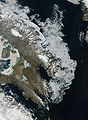
Canada's oldest ice is a remnant of the Laurentide Ice Sheet 20,000 years old called the Barnes Ice Cap
on central Baffin Island
.
Ice sheet
An ice sheet is a mass of glacier ice that covers surrounding terrain and is greater than 50,000 km² , thus also known as continental glacier...
that covered hundreds of thousands of square miles, including most of Canada
Canada
Canada is a North American country consisting of ten provinces and three territories. Located in the northern part of the continent, it extends from the Atlantic Ocean in the east to the Pacific Ocean in the west, and northward into the Arctic Ocean...
and a large portion of the northern United States
United States
The United States of America is a federal constitutional republic comprising fifty states and a federal district...
, multiple times during Quaternary
Quaternary
The Quaternary Period is the most recent of the three periods of the Cenozoic Era in the geologic time scale of the ICS. It follows the Neogene Period, spanning 2.588 ± 0.005 million years ago to the present...
glacial epochs. It last covered most of northern North America between c. 95,000 and c. 20,000 years before the present day. At times, its southern margin included the modern sites of New York City
New York City
New York is the most populous city in the United States and the center of the New York Metropolitan Area, one of the most populous metropolitan areas in the world. New York exerts a significant impact upon global commerce, finance, media, art, fashion, research, technology, education, and...
and Chicago
Chicago
Chicago is the largest city in the US state of Illinois. With nearly 2.7 million residents, it is the most populous city in the Midwestern United States and the third most populous in the US, after New York City and Los Angeles...
, and then followed quite precisely the present course of the Missouri River
Missouri River
The Missouri River flows through the central United States, and is a tributary of the Mississippi River. It is the longest river in North America and drains the third largest area, though only the thirteenth largest by discharge. The Missouri's watershed encompasses most of the American Great...
up to the northern slopes of the Cypress Hills, beyond which it merged with the Cordilleran Ice Sheet
Cordilleran Ice Sheet
The Cordilleran ice sheet was a major ice sheet that covered, during glacial periods of the Quaternary, a large area of North America. This included the following areas:*Western Montana*The Idaho Panhandle...
. The ice coverage extended approximately as far south as 38 degrees latitude in the mid-continent.
Description
This ice sheet was the primary feature of the PleistocenePleistocene
The Pleistocene is the epoch from 2,588,000 to 11,700 years BP that spans the world's recent period of repeated glaciations. The name pleistocene is derived from the Greek and ....
epoch in North America, commonly referred to as the ice age
Quaternary glaciation
Quaternary glaciation, also known as the Pleistocene glaciation, the current ice age or simply the ice age, refers to the period of the last few million years in which permanent ice sheets were established in Antarctica and perhaps Greenland, and fluctuating ice sheets have occurred elsewhere...
. It was up to two miles thick in Nunavik
Nunavik
Nunavik comprises the northern third of the province of Quebec, Canada. Covering a land area of 443,684.71 km² north of the 55th parallel, it is the homeland of the Inuit of Quebec...
, Quebec
Quebec
Quebec or is a province in east-central Canada. It is the only Canadian province with a predominantly French-speaking population and the only one whose sole official language is French at the provincial level....
, Canada
Canada
Canada is a North American country consisting of ten provinces and three territories. Located in the northern part of the continent, it extends from the Atlantic Ocean in the east to the Pacific Ocean in the west, and northward into the Arctic Ocean...
but much thinner at its edges where nunatak
Nunatak
A nunatak is an exposed, often rocky element of a ridge, mountain, or peak not covered with ice or snow within an ice field or glacier. The term is typically used in areas where a permanent ice sheet is present...
s were common in hilly areas.
Its cycles of growth and melting were a decisive influence on global climate
Climate
Climate encompasses the statistics of temperature, humidity, atmospheric pressure, wind, rainfall, atmospheric particle count and other meteorological elemental measurements in a given region over long periods...
during its existence. This is because it served to divert the jet stream
Jet stream
Jet streams are fast flowing, narrow air currents found in the atmospheres of some planets, including Earth. The main jet streams are located near the tropopause, the transition between the troposphere and the stratosphere . The major jet streams on Earth are westerly winds...
which would otherwise flow from the relatively warm Pacific Ocean
Pacific Ocean
The Pacific Ocean is the largest of the Earth's oceanic divisions. It extends from the Arctic in the north to the Southern Ocean in the south, bounded by Asia and Australia in the west, and the Americas in the east.At 165.2 million square kilometres in area, this largest division of the World...
through Montana
Montana
Montana is a state in the Western United States. The western third of Montana contains numerous mountain ranges. Smaller, "island ranges" are found in the central third of the state, for a total of 77 named ranges of the Rocky Mountains. This geographical fact is reflected in the state's name,...
and Minnesota
Minnesota
Minnesota is a U.S. state located in the Midwestern United States. The twelfth largest state of the U.S., it is the twenty-first most populous, with 5.3 million residents. Minnesota was carved out of the eastern half of the Minnesota Territory and admitted to the Union as the thirty-second state...
to the south. This gave the southwestern United States
Southwestern United States
The Southwestern United States is a region defined in different ways by different sources. Broad definitions include nearly a quarter of the United States, including Arizona, California, Colorado, Nevada, New Mexico, Oklahoma, Texas and Utah...
, otherwise a desert, abundant rainfall during ice ages — in extreme contrast to most other parts of the world which became exceedingly dry, though the effect of ice sheets in Europe
Europe
Europe is, by convention, one of the world's seven continents. Comprising the westernmost peninsula of Eurasia, Europe is generally 'divided' from Asia to its east by the watershed divides of the Ural and Caucasus Mountains, the Ural River, the Caspian and Black Seas, and the waterways connecting...
had an analogous effect on the rainfall in Afghanistan
Afghanistan
Afghanistan , officially the Islamic Republic of Afghanistan, is a landlocked country located in the centre of Asia, forming South Asia, Central Asia and the Middle East. With a population of about 29 million, it has an area of , making it the 42nd most populous and 41st largest nation in the world...
, parts of Iran
Iran
Iran , officially the Islamic Republic of Iran , is a country in Southern and Western Asia. The name "Iran" has been in use natively since the Sassanian era and came into use internationally in 1935, before which the country was known to the Western world as Persia...
, possibly western Pakistan
Pakistan
Pakistan , officially the Islamic Republic of Pakistan is a sovereign state in South Asia. It has a coastline along the Arabian Sea and the Gulf of Oman in the south and is bordered by Afghanistan and Iran in the west, India in the east and China in the far northeast. In the north, Tajikistan...
in winter, as well as North Africa
North Africa
North Africa or Northern Africa is the northernmost region of the African continent, linked by the Sahara to Sub-Saharan Africa. Geopolitically, the United Nations definition of Northern Africa includes eight countries or territories; Algeria, Egypt, Libya, Morocco, South Sudan, Sudan, Tunisia, and...
.
Salinity
Salinity is the saltiness or dissolved salt content of a body of water. It is a general term used to describe the levels of different salts such as sodium chloride, magnesium and calcium sulfates, and bicarbonates...
water into the Arctic Ocean
Arctic Ocean
The Arctic Ocean, located in the Northern Hemisphere and mostly in the Arctic north polar region, is the smallest and shallowest of the world's five major oceanic divisions...
via the Mackenzie River
Mackenzie River
The Mackenzie River is the largest river system in Canada. It flows through a vast, isolated region of forest and tundra entirely within the country's Northwest Territories, although its many tributaries reach into four other Canadian provinces and territories...
is believed to have disrupted the formation of North Atlantic Deep Water
North Atlantic Deep Water
North Atlantic Deep Water is a water mass that forms in the North Atlantic Ocean. It is largely formed in the Labrador Sea and in the Greenland Sea by the sinking of highly saline, dense overflow water from the Greenland Sea...
, the very saline, cold, deep water that flows from the Greenland Sea
Greenland Sea
The Greenland Sea is a body of water that borders Greenland to the west, the Svalbard archipelago to the east, Fram Strait and the Arctic Ocean to the north, and the Norwegian Sea and Iceland to the south. The Greenland Sea is often defined as part of the Arctic Ocean, sometimes as part of the...
. This interrupted the thermohaline circulation
Thermohaline circulation
The term thermohaline circulation refers to a part of the large-scale ocean circulation that is driven by global density gradients created by surface heat and freshwater fluxes....
, creating the brief Younger Dryas
Younger Dryas
The Younger Dryas stadial, also referred to as the Big Freeze, was a geologically brief period of cold climatic conditions and drought between approximately 12.8 and 11.5 ka BP, or 12,800 and 11,500 years before present...
cold epoch and a temporary re-advance of the ice sheet, which did not retreat from Nunavik
Nunavik
Nunavik comprises the northern third of the province of Quebec, Canada. Covering a land area of 443,684.71 km² north of the 55th parallel, it is the homeland of the Inuit of Quebec...
until 6,500 years ago.
Some people have argued that huge influxes of fresh water stopped the feeding of the ice sheet and starved
Starvation (glaciology)
In glaciology, starvation occurs when a glacier retreats, not because of temperature increases, but due to precipitation so low that the ice flow downward into the zone of ablation exceeds the replenishment from snowfall...
it, aiding the retreat that had already began. This is a controversial position because it is known that the North Atlantic was very cold throughout glacial periods and it is likely that the anticyclone
Anticyclone
An anticyclone is a weather phenomenon defined by the United States' National Weather Service's glossary as "[a] large-scale circulation of winds around a central region of high atmospheric pressure, clockwise in the Northern Hemisphere, counterclockwise in the Southern Hemisphere"...
on top of the ice sheet helped sustain it through moist easterly winds which encouraged snow-bearing winds from the south.
During the Pre-Illinoian Stage the Laurentide Ice Sheet extended even further south, advancing as far as the Missouri
Missouri River
The Missouri River flows through the central United States, and is a tributary of the Mississippi River. It is the longest river in North America and drains the third largest area, though only the thirteenth largest by discharge. The Missouri's watershed encompasses most of the American Great...
and Ohio River
Ohio River
The Ohio River is the largest tributary, by volume, of the Mississippi River. At the confluence, the Ohio is even bigger than the Mississippi and, thus, is hydrologically the main stream of the whole river system, including the Allegheny River further upstream...
valleys.
The ultimate collapse of the Laurentide Ice Sheet is also suspected to have influenced European agriculture indirectly through the rise of global sea levels.
Canada's oldest ice is a remnant of the Laurentide Ice Sheet 20,000 years old called the Barnes Ice Cap
Barnes Ice Cap
The Barnes Ice Cap is an ice cap located in central Baffin Island, Nunavut, Canada. It covers close to and has been thinning due to regional warming. Between 2004 and 2006, the ice cap was thinning at a rate of per year....
on central Baffin Island
Baffin Island
Baffin Island in the Canadian territory of Nunavut is the largest island in the Canadian Arctic Archipelago, the largest island in Canada and the fifth largest island in the world. Its area is and its population is about 11,000...
.
See also
- Canadian ShieldCanadian ShieldThe Canadian Shield, also called the Laurentian Plateau, or Bouclier Canadien , is a vast geological shield covered by a thin layer of soil that forms the nucleus of the North American or Laurentia craton. It is an area mostly composed of igneous rock which relates to its long volcanic history...
- Glacial history of MinnesotaGlacial history of MinnesotaThe glacial history of Minnesota is most defined since the onset of the last glacial period, which ended some 10,000 years ago. Within the last million years, most of the Midwestern United States and much of Canada were covered at one time or another with an ice sheet. This continental glacier had...
- Lake AgassizLake AgassizLake Agassiz was an immense glacial lake located in the center of North America. Fed by glacial runoff at the end of the last glacial period, its area was larger than all of the modern Great Lakes combined, and it held more water than contained by all lakes in the world today.-Conception:First...
- Wisconsin glaciationWisconsin glaciationThe last glacial period was the most recent glacial period within the current ice age occurring during the last years of the Pleistocene, from approximately 110,000 to 10,000 years ago....
External links
- The Retreat of Glaciers in North America (MPEG-Video)