

Berkeley Marina
Encyclopedia
The Berkeley Marina is the westernmost portion of the city of Berkeley, California
, located west of the Eastshore Freeway (Interstate 80 and 580) at the foot of University Avenue on San Francisco Bay
. Narrowly speaking, "Berkeley Marina" refers only to the city marina
, but in common usage, it applies more generally to the surrounding area.
There are several restaurants, a hotel and a yacht club in the Berkeley Marina. There are also several walking and bicycle paths. The area is accessible from the rest of Berkeley by foot or bike over the Berkeley I-80 Bridge
at the foot of Addison Street (one block south of University Avenue), and is traversed near Interstate 80 by a segment of the San Francisco Bay Trail
. In addition, it is the western terminus
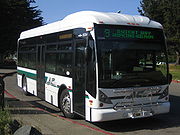
of AC Transit
Route 51B (University Avenue-Rockridge BART) on select trips only.
The eastern-most portion of the Marina, running parallel to I-80/580, is now a part of the Eastshore State Park
.
. The original shoreline ran a few yards west of the Southern Pacific
(now Union Pacific) tracks on 3rd Street. The area was gradually filled in over the years.
In 1909 the City built a municipal wharf at the foot of University Avenue which was used primarily for freight. Starting in 1926 the Golden Gate Ferry Company, a subsidiary of the Southern Pacific railroad began construction of the Berkeley Pier
. It was built out from the foot of University Avenue about 3.5 miles (5.6 km) into the Bay (measured from the original shoreline). On June 16, 1927 auto ferry service began. between the Berkeley Pier and the Hyde Street Pier
in San Francisco, a pier shared with the Sausalito ferry. During this period US Highway 40 ran from San Pablo Avenue down University Avenue to the Berkeley Pier. The ferry service lasted until about 1937, after the 1936 opening of the San Francisco – Oakland Bay Bridge, and the pier was turned into a fishing pier. US 40 then shifted to the new Eastshore Highway and the Bay Bridge. Storms damaged the end of the pier over the years. In the 1970s, the city repaired and upgraded the least damaged length of the Berkeley Pier, and it is still in use today for fishing and viewing.
Since about the late 1920s the city municipal dump was located here, and the accumulated garbage and construction debris accounts for most of the dry land of the Berkeley Marina. In the early 1990s much of the former dump was landscaped and converted into a park, originally named "North Waterfront Park". The park was renamed Cesar Chavez Park
in 1996 to commemorate the late California labor leader.
The actual Berkeley Marina, used by many people who sail on the Bay, was constructed as the Berkeley Yacht Harbor in the late 1930s by the Works Progress Administration
in conjunction with its nearby work developing Aquatic Park
. From October 1961 until April 1974 a heliport was operated by SFO Helicopter on the north side of University Avenue west of I-80. They carried passengers to the San Francisco
and Oakland
international airports.
Berkeley, California
Berkeley is a city on the east shore of the San Francisco Bay in Northern California, United States. Its neighbors to the south are the cities of Oakland and Emeryville. To the north is the city of Albany and the unincorporated community of Kensington...
, located west of the Eastshore Freeway (Interstate 80 and 580) at the foot of University Avenue on San Francisco Bay
San Francisco Bay
San Francisco Bay is a shallow, productive estuary through which water draining from approximately forty percent of California, flowing in the Sacramento and San Joaquin rivers from the Sierra Nevada mountains, enters the Pacific Ocean...
. Narrowly speaking, "Berkeley Marina" refers only to the city marina
Marina
A marina is a dock or basin with moorings and supplies for yachts and small boats.A marina differs from a port in that a marina does not handle large passenger ships or cargo from freighters....
, but in common usage, it applies more generally to the surrounding area.
There are several restaurants, a hotel and a yacht club in the Berkeley Marina. There are also several walking and bicycle paths. The area is accessible from the rest of Berkeley by foot or bike over the Berkeley I-80 Bridge
Berkeley I-80 bridge
The Berkeley I-80 bridge is a -wide bridge spanning the Eastshore Freeway in Berkeley, California to allow bicycles, pedestrians, and wheelchair users access to the Berkeley Marina, Eastshore State Park, and the city. In the records of the city, the bridge is referred to as the "City of Berkeley...
at the foot of Addison Street (one block south of University Avenue), and is traversed near Interstate 80 by a segment of the San Francisco Bay Trail
San Francisco Bay Trail
The San Francisco Bay Trail is a bicycle and pedestrian trail that will eventually allow continuous travel around the shoreline of San Francisco Bay. As of 2011, approximately 310 miles of trail have been completed...
. In addition, it is the western terminus
Terminal Station
Terminal Station is a 1953 film by Italian director Vittorio De Sica. It tells the story of the love affair between an Italian man and an American woman. The film was entered into the 1953 Cannes Film Festival.-Production:...
of AC Transit
AC Transit
AC Transit is an Oakland-based regional public transit agency serving the western half of Alameda County and parts of western Contra Costa County in the western, Bay-side area of the East Bay of the San Francisco Bay Area...
Route 51B (University Avenue-Rockridge BART) on select trips only.
The eastern-most portion of the Marina, running parallel to I-80/580, is now a part of the Eastshore State Park
Eastshore State Park
Eastshore State Park is a state park and wildlife refuge along the San Francisco Bay shoreline of the East Bay between the cities of Richmond, Albany, Berkeley, Emeryville, and Oakland. It encompasses remnant natural wetlands, restored wetlands as well as landfill west of the Eastshore Freeway. It...
.
History
The Berkeley Marina was originally part of the open waters of San Francisco BaySan Francisco Bay
San Francisco Bay is a shallow, productive estuary through which water draining from approximately forty percent of California, flowing in the Sacramento and San Joaquin rivers from the Sierra Nevada mountains, enters the Pacific Ocean...
. The original shoreline ran a few yards west of the Southern Pacific
Southern Pacific Railroad
The Southern Pacific Transportation Company , earlier Southern Pacific Railroad and Southern Pacific Company, and usually simply called the Southern Pacific or Espee, was an American railroad....
(now Union Pacific) tracks on 3rd Street. The area was gradually filled in over the years.
In 1909 the City built a municipal wharf at the foot of University Avenue which was used primarily for freight. Starting in 1926 the Golden Gate Ferry Company, a subsidiary of the Southern Pacific railroad began construction of the Berkeley Pier
Berkeley Pier
The Berkeley Pier is a pier in Berkeley, California. When constructed, the pier extended 3.5 miles into San Francisco Bay from the end of University Avenue. Due to extensive filling of the bay and the creation of the Berkeley Marina, it presently extends only 2.5 miles...
. It was built out from the foot of University Avenue about 3.5 miles (5.6 km) into the Bay (measured from the original shoreline). On June 16, 1927 auto ferry service began. between the Berkeley Pier and the Hyde Street Pier
Hyde Street Pier
The Hyde Street Pier is a historic ferry pier located on the northern waterfront of San Francisco, California, amidst the tourist zone of Fisherman's Wharf....
in San Francisco, a pier shared with the Sausalito ferry. During this period US Highway 40 ran from San Pablo Avenue down University Avenue to the Berkeley Pier. The ferry service lasted until about 1937, after the 1936 opening of the San Francisco – Oakland Bay Bridge, and the pier was turned into a fishing pier. US 40 then shifted to the new Eastshore Highway and the Bay Bridge. Storms damaged the end of the pier over the years. In the 1970s, the city repaired and upgraded the least damaged length of the Berkeley Pier, and it is still in use today for fishing and viewing.
Since about the late 1920s the city municipal dump was located here, and the accumulated garbage and construction debris accounts for most of the dry land of the Berkeley Marina. In the early 1990s much of the former dump was landscaped and converted into a park, originally named "North Waterfront Park". The park was renamed Cesar Chavez Park
César Chávez Park
César Chávez Park is a city park of Berkeley, California named after César Chávez. It can be found on the peninsula on the north side of the Berkeley Marina in the San Francisco Bay and is adjacent to Eastshore State Park....
in 1996 to commemorate the late California labor leader.
The actual Berkeley Marina, used by many people who sail on the Bay, was constructed as the Berkeley Yacht Harbor in the late 1930s by the Works Progress Administration
Works Progress Administration
The Works Progress Administration was the largest and most ambitious New Deal agency, employing millions of unskilled workers to carry out public works projects, including the construction of public buildings and roads, and operated large arts, drama, media, and literacy projects...
in conjunction with its nearby work developing Aquatic Park
Aquatic Park (Berkeley)
Aquatic Park is a public park in Berkeley, California, United States, located just east of the Eastshore Freeway between Ashby and University Avenues. The park was created in the 1930s by the Works Progress Administration, simultaneous with its work on the nearby Berkeley Yacht Harbor...
. From October 1961 until April 1974 a heliport was operated by SFO Helicopter on the north side of University Avenue west of I-80. They carried passengers to the San Francisco
San Francisco International Airport
San Francisco International Airport is a major international airport located south of downtown San Francisco, California, United States, near the cities of Millbrae and San Bruno in unincorporated San Mateo County. It is often referred to as SFO...
and Oakland
Oakland International Airport
Oakland International Airport , also known as Metropolitan Oakland International Airport, is a public airport located south of the central business district of Oakland, a city in Alameda County, California, United States...
international airports.
See also
- César Chávez ParkCésar Chávez ParkCésar Chávez Park is a city park of Berkeley, California named after César Chávez. It can be found on the peninsula on the north side of the Berkeley Marina in the San Francisco Bay and is adjacent to Eastshore State Park....
- Berkeley PierBerkeley PierThe Berkeley Pier is a pier in Berkeley, California. When constructed, the pier extended 3.5 miles into San Francisco Bay from the end of University Avenue. Due to extensive filling of the bay and the creation of the Berkeley Marina, it presently extends only 2.5 miles...