

Telegraph Avenue
Encyclopedia
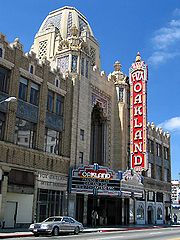
Telegraph Avenue is a street
that begins, at its southernmost point, in the midst of the historic downtown
district of Oakland, California
, USA, and ends, at its northernmost point, at the southern edge of the University of California
campus in Berkeley, California
. It is approximately 4.5 miles (7 km) in length.
Among some Berkeley residents, especially Cal students, Telegraph refers mainly to a four-block section just south of the university, from Bancroft Way (which borders the campus) to Dwight Way. As a center of campus and community life, this section of Telegraph Avenue is home to many restaurants, bookstores, and clothing shops, along with street vendors occupying its wide sidewalks. Telegraph attracts a diverse audience of visitors, including college students, tourists, artists, street punks, eccentrics, and the homeless.
 Telegraph Avenue originated from several separately named thoroughfares.
In 1859, a telegraph
line was constructed between Oakland and Martinez
by the Alta Telegraph Company
, and the existing roads which ran alongside it were then re-named The Telegraph Road. The segment of the Telegraph Road which ran from downtown Oakland out to the Peralta estate in Temescal was first known as the "Peralta Road". The segment which ran to and up Harwood's (now Claremont) Canyon was first known as "Harwood's Road".
The Telegraph Road followed the route of present day Telegraph Avenue from Downtown Oakland to Temescal, then ran along what is now the route of Claremont Avenue up to the summit of the Berkeley Hills
where it became Fish Ranch Road.
In Berkeley, the trustees of the private College of California
(the predecessor of the University of California
) laid out a residential subdivision
south of their new campus in order to finance its construction. The streets were named alphabetically from east to west; the third street was named Choate Street, after Rufus Choate
. Oakland subsequently extended a road to connect with Berkeley's Choate, but named it Humboldt Avenue.
Oakland's first horsecar
line was built in 1869 and ran along Telegraph Road to 36th Street. It was extended to Temescal a year later, then to the university campus via Humboldt and Choate after the university relocated from Oakland in 1873. A business district grew up along Choate Street. The horsecar line was eventually replaced by a steam dummy
line, and later by an electric streetcar line. This transportation corridor stimulated the development of neighborhoods along its route, as well as an amusement park
, Idora Park
, between 56th and 58th Streets.
When the segment of the Telegraph Road leading up to Harwood's Canyon was re-named "Claremont" to suit the interests of a developer of the district, the cities of Berkeley and Oakland opted to change Humboldt and Choate to Telegraph since Oakland's portion of the thoroughfare was already aligned with what remained of the old Telegraph Road between the new Claremont and downtown Oakland. The Town Trustees of Berkeley made the change by ordinance on October 10, 1892.
was built at the northern end of Telegraph Avenue. The university built Sproul Hall on Telegraph in the 1940s. In the 1950s the campus expanded south to Bancroft Way; Telegraph Avenue was shortened by 1½ blocks and buildings were demolished to make room for Sproul Plaza
and several other new buildings including the new student union building.
The 1960s saw the construction of the Grove Shafter Freeway, which parallels Telegraph Avenue half a block west, between Downtown Oakland and 56th Street. The freeway created a wall between Telegraph Avenue and present day Martin Luther King Jr. Way (formerly Grove Street), and sliced the Temescal District in half.
The Berkeley end of Telegraph Avenue, along with Sproul Plaza, has been the site of numerous protests and riots beginning in the 1960s. In 1969, Telegraph was the site of massive confrontation between police and demonstrators during the conflict over People's Park
. Alameda County Sheriff's deputies killed one man (James Rector) and permanently blinded another (Alan Blanchard) when they fired buckshot loaded shotguns at people sitting on the roof above Telegraph Ave. At one point, protesters were chased down Telegraph as far as Willard Junior High School (now Willard Middle School) at Derby Street, with Sheriff's deputies firing teargas canisters onto the school grounds.
. Over the next couple of decades the Berkeley end of Telegraph became home to increasing numbers of homeless
people and panhandlers
, and by the 1990s had become a destination point for runaways from around the United States
. The numbers of panhandlers have decreased since a series of police sweeps in the late 1990s, howeverhttp://www.sfgate.com/cgi-bin/article.cgi?f=/c/a/1998/11/10/MN94998.DTL; university students remain the largest daily population on Telegraph, which still serves as the anchor of food, culture and student life on the south side of campus.
More recently, a Korean
business district has emerged just south of Temescal along Telegraph Ave. Attempts to change the name of the area to Koreatown
have led to controversy, as most residents of the surrounding neighborhoods do not identify as Korean or Korean-American.http://articles.sfgate.com/2010-02-01/bay-area/17841859_1_koreatown-merchants-korean-merchants-group A large Ethiopian and Eritrean population has also resulted in a string of Ethiopian restaurants, cafes and social clubs, stretching along Telegraph from about 30th Street in Oakland all the way into Berkeley.
As a result of heavy foot traffic and the narrow width of the street, the area near the Berkeley campus is designated as a one-way street by the city, and there have been talks of completely eliminating car access, a topic still hotly debated in the city council. A proposal by AC Transit
to build a Bus Rapid Transit
line on Telegraph has stirred up controversy, especially on the northern end where it might result in the elimination of parking and/or car access.
Street
A street is a paved public thoroughfare in a built environment. It is a public parcel of land adjoining buildings in an urban context, on which people may freely assemble, interact, and move about. A street can be as simple as a level patch of dirt, but is more often paved with a hard, durable...
that begins, at its southernmost point, in the midst of the historic downtown
Downtown Oakland
Downtown Oakland is the central business district of Oakland, California; roughly bounded by 6th Street or the Oakland Estuary on the southwest, Interstate 980 on the northwest, Grand Avenue on the northeast, and Lake Merritt on the east....
district of Oakland, California
Oakland, California
Oakland is a major West Coast port city on San Francisco Bay in the U.S. state of California. It is the eighth-largest city in the state with a 2010 population of 390,724...
, USA, and ends, at its northernmost point, at the southern edge of the University of California
University of California
The University of California is a public university system in the U.S. state of California. Under the California Master Plan for Higher Education, the University of California is a part of the state's three-tier public higher education system, which also includes the California State University...
campus in Berkeley, California
Berkeley, California
Berkeley is a city on the east shore of the San Francisco Bay in Northern California, United States. Its neighbors to the south are the cities of Oakland and Emeryville. To the north is the city of Albany and the unincorporated community of Kensington...
. It is approximately 4.5 miles (7 km) in length.
Among some Berkeley residents, especially Cal students, Telegraph refers mainly to a four-block section just south of the university, from Bancroft Way (which borders the campus) to Dwight Way. As a center of campus and community life, this section of Telegraph Avenue is home to many restaurants, bookstores, and clothing shops, along with street vendors occupying its wide sidewalks. Telegraph attracts a diverse audience of visitors, including college students, tourists, artists, street punks, eccentrics, and the homeless.
Origins
In 1859, a telegraph
Electrical telegraph
An electrical telegraph is a telegraph that uses electrical signals, usually conveyed via telecommunication lines or radio. The electromagnetic telegraph is a device for human-to-human transmission of coded text messages....
line was constructed between Oakland and Martinez
Martinez, California
Martinez is a city and the county seat of Contra Costa County, California, United States. The population was 35,824 at the 2010 census. The downtown is notable for its large number of preserved old buildings...
by the Alta Telegraph Company
Alta Telegraph Company
The Alta Telegraph Company was a telegraph company which operated in the mid-19th century within the state of California prior to the construction of the Transcontinental Telegraph. It was incorporated in the early 1850s. Its first line was constructed during 1854, stretching from Sacramento to...
, and the existing roads which ran alongside it were then re-named The Telegraph Road. The segment of the Telegraph Road which ran from downtown Oakland out to the Peralta estate in Temescal was first known as the "Peralta Road". The segment which ran to and up Harwood's (now Claremont) Canyon was first known as "Harwood's Road".
The Telegraph Road followed the route of present day Telegraph Avenue from Downtown Oakland to Temescal, then ran along what is now the route of Claremont Avenue up to the summit of the Berkeley Hills
Berkeley Hills
The Berkeley Hills are a range of the Pacific Coast Ranges that overlook the northeast side of the valley that surrounds San Francisco Bay. They were previously called the "Contra Costa Range/Hills" , but with the establishment of Berkeley and the University of California, the current usage was...
where it became Fish Ranch Road.
In Berkeley, the trustees of the private College of California
College of California
The College of California was the predecessor of the University of California system of public universities. The private college was founded in 1855 by noted educator Dr. Samuel H. Willey...
(the predecessor of the University of California
University of California
The University of California is a public university system in the U.S. state of California. Under the California Master Plan for Higher Education, the University of California is a part of the state's three-tier public higher education system, which also includes the California State University...
) laid out a residential subdivision
Subdivision (land)
Subdivision is the act of dividing land into pieces that are easier to sell or otherwise develop, usually via a plat. The former single piece as a whole is then known in the United States as a subdivision...
south of their new campus in order to finance its construction. The streets were named alphabetically from east to west; the third street was named Choate Street, after Rufus Choate
Rufus Choate
Rufus Choate , American lawyer and orator, was born in Ipswich, Massachusetts, a descendant of an English family which settled in Massachusetts in 1643. His first cousin, physician George Choate, was the father of George C. S. Choate and Joseph Hodges Choate...
. Oakland subsequently extended a road to connect with Berkeley's Choate, but named it Humboldt Avenue.
Oakland's first horsecar
Horsecar
A horsecar or horse-drawn tram is an animal-powered streetcar or tram.These early forms of public transport developed out of industrial haulage routes that had long been in existence, and from the omnibus routes that first ran on public streets in the 1820s, using the newly improved iron or steel...
line was built in 1869 and ran along Telegraph Road to 36th Street. It was extended to Temescal a year later, then to the university campus via Humboldt and Choate after the university relocated from Oakland in 1873. A business district grew up along Choate Street. The horsecar line was eventually replaced by a steam dummy
Steam dummy
A steam dummy or dummy engine, in the United States of America and Canada, was a steam engine enclosed in a wooden box structure made to resemble a railroad passenger coach....
line, and later by an electric streetcar line. This transportation corridor stimulated the development of neighborhoods along its route, as well as an amusement park
Amusement park
thumb|Cinderella Castle in [[Magic Kingdom]], [[Disney World]]Amusement and theme parks are terms for a group of entertainment attractions and rides and other events in a location for the enjoyment of large numbers of people...
, Idora Park
Idora Park
Idora Park was a Victorian era trolley park in north Oakland, California constructed in 1904 on the site of an informal park setting called Ayala Park on the north banks of Temescal Creek. Idora Park was leased by the Ingersoll Pleasure and Amusement Park Company that ran several eastern pleasure...
, between 56th and 58th Streets.
When the segment of the Telegraph Road leading up to Harwood's Canyon was re-named "Claremont" to suit the interests of a developer of the district, the cities of Berkeley and Oakland opted to change Humboldt and Choate to Telegraph since Oakland's portion of the thoroughfare was already aligned with what remained of the old Telegraph Road between the new Claremont and downtown Oakland. The Town Trustees of Berkeley made the change by ordinance on October 10, 1892.
Early-mid 20th century
In 1910, Sather GateSather Gate
Sather Gate is a prominent landmark separating Sproul Plaza from the bridge over Strawberry Creek, leading to the center of the University of California, Berkeley campus. The gate was donated by Jane K. Sather, a benefactor of the university, in memory of her late husband Peder Sather, a trustee of...
was built at the northern end of Telegraph Avenue. The university built Sproul Hall on Telegraph in the 1940s. In the 1950s the campus expanded south to Bancroft Way; Telegraph Avenue was shortened by 1½ blocks and buildings were demolished to make room for Sproul Plaza
Sproul Plaza
Sproul Plaza is a major center of student activity at the University of California, Berkeley. It is divided into two sections: Upper Sproul and Lower Sproul. They are separated by 12 vertical feet and a set of stairs.-History:...
and several other new buildings including the new student union building.
The 1960s saw the construction of the Grove Shafter Freeway, which parallels Telegraph Avenue half a block west, between Downtown Oakland and 56th Street. The freeway created a wall between Telegraph Avenue and present day Martin Luther King Jr. Way (formerly Grove Street), and sliced the Temescal District in half.
The Berkeley end of Telegraph Avenue, along with Sproul Plaza, has been the site of numerous protests and riots beginning in the 1960s. In 1969, Telegraph was the site of massive confrontation between police and demonstrators during the conflict over People's Park
People's Park (Berkeley)
People's Park in Berkeley, California, USA, is a park off Telegraph Avenue, bounded by Haste and Bowditch streets and Dwight Way, near the University of California, Berkeley. The park was created during the radical political activism of the late 1960s....
. Alameda County Sheriff's deputies killed one man (James Rector) and permanently blinded another (Alan Blanchard) when they fired buckshot loaded shotguns at people sitting on the roof above Telegraph Ave. At one point, protesters were chased down Telegraph as far as Willard Junior High School (now Willard Middle School) at Derby Street, with Sheriff's deputies firing teargas canisters onto the school grounds.
Post-Vietnam War era
The events of the 1960s and 1970s had made Telegraph, as well as Berkeley, a symbol of the Counterculture of the 1960sCounterculture
Counterculture is a sociological term used to describe the values and norms of behavior of a cultural group, or subculture, that run counter to those of the social mainstream of the day, the cultural equivalent of political opposition. Counterculture can also be described as a group whose behavior...
. Over the next couple of decades the Berkeley end of Telegraph became home to increasing numbers of homeless
Homelessness
Homelessness describes the condition of people without a regular dwelling. People who are homeless are unable or unwilling to acquire and maintain regular, safe, and adequate housing, or lack "fixed, regular, and adequate night-time residence." The legal definition of "homeless" varies from country...
people and panhandlers
Begging
Begging is to entreat earnestly, implore, or supplicate. It often occurs for the purpose of securing a material benefit, generally for a gift, donation or charitable donation...
, and by the 1990s had become a destination point for runaways from around the United States
United States
The United States of America is a federal constitutional republic comprising fifty states and a federal district...
. The numbers of panhandlers have decreased since a series of police sweeps in the late 1990s, howeverhttp://www.sfgate.com/cgi-bin/article.cgi?f=/c/a/1998/11/10/MN94998.DTL; university students remain the largest daily population on Telegraph, which still serves as the anchor of food, culture and student life on the south side of campus.
More recently, a Korean
Korean American
Korean Americans are Americans of Korean descent, mostly from South Korea, with a small minority from North Korea...
business district has emerged just south of Temescal along Telegraph Ave. Attempts to change the name of the area to Koreatown
Koreatown
Koreatown is a term to describe a Korean ethnic enclave within a city or metropolitan area. Similar terms may include Little Seoul or Little Korea.-Beijing:There are more than 150,000 Koreans living in Beijing...
have led to controversy, as most residents of the surrounding neighborhoods do not identify as Korean or Korean-American.http://articles.sfgate.com/2010-02-01/bay-area/17841859_1_koreatown-merchants-korean-merchants-group A large Ethiopian and Eritrean population has also resulted in a string of Ethiopian restaurants, cafes and social clubs, stretching along Telegraph from about 30th Street in Oakland all the way into Berkeley.
As a result of heavy foot traffic and the narrow width of the street, the area near the Berkeley campus is designated as a one-way street by the city, and there have been talks of completely eliminating car access, a topic still hotly debated in the city council. A proposal by AC Transit
AC Transit
AC Transit is an Oakland-based regional public transit agency serving the western half of Alameda County and parts of western Contra Costa County in the western, Bay-side area of the East Bay of the San Francisco Bay Area...
to build a Bus Rapid Transit
Bus rapid transit
Bus rapid transit is a term applied to a variety of public transportation systems using buses to provide faster, more efficient service than an ordinary bus line. Often this is achieved by making improvements to existing infrastructure, vehicles and scheduling...
line on Telegraph has stirred up controversy, especially on the northern end where it might result in the elimination of parking and/or car access.
See also
- Cathedral BuildingCathedral BuildingLocated in Oakland, California, the Cathedral Building, originally named the Federal Realty Building, was the first Gothic Revival style skyscraper west of the Mississippi River. It is also called the "Wedding Cake" for its appearance, which resembles New York's Flatiron Building...
- Cody's BooksCody's BooksCody's Books was an independent bookstore based in Berkeley, California. It "was a pioneer in bookselling, bringing the paperback revolution to Berkeley, fighting censorship, and providing a safe harbor from tear gas directed at anti-Vietnam War protesters throughout the 1960s and...
- OaksterdamOaksterdamOaksterdam is a cultural district on the north end of downtown Oakland, California, where medical cannabis in a variety of competitively priced smokeable and edible preparations is available for purchase in multiple cafes, clubs, and patient dispensaries. Oaksterdam is located on the north end of...
- Southside, Berkeley, CaliforniaSouthside, Berkeley, CaliforniaSouthside, also known by the older names South of Campus or South Campus, is a neighborhood in Berkeley, California. Southside is located directly south of and adjacent to the University of California, Berkeley campus...
- Uptown OaklandUptown OaklandUptown is a neighborhood in Downtown Oakland, California, located just north of the center of downtown. Its boundaries are ill-defined, but most definitions include the area bounded by Grand Avenue at the north, Telegraph Avenue on the west, City Center plaza on the south, and Harrison Street on...