

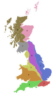
A roads in Zone 5 of the Great Britain numbering scheme
Encyclopedia
Great Britain
Great Britain or Britain is an island situated to the northwest of Continental Europe. It is the ninth largest island in the world, and the largest European island, as well as the largest of the British Isles...
starting north/east of the A5, west of the A6, south of the Solway Firth
Solway Firth
The Solway Firth is a firth that forms part of the border between England and Scotland, between Cumbria and Dumfries and Galloway. It stretches from St Bees Head, just south of Whitehaven in Cumbria, to the Mull of Galloway, on the western end of Dumfries and Galloway. The Isle of Man is also very...
/Eden Estuary (roads beginning with 5).
Single- and double-digit roads
| Road | From | To | Notes |
|---|---|---|---|
| Central London Central London Central London is the innermost part of London, England. There is no official or commonly accepted definition of its area, but its characteristics are understood to include a high density built environment, high land values, an elevated daytime population and a concentration of regionally,... |
Holyhead Holyhead Holyhead is the largest town in the county of Anglesey in the North Wales. It is also a major port adjacent to the Irish Sea serving Ireland.... |
||
| Warrington Warrington Warrington is a town, borough and unitary authority area of Cheshire, England. It stands on the banks of the River Mersey, which is tidal to the west of the weir at Howley. It lies 16 miles east of Liverpool, 19 miles west of Manchester and 8 miles south of St Helens... |
Leicester Leicester Leicester is a city and unitary authority in the East Midlands of England, and the county town of Leicestershire. The city lies on the River Soar and at the edge of the National Forest... |
||
| Chester Chester Chester is a city in Cheshire, England. Lying on the River Dee, close to the border with Wales, it is home to 77,040 inhabitants, and is the largest and most populous settlement of the wider unitary authority area of Cheshire West and Chester, which had a population of 328,100 according to the... |
Kingsbury Kingsbury, Warwickshire Kingsbury is a large village and civil parish in the North Warwickshire district of the county of Warwickshire, in the West Midlands region of England.... |
||
| Newcastle-under-Lyme Newcastle-under-Lyme Newcastle-under-Lyme is a market town in Staffordshire, England, and is the principal town of the Borough of Newcastle-under-Lyme. It is part of The Potteries Urban Area and North Staffordshire. In the 2001 census the town had a population of 73,944... |
Mablethorpe Mablethorpe Mablethorpe is a small seaside town in East Lindsey on the coast of Lincolnshire, England.-Geography:Several small caravan parks exist around Mablethorpe. The town is administered with Sutton-on-Sea and Trusthorpe, as the civil parish of Mablethorpe and Sutton... |
||
| Buxton Buxton Buxton is a spa town in Derbyshire, England. It has the highest elevation of any market town in England. Located close to the county boundary with Cheshire to the west and Staffordshire to the south, Buxton is described as "the gateway to the Peak District National Park"... |
Shrewsbury Shrewsbury Shrewsbury is the county town of Shropshire, in the West Midlands region of England. Lying on the River Severn, it is a civil parish home to some 70,000 inhabitants, and is the primary settlement and headquarters of Shropshire Council... |
||
| Chester Chester Chester is a city in Cheshire, England. Lying on the River Dee, close to the border with Wales, it is home to 77,040 inhabitants, and is the largest and most populous settlement of the wider unitary authority area of Cheshire West and Chester, which had a population of 328,100 according to the... |
Buxton Buxton Buxton is a spa town in Derbyshire, England. It has the highest elevation of any market town in England. Located close to the county boundary with Cheshire to the west and Staffordshire to the south, Buxton is described as "the gateway to the Peak District National Park"... |
||
| Holyhead Holyhead Holyhead is the largest town in the county of Anglesey in the North Wales. It is also a major port adjacent to the Irish Sea serving Ireland.... |
Chester Chester Chester is a city in Cheshire, England. Lying on the River Dee, close to the border with Wales, it is home to 77,040 inhabitants, and is the largest and most populous settlement of the wider unitary authority area of Cheshire West and Chester, which had a population of 328,100 according to the... |
||
| Chester Chester Chester is a city in Cheshire, England. Lying on the River Dee, close to the border with Wales, it is home to 77,040 inhabitants, and is the largest and most populous settlement of the wider unitary authority area of Cheshire West and Chester, which had a population of 328,100 according to the... |
A59 near Broughton Broughton, Craven Broughton is a village and civil parish in the Craven district of North Yorkshire, England. According to the 2001 census it had a population of 81. The village is situated on the A59 road, about three miles west of Skipton.-Broughton Hall:... |
||
| Liverpool Liverpool Liverpool is a city and metropolitan borough of Merseyside, England, along the eastern side of the Mersey Estuary. It was founded as a borough in 1207 and was granted city status in 1880... |
Lincoln Lincoln, Lincolnshire Lincoln is a cathedral city and county town of Lincolnshire, England.The non-metropolitan district of Lincoln has a population of 85,595; the 2001 census gave the entire area of Lincoln a population of 120,779.... |
||
| Prescot Prescot Prescot is a town and civil parish, within the Metropolitan Borough of Knowsley in Merseyside, England. It is 8 miles to the east of Liverpool city centre and lies within the historic boundaries of Lancashire. At the 2001 Census, the population was 11,184 .Prescot marks the beginning of the... |
Wetherby Wetherby Wetherby is a market town and civil parish within the metropolitan borough of the City of Leeds, in West Yorkshire, England. It stands on the River Wharfe, and has been for centuries a crossing place and staging post on the Great North Road, being mid-way between London and Edinburgh... |
Becomes A58(M) as part of Leeds Inner Ring Road Leeds Inner Ring Road The Leeds Inner Ring Road is part-motorway and part-A roads in Leeds, West Yorkshire, England, which forms a ring road around the city centre. It has six different road numbers that are all sections of longer roads... |
|
| Liverpool Liverpool Liverpool is a city and metropolitan borough of Merseyside, England, along the eastern side of the Mersey Estuary. It was founded as a borough in 1207 and was granted city status in 1880... |
York York York is a walled city, situated at the confluence of the Rivers Ouse and Foss in North Yorkshire, England. The city has a rich heritage and has provided the backdrop to major political events throughout much of its two millennia of existence... |
Three-digit roads
| Road | From | To | Notes |
|---|---|---|---|
| Clayton Clayton, Staffordshire Clayton is a suburb and a ward in the south of Newcastle-under-Lyme, Staffordshire.-Today:Clayton lies on the boundary between urban and rural Staffordshire, not far from the Shropshire border... |
Nantwich Nantwich Nantwich is a market town and civil parish in the Borough of Cheshire East and the ceremonial county of Cheshire, England. The town gives its name to the parliamentary constituency of Crewe and Nantwich... |
Known locally as the D Road, because its route resembles the curved part of a capital letter D (with a section of the M6 forming the upright) | |
| Marylebone Marylebone Marylebone is an affluent inner-city area of central London, located within the City of Westminster. It is sometimes written as St. Marylebone or Mary-le-bone.... |
Moorgate Moorgate Moorgate was a postern in the London Wall originally built by the Romans. It was turned into a gate in the 15th century. Though the gate was demolished in 1762, the name survives as a major street in the City of London... |
Part of the London Inner Ring Road London Inner Ring Road The London Inner Ring Road is the name commonly given to a route formed from a number of major roads that encircle the centremost part of London... , comprises Marylebone Road, Euston Road, Pentonville Road and City Road. Terminates at junction with London Wall |
|
| Camden Town Camden Town -Economy:In recent years, entertainment-related businesses and a Holiday Inn have moved into the area. A number of retail and food chain outlets have replaced independent shops driven out by high rents and redevelopment. Restaurants have thrived, with the variety of culinary traditions found in... |
Hendon Hendon Hendon is a London suburb situated northwest of Charing Cross.-History:Hendon was historically a civil parish in the county of Middlesex. The manor is described in Domesday , but the name, 'Hendun' meaning 'at the highest hill', is earlier... |
through Hampstead Hampstead Hampstead is an area of London, England, north-west of Charing Cross. Part of the London Borough of Camden in Inner London, it is known for its intellectual, liberal, artistic, musical and literary associations and for Hampstead Heath, a large, hilly expanse of parkland... , pretty much follows the Edgware branch of the Northern Line for 5 stations |
|
| Camden Town Camden Town -Economy:In recent years, entertainment-related businesses and a Holiday Inn have moved into the area. A number of retail and food chain outlets have replaced independent shops driven out by high rents and redevelopment. Restaurants have thrived, with the variety of culinary traditions found in... |
Woodford | Camden Road and Seven Sisters Road (primary) and Ferry Lane (non-primary), though Holloway Holloway, London Holloway is an inner-city district in the London Borough of Islington located north of Charing Cross and follows for the most part, the line of the Holloway Road . At the centre of Holloway is the Nag's Head area... and Walthamstow Walthamstow Walthamstow is a district of northeast London, England, located in the London Borough of Waltham Forest. It is situated north-east of Charing Cross... |
|
| West Hendon West Hendon West Hendon is a place in the London Borough of Barnet.-History:West Hendon was a settlement within that part of the ancient parish of Hendon known as the Hyde, and is now a part of the London Borough of Barnet. It was formally known, from 1878–1890, as New Hendon, a small railway development on... |
Seven Sisters Seven Sisters, London Seven Sisters is an area of North London in the United Kingdom and part of the London Borough of Haringey. It is located at the east end of Seven Sisters Road, which runs from Tottenham High Road to join the A1 in Holloway.-Etymology:... |
via Hendon Hendon Hendon is a London suburb situated northwest of Charing Cross.-History:Hendon was historically a civil parish in the county of Middlesex. The manor is described in Domesday , but the name, 'Hendun' meaning 'at the highest hill', is earlier... , Finchley Finchley Finchley is a district in Barnet in north London, England. Finchley is on high ground, about north of Charing Cross. It formed an ancient parish in the county of Middlesex, becoming a municipal borough in 1933, and has formed part of Greater London since 1965... , East Finchley East Finchley East Finchley is a suburb in the London Borough of Barnet, in north London, and situated north-west of Charing Cross. Geographically it is somewhat separate from the rest of Finchley, with North Finchley and West Finchley to the north, and Finchley Central to the west.- History :The land on which... , Muswell Hill Muswell Hill Muswell Hill is a suburb of north London, mostly in the London Borough of Haringey. It is situated about north of Charing Cross and around from the City of London. Muswell Hill is in the N10 postal district and mostly in the Hornsey and Wood Green parliamentary constituency.- History :The... , Hornsey Hornsey Hornsey is a district in London Borough of Haringey in north London in England. Whilst Hornsey was formerly the name of a parish and later a municipal borough of Middlesex, today, the name refers only to the London district. It is an inner-suburban area located north of Charing Cross.-Locale:The ... and West Green West Green, London West Green is an area of North London in the United Kingdom and part of the London Borough of Haringey. It is an inner-suburban area located 5.7 miles north of Charing Cross.... |
|
| Linslade Linslade Linslade is an English town, located on the Bedfordshire side of the Bedfordshire-Buckinghamshire border . It abuts onto the town of Leighton Buzzard with which it forms the civil parish of Leighton-Linslade. Linslade was transferred from Buckinghamshire in 1965, and was previously a separate... |
Great Abington | ||
| Walton Walton, Merseyside Walton, originally known as Walton-on-the-Hill, in Liverpool, Merseyside, England, is an area situated to the north of Anfield and the east of Bootle and Orrell Park. It is largely residential, with a diverse population.-History:... |
Stanley Gate nr. Bickerstaffe Bickerstaffe Bickerstaffe is a village and civil parish in the West Lancashire district of Lancashire, England. According to the 2001 Census the population of the civil parish was 1,196, although the population of the electoral ward was slightly greater at 2,013.... |
||
| Buntingford Buntingford Buntingford is a small market town and civil parish in the district of East Hertfordshire and county of Hertfordshire in England. It lies on the River Rib and on the Roman road Ermine Street. As a result of its location, it grew mainly as a staging post with many coaching inns and has an 18th... |
M1 M1 motorway The M1 is a north–south motorway in England primarily connecting London to Leeds, where it joins the A1 near Aberford. While the M1 is considered to be the first inter-urban motorway to be completed in the United Kingdom, the first road to be built to motorway standard in the country was the... junction 13 |
The northern terminus and the course of the road have recently been changed to bypass Ridgmont Ridgmont Ridgmont is a small village and civil parish in Bedfordshire, England. It is located beside junction 13 of the M1 motorway, and close to Milton Keynes and Woburn Abbey... . |
|
| Old Stratford Old Stratford Old Stratford is a village in the south of the English county of Northamptonshire. The river Great Ouse forms the boundary with Buckinghamshire and Milton Keynes.-Location:... |
Market Harborough Market Harborough Market Harborough is a market town within the Harborough district of Leicestershire, England.It has a population of 20,785 and is the administrative headquarters of Harborough District Council. It sits on the Northamptonshire-Leicestershire border... |
||
| Milton Keynes Milton Keynes Milton Keynes , sometimes abbreviated MK, is a large town in Buckinghamshire, in the south east of England, about north-west of London. It is the administrative centre of the Borough of Milton Keynes... |
Kettering Kettering Kettering is a market town in the Borough of Kettering, Northamptonshire, England. It is situated about from London. Kettering is mainly situated on the west side of the River Ise, a tributary of the River Nene which meets at Wellingborough... |
||
| Wellingborough Wellingborough Wellingborough is a market town and borough in Northamptonshire, England, situated some from the county town of Northampton. The town is situated on the north side of the River Nene, most of the older town is sited on the flanks of the hills above the river's current flood plain... |
Cranford St John Cranford St John Cranford St John is an English village near Kettering in Northamptonshire. It is in the southern half of the civil parish of Cranford, next to Cranford St Andrew - both named after the two parish churches... |
Forms part of Wellingborough's outer ring road. | |
| M1 M1 motorway The M1 is a north–south motorway in England primarily connecting London to Leeds, where it joins the A1 near Aberford. While the M1 is considered to be the first inter-urban motorway to be completed in the United Kingdom, the first road to be built to motorway standard in the country was the... |
A50 A50 road The A50 is a major trunk road in England. It runs from Warrington to Leicester; however, it was once a much longer route.-Current route:... |
||
| Loughborough Loughborough Loughborough is a town within the Charnwood borough of Leicestershire, England. It is the seat of Charnwood Borough Council and is home to Loughborough University... |
Ashby-de-la-Zouch Ashby-de-la-Zouch Ashby-de-la-Zouch, — Zouch being pronounced "Zoosh" — often shortened to Ashby, is a small market town and civil parish in North West Leicestershire, England, within the National Forest. It is twinned with Pithiviers in north-central France.... |
||
| Tamworth Tamworth Tamworth is a town and local government district in Staffordshire, England, located north-east of Birmingham city centre and north-west of London. The town takes its name from the River Tame, which flows through the town, as does the River Anker... |
Stafford Stafford Stafford is the county town of Staffordshire, in the West Midlands region of England. It lies approximately north of Wolverhampton and south of Stoke-on-Trent, adjacent to the M6 motorway Junction 13 to Junction 14... |
||
| Derby Derby Derby , is a city and unitary authority in the East Midlands region of England. It lies upon the banks of the River Derwent and is located in the south of the ceremonial county of Derbyshire. In the 2001 census, the population of the city was 233,700, whilst that of the Derby Urban Area was 229,407... |
A444 A444 road The A444 is a primary road running between Coventry and Burton on Trent in England, usually referred to as the "A treble four".-Route:Starting on the A4600 Sky Blue Way in Coventry, the road heads north on a dual carriageway road, crossing the M6 at junction 3. It bypasses Bedworth to the west and... |
||
| Lichfield Lichfield Lichfield is a cathedral city, civil parish and district in Staffordshire, England. One of eight civil parishes with city status in England, Lichfield is situated roughly north of Birmingham... |
Buxton Buxton Buxton is a spa town in Derbyshire, England. It has the highest elevation of any market town in England. Located close to the county boundary with Cheshire to the west and Staffordshire to the south, Buxton is described as "the gateway to the Peak District National Park"... |
||
| Derby Derby Derby , is a city and unitary authority in the East Midlands region of England. It lies upon the banks of the River Derwent and is located in the south of the ceremonial county of Derbyshire. In the 2001 census, the population of the city was 233,700, whilst that of the Derby Urban Area was 229,407... |
Hatton Hatton, Derbyshire Hatton is a village in South Derbyshire, England. It is located 6 km north of Burton upon Trent, 20 km west of Derby and 40 km east of Stoke-on-Trent.-Geography:... |
||
| Belper Belper Belper is a town and civil parish in the local government district of Amber Valley in Derbyshire, England.-Geography:Belper is situated eight miles north of Derby and is centred in the valley of the River Derwent... |
Ashbourne Ashbourne, Derbyshire Ashbourne is a small market town in the Derbyshire Dales, England. It has a population of 10,302.The town advertises itself as 'The Gateway to Dovedale'.- Local customs :... |
||
| Uttoxeter Uttoxeter Uttoxeter is a historic market town in Staffordshire, in the West Midlands region of England. The current population is approximately 13,711, though new developments in the town will increase this figure. Uttoxeter lies close to the River Dove and is near the cities of Stoke-on-Trent, Derby and... |
Telford Telford Telford is a large new town in the borough of Telford and Wrekin and ceremonial county of Shropshire, England, approximately east of Shrewsbury, and west of Birmingham... |
||
| Newcastle-under-Lyme Newcastle-under-Lyme Newcastle-under-Lyme is a market town in Staffordshire, England, and is the principal town of the Borough of Newcastle-under-Lyme. It is part of The Potteries Urban Area and North Staffordshire. In the 2001 census the town had a population of 73,944... |
Newport Newport, Shropshire Newport is a market town in the borough of Telford and Wrekin and ceremonial county of Shropshire, England. It lies some north of Telford and some west of Stafford sitting on the Shropshire/Staffordshire border... |
||
| Stone Stone, Staffordshire Stone is an old market town in Staffordshire, England, situated about seven miles north of Stafford, and around seven miles south of the city of Stoke-on-Trent. It is the second town, after Stafford itself, in the Borough of Stafford, and has long been of importance from the point of view of... |
Leek Leek, Staffordshire Leek is a market town in the county of Staffordshire, England, on the River Churnet. It is an ancient borough and was granted its royal charter in 1214.It is the administrative centre for the Staffordshire Moorlands District Council... |
||
| Meir | Froghall | ||
| Uttoxeter Uttoxeter Uttoxeter is a historic market town in Staffordshire, in the West Midlands region of England. The current population is approximately 13,711, though new developments in the town will increase this figure. Uttoxeter lies close to the River Dove and is near the cities of Stoke-on-Trent, Derby and... |
Wetley Rocks | ||
| Swinscoe | Hazel Grove Hazel Grove -Education:Hazel Grove has a number of primary schools and Hazel Grove High School, the local high school. Some do decide to go to other local high schools, such as local Marple Hall, in neighbouring village Marple. The main primary schools in the area are, Hazel Grove Primary School, Torkington... |
||
| A524 | Unused | Was a road in North Staffordshire North Staffordshire North Staffordshire describes an area of Staffordshire, in the West Midlands region of England. It contains the Borough of Newcastle-under-Lyme, Staffordshire Moorlands and the City of Stoke-on-Trent. The Stoke and Newcastle areas make up The Potteries Urban Area, whilst the Moorlands are largely... . |
|
| Rhyl Rhyl Rhyl is a seaside resort town and community situated on the north east coast of Wales, in the county of Denbighshire , at the mouth of the River Clwyd . To the west is the suburb of Kinmel Bay, with the resort of Towyn further west, Prestatyn to the east and Rhuddlan to the south... |
Newcastle-under-Lyme Newcastle-under-Lyme Newcastle-under-Lyme is a market town in Staffordshire, England, and is the principal town of the Borough of Newcastle-under-Lyme. It is part of The Potteries Urban Area and North Staffordshire. In the 2001 census the town had a population of 73,944... |
||
| Woolfall Heath M57 M57 motorway The M57 motorway, also known as the Liverpool Outer Ring Road, is a road in England. Designed as a bypass road for Liverpool, it is long and links various towns east of the city, as well as the M62 and M58 motorways.-Route:... J3 |
Woolfall Heath A57 A57 road The A57 is a major road in England. It runs east from Liverpool to Lincoln, via Warrington, Cadishead, Irlam, Patricroft, Eccles, Salford and Manchester, then through the Pennines over the Snake Pass , around the Ladybower Reservoir, through Sheffield and past Worksop... |
Seth Powell Way | |
| Newcastle-under-Lyme Newcastle-under-Lyme Newcastle-under-Lyme is a market town in Staffordshire, England, and is the principal town of the Borough of Newcastle-under-Lyme. It is part of The Potteries Urban Area and North Staffordshire. In the 2001 census the town had a population of 73,944... |
Congleton Congleton Congleton is a town and civil parish in the unitary authority of Cheshire East and the ceremonial county of Cheshire, England, on the banks of the River Dane, to the west of the Macclesfield Canal and 21 miles south of Manchester. It has a population of 25,750.-History:The first settlements in... |
||
| Wrexham Wrexham Wrexham is a town in Wales. It is the administrative centre of the wider Wrexham County Borough, and the largest town in North Wales, located in the east of the region. It is situated between the Welsh mountains and the lower Dee Valley close to the border with Cheshire, England... |
Shrewsbury Shrewsbury Shrewsbury is the county town of Shropshire, in the West Midlands region of England. Lying on the River Severn, it is a civil parish home to some 70,000 inhabitants, and is the primary settlement and headquarters of Shropshire Council... |
||
| Hinstock Hinstock Hinstock is a village and civil parish in Shropshire, England.It appeared in the Domesday book survey as "Stoche" ; the present version of its name was created in the mediaeval period by prefixing Middle English hine .Hinstock is approximately halfway between the market towns of Newport and Market... |
Nantwich Nantwich Nantwich is a market town and civil parish in the Borough of Cheshire East and the ceremonial county of Cheshire, England. The town gives its name to the parliamentary constituency of Crewe and Nantwich... |
||
| Whitchurch Whitchurch, Shropshire Whitchurch is a market town in Shropshire, England on the border between England and Wales. It is the oldest continuously inhabited town in Shropshire. According to the 2001 Census, the population of the town is 8,673, with a more recent estimate putting the population of the town at 8,934... |
Northwich Northwich Northwich is a town and civil parish in the unitary authority of Cheshire West and Chester and the ceremonial county of Cheshire, England. It lies in the heart of the Cheshire Plain, at the confluence of the rivers Weaver and Dane... |
||
| Madeley Heath | Weston Weston, Cheshire Weston is a village and civil parish in the unitary authority of Cheshire East and the ceremonial county of Cheshire, England. The village lies 3 miles to the south east of Crewe. The parish also includes the small settlements of Carters Green, Gorsthill, Rose Hill, Snape, Stowford and part of... |
||
| Crewe Green Crewe Green Crewe Green is a small village and civil parish in the unitary authority of Cheshire East and the ceremonial county of Cheshire, England. The village lies 1½ miles to the east of the centre of Crewe... |
Marshfield Bank, Crewe Crewe Crewe is a railway town within the unitary authority area of Cheshire East and the ceremonial county of Cheshire, England. According to the 2001 census the urban area had a population of 67,683... |
||
| Alsager Alsager Alsager is a town and civil parish in the unitary authority of Cheshire East and the ceremonial county of Cheshire, England, to the north-west of the city of Stoke-on-Trent, and east of the railway town of Crewe... |
Widnes Widnes Widnes is an industrial town within the borough of Halton, in Cheshire, England, with an urban area population of 57,663 in 2004. It is located on the northern bank of the River Mersey where the estuary narrows to form the Runcorn Gap. Directly to the south across the Mersey is the town of Runcorn... |
Crosses Runcorn-Widnes Bridge | |
| Wrexham Wrexham Wrexham is a town in Wales. It is the administrative centre of the wider Wrexham County Borough, and the largest town in North Wales, located in the east of the region. It is situated between the Welsh mountains and the lower Dee Valley close to the border with Cheshire, England... |
West Heath West Heath, Cheshire West Heath is a suburb to the west of Congleton, in Cheshire, England. It is the site of Astbury Mere Country Park.The West Heath area has three schools, with one of Congleton's two secondary schools, Congleton High School being based there.... |
||
| Holmes Chapel Holmes Chapel Holmes Chapel is a village and civil parish in the unitary authority of Cheshire East and the ceremonial county of Cheshire, England. Until 1974 the parish was known as Church Hulme.At the 2001 Census the population of the village was recorded as 5,669... |
Alderley Edge Alderley Edge Alderley Edge is a village and civil parish within the unitary authority of Cheshire East and the ceremonial county of Cheshire, England. According to the 2001 census the parish had a population of 4,409.... |
via Twemlow Twemlow Twemlow is a civil parish, containing the village of Twemlow Green in the unitary authority of Cheshire East and the ceremonial county of Cheshire, England. According to the 2001 Official UK Census, the population of the entire civil parish was 168.Twemlow lies along the A535 road.From the 16th to... Green, past Jodrell Bank Jodrell Bank The Jodrell Bank Observatory is a British observatory that hosts a number of radio telescopes, and is part of the Jodrell Bank Centre for Astrophysics at the University of Manchester... , via Chelford Chelford Chelford is a village and civil parish in the unitary authority of Cheshire East and the ceremonial county of Cheshire, England. It is near to the junction of the A537 and A535 roads, about six miles west of Macclesfield, and six miles south-east of Knutsford. It is served by a small railway... |
|
| Congleton Congleton Congleton is a town and civil parish in the unitary authority of Cheshire East and the ceremonial county of Cheshire, England, on the banks of the River Dane, to the west of the Macclesfield Canal and 21 miles south of Manchester. It has a population of 25,750.-History:The first settlements in... |
Macclesfield Macclesfield Macclesfield is a market town within the unitary authority of Cheshire East, the county palatine of Chester, also known as the ceremonial county of Cheshire, England. The population of the Macclesfield urban sub-area at the time of the 2001 census was 50,688... |
||
| Knutsford Knutsford Knutsford is a town and civil parish in the unitary authority area of Cheshire East and the ceremonial county of Cheshire, in North West England... |
Buxton Buxton Buxton is a spa town in Derbyshire, England. It has the highest elevation of any market town in England. Located close to the county boundary with Cheshire to the west and Staffordshire to the south, Buxton is described as "the gateway to the Peak District National Park"... |
The section between Macclesfield and Buxton has been named the most dangerous road in Britain. See also Cat and Fiddle Road Cat and Fiddle Road The Cat and Fiddle is a road in England running between Buxton, Derbyshire and Macclesfield, Cheshire, named after the public house at its summit. Formed by parts of the A537, A54 and A53 it is famous for its scenic views across the Greater Manchester conurbation, Peak District National Park and... . |
|
| Macclesfield Macclesfield Macclesfield is a market town within the unitary authority of Cheshire East, the county palatine of Chester, also known as the ceremonial county of Cheshire, England. The population of the Macclesfield urban sub-area at the time of the 2001 census was 50,688... |
Altrincham Altrincham Altrincham is a market town within the Metropolitan Borough of Trafford, in Greater Manchester, England. It lies on flat ground south of the River Mersey about southwest of Manchester city centre, south-southwest of Sale and east of Warrington... |
Passes underneath the runways of Manchester Airport | |
| Eglwys Cross | Llangollen Llangollen Llangollen is a small town and community in Denbighshire, north-east Wales, situated on the River Dee and on the edge of the Berwyn mountains. It has a population of 3,412.-History:... |
||
| Chester Chester Chester is a city in Cheshire, England. Lying on the River Dee, close to the border with Wales, it is home to 77,040 inhabitants, and is the largest and most populous settlement of the wider unitary authority area of Cheshire West and Chester, which had a population of 328,100 according to the... |
Hoylake Hoylake Hoylake is a seaside town within the Metropolitan Borough of Wirral, on Merseyside, England. It is located at the north western corner of the Wirral Peninsula, near to the town of West Kirby and where the River Dee estuary meets the Irish Sea... |
||
| Wrexham Wrexham Wrexham is a town in Wales. It is the administrative centre of the wider Wrexham County Borough, and the largest town in North Wales, located in the east of the region. It is situated between the Welsh mountains and the lower Dee Valley close to the border with Cheshire, England... |
Trefnant Trefnant Trefnant is a village and community in Denbighshire, Wales. It is located on the A525 road in the Vale of Clwyd , about halfway between St Asaph to the north and Denbigh to the south... |
||
| Llangollen Llangollen Llangollen is a small town and community in Denbighshire, north-east Wales, situated on the River Dee and on the edge of the Berwyn mountains. It has a population of 3,412.-History:... |
Llandegla Llandegla Llandegla or Llandegla-yn-Iâl is a village and community in the county of Denbighshire in Wales. In the 2001 census, the community had a population of 494.- Name :... |
crosses the Horseshoe Pass Horseshoe Pass The Horseshoe Pass is a mountain pass in Denbighshire, northeast Wales. It separates Llantysilio Mountain to the west from Cyrn-y-Brain to the east. The A542 road from Llandegla to Llangollen runs through the pass, reaching a maximum height of... |
|
| Pentrefoelas | Bodfari Bodfari Bodfari is a village in Denbighshire, Wales.- Location :Bodfari is located at approximate grid reference SJ093701. The village lies on the A541 road at the point where the road passes through a gap in the Clwydian Hills, the gap being part of the valley of the River Wheeler .The Offa's Dyke... |
||
| Bylchau | Llanfair Talhaiarn Llanfair Talhaiarn Llanfair Talhaiarn is a village approximately 5 miles south of Abergele in Conwy county borough, Wales, formerly in Denbighshire.... |
||
| Menai Bridge Menai Bridge Menai Bridge is a small town and community on the Isle of Anglesey in north Wales. It overlooks the Menai Strait and lies by the Menai Suspension Bridge, built in 1826 by Thomas Telford... |
Beaumaris | ||
| Tywyn Tywyn Tywyn is a town and seaside resort on the Cardigan Bay coast of southern Gwynedd , in north Wales. The name derives from the Welsh tywyn and the town is sometimes referred to as Tywyn Meirionnydd... |
Llandudno Llandudno Llandudno is a seaside resort and town in Conwy County Borough, Wales. In the 2001 UK census it had a population of 20,090 including that of Penrhyn Bay and Penrhynside, which are within the Llandudno Community... |
||
| Prestatyn Prestatyn Prestatyn is a seaside resort, town and community in Denbighshire, North Wales. It is located on the Irish Sea coast, to the east of Rhyl. At the 2001 Census, Prestatyn had a population of 18,496.-Prehistory:... |
Conwy Conwy Conwy is a walled market town and community in Conwy County Borough on the north coast of Wales. The town, which faces Deganwy across the River Conwy, formerly lay in Gwynedd and prior to that in Caernarfonshire. Conwy has a population of 14,208... |
||
| Chester Chester Chester is a city in Cheshire, England. Lying on the River Dee, close to the border with Wales, it is home to 77,040 inhabitants, and is the largest and most populous settlement of the wider unitary authority area of Cheshire West and Chester, which had a population of 328,100 according to the... |
Llanrwst Llanrwst Llanrwst is a small town and community on the A470 road and the River Conwy in Conwy County Borough, Wales. It takes its name from the 5th century to 6th century Saint Grwst, and the original parish church in Cae Llan was replaced by the 12th-century church.... |
||
| Drury | Mold Mold, Flintshire Mold is a town in Flintshire, North Wales, on the River Alyn. It is the administrative seat of Flintshire County Council, and was also the county town of Clwyd from 1974 to 1996... |
||
| Caergwrle Caergwrle Caergwrle is a village in the county of Flintshire, in north east Wales. Approximately 5–6 miles from Wrexham and situated on the A541 road, it is contiguous with the village of Abermorddu and closely related to the village of Hope . The village lies on the River Alyn and sits at the base of Hope... |
Hooton Hooton, Cheshire Hooton is a village in the unitary authority of Cheshire West and Chester and the ceremonial county of Cheshire, England in the south of the Wirral Peninsula near Ellesmere Port.- History :... |
||
| Seacombe Seacombe Seacombe is a district of the town of Wallasey, on the Wirral Peninsula, England. Administratively, Seacombe is a ward of the Metropolitan Borough of Wirral. Before local government reorganisation in 1 April 1974, it was part of the County Borough of Wallasey, within the geographical county of... |
Gayton Gayton, Merseyside Gayton is a village in Wirral, Merseyside, England, located between Heswall and Parkgate. It is part of the Metropolitan Borough of Wirral and is situated in the parliamentary constituency of Wirral South... |
||
| Birkenhead Birkenhead Birkenhead is a town within the Metropolitan Borough of Wirral in Merseyside, England. It is on the Wirral Peninsula, along the west bank of the River Mersey, opposite the city of Liverpool... |
West Kirby West Kirby West Kirby is a town on the north-west corner of the coast of the Wirral Peninsula, England, at the mouth of the River Dee across from the Point of Ayr in North Wales. To the north-east of the town lies Hoylake, with the suburbs of Grange and Newton to the east, and the village of Caldy to the... |
||
| Birkenhead Birkenhead Birkenhead is a town within the Metropolitan Borough of Wirral in Merseyside, England. It is on the Wirral Peninsula, along the west bank of the River Mersey, opposite the city of Liverpool... |
Hoylake Hoylake Hoylake is a seaside town within the Metropolitan Borough of Wirral, on Merseyside, England. It is located at the north western corner of the Wirral Peninsula, near to the town of West Kirby and where the River Dee estuary meets the Irish Sea... |
||
| Birkenhead Birkenhead Birkenhead is a town within the Metropolitan Borough of Wirral in Merseyside, England. It is on the Wirral Peninsula, along the west bank of the River Mersey, opposite the city of Liverpool... |
Bidston Bidston Bidston is a suburb of Birkenhead, on the Wirral Peninsula, England. Administratively, it is also a ward of the Metropolitan Borough of Wirral. Before local government reorganisation on 1 April 1974, it was part of the County Borough of Birkenhead, within the geographical county of Cheshire... |
||
| Handforth Handforth Handforth is a suburban area situated between Wilmslow, Heald Green, and Styal in Cheshire, England. Travelling south from Manchester, Handforth is the first place in Cheshire, although other areas nearer Manchester lie within the historic boundaries of the county.In the 1950s, two overspill... |
Woodford Woodford, Greater Manchester Woodford is a suburban village at the southern extent of the Metropolitan Borough of Stockport, in Greater Manchester, England. It lies south of Stockport, north-northwest of Macclesfield, and south-southeast of Manchester... |
||
| Delamere Delamere, Cheshire thumb|right|200px|Map of civil parish of Delamere within the former borough of Vale RoyalDelamere is a civil parish and village in Cheshire. It is situated approximately 7 miles to the west of Northwich, within the unitary authority of Cheshire West and Chester.The village is well-known for the... |
Bowdon Bowdon, Greater Manchester Bowdon is a suburban village and electoral ward in the Altrincham area of the Metropolitan Borough of Trafford, in Greater Manchester, England.-History:... |
Northern section takes traffic from and to M6 M6 motorway The M6 motorway runs from junction 19 of the M1 at the Catthorpe Interchange, near Rugby via Birmingham then heads north, passing Stoke-on-Trent, Manchester, Preston, Carlisle and terminating at the Gretna junction . Here, just short of the Scottish border it becomes the A74 which continues to... J19 and M56 M56 motorway The M56 Motorway, also known as the North Cheshire motorway, is in Cheshire and Greater Manchester, England. It runs from Junction 4 of the M60 to Dunkirk, Cheshire and is in length. It is often busy with long-distance commuter traffic towards North Wales... J7 for Manchester Airport and South Manchester |
|
| Sutton Weaver Sutton Weaver Sutton Weaver is a small village in the civil parish of Sutton, Cheshire West and Chester, England . It is in the unitary authority of Cheshire West and Chester, 2 miles north-east of Frodsham.-See also:*Sutton Hall, Vale Royal... |
Rainhill Rainhill Rainhill is a large village and civil parish of the Metropolitan Borough of St Helens, in Merseyside, England.Historically a part of Lancashire, Rainhill was formerly a township within the ecclesiastical parish of Prescot, and hundred of West Derby... , St Helens St Helens, Merseyside St Helens is a large town in Merseyside, England. It is the largest settlement and administrative centre of the Metropolitan Borough of St Helens with a population of just over 100,000, part of an urban area with a total population of 176,843 at the time of the 2001 Census... M62 M62 motorway The M62 motorway is a west–east trans-Pennine motorway in Northern England, connecting the cities of Liverpool and Hull via Manchester and Leeds. The road also forms part of the unsigned Euroroutes E20 and E22... J7 |
||
| Daresbury Daresbury Daresbury is a small rural village, civil parish and ward in the unitary authority of Halton and part of the ceremonial county of Cheshire, England. It is covered by the Weaver Vale constituency... |
Runcorn Runcorn Runcorn is an industrial town and cargo port within the borough of Halton in the ceremonial county of Cheshire, England. In 2009, its population was estimated to be 61,500. The town is on the southern bank of the River Mersey where the estuary narrows to form Runcorn Gap. Directly to the north... |
Daresbury Expressway | |
| Sandiway Sandiway Sandiway is a village in the civil parish of Cuddington, Cheshire, England. It lies to the east of and is contiguous with the village of Cuddington.... |
Stretton, Cheshire Stretton, Cheshire Stretton is a village and civil parish in Cheshire, England not far from Warrington. The parish includes the village of Lower Stretton. It is at the very southern tip of Warrington, about seven miles south of the town centre. It has a large hotel and is the site of Warrington's private hospital,... |
||
| Altrincham Altrincham Altrincham is a market town within the Metropolitan Borough of Trafford, in Greater Manchester, England. It lies on flat ground south of the River Mersey about southwest of Manchester city centre, south-southwest of Sale and east of Warrington... |
Hattersley Hattersley Hattersley is a residential area within the Metropolitan Borough of Tameside, in Greater Manchester, England. It is to the east of Hyde and 6 miles west of the Peak District National Park.... |
||
| Halewood Halewood Halewood is in Merseyside, England and is located in the Metropolitan Borough of Knowsley. The district lies near Liverpool's southeastern boundary, bordered by the suburbs of Hunts Cross and Woolton.... |
Liverpool Liverpool Liverpool is a city and metropolitan borough of Merseyside, England, along the eastern side of the Mersey Estuary. It was founded as a borough in 1207 and was granted city status in 1880... |
||
| Liverpool Liverpool Liverpool is a city and metropolitan borough of Merseyside, England, along the eastern side of the Mersey Estuary. It was founded as a borough in 1207 and was granted city status in 1880... |
Penketh Penketh Penketh is a civil parish in the Borough of Warrington in Cheshire, England. It is about west of Warrington town centre. It has a population of 8,699.The emblem/badge of Penketh is three kingfishers.-History:... |
||
| A6 London Road at Oadby | A47 Uppingham Road | Leicester Leicester Leicester is a city and unitary authority in the East Midlands of England, and the county town of Leicestershire. The city lies on the River Soar and at the edge of the National Forest... Outer Ring Road |
|
| A564 | Unused | Referred to sections of the upgraded A50 A50 road The A50 is a major trunk road in England. It runs from Warrington to Leicester; however, it was once a much longer route.-Current route:... before the A50 was rerouted |
|
| Bootle Bootle Bootle is a town within the Metropolitan Borough of Sefton in Merseyside, England, and a 'Post town' in the L postcode area. Formally known as Bootle-cum-Linacre, the town is 4 miles to the north of Liverpool city centre, and has a total resident population of 77,640.Historically part of... |
Tarleton Tarleton -Population :-Economy:As a result of soil on the former mossland, a major economic activity in Tarleton is market gardening, particularly growing salad crops.... |
||
| Bootle Bootle Bootle is a town within the Metropolitan Borough of Sefton in Merseyside, England, and a 'Post town' in the L postcode area. Formally known as Bootle-cum-Linacre, the town is 4 miles to the north of Liverpool city centre, and has a total resident population of 77,640.Historically part of... |
Orrell Park Orrell Park Orrell Park is a district of Liverpool, Merseyside, England. It is a small residential area of northern Liverpool between the large districts of Aintree and Walton.... |
||
| Seaforth Seaforth, Merseyside Seaforth is a district within the Metropolitan Borough of Sefton, Merseyside, England. It is located to the north of Liverpool, between Bootle and Waterloo.-History:... |
Scotland Road, Liverpool Liverpool Liverpool is a city and metropolitan borough of Merseyside, England, along the eastern side of the Mersey Estuary. It was founded as a borough in 1207 and was granted city status in 1880... |
||
| A568 | Unused | Was the road between Widnes Widnes Widnes is an industrial town within the borough of Halton, in Cheshire, England, with an urban area population of 57,663 in 2004. It is located on the northern bank of the River Mersey where the estuary narrows to form the Runcorn Gap. Directly to the south across the Mersey is the town of Runcorn... and Lea Green railway station Lea Green railway station Lea Green railway station is a railway station in St Helens, Merseyside, England, around three miles from the town centre near to the suburb of Clock Face. It is situated on the northern route of the Liverpool to Manchester Line . It is operated by Northern Rail... , St Helens St Helens, Merseyside St Helens is a large town in Merseyside, England. It is the largest settlement and administrative centre of the Metropolitan Borough of St Helens with a population of just over 100,000, part of an urban area with a total population of 176,843 at the time of the 2001 Census... , now B5419 |
|
| Bold Heath | St Helens St Helens, Merseyside St Helens is a large town in Merseyside, England. It is the largest settlement and administrative centre of the Metropolitan Borough of St Helens with a population of just over 100,000, part of an urban area with a total population of 176,843 at the time of the 2001 Census... |
||
| Rainhill Rainhill Rainhill is a large village and civil parish of the Metropolitan Borough of St Helens, in Merseyside, England.Historically a part of Lancashire, Rainhill was formerly a township within the ecclesiastical parish of Prescot, and hundred of West Derby... , St Helens St Helens, Merseyside St Helens is a large town in Merseyside, England. It is the largest settlement and administrative centre of the Metropolitan Borough of St Helens with a population of just over 100,000, part of an urban area with a total population of 176,843 at the time of the 2001 Census... M62 M62 motorway The M62 motorway is a west–east trans-Pennine motorway in Northern England, connecting the cities of Liverpool and Hull via Manchester and Leeds. The road also forms part of the unsigned Euroroutes E20 and E22... J7 |
Southport Southport Southport is a seaside town in the Metropolitan Borough of Sefton in Merseyside, England. During the 2001 census Southport was recorded as having a population of 90,336, making it the eleventh most populous settlement in North West England... |
||
| St Helens St Helens, Merseyside St Helens is a large town in Merseyside, England. It is the largest settlement and administrative centre of the Metropolitan Borough of St Helens with a population of just over 100,000, part of an urban area with a total population of 176,843 at the time of the 2001 Census... |
Wigan Wigan Wigan is a town in Greater Manchester, England. It stands on the River Douglas, south-west of Bolton, north of Warrington and west-northwest of Manchester. Wigan is the largest settlement in the Metropolitan Borough of Wigan and is its administrative centre. The town of Wigan had a total... |
||
| Swinton Swinton, Greater Manchester Swinton is a town within the City of Salford, in Greater Manchester, England. Located on the A6 road it stands on gently sloping ground on the southwest side of the River Irwell, and within the bounds of the orbital M60 motorway. It is west-northwest of Salford, and west-northwest of Manchester... |
St Helens St Helens, Merseyside St Helens is a large town in Merseyside, England. It is the largest settlement and administrative centre of the Metropolitan Borough of St Helens with a population of just over 100,000, part of an urban area with a total population of 176,843 at the time of the 2001 Census... |
||
| Winwick, Cheshire Winwick, Cheshire Winwick is a village and civil parish in the borough of Warrington in Cheshire, England. Historically within Lancashire, until 1 April 1974, Winwick was administered as part of Lancashire with the rest of north Warrington. It is situated about three miles north of Warrington town centre, near... |
Wigan Wigan Wigan is a town in Greater Manchester, England. It stands on the River Douglas, south-west of Bolton, north of Warrington and west-northwest of Manchester. Wigan is the largest settlement in the Metropolitan Borough of Wigan and is its administrative centre. The town of Wigan had a total... |
||
| Leigh Leigh, Greater Manchester Leigh is a town within the Metropolitan Borough of Wigan, in Greater Manchester, England. It is southeast of Wigan, and west of Manchester. Leigh is situated on low lying land to the north west of Chat Moss.... |
Sankey Bridges Sankey Bridges Sankey Bridges is part of the parish of great sankey in Warrington, a unitary authority in the north-west of England. Located around the crossing of the main turnpike road between Warrington, Prescot and Liverpool over the Sankey Brook, it became home to many industries after the opening of the... , Warrington Warrington Warrington is a town, borough and unitary authority area of Cheshire, England. It stands on the banks of the River Mersey, which is tidal to the west of the weir at Howley. It lies 16 miles east of Liverpool, 19 miles west of Manchester and 8 miles south of St Helens... |
Also spurs to M62 M62 motorway The M62 motorway is a west–east trans-Pennine motorway in Northern England, connecting the cities of Liverpool and Hull via Manchester and Leeds. The road also forms part of the unsigned Euroroutes E20 and E22... J11 |
|
| Bolton Bolton Bolton is a town in Greater Manchester, in the North West of England. Close to the West Pennine Moors, it is north west of the city of Manchester. Bolton is surrounded by several smaller towns and villages which together form the Metropolitan Borough of Bolton, of which Bolton is the... |
Worsley Worsley Worsley is a town in the metropolitan borough of the City of Salford, in Greater Manchester, England. It lies along the course of Worsley Brook, west of Manchester. The M60 motorway bisects the area.... |
||
| Stretford Stretford Stretford is a town within the Metropolitan Borough of Trafford, in Greater Manchester, England. Lying on flat ground between the River Mersey and the Manchester Ship Canal, it is to the southwest of Manchester city centre, south-southwest of Salford and northeast of Altrincham... |
Middleton Middleton, Greater Manchester Middleton is a town within the Metropolitan Borough of Rochdale, in Greater Manchester, England. It stands on the River Irk, south-southwest of Rochdale, and north-northeast of the city of Manchester... |
||
| Boothstown Boothstown Boothstown is a residential village straddling the City of Salford and Metropolitan Borough of Wigan, in Greater Manchester, England. It is situated to the west of the City of Salford, bordered to the north by the East Lancashire Road A580 and to the south by the Bridgewater Canal... |
Ormskirk Ormskirk Ormskirk is a market town in West Lancashire, England. It is situated north of Liverpool city centre, northwest of St Helens, southeast of Southport and southwest of Preston.-Geography and administration:... |
||
| Leigh Leigh, Greater Manchester Leigh is a town within the Metropolitan Borough of Wigan, in Greater Manchester, England. It is southeast of Wigan, and west of Manchester. Leigh is situated on low lying land to the north west of Chat Moss.... |
Hindley Green Hindley Green Hindley Green is a village in the Metropolitan Borough of Wigan in Greater Manchester, England. The village lies to the east of Hindley and is centred on the A577 Atherton Road to its boundary with Leigh.-History:... |
||
| M6 M6 motorway The M6 motorway runs from junction 19 of the M1 at the Catthorpe Interchange, near Rugby via Birmingham then heads north, passing Stoke-on-Trent, Manchester, Preston, Carlisle and terminating at the Gretna junction . Here, just short of the Scottish border it becomes the A74 which continues to... J22 |
Bolton Bolton Bolton is a town in Greater Manchester, in the North West of England. Close to the West Pennine Moors, it is north west of the city of Manchester. Bolton is surrounded by several smaller towns and villages which together form the Metropolitan Borough of Bolton, of which Bolton is the... |
||
| Liverpool Liverpool Liverpool is a city and metropolitan borough of Merseyside, England, along the eastern side of the Mersey Estuary. It was founded as a borough in 1207 and was granted city status in 1880... |
Manchester Manchester Manchester is a city and metropolitan borough in Greater Manchester, England. According to the Office for National Statistics, the 2010 mid-year population estimate for Manchester was 498,800. Manchester lies within one of the UK's largest metropolitan areas, the metropolitan county of Greater... |
The East Lancs Road | |
| Chorley Chorley Chorley is a market town in Lancashire, in North West England. It is the largest settlement in the Borough of Chorley. The town's wealth came principally from the cotton industry... |
Rufford Rufford, Lancashire -Population :-Economy:The village is largely rural with little or no industry. The farmland is grade one agricultural land. In the early 20th century the village was described as "one of the prettiest in South Lancashire" and was a destination for day trips from neighbouring towns... |
||
| A6 near Lostock Hall Lostock Hall Lostock Hall is a small suburban village within the South Ribble borough of Lancashire, England. It is located on the south side of the River Ribble, some south of Preston and north of Leyland. It is bordered on its southeastern side by the interchange for the M6, M61 and M65 motorways... |
Higher Penwortham | ||
| Blackpool Blackpool Blackpool is a borough, seaside town, and unitary authority area of Lancashire, in North West England. It is situated along England's west coast by the Irish Sea, between the Ribble and Wyre estuaries, northwest of Preston, north of Liverpool, and northwest of Manchester... |
Preston | ||
| Clifton Clifton, Lancashire Clifton is a village in the English county of Lancashire and in the district of Fylde. The village is part of the civil parish of Newton with Clifton... |
Little Bispham | ||
| Kirkham Kirkham, Lancashire Kirkham, or as it once was known, Kirkam-in-Amounderness is a town and civil parish in the Borough of Fylde in Lancashire, England, midway between Blackpool and Preston and adjacent to the smaller town of Wesham. It owes its existence to Carr Hill upon which it was built and which was the location... |
Fleetwood Fleetwood Fleetwood is a town within the Wyre district of Lancashire, England, lying at the northwest corner of the Fylde. It had a population of 26,840 people at the 2001 Census. It forms part of the Greater Blackpool conurbation. The town was the first planned community of the Victorian era... |
||
| Garstang Garstang Garstang is a town and civil parish within the Wyre borough of Lancashire, England. It is ten miles north-northwest of the city of Preston and eleven miles south of Lancaster, and had a total resident population of 4,074 in 2001.... |
Blackpool Blackpool Blackpool is a borough, seaside town, and unitary authority area of Lancashire, in North West England. It is situated along England's west coast by the Irish Sea, between the Ribble and Wyre estuaries, northwest of Preston, north of Liverpool, and northwest of Manchester... |
||
| Blackpool Blackpool Blackpool is a borough, seaside town, and unitary authority area of Lancashire, in North West England. It is situated along England's west coast by the Irish Sea, between the Ribble and Wyre estuaries, northwest of Preston, north of Liverpool, and northwest of Manchester... |
Fleetwood Fleetwood Fleetwood is a town within the Wyre district of Lancashire, England, lying at the northwest corner of the Fylde. It had a population of 26,840 people at the 2001 Census. It forms part of the Greater Blackpool conurbation. The town was the first planned community of the Victorian era... |
||
| Poulton-Le-Fylde Poulton-le-Fylde Poulton-le-Fylde is a market town in Lancashire, England, situated on the coastal plain called the Fylde. As of the 2001 United Kingdom census, it had a population of 18,264. There is evidence of human habitation in the area from 12,000 years ago and several archaeological finds from Roman... |
Lancaster Lancaster, Lancashire Lancaster is the county town of Lancashire, England. It is situated on the River Lune and has a population of 45,952. Lancaster is a constituent settlement of the wider City of Lancaster, local government district which has a population of 133,914 and encompasses several outlying towns, including... |
||
| Lancaster Lancaster, Lancashire Lancaster is the county town of Lancashire, England. It is situated on the River Lune and has a population of 45,952. Lancaster is a constituent settlement of the wider City of Lancaster, local government district which has a population of 133,914 and encompasses several outlying towns, including... |
Heysham Heysham Heysham is a large coastal village near Lancaster in the county of Lancashire, England. Overlooking Morecambe Bay, it is a ferry port with services to the Isle of Man and Ireland. Heysham is the site of two nuclear power stations which are landmarks visible from hills in the surrounding area... |
||
| M6 motorway M6 motorway The M6 motorway runs from junction 19 of the M1 at the Catthorpe Interchange, near Rugby via Birmingham then heads north, passing Stoke-on-Trent, Manchester, Preston, Carlisle and terminating at the Gretna junction . Here, just short of the Scottish border it becomes the A74 which continues to... Junction 36 |
Barrow-in-Furness Barrow-in-Furness Barrow-in-Furness is an industrial town and seaport which forms about half the territory of the wider Borough of Barrow-in-Furness in the county of Cumbria, England. It lies north of Liverpool, northwest of Manchester and southwest from the county town of Carlisle... |
||
| A590 A590 road The A590 is a trunk road in southern Cumbria, in the north-west of England. It runs north-east to south-west from M6 junction 36, through the towns of Ulverston and Barrow-in-Furness to terminate at Vickerstown on Walney Island. The road is a mixture of dual carriageway and single carriageway,... |
Bothel Bothel, Cumbria Bothel is a small village in Cumbria, North-western England. It is situated just off the main A595 road, eighteen miles from Carlisle and seven miles from Cockermouth. The village is in the civil parish of Bothel and Threapland just outside the boundary of the Lake District National Park... |
||
| Storrs | Penrith Penrith, Cumbria Penrith was an urban district between 1894 and 1974, when it was merged into Eden District.The authority's area was coterminous with the civil parish of Penrith although when the council was abolished Penrith became an unparished area.... |
||
| Broughton-in-Furness Broughton-in-Furness Broughton in Furness is a small town on the southern boundary of England's Lake District National Park. It is located in the Furness region of Cumbria, which was part of Lancashire before 1974... |
Ambleside Ambleside Ambleside is a town in Cumbria, in North West England.Historically within the county of Westmorland, it is situated at the head of Windermere, England's largest lake... |
||
| A594 road (Cumbria) A594 road (Cumbria) The A594 is a main road in Cumbria, that runs between the A596 in Maryport and the A595 on the outskirts of Cockermouth. Its total length is around .Curiously, the inner ring road in Leicester is also numbered as the A594.... |
Maryport Maryport Maryport is a town and civil parish within the Allerdale borough of Cumbria, England, in the historic county of Cumberland. It is located on the A596 road north of Workington, and is the southernmost town on the Solway Firth. Maryport railway station is on the Cumbrian Coast Line. The town is in... |
Cockermouth Cockermouth -History:The Romans created a fort at Derventio, now the adjoining village of Papcastle, to protect the river crossing, which had become located on a major route for troops heading towards Hadrian's Wall.... |
|
| A594 road (Leicester) A594 road (Leicester) The Leicester version of the A594 is that city's inner ring road, surrounding the core area of Leicester City Centre. Leicester has two other ring-roads, the A6030, and the A563.... |
Leicester Leicester Leicester is a city and unitary authority in the East Midlands of England, and the county town of Leicestershire. The city lies on the River Soar and at the edge of the National Forest... Inner Ring Road |
||
| Carlisle | Dalton-in-Furness Dalton-in-Furness Dalton-in-Furness is a small town of 8,394 people, north east of Barrow-in-Furness, in Cumbria, England.-History:Dalton is mentioned in the Domesday Book, written as "Daltune" as one of the townships forming the Manor of Hougun held by Earl Tostig. Historically, it was the capital of Furness... |
||
| Thursby Thursby Thursby is a village near Carlisle in north-western England. West of Thursby is the church of St Andrews, built in 1846. It was not the first church on the site; one existed since the 6th century.... |
Workington Workington Workington is a town, civil parish and port on the west coast of Cumbria, England, at the mouth of the River Derwent. Lying within the Borough of Allerdale, Workington is southwest of Carlisle, west of Cockermouth, and southwest of Maryport... |
||
| Workington Workington Workington is a town, civil parish and port on the west coast of Cumbria, England, at the mouth of the River Derwent. Lying within the Borough of Allerdale, Workington is southwest of Carlisle, west of Cockermouth, and southwest of Maryport... |
Distington Distington Distington is a large village and civil parish in Cumbria, England, south of Workington and north-northeast of Whitehaven.Historically a part of Cumberland, the civil parish includes the nearby settlements of Common End, Gilgarran and Pica... |
Northside Bridge in Workington Workington Workington is a town, civil parish and port on the west coast of Cumbria, England, at the mouth of the River Derwent. Lying within the Borough of Allerdale, Workington is southwest of Carlisle, west of Cockermouth, and southwest of Maryport... , which carries part of the route, destroyed in November 2009 floods |
|
| Hampstead Hampstead Hampstead is an area of London, England, north-west of Charing Cross. Part of the London Borough of Camden in Inner London, it is known for its intellectual, liberal, artistic, musical and literary associations and for Hampstead Heath, a large, hilly expanse of parkland... |
North Finchley | Commences at the junction of Finchley Road and Hendon Way on the A41. It goes through Golders Green and crosses the A406 and A1 at Henlys Corner, then heads through Regents Park Road to the centre of Finchley and Ballards Lane up to Tally-Ho Corner where it terminates on the A1000 | |
| Haydock Park Racecourse Haydock Park Racecourse Haydock Park Racecourse is a racecourse in Haydock, Merseyside, England. The track is a mostly flat left-handed oval of around 1 mile 5 furlongs with a very slight rise on the run-in. There are courses for flat racing and National Hunt racing... |
Blackbrook Blackbrook, Merseyside Blackbrook is an electoral ward in St Helens, Merseyside. The area is so called for the brook of the same name. The Blackbrook area is situated at the north east of St.Helens Borough and is historically part of the Parr township.... Bypass, St Helens St Helens, Merseyside St Helens is a large town in Merseyside, England. It is the largest settlement and administrative centre of the Metropolitan Borough of St Helens with a population of just over 100,000, part of an urban area with a total population of 176,843 at the time of the 2001 Census... |
Four-digit roads (50xx)
| Road | From | To | Notes |
|---|---|---|---|
| A504, Finchley Finchley Finchley is a district in Barnet in north London, England. Finchley is on high ground, about north of Charing Cross. It formed an ancient parish in the county of Middlesex, becoming a municipal borough in 1933, and has formed part of Greater London since 1965... |
A598, Finchley | The section of Hendon Lane north of Gravel Hill. Originally all of Hendon Lane and the A504 to the West of it was part of the A5000 | |
| Rushden Rushden Rushden is a town and civil parish in the county of Northamptonshire, England.The parish of Rushden covers an area of some and is part of the district of East Northamptonshire. The population of Rushden was estimated at around 28,368, making it the fifth largest town in the county... |
Rushden Rushden Rushden is a town and civil parish in the county of Northamptonshire, England.The parish of Rushden covers an area of some and is part of the district of East Northamptonshire. The population of Rushden was estimated at around 28,368, making it the fifth largest town in the county... |
||
| Whaley Bridge Whaley Bridge Whaley Bridge is a small town and civil parish in the High Peak district of Derbyshire, England, situated on the River Goyt. Whaley Bridge is approximately south of Manchester, north of Buxton , east of Macclesfield and west of Sheffield, and had a population of 6,226 at the 2001 census. This... |
Buxton Buxton Buxton is a spa town in Derbyshire, England. It has the highest elevation of any market town in England. Located close to the county boundary with Cheshire to the west and Staffordshire to the south, Buxton is described as "the gateway to the Peak District National Park"... |
Number for the former A6 between Buxton and Whaley Bridge | |
| Longton, Staffordshire Longton, Staffordshire Longton is a southern district of Stoke-on-Trent, Staffordshire, England, and is known locally as the "Neck End" of the city. Longton is one of the six towns of "the Potteries" which formed the City of Stoke-on-Trent in 1925.-History:... |
Barlaston Barlaston Barlaston is a village and civil parish in the borough of Stafford in the county of Staffordshire, England. It is roughly halfway between the city of Stoke-on-Trent and the small town of Stone. According to the 2001 census the population of the parish was 2,659.-History:The old parish church of... |
||
| Stoke-upon-Trent Stoke-upon-Trent Stoke-upon-Trent, commonly called Stoke or Stoke town, is a component town of the city of Stoke-on-Trent, in the ceremonial county of Staffordshire, England.... |
Hanley | Previously used for the M6 to Hanford section of the A500. | |
| Stoke upon Trent | Fenton Fenton, Staffordshire Fenton is one of the six towns of the Stoke-on-Trent conurbation which were federated in 1910. It is situated in the south-east of the city. Arnold Bennett called his fictionalised version of Stoke on Trent the "Five Towns", and Fenton has been dubbed the town Arnold Bennett... |
||
| Burslem Burslem The town of Burslem, known as the Mother Town, is one of the six towns that amalgamated to form the current city of Stoke-on-Trent, in the ceremonial county of Staffordshire, in the Midlands of England.-Topography:... |
Bucknall Bucknall, Staffordshire Bucknall is a suburb of Stoke-on-Trent in the county of Staffordshire.It was recorded in the Domesday Book as having a taxable value of 0.3 geld and consisting of three ploughlands.... |
||
| Bucknall Bucknall, Staffordshire Bucknall is a suburb of Stoke-on-Trent in the county of Staffordshire.It was recorded in the Domesday Book as having a taxable value of 0.3 geld and consisting of three ploughlands.... |
Badderley Green | ||
| Burslem Burslem The town of Burslem, known as the Mother Town, is one of the six towns that amalgamated to form the current city of Stoke-on-Trent, in the ceremonial county of Staffordshire, in the Midlands of England.-Topography:... |
Burslem | ||
| Talke Talke Talke is a village in the English county of Staffordshire, four miles northwest of Newcastle-under-Lyme.-Etymology:Its unusual name is derived from the even more unusual "Talk o' th' Hill" which means 'bush on top of the hill'... |
Alsager Alsager Alsager is a town and civil parish in the unitary authority of Cheshire East and the ceremonial county of Cheshire, England, to the north-west of the city of Stoke-on-Trent, and east of the railway town of Crewe... |
||
| Cromford Cromford Cromford is a village, two miles to the south of Matlock in the Derbyshire Dales district in Derbyshire, England. It is principally known for its historical connection with Richard Arkwright, and the Cromford Mill which he built here in 1771... |
A515 A515 road The A515 is a primary route in England. It runs 48 miles from Lichfield, Staffordshire to Buxton, Derbyshire.-Route:The A515 begins off the A51 road just outside Lichfield. It crosses the Trent and Mersey Canal and passes through the villages of Kings Bromley and Yoxall. As it crosses the River... |
||
| Stafford Stafford Stafford is the county town of Staffordshire, in the West Midlands region of England. It lies approximately north of Wolverhampton and south of Stoke-on-Trent, adjacent to the M6 motorway Junction 13 to Junction 14... |
Eccleshall Eccleshall Eccleshall is a town in Staffordshire, England. It is located seven miles north west of Stafford, and six miles west of Stone. Eccleshall is twinned with Sancerre in France.-History:... |
||
| Old Trafford | Stretford Stretford Stretford is a town within the Metropolitan Borough of Trafford, in Greater Manchester, England. Lying on flat ground between the River Mersey and the Manchester Ship Canal, it is to the southwest of Manchester city centre, south-southwest of Salford and northeast of Altrincham... |
||
| Burleydam | Burleydam | ||
| Winsford Winsford Winsford is a town and civil parish within the unitary authority of Cheshire West and Chester and the ceremonial county of Cheshire, England. It lies on the River Weaver south of Northwich and west of Middlewich, and grew around the salt mining industry after the river was canalised in the... |
Wharton Green | ||
| Crewe Crewe Crewe is a railway town within the unitary authority area of Cheshire East and the ceremonial county of Cheshire, England. According to the 2001 census the urban area had a population of 67,683... |
Crewe Crewe Crewe is a railway town within the unitary authority area of Cheshire East and the ceremonial county of Cheshire, England. According to the 2001 census the urban area had a population of 67,683... |
||
| A500 near Englesea-Brook Englesea-Brook Englesea-Brook is a small rural village in the unitary authority of Cheshire East and the ceremonial county of Cheshire, England. Located close to Crewe, and to junction 16 of the M6 motorway, it is a quaint little village with character aplenty and a history closely tied to the local foundations... |
Crewe Green | ||
| Sandbach Sandbach Sandbach is a market town and civil parish in the unitary authority of Cheshire East and the ceremonial county of Cheshire, England. The civil parish contains four settlements; Sandbach itself, Elworth, Ettiley Heath and Wheelock.... |
Brereton Green | ||
| Macclesfield Macclesfield Macclesfield is a market town within the unitary authority of Cheshire East, the county palatine of Chester, also known as the ceremonial county of Cheshire, England. The population of the Macclesfield urban sub-area at the time of the 2001 census was 50,688... A536 A536 road -Route:Starting at the junction with the A34 in Lower Heath, Congleton, the road travels through the villages of Eaton and Gawsworth before entering Macclesfield... |
Macclesfield Macclesfield Macclesfield is a market town within the unitary authority of Cheshire East, the county palatine of Chester, also known as the ceremonial county of Cheshire, England. The population of the Macclesfield urban sub-area at the time of the 2001 census was 50,688... A523 A523 road The A523 is a road in Derbyshire and Staffordshire, England running from a junction with the A52 north west of Ashbourne to the A6 in Hazel Grove, passing through Leek, Macclesfield and Poynton.... |
||
| Llanfairpwllgwyngyll Llanfairpwllgwyngyll Llanfairpwllgwyngyllgogerychwyrndrobwllllantysiliogogogoch is a large village and community on the island of Anglesey in Wales, situated on the Menai Strait next to the Britannia Bridge and across the strait from Bangor. This village has the longest place name in Europe and one of the longest... |
A55 A55 road The A55, also known as the North Wales Expressway, is a major road in Britain. Its entire length is a dual carriageway primary route, with the exception of the point where it crosses the Britannia Bridge over the Menai Strait. All junctions are grade separated except for two roundabouts — one... near Valley |
||
| Lloc | Walwen | ||
| Liscard Liscard Liscard is an area of the town of Wallasey, in the Metropolitan Borough of Wirral, Merseyside, England. The most centrally located of Wallasey's townships, it is the main shopping area of the town, with many shops located in the Cherry Tree Shopping Centre... |
Upton Upton, Merseyside Upton is a village in the parish of Overchurch on the Wirral Peninsula, England, situated close to Birkenhead. At the 2001 Census, the population was 15,731 , although as a ward of the Metropolitan Borough of Wirral, encompassing a larger area, it was recorded as 16,200.-History:Upton was... |
||
| Higham Ferrers Higham Ferrers Higham Ferrers is a market town in the Nene Valley in East Northamptonshire, England, close to the Cambridgeshire and Bedfordshire borders. It forms a single urban area with Rushden to the south and has an estimated population of 6,086... |
Rushden Rushden Rushden is a town and civil parish in the county of Northamptonshire, England.The parish of Rushden covers an area of some and is part of the district of East Northamptonshire. The population of Rushden was estimated at around 28,368, making it the fifth largest town in the county... |
||
| Birkenhead Birkenhead Birkenhead is a town within the Metropolitan Borough of Wirral in Merseyside, England. It is on the Wirral Peninsula, along the west bank of the River Mersey, opposite the city of Liverpool... |
Birkenhead | ||
| Birkenhead Birkenhead Birkenhead is a town within the Metropolitan Borough of Wirral in Merseyside, England. It is on the Wirral Peninsula, along the west bank of the River Mersey, opposite the city of Liverpool... |
Birkenhead | ||
| Backford Backford Backford is a village and civil parish in the unitary authority of Cheshire West and Chester and ceremonial county of Cheshire, England. It is situated between Chester and Ellesmere Port on the A41 trunk road, to the north of the Shropshire Union Canal.... |
Ellesmere Port Ellesmere Port Ellesmere Port is a large industrial town and port in the unitary authority of Cheshire West and Chester and the ceremonial county of Cheshire, England. It is situated on the south border of the Wirral Peninsula on the banks of the Manchester Ship Canal, which in turn gives access to the River... |
||
| Near Knutsford Knutsford Knutsford is a town and civil parish in the unitary authority area of Cheshire East and the ceremonial county of Cheshire, in North West England... |
Knutsford | ||
| Near Mere, Cheshire Mere, Cheshire Mere is a civil parish and linear village along the A556 road in the unitary authority of Cheshire East and the ceremonial county of Cheshire, North West England, about south-west of Altrincham. Bucklow Hill is at its northeast end, and the Mere crossroads is at the far end. The village of Mere is... |
|||
| Trentham Trentham, Staffordshire Trentham is a suburb of Stoke-on-Trent, located to the south-west of the city centre and to the south of the neighbouring town of Newcastle-under-Lyme. Although the majority of Trentham is within the city limits, it is mostly separated from the main urban area by surrounding open space and the... |
Longton Longton, Staffordshire Longton is a southern district of Stoke-on-Trent, Staffordshire, England, and is known locally as the "Neck End" of the city. Longton is one of the six towns of "the Potteries" which formed the City of Stoke-on-Trent in 1925.-History:... |
||
| Switch Island Switch Island Switch Island is a road junction south of Maghull and near Aintree in Merseyside, England on the Liverpool rural-urban fringe. The junction is at the western terminus of both the M57 and M58 motorways, which converge on the A59 trunk road, the north-south route from Liverpool... |
Toxteth Toxteth Toxteth is an inner city area of Liverpool, England. Located to the south of the city, Toxteth is bordered by Liverpool City Centre, Dingle, Edge Hill, Wavertree and Aigburth.-Description:... (Brunswick railway station Brunswick railway station Brunswick railway station is a railway station in Dingle, Liverpool, England, on the Northern Line of the Merseyrail rapid-transit urban network. It also serves the nearby district of Dingle and is situated on a short section of track between two tunnels, between the now in-filled Toxteth and... ) |
In 2 parts: Switch Island-Seaforth Seaforth, Merseyside Seaforth is a district within the Metropolitan Borough of Sefton, Merseyside, England. It is located to the north of Liverpool, between Bootle and Waterloo.-History:... and Bootle-Brunswick |
|
| Liverpool Liverpool Liverpool is a city and metropolitan borough of Merseyside, England, along the eastern side of the Mersey Estuary. It was founded as a borough in 1207 and was granted city status in 1880... |
Liverpool | ||
| Liverpool Liverpool Liverpool is a city and metropolitan borough of Merseyside, England, along the eastern side of the Mersey Estuary. It was founded as a borough in 1207 and was granted city status in 1880... |
Litherland Litherland Litherland is a suburban village in the Metropolitan Borough of Sefton, Merseyside, England. It was formerly an urban district, which included Seaforth and Ford... |
||
| Liverpool Liverpool Liverpool is a city and metropolitan borough of Merseyside, England, along the eastern side of the Mersey Estuary. It was founded as a borough in 1207 and was granted city status in 1880... |
Liverpool | ||
| Liverpool Liverpool Liverpool is a city and metropolitan borough of Merseyside, England, along the eastern side of the Mersey Estuary. It was founded as a borough in 1207 and was granted city status in 1880... |
Liverpool | Paradise Street (part), plus short section of Old Haymarket on opposite side of pedestrianised city centre | |
| Liverpool Liverpool Liverpool is a city and metropolitan borough of Merseyside, England, along the eastern side of the Mersey Estuary. It was founded as a borough in 1207 and was granted city status in 1880... |
Liverpool | Canning Place. Closed to general traffic; part converted into bus station | |
| Liverpool Liverpool Liverpool is a city and metropolitan borough of Merseyside, England, along the eastern side of the Mersey Estuary. It was founded as a borough in 1207 and was granted city status in 1880... |
Liverpool | ||
| Liverpool Liverpool Liverpool is a city and metropolitan borough of Merseyside, England, along the eastern side of the Mersey Estuary. It was founded as a borough in 1207 and was granted city status in 1880... |
Old Swan Old Swan Old Swan is an inner-city area of Liverpool, Merseyside, England and a Liverpool City Council Ward. It is located fairly centrally in the city, bordered by Stoneycroft, Broadgreen, Fairfield and Wavertree... |
||
| Royal Liverpool University Hospital Royal Liverpool University Hospital The Royal Liverpool University Hospital is a large teaching hospital in Liverpool, England. Along with Broadgreen Hospital, the hospital operates on behalf of the Royal Liverpool and Broadgreen University Hospital NHS Trust and is associated with the University of Liverpool and Liverpool John... |
Liverpool Women's Hospital Liverpool Women's Hospital Liverpool Women's Hospital is NHS Foundation Trust in Liverpool, England. The Trust uses the Single Transferable Vote voting system to elect its Members' Council.-History and architecture:... |
||
| Liverpool Liverpool Liverpool is a city and metropolitan borough of Merseyside, England, along the eastern side of the Mersey Estuary. It was founded as a borough in 1207 and was granted city status in 1880... |
Clubmoor Clubmoor Clubmoor is a district of Liverpool, Merseyside, England and a Liverpool City Council ward.At the 2001 Census the population was recorded as 13,387... |
||
| Everton, Liverpool | Everton | St Domingo Road | |
| Liverpool Liverpool Liverpool is a city and metropolitan borough of Merseyside, England, along the eastern side of the Mersey Estuary. It was founded as a borough in 1207 and was granted city status in 1880... |
Liverpool | Moorfields | |
| Liverpool Liverpool Liverpool is a city and metropolitan borough of Merseyside, England, along the eastern side of the Mersey Estuary. It was founded as a borough in 1207 and was granted city status in 1880... |
Liverpool | King Edward Street | |
| Liverpool Liverpool Liverpool is a city and metropolitan borough of Merseyside, England, along the eastern side of the Mersey Estuary. It was founded as a borough in 1207 and was granted city status in 1880... |
Liverpool | Leeds Street | |
| Liverpool Liverpool Liverpool is a city and metropolitan borough of Merseyside, England, along the eastern side of the Mersey Estuary. It was founded as a borough in 1207 and was granted city status in 1880... |
Liverpool | Boundary Street | |
| Liverpool Liverpool Liverpool is a city and metropolitan borough of Merseyside, England, along the eastern side of the Mersey Estuary. It was founded as a borough in 1207 and was granted city status in 1880... |
Liverpool | Sandhills Lane | |
| Liverpool Liverpool Liverpool is a city and metropolitan borough of Merseyside, England, along the eastern side of the Mersey Estuary. It was founded as a borough in 1207 and was granted city status in 1880... |
Liverpool | Bankhall Street | |
| Bootle Bootle Bootle is a town within the Metropolitan Borough of Sefton in Merseyside, England, and a 'Post town' in the L postcode area. Formally known as Bootle-cum-Linacre, the town is 4 miles to the north of Liverpool city centre, and has a total resident population of 77,640.Historically part of... |
Bootle | ||
| Bootle Bootle Bootle is a town within the Metropolitan Borough of Sefton in Merseyside, England, and a 'Post town' in the L postcode area. Formally known as Bootle-cum-Linacre, the town is 4 miles to the north of Liverpool city centre, and has a total resident population of 77,640.Historically part of... |
Aigburth Aigburth Aigburth is a suburb of Liverpool, Merseyside, England. Located to the south of the city, it is bordered by Dingle, Mossley Hill, and Garston.-History:... |
Queens Drive | |
| Warrington Warrington Warrington is a town, borough and unitary authority area of Cheshire, England. It stands on the banks of the River Mersey, which is tidal to the west of the weir at Howley. It lies 16 miles east of Liverpool, 19 miles west of Manchester and 8 miles south of St Helens... |
Lower Walton Walton, Cheshire Walton is a civil parish within the borough of Warrington in Cheshire, northern England.Walton is at the southwest edge of the borough, next to the parish of Stockton Heath. It is also close to Daresbury and Moore, although these are in the neighbouring borough of Halton.Walton is divided into... |
Chester Road | |
| Warrington Warrington Warrington is a town, borough and unitary authority area of Cheshire, England. It stands on the banks of the River Mersey, which is tidal to the west of the weir at Howley. It lies 16 miles east of Liverpool, 19 miles west of Manchester and 8 miles south of St Helens... |
Knutsford Road | ||
| Ashton-in-Makerfield Ashton-in-Makerfield Ashton-in-Makerfield is a town in the Metropolitan Borough of Wigan, Greater Manchester. It is situated south of Wigan, north-northwest of Warrington and west of the city of Manchester. In 2001 it had a population of 28,505.... |
Only 0.1 mile long | ||
| Old Trafford | Salford City of Salford The City of Salford is a city and metropolitan borough of Greater Manchester, England. It is named after its largest settlement, Salford, but covers a far larger area which includes the towns of Eccles, Swinton-Pendlebury, Walkden and Irlam which apart from Irlam each have a population of over... |
||
| Emstrey Emstrey Emstrey is a dispersed hamlet on the outskirts of Shrewsbury, in the English county of Shropshire. The hamlet is located south-east of the town, on the B4380 road to Atcham.... , near Shrewsbury Shrewsbury Shrewsbury is the county town of Shropshire, in the West Midlands region of England. Lying on the River Severn, it is a civil parish home to some 70,000 inhabitants, and is the primary settlement and headquarters of Shropshire Council... |
Shrewsbury | Named "London Road" | |
| Ordsall Ordsall, Greater Manchester Ordsall is an inner city area of Salford, in Greater Manchester, England. It is situated chiefly to the south of the A57 road and close to the River Irwell, the main boundary with the city of Manchester... |
Lower Broughton | ||
| Gorse Hill, Stretford Stretford Stretford is a town within the Metropolitan Borough of Trafford, in Greater Manchester, England. Lying on flat ground between the River Mersey and the Manchester Ship Canal, it is to the southwest of Manchester city centre, south-southwest of Salford and northeast of Altrincham... |
Manchester Manchester Manchester is a city and metropolitan borough in Greater Manchester, England. According to the Office for National Statistics, the 2010 mid-year population estimate for Manchester was 498,800. Manchester lies within one of the UK's largest metropolitan areas, the metropolitan county of Greater... |
||
| Skelmersdale Skelmersdale Skelmersdale is a town in West Lancashire, England. It lies on high-ground on the River Tawd, to the west of Wigan, to the northeast of Liverpool, south-southwest of Preston. As of 2006, Skelmersdale had a population of 38,813, down from 41,000 in 2004. The town is known locally as Skem.The... |
Skelmersdale | ||
| Preston | Preston | Corporation Street / Moor Lane. Corporation Street was formerly a B road. | |
| Preston | Preston | Strand Road | |
| South Shore South Shore, Blackpool South Shore is the southern coastal area of Blackpool, an English seaside resort in the county of Lancashire. It has a large local community and a number of tourist attractions.... , Blackpool Blackpool Blackpool is a borough, seaside town, and unitary authority area of Lancashire, in North West England. It is situated along England's west coast by the Irish Sea, between the Ribble and Wyre estuaries, northwest of Preston, north of Liverpool, and northwest of Manchester... |
Blackpool | ||
| Gilpin Bridge | Windemere | ||
| Ambleside Ambleside Ambleside is a town in Cumbria, in North West England.Historically within the county of Westmorland, it is situated at the head of Windermere, England's largest lake... |
Ambleside | ||
| Upton Upton, Northamptonshire Upton is a civil parish north-east of Kislingbury and south-west of Dallington, in Northamptonshire, England about west of Northampton town centre along the A45 road. Formerly a scattered hamlet, it is now part of the town... |
Kingsthorpe Kingsthorpe Kingsthorpe was once a Northamptonshire village but is now an extremely affluent suburb to the north-west of the major town of Northampton, England. The River Nene flows through the area to the west... |
Formerly part of the A45 road A45 road The A45 is a major road in England. It runs east from Birmingham past the National Exhibition Centre and the M42, then bypasses Coventry and Rugby, where it briefly merges with the M45 until it continues to Daventry... . |
|
| Crewe Crewe Crewe is a railway town within the unitary authority area of Cheshire East and the ceremonial county of Cheshire, England. According to the 2001 census the urban area had a population of 67,683... |
Site of Crewe Locomotive Works | ||
| Levenshulme Levenshulme Levenshulme is an urban area of the City of Manchester, in North West England. It borders Longsight, Gorton, Burnage, Heaton Chapel and Reddish, and is approximately halfway between Stockport and Manchester City Centre on the A6 road. The A6 bisects Levenshulme. The Manchester to London railway... |
Longsight Longsight Longsight is an area of Manchester, England, about south of the city centre. Its population is about 16,000.-History:Longsight has been known over the past for its gang related violence, similar to that of nearby Moss Side. Most of the violence came from tensions between 2 gangs; The Longsight... |
||
| Liverpool Liverpool Liverpool is a city and metropolitan borough of Merseyside, England, along the eastern side of the Mersey Estuary. It was founded as a borough in 1207 and was granted city status in 1880... |
Penketh Penketh Penketh is a civil parish in the Borough of Warrington in Cheshire, England. It is about west of Warrington town centre. It has a population of 8,699.The emblem/badge of Penketh is three kingfishers.-History:... |
||
| M60 M60 motorway The M60 motorway, or Manchester Orbital, is an orbital motorway circling Greater Manchester, a metropolitan county in North West England. It passes through all Greater Manchester's metropolitan boroughs except for Wigan and Bolton... Junction 9 |
Old Trafford | Main Route through Trafford Park Trafford Park Trafford Park is an area of the Metropolitan Borough of Trafford, in Greater Manchester, England. Located opposite Salford Quays, on the southern side of the Manchester Ship Canal, it is west-southwest of Manchester city centre, and north of Stretford. Until the late 19th century it was the... |
|
| Astley Astley, Greater Manchester Astley is a settlement within the Metropolitan Borough of Wigan in Greater Manchester, England, variously described as a suburb or a village. Astley lies on flat land to the northwest of the city of Manchester, and is crossed by the Bridgewater Canal and the A580 "East Lancashire Road"... |
Farnworth Farnworth Farnworth is within the Metropolitan Borough of Bolton in Greater Manchester, England. It is located southeast of Bolton, 6 miles south-west of Bury , and northwest of Manchester.... |
||
| A582 near Lostock Hall Lostock Hall Lostock Hall is a small suburban village within the South Ribble borough of Lancashire, England. It is located on the south side of the River Ribble, some south of Preston and north of Leyland. It is bordered on its southeastern side by the interchange for the M6, M61 and M65 motorways... , Lancashire Lancashire Lancashire is a non-metropolitan county of historic origin in the North West of England. It takes its name from the city of Lancaster, and is sometimes known as the County of Lancaster. Although Lancaster is still considered to be the county town, Lancashire County Council is based in Preston... |
A49 A49 road The A49 is a major road in western England, which traverses the Welsh Marches region. It runs north from Ross-on-Wye in Herefordshire via Hereford, Leominster, Ludlow, Shrewsbury and Whitchurch, then continues through central Cheshire to Warrington and Wigan before terminating at its junction with... near Cuerden Cuerden Cuerden is a village and civil parish of the Borough of Chorley, in Lancashire, England. It is situated between Bamber Bridge and Leyland, and has a population of 77.-History:The name derives from the Welsh cerdin, the plural of cerdinen, "rowan".... , Lancashire Lancashire Lancashire is a non-metropolitan county of historic origin in the North West of England. It takes its name from the city of Lancaster, and is sometimes known as the County of Lancaster. Although Lancaster is still considered to be the county town, Lancashire County Council is based in Preston... |
||
| Lowick Green | Torver Torver Torver is a hamlet and civil parish in the South Lakeland district of Cumbria south west of the village of Coniston and west of Coniston Water.... |
||
| Ribbleton Ribbleton Ribbleton is a suburb and ward of the city of Preston, Lancashire, England. It is located to the east of the city centre, between the A59 New Hall Lane and the B6243 Longridge Road. The M6 motorway also runs through the area... |
Lea, Lancashire Lea, Lancashire Lea and Cottam are villages in the City of Preston, Lancashire, England. Together they form the civil parish of Lea, which has a population of 5,962.-Geography:... |
Blackpool Road, Preston | |
| Egremont Egremont, Cumbria Egremont is a market town and civil parish in the Borough of Copeland in Cumbria, England, south of Whitehaven and on the River Ehen. The town, which lies at the foot of Uldale Valley and Dent Fell, was historically within Cumberland and has a long industrial heritage including dyeing, weaving and... |
Cockermouth Cockermouth -History:The Romans created a fort at Derventio, now the adjoining village of Papcastle, to protect the river crossing, which had become located on a major route for troops heading towards Hadrian's Wall.... |
||
| Ulverston Ulverston Ulverston is a market town and civil parish in the South Lakeland district of Cumbria in north-west England. Historically part of Lancashire, the town is located in the Furness area, close to the Lake District, and just north of Morecambe Bay.... |
Barrow-in-Furness Barrow-in-Furness Barrow-in-Furness is an industrial town and seaport which forms about half the territory of the wider Borough of Barrow-in-Furness in the county of Cumbria, England. It lies north of Liverpool, northwest of Manchester and southwest from the county town of Carlisle... |
||
| Birkenhead Birkenhead Birkenhead is a town within the Metropolitan Borough of Wirral in Merseyside, England. It is on the Wirral Peninsula, along the west bank of the River Mersey, opposite the city of Liverpool... |
Liscard Liscard Liscard is an area of the town of Wallasey, in the Metropolitan Borough of Wirral, Merseyside, England. The most centrally located of Wallasey's townships, it is the main shopping area of the town, with many shops located in the Cherry Tree Shopping Centre... |
||
| Anfield Anfield, Liverpool Anfield is a district of Liverpool, Merseyside, England and a Liverpool City Council Ward.-Toponymy:Originally common pasture land, the area had the name of Hanging-fields or Hangfield - the name originating from the deeply sloping nature of the terrain. The name was also frequently written as... |
Newsham Park Newsham Park Newsham Park in Liverpool, England is a Victorian park that was opened in 1868. To the east of it is the Canada Dock branch railway line, and to the north is West Derby Road.-History:... |
Formerly also included more of Liverpool inner ring road, south to Toxteth and Dingle - now B roads | |
| Litherland Litherland Litherland is a suburban village in the Metropolitan Borough of Sefton, Merseyside, England. It was formerly an urban district, which included Seaforth and Ford... |
Kirkdale | ||
| Ullswater Ullswater Ullswater is the second largest lake in the English Lake District, being approximately nine miles long and 0.75 miles wide with a maximum depth of slightly more than .... |
Troutbeck Troutbeck, South Lakeland Troutbeck is a village in South Lakeland district in Cumbria. It is north of Windermere town, to the west of the A592 road. It is a conservation area and includes the National Trust property of Townend.-Village Amenities:... |
||
| Greenodd Greenodd Greenodd is a village in the Furness area of the county of Cumbria but within the historical county of Lancashire. For local government purposes the village is also within the area of South Lakeland District. It is located 3 miles north-east of Ulverston at the junction of the A590 trunk road and... |
Grizebeck | ||
| Haithwaites | Whicham | ||
| Whitehaven Whitehaven Whitehaven is a small town and port on the coast of Cumbria, England, which lies equidistant between the county's two largest settlements, Carlisle and Barrow-in-Furness, and is served by the Cumbrian Coast Line and the A595 road... |
Whitehaven | ||
| Northampton Northampton Northampton is a large market town and local government district in the East Midlands region of England. Situated about north-west of London and around south-east of Birmingham, Northampton lies on the River Nene and is the county town of Northamptonshire. The demonym of Northampton is... |
Northampton railway station Northampton railway station Northampton railway station is a railway station serving the large town of Northampton and other parts of Northamptonshire in England. Other parts of South Northamptonshire are better served by Kings Sutton, Banbury and Milton Keynes Central stations.... |
||
| Bootle Bootle Bootle is a town within the Metropolitan Borough of Sefton in Merseyside, England, and a 'Post town' in the L postcode area. Formally known as Bootle-cum-Linacre, the town is 4 miles to the north of Liverpool city centre, and has a total resident population of 77,640.Historically part of... |
Walton Walton, Merseyside Walton, originally known as Walton-on-the-Hill, in Liverpool, Merseyside, England, is an area situated to the north of Anfield and the east of Bootle and Orrell Park. It is largely residential, with a diverse population.-History:... |
||
| Blackpool Blackpool Blackpool is a borough, seaside town, and unitary authority area of Lancashire, in North West England. It is situated along England's west coast by the Irish Sea, between the Ribble and Wyre estuaries, northwest of Preston, north of Liverpool, and northwest of Manchester... |
Blackpool |
Four-digit roads (51xx)
| Road | From | To | Notes |
|---|---|---|---|
| Edgware Edgware Edgware is an area in London, situated north-northwest of Charing Cross. It forms part of both the London Borough of Barnet and the London Borough of Harrow. The area is identified in the London Plan as one of 35 major centres in Greater London.... |
Mill Hill Circus Mill Hill Mill Hill is a place in the London Borough of Barnet. It is a suburb situated 9 miles north west of Charing Cross. Mill Hill was in the historic county of Middlesex until it was absorbed by London... |
Station Road (Edgware), Hale Lane, Mill Hill Broadway | |
| Northampton Northampton Northampton is a large market town and local government district in the East Midlands region of England. Situated about north-west of London and around south-east of Birmingham, Northampton lies on the River Nene and is the county town of Northamptonshire. The demonym of Northampton is... |
Northampton | ||
| Stockport Stockport Stockport is a town in Greater Manchester, England. It lies on elevated ground southeast of Manchester city centre, at the point where the rivers Goyt and Tame join and create the River Mersey. Stockport is the largest settlement in the metropolitan borough of the same name... |
Wilmslow Wilmslow -Economy:Wilmslow is well known, like Alderley Edge, for having many famous residents, notably footballers, stars of Coronation Street and rich North West businessmen. The town is part of the so-called Golden Triangle in the north west together with Alderley Edge and Prestbury... |
||
| Manchester city centre Manchester City Centre Manchester city centre is the central business district of Manchester, England. It lies within the Manchester Inner Ring Road, next to the River Irwell... |
M56 M56 motorway The M56 Motorway, also known as the North Cheshire motorway, is in Cheshire and Greater Manchester, England. It runs from Junction 4 of the M60 to Dunkirk, Cheshire and is in length. It is often busy with long-distance commuter traffic towards North Wales... Junction 3 near Wythenshawe Wythenshawe Wythenshawe is a district in the south of the city of Manchester, England.Formerly part of the administrative county of Cheshire, in 1931 Wythenshawe was transferred to the City of Manchester, which had begun building a massive housing estate there in the 1920s to resolve the problem of its inner... |
Commonly referred to as the Princess Parkway, although this name only applies to the section between the M60 and the M56. The A5103 between the M60 and the city centre is actually Princess Road. | |
| Corwen Corwen Corwen is a town and community in the county of Denbighshire in Wales; it was previously part of the county of Meirionnydd). Corwen stands on the banks of the River Dee beneath the Berwyn mountains. The town is situated west of Llangollen and south of Ruthin... |
Chester Chester Chester is a city in Cheshire, England. Lying on the River Dee, close to the border with Wales, it is home to 77,040 inhabitants, and is the largest and most populous settlement of the wider unitary authority area of Cheshire West and Chester, which had a population of 328,100 according to the... |
||
| Morecambe Morecambe Morecambe is a resort town and civil parish within the City of Lancaster in Lancashire, England. As of 2001 it has a resident population of 38,917. It faces into Morecambe Bay... |
Bolton-le-Sands Bolton-le-Sands Bolton-le-Sands is a large village and civil parish of the City of Lancaster in Lancashire, England. The parish had a population of 4,098 recorded in the 2001 census,... |
||
| A6 near Chorley Chorley Chorley is a market town in Lancashire, in North West England. It is the largest settlement in the Borough of Chorley. The town's wealth came principally from the cotton industry... |
A49 A49 road The A49 is a major road in western England, which traverses the Welsh Marches region. It runs north from Ross-on-Wye in Herefordshire via Hereford, Leominster, Ludlow, Shrewsbury and Whitchurch, then continues through central Cheshire to Warrington and Wigan before terminating at its junction with... near Standish Standish, Greater Manchester Standish is a village within the Metropolitan Borough of Wigan, in Greater Manchester, England. It is located on the A49 road between the towns of Chorley and Wigan, a short distance from Junction 27 of the M6 motorway.... |
||
| Llanallgo Llanallgo Llanallgo is a village in Anglesey, in north-west Wales.... |
Moelfre Moelfre Moelfre is a village and community on the east coast of Isle of Anglesey in Wales, and on the Anglesey Coastal Path. It has a population of 1,129.The Royal Mail postcode begins LL72.... |
||
| Edgware Edgware Edgware is an area in London, situated north-northwest of Charing Cross. It forms part of both the London Borough of Barnet and the London Borough of Harrow. The area is identified in the London Plan as one of 35 major centres in Greater London.... |
Whetstone Whetstone, London -Buses:* 34 - Barnet Church to Walthamstow Central bus/tube/railway station* 125 - Winchmore Hill to Finchley Central* 234 - Barnet to Highgate Wood * 251 - Edgware bus/tube station to Arnos Grove tube station... |
Includes the Western section of Deansbrook Lane and Deans Lane, Selvage Lane, then Marsh Lane, Totteridge Common and Totteridge Lane | |
| Mackworth Mackworth Mackworth Conservation Village, mentioned in the Domesday Book, and civil parish in the borough of Amber Valley, in Derbyshire, England. Historically, the parish also contained the neighbouring village of Markeaton, now within the Derby city boundary. Mackworth Estate shares its name with the... |
Spondon Spondon Spondon is a ward within the city of Derby. Prior to this, Spondon was a separate village which dated from before the Domesday Book of 1086.-Description:The name Spondon is Anglo-Saxon and describes a gravelly hill.... |
Derby Outer Ring Road | |
| Battlefield | Shrewsbury Shrewsbury Shrewsbury is the county town of Shropshire, in the West Midlands region of England. Lying on the River Severn, it is a civil parish home to some 70,000 inhabitants, and is the primary settlement and headquarters of Shropshire Council... |
||
| A55 A55 road The A55, also known as the North Wales Expressway, is a major road in Britain. Its entire length is a dual carriageway primary route, with the exception of the point where it crosses the Britannia Bridge over the Menai Strait. All junctions are grade separated except for two roundabouts — one... |
Llangefni Llangefni Llangefni is the county town of Anglesey in Wales and contains the principal offices of the Isle of Anglesey County Council. According to the United Kingdom Census 2001, the population of Llangefni was 4,662 people and it is the second largest settlement on the island... |
||
| Chester Chester Chester is a city in Cheshire, England. Lying on the River Dee, close to the border with Wales, it is home to 77,040 inhabitants, and is the largest and most populous settlement of the wider unitary authority area of Cheshire West and Chester, which had a population of 328,100 according to the... |
Church Broughton Church Broughton Church Broughton is a village and civil parish located in Derbyshire, just ten miles to the west of Derby. There is a church , a Methodist chapel and Church Broughton Primary School. Pupils from the school would then move on to John Port School in Etwall.... |
||
| Chester Chester Chester is a city in Cheshire, England. Lying on the River Dee, close to the border with Wales, it is home to 77,040 inhabitants, and is the largest and most populous settlement of the wider unitary authority area of Cheshire West and Chester, which had a population of 328,100 according to the... |
Moston Moston, Chester Moston is a small village and civil parish in the unitary authority of Cheshire West and Chester and the ceremonial county of Cheshire, England. It is situated in the north east of Chester, close to the Shropshire Union Canal and the A41 trunk road between Chester and Birkenhead... |
||
| Helsby Helsby Helsby is a large village and civil parish in the unitary authority of Cheshire West and Chester and the ceremonial county of Cheshire, England. At the 2001 Census, Helsby had a population of 4,701.-Geography:... |
Sealand Sealand, Cheshire Sealand is a community in Flintshire, north-east Wales. It is situated to the west of the city of Chester, England, and is part of the Deeside conurbation on the Wales-England border. At the 2001 Census, it had a population of 2,746 .The settlement is built on an area of flat land formed by... |
||
| Penyffordd Penyffordd Penyffordd is a village in Flintshire, North Wales, situated to the south west of Buckley and to the west of Chester. The name is derived from the Welsh Pen Y Ffordd - meaning, literally, "head of the road"... |
Llong | ||
| Mold Mold, Flintshire Mold is a town in Flintshire, North Wales, on the River Alyn. It is the administrative seat of Flintshire County Council, and was also the county town of Clwyd from 1974 to 1996... |
Flint Flint, Flintshire Flint is a town in Flintshire, North Wales, lying on the estuary of the River Dee. It was the county town of the historic county of Flintshire and today is the third largest town in Flintshire. According to the 2001 Census the population of the community of Flint was 12,804... |
||
| Dunstable Dunstable Dunstable is a market town and civil parish located in Bedfordshire, England. It lies on the eastward tail spurs of the Chiltern Hills, 30 miles north of London. These geographical features form several steep chalk escarpments most noticeable when approaching Dunstable from the north.-Etymology:In... |
Ampthill Ampthill Ampthill is a small town and civil parish in Bedfordshire, England, between Bedford and Luton, with a population of about 6,000. It is administered by Central Bedfordshire Council. A regular market has taken place on Thursdays for centuries.-History:... bypass Bypass (road) A bypass is a road or highway that avoids or "bypasses" a built-up area, town, or village, to let through traffic flow without interference from local traffic, to reduce congestion in the built-up area, and to improve road safety.... |
||
| Branston Branston, Staffordshire Branston is a village in Staffordshire, England.Branston was originally a small village beside the River Trent and lies to the south of Burton upon Trent. It spread in the 19th century along the main Burton to Lichfield road, which is now the dual carriageway A38. There is much 19th- and... |
Stretton Stretton -England:Stretton means "settlement on a Roman Road" . Of the seventeen places in England, all but two are situated on a Roman Road, the exceptions being Stretton Westwood and Stretton en le Field.-Cheshire:... |
||
| Rothersthorpe Rothersthorpe Rothersthorpe is a small village of medieval origin, in South Northamptonshire, England, with a population of 500 in the 2001 Census. It is from the town of Northampton.-Governance:... |
Northampton Northampton Northampton is a large market town and local government district in the East Midlands region of England. Situated about north-west of London and around south-east of Birmingham, Northampton lies on the River Nene and is the county town of Northamptonshire. The demonym of Northampton is... |
||
| Battlefield Battlefield, Shropshire Battlefield is a village north of Shrewsbury town centre in Shropshire, England.The village is today split between three parishes - Shrewsbury, Astley and Pimhill.-Battle of Shrewsbury:... |
Broadoak | ||
| Runcorn Runcorn Runcorn is an industrial town and cargo port within the borough of Halton in the ceremonial county of Cheshire, England. In 2009, its population was estimated to be 61,500. The town is on the southern bank of the River Mersey where the estuary narrows to form Runcorn Gap. Directly to the north... |
"Weston Link" - Links A533 and A557, a part of the Runcorn Expressways system | ||
| Birmingham Birmingham Birmingham is a city and metropolitan borough in the West Midlands of England. It is the most populous British city outside the capital London, with a population of 1,036,900 , and lies at the heart of the West Midlands conurbation, the second most populous urban area in the United Kingdom with a... |
Lichfield Lichfield Lichfield is a cathedral city, civil parish and district in Staffordshire, England. One of eight civil parishes with city status in England, Lichfield is situated roughly north of Birmingham... |
||
| Wellingborough Wellingborough Wellingborough is a market town and borough in Northamptonshire, England, situated some from the county town of Northampton. The town is situated on the north side of the River Nene, most of the older town is sited on the flanks of the hills above the river's current flood plain... |
Wilby Wilby, Northamptonshire Wilby is a linear village and civil parish in Northamptonshire. It is directly south-west of the town of Wellingborough on the former trunk road, the A4500, to the county town of Northampton... |
||
| M1 M1 motorway The M1 is a north–south motorway in England primarily connecting London to Leeds, where it joins the A1 near Aberford. While the M1 is considered to be the first inter-urban motorway to be completed in the United Kingdom, the first road to be built to motorway standard in the country was the... Junction 14 |
Woburn Woburn, Bedfordshire Woburn is a small Saxon village and civil parish in Bedfordshire, England. It is situated about southeast of the centre of Milton Keynes, and about south of junction 13 of the M1 motorway and is a popular tourist attraction.-History:... |
||
| Hilton Hilton, Derbyshire Hilton is a village not far from Derby.-History:Hilton was mentioned in the Domesday Book in 1086 as belonging to Henry de Ferrers and being worth ten shillings... |
Swarkestone Swarkestone Swarkestone is a village and civil parish in Derbyshire, England.Swarkestone has a very old village church, a full cricket pitch, the Crewe and Harpur pub, a canal with locks, moorings and canalside tea-rooms... |
||
| Bromham Bromham, Bedfordshire Bromham is a village and civil parish in Bedfordshire, England, west of the town of Bedford. It is within commuting distance to London via Bedford railway station.-Notable features:... |
Kempston Kempston Kempston is a town and civil parish located in Bedfordshire, England. Once known as the largest village in England, Kempston is now a town with its own town council. It has a population of about 20,000, and together with Bedford, it forms an urban area with around 100,000 inhabitants, which is the... |
Presently being replaced by the Bedford Western Bypass | |
| Borehamwood Borehamwood -Film industry:Since the 1920s, the town has been home to several film studios and many shots of its streets are included in final cuts of 20th century British films. This earned it the nickname of the "British Hollywood"... |
Borehamwood | ||
| Heswall Heswall Heswall is a town in Wirral, in the county of Merseyside, England. Administratively, it is a ward of the Metropolitan Borough of Wirral. At the time of the 2001 Census, the total population of the ward was 16,012 , which included the nearby villages of Barnston and Gayton... |
Clatterbridge (M53 M53 motorway The M53 is a motorway in the Metropolitan Borough of Wirral and Cheshire on the Wirral Peninsula in England. It can also be referred to as the Mid Wirral Motorway... Junction 4) |
||
| Seacombe Seacombe Seacombe is a district of the town of Wallasey, on the Wirral Peninsula, England. Administratively, Seacombe is a ward of the Metropolitan Borough of Wirral. Before local government reorganisation in 1 April 1974, it was part of the County Borough of Wallasey, within the geographical county of... docks |
M53 M53 motorway The M53 is a motorway in the Metropolitan Borough of Wirral and Cheshire on the Wirral Peninsula in England. It can also be referred to as the Mid Wirral Motorway... at Bidston Bidston Bidston is a suburb of Birkenhead, on the Wirral Peninsula, England. Administratively, it is also a ward of the Metropolitan Borough of Wirral. Before local government reorganisation on 1 April 1974, it was part of the County Borough of Birkenhead, within the geographical county of Cheshire... |
||
| Bedford Bedford Bedford is the county town of Bedfordshire, in the East of England. It is a large town and the administrative centre for the wider Borough of Bedford. According to the former Bedfordshire County Council's estimates, the town had a population of 79,190 in mid 2005, with 19,720 in the adjacent town... |
Bedford | ||
| Hazel Grove Hazel Grove -Education:Hazel Grove has a number of primary schools and Hazel Grove High School, the local high school. Some do decide to go to other local high schools, such as local Marple Hall, in neighbouring village Marple. The main primary schools in the area are, Hazel Grove Primary School, Torkington... |
Bramhall Green | ||
| Hale Hale, Greater Manchester Hale is a village and electoral ward within the Metropolitan Borough of Trafford, in Greater Manchester, England. It is contiguous with the southeast of Altrincham, approximately southwest of the city of Manchester.... |
Timperley Timperley Timperley is a village within the Altrincham area, of the Metropolitan Borough of Trafford in Greater Manchester, England. Situated within the historic county boundaries of Cheshire, Timperley is approximately seven miles southwest of Manchester.... |
||
| Stockport Stockport Stockport is a town in Greater Manchester, England. It lies on elevated ground southeast of Manchester city centre, at the point where the rivers Goyt and Tame join and create the River Mersey. Stockport is the largest settlement in the metropolitan borough of the same name... |
Stretford Stretford Stretford is a town within the Metropolitan Borough of Trafford, in Greater Manchester, England. Lying on flat ground between the River Mersey and the Manchester Ship Canal, it is to the southwest of Manchester city centre, south-southwest of Salford and northeast of Altrincham... |
||
| Maghull Maghull Maghull is a town and civil parish within the Metropolitan Borough of Sefton, in Merseyside, England. The town is located eight miles north of the City of Liverpool and south of Ormskirk in West Lancashire. The area of Moss Side also contains HM Prison Kennet and Ashworth Hospital. Maghull had a... |
Scarisbrick Scarisbrick Scarisbrick is a village and civil parish in West Lancashire, England. It is spread out along the A570 so there is no real village centre, though the junction with the A5147 is close to the geographic centre... |
||
| Lichfield Lichfield Lichfield is a cathedral city, civil parish and district in Staffordshire, England. One of eight civil parishes with city status in England, Lichfield is situated roughly north of Birmingham... |
Lichfield | Short spur connecting A38 A38 road The A38, part of which is also known as the Devon Expressway, is a major A-class trunk road in England.The road runs from Bodmin in Cornwall to Mansfield in Nottinghamshire. It is long, making it one of the longest A-roads in England. It was formerly known as the Leeds — Exeter Trunk Road,... at Swinfen Island to M6 Toll M6 Toll The M6 Toll , connects M6 Junction 4 at the NEC to M6 Junction 11A at Wolverhampton with of six-lane motorway. The weekday cash cost is £5.30 for a car and £10.60 for a HGV... /A5 at Wall Island |
|
| Poynton Poynton Poynton is a town within the civil parish of Poynton-with-Worth, and the unitary authority area of Cheshire East, England. For ceremonial purposes it is part of the county of Cheshire. Poynton is located at the eastern most fringe of the Cheshire Plain, north of Macclesfield, south of Stockport... |
Cheadle, Greater Manchester Cheadle, Greater Manchester Cheadle is a suburb in the Metropolitan Borough of Stockport in Greater Manchester, England. It borders the districts of Cheadle Hulme, Gatley, Heald Green and Cheadle Heath in Stockport, and the East Didsbury area of Manchester. As of 2001 it had a population of 14,261.-Early history:There has... |
||
| Colindale Colindale -Transport:*Colindale tube station, on the Northern Line Edgware branch, is situated on the north side of the east-west Colindale Lane.-Development:... |
Hendon Hendon Hendon is a London suburb situated northwest of Charing Cross.-History:Hendon was historically a civil parish in the county of Middlesex. The manor is described in Domesday , but the name, 'Hendun' meaning 'at the highest hill', is earlier... |
Colindeep Lane | |
| Lloc | Rhuddlan Rhuddlan Rhuddlan is a town and community in the county of Denbighshire , in north Wales. It is situated to the south of the coastal town of Rhyl and overlooks the River Clwyd. The town gave its name to the Welsh district of Rhuddlan from 1974 to 1996... |
||
| Gaerwen Gaerwen Gaerwen is a village on the island of Anglesey, Wales. It is located in the south of the island 4 miles west of Llanfairpwllgwyngyll and 4 miles Northeast of Llangefni... |
A55 A55 road The A55, also known as the North Wales Expressway, is a major road in Britain. Its entire length is a dual carriageway primary route, with the exception of the point where it crosses the Britannia Bridge over the Menai Strait. All junctions are grade separated except for two roundabouts — one... near Gaerwen |
||
| Holyhead Holyhead Holyhead is the largest town in the county of Anglesey in the North Wales. It is also a major port adjacent to the Irish Sea serving Ireland.... |
Holyhead | ||
| Holyhead Holyhead Holyhead is the largest town in the county of Anglesey in the North Wales. It is also a major port adjacent to the Irish Sea serving Ireland.... Port |
Holyhead | ||
| North Wrexham Wrexham Wrexham is a town in Wales. It is the administrative centre of the wider Wrexham County Borough, and the largest town in North Wales, located in the east of the region. It is situated between the Welsh mountains and the lower Dee Valley close to the border with Cheshire, England... |
East Wrexham | ||
| Stretford Stretford Stretford is a town within the Metropolitan Borough of Trafford, in Greater Manchester, England. Lying on flat ground between the River Mersey and the Manchester Ship Canal, it is to the southwest of Manchester city centre, south-southwest of Salford and northeast of Altrincham... |
Trafford Park Trafford Park Trafford Park is an area of the Metropolitan Borough of Trafford, in Greater Manchester, England. Located opposite Salford Quays, on the southern side of the Manchester Ship Canal, it is west-southwest of Manchester city centre, and north of Stretford. Until the late 19th century it was the... |
||
| Acton Acton, Staffordshire Acton is a hamlet in the Borough of Newcastle-under-Lyme, Staffordshire.... |
Clayton Clayton, Staffordshire Clayton is a suburb and a ward in the south of Newcastle-under-Lyme, Staffordshire.-Today:Clayton lies on the boundary between urban and rural Staffordshire, not far from the Shropshire border... |
||
| M1 M1 motorway The M1 is a north–south motorway in England primarily connecting London to Leeds, where it joins the A1 near Aberford. While the M1 is considered to be the first inter-urban motorway to be completed in the United Kingdom, the first road to be built to motorway standard in the country was the... Junction 9 |
Edgware Edgware Edgware is an area in London, situated north-northwest of Charing Cross. It forms part of both the London Borough of Barnet and the London Borough of Harrow. The area is identified in the London Plan as one of 35 major centres in Greater London.... |
The A5 before it was de-trunked. | |
| Longsight Longsight Longsight is an area of Manchester, England, about south of the city centre. Its population is about 16,000.-History:Longsight has been known over the past for its gang related violence, similar to that of nearby Moss Side. Most of the violence came from tensions between 2 gangs; The Longsight... |
University of Manchester University of Manchester The University of Manchester is a public research university located in Manchester, United Kingdom. It is a "red brick" university and a member of the Russell Group of research-intensive British universities and the N8 Group... |
||
| Eccles Eccles, Greater Manchester Eccles is a town in the City of Salford, a metropolitan borough of Greater Manchester in North West England, west of Salford and west of Manchester city centre... |
Swinton Swinton, Greater Manchester Swinton is a town within the City of Salford, in Greater Manchester, England. Located on the A6 road it stands on gently sloping ground on the southwest side of the River Irwell, and within the bounds of the orbital M60 motorway. It is west-northwest of Salford, and west-northwest of Manchester... |
||
| Salford City of Salford The City of Salford is a city and metropolitan borough of Greater Manchester, England. It is named after its largest settlement, Salford, but covers a far larger area which includes the towns of Eccles, Swinton-Pendlebury, Walkden and Irlam which apart from Irlam each have a population of over... |
Salford | ||
| Stafford Stafford Stafford is the county town of Staffordshire, in the West Midlands region of England. It lies approximately north of Wolverhampton and south of Stoke-on-Trent, adjacent to the M6 motorway Junction 13 to Junction 14... |
Stafford | Part of the Stafford ring road | |
| Burton upon Trent Burton upon Trent Burton upon Trent, also known as Burton-on-Trent or simply Burton, is a town straddling the River Trent in the east of Staffordshire, England. Its associated adjective is "Burtonian".... |
Burton upon Trent | ||
| Lichfield Lichfield Lichfield is a cathedral city, civil parish and district in Staffordshire, England. One of eight civil parishes with city status in England, Lichfield is situated roughly north of Birmingham... |
Cannock Cannock Cannock is the most populous of three towns in the district of Cannock Chase in the central southern part of the county of Staffordshire in the West Midlands region of England.... |
||
| Shrewsbury Shrewsbury Shrewsbury is the county town of Shropshire, in the West Midlands region of England. Lying on the River Severn, it is a civil parish home to some 70,000 inhabitants, and is the primary settlement and headquarters of Shropshire Council... |
Shrewsbury | ||
| Lichfield Lichfield Lichfield is a cathedral city, civil parish and district in Staffordshire, England. One of eight civil parishes with city status in England, Lichfield is situated roughly north of Birmingham... |
Lichfield | ||
| Wellingborough Wellingborough Wellingborough is a market town and borough in Northamptonshire, England, situated some from the county town of Northampton. The town is situated on the north side of the River Nene, most of the older town is sited on the flanks of the hills above the river's current flood plain... |
Wellingborough | The A509 prior to the Wellingborough by-pass | |
| Brownhills Brownhills Brownhills is a town in the West Midlands, England. Located on the edge of Cannock Chase near the large artificial lake Chasewater, it is north-east of Walsall and a similar distance south-west of Lichfield. It is part of the Metropolitan Borough of Walsall and the Aldridge-Brownhills... |
Chasetown Chasetown Chasetown is an area in the town of Burntwood, and is split between the civil parishes of Burntwood and Hammerwich in Staffordshire, England.Chasetown began as a coal mining village in the mid-18th century, at first known simply as Cannock Chase... |
||
| Leicester Leicester Leicester is a city and unitary authority in the East Midlands of England, and the county town of Leicestershire. The city lies on the River Soar and at the edge of the National Forest... |
Kingsthorpe Kingsthorpe Kingsthorpe was once a Northamptonshire village but is now an extremely affluent suburb to the north-west of the major town of Northampton, England. The River Nene flows through the area to the west... |
Was A50 A50 road The A50 is a major trunk road in England. It runs from Warrington to Leicester; however, it was once a much longer route.-Current route:... |
Four-digit roads (52xx and higher)
| Road | From | To | Notes |
|---|---|---|---|
| Holborn Holborn Holborn is an area of Central London. Holborn is also the name of the area's principal east-west street, running as High Holborn from St Giles's High Street to Gray's Inn Road and then on to Holborn Viaduct... |
Tufnell Park Tufnell Park Tufnell Park is an area of north London, England which straddles the border of the London Borough of Islington and the London Borough of Camden.-Origins:... |
Grays Inn Road, York Way and Brecknock Road | |
| Bloomsbury Bloomsbury -Places:* Bloomsbury is an area in central London.* Bloomsbury , related local government unit* Bloomsbury, New Jersey, New Jersey, USA* Bloomsbury , listed on the NRHP in Maryland... |
Shoreditch Shoreditch Shoreditch is an area of London within the London Borough of Hackney in England. It is a built-up part of the inner city immediately to the north of the City of London, located east-northeast of Charing Cross.-Etymology:... |
Clerkenwell Road and Old Street | |
| St Pancras St Pancras, London St Pancras is an area of London. For many centuries the name has been used for various officially-designated areas, but now is used informally and rarely having been largely superseded by several other names for overlapping districts.-Ancient parish:... |
Camden London Borough of Camden In 1801, the civil parishes that form the modern borough were already developed and had a total population of 96,795. This continued to rise swiftly throughout the 19th century, as the district became built up; reaching 270,197 in the middle of the century... |
Mostly split into two one-way streets, St Pancras Way and Royal College Street. Southern section used to meet the Euston Road but now runs along Goods Way | |
| Kings Cross Kings Cross, London King's Cross is an area of London partly in the London Borough of Camden and partly in the London Borough of Islington. It is an inner-city district located 2.5 miles north of Charing Cross. The area formerly had a reputation for being a red light district and run-down. However, rapid regeneration... |
Holloway Holloway, London Holloway is an inner-city district in the London Borough of Islington located north of Charing Cross and follows for the most part, the line of the Holloway Road . At the centre of Holloway is the Nag's Head area... |
Caledonian Road | |
| A5 | Regent Street Regent Street Regent Street is one of the major shopping streets in London's West End, well known to tourists and Londoners alike, and famous for its Christmas illuminations... |
Wigmore Street | |
| Maida Vale Maida Vale Maida Vale is a residential district in West London between St John's Wood and Kilburn. It is part of the City of Westminster. The area is mostly residential, and mainly affluent, consisting of many large late Victorian and Edwardian blocks of mansion flats... |
Camden Town Camden Town -Economy:In recent years, entertainment-related businesses and a Holiday Inn have moved into the area. A number of retail and food chain outlets have replaced independent shops driven out by high rents and redevelopment. Restaurants have thrived, with the variety of culinary traditions found in... |
Starts at junction of A4201 Albany Street, (Piccadilly Circus to Camden Town via Portland, Fitzrovia) goes via the A41 Park Road Junction (with the A41 Wellington Road) as the Prince Albert Road, and then contiunes to the A5 at Maida Vale as St. John's Wood Road. The Road acts as a northern bypass to the London Inner ring-road between the Edgware Road and Great Portland Street section, and as such is a much faster route than the A501 in this section at all times. |
|
| A38 A38 road The A38, part of which is also known as the Devon Expressway, is a major A-class trunk road in England.The road runs from Bodmin in Cornwall to Mansfield in Nottinghamshire. It is long, making it one of the longest A-roads in England. It was formerly known as the Leeds — Exeter Trunk Road,... near Lichfield Lichfield Lichfield is a cathedral city, civil parish and district in Staffordshire, England. One of eight civil parishes with city status in England, Lichfield is situated roughly north of Birmingham... |
Lichfield | ||
| Thornton, Sefton Thornton, Sefton Thornton is a village in the Metropolitan Borough of Sefton, in Merseyside, England. Situated to the north east of Crosby, it is a residential area of semi-detached and detached housing which dates mainly from the 1930s. Many of the houses, particularly those around Edge Lane and Water Street,... |
A5036 near Switch Island Switch Island Switch Island is a road junction south of Maghull and near Aintree in Merseyside, England on the Liverpool rural-urban fringe. The junction is at the western terminus of both the M57 and M58 motorways, which converge on the A59 trunk road, the north-south route from Liverpool... |
See also A5208 | |
| Kirkby Kirkby Kirkby is a town in the Metropolitan Borough of Knowsley in the metropolitan county of Merseyside in England. The town was developed from the 1950s through 1970s as a means to house the overspill of Liverpool. It is situated roughly north of Huyton, the administrative HQ of the borough and about... |
A580 A580 road The A580 is a primary A road in England that connects Walton, near Liverpool and Salford, near Manchester and known officially as Liverpool-East Lancashire Road. Locally, the road is shortened to the "East Lancs". The road was designed and built to provide better access to the Port of Liverpool for... |
Bifurcates - second branch to M57 M57 motorway The M57 motorway, also known as the Liverpool Outer Ring Road, is a road in England. Designed as a bypass road for Liverpool, it is long and links various towns east of the city, as well as the M62 and M58 motorways.-Route:... Junction 4 - though this branch also recorded as A5207 |
|
| Standish Standish, Greater Manchester Standish is a village within the Metropolitan Borough of Wigan, in Greater Manchester, England. It is located on the A49 road between the towns of Chorley and Wigan, a short distance from Junction 27 of the M6 motorway.... |
Burscough Burscough Burscough is a village and civil parish within West Lancashire in North West England, to the north of both Ormskirk and Skelmersdale.-Growth:... |
||
| Telford Telford Telford is a large new town in the borough of Telford and Wrekin and ceremonial county of Shropshire, England, approximately east of Shrewsbury, and west of Birmingham... |
A442 A442 road The A442 is a main road which passes through the counties of Worcestershire and Shropshire, in the West Midlands region of England.-Route:From Droitwich in Worcestershire it runs towards Kidderminster where it meets the A449 from Worcester... |
||
| Birkenhead Birkenhead Birkenhead is a town within the Metropolitan Borough of Wirral in Merseyside, England. It is on the Wirral Peninsula, along the west bank of the River Mersey, opposite the city of Liverpool... |
Birkenhead | Borough Road East flyover between A41 and A552 | |
| Luton Luton Luton is a large town and unitary authority of Bedfordshire, England, 30 miles north of London. Luton and its near neighbours, Dunstable and Houghton Regis, form the Luton/Dunstable Urban Area with a population of about 250,000.... |
Luton | ||
| Mereside | Blackpool Blackpool Blackpool is a borough, seaside town, and unitary authority area of Lancashire, in North West England. It is situated along England's west coast by the Irish Sea, between the Ribble and Wyre estuaries, northwest of Preston, north of Liverpool, and northwest of Manchester... Beach |
||
| A38 A38 road The A38, part of which is also known as the Devon Expressway, is a major A-class trunk road in England.The road runs from Bodmin in Cornwall to Mansfield in Nottinghamshire. It is long, making it one of the longest A-roads in England. It was formerly known as the Leeds — Exeter Trunk Road,... near Littleover Littleover Littleover is a large suburb of Derby, England situated between Rose Hill, Normanton, Sunny Hill, South Derbyshire and Mickleover about three miles south west of Derby city centre.-History:The history of the name of Littleover is simple... |
Derby Derby Derby , is a city and unitary authority in the East Midlands region of England. It lies upon the banks of the River Derwent and is located in the south of the ceremonial county of Derbyshire. In the 2001 census, the population of the city was 233,700, whilst that of the Derby Urban Area was 229,407... |
Old A38 | |
| Birkdale Birkdale Birkdale is a village and district in the southern part of the conurbation of the town of Southport, within the Metropolitan Borough of Sefton, Merseyside, though historically in Lancashire, in the north-west of England. The village is located on the Irish Sea coast, approximately a mile away from... |
Churchtown Churchtown, Sefton - Education :Churchtown has one primary school which is situated on St Cuthbert's Road and access is also available via Botanic Gardens The school is a "community school" but is closely associated with St Cuthbert's Church... |
||
| Chester Chester Chester is a city in Cheshire, England. Lying on the River Dee, close to the border with Wales, it is home to 77,040 inhabitants, and is the largest and most populous settlement of the wider unitary authority area of Cheshire West and Chester, which had a population of 328,100 according to the... |
Chester | Inner ring road | |
| Buxton Buxton Buxton is a spa town in Derbyshire, England. It has the highest elevation of any market town in England. Located close to the county boundary with Cheshire to the west and Staffordshire to the south, Buxton is described as "the gateway to the Peak District National Park"... |
Buxton | ||
| East Keswick Keswick, Cumbria Keswick is a market town and civil parish within the Borough of Allerdale in Cumbria, England. It had a population of 4,984, according to the 2001 census, and is situated just north of Derwent Water, and a short distance from Bassenthwaite Lake, both in the Lake District National Park... |
North Keswick | ||
| Wolstanton Wolstanton Wolstanton is a suburban area on the outskirts of Newcastle-under-Lyme, Staffordshire.-History:Historically, Wolstanton was a place in its own right. It is mentioned in the Domesday book where it is listed amongst the lands belonging to the King. The land consisted of work for 2 ploughs, 14... |
Tunstall Tunstall, Staffordshire Tunstall is an area in Stoke-on-Trent, Staffordshire, England. It was one of the original six towns that federated to form the city. Tunstall is the most northern town of the city of Stoke-on-Trent.... |
Duplicated Number | |
| Weston Coyney Weston Coyney Weston Coyney is a suburb of the City of Stoke-on-Trent in Staffordshire. It lies on the south eastern edge of the city and borders the neighbouring Staffordshire Moorlands district.... |
Great Chell | ||
| Kendal Kendal Kendal, anciently known as Kirkby in Kendal or Kirkby Kendal, is a market town and civil parish within the South Lakeland District of Cumbria, England... |
Kendal | ||
| M57 M57 motorway The M57 motorway, also known as the Liverpool Outer Ring Road, is a road in England. Designed as a bypass road for Liverpool, it is long and links various towns east of the city, as well as the M62 and M58 motorways.-Route:... / M62 M62 motorway The M62 motorway is a west–east trans-Pennine motorway in Northern England, connecting the cities of Liverpool and Hull via Manchester and Leeds. The road also forms part of the unsigned Euroroutes E20 and E22... junction |
A562 A562 road The A562 is a road in England which runs from Liverpool to Warrington.At Liverpool the road is known at first as Parliament Street, then Upper Parliament Street, Smithdown Road, Allerton Road, Menlove Avenue, Hillfoot Road, Hillfoot Avenue and Higher Road, before joining Speke Boulevard.It ends in... between Halewood Halewood Halewood is in Merseyside, England and is located in the Metropolitan Borough of Knowsley. The district lies near Liverpool's southeastern boundary, bordered by the suburbs of Hunts Cross and Woolton.... and Widnes Widnes Widnes is an industrial town within the borough of Halton, in Cheshire, England, with an urban area population of 57,663 in 2004. It is located on the northern bank of the River Mersey where the estuary narrows to form the Runcorn Gap. Directly to the south across the Mersey is the town of Runcorn... |
Commonly known as Knowsley Expressway | |
| Nantwich Nantwich Nantwich is a market town and civil parish in the Borough of Cheshire East and the ceremonial county of Cheshire, England. The town gives its name to the parliamentary constituency of Crewe and Nantwich... |
Nantwich | ||
| M1 M1 motorway The M1 is a north–south motorway in England primarily connecting London to Leeds, where it joins the A1 near Aberford. While the M1 is considered to be the first inter-urban motorway to be completed in the United Kingdom, the first road to be built to motorway standard in the country was the... / M69 M69 motorway The M69 is a lightly used dual three lane dual carriageway motorway in Leicestershire and Warwickshire, England connecting Leicester and Coventry. It opened in 1977.-History:... at J21 |
Leicester Leicester Leicester is a city and unitary authority in the East Midlands of England, and the county town of Leicestershire. The city lies on the River Soar and at the edge of the National Forest... Inner ring road (A594) |
Was originally part of the A46 A46 road The A46 is an A road in England. It starts east of Bath, Somerset and ends in Cleethorpes, North East Lincolnshire, but it does not form a continuous route. Large portions of the old road have been lost, bypassed, or replaced by motorway development... (Narborough Road) |
|
| Blacon Blacon Blacon is a large suburb near Chester, in Cheshire, England, containing a mixture of private homes and substantial public council-built properties... |
Upton Upton, Merseyside Upton is a village in the parish of Overchurch on the Wirral Peninsula, England, situated close to Birkenhead. At the 2001 Census, the population was 15,731 , although as a ward of the Metropolitan Borough of Wirral, encompassing a larger area, it was recorded as 16,200.-History:Upton was... |
||
| Northwich Northwich Northwich is a town and civil parish in the unitary authority of Cheshire West and Chester and the ceremonial county of Cheshire, England. It lies in the heart of the Cheshire Plain, at the confluence of the rivers Weaver and Dane... inner ring road |
Also recorded as B5337 | ||
| Anstey Anstey, Leicestershire Anstey is a large semi-industrialised village in Leicestershire, England, located north west of Leicester in the borough of Charnwood. Its population was about 6,000 at the 2001 census although this is likely to have increased... |
A563 |