
A50 road
Encyclopedia
Trunk road
A trunk road, trunk highway, or strategic road is a major road—usually connecting two or more cities, ports, airports, and other things.—which is the recommended route for long-distance and freight traffic...
in England
England
England is a country that is part of the United Kingdom. It shares land borders with Scotland to the north and Wales to the west; the Irish Sea is to the north west, the Celtic Sea to the south west, with the North Sea to the east and the English Channel to the south separating it from continental...
. It runs from Warrington
Warrington
Warrington is a town, borough and unitary authority area of Cheshire, England. It stands on the banks of the River Mersey, which is tidal to the west of the weir at Howley. It lies 16 miles east of Liverpool, 19 miles west of Manchester and 8 miles south of St Helens...
to Leicester
Leicester
Leicester is a city and unitary authority in the East Midlands of England, and the county town of Leicestershire. The city lies on the River Soar and at the edge of the National Forest...
; however, it was once a much longer route.
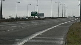
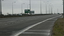
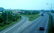
Current route
The A50 runs from the centre of WarringtonWarrington
Warrington is a town, borough and unitary authority area of Cheshire, England. It stands on the banks of the River Mersey, which is tidal to the west of the weir at Howley. It lies 16 miles east of Liverpool, 19 miles west of Manchester and 8 miles south of St Helens...
via Junction 20 of the M6
M6 motorway
The M6 motorway runs from junction 19 of the M1 at the Catthorpe Interchange, near Rugby via Birmingham then heads north, passing Stoke-on-Trent, Manchester, Preston, Carlisle and terminating at the Gretna junction . Here, just short of the Scottish border it becomes the A74 which continues to...
, Knutsford
Knutsford
Knutsford is a town and civil parish in the unitary authority area of Cheshire East and the ceremonial county of Cheshire, in North West England...
, Holmes Chapel
Holmes Chapel
Holmes Chapel is a village and civil parish in the unitary authority of Cheshire East and the ceremonial county of Cheshire, England. Until 1974 the parish was known as Church Hulme.At the 2001 Census the population of the village was recorded as 5,669...
, Kidsgrove
Kidsgrove
Kidsgrove is a town in the borough of Newcastle-under-Lyme, Staffordshire, England, near the border with Cheshire. It forms part of The Potteries Urban Area in North Staffordshire, along with Stoke-on-Trent and Newcastle-under-Lyme. It has a population of 24,112...
and Stoke on Trent
Stoke-on-Trent
Stoke-on-Trent , also called The Potteries is a city in Staffordshire, England, which forms a linear conurbation almost 12 miles long, with an area of . Together with the Borough of Newcastle-under-Lyme Stoke forms The Potteries Urban Area...
to Junction 24 of the M1
M1 motorway
The M1 is a north–south motorway in England primarily connecting London to Leeds, where it joins the A1 near Aberford. While the M1 is considered to be the first inter-urban motorway to be completed in the United Kingdom, the first road to be built to motorway standard in the country was the...
near Kegworth
Kegworth
Kegworth is a large village and civil parish in Leicestershire, England....
, via Derby
Derby
Derby , is a city and unitary authority in the East Midlands region of England. It lies upon the banks of the River Derwent and is located in the south of the ceremonial county of Derbyshire. In the 2001 census, the population of the city was 233,700, whilst that of the Derby Urban Area was 229,407...
's southern bypass. From here the A50 is concurrent with the M1, resuming again at Junction 22, the A50 runs to the centre of the City of Leicester
Leicester
Leicester is a city and unitary authority in the East Midlands of England, and the county town of Leicestershire. The city lies on the River Soar and at the edge of the National Forest...
which is its southernmost point.
Between Stoke and Derby what is now the A50 was planned to be the M64
M64 motorway
The United Kingdom's M64 motorway was planned during the 1970s to link the M6 at Stoke-on-Trent with the M1 near Castle Donington, by way of Uttoxeter and Derby....
. The resulting A564, which borrowed the alias A50, is in effect this motorway.
- The 9 miles (14.5 km) £16m Blythe Bridge - UttoxeterUttoxeterUttoxeter is a historic market town in Staffordshire, in the West Midlands region of England. The current population is approximately 13,711, though new developments in the town will increase this figure. Uttoxeter lies close to the River Dove and is near the cities of Stoke-on-Trent, Derby and...
section (convenient for Alton TowersAlton TowersAlton Towers is a theme park and resort located in Staffordshire, England. It attracts around 2.7 million visitors per year making it the most visited theme park in the United Kingdom. Alton Towers is also the 9th most visited theme park in Europe...
traffic from the north-west) opened in late 1984 as the A564. - The 6 miles (9.7 km) £30.4m HattonHatton, DerbyshireHatton is a village in South Derbyshire, England. It is located 6 km north of Burton upon Trent, 20 km west of Derby and 40 km east of Stoke-on-Trent.-Geography:...
, HiltonHilton, DerbyshireHilton is a village not far from Derby.-History:Hilton was mentioned in the Domesday Book in 1086 as belonging to Henry de Ferrers and being worth ten shillings...
and FostonFoston, DerbyshireFoston is a hamlet in the Foston and Scropton civil parish of South Derbyshire, Derbyshire, England, about west of Derby. The Domesday Book of 1086 lists it as Farulveston.-Foston Hall:...
Bypass opened (as the A564) on 25 May 1995, by John WattsJohn Arthur WattsJohn Arthur Watts was a Conservative Party Member of Parliament in the United Kingdom House of Commons between 1983 and 1997....
. - The 3 miles (4.8 km) £52m section 1 of the Blythe BridgeBlythe BridgeBlythe Bridge is a village situated in the Staffordshire Moorlands District, although it is effectively a south-eastern suburb of the city of Stoke-on-Trent.-Etymology:...
to Queensway section opened in June 1997, and the 1 miles (1.6 km) £21m section 2 opened in November 1997. - Maybe as a reference to the former M64, the £109.5m 14.9 miles (24 km) Derby Southern Bypass, was opened on 4 September 1997 by Helene Hayman, Baroness HaymanHelene Hayman, Baroness HaymanHelene Valerie Hayman, Baroness Hayman, PC was Lord Speaker of the House of Lords in the Parliament of the United Kingdom. As a member of the Labour Party she was a Member of Parliament from 1974 to 1979, and became a Life Peer in 1996...
, Minister for Roads at the DETR, as the A564. Construction had started in February 1995. This was the main piece in the jigsaw of the Stoke-Derby route, and mirrored the plans for the original M64, even having three lanes in some sections - notably the section from KegworthKegworthKegworth is a large village and civil parish in Leicestershire, England....
to the A6 junction near Derby. The A6 Derby Spur opened at the same time. - The 5 miles (8 km) £20.6m DoveridgeDoveridgeDoveridge is a village and Civil parish in Derbyshire, United Kingdom, near the border with Staffordshire and about east of Uttoxeter. Its name comes from its bridge over the river Dove , a tributary of the River Trent....
Bypass opened on 6 March 1998 also as the A564. The £2.6m A516 EtwallEtwallEtwall is a civil parish and village in Derbyshire, England. It is located southwest from Derby on the A50.-Geography:Etwall is squeezed between the A516, which bypassed the village in February 1992, and the A50. The A516 draws a lot of heavy traffic heading for the M1 north.The village has its...
bypass which opened in February 1992 allowed a quicker route to the west of Derby from this section. - The final section to be built, which was not a missing link, but a junction improvement was the A50/M1 junction 24a. It was due to open with all the rest of the road, but had been postponed in March 1996. It opened in stages, beginning in June 1999 when the north-bound slip-road opened. The section of the A50 from junctions 24a (in Lockington cum HemingtonLockington cum HemingtonLockington cum Hemington is a civil parish in the North West Leicestershire district of Leicestershire, England. According to the 2001 census it had a population of 556...
) and 24 (in KegworthKegworthKegworth is a large village and civil parish in Leicestershire, England....
) of the M1 is still what was the former A6 and has not been widened. It is only three lanes west-bound from junction 24a.
Once the Southern Derby Bypass was completed, it became the A50. The road is maintained privately by Connect A50 Ltd. Much of the new section of road is made of concrete
Concrete
Concrete is a composite construction material, composed of cement and other cementitious materials such as fly ash and slag cement, aggregate , water and chemical admixtures.The word concrete comes from the Latin word...
.
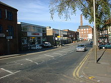
Previous routes
North of Leicester, before the dual carriageway section bypassing Derby was built, the A50 formerly went through Burton upon TrentBurton upon Trent
Burton upon Trent, also known as Burton-on-Trent or simply Burton, is a town straddling the River Trent in the east of Staffordshire, England. Its associated adjective is "Burtonian"....
and Ashby-de-la-Zouch
Ashby-de-la-Zouch
Ashby-de-la-Zouch, — Zouch being pronounced "Zoosh" — often shortened to Ashby, is a small market town and civil parish in North West Leicestershire, England, within the National Forest. It is twinned with Pithiviers in north-central France....
to Leicester, but that section is now designated the A511 road
A511 road
The A511 road is a stretch of mainly single-carriageway road which runs northwest from junction 22 of the M1 motorway in Leicestershire, England to join the A50 between Uttoxeter and Derby....
.
South of Leicester, the A50 used to terminate at Hockliffe
Hockliffe
Hockliffe is a village and civil parish in Bedfordshire on the crossroads of the A5 road which lies upon the course of the roman road known as Watling Street and the A4012 road.It is about four miles east of Leighton Buzzard...
in Bedfordshire
Bedfordshire
Bedfordshire is a ceremonial county of historic origin in England that forms part of the East of England region.It borders Cambridgeshire to the north-east, Northamptonshire to the north, Buckinghamshire to the west and Hertfordshire to the south-east....
at a junction with the A5.
- The section from Leicester to NorthamptonNorthamptonNorthampton is a large market town and local government district in the East Midlands region of England. Situated about north-west of London and around south-east of Birmingham, Northampton lies on the River Nene and is the county town of Northamptonshire. The demonym of Northampton is...
is now designated the A5199A5199 roadThe A5199 road is the direct road from Leicester to Northampton in England. It was formerly part of the A50 trunk road that ran from Bedfordshire to Lancashire...
having been down-classified when the A14 was built to deter drivers from using this stretch assuming it was a higher grade than it is. - The section south of Northampton was down-classified when the M1 was built as it runs parallel with the motorway and is an unsuitable alternative:
- Between Northampton and the Newport PagnellNewport PagnellNewport Pagnell is a town in the Borough of Milton Keynes , England. It is separated by the M1 motorway from Milton Keynes itself, though part of the same urban area...
bypass it is now the B526. - Between the Newport Pagnell bypass and Junction 14 of the M1 it is now part of the A509 roadA509 roadThe A509 is a short A-class road for north-south journeys in south central England, forming the route from Kettering in Northamptonshire to the M1 and A5 in Milton Keynes....
. - From Junction 14 of the M1 to WoburnWoburn, BedfordshireWoburn is a small Saxon village and civil parish in Bedfordshire, England. It is situated about southeast of the centre of Milton Keynes, and about south of junction 13 of the M1 motorway and is a popular tourist attraction.-History:...
it is the A5130A5130 roadThe A5130 is a road in the United Kingdom. It starts on a roundabout with the A509 near Junction 14 of the M1 motorway and proceeds south round the eastern edge of the original Milton Keynes designated area. After crossing the A421 the 5130 continues past the village of Wavendon. It then crosses... - From Woburn to Hockcliffe it is the A4012A4012 roadThe A4012 is a road in the United Kingdom. It starts in the village of Husborne Crawley to the south east of Milton Keynes and heads southwest to the village of Woburn. Here it meets the A5130 and changes direction, heading southeast past Milton Bryan before crossing the A5 at right angles in the...
.
- Between Northampton and the Newport Pagnell
The old A50 used to be the main route to London from Leicester, before it was replaced in the 19th century by what is now the A6.