
A55 road
Encyclopedia
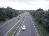
The A55, also known as the North Wales Expressway, is a major road in Britain
. Its entire length is a dual carriageway
primary route, with the exception of the point where it crosses the Britannia Bridge
over the Menai Strait
. All junctions are grade separated except for two roundabouts — one east of Penmaenmawr
and one in Llanfairfechan
. The road originally ran from Chester
to Bangor
but was extended parallel to the A5 across Anglesey
right into Holyhead
Docks
in 2001. The road improvements have been part funded with European money, under the Trans-European Networks
programme, as the route is designated part of Euroroute
E22
(Holyhead
- Leeds
- Amsterdam
- Hamburg
- Malmoe - Riga
- Moscow
- Perm
- Ekaterinburg - Ishim
).
near Chester
, where it is known as the Chester Southerly Bypass, crossing the River Dee
and the Welsh
border before passing close to Broughton
then passing north of Buckley
and Northop
. There is a major climb westbound between Broughton and Buckley (Junctions 35a to 35) though with no crawler lane. There is a difficult junction with the A494 at Junction 34/33b and the road briefly has a three lane section as traffic joins from Queensferry
and leaves towards Mold
. In the eastbound direction there is also a short three lane section for the same reason. In the eastbound direction there is also a 270 degree speed limited single lane curve to climb up and over the A55/A494. There were plans that might have affected this often congested junction as part of the A494 Queensferry to Ewloe
improvement but the Welsh Assembly Government rejected these on 26 March 2008 as being of too large a scale. However, a scheme for improving the A55/A494 Junction is planned to go ahead and includes widening the dual carriageway to three lanes between Ewloe roundabout and Junction 33 (Northop). Junction 33A at Northop Hall and Junction 33B with the A494 for Mold would be closed and a new junction for all traffic flows will be constructed near the Northop Hall service station for the A494 traffic. This proposal will remove all weaving traffic at the A55 junction with the A494 and remove the infamous 270 degree trumpet junction. Work might start by April 2010.
with major climbs between Northop
and Halkyn (Junctions 33 and 32b) and Halkyn and Holywell
Summit (Junctions 32 and 31). This section of road is notorious for poor weather conditions including fog, ice and snow in winter months. In fine weather, however there are extensive views over the River Dee estuary to the Wirral Peninsula
, Liverpool
and beyond. The highest part of the road is in the vicinity of Brynford at around 790 feet (240 m). The steep descent towards St Asaph
is down the new Rhuallt Hill (Junctions 29 to 28), which also provides the first views of the mountains of Snowdonia
in the far distance. There is a crawler lane on Rhuallt Hill for eastbound traffic. The road bypasses St Asaph to the north, and runs past Bodelwyddan
and Abergele
to reach the North Wales
coast at Pensarn
(Junction 23A). From here onwards to Bangor
, the route is close to the North Wales Coast railway
.
to (Junction 17) Conwy
is signed as a 70 mph (110 km/h) speed limit (as opposed to most of the other sections of the A55, which are the National Speed Limit) and is a non-motorway special road
, which has restrictions on access by pedestrian and other traffic, similar to the restrictions applied to a motorway. There is also a stretch passing through Colwyn Bay
(Old Colwyn
to Mochdre
) signed as a 50 mph (80 km/h) limit. These restrictions are imposed as added safety precautions because the slip-roads in this stretch are unusually short because of the difficulty of fitting the road into a very narrow area of land, and, due to the road underpassing much of the town, to reduce road surface noise levels. The section from west of Colwyn Bay railway station
to the Station Road overbridge at Mochdre
was constructed on the trackbed of the North Wales Coast railway
. The former 4 track railway was reduced to the two more northerly tracks to make space for the road.
is by means of an immersed tube
tunnel
, the first of its kind constructed in the United Kingdom.
The decision to construct an immersed tube tunnel bypass followed an extensive public consultation, named the Collcon Feasibility Study. This ruled out another bridge by the castle on aesthetic grounds, since it would have damaged the view of the world heritage site Conwy Castle
, and the two bridges by Robert Stephenson
and Thomas Telford
. Another alternative bridge crossing was proposed at Deganwy
, but this too was ruled out for aesthetic reasons. An inland alternative with heavy grades which would have passed over Bwlch y Ddeufaen pass at 430 metres (1,410.8 ft), following the old Roman road, was also worked up but rejected for cost and utility reasons.
The tunnel was constructed by a Costain
/Tarmac Construction joint venture, as pre-formed concrete
sections, and then floated into position over a pre-prepared trench in the bed of the estuary. The 3million tonnes of silt and mud extracted to create the trench in which the tunnel sections sat, were vacuumed to one side of the construction site, as to let them drift down river would have harmed the large mussel
fishing beds downstream. The silt was deposited upstream of the bridge at Conwy which created a large new area of low lying land which was subsequently given to the RSPB for a wildlife preserve
. The casting basin for the tunnel sections was later converted into a new marina in the lower estuary. Because of the valuable fishery in the river and also because of the history of heavy metal
mining
in the catchment of the river, extensive ecological
assessments were made both prior to the construction of the tunnel and subsequently. These studies finally concluded that no significant environmental damage had been caused.
After five years of construction, the tunnel was opened in October 1991. It initially had an advisory 50 miles per hour (22.4 m/s) speed limit, but this was dropped in 2007 as accidents were rare in the tunnels.
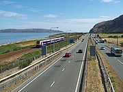 The construction of the coastal section of the road involved major civil engineering works, with hard rock tunnels passing through the cliffs in two places. In the westbound direction both the Penmaenbach and the Pen-y-clip tunnels (east and west of Penmaenmawr respectively) were initially subject to advisory 50mph speed limits but these were lifted in 2007 as there had been few accidents. In the Eastbound direction, the road still uses the 1930s cliffhugging route at both locations. The eastbound carriageway at Penmaenbach is subject to a 30 mph (50 km/h) speed limit due to sharp curves and double white lines nominally preclude lane changing. Plans to rectify the awkward alignment by building another tunnel parallel to the current westbound tunnel (as originally intended when the westbound tunnel was proposed) have been discussed for several years. The original Telford road around the cliffs is now a cycleway at both locations although at Pen-y-Clip it cannot be used in an easterly direction without cycling the wrong way along the westbound carriageway. Recent work (late 2007) at Penmaenbach eastbound has seen the erection of gantries to close lanes when bidirectional working is in place.
or the Llŷn Peninsula
, though much continues on to the port of Holyhead. As such part of the route is not classed as clearway and has two at grade junctions (roundabouts), Penmaenmawr (Junction 16) and Llanfairfechan (Junction 15). The Bangor
bypass, in which the road previously terminated and became the A5 regains high standards and is such through the Anglesey
section, bar the Britannia Bridge
, which is a single carriageway deck above the North Wales Coast railway
over the Menai Strait
. In 2007 the Welsh Assembly Government undertook a consultation to determine which of four options would be preferred for a second crossing. This section intersects with the A487 towards Caernarfon
, and the west coast of North Wales
.
section. This 20 mile (32 km) section from the end of the Llanfairpwll bypass to Holyhead
Harbour was constructed as Private Finance Initiative
scheme where the builders, a Carillion / John Laing joint venture, earn a shadow toll
based on usage and lane availability. They also have to maintain the road for the extended period of their shadow toll agreement. When travelling eastbound along this section there are fine views of Snowdonia. The approach to Holyhead required major work with a new section over the sea paralleling the Stanley Embankment that carries the original A5 and the North Wales Coast railway
.
from Chester (Deva) to Caernarfon (Segontium
), particularly from Junction 31 to 30 and Junction 13 to 12. Between Chester and Holywell the alignment of this road is uncertain and between St. Asaph and Abergele, the Roman road followed an inland route avoiding the difficulties of the crossing of the Conwy estuary and the cliffs at Penmaenbach and Pen-y-Clip.
|- align="center" bgcolor=":28732" style="color:#ffd200 ;font-size:120%;"
| colspan=4 | A55 Road
|-
!scope=col|km
!scope=col abbr="Westbound"|Westbound exits (B Carriageway)
!scope=col|Junction
!scope=col abbr="Eastbound"|Eastbound exits (A Carriageway)
|- align="center"
|0.0
| Holyhead Ferry Port
| Terminus
53.3089°N 4.6290°W Start of A55 - Holyhead Ferry Port
| Start of Road
|- align="center"
|0.5
| Holyhead
Town centre
A5154
Amlwch
A5 (A5025
)
| Road
junction
| Holyhead Town centre A5154
Amlwch A5 (A5025)
|- align="center"
|0.7
| Trearddur Bay B4545
| J1
Roundabout
| Trearddur Bay B4545
|- align="center"
|1.2
2.0
| A5153
| J2
| A5153
|- align="center"
|7.1
7.7
| Caergeiliog
, Valley
A5
Amlwch A5025
| J3
| Caergeiliog, Valley A5
Amlwch A5025
|- align="center"
|9.6
10.2
| Caergeiliog
, RAF Valley
, Bryngwran
A5
| J4
| Caergeiliog, RAF Valley, Bryngwran A5
|- align="center"
|14.0
14.6
| Bryngwran
, Gwalchmai
A5
Rhosneigr
A4080
| J5
| Bryngwran, Gwalchmai A5
Rhosneigr A4080
|- align="center"
|23.2
24.0
| Pentre Berw
, Gwalchmai
A5
Llangefni
A5114
| J6
| Pentre Berw A5
Llangefni A5114
|- align="center"
|27.8
28.6
| Gaerwen
A5152
| J7
| Gaerwen A5152
|- align="center"
|31.3
| No access
Llanfair PG A5
| J7A
| No exit
Access only
|- align="center"
|32.9
33.4
| Llanfair PG, Benllech
A5025
| J8
| Llanfair PG, Benllech A5025
|- align="center"
|33.8
| No access
Llanfair PG, Menai Bridge
A5
| J8A
| No exit
Access only
|- align="center"
|34.1
34,4
| Britannia Bridge
|Bridge
53.2161°N 4.1856°W Britannia Bridge
- crosses the Menai Straits
| Britannia Bridge
|- align="center"
|35.3
35.6
| Bangor
, Menai Bridge
, Ysbyty Gwynedd A487
| J9
| Caernarfon, Menai Bridge, Ysbyty Gwynedd A487
|- align="center"
|36.4
37.0
| Caernarfon
, Bangor
A4087
| J10
| Bangor A4087
|- align="center"
|40.3
40.9
| Bangor
, Bethesda
A5
B4366
| J11
| Bethesda A5
B4366
|- align="center"
|43.6
44.2
| Talybont
| J12
| Talybont
|- align="center"
|47.2
47.5
| Abergwyngregyn
| J13
| Abergwyngregyn
|- align="center"
|48.9
49.2
| Llanfairfechan
| J14
| Llanfairfechan
|- align="center"
|51.7
| Llanfairfechan
| J15
Roundabout
| Llanfairfechan
|- align="center"
|52.8
53.7
|Pen-y-Clip Westbound Tunnel (930 m)
|Tunnel
|Two short tunnels
|- align="center"
|53.8
54.2
| access only
No exit
| J15A
| Penmaenmawr
|- align="center"
|56.2
| Penmaenmawr
| J16
Roundabout
| Penmaenmawr
|- align="center"
|57.8
57.8
| Dwygyfylchi
| J16A
| No exit
|- align="center"
|58.4
59.1
|Penmaenbach Westbound Tunnel (658 m)
|Tunnel
|Penmaenbach Eastbound Headland Tunnel(172 m)
|- align="center"
|60.4
61.0
| Conwy
A547
| J17
| Conwy A547
|- align="center"
|61.8
62.9
| Conwy Road Tunnel (1080 m)
Restictions apply
|Tunnel
53.2875°N 3.8240°W Conwy Tunnel - Crossing of the Conwy Estuary
| Conwy Road Tunnel
Restictions apply
|- align="center"
|63.6
64.2
| Conwy
(A547)
| J18
| Llandudno Junction A546
|- align="center"
|64.8
65.5
| Llandudno
, Llanrwst
A470
Llandudno Junction
| J19
| Llandudno, Llanrwst A470
Colwyn Bay (A547)
Llandudno Junction
|- align="center"
|68.7
69.8
| Colwyn Bay
, Mochdre
, Penrhyn Bay
B5115
| J20
| Colwyn Bay, Mochdre, Penrhyn Bay B5115
|- align="center"
|70.6
71.0
| Colwyn Bay
A547
| J21
| Colwyn Bay A547
|- align="center"
|71.5
72.0
| Old Colwyn
A547
| J22
| Old Colwyn A547
|- align="center"
|
| Start of Special road
|
| End of Special road
|- align="center"
|76.0
76.1
| Llanddulas
A547
Prohibited Traffic
| J23
| Llanddulas A547
|- align="center"
|80.0
80.4
| Access only
No exit
| J23A
| Pensarn
, Abergele A548
No access
|- align="center"
|81.2
81.9
| Abergele
, Rhuddlan
A547
| J24
| Abergele, Rhuddlan A547
|- align="center"
|84.6
| no access
St. George, Towyn
| J24A
| No exit
no access
|- align="center"
|86.7
86.8
| Bodelwyddan
, Ysbyty Glan Clwyd
| J25
| Bodelwyddan, Ysbyty Glan Clwyd
|- align="center"
|88.2
88.8
| St Asaph
Business Park
| J26
| St Asaph Business Park
|- align="center"
|89.9
90.6
| St Asaph
, Trefnant
, Denbigh
, Rhuddlan
, Rhyl
A525
| J27
| St Asaph,Trefnant, Denbigh, Rhuddlan, Rhyl A525
|- align="center"
|91.6
91.6
| St Asaph
A525
| J27A
| No exit
No access
|- align="center"
|92.9
93.2
| Rhuallt, Rhuddlan
B5429
| J28
| Rhuallt B5429
|- align="center"
|96.7
97.3
| Rhuallt
| J29
| Rhuallt
|- align="center"
|99.0
99.3
| Pen-y-Cefn
| J30
| Pen-y-Cefn
|- align="center"
|100.3
100.8
| Trelawnyd
A5151
Caerwys
B5122
| J31
| Holywell A5151
Caerwys B5122
|- align="center"
|108.7
108.8
| no access
Holywell
A5026
| J32
| Holywell A5026
Halkyn, Pentre Halkyn
No access
|- align="center"
|109.3
109.9
| Pentre Halkyn
| J32A
| No exit
Access only
|- align="center"
|111.3
111.4
| Halkyn
| J32B
| No exit
No access
|- align="center"
|114.6
115.3
| Northop
, Flint
, A548 Coast Road A5119
| J33
| Northop
, Flint
, Mold
A5119
|- align="center"
|116.5
| No access
Connah's Quay
B5126
| rowspan=2 | J33A
| No exit
No access
|- align="center"
|117.8
117.9
| No exit
| Northop Hall
|- align="center"
|120.0
| No access
Mold
A494
| J33B
| No exit
Access only
|- align="center"
|120.5
128.8
| Ewloe
, Queensferry
A494
Manchester
(M56
)
| J34
"Totso"[See notes]
| Ewloe, Queensferry A494
Manchester (M56)
|- align="center"
|123.1
123.6
| Hawarden
, Buckley
, Corwen
A550
| J35
| Hawarden, Wrexham A550
|- align="center"
|125.3
125.9
| Penyffordd
| rowspan="2"|J35A
| Broughton, Saltney
A5104
|- align="center"
|128.5
| no access
Broughton
(A5104)
| No exit
Access only
|- align="center"
|128.6
|Entry into England

|Border
|Entry into Wales

|- Align="center"
|
| Wrexham
, Chester
A483
| J36
| Wrexham, Chester A483
|- align="center"
|
| Access only
No exit
| J36a
| Chester A5115
Whitchurch (A41)
No access
|- align="center"
|
| Chester
Nantwich
, Northwich
A51
Whitchurch
(A41
)
| J37
| Chester
Nantwich, Northwich A51
|- align="center"
|
| Start of road
| rowspan="2"| M53 J12
53.2116°N 2.8536°W End of the A55 - becomes the M53
| Chester, Helsby A56
Non-motorway traffic
|- align="center"
|
| Chester
, Helsby
A56
| Road continues as M53
to Wallasey
|-
|colspan=4|Notes
|-
Coordinate list
Great Britain
Great Britain or Britain is an island situated to the northwest of Continental Europe. It is the ninth largest island in the world, and the largest European island, as well as the largest of the British Isles...
. Its entire length is a dual carriageway
Dual carriageway
A dual carriageway is a class of highway with two carriageways for traffic travelling in opposite directions separated by a central reservation...
primary route, with the exception of the point where it crosses the Britannia Bridge
Britannia Bridge
Britannia Bridge is a bridge across the Menai Strait between the island of Anglesey and the mainland of Wales. It was originally designed and built by Robert Stephenson as a tubular bridge of wrought iron rectangular box-section spans for carrying rail traffic...
over the Menai Strait
Menai Strait
The Menai Strait is a narrow stretch of shallow tidal water about long, which separates the island of Anglesey from the mainland of Wales.The strait is bridged in two places - the main A5 road is carried over the strait by Thomas Telford's elegant iron suspension bridge, the first of its kind,...
. All junctions are grade separated except for two roundabouts — one east of Penmaenmawr
Penmaenmawr
PenmaenmawrConwyPenmaenmawr is a town in the parish of Dwygyfylchi, in Conwy County Borough, Wales. The population was 3857 in 2001. It is a quarrying town, though the latter is no longer a major employer, on the North Wales coast between Conwy and Llanfairfechan.The town was bypassed by the A55...
and one in Llanfairfechan
Llanfairfechan
Llanfairfechan is a town and community in the Conwy County Borough, Wales. It lies on the coast of north Wales on the route of the A55 road, between Penmaenmawr and Bangor. It previously was in Gwynedd and prior to that was in Caernarfonshire. For ceremonial and electoral boundary purposes it was...
. The road originally ran from Chester
Chester
Chester is a city in Cheshire, England. Lying on the River Dee, close to the border with Wales, it is home to 77,040 inhabitants, and is the largest and most populous settlement of the wider unitary authority area of Cheshire West and Chester, which had a population of 328,100 according to the...
to Bangor
Bangor, Gwynedd
Bangor is a city in Gwynedd, north west Wales, and one of the smallest cities in Britain. It is a university city with a population of 13,725 at the 2001 census, not including around 10,000 students at Bangor University. Including nearby Menai Bridge on Anglesey, which does not however form part of...
but was extended parallel to the A5 across Anglesey
Anglesey
Anglesey , also known by its Welsh name Ynys Môn , is an island and, as Isle of Anglesey, a county off the north west coast of Wales...
right into Holyhead
Holyhead
Holyhead is the largest town in the county of Anglesey in the North Wales. It is also a major port adjacent to the Irish Sea serving Ireland....
Docks
Dock (maritime)
A dock is a human-made structure or group of structures involved in the handling of boats or ships, usually on or close to a shore.However, the exact meaning varies among different variants of the English language...
in 2001. The road improvements have been part funded with European money, under the Trans-European Networks
Trans-European Networks
The Trans-European Networks were created by the European Union by Articles 154-156 of the Treaty of Rome , with the stated goals of the creation of an internal market and the reinforcement of economic and social cohesion...
programme, as the route is designated part of Euroroute
International E-road network
The international E-road network is a numbering system for roads in Europe developed by the United Nations Economic Commission for Europe . The network is numbered from E 1 up and its roads cross national borders...
E22
European route E22
The European route E 22 is one of the longest European routes. It has a length of about . Many of the E-roads have been extended into Asia since the year 2000; the E 22 was extended on 24 June 2002.-United Kingdom:...
(Holyhead
Holyhead
Holyhead is the largest town in the county of Anglesey in the North Wales. It is also a major port adjacent to the Irish Sea serving Ireland....
- Leeds
Leeds
Leeds is a city and metropolitan borough in West Yorkshire, England. In 2001 Leeds' main urban subdivision had a population of 443,247, while the entire city has a population of 798,800 , making it the 30th-most populous city in the European Union.Leeds is the cultural, financial and commercial...
- Amsterdam
Amsterdam
Amsterdam is the largest city and the capital of the Netherlands. The current position of Amsterdam as capital city of the Kingdom of the Netherlands is governed by the constitution of August 24, 1815 and its successors. Amsterdam has a population of 783,364 within city limits, an urban population...
- Hamburg
Hamburg
-History:The first historic name for the city was, according to Claudius Ptolemy's reports, Treva.But the city takes its modern name, Hamburg, from the first permanent building on the site, a castle whose construction was ordered by the Emperor Charlemagne in AD 808...
- Malmoe - Riga
Riga
Riga is the capital and largest city of Latvia. With 702,891 inhabitants Riga is the largest city of the Baltic states, one of the largest cities in Northern Europe and home to more than one third of Latvia's population. The city is an important seaport and a major industrial, commercial,...
- Moscow
Moscow
Moscow is the capital, the most populous city, and the most populous federal subject of Russia. The city is a major political, economic, cultural, scientific, religious, financial, educational, and transportation centre of Russia and the continent...
- Perm
Perm
Perm is a city and the administrative center of Perm Krai, Russia, located on the banks of the Kama River, in the European part of Russia near the Ural Mountains. From 1940 to 1957 it was named Molotov ....
- Ekaterinburg - Ishim
Ishim
Ishim is a town in the south of Tyumen Oblast, Russia. Population: -History:It was founded in 1670 as the village of Korkina Sloboda. In 1721 by the order of Tsar Peter the Great the village gained the right to establish Nikolskaya Trade Fair which rapidly became one of the most important trade...
).
The Chester Southerly Bypass
The A55 runs west from its junction with the M53 motorwayM53 motorway
The M53 is a motorway in the Metropolitan Borough of Wirral and Cheshire on the Wirral Peninsula in England. It can also be referred to as the Mid Wirral Motorway...
near Chester
Chester
Chester is a city in Cheshire, England. Lying on the River Dee, close to the border with Wales, it is home to 77,040 inhabitants, and is the largest and most populous settlement of the wider unitary authority area of Cheshire West and Chester, which had a population of 328,100 according to the...
, where it is known as the Chester Southerly Bypass, crossing the River Dee
River Dee, Wales
The River Dee is a long river in the United Kingdom. It travels through Wales and England and also forms part of the border between the two countries....
and the Welsh
Wales
Wales is a country that is part of the United Kingdom and the island of Great Britain, bordered by England to its east and the Atlantic Ocean and Irish Sea to its west. It has a population of three million, and a total area of 20,779 km²...
border before passing close to Broughton
Broughton, Flintshire
Broughton is a small district in Flintshire, Wales, close to the Wales–England border and located to the west of the City of Chester, England. Along with the nearby village of Bretton, the total population was 5,791 at the 2001 Census....
then passing north of Buckley
Buckley
Buckley is a town and community in Flintshire, located in north-east Wales. It is situated 2 miles from the county town of Mold and is contiguous with the nearby villages of Ewloe, Alltami and Mynydd Isa...
and Northop
Northop
Northop is a small village situated in Flintshire, Wales, approximately 12 miles west of the city of Chester, mid-way between Mold and Flint, and situated just off junction 33 of the A55 North Wales Expressway. At the 2001 Census, the population of Northop was 2,983.The village is home to two...
. There is a major climb westbound between Broughton and Buckley (Junctions 35a to 35) though with no crawler lane. There is a difficult junction with the A494 at Junction 34/33b and the road briefly has a three lane section as traffic joins from Queensferry
Queensferry, Flintshire
Queensferry is a town in Flintshire, North Wales, lying on the River Dee near the border with England.Queensferry lies along the B5441 and B5129 roads, and is bypassed by the A494 dual carriageway. It is contiguous with Deeside...
and leaves towards Mold
Mold, Flintshire
Mold is a town in Flintshire, North Wales, on the River Alyn. It is the administrative seat of Flintshire County Council, and was also the county town of Clwyd from 1974 to 1996...
. In the eastbound direction there is also a short three lane section for the same reason. In the eastbound direction there is also a 270 degree speed limited single lane curve to climb up and over the A55/A494. There were plans that might have affected this often congested junction as part of the A494 Queensferry to Ewloe
Ewloe
Ewloe is a small town in North Wales, contiguous with Hawarden and Buckley and near to Queensferry and Shotton. Situated close to the Flintshire/Cheshire sector of the Wales-England border, Ewloe forms part of Deeside. The A55 expressway passes through the town and its most notable landmark is...
improvement but the Welsh Assembly Government rejected these on 26 March 2008 as being of too large a scale. However, a scheme for improving the A55/A494 Junction is planned to go ahead and includes widening the dual carriageway to three lanes between Ewloe roundabout and Junction 33 (Northop). Junction 33A at Northop Hall and Junction 33B with the A494 for Mold would be closed and a new junction for all traffic flows will be constructed near the Northop Hall service station for the A494 traffic. This proposal will remove all weaving traffic at the A55 junction with the A494 and remove the infamous 270 degree trumpet junction. Work might start by April 2010.
Ewloe to Colwyn Bay
From Ewloe, the road is relatively flat until after Northop when it climbs up onto the flanks of Halkyn Mountain range, passing to the southwest of HolywellHolywell
Holywell is the fifth largest town in Flintshire, North Wales, lying to the west of the estuary of the River Dee.-History:The market town of Holywell takes its name from the St Winefride's Well, a holy well surrounded by a chapel...
with major climbs between Northop
Northop
Northop is a small village situated in Flintshire, Wales, approximately 12 miles west of the city of Chester, mid-way between Mold and Flint, and situated just off junction 33 of the A55 North Wales Expressway. At the 2001 Census, the population of Northop was 2,983.The village is home to two...
and Halkyn (Junctions 33 and 32b) and Halkyn and Holywell
Holywell
Holywell is the fifth largest town in Flintshire, North Wales, lying to the west of the estuary of the River Dee.-History:The market town of Holywell takes its name from the St Winefride's Well, a holy well surrounded by a chapel...
Summit (Junctions 32 and 31). This section of road is notorious for poor weather conditions including fog, ice and snow in winter months. In fine weather, however there are extensive views over the River Dee estuary to the Wirral Peninsula
Wirral Peninsula
Wirral or the Wirral is a peninsula in North West England. It is bounded by three bodies of water: to the west by the River Dee, forming a boundary with Wales, to the east by the River Mersey and to the north by the Irish Sea. Both terms "Wirral" and "the Wirral" are used locally , although the...
, Liverpool
Liverpool
Liverpool is a city and metropolitan borough of Merseyside, England, along the eastern side of the Mersey Estuary. It was founded as a borough in 1207 and was granted city status in 1880...
and beyond. The highest part of the road is in the vicinity of Brynford at around 790 feet (240 m). The steep descent towards St Asaph
St Asaph
St Asaph is a town and community on the River Elwy in Denbighshire, Wales. In the 2001 Census it had a population of 3,491.The town of St Asaph is surrounded by countryside and views of the Vale of Clwyd. It is situated close to a number of busy coastal towns such as Rhyl, Prestatyn, Abergele,...
is down the new Rhuallt Hill (Junctions 29 to 28), which also provides the first views of the mountains of Snowdonia
Snowdonia
Snowdonia is a region in north Wales and a national park of in area. It was the first to be designated of the three National Parks in Wales, in 1951.-Name and extent:...
in the far distance. There is a crawler lane on Rhuallt Hill for eastbound traffic. The road bypasses St Asaph to the north, and runs past Bodelwyddan
Bodelwyddan
Bodelwyddan is a village and community in Denbighshire, Wales now bypassed by the A55 road. It has a population of 2,106. The village lies east of Abergele, south of Rhyl, and north west of Ruthin....
and Abergele
Abergele
Abergele is a community and old Roman trading town, situated on the north coast of Wales between the holiday resorts of Colwyn Bay and Rhyl, in Conwy County Borough. Its northern suburb of Pensarn lies on the Irish Sea coast and is known for its beach, where it is claimed by some that a ghost ship...
to reach the North Wales
North Wales
North Wales is the northernmost unofficial region of Wales. It is bordered to the south by the counties of Ceredigion and Powys in Mid Wales and to the east by the counties of Shropshire in the West Midlands and Cheshire in North West England...
coast at Pensarn
Pensarn
Pensarn is a suburb of Abergele in Conwy County Borough, Wales. It has a population of around 2,000.The name Pensarn means 'end of the causeway' in English. The crossing of Morfa Rhuddlan was facilitated by a causeway near the sea, located at this point...
(Junction 23A). From here onwards to Bangor
Bangor, Gwynedd
Bangor is a city in Gwynedd, north west Wales, and one of the smallest cities in Britain. It is a university city with a population of 13,725 at the 2001 census, not including around 10,000 students at Bangor University. Including nearby Menai Bridge on Anglesey, which does not however form part of...
, the route is close to the North Wales Coast railway
North Wales Coast Line
The North Wales Coast Line is the railway line from Crewe to Holyhead. Virgin Trains consider their services along it to be a spur of the West Coast Main Line. The first section from Crewe to Chester was built by the Chester and Crewe Railway and absorbed by the Grand Junction Railway shortly...
.
Colwyn Bay Bypass
Part of the route (Junction 23) LlanddulasLlanddulas
Llanddulas is a village in Conwy county borough, North Wales midway between Old Colwyn and Abergele and next to the North Wales Expressway.The village lies beneath the limestone hill of Cefn-yr-Ogof...
to (Junction 17) Conwy
Conwy
Conwy is a walled market town and community in Conwy County Borough on the north coast of Wales. The town, which faces Deganwy across the River Conwy, formerly lay in Gwynedd and prior to that in Caernarfonshire. Conwy has a population of 14,208...
is signed as a 70 mph (110 km/h) speed limit (as opposed to most of the other sections of the A55, which are the National Speed Limit) and is a non-motorway special road
Special road
A special road is a classification of road in the United Kingdom. For a road to become a special road, it must have a Statutory Instrument sanctioned under the Highways Act 1980. A road which is not a special road is termed an all-purpose road...
, which has restrictions on access by pedestrian and other traffic, similar to the restrictions applied to a motorway. There is also a stretch passing through Colwyn Bay
Colwyn Bay
- Demography :Prior to local government reorganisation on 1 April 1974 Colwyn Bay was a municipal borough with a population of c.25,000, but in 1974 this designation disappeared leaving five separate parishes, known as communities in Wales, of which the one bearing the name Colwyn Bay encompassed...
(Old Colwyn
Old Colwyn
Old Colwyn , is a small town just to the east of Colwyn Bay, in Conwy County Borough, Wales.Prior to local government reorganisation in April 1974 it was part of the Municipal Borough of Colwyn Bay, but the reorganisation established it as a separate parish , whose population at the 2001 census was...
to Mochdre
Mochdre, Conwy
Mochdre is a village to the west of Colwyn Bay in Conwy County Borough, north Wales. Originally part of the Municipal Borough of Colwyn Bay prior to local government reorganisation in April 1974, it is now a separate community , whose population at the 2001 census was 1,862.- Origin of the name...
) signed as a 50 mph (80 km/h) limit. These restrictions are imposed as added safety precautions because the slip-roads in this stretch are unusually short because of the difficulty of fitting the road into a very narrow area of land, and, due to the road underpassing much of the town, to reduce road surface noise levels. The section from west of Colwyn Bay railway station
Colwyn Bay railway station
Colwyn Bay railway station is on the Crewe to Holyhead North Wales Coast Line.The current station consists of the platform faces that served the Up Slow and Up Fast lines. The platform faces to the Down Slow and Down Fast lines were taken out of service and have been obliterated as a result of the...
to the Station Road overbridge at Mochdre
Mochdre, Conwy
Mochdre is a village to the west of Colwyn Bay in Conwy County Borough, north Wales. Originally part of the Municipal Borough of Colwyn Bay prior to local government reorganisation in April 1974, it is now a separate community , whose population at the 2001 census was 1,862.- Origin of the name...
was constructed on the trackbed of the North Wales Coast railway
North Wales Coast Line
The North Wales Coast Line is the railway line from Crewe to Holyhead. Virgin Trains consider their services along it to be a spur of the West Coast Main Line. The first section from Crewe to Chester was built by the Chester and Crewe Railway and absorbed by the Grand Junction Railway shortly...
. The former 4 track railway was reduced to the two more northerly tracks to make space for the road.
The Conwy Bypass
The crossing of the estuary of the River ConwyRiver Conwy
The River Conwy is a river in north Wales. From its source to its discharge in Conwy Bay it is a little over long. "Conwy" is sometimes Anglicized as "Conway."...
is by means of an immersed tube
Immersed tube
An immersed tube is a kind of underwater tunnel composed of segments, constructed elsewhere and floated to the tunnel site to be sunk into place and then linked together. They are commonly used for road and rail crossings of rivers, estuaries and sea channels/harbours...
tunnel
Tunnel
A tunnel is an underground passageway, completely enclosed except for openings for egress, commonly at each end.A tunnel may be for foot or vehicular road traffic, for rail traffic, or for a canal. Some tunnels are aqueducts to supply water for consumption or for hydroelectric stations or are sewers...
, the first of its kind constructed in the United Kingdom.
The decision to construct an immersed tube tunnel bypass followed an extensive public consultation, named the Collcon Feasibility Study. This ruled out another bridge by the castle on aesthetic grounds, since it would have damaged the view of the world heritage site Conwy Castle
Conwy Castle
Conwy Castle is a castle in Conwy, on the north coast of Wales.It was built between 1283 and 1289 during King Edward I's second campaign in North Wales....
, and the two bridges by Robert Stephenson
Robert Stephenson
Robert Stephenson FRS was an English civil engineer. He was the only son of George Stephenson, the famed locomotive builder and railway engineer; many of the achievements popularly credited to his father were actually the joint efforts of father and son.-Early life :He was born on the 16th of...
and Thomas Telford
Thomas Telford
Thomas Telford FRS, FRSE was a Scottish civil engineer, architect and stonemason, and a noted road, bridge and canal builder.-Early career:...
. Another alternative bridge crossing was proposed at Deganwy
Deganwy
Deganwy is a village in Conwy County Borough in Wales with a population of 3,700. It is in a more English-speaking region of North Wales, with only 1 in 4 residents speaking Welsh as a first language...
, but this too was ruled out for aesthetic reasons. An inland alternative with heavy grades which would have passed over Bwlch y Ddeufaen pass at 430 metres (1,410.8 ft), following the old Roman road, was also worked up but rejected for cost and utility reasons.
The tunnel was constructed by a Costain
Costain Group
Costain Group plc is a British construction and civil engineering company headquartered in Maidenhead. It was part of the original Channel Tunnel consortium and is involved in Private Finance Initiative projects.-History:...
/Tarmac Construction joint venture, as pre-formed concrete
Concrete
Concrete is a composite construction material, composed of cement and other cementitious materials such as fly ash and slag cement, aggregate , water and chemical admixtures.The word concrete comes from the Latin word...
sections, and then floated into position over a pre-prepared trench in the bed of the estuary. The 3million tonnes of silt and mud extracted to create the trench in which the tunnel sections sat, were vacuumed to one side of the construction site, as to let them drift down river would have harmed the large mussel
Mussel
The common name mussel is used for members of several families of clams or bivalvia mollusca, from saltwater and freshwater habitats. These groups have in common a shell whose outline is elongated and asymmetrical compared with other edible clams, which are often more or less rounded or oval.The...
fishing beds downstream. The silt was deposited upstream of the bridge at Conwy which created a large new area of low lying land which was subsequently given to the RSPB for a wildlife preserve
Conwy RSPB reserve
Conwy RSPB reserve is a nature reserve of the Royal Society for the Protection of Birds situated on the east side of the Conwy estuary in Conwy county borough, North Wales. It covers 47 hectares and protects a variety of habitats including grassland, scrubland, reedbeds, salt marsh and mudflats...
. The casting basin for the tunnel sections was later converted into a new marina in the lower estuary. Because of the valuable fishery in the river and also because of the history of heavy metal
Heavy metals
A heavy metal is a member of a loosely-defined subset of elements that exhibit metallic properties. It mainly includes the transition metals, some metalloids, lanthanides, and actinides. Many different definitions have been proposed—some based on density, some on atomic number or atomic weight,...
mining
Mining
Mining is the extraction of valuable minerals or other geological materials from the earth, from an ore body, vein or seam. The term also includes the removal of soil. Materials recovered by mining include base metals, precious metals, iron, uranium, coal, diamonds, limestone, oil shale, rock...
in the catchment of the river, extensive ecological
Ecology
Ecology is the scientific study of the relations that living organisms have with respect to each other and their natural environment. Variables of interest to ecologists include the composition, distribution, amount , number, and changing states of organisms within and among ecosystems...
assessments were made both prior to the construction of the tunnel and subsequently. These studies finally concluded that no significant environmental damage had been caused.
After five years of construction, the tunnel was opened in October 1991. It initially had an advisory 50 miles per hour (22.4 m/s) speed limit, but this was dropped in 2007 as accidents were rare in the tunnels.
Pen-y-clip and Penmaenbach tunnels
Penmaenmawr to Anglesey
Some sections of the rest of the route are of lower standard than that of those further east. Some traffic leaves for major holiday destinations such as CaernarfonCaernarfon
Caernarfon is a Royal town, community and port in Gwynedd, Wales, with a population of 9,611. It lies along the A487 road, on the east banks of the Menai Straits, opposite the Isle of Anglesey. The city of Bangor is to the northeast, while Snowdonia fringes Caernarfon to the east and southeast...
or the Llŷn Peninsula
Llŷn Peninsula
The Llŷn Peninsula extends into the Irish Sea from north west Wales, south west of the Isle of Anglesey. It is part of the modern county and historic region of Gwynedd. The name is thought to be of Irish origin, and to have the same root Laigin in Irish as the word Leinster...
, though much continues on to the port of Holyhead. As such part of the route is not classed as clearway and has two at grade junctions (roundabouts), Penmaenmawr (Junction 16) and Llanfairfechan (Junction 15). The Bangor
Bangor, Gwynedd
Bangor is a city in Gwynedd, north west Wales, and one of the smallest cities in Britain. It is a university city with a population of 13,725 at the 2001 census, not including around 10,000 students at Bangor University. Including nearby Menai Bridge on Anglesey, which does not however form part of...
bypass, in which the road previously terminated and became the A5 regains high standards and is such through the Anglesey
Anglesey
Anglesey , also known by its Welsh name Ynys Môn , is an island and, as Isle of Anglesey, a county off the north west coast of Wales...
section, bar the Britannia Bridge
Britannia Bridge
Britannia Bridge is a bridge across the Menai Strait between the island of Anglesey and the mainland of Wales. It was originally designed and built by Robert Stephenson as a tubular bridge of wrought iron rectangular box-section spans for carrying rail traffic...
, which is a single carriageway deck above the North Wales Coast railway
North Wales Coast Line
The North Wales Coast Line is the railway line from Crewe to Holyhead. Virgin Trains consider their services along it to be a spur of the West Coast Main Line. The first section from Crewe to Chester was built by the Chester and Crewe Railway and absorbed by the Grand Junction Railway shortly...
over the Menai Strait
Menai Strait
The Menai Strait is a narrow stretch of shallow tidal water about long, which separates the island of Anglesey from the mainland of Wales.The strait is bridged in two places - the main A5 road is carried over the strait by Thomas Telford's elegant iron suspension bridge, the first of its kind,...
. In 2007 the Welsh Assembly Government undertook a consultation to determine which of four options would be preferred for a second crossing. This section intersects with the A487 towards Caernarfon
Caernarfon
Caernarfon is a Royal town, community and port in Gwynedd, Wales, with a population of 9,611. It lies along the A487 road, on the east banks of the Menai Straits, opposite the Isle of Anglesey. The city of Bangor is to the northeast, while Snowdonia fringes Caernarfon to the east and southeast...
, and the west coast of North Wales
North Wales
North Wales is the northernmost unofficial region of Wales. It is bordered to the south by the counties of Ceredigion and Powys in Mid Wales and to the east by the counties of Shropshire in the West Midlands and Cheshire in North West England...
.
Anglesey
The final section of the A55 to be constructed was the AngleseyAnglesey
Anglesey , also known by its Welsh name Ynys Môn , is an island and, as Isle of Anglesey, a county off the north west coast of Wales...
section. This 20 mile (32 km) section from the end of the Llanfairpwll bypass to Holyhead
Holyhead
Holyhead is the largest town in the county of Anglesey in the North Wales. It is also a major port adjacent to the Irish Sea serving Ireland....
Harbour was constructed as Private Finance Initiative
Private Finance Initiative
The private finance initiative is a way of creating "public–private partnerships" by funding public infrastructure projects with private capital...
scheme where the builders, a Carillion / John Laing joint venture, earn a shadow toll
Shadow toll
Shadow tolls are payments made by government to the private sector operator of a road based, at least in part, on the number of vehicles using the road. First proposed by the UK Government in 1993, they are currently in operation on some roads in the UK...
based on usage and lane availability. They also have to maintain the road for the extended period of their shadow toll agreement. When travelling eastbound along this section there are fine views of Snowdonia. The approach to Holyhead required major work with a new section over the sea paralleling the Stanley Embankment that carries the original A5 and the North Wales Coast railway
North Wales Coast Line
The North Wales Coast Line is the railway line from Crewe to Holyhead. Virgin Trains consider their services along it to be a spur of the West Coast Main Line. The first section from Crewe to Chester was built by the Chester and Crewe Railway and absorbed by the Grand Junction Railway shortly...
.
Planned improvements
The Welsh Assembly Government (WAG) published its National Transport Plan in July 2009. This includes mention of improvements to the A55 including the possible removal of the two roundabouts at Penmaenmawr and Llanfairfechan.History
The A55 partly follows the alignment of the Roman roadRoman roads in Britain
Roman roads, together with Roman aqueducts and the vast standing Roman army , constituted the three most impressive features of the Roman Empire. In Britain, as in other provinces, the Romans constructed a comprehensive network of paved trunk roads Roman roads, together with Roman aqueducts and the...
from Chester (Deva) to Caernarfon (Segontium
Segontium
Segontium is a Roman fort for a Roman auxiliary force, located on the outskirts of Caernarfon in Gwynedd, north Wales.It probably takes its name from the nearby River Seiont, and may be related to the Segontiaci, a British tribe mentioned by Julius Caesar. The fort was founded by Agricola in 77 or...
), particularly from Junction 31 to 30 and Junction 13 to 12. Between Chester and Holywell the alignment of this road is uncertain and between St. Asaph and Abergele, the Roman road followed an inland route avoiding the difficulties of the crossing of the Conwy estuary and the cliffs at Penmaenbach and Pen-y-Clip.
A55 opening dates of major improvements
- Unknown date 1930s? Ewloe to Northop avoiding Northop Hall
- Unknown date 1930s? Northop Bypass
- Unknown date 1930s? Holywell Bypass
- Unknown date 1930s? St. Asaph to Rhuallt dual carriageway
- Unknown date 1930s? Short section of 'experimental' concrete road west of St Asaph
- 1932 Penmaenbach Tunnel
- 1935 Pen-y-Clip Tunnels
- 1958 Conway new bridge avoiding Telford's suspension bridge
- 1960s Tai'r Meibion to Tan-y-lon dual carriageway east of Bangor
- 1964? Ewloe roundabout (part of the A494 Queensferry to Ewloe dualling, the 'Aston Bypass')
- Unknown date 1965? Llysfaen dualling
- 1968 Abergele Bypass
- 1970 St. Asaph Bypass
- 1975 Northop Hall Crossroads to East of Gables
- 1976 Coed-y-Cra to Chaingates (Holywell)
- 1976 Chester Southerly Bypass (terminating at Broughton)
- 1980 Britannia Bridge and link roads
- December 1980 Holywell By-Pass (Stage 1)
- March 1981 Diversion East of Abergele
- December 1983 Bangor By-Pass
- Unknown Date Llanfairpwll By-Pass
- September 1984 Hawarden By-Pass (from a point east of Broughton on the Chester Southerly Bypass to Northop Hall)
- December 1984 Llanddulas to Glan Conwy (Colwyn Bay By-Pass, Stage 1)
- June 1985 Llanddulas to Glan Conwy (Colwyn Bay By-Pass, Stage 2)
- October 1986 Holywell By-Pass (Stage 2)
- December 1986 Bodelwyddan By-Pass
- June 1989 Penmaenbach Tunnel
- June 1989 Northop By-Pass (Northop Hall to Halkyn)
- October 1989 Penmaenmawr and Llanfairfechan By-Passes (excluding Pen-y-Clip Tunnel)
- May 1990 Travellers' Inn Improvement
- 1991 tunnel crossing of the River ConwyRiver ConwyThe River Conwy is a river in north Wales. From its source to its discharge in Conwy Bay it is a little over long. "Conwy" is sometimes Anglicized as "Conway."...
- June 1991 Extension of Chester Bypass to M53 (Junction 12)
- May 1992 Rhuallt Hill Improvement
- October 1993 Pen-y-Clip Tunnel
- October 1994 Abergwyngregyn Improvement
- 16 March 2001 Anglesey section (Llanfairpwll to Holyhead)
- 2000/2004 Penmaenmawr eastbound slip road and grade separation at the summit of the Rhuallt Hill
- 2004 Improvements to railway underbridges and cliffs at Penmaenbach (eastbound)
- 2007 Alterations to roundabout at Llanfairfechan and bidirectional road indicators at Penmaenbach (eastbound)
- 2008 New overbridge between Junction 32A and 32B for improved local access
Junctions
{| border=1 cellpadding=2 style="margin-left:1em; margin-bottom: 1em; color: black; border-collapse: collapse; class="wikitable"|- align="center" bgcolor=":28732" style="color:#ffd200 ;font-size:120%;"
| colspan=4 | A55 Road
|-
!scope=col|km
!scope=col abbr="Westbound"|Westbound exits (B Carriageway)
!scope=col|Junction
!scope=col abbr="Eastbound"|Eastbound exits (A Carriageway)
|- align="center"
|0.0
| Holyhead Ferry Port
Port of Holyhead
The Port of Holyhead is a ferry port in Anglesey, Wales, handling more than 2 million passengers each year. Stena Line and Irish Ferries sail from Holyhead to Dublin and Dún Laoghaire in Ireland, forming the principal link for surface transport from north Wales and central and northern England to...
| Terminus
53.3089°N 4.6290°W Start of A55 - Holyhead Ferry Port
Port of Holyhead
The Port of Holyhead is a ferry port in Anglesey, Wales, handling more than 2 million passengers each year. Stena Line and Irish Ferries sail from Holyhead to Dublin and Dún Laoghaire in Ireland, forming the principal link for surface transport from north Wales and central and northern England to...
| Start of Road
|- align="center"
|0.5
| Holyhead
Holyhead
Holyhead is the largest town in the county of Anglesey in the North Wales. It is also a major port adjacent to the Irish Sea serving Ireland....
Town centre
Town centre
The town centre is the term used to refer to the commercial or geographical centre or core area of a town.Town centres are traditionally associated with shopping or retail. They are also the centre of communications with major public transport hubs such as train or bus stations...
A5154
Amlwch
Amlwch
Amlwch is the most northerly town in Wales. It is situated on the north coast of the Isle of Anglesey, on the A5025 which connects it to Holyhead and to Menai Bridge. The town has no beach, but it has impressive coastal cliffs. Tourism is an important element of the local economy. At one time it...
A5 (A5025
A5025 road
The A5025 is a British 'A' road that runs from Llanfairpwllgwyngyll to Valley in Anglesey, Wales. It runs up the east, north and finally north-west side of the island via several places including Benllech and Amlwch. In all the road is around long...
)
| Road
junction
| Holyhead Town centre A5154
Amlwch A5 (A5025)
|- align="center"
|0.7
| Trearddur Bay B4545
| J1
Roundabout
| Trearddur Bay B4545
|- align="center"
|1.2
2.0
| A5153
| J2
| A5153
|- align="center"
|7.1
7.7
| Caergeiliog
Caergeiliog
Caergeiliog is a village in Anglesey, in north-west Wales....
, Valley
Valley, Anglesey
Valley is a village near Holyhead/Caergybi on the west coast of Anglesey, North Wales.In Welsh it is referred to as either Y Dyffryn or [Y] Fali . Recent research, prompted by local opposition to the name of Y Fali, suggested that Valley may be a corruption of the Irish Bally , or Baile as it is...
A5
Amlwch A5025
| J3
| Caergeiliog, Valley A5
Amlwch A5025
|- align="center"
|9.6
10.2
| Caergeiliog
Caergeiliog
Caergeiliog is a village in Anglesey, in north-west Wales....
, RAF Valley
RAF Valley
RAF Valley is a Royal Air Force station on the island of Anglesey, Wales, and which is also used as Anglesey Airport. It provides fast-jet training using the BAE Hawk and provides training for aircrew working with Search and Rescue. Unofficially the motto for RAF Valley is 'One Valley, Training...
, Bryngwran
Bryngwran
Bryngwran is a village on the A5 road across Anglesey in North Wales. It lies just east of RAF Valley.- External links :*...
A5
| J4
| Caergeiliog, RAF Valley, Bryngwran A5
|- align="center"
|14.0
14.6
| Bryngwran
Bryngwran
Bryngwran is a village on the A5 road across Anglesey in North Wales. It lies just east of RAF Valley.- External links :*...
, Gwalchmai
Gwalchmai, Anglesey
Gwalchmai is a village on Anglesey in north Wales.- Location :Gwalchmai is less than a mile from the A55 and the Anglesey Show Ground and less than two miles from RAF Mona.- Amenities and history :...
A5
Rhosneigr
Rhosneigr
Rhosneigr is a village in the south-west of Anglesey, North Wales. It is situated on the A4080 road some 10km south-east of Holyhead, and is on the Anglesey Coastal Path. From the clock at the centre of the village can be seen RAF Valley and Holyhead Mountain...
A4080
A4080 road
The A4080 is a British A road which is located on the Island of Anglesey, Wales. The road begins at Menai Bridge and runs via Llanfairpwllgwyngyll, Newborough and Rhosneigr to join the A55 about 9 miles from Holyhead. In all the road is about 17 miles long...
| J5
| Bryngwran, Gwalchmai A5
Rhosneigr A4080
|- align="center"
|23.2
24.0
| Pentre Berw
Pentre Berw
Pentre Berw is a small village located on the island of Anglesey, in north Wales. It lies two and a half miles south of the county town of Llangefni....
, Gwalchmai
Gwalchmai
Gwalchmai or Gwalchmei is a figure in Welsh Arthurian legend known in English as Gawain.Gwalchmai may also refer to:* Gwalchmai, Anglesey, a village in Anglesey, north Wales*Gwalchmai ap Meilyr , Welsh court poet...
A5
Llangefni
Llangefni
Llangefni is the county town of Anglesey in Wales and contains the principal offices of the Isle of Anglesey County Council. According to the United Kingdom Census 2001, the population of Llangefni was 4,662 people and it is the second largest settlement on the island...
A5114
| J6
| Pentre Berw A5
Llangefni A5114
|- align="center"
|27.8
28.6
| Gaerwen
Gaerwen
Gaerwen is a village on the island of Anglesey, Wales. It is located in the south of the island 4 miles west of Llanfairpwllgwyngyll and 4 miles Northeast of Llangefni...
A5152
| J7
| Gaerwen A5152
|- align="center"
|31.3
| No access
Llanfair PG A5
| J7A
| No exit
Access only
|- align="center"
|32.9
33.4
| Llanfair PG, Benllech
Benllech
__FORCETOC__Benllech is a small town on the Isle of Anglesey in Wales. It is in the community of Llanfair-Mathafarn-Eithaf, which has a population of 3,408...
A5025
| J8
| Llanfair PG, Benllech A5025
|- align="center"
|33.8
| No access
Llanfair PG, Menai Bridge
Menai Bridge
Menai Bridge is a small town and community on the Isle of Anglesey in north Wales. It overlooks the Menai Strait and lies by the Menai Suspension Bridge, built in 1826 by Thomas Telford...
A5
| J8A
| No exit
Access only
|- align="center"
|34.1
34,4
| Britannia Bridge
Britannia Bridge
Britannia Bridge is a bridge across the Menai Strait between the island of Anglesey and the mainland of Wales. It was originally designed and built by Robert Stephenson as a tubular bridge of wrought iron rectangular box-section spans for carrying rail traffic...
|Bridge
53.2161°N 4.1856°W Britannia Bridge
Britannia Bridge
Britannia Bridge is a bridge across the Menai Strait between the island of Anglesey and the mainland of Wales. It was originally designed and built by Robert Stephenson as a tubular bridge of wrought iron rectangular box-section spans for carrying rail traffic...
- crosses the Menai Straits
| Britannia Bridge
|- align="center"
|35.3
35.6
| Bangor
Bangor, Gwynedd
Bangor is a city in Gwynedd, north west Wales, and one of the smallest cities in Britain. It is a university city with a population of 13,725 at the 2001 census, not including around 10,000 students at Bangor University. Including nearby Menai Bridge on Anglesey, which does not however form part of...
, Menai Bridge
Menai Bridge
Menai Bridge is a small town and community on the Isle of Anglesey in north Wales. It overlooks the Menai Strait and lies by the Menai Suspension Bridge, built in 1826 by Thomas Telford...
, Ysbyty Gwynedd A487
A487 road
The A487 is a trunk road in Wales, running up the western side of the country from Haverfordwest in the south to Bangor in the north.It starts at Merlin's Bridge near Haverfordwest, from where it travels north west to St David's, then switches back north east through Fishguard, Cardigan, Aberaeron,...
| J9
| Caernarfon, Menai Bridge, Ysbyty Gwynedd A487
|- align="center"
|36.4
37.0
| Caernarfon
Caernarfon
Caernarfon is a Royal town, community and port in Gwynedd, Wales, with a population of 9,611. It lies along the A487 road, on the east banks of the Menai Straits, opposite the Isle of Anglesey. The city of Bangor is to the northeast, while Snowdonia fringes Caernarfon to the east and southeast...
, Bangor
Bangor, Gwynedd
Bangor is a city in Gwynedd, north west Wales, and one of the smallest cities in Britain. It is a university city with a population of 13,725 at the 2001 census, not including around 10,000 students at Bangor University. Including nearby Menai Bridge on Anglesey, which does not however form part of...
A4087
| J10
| Bangor A4087
|- align="center"
|40.3
40.9
| Bangor
Bangor, Gwynedd
Bangor is a city in Gwynedd, north west Wales, and one of the smallest cities in Britain. It is a university city with a population of 13,725 at the 2001 census, not including around 10,000 students at Bangor University. Including nearby Menai Bridge on Anglesey, which does not however form part of...
, Bethesda
Bethesda, Wales
Bethesda is a town lying on the River Ogwen and the A5 road on the edge of Snowdonia, in Gwynedd, north-west Wales, colloquially called Pesda by the locals.- History :...
A5
B4366
| J11
| Bethesda A5
B4366
|- align="center"
|43.6
44.2
| Talybont
| J12
| Talybont
|- align="center"
|47.2
47.5
| Abergwyngregyn
Abergwyngregyn
Abergwyngregyn is a village of historical note in Gwynedd, a county and principal area in Wales. Under its historic name of Aber Garth Celyn it was the seat of Llywelyn ap Gruffudd....
| J13
| Abergwyngregyn
|- align="center"
|48.9
49.2
| Llanfairfechan
Llanfairfechan
Llanfairfechan is a town and community in the Conwy County Borough, Wales. It lies on the coast of north Wales on the route of the A55 road, between Penmaenmawr and Bangor. It previously was in Gwynedd and prior to that was in Caernarfonshire. For ceremonial and electoral boundary purposes it was...
| J14
| Llanfairfechan
|- align="center"
|51.7
| Llanfairfechan
Llanfairfechan
Llanfairfechan is a town and community in the Conwy County Borough, Wales. It lies on the coast of north Wales on the route of the A55 road, between Penmaenmawr and Bangor. It previously was in Gwynedd and prior to that was in Caernarfonshire. For ceremonial and electoral boundary purposes it was...
| J15
Roundabout
| Llanfairfechan
|- align="center"
|52.8
53.7
|Pen-y-Clip Westbound Tunnel (930 m)
|Tunnel
|Two short tunnels
|- align="center"
|53.8
54.2
| access only
No exit
| J15A
| Penmaenmawr
|- align="center"
|56.2
| Penmaenmawr
Penmaenmawr
PenmaenmawrConwyPenmaenmawr is a town in the parish of Dwygyfylchi, in Conwy County Borough, Wales. The population was 3857 in 2001. It is a quarrying town, though the latter is no longer a major employer, on the North Wales coast between Conwy and Llanfairfechan.The town was bypassed by the A55...
| J16
Roundabout
| Penmaenmawr
|- align="center"
|57.8
57.8
| Dwygyfylchi
Dwygyfylchi
Dwygyfylchi is a village in north Wales. It lies within Conwy County Borough. The ward of Dwygyfylchi contains the nearby settlement of Penmaenmawr and has a population of 3,857. The name Dwygyfylchi means the meeting of the two semi circles, referring to the two promentories of Penmaen Bach and...
| J16A
| No exit
|- align="center"
|58.4
59.1
|Penmaenbach Westbound Tunnel (658 m)
|Tunnel
|Penmaenbach Eastbound Headland Tunnel(172 m)
|- align="center"
|60.4
61.0
| Conwy
Conwy
Conwy is a walled market town and community in Conwy County Borough on the north coast of Wales. The town, which faces Deganwy across the River Conwy, formerly lay in Gwynedd and prior to that in Caernarfonshire. Conwy has a population of 14,208...
A547
| J17
| Conwy A547
|- align="center"
|61.8
62.9
| Conwy Road Tunnel (1080 m)
Restictions apply
|Tunnel
53.2875°N 3.8240°W Conwy Tunnel - Crossing of the Conwy Estuary
| Conwy Road Tunnel
Restictions apply
|- align="center"
|63.6
64.2
| Conwy
Conwy
Conwy is a walled market town and community in Conwy County Borough on the north coast of Wales. The town, which faces Deganwy across the River Conwy, formerly lay in Gwynedd and prior to that in Caernarfonshire. Conwy has a population of 14,208...
(A547)
| J18
| Llandudno Junction A546
|- align="center"
|64.8
65.5
| Llandudno
Llandudno
Llandudno is a seaside resort and town in Conwy County Borough, Wales. In the 2001 UK census it had a population of 20,090 including that of Penrhyn Bay and Penrhynside, which are within the Llandudno Community...
, Llanrwst
Llanrwst
Llanrwst is a small town and community on the A470 road and the River Conwy in Conwy County Borough, Wales. It takes its name from the 5th century to 6th century Saint Grwst, and the original parish church in Cae Llan was replaced by the 12th-century church....
A470
A470 road
The A470 is a major long-distance connective spine road in Wales, running from Cardiff on the south coast to Llandudno on the north coast. It covers approximately 186 miles , over a zig-zagging route through the entirety of the country's mountainous central region, including the Brecon Beacons and...
Llandudno Junction
Llandudno Junction
Llandudno Junction , once known as Tremarl, is a small town in the county borough of Conwy, Wales. It is part of the ancient parish of Llangystennin, and it is located south of Llandudno. It adjoins Deganwy and is to the east of the walled town of Conwy, which is on the opposite side of the River...
| J19
| Llandudno, Llanrwst A470
Colwyn Bay (A547)
Llandudno Junction
|- align="center"
|68.7
69.8
| Colwyn Bay
Colwyn Bay
- Demography :Prior to local government reorganisation on 1 April 1974 Colwyn Bay was a municipal borough with a population of c.25,000, but in 1974 this designation disappeared leaving five separate parishes, known as communities in Wales, of which the one bearing the name Colwyn Bay encompassed...
, Mochdre
Mochdre, Conwy
Mochdre is a village to the west of Colwyn Bay in Conwy County Borough, north Wales. Originally part of the Municipal Borough of Colwyn Bay prior to local government reorganisation in April 1974, it is now a separate community , whose population at the 2001 census was 1,862.- Origin of the name...
, Penrhyn Bay
Penrhyn Bay
Penrhyn Bay is a small town on the north Wales coast, in Conwy county borough, within the parish or community of Llandudno, and part of the ecclesiastical parish of Llanrhos. It is a prosperous village with a cluster of local shops, a pub, a parish church and a modern medical centre with doctors'...
B5115
| J20
| Colwyn Bay, Mochdre, Penrhyn Bay B5115
|- align="center"
|70.6
71.0
| Colwyn Bay
Colwyn Bay
- Demography :Prior to local government reorganisation on 1 April 1974 Colwyn Bay was a municipal borough with a population of c.25,000, but in 1974 this designation disappeared leaving five separate parishes, known as communities in Wales, of which the one bearing the name Colwyn Bay encompassed...
A547
| J21
| Colwyn Bay A547
|- align="center"
|71.5
72.0
| Old Colwyn
Old Colwyn
Old Colwyn , is a small town just to the east of Colwyn Bay, in Conwy County Borough, Wales.Prior to local government reorganisation in April 1974 it was part of the Municipal Borough of Colwyn Bay, but the reorganisation established it as a separate parish , whose population at the 2001 census was...
A547
| J22
| Old Colwyn A547
|- align="center"
|
| Start of Special road
|
| End of Special road
|- align="center"
|76.0
76.1
| Llanddulas
Llanddulas
Llanddulas is a village in Conwy county borough, North Wales midway between Old Colwyn and Abergele and next to the North Wales Expressway.The village lies beneath the limestone hill of Cefn-yr-Ogof...
A547
Prohibited Traffic
| J23
| Llanddulas A547
|- align="center"
|80.0
80.4
| Access only
No exit
| J23A
| Pensarn
Pensarn
Pensarn is a suburb of Abergele in Conwy County Borough, Wales. It has a population of around 2,000.The name Pensarn means 'end of the causeway' in English. The crossing of Morfa Rhuddlan was facilitated by a causeway near the sea, located at this point...
, Abergele A548
No access
|- align="center"
|81.2
81.9
| Abergele
Abergele
Abergele is a community and old Roman trading town, situated on the north coast of Wales between the holiday resorts of Colwyn Bay and Rhyl, in Conwy County Borough. Its northern suburb of Pensarn lies on the Irish Sea coast and is known for its beach, where it is claimed by some that a ghost ship...
, Rhuddlan
Rhuddlan
Rhuddlan is a town and community in the county of Denbighshire , in north Wales. It is situated to the south of the coastal town of Rhyl and overlooks the River Clwyd. The town gave its name to the Welsh district of Rhuddlan from 1974 to 1996...
A547
| J24
| Abergele, Rhuddlan A547
|- align="center"
|84.6
| no access
St. George, Towyn
Towyn
Towyn , is a seaside resort in the County Borough of Conwy, Wales.It is located between Rhyl, in Denbighshire, and Abergele in Conwy. According to the 2001 Census, together with neighbouring Kinmel Bay , it had a population 7,864, of which 10.7% could speak Welsh...
| J24A
| No exit
no access
|- align="center"
|86.7
86.8
| Bodelwyddan
Bodelwyddan
Bodelwyddan is a village and community in Denbighshire, Wales now bypassed by the A55 road. It has a population of 2,106. The village lies east of Abergele, south of Rhyl, and north west of Ruthin....
, Ysbyty Glan Clwyd
| J25
| Bodelwyddan, Ysbyty Glan Clwyd
|- align="center"
|88.2
88.8
| St Asaph
St Asaph
St Asaph is a town and community on the River Elwy in Denbighshire, Wales. In the 2001 Census it had a population of 3,491.The town of St Asaph is surrounded by countryside and views of the Vale of Clwyd. It is situated close to a number of busy coastal towns such as Rhyl, Prestatyn, Abergele,...
Business Park
Business park
A business park or office park is an area of land in which many office buildings are grouped together. All of the work that goes on is commercial, not industrial or residential....
| J26
| St Asaph Business Park
|- align="center"
|89.9
90.6
| St Asaph
St Asaph
St Asaph is a town and community on the River Elwy in Denbighshire, Wales. In the 2001 Census it had a population of 3,491.The town of St Asaph is surrounded by countryside and views of the Vale of Clwyd. It is situated close to a number of busy coastal towns such as Rhyl, Prestatyn, Abergele,...
, Trefnant
Trefnant
Trefnant is a village and community in Denbighshire, Wales. It is located on the A525 road in the Vale of Clwyd , about halfway between St Asaph to the north and Denbigh to the south...
, Denbigh
Denbigh
Denbigh is a market town and community in Denbighshire, Wales. Before 1888, it was the county town of Denbighshire. Denbigh lies 8 miles to the north west of Ruthin and to the south of St Asaph. It is about 13 miles from the seaside resort of Rhyl. The town grew around the glove-making industry...
, Rhuddlan
Rhuddlan
Rhuddlan is a town and community in the county of Denbighshire , in north Wales. It is situated to the south of the coastal town of Rhyl and overlooks the River Clwyd. The town gave its name to the Welsh district of Rhuddlan from 1974 to 1996...
, Rhyl
Rhyl
Rhyl is a seaside resort town and community situated on the north east coast of Wales, in the county of Denbighshire , at the mouth of the River Clwyd . To the west is the suburb of Kinmel Bay, with the resort of Towyn further west, Prestatyn to the east and Rhuddlan to the south...
A525
A525 road
The A525 is major route from Rhyl in North Wales to Newcastle-under-Lyme in England. On the way, it passes near to Denbigh, through Ruthin, through Wrexham and near Whitchurch.It is dual carriageway just south of Rhyl...
| J27
| St Asaph,Trefnant, Denbigh, Rhuddlan, Rhyl A525
|- align="center"
|91.6
91.6
| St Asaph
St Asaph
St Asaph is a town and community on the River Elwy in Denbighshire, Wales. In the 2001 Census it had a population of 3,491.The town of St Asaph is surrounded by countryside and views of the Vale of Clwyd. It is situated close to a number of busy coastal towns such as Rhyl, Prestatyn, Abergele,...
A525
A525 road
The A525 is major route from Rhyl in North Wales to Newcastle-under-Lyme in England. On the way, it passes near to Denbigh, through Ruthin, through Wrexham and near Whitchurch.It is dual carriageway just south of Rhyl...
| J27A
| No exit
No access
|- align="center"
|92.9
93.2
| Rhuallt, Rhuddlan
Rhuddlan
Rhuddlan is a town and community in the county of Denbighshire , in north Wales. It is situated to the south of the coastal town of Rhyl and overlooks the River Clwyd. The town gave its name to the Welsh district of Rhuddlan from 1974 to 1996...
B5429
| J28
| Rhuallt B5429
|- align="center"
|96.7
97.3
| Rhuallt
| J29
| Rhuallt
|- align="center"
|99.0
99.3
| Pen-y-Cefn
| J30
| Pen-y-Cefn
|- align="center"
|100.3
100.8
| Trelawnyd
Trelawnyd
- History :Trelawnyd is one of Flintshire's ancient parishes, originally part of Dyserth parish. It became a separate parish between 1254 and 1291, and included the townships of Gop, Graig, Pentreffyddion and Rhydlyfnwyd....
A5151
Caerwys
Caerwys
Caerwys is a town in Flintshire, Wales. It is situated just under two miles from the A55 North Wales Expressway and one mile from the A541 Mold-Denbigh road. At the 2001 Census, the population of Caerwys civil parish was 1,315, with a total ward population of 2,496.Caerwys is mentioned in the...
B5122
| J31
| Holywell A5151
Caerwys B5122
|- align="center"
|108.7
108.8
| no access
Holywell
Holywell
Holywell is the fifth largest town in Flintshire, North Wales, lying to the west of the estuary of the River Dee.-History:The market town of Holywell takes its name from the St Winefride's Well, a holy well surrounded by a chapel...
A5026
| J32
| Holywell A5026
Halkyn, Pentre Halkyn
No access
|- align="center"
|109.3
109.9
| Pentre Halkyn
Pentre Halkyn
Pentre Halkyn is a small village in Flintshire, North Wales. It is situated approximately three miles from Holywell, and is off Junction 32 of the A55 North Wales Expressway. It has a quarry, a small hotel, a local shop and not much else...
| J32A
| No exit
Access only
|- align="center"
|111.3
111.4
| Halkyn
Halkyn
Halkyn is a village in Flintshire, north-east Wales and situated between Pentre Halkyn, Northop and Rhosesmor. At the 2001 Census the population of the community was 2,876.- History :...
| J32B
| No exit
No access
|- align="center"
|114.6
115.3
| Northop
Northop
Northop is a small village situated in Flintshire, Wales, approximately 12 miles west of the city of Chester, mid-way between Mold and Flint, and situated just off junction 33 of the A55 North Wales Expressway. At the 2001 Census, the population of Northop was 2,983.The village is home to two...
, Flint
Flint, Flintshire
Flint is a town in Flintshire, North Wales, lying on the estuary of the River Dee. It was the county town of the historic county of Flintshire and today is the third largest town in Flintshire. According to the 2001 Census the population of the community of Flint was 12,804...
, A548 Coast Road A5119
| J33
| Northop
Northop
Northop is a small village situated in Flintshire, Wales, approximately 12 miles west of the city of Chester, mid-way between Mold and Flint, and situated just off junction 33 of the A55 North Wales Expressway. At the 2001 Census, the population of Northop was 2,983.The village is home to two...
, Flint
Flint, Flintshire
Flint is a town in Flintshire, North Wales, lying on the estuary of the River Dee. It was the county town of the historic county of Flintshire and today is the third largest town in Flintshire. According to the 2001 Census the population of the community of Flint was 12,804...
, Mold
Mold, Flintshire
Mold is a town in Flintshire, North Wales, on the River Alyn. It is the administrative seat of Flintshire County Council, and was also the county town of Clwyd from 1974 to 1996...
A5119
|- align="center"
|116.5
| No access
Connah's Quay
Connah's Quay
Connah's Quay is the largest town in Flintshire, North Wales, lying on the River Dee, near the border with England. It can be accessed by road from the A550, by rail from the nearby Shotton station and also lies on the National Cycle Network Route 5. It is situated near the region's industrial...
B5126
| rowspan=2 | J33A
| No exit
No access
|- align="center"
|117.8
117.9
| No exit
| Northop Hall
Northop Hall
Northop Hall is a large village near Mold, in Flintshire, Wales. Located to the east of Northop, near the A55 North Wales Expressway, the village is largely residential in character...
|- align="center"
|120.0
| No access
Mold
Mold, Flintshire
Mold is a town in Flintshire, North Wales, on the River Alyn. It is the administrative seat of Flintshire County Council, and was also the county town of Clwyd from 1974 to 1996...
A494
A494 road
The A494 is an important trunk road in Wales. The road runs between "Drome Corner" at the intersection of the A548 and A550 by RAF Sealand, Queensferry and the A470 at Dolgellau, Gwynedd.-Beginnings:...
| J33B
| No exit
Access only
|- align="center"
|120.5
128.8
| Ewloe
Ewloe
Ewloe is a small town in North Wales, contiguous with Hawarden and Buckley and near to Queensferry and Shotton. Situated close to the Flintshire/Cheshire sector of the Wales-England border, Ewloe forms part of Deeside. The A55 expressway passes through the town and its most notable landmark is...
, Queensferry
Queensferry, Flintshire
Queensferry is a town in Flintshire, North Wales, lying on the River Dee near the border with England.Queensferry lies along the B5441 and B5129 roads, and is bypassed by the A494 dual carriageway. It is contiguous with Deeside...
A494
A494 road
The A494 is an important trunk road in Wales. The road runs between "Drome Corner" at the intersection of the A548 and A550 by RAF Sealand, Queensferry and the A470 at Dolgellau, Gwynedd.-Beginnings:...
Manchester
Manchester
Manchester is a city and metropolitan borough in Greater Manchester, England. According to the Office for National Statistics, the 2010 mid-year population estimate for Manchester was 498,800. Manchester lies within one of the UK's largest metropolitan areas, the metropolitan county of Greater...
(M56
M56 motorway
The M56 Motorway, also known as the North Cheshire motorway, is in Cheshire and Greater Manchester, England. It runs from Junction 4 of the M60 to Dunkirk, Cheshire and is in length. It is often busy with long-distance commuter traffic towards North Wales...
)
| J34
"Totso"[See notes]
| Ewloe, Queensferry A494
Manchester (M56)
|- align="center"
|123.1
123.6
| Hawarden
Hawarden
Hawarden is a village in Flintshire, North Wales. Hawarden forms part of the Deeside conurbation on the Welsh/English border. At the 2001 Census, the population of Hawarden Ward was 1,858...
, Buckley
Buckley
Buckley is a town and community in Flintshire, located in north-east Wales. It is situated 2 miles from the county town of Mold and is contiguous with the nearby villages of Ewloe, Alltami and Mynydd Isa...
, Corwen
Corwen
Corwen is a town and community in the county of Denbighshire in Wales; it was previously part of the county of Meirionnydd). Corwen stands on the banks of the River Dee beneath the Berwyn mountains. The town is situated west of Llangollen and south of Ruthin...
A550
| J35
| Hawarden, Wrexham A550
|- align="center"
|125.3
125.9
| Penyffordd
Penyffordd
Penyffordd is a village in Flintshire, North Wales, situated to the south west of Buckley and to the west of Chester. The name is derived from the Welsh Pen Y Ffordd - meaning, literally, "head of the road"...
| rowspan="2"|J35A
| Broughton, Saltney
Saltney
Saltney is a small town in Flintshire, Wales. It is immediately to the west of the border with Cheshire in England and is contiguous with the Chester urban area.The name is derived from the former salt marshes on which it is built, lying on the River Dee...
A5104
|- align="center"
|128.5
| no access
Broughton
Broughton, Flintshire
Broughton is a small district in Flintshire, Wales, close to the Wales–England border and located to the west of the City of Chester, England. Along with the nearby village of Bretton, the total population was 5,791 at the 2001 Census....
(A5104)
| No exit
Access only
|- align="center"
|128.6
|Entry into England
England
England is a country that is part of the United Kingdom. It shares land borders with Scotland to the north and Wales to the west; the Irish Sea is to the north west, the Celtic Sea to the south west, with the North Sea to the east and the English Channel to the south separating it from continental...
|Border
|Entry into Wales
Wales
Wales is a country that is part of the United Kingdom and the island of Great Britain, bordered by England to its east and the Atlantic Ocean and Irish Sea to its west. It has a population of three million, and a total area of 20,779 km²...
|- Align="center"
|
| Wrexham
Wrexham
Wrexham is a town in Wales. It is the administrative centre of the wider Wrexham County Borough, and the largest town in North Wales, located in the east of the region. It is situated between the Welsh mountains and the lower Dee Valley close to the border with Cheshire, England...
, Chester
Chester
Chester is a city in Cheshire, England. Lying on the River Dee, close to the border with Wales, it is home to 77,040 inhabitants, and is the largest and most populous settlement of the wider unitary authority area of Cheshire West and Chester, which had a population of 328,100 according to the...
A483
A483 road
The A483 is a major road in the United Kingdom, running from Swansea in Wales to Chester in England, although the official title is the Swansea to Manchester Trunk Road.-Swansea:...
| J36
| Wrexham, Chester A483
|- align="center"
|
| Access only
No exit
| J36a
| Chester A5115
Whitchurch (A41)
No access
|- align="center"
|
| Chester
Chester
Chester is a city in Cheshire, England. Lying on the River Dee, close to the border with Wales, it is home to 77,040 inhabitants, and is the largest and most populous settlement of the wider unitary authority area of Cheshire West and Chester, which had a population of 328,100 according to the...
Nantwich
Nantwich
Nantwich is a market town and civil parish in the Borough of Cheshire East and the ceremonial county of Cheshire, England. The town gives its name to the parliamentary constituency of Crewe and Nantwich...
, Northwich
Northwich
Northwich is a town and civil parish in the unitary authority of Cheshire West and Chester and the ceremonial county of Cheshire, England. It lies in the heart of the Cheshire Plain, at the confluence of the rivers Weaver and Dane...
A51
A51 road
The A51 is a road in England running from Kingsbury in Warwickshire to Chester. The road follows the following route:*Kingsbury*Tamworth*Lichfield*Rugeley *Little Haywood*Great Haywood*Weston*Sandon...
Whitchurch
Whitchurch, Shropshire
Whitchurch is a market town in Shropshire, England on the border between England and Wales. It is the oldest continuously inhabited town in Shropshire. According to the 2001 Census, the population of the town is 8,673, with a more recent estimate putting the population of the town at 8,934...
(A41
A41 road
The A41 is a formerly-major trunk road in England that links London and Birkenhead, although it has now largely been superseded by motorways. It passes through or near various towns and cities including Watford, Hemel Hempstead, Aylesbury, Solihull, Birmingham, West Bromwich, Wolverhampton,...
)
| J37
| Chester
Nantwich, Northwich A51
|- align="center"
|
| Start of road
| rowspan="2"| M53 J12
53.2116°N 2.8536°W End of the A55 - becomes the M53
| Chester, Helsby A56
Non-motorway traffic
|- align="center"
|
| Chester
Chester
Chester is a city in Cheshire, England. Lying on the River Dee, close to the border with Wales, it is home to 77,040 inhabitants, and is the largest and most populous settlement of the wider unitary authority area of Cheshire West and Chester, which had a population of 328,100 according to the...
, Helsby
Helsby
Helsby is a large village and civil parish in the unitary authority of Cheshire West and Chester and the ceremonial county of Cheshire, England. At the 2001 Census, Helsby had a population of 4,701.-Geography:...
A56
A56 road
The A56 is a road in England which extends between the city of Chester in Cheshire and the village of Broughton in North Yorkshire. The road contains a mixture of single and dual carriageway sections, and traverses environments as diverse as the dense urban sprawl of inner city Manchester and the...
| Road continues as M53
M53 motorway
The M53 is a motorway in the Metropolitan Borough of Wirral and Cheshire on the Wirral Peninsula in England. It can also be referred to as the Mid Wirral Motorway...
to Wallasey
Wallasey
Wallasey is a town within the Metropolitan Borough of Wirral, in Merseyside, England, on the mouth of the River Mersey, at the northeastern corner of the Wirral Peninsula...
|-
|colspan=4|Notes
- Data from location marker postsDriver location signsDriver location signs are English highway route markers, first introduced in 2003, that complement distance marker posts. Both types of marker post display the distances from a nominal start point in kilometres...
are used to provide distance and carriageway identification information. Where a junction spans several hundred metres and the data is available, both the start and finish values for the junction are shown. - Totso = "Turn off to stay on" meaning that the driver must leave the main carriageway to stay on the specified (A55) route.
|-
Coordinate list
External links
- Traffic Wales - containing A55 webcams
- SABRE Roaders Digest - A55
- Images of diversion of North Wales Coast Railway at Colwyn Bay to accommodate A55
- BBC News - Engineers look at more A55 relief - 03/09/2004
- The Motorway Archive - A55
- The Chester-Bangor Trunk Road (A55) (Rhuallt Hill Improvement and Slip Roads) Order 1989 (S.I. 1989/2091)
- Other Statutory Instruments pertaining to the A55
- Roads UK: A55