
A45 road
Encyclopedia
The A45 is a major road in England. It runs east from Birmingham
past the National Exhibition Centre
and the M42
, then bypasses Coventry
and Rugby
, where it briefly merges with the M45
until it continues to Daventry
. It then heads to Northampton
and Wellingborough
before running north of Rushden
and Higham Ferrers
and terminating at its junction with the A14 road near Thrapston
.
Prior to the construction of the M6 motorway
it was the main route from the Midlands to Ipswich and to the Haven ports
. When the A1-M1 link road section of the current A14 opened in 1994 most of the A45 to the east of Cambridge was re-designated as the A14 and some sections to the west were downgraded to B-roads.
was opened in 1982, the road was diverted to pass over the new bridge.
A bypass for the village of Eltisley
was built in 1972, along with a bypass on the B1040 road. The 3 miles (4.8 km) £8 million St Neots
Bypass opened in December 1985 on what was then the A45. When the M6-to-Felixstowe route was moved and upgraded to become the A14, this bypass became redesignated part of the less important Cambridge
-Coventry
A428
.
Birmingham Ring Road, bypassing Small Heath and crossing the B4145. It passes over the River Cole
and meets the A4040
at a grade-separated junction
at the Swan Shopping Centre
in Yardley. It meets the B425 at traffic lights in Sheldon
, then enters the borough of Solihull
. The section of the A45 from Birmingham city centre to the M45 is all dual-carriageway—urban dual-carriageway with traffic lights until Birmingham Airport, then rural grade-separated between the airport and Coventry. The Bickenhill Junction intersects with the B4438, a dual-carriageway access road for Birmingham International Airport
, the N.E.C.
and Birmingham International railway station
. There is a grade-separated junction with the M42
at junction 6. On this roundabout is also access to the National Motorcycle Museum
. The road passes over the A452
at Stonebridge and passes over the River Blythe
where the road briefly enters Warwickshire
. Meriden
is bypassed to the North. The Heart of England Way
passes under the road, and the road enters the borough of Coventry
.
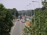
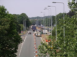 The A45 becomes an urban road and skirts the South side of Coventry, crossing the B4101 at Tile Hill, West Coast Main Line
, A429
and B4113. Beyond here the road takes a more rural nature, with a grade separated junction with the A46
. Between here and the next junction the A45 multiplexes with the A46
. Tollbar End roundabout is one of the busiest in the Midlands. It has exits for the A46 north/Coventry Eastern Bypass, Coventry Airport
and B4110. Crossing the River Avon
, the road re-enters Warwickshire
. The A423 exits to the south-east at a GSJ near the former Peugeot
factory. The A445 crosses at a roundabout near Ryton on Dunsmore, followed by another roundabout with the B4455 Fosse Way
. There is a grade separated junction with the A4071 (Rugby
), the final roundabout on this section is the start of the M45
. For 2 miles (3.2 km) the A45 multiplexes with the M45 to a fairly new junction beyond Dunchurch.
, the road is a single-carriageway. The road passes two prison
s: HMP Onley
and HMP Rye Hill
. After Willoughby
, the road enters Northamptonshire
, where it crosses the Oxford Canal
and Grand Union Canal
near Braunston
. The Jurassic Way
crosses the road here. The road enters Daventry, home to large distribution centres for Ford Motor Company
, and Diageo
. The road briefly runs concurrent with the A425
heading to Leamington Spa
, then heads south-east on the Daventry bypass, called the Stefen Way. The road meets the B4038 at a roundabout where the A425 exits. The road heads west past Dodford
to Weedon Bec
, where it crosses the West Coast Main Line and Grand Union Canal, then meets the A5 at traffic lights. The road passes through Flore
, then meets the M1
at junction 16.
The A45 resumes at the M1 junction 15, heading around the South side of the town. From the point as which it meets the old route at the A45/A508 GSJ, near Northampton High School, it crosses the River Nene
and Nene Way, then there is a large GSJ with the A428
. This section is concurrent with the A43, which exits at a GSJ near Weston Favell
. The GSJ with the A5076 is also the exit for Billing Aquadrome
. The road has a GSJ with the B573 near Earls Barton. The road meets the Wellingborough
bypass (A509) at a roundabout. It runs concurrently with the A509 to the GSJ near the bridge over the River Nene, where the A509 exits south near Irchester Country Park. East of Wellingborough, the road crosses the Midland Main Line
. There is a GSJ for the A5001 and the route runs alongside the River Nene
. At the roundabout with the A6 near Higham Ferrers
, it starts the follow the former route of the A605. The section of dual carriageway
from the M1 now ends at the next roundabout. This is the start of the Raunds
bypass. The next roundabout is with the B663. The route bypasses Ringstead
and the A45 finishes at a GSJ with the A14 near Thrapston
.
The project was given the go ahead in the 2011 Autumn Statement on 29 November 2011.
in 1982.
Birmingham
Birmingham is a city and metropolitan borough in the West Midlands of England. It is the most populous British city outside the capital London, with a population of 1,036,900 , and lies at the heart of the West Midlands conurbation, the second most populous urban area in the United Kingdom with a...
past the National Exhibition Centre
National Exhibition Centre
The National Exhibition Centre is an exhibition centre in Birmingham, England. It is near junction 6 of the M42 motorway, and is adjacent to Birmingham International Airport and Birmingham International railway station. It has 20 interconnected halls, set in grounds of 628 acres making it the...
and the M42
M42 motorway
The M42 motorway is a major road in England. The motorway runs north east from Bromsgrove in Worcestershire to just south west of Ashby-de-la-Zouch in Leicestershire, passing Redditch, Solihull, the National Exhibition Centre and Tamworth on the way. The section between the M40 and M6 road forms...
, then bypasses Coventry
Coventry
Coventry is a city and metropolitan borough in the county of West Midlands in England. Coventry is the 9th largest city in England and the 11th largest in the United Kingdom. It is also the second largest city in the English Midlands, after Birmingham, with a population of 300,848, although...
and Rugby
Rugby, Warwickshire
Rugby is a market town in Warwickshire, England, located on the River Avon. The town has a population of 61,988 making it the second largest town in the county...
, where it briefly merges with the M45
M45 motorway
The M45 is a motorway in Northamptonshire and Warwickshire, England and is long. It runs from Junction 17 of the M1 motorway south east of Rugby and ends with a junction with the A45 road southwest of Rugby...
until it continues to Daventry
Daventry
Daventry is a market town in Northamptonshire, England, with a population of 22,367 .-Geography:The town is also the administrative centre of the larger Daventry district, which has a population of 71,838. The town is 77 miles north-northwest of London, 13.9 miles west of Northampton and 10.2...
. It then heads to Northampton
Northampton
Northampton is a large market town and local government district in the East Midlands region of England. Situated about north-west of London and around south-east of Birmingham, Northampton lies on the River Nene and is the county town of Northamptonshire. The demonym of Northampton is...
and Wellingborough
Wellingborough
Wellingborough is a market town and borough in Northamptonshire, England, situated some from the county town of Northampton. The town is situated on the north side of the River Nene, most of the older town is sited on the flanks of the hills above the river's current flood plain...
before running north of Rushden
Rushden
Rushden is a town and civil parish in the county of Northamptonshire, England.The parish of Rushden covers an area of some and is part of the district of East Northamptonshire. The population of Rushden was estimated at around 28,368, making it the fifth largest town in the county...
and Higham Ferrers
Higham Ferrers
Higham Ferrers is a market town in the Nene Valley in East Northamptonshire, England, close to the Cambridgeshire and Bedfordshire borders. It forms a single urban area with Rushden to the south and has an estimated population of 6,086...
and terminating at its junction with the A14 road near Thrapston
Thrapston
Thrapston is a small town in Northamptonshire, England. It is the headquarters of the East Northamptonshire district, and in 2001 had a population of 4,855. By 2006, this was estimated to be over 5,700....
.
Prior to the construction of the M6 motorway
M6 motorway
The M6 motorway runs from junction 19 of the M1 at the Catthorpe Interchange, near Rugby via Birmingham then heads north, passing Stoke-on-Trent, Manchester, Preston, Carlisle and terminating at the Gretna junction . Here, just short of the Scottish border it becomes the A74 which continues to...
it was the main route from the Midlands to Ipswich and to the Haven ports
Haven ports
The Haven Ports are a group of five ports on the East Coast of England, these are Port of Felixstowe, Port of Ipswich, Harwich International, Harwich Navyard and Mistley...
. When the A1-M1 link road section of the current A14 opened in 1994 most of the A45 to the east of Cambridge was re-designated as the A14 and some sections to the west were downgraded to B-roads.
History
The original (1923) route of the A45 was Birmingham to Ipswich. The road was extended to Felixstowe in 1935, replacing the A139. Initially, the A45 passed through Ipswich to Felixstowe; when the Orwell bridgeOrwell Bridge
The Orwell Bridge was opened to road traffic in 1982 and carries the A14 over the River Orwell just south of Ipswich in Suffolk, England....
was opened in 1982, the road was diverted to pass over the new bridge.
A bypass for the village of Eltisley
Eltisley
Eltisley is a village and civil parish in South Cambridgeshire, England, on the A428 road about 5.5 miles east of St Neots and about 11 miles west of the city of Cambridge. The population in 2001 was 421 people.-History:...
was built in 1972, along with a bypass on the B1040 road. The 3 miles (4.8 km) £8 million St Neots
St Neots
St Neots is a town and civil parish with a population of 26,356 people. It lies on the River Great Ouse in Huntingdonshire District, approximately north of central London, and is the largest town in Cambridgeshire . The town is named after the Cornish monk St...
Bypass opened in December 1985 on what was then the A45. When the M6-to-Felixstowe route was moved and upgraded to become the A14, this bypass became redesignated part of the less important Cambridge
Cambridge
The city of Cambridge is a university town and the administrative centre of the county of Cambridgeshire, England. It lies in East Anglia about north of London. Cambridge is at the heart of the high-technology centre known as Silicon Fen – a play on Silicon Valley and the fens surrounding the...
-Coventry
Coventry
Coventry is a city and metropolitan borough in the county of West Midlands in England. Coventry is the 9th largest city in England and the 11th largest in the United Kingdom. It is also the second largest city in the English Midlands, after Birmingham, with a population of 300,848, although...
A428
A428 road
The A428 road is a major road in central and eastern England. It connects the cities of Coventry and Cambridge by way of the county towns of Northampton and Bedford.-Coventry - Northampton:...
.
Bypasses and realignments
- Small Heath (Now bypassed to the south)
- Meriden (Now bypassed to the north)
- Coventry (An early bypass to the south)
- Daventry (The route now follows the ring road)
- Northampton (Bypassed, the former route being A4500)
- Higham Ferrers (Bypassed to the west of the town)
Re-designation
When the new A14 A1-M1 link road was opened to traffic in the mid-1990s, the Cambridge to Felixstowe stretch of the A45 was redesignated as the A14; the former A45 to the A1 was downgraded to B645; and the A1 to Cambridge section became part of an extended A428. The route through Felixstowe at the end of the A14 is now the A154.Birmingham to Dunchurch
The road starts on the A4540A4540 road
The A4540 is a Ring Road in Birmingham, England, also known as the Middle Ring Road, or the Middleway. There are proposals to make it a red route. It runs around the centre of the city at a distance of approximately . Birmingham City Centre is the area within this ring road. The ring road was...
Birmingham Ring Road, bypassing Small Heath and crossing the B4145. It passes over the River Cole
River Cole, West Midlands
The River Cole is a river in the English Midlands. It rises in Redhill, near Kings Norton, South of Birmingham. After flowing through Birmingham, it passes Coleshill, to which it gave its name. It joins the River Blythe, of which it is a tributary, near Ladywalk, shortly before the Blythe meets...
and meets the A4040
A4040 road
The A4040 is the Outer Ring Road in Birmingham, England. It is the route followed by the Birmingham Outer Circle bus route. It was formed mainly of redesignated old roads, unlike Birmingham's inner and middle ring road , which were mostly purpose built.Places along the route include:* Perry Barr*...
at a grade-separated junction
Grade separation
Grade separation is the method of aligning a junction of two or more transport axes at different heights so that they will not disrupt the traffic flow on other transit routes when they cross each other. The composition of such transport axes does not have to be uniform; it can consist of a...
at the Swan Shopping Centre
Swan Shopping Centre
The Swan Shopping Centre is an under-construction shopping centre in Yardley, Birmingham, scheduled to open in Spring 2012.With its landmark high rise building, it stands on the A45 Coventry Road at its intersection with the A4040 Outer Ring Road , known as Swan Island.-History:It consists of a...
in Yardley. It meets the B425 at traffic lights in Sheldon
Sheldon, West Midlands
Sheldon is an area of eastern Birmingham in the West Midlands, England. It is close to the border with the Metropolitan Borough of Solihull and Birmingham International Airport....
, then enters the borough of Solihull
Metropolitan Borough of Solihull
The Metropolitan Borough of Solihull is a metropolitan borough of the West Midlands, in west-central England. It is named after its largest town, Solihull, from which Solihull Metropolitan Borough Council is based. For Eurostat purposes it is a NUTS 3 region and is one of five boroughs or unitary...
. The section of the A45 from Birmingham city centre to the M45 is all dual-carriageway—urban dual-carriageway with traffic lights until Birmingham Airport, then rural grade-separated between the airport and Coventry. The Bickenhill Junction intersects with the B4438, a dual-carriageway access road for Birmingham International Airport
Birmingham International Airport (UK)
Birmingham Airport , formerly Birmingham International Airport is an airport located east southeast of Birmingham city centre, at Bickenhill in the Metropolitan Borough of Solihull within the West Midlands, England...
, the N.E.C.
National Exhibition Centre
The National Exhibition Centre is an exhibition centre in Birmingham, England. It is near junction 6 of the M42 motorway, and is adjacent to Birmingham International Airport and Birmingham International railway station. It has 20 interconnected halls, set in grounds of 628 acres making it the...
and Birmingham International railway station
Birmingham International railway station
Birmingham International railway station is located in the borough of Solihull, just east of the city of Birmingham in England.The station is on the Rugby-Birmingham-Stafford Line 14 km east of Birmingham New Street and serves both Birmingham International Airport and the National Exhibition...
. There is a grade-separated junction with the M42
M42 motorway
The M42 motorway is a major road in England. The motorway runs north east from Bromsgrove in Worcestershire to just south west of Ashby-de-la-Zouch in Leicestershire, passing Redditch, Solihull, the National Exhibition Centre and Tamworth on the way. The section between the M40 and M6 road forms...
at junction 6. On this roundabout is also access to the National Motorcycle Museum
National Motorcycle Museum (UK)
The National Motorcycle Museum occupies an site in Bickenhill, Solihull, England and holds the world's largest collection of British motorcycles. In addition to over 850 motorcycles which cover a century of motorcycle manufacture the site has conference facilities...
. The road passes over the A452
A452 road
The A452 is a road in England, which runs from Leamington Spa, Warwickshire to Brownhills in Staffordshire. It is the major link to the M6 motorway for both Leamington and Warwick in addition to serving as Leamington's link to the M40 motorway and to Coventry....
at Stonebridge and passes over the River Blythe
River Blythe
The Blythe is a river in the English Midlands which runs from Warwickshire, through the borough of Solihull and on to Coleshill. It runs along the Meriden Gap in the Midlands Plateau,...
where the road briefly enters Warwickshire
Warwickshire
Warwickshire is a landlocked non-metropolitan county in the West Midlands region of England. The county town is Warwick, although the largest town is Nuneaton. The county is famous for being the birthplace of William Shakespeare...
. Meriden
Meriden, West Midlands
-External links:*****...
is bypassed to the North. The Heart of England Way
Heart of England Way
The Heart of England Way is a long distance walk of around through the Midlands of England. The walk starts from Milford Common on Cannock Chase and ends at Bourton on the Water in the Cotswolds passing through the counties of Staffordshire, Warwickshire and Gloucestershire.The walk provides links...
passes under the road, and the road enters the borough of Coventry
Coventry
Coventry is a city and metropolitan borough in the county of West Midlands in England. Coventry is the 9th largest city in England and the 11th largest in the United Kingdom. It is also the second largest city in the English Midlands, after Birmingham, with a population of 300,848, although...
.
West Coast Main Line
The West Coast Main Line is the busiest mixed-traffic railway route in Britain, being the country's most important rail backbone in terms of population served. Fast, long-distance inter-city passenger services are provided between London, the West Midlands, the North West, North Wales and the...
, A429
A429 road
The A429 is a main road in England that runs in a north-northeasterly direction from junction 17 of the M4 motorway to Coventry in the West Midlands, by way of Malmesbury, Cirencester, Stow-on-the-Wold, Moreton-in-Marsh, east of Stratford-upon-Avon, Warwick, and Kenilworth.For much of its length...
and B4113. Beyond here the road takes a more rural nature, with a grade separated junction with the A46
A46 road
The A46 is an A road in England. It starts east of Bath, Somerset and ends in Cleethorpes, North East Lincolnshire, but it does not form a continuous route. Large portions of the old road have been lost, bypassed, or replaced by motorway development...
. Between here and the next junction the A45 multiplexes with the A46
A46 road
The A46 is an A road in England. It starts east of Bath, Somerset and ends in Cleethorpes, North East Lincolnshire, but it does not form a continuous route. Large portions of the old road have been lost, bypassed, or replaced by motorway development...
. Tollbar End roundabout is one of the busiest in the Midlands. It has exits for the A46 north/Coventry Eastern Bypass, Coventry Airport
Coventry Airport
Coventry Airport is located south southeast of Coventry city centre, in the village of Baginton, Warwickshire, England, and about outside Coventry boundaries...
and B4110. Crossing the River Avon
River Avon, Warwickshire
The River Avon or Avon is a river in or adjoining the counties of Leicestershire, Northamptonshire, Warwickshire, Worcestershire and Gloucestershire in the Midlands of England...
, the road re-enters Warwickshire
Warwickshire
Warwickshire is a landlocked non-metropolitan county in the West Midlands region of England. The county town is Warwick, although the largest town is Nuneaton. The county is famous for being the birthplace of William Shakespeare...
. The A423 exits to the south-east at a GSJ near the former Peugeot
Peugeot
Peugeot is a major French car brand, part of PSA Peugeot Citroën, the second largest carmaker based in Europe.The family business that precedes the current Peugeot company was founded in 1810, and manufactured coffee mills and bicycles. On 20 November 1858, Emile Peugeot applied for the lion...
factory. The A445 crosses at a roundabout near Ryton on Dunsmore, followed by another roundabout with the B4455 Fosse Way
Fosse Way
The Fosse Way was a Roman road in England that linked Exeter in South West England to Lincoln in Lincolnshire, via Ilchester , Bath , Cirencester and Leicester .It joined Akeman Street and Ermin Way at Cirencester, crossed Watling Street at Venonis south...
. There is a grade separated junction with the A4071 (Rugby
Rugby, Warwickshire
Rugby is a market town in Warwickshire, England, located on the River Avon. The town has a population of 61,988 making it the second largest town in the county...
), the final roundabout on this section is the start of the M45
M45 motorway
The M45 is a motorway in Northamptonshire and Warwickshire, England and is long. It runs from Junction 17 of the M1 motorway south east of Rugby and ends with a junction with the A45 road southwest of Rugby...
. For 2 miles (3.2 km) the A45 multiplexes with the M45 to a fairly new junction beyond Dunchurch.
Dunchurch to Thrapston
Heading towards DaventryDaventry
Daventry is a market town in Northamptonshire, England, with a population of 22,367 .-Geography:The town is also the administrative centre of the larger Daventry district, which has a population of 71,838. The town is 77 miles north-northwest of London, 13.9 miles west of Northampton and 10.2...
, the road is a single-carriageway. The road passes two prison
Prison
A prison is a place in which people are physically confined and, usually, deprived of a range of personal freedoms. Imprisonment or incarceration is a legal penalty that may be imposed by the state for the commission of a crime...
s: HMP Onley
Onley (HM Prison)
HM Prison Onley is a Category C men's prison, operated by Her Majesty's Prison Service. The prison is named after the lost village of Onley which is located next to the prison....
and HMP Rye Hill
Rye Hill (HM Prison)
HM Prison Rye Hill is a Category B men's private prison, operated by G4S. The prison is situated next to HMP Onley.Rye Hill Prison is located in the county of Northamptonshire close to its border with Warwickshire in England. The prison lies in the parish of Barby in Northamptonshire...
. After Willoughby
Willoughby, Warwickshire
Willoughby is a village and civil parish about south of Rugby, Warwickshire, England. The village is only about northwest of Daventry in neighbouring Northamptonshire and the eastern boundary of the parish forms part of the county boundary....
, the road enters Northamptonshire
Northamptonshire
Northamptonshire is a landlocked county in the English East Midlands, with a population of 629,676 as at the 2001 census. It has boundaries with the ceremonial counties of Warwickshire to the west, Leicestershire and Rutland to the north, Cambridgeshire to the east, Bedfordshire to the south-east,...
, where it crosses the Oxford Canal
Oxford Canal
The Oxford Canal is a narrow canal in central England linking Oxford with Coventry via Banbury and Rugby. It connects with the River Thames at Oxford, to the Grand Union Canal at the villages of Braunston and Napton-on-the-Hill, and to the Coventry Canal at Hawkesbury Junction in Bedworth just...
and Grand Union Canal
Grand Union Canal
The Grand Union Canal in England is part of the British canal system. Its main line connects London and Birmingham, stretching for 137 miles with 166 locks...
near Braunston
Braunston
Braunston is a village and civil parish in the county of Northamptonshire, England. It has a population of 1,675 . Braunston is situated just off the A45 main road and lies between the towns of Rugby and Daventry....
. The Jurassic Way
Jurassic Way
The Jurassic Way is a designated and signed long-distance footpath that connects the Oxfordshire town of Banbury with the Lincolnshire town of Stamford in England...
crosses the road here. The road enters Daventry, home to large distribution centres for Ford Motor Company
Ford Motor Company
Ford Motor Company is an American multinational automaker based in Dearborn, Michigan, a suburb of Detroit. The automaker was founded by Henry Ford and incorporated on June 16, 1903. In addition to the Ford and Lincoln brands, Ford also owns a small stake in Mazda in Japan and Aston Martin in the UK...
, and Diageo
Diageo
Diageo plc is a global alcoholic beverages company headquartered in London, United Kingdom. It is the world's largest producer of spirits and a major producer of beer and wine....
. The road briefly runs concurrent with the A425
A425 road
The A425 road is an A road in England, which runs between Daventry in Northamptonshire and Warwick in Warwickshire via Staverton, Lower Shuckburgh and Southam.At Southam it links with the A426 as well as the A423....
heading to Leamington Spa
Leamington Spa
Royal Leamington Spa, commonly known as Leamington Spa or Leamington or Leam to locals, is a spa town in central Warwickshire, England. Formerly known as Leamington Priors, its expansion began following the popularisation of the medicinal qualities of its water by Dr Kerr in 1784, and by Dr Lambe...
, then heads south-east on the Daventry bypass, called the Stefen Way. The road meets the B4038 at a roundabout where the A425 exits. The road heads west past Dodford
Dodford, Northamptonshire
Dodford is a village in the county of Northamptonshire, England, within the Weedon Ward of Daventry District. The village is just north of the A45 road 1½ miles west of Weedon. It is 3½ miles east of Daventry and ten miles west of Northampton. It is also close to junction 16 of the M1 motorway...
to Weedon Bec
Weedon Bec
Weedon Bec , usually just called "Weedon", is a large village and parish in the district of Daventry, Northamptonshire, England. It lies close to the source of the River Nene.-Geography:...
, where it crosses the West Coast Main Line and Grand Union Canal, then meets the A5 at traffic lights. The road passes through Flore
Flore, Northamptonshire
Flore is a village and civil parish in the Daventry district of the county of Northamptonshire in England. The A45 road divides the upper part of the village from several older, lower streets. The population at the 2001 census was 1,221.- External links :...
, then meets the M1
M1 motorway
The M1 is a north–south motorway in England primarily connecting London to Leeds, where it joins the A1 near Aberford. While the M1 is considered to be the first inter-urban motorway to be completed in the United Kingdom, the first road to be built to motorway standard in the country was the...
at junction 16.
The A45 resumes at the M1 junction 15, heading around the South side of the town. From the point as which it meets the old route at the A45/A508 GSJ, near Northampton High School, it crosses the River Nene
River Nene
The River Nene is a river in the east of England that rises from three sources in the county of Northamptonshire. The tidal river forms the border between Cambridgeshire and Norfolk for about . It is the tenth longest river in the United Kingdom, and is navigable for from Northampton to The...
and Nene Way, then there is a large GSJ with the A428
A428 road
The A428 road is a major road in central and eastern England. It connects the cities of Coventry and Cambridge by way of the county towns of Northampton and Bedford.-Coventry - Northampton:...
. This section is concurrent with the A43, which exits at a GSJ near Weston Favell
Weston Favell
Weston Favell is a former village in the English town of Northampton, Northamptonshire.-Location:Since the Industrial Revolution and 20th Century, the town of Northampton has grown closer and closer to the village boundaries, such that it is an outer district of Northampton, near to several other...
. The GSJ with the A5076 is also the exit for Billing Aquadrome
Billing Aquadrome
Billing Aquadrome is a leisure park in Great Billing, in the eastern district of Northampton, England. Facilities within the 235-acre park, which is based around various mature gravel pits, include a caravan site, marina and funfair...
. The road has a GSJ with the B573 near Earls Barton. The road meets the Wellingborough
Wellingborough
Wellingborough is a market town and borough in Northamptonshire, England, situated some from the county town of Northampton. The town is situated on the north side of the River Nene, most of the older town is sited on the flanks of the hills above the river's current flood plain...
bypass (A509) at a roundabout. It runs concurrently with the A509 to the GSJ near the bridge over the River Nene, where the A509 exits south near Irchester Country Park. East of Wellingborough, the road crosses the Midland Main Line
Midland Main Line
The Midland Main Line is a major railway route in the United Kingdom, part of the British railway system.The present-day line links London St...
. There is a GSJ for the A5001 and the route runs alongside the River Nene
River Nene
The River Nene is a river in the east of England that rises from three sources in the county of Northamptonshire. The tidal river forms the border between Cambridgeshire and Norfolk for about . It is the tenth longest river in the United Kingdom, and is navigable for from Northampton to The...
. At the roundabout with the A6 near Higham Ferrers
Higham Ferrers
Higham Ferrers is a market town in the Nene Valley in East Northamptonshire, England, close to the Cambridgeshire and Bedfordshire borders. It forms a single urban area with Rushden to the south and has an estimated population of 6,086...
, it starts the follow the former route of the A605. The section of dual carriageway
Dual carriageway
A dual carriageway is a class of highway with two carriageways for traffic travelling in opposite directions separated by a central reservation...
from the M1 now ends at the next roundabout. This is the start of the Raunds
Raunds
Raunds is a small market town in rural Northamptonshire, England. It has a population of 8,275 , is a civil parish, and is part of the East Northamptonshire district.- Geography :Raunds is situated 21 miles north-east of Northampton...
bypass. The next roundabout is with the B663. The route bypasses Ringstead
Ringstead, Northamptonshire
Ringstead is a small village and civil parish in Northamptonshire, England approximately 15 miles north-east of Northampton. At the time of the 2001 census, the parish's population was 1,428 people....
and the A45 finishes at a GSJ with the A14 near Thrapston
Thrapston
Thrapston is a small town in Northamptonshire, England. It is the headquarters of the East Northamptonshire district, and in 2001 had a population of 4,855. By 2006, this was estimated to be over 5,700....
.
Felixstowe
The final leg of the A45 in Felixstowe was never re-designated as the A14. It runs as Walton Avenue from Junction 62 of the A14, along Beach Station Road and ends at the junction with the terminus of the A154 at Langer Road: Ordnance Survey maps, however, show Walton Avenue as part of the A154.A45/A46 Tollbar End
The A45/A46 Tollbar End improvement near Coventry will create a grade separated junction here, as well as improvements to the Stonebridge Highway.The project was given the go ahead in the 2011 Autumn Statement on 29 November 2011.
Popular culture
The A45 is mentioned in the song "Driving in my car" by pop group MadnessMadness (band)
In 1979, the band recorded the Lee Thompson composition "The Prince". The song, like the band's name, paid homage to their idol, Prince Buster. The song was released through 2 Tone Records, the label of The Specials founder Jerry Dammers. The song was a surprise hit, peaking in the UK music charts...
in 1982.