

M53 motorway
Encyclopedia
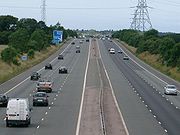
The M53 is a 18.9 miles (30.4 km) motorway in the Metropolitan Borough of Wirral
and Cheshire
on the Wirral Peninsula
in England
. It can also be referred to as the Mid Wirral Motorway. It runs between the Kingsway Tunnel
, at Wallasey
in the north, and the A55
at Chester
.
The main reason for the motorway was to provide a through route to the new Mersey Road Tunnel, Kingsway
, which was built at the same time. Part of this motorway was originally the M531.
 Starting at the northern end, the motorway starts in Wallasey
at the exit slip roads from the Kingsway Tunnel from Liverpool. It loops round the north west of Birkenhead
and then runs south as a dual 3-lane route between Upton
, Woodchurch
in the west and Prenton
. From Junctions 1 to 3 it runs parallel to the Borderlands railway line
. It crosses this line south of junction 3. From this junction it proceeds south to the west of Bebington
through junction 4 and then further south for 4 miles (6.4 km) (where it crosses the Wirral railway line
), before narrowing to dual 2 lanes and turning sharply to the east. At junction 5, traffic for Wales
can take the A41
, A550 & A494
to join the A55
near Ewloe
. The road passes north and then east of Hooton
, then to the east of Overpool
and Wolverham and with Ellesmere Port
to the west.
South of Junction 10 the route enters a more rural
setting, passing under the M56 motorway
at Junction 11. Finally it heads south and becomes the A55
North Wales
Expressway at Junction 12.
to Backford
. The M531 would have run from between the current junctions 4 & 5 and provided a connection with the M56
for eastbound travel.
When the M53 was first planned in the early 1960s
, it was designed as a route to connect the two Mersey
road tunnels with the A55
trunk road on the Welsh
border, giving Liverpool and the rest of Merseyside a direct link with Chester
and the towns on the North Wales
coast.
In the event, the A55 link was never built and instead the M531 (by-passing the eastern side of Chester) was incorporated into the M53.
factory
near Ellesmere Port
. It was opened in 1968 as a non-designated road. Subsequently this road was extended further south to meet the A5117 and was designated as the M531. In March 1981 the M531 was lengthened to meet the M56 and at this stage the whole route was redesignated as the M53.
for traffic from Merseyside
. The route to North Wales was unresolved as there was even an option to run due west from south of Junction 4 and cross the River Dee on a barrage. In 1972 this first section from the Tunnel to junction 5 where it connected straight into the Vauxhall Motors road was opened. A junction was partially built to allow extension of the motorway further south west, around 1 miles (1.6 km) west of junction 5. The unbuilt motorway would have provided a bypass of the A41
and would likely have terminated on the M56, though exactly where is unknown. The unfinished junction for this extension has now been demolished.
The final section of the M53 provided a link to Chester
from the M56 and was opened in 1982. No plans are known to exist to complete the originally planned M53.
are used to provide distance and carriageway identifier information.
Metropolitan Borough of Wirral
The Metropolitan Borough of Wirral is a metropolitan borough of Merseyside, in North West England. It has a population of 311,200, and encompasses of the northern part of the Wirral Peninsula. Major settlements include Birkenhead, Wallasey, Bebington, Heswall, Hoylake and West Kirby. The city of...
and Cheshire
Cheshire
Cheshire is a ceremonial county in North West England. Cheshire's county town is the city of Chester, although its largest town is Warrington. Other major towns include Widnes, Congleton, Crewe, Ellesmere Port, Runcorn, Macclesfield, Winsford, Northwich, and Wilmslow...
on the Wirral Peninsula
Wirral Peninsula
Wirral or the Wirral is a peninsula in North West England. It is bounded by three bodies of water: to the west by the River Dee, forming a boundary with Wales, to the east by the River Mersey and to the north by the Irish Sea. Both terms "Wirral" and "the Wirral" are used locally , although the...
in England
England
England is a country that is part of the United Kingdom. It shares land borders with Scotland to the north and Wales to the west; the Irish Sea is to the north west, the Celtic Sea to the south west, with the North Sea to the east and the English Channel to the south separating it from continental...
. It can also be referred to as the Mid Wirral Motorway. It runs between the Kingsway Tunnel
Kingsway Tunnel
The Kingsway Tunnel is a road tunnel under the River Mersey in Merseyside, northwest England, and runs between Liverpool and Wallasey. It is one and half miles long and is often called the Wallasey Tunnel to distinguish it from the older Queensway Tunnel which runs between Liverpool and...
, at Wallasey
Wallasey
Wallasey is a town within the Metropolitan Borough of Wirral, in Merseyside, England, on the mouth of the River Mersey, at the northeastern corner of the Wirral Peninsula...
in the north, and the A55
A55 road
The A55, also known as the North Wales Expressway, is a major road in Britain. Its entire length is a dual carriageway primary route, with the exception of the point where it crosses the Britannia Bridge over the Menai Strait. All junctions are grade separated except for two roundabouts — one...
at Chester
Chester
Chester is a city in Cheshire, England. Lying on the River Dee, close to the border with Wales, it is home to 77,040 inhabitants, and is the largest and most populous settlement of the wider unitary authority area of Cheshire West and Chester, which had a population of 328,100 according to the...
.
The main reason for the motorway was to provide a through route to the new Mersey Road Tunnel, Kingsway
Kingsway Tunnel
The Kingsway Tunnel is a road tunnel under the River Mersey in Merseyside, northwest England, and runs between Liverpool and Wallasey. It is one and half miles long and is often called the Wallasey Tunnel to distinguish it from the older Queensway Tunnel which runs between Liverpool and...
, which was built at the same time. Part of this motorway was originally the M531.
Route
Wallasey
Wallasey is a town within the Metropolitan Borough of Wirral, in Merseyside, England, on the mouth of the River Mersey, at the northeastern corner of the Wirral Peninsula...
at the exit slip roads from the Kingsway Tunnel from Liverpool. It loops round the north west of Birkenhead
Birkenhead
Birkenhead is a town within the Metropolitan Borough of Wirral in Merseyside, England. It is on the Wirral Peninsula, along the west bank of the River Mersey, opposite the city of Liverpool...
and then runs south as a dual 3-lane route between Upton
Upton, Merseyside
Upton is a village in the parish of Overchurch on the Wirral Peninsula, England, situated close to Birkenhead. At the 2001 Census, the population was 15,731 , although as a ward of the Metropolitan Borough of Wirral, encompassing a larger area, it was recorded as 16,200.-History:Upton was...
, Woodchurch
Woodchurch
Woodchurch is an area of the Wirral Peninsula, in England, which is sometimes considered a suburb of Birkenhead. Administratively, Woodchurch is within the Metropolitan Borough of Wirral and the parliamentary constituency of Wirral West...
in the west and Prenton
Prenton
Prenton is a suburb of Birkenhead on the Wirral Peninsula, England and a 'post town' in the CH postcode area. Administratively, it is also a ward of the Metropolitan Borough of Wirral. Before local government reorganisation on 1 April 1974, it was part of the County Borough of Birkenhead, within...
. From Junctions 1 to 3 it runs parallel to the Borderlands railway line
Borderlands Line
The Borderlands Line is the railway line between Wrexham, Wales, and Bidston, Wirral, England.Passenger train services are operated by Arriva Trains Wales between Wrexham Central and Bidston. Trains run every hour Monday to Saturday daytime, every two hours after 18:45 and on Sundays...
. It crosses this line south of junction 3. From this junction it proceeds south to the west of Bebington
Bebington
Bebington is a small town and electoral ward within the Metropolitan Borough of Wirral, in Merseyside, England. It lies south of Liverpool and west southwest of Manchester, along the River Mersey on the eastern side of the Wirral Peninsula...
through junction 4 and then further south for 4 miles (6.4 km) (where it crosses the Wirral railway line
Wirral Line
The Wirral Line is one of the two commuter railway lines operated by Merseyrail that are centred around Merseyside, England, the other being the Northern Line...
), before narrowing to dual 2 lanes and turning sharply to the east. At junction 5, traffic for Wales
Wales
Wales is a country that is part of the United Kingdom and the island of Great Britain, bordered by England to its east and the Atlantic Ocean and Irish Sea to its west. It has a population of three million, and a total area of 20,779 km²...
can take the A41
A41 road
The A41 is a formerly-major trunk road in England that links London and Birkenhead, although it has now largely been superseded by motorways. It passes through or near various towns and cities including Watford, Hemel Hempstead, Aylesbury, Solihull, Birmingham, West Bromwich, Wolverhampton,...
, A550 & A494
A494 road
The A494 is an important trunk road in Wales. The road runs between "Drome Corner" at the intersection of the A548 and A550 by RAF Sealand, Queensferry and the A470 at Dolgellau, Gwynedd.-Beginnings:...
to join the A55
A55 road
The A55, also known as the North Wales Expressway, is a major road in Britain. Its entire length is a dual carriageway primary route, with the exception of the point where it crosses the Britannia Bridge over the Menai Strait. All junctions are grade separated except for two roundabouts — one...
near Ewloe
Ewloe
Ewloe is a small town in North Wales, contiguous with Hawarden and Buckley and near to Queensferry and Shotton. Situated close to the Flintshire/Cheshire sector of the Wales-England border, Ewloe forms part of Deeside. The A55 expressway passes through the town and its most notable landmark is...
. The road passes north and then east of Hooton
Hooton, Cheshire
Hooton is a village in the unitary authority of Cheshire West and Chester and the ceremonial county of Cheshire, England in the south of the Wirral Peninsula near Ellesmere Port.- History :...
, then to the east of Overpool
Overpool
Overpool is a village on the Wirral Peninsula in the ceremonial county of Cheshire, England. It is a suburb of Ellesmere Port, and part of the unitary authority of Cheshire West and Chester.-History:...
and Wolverham and with Ellesmere Port
Ellesmere Port
Ellesmere Port is a large industrial town and port in the unitary authority of Cheshire West and Chester and the ceremonial county of Cheshire, England. It is situated on the south border of the Wirral Peninsula on the banks of the Manchester Ship Canal, which in turn gives access to the River...
to the west.
South of Junction 10 the route enters a more rural
Rural
Rural areas or the country or countryside are areas that are not urbanized, though when large areas are described, country towns and smaller cities will be included. They have a low population density, and typically much of the land is devoted to agriculture...
setting, passing under the M56 motorway
M56 motorway
The M56 Motorway, also known as the North Cheshire motorway, is in Cheshire and Greater Manchester, England. It runs from Junction 4 of the M60 to Dunkirk, Cheshire and is in length. It is often busy with long-distance commuter traffic towards North Wales...
at Junction 11. Finally it heads south and becomes the A55
A55 road
The A55, also known as the North Wales Expressway, is a major road in Britain. Its entire length is a dual carriageway primary route, with the exception of the point where it crosses the Britannia Bridge over the Menai Strait. All junctions are grade separated except for two roundabouts — one...
North Wales
North Wales
North Wales is the northernmost unofficial region of Wales. It is bordered to the south by the counties of Ceredigion and Powys in Mid Wales and to the east by the counties of Shropshire in the West Midlands and Cheshire in North West England...
Expressway at Junction 12.
History
This motorway was originally two separate projects, the M53 and M531. The M53 was originally proposed to run from the Kingsway TunnelKingsway Tunnel
The Kingsway Tunnel is a road tunnel under the River Mersey in Merseyside, northwest England, and runs between Liverpool and Wallasey. It is one and half miles long and is often called the Wallasey Tunnel to distinguish it from the older Queensway Tunnel which runs between Liverpool and...
to Backford
Backford
Backford is a village and civil parish in the unitary authority of Cheshire West and Chester and ceremonial county of Cheshire, England. It is situated between Chester and Ellesmere Port on the A41 trunk road, to the north of the Shropshire Union Canal....
. The M531 would have run from between the current junctions 4 & 5 and provided a connection with the M56
M56 motorway
The M56 Motorway, also known as the North Cheshire motorway, is in Cheshire and Greater Manchester, England. It runs from Junction 4 of the M60 to Dunkirk, Cheshire and is in length. It is often busy with long-distance commuter traffic towards North Wales...
for eastbound travel.
When the M53 was first planned in the early 1960s
1960s
The 1960s was the decade that started on January 1, 1960, and ended on December 31, 1969. It was the seventh decade of the 20th century.The 1960s term also refers to an era more often called The Sixties, denoting the complex of inter-related cultural and political trends across the globe...
, it was designed as a route to connect the two Mersey
River Mersey
The River Mersey is a river in North West England. It is around long, stretching from Stockport, Greater Manchester, and ending at Liverpool Bay, Merseyside. For centuries, it formed part of the ancient county divide between Lancashire and Cheshire....
road tunnels with the A55
A55 road
The A55, also known as the North Wales Expressway, is a major road in Britain. Its entire length is a dual carriageway primary route, with the exception of the point where it crosses the Britannia Bridge over the Menai Strait. All junctions are grade separated except for two roundabouts — one...
trunk road on the Welsh
Wales
Wales is a country that is part of the United Kingdom and the island of Great Britain, bordered by England to its east and the Atlantic Ocean and Irish Sea to its west. It has a population of three million, and a total area of 20,779 km²...
border, giving Liverpool and the rest of Merseyside a direct link with Chester
Chester
Chester is a city in Cheshire, England. Lying on the River Dee, close to the border with Wales, it is home to 77,040 inhabitants, and is the largest and most populous settlement of the wider unitary authority area of Cheshire West and Chester, which had a population of 328,100 according to the...
and the towns on the North Wales
North Wales
North Wales is the northernmost unofficial region of Wales. It is bordered to the south by the counties of Ceredigion and Powys in Mid Wales and to the east by the counties of Shropshire in the West Midlands and Cheshire in North West England...
coast.
In the event, the A55 link was never built and instead the M531 (by-passing the eastern side of Chester) was incorporated into the M53.
M531
The first section of the M531 was built to improve access to the Vauxhall MotorsVauxhall Motors
Vauxhall Motors is a British automotive company owned by General Motors and headquartered in Luton. It was founded in 1857 as a pump and marine engine manufacturer, began manufacturing cars in 1903 and was acquired by GM in 1925. It has been the second-largest selling car brand in the UK for...
factory
Factory
A factory or manufacturing plant is an industrial building where laborers manufacture goods or supervise machines processing one product into another. Most modern factories have large warehouses or warehouse-like facilities that contain heavy equipment used for assembly line production...
near Ellesmere Port
Ellesmere Port
Ellesmere Port is a large industrial town and port in the unitary authority of Cheshire West and Chester and the ceremonial county of Cheshire, England. It is situated on the south border of the Wirral Peninsula on the banks of the Manchester Ship Canal, which in turn gives access to the River...
. It was opened in 1968 as a non-designated road. Subsequently this road was extended further south to meet the A5117 and was designated as the M531. In March 1981 the M531 was lengthened to meet the M56 and at this stage the whole route was redesignated as the M53.
M53
Construction on the M53 started in 1969. It was to be built in stages as part of a strategic route to North WalesNorth Wales
North Wales is the northernmost unofficial region of Wales. It is bordered to the south by the counties of Ceredigion and Powys in Mid Wales and to the east by the counties of Shropshire in the West Midlands and Cheshire in North West England...
for traffic from Merseyside
Merseyside
Merseyside is a metropolitan county in North West England, with a population of 1,365,900. It encompasses the metropolitan area centred on both banks of the lower reaches of the Mersey Estuary, and comprises five metropolitan boroughs: Knowsley, St Helens, Sefton, Wirral, and the city of Liverpool...
. The route to North Wales was unresolved as there was even an option to run due west from south of Junction 4 and cross the River Dee on a barrage. In 1972 this first section from the Tunnel to junction 5 where it connected straight into the Vauxhall Motors road was opened. A junction was partially built to allow extension of the motorway further south west, around 1 miles (1.6 km) west of junction 5. The unbuilt motorway would have provided a bypass of the A41
A41 road
The A41 is a formerly-major trunk road in England that links London and Birkenhead, although it has now largely been superseded by motorways. It passes through or near various towns and cities including Watford, Hemel Hempstead, Aylesbury, Solihull, Birmingham, West Bromwich, Wolverhampton,...
and would likely have terminated on the M56, though exactly where is unknown. The unfinished junction for this extension has now been demolished.
The final section of the M53 provided a link to Chester
Chester
Chester is a city in Cheshire, England. Lying on the River Dee, close to the border with Wales, it is home to 77,040 inhabitants, and is the largest and most populous settlement of the wider unitary authority area of Cheshire West and Chester, which had a population of 328,100 according to the...
from the M56 and was opened in 1982. No plans are known to exist to complete the originally planned M53.
Recent Work
The M53 at Bidston Moss viaduct has undergone extensive surveying over the past couple of years due to it being built on boggy area. The junction will be closed in late 2009 for further surveying work.Dates
- Junctions 1 to 5 were opened in 1972
- Junctions 5 to 8 were redesignated as motorway in 1974 as part of the M531
- Junctions 8 to 10 opened in 1975 as part of the M531
- Junctions 10 to 11 were opened in 1981
- Junctions 11 to 12 were opened in 1982
Junctions
Data from driver location signsDriver location signs
Driver location signs are English highway route markers, first introduced in 2003, that complement distance marker posts. Both types of marker post display the distances from a nominal start point in kilometres...
are used to provide distance and carriageway identifier information.
| M53 Motorway | |||
| km | Northbound exits | Junction | Southbound exits |
| 0.0 | Road continues as A5139 towards Kingsway Tunnel Kingsway Tunnel The Kingsway Tunnel is a road tunnel under the River Mersey in Merseyside, northwest England, and runs between Liverpool and Wallasey. It is one and half miles long and is often called the Wallasey Tunnel to distinguish it from the older Queensway Tunnel which runs between Liverpool and... and Liverpool Liverpool Liverpool is a city and metropolitan borough of Merseyside, England, along the eastern side of the Mersey Estuary. It was founded as a borough in 1207 and was granted city status in 1880... |
J1 | Bidston Bidston Bidston is a suburb of Birkenhead, on the Wirral Peninsula, England. Administratively, it is also a ward of the Metropolitan Borough of Wirral. Before local government reorganisation on 1 April 1974, it was part of the County Borough of Birkenhead, within the geographical county of Cheshire... , Wallasey A554 Non-motorway traffic |
| Claughton Claughton, Merseyside Claughton is a residential district in Birkenhead, on the Wirral Peninsula, England. It is close to the main shopping area of Birkenhead town centre, and Birkenhead Park is partly located within its boundaries. Administratively, Claughton is a ward of the Metropolitan Borough of Wirral... , Wallasey Wallasey Wallasey is a town within the Metropolitan Borough of Wirral, in Merseyside, England, on the mouth of the River Mersey, at the northeastern corner of the Wirral Peninsula... A554 |
Start of motorway | ||
| 10.5 | West Kirby West Kirby West Kirby is a town on the north-west corner of the coast of the Wirral Peninsula, England, at the mouth of the River Dee across from the Point of Ayr in North Wales. To the north-east of the town lies Hoylake, with the suburbs of Grange and Newton to the east, and the village of Caldy to the... , Hoylake Hoylake Hoylake is a seaside town within the Metropolitan Borough of Wirral, on Merseyside, England. It is located at the north western corner of the Wirral Peninsula, near to the town of West Kirby and where the River Dee estuary meets the Irish Sea... , Upton Upton, Merseyside Upton is a village in the parish of Overchurch on the Wirral Peninsula, England, situated close to Birkenhead. At the 2001 Census, the population was 15,731 , although as a ward of the Metropolitan Borough of Wirral, encompassing a larger area, it was recorded as 16,200.-History:Upton was... A5027 |
J2 | West Kirby, Hoylake, Upton A5027 |
| 13.8 | Tranmere Tranmere, Merseyside Tranmere is a suburb of Birkenhead, on the Wirral Peninsula, England. Administratively, it is also a ward of the Metropolitan Borough of Wirral. Before local government reorganisation on 1 April 1974, it was part of the County Borough of Birkenhead, within the geographical county of Cheshire... , Heswall Heswall Heswall is a town in Wirral, in the county of Merseyside, England. Administratively, it is a ward of the Metropolitan Borough of Wirral. At the time of the 2001 Census, the total population of the ward was 16,012 , which included the nearby villages of Barnston and Gayton... , Woodchurch Woodchurch Woodchurch is an area of the Wirral Peninsula, in England, which is sometimes considered a suburb of Birkenhead. Administratively, Woodchurch is within the Metropolitan Borough of Wirral and the parliamentary constituency of Wirral West... , Prenton Prenton Prenton is a suburb of Birkenhead on the Wirral Peninsula, England and a 'post town' in the CH postcode area. Administratively, it is also a ward of the Metropolitan Borough of Wirral. Before local government reorganisation on 1 April 1974, it was part of the County Borough of Birkenhead, within... A552 |
J3 | Tranmere, Heswall, Woodchurch, Prenton A552 |
| 18.8 | Heswall Heswall Heswall is a town in Wirral, in the county of Merseyside, England. Administratively, it is a ward of the Metropolitan Borough of Wirral. At the time of the 2001 Census, the total population of the ward was 16,012 , which included the nearby villages of Barnston and Gayton... A5137 Bebington Bebington Bebington is a small town and electoral ward within the Metropolitan Borough of Wirral, in Merseyside, England. It lies south of Liverpool and west southwest of Manchester, along the River Mersey on the eastern side of the Wirral Peninsula... , Port Sunlight Port Sunlight Port Sunlight is a model village, suburb and electoral ward in the Metropolitan Borough of Wirral, Merseyside, England. It is located between Lower Bebington and New Ferry, on the Wirral Peninsula. Between 1894 and 1974 it formed part of Bebington urban district within the county of Cheshire... B5137 |
J4 | Heswall A5137 Bebington, Port Sunlight B5137 |
| 25.4 | Eastham Eastham, Merseyside Eastham is a village and an electoral ward of the Metropolitan Borough of Wirral, in Merseyside, England. It is situated on the Wirral Peninsula, to the south of Bromborough... , Hooton Hooton, Cheshire Hooton is a village in the unitary authority of Cheshire West and Chester and the ceremonial county of Cheshire, England in the south of the Wirral Peninsula near Ellesmere Port.- History :... A41 A41 road The A41 is a formerly-major trunk road in England that links London and Birkenhead, although it has now largely been superseded by motorways. It passes through or near various towns and cities including Watford, Hemel Hempstead, Aylesbury, Solihull, Birmingham, West Bromwich, Wolverhampton,... Queensferry Queensferry, Flintshire Queensferry is a town in Flintshire, North Wales, lying on the River Dee near the border with England.Queensferry lies along the B5441 and B5129 roads, and is bypassed by the A494 dual carriageway. It is contiguous with Deeside... (A550) |
J5 | Bebington, Eastham, Hooton A41 Queensferry (A550) |
| 26.1 | Eastham Oil Terminal Eastham Oil Terminal Eastham Oil Terminal is situated close to the small town of Eastham on the Wirral Peninsula, beside the Manchester Ship Canal. It was built during the 1950s close to the Queen Elizabeth II Dock and stores oil refined at Stanlow Refinery, to which it is connected by pipeline. The site is currently... B5132 B roads in Zone 5 of the Great Britain numbering scheme B roads are numbered routes in Great Britain of lesser importance than A roads. See the article Great Britain road numbering scheme for the rationale behind the numbers allocated.-Zone 5 :-Zone 5 :... |
J6 | Eastham Oil Terminal B5132 |
| 28.2 | Overpool Overpool Overpool is a village on the Wirral Peninsula in the ceremonial county of Cheshire, England. It is a suburb of Ellesmere Port, and part of the unitary authority of Cheshire West and Chester.-History:... , Vauxhall Motors Vauxhall Motors Vauxhall Motors is a British automotive company owned by General Motors and headquartered in Luton. It was founded in 1857 as a pump and marine engine manufacturer, began manufacturing cars in 1903 and was acquired by GM in 1925. It has been the second-largest selling car brand in the UK for... B5132 B roads in Zone 5 of the Great Britain numbering scheme B roads are numbered routes in Great Britain of lesser importance than A roads. See the article Great Britain road numbering scheme for the rationale behind the numbers allocated.-Zone 5 :-Zone 5 :... |
J7 | Overpool, Vauxhall Motors B5132 |
| 29.5 | Overpool Overpool Overpool is a village on the Wirral Peninsula in the ceremonial county of Cheshire, England. It is a suburb of Ellesmere Port, and part of the unitary authority of Cheshire West and Chester.-History:... B5132 B roads in Zone 5 of the Great Britain numbering scheme B roads are numbered routes in Great Britain of lesser importance than A roads. See the article Great Britain road numbering scheme for the rationale behind the numbers allocated.-Zone 5 :-Zone 5 :... Industrial Estate A5032 |
J8 | Industrial Estate A5032 |
| 30.7 | Ellesmere Port Ellesmere Port Ellesmere Port is a large industrial town and port in the unitary authority of Cheshire West and Chester and the ceremonial county of Cheshire, England. It is situated on the south border of the Wirral Peninsula on the banks of the Manchester Ship Canal, which in turn gives access to the River... A5032 Stanlow Refinery Stanlow Refinery Stanlow Refinery is an oil refinery owned by Essar Energy in Ellesmere Port, Cheshire, England. It was previously owned by Royal Dutch Shell and is part of the Shell Stanlow Manufacturing Complex.-History:... |
J9 | Ellesmere Port A5032 |
| 33.7 | Elton Elton, Cheshire Elton is a village and civil parish in the unitary authority of Cheshire West and Chester and the ceremonial county of Cheshire, England. It is situated approximately to the northeast of Chester, between Helsby and Ellesmere Port, near to the River Mersey. Its proximity to the River Mersey and... , Whitbyheath, Cheshire Oaks A5117 Queensferry Queensferry, Flintshire Queensferry is a town in Flintshire, North Wales, lying on the River Dee near the border with England.Queensferry lies along the B5441 and B5129 roads, and is bypassed by the A494 dual carriageway. It is contiguous with Deeside... (A550) |
J10 | Elton, Whitbyheath, Cheshire Oaks A5117 Queensferry (A550) |
| 34.8 | Runcorn Runcorn Runcorn is an industrial town and cargo port within the borough of Halton in the ceremonial county of Cheshire, England. In 2009, its population was estimated to be 61,500. The town is on the southern bank of the River Mersey where the estuary narrows to form Runcorn Gap. Directly to the north... , Warrington Warrington Warrington is a town, borough and unitary authority area of Cheshire, England. It stands on the banks of the River Mersey, which is tidal to the west of the weir at Howley. It lies 16 miles east of Liverpool, 19 miles west of Manchester and 8 miles south of St Helens... , Manchester Manchester Manchester is a city and metropolitan borough in Greater Manchester, England. According to the Office for National Statistics, the 2010 mid-year population estimate for Manchester was 498,800. Manchester lies within one of the UK's largest metropolitan areas, the metropolitan county of Greater... M56 M56 motorway The M56 Motorway, also known as the North Cheshire motorway, is in Cheshire and Greater Manchester, England. It runs from Junction 4 of the M60 to Dunkirk, Cheshire and is in length. It is often busy with long-distance commuter traffic towards North Wales... |
J11 | Runcorn, Warrington, Manchester M56 |
| 39.5 | Start of Motorway | J12 | Chester A56 |
| 40.1 | Chester Chester Chester is a city in Cheshire, England. Lying on the River Dee, close to the border with Wales, it is home to 77,040 inhabitants, and is the largest and most populous settlement of the wider unitary authority area of Cheshire West and Chester, which had a population of 328,100 according to the... , Helsby Helsby Helsby is a large village and civil parish in the unitary authority of Cheshire West and Chester and the ceremonial county of Cheshire, England. At the 2001 Census, Helsby had a population of 4,701.-Geography:... A56 A56 road The A56 is a road in England which extends between the city of Chester in Cheshire and the village of Broughton in North Yorkshire. The road contains a mixture of single and dual carriageway sections, and traverses environments as diverse as the dense urban sprawl of inner city Manchester and the... Non-motorway traffic |
Road continues as A55 A55 road The A55, also known as the North Wales Expressway, is a major road in Britain. Its entire length is a dual carriageway primary route, with the exception of the point where it crosses the Britannia Bridge over the Menai Strait. All junctions are grade separated except for two roundabouts — one... to North Wales North Wales North Wales is the northernmost unofficial region of Wales. It is bordered to the south by the counties of Ceredigion and Powys in Mid Wales and to the east by the counties of Shropshire in the West Midlands and Cheshire in North West England... |
|